alison gallensky (was alison shapiro)proceedings.esri.com/library/userconf/proc18/papers/237...2018...
TRANSCRIPT

1

Alison Gallensky (was Alison Shapiro)1995 Upper Arkansas and South Platte Project (now Wild Connections)
roadless inventory volunteer2002 started studying GIS2005 - 2008 contractor for Colorado Environmental Coalition (now
Conservation Colorado) and Wild Connections2007 – present Rocky Mountain Wild (was Center for Native
Ecosystems, absorbed Southern Rockies Ecosystem Project)Biodiversity Protection in the Greater Southern RockiesGIS Services
Photo: Munger Creek (BLM Land with WildeernessCharacteristics), Colorado, by Soren Jespersen, The Wilderness Society
2

3

4

5

6

What lands does the USFS manage?• USFS manages 154 national forests and 20 grasslands in 43 states and
Puerto Rico.• 193 million acres managed by the Forest Service• 14.5 million acres in Colorado (22% of Colorado’s 66.7 million acres; 20.8
million acres in California – of 101 million acres)What lands does the BLM manage?• Over 245 million surface acres of public land• mostly located in the 12 Western states, including Alaska• 8.3 million surface acres in Colorado (about 12%); 15.3 million CA (15%)
7

Wilderness Act:
In order to assure that an increasing population, accompanied by expanding settlement and growing mechanization, does not occupy and modify all areas within the United States and its possessions, leaving no lands designated for preservation and protection in their natural condition, it is hereby declared to be the policy of the Congress to secure for the American people of present and future generations the benefits of an enduring resource of wilderness… A wilderness, in contrast with those areas where man and his own works dominate the landscape, is hereby recognized as an area where the earth and its community of life are untrammeled by man, where man himself is a visitor who does not remain.
Photos by John Fielder
8

44 wilderness areas 3.8 million acres (6% of Colorado’s 66.7 million acres)Map as of 2015 by Alison Gallensky, Rocky Mountain Wild http://rockymountainwild.org/wilderness50th.Hermosa Creek has been designated as wilderness since this map was created.
9
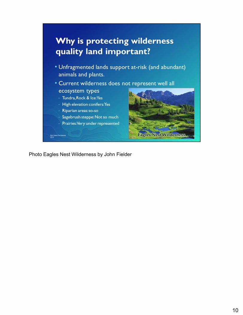
Photo Eagles Nest Wilderness by John Fielder
10

11

Photo:Mount Gunnison in the West Elk Wilderness towers over a beaver pond in the Sunset Roadless Area.PHOTOS BY TED ZUKOSKI / EARTHJUSTICEHTTPS://EARTHJUSTICE.ORG/FEATURES/PHOTOS-SUNSET-ROADLESS-AREA
Roadless areas must meet the size criteria:• At least 5,000 acres• Or adjacent to Wilderness or area recommended for Wilderness protection
12
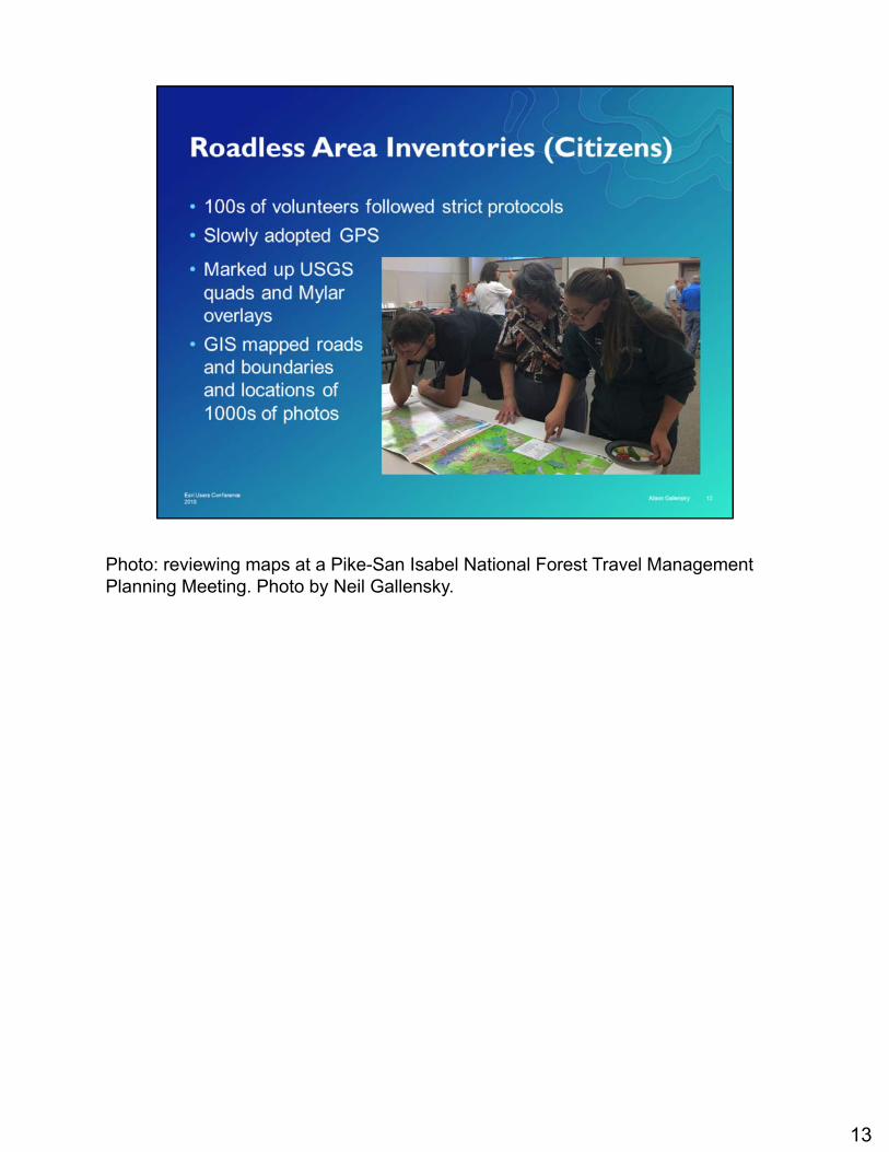
Photo: reviewing maps at a Pike-San Isabel National Forest Travel Management Planning Meeting. Photo by Neil Gallensky.
13

14

15

Photo: Overlooking Cucharas Canyon. Photo by John Stansfield. http://cozine.com/2015-april/20823/
BLM• Instruction Memorandum (IM) 2011-154• Conducting Wilderness Characteristics Inventory on BLM Lands – Manual 6310• Considering Lands with Wilderness Characteristics in the BLM Land Use
Planning Process – Manual 6320When is a route a road?• Improved and maintained (when needed)• By mechanical means (not soley by the passage of vehicles• To insure ritual and continuous use (including access road…)
16

Photo: Wilderness Society staffer Soren Jespersen, left, works with Will Roush of partner group The Wilderness Workshop to inventory lands for wilderness characteristics. https://wilderness.org/lands-wilderness-characteristics
17

Map by Alison Gallensky, Rocky Mountain Wildhttp://rockymountainwild.org/wild-connections-mapping-potential-wilderness-areas
18

19

What lands does the USFS manage?• 11 national forests in Colorado with 7 planning units (GMUG, ARNF, PSI,
Routt, RGNF, SJFN, WRNF) plus a small portion of the Manti-La Sal• 14.5 million acres in Colorado (22% of Colorado’s 66.7 million acres)• 4 million roadless
20

Photo: Rio Grande National Forest: North Clear Creek Falls, Divide Ranger District, Highway 149, Photo by USFS. https://www.fs.usda.gov/riogrande
21

Wilderness Process1. Inventory2. Evaluation3. Analysis4. Recommendation
Infographic on Wilderness Process from USFS: https://www.fs.usda.gov/detail/gmug/landmanagement/planning/?cid=fseprd570149
22

Successes TBD
23

Map of Grand Mesa, Uncompahgre, and Gunnison (GMUG) National Forest by Alison Gallenskyhttp://rockymountainwild.org/gmugscopingAnd see interactive map here: https://www.gmugrevision.com/maps/
24

25

26
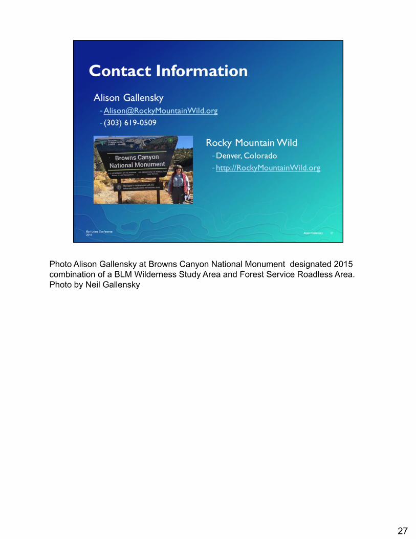
Photo Alison Gallensky at Browns Canyon National Monument designated 2015 combination of a BLM Wilderness Study Area and Forest Service Roadless Area. Photo by Neil Gallensky
27