alyssa aaby the nestucca bay area: reconstructing the ...oregonstate.edu/instruct/geo422/nestucca...
TRANSCRIPT
Alyssa Aaby 3/19/03 GEOG 522 Final Project The Nestucca Bay Area: Reconstructing the Historical Landscape Since the arrival of the first white settlers over 140 years ago, the physical
landscape of the Nestucca Bay area has undergone significant changes. Yet, these
changes are not well understood, and many questions arise pertaining to the ecological
history of the area. How did the landscape reach its present state? What activities
occurred on the land? How have the choices made by people influenced the landscape?
In this paper, I will seek to answer these questions. In order to do so, I will examine both
how and why the physical landscape has changed over time in response to these
activities: agriculture, grazing, fishing, and tourism. Furthermore, I will examine how
changing perceptions of the physical landscape have led people to modify the landscape
in various ways. The sources used in this analysis will be early settler accounts,
newspaper articles, and historic maps.
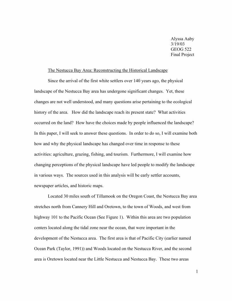
Located 30 miles south of Tillamook on the Oregon Coast, the Nestucca Bay area
stretches north from Cannery Hill and Oretown, to the town of Woods, and west from
highway 101 to the Pacific Ocean (See Figure 1). Within this area are two population
centers located along the tidal zone near the ocean, that were important in the
development of the Nestucca area. The first area is that of Pacific City (earlier named
Ocean Park (Taylor, 1991)) and Woods located on the Nestucca River, and the second
area is Oretown located near the Little Nestucca and Nestucca Bay. These two areas
1
served as the community centers for early settlers and most commercial operations. The
physical landscape of this area is highly diverse. The topography of the area ranges from
steep hills and mountains, to winding rivers and floodplains. This varied topography
created many niches for the native plant and animal species. It also led settlers to engage
in a variety of activities upon the land.
As early as can be remembered, the
Nestucca Indians were a well-established
group within the Nestucca basin. In 1855,
a treaty relegated the Indians to a
reservation in the Little Nestucca River
valley, which was later abolished in 1876
in favor of white settlement of the area
(Taylor, 1991). Thus, during the spring of
1876, a group of settlers from Oregon City
traveled from Grand Ronde over the old
Gauldy trail, an early route to the Little
Nestucca Valley, to file on homesteads Figure 1. A 1972 map of Nestucca Bay (Cox, 1975).
(Taylor, 1991). A few months later, in
June of 1876, the Nestucca Indians left the area under great pressure from the US
government. By 1877, a school was opened, and a year later a post office was
established in Oretown, making it the first settlement in the Nestucca region. Less than
twenty years later, Woods also become a thriving population center. By 1893, Woods
had a population of about 75, and a post-office with a triweekly mail via Dolph and
2
Sheridan. It also had two general stores, a drug store and a small stream sawmill with
about 10,000 feet B.M. capacity per day (Congress, 1893). The establishment of these
towns, as well as the settlement of the area, altered the physical landscape and created a
much different environment than the one observed by the first settlers.
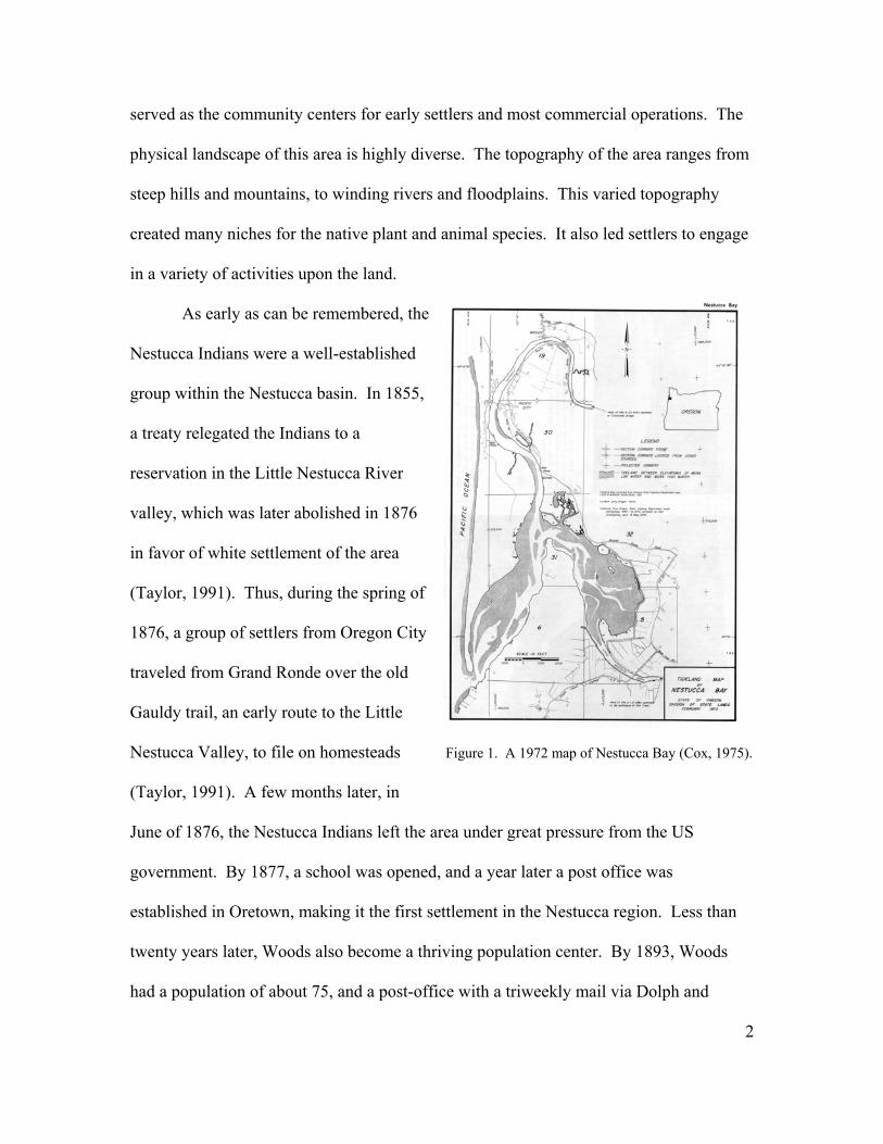
When the first white settlers arrived to the Nestucca area, the physical landscape
they observed was quite different from the one observed today (See Figure 2).
Figure 2. Nestucca
Bay as it must have
looked to early settlers.
Note the relatively
sparse vegetation, as
well as the tree stumps
in the foreground
(www.pacificcity.org,
3/12/03).
3
In describing the physical landscape, settlers, surveyors and local newspapers stated that
the area was open and so rugged, that one homesteader looked at his claim and decided to
return home (Rock, 1926). Other descriptions stated that a fire had raged through the
area sometime 40 to 50 years prior, burning all the “magnificent forests” (Congress,
1893) that once covered the mountains. The accuracy of this observation is validated by
a similar account printed in the The Oregonion, on August 25, 1894, which describes a
great fire around the Nestucca Bay in 1845 (Morris, 1934). This might help to explain
the description of open areas, as well as the abundance of “the finest spruce and alder,
some cedar and fir” (Yamhill Reporter, 1883) along the coast. This fire had also left scars
upon the landscape that were observed as late as 1934:
The vast deforested area today covered with ferns, brush and scattered young trees in the hills along the highway between Willamina and Hebo marks the course of a fire known from the tree ages to have occurred about 1845. The exact extent of the fire is unknown, as later fires have destroyed part of the evidence of the original fire (Morris, 1934).
Based on various accounts, it is likely that this fire covered about 380,000 acres and was
started when a slashing fire grew out of control. And, as the statement above suggests,
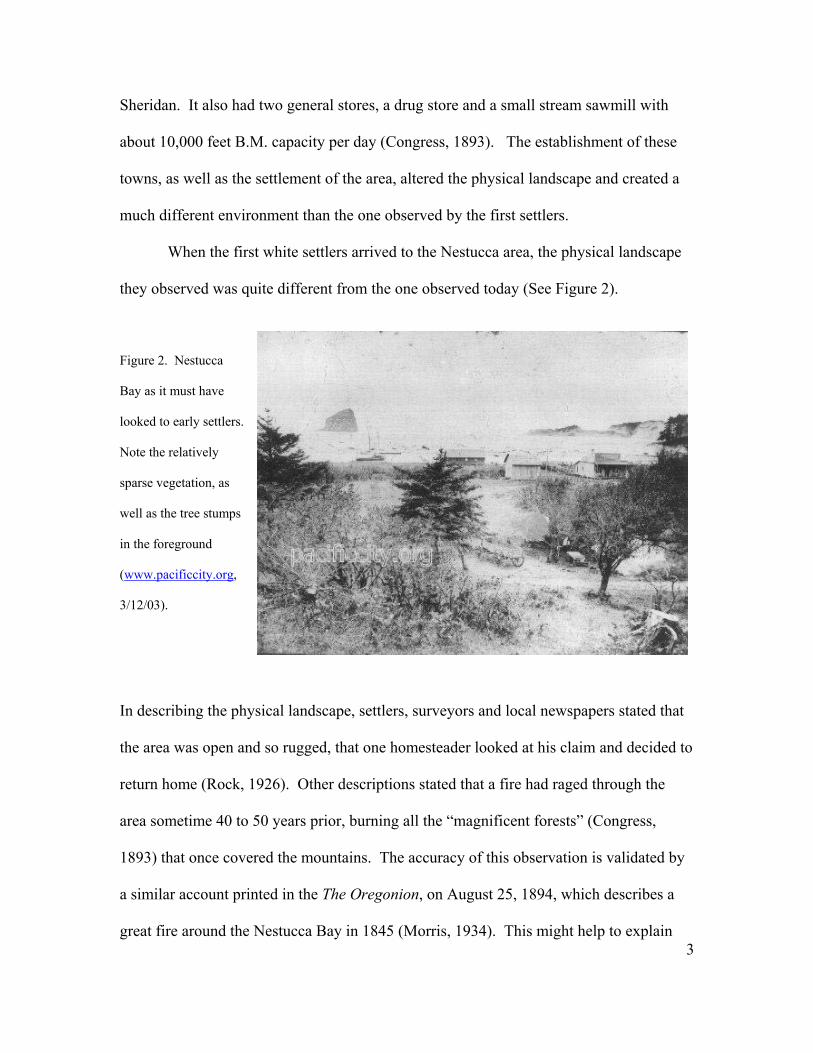
this was not the only fire to burn in the Nestucca area. The image below, taken in 1924,
highlights this idea. The hill in the background is bald, except for a few sparse trees. I
would argue the lack of vegetation was the result of a fire, due to the condition of the
remaining dead trees, as well as the underbrush vegetation. However, it is difficult to
ascertain the true reason, as the quality of the photograph is poor.
(Anonymous, 1971).
4
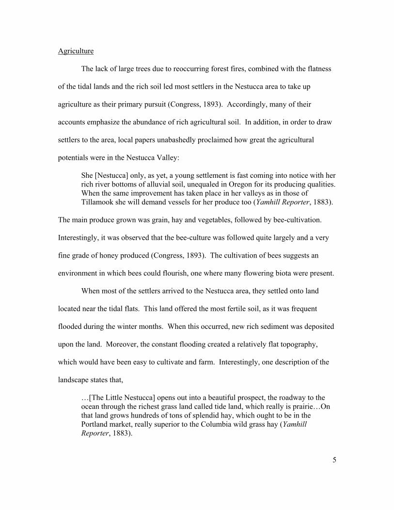
Agriculture
The lack of large trees due to reoccurring forest fires, combined with the flatness
of the tidal lands and the rich soil led most settlers in the Nestucca area to take up
agriculture as their primary pursuit (Congress, 1893). Accordingly, many of their
accounts emphasize the abundance of rich agricultural soil. In addition, in order to draw
settlers to the area, local papers unabashedly proclaimed how great the agricultural
potentials were in the Nestucca Valley:
She [Nestucca] only, as yet, a young settlement is fast coming into notice with her rich river bottoms of alluvial soil, unequaled in Oregon for its producing qualities. When the same improvement has taken place in her valleys as in those of Tillamook she will demand vessels for her produce too (Yamhill Reporter, 1883).
The main produce grown was grain, hay and vegetables, followed by bee-cultivation.
Interestingly, it was observed that the bee-culture was followed quite largely and a very
fine grade of honey produced (Congress, 1893). The cultivation of bees suggests an
environment in which bees could flourish, one where many flowering biota were present.
When most of the settlers arrived to the Nestucca area, they settled onto land
located near the tidal flats. This land offered the most fertile soil, as it was frequent
flooded during the winter months. When this occurred, new rich sediment was deposited
upon the land. Moreover, the constant flooding created a relatively flat topography,
which would have been easy to cultivate and farm. Interestingly, one description of the
landscape states that,
…[The Little Nestucca] opens out into a beautiful prospect, the roadway to the ocean through the richest grass land called tide land, which really is prairie…On that land grows hundreds of tons of splendid hay, which ought to be in the Portland market, really superior to the Columbia wild grass hay (Yamhill Reporter, 1883).
5

This statement is interesting for two reasons. The first is that the author misidentifies the
‘prairies’ as ‘tidelands.’ Tidelands are the lands that are covered and uncovered by the
daily rise and fall of the tide. Thus, it is unlikely that farmers grew hay on the tidelands.
It is more likely to assume that they farmed the tidal flats, the land adjacent to the
tideland. However, due to the constant winter floods, it is possible to understand the
writer’s confusion. And secondly, this statement reveals that many of the agricultural
lands were used to grow hay, both for personal use and potential marketability in
Portland. In addition, it gives an idea as to the scale of the hay harvests.
A similar description of the landscape was written only two years later. This
congressional survey notes the amount of land suitable for agricultural purposes, as well
as the assumed correct location of the agricultural land on the tidal flats:
Except for about 3 miles from its mouth, the Little Nestugga [SIG] is bordered by tide flats, it flows through a narrow valley, which is in places almost a gorge and which contains little or no agricultural land. There are probably 5 or 6 square miles of land fit for agricultural purposes in the vicinity of the Little Nestugga [SIG]. The area of agricultural land in the valley of the Nestugga [SIG] River will amount in all to probably 20 square miles…The soil is rich and admirably suited for the growth of vegetables and for dairy products (Congress, 1893).
In addition to the description of the Nestucca area as “admirably suited” for agricultural
purposes, the survey also notes some of the problems associated with living on tidal flats.
Of particular significance to the settlers, were the frequent floods. During the
winter months, much of the Nestucca valley was under a few feet of water:
During the freshets, which usually occur in November or December, the Nestugga [SIG] generally raises several feet and runs with a very swift current, nearly 4 or 5 miles per hour. At such times the town of Woods is partially overflowed, and also nearly the whole of the adjacent flat country, over which the water flows with considerable velocity (Congress, 1893).
6
Thus, not only were the agricultural lands flooded, but many homes and even towns were
under water as well. In order to solve the problem of flooding, levees were built along
the Big and Little Nestucca rivers, as well as the Nestucca Bay. However, these levees
have only been partially successful in controlling the flooding. Consequently, many
studies have been conducted over the past 70 years to examine the feasibility of
additional flood control projects. One such study was conducted by the ACE in 1970.
However, much to the dismay of many Nestucca residents, the conclusions from this
study echoed those of past studies, and little was done to the area:
The ACOE has labeled ‘economically unfeasible’ four types of development of the Nestucca River Basin in Tillamook County…Areas of development studied were reservoirs for flood controls, levees and dikes to prevent flooding, rip-rap or bank erosion control, and channel clearing and snagging (The Oregonian, 1970).
Without these changes to the physical landscape, farmers still experience many of the
same problems with sedimentation, flooding, flood control, channel movement as they
did 100 years ago. However, some gains have been made as low-lying farmlands,
totaling 10,000 acres, are protected by the bay and river dikes. Yet, additional diking
would be necessary to completely protect agricultural lands from river flooding (ACE,
1964). Ironically, the characteristics of the physical landscape that initially attracted
settlers over 100 years ago continue to cause great hardship to the farmers today.
Furthermore, the changing attitudes toward the diking projects parallel the changing
perceptions of the landscape. Currently, debate is underway to remove the levees, as they
hinder the natural processes of the river and bay. On the other hand, the levees allow
man to better utilize the land. This debate illustrates the different perspectives people
have of the landscape—humans living with the land and humans living off the land.
7
In addition to projects aimed at controlling the floods in the Nestucca area, many
projects were undertaken to control the movement of the sand from the Nestucca Spit.
As early as the 1890s, the movement of sand from the spit has been altered by human
actions. These early modifications included planting grasses on the dunes (Congress,
1893). I would hypothesize that the grass planted on the dunes was European beach
grass, which is a highly invasive non-native species. This introduction of European
Beach Grass to the Nestucca would have resulted in a great loss of native animal habitat
types, as well as the alteration of dune morphology. Arguments for the stabilization of
the sand from the spit are again heard in 1958,
The wind-driven sand from the government owned sand dunes along the Nestucca spit was filling up the river channel and causing serious injury to homes and commercial buildings along the banks through winter flooding, as well as permanent injury to the fish spawning and clam beds in the river (The Oregonian, 1958).
Thus, the opinion of the writer was that the natural movement of the sands was causing
“serious injury” to the people and businesses that chose to settle in the area, as well as
“permanent injury” to the wildlife in the water. Interesting, this statement reveals the
common perception that the movement of sand is an injurious, unwanted physical
process. This idea is further strengthened by accounts that mention the “damage done” to
the lower Nestucca River (ACE, 1964), as wind blew sand into the bay. These accounts
highlight the perception that human activities take precedence over natural processes.
In the development of the land for agriculture, often though of as an
“improvement” to the current landscape, farmers removed native vegetation and tilled the
soil. As a result, the abundance and diversity of native vegetation decreased (See Figure
3). The loss of native vegetation meant that many animal species lost their habitat and
8
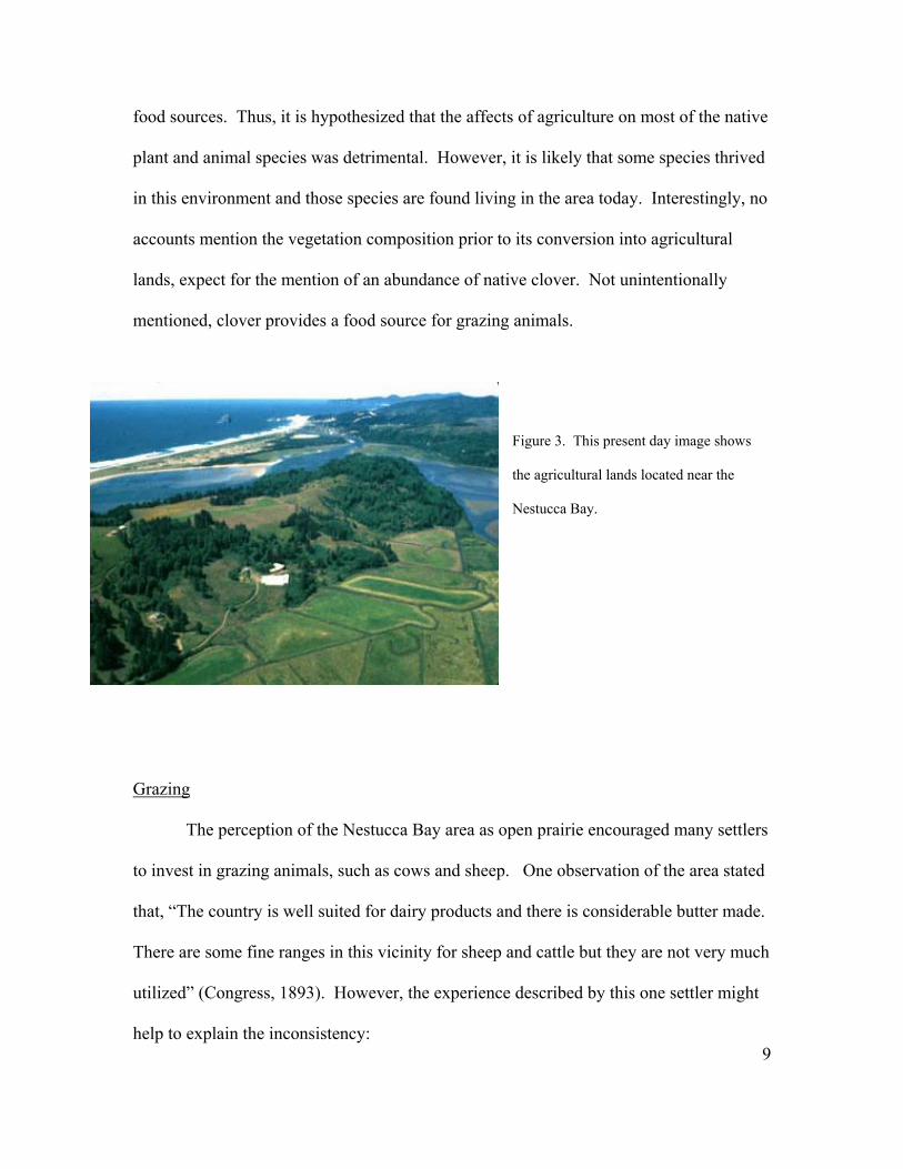
food sources. Thus, it is hypothesized that the affects of agriculture on most of the native
plant and animal species was detrimental. However, it is likely that some species thrived
in this environment and those species are found living in the area today. Interestingly, no
accounts mention the vegetation composition prior to its conversion into agricultural
lands, expect for the mention of an abundance of native clover. Not unintentionally
mentioned, clover provides a food source for grazing animals.
Figure 3. This present day image shows
the agricultural lands located near the
Nestucca Bay.
Grazing
9
The perception of the Nestucca Bay area as open prairie encouraged many settlers
to invest in grazing animals, such as cows and sheep. One observation of the area stated
that, “The country is well suited for dairy products and there is considerable butter made.
There are some fine ranges in this vicinity for sheep and cattle but they are not very much
utilized” (Congress, 1893). However, the experience described by this one settler might
help to explain the inconsistency:
The country was more open then than it is now. Believing that the rich grassy lands offered good pasture, I…brought in some sheep. We soon found that the scheme was not a success for the bears ate up half our flock, we used most of our time hunting bears.” (Rock, 1926).
This account highlights the differences in present day animal distributions, as fewer bears
are found on the coast today. Moreover, what this statement reveals is how peoples’
perception of the landscape affected the choices that they made in regards to what
activities to pursue. In this case, the perception of the landscape as offering a good
pasture resulted in the purchase of sheep. However, what was not observed the first time,
which was the presence of other large species, was discovered to the settler’s chagrin
later on.
Perceiving the landscape as an area rich in natural resources, to be modified and
harvested, was very much a necessity for the survival of the Nestucca settlers. Observing
the landscape in terms of its natural resources is illustrated by this statement, “her
[Nestucca] hills are bald ridges of native clover stretching for four miles toward Salmon
Cape,…The underbrush has only to be turnt off and grass seed sown to afford splendid
pasturage” (Yamhill Reporter, 1883). However, this statement also reveals the nativity in
which some settlers viewed the landscape. Was creating a pasture really as easy as
turning off the underbrush and growing some grass? Moreover, it raises some interesting
questions as to how settlers did remove the underbrush. Was it with fire? And what kind
of grass seed are they referring too? These questions will unfortunately have to remain
unanswered until further research is conducted.
10
During the late 1800s, the attitude of the people toward the land was that the land
was put there for their use. Accordingly, changes to the physical landscape went
unrecorded. This included the growth of non-native grass seed for the grazing livestock.
Furthermore, it is likely that the livestock destroyed native plant species, as well as
trampled the tidal flat areas. In addition, fences were probably erected to contain the
livestock, which further modified the landscape.
Fishing
Following in the footsteps of the Nestucca Indians, the primary activity of the
settlers in the fall was fishing. The fish in the Nestucca consisted of various kinds such
as Chinook, silverside, steelhead and dog salmon, and were used for food by the settlers
and were usually shipped to Portland as well (Congress, 1893). It was estimated that in
the course of a year, about 75 tons of salmon were shipped to Portland markets via
Sheridan and the Portland and Willamette Valley Railroad (Congress, 1893).
Accordingly, the Nestucca River became well known as the “famous salmon and
steelhead fishing stream in Tillamook County” (The Oregonian, 1958).
With the removal of the Nestucca Indians, pressure on the Nestucca fishery was
reduced. The Indian diet included much more salmon than that of the white settlers, who
relied more on imported cattle and grains to supplement their diet (Taylor, 1991). Thus,
the relocation of the Nestucca, combined with an initially small settler population, caused
the salmon population to rapidly grow. So much so, that in 1886, a cannery was built on
Nestucca Bay adjacent to Oretown (Taylor, 1991) (See Figure 4).
The construction of the cannery had a profound impact on the local economy.
Prior to its construction, Oretown was strictly a farming center. However, the cannery
created new economic opportunities, such as offering boarding or serving meals to the
“cannery workers, boat crews, fishermen and people living in the neighborhood” (Taylor,
11

Figure 4. This is a 1920s
photograph of the cannery at
taken at low tide
(www.pacificcity.org,
3/12/03).
1991). Locals became employed as carpenters to construct living quarters for the
Chinese cannery workers, and shacks for fishermen and their families along the bay and
rivers (Taylor, 1991). Furthermore, fishing often provided the income needed by farmers
to ‘pay off the farm.’
The cannery ran from 1887 to 1889, until “an over-supply at high prices and then
‘unprecedented’ low prices,” (Taylor, 1991) resulted in its closure. Noting this closure
in a congressional survey conducted in 1892, the surveyor stated that,
There is a cannery about 1 mile above the bar, but it has not been run in the last three years. While running, however, the cannery has an average output of about 6,000 cases per year, but its capacity was considerably larger, in fact, close to 1,000 cases per day, but the cannery was on too large a scale for the place, and that is probably the main reason why is did not pay (Congress, 1893).
While this statement is only partially correct, it does give a measure of the abundance of
fish in the Nestucca River. Furthermore, it points to the resources needed to sustain such
12
operations. This would have meant power generation to operate the cannery, and wood
resources to build the cannery and house the employees. Therefore, this land was greatly
altered from supporting a high concentration of people, as well as the cannery operations.
In 1899, the cannery went back into production under the Astor Packing
Company, and ran for three years (Taylor, 1991). Then in 1905, the Elmore Packing
Company purchased the cannery, and “renovated the facilities, and resumed canning
operations, which went on until 1919 uninterrupted except for the 1909 season” (Taylor,
1991). The lack of economic diversification in the area during this time resulted in
severe hardship when the cannery closed in 1919. Then again in 1927, fishing industry
was dealt another hard blow with the introduction of House Bill 282. This bill stated that
commercial salmon fishing and the use of all nets were illegal on the Nestucca River and
on the bay as well (Taylor, 1991). In response, one local stated,
The steam salmon cannery at Nestucca bay, which in its time occasionally has three masted sailing vessels at her dock, did a thriving night and day business using mostly oriental labor until Oregon voted to prohibit commercial fishing on the Nestucca and tributaries. This was the first stream in Oregon coast set aside by the voters for the exclusive use of the dead game sports (Graves, 1973).
Thus, the independent sportsmen wishing to have the waters to themselves tore the local
fishermen from their livelihood (Taylor, 1991).
From the accounts of early settlers, one finds that the Nestucca area was lacking a
good transportation system. At the turn of the century, it took settlers three days by horse
and buggy over rough terrain to transport their goods to Portland. It was even said that,
“the road to Nestucca was so poor it could hardly be called a road even as the 19th
century drew to a close” (Westenhouse, 2001). Furthermore, one settler’s account of life
in Nestucca stated that,
13
The first settlers in Nestucca, particularly those with families, endured a good many hardships. With Litchfield’s store at Grande Ronde, the nearest point, thirty miles distance over a rough mountain trail, we had to ford swift streams and cross swamps where the horses mired to their bellies in mud to bring in provisions for winter (Rock, 1926).
Consequently, settlers were anxious for the development of stream navigation for the
transportation of goods and services between Nestucca and bigger cities like Portland.
However, the shallowness of the Nestucca Bay and rivers presented a problem, as the Big
Nestucca River was only navigable for fourteen miles when cleared of a few log drifts
(Yamhill Reporter, 1883). Yet, smaller boats could travel upstream and from 1873 to
1911 there existed stream navigation (Graves, 1973).
In 1893, a government sponsored survey of the stream was conducted to examine
the possibly of deepening the channel. The final report stated that,
The portion of the Nestugga [SIG] River above the influence of the tide is entirely unfit for purposes of navigation. The portion of the river from the vicinity of Woods to the mouth is tidal. This portion flows in a direction generally parallel with the shore of the Pacific Ocean, and is separated therefrom by a sand spit from 700 to 3,500 feet in width. The spit is almost entirely bare and composed of drifting sands, the sand dunes having an easy slope toward the ocean and an abrupt slope toward the river…the river is worthy of improvement by the General Government to the extent of removing the dangerous reef rocks extending from the headland at the south of the harbor throat about 100 feet directly into the channel. It is the opinion of the Division Engineer that the Nestugga [SIG] River as far as Woods is not worthy of improvement by the General Government (Congress, 1893).
Thus it was only the rocky reef, which formed a dangerous obstruction at the entrance of
Nestucca Bay that was to be eliminated for the purposes of safer navigation (Congress,
1895). Despite the many transportation hardships described, the Nestucca Bay area
slowly developed commercial industries for agriculture, dairy and fish. Moreover, by the
turn of the 19th century, Nestucca became known for something more—a summer resort.
14
Tourism
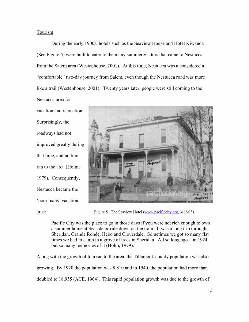
During the early 1900s, hotels such as the Seaview House and Hotel Kiwanda
(See Figure 5) were built to cater to the many summer visitors that came to Nestucca
from the Salem area (Westenhouse, 2001). At this time, Nestucca was a considered a
“comfortable” two-day journey from Salem, even though the Nestucca road was more
like a trail (Westenhouse, 2001). Twenty years later, people were still coming to the
Nestucca area for
vacation and recreation.
Surprisingly, the
roadways had not
improved greatly during
that time, and no train
ran to the area (Holm,
1979). Consequently,
Nestucca became the
‘poor mans’ vacation
area: Figure 5. The Seaview Hotel (www.pacificcity.org, 3/12/03).
Pacific City was the place to go in those days if you were not rich enough to own a summer home at Seaside or ride down on the train. It was a long trip through Sheridan, Grande Ronde, Hebo and Cloverdale. Sometimes we got so many flat times we had to camp in a grove of trees in Sheridan. All so long ago—in 1924—but so many memories of it (Holm, 1979).
Along with the growth of tourism to the area, the Tillamook county population was also
growing. By 1920 the population was 8,810 and in 1940, the population had more than
doubled to 18,955 (ACE, 1964). This rapid population growth was due to the growth of
15
industrialization in the area, which in turn brought in more laborers and their families to
Nestucca. The two main resource based industries in the area were manufacturing and
salvage logging. However, after the peak of the salvage logging operations in 1952, the
population was in decline. Additionally, the employment in lumber and wood products
manufacturing paralleled this decline as did farm employment (Tillamook County
Planning Commission, 1967). However, as the manufacturing industries were in decline,
recreational activity in the area was on the rise. The Tillamook County Planning
Commission noted this in 1967 when they stated,
In contrast to the decline in these two major resource based industries there has been a substantial increase in several economic indicators which partially reflect the increased activity in the recreation industry. Increased traffic volume to and from the county has increased considerably since 1954. Second, dwelling construction has continued since 1953 (Tillamook County Planning Commission, 1967).
These observations led planners to write land use development laws, and invest in
enhancements that would economically benefit the area through the development of
tourism. This included the designation of the Nestucca Spit as a state park (Tillamook
County Planning Commission, 1967). Also, this led to the desire to reroute Highway 101
to run directly past Pacific City, as it was believed that rerouting Highway 101 closer to
Pacific City would bring more tourists to the area.
16
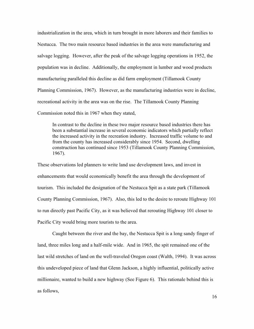
Caught between the river and the bay, the Nestucca Spit is a long sandy finger of
land, three miles long and a half-mile wide. And in 1965, the spit remained one of the
last wild stretches of land on the well-traveled Oregon coast (Walth, 1994). It was across
this undeveloped piece of land that Glenn Jackson, a highly influential, politically active
millionaire, wanted to build a new highway (See Figure 6). This rationale behind this is
as follows,
The Oregon Highway Department had undertaken a realignment of US 101 to remove the road’s dangerous curves. The development had other motives as well, namely, to bring the road closer to the ocean to improve the view for motorists, and to boost business in coastal towns otherwise isolated from the main road (Walth, 1994).
Figure 6. The planned reroute of 101
(Tillamook County Planning
Commission, 1964).
This statement reveals the importance of tourism to the area of Nestucca, as well as other
coast towns. As various other economic activities were in decline, tourism was on the
rise and was an essential part of the economic viability of Nestucca—“The coastal areas
currently under construction are strongly oriented toward the recreation industry, thus
facilities and accommodations for this type of activity are strongly encouraged”
(Tillamook County Planning
17
Commission, 1967). Ironically, much of the recreation in the area was due to the scenic
and undeveloped nature of the Nestucca area. The bay drew hundreds of sport fisherman,

and the spit drew hundreds of hikers, nature-lovers and crab-fishing-buffs (The
Oregonian, 1978). Thus, in its attempts of draw more tourists to the area, the
realignment of Highway 101 along the spit would have destroyed some of the very
qualities tourists sought out.
The public became notified of this plan by then state Treasurer Bob Straub, an
Oregon governor candidate running against then governor Tom McCall. Realizing the
importance of environmental issues to Oregonians, and by notifying the public about
McCalls’s plan to realign Highway 101 across the Nestucca Spit, Straub was successful
in shaking McCall’s environmental platform. While unsuccessful in the race for
governor, Bob Straub succeeded in halting the move with an assist from the US Bureau
of Land management, which turned down the highway department’s application to route
the coastal highway through federal lands adjacent to the Nestucca (The Oregonian,
1978). And that is why, twenty years later, when the state established a wildlands park
on the spit, it was named for Bob Straub. On a further note, the rejection of the plan to
reroute Highway 101 turned out to be a lucky decision for the Nestucca Spit was
breached by unusually severe waves in the winter of 1978 (Colby, 1978). Thus, the
highway would have destroyed.
As a result of the failure to reroute Highway 101, the Nestucca area remains a
mecca for nature lovers, and fisherman alike. According to the Tillamook County
Planning Commission,
There are about 1,500 seasonal residential units in Tillamook County. Assuming three persons per unit, the country’s part-time population amounts to 4,500 in addition to visitors staying in tourist attractions…The economy of the beach areas here is of a recreational nature. Proceeding inland, farming becomes the predominate land use (Tillamook County Planning Commission, 1967).
18
Much of the recent changes in the physical landscape are directly correlated with
tourism in the area. This includes the use of natural resources, such as the cutting of
timber and the development of lots, for the enhancement of the tourism industry. In
addition, the tourism industry has affected the perception of the natural landscape.
During the turn of the century, the perception of the land was that it was there for human
use. People spoke of modifying and utilizing the resources for agriculture and grazing in
high regards. However, the current perception of the landscape is that it is most
economically valuable in its ‘natural’ state. This was one of the listed goals of the
Tillamook County Planning Commission, “In these recreation areas a further objective is
to maintain the function of present beneficial activities and particularly to prevent the
destruction of the prime economic resources of natural beauty and wildlife” (Tillamook
County Planning Commission, 1967). This is because tourists come to visit the natural
wildlife areas.
Accordingly, in 1992, the Nestucca Bay National Refuge was established. It
consists of 3,060 acres of wild lands. In protecting these lands from development, the
refuge is also seeking to conserve fish and wildlife by protecting their ‘natural’ habitat.
This will in turn help the tourism economy, as the continued runs of fish will draw sport
fishermen to the area, and the wildlife will draw nature-lovers. The establishment of the
Nestucca National Wildlife Refuge emphasizes the importance of natural areas to the
people of the 21st century. From the comparison of a map showing the Nestucca Bay
National Wildlife Refuge, with historic maps, it is observed that most of the land located
in the National Wildlife Refuge was originally located in marsh or swamp lands. Likely,
as this land was not good for cultivation, it had remained undeveloped until it was
19
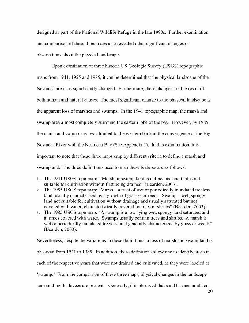
designed as part of the National Wildlife Refuge in the late 1990s. Further examination
and comparison of these three maps also revealed other significant changes or
observations about the physical landscape.
Upon examination of three historic US Geologic Survey (USGS) topographic
maps from 1941, 1955 and 1985, it can be determined that the physical landscape of the
Nestucca area has significantly changed. Furthermore, these changes are the result of
both human and natural causes. The most significant change to the physical landscape is
the apparent loss of marshes and swamps. In the 1941 topographic map, the marsh and
swamp area almost completely surround the eastern lobe of the bay. However, by 1985,
the marsh and swamp area was limited to the western bank at the convergence of the Big
Nestucca River with the Nestucca Bay (See Appendix 1). In this examination, it is
important to note that these three maps employ different criteria to define a marsh and
swampland. The three definitions used to map these features are as follows:
1. The 1941 USGS topo map: “Marsh or swamp land is defined as land that is not suitable for cultivation without first being drained” (Bearden, 2003).
2. The 1955 USGS topo map: “Marsh—a tract of wet or periodically inundated treeless land, usually characterized by a growth of grasses or reeds. Swamp—wet, spongy land not suitable for cultivation without drainage and usually saturated but not covered with water; characteristically covered by trees or shrubs” (Bearden, 2003).
3. The 1985 USGS topo map: “A swamp is a low-lying wet, spongy land saturated and at times covered with water. Swamps usually contain trees and shrubs. A marsh is wet or periodically inundated treeless land generally characterized by grass or weeds” (Bearden, 2003).
20
Nevertheless, despite the variations in these definitions, a loss of marsh and swampland is
observed from 1941 to 1985. In addition, these definitions allow one to identify areas in
each of the respective years that were not drained and cultivated, as they were labeled as
‘swamp.’ From the comparison of these three maps, physical changes in the landscape
surrounding the levees are present. Generally, it is observed that sand has accumulated
next to the levees, creating changes in the bay. This is most apparent in the 1985 map.
Moreover, the 1941 map shows that levees were built by 1941, and the later maps reveal
the construction of more levees along the Little Nestucca River. While these changes
were the result of physical modifications to the landscape, natural changes are observed
as well. From the examination of these three maps, changes in the Big Nestucca River
channel are observed. These changes could be the result of such natural factors as a piece
of downed wood in the river and sediment deposit in the channel (ACE, 1964).
In conclusion, I sought to answer questions of how the landscape reached its
present state? What activities occurred on the land? How have the choices made by
people influenced the landscape? I did this by examining how agriculture, grazing,
fishing, and tourism, shaped the landscape into its present state. Furthermore, to answer
these questions, I used information from settler accounts, newspaper articles, historic
maps and aerial photographs. From this research, it was determined that the physical
landscape of the Nestucca Bay area has undergone significant changes. The practice of
agriculture and grazing has changed the vegetation composition in much of the bay area.
This has led to a reduced number of native plant and animal species. Furthermore, both
activities have introduced non-native species into the area. The perception of the
landscape as suitable for agriculture has also led to the construction of levees along the
eastern side of the bay, as well as the Little Nestucca River. These levees were
constructed for flood control, as many of the desirable qualities of the agricultural lands
were the result of frequent flooding.
Fishing has also caused changes to the physical landscape. In addition to the
removal of fish from the riverbed, the cannery drew upon surrounding natural resources
21

for power generation and wood for its construction. The cannery operations also changed
the demographics of the Nestucca area—bringing in ‘oriental labor.’ Finally, tourism has
significantly changed the physical landscape. From the construction of more roads to the
Nestucca area, to the designation of land for the Nestucca Bay National Wildlife Refuge,
tourism had helped to both preserve the natural landscape and modify it as well.
Increases in tourism to the area have served to emphasize the changing perceptions of the
physical landscape, revealing an interest in the natural landscape. Accordingly, more
studies on reconstructing the landscape need to be done on the Nestucca area in order to
better understand how humans have modified the area.
22

Bibliography:
1. ACE, Army Corps of Engineers, Portland district. Nestucca River and Tributaries,
OR. Review Report. Transcript of public hearing held at Tillamook, OR. 4/28/64
2. Anonymous. Oregon Historical Quarterly. 71.2. 1970
3. Bearden, Leslie. “Re: Wetlands, Customer Inquiry.” [email protected]. (March 3,
2003.)
4. Colby, Richard. “Wave-beached sand spit mends.” The Oregonian. 7/23/78.
5. Congress. House Executive Document, 2nd session, 52nd Congress. Washington DC:
Government Press. 28.97 1893.
6. Congress. House Executive Document, 3rd session, 53rd Congress. Washington DC:
Government Press. 32.224 1895.
7. Cox, William. Oregon Estuaries. Oregon: Division of State Lands. 1973.
8. Eckhardt, Lorraine. “Pacific City Oregon, historical photographs.”
www.pacificcity.org. (3/17/03).
9. Holm, Don. “Reminiscing About The Ol’ Nestuck.” Northwest Magazine. 2/4/79.
10. Morris, William. “Forest Fires in Oregon and Washington.” Oregon Historical
Quarterly. 35.3 1934: 317-319.
11. Oregonian, The. “Study Voted Coast River.” The Oregonian. 8/6/58.
12. Oregonian, The. “Corps Rules Out Reservoirs, Dikes for Nestucca Basin.” The
Oregonian. 11/19/70.
13. Rock, Hardy. “Old Timer.” Tillamook Highlight. 3/3/26.
14. Taylor, Joseph. “For the Love of It: A Short History of Commercial Fishing in
Pacific City, Oregon”. Pacific Northwest Quarterly. 82 (1991): 22-32.
15. Tillamook County Planning Commission. A Proposed Preliminary Comprehensive
Plan. Tillamook: Office of Planning Commission, Tillamook County 1967.
16. Walth, Brent. Fire at Eden’s Gate. Portland: Oregon Historical Society Press, 1994.
Pgs 68-194.
17. Westenhouse, Sybil. “In the Land of Cooling Breezes…Down by the Sea.” Marion
County Historical Society Quarterly. 39.2 (2001): 1-6.
18. Yamhill Reporter. “Tillamook County.” Yamhill Reporter. 4/26/1883.
23
APPENDEX 1. Historic USGS TOPO maps
1941 1955 1985
24