an integrated information system to support research on ... · solos na sequência de incêndios...
TRANSCRIPT
AAccttaass // PPrroocceeeeddiinnggss ddoo VV CCoonnggrreessssoo NNaacciioonnaall ddee GGeeoommoorrffoollooggiiaa PPoorrttoo,, 88‐‐1111 DDeezzeemmbbrroo ddee 22001100
ISBN: 978-989-96462-2-3 385
An integrated information system to support research on soil erosion mitigation techniques after forest fires
Sistema Integrado de Informação de apoio à investigação de técnicas de mitigação da erosão dos
solos na sequência de incêndios florestais
A. Vieira1, A. Bento Gonçalves2, C. Martins3, F. Leite4 1Centro de Estudos em Geografia e Ordenamento do Território (CEGOT)/Núcleo de Investigação em Geografia e Planeamento (NIGP), Universidade do Minho, Campus de Azurém, 4800‐058 Guimarães, Portugal. E‐mail: [email protected] 2Centro de Estudos em Geografia e Ordenamento do Território (CEGOT)/Núcleo de Investigação em Geografia e Planeamento (NIGP), Universidade do Minho, Campus de Azurém, 4800‐058 Guimarães, Portugal. E‐mail: [email protected] 3Núcleo de Investigação em Geografia e Planeamento (NIGP), Universidade do Minho, Campus de Azurém, 4800‐058 Guimarães, Portugal. E‐mail: [email protected] 4Núcleo de Investigação em Geografia e Planeamento (NIGP), Universidade do Minho, Campus de Azurém, 4800‐058 Guimarães, Portugal. E‐mail: [email protected]
Abstract The project RECOVER aims to develop mitigation techniques to reduce soil and water degradation immediately after forest fires. Forest fires are becoming increasingly frequent as a result of climate change and poor forest planning, with deleterious impacts on soil fertility and structure. It erodes the top soil layers, where is located the only nutrient pool of the majority of Portuguese soils. This nutrient mobilization happens during the first autumn rainfall events, and therefore sediment and nutrient exportation typically occurs in the first 4/6 months after fire. The speed at which nutrient loss occurs and the extension of forest fires limits in terms of costs and logistics the solutions that can be taken to reduce soil and water degradation. RECOVER will test a set of feasible solutions to reduce ash flush. This is essential to produce feasible solutions that will be easily adopted by forest managers and forest owners. RECOVER presents an innovative approach based on field surveys of soil and vegetation properties following forest fires, which will be used to perform a GIS database from which the critical spots will be identified. The implementation of an integrated information system (integrating a spatial database, a map server and GIS software) will allow us to store the data collected in the field as well as the information produced through the spatial analysis. This information will be available in a web‐GIS portal, complemented with information to producers and all other agents evolved in the forestry management. Keywords Forest fires, soil degradation and recovery, GIS database, GIS modeling Resumo O RECOVER almeja desenvolver técnicas mitigadoras e estratégias para a redução da degradação do solo e da água imediatamente após os incêndios florestais. A frequência dos referidos incêndios florestais tem vindo a aumentar, fruto das mudanças climáticas e do deficiente planeamento florestal, com severos impactes ao nível da fertilidade e estrutura dos solos. Como consequência aumenta a erosão da camada superior dos solos, onde se localizam, na maioria dos solos portugueses, os únicos nutrientes existentes. Esta mobilização de nutrientes ocorre nos primeiros eventos chuvosos outonais, e, como tal, a exportação dos sedimentos e dos nutrientes acontece normalmente nos primeiros 4/6 meses após os incêndios. A velocidade a que a perda de cada nutriente ocorre e a extensão dos incêndios florestais é uma condicionante em termos de custos e baliza as soluções que se podem implementar para a redução da degradação do solo e da água. O RECOVER testará um conjunto de soluções praticáveis de forma a reduzir a lavagem das cinzas. A metodologia proposta apresenta uma integração inovadora de técnicas quantitativas de campo e irá proceder a análises de percepção junto de todos os intervenientes no planeamento florestal. Tal abordagem é essencial afim de produzir soluções passíveis de se colocar em prática que poderão ser facilmente adoptadas pelos planeadores florestais bem como pelos proprietários florestais. Este projecto apresenta uma abordagem inovadora baseada em levantamentos de campo das propriedades do solo e da vegetação após a ocorrência de incêndios florestais, cujos resultados serão usados para a construção de uma base de dados em ambiente SIG, que servirá para identificar os locais críticos. A implementação de um sistema de informação integrado (conjugando uma base de dados espacial, um servidor de mapas e software SIG) permitir‐nos‐á armazenar os dados recolhidos no campo bem como a informação produzida através da análise espacial desenvolvida. Esta informação estará disponível através de um portal Web‐SIG, complementado com informações para os produtores e todos os outros agentes envolvidos na gestão florestal. Palavras‐Chave Incêndios florestais, degradação e recuperação do solo, base de dados espacial, modelação SIG
AAccttaass // PPrroocceeeeddiinnggss ddoo VV CCoonnggrreessssoo NNaacciioonnaall ddee GGeeoommoorrffoollooggiiaa PPoorrttoo,, 88‐‐1111 DDeezzeemmbbrroo ddee 22001100
ISBN: 978-989-96462-2-3 386
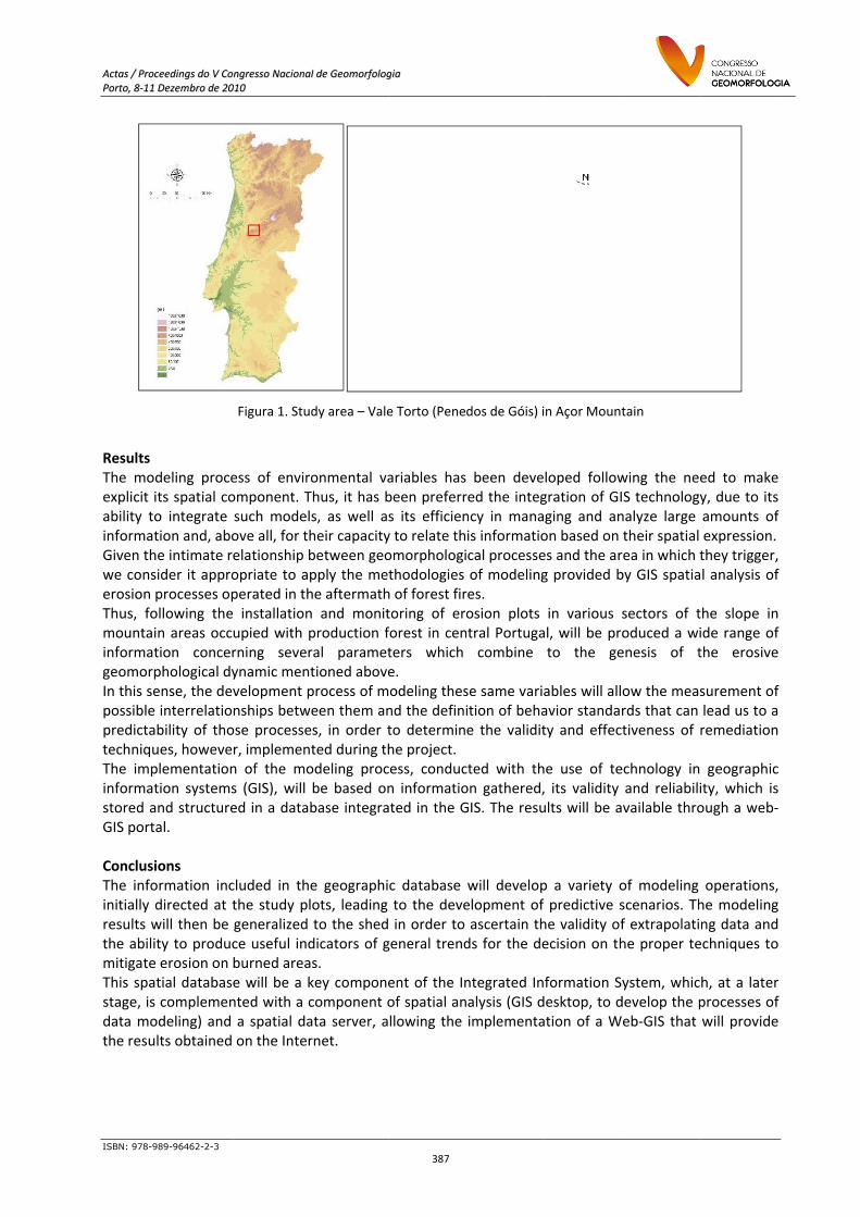
Introduction The RECOVER (Immediate Soil Management Strategy for Recovery after Forest Fires) project aims to develop mitigation techniques and strategies to reduce soil and water degradation immediately after forest fires. Forest fires are becoming increasingly frequent as a result of climate variability, socio‐economic change and unsuitable forest planning, with adverse impacts on soil fertility and structure. One of the most important is the erosion of the top soil layers, where is located the ‘nutrient pool’ of the majority of Portuguese soils. This nutrient mobilization happens during the first autumn rainfall events, and therefore sediment and nutrient exportation typically occurs in the first 4/6 months after fire. The speed at which nutrient loss occurs and the extension of forest fires, tend to limit, in terms of costs and logistics, the solutions that can be taken to reduce soil and water degradation. RECOVER will test a set of feasible solutions to reduce ash flush. The proposed approach presents an innovative integration of field measurement techniques and will perform a perception analysis to all those with responsibilities in forest management. This is essential to produce effective solutions that will be easily adopted by forest managers and forest owners. To manage all data produced during the project (fieldwork and data analysis) will be implemented an Integrated Information System (that includes a spatial database, a map server and other geographical data management tools) that will allow us develop several spatial analysis and to disseminate the results of this project. Objectives The aim of this work is to present the methodology applied in the implementation of an integrated information system with GIS technology, and develop a geomorphologic process model using GIS tools. The ultimate goal is to produce a tool that allows, to those with responsibilities in managing burned areas, the identification of the critical areas where interventions must be made to obtain the best conservation results at the lowest price, which will have a significant impact on soil conservation, vegetation recover, and therefore on ecosystem functioning. It will also reduce significantly the downstream impacts of ash wash. Methodology Since the start of the project (2007) and during the years of 2007 and 2008, there were no large or high intensity forest fires in central Portugal, condition for the normal development of this project. To overcome this problem, the solution was to chose an area in monitorization for a long time: Vale Torto catchment (Penedos de Góis) in Açor Mountain. It’s a small (8,9 ha) schist and quartzite catchment, covered by shrubs and located in the municipality of Góis, Coimbra. The project includes an initial phase of collecting and processing information related to the variables identified for the study and defining the data model to implement and organize the spatial database. The survey of the study area (Fig. 1) allowed its three‐dimensional modeling and the establishment of a surface runoff/flow modeling. Also the land use and soil components (structure, texture, moisture, porosity, etc.) characterization, at the slope scale, as well as forest fires factors analysis (intensity, recurrence…), will be used and integrated in the geographic database, allowing the definition of the variables required in the model.
AAccttaass // PPrrooccPPoorrttoo,, 88‐‐1111
ISBN: 978-9
Results The modexplicit iability toinformatGiven thwe conserosion Thus, fomountaiinformatgeomorpIn this sepossible predictatechniquThe impinformatstored aGIS port ConclusiThe infoinitially dresults wthe abilimitigateThis spastage, is data mothe resu
cceeeeddiinnggss ddoo VV CCooDDeezzeemmbbrroo ddee 2200
989-96462-2-3
deling proceits spatial coo integrate tion and, abohe intimate resider it approprocesses opollowing thein areas ocction concerphological dyense, the devinterrelatiobility of thoues, howeveplementationtion systemsand structureal.
ions ormation incdirected at twill then be ty to produce erosion on tial database complemenodeling) and lts obtained
onnggrreessssoo NNaacciioonnaa001100
Figura 1. Stu
ess of enviroomponent. Tsuch modelove all, for thelationship bopriate to apperated in th installationupied with prning severynamic mentvelopment pnships betwose processer, implemenn of the mos (GIS), will ed in a datab
cluded in thethe study plgeneralized ce useful indburned areae will be a knted with a ca spatial daon the Inter
all ddee GGeeoommoorrffoolloogg
dy area – Vale
onmental vaThus, it has bs, as well asheir capacitybetween geopply the methe aftermathn and monitproduction fral paramettioned aboveprocess of meen them anes, in order tted during thodeling procbe based onbase integra
e geographiots, leading to the sheddicators of gs. key componecomponent oata server, arnet.
ggiiaa
387
e Torto (Pene
ariables hasbeen preferrs its efficieny to relate thomorphologithodologies h of forest firtoring of eroforest in centers which e. odeling thesnd the definito determinhe project. cess, conducn informatioated in the G
c database to the deve in order togeneral trend
ent of the Inof spatial anllowing the
dos de Góis) i
been devered the integncy in manais informatiocal processeof modelingres. osion plots ntral Portuga
combine
se same variaition of behae the validit
cted with thon gathered,GIS. The resu
will developelopment of ascertain thds for the de
ntegrated Inalysis (GIS dimplementa
n Açor Mount
loped followgration of GIging and anon based on es and the arg provided b
in various al, will be prto the ge
ables will allavior standarty and effec
e use of te, its validity ults will be a
p a variety opredictive s
he validity ofecision on th
formation Sesktop, to dation of a W
tain
wing the neS technolognalyze large their spatialrea in which by GIS spatia
sectors of toduced a wienesis of t
ow the meards that can tiveness of
echnology inand reliabilvailable thro
of modeling scenarios. Thf extrapolatihe proper te
ystem, whicdevelop the peb‐GIS that
ed to makey, due to itsamounts of expression. they trigger,al analysis of
the slope inide range ofthe erosive
surement oflead us to aremediation
geographicity, which isough a web‐
operations,he modelingng data andechniques to
ch, at a laterprocesses ofwill provide
e s f , f
n f e
f a n
c s ‐
, g d o
r f e

AAccttaass // PPrroocceeeeddiinnggss ddoo VV CCoonnggrreessssoo NNaacciioonnaall ddee GGeeoommoorrffoollooggiiaa PPoorrttoo,, 88‐‐1111 DDeezzeemmbbrroo ddee 22001100
ISBN: 978-989-96462-2-3 388
Aknowledges Funded by FCT – Fundação para a Ciência e Tecnologia (PTDC/AGR‐AAM/73350/2006), coordinated by Universidade de Aveiro with the colaboration of Universidade do Minho and Escola Superior de Agrária de Coimbra. References Benavides‐Solorio J, Macdonald LH, 2005. Measurement and prediction of post‐fire erosion at the hillslope scale, Colorado Front Range. International Journal of Wildland Fire, 14, 457‐474. Bento Gonçalves, A. J., Vieira, António A., Ferreira, A. D. e Coelho, C., 2008. Caracterização geomorfológica e implementação de um sistema integrado de informação, em ambiente SIG, no âmbito do projecto RECOVER (Estratégias de remediação de solos imediatamente após incêndios florestais”. Revista Geografia Ensino & Pesquisa, V. 12, nº 1, Santa Maria, Rio Grande do Sul, Brasil, p.3721‐3735. Coelho Coa, Ferreira AJD, Boulet AK, Keizer JJ, 2004. Overland flow generation processes, erosion yields and solute loss following different intensity fires. Quarterly Journal of Engineering Geology and Hydrogeology, 37, 3, 233‐240. Goodchild M.F. et al. (Ed.), 1996. GIS and environment modeling. John Wiley & Sons, England. 504 p. Longley P, Batty M (Ed.), 1997. Spatial analysis: modeling in a GIS environment. John Wiley & Sons, England. 392 p. Moffet, Correy et al., 2007. Modeling soil erosion on steep sagebrush rangeland before and after prescribed fire. Catena, 71, 218‐228. Shakesby R., Ferreira A.J.D., Ferreira C.S.S., Stoof C.R., Urbanek E., Walsh R.P.D.. Wildfires in Portugal: characteristics, soil degradational impacts and mitigation measures. Desire. Shekhar S & Chawla S, 2003. Spatial databases. A tour. Prentice Hall. 262 p. Thomas AD, Walsh RPD, Shakesby RA, 2000. Post‐fire forestry management and nutrient losses in eucalyptus and pine plantations, northern Portugal. Land Degradation & Development, 11, 257‐271.