april/may 2020 oil & gas precision
TRANSCRIPT

OIL & GASPRECISION
APRIL/MAY 2020
GNSS ConstellationsWhy it matters to surveyors
Study the ScopeAvoiding overruns
GLO PlatsJeremiah Johnson

GNSS ConstellationsTracking All
An LSU C4G GNSS base
station located at the U.S.
Army Corps of Engineers
Old River Auxiliary Control
Structure in Simmsport, La.
Displayed with permission • The American Surveyor • April/May 2020 • Copyright 2020 Cheves Media • www.Amerisurv.com
W e interviewed three Global Navigation Satellite System (GNSS) real-time network (RTN)
operation experts about the advantages of talking to all available constellations. While some people may think it is only necessary to access their regional GNSS constellation, there are several advantages afforded by talking with satellites from other regional constellations.
Our industry experts include:
◾ Sean Fernandez, state cadastral surveyor and RTN administrator for the State of Utah Automated Geographic Reference Center
◾ Kimberley A. Holtz, PLS, PG, Director of Survey for Port of Long Beach
◾ Randy L. Osborne, network manager at the Louisiana State University Center for GeoInformatics
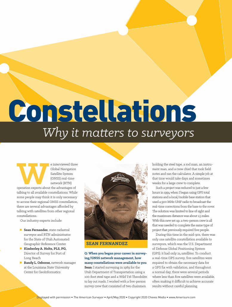
SEAN FERNANDEZ
Q: When you began your career in survey-ing/GNSS network management, how many constellations were available to youSean: I started surveying in 1989 for the Utah Department of Transportation using a 100-foot steel tape and a Wild T16 Theodolite to lay out roads. I worked with a five-person survey crew that consisted of two chainmen
holding the steel tape, a rod man, an instru-ment man, and a crew chief that took field notes and ran the calculator. A simple job at that time would take days and sometimes weeks for a large crew to complete.
Such a project was reduced to just a few hours in 1994 when I began using GPS total stations and a local/mobile base station that used a 900 MHz UHF radio to broadcast the real-time corrections from the base to the rover. The solution was limited to line of sight and the maximum distance was about 1.5 miles. With this new set up, a two-person crew is all that was needed to complete the same type of project that previously required five people.
During this time in the mid-90s, there was only one satellite constellation available to surveyors, which was the U.S. Department of Defense Global Positioning System (GPS); it had only 24 satellites. To conduct a real-time GPS survey, five satellites were required to obtain the necessary data for a GPS fix with validation, and throughout a normal day, there were several periods where less than five satellites were available, often making it difficult to achieve accurate results without careful planning.
GNSS ConstellationsWhy it matters to surveyors
Displayed with permission • The American Surveyor • April/May 2020 • Copyright 2020 Cheves Media • www.Amerisurv.com
Sean Fernandez and Martin Janousek, Trimble Advanced Positioning Sr. Product Manager, catching up at the Trimble Dimensions user conference.
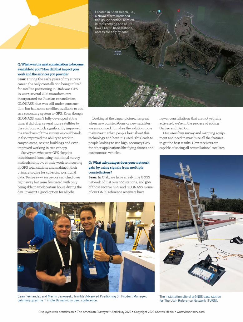
The installation site of a GNSS base station for The Utah Reference Network (TURN).
Located in Shell Beach, La., a NOAA storm hardened tide gauge sentinel (circled in red) contains one of LSU C4G’s GNSS base stations, accessible only by boat!
Q: What was the next constellation to become available to you? How did that impact your work and the services you provide?Sean: During the early years of my survey career, the only constellation being utilized for satellite positioning in Utah was GPS. In 2007, several GPS manufacturers incorporated the Russian constellation, GLONASS, that was still under construc-tion, but had some satellites available to add as a secondary system to GPS. Even though GLONASS wasn’t fully developed at the time, it did offer several more satellites to the solution, which significantly improved the windows of time surveyors could work. It also improved the ability to work in canyon areas, next to buildings and even improved working in tree canopy.
Surveyors who were GPS skeptics transitioned from using traditional survey methods for 100% of their work to investing in GPS total stations and making it their primary source for collecting positional data. Tech-savvy surveyors switched over right away but were frustrated with only being able to work certain hours during the day. It wasn’t a good option for all jobs.
Looking at the bigger picture, it’s great when new constellations or new satellites are announced. It makes the solution more mainstream when people hear about this technology and how it is used. This leads to people looking to use high-accuracy GPS for other applications like flying drones and autonomous vehicles.
Q: What advantages does your network gain by using signals from multiple constellations?Sean: In Utah, we have a real-time GNSS network of just over 100 stations, and 50% of those receive GPS and GLONASS. Some of our GNSS reference receivers have
newer constellations that are not yet fully activated; we’re in the process of adding Galileo and BeiDou.
Our users buy survey and mapping equip-ment and need to maximize all the features to get the best results. New receivers are capable of seeing all constellations’ satellites,
Displayed with permission • The American Surveyor • April/May 2020 • Copyright 2020 Cheves Media • www.Amerisurv.com
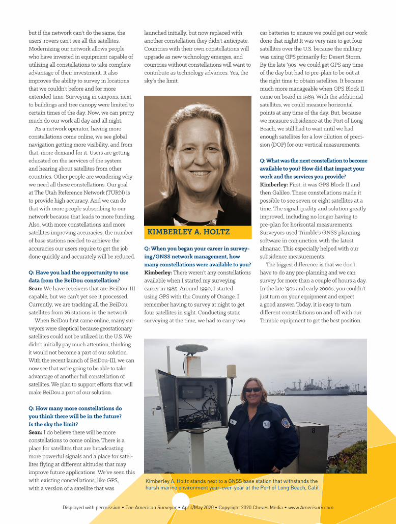
Kimberley A. Holtz stands next to a GNSS base station that withstands the harsh marine environment year-over-year at the Port of Long Beach, Calif.
but if the network can’t do the same, the users’ rovers can’t see all the satellites. Modernizing our network allows people who have invested in equipment capable of utilizing all constellations to take complete advantage of their investment. It also improves the ability to survey in locations that we couldn’t before and for more extended time. Surveying in canyons, next to buildings and tree canopy were limited to certain times of the day. Now, we can pretty much do our work all day and all night.
As a network operator, having more constellations come online, we see global navigation getting more visibility, and from that, more demand for it. Users are getting educated on the services of the system and hearing about satellites from other countries. Other people are wondering why we need all these constellations. Our goal at The Utah Reference Network (TURN) is to provide high accuracy. And we can do that with more people subscribing to our network because that leads to more funding. Also, with more constellations and more satellites improving accuracies, the number of base stations needed to achieve the accuracies our users require to get the job done quickly and accurately will be reduced.
Q: Have you had the opportunity to use data from the BeiDou constellation?Sean: We have receivers that are BeiDou-III capable, but we can’t yet see it processed. Currently, we are tracking all the BeiDou satellites from 26 stations in the network.
When BeiDou first came online, many sur-veyors were skeptical because geostationary satellites could not be utilized in the U.S. We didn’t initially pay much attention, thinking it would not become a part of our solution. With the recent launch of BeiDou-III, we can now see that we’re going to be able to take advantage of another full constellation of satellites. We plan to support efforts that will make BeiDou a part of our solution.
Q: How many more constellations do you think there will be in the future? Is the sky the limit?Sean: I do believe there will be more constellations to come online. There is a place for satellites that are broadcasting more powerful signals and a place for satel-lites flying at different altitudes that may improve future applications. We’ve seen this with existing constellations, like GPS, with a version of a satellite that was
launched initially, but now replaced with another constellation they didn’t anticipate. Countries with their own constellations will upgrade as new technology emerges, and countries without constellations will want to contribute as technology advances. Yes, the sky’s the limit.
KIMBERLEY A. HOLTZ
Q: When you began your career in survey-ing/GNSS network management, how many constellations were available to you?Kimberley: There weren’t any constellations available when I started my surveying career in 1985. Around 1990, I started using GPS with the County of Orange. I remember having to survey at night to get four satellites in sight. Conducting static surveying at the time, we had to carry two
car batteries to ensure we could get our work done that night! It was very rare to get four satellites over the U.S. because the military was using GPS primarily for Desert Storm. By the late ‘90s, we could get GPS any time of the day but had to pre-plan to be out at the right time to obtain satellites. It became much more manageable when GPS Block II came on board in 1989. With the additional satellites, we could measure horizontal points at any time of the day. But, because we measure subsidence at the Port of Long Beach, we still had to wait until we had enough satellites for a low dilution of preci-sion (DOP) for our vertical measurements.
Q: What was the next constellation to become available to you? How did that impact your work and the services you provide?Kimberley: First, it was GPS Block II and then Galileo. These constellations made it possible to see seven or eight satellites at a time. The signal quality and solution greatly improved, including no longer having to pre-plan for horizontal measurements. Surveyors used Trimble’s GNSS planning software in conjunction with the latest almanac. This especially helped with our subsidence measurements.
The biggest difference is that we don’t have to do any pre-planning and we can survey for more than a couple of hours a day. In the late ‘90s and early 2000s, you couldn’t just turn on your equipment and expect a good answer. Today, it is easy to turn different constellations on and off with our Trimble equipment to get the best position.
Displayed with permission • The American Surveyor • April/May 2020 • Copyright 2020 Cheves Media • www.Amerisurv.com

Q: What advantages does your network gain by using signals from multiple constellations?Kimberley: Now, we can see nine to 10 satellites using GPS Blocks I and II, Galileo and GLONASS. This provides better data, which lowers your DOP (dilution of precision). Some days, you may want to cut out a satellite to procure quality data, and we also use our Trimble Pivot software to automatically eliminate bad data. Having access to more constellations matters to different degrees depending on where you are in the world.
Q: Have you had the opportunity to use data from the BeiDou constellation?Kimberley: We are doing a horizontal control network that represents a 15-year rail project in the port. This control will be used for the design survey and throughout construction. We will consider utilizing the BeiDou system for some of the measure-ments. However, we will test it first, to see if it helps improve our data, makes it worse or if it is even noticeable.
Q: How many more constellations do you think there will be in the future? Is the sky the limit?Kimberley: I don’t think there will be too many more. The current ones will get upgraded or densified by adding more satel-lites. Some countries might establish their own networks, but it’s more likely everyone will stay with the ones already up there.
Inside an LSU C4G GNSS base station enclosure that has access to Ethernet and AC power.
Located at Amerada Pass, La., this NOAA storm hardened tide gauge contains one of LSU C4G’s GNSS base stations.
Displayed with permission • The American Surveyor • April/May 2020 • Copyright 2020 Cheves Media • www.Amerisurv.com

RANDY L. OSBORNE
Q: When you began your career in survey-ing/GNSS network management, how many constellations were available to you? Randy: When I began working at the LSU Center for GeoInformatics (C4G) in late 2007, only GPS was available for our users in Louisiana.
Q: What was the next constellation to become available to you? How did that impact your work and the services you provide?Randy: GLONASS came next. We enter-tained using it because our clients wanted more satellites to be available so they could make GPS observations without a lot of mission planning. Additionally, having more satellites in the sky made it possible to work more during the day.
This posed a problem for us because our mature network receivers only had GPS capabilities. We had to replace all of our GPS infrastructure, purchasing newer receivers that could talk with GPS and GLONASS. At the time, our funding came from govern-ment earmarks, so we implemented the upgrade in small portions over time. We’ve progressed through Trimble’s NetRS to NetR5, then NetR8 and NetR9. Now, we’re adding in some new Trimble Alloy GNSS reference receivers, but we are only licensing the GPS, GLONASS and Galileo constel-lations. In Louisiana, we don’t need QZSS because it doesn’t geosync around to our part of the world, and, for similar reasons, we are not using BeiDou or NavIC.
Q: What advantages does your network gain by using signals from multiple constellations?Randy: Having more signals solves one of the original problems users had in the field, which was the ability to see enough satel-lites for horizontal and vertical positioning. More satellites on your radar is always better than having less.
Access to GPS, GLONASS and Galileo primarily benefits the rovers in our network. When using a network solution, having access to these constellations in urban canyons or tree canopy—where you can’t get a clear view of the sky, or the geometry is clumped together—you can better solve vertical problems. This is essential in Louisiana and is really the only way to get a good position. That position in real-time is critical for those working on jobs that are in a constantly changing environment. On the science side and for the research we are doing at LSU, we don’t face the same challenges.
Q: Have you had the opportunity to use data from the BeiDou constellation?Randy: Our Trimble NetR9s have BeiDou turned on, but we can’t see all of this constellation’s satellites. So far, our clients haven’t asked to use it.
Different constellations do different things, but those satellites that are specifi-cally on the other side of the earth don’t help much right now. At some point, those constellations might add more satellites that could help. But, today, they are not important to us.
Q: How many more constellations do you think there will be in the future? Is the sky the limit?Randy: Potentially, every country could have its own constellation, but I don’t see the need for it. I think it is most likely that existing constellations will send up more satellites. Or, maybe people will start to set up their own personal networks.
We appreciate the time Sean, Kimberley and Randy took to speak with us. If you
want to share your experience using multiple constellations, let us know by post-ing your thoughts on Twitter and Facebook using the hashtag #TrimbleConstellations. ◾
Sean Fernandez is a registered professional land surveyor in the state of Utah. He stays closely engaged in the surveying community by managing the Statewide GPS Network, helping protect and maintain the Public Land Survey System, and acting as the National Geodetic Survey (NGS) state coordinator for Utah.
Kimberley A. Holtz, a professional geologist and land surveyor, has more than 30 years of land surveying experience in both private and public sectors. She is currently chair of the California Spatial Reference Center, a director and educational chair for the California Land Surveyor Association and treasurer of the League of California Survey Organizations.
Randy L. Osborne is a research specialist and the administrator of CORS and real-time networks at LSU’s Center for GeoInformatics (C4G). He has been instrumental in generating funding for C4G through RTN subscriptions and grants for height modernization and geospatial modeling.
Part of the LSU C4G RTN network, this enclosure in the middle of Lake Borgne, La., holds two gel cell batteries, a solar charger, cell modem, cell booster and a Trimble Alloy GNSS reference receiver.
Displayed with permission • The American Surveyor • April/May 2020 • Copyright 2020 Cheves Media • www.Amerisurv.com