arcgis api for flex –an introduction · •arcgis viewer for flex -configurable ready-made viewer...
TRANSCRIPT

Technical Workshops |
Esri International User Conference San Diego, California
ArcGIS API for Flex –An Introduction
Lloyd Heberlie Heather Gonzago
July 25, 2012
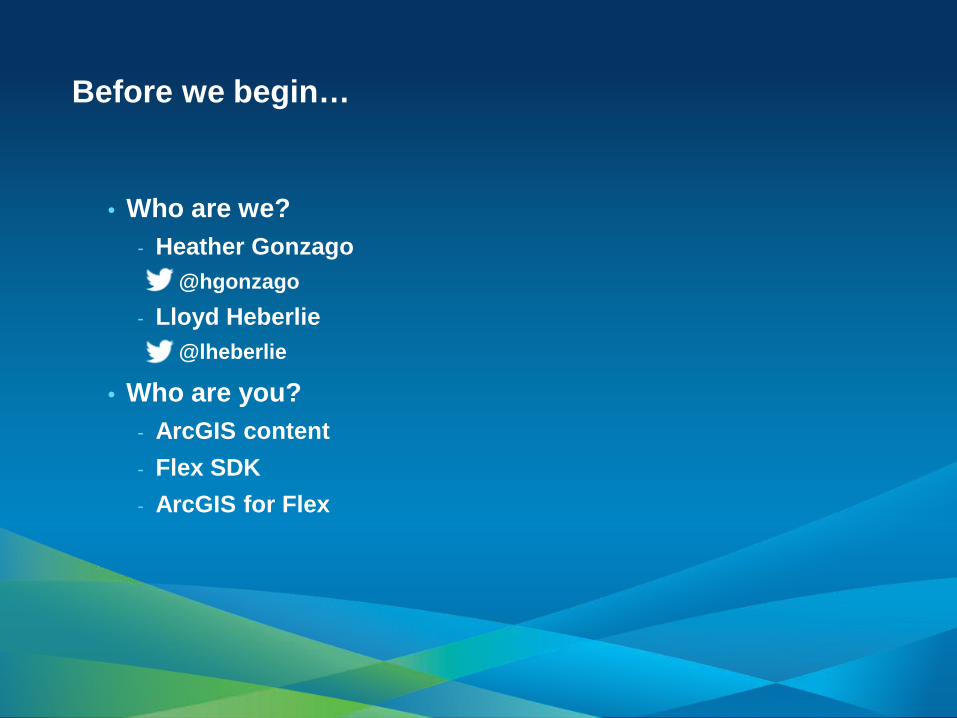
Before we begin…
• Who are we? - Heather Gonzago
@hgonzago - Lloyd Heberlie
@lheberlie
• Who are you? - ArcGIS content - Flex SDK - ArcGIS for Flex

• Introduction • Getting started • Concepts and examples • Developer / Deployment workflows • Road ahead • Additional resources
Agenda
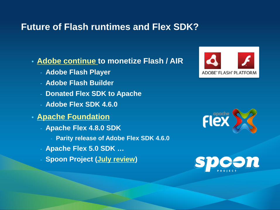
• Adobe continue to monetize Flash / AIR - Adobe Flash Player - Adobe Flash Builder - Donated Flex SDK to Apache - Adobe Flex SDK 4.6.0
• Apache Foundation - Apache Flex 4.8.0 SDK
- Parity release of Adobe Flex SDK 4.6.0 - Apache Flex 5.0 SDK … - Spoon Project (July review)
Future of Flash runtimes and Flex SDK?
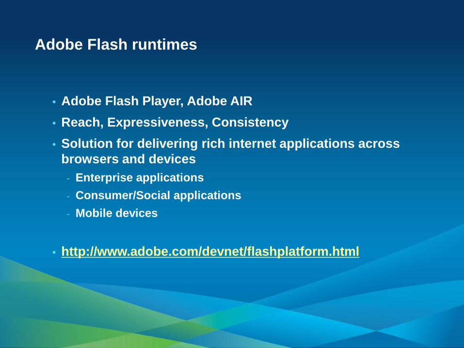
• Adobe Flash Player, Adobe AIR • Reach, Expressiveness, Consistency • Solution for delivering rich internet applications across
browsers and devices - Enterprise applications - Consumer/Social applications - Mobile devices
• http://www.adobe.com/devnet/flashplatform.html
Adobe Flash runtimes
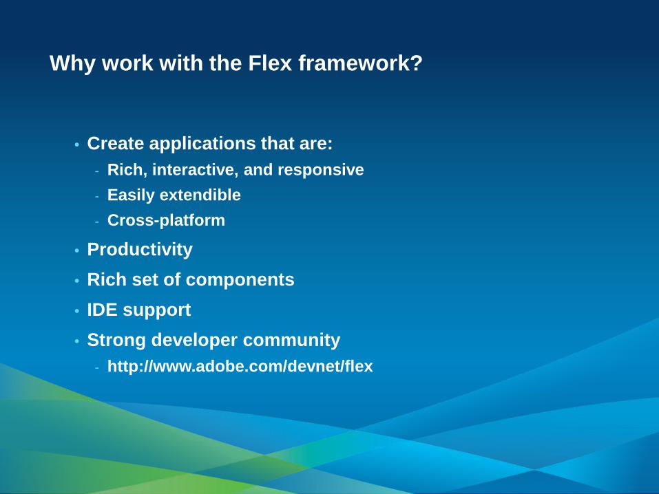
Why work with the Flex framework?
• Create applications that are: - Rich, interactive, and responsive - Easily extendible - Cross-platform
• Productivity • Rich set of components • IDE support • Strong developer community
- http://www.adobe.com/devnet/flex

Introduction
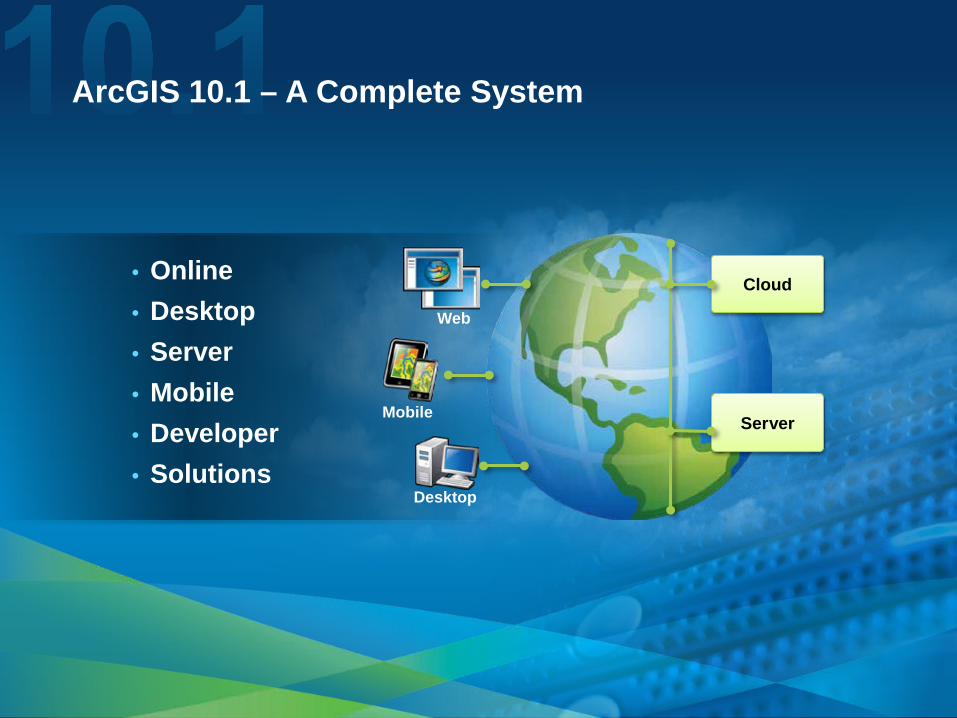
ArcGIS 10.1 – A Complete System
• Online • Desktop • Server • Mobile • Developer • Solutions
Cloud
Server Mobile
Desktop
Web
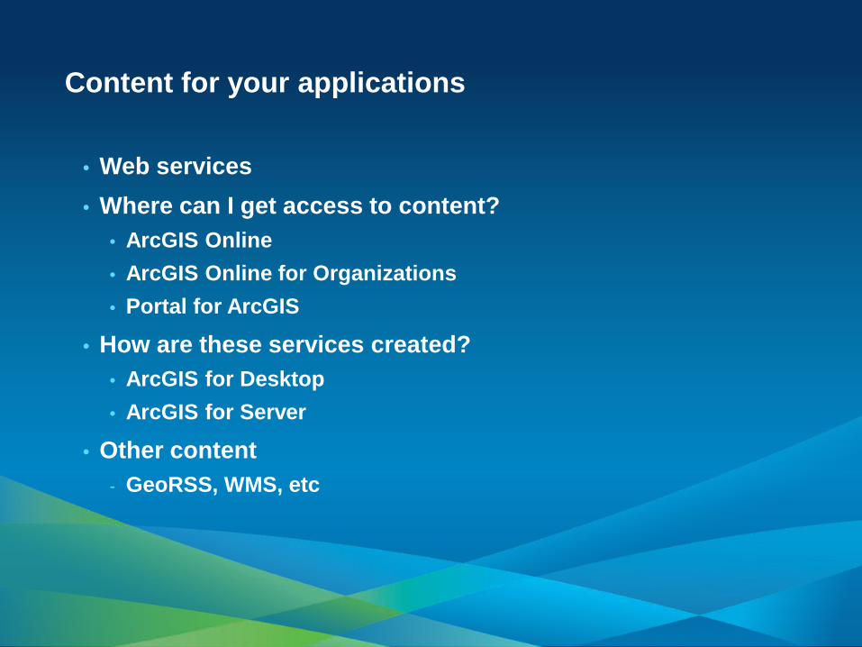
• Web services • Where can I get access to content?
• ArcGIS Online • ArcGIS Online for Organizations • Portal for ArcGIS
• How are these services created? • ArcGIS for Desktop • ArcGIS for Server
• Other content - GeoRSS, WMS, etc
Content for your applications
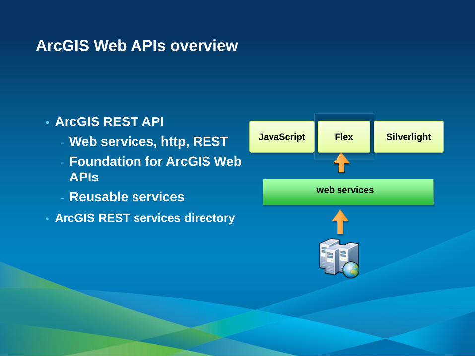
• ArcGIS REST API - Web services, http, REST - Foundation for ArcGIS Web
APIs - Reusable services
• ArcGIS REST services directory
ArcGIS Web APIs overview
web services
JavaScript Silverlight Flex
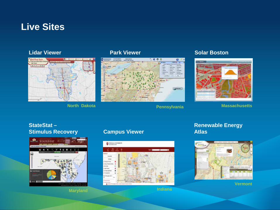
Live Sites
Campus Viewer Renewable Energy Atlas
StateStat – Stimulus Recovery
Park Viewer Solar Boston Lidar Viewer
Indiana Vermont Panama
Pennsylvania Massachusetts North Dakota
Maryland

• Well adopted • Very active forum • Community code gallery • Release schedule
ArcGIS for Flex overview
Flex API Flex Viewer June 2012 3.0 3.0 November 2011 2.5 / 2.5.1 2.5 / 2.5.1 July 2011 2.4 2.4 April 2011 2.3 / 2.3.1 2.3 / 2.3.1
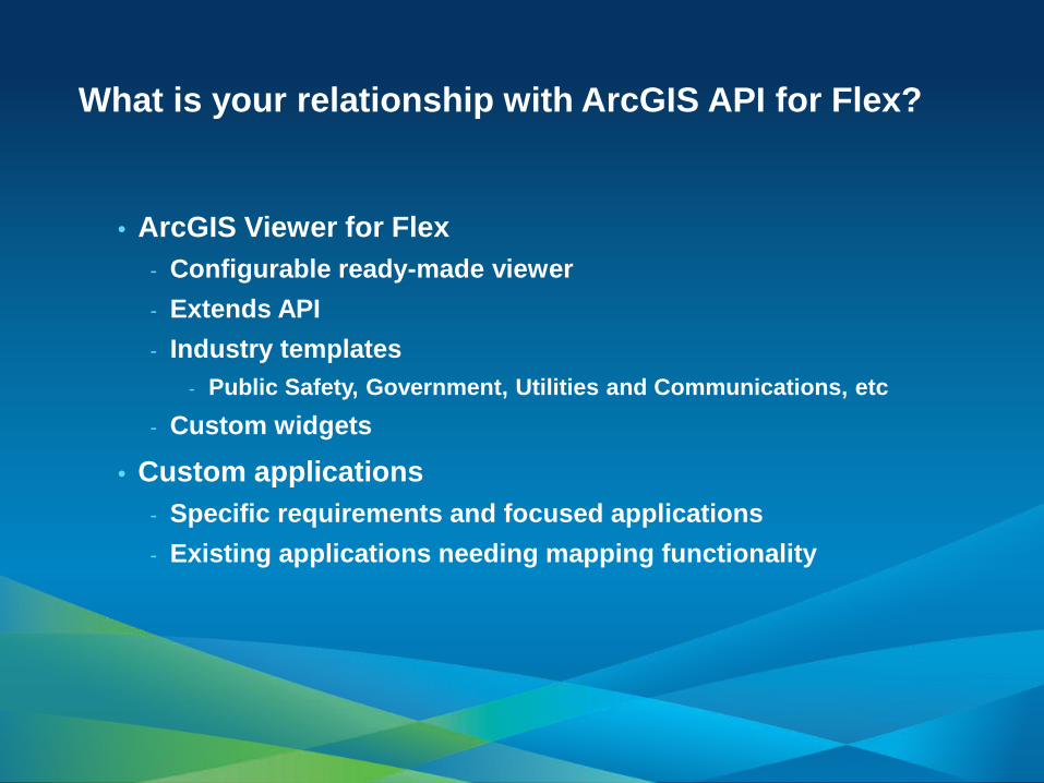
• ArcGIS Viewer for Flex - Configurable ready-made viewer - Extends API - Industry templates
- Public Safety, Government, Utilities and Communications, etc - Custom widgets
• Custom applications - Specific requirements and focused applications - Existing applications needing mapping functionality
What is your relationship with ArcGIS API for Flex?
Demo
Resource Center and
Content

Getting Started
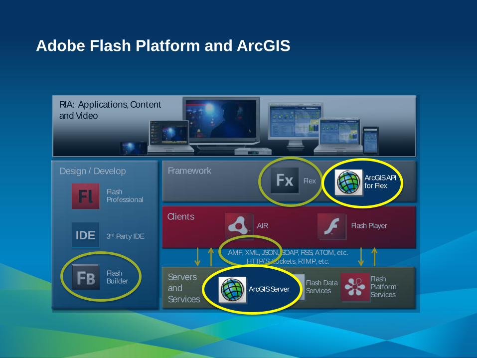
Adobe Flash Platform and ArcGIS
AMF, XML, JSON, SOAP, RSS, ATOM, etc. HTTP/S, Sockets, RTMP, etc.
Flash Builder
Flex Flash Professional
Design / Develop
Clients
Servers and Services
Framework
Flash Player AIR
RIA: Applications, Content and Video
Flash Media Server
Flash Data Services
Flash Platform Services
3rd Party IDE IDE
ArcGIS API for Flex
ArcGIS Server
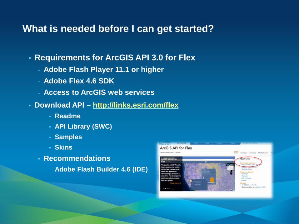
• Requirements for ArcGIS API 3.0 for Flex - Adobe Flash Player 11.1 or higher - Adobe Flex 4.6 SDK - Access to ArcGIS web services
• Download API – http://links.esri.com/flex • Readme • API Library (SWC) • Samples • Skins
• Recommendations - Adobe Flash Builder 4.6 (IDE)
What is needed before I can get started?
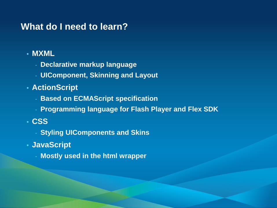
• MXML - Declarative markup language - UIComponent, Skinning and Layout
• ActionScript - Based on ECMAScript specification - Programming language for Flash Player and Flex SDK
• CSS - Styling UIComponents and Skins
• JavaScript - Mostly used in the html wrapper
What do I need to learn?
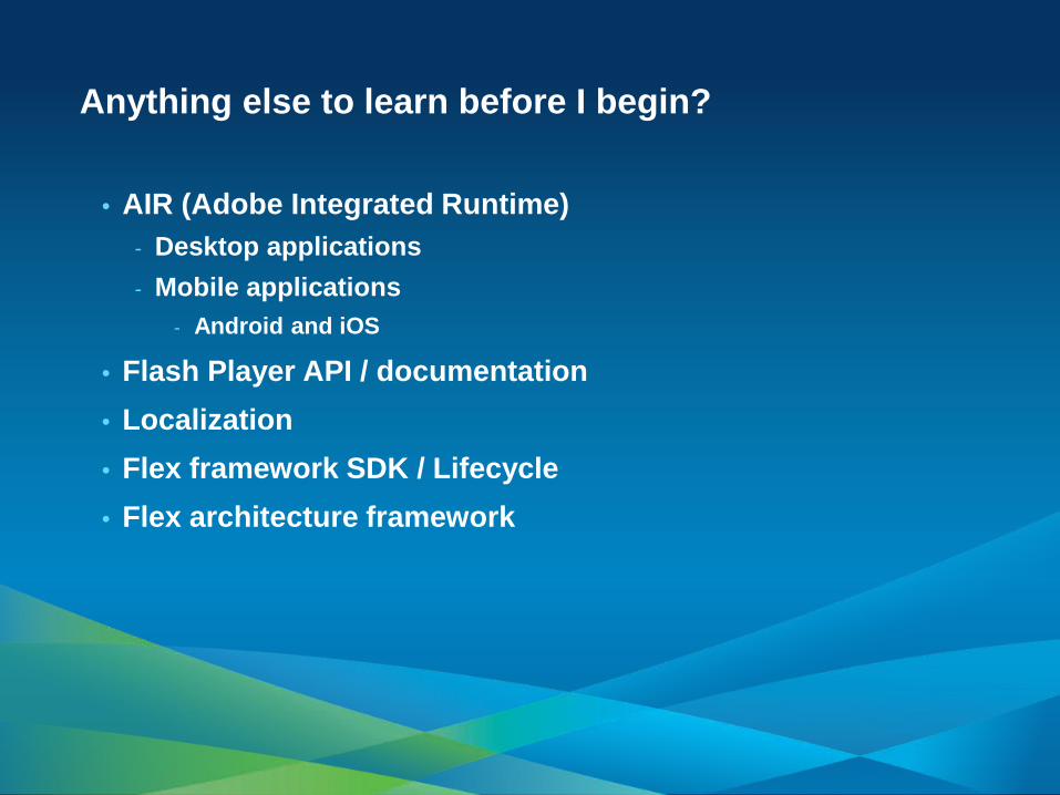
• AIR (Adobe Integrated Runtime) - Desktop applications - Mobile applications
- Android and iOS
• Flash Player API / documentation • Localization • Flex framework SDK / Lifecycle • Flex architecture framework
Anything else to learn before I begin?

Concepts and examples

• Mapping and visualization - Basemaps (static data)
• Operational layers - Dynamic data (frequently changing) - More interactive
• Graphics - Symbols and rendering - Taken from user input or as output results from analysis
• Analysis - Tasks
Overview
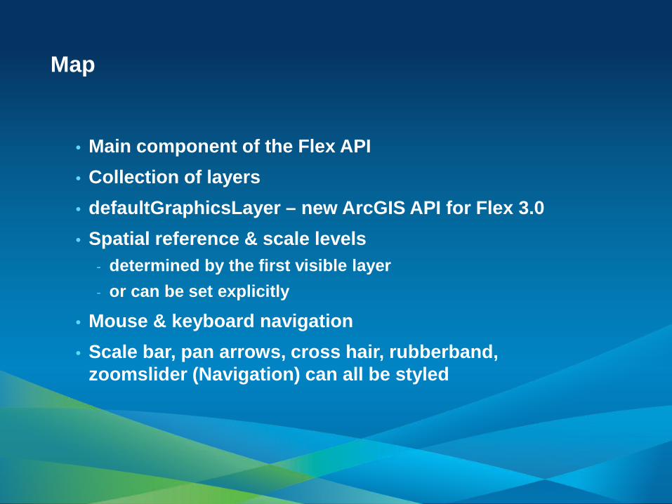
Map
• Main component of the Flex API • Collection of layers • defaultGraphicsLayer – new ArcGIS API for Flex 3.0 • Spatial reference & scale levels
- determined by the first visible layer - or can be set explicitly
• Mouse & keyboard navigation • Scale bar, pan arrows, cross hair, rubberband,
zoomslider (Navigation) can all be styled
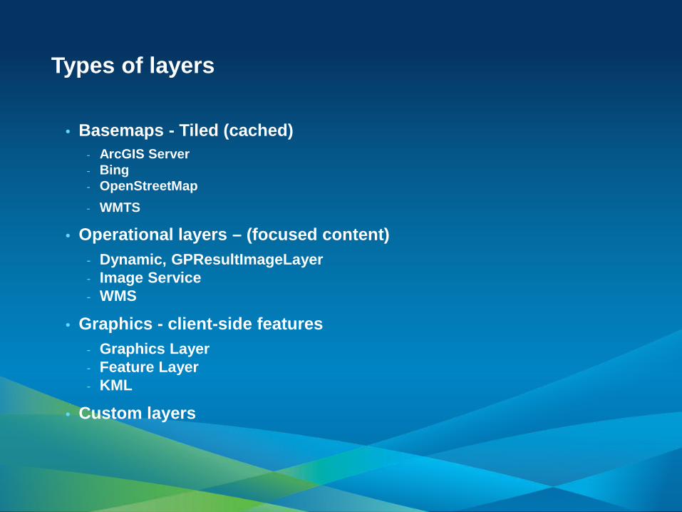
• Basemaps - Tiled (cached) - ArcGIS Server - Bing - OpenStreetMap - WMTS
• Operational layers – (focused content) - Dynamic, GPResultImageLayer - Image Service - WMS
• Graphics - client-side features - Graphics Layer - Feature Layer - KML
• Custom layers
Types of layers
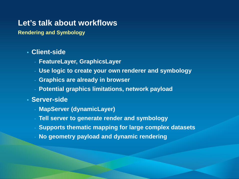
Let’s talk about workflows Rendering and Symbology
• Client-side - FeatureLayer, GraphicsLayer - Use logic to create your own renderer and symbology - Graphics are already in browser - Potential graphics limitations, network payload
• Server-side - MapServer (dynamicLayer) - Tell server to generate render and symbology - Supports thematic mapping for large complex datasets - No geometry payload and dynamic rendering

Demo
Combining basemaps and
operational layers
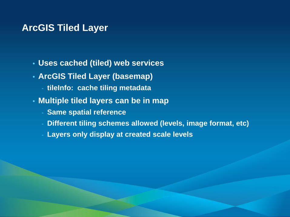
ArcGIS Tiled Layer
• Uses cached (tiled) web services • ArcGIS Tiled Layer (basemap)
- tileInfo: cache tiling metadata
• Multiple tiled layers can be in map - Same spatial reference - Different tiling schemes allowed (levels, image format, etc) - Layers only display at created scale levels
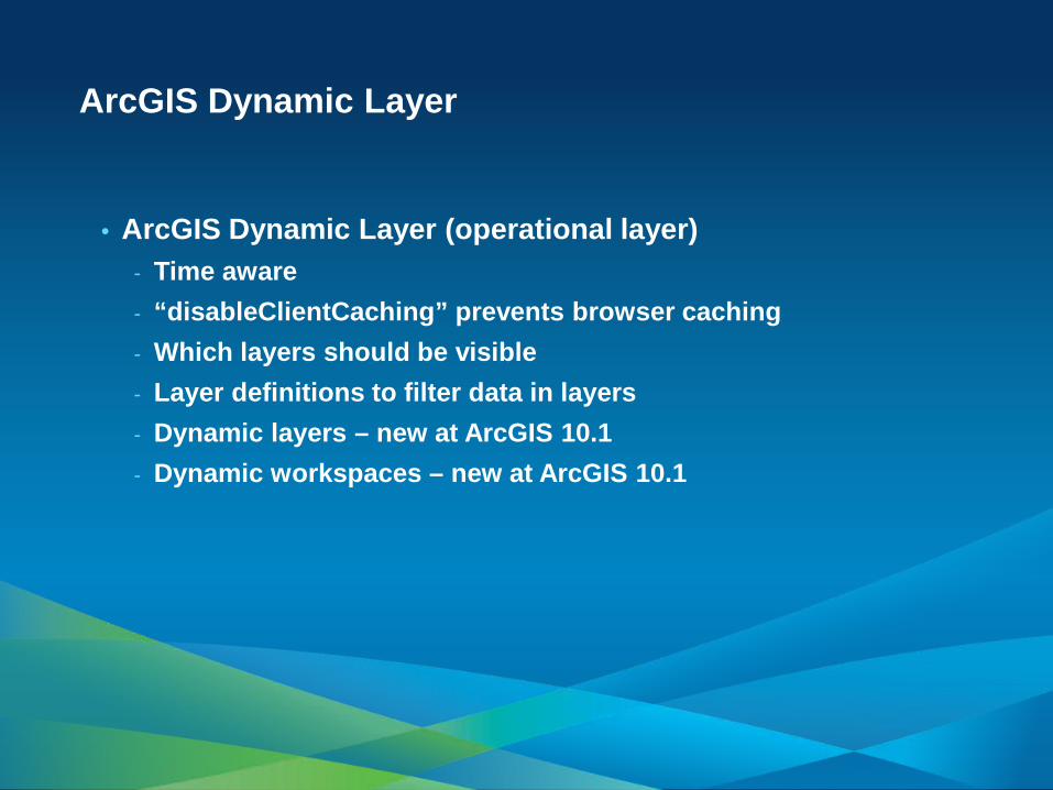
• ArcGIS Dynamic Layer (operational layer) - Time aware - “disableClientCaching” prevents browser caching - Which layers should be visible - Layer definitions to filter data in layers - Dynamic layers – new at ArcGIS 10.1 - Dynamic workspaces – new at ArcGIS 10.1
ArcGIS Dynamic Layer
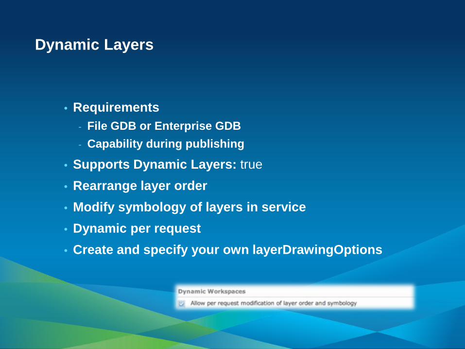
Dynamic Layers
• Requirements - File GDB or Enterprise GDB - Capability during publishing
• Supports Dynamic Layers: true • Rearrange layer order • Modify symbology of layers in service • Dynamic per request • Create and specify your own layerDrawingOptions
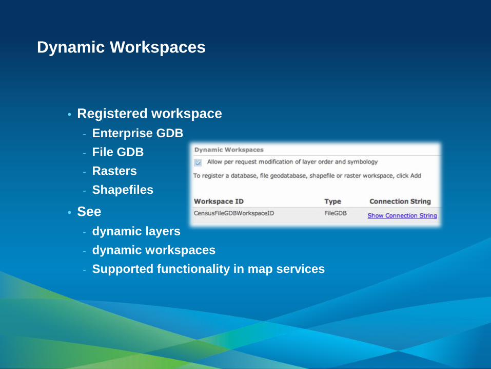
Dynamic Workspaces
• Registered workspace - Enterprise GDB - File GDB - Rasters - Shapefiles
• See - dynamic layers - dynamic workspaces - Supported functionality in map services
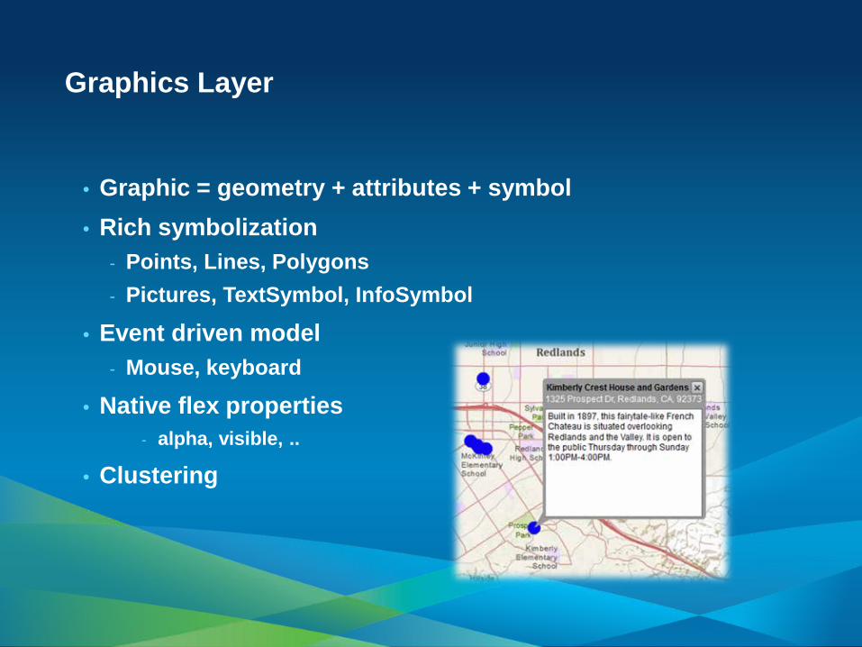
• Graphic = geometry + attributes + symbol • Rich symbolization
- Points, Lines, Polygons - Pictures, TextSymbol, InfoSymbol
• Event driven model - Mouse, keyboard
• Native flex properties - alpha, visible, ..
• Clustering
Graphics Layer
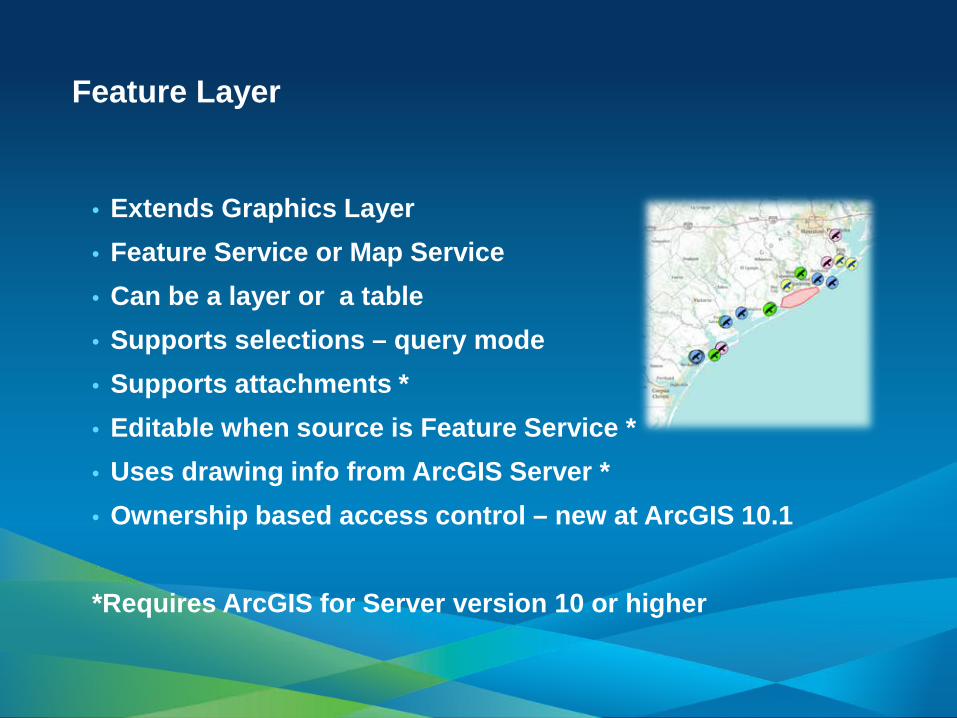
• Extends Graphics Layer • Feature Service or Map Service • Can be a layer or a table • Supports selections – query mode • Supports attachments * • Editable when source is Feature Service * • Uses drawing info from ArcGIS Server * • Ownership based access control – new at ArcGIS 10.1
*Requires ArcGIS for Server version 10 or higher
Feature Layer
Ownership based access control
• Geodatabase configuration - Enable editor tracking - Creator, editor, date/timestamp
• Feature service configuration - Allow geometry updates - Operations for features created by others - Anonymous or user login
• Combine with secure services - IdentityManager

Demo FeatureLayer
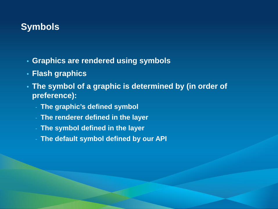
• Graphics are rendered using symbols • Flash graphics • The symbol of a graphic is determined by (in order of
preference): - The graphic’s defined symbol - The renderer defined in the layer - The symbol defined in the layer - The default symbol defined by our API
Symbols

• SimpleRenderer • ClassBreaksRenderer
- array of ClassBreakInfo: 1-2, 2-3
• UniqueValueRenderer - UniqueValueInfo: urban, rural, etc - support for multiple attributes
• TemporalRenderer - any renderer, plus aging and grouping
by track
Rendering
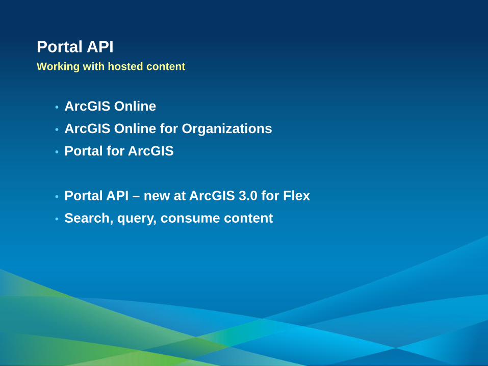
Portal API Working with hosted content
• ArcGIS Online • ArcGIS Online for Organizations • Portal for ArcGIS
• Portal API – new at ArcGIS 3.0 for Flex • Search, query, consume content

Analysis for your applications
Tasks
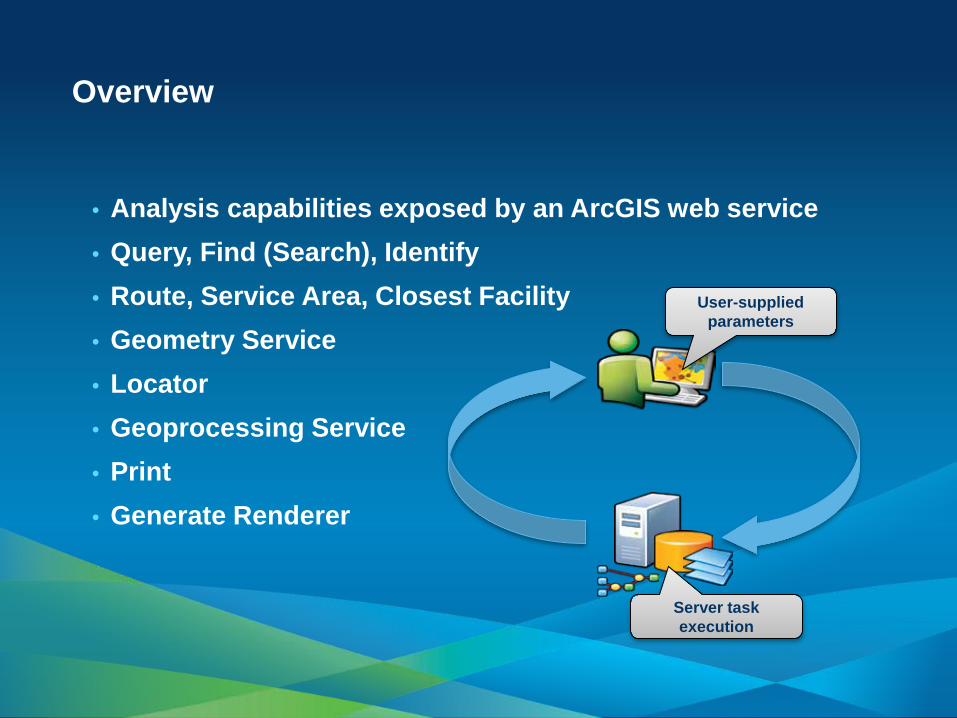
• Analysis capabilities exposed by an ArcGIS web service • Query, Find (Search), Identify • Route, Service Area, Closest Facility • Geometry Service • Locator • Geoprocessing Service • Print • Generate Renderer
Overview
User-supplied parameters
Server task execution
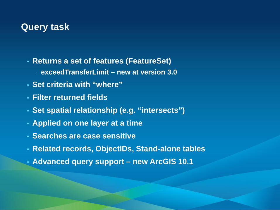
• Returns a set of features (FeatureSet) - exceedTransferLimit – new at version 3.0
• Set criteria with “where” • Filter returned fields • Set spatial relationship (e.g. “intersects”) • Applied on one layer at a time • Searches are case sensitive • Related records, ObjectIDs, Stand-alone tables • Advanced query support – new ArcGIS 10.1
Query task
• Get candidates for an address (forward) • Get an address for a given location (reverse) • Specify the output spatial reference • searchExtent – new ArcGIS 10.1 • Service -> locator -> address styles -> data • Capabilities tied to the underlying address locator
Locator task

Demo
Advanced Query using
Statistics
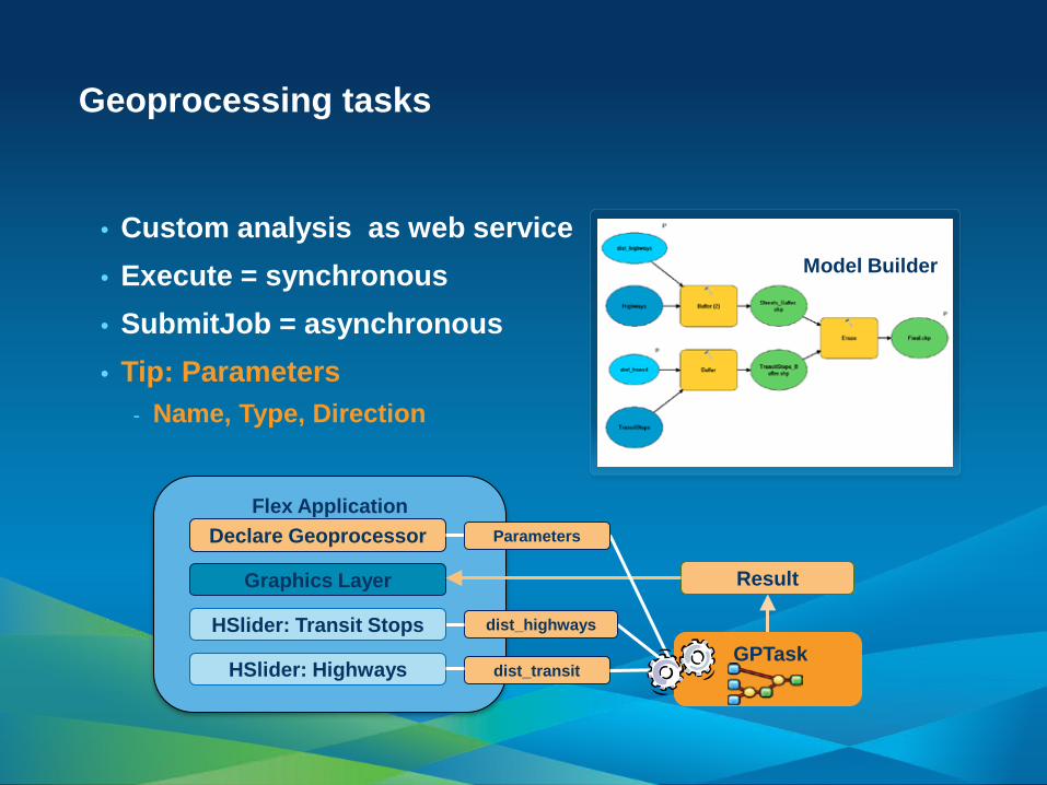
• Custom analysis as web service • Execute = synchronous • SubmitJob = asynchronous • Tip: Parameters
- Name, Type, Direction
Geoprocessing tasks
Flex Application
Result
HSlider: Highways dist_transit
Graphics Layer
Declare Geoprocessor
dist_highways
GPTask HSlider: Transit Stops
Parameters
Model Builder
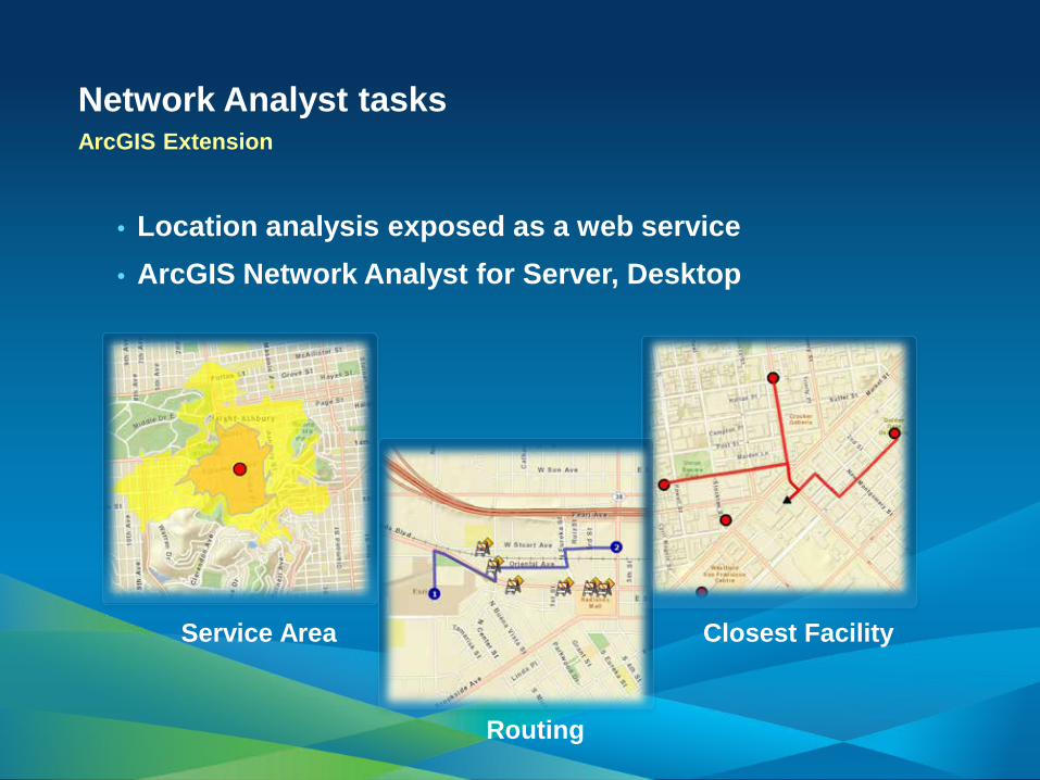
Network Analyst tasks ArcGIS Extension
• Location analysis exposed as a web service • ArcGIS Network Analyst for Server, Desktop
Service Area Closest Facility
Routing

• A web service for spatial relationships and algorithms • Supports operations related to manipulating geometries
- Project, buffer, simplify, cut, densify, difference, generalize, union, split, etc.
• Supports editing functionality with a Feature service • Geodesic calculations – new ArcGIS 10.1
Geometry service
• New web service capability at ArcGIS 10.1 • Generates a printer-ready version of the map • Layout templates
- Letter, Portrait, etc.
• Output types - e.g. PDF, SVG, PNG, etc.
• Defined by ExportWebMap specification • Publish your own custom print service
Print task
• New web service capability at ArcGIS 10.1 • Groups data using a supplied classification definition • ClassBreaksDefinition
- Standard Deviation, Natural Breaks, Quantile, etc
• UniqueValueDefinition • Creates a UniqueValue or ClassBreaks renderer • Complements dynamic layer capabilities
Generate renderer task

Demo
Finishing up the tasks
• Identity Manager – ArcGIS 10 sp1 and higher • Editor • Template Picker • AttributeInspector • AttachmentInspector • ContentNavigator • Navigation, ScaleBar, Legend • TimeSlider • LabelDataRenderer
UI Components
• ArcGIS Dynamic and ArcGIS Image Service Layers - timeInfo, timeOffset, timeOffsetUnits
• FeatureLayer - timeDefinition, timeOffset, timeOffsetUnits
• Identify and Query Tasks - timeExtent
• Time Slider - UIComponent • Temporal Renderer - Symbology
Time and ArcGIS API for Flex
Developer / Deployment workflows

• Minimum Flash Player installation (11.1) - Wrapper streamlines process
• Uncheck enable integration with browser navigation • Use Runtime Shared Library (RSL) • Export “Release build” • Flash Player cross-domain issues
- crossdomain.xml - proxy page (for security)
Think ahead to deployment
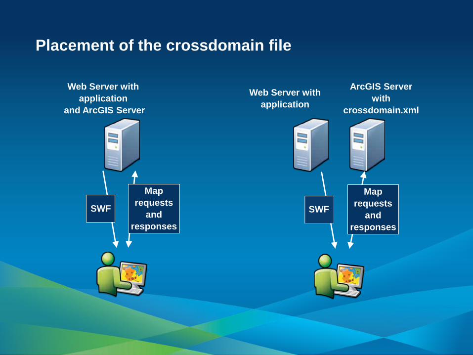
Placement of the crossdomain file
Web Server with application
and ArcGIS Server
Web Server with application
ArcGIS Server with
crossdomain.xml
SWF SWF
Map requests
and responses
Map requests
and responses
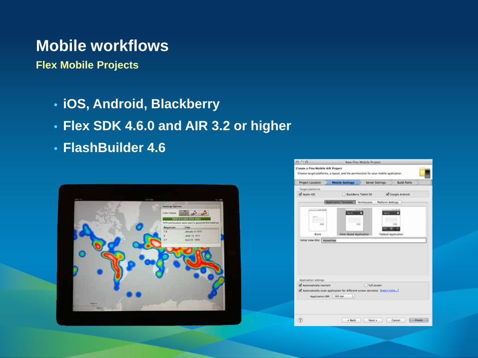
Mobile workflows Flex Mobile Projects
• iOS, Android, Blackberry • Flex SDK 4.6.0 and AIR 3.2 or higher • FlashBuilder 4.6

Road Ahead
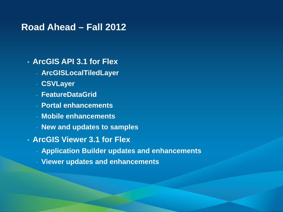
• ArcGIS API 3.1 for Flex - ArcGISLocalTiledLayer - CSVLayer - FeatureDataGrid - Portal enhancements - Mobile enhancements - New and updates to samples
• ArcGIS Viewer 3.1 for Flex - Application Builder updates and enhancements - Viewer updates and enhancements
Road Ahead – Fall 2012
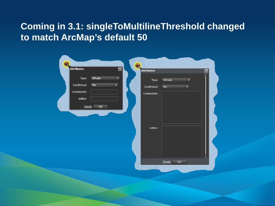
Coming in 3.1: singleToMultilineThreshold changed to match ArcMap’s default 50

Additional resources

• Esri - http://resources.arcgis.com - Forums, samples - http://links.esri.com/flex
- See Concepts -> What’s new - http://links.esri.com/flexviewer
- See Concepts -> What’s new
• Adobe - http://www.adobe.com/devnet/flex.html - http://www.adobe.com/devnet/flex/videotraining.html - http://www.adobe.com/devnet/flex/tourdeflex.html
More information

• http://www.esri.com/training • Instructor-Led Courses
- Introduction to ArcGIS Server - Building Web Applications Using the ArcGIS API for Flex,
JavaScript, or Microsoft Silverlight/WPF
• Online Training Seminars - Free, one-hour presentation and demos by Esri technical
experts - Live seminar broadcast on a new topic every month
Esri training for Web developers
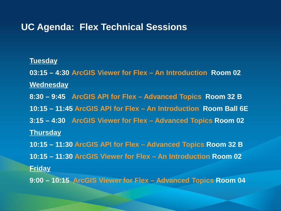
Tuesday 03:15 – 4:30 ArcGIS Viewer for Flex – An Introduction Room 02 Wednesday 8:30 – 9:45 ArcGIS API for Flex – Advanced Topics Room 32 B 10:15 – 11:45 ArcGIS API for Flex – An Introduction Room Ball 6E 3:15 – 4:30 ArcGIS Viewer for Flex – Advanced Topics Room 02 Thursday 10:15 – 11:30 ArcGIS API for Flex – Advanced Topics Room 32 B 10:15 – 11:30 ArcGIS Viewer for Flex – An Introduction Room 02 Friday 9:00 – 10:15 ArcGIS Viewer for Flex – Advanced Topics Room 04
UC Agenda: Flex Technical Sessions

Tuesday 12:00 – 1:00 Flex Developer Special Interest Group Room 28A 12:00 – 12:30 Mind Control, Big data, Hadoop and lots more Esri Labs Exhibit Hall B Wednesday 12:00 – 1:00 Killer Apps: Flex and HTML5 Room Ball 6E 3:00 – 3:30 Reinventing the Feel: Building Impressive HTML User Experiences Esri Labs Exhibit Hall B
UC Agenda: Other sessions and info

Esri Showcase schedule
• Tuesday 9 – 6 • Wednesday 9 – 6 • Thursday 9 – 1:30
• Introduction • Getting started • Concepts and examples • Developer / Deployment workflows • Road ahead • Additional resources
Summary
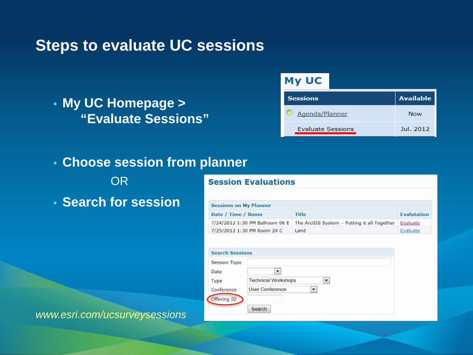
Steps to evaluate UC sessions
• My UC Homepage > “Evaluate Sessions”
• Choose session from planner OR
• Search for session
www.esri.com/ucsurveysessions

• Thank you for attending
• Have fun at UC2012
• Open for Questions
• Please fill out the evaluation:
www.esri.com/ucsessionsurveys
First Offering ID: 590 Second Offering ID: 1931