archaeological investigations for the canyon …
TRANSCRIPT
ARCHAEOLOGICAL INVESTIGATIONS FOR THE CANYON HYDROELECTRIC PROJECT,
COMAL COUNTY, TEXAS
PART I. ARCHAEOLOGICAL SURVEY
A. Joachim McGraw and William B. Ellis
PART II. ARCHAEOLOGICAL TESTING
Joseph H. Labadie
With A Contribution By I. Waynne Cox
Center for Archaeological Research The University of Texas at San Antonio® Archaeological Survey Report, No. 162
1987
A list of publications offered by the Center for Archaeological Research can be obtained by sending $1.00 to the Center for Archaeological Research, The University of Texas at San Antonio, San Antonio, Texas 78285-0658.
ABSTRACT
During January 1986, the Center for Archaeological Research from The University of Texas at San Antonio conducted a pedestrian survey along portions of a proposed Canyon Lake hydroelectric transmission line right-ofway in Comal County, Texas, for the Guadalupe-Blanco River Authority. The survey located six prehistoric sites (41 CM 160, 41 CM 161, 41 CM 162, 41 CM 163, 41 CM 164, and 41 CM 166) in the right-of-way, and one historic building complex (41 CM 165) adjacent to but well outside of the right-ofway. Recommendations were made for further testing of the prehistoric sites and background research for the historic site to determine their potential eligibility for nomination to the National Register of Historic Places and as a Texas Archeological Landmark.
During April 1986, the Center conducted testing at prehistoric sites 41 CM 160, 41 CM 161, 41 CM 162, 41 CM 163, and 41 CM 164. Archival research was done for 41 CM 165. Thi s work was done for the Guada 1 upe-Bl anco Ri ver Authority as required by the Texas Historical Commission. All of the prehistoric sites were found to be lithic quarry sites that are deemed to have little potential for contributing significant new archaeological information. None are recommended as potentially eligible for nomination to the National Register or for Texas Archeological Landmark status. The historic site (41 CM 165) appears to have National Register potential. Further background research, building documentation, and selective testing are recommended, but not as part of this project.
i
ABSTRACT . . . . . . . . . . LIST OF FIGURES . . . . . . ACKNOWLEDGMENTS . . . . . . . PART I. ARCHAEOLOGICAL SURVEY INTRODUCTION . . . . . . .' . . FIELD METHODS . . . . . . . . DESCRIPTION OF THE STUDY AREA ARCHAEOLOGICAL BACKGROUND SITE DESCRIPTIONS .
Site 41 CM 160 Site 41 CM 161 Site 41 CM 162 Site 41 CM 163 Site 41 CM 164 Site 41 CM 165 Site 41 CM 166 Three Localities ..
SUMMARY AND RECOMMENDATIONS REFERENCES CITED . . . . . .
TABLE OF CONTENTS
i . . .. iii
(A. Joachim McGraw and William B. Ellis). iv v 1 1 3 4 6 6 7 8 9 9
10 11 12 12 13
PART II. ARCHAEOLOGICAL TESTING (Joseph H. Labadie) 15 INTRODUCTION. . . . 17 PREVIOUS RESEARCH . 17 FIELD METHODS . . . 18 TESTING RESULTS . . 18
Site 41 CM 160 18 Site 41 CM 161 21 Site 41 CM 162 23 Site 41 CM 163 23 Site 41 CM 164 24 Site 41 CM 165 . . . 24
SUMMARY AND RECOMMENDATIONS 26 REFERENCES CITED . . . . . . . . . . . . . . . . . . . . . . . . 27 APPENDIX I. FARM MARIENTHAL, COMAL COUNTY, TEXAS (I. Waynne Cox) 29 APPENDIX II. ARTIFACTS RECOVERED DURING TESTING. . . . . . . . . 31
i i
LIST Of fIGURES
1. Location of Proposed Transmission Corridor and Sites Recorded
2. Comparison of Upper Salado Creek and Canyon Reservoir Chronological Cultural Sequence .
3. Topographic Map of Site 41 CM 160 .
4. Topographic Map of Sites 41 CM 161, 41 CM 162, and 41 CM 163
5. Location of the Ferguson Homestead Relative to the GBRA
2
5
19
22
Ri ght-of-Way. ... .. . . . . . 25
6. Bifacial Artifacts Recovered from Site 41 CM 160 32
7. Bifacial Artifacts Recovered from Sites 41 CM 160 and 41 CM 161 33
8. Bifacial Artifacts Recovered from Sites 41 CM 162 and 41 CM 163 34
iii
ACKNOWLEDGMENTS
The authors thank David Welsch, director of Planning and Development, GBRA, for much appreciated information and aid in carrying out the project. Thanks are also extended to the Center for Archaeological Research administrative staff for assistance in preparing this report.
Special thanks to Bruce Ellis for the drafting of the maps and the cover design and to Cathy Dodt-Ellis for the artifact illustrations.
iv
PART I. ARCHAEOLOGICAL SURVEY
A. Joachim McGraw and
William B. Ellis

INTRODUCTION
During early January 1986, personnel from the Center for Archaeological Research (CAR), The University of Texas at San Antonio (UTSA), conducted archaeological surveys along portions of a proposed Canyon Lake hydroelectric transmission line in Comal County, Texas. The work was initiated following a letter of agreement between the Guadalupe-Blanco River Authority (GBRA) and the Center for Archaeological Research (letter dated December 26, 1985). The work was deemed necessary to fulfill the requirements and pursuant to Section 106 (36 CFR 800) of the National Historic Preservation Act of 1966, as amended. Assessments of newly recorded prehi stori c and hi stori c sites are based upon their potential for nomination to the National Register of Historic Places and as State Archeological Landmarks. The intensive surface survey work was carri ed out by A. Joachim McGraw and Bruce Ell is of the Center staff during the period of January 7-13 (briefly interrupted by inclement weather) along a proposed transmission corridor route approximately 6 km long. Beginning just southeast of Canyon Lake, the line extends southeast along or roughly parallel to Highway 306 toward the city of New Braunfels (Fig. 1). The field work was done under the general direction of Thomas R. Hester, Center director, and Jack D. Eaton, associate director.
FIELD METHODS
Field work consisted of intensive pedestrian surveys along the proposed transmission corridor as identified from 7.5' USGS topographic maps and 1:200 orthophotographic maps with the routes clearly plotted. It should be noted that while, according to landowners, the corridor had been marked and surveyed in the past, little evidence of surveyors' stakes or flagging tape was observed during current work. Thus, the field work followed interpretat ions of the proposed route rather than actual surface stakes, fl ags, or markers. Given the distinctive local topography of the area and the extreme detail of the 1: 200 scal e orthophotographi c images (often i ndi vidual trees could be identified along the transmission route), we believe that our estimations of the corridor location to be accurate to within 10 to 15 m. As an example, a 2-km survey segment over varying terrain, following the features identified from the aerial maps, would result in a variance of less than 7 to 8 m from the identifiable end survey point. Although the width of the impacted corridor was estimated at ca. 17 m, actual field survey included an approximate 100 m wi dth to allow for some future fl exi bil ity along the route, given the varying terrain and the potential avoidance of newly recorded sites.
The field survey was accomplished by two persons spaced at 15- to 25-m intervals, dependent upon topography and ground cover. Each individual, in addition to personal equipment, also carried a compass, topographic maps with the survey routes cl early marked, and common survey items such as fl aggi ng tape, field forms, collection bags, etc. All newly identified site areas were recorded on state site survey forms as required by the Texas Historical Commission and the Texas Archeological Research Laboratory, Austin. Site locations were plotted on 7.5' USGS maps, and collections were made of chronologically diagnostic or otherwise significant artifacts from individual sites. When possible, newly located sites were revisited to review the

This page has been
redacted because it
contains restricted
information.
Part I. Archaeological Survey
accuracy of site description, dimensions, and location. All collected field notes, photographs, and other site data are on file at the CAR.
DESCRIPTION OF THE STUDY AREA
The proposed transmi ssi on corridor 1 i es just southeast of Canyon Dam and Reservoir, near the southeastern edge of the Edwards Plateau and the Balcones Escarpment, a we ll-defi ned fault 1 i ne that vari es from between 300 to 1000 feet in elevation along its margins.
The Guadalupe River, the major drainage system in this area, flows from its headwaters in Kerr County into San Antonio Bay, a distance of ca. 430 miles (Johnson, Suhm, and Tunnell 1962:9). Canyon Dam, on the upper Guadalupe Ri ver, stores water for flood control and water supp 1 i es as well as the deve 1 opment. of hydroe 1 ectri c power. As the fi rst major project on the Guadalupe River, Canyon Dam has ca. 366,400 acre-feet of conservation storage and is estimated to yield 96,000 acre-feet during severe episodes of drought (U.S. Department of the Interior, Bureau of Reclamation 1978:34-35).
The landforms of northern Comal County in the vicinity of Canyon Dam consist of sedimentary materials accumulated along the Gulf coast geosyncline during the Mesozoic and Cretaceous eras. The oldest exposed geologic formations are Cretaceous limestone materials and often include extensive deposits of si 1 i ceous chert cobbl es or nodul es. Thi s chert represents an important feature of prehistoric lithic resources in the local study area. Major limestone formations in the area inclusively known as Edwards include Georgetown, Kiamichi, and Comanche Peak. These are characterized by massive, hard materials containing dolomite or chert and often occur as limestone remnants that cap eroded hills in dissected stream valleys (ibid.:8).
The study area forms the southern margins of the Balconian Biotic Province characterized locally by distinctive flora and fauna, generally indigenous to the Edwards Plateau. Climax vegetation consists of a series of subgroups of which live oak is predominant but also includes elm, mesquite, shin oak, Texas oak, and juniper (cedar). Fauna indigenous to the area includes whitetailed deer, javelina, wild turkey, and a variety of smaller animals such as fox, squirrel, cottontail rabbit, jackrabbit, and one of the largest collections of avifauna in the United States (U.S. Department of the Interior, Bureau of Reclamation 1978:15).
The study area and Comal County generally fall within the south-central climatological region of Texas, characterized by a modified subtropical climate. The average growing season between frosts is 282 days while local temperatures range between 50-85°F. Rainfall, known to vary widely, averages 28 inches or more annually and often occurs in the form of seri ous fl ash floods during spring and fall.
A more extensive discussion of the physiography, ecology, and hydrology of the area is beyond the scope of this report, and the reader is referred to Austin et a7. (1975), Sellards, Adkins, and Plummer (1958), and Parker et al. (1975) for a more detailed review.
3
Part I. Archaeological Survey
ARCHAEOLOGICAL BACKGROUND
The archaeological resources of Comal County are, in comparison, much more poorly described than those in adjacent Bexar County, although both counties include the southeastern margins of the Edwards Plateau and the Balcones Escarpment. These physiographic features are thought to have significantly influenced the character of prehistoric occupations in this area for mi 11 enni a.
The remains of prehistoric occupations and other activity sites such as quarries and lithic workshops indicate the region has been exploited by a series of hunter-gatherer groups since at least 9200 B.C. More locally, at the Footbridge site, 41 CM 2, excavated at Canyon Reservoir (Johnson, Suhm, and Tunnell 1962), Late Paleo-Indian materials in the form of Meserve (ca. 8000 B.C.?) and Angostura (6500-6000 B.C.) projectile points were recovered. As a result of salvage operations by Johnson, Suhm, and Tunnell (1962) not only at 41 CM 2, but also 41 CM 1 and 41 CM 3 (all within the present Canyon Dam and Reservoir area), a series of chronologically diagnostic artifacts indicating prehistoric activities ranging from the Paleo-Indian and Archaic periods through the Toyah focus of the Late Prehistoric (ca. A.D. 1200) was recovered. Johnson, Suhm, and Tunnell (1962) present a cultural chronology of the Canyon Reservoir area along with a comparison to central Texas and adj acent areas . Although dated, thes'e data st i 11 represent a sign i fi cant contribution to regional prehistoric studies and offer direct comparisons to materials and sites from the current study area.
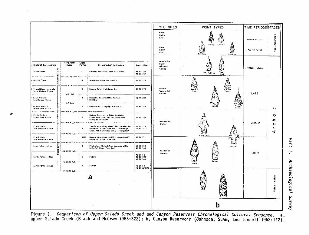
More recently, Black and McGraw (1985) have derived a comparative chronology based on materi a 1 s recovered from 41 BX 228 in nei ghbori ng Bexar County. Also included, is a detailed discussion of the implications of such a derived sequence to an understanding of aboriginal cultural patterns throughout the Balcones Escarpment of the Edwards Plateau (Fig. 2).
Another significant site in Comal County is Friesenhahn Cave, a sinkhole cave containing Pleistocene faunal remains and possible stone artifacts (Hester 1980:131-132), including some of the largest saber-toothed tiger remains known (Graham 1976).
OngOing, extensive excavations at 41 CM 104, the Dan Baker site, an intensive Late Paleo-Indian, Archaic, and Late Prehistoric occupation site along the Guada 1 upe Ri ver in northwest Coma 1 County, also offer new contri but ions to the 1 oca 1 archaeol ogi cal record. Members of the Southern Texas Archaeological Association, over a six-year period, have recovered an extensive artifact collection from this significant site.
For a more detailed background on the chronology, sites, and areal prehistoric research, the reader is referred to Hester (1980), Black and McGraw (1985), Johnson, Suhm, and Tunnell (1962), Assad (1978), Weir (1976), Prewitt (1981), and Hester, ed. (1976).
4
(J'1
-
TYPE SITES POINT TYPES TIME PERIODS STAGES
Blum • ~~ Smith c: 0
Kyl. u ~ - (TOYAH FOCUS) ';:
~ '":..p- '"
6 E
PerdiZ Cliff Ion <l Blum
, 0
Smith .- (AUSTIN FOCUS) '" Kylo Z Granbur Scollorn
Wundorllch
~ t\ I Approxt~te I local I I Smith Reglonal Des1gnatfons I Dates I Period I Chronolog(cal Ind1cators I local Sites Williams ~~ I 1 ___ 1 --------- I TRANSITIONAL
!; I I I I ColUns Toyah Phase ;;I I I 11 I Perdiz, ceramtcs. beveled knives I 41 ax 228 ~~1
" I I I I 41 8X 369 Prov Type m Dorl
~ l-AoOo 1300-1---1 I ~
~ I
Aust1n Phase ~ I I 10 I SCllllom. Edwards. ceram1cs I 41 ax 228 ,~ !il I I I I
~ ?-I-AoOo 900-1---1 I E{'
~ I ~~~ Trans1tional Archaic I I I 9 I Ensor. FrIo. Fafrhnd. Darl 41 ex 228 Oblat. Tw1n Sfsters Phase I I I Wunderlich En~or Frio
I l-Aooo 250-1---1 Collinl i
~ LATE
I I I lne Archa Ie I I 8 I Mantell, Castrovl1le. Marcos. 41 ex 228 I San Marcos Phase I I I Wl111aas i;J I > 1---{;50 8oCo-l---l .,." '. I I Middle Archaic 1 I I 7 I Podornalos. langtry. Klnney(?) 41 ex 228 Montell
Morcos I Round Rock Phllse ~ I I I U I i 1-20008oco-l---1 --- ~~
0-
I I Early Archaic f I I I Nohn. TravIs, La Jlta, Pandale. 0 I Clellr Fork Phase =r I I 6 I Clear Fork tooH?)' "thinned-base I 41 ex 228
k~ I I ;.. I I I early trlllngular" I ..c. I ~ 1-3000 eoco-l---l I
Wund.rlich I Cruml.y r. MIDDLE U
I Pr .... Arch.lc I I I I "early expandIng stsn," Martlndal •• Bell 41 ex 228 1,- i-~ "-I San Geronimo Phase I I 5 I unHac1al Clear Fork tool. Guadalupe 41 ax 271
I I I I I tool. "thinned-base early trlllngular" « I I 1-04000(1) aoco-l---l Pedernales
I Pr .... Archalc \1 I 41!) I Gow.r, Guadalupo too1l1), Angostural!), <I AX 271
i '", .
I San Geronimo Phase I I I unHac:1al Clear Fork tool L I ---- r
l-SOOO (1) aoco-l----l !:t I late Paleo-Indian tTl I I 3 I Ph1nvhnh Golondr1na, Angostura(1), ,41 ex 229 Bulverde
I ? I I I bHacial Clear Fork tool 41 ex 369
I § 1_00 (1) eoco-l---l Wunderlich ~J~ Cruml.y EARLY I f I I I 41 ax 52 l"\i I Early Paleo-Indl.n II I 2 I Fo1."," 41 ex 229 &c; I I I I 41 ex 369
1--------- 1-'>000(1) eoco-l---l ----- Trav1S
I I NaJan
I Early paleo-Indllln~ I I 1 I Clovis I 41 ax 52 I I I I I I I 41 8X 228(1) I I 1-'>700(1) eoco-I---I I I
~ a , c: 0
'0
-~ E
0
~ 0 IL
b Cultural Sequence. a, Figure 2. Comparison of Upper Salado Creek and and Canyon Reservoir Chronological
upper Salado Creek (Black and McGraw 1985:322); b, Canyon Reservoir (Johnson, Suhm, and Tunnell 1962:122).
'tJ QJ ""'S ..,. '-t
::t.. ""'S (') ::r QJ It) C -.. c
\Q ..... (') QJ -.. tI") c:: ""'S
'" ~

Part I. Archaeological Survey
SITE DESCRIPTIONS
Seven archaeological sites and three localities, thought to have a high potential for deeply buried cultural deposits, have been identified along the proposed transmission line route (see Fig. 1 for site locations). The following presents descriptions, assessments, and recommendations for these sites.
SITE 41 CM 160
Type of site: Extensive prehistoric quarry and lithic workshop area with light occupation activities in some locales; ca. 1.5 km x 250 m (minimum).
Location: Extending northwest from the southern margins of the transmission corridor. The site continues along and adjacent to the route for ca. 1.5 km.
Topographic context: The site, perhaps more correctly a zone, encompasses the slopes of several adjacent hilltops as well as a tertiary drainage between the small points of rel ief. Elevation: 1040-1080 feet above mean sea level (msl).
Water source: A small, intermittent drainage bisects the activity area.
Vegetation/soil: Because of the extensive length of the site, vegetation varies from cleared fields to dense groves of oaks and juniper. The soil consists of eroded, clayey grayish brown calcareous materials and exposures of lighter colored, more clayey subsoil. Pockets of relatively undisturbed, more extensive soil deposits were observed along the lower slopes.
Site conditions: Moderately di sturbed by natural erosi onal processes and modern land alterations.
Site discussion: The location is the remains of an extensive prehistoric quarry-workshop activity area apparently rel ated to the exposures of chert cobb 1 es and nodul es that outcrop along the slopes of small hill sin th is area. Some scattered fragments of burned rock were noted throughout the site area, and this indicates at least some past temporary camping/occupation activities.
Artifactual materials consisted primarily of large quarry blanks, often more than 12 cm in length, tested cobbles, and lithic debris (decorticate chips and fl akes with retouch and marginal util ization), often moderately patinated. No features or diagnostic projectile points were collected or observed.
The distribution of materials, lithic types, and extensive site character is similar to the large quarry-workshop sites investigated by McGraw and Valdez (1978) in adjacent northern Bexar County.
Recommendations: Site significance is directly related to poorly understood local patterns of prehistoric exploitations of natural resources, particularly raw materials for the manufacture of stone tools.
6
Part I. Archaeological Survey
While portions of the site have been damaged by erosion and modern alterations, an extensive area of the site remains relatively intact. Preliminary inspections, in the form of intensive surveys along the transmission corridor, cannot accurately determine the overall site dimensions or assess the significance of tentatively identified intrasite activity areas. Given the nature of the potential impact to this site area, we recommend: (1) monitoring of construction activities if the impact is directed to a corridor ca. 17-m (50-feet) wide, or (2) limited testing of the site along the projected route in the form of hand-excavated shovel tests and 1-m2 units. We believe, given the limited nature of potential impact in a narrow zone along this route, that the former alternative is more cost-effective; however, its applicability is dependent upon the type and extent of construction activities necessary. It should be noted that avoidance of this site would involve a line movement of at least 200 m laterally and possibly much more. If the first alternative is adopted and significant deposits are found during monitoring, this could cause potentially costly delays.
Given the limited site data, the extensive area and frequency of materials, and the site's potential for contributing significant information on aspects of the local and regional archaeological record, we recommend further work in the form of the presented alternatives to mitigate future destructive impacts.
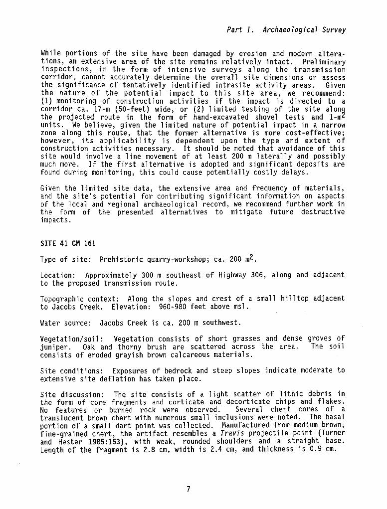
SITE 41 eM 161
Type of site: Prehistoric quarry-workshop; ca. 200 m2.
Location: Approximately 300 m southeast of Highway 306, along and adjacent to the proposed transmission route.
Topographic context: Along the slopes and crest of a small hilltop adjacent to Jacobs Creek. Elevation: 960-980 feet above msl.
Water source: Jacobs Creek is ca. 200 m southwest.
Vegetat i on/ soil: Vegetation cons i sts of short grasses and dense groves of juni per. Oak and thorny brush are scattered across the area. The soil consists of eroded grayish brown calcareous materials.
Site conditions: Exposures of bedrock and steep slopes indicate moderate to extensive site deflation has taken place.
Site discussion: The site consists of a light scatter of lithic debris in the form of core fragments and corticate and decorticate chips and flakes. No features or burned rock were observed. Several chert cores of a translucent brown chert with numerous small inclusions were noted. The basal portion of a small dart point was collected. Manufactured from medium brown, fine-grained chert, the artifact resembles a Travis projectile point (Turner and Hester 1985:153), with weak, rounded shoulders and a straight base. Length of the fragment is 2.8 em, width is 2.4 cm, and thickness is 0.9 cm.
7
Part I. Archaeological Survey
Extensive chert cobbles and nodules were observed eroding from the site slopes. Hill slope was estimated at 5-10% at the crest to 30-40% on the southwestern margins.
Recommendations: Should this area be impacted by the proposed transmission route, we recommend that an archaeologist be present to monitor construction activities and to identify possible subsurface materials/deposits exposed during line clearing or construction.
SITE 41 eM 162
Type of site: Prehistoric quarry-workshop; ca. 200 x 450 m.
Location: Approximately 200 m northwest of 41 CM 160 along and adjacent to the proposed transmission line route.
Topographic context: Along the southern slopes of a small hill overlooking the main channel of (intermittent) Jacobs Creek. Elevation: 960-1020 feet above msl.
Water source: Jacobs Creek is ca. 50-75 m southwest of site.
Vegetation/soil: Dense juniper and short grasses cover the area; oak and some thorny brush are scattered across the site. Limestone outcrops along the slopes, and the soil consists of shallow grayish brown calcareous materials. A relative increase in soil depth was observed on the lower slopes, but the extent is not known.
Site conditions: A moderate to extensive degree of site deflation has taken place, due to the erosion of shallow soil and steep slopes. As noted, possible soil deposits of some relative depth may occur on the lower southwestern slopes.
Site discussion: The site consists of a light scatter of lithic debris, including chert core fragments and corticate and decorticate chips and flakes. No features or diagnostic materials were noted. The distribution of materials appears to follow the outcroppings/exposures of chert cobbles and nodules. No burned rock was observed.
Recommendations: Because the proposed transmission line is projected through the lower southwestern slopes of this site, the limited site information available to date, and the potential for buried, possibly significant cultural deposits adjacent to the Jacobs Creek drainage, we recommend limited testing along the proposed route in this area in the form of a series of systematic 50-cm2 shovel tests and hand-excavated 1-m2 units to assess the occurrence, extent, depth, and significance of buried deposits.
8
Part I. Archaeological Survey
SITE 41 CM 163
Type of site: Prehistoric quarry-workshop area; 500 x 150 m (possibly wider). Light to moderate scatter of burned rock indicates some form of temporary occupation activities also occurred here.
Location: Approximately 0.8 km south of Highway 306 and just south of Jacobs Creek.
Topographi c context: Jacobs Creek drainage.
Along the lower slopes of a ri dge adj acent to the Elevation: 940-980 feet above msl.
Water source: Jacobs Creek (intermittent drainage) is ca. 50 m northeast of site.
Vegetation/soil: Dense grasses cover most of the site area. Juniper and oak are scattered across the site, although most of the juniper has been cleared. The soil consists of grayish brown calcareous materials and appears shallow, although time limitations did not allow shovel testing to determine soil depth across the site.
Site conditions: The site has been cleared of dense juniper, although the landowner indicates that the area has not been chained. The surface does not appear to be seriously disturbed except for natural erosion.
Site discussion: The site consists of a moderate scatter of 1 ithic debris reflecting all stages of tool manufacture. Cores, fragments, tested cobbles, corticate and decorticate chips and flakes as well as utilized and retouched debri s were noted. Surface con cent rat ions of 1 ith i c debri s were observed, but no features were identified. A light scatter of burned, fire-fractured rock was also noted across the site area. One medial biface fragment, chronologically undiagnostic, was surface collected. Moderately patinated, the projectile pOint(?) was manufactured from medium gray, fine-grained chert. Length of the specimen is 3.9 cm, width is 3.3 cm, and thickness is 0.75 cm.
Recommendations: The multifunctional activities indicated from the variety of artifactual remains suggest that this site may be of potential quality for nomination to the National Register of Historic Places. We recommend limited testing in the form of hand excavated 50-cm2 shovel tests and 1-m2 test pits to determi ne the potential and s i gnifi cance of, as yet, undefi ned buri ed deposits.
SITE 41 CM 164
Type of site: Prehistoric occupation; ca. 350 x 200 m.
Location: Along the proposed transmission route, ca. 100 m south of Highway 306 and 700 m southeast of the Guadalupe River.
Topographic context: Along the lower slopes of an extensive and high ridge complex adjacent to the fossil floodplain of the Guadalupe River. A small,
9
Part I. / Archaeological Survey
intermittent run-off drainage bisects the site area. Elevation: 780-750 feet above msl.
Water source: The modern channel of the Guadalupe River is ca. 700 m distant. A modern channel of Cordova Creek is located ca. 100 m from the main site area. It is possible that a fossil confluence of this tributary and the Guadalupe River were located in the immediate vicinity of this site.
Vegetation/soil: Soil deposits in the lower site elevations consist of dark loamy topsoil that overlies a reddish brown subsoil with numerous small gravels and pebbles. Upper elevations are extremely eroded, and extensive limestone outcroppings occur in this locale.
Site conditions: The site has been partially cleared and extensively damaged by a ranch complex (outbuil di ngs, pens, ranch roads, etc.). The lower site elevations in the northern area in the vicinity of the proposed transmission route are cleared but soil profiles exposed in deep gullies indicate potentially undisturbed soil deposits in excess of 1.5 m.
Site discussion: A light scatter of burned rock and chert debris covers the site area; a moderate scatter has been exposed in disturbed locales such as animal pens. The landowner has collected ca. 20 biface fragments and an assortment of utili zed and retouched artifacts from thi s area. Severa 1 diagnostic were observed in this collection: Late Archaic Marcos and Marshall projectile points, a small arrow point fragment (Perdiz?), and a perforator. No features or other d i agnost i cs were observed or collected from the site area. Given the site's location adjacent to a former confluence point, it is possible that further cultural deposits may lie below the surface in portions of the site.
Recommendations: This site represents the largest and most distinctive multifunctional prehistoric activity area identified in the survey of the proposed transmission route. Given the potential for buried cultural deposits and the artifacts previously collected by the landowner, the authors recommend 1 imited testing in the form of a seri es of hand-excavated units (50-cm2 shovel tests and I-m2 units) along the transmission corridor to identify the location of potential, if not probable, buried site deposits and assess the site's potential for nomination to the National Register of Historic Places.
SITE 41 eM 165
Type of site: Abandoned historical occupation complex.
Location: Approximately 100 m north of proposed transmission line, 500 m east of Guadalupe River.
Topographic context: This site ;s located just south of Cordova Creek and along its southern terrace.
Water source: Cordova Creek is ca. 30 m north; a well or cistern may be located in the :omplex (unidentified).
10
Part I. Archaeological Survey
Vegetation/soil: The area was once cleared. The site exists on the margins of an extensive cultivated field and is bordered by a dense grove of mesquite, hackberry, and oak trees. The soil consi sts of a medi urn brown, clayey, silty loam.
Site condition: Abandoned.
Site discussion: The site consists of a one-floor occupation structure constructed of stone and soft paste mortar covered by a tan-colored plaster. Wooden porches extend from the roof line along both sides of the longitudinal axi s of the structure. Several wooden outbuil di ngs are scattered through dense brush adjacent to the house. The construction style is tentatively identified as ethnic vernacular, and estimated time of construction is considered to be mid to late 19th century.
The occupation complex is not considered to be under primar.y impact of the transmission corridor; however, it is identified here, should considerations be made to move a proposed route laterally. Very little information is available concerning the background or early occupants of this site, although its 1 ocat i on adjacent to Cordova Creek and ca. 2 km from Jacobs Creek may offer some clues. Jacobs Creek was named after Jacob de Cordova, a 19thcentury Texas land speculator remembered for his accumulation script on a mi 11 i on acres of 1 and by 1859. De Cordova I s former home is known to be in Comal County (Webb 1952:480, 903), but research on its location is beyond the scope of this report.
Recommendat ions: On the bas is of i nformat i on to date, the authors cannot identify the past ownership of this structure, but recommend avoidance of the site area. If avoidance is not possible, a detailed archival search is recommended, as well as architectural documentation to more clearly identify the significance of the structures.
SITE 41 eM 166
Type of site: Prehistoric occupation; ca. 200 x 100 m (minimum).
Locat ion: Along the proposed transmi ss ion 1 i ne route and adj acent to the west bank of the Guadalupe River. The former site location is now bisected by FM 2673.
Topographic context: Situated on the upper terraces above the modern channel of the Guadalupe River. Elevation: ca. 740-780 feet above msl.
Water source: Guadalupe River is ca. 15 to 20 m distant.
Vegetation/soil: The site is extensively damaged by road construction, a modern ranch complex, and natural erosion. Short grasses and dense juniper are located on the eastern slopes of the site nearest the ri ver; all other areas have been extensively damaged or destroyed. The soil is extremely eroded along the eastern slopes; the soil on the western portion consists of medium brown, clayey loam.
11
Part I. Archaeological Survey
Site conditions: Over 95% of the original estimated site area is destroyed; an apparent deflated lithic scatter and burned rock were observed along the eastern site margins.
Site discussion: Very little remains of this occupation site, and it can be identified primarily by an intensive scatter of lithic debris and burned rock along its eastern margi ns and adj acent to the Guadalupe Ri ver . Several decorticate chips and flakes and an occasional burned rock were also noted within the (disturbed) area of a modern ranch complex just west of FM 2673. No features or diagnostic materials were collected from this area. Soil depth increases westward away from the site area, and a potential exists for deeply buried materials in that locale.
Recommendations: Given the extensive disturbance, both natural and man made and the lack of possible deeply buried cultural deposits, no further work is recommended at this site based on information to date. The site does not warrant consideration for potential National Register status.
THREE LOCAL IT I ES
Three specific localities were identified as having a high potential for buried site deposits (Fig. 1). Although no cultural materials were observed in these areas, their physiographic context, broad floodplains adjacent to a laterally shifting river channel, suggests a possibility of as yet unidentified buried archaeological sites situated on former river terraces. We recommend that an archaeologist be present to monitor future construction activities in these areas, should these locations be impacted.
SUMMARY AND RECOMMENDATIONS
Seven newly identified archaeological sites and three localities having a high potential for buried cultural deposits have been identified in the proposed GBRA transmission 1 ine corridor. Because of the extensive nature and complexity of site materials, preliminary identifications cannot, for the most part, assess the potential of these sites for consideration to National Register status without further limited testing.
We therefore recommend a management plan that would offer three alternatives.
1. If it is feasible to reroute the transmission line in those critical areas so as to avoid and protect the archaeological sites, this would be the most des i rab 1 e a lternat i ve. However, any rerouting of the 1 i ne outs i de of the corridor already surveyed would require new surveys, with the potential of additional archaeological sites.
2. If the transmission line were rerouted, but in the near vicinity of any or all of the known or suspected archaeological sites, and if the sites would be potentially impacted by placement of poles or vehicle/machine traffic, then they should be tested to determine eligibility for nomination to the National Register of Historic Places. Any site deemed eligible would have to be avoided or mitigated.
12
Part I. Archaeological Survey
3. Should the transmission line keep its current routing plan, and potentially or directly impact any or all of the archaeological sites discovered or suspected, then the sites should be tested for National Register eligibility. Those sites deemed to be eligible should then be either avoided or a mitigation plan developed for those areas which would suffer adverse effects. The i ntens i ty and extent of any mi t i gat i ve excavations recommended would be decided following initial eligibility testing.
In summary, we recommend that the sites be avoided and protected if possible. Should this not be feasible, then we recommend that all sites be tested to determi ne eli gi bil ity for nomi nat i on to the Nat i ona 1 Regi ster of Hi stori c Places, and that mitigative excavations be undertaken at potentially eligible archaeological sites that would be directly impacted.
REFERENCES CITED
Assad, C.
1978 An Evaluation of Archaeological Sites in the Vicinity of Floodwater Retarding Structure No.2, Dry Comal Creek, Comal County, Texas. Center for Archaeological Research, The University of Texas at San Antonio, Archaeological Survey Report 50.
Austin, G. L., L. M. Kaemarcik, D. E. Solomon, and S. E. Sweetser
1975 Environmental Inventory of the Guadalupe and San Antonio River Basins. Ecology Audits, Inc., Dallas, Texas.
Black, S. L. and A. J. McGraw
1985 The Panther Springs Creek Site: Cultural Change and Continuity in the Upper Salado Creek Watershed, South-Central Texas. Center for Archaeological Research, The University of Texas at San Antonio, Archaeological Survey Report 100.
Graham, R. W.
1976 Friesenhahn Cave Revisited (A Glimpse of Central Texas 20,000 Years Ago). The Mustang 18(5):1-7.
Hester, T. R.
1980 Digging Into South Texas Prehistory. Corona Publishing Co. , San Antonio.
Hester, T. R. , editor
1976 The Texas Archaic: A Symposium. Center for Archaeological Research, The University of Texas at San Antonio, Special Report 2.
13
Part I. Archaeological Survey
Johnson, L., Jr., D. A. Suhm, and C. D. Tunnell
1962 Salvage Archeology of Canyon Reservoir: The Wunderlich, Footbridge, and Oblate Sites. Texas Memorial Museum, Bulletin 5, Austin.
McGraw, A. J. and F. Valdez, Jr.
1978 41 BX 68: A Prehistoric Quarry-Workshop in Northern Bexar County, Texas. Center for Archaeo I ogi ca I Research, The University of Texas at San Antonio, Archaeologica7 Survey Report 56.
Parker, R. H., L. E. Anderson, J. L. Bean, D. R. Gattis, W. W. Reagan, and K. W. Turgeon
1975 Evaluation of Impacts of a "No-Management" Plan of the San Antonio-Guadalupe River Basin. Coastal Ecosystems Management, Inc., Fort Worth, Texas.
Prewitt, E.
1981 Cultural Chronology in Central Texas. Bulletin of the Texas Archeological Society 52:65-89.
Sellards, E. H., W. S. Adkins, and F. B. Plummer
1958 The Geology of Texas. Volume 1. Bureau of Economic Geo7ogy, Bulletin 3232. Austin.
Turner, E. S. and T. R. Hester
1985 A Fie7d Guide to Stone Artifacts of Texas Indians. Texas Monthly Press, Austin.
U.S. Department of the Interior, Bureau of Reclamation
1978 Special Report on San Antonio-Guadalupe River Basins Study. Texas Basin Project. Amarillo, Texas.
Webb, W. P., editor
1952 The Handbook of Texas. Volume I. The Texas State Historical Association, Austin, Texas.
Weir, F. A.
1976 The Central Texas Archaic. State University, Pullman.
14
Ph.D. dissertation, Washington University Microfilms, Ann Arbor.
PART II. ARCHAEOLOGICAL TESTING
Joseph H. Labadie
With A Contribution By I. Waynne Cox

INTRODUCTION
During April 3-5, 1986, staff personnel from the Center for Archaeological Research (CAR), The University of Texas at San Antonio (UTSA), conducted archaeological testing at five prehistoric sites for the Guadalupe-Blanco River Authority (GBRA), in the vicinity of the Canyon Dam and Reservoir. The work conducted by the CAR-UTSA was designed to collect evaluative data on five targeted sites within the GBRA transmission line right-of-way. Assessments of these sites are based upon thei r potent i a 1 for nomi nat i on to the National Register of Historic Places and State Archeological Landmarks.
The subsurface testing at sites 41 CM 160, 41 CM 161, 41 CM 162, 41 CM 163, and 41 CM 164 was carried out by CAR staff archaeologists Paul Maslyk, Kelly Scott, and Joe Labadie (project director). Work at site 41 CM 165 was limited to photographic documentation with architectural and archival research conducted by I. Waynne Cox, CAR-UTSA (Appendix I). All field work was done under the general direction of Thomas R. Hester, Center director, and Anne A. Fox, laboratory director. .
PREVIOUS RESEARCH
The archaeological resources within the GBRA's Canyon Reservoir Project area (Fig. 1) are typical of the many prehistoric cultural resources found throughout this portion of the Balcones Escarpment which is the heavily eroded southeastern margi n of the upl i fted Edwards Pl ateau. The escarpment also forms the ecotonal boundary between the Balconian and Tamaulipan Biotic Provinces (Blair 1950:Fig. 3). Each biome consists of distinctive floral and associated faunal communities due principally to regional physiography. Ecological diversity, confined to a limited geographic area, acted as a major attraction to prehistoric hunter-gatherer groups in this, and other, distinctive physiographic regions in Texas. Evidences of resource exploitation and human occupation in the vicinity of Canyon Reservoir span over 10,000 years of prehistory.
Recognizable settlement patterns and distinctive subsistence technologies in the Balcones Escarpment area have changed over time and reflect concomitant changes in environment and cultural preferences. The availability and predi ctabl e occurrence of one natural resource in part i cul ar, chert, has remained constant throughout the culture history of the project area.
Artifacts manufactured from locally occurring chert constitute the bul k of the archaeological materials to be found within the project area that have withstood the ravages of time. Distinctive lithic tool forms and projectile points have been found in archaeological contexts in sufficient numbers and local ities to allow for temporal seriations based on form and radiocarbondated contexts. The fi rst cultural chronology for the project area, us i ng changing forms of lithic artifacts, came as a result of the archaeological salvage operations by Johnson, Suhm, and Tunnell (1962) at sites 41 CM 1, 41 CM 2, and 41 CM 3 (all within the Canyon Dam and Reservoir area). Refinements to thi s somewhat dated chronology have occurred wi th the ever increasing understanding of lithic artifacts for this and the larger Central Texas Archaeological Region. For a more detailed background on chronologies,
17
Part II. Archaeological Testing
projectile point typologies and prehistoric research, the reader is referred to Turner and Hester (1985), Black and McGraw (1985), Prewitt (1981), Weir (1976), Hester (1980), and Johnson, Suhm, and Tunnell (1962).
Prior to this project McGraw and Ellis conducted a survey for the GBRA which originally recorded the five archaeological sites tested by this project (see Part I of this report). Descriptive site data were obtained at each site via pedestrian reconnaissance of the general site areas. Determinations of site type were based on intensive surface survey without subsurface testing, therefore, assessments of the potential el igibil ity for nomination to the National Register of Historic Places were not made.
The Texas Historical Commission (THC) recommended testing of the deposits at sites 41 CM 160, 41 CM 161, 41 CM 162, and 41 CM 163, and archival research for site 41 CM 165 (1 etter dated March 5, 1986, Herri ngton to Welsch). The site data obtained during the field work by this project have been used for initial assessments of site significance using criteria developed for the National Register of Historic Places.
FIELD METHODS
The research design for subsurface testing relied on standard archaeological field methods (Hester, Heizer, and Graham 1975) which conform to CTA (1981) guidelines. Each site was tested via a series of linear shovel tests (ca. 25 cm2). The base 1 ines were roughly parallel to the GBRA right-of-way at each site. Site datums were established at the approximate midpoint of each base line. The location of the GBRA right-of-way, relative to each site area, was reconnoitered by lensatic compass. Soil removed from each shovel test was visually inspected for cultural materials but was not screened.
All field work was designed to collect subsurface and surface evaluative data at each of the targeted sites. All sites, except site 41 CM 165, were evaluated according to Criterion D of 36 CFR Part 60.4 (National Register Criteria). Site 41 CM 165, consisting of several historic structures, was evaluated according to Criteria B, C, and D of 36 CFR Part 60.4 (National Register Criteria). Assessments of all sites are based upon their potential for nomination to the National Register of Historic Places and as State Archeological Landmarks.
TESTING RESULTS
SITE 41 eM 160 (Fig. 3)
Site 41 CM 160 was reported by McGraw and Ellis (see Part I of this report) as an extensive prehistoric quarry site and lithic workshop which covers an area ca. 1500 m x 250 m. Chert cobbles and nodules outcrop along the slopes of small hi 11 s with some scattered fragments of burned rock noted. No cultural features or diagnostic projectile points were observed. Artifactual materials noted were limited to large crude quarry blanks, tested cobbles/nodules, lithic debitage, and utilized flakes.
18

This page has been
redacted because it
contains restricted
information.
Part II. Archaeological Testing
Prior to the commencement of subsurface testing, the GBRA right-of-way, which transects the site along its long axis (1500 m), was relocated by the use of lensatic compass and GBRA project maps (there were no identifiers left in the field). The length and breadth of the right-of-way were resurveyed with spec i a 1 emphas is placed on surface topography and re 1 at i ve frequenc i es of culturally modified materials. Vegetation along the right-of-way varies greatly but generally was limited to short grasses and perennial forbs which a 11 owed for excellent ground vi sibil ity. Modern ground surface cons i sts of unvegetated bedded limestone outcroppings and large areas of indurated limestone fragments intermixed with soil and chert cobbles/nodules (both modifi ed and unmodifi ed) . Surface soi 1 coverage vari es greatly across the length of the site with the location and depth of subsurface soil determined by ground slope and limestone outcroppings.
Subsurface testing consisted of a linear series of shovel tests spaced at ca. 50-m intervals. Individual test probe locations were arbitrarily placed in areas within and outside the GBRA right-of-way where adjacent surface topography suggested substantial subsoil.
The results of shovel testing revealed that the subsoil extended to a maximum depth of 40 cm but more commonly ranged from 5-15 cm in depth. Two soil types were recognized: (1) dark reddish dark black (5 YR 3/3 dry); and (2) reddish brown (2.5 YR 3/4 dry). The soil did not have a consistent subsurface superposition as it was identified in inverted relationships in adjacent shovel tests at all sites tested.
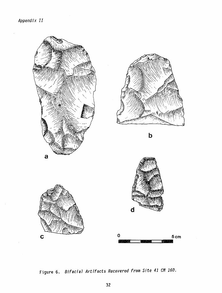
There were no appreciable differences between subsurface cultural materials and surface materials. Lithic debitage, utilized flakes, tested cobbles/nodules,and indurated 1 imestone fragments occurred in roughly equal frequencies and densities. Limestone fragments generally increased with depth. Shovel testing failed to isolate any discrete cultural features, burned rock fragments, or diagnostic projectile points. Several crude bifaces, representing the i nit i al stages of hard-hammer bifaci al reduction, were recovered from subsurface contexts (see Appendix II). Lithic debitage, in general terms, consisted of hard-hammer unmodified primary and secondary corticate flakes; decorticate tertiary flakes were in the distinct minority in all shovel tests.
Limited testing at site 41 eM 160 tends to confirm the initial survey evaluations (see Part I of this report). Testing indicated surface and subsurface cultural materials at this site occur in roughly the same frequencies and densities. The range of demonstrable prehistoric activities at the site would appear to be 1 imited to the procurement and initial hard-hammer reduction of naturally occurring chert cobbles and nodules; there was limited evidence for tabular occurrence. Both core and fl ake technology appear to be present at the site. No evi dence was found (burned angular rock fragments) to infer limited campsite activities. The local landowner stated that most burned rock in the general area was probably attributable to cedar burning, and erosion had scattered the major ash piles downslope from the location of the actual fires (Mr. Voges, personal communication, April 4, 1986). Surface topography would tend to confirm this observat ion. Limited surface vegetation and 1 imestone outcroppi ngs have combi ned to create an eros i on-prone ground surface throughout the general
20
Part II. Archaeological Testing
site area. Sheet-wash erosion, accentuated by ground slope, tends to concentrate prehistoric cultural materials and soil in gullies, low-lying areas, and in between cracks and fissures in bedded limestone.
This site is similar to many other quarry sites in this portion of the Balcones Escarpment. Site 41 CM 160 holds very little potential for contributing significant new archaeological information that could not otherwise be obtained from similar sites located outside the GBRA rights-of-way (Kelly and Hester 1975; Assad 1978).
SITE 41 eM 161 (Fig. 4)
Site 41 eM 161 was reported by McGraw and Ellis (see Part I of this report) as a prehistoric quarry-workshop with an areal coverage of ca. 200 m2 situated along the slopes and crest of a small hilltop adjacent to (intermittent) Jacobs Creek. Exposures of bedrock and steep slopes (5-40°) indicate moderate to extensive deflation has taken place at this site. A Travis projectile point (Turner and Hester 1985:153) found at this site would suggest some cultural activity during the Early Archaic (3000-2000 B.C.; Black and McGraw 1985:322).
Prior to shovel testing, the general site area was resurveyed with special emphasis placed on surface topography and relative frequencies and densities of surface lithic artifacts. Dense groves of juniper, oak, and thorny brush, combined with steep hillsides, hampered the surface survey. The GBRA rightof-way was relocated by the use of a lensatic compass and GBRA project maps. The areal soil coverage and depth seem to be directly linked to the relative locations of bedrock outcroppings and degree of ground slope.
Subsurface testing consisted of a linear series of shovel tests spaced at ca. 25-m intervals. Test probes were placed in areas where surface topography suggested substantial subsoil. The results of shovel testing reveal ed that the subsoil extended to a maximum depth of 35 cm in areas tested, but more commonly ranged between 10-15 cm.
Lithic manufacturing debris (debitage) and tested cobbles/nodules identified during shovel testing occur in roughly the same frequencies and densities as surface materials. No discrete cultural features, burned rock fragments, or diagnostic projectile points were identified in subsurface contexts; two bifacial preforms were recovered (Appendix II).
Limited testing at site 41 CM 161 tends to confirm the initial survey evaluations (see Part I of this report). The range of prehistoric activities would appear to be limited to the procurement and initial hard-hammer reduction of naturally occurring chert cobbles and nodules. Both core and flake technology appear to be present.
This site is similar to many other sites of this type located in this portion of the Balcones Escarpment. It holds very little potential for contributing significant new archaeological information that could not otherwise be obtained from similar sites located outside the GBRA rights-of-way.
21

This page has been
redacted because it
contains restricted
information.
Part II. Archaeological Testing
SITE 41 CM 162 (Fig. 4)
Site 41 CM 162 was reported by McGraw and Ellis (see Part I of this report) as a prehistoric 1 ithic workshop with an areal coverage of 200 x 450 m, situated along the southern slopes of a small hill overlooking the main channel of (intermittent) Jacobs Creek. A moderate to extensive degree of site deflation has taken place, due to the erosion of shallow soil and steep slopes. Cultural materials consisted of a light scatter of lithic debris, chert core fragments, and corticate and decorticate chips and flakes.
The general site area was resurveyed prior to testing; the GBRA right-of-way was relocated by the use of a 1 ensat i c compass and the GBRA project maps. The general site area is vegetated by dense groves of juniper and thorny brush with a general lack of surface vegetation. Subsurface testing consisted of a linear series of shovel tests (ca. 25 cm2) spaced at ca. 25-m intervals; the southwestern slope was tested in ca. 10-m intervals.
Limited testing at site 41 CM 162 reflected the same general character of deposits and soil depths as seen at sites 41 CM 160 and 41 CM 161. No discrete cultural features, burned rock, or diagnostic projectile points were identified in subsurface contexts; two bifacial preforms were recovered (Appendix II). A general pattern of increasing soil depth was identified on the lower portion of the southwestern slope (maximum depth of 47 cm); subsurface materi a 1 s occurred in roughly the same frequenc i es as surface deposits.
Limited testing tends to indicate that site 41 CM 162 holds very little potential for contributing significant new archaeological information that could not otherwise be obtained from similar sites located outside the GBRA rights-of-way.
SITE 41 CM 163 (Fig. 4)
Site 41 CM 163 was reported by McGraw and Ellis (see Part I of this report) as a prehistoric quarry-workshop area (500 x 150 m) with a light-to-moderate surface scatter of burned rock, inferring some form of temporary occupation in addition to quarry/workshop activities. The site, situated along the lower slopes of a ridge adjacent to (intermittent) Jacobs Creek, ;s directly across the creek bed from site 41 CM 162 (Fig. 4). The soil was noted to be grayish brown calcareous materials and appeared to be shallow; cultural materials consisted of a moderate lithic scatter reflecting all stages of tool manufacturing (see Part I of this report).
Subsurface testing began following an intensive surface survey of the general site area; the GBRA right-of-way was relocated by the use of a lensatic compass and the GBRA project maps. Subsurface probes were placed in a linear series of shovel tests spaced at ca. 25-m intervals.
The results from shovel testing tend to indicate that there is no appreciable difference between surface and subsurface cultural materi al s. No di screte cultura 1 features or d i agnost i c project il e poi nts were found in subsurface contexts. A light surface scatter of burned, angular limestone fragments was
23
Part II. Archaeological Testing
noted duri ng the surface survey whi ch appeared to be randomly scattered by erosion across the lower portion of the site; burned rock was not found in any subsurface contexts. L ithi cart ifacts were generall y 1 imited to cores and debitage reflecting the initial stages of reduction; both core and flake technology were evident (Appendix II).
This site is similar to many other sites in this portion of the Balcones Escarpment. It holds very little potential for contributing significant new archaeological information that could not otherwise be obtained from similar sites located outside GBRA rights-of-way.
SITE 41 CM 164 (Fig. 1)
Site 41 CM 164 was reported by McGraw and Ellis (see Part I of this report) as a prehistoric occupation site (300 x 200 m) situated along the lower slopes of an extensive and high ridge complex adjacent to the fossil floodplain of the Guadalupe River. The site has been partially cleared and extensively damaged by a ranch complex which apparently dates to the mid 20th century. The complex includes a frame house, outbuildings, pens, ranch roads, etc.; upper elevations are extremely eroded and extensive outcroppings occur in this locale.
The THC did not recommend testing at site 41 CM 164 due to the present conditions and highly disturbed nature of deposits. The McGraw and Ellis survey report recommended testing (see Part I of this report).
A quick inspection of the general site area in the vicinity of the GBRA right-of-way, combined with several shovel tests, tends to confirm the THC recommendation that no further work at this site is necessary in view of the highly disturbed nature of the remaining cultural deposits.
SITE 41 CM 165 (Fig. 1)
Site 41 CM 165 consists of several unoccupied historical buildings located approximately 100 m north of the GBRA right-of-way and is situated along the southern bank of Cordova Creek (see Part I of this report).
The main building within the complex (Fig. 5, Structure A) is a one-story stone and 1 i me-mortar house. The roof, porches, and outs i de wall surfaces are in good condition. Two wooden frame outbuildings appear to be associated with the main stone structure. To the south of the stone house is a one-story 1940s farmhouse constructed of what appears to be painted cinder block. The general site area is densely overgrown by medium grasses, herbaceous plants, and perennial forbs. Direct access to this complex was not possible due to a series of three fences, the last of which consisted of an eight-foot deer fence. Four attempts were made to obtain di rect access, but the absentee landowner could not be located.
The CAR-UTSA investigations at this site were limited to photographic documentation; no subsurface testing was done. The THC recommended archival research of this property to establish the historical context, deed record
24

This page has been
redacted because it
contains restricted
information.
Part II. Archaeological Testing
history, and person(s) originally associated with the construction of the building complex. Appendix I presents these data which have been compiled by I. Waynne Cox of the CAR-UTSA.
This building complex is located in excess of 100 m from the GBRA right-ofway (Fig. 5). Consequently, GBRA transmission line construction will not directly, or indirectly (i.e., overhead lines), impact this site. It is felt by the author that further work at this site, at GBRA expense, is not justified given its distance from the GBRA right-of-way.
SUMMARY AND RECOMMENDATIONS
The results of the limited testing at sites 41 CM 160, 41 CM 161, 41 CM 162, and 41 CM 163 tend to confirm the original survey evaluations for these cultural resources (see Part I of this report).
Controlled surface survey revealed that there was no break in the lithic scatter between sites 41 CM 160 and 41 CM 162, as indicated by the original survey. It is recommended that these two sites be merged and considered as one continuous site along this uninterrupted ridge 1 ine rather than as two areally discrete sites.
Limited testing at all sites was designed to assess the occurrence, areal extent, depth, and significance of buried cultural deposits. Assessments of site significance are based on Criterion 0 of 36 CFR 60.4 (National Register Criteria). Site 41 CM 165 was tentatively assessed according to Criteria B, C, and 0 of 36 CFR 60.4 (National Register Criteria).
Comparative site data obtained from subsurface testing clearly indicate the near homogenous nature of surface and subsurface deposits. The Soil Conservation Service (1984:Sheet 70) survey indicates that sites 41 CM 160, 41 CM 161, and 41 CM 163 are compri sed of an identical soil type (Rumpl eComfort series) overlying the same geologic formation that has been bisected by intermittent creek beds. The occurrence of chert outcroppings at each of these sites is therefore predictably constant. Surface deflation, accentuated by unvegetated ground surfaces, bedrock exposures, and ground slope, is actively exposing and reburying cultural materials at each site.
Cultura 1 materi a 1 s (Appendi x II) i dent ifi ed in both surface and subsurface contexts infer a limited range of prehistoric activities at sites 41 CM 160, 41 CM 161, 41 CM 162, and 41 CM 163, i.e., the procurement and initial reduct i on of naturally occurri ng chert resources. Short-term occupati on cannot be demonstrated in subsurface contexts at any of the sites tested by thi s project.
These sites are'very similar to many other prehistoric quarry sites found throughout this portion of the Balcones Escarpment. Sites 41 CM 160, 41 CM 161, 41 CM 162, and 41 CM 163 do not represent significant cultural resources in that they are not deemed potentially eligible for nomination to the National Register of Historic Places or as State Archeological Landmarks. No further work is recommended at these four sites in view of the perceived
26
Part II. Archaeological Testing
impact by the GBRA. It is recommended that GBRA transmission line construction proceed at these four sites. -
Testing at site 41 CM 164 was not recommended by the THC. A quick inspection of this site area supports this recommendation. It is recommended that GBRA transmission line construction proceed at site 41 CM 164.
At site 41 CM 165 (historic building complex) the THC recommended archival research and photographic documentation. This research is presented in Appendix I. Given the distance of this site from the GBRA right-of-way, it is recommended that GBRA transmission line construction in this location should proceed. No further work at this site is recommended as a part of this project.
Site 41 CM 165 has the potential to be a significant cultural resource. It appears to be eligible for nomination to the National Register since it is a well-preserved example of the type of construction popular in the area in the 1850s and was apparently built and occupied by a prominent New Braunfels merchant (Appendi x 1). Further research, recordi ng, and testing, with the permission of the landowner, would make an ideal project for an archaeology student or local archaeological society.
REFERENCES CITED
Assad, C.
1978 An Evaluation of Archaeological Sites in the Vicinity of Floodwater Retarding Structure No.2, Dry Comal Creek, Comal County, Texas. Center for Archaeo 1 ogi ca 1 Research, The University of Texas at San Antonio, Archaeological Survey Report 50.
Black, S. L. and A. J. McGraw
1985 The Panther Spri ngs Creek Site: Cul tura 1 Change and Continuity in the Upper Salado Creek Watershed, South-Central Texas. Center for Archaeologica7 Research, The University of Texas at San Antonio, Archaeologica7 Survey Report 100.
Council of Texas Archeologists (CTA)
1981 Council of Texas Archeologists Performance Guidelines. Newsletter 5(2).
Hester, T. R.
1980 Digging Into South Texas Prehistory. Corona Publishing Co., San Antonio.
27
Part II. Archaeological Testing
Hester, T. R., R. F. Heizer, and J. A. Graham
1975 Field Methods in Archaeology. 6th edition. Publishing Co., Palo Alto, California.
Johnson, L., Jr., D. A. Suhm, and C. D. Tunnell
Mayfi e 1 d
1962 Salvage Archeology of Canyon Reservoir: The Wunderlich, Footbridge, and Oblate Sites. Texas Memorial Museum, Bulletin 5, Austin.
Kelly, T. C. and T. R. Hester
1975 Archaeological Investigations at Four Sites in the Dry Coma1 Watershed, Coma1 County, South Central Texas. Center for Archaeological Research, The University of Texas at San Antonio, Archaeological Survey Report 15.
Prewitt, E.
1981 Cultural Chronology in Central Texas. Bu77etin of the Texas Archeological Society 52:65-89.
Soil Conservation Service
1984 So i 1 Survey of Coma 1 and Hays Count i es, Texas. Un ited States Department of Agriculture, Soil Conservation Service.
Turner, E. S. and T. R. Hester
1985 A Field Guide to Stone Artifacts of Texas Indians. Texas Monthly Press, Austin.
Weir, F. A.
1976 The Central Texas Archaic. Ph.D. dissertation, Washington State University, Pullman. University Microfilms, Ann Arbor.
28
APPENDIX I
FARM MARIENTHAL, COMAl COUNTY, TEXAS
I. Waynne Cox
A historic structure (Fig. 5, Structure A) is situated on the extreme northwest corner of Texas Government Patent Number 427 (General Land Office, File 2-34). It was granted initially to Henry A. Reed, who arrived as a colonist in the Sterling C. Robertson Grant on February 2,1835. Reed participated in the battle of San Jacinto and later served as brigade quartermaster in Edwin Morehouse's regiment (Webb 1952 Vol. II:454). He assigned his rights to the grant to Jacob de Cordova in February 1848, who had the land surveyed and plotted as a 305-1/2 acre tract (Survey No. 16) above the fourth crossing of the Guadalupe River 10 miles north of the settlement of New Braunfels (CCDR Book A:476). Cordova, an early land speculator in the new Republic, accumulated titles of such patents on a million acres of land by 1859 (Webb 1952 Vol. 1:480). He, in turn, sold the tract to the partnership of James Ferguson and Henry Hessler of New Braunfels the following July for $1.00 per acre (CCDR Book· A:477). Ferguson and Hessler had a mercantile store in the town on the corner of San Antonio and Castell Streets, and Ferguson was married to Hessler's sister, Marie, for whom the Farm Marienthal (Webb 1952 Vol. 11:142) was named. By 1850, Ferguson joi ned with hi s younger brother, Al exander, to found the fi rm of Ferguson and Brother. Ten years later, after James' death, his widow and brother conveyed the Farm Marienthal, "with improvements," to Doctor Theodore Koester of New Braunfels for $2050 (CCDR Book F: 95) . A few days 1 ater (September 28, 1858), Doctor Koester sold the property to Carl Baetge for the same price (CCDE Book F:107). Carl Baetge of Hanover, Germany, and his wife Pauline, of Russia, had five children. The eldest, Marie, possibly from a previous marriage, was 10 years older than her sister, also named Pauline. There were also three sons, Eduard, Otto, and Oscar (United States Department of the Interior, Office of the Census 1860). After Carls' death, Pauline married Christian Pantermuke and, she, joined with her daughter, Pauline Baetge, transferred title to the three sons for $2100 on December 9, 1884 (CCDR Book S:120). In 1908, Ed and Helene Baetge, Otto and Johnne Baetge, and Oscar and Hedwig Baetge sold the property to Robert Linnartz, along with another tract of 80 acres, for a total price of $7000 (CCDR Book 29:542). A subsequent search of the deed records revealed no further transfers of the property until after 1920.
29
Appendix I
REFERENCES CITED
Comal County Deed Records (CCDR)
1848- County Clerks Office. Comal County Courthouse, New Braunfels, 1920 Texas.
General Land Office
1848 Land Grant Files. Stephen F. Austin Building, Austin, Texas.
United States Department of the Interior, Office of the Census
1869 The 8th Census, 1860. Returns of Schedule One, Population. Comal County, Texas. July 12, 1860.
Webb, W. P., editor
1952 The Handbook of Texas. Vol urnes I and I I. The State Hi storical Association, Austin, Texas.
30

APPENDIX II
ARTIFACTS RECOVERED DURING TESTING
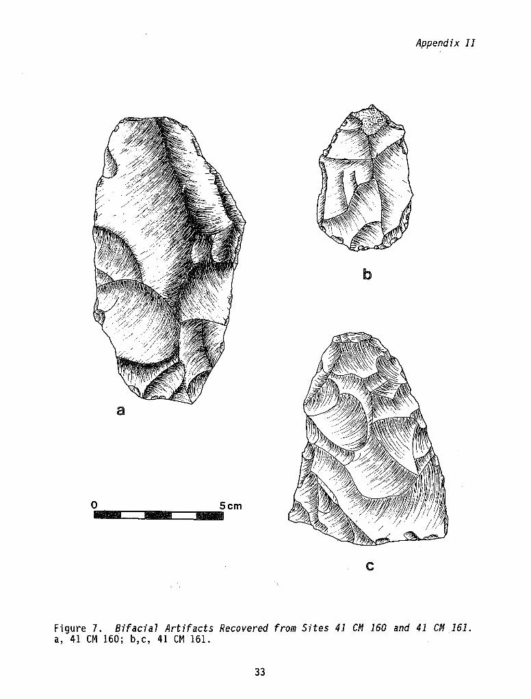
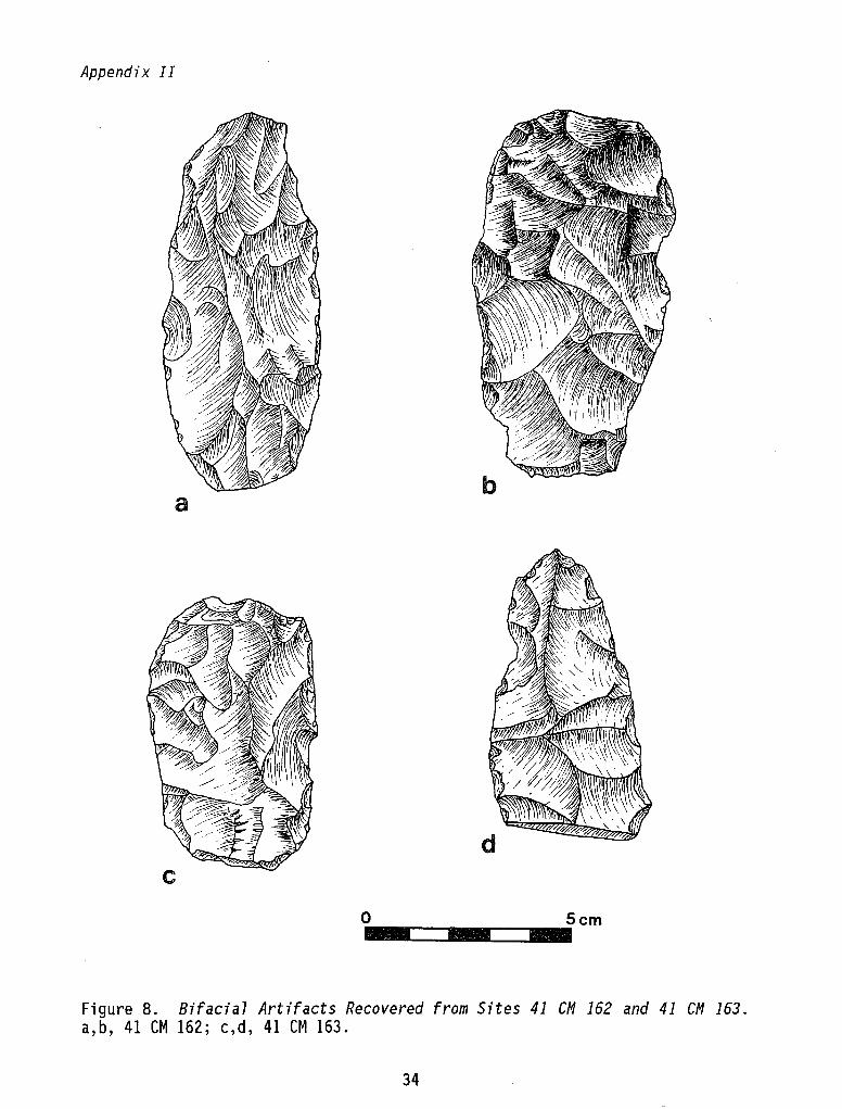
A total of 11 prehistoric artifacts was recovered during testing. All collected specimens are illustrated except for one from site 41 eM 160; the artifact was a large (18 cm long, 12 cm wide, and 4.5 cm thick) bifacial preform or quarry blank.
31
Appendix II
b
o .. ~==~ .. ==~ .. 5Cm
Figure 6. Bifacia7 Artifacts Recovered from Site 41 eM 160.
32
Appendix II
b
a
O .. ~==~ .. ==~ .. 5cm
c
Figure 7. Bifacia7 Artifacts Recovered from Sites 41 CM 160 and 41 CM 161. a, 41 CM 160; b,c, 41 CM 161.
33
Appendix II
a
o
Figure 8. Bifacia7 Artifacts Recovered from Sites 41 CM 162 and 41 CM 163. a,b, 41 CM 162; c,d, 41 CM 163.
34