atmospheric sciences 370 observing systems january 2007
Post on 21-Dec-2015
217 views
TRANSCRIPT

Atmospheric Sciences 370 Observing Systems
January 2007
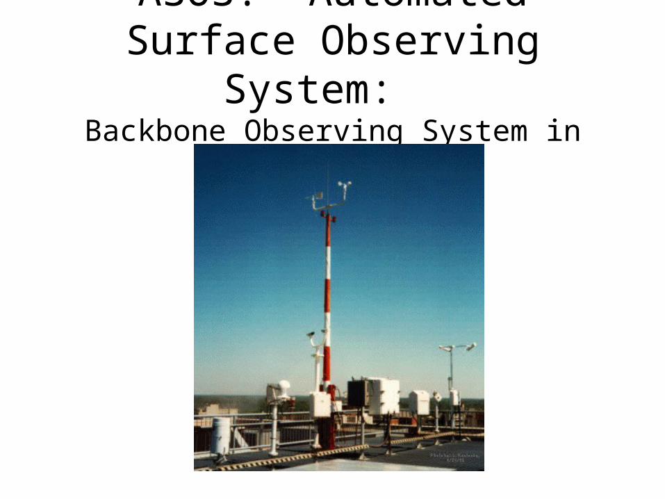
ASOS: Automated Surface Observing System:
Backbone Observing System in the U.S.

ASOS• Located at primary and secondary airports
• Sponsored by the FAA and NWS
• High quality instrumentation that is well maintained and calibrated.
• Reported in METAR format (more later)

Hydrothermograph

Precipitation Gauges

Laser WeatherIdentifier
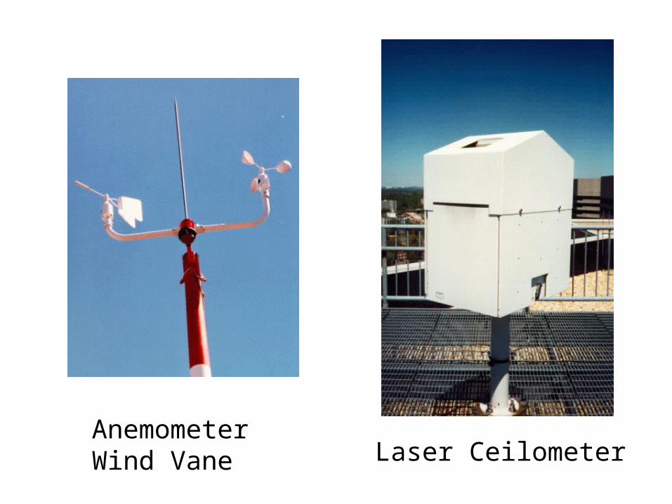
AnemometerWind Vane Laser Ceilometer
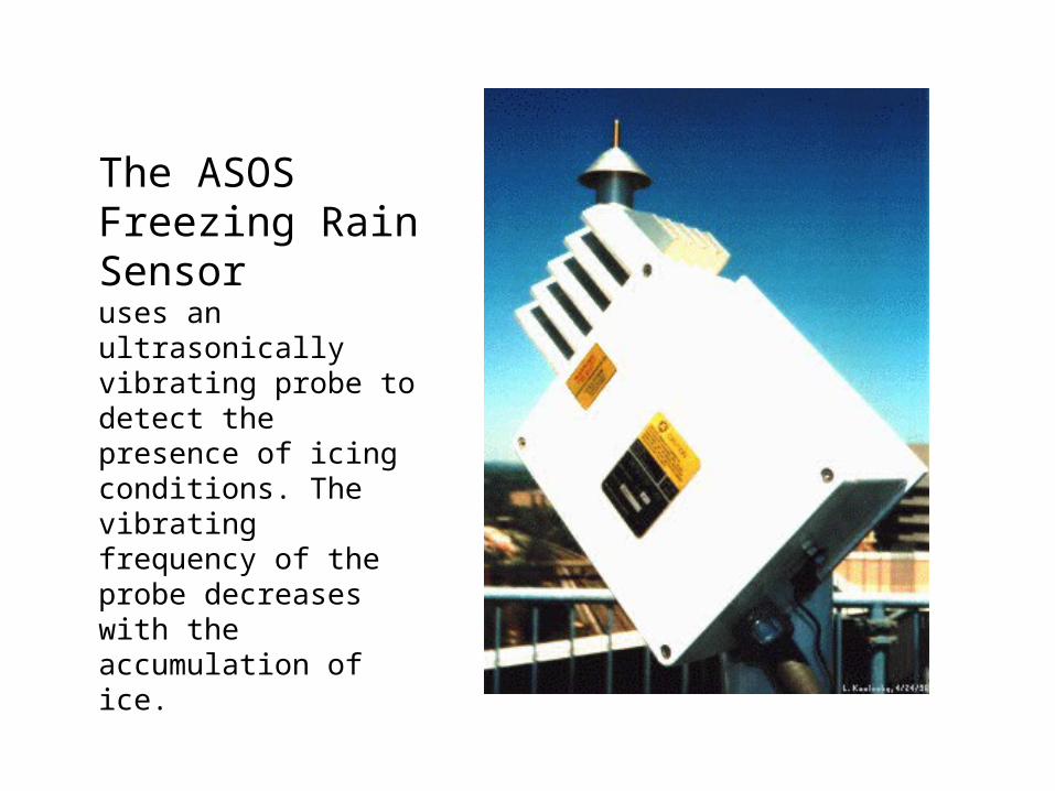
The ASOS Freezing Rain Sensor
uses an ultrasonically vibrating probe to detect the presence of icing conditions. The vibrating frequency of the probe decreases with the accumulation of ice.
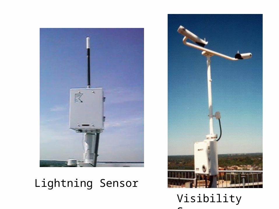
Lightning Sensor
Visibility Sensor
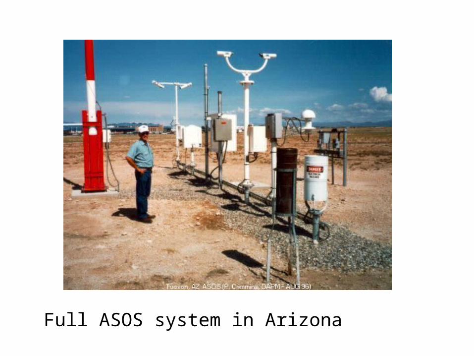
Full ASOS system in Arizona

Observing Heights (ASOS and most official obs)
• Temperature and dewpoint (2-m)
• Wind speed and direction (10-m)
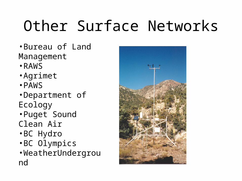
Other Surface Networks•Bureau of Land Management•RAWS•Agrimet•PAWS•Department of Ecology•Puget Sound Clean Air•BC Hydro•BC Olympics•WeatherUnderground
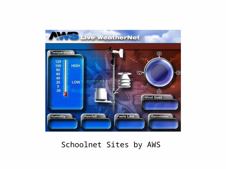
Schoolnet Sites by AWS

Oklahoma Mesonet
Networks of Networks
UW: We collect data from about 60 networks in real time over NW
Mesowest: Collects about 100 networks over the western third of U.S.
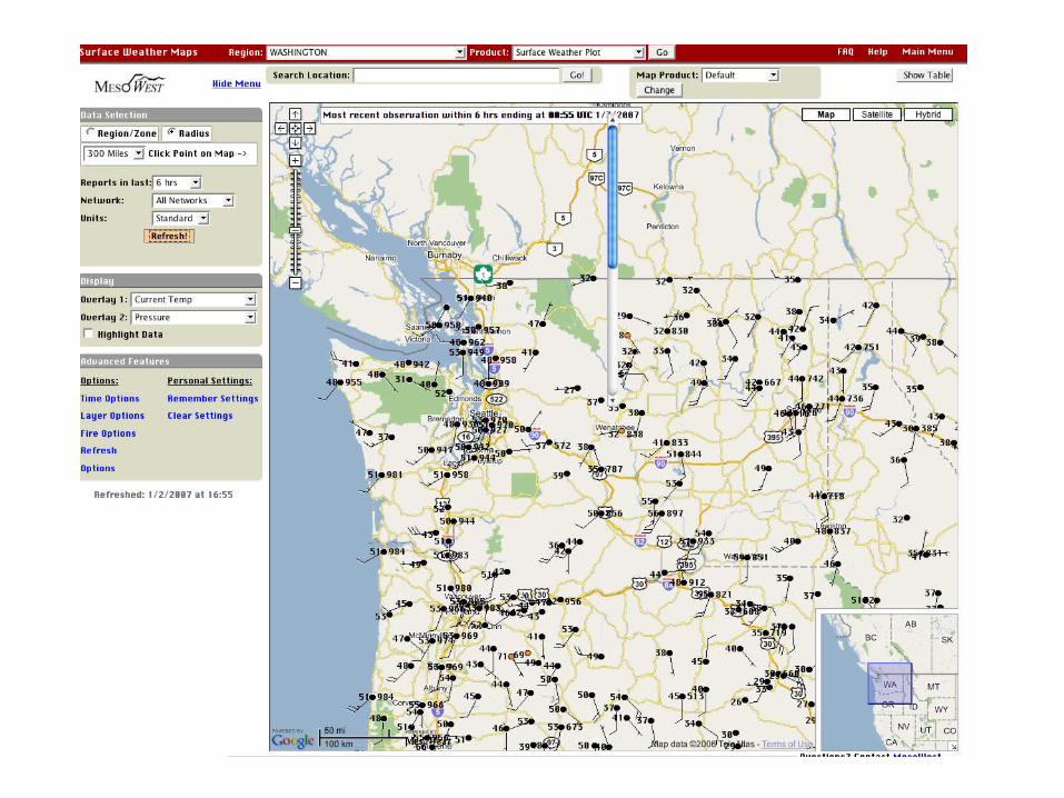

NWNet: Regional Real-Time Collection of Over 60 Networks Over the Pacific Northwest
Marine Reports

Ocean and LakeWeather Buoys
Anchored
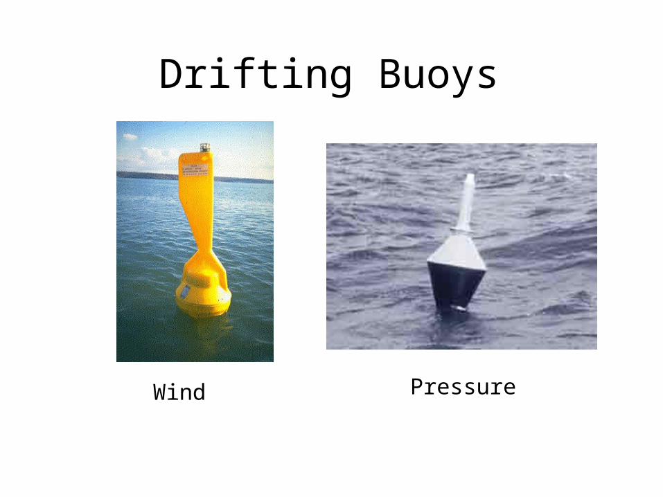
Drifting Buoys
Wind Pressure

Coastal Marine (CMAN) Reports from the Coast Guard
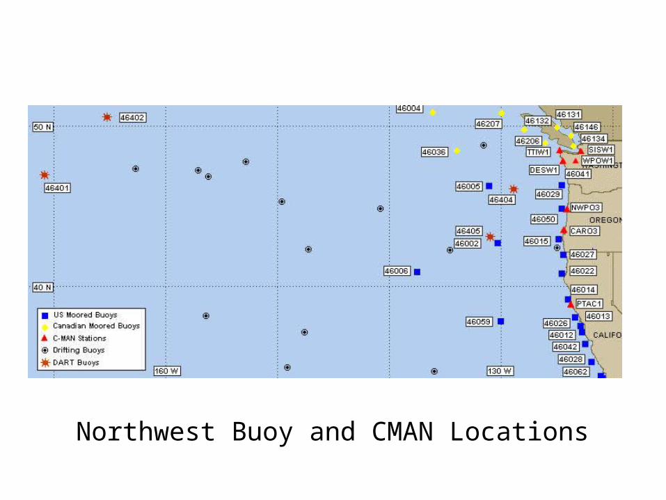
Northwest Buoy and CMAN Locations

Ship Reports: Marine VOS Program
Volunteers Observers--generally 6-hourly reports

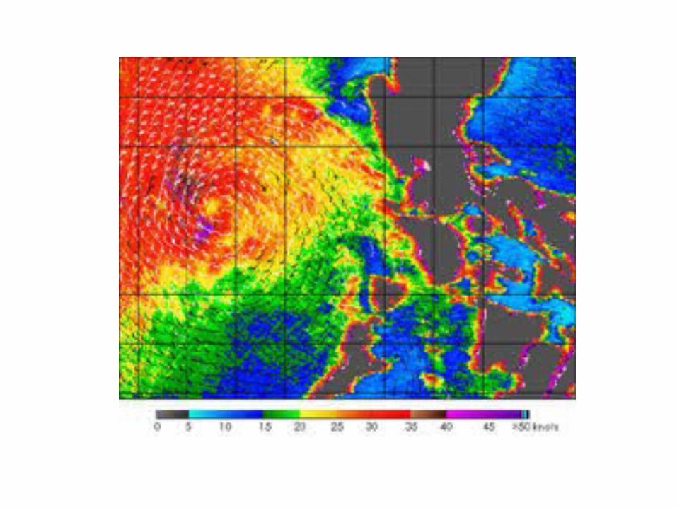
SatelliteMicrowaveScatterometerWinds
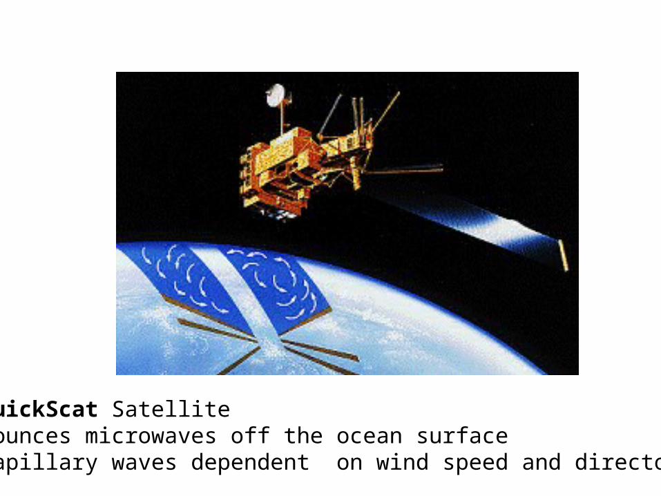
QuickScat SatelliteBounces microwaves off the ocean surfaceCapillary waves dependent on wind speed and directon


Upper Air Data
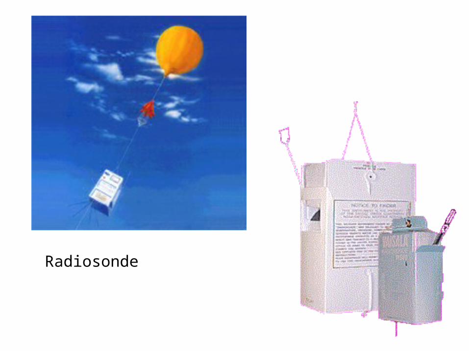
Radiosonde

Radar Wind Profiler and RASS (Radio Acoustic Sounding System)


Seattle Profiler/RASS

Profiler Locations

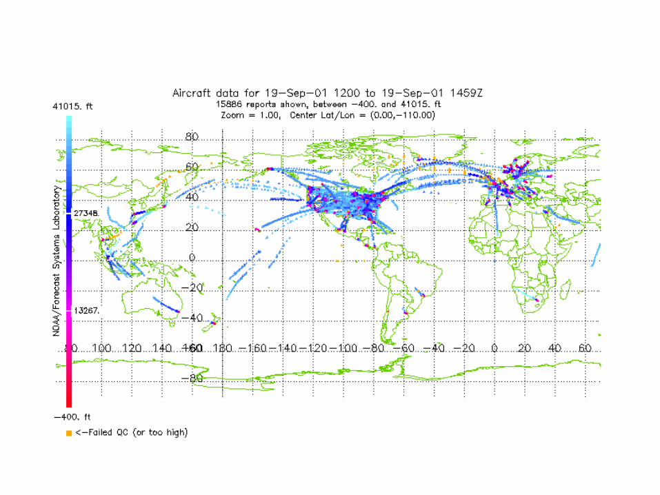
ACARS: Aircraft ObservationsGenerally on wide-body aircraft
Aircraft Communications Addressing and Reporting System

New Satellite Observing Capabilities
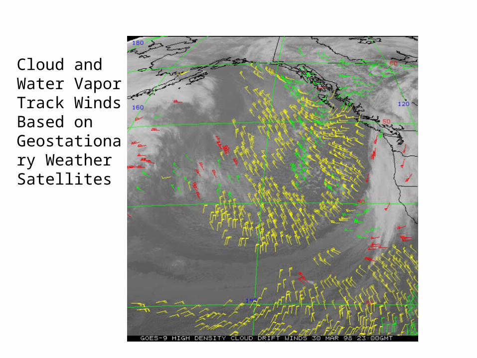
Cloud andWater VaporTrack WindsBased on Geostationary Weather Satellites


Satellite Temperature and Humidity Soundings

GOES sounder unit

Radar and Satellite Imagery
MORE LATER!

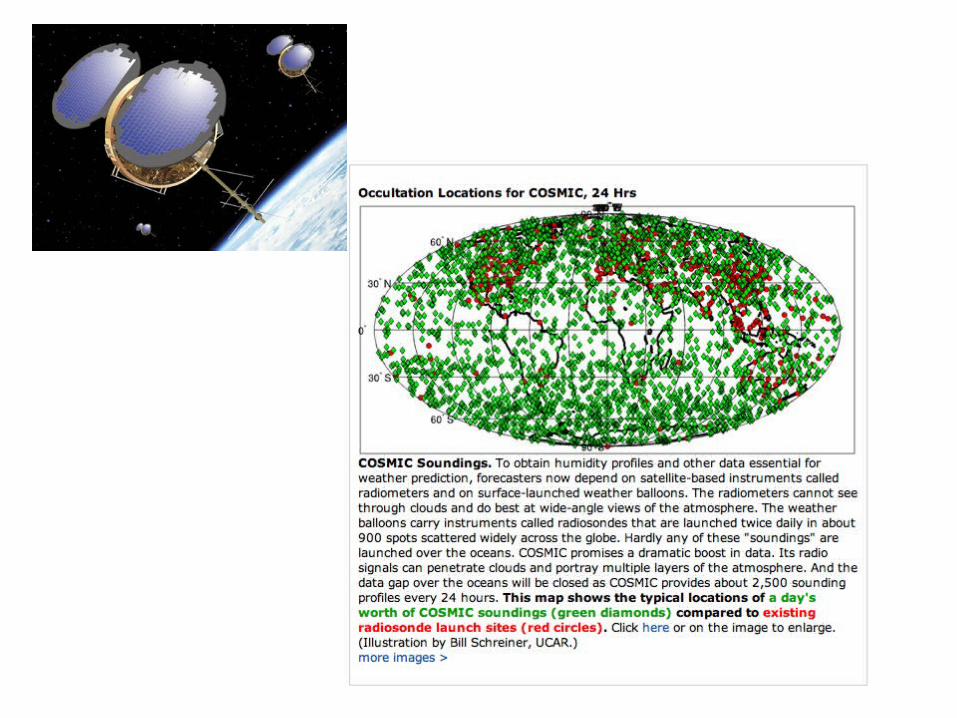
GPS Sounding
• A constellation of GPS satellites orbit the earth.• By measuring the delay in time as the GPS signal
is bent by the earth’s atmosphere, one can acquire density information that can be used to create temperature and humidity soundings.
• Can do this with fixed receivers on earth or with receivers on satellites--the COSMIC project.

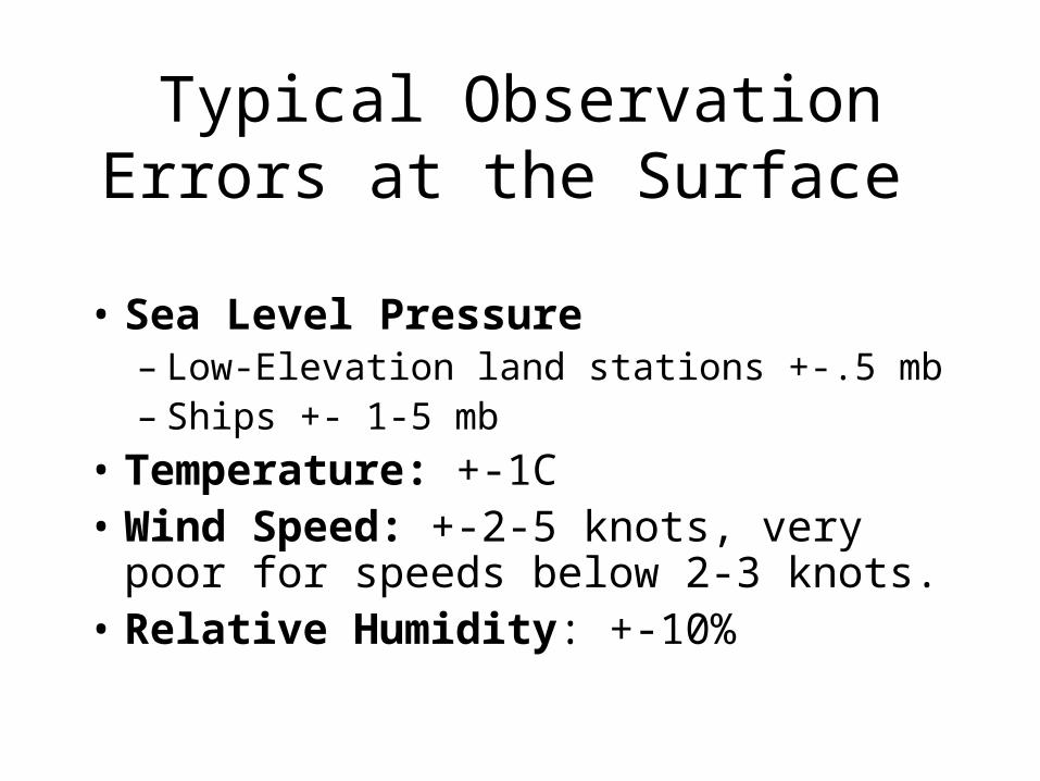
Typical Observation Errors at the Surface
• Sea Level Pressure– Low-Elevation land stations +-.5 mb– Ships +- 1-5 mb
• Temperature: +-1C• Wind Speed: +-2-5 knots, very poor for
speeds below 2-3 knots.• Relative Humidity: +-10%
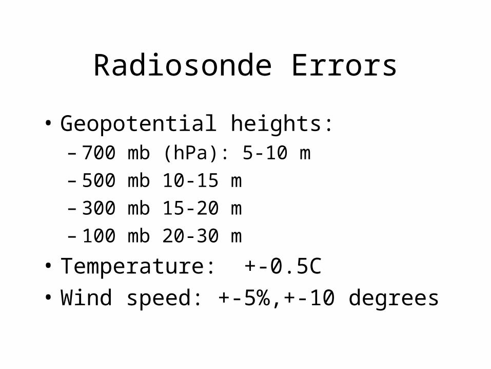
Radiosonde Errors
• Geopotential heights: – 700 mb (hPa): 5-10 m– 500 mb 10-15 m– 300 mb 15-20 m– 100 mb 20-30 m
• Temperature: +-0.5C
• Wind speed: +-5%,+-10 degrees
