atoll research bulletin no. 129 four · pdf filefour southwestern caribbean atolls: courtown...
TRANSCRIPT

ATOLL RESEARCH BULLETIN NO. 129
FOUR SOUTHWESTERN CARIBBEAN ATOLLS: COURTOWN CAYS, ALBUQUERQUE CAYS, RONCADOR BANK AND SERRANA BANK
by John D. Milliman
Issued by
THE SMITHSONIAN INSTITUTION
Washington, D. C., U. S. A.
August 15, 1969

TABLE OF CONTENTS
23E
ABSTRACT . . . . . . . . . . . . . . . . . . . . . . . . . . . . . 1 INTRODUCTION . . . . . . . . . . . . . . . . . . . . . . . . . . . 2
Acknowledgements . . . . . . . . . . . . . . . . . . . . . . 2 Regional S e t t i n g . . . . . . . . . . . . . . . . . . . . . . 2 Climate and Oceanography . . . . . . . . . . . . . . . . . . 3 History . . . . . . . . . . . . . . . . . . . . . . . . . . . 3
. . . . . . . . . . . . . . . . . . . . . . Previous Studies 4 Methods . . . . . . . . . . . . . . . . . . . . . . . . . . . 4
ATOLLECOLOGY . . . . . . . . . . . . . . . . . . . . . . . . . . 5 General . . . . . . . . . . . . . . . . . . . . . . . . . . . 5
. . . . . . . . . . . . . . . . . . . . . . . Reef Front 5 Windward Reef F l a t . . . . . . . . . . . . . . . . . . . 6 Lagoon . . . . . . . . . . . . . . . . . . . . . . . . . 8 Leeward Reef F l a t . . . . . . . . . . . . . . . . . . . 8
Courtowncays . . . . . . . . . . . . . . . . . . . . . . . . 8 Albuquerque Cays . . . . . . . . . . . . . . . . . . . . . . 10 RoncadorBank . . . . . . . . . . . . . . . . . . . . . . . . 13 SerranaBank . . . . . . . . . . . . . . . . . . . . . . . . 14
DISCUSSION . . . . . . . . . . . . . . . . . . . . . . . . . . . . 19 NICARAGUAN AND PACIFIC ATOLLS . . . . . . . . . . . . . . . . . . 20 REFERENCES CITED . . . . . . . . . . . . . . . . . . . . . . . . . 21 APPENDIX: REEF PRODUCTIVITY MEASUREMENTS by John D . Milliman & . . 23
Conrad V . W . Mahnken O x y g e n U p t a k e o n R e e f F l a t s . . . . . . . . . . . . . . . . . 23 Plankton P roduc t iv i ty . . . . . . . . . . . . . . . . . . . . 25 References Cited . . . . . . . . . . . . . . . . . . . . . . 26
FIGURES (Following p . 26)
Chart of western Caribbean and Cent ra l America.
Study a rea cha r t
Chart of Courtown Cays, based on a e r i a l photographs, H . 0 . Chart 2077, and observat ions made during t h e c r u i s e .
Chart of Albuquerque Cays, based on a e r i a l photographs, H . 0 . Chart 2077, and observat ions made during t h e c r u i s e .
Chart of Roncador Bank, based on a e r i a l photographs, H. 0 . Chart 1374, and observat ions made during t h e c r u i s e .
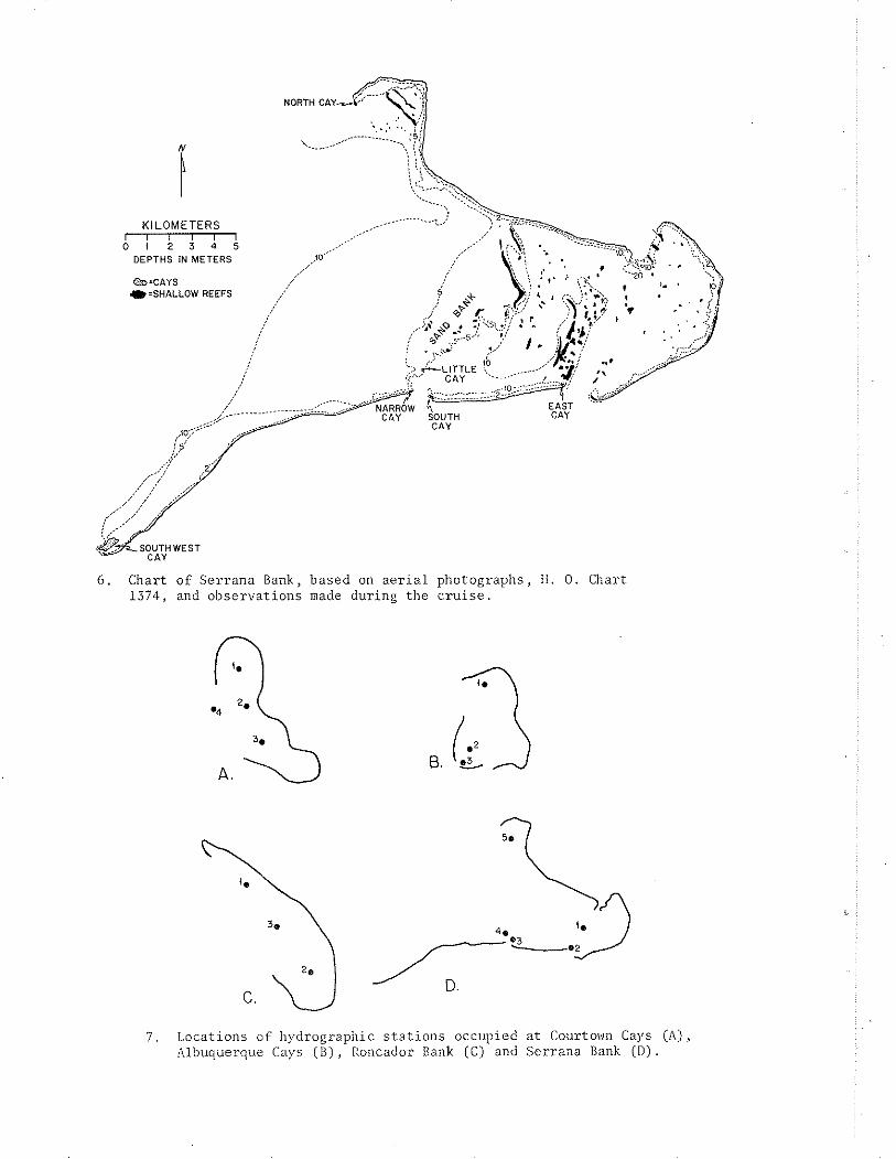
Chart of Serrana Bank, based on a e r i a l photographs, H . 0 . Chart 1374, and observat ions made during t h e c r u i s e .
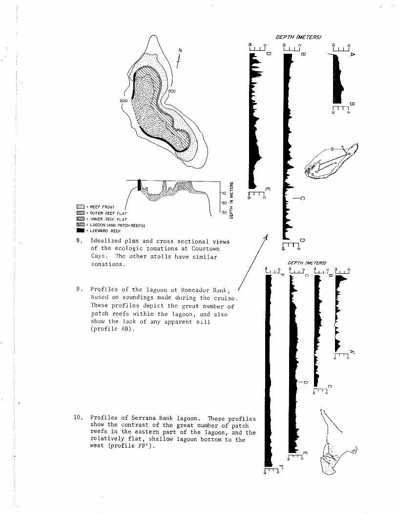
Locations of hydrographic s t a t i o n s occupied at Courtown Cays (A), Albuquerque Cays (B) , Roncador Bank (C) and Serrana Bank (D) . Idea l i zed p lan and cross s e c t i o n a l views of the ecologic zonat ions a t Courtown Cays. The o the r a t o l l s have s i m i l a r zonat ions.
P r o f i l e s of t h e lagoon a t Roncador Bank, based on soundings made during t h e c r u i s e . These p r o f i l e s dep ic t t h e g rea t number o f patch r e e f s within t h e lagoon, and a l s o show t h e lack of any apparent s i l l ( p r o f i l e AB).
P ro f i l e s of Serrana Bank lagoon. These p r o f i l e s show the cont ras t of t h e grea t number of patch r e e f s i n t h e eas tern p a r t of the lagoon, and t h e r e l a t i v e l y f l a t , shallow lagoon bottom t o the west ( p r o f i l e FF ' ) .

i i i
PLATES
1. The Millepora zone, composed p r imar i ly of t h e f l a t hydrocoral !lilleporu a l c i c o r n i s ( lahc led ma i n picture), the s o f t cora l Palythoa - m a ~ ~ n l l l o s ~ ( ~ m ) and encrus t ing red algae ( r x ) ; Halimeda opuntia (ho) i s a l s o common.
2 . A panoramic photograph of t h e Mil lepora zone i n the heavy s u r f zone ( l e f t ) o f t h e ou te r windward r e e f . This p i c t u r e was taken a t Roncador Bank during sp r ing low t i d e s ; s i m i l a r , bu t somewhat l e s s well-developed colonies a r e found a t the o the r a t o l l s .
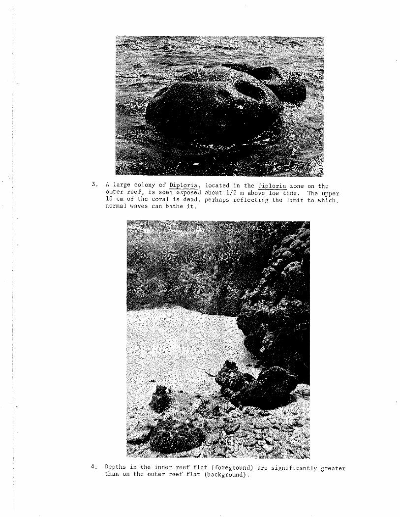
3. A l a rge colony of Diplor ia , loca ted i n t h e Diploria zone on t h e o u t e r r e e f , i s seen exposed about 1 / 2 m above low t i d e . The upper 10 cm of t h e c o r a l i s dead, perhaps r e f l e c t i n g t h e l i m i t t o which normal waves can bathe i t .
4 . Depths i n the inne r r ee f f l a t (foreground) a re s i g n i f i c a n t l y g r e a t e r t han on t h e ou te r r ee f f l a t (background).
5. A t a l l a t o l l s the majori ty of lagoon r e e f s a re s c a t t e r e d , low-lying pa tches . The bottom depth i n t h i s photograph is about 13 m ; t h e d i v e r i s 5 ' 10" t a l l .
6 . Patch r e e f s of ten have an abundance of f o l i o s e and pinnacle growth forms of Montastrea annu la r i s , t h e l a t t e r shown i n t h e cen te r of t h i s p i c t u r e .
7. Bands of beachrock extend windward from East Cay a t Courtown Cays, seemingly i n d i c a t i v e of t h e lagoonward migrat ion of t h e cay. T a l l palm t r e e s cha rac te r i ze t h e vege ta t ion on East Cay. I n t h e back- ground i s t h e wreck of a Colombian s h i p , awash on t h e r e e f s .
8. Close-up p i c t u r e of t h e beachrock bands. F issures a re p a r a l l e l and perpendicular t o the s t r i k e of t h e rock.
9 . Elevated heachrock a t North Cay, Albuquerque Cays. Recent beach- rock i s i n t h e foreground of t h e p i c t u r e .
10. Dense Ficus f o r e s t a t South Cay, A1buquerqu.e Cays. - 11. Rocks emergent a t low t i d e l i n e t h e windward r i m of t h e ou te r r ee f
a t Roncador Bank. Roncador Cay i s seen i n t h e background.
1 2 . Roncador Cay i s covered with a rubble of co ra l heads. P i l e s of these dead c o r a l s were once used as wa l l s .
13. A c ros s - sec t ion of a lagoon patch r e e f a t Serrana Bank. The pl~otographs i l l u s t r a t e t h e various communities t h a t cha rac te r i ze t h e d i f f e r e n t depths and environments.

APPENDIX FIGURES
A - l Locations of r e e f p roduc t iv i ty s t a t i o n s a t Courtown and Albuquerque Cays.
A - 2 . Time p l o t of temperature, s a l i n i t y and oxygen v a r i a t i o n s on the r e e f f l a t s of Courtown Cays.
A-3. Time p l o t of temperature, s a l i n i t y and oxygen v a r i a t i o n s on t h e r e e f f l a t s of Albuquerque Cays.
A-4 . Calculated oxygen ga in and los s on t h e r ee f f l a t s of Courtown Cays.
A - 5 . Calculated oxygen ga in and l o s s on the r e e f f l a t s of Albuquerque Cays.
A-6. Carbon f i x a t i o n r a t e s across t h e windward r e e f f l a t of Courtown Cays.
A-7 . Carbon f i x a t i o n r a t e s across t h e wi.ndward r ee f f l a t o f Albuquerque Cays.
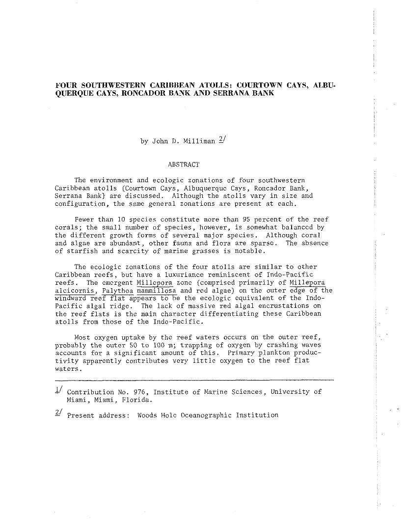
FOUR SOUTHWESTERN CARlBBEAN ATOLLS: COURTOWN CAYS, ALBU- QUERQUE CAYS, RONCADOR BANK AND SERRANA BANK
21 by John D . Milliman -
ABSTRACT
The environment and ecologic zonations of four southwestern Caribbean a t o l l s (Courtown Cays, Albuquerque Cays, Roncador Bank, Serrana Bank) a re d iscussed . Although t h e a t o l l s vary i n s i z e and conf igura t ion , t h e same genera l zonations a re present a t each.
Fewer than 10 spec ie s c o n s t i t u t e more than 95 percent of t h e r e e f c o r a l s ; t h e small number of spec ie s , however, i s somewhat balanced by t h e d i f f e r e n t growth forms of s eve ra l major spec ie s . Although co ra l and a lgae a re abundant, o the r fauna and f l o r a a re spa r se . The absence of s t a r f i s h and s c a r c i t y of marine grasses is notable .
The ecologic zonations of t h e fou r a t o l l s a r e s i m i l a r t o o the r Caribbean r e e f s , but have a luxuriance reminiscent of Indo-Pacif ic r e e f s . The emergent Millepora zone (comprised pr imar i ly of Millepora a l c i c o r n i s , Palythoa mammillosa and r e d algae) on the o u t e r edge of the windward r e e f f l a t appears t o be t h e ecologic equivalent of the Indo- P a c i f i c a l g a l r idge . The lack of massive red a l g a l enc rus t a t ions on t h e r e e f f l a t s i s t h e main cha rac te r d i f f e r e n t i a t i n g these Caribbean a t o l l s from those of t h e Indo-Pacif ic .
Most oxygen uptake by t h e r e e f waters occurs on t h e ou te r r e e f , probably t h e ou te r 50 t o 100 m ; t rapping of oxygen by crashing waves accounts f o r a s i g n i f i c a n t amount of t h i s . Primary plankton produc- t i v i t y apparent ly con t r ibu te s very l i t t l e oxygen t o t h e r e e f f l a t waters .
I' Contr ibut ion No. 976, I n s t i t u t e of Marine Sciences, Universi ty of Miami, Miami, F lor ida .
2/ Present address: Woods Hole Oceanographic I n s t i t u t i o n

INTRODUCTION
Darwin (1851) be l ieved t h a t the re a r e no t r u e a t o l l s i n the At l an t i c . However, by def in ing an a t o l l a s a geomorphic form ( ra the r than by o r i g i n , as Darwin d i d ) , Bryan (1953) l i s t e d 27 At l an t i c a t o l l s , 26 of which a re i n the Caribbean. A more reasonable es t imate might be 15. P r io r t o 1966, f i v e Caribbean a t o l l s had been extens ive ly s tud ied : Alacran Reef (Kornicker and Boyd, 1962;. Hoskin, 1963), The Br i t i sh Honduras a t o l l s , Lighthouse Reef, Glover's Reef and Turneffe Is lands (Stoddart , 1962), and Hogsty Reef (Milliman, 1967a, 1967b).
In May and June, 1966, the Caribbean Reef and Atol l Program (CRAP) c ru i se conducted aboard t h e R / V GERDA, I n s t i t u t e of Marine Science, ' Jniversi ty of M i a m i , v i s i t e d four o ther Caribbean a t o l l s . These a t o l l s , Courtown Cays, Albuquerque Cays, Roncador Bank, and Serrana Bank, a re loca ted i n the Southwestern Caribbean, e a s t of the Miskito Bank (Figures 1 and 2 ) . In many re spec t s these a t o l l s b e a r c lose cl imatologic, ocea.nographic, and geologic resemblance t o many P a c i f i c a t o l l s : 1) the cl imate i s t r o p i c a l and being 200 km windward of the Central American mainland, has l i t t l e seasonal change (see below); 2) the windward fe t ch i s more than 2,000 km; 3) the a t o l l s a r e surrounded by deep water (deeper than 1,000 m) and may be the only a t o l l s i n the Caribbean with volcanic basement (Milliman and Supko, 1968).
This paper presents a discussion of t h e morphology, ecology and oceanography observed on. the a t o l l s during the c ru i se .
Acknowledgements
This inves t iga t ion was made while the author was a t t he I n s t i t u t e of Marine Sciences, Universi ty of Miami (F lo r ida ) . C . Emiliani made. t h e s tudy poss ib le through support from NSF con t rac t G-5012. Assistance by t h e crew of the R . V. GERDA, e spec ia l ly Captain William Dickinson, assured t h e success of the c ru i se . I thank C. V. W. Mahnken, J. I . Jones and D. R . Moore f o r t h e i r a id i n f i e l d s t u d i e s and f o r t h e i r he lp fu l d iscuss ions .
Regional s e t t i n g
Courtown Cays (12'24'N, 81°25'W) (Fj.gure 3 ) and Albuquerque Cays (12"101N, 81°50'W) (Figure 4) a re two small a t o l l s , ly ing about 200 km e a s t of Nicaragua, seaward of the cont inenta l s h e l f . Both a t o l l s belong t o the Republic of Colombia, and a re within the j u r i s d i c t i o n of San Andres (12'29 ' N , 81°43'W) , an u p l i f t e d limestone i s l a n d . The longitude of Courtown Cays i s l i s t e d as 81°28'W (U.S. Hydrographic Office, 1952). Radar bearings from t h e R . V . GERDA, however, showed Courtown Cays as being 33 km (or 18' longitude) e a s t of San Andres. Assuming t h a t the coordinates of San Andres, having a commercial a i r p o r t , a r e accurate, t he longi'cude of Courtown Cays is 81°25'W.
Roncador Bank (13'34'N, 8 0 ° 0 4 ' ~ ) (Figure 5) i s about 200 km northwest of Courtown Cays and 140 km w e s t o f the volcanic i s l and , Providencia. Serrana Bank (14'16'N, 80"20sW) (Figure 6 ) , t h e l a rges t
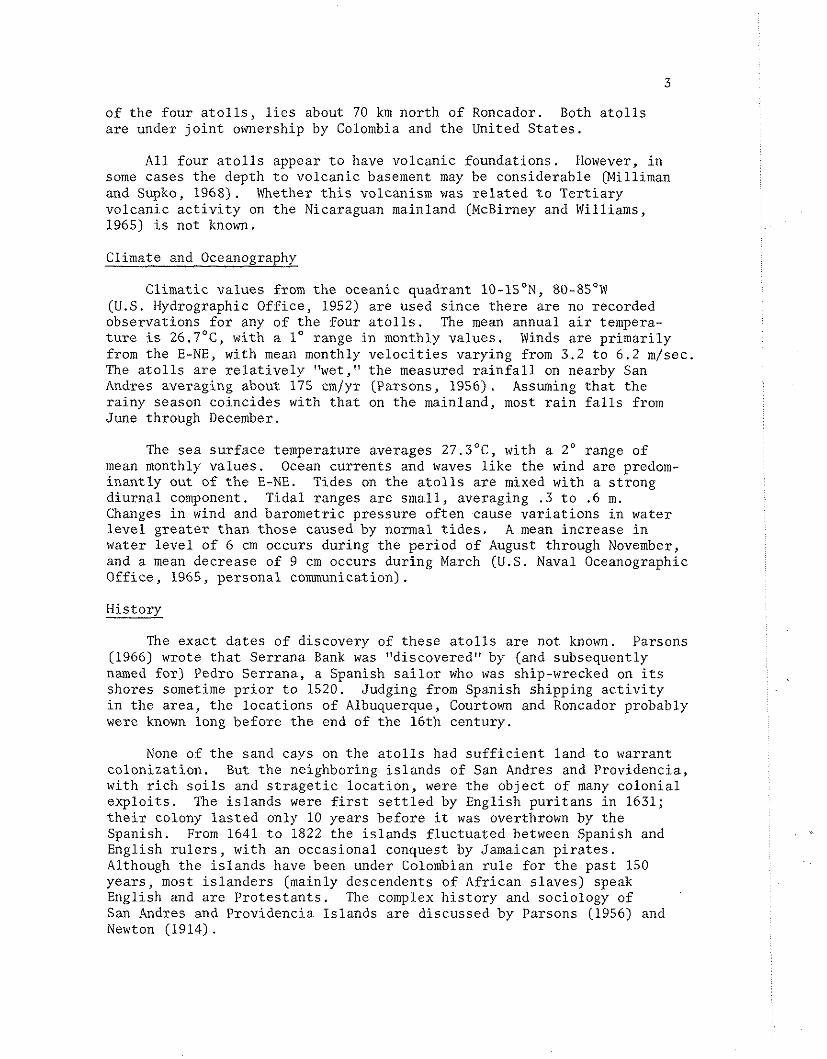
of t h e four a t o l l s , l i e s about 70 km nor th of Roncador. Both a t o l l s a r e under j o i n t ownership by Colombia and t h e United S t a t e s .
A l l four a t o l l s appear t o have volcanic foundat ions. However, i n some cases t h e depth t o volcanic basement may be considerable (Milliman and Supko, 1968). Whether t h i s volcanism was r e l a t e d t o T e r t i a r y volcanic a c t i v i t y on t h e Nicaraguan mainland (McBirney and Williams, 1965) i s not known.
Climate and Oceanography
Climatic va lues from t h e oceanic quadrant 10-lSON, 80-8S0W (U.S. Hydrographic Off ice , 1952) a re used s i n c e t h e r e a r e no recorded observat ions f o r any of t h e four a t o l l s . The mean annual a i r tempera- t u r e is 26.7"C, with a lo range i n monthly va lues . Winds a r e pr imar i ly from t h e E-NE, with mean monthly v e l o c i t i e s varying from 3.2 t o 6 .2 m/sec. The a t o l l s a r e r e l a t i v e l y "wet," t h e measured r a i n f a l l on nearby San Andres averaging about 175 cm/yr (Parsons, 1956). Assuming t h a t t h e ra iny season coincides with t h a t on t h e mainland, most r a i n f a l l s from June through December.
The sea su r face temperature averages 27.S°C, with a 2' range of mean monthly va lues . Ocean cu r ren t s and waves l i k e the wind a re predom- i n a n t l y out of t h e E-NE. Tides on t h e a t o l l s a r e mixed with a s t rong d iu rna l component. Tidal ranges a re smal l , averaging . 3 t o .6 m . Changes i n wind and barometr ic pressure o f t en cause v a r i a t i o n s i n water l eve l g rea t e r t han those caused by normal t i d e s . A mean increase i n water l e v e l of 6 cm occurs during t h e period of August through November, and a mean decrease of 9 cm occurs during March (U.S. Naval Oceanographic Of f i ce , 1965, personal communication).
History
The exact da t e s of discovery of t hese a t o l l s a r e not known. Parsons (1966) wrote t h a t Serrana Bank was "discovered" by (and subsequently named f o r ) Pedro Serrana, a Spanish s a i l o r who was ship-wrecked on i t s shores sometime p r i o r t o 1520. Judging from Spanish shipping a c t i v i t y i n t h e a rea , t h e loca t ions of Albuquerque, Courtown and Roncador probably were known long before t h e end of t h e 16th century.
None of t h e sand cays on t h e a t o l l s had s u f f i c i e n t land t o warrant co loniza t ion . But t h e neighboring i s l a n d s of San Andres and Providencia, with r i c h s o i l s and s t r a g e t i c l oca t ion , were t h e ob jec t of many co lon ia l e x p l o i t s . The i s l a n d s were f i r s t s e t t l e d by English pu r i t ans i n 1631; t h e i r colony l a s t e d only 10 years before it was overthrown by t h e Spanish. From 1641 t o 1822 the i s l a n d s f l u c t u a t e d between Spanish and English r u l e r s , with an occasional conquest by Jamaican p i r a t e s . Although t h e i s l a n d s have been under Colombian r u l e f o r t h e pas t 150 yea r s , most i s l a n d e r s (mainly descendents of African s l aves ) speak English and a r e P ro te s t an t s . The complex h i s t o r y and sociology of San Andres and Providencia I s lands a r e discussed by Parsons (1956) and Newton (1914).
Courtown and Albuquerque Cays have been v i s i t e d by San Andrean and Providencian na t ives f o r many yea r s . Fishermen remain a t t hese a t o l l s f o r s e v e r a l months, c o l l e c t i n g both f i s h and t u r t l e s . Shacks and lean- t o s a r e loca ted on Sand, East and Middle Cays a t Courtown, and on North Cay a t Albuquerque. While Cayman i s l a n d e r s have hunted t u r t l e s on both Roncador and Serrana Banks, t h e main i n t e r e s t i n these two a t o l l s was t h e guano depos i t s on t h e i r cays. In t h e mid 19th century, with the increased need f o r f e r t i l i z e r , t h e United S t a t e s claimed possession of Ser rana and Roncador Banks, on the p re t ense t h a t James W . J enne t t had "discovered" these cays during t h e c i v i l war (Parsons, 1956). Although Colombia a l s o l a i d claim t o t h e a t o l l s , po in t ing out t h a t they had been discovered 300 years before (see above), t h e d ispute continued u n t i l most a l l t h e guano had been removed by American companies. In 1928, t h e United S t a t e s and Colombia agreed t o j o i n t ownership t o t h e a t o l l s , provided t h a t Washington maintain l i g h t s at both a t o l l s . Parsons (1956) d i scusses t h i s h i s t o r y f u r t h e r .
Previous Studies
Although San Andres and Providencia had been v i s i t e d by the U.S. Steamer ALBATROSS (U.S. Comm. Fish and F i she r i e s , 1886), t h e Pinchot South Sea Expedition (Pinchot , 1930), t h e F i f t h George Vanderbi.lt Expedition (Vanderbi l t , 1944), and t h e Catherwood-Chaplin West Indies Expedition (von Ripper, 1949), only t h e Vanderbi l t expedit ion stopped a t t h e neighboring a t o l l s . The v i s i t s a t each a t o l l were b r i e f , a t o t a l of t h r e e days a t Serrana and Roncador, and one day a t Courtown and Albuquerque. Published observat ions inc lude r epor t s on t h e b i r d s (Bond and DeSchauensee, 1944), t h e f i s h (Fowler, 1944) and crustaceans (Coventry, 1944) co l l ec t ed a t these a t o l l s .
Numerous o the r c ru i se s have passed t h e s e a t o l l s , t ak ing various oceanographic observa t ions . But t o t h e b e s t of the w r i t e r ' s knowledge, no o t h e r c r u i s e had s tudied these a t o l l s .
Methods
I n order t o gain i n s i g h t i n t o t h e ecology, oceanography, and geology of these a t o l l s , t h e fol lowing d a t a were co l l ec t ed : 1) sediment samples; 2 ) environmental d i s t r i b u t i o n within t h e a t o l l s ; 3) bathymetry within the a t o l l ; 4) meteorologic and hydrographic measurements within t h e a t o l l ; 5) bathymetr ic and magnetic p r o f i l e s and rock dredges on t h e outer s lopes .
The da te s spent a t each a t o l l were: Courtown Cays, May 12-19, Albuquerque Cays, May 20-24, Roncador Bank, June 4-7, Serrana Bank, June 8-13. Additional da t a were c o l l e c t e d a t San Andres, iblay 28-29 and a t Providencia, May 31-June 1. '?he d a t a co l l ec t ed should be \iiei\v?d i n li.ght of the l imi t ed time a v a i l a b l e a t each a t o l l . This i s e s p e c i a l l y t r u e f o r the ecologic o b s e r v a t i o ~ ~ s , irillich should be t r e a t e d as pre l iminary .
i\'llil.e sediment samples were being c o l l e c t e d (mainly by sk in diving) the na tu re and depth of t h e bottom, toge the r witli in-ominen.: spec ie s of

c o r a l , a lgae and o the r organisms, were noted. The c l a r i t y of t h e water a l s o allowed us t o observe genera l changes i n the bottom mor- phology and communities from an outboard s k i f f .
Several hydrographic s t a t i o n s wi th in the lagoon of each a t o l l were occupied by t h e R . V . GERDA (Figure 7 ) . Various hydrographic and meteorological measurements were taken hourly. Most s t a t i o n s were occupied f o r one day, although some f o r much longer or s h o r t e r dura- t i o n s .
Current v e l o c i t i e s a t t h e s u r f a c e , mid-depth and 1 / 2 m above tlie bottom were measured by a Savonius r o t o r , r e g i s t e r e d on a d i g i t a l meter. In shallow depths only su r face and bottom readings werc taken. Current d i r e c t i o n s were est imated froin both t h e s h i p ' s head and t h e wire angle . A t he rmis to r , a t tached t o the cur rent nieter, was used t o measure watcr temperature. Unfortunately the the rmis to r broke during tlie f i r s t hydrographic s t a t i o n a t Courtown Cays. Thereaf te r a s tandard "bucket" thermometer, with an est imated accuracy of 0.S0C, was used.
Concurrent with these ~ c e a n o g r a p h i c observa t ions , air temperature ( i n the shade) and wind ve loc i ty and d i r e c t i o n were nieasured. 'l'he wind v e l o c i t i e s observed during t h i s c r u i s e were genera l ly g r e a t e r than normal ( see above), suggest ing t h a t t h e cu r ren t s inay have been somewhat f a s t e r than normal. m e wind (and cu r ren t ) d i r e c t i o n (except f o r Roncador) and a i r and water temperatures , however, did seem normal.
A t Courtown Cays s a l i n i t y samplcs of the sur face and bottom waters were taken twice d a i l y , a t noon and midnight. A t Albuquerque Cays and Serrana Bank one s e t of s a l i n i t y samples was taken a t each s t a t i o n . No samples were takcn a t Roncador Bank.
ATOLL ECOLOGY
General
Each a t o l l has the same b a s i c environments: the r e e f f r o n t , windward r e e f f l a t , lagoon ( together with patch r e e f s ) , and leeward reef f l a t ( f igu re 8 ) . To save space, t hese environments a r e d iscussed , followed by a di.scussion of t h e unique c h a r a c t e r i s t i c s 05 each a t o l l .
Reef Front
'The windward reef f ron t drops s t e e p l y t o a depth of about 5 111,
g radual ly s lopes t o about 18 t o 20 m, and then again s teepens . ?'he width of t h i s r e e f f r o n t v a r i ~ e s , but i s genera l ly l e s s than 500 111
(Figurc 8 ) . Because of t h e high surF condi t ions a t Roncador and Serrana, only t h c r ee f f r o n t s a t Aibuquerque and Courtown Cays were s tud ied ; even t h e r e sur:F li injted t h e time spent on tlie r e e f f ro i i t .
lilon'castrea annu1ari.s i s t h e mas-l: prominen-t cora l in del?tlis - exceeding 5 nl . Jn shallow cleptlis Acropora e t a , o r i en ted i n t o t h c s u r f , grows p r o f i ~ s c i y . The prominence of t h i s c o x 1 i s c l ~ a r n c f c r i s t i c

of t h e shallow r e e f f r o n t s of most Caribbean r e e f s (Shinn, 1963, and o t h e r re ferences c i t e d below) . Other c o r a l s include Agaricia a g a r i c i t e s and Acropora ce rv ico rn i s , t h e l a t t e r u sua l ly found i n depths g r e a t e r than 2 m. The hydrocoral , Millepora a l c i c o r n i s , i s prominent i n shallow depths. Red a lgae , p r imar i ly Goniolithon, encrust r e e f rock and loose c o r a l rubble .
Reef p innacles , composed mainly of M. annular i s and A . palmata, a r e common j u s t windward of t h e s u r f zone a t t h e n o r t h e a s t corners of both Courtown and Albuquerque cays. These p innacles , r i s i n g from depths of about 5 m of ten break t h e su r face .
Aer ia l photographs i n d i c a t e t h e presence of b u t t r e s s e s and grooves o r i en ted normal t o t h e r e e f f l a t . Although these f e a t u r e s were n e i t h e r well-developed nor continuous on those p a r t s of t h e r e e f f r o n t inves- t i g a t e d , t h e i r prominence on t h e ou te r r e e f f l a t (see below) i n f e r s t h a t t h e but t ress -groove zone is present on much of t h e r e e f f r o n t , although probably not a s well-developed as a t Jamaica (Goreau, 1959).
Windward Reef F l a t
Outer Margin: Reefs on the windward r e e f f l a t a r e b e s t developed on t h e nor th and nor theas t e rn s i d e s of each a t o l l , where waves and cu r ren t s a re g r e a t e s t . The southeas tern r e e f s tend t o be l e s s well- developed.
The nor theas tern and e a s t e r n r e e f margins of a l l a t o I l s a r e pene t r a t ed by a s e r i e s of surge channels, 1, t o 2 m deep, o r i en ted normal t o t h e r ee f f r o n t . Crashing s u r f forces swi f t cu r ren t s through these channels onto t h e r e e f f l a t . The s i d e s of the channels a r e l ined . with massive Diplor ia , Montastrea annu la r i s and P o r i t e s a s t r o i d e s , the l a t t e r , i n p l aces , assuming a f l a t , s h e e t - l i k e form. P o r i t e s p o r i t e s and t h e green a lga , Halimeda opuntia form l a rge masses. Branching red a lgae , Amphiroa and Goniolithon a re common and the pink conch, Strombus gigas, i s l o c a l l y abundant.
Growing on t h e b u t t r e s s e s (and on most of t h e o u t e r r e e f pavement not penet ra ted by surge channels) i s t h e p r o l i f i c assemblage of Mil lepora a l c i c o r n i s , t h e s o f t co ra l Palythoa mammillosa, and enc rus t ing red a lgae (Porol i thon and Goniol i thon); Agaricia a a r i c i t e s and Halimeda oyuntia a r e o f t e n present i n t h i s community ( P l e This f e a t u r e , he re termed t h e Millepora zone, grows up t o 40 cm above t h e low t i d e l e v e l , and occupies a near continuous zone, 15 t o 20 meters wide, along t h e outermost margins of t h e windward r e e f f l a t ( P l a t e 2 ) . I t i s most thoroughly developed on t h e nor theas tern s i d e s of t h e a t o l l s where high s u r f con t inua l ly sp lashes and washes the emergent co lonies . Concentrations of M . a l c i c o r n i s and zoanthid co ra l s on r e e f c r e s t s have been noted a t o t h e r Caribbean r e e f s (Goreau, 1959; Lewis, 1960; Kornicker and Boyd, 1962), but a t none a re they repor ted emergent a t low t i d e .
The Millepora zone seems t o be the ecologic equiva lent of t h e leeward po r t ions of t h e a l g a l r idge and Acropora cuneata zone found on P a c i f i c a t o l l s (IVells, 1954). I n each a r e a p l a t e - l i k e c o r a l s a r e

encrusted with red algae and zoanthid c o r a l s , and are exposed t o low t i d e ( see Tracey, Ladd and Hoffmeister, 1948, P la t e I , Figure 2 ; Emery, Tracey and Ladd, 1954, P l a t e 19, Figure 2) . The zone, however, cannot r e a l l y be c a l l e d an a l g a l r idge because massive red a lgae do not a c t u a l l y form the b a s i c s t r u c t u r e . Rather algae and t h e s o f t c o r a l s encrus t emergent co lonies of Millepora.
J u s t leeward of the Millepora zone i s an environment of p r o l i f i c co ra l growth, 20 t o 50 m wide, termed t h e "Diploria zone," because of t h e abundance of t h a t genus, e s p e c i a l l y D . c l i vosa ; Lewis (1960) has descr ibed a s i m i l a r zone a t Barbados. ~ c p t h s range from a few cm t o over 1 m . The massive growth form of Montastrea annu la r i s i s prominent with l e s s e r amounts of A. p a l ~ n a t a ( a l so i n massive growth f o r ~ ~ ~ ) , Mil lepora a l c i c o r n i s , ~ o r i t e s a s t r o i d e s and P . g o r i t e s . Thickets of Acropora cerv icorn is a r e p resen t on the more-leeward po r t ions of t h e Dip lo r i a zone. Corals of every major hermatypic spec ie s , p lus many spec ie s of a lgae , grow up t o 1/2 m above low t i d e l e v e l ( P l a t e 3 ) . Although these organisms a r e exposed above mean low t i d e l e v e l f o r r e l a t i v e l y long dura t ions , they a re ab le t o survive by means of i n t e r m i t t e n t su r f sp lash .
Halimeda opuntia , growing i n l a rge mounds, i s a prominent sediment con t r ibu to r . The s e a urchin , Diadema ant i l la rum, i s a l s o common, e s p e c i a l l y i n holes and c rev ices . A t some t r a n s e c t s t h e windward r ee f f l a t i s almost devoid of c o r a l , t h e r e e f pavement and any a v a i l a b l e rubb1.e being covered with encrus t ing a lgae . Red algae form l a rge hemispherical masses, up t o 25 cm i n diameter. Many have hollow i n t e r i o r s , where they probably once encrusted dead co ra l .
Inner Reef F l a t : The inne r r ee f f l a t i s defined by a sudden inc rease i n depth leeward of t h e ou te r r e e f f l a t . Depths commonly inc rease from l e s s than a few tens of cm t o more than 1 m ( P l a t e 4 ) . The inne r r e e f f l a t i s l a r g e l y devoid of co ra l although t h e r e a r e some P o r i t e s a s t r o i d e s , Montastrea annu la r i s and S i d e r a s t r e a , mainly i n encrus t ing growth form. Covering l a rge por t ions of the bottom a re green a lgae (Halimeda, P e n i c i l l u s , Rhipocephalus, Udotea, Padina) , brown a lgae (Dictyota and Turbinar ia ) and red algae (Porol i thon, Goniolithon, Anlphiroa). Red a lgae a re t h e most common type on t h e inne r r e e f , encrus t ing much o f t h e rubble t h a t has been washed i n from t h e windward r e e f s . The gastropods Strombus gigas and Astrea ~ h o e b i a a r e l o c a l l y common.
Lagoonward Margin: The leeward margin of the r e e f is genera l ly 1 t o 2 m deep, with occasional small r e e f s , p r imar i ly Montastrea annu la r i s , Acrogora ce rv ico rn i s and A . palmata breaking the su r face . Alcyonarians, very spa r se on t h e outer r e e f , a r e somewhat more prominent i n t h i s zone. Green and brown algae a r e common. The marine g ras ses , Thalass ia , Halodule, and Syringodium, a r e completely lacking, except i n s h e l t e r e d spo t s leeward of some cays. This c o n t r a s t s with the abundance of r e e f f l a t grasses on Alacran Reef and t h e B r i t i s h Honduras a t o l l s (Kornicker and Boyd, 1962; S toddar t , 1962). Green a lgae , e spec ia l ly Halimeda, and. brown a lgae (Dictyota and Turbinar ia ) a r e the dominant p l a n t s on t h e lagoonward margin. Near t h e sand cays, Halimeda is e s p e c i a l l y p r o l i f i c , as i s evidenced by the widespread Iialimeda sands on t h e cay beaches.

A common leeward f e a t u r e of the lagoonward margin is a "sand c l i f f , " which drops abrupt ly from t h e r ee f f l a t i n t o t h e lagoon (Figure 10 ) . Ver t i ca l r e l i e f is as g rea t as 10 m , with s lopes up t o 35". S imi lar s t eep s lopes have been repor ted a t Alacran Reef (Kornicker and Boyd, 1962) and Glover 's Reef (Stoddart , 1962) i n t h e Caribbean, and a t I fa luk Atol l (Tracey, +. , 1961) and Midway and Kure a t o l l s (Gross, e t a l . , 1968) i n t h e P a c i f i c . This s t e e p s lope may be formed by -- t r anspor t of r e e f f l a t sediment i n t o the lagoon, suggest ing a f o r e - s e t s lope , or it may be a k a r s t remnant of e a r l i e r P le is tocene low s e a l eve l s (MacNeil, 1954) .
Lagoon
A l a rge po r t ion of t h e lagoon bottom a t each a t o l l is covered with patch r e e f s . About 1 /3 of the lagoon r e e f s a re emergent, o r come wi th in a few meters of t h e su r face . The r e s t a r e low-lying, r i s i n g no more than a few meters above t h e bottom ( P l a t e 5 ) . The massive and columnar growth forms of Montastrea annular i s a r e prominent i n shallow depths. The columnar (Lewis, 1960, p. 1143), p innacle (P la t e 6) and f o l i o s e forms a r e more c h a r a c t e r i s t i c of deeper patch r e e f s . Thickets o f A. c e rv ico rn i s a re common on both shallow and deep r e e f s . There a re - a l s o varying amounts of Diplor ia , A. palmata, P . p o r i t e s , S ide ras t r ea , and Agaricia . Alcyonarians, which-are s p o r a d i c on t h e shallow r e e f s , a r e abundant on many of t h e deeper patch r e e f s .
Most of t h e lagoonal organisms l i v e on, i n , or near these r e e f s . Green algae ( P e n i c i l l u s , Rhipocephalus, Halimeda) a re l o c a l l y common near r e e f s , bu t otherwise genera l ly lacking . Polychaete tubes, emerging from t h e bottom, grow t h i c k l y i n the v i c i n i t y of patch r e e f s . In deeper p a r t s of t h e lagoon, sponges a r e common and reach la rge s i z e . Judging from t h e number o f mounds, burrohling organisms may p lay an important r o l e i n t h e ecology of the lagoon bottom. The por t ion of the lagoon f l o o r not covered with r e e f i s genera l ly ba re , except f o r occasional conchs (Strombus g igas ) , a l g a l patches, and f e c a l mounds.
Leeward Reef F l a t
A t a l l a t o l l s t h e leeward pe r iphe ra l r e e f s a re i l l - d e f i n e d and discontinuous. They appear t o have been formed by the c o a l i t i o n of patch r e e f s . The r e e f organisms a r e s i m i l a r t o those on t h e windward r e e f s , bu t l e s s abundant; a l s o , t h e marked zonations seen on t h e windward r e e f s a r e gene ra l ly absent . I n p laces the r e e f s a re dead, with Dictyota and o t h e r brown algae enc rus t ing t h e r ee f f l a t bottom.
Courtown Cays
Courtown Cays (1Z024'N, 81°25'W) i s a l e n t i c u l a r a t o l l , 8-1/2 km N-S and 3-1/2 km E-W. The windward reef f l a t i s indented i n two p l a c e s , giving t h e a t o l l an unusual bowed shape (Figure 3 ) . Aer ia l photographs show t h a t surge channel l i n e a t i o n s a re most conspicuous i n t h e indented por t ions of t h e ou te r r e e f . The area of most prominent l i n e a t i o n s i s l abe l l ed "Buttress-Groove Zone" i n Figure 3 . The surge channels i n t h i s a rea have r e l i e f of 1/2 t o 1 m, and extend i n t o the r ee f f r o n t as a but tress-groove system. Depths shoal t o about 1 m on the ou te r r e e f ;

no s i g n of t h e emergent Millepora zone o r o t h e r r e e f organisms was seen. The gene ra l ly deep, r e e f - l e s s bottom i n t h i s indented a rea i s d i f f i c u l t t o expla in ; perhaps it i s r e l a t e d t o t h e swi f t cu r ren t s t h a t seem t o con t inua l ly flow through t h i s a r e a .
The leeward r e e f a t Courtown Cays i s in t e r rup ted by a 2 km gap, r e s u l t i n g i n a lagoon open t o t h e NW. Sounding p r o f i l e s showed no lagoon s i l l . Lagoon depths average about 12 m, although depths l o c a l l y reach 16 m.
A l a rge patch of s e a grass , both Thalass ia and Syringodium, extends some 100 m leeward of East Cay. The echinoid Tripneustes esculentus i s p a r t i c u l a r l y common i n t h i s grass patch.
Patch r e e f s cover only about 10 percent of the lagoon bottom. The r e e f s t h a t break, o r nea r ly break, t h e su r face a re usua l ly loca ted wi th in t h e 10 m i soba th (Figure 3 ) . Coalescing patch r e e f s have nea r ly i s o l a t e d t h e southern t h i r d of t h e lagoon.
Courtown Cays has f i v e small cays and one rocky s p i t . Sand Cay i s -- about 200 m by 25 m with a maximum he igh t of about 1-1/2 t o 2 m. The windward beaches a r e covered with encrus ted r e e f rubble. A sand s p i t extends about 20 m south of the cay. Two prominent p l a n t spec ies grow on t h e cay: Tournefor t ia shrubs, with he igh t s up t o 1 m, and a low creeping v ine (Euphorbia 1 ) . A few coconut palms a re a l s o present . One unoccupied thatched h u t , about t h e s i z e and shape of a pup- ten t , was found on t h e c e n t r a l p a r t of the cay.
East Cay i s t h e l a r g e s t cay a t Courtown Cays, being about 300 m by 100 m. Four bands of beachrock, p a r a l l e l i n g t h e e a s t e r n shore l ine , extend windward on t h e r e e f f l a t . The rock bands, about 20 m a p a r t , probably represent previous shore l ines , and suggest t h e lagoon migrat ion of t h e cay (P la t e s 7, 8 ) . The d i s t ingu i sh ing f e a t u r e on East Cay i s t h e t a l l s t and of coconut palms ( P l a t e 7 ) . Large Scaevola bushes grow on t h e lagoon s i d e . Several o the r p l a n t types were noted but not i d e n t i f i e d . A shack, on the lagoonward s i d e of t h e cay, was occupied by a San Andrean fisherman and h i s dog.
A small rocky s p i t , composed of massive co ra l d e b r i s , l i e s a t t h e southern t i p of t h e pe r iphe ra l r e e f . Wave r e f r a c t i o n around t h e southern end of t h e a t o l l r e s u l t s i n c rashing s u r f from both t h e south- e a s t and southwest. Nestled i n between t h e l a rge co ra l rubble were t h e n e t s of s e v e r a l f r i g a t e b i r d s . No l i v i n g land p l a n t s were seen on t h e s p i t .
Three small cays, Middle Cay, West Cay, and a sand s p i t , s i t on patch r e e f s t h a t c o l l e c t i v e l y form t h e leeward pe r iphe ra l r e e f . Only Middle Cay was v i s i t e d . Most of t h e cay i s surrounded by emergent patch r e e f s . The c e n t r a l vegetated po r t ion of t h e cay is bordered by Tournefor t ia and Scaevola bushes. Low-lying, u n i d e n t i f i e d creepers cover most of t h e cay ' s i n t e r i o r . Several Providencian na t ives were l i v i n g on t h e cay.

Viewed from an outboard s k i f f , West Cay apparent ly had vege ta t ion s i m i l a r t o t h a t on Middle Cay. The sand s p i t appeared t o lack any p lan t l i f e .
Four hydrographic s t a t i o n s were occupied i n t h e Courtown Cays lagoon (Table 1 ) . A i r temperatures averaged about 28°C. Water tem- pe ra tu res were somewhat lower averaging 27.5'C, with small d a i l y ranges. While t h e thermis tor was opera t ive l i t t l e d i f f e rence was noted i n t h e su r face and near bottom water temperatures a t S t a t i o n C-I. S a l i n i t i e s were between 36.1 and 36.4 o/oo. Def in i t e s a l i n i t y v a r i a t i o n s were not iced a t S t a t i o n C - 1 , where t h e s a l i n i t y on t h e second day was more than 0.2 o/oo h igher than t h e f i r s t day (Table 1 ) .
Northeast winds seldom dropped below 7 m/sec. Current d i r e c t i o n coincided with the wind. A t C - 1 cu r ren t v e l o c i t i e s averaged 5 cm/sec. Current v e l o c i t i e s a t t h e o the r t h r e e s t a t i o n s averaged 16 t o 21 c /sec a t t h e su r face and 10 t o 14 cm/sec near t h e bottom.
Albuquerque Cays
Albuquerque Cays (lZalO'N, 8lo50'W) is a nea r ly c i r c u l a r a t o l l , about 6-1/2 km E-W and 5 km N-S (Figure 4 ) . Leeward pe r iphe ra l r e e f s grow on a shal low, wide sand f l a t , which forms the lagoon s i l l . The sand f l a t deepens from about 3 t o 5 m a t t h e leeward r e e f s , t o 10 t o 15 m 3 km t o the west. The f l a t i s covered with small , low-lying patch r e e f s . TWO navigable channels on t h e southwest and northwest broach t h e f l a t i n t o t h e lagoon.
Lagoon depths a re as much as 18 m bu t genera l ly about 10 t o 15 m. Patch r e e f s cover an est imated 20 percent of the lagoon bottom. These r e e f s a r e e s p e c i a l l y prominent i n t h e nor thern h a l f . Anastomosing pa tch r e e f s , corresponding t o those described by Kornicker and Boyd (1962) a s " c e l l u l a r r e e f s , " were seen i n t h e nor theas tern p a r t s o f t h e lagoon.
The only s e a grasses found on t h i s a t o l l a re s t r ands of Malodule and Syringodimn, on the northern and southern s i d e s of North Cay.
Two i s l a n d s , North Cay and South Cay, r i s e above the windward r e e f f l a t . North Cay measures 350 m N-S and 125 m E-W, and s tands about 2 m h igh . South Cay, about 250 m t o t h e south , i s a smal le r ve r s ion (180 by 70 m) of North Cay.
Beachrock i s present on the e a s t e r n shore l ines of both cays (P la t e 9 ) . Several o the r bands extend windward, i n a s i m i l a r manner t o those a t East Cay on Courtorm. Another beachrock outcrop, s tanding 1/2 t o 1 - 1 / 2 m above s e a l eve l i s loca ted on t h e northern s ides of North and South Cays. This e leva ted beachrock apparent ly continues across both cays; a s o i l p i t dug i n t h e i n t e r i o r of South Cay exposed a l aye r of beachrock, about 1/2 ~n t h i ck and about 1-1/2 m above present s e a l e v e l , overlying an unconsolidated Halimeda sand. Carbon-14 da tes have not

WIND CURRENTS
Table 1. Hydrographic d a t a co l l ec t ed a t Courtown Cays, May 12-19, 1966. As te r i sk (*) s i g n i f i e s t h a t va lues presented a r e averages; numbers i n parentheses r ep resen t t h e range i n va lues .

Table 2 . Hydrographic da ta c o l l e c t e d a t Albuquerque Cays. As te r i sk (*) s i g n i f i e s t h a t va lues p e s e n t e d a r e averages; numbers i n paren- theses r ep resen t t h e range i n values. For s t a t i o n 3, dominant average cu r ren t va lues a r e given f i r s t ; bracketed va lues repre- s e n t average v e l o c i t y and d i r e c t i o n of t i d a l r eve r sa l s .
been run on t h e rock o r underlying sediments, s o t h a t the age and o r ig in of t h i s formation i s open t o specu la t ion .
Coconut palms, Ficus t r e e s and Scaevola shrubs a re t h e prominent - p l a n t s . The i n t e r i o r po r t ions of both i s l a n d s a r e so heav i ly wooded t h a t l i t t l e sun pene t r a t e s (P la t e 10) . On both cays the t r e e s a r e lowest on t h e windward s i d e and h ighes t on the leeward s i d e , g iv ing t h e cays a swept-wing appearance. Because of t h e heavy, lush vege ta t ion , t h e s o i l s a r e more r i c h and loamy than a t o ther a t o l l s . When v i s i t e d , four fishermen from Providencia were l i v i n g on North Cay.
Bond and DeSchauensee (1944) repor ted nine spec ie s of b i r d s on t h e two cays. Most were migratory b i r d s , but some were boobies and t e r n s . One s p e c i e s , a hummingbird (Anthracothorax p r e v o s t i i hendersoni ) , i s apparent ly a permanent i nhab i t an t (Bond and DeSchauensee, 1944).
Three hydrographic s t a t i o n s , ranging i n dura t ion from s i x t o 28 hours , were occupied a t Albuquerque Cays (Table 2 ) . A i r and water temperatures were s i m i l a r t o those measurements taken a t Courtown Cays. S a l i n i t y va lues were around 36.35 o/oo, somewhat higher than a t Courtown Cays.
Winds were between 5 and 7 m/sec from the n o r t h e a s t . Surface cu r ren t s a t S t a t ions A - 1 and A-2 r a r e l y exceeded 15 cm/sec, and aver- aging about 10 cm/sec; bottom cur ren t s were l e s s , 5 cm/sec. Current d i r e c t i o n , l i k e wind, was i n a wes ter ly d i r e c t i o n . The cu r ren t s a t S t a t i o n A-3, a t t h e southwestern lagoon ent rance , reversed and flowed i n t o t h e lagoon f o r a pe r iod of four hours . I t i s assumed t h a t t h i s cu r ren t r e v e r s a l was t i d a l .
Roncador Bank
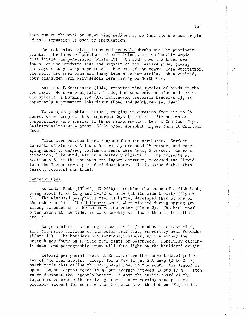
Roncador Bank (13'34', 8O004'W) resembles t h e shape of a f i s h hook, be ing about 11 km long and 3-1/2 km wide ( a t i t s widest p a r t ) (Figure 5 ) . The windward pe r iphe ra l r e e f i s b e t t e r developed than a t any of t h e o t h e r a t o l l s . The Mil lepora zone, when v i s i t e d during sp r ing low t i d e s , extended up t o 50 cm above t h e water (P la t e 2) . The back r e e f , o f t en awash a t low t i d e , i s considerably shal lower than a t t h e o the r a t o l l s .
Large boulders , s tanding as much a s 1-1/2 m above t h e r e e f f l a t , l i n e ex tens ive po r t ions of t h e o u t e r r e e f f l a t , e s p e c i a l l y near Roncador ( P l a t e 11) . The boulders a r e l e n t i c u l a r b locks , unl ike e i t h e r t h e negro heads found on P a c i f i c r e e f f l a t s o r beachrock. Hopefully carbon- 14 da te s and pe t rographic s tudy w i l l shed l i g h t on t h e boulders ' o r i g i n .
Leeward per iphera l r e e f s a t Roncador a r e the poorest developed of any of t h e fou r a t o l l s . Except f o r a few l a rge , bu t deep (2 t o 3 m), patch r e e f s t h a t def ine t h e pe r iphe ra l r e e f t o t h e south, t h e lagoon i s open. Lagoon depths reach 18 m , bu t average between 10 and 12 m. Patch r e e f s dominate t h e lagoon's bottom. Almost t h e e n t i r e t h i r d of t h e lagoon i s covered with low-lying r e e f s ; i n t e r spe r s ing sand patches probably account f o r no more than 30 percent of the bottom (Figure 9 ) .
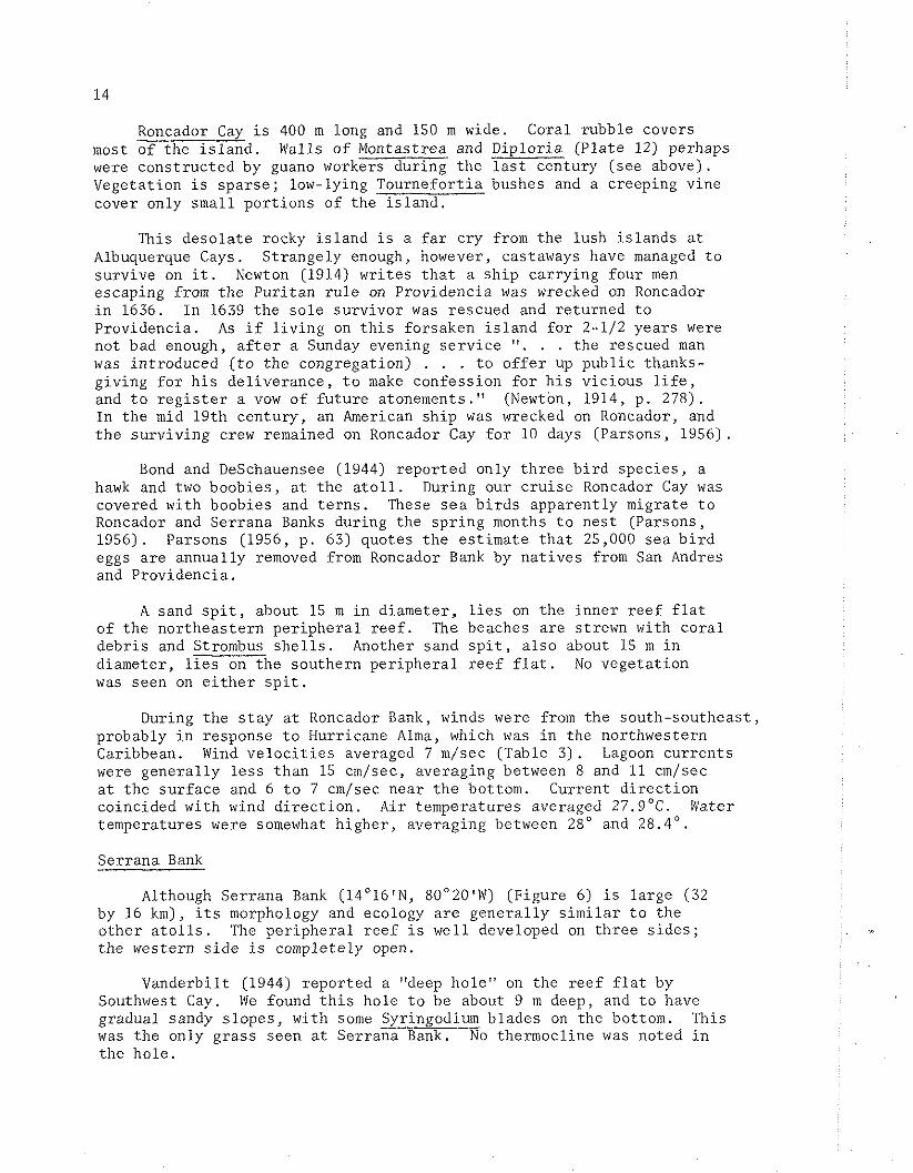
Roncador Cay i s 400 m long and 150 m wide. Coral rubble covers most of the i s l a n d . Walls of Montastrea and Diplor ia (P la t e 12) perhaps were cons t ruc ted by guano workers during t h e l a s t century (see above). Vegetation i s s p a r s e ; low-lying Tournefor t ia bushes and a creeping vine cover only small po r t ions of the i s l a n d .
This deso la t e rocky i s l a n d i s a f a r c r y from the lush i s l ands a t Albuquerque Cays. Strangely enough, however, castaways have managed t o surv ive on i t . Newton (1914) wr i tes t h a t a s h i p car ry ing four men escaping from t h e Pur i tan r u l e on Providencia was wrecked on Roncador i n 1636. In 1639 t h e s o l e surv ivor was rescued and re turned t o Providencia. A s i f l i v i n g on t h i s forsaken i s l a n d f o r 2-1/2 years were not bad enough, a f t e r a Sunday evening s e r v i c e ". . . the rescued man was introduced ( t o t h e congregation) . . . t o o f f e r up publ ic thanks- giving f o r h i s de l iverance , t o make confession f o r h i s v ic ious l i f e , and t o r e g i s t e r a vow of f u t u r e atonements." (Newton, 1914, p. 278). In the mid 19th century, an American s h i p was wrecked on Roncador, and t h e surv iv ing crew remained on Roncador Cay f o r 10 days (Parsons, 1956).
Bond and DeSchauensee (1944) repor ted only t h r e e b i r d spec ie s , a hawk and two boobies , a t t h e a t o l l . During our c r u i s e Roncador Cay was covered with boobies and t e r n s . These s e a b i r d s apparent ly migrate t o Roncador and Serrana Banks during the sp r ing months t o nes t (Parsons, 1956). Parsons (1956, p. 63) quotes t h e es t imate t h a t 25,000 sea b i r d eggs a re annual ly removed from Roncador Bank by n a t i v e s from San Andres and Providencia.
A sand s p i t , about 15 m i n diameter, l i e s on t h e inne r r ee f f l a t of the nor theas tern pe r iphe ra l r e e f . The beaches a re strewn with co ra l deb r i s and Strombus s h e l l s . Another sand s p i t , a l s o about 15 m i n diameter , l i e s on t h e southern pe r iphe ra l r e e f f l a t . No vegeta t ion was seen on e i t h e r s p i t .
During t h e s t a y a t Roncador Bank, winds were from t h e south-southeas t , probably i n response t o Hurricane AIma, which was i n t h e northwestern Caribbean. Wind v e l o c i t i e s averaged 7 m/sec (Table 3 ) . Lagoon cu r ren t s were genera l ly l e s s than 15 cm/sec, averaging between 8 and 11 cm/sec a t t h e su r face and 6 t o 7 cm/sec near t h e bottom. Current d i r e c t i o n coincided with wind d i r e c t i o n . A i r temperatures averaged 27.g°C. Water temperatures were somewhat h ighe r , averaging between 28" and 28.4'.
Serrana Bank
Although Serrana Bank (14'16'N, 80°20'W) (Figure 6) i s l a rge (32 by 16 km), i t s morphology and ecology a r e gene ra l ly s i m i l a r t o t h e o the r a t o l l s . ' h e pe r iphe ra l r e e f i s well developed on t h r e e s i d e s ; the western s i d e is completely open.
Vanderbilt (1944) repor ted a "deep hole" on the r e e f f l a t by Southwest Cay. We found t h i s hole t o be about 9 m deep, and t o have gradual sandy s lopes , with some Syringodium blades on the bottom. This was t h e only g ras s seen a t Serrana Bank. No thermocline was noted i n t h e ho le .

WIND
Table 3. Ilydrographic da ta co l l ec t ed a t 'oncador Bank, June 4-7 , 1966. As te r i sk (*) s i g n i f i e s t h a t va lues presented a r e averages; numbers i n parentlieses represent t h e range i n va lues .
Two bands of patch r e e f s , one extending north from East Cay, t h e o t h e r extending south from the nor thern pe r iphe ra l r ee f towards L i t t l e Cay, e f f e c t i v e l y d iv ide Serrana lagoon i n h a l f (Figure 6 ) . While lagoon water flows over these extensive r e e f complexes, water depths a re t o o shal low f o r anything l a r g e r than a small s k i f f t o pass over. The e a s t e r n s t r i n g of patch r e e f s shoals r a p i d l y from depths exceeding 15 m . Alcyonarians and gorgonians, t oge the r with Monastrea heads and s c a t t e r e d clumps of green a lgae , dominate the deeper bottom ( P l a t e 13). As t h e r e e f s h o a l s , Acro ora ce rv ico rn i s and Monastrea annular i s increase i n -+ abundance. In ep ths shal lower than 4 m, Acropora palmata o r i en ted i n t o t h e cu r ren t s and Millepora a l c i c o r n i s a r e p r o l i f i c . The r e e f f l a t , up t o 100 m wide, i s gene ra l ly 1 t o 2 m deep. Most common c o r a l s on t h e r ee f f l a t a r e M . annu la r i s , D ip lo r i a , ~ c i o ~ o r a palmata, A. c e rv ico rn i s and a l cyonar i az c o r a l s . The encrus t ing c o r a l , Po r i t e s a*oides, i s common throughout t h e patch r e e f .
A . c e rv ico rn i s e x h i b i t s t h r e e d i s t i n c t i v e growth forms on t h e pa tch reefs: On the r e e f f r o n t , i n deeper water (5 t o 10 m), t h e co lonies a re small and f r a g i l e ; a t shal lower depths (1 t o 3 m) on t h e r e e f f r o n t , t h e co lonies a re longer and t h i c k e r , bu t with few branches. On t h e r e e f f l a t , - A . ce rv ico rn i s i s smal le r , bu t with many th i ck branches.
The na tu re of t h e bottom and t h e zonation of t h e co ra l s on these coa lesc ing patch r e e f s a re s i m i l a r t o t h e windward pe r iphe ra l r e e f s . With an open lagoon f e t c h of some 3 t o 5 km, considerable s u r f can crash onto these shallow r e e f s . I n c o n t r a s t t o t h e windward pe r iphe ra l r e e f s alcyonarians a re more common, red a lgae l e s s common, and t h e emergent Mil lepora zone and surge channel l i n e a t i o n s a re absent .
The second, leeward coalescing pa tch r e e f , while having s i m i l a r zonat ions t o t h e eas t e rn patch r e e f s , l i e s on a broad sand bank, t h a t extends some 2 km leeward of t h e r e e f s . Depths on t h e bank a r e seldom more than 3 o r 4 m. I t i s d i f f i c u l t t o conceive t h a t t h i s r e e f has produced t h a t much sand; r a t h e r , t h e r e e f s probably have grown on t h e sand f l a t .
Lagoon depths e a s t of t h e patch r e e f bands reach 20 m, but average about 15 m. An est imated t h i r t y percent of t h e bottom i n t h e e a s t e r n lagoon i s covered with patch r e e f (Figure 10) . Leeward of t h e l i n e a r r e e f bands i s a broad shallow f l a t ; depths seldom a re g r e a t e r than 10 m (Figure 6 ) . In con t ra s t t o the e a s t e r n lagoon, only about 5 percent of t h i s f l a t i s covered with patch r e e f s (Figure 10 ) .
S ix cays a r e loca ted on Ser rana Bank. East Cay i s a small i s l e t covered with co ra l and mollusk (Astrea s p . ) rubble. Tournefor t ia i s the only p l a n t p re sen t .
South Cay i s about 150 m long and 25 m wide. Beachrock l i n e s t h e seaward beach; t h e r e s t of the cay i s composed of rubble and sand. The t h r e e spec ie s of p l a n t s present (Tournefor t ia , Ipomoea and Euphorbia were a l l spa r se .

L i t t l e Cay l i e s on t h e southern edge o f a l i n e a r r e e f band (see above) and forms t h e apex of an e q u i l a t e r a l t r i a n g l e with South and Narrow Cays. The cay i s l e s s than 100 m i n diameter . Rubble l i n e s t h e seaward (south and e a s t ) beaches, and beachrock i s present on t h e south and west s i d e s . The r e s t of t h e i s l and i s f i n e sand; no vegeta t ion was seen .
Narrow Cay west of South Cay i s e s s e n t i a l l y a rubble p i l e . The e n t i r e r e e f f l a t west of the cay i s covered with beachrock and rubble . This may i n d i c a t e t h e former p o s i t i o n o f t h e cay.
Southwest Cay i s t h e l a r g e s t i s l a n d on any of t h e a t o l l s v i s i t e d . I ts dimensions (about 500 m long, 200 m wide) c o n t r a s t with f i v e small cays on t h i s a t o l l . Although most of t h e i s l a n d i s only a few m h igh , sand dunes on t h e south and west s i d e s reach he ights g rea t e r than 10 m .
For an i s l a n d of t h i s s i z e t h e r e a r e s u r p r i s i n g l y few p lan t spec ie s A c reeper vine covers much of t h e low-lying p a r t of the cay. Several spec ie s of shrubs grow on t h e dunes. Two d i l ap ida ted huts a re loca ted i n a small grove of coconut palms. These huts may belong t o Cayman Brac na t ives who, according t o Vanderbilt (1944), l i v e on Serrana Bank most of t h e year , c o l l e c t i n g guano and hunt ing t u r t l e s . No na t ives were seen during our v i s i t .
Bond and DeSchauensee (1944) r epor t ed e i g h t spec ies of b i r d s a t Serrana. A t t h e time of our v i s i t l a r g e co lonies of boobies and t e r n s were nes t ing ; we est imated about 100,000 b i r d s on t h e cay. I t i s not hard t o s e e why Parsons (1956) r e p o r t s t h a t 300,000 b i r d eggs a r e c o l l e c t e d annual ly by Jamaicans, nor t o understand why guano accumulated i n such l a rge q u a n t i t i e s .
North Cay, loca ted a t t h e nor thern edge of t h e per iphera l r e e f , i s composed of sand and rubble. Three spec ie s of p l a n t s , Tournefor t ia , Ipomea and t h e small spec ie s of c reeper seen a t Southwest Cay were noted.
Five hydrographic s t a t i o n s , ranging i n dura t ion from 17 t o 24 hours , were occupied a t Serrana Bank (Table 4) a t t h e f i r s t s t a t i o n , S-1, wind was from t h e southeas t with an average v e l o c i t y of 4 m/sec. The wind d i r e c t i o n then s h i f t e d t o t h e e a s t and v e l o c i t i e s increased t o about 8 m/sec. These winds continued f o r t h e r e s t of t h e s t a y a t Serrana.
Currents i n t h e i n t e r i o r p a r t s of t h e lagoon ( s t a t i o n s S-1, S-4, and S-5) followed t h e wind d i r e c t i o n . Currents near the lagoon ent rances (5-2 and S-3) , however, were seldom coinc ident with t h e wind. Water flowed out of t h e lagoon (S-3) o r westward (S-2) during ebb t i d e . During f lood and s l ack t i d e , water would flow i n t o t h e lagoon. Thus t h e average cu r ren t flowed i n t o the lagoon. The f a s t e s t cu r ren t s measured during t h e e n t i r e c r u i s e were a t these lagoon ent rances ; a t 5-3, cu r ren t s o f t en exceeded 50 cm/sec.
A i r and water temperatures were i n near equil ibr ium; t h e d a i l y average f o r each being about 27.9"C. S a l i n i t i e s ranged between 35.93 and 36.04 o/oo.

WIND CURRENTS
Table 4. Hydrographic da ta co l l ec t ed a t Serrana Bank, June 8-13, 1966. As te r i sk (*) s i g n i f i e s t h a t va lues presented a r e averages; numbers i n parantheses r ep resen t t h e range i n va lues . For s t a t i o n s 2 and 3 dominant average cu r ren t va lues a r e given f i r s t ; bracketed va lues represent average v e l o c i t y and d i r ec - t i o n of t i d a l r e v e r s a l s .

19
DISCUSSION
Simi lar ecologic zonat ions a r e present a t Courtom Cays, Albuquerque Cays, Roncador Bank and Serrana Bank. The ou te r windward r e e f f l a t is cha rac te r i zed by an emergent Mil lepora zone and a leeward Diplor ia zone. The deeper ( 1 t o 2 m) inne r r e e f f l a t lacks t h e p r o l i f i c r e e f growth; r e d , green and brown a lgae a r e most conspicuous. Steep sand c l i f f s mark t h e sudden t r a n s i t i o n from the inne r r ee f f l a t t o t h e lagoon. Patch r e e f s dominate t h e lagoons. The leeward r e e f s seem t o r e s u l t from coalescence of patch r e e f s .
Some d i f f e rences e x i s t between a t o l l s : 1) Serrana Bank, being l a r g e r than t h e o the r t h r e e a t o l l s , has a more complex lagoon. Bands of coalescing patch r e e f s have almost divided the lagoon i n two. 2) Courtown and Roncador, lacking leeward r e e f s , have more open lagoons. 3) Lagoon patch r e e f s a r e e s p e c i a l l y dominant a t Roncador Bank, where an est imated 40 t o 50 percent of t h e bottom i s covered. 4) The sand cays a t Albuquerque Cays have a r e l a t i v e l y lush f o l i a g e and r i c h s o i l compared t o t h e pioneer s t r a n d l i n e p l a n t communities a t t h e o the r t h r e e a t o l l s . 5) Elevated beachrock i s found on the two i s l a n d s a t Albuquerque; l a rge r e e f blocks l i n e t h e o u t e r periphery of the windward r e e f f l a t a t Roncador .
Other than t h e abundant c o r a l s and calcareous a lgae , t h e fauna and f l o r a of these Nicaraguan a t o l l s seem depauperate. The most important mollusk and echinoderm spec ie s (Strombus, Astrea and Diadema) a re only l o c a l l y common. Several spec ie s of ophiuroids were c o l l e c t e d o r observed, but only t h e ubiqui tous b lack Ophiocoma r i i s e i was common. Vi r tua l ly no holo thur ians were seen except Actinopyga a g a s s i z i i , l o c a l l y abundant on t h e r ee f f l a t and a t moderate depths i n the lagoon. Crustacea a l s o were poorly represented. Many of the su r face dwelling fauna such as Clypeaster rosaceus and Lytechinus va r i ega tus , were not seen . Signs of an abundant molluscan infauna, such as empty b iva lve s h e l l s , were a l s o lacking . P r o l i f i c alcyonarian growth was pr imar i ly l imi t ed t o deeper lagoon r e e f s .
Not one s t a r f i s h was found. The t o t a l absence of t h i s group and t h e almost complete lack of marine grasses was s u r p r i s i n g , e s p e c i a l l y s ince both a r e common on t h e leeward shores of nearby San Andres and Providencia i s l a n d s . This might suggest t h a t the high cu r ren t energy environments on t h e a t o l l s have e f f e c t i v e l y l imi ted t h e s t a r f i s h and g ras s populat ions. I t i s i n t e r e s t i n g t o note t h a t the few grasses a t t h e a t o l l s were always found i n t h e most r e s t r i c t e d , low-energy environments.
Fowler (1944) was impressed by t h e numerous f i s h a t Courtom Cays. He a l s o mentioned ca tching s e v e r a l l o b s t e r s (Panulirus e). The present w r i t e r was impressed by t h e small number and s i z e of f i s h spec ies and ind iv idua l s . Extensive sk in d iv ing d id not revea l many l o b s t e r s . The discrepancy between Fowler 's observat ions and ours may be due t o the f i s h i n g a c t i v i t y of the n a t i v e s .
NICARAGUAN AND PACIFIC ATOLLS
Caribbean r e e f s and a t o l l s a r e considered p a l e images of t h e i r Indo-Paci f ic coun te rpa r t s , lacking i n : 1) number of co ra l spec ie s (about 50 versus about 700 i n t h e Indo-Pac i f i c ) , 2) t h e emergence of c o r a l s a t low t i d e , 3) an a l g a l r idge zone, and 4) genera l r e e f matur i ty (Wells, 1957; Newell, 1959; Yonge, 1963). These condit ions a re t r u e i n t h e nor thern Caribbean, where the f e t c h is of ten s h o r t and t h e annual range of a i r temperature may be g r e a t . Y e t a t t h e Nicaraguan a t o l l s , whose environment c l o s e l y p a r a l l e l s many P a c i f i c a t o l l s , most hermatypic co ra l spec ie s can l i v e exposed between t i d e s . While no t r u e a l g a l r i d g e occurs on t h e Nicaraguan a t o l l s , the Mil lepora zone, emergent a t low t i d e , appears t o be i t s ecologic equ iva len t .
The lack of co ra l spec ie s does not seem t o i n h i b i t t h e p r o l i f i c r e e f growth. As i n o the r Caribbean r e e f s (Goreau, 1959; Lewis, 1960; S toddar t , 1962), Montastrea annular i s i s t h e b a s i c r e e f framework b u i l d e r , est imated t o comprise more than 60 percent (by volume) of t h e t o t a l c o r a l . I f t h e var ious spec ies of Acropora, P o r i t e s and Diplora, and t h e hydrozoan Mil lepora were added t o t h i s e s t ima te , t h e f i g u r e is c l o s e r t o 95 percent . These few spec ies adapt t o t h e var ious environ- ments of t h e a t o l l by assuming d i f f e r e n t growth forms. Thus, f o r i n s t ance , Montastrea annu la r i s has four b a s i c growth forms: t h e massive (and most common) form is t y p i c a l of the r e e f f l a t and shallow lagoon; t h e columnar form i s found throughout the lagoon; t h e p innacle and f o l i o s e forms a r e more t y p i c a l of t h e deeper lagoon r e e f s . S imi l a r ly , Acropora palmata, P o r i t e s p o r i t e s and Mil lepora a l c i c o r n i s were noted t o have seve ra l growth forms.
The main d i f f e r e n c e between Nicaraguan and P a c i f i c a t o l l s i s t h e r e l a t i v e importance of encrus t ing c o r a l l i n e a lgae . Although a l g a l enc rus t a t ions cover po r t ions of t h e Nicaraguan r e e f f l a t s , and coat much of t h e r e e f deb r i s , massive co lonies of red a lgae such as Porol i thon spec ie s t h a t form t h e P a c i f i c a l g a l r idges a re lacking. Thus t h e Caribbean equiva lent t o the a l g a l r idge i s mainly Millepora c o r a l ; c o r a l l i n e a lgae only encrus t t h e emergent co lonies . The general lack of red a lgae i n t h e Caribbean has a l s o been noted by Goreau (1959) and Fosberg (1962).
Perhaps it i s t h i s lack of profuse enc rus t ing red a lgae t h a t limits t h e development of an a l g a l r idge and r e s u l t s i n t h e general lack of r e e f cohesiveness t h a t s o many Caribbean r e e f workers have observed (Wells, 1957; Newell, 1959). This po in t should be one of f u t u r e s tudy.
REFERENCES CITED
BOND, James, and DeSCHAUENSEE, Rudolphe, 1944. Resul ts of t h e F i f t h George Vanderbi l t Expedition (1941): The b i r d s . Acad. Nat. S c i . , Ph i l a . , Monographs, v . 6 , p . 7-56.
BRYAN, E . H . , J r . , 1953. Check l i s t of a t o l l s . A to l l Res. Bull . 19, 38 p .
COVENTRY, G . A . , 1944. Results of t h e F i f t h George Vanderbilt Expedition (1941): The Crustacea. Acad. Nat. S c i . , P h i l a . , Monographs, v. 6 , p. 531-544.
DARWIN, C . , 1851. The S t ruc tu re and Dis t r ibu t ion of Coral Reefs (Reprinted by Universi ty of C a l i f o r n i a Press , 1962, 214 p . )
EMERY, K . O . , TRACEY, J . I . , Jr. and LADD, II. S. , 1954. Geology of Bik in i and nearby a t o l l s . U.S. Geol. Survey Prof . Paper 260-A, p. 1-254.
FOSBERG, F. R . , 1962. A b r i e f s tudy of t h e cays of Arrec i fe Alacran, a Mexican a t o l l . A to l l Res. Bul l . 93, 25 p.
FOWLER, H . W . , 1944. Resul ts of t h e F i f t h George Vanderbilt Expedition (1941): The Fishes . Acad. Nat. S c i . , P h i l a . , Monographs, v . 6 , p . 57-529.
GROSS, M . G . , MILLIMAN, J . D . , TRACEY, J . I . , J r . , LADD, H . S . , 1969. Midway and Kure a t o l l s . P a c i f i c S c i . , v . 23, p . 16-25.
MOSKIN, C. M . , 1963. Recent carbonate sedimentation on Alacran Reef, Yucatan. Mexico. National Acad. S c i . , National Res. Council, Publ. 1089, 160 p .
KORNICKER, L . S . and BOYD, D . W . , 1962. Shallow-water geology and environments of Alacran Reef complex, Campeche Bank, Mexico. Amer. Assoc. Petroleum Geol. B u l l . , v . 46, p . 640-673.
LEWIS, J . B . , 1960. The co ra l r e e f s and co ra l communities of Barbados, West Ind ie s . Canadian J . Zool., v . 38, p . 1133-1145.
McBIRNEY, A . R. and WILLIAMS, Howell, 1965. Volcanic h i s t o r y of Nicaragua. Univ. Ca l i fo rn ia , Publ. i n Geol. S c i . , v . 55, 65 p.
MacNEIL, F. S . , 1952. The shape of a t o l l s : an inhe r i t ance from s u b a e r i a l form. Amer. J . S c i . , v. 252, p . 402-427.
MILLIMAN, J . D . , 1967a. Carbonate sedimentat ion on Hogsty Reef, a Bahamian a t o l l . J . Sed. Petrology, v. 37(2) , p. 658-676.
MILLIMAN, J. D. , 1967b. The geomorphology and h i s t o r y of Hogsty Reef, a Bahamian a t o l l . Bull . Mar. S c i . , v . 17 (3 ) , p. 519-543.
MILLIMAN, J . D . and SUPKO, P. R . , 1968. On t h e geology of San Andres I s l and , western Caribbean. Geol. Mi jn . , v . 47, p . 102-105.
NEWELL, N. D . , 1959. The biology o f c o r a l s , Nat. Hist . , v . 68, p . 226- 235.
NEWTON, A. P . , 1914. The Colonizing A c t i v i t i e s of the English Pur i t ans . Yale Univ. Press , New Haven.
PARSONS, J . J . , 1956. San Andres and Providencia, English-speaking i s l a n d s i n t h e western Caribbean. Univ. Ca l i fo rn ia , Publ. i n Geogr., v . 12, 84 p.
PINCHOT, Gif ford , 1930. To t h e South Seas. The Cruise of t h e Schooner Mary Pinchot t o t h e Galapagos, t h e Marquesas, t h e Tuamotu and T a h i t i . Phi lade lphia .
SHINN, E . A . , 1963. Spur and groove formation on t h e Flor ida r e e f t r a c t . J . Sed. Petrology, v . 33, p . 291-303.
STODDART, D. R . , 1962. Three Caribbean a t o l l s : Turneffe I s l ands , Lighthouse Reef and Glover 's Reef, B r i t i s h Honduras. A to l l Res. Bull. 87, 151 p .
TRACEY, J . I . , J r . , ABBOTT, D . P . and ARNOW, T., 1961. Natural h i s t o r y of 1faluk A t o l l : Physical environment. Bull . B . P . Bishop Mus., v . 222, 75 p .
TRACEY, J . I . , J r . , LADD, H. S . and HOFFMEISTER, J . E . , 1948. Reefs of B ik in i , Marshall I s l ands . Bull . Geol. Soc. Amer., v. 59, p . 861-878.
U.S. COMMISSION OF FISH AND FISHERIES, 1886. Commissioner's Report f o r 1884, p. 24-25.
U.S. HYDROGRAPHIC OFFICE, 1952. S a i l i n g d i r e c t i o n s f o r t h e e a s t coas ts of Central America and Mexico. H . 0. Publ. 20, 269 p .
VANDERBILT, George, 1944. Resul ts of t h e F i f t h George Vanderbilt Expedition (1941): In t roduct ion and I t i n e r a r y . Acad. Nat. S c i . , P h i l a . , Monographs, v . 6 , p . 1-6.
von RIPPER, Avi, 1949. In t h e West Ind ie s with t h e Catherwood-Chaplin Academy Expedition. F ron t i e r s (Nat. Acad. S c i . , P h i l a . ) , v . 13, p . 74-75.
WELLS, J . W . , 1954. Recent co ra l s of t h e Marshall I s l ands . U.S. Geol. Survey Prof . Paper 260-1, p. 385-486.
WELLS, J . W . , 1957. Coral r e e f s . I n J . Hedgpeth ( e d . ) , T r e a t i s e on Marine Ecology. Geol. Soc. Amer., M e m . 67(1) , p . 609-631.
YONGE, C . M . , 1963. The biology of co ra l r e e f s . In Russel l ( ed . ) , Recent Advances i n Marine Biology. Academic Press , London. p . 209-260.

APPENDIX: REEF PRODUCTIVITY MEASUREMENTS
1 / by John D . Milliman and Conrad V . W . Mahnken -
Oxygen Uptake on Reef F l a t s
Hydrographic observat ions were taken on t r a n s e c t s across t h e r e e f f l a t s of Courtown and Albuquerque cays. Three s t a t i o n s comprised t h e t r a n s e c t a t Courtorm (between East and Sand cays) ; four s t a t i o n s comprised t h e Albuquerque t r a n s e c t (south of South Cay). Each s t a t i o n was marked by two anchored buoys, placed a t approximately equa l ly spaced i n t e r v a l s across t h e r e e f f l a t . The outermost s t a t i o n ( r e fe r r ed t o as S t a t i o n 1) of both t r a n s e c t s was about 75 m leeward of t h e outer r e e f margin; the innermost (S ta t ion 3 a t Courtown, 4 a t Albuquerque) was on t h e leeward margin of the inne r r ee f (Figure A-1). Observations were taken a t approximately three-hour i n t e r v a l s f o r 25 hours a t Courtown Cays (23-24 May). The o u t e r r ee f s t a t i o n s were not sampled a t n igh t due t o hazardous naviga t ion; values, however, could be i n f e r r e d from sunse t and pre-dawn va lues .
Water and a i r temperatures were measured with a "bucket" thermometer, the accuracy being about C 0.5"C. Current d i r e c t i o n and v e l o c i t y were est imated by measuring t h e d i r e c t i o n and time f o r a p a r t i a l l y submerged small f l o a t t o t r a v e r s e a d i s t ance of 10 m. S a l i n i t y and oxygen samples were taken; t h e oxygen samples were then "pickled," us ing t h e s tandard Winkler technique, and s t o r e d i n a dark, cool p lace u n t i l r e t u r n t o t h e labora tory .
Temperature, s a l i n i t y and oxygen v a r i a t i o n s over the o u t e r and inne r r e e f f l a t s of Courtown and Albuquerque cays a re shown i n Figures A-2 and A-3. The ranges of oxygen and temperature values gene ra l ly were g r e a t e r a t t h e inne r s t a t i o n s (higher values i n daytime, lower a t n i g h t ) . S a l i n i t y remained more o r l e s s cons tant , i n d i c a t i n g t h e r e l a t i v e l y rap id passage of water over t h e r e e f f l a t . Currents on t h e r ee f f l a t s t a t i o n s a t Courtown Cays ranged from 26 t o 36 cm/sec and a t Albuquerque Cays, from 13 t o 15 cm/sec.
Oxygen change i n flowing waters is expressed as t h e product of mean cu r ren t ve loc i ty , mean water depth, and t h e d i f f e rence i n oxygen concent ra t ions between t h e up- and down-stream s t a t i o n s (Sargent and Aust in, 1954). In c a l c u l a t i n g t h e oxygen uptake on the o u t e r r e e f
" Bureau of Commercial F i she r i e s , Biological Laboratory, 2725 Montlake Blvd. Eas t , S e a t t l e , Washington 98102.

NET OXYGEN NET OXYGEN NET OXYGEN GAINED (ml/cm/day) LOST GAIN (ml/cm/day)
To ta l reef f l a t ( s t a . 4 - ocean s t a . ) 69,000 8,200 60,900
Outer reef f l a t ( s t a . 1 - ocean s t a . ) 83,000
Inner reef f l a t ( s t a . 4 - s t a . 1 ) 9,800 30,600 -20,800
ALBUQUERQUE CAYS
To ta l reef f l a t ( s t a . 3 - ocean s t a . ) 75,000 7,300
Outer reef f l a t ( s t a . 1 - ocean s t a . ) 67,300
Inner reef f l a t ( s t a . 3 - s t a . 1 ) 37,200 36,400
COURTOWN CAYS
Table A-1. Computation of oxygen ga in and l o s s on the reef f l a t s of Albuquerque and Courtown Cays.
REEF STATIONS
OCEAN 1 2 3 4
Courtown ---- 2.87 3.15 3.18 ----
Albuquerque ---- 2.37 2.23 4.47 5.38
Western Caribbean 2.21
Table A-2. Twenty-four hour mean su r face carbon f i x a t i o n (g/~arbon/m3/day) a t s t a t i o n s ac ross the windward reef of Courtown and Albuquerque Cays and oceanic waters of t h e western Caribbean.

f l a t , open-ocean and o t e r r e e f f lat va lues represent up- and down-stream 1Y. va lues , r e spec t ive ly - , f o r the inne r r e e f , ou te r r ee f and inne r reef
va lues r ep resen t up- and down-stream values . Oxygen uptake across t h e e n t i r e r e e f f l a t i s r e f l e c t e d by t h e d i f f e rence i n open ocean (up stream) and inne r r e e f (down stream) oxygen va lues . The ca l cu la t ed oxygen changes i n t h e r e e f waters a t Courtown and Albuquerque Cays a r e shown i n Figures A-4 and A-5. In t eg ra t ion of t h e a rea above t h e zero l i n e s q u a n t i f i e s t h e n e t gain i n oxygen; s i m i l a r l y , t h e a rea below t h e l i n e r ep resen t s t h e n e t l o s s . These va lues ( f o r 24 hours) a re given i n Table A - 1 .
A t Courtown Cays most of t h e oxygen uptake occurred on t h e o u t e r r e e f ; t h e n e t oxygen gain on t h e inne r r e e f f l a t was neg l ig ib l e . A t Albuquerque Cays, waters flowing across t h e inne r r e e f f l a t a c t u a l l y l o s t oxygen; t h e e n t i r e oxygen uptake occurred on the ou te r r e e f .
I f t h e oxygen i n f l u x had been s t r i c t l y due t o b io log ic a c t i v i t y , a n e t l o s s of oxygen would have been expected a t n igh t . The f a c t t h a t incoming ocean waters cont inual ly gained oxygen on t h e ou te r r e e f sugges ts t h a t oxygen i s en te r ing from a non-biologic source . Blanchard and Woodcock (1957; c f . Gordon and Kelly, 1962) showed t h a t t h e t rapping of a i r bubbles by breaking waves can cause oxygen s a t u r a t i o n s up t o 115 pe rcen t . With s u r f almost cons tan t ly c rashing on the ou te r r e e f s of both a t o l l s , oxygen can be continuously forced i n t o the incoming waters .
Without a proper measure of t h e amount of oxygen phys ica l ly put i n t o t h e o u t e r r e e f waters , no measure of r e e f p roduc t iv i ty can be made. However, t hese observat ions lend support t o t h e opinion t h a t most oxygen uptake takes p lace on t h e o u t e r edge of the r ee f (Gordon and Kelly, 1962).
Plankton P roduc t iv i ty
A t each s t a t i o n t h e plankton p roduc t iv i ty of the ambient r e e f waters was determined by measuring t h e C-14 uptake (Steeman-Nielsen, 1952). Dark and l i g h t b o t t l e s were inocula ted with C-14 and incubated i n s i t u i n a s e r i e s of short- term experiments corresponding i n time -- t o t h e per iods between oxygen sampling. The b o t t l e s a t each s t a t i o n were hung from l i n e s a t tached between two buoys. Upon r e t r i e v a l , t h e water i n each b o t t l e was f i l t e r e d through an HA Mi l l ipore f i l t e r (0.451~. pore opening). The indiv idual f i l t e r s were s t o r e d and l a t e r counted a t
-
1! In these c a l c u l a t i o n s i t i s assumed t h a t open ocean water approaching t h e a t o l l i s i n equil ibr ium with t h e atmosphere ( t h a t i s s a t u r a t e d with oxygen). Indeed, oxygen values i n t h e upper 20 m of nine oceanographic s t a t i o n s occupied by the U.S. Fish and Wi ld l i f e s e rv ice GERONIMO during October 1965, i n t h e v i c i n i t y of Courtown Cays, a re e s s e n t i a l l y a t s a t u r a t i o n l e v e l s (101 - 1 percent ; 4.45 ? 0.01 m l / l ) , with a d iu rna l range of hundredths of a m l / l (unpublished d a t a ) .

t h e U.S. Bureau of Commercial F i she r i e s Radiobiological Laboratory, Beaufort , N . C .
'Iko t r ends of plankton p roduc t iv i ty a re apparent a t both a t o l l s : t h e r e i s a marked d iu rna l v a r i a t i o n i n carbon f i x a t i o n , and t h e r e i s a ne t inc rease i n carbon f i x a t i o n from the windward t o leeward s t a t i o n s ac ross the r e e f s (Figures A-6, A-7; Table A-2). Because no synoptic oceanic measurements were taken f o r comparison, we have used a mean production es t imate of f i v e ocean s t a t i o n s occupied i n October 1965, by t h e F. W . S. GERONIMO, along a s e c t i o n extending 700 km t o t h e windward of Courtown and Albuquerque Cays. Since l i g h t i n h i b i t i o n is c h a r a c t e r i s t i c of shallow su r face waters a t a l l f i v e ocean s t a t i o n s (maximum produc t iv i ty i s a t 10 t o 15 m) (unpublished da ta) the s t rong l i g h t must a l s o tend t o i n h i b i t planktonic p roduc t iv i ty on the shallow r e e f s t a t i o n s a t t he two a t o l l s . Consistent with t h i s assumption i s t h e s i m i l a r i t y between mean su r face carbon f i x a t i o n r a t e s f o r the oceanic and windward r e e f s t a t i o n s (Table A-2). The success ive increase i n carbon f i x a t i o n across t h e r e e f s i n the d i r e c t i o n of flow the re fo re may not be a t t r i b u t e d t o p lanktonic a lgae , but in s t ead may be r e l a t e d t o t h e presence of ben th ic algae, t o r n loose from the r ee f f l a t , which a r e not i n h i b i t e d by high i r r ad iance . The reef water poss ib ly accumu- l a t e s more benthonic fragments as it passes across the r e e f , accounting f o r t h e increase i n ne t carbon f i x a t i o n a t t he innermost s t a t i o n s . Thus the r e l a t i v e cont r ibut ion of planktonic forms t o the o v e r a l l product iv i ty of t h e r e e f f l a t i s probably n i l ; Odum and Odum (1955) reached a s i m i l a r conclusion.
References Cited
BLANCHARD, D . C . and WOODCOCK, A. H . , 1957. Bubble formation and modif icat ion i n t h e s e a and its meteorological s ign i f i cance . Te l lus , v . 9, p . 145-158.
GORDON, M. S. and KELLY, H. M . , 1962. Primary p roduc t iv i ty of an Hawaiian c o r a l r e e f : a c r i t i q u e of flow respirometry i n tu rbu len t waters . Ecology, v . 43, p . 473-480.
ODUM, H. T. and ODUM, E . P., 1955. Trophic s t r u c t u r e and p roduc t iv i ty o f a windward c o r a l r e e f community on Eniwetok Ato l l . Ecol. Monogr., v . 25, p. 291-320.
SARGENT, M. C. and AUSTIN, T. S . , 1954. Riologic economy of c o r a l r e e f s . U.S. Geol. Survey Prof . Paper 260-E, p. 293-300.
STEEMAN-NIELSON, E . , 1952. The use of r a d ~ o a c t i v e carbon (c14) f o r measuring organic p roduc t iv i ty i n the sea . J . Conseil Perm. In tern . Exploration Mer., v . 18, p. 117-140.

C A R Z B B E A N
P A C Z F Z C
2 . S tudy a rea c h a r t .

3. Chart of Courtown Cays, based on a e r i a l photographs, H . 0 . Chart 2077, and observa t ions made dur ing t h e c r u i s e .

/' ~~.
,/
,/
i 10
h
K I L O M E T E R S
I 2 0 CAYS
DEPTHS IN METERS
4 . Char t o f Albuquerque Cays, based on a e r i a l photographs, H . 0 . Chart 2077, and o b s e r v a t i o n s made d u r i n g t h e c r u i s e .
KILOMETERS r
DEPTHS IN METERS
$,CAYS SHALLOW REEFS
5 . Char t of Roncador Bank, based on a e r i a l pho tographs , I I . 0 . Chart 1374, and o b s e r v a t i o n s made dur ing t h e c r u i s e .
6. Chart of Se r r ana Bank, based on a e r i a l photographs, H . 0 . Chart 1374, and obse rva t i ons made during t h e c r u i s e .
7 . Locat ions of l iydrographic s t a t i o n s occupied a t Courtown Cays ( A ) , Albuquerque Cays ( B ) , lioncador Bank (C) and Ser rana Bank ( I ) ) .
n DEPTH /METERS/
REEF FRONT
OUTER REEF FLAT \ ' 3 0 & INNER REEF FLAT
0
LAGOON (AND PATCH REEFS) LEEWARD REEF
I dea l i z ed p l an and c r o s s s e c t i o n a l views of t he eco log i c zona t ions a t Courtown Cays. The o t h e r a t o l l s have s i m i l a r zona t ions .
P r o f i l e s of t h e lagoon a t Roncador Bank, / based on soundings made dur ing t hc c r u i s e . These p r o f i l e s dep i c t t h c g r e a t number of patch r e e f s wi th in t he lagoon, and a l s o show t h e lack of any apparent- s i l l ( p r o f i l e AB) .
P r o f i l e s of Ser rana Bank lagoon. These p r o f i l e s show t h e c o n t r a s t of t h e g r e a t number of patch r e e f s i n t he e a s t e r n p a r t of t h e lagoon, and t h e r e l a t i v e l y f l a t , shal low lagoon bottom t o t he west ( p r o f i l e F F ' ) .
DEPTH /M€rERS/

1. The h l i l l e p o r a zone, co~nposed p r i n ~ a r i l y of t h e f l a t hydrocora l P l i l l epora a l c i c o r n i s ( l a b e l e d ma i n p i c t u r e ) , t h e s o f t c o r a l I 'alythoa manunillosa (pm) and e n c r u s t i n g r e d a l g a e ( r a ) ; Halimeda o p u n t i a (ho) is a l s o conmlon.
2 . A panoramic photograph of t h e b l i l l epora zone i n t h e heavy s u r f zone ( l e f t ) o f t h e o u t e r windward r e e f . Th i s p i c t u r e was t a k e n a t Iloncador Bank dur ing s p r i n g low t i d e s ; s i m i l a r , b u t somewhat l e s s wel l -developed c o l o n i e s a r e found a t t h e o t h e r a t o l l s .
3 . A l a r g e colony of D ip lo r i a , l oca t ed i n t h e U ip lo r i a zone on t h e o u t e r r e e f , i s seen exposed about 1/2 m above low t i d e . ?he up1 10 cm o f t h e c o r a l is dead, perhaps r e f l e c t i n g t he l i m i t t o whi( normal waves can ba the i t .
4. Depths i n t h e i nne r r e e f f l a t (foreground) a r e s i g n i f i c a n t l y gre t han on t h e o u t e r r e e f f l a t (background).
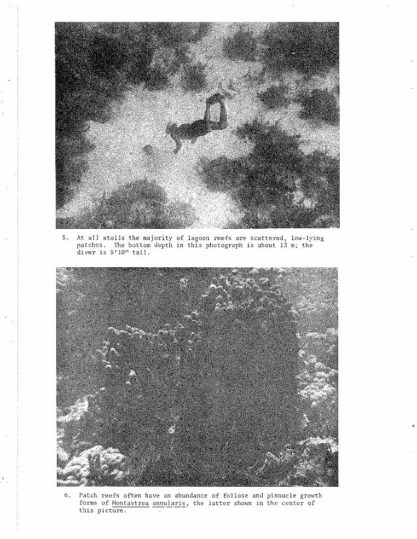
5 . A t a l l a t o l l s t he majori ty of lagoon r e e f s a r e s c a t t e r e d , low-lying pa tches . The bottom depth i n t h i s photograph i s about 13 ni; t he d ive r i s 5'10' ' t a l l .
6 . Patch r e e f s of ten have an abundance of f o l i o s e and pinnacle growth - fornis of Montastrea annu la r i s , t he l a t t e r shown i n the cen te r of t h i s

7 . Bands of beachrock extend windward from East Cay a t Courtown Cays, seemingly i n d i c a t i v e of t h e lagoonward migra t ion of t h e cay. Ta l l palm t r e e s c h a r a c t e r i z e t h e vege t a t i on on East Cay. In t h e back- ground i s t h e wreck of a Colombian s h i p , awash on t h e r e e f s .
8 . Close-up p i c t u r e of t h e beachrock bands. 1:issures a r e p a r a l l e l and perpendicu la r t o t h e s t r i k e of tlie rock.

9 . Elevated beachrock a t North Cay, Albuquerque Cays. Recent beach- rock is i n t h e foreground of t h e p i c t u r e .
10. Dense - Ficus f o r e s t a t South Cay, Albuquerque Cays.

11. Rocks emergent a t low t i d e l i n e t h e windward r i i n of t h e o u t e r r e e f a t Roncador Bank. Roncador Cay i s seen i n t h e background.
1 2 . Roncador Cay i s covered with a rubble of c o r a l heads . P i l e s o f t h e s e dead c o r a l s were once used a s w a l l s .

3. A cross-section of a lagoon patch 'reef at Serrana Bank. Tne photographs illustrate the various oommunities that characterize the different depths and environments.

A - 1 Locat ions of r e e f p r o d u c t i v i t y s t a t i o n s a t Courtown and Albuquerque Cays.
8 OUTER REEF 0 INNER REEF
DUSK DAWN --.- . L , -.I -..,.._.-- 0 8 0 0 1200 1600 ZOO? 0000 04011 0 8 0 0 1200 1600
LOCAL MEAN SOLAR TIME
A-2. Time p l o t of temperature , s a l i n i t y and oxygen v a r i a t i o n s on t he r e e f f l a t s of Courtown Cays.
B OUTER REEF O INNER REEF
DUSK DAWN --------I----------
0 8 0 0 1200 IGOO 2 0 0 0 0000 0 4 0 0 0 8 0 0 8200 1500
LOCAL MEAN SOLA6 TIME
A -3 . Time p l o t of temperature , s a l i n i t y and oxygen variations on t h e r e e f f l a t s of Albuquerque Cays.

A TOTAL REEF FLAT ISTA. 3 -OCEAN REF.)
a OUTER REEF FLAT 1STA.i- OCEAN REF.)
0 INNER REEF FLAT (STA. 3 - STA. I )
t 1 , DUSK DAWN
- 2 . 0 0 I I
0800 1200 1600 2 0 0 0 0000 0 4 0 0 0800 1200 1600 LOCAL MEAN SOLAR TIME
A-4. Calculated oxygen gain and loss on the reef flats of Courtown Cays.
4.00 -'
A TOTAL REEF FLAT (STA.4-OCEAN REF.)
a OUTER REEF FLAT 3.00 (STA.1-OCEAN REF.)
0 INNER REEF FLAT
E
Z \
CJ - 0.00
V) V) 0
-1.00
I f DUSK DAWN
-2.00 I I
0 8 0 0 1200 1600 2000 0000 0 4 0 0 0 8 0 0 1200 1600
LOCAL MEAN SOLAR TIME
A-5. Calculated oxygen gain and loss on the reef flats of Albuquerque Cays

STATION 3
'STATION 2
I 0 7 0 0 1100 1500 1900 2300 0 3 0 0 0 7 0 0 1100
LOCAL MEAN SOLAR TlME
Carboll f l x a t i o n r a t e s a c r o s s t he windi$,ard r e e f f l a t of Courtown
STATION 3
L
1100 1500 1900 2300 0300 0 7 0 0 1100 1500
LOCAL MEAN SOLAR TlME
.A-7. Carbon f i x a t i o n r a t e s a c ro s s t h e windward r e e f f l a t o f AlbuquerqueCays.