ausable river natural river plan - michigan.gov · thomas j. anderson marlene j. fluharty ......
TRANSCRIPT
AU SABLE RIVER NATURAL RIVER PLAN
ALCONA, CRAWFORD, TOSCO, MONTMORENCY, OSCODA, OTSEGO, AND ROSCOMMON COUNTIES
JULY 1987
MICHIGANATURALRevised Ma
FISHERIES DIVISION
N DEPARTMENT OF RESOURCES rch 12, 2002
FISHERIES DIVISION

Equal Rights for Natural Resource Users The MI Department of Natural Resources (MDNR) provides equal opportunities for employment and for access to Michigan natural resources. State and federal laws prohibit discrimination on the basis of race, color, sex, national origin, religion, disability, age, marital status, height and weight. If you believe that you have been discriminated against in any program, activity, or facility, please write the DNR Equal Opportunity Office, P.O. Box 30028, Lansing, MI 48909, or the MI Department of Civil Rights, 1200 6th Avenue, Detroit, MI 4826, or the Office of Human Resources, U.S. Fish and Wildlife Service, Washington, DC 20240. For information or assistance on this publication, contact DNR, Fisheries Division, Department of Natural Resources, P.O. Box 30446, Lansing, MI 48909.

AU SABLE RIVER
Alcona, Crawford, Iosco, Montmorency, Oscoda, Otsego, and Roscommon Counties
Plan Adopted and River Designated As a WILD-SCENIC RIVER by the
Natural Resources Commission
July 10, 1987
MICHIGAN NATURAL RESOURCES COMMISSION
Thomas J. Anderson Marlene J. Fluharty
Kerry Kammer O. Stewart Myers David D. Olson
Raymond Poupore
Michigan Department of Natural Resources
Fisheries Division
PREFACE The Au Sable River has the reputation for being an outstanding trout stream as well as being popular with canoeists, homeowners and other recreationists. The many outstanding natural values possessed by this river have resulted in 23 miles of the mainstream being designated by the United States Congress as a Scenic River under the Federal Wild and Scenic Rivers Act (PL 90-542). It is the intent of this plan to develop management recommendations for the Au Sable system that will help to protect its many natural qualities. Under Michigan's Natural Rivers Act, protection will include not only the mainstream, but its important tributaries as well. This plan recognizes the state and national attention the Au Sable system receives and the ever constant recreational and development pressures it must endure.


TABLE OF CONTENTS
I. INTRODUCTION ..................................................................................................1 II. AU SABLE RIVER WATERSHED ........................................................................2
A. General Characteristic ...............................................................................2 B. Accessibility ...............................................................................................2 C. Area Government.......................................................................................2 D. Stream Characteristics...............................................................................2 E. Water Quality ...........................................................................................17 F. Physiography ...........................................................................................17 G. Soils .........................................................................................................18 H. Vegetation................................................................................................22 I. Climate.....................................................................................................23 J. Fisheries ..................................................................................................24 K. Wildlife .....................................................................................................32 L. Geology and Minerals ..............................................................................35
III. EXISTING USES AND CULTURAL OPPORTUNITIES
A. Population and Way of Life ......................................................................36 B. Economy ..................................................................................................37 C. Transportation..........................................................................................37 D. Land Use and Ownership.........................................................................37 E. Recreation and Scenery...........................................................................37 F. Archaeologic, Historic and Cultural Resources ........................................44
IV. NATURAL RIVER PLAN
A. Goal .........................................................................................................48 B. Objectives ................................................................................................48 C. Proposed Designation..............................................................................48 D. Natural River District ................................................................................50 E. Residential Housing .................................................................................51 F. Industrial and Commercial Structures and Uses ......................................51 G. Building Setbacks.....................................................................................52 H. Building Design and Screening ................................................................52 I. Docks .......................................................................................................53 J. On-Site Sanitation Systems .....................................................................53 K. Signs ........................................................................................................54 L. Soil Erosion and Sedimentation Control Measures..................................54 M. Minerals ...................................................................................................55 N. Utilities and Transportation Systems........................................................55 O. Agriculture................................................................................................56 P. Disposal of Solid Waste ...........................................................................56 Q. Stream Alteration .....................................................................................56 R. Land Alteration.........................................................................................57 S. Natural Vegetation Strip on Adjacent Shoreline .......................................57

T. Recreation................................................................................................58 U. Public Access Sites..................................................................................59 V. Motorized Vehicles...................................................................................60 W. Historic and Archaeological Sites.............................................................60 X. Federal Wild and Scenic Rivers Act .........................................................60 Y. Military Use ..............................................................................................61 Z. Administration ..........................................................................................61 AA. State/Federal Cooperation .......................................................................63 BB. Management of Areas Beyond the Natural River Zone............................63
APPENDIX A - PART 305 – NATURAL RIVERS PA 451 OF 1994...............................66 APPENDIX B - NATURAL RESOURCES COMMISSION POLICY AND
PROCEDURES REGARDING THE NATURAL RIVER ACT OF 1970 ............................................................................70
APPENDIX C - RELATED LAWS..................................................................................76 APPENDIX D - “ALTERATION OF RIVERS” LAW........................................................97 APPENDIX E - DESIGNATED STREAM MILEAGE....................................................100 APPENDIX F - LOG-SOD COVERED DOCKS--DESIGN ...........................................102


1

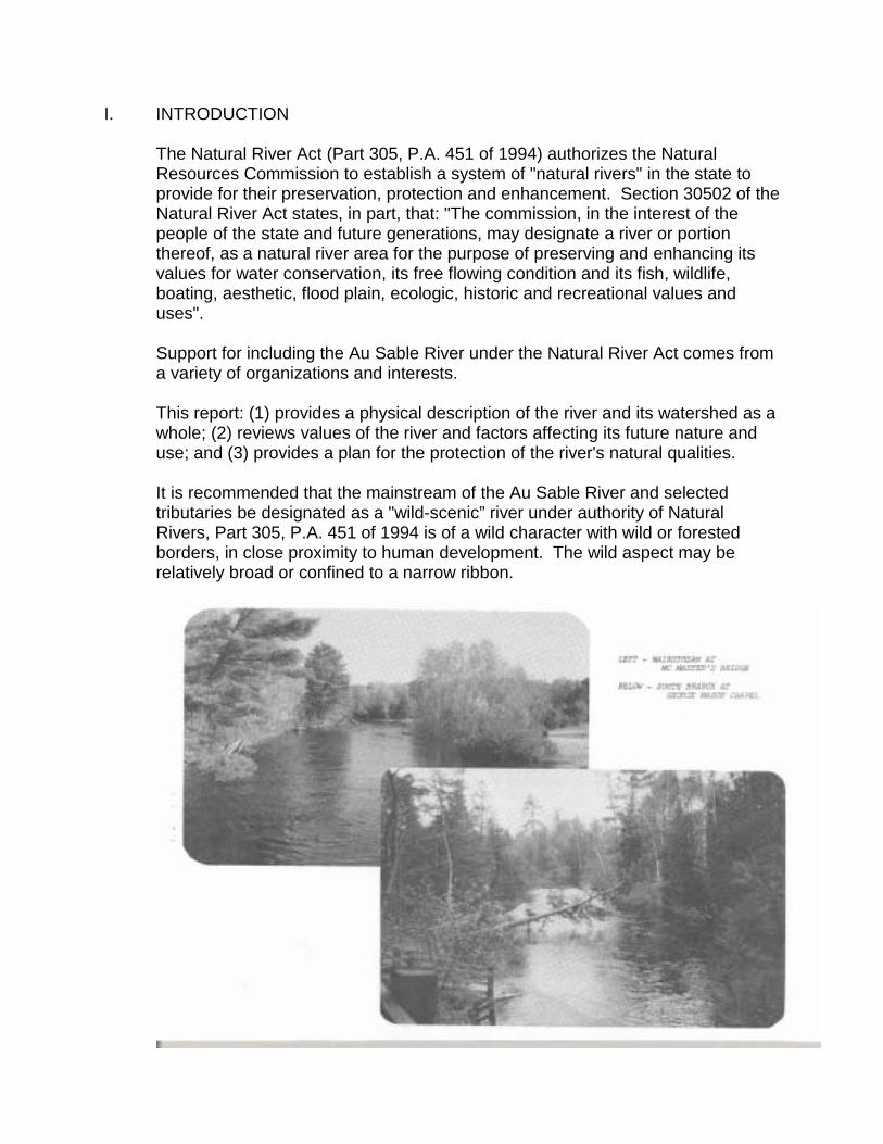
I. INTRODUCTION
The Natural River Act (Part 305, P.A. 451 of 1994) authorizes the Natural Resources Commission to establish a system of "natural rivers" in the state to provide for their preservation, protection and enhancement. Section 30502 of the Natural River Act states, in part, that: "The commission, in the interest of the people of the state and future generations, may designate a river or portion thereof, as a natural river area for the purpose of preserving and enhancing its values for water conservation, its free flowing condition and its fish, wildlife, boating, aesthetic, flood plain, ecologic, historic and recreational values and uses". Support for including the Au Sable River under the Natural River Act comes from a variety of organizations and interests. This report: (1) provides a physical description of the river and its watershed as a whole; (2) reviews values of the river and factors affecting its future nature and use; and (3) provides a plan for the protection of the river's natural qualities. It is recommended that the mainstream of the Au Sable River and selected tributaries be designated as a "wild-scenic” river under authority of Natural Rivers, Part 305, P.A. 451 of 1994 is of a wild character with wild or forested borders, in close proximity to human development. The wild aspect may be relatively broad or confined to a narrow ribbon.
2
II. AU SABLE RIVER WATERSHED
A. General Characteristics
The Au Sable is a major tributary to Lake Huron. It drains a north-south basin that includes 1,932 square miles in north-central lower Michigan. The basin is approximately 90 miles long and 10 to 30 miles wide. The river basin is partially within the Huron National Forest and includes parts of Otsego, Montmorency, Crawford, Osco, Alcona, Roscommon, Ogemaw, and Iosco counties. While technically a part of the Au Sable River Basin, many observers view the Pine and Van Etten Creek Watershed in Iosco and Alcoa counties as a separate, distinct river basin. This is due to the fact that the Pine River system drains into the large Van Etten Lake before entering the Au Sable River less than two miles from where the main river drains into Lake Huron. For the purpose of this study, the Pine and Van Etten creeks will not be considered a part of the Au Sable River system.
B. Accessibility
The river basin is readily accessible by all major forms of transportation. Interstate highway 75 is a major Michigan north-south artery. It provides ready access to the Grayling area from all of southern Michigan. Highway 23 is a major Lake Huron shore route serving the Oscoda area and providing access from all of southeastern Michigan. State highways 72, 33, and 65 are intermediate routes serving the entire river basin. Aside from several very small areas with difficult access, the basin has a heavily developed system of federal, state, county and Forest Service roads.
C. Area Government
The watershed is located within parts of the following eight counties: Otsego, Crawford, Roscommon, Montmorency, Oscoda, Ogemaw, Iosco and Alcona. The area includes some 30 administrative townships. The incorporated cities of Grayling and Roscommon are within the watershed, as are numerous unincorporated villages, including Mio, the seat of Oscoda County, and Oscoda. Gaylord, a major community, sits at the headwaters of both the Sturgeon and Au Sable rivers. Drainage to the south out of Gaylord makes its way to Lake Huron through the Au Sable River system.
D. Stream Characteristics
The Au Sable River drains an area of 1,932 square miles and drops approximately 650 feet from its point-of-origin. The average discharge at the Mio Dam from a drainage area of 1,100 square miles equals 990 cubic feet per second (cfs). On a direct drainage area ratio, the average discharge at the mouth is estimated to be 1,600 cfs.

3
There are approximately 476 miles of streams in the Au Sable River system. The mainstream is about 129 miles long and includes 37 miles of impoundments. The table on page 6 is a list of streams within the watershed (a few small unnamed streams are not included). Lengths are shown in miles.

4

5

6
AU SABLE RIVER SYSTEM Miles Au Sable River (Mainstream) 129 Bradford Creek 5 Kolka Creek 8 East Branch Au Sable 17 Barker Creek 3 Wakely Creek 2 South Branch Au Sable 37 Sauger Creek 2 Douglas Creek 3 Thayer Creek 5 Hickey Creek 4 Beaver Creek 10 Robinson Creek 5 Hudson Creek 6 East Creek 5 South Creek 2 Connors Creek 2 North Branch Au Sable 36 Turtle Creek 4 Chub Creek 5 Big Creek 1 West Branch Big Creek 18 Middle Branch Big Creek 9 East Branch Creek 14 Wright Creek 7 Whitewater Creek 2 Sohn Creek 4 Beaver Creek 5 Big Creek 4 Red Creek 2 West Branch Big Creek 14 Hunt Creek 3 East Branch Big Creek 11 Lost Creek 8 Honeywell Creek 6 Wolf Creek 3 Cherry Creek 7 Loud Creek 2 Perry Creek 9 Couchy Creek 2 Comins Creek 4 Glennie Creek 3 Nine Mile Creek 3 Blockhouse Creek 6 Wilbur Creek 5 Bamfield Creek 5 Smith Creek 5 Stewart Creek 4 Hoppy Creek 3 South Branch Creek 7 Harper Creek 4 Baker Creek 3
Wildcat Creek 2 TOTAL 476 Miles

7
There are six existing hydro-electric power plants in the Au Sable River basin, with a total installed capacity of 41,000 kilowatts and an average annual energy output of 139,000 megawatt hours (MWH). All the power plants are operated by an investor owned utility company - Consumers Energy Company of Jackson, Michigan. The six reservoirs were constructed during the period of 1911 through 1924. 1. Mainstream
a. Source to Mio
The Au Sable River mainstream originates at the junction of Kolka and Bradford creeks, approximately 2 1/2 miles north of the town of Frederick in northwestern Crawford County. The mainstream above Grayling has a narrow winding channel with occasional beaver dams and debris clogged passages. Although safely floatable from Cameron Road Bridge, it is arduous canoeing and not popular. Shallow water and partly submerged debris also discourages canoe use. The stream gradient averages 4.0 feet per mile. The stream gauging station at Grayling indicates an average discharge of 73.5 cfs -- or approximately four percent of the total discharge at Oscoda.

8

9

10
Discharge increases rapidly between Grayling and Mio. Stream flow measurements in July 1972 indicate: a discharge of 76 cfs at Grayling; 141 cfs at I-75; 230 cfs at Stephan's Bridge; 511 cfs at Beaver Bend; and 862 cfs at Mio. The increase reflects East, North, and South Branch inflow as well as groundwater flow. Current speed below Grayling varies from 2 to 4 mph depending on depth, bottom conditions, and gradient. The gradient is 4.71 feet per mile below Grayling. The river follows an occasionally narrow, sinuous course before straightening at McMaster's Bridge. It has sufficient depth for canoeing at all seasons, but heavy ice may be encountered above this area during severe winters. There are many short sections of fast riffle current, sharp turns, and occasional sweepers and down debris which constitute challenging and relatively safe floating for the novice and beginner canoeists.

11
b. Mio to Alcona
This 23 mile segment was the only portion of the Au Sable River system designated by the U.S. Congress as a component of the Federal Wild and Scenic River system. From Mio to Alcona Pond, the river has occasional large curves and many short relatively straight stretches. The river is wide, flows at a moderate speed, and has sufficient depth for safe, pleasant canoeing by beginner-novice level canoeists. It is free of all debris and sweepers but may be iced over below McKinley during severely cold winters. There are occasional short stretches of riffle.

12
Current velocity may average 2 to 4 mph depending on channel configuration and discharge increases from 982 cfs (average-1966) at Mio to 1,350 cfs (average 1909-1914) at Alcona. The increase is attributable to inflow from Cherry, Perry, Comins, Wolfe and Loud creeks, plus groundwater sources. Although the Mio Dam is still used by Consumers Energy Company for power generation, an agreement between the DNR and Consumers Energy in 1966 set Mio Dam discharge equal to pond inflow. Therefore, river discharge above and below the pond are equal and power generation should not affect the lower river flow rates.
c. Alcona to Mouth at Oscoda
Below Alcona Dam, the Au Sable flows through many large gradual curves with few straight stretches over 1/4 mile long. It is a large river at this point and has sufficient depth and width for easy canoeing. However, during power generation discharge at Alcona, the water level may rise up to four feet and create somewhat hazardous conditions for inexperienced canoeists. Although this section is relatively free of debris, the current becomes quite strong forming deep eddies and some turbulence.
13
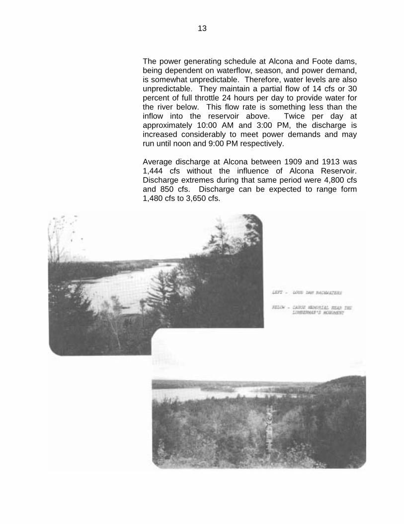
The power generating schedule at Alcona and Foote dams, being dependent on waterflow, season, and power demand, is somewhat unpredictable. Therefore, water levels are also unpredictable. They maintain a partial flow of 14 cfs or 30 percent of full throttle 24 hours per day to provide water for the river below. This flow rate is something less than the inflow into the reservoir above. Twice per day at approximately 10:00 AM and 3:00 PM, the discharge is increased considerably to meet power demands and may run until noon and 9:00 PM respectively. Average discharge at Alcona between 1909 and 1913 was 1,444 cfs without the influence of Alcona Reservoir. Discharge extremes during that same period were 4,800 cfs and 850 cfs. Discharge can be expected to range form 1,480 cfs to 3,650 cfs.

14
Conditions similar to those below Alcona also prevail below Foote Dam. However, the lower river has considerable amounts of sunken and partly submerged debris which is largely covered during high water. Average annual discharge at Oscoda in 1966 was 1,937 cfs. Discharge at Foote Dam during power generation ranges from 1,480 to 3,650 cfs.
2. South Branch
The South Branch above Roscommon follows a slow sinuous course through lowlands. The channel is narrow and frequently choked with downed trees, debris, and overhanging shoreline vegetation. Although safe, it is arduous, slow and unattractive to most canoeists. Below Roscommon, the river has adequate depth and width to provide safe, pleasant canoeing experiences. It has many gentle bends, several narrow channels and many short interesting stretches of riffle. It is relatively free of debris that would hinder canoeing, but may have several shallow stretches with exposed rock during very dry seasons.

15
August 1972, stream discharge at Chase Bridge, six miles below Roscommon was 91 cfs; Smith Bridge 136 cfs, Oxbow 178 cfs, and at the mouth, 133 cfs. The lower river below Oxbow actually loses flow from infiltration and evaporation. An average annual discharge at Smith Bridge and the mouth would be 229 cfs and 252 cfs respectively. The stream gradient from Roscommon to the mouth is 4.4 feet per mile.
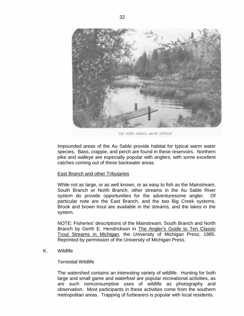
3. North Branch
The North Branch above Lovells progresses from a slow, narrow meandering stream, clogged with shoreline vegetation, to a much wider shallow river at Lovells. The vegetation, debris and shallow water make this section very difficult to navigate with a canoe. Below Lovells, the first 1/2 mile may be shallow and difficult during normal seasons but can be floated safely. The lower river has adequate depth and width for canoe use. Streamflow measurements taken in July 1971, indicate discharges of 16 cfs at Old State Road; 79 cfs at the Ford; 125 CFAs at Blackhole; 161 cfs at Lovells; 204 cfs at Kellogg; and 344 cfs at the mouth. Stream gradient from Dam #2 to the mouth is 8.7 feet per mile.

16

17
E. Water Quality
Highly stable water flows of very high quality water may be the single most significant trait of the Au Sable River. The coarse sand-gravel composition of the watershed allows rapid infiltration of water and tends to level precipitation into a steady groundwater contribution to stream flow. Water flows vary insignificantly throughout the season because most inflow is from groundwater sources. This spring seepage is also an important factor to help maintain lower stream temperature during the summer months. However, river flow rates may respond to very rapid snowmelts and some sections will experience increases in water level and turbidity. High or dangerous water conditions are rare. The greatest river discharge occurs during April following snowmelt with an average discharge at Mio from 1961 to 1965 of 1286 cfs. The average discharge drops to 1,163 cfs in May; 864 in June and 746 in July as compared to annual average of 990 cfs. In addition to a stable flow, the water quality of the Au Sable River system is very high when compared to other rivers in the state. Using the standardized Water Quality Index, the Au Sable River at its mouth is shown to average 85.9. Water quality index consists of averaging numerical values from chemical, physical and biological parameters collected from monitoring stations on the river. Parameters used in establishing the WQI are: dissolved oxygen (D.O.), Fecal Coliforms, PH, Biochemical oxygen demand (BOD5), NO3-N (nitrogen), PO4-P (phosphates, temperature, turbidity and dissolved solids. Figure I shows this average compares very favorably with other rivers in Michigan. Water quality of the Au Sable river system is protected for the following uses: (a) total body contact recreation; (b) agriculture; (c) industrial water supply; (d) navigation; and (e) public water supply. Most of the mainstream and tributaries, at least above Loud Dam are classed as cold water trout streams. Any designated stretches of the river system will governed by the "nondegradation" rule of the Water Resources Commission's water quality standards.
F. Physiography
The topography of the Au Sable river basin is rolling to flat. Maximum elevation above sea level is approximately 1,447 feet in the extreme western portion and the minimum elevation is approximately 600 feet on the extreme eastern end. The river basin has an approximate fall of 669 feet. The western half of the river basin is generally flat to slightly rolling and the eastern half is flat--broken only by stream channels.
18
Low swamps and marshes are common throughout the western half of the river basin--particularly in the river headwaters and margins. The eastern half is comparatively well drained and has relatively few lowland areas. The Au Sable's outstanding scenery is presented in dramatic fashion by constantly changing topography. Each landform situation offers an attractive and varying display of geologic and vegetative conditions. High bluffs, lowland swamps, gentle slopes, river banks, upland plateaus and marshland often fluctuate over relatively short distances and provide background for the river's outstanding scenic resources. The watershed, like all others in the State of Michigan, shows the effects of glacial action. It lies in an area once covered by the Michigan Lake of the Pleistocene glacier and is characterized by glacial moraines and outwash plains. The basin is underlain by glacial drift up to several hundred feet deep with no outcroppings of bedrock material. The morainal areas are hilly with bold detached ridges. Outwash areas are relatively flat undulating plains except where cut by stream channels. The ancient lake bed area west of Oscoda is extremely flat and was covered during ancient glacial periods by the waters of Lake Huron. There are excellent examples of the effects of the ice, water, and wind on the landscape. Kettle lakes, oxbow lakes, eskers, drumlins, kames, terraces, sandblows, and deltas can be observed in the watershed.
G. Soils
The soils of the Au Sable River are situated on three main levels--the flood plains, at the terrace level, and the outwash plain. The outwash plain was deposited as the glaciers started to recede. As the glaciers receded further and the amount of water increased, the Au Sable began to downcut through its own outwash plain, thus producing the terrace level and the present level of the river. The outwash plain is primarily a deep medium sand soil with very little organic soil development. Because of its sandy nature, water percolates through it rapidly, thus causing a water scarcity for plant life. The principle vegetation is jack pine and oak. There are some areas that have more nutrient and moisture status that support quaking aspen, red pine, and higher site oak and jack pine. On the terrace level, gravel predominates most of the soils. This gravel is found, in many cases, throughout the soil profile, ranging from 5 to 30 percent of the soil material; often it starts at 18 to 24 inches and continues throughout the profile. The texture of the layer above the gravel is sand, resembling the weakly developed soil of the outwash plain. The vegetation of this soil is jack pine and oak. Along this terrace there are many areas of well-drained, heavy textured soils and more strongly

19
developed sands that support quaking aspen, white pine, and more productive red pine. The soils in the flood plain are mostly poorly drained organics. The organic layer varies from about 6 inches to 5 feel deep. The mineral layers below are usually sand with a few having sands of finer textured materials just below the organic layer. White and black spruce, balsam fir, northern white cedar, and tag alder occur on these soils. In draws and potholes on the terrace, similar soils also occur with lowland hardwoods such as elm, ash, and paper birch. Between the flood plain and terrace, there is often a transition zone containing the moderately well-drained and somewhat poorly drained soils which are sand or heavy textured. Quaking aspen, paper birch, and balsam fir dominate on these areas.

20

21

22
The heavier textured soils that are better drained that might be used for farming occur only in small areas, and on steep slopes not conducive to farming. There is some evidence of small gravel pits, but apparently none have been commercially developed.
H. Vegetation
Vegetation is the primary contribution toward providing and protecting the Au Sable's outstanding values. The river's high scenic quality results from constantly changing vegetative types and conditions--all remaining in a relatively natural condition and in apparent harmony with other natural elements. Vegetation shades the water thereby helping maintain low water temperatures. Vegetation softens incongruities and provides habitat and food for wildlife. Soils are stabilized and developed by vegetation. The great diversity of trees, shrubs, ferns, small flowering plants, lichens, mosses and mushrooms offer an interesting variety of form, color and texture--often changing with each season.
23
Vegetation along the Au Sable River is generally typical of east central Michigan. However, two features combine to produce distinctive local plant communities within the river zone. First on the stream terraces, water from the river and local aquifers permit a greater variety of growth than that found on the surrounding plains. There is also a preponderance of silty and organic soils found on the river terraces with their associated different vegetative types. Secondly, the river winds through a variety of landforms and soil types--each having its own distinct vegetative cover. This vegetative description is not all encompassing, but describes dominant plants in either the superstory or substory for the various landforms. Over 80 percent of the watershed is forested. Major vegetative types include aspen, jack pine, red pine, oak, maple, beech, birch, and pine plantations. Lowland conifers include white cedar, balsam fir, tamarack and spruce. Original cover on the better-drained sites was predominantly red and white pine and northern hardwoods which were virtually eliminated during the early logging era. Nearly all stands are now in second or third growth cover. Vegetative types are predictable and ecologically diverse, depending on topographic situations, particularly in the river zone. The well-drained sites support stands of northern hardwood, aspen or red, jack, and white pine. They often cover extensive upland areas, are productive and generally even-aged. They provide good summer range for wildlife and support many varied forms of ground vegetation. Lowland areas have higher water tables and poor drainage. Lowland conifers, hardwoods and shrubs dominate these sites. These lowland areas tend to be less extensive, are spotty, follow stream courses and are densely vegetated. They tend to be excellent deer winter range and have rich variety of ground vegetation.
I. Climate
The Au Sable River basin offers a climate typical of the state's "north country". The warm days and cool nights offer a pleasant haven for vacationers. The winters provide an excellent climate for skiers, snowmobiling, and other winter sports. Weather data for the Au Sable basin indicates a record high of 112 degrees F with the record low of -47 degrees F, both recorded at Mio. A temperature of 100 is reached on an average of once in 10 years. At the other extreme, one can expect temperatures to fall below zero an average of 25 days per year. The average yearly temperature for the basin is 43.1 degrees F.

24
Precipitation is heaviest during the summer season averaging 63 percent of the annual total during the six month period, April through September. Heaviest rainfall for the basin is in September which shows an average of 3.38 inches. Lowest rainfall occurs in February with an average of 1.30 inches. Annual precipitation averages 28.30 for the 24 years of record. Summer skies tend to be generally free of cloud cover and westerly breezes are nearly constant. Winter skies are generally cloud covered and windy.
J. Fisheries
Au Sable River Mainstream Michigan's Au Sable River probably is the best brown trout water in the Great Lakes region, and it may be the best east of the Rockies. The flies-only section of the river, sometimes called the "Holy Water", is ideal fly water, with good insect hatches and excellent trout populations--all stream bred. Most of it is shallow enough for easy wading, has a firm gravel bottom, and is wide enough that you can cast a fly without hanging up on streamside vegetation. The velocity of flow is only moderate, so you can wade upstream or down, depending on your energy and inclination. From Grayling to Burton's Landing, about 6 river miles, much of the river bottom is sand, and some parts are too deep to wade. Trout populations are low in this part of the river, and fishing pressure is light most of the season. However, during the so-called caddis hatch (Hexagenia limbata), some very large trout are caught in this section. The "Holy Water" section of the river begins at Burton's Lansing and continues downstream about 8 river miles to Wakeley Bridge. In this section, the river gradient is steeper, the flow a little faster, and trout populations much greater than in the upstream reaches. This section is fished more than any other part of the river. Nevertheless, it continues to yield excellent fishing, year after year.
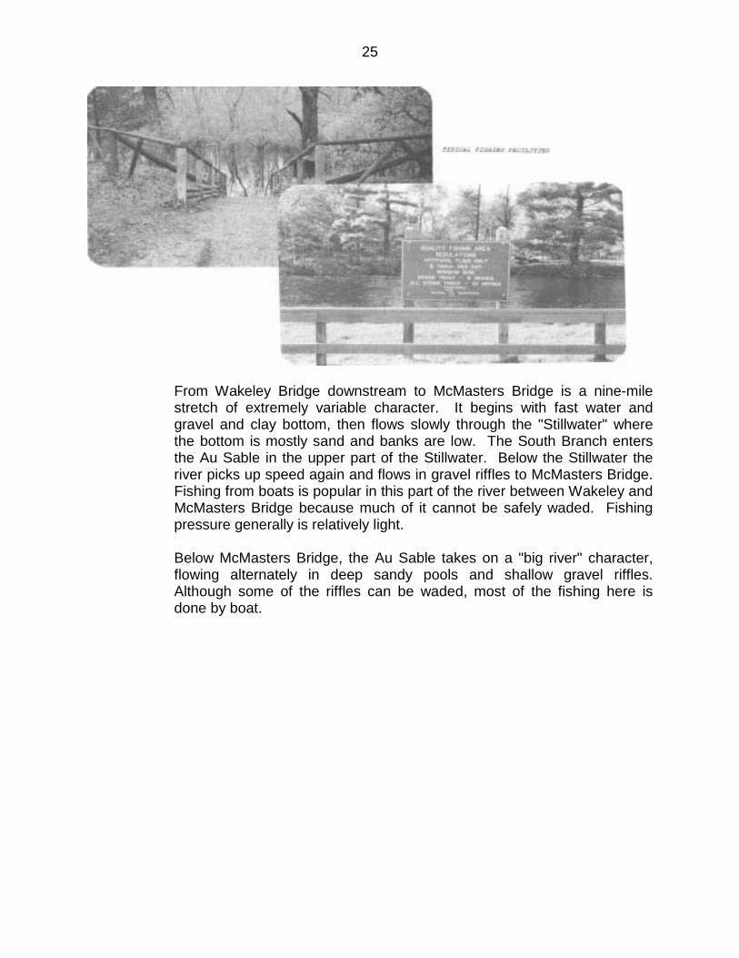
25
From Wakeley Bridge downstream to McMasters Bridge is a nine-mile stretch of extremely variable character. It begins with fast water and gravel and clay bottom, then flows slowly through the "Stillwater" where the bottom is mostly sand and banks are low. The South Branch enters the Au Sable in the upper part of the Stillwater. Below the Stillwater the river picks up speed again and flows in gravel riffles to McMasters Bridge. Fishing from boats is popular in this part of the river between Wakeley and McMasters Bridge because much of it cannot be safely waded. Fishing pressure generally is relatively light. Below McMasters Bridge, the Au Sable takes on a "big river" character, flowing alternately in deep sandy pools and shallow gravel riffles. Although some of the riffles can be waded, most of the fishing here is done by boat.
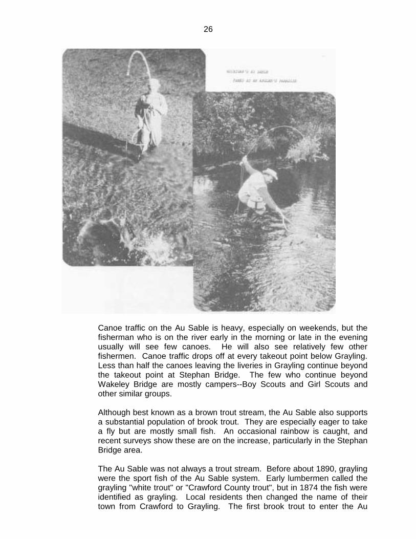
26
Canoe traffic on the Au Sable is heavy, especially on weekends, but the fisherman who is on the river early in the morning or late in the evening usually will see few canoes. He will also see relatively few other fishermen. Canoe traffic drops off at every takeout point below Grayling. Less than half the canoes leaving the liveries in Grayling continue beyond the takeout point at Stephan Bridge. The few who continue beyond Wakeley Bridge are mostly campers--Boy Scouts and Girl Scouts and other similar groups. Although best known as a brown trout stream, the Au Sable also supports a substantial population of brook trout. They are especially eager to take a fly but are mostly small fish. An occasional rainbow is caught, and recent surveys show these are on the increase, particularly in the Stephan Bridge area. The Au Sable was not always a trout stream. Before about 1890, grayling were the sport fish of the Au Sable system. Early lumbermen called the grayling "white trout" or "Crawford County trout", but in 1874 the fish were identified as grayling. Local residents then changed the name of their town from Crawford to Grayling. The first brook trout to enter the Au

27
Sable system reportedly were taken from the Jordan River and planted in the East Branch of the Au Sable by Rube Babbit in the 1880's. Rainbow trout had been planted somewhat earlier and browns came shortly after. Grayling became scarce soon after the trout appeared, but few of the old-time residents blame the trout for this. Apparently the grayling was less tolerant to changing conditions than the trout, and it is doubtful if the grayling could have survived even if trout had not entered the river. The last grayling reported caught in the Au Sable mainstream was taken by Dan Stephan in 1908 about three miles above McMasters Bridge. Recently, however, grayling have been reintroduced by the Department. In April 1987, 40,000 seven-inch fish were released into the mainstream near Mio. If successful, the grayling may be caught and kept within 1-2 years. The Au Sable is excellent trout habitat because it is relatively steady in flow, has generally cool summer water temperatures, and, in most of the upper river, ample clean gravel spawning beds. About 85 percent of the flow of the upper Au Sable is from groundwater discharge, so the stream is not subject to large changes in stage or velocity. In an average year it is only about one foot higher at high water than at normal low flow. Unusually great snow melt or heavy rains can bring this up a bit, but the Au Sable is generally a remarkably steady stream. As pointed out earlier, however, a rise of even six inches can make wading much more difficult. The groundwater inflow also helps to keep the Au Sable cool in summer. Water temperatures sometimes go higher than 75 degrees F in the sandy area below Grayling, but the water rarely gets that warm in the flies-only section. Brook trout, the least tolerant of warm water, seem to thrive in this section of the river. There are excellent hatches of almost all Michigan flies on the Au Sable. Hatches are especially good on the flies-only section, except for the drake and Hexagenia hatches. These hatches are better in the sand and silt sections of the river, both above and below the flies-only water. For the fisherman who wants to fish the lower unwadable waters, there are expert guides with Au Sable riverboats at your service. The Au Sable riverboat was designed expressly for trout fishermen on the Au Sable, but it is now used on many Michigan streams. You can cover a lot of water in a day's fishing in one of these. Float fishing is especially helpful to those fishermen whose physical condition no longer permits them to wade the stream. South Branch - Au Sable River The South Branch of the Au Sable is the favorite of many anglers who are especially interested in catching big browns. It is not always an easy river to fish, however. In the early season, and after heavy rains at any season,

28
the river flows fast, high, and murky, and the rounded cobbles and boulders are slippery. The flow of the South Branch is much more variable than that of either the mainstream or the North Branch. Consequently, wading and fishing conditions change greatly from day to day. The reach you waded with ease one day may be totally unwadable another, and the cover that harbored some huge trout on one day may be left high and dry after a long drought. The water is clear at normal low flows but becomes so cloudy after heavy rains that you may not be able to see the deep holes that will overtop your waders. Trout populations generally are lower on the South Branch than on the mainstream or North Branch (Gowing and Alexander 1980), but fishermen who know the river do well on the South Branch. Fishing pressure is heavy on the South Branch during the drake hatch and even heavier during the Hexagenia hatch. A survey by Gaylord Alexander (1974) showed that evening fishing in the Mason Tract of the South Branch increased from about 75 angler hours per day in the first week of June to about 375 angler hours per day in the fourth week of that month. In the first week in July fishing had dropped to about 270 angler hours per day. Before and after these hatches of the large mayflies, fishing pressure is light to moderate. In general, the farther you walk from the access roads, the better your chances of fishing alone on the river. But you also run a better chance of getting lost going to and from these remote spots. From its source in Lake St. Helen to Roscommon, the South Branch is too warm to support a good trout fishery, and it does not become a really first class troutwater until it reaches Chase Bridge, about six river miles below this city. From Chase Bridge all the way down to Smith Bridge, about 12 river miles, the South Branch is classic fly water. This stretch of river, called the Mason Tract after the donor, George Mason, has an interesting history. According to Mrs. Margaret Jenson (1982), most of the Mason Tract was formerly a club property owned by a Mr. Downey and several others. When the club broke up, Mr. Downey purchased all the forties fronting the river. Mr. Downey died in 1921, and several years later his widow sold the property to her nephew, Mr. Durant, who built the ill-fated "castle" on the South Branch below Chase Bridge. Mr. Durant's widow in turn, sold the land to George Mason and D. B. Lee, and D. B. Lee's widow sold Lee's share to Mr. Mason. In accordance with Mr. Mason's wishes, this tract, now state property, remains free of all development except for a simple log chapel and one campground. The river is 50 to 100 feet wide here and mostly two to four feet deep at mid-channel, with many holes over your wader tops and few over your head, even at low water. The streambed is mostly gravel, with sand and muck along the banks and in some of the deeper holes. There are large boulders in places and some patches of hard, slippery clay.

29
From Smith Bridge to the mouth, about five river miles, the riverbanks on both sides are mostly private property, and there is no improved public access to this part of the river. You can put in at Smith Bridge, float down to the mouth, and then continue on down the mainstream to Connors Flat Public Access Site or Rainbow Bend Campground. Much of this lower river is too deep to wade, and some of the holes are over your head. As you approach the Stillwater section of the mainstream, the South Branch flows more slowly and the bottom is more sandy. Bait and spin fishing is permitted above Chase Bridge, but from Chase Bridge all the way to the mouth, about 17 river miles, the South Branch is designated quality fishing water limited to fly-fishing. In addition, the four river miles from Chase Bridge downstream to the Lower Highbanks are designated no-kill water. All fish caught here must be returned to the river.

30
As a canoe trail, the South Branch is almost as popular as the mainstream. Liveries at Roscommon supply rental canoes and put-in and take-out service. The fisherman may find the canoes interrupt his fishing at midday, but there will be a few canoes on the river in the very early morning or late evening. Not much fishing is done from boats on the South Branch, but this is one way you can fish the more remote spots without fear of getting lost. From Roscommon downstream to the mouth, the South Branch has enough groundwater inflow to keep the summer temperatures cool enough for trout. Like all streams in this part of Michigan, the water is hard and high in calcium and magnesium, and slightly alkaline. The supply of nutrients is adequate to support the species on which the trout feed. The gravel bottom that predominates at mid-channel provides ample spawning beds, and the sand and muck along the banks and in the deeper holes give rise to excellent drake and Hexangenia hatches. North Branch - Au Sable River Although not so famous as the Au Sable mainstream, the North Branch is a top-quality stream for brook and brown trout. It is not so heavily fished as the mainstream and has practically no canoe traffic, so you have a better chance of fishing alone here. Much of the river frontage north of Lovells is state land, and there is ample public access here. Downstream (south) from Lovells there is relatively little public land, and access is limited. The North Branch begins as an overflow from Otsego Lake in southern Otsego County and flows generally southeastward to the north Crawford County line. Here it turns out the village of Lovells, thence south and southeast to enter the mainstream about a mile below McMasters Bridge. Because it drains several lakes in the headwaters, the upper North Branch is too warm in summer for ideal trout water, but inflow of groundwater cools the stream so that it supports a good population of trout before it turns south into Crawford County. From the north line of Crawford County all the way to the junction with the mainstream, the North Branch provides good fishing, but that part of the river upstream from Lovells (about five river miles) is the favorite of many anglers. The flies-only water of the North Branch begins at the Sheep Ranch Public Access Site above Twin Bridge and continues downstream about 21 river miles to the mouth. Much of the river in Otsego County and all the river in Crawford County is wide enough for fly-casting, but some parts are too deep to wade. The North Branch in the Lovells area has been dubbed "old man's fishing", because it is mostly only knee deep and
31
easy wading, but there are holes both upstream and down that will overtop your waders. The width of the North Branch is much more variable than that of the mainstream or South Branch. From its confluence with Chub Creek in southern Otsego County all the way to the mouth, it varies in width from about 40 to more than 150 feet. The changes in width can be quite abrupt and should be a warning to wading fishermen. When the stream narrows the depth or velocity, or both, must increase, and wading will be more difficult, and, in places, impossible. The National Guard Artillery Range borders the upper North Branch on the south in Otsego County and on the west in Crawford County. For obvious reasons, fishermen should avoid crossing over into the military reservation. The North Branch can be canoed from the Pipe Springs Public Access Site near the north Crawford County line all the way to the mouth, but not many canoeists care to make the trip. There are logjams and in-stream structures to avoid, and gravel riffles and sandy shoals to pull through at low water. The North Branch was considered even better than the mainstream for brook trout in the late 1800s, according to William B. Mershon (1923). The railroad had been extended from Grayling through Lovells, and this little village became famous as a center for trout fishermen. The North Branch is still a top-notch brookie stream today, although the catches are nothing like those of the old days. There are fewer browns than brookies in the upper North Branch, but the browns run to larger size. The summer water temperatures on the upper North Branch occasionally go as high as 80 degrees F, higher than on the flies-only section of the mainstream and much higher than the optimum for brook trout. It is probable that the trout protect themselves from the high temperatures by seeking out the colder areas where large amounts of groundwater enter the stream. Large schools of brook trout also can be seen in springs areas in late summer. The flow of the North Branch is remarkably stable, somewhat more stable than the mainstream and much more stable than the South Branch. Wading conditions do not change as drastically on the North Branch as on the South Branch, but caution is still advised when wading the deeper reaches. Because of the warmer water, fly hatches may occur earlier on the North Branch than on the mainstream or South Branch.
32
Impounded areas of the Au Sable provide habitat for typical warm water species. Bass, crappie, and perch are found in these reservoirs. Northern pike and walleye are especially popular with anglers, with some excellent catches coming out of these backwater areas. East Branch and other Tributaries While not as large, or as well known, or as easy to fish as the Mainstream, South Branch or North Branch, other streams in the Au Sable River system do provide opportunities for the adventuresome angler. Of particular note are the East Branch, and the two Big Creek systems. Brook and brown trout are available in the streams, and the lakes in the system. NOTE: Fisheries' descriptions of the Mainstream, South Branch and North Branch by Gerth E. Hendrickson in The Angler's Guide to Ten Classic Trout Streams in Michigan, the University of Michigan Press, 1985. Reprinted by permission of the University of Michigan Press.
K. Wildlife
Terrestial Wildlife The watershed contains an interesting variety of wildlife. Hunting for both large and small game and waterfowl are popular recreational activities, as are such nonconsumptive uses of wildlife as photography and observation. Most participants in these activities come from the southern metropolitan areas. Trapping of furbearers is popular with local residents.

33
In the big game category, white-tailed deer are the most important species. Deer benefited from plant succession following the logging and wildlife era in the late 1800's and early 1900's. Carrying capacity of the range and then subsequent deer populations rose dramatically about 1920. Populations exceeded the carrying capacity in the 1930's, leveled off in the 1940's, declined again in the 1950's and has again leveled off. A controlled harvest has helped to balance the population with habitat conditions. River bottomlands and adjacent uplands are used by deer as winter habitat. Black bear, bobcat and coyote can also be found in the watershed, but are infrequently seen. The river basin area contains 35 percent of the huntable population of wild turkeys in Michigan and is one of three such areas in the state. Hunting is controlled by a permit system. The birds are the result of an intensive management and stocking program by the Department of Natural Resources in cooperation with the Forest Service. The presence of these magnificent birds adds much to the wildlife attraction of the area. The river area is used extensively by waterfowl and shore birds for nesting and brood rearing during the spring and summer. Upland game birds found in the area are ruffed grouse, woodcock, turkey, and, in farm areas, ring-necked pheasant. Small game species include cottontail rabbit, snowshoe hare, fox and gray squirrel. At least 70 species of nongame birds are known to nest in the watershed. In addition, many other species migrate through the area. A complete list of nesting and migrating species would number well over 100. Fur bearers open to trapping include beaver, muskrat, mink, otter, red fox, raccoon and skunk. Fur prices have increased so that trapping has become a commercial enterprise as well as a sport. Other Animals Many other creatures are indigenous to the area. In and along the river, several species of nonpoisonous reptiles such as the blue racer, common water snake, hog nose snake, snapping turtles, painted turtle, and soft-shelled turtle can be found. Various frogs, toads, lizards, and salamanders are also commonly observed. Threatened and Endangered Species The northern bald eagle (Haliaeetus leucocephalus, washingtoniensis) is currently being considered for listing as endangered in the "Lower 48" states except in the Great Lakes states where it is listed as threatened on the federal list.

34
Currently, there are five pair of northern bald eagles actively nesting along the Au Sable River. The results of their nesting attempts has been quite variable. In recent years, there has been a marked improvement in success with four of the five raising young in 1976. The eagles along the Au Sable have been able to continue nesting with better success than in other areas of lower Michigan. The probable reason for this is that their nests are in relatively inaccessible locations that prevents both inadvertent and intentional harassment by people; and, the relatively low amounts of persistent pesticide contamination in the fish eaten by eagles from the Au Sable. If the bald eagle is to persist as a viable part of the fauna of the Au Sable, their nesting sites must not be intruded upon the river must remain free of the pollutants that adversely affect this and other life forms. The Kirtland's Warbler (Dendroica kirtlandii) has been classed as an endangered species, and its status has become increasingly perilous since 1961. Its nesting population was 200 pairs in 1976, only 40 percent of the 502 pairs counted in 1961. The Au Sable watershed is the heart of the nesting range of this species. It is noted that the first nest to be found of this species was in 1903. This rare warbler has been found nesting in several suitable sites located in close proximity to the river. Some of the jack pine stands on suitable sites

35
along the river are being considered for management as critical habitat as set forth in the "Recovery Plan for the Kirtland's Warbler".
L. Geology and Minerals
The watershed, like all others in the State of Michigan, shows the effects of glacial action. It lies in an area once covered by the Michigan Lake of the Pleistocene Glacier and is characterized by glacial moraines and outwash plains. The basin is underlain by glacial drift up to several hundred feet deep with no outcroppings of bedrock material. The morainal areas are hilly with bold detached ridges. Outwash areas are relatively flat, undulating plains except where cut by stream channels. The ancient lake bed area west of Oscoda is extremely flat and was covered during ancient glacial periods by the waters of Lake Huron. The streamflow and water temperature characteristics are strongly influenced by the geology of the basin. Permeable sand and gravel in the outwash areas contribute relatively large amounts of groundwater discharge to the river. This groundwater maintains the flow during drought periods and cools the stream during the hot summer months. These areas also buffer sudden changes in river levels, thus reducing the probability of flash flooding. There are excellent examples of the effects of the ice, water, and wind on the landscape. Kettle lakes, oxbow lakes, eskers, drumlins, kames, terraces, sandblows, and deltas can be observed. Sandstones, shales, and small amounts of limestone directly underlie the unconsolidated glacial deposits. The shales, in some instances, are suitable for use in manufacturing brick and tile. Relatively shallow oil and gas fields are scattered over much of the watershed. In addition to oil and gas, bromine, calcium, chloride, and calcium magnesium chloride are either obtained directly from wells or produced from materials derived from the wells. The general area, including all the lands contained in the watershed, is being subjected to a great amount of oil and gas lease activity and exploration. Geophysical work has been conducted over a large portion of the area. The present exploration activity is directed toward locating and testing coral reef developments in the older limestone formations. A few tests have been successful but the exploration activities in the deeper horizons are in an early stage. Other than sand and gravel deposits, oil and gas are considered the only mineral resources with significant value in this area.
36
III. EXISTING USES AND CULTURAL OPPORTUNITIES
A. Population and Way-of-Life
Residential population within the Au Sable watershed has experienced a steady increase in the past 20 years. The counties encompassing the basin have grown approximately 60 percent in the same 20-year period. The State of Michigan population grew less than 30 percent in those years. The average density across the basin is approximately 11 people per square mile. This compares to 22 per square mile in the northeast region and 156 per square mile for all of Michigan. Most local units shared in this accelerated growth in this past decade. The U.S. Census tells us that 29 of the 30 townships grew faster than the state's average of 13.4 percent in 10 years. Oscoda is the basin's largest town with a population of 3,475. This does not include Wurtsmith AFB, although a portion of this population may be due to Air Force families living outside the air base itself. Oscoda's growth can be attributed to the attractiveness of Lake Huron lakeshore properties and the northern rural environment to people from the Detroit, Saginaw, and Fling areas. Populations in other major basin towns, Grayling -- 2,143, Roscommon -- 850, and Mio -- 1,000 are increasing rapidly. This is due largely to the physical attractiveness of the area and easy access from urban areas via interstate highway 75. The basin is rural in lifestyle. A distinctively small town atmosphere prevails in all towns of significance in the river basin. Tourist services, very light manufacturing, and forest related industries are the major employers. A significant portion of the local population is seasonal and/or retirement. Seasonal populations are particularly heavy during June, July and August. These trends can be attributed to more leisure time and greater interest in seasonal outdoor activities.
B. Economy
The present economy of the Au Sable basin relies on light manufacturing, retail trade, forest products, and recreation. Industries such as forest products and recreation are obviously dependent on the regional resources. The manufacturing sector, which would include processing of forest products, is the leading employer in the region employing 30.6 percent of all regional employees. This, however, is considerably lower than the statewide factor of 43.0 percent of all employees in that sector. Significantly, the second leading employment sector, as 30.1 percent is retail trade. This figure is well above the state average of only 18.9

37
percent. Recreational services employ approximately 16.6 percent of the region. The 60,250 person labor force in the study area suffered an unemployment rate of 13.8 percent in 1976, compared to state unemployment of only 10.1 percent for the same period. Also lower than state levels was the per capita income of the region. The mean income level for all counties in the region was only $3,776 in 1974, compared to a state average of $5,880.
C. Transportation
The river basin is readily accessible by all major forms of transportation. Interstate highway 75 is a major Michigan North-south artery. It provides ready access to the Grayling area from all of southern Michigan. Highway 23 is a major Lake Huron shore route serving the Oscoda area and providing access from all of southeastern Michigan. State highways 72, 33, and 65 are intermediate routes serving the entire river basin. Aside from several very small areas with difficult access, the basin has a heavily developed system of federal, state, county and Forest Service roads. Con Rail lines serve Roscommon, Gaylord, and Grayling (freight service only). The Detroit and Mackinac rail lines serve the Oscoda and Harrisville areas. Commercial airline service is available at Alpena and Wurtsmith Air Force Base offers commercial freight service. Private aircraft may land at small public airports in Tawas, Harrisville, Mio, South Branch, Roscommon, Grayling and Gaylord. Commercial service is generally very limited in the central and western part of the basin and flights must be made through Traverse City.
D. Land Use and Ownership
Throughout Michigan in general, and in the Au Sable basin in particular, historic settlement patterns have led to fairly predictable land ownership patterns today. Since 1817, the choice productive agricultural lands, especially those with water and fertile soils, have been homesteaded and thereby taken out of public domain. The heavily timbered land was acquired by lumber companies and private individuals. The remaining area became public land (the Huron National forest was established in 1909) and state forests. The original heavily timbered land was cut over and either held by the owners, sold to the state and federal governments, or became tax delinquent and subsequently public land. Attempts at agriculture have been largely unsuccessful in the river basin. Early homesteaders tried promising areas but moved on when the land
38
"played out". Agricultural land now accounts for eight percent of the river basin land area. Beginning in 1909, large portions of unclaimed public domain land in the basin, especially unproductive timberland, became state and national forests. Tax delinquent "land that no one wanted" was added to this, and national forests now comprise five percent of the total basin area. State forests were also formed during this period and now comprise five percent of the total basin area. State forests were also formed during this period and now comprise 29 percent of the basin land area. An additional three-percent of the basin land area is administered by the Michigan National Guard. In the early 1900's, Consumers Energy Company became interested in the hydroelectric potential of the Au Sable River. The river's power was harnessed with the construction of Mio Pond Dam in 1916; Alcona Dam in 1924; Loud Dam in 1913; 5-Channels Dam in 1912; Cooke Dam in 1911; and Foote Dam in 1918. The hydroelectric development involved purchase of 13,010 acres within the watershed, or one percent of the total river basin acreage. Private interest in the land has increased during the past 25 years but is directed primarily toward the basin's recreation value and residential development. This increased interest has led to extensive subdivision and seasonal and retirement home development, primarily along the river. Private land accounts for 62 percent of the basin land area.
E. Recreation and Scenery
There is a high proportion of public and quasi-public land in the basin--state forests, national forests, and Consumers Energy Company. In addition, a number of state, federal, local government and private recreation facilities and areas are available and adequately developed for public use. There are 15 public campground facilities and 25 public access sites available along the Au Sable. Overnight and access facilities are well located and developed to meet public needs. Several overnight facilities have been upgraded during the past few years to better protect the sites, screen them from the river, and improve site quality. All the above facilities have been provided by state or local governments. Recreation opportunities are diverse and year-around activity in the river basin is increasing. More leisure time and increased interest in snowmobiling and cross-country skiing have opened the winter seasons to more recreationists. More and better winter sport facilities and equipment have also encouraged people to enjoy the winter out-of-doors.

39
Au Sable River fishing has attracted anglers since the very late 1800's. Today the river is rated as one of the most productive trout streams in the United States. The Michigan grayling captured the attention of early anglers, but brown trout were introduced long before the grayling disappeared. Brown, brook and rainbow trout are responsible for the river's reputation today. Trout fishing develops in early spring and extends throughout the summer. It offers outstanding fishing opportunities and attracts anglers from throughout the midwestern United States. The Michigan recreation plan indicates fishing participation in the eight county region at 103,000 days annually with use projected to increase approximately 10 percent by 1990. A significant portion of the increased fishing use may be for anadramous fish in the rivers and Lake Huron. The anadramous fishery has developed in the lower Au Sable during the past 10 years. Fish migration upstream is restricted by Foote Dam. However, the program has been highly successful and attracts vast numbers of anglers during the spring and fall seasons.

40

41

42
Developed Public Access Points Developed Campground Facilities
Capacity 1/ Capacity 2/ 1. AuSable Canoe Camp 15 1. AuSable River Canoe Camp 190 2. Burton's Landing 24 2. Burton's 60 3. Keystone Landing 4 3. Keystone 90 4. Stephan's Bridge 25 4. White Pine Canoe Camp 300 5. Wakely Bridge 15 5. Rainbow Canoe Camp 35 6. White Pine Canoe Camp 20 6. Parmallee Bridge 75 7. Cannors Flats 10 7. Luzerne Township Park 150 8. Rainbow Canoe Camp 10 8. Old Orchard County Park 2000 9. McMaster's Bridge 20 9. Curtis Township Park 816 10. Parmelee Bridge 6 10. Curtis Township Park 660 11. Luzerne Township Park 8 11. Rollways 105 12. Camp 10 Bridge 7 12. Monument 100 13. Mio Access 25 13. Sheep Pasture 60 14. Rollways 50 14. Canoe Harbor 520 15. Old Orchard County Park 55 16. Sheep Pasture Camp 23 Total 5161 17. Smith Bridge 25 18. Canoe Harbor Camp 19. Chase Bridge 12 20. Beaver Creek 12
Total 366
1/ Numbers of cars for which space is available. 2/ Capacity expressed in numbers of "people at one time" (PAOT)
Canoeing could account for the highest single use on the Au Sable River. The canoeing season extends from late spring through Labor Day. A University of Michigan study indicates approximately 50,000 canoes traveled on the Upper Au Sable in 1971. This would include 25,000 canoes on the Grayling mainstream; 10,000 on the Mio mainstream and 15,000 on the South Branch. The Michigan Recreation Plan (1974) projected a 10.1 percent increase in canoeing by 1980 for the eight county region. In recent years, various factors have contributed to a significant decrease in the canoe traffic originating in Grayling. The factors which have reduced rental canoe traffic include the changing travel patterns by vacationers triggered by the late 70's oil/gas shortages and the large increase in the number of rental canoes that have become available on other Michigan waterways.

43
Area liveries estimate a significant decrease in canoe rental traffic, as compared to the 1971 level. The only increasing segments of canoe traffic are private canoes, those that have been purchased by scout, religious, or fraternal organizations and "you-haul" canoes rented in other areas and brought into the area by the users. Canoe use is concentrated in the Grayling to Stephan's Bridge and South Branch sections. The Foote Dam to Oscoda section receives very light canoe use and the Alcona to Loud Pond section and North Branch have no measurable canoe use. Mio, Alcona, Loud, 5-Channels, Cooke, and Foote Ponds are Consumers Energy Company reservoirs and are available for public recreation use. The six reservoirs provide 6,625 acres of water for warm water fishing, boating, canoeing, and swimming. In addition, there are six camp-picnic sites available along the shorelines and public access sites to each reservoir. In the fall, deer, ruffed grouse, and rabbit hunting are the primary recreational pursuits in the basin. Waterfowl are also hunted but to a lesser degree.

44
Skiinng and snowmobiling have increased significantly during recent years. The eight county area has 11 ski areas, or 17 percent of the state's downhill ski runs. The Michigan Tourist Council reports skiing increased from 65,000 to 350,000 skiers during the 1954-1970 period. A large percentage of the increase is attributed to cross-country skiing. Although a large percentage of the snowmobiles are registered in the downstate urban areas, the heavy use occurs in the north country. The availability of heavy snow cover, public lands, and developed trails are the main attractions. The Au Sable River corridor is a well known, outstanding, scenic resource in the river basin and Midwest. It rates very high when compared with other rivers in the region. Its major scenic attractions are relatively undeveloped shorelines, high quality water, diverse vegetation, and sinuous course. Scenic qualities of the river basin may be typical of the north one half of Lower Michigan. The rural landscape is heavily forested and broken by occasional small farms, towns, swamps, lakes, and streams. This is also an area of extensive jack pine sand plains without physiographic or vegetative variety. It lacks vistas and variety afforded by broken topography. Scenery rated typical within the basin would be considered outstanding in other areas of the Midwest.
F. Archaeological, Historic, and Cultural Resources
The Au Sable River basin is almost archaeologically unknown. Virtually no systematic survey of the area has ever taken place. The few reported sites are primarily accidental discoveries with the exception of one major site near Oscoda. There is also little doubt that human action in the form of damming, logging, and other development has destroyed sites. Nevertheless, it is likely that a comprehensive survey of the Au Sable would yield numerous (albeit small) sites. It is speculated that the Au Sable and Manistee rivers provided prehistoric inhabitants with an almost uninterrupted passage from Lake Michigan to Lake Huron, but its use has not been substantiated. Frenchmen may have explored portions of the river as early as 1688, but the area remained a mystery to white men for almost 150 more years. Some early atlases did not include the river on charted maps, and several names were applied to it. A 1795 United States gazetteer, for example, referred to it as the Beauais River. The area was labeled as inaccessible and essentially worthless in an inaccurate yet widely circulated survey. Alexis DeTocqueville, who visited Saginaw in 1831, warned that the territory northward was "covered by an almost impenetrable forest which extends uninterruptedly . . . full of nothing but wild beasts and Indians." Not everyone was discouraged by these observations, however. In 1835, several traders explored the Au Sable and small-scale logging operations commenced soon thereafter.

45
The end of the Civil War, along with a huge influx of eastern capital, accelerated the growth of the logging industry. An 1899 timer survey found that, in contrast to earlier reports, the region contained extensive timber stands. Furthermore, the Au Sable River itself was wide, deep, and had few meanders; it was, therefore, an almost perfect river for logging drifts. Beginning in the late 1860's, the industry grew at an astounding rate. The occasional warnings of the rapid depletion of the forests were ignored by the lumber industry, which felt the timber supply virtually unlimited and, in any case, was committed to a "cut and get out" policy. Oscoda was the center of lumbering in the Au Sable river basin. Its mills sawed as much as 75 million board feet per year. Meanwhile, the extension of the railroad to Grayling in 1878, followed by narrow gauge inland spurs, accelerated the industry's growth. The atmosphere of the boom was contagious and colorfully reported in such newspapers as Grayling's Crawford Weekly Avalanche. Some people, such as H. M. Loud of Oscoda, made fortunes. Most loggers, however, made subsistence wages, and labor disputes were frequent. A strike in 1884 at Oscoda almost led to the entry of militia. The logging industry faded rapidly after 1890, and the rise of recreation in subsequent years barely compensated for the transformation of forested land into cutover, sandy acreage. There was one last brilliant chapter to the industry. A large tract of cork pine in northwestern Crawford County, near the headwaters of the Mainstay and the Au Sable's Middle Branch remained untouched. It was owned by David Ward, a famous lumber speculator who had explored the area in the 1850's. Upon Ward's death in 1900, his heirs discovered that the estate required execution by 1912. The town of Deward was constructed in 1901 to harvest the timber. It included housing, a school, and one of the world's largest mills. By 1912, the forest was denuded and Deward was abandoned. A few rotting buildings now mark the site of this ghost town. Ironically enough, Hartwick Pines, the state's last virgin White Pine Forest, lies only a few miles to the southwest. The Au Sable's cultural value is most evident in the way it has influenced visitors and residents of the surrounding countryside. People can attain a greater appreciation of natural beauty and outdoor activity by visiting an outstanding natural area. The river has fostered legends, which, through the years, impart a sense of feeling and appreciation for early river people and their lives.

46

47

48
IV. NATURAL RIVER PLAN--AU SABLE RIVER
A. Goal
To preserve, protect and enhance the river environment in a natural state for the use and enjoyment of present and future generations.
B. Objectives
1. To maintain water quality consistent with the designated classification of the river and adhere to the concept of nondegradation of water quality.
2. To prohibit development or activity which may damage the ecologic, aesthetic or historic values of the river and adjacent lands.
3. To ensure that any development which may occur shall be done in an orderly manner consistent with the natural environment and aesthetic qualities of the stream.
4. To ensure that recreational uses which occur, be done in an orderly manner consistent with the natural environment and aesthetic qualities of the stream, and that a quality recreation experience is maintained.
C. Proposed Designation
The following portions of the Au Sable River are designated as a wild-scenic river under authority of Part 305, P.A. 451 of 1994 (approximate mileage--mainstream (98 miles), South Branch (34 miles), North Branch (35 miles), and tributaries (182 miles). (Total 349 miles.) MAINSTREAM--from the confluence of Kolka and Bradford creeks (T28N, R4W), downstream to Loud Dam (Iosco County) Kolka Creek--from the outfall of Lynn Lake (T29N, R4W) to its confluence with Bradford Creek Bradford Creek--from the outfall of Big Bradford lake (t28N, R3W) to its confluence with Kolka Creek East Branch--from the outfall of Barnes Lake (t28N, R2W) to its confluence with the Au Sable River South Branch--from M76 (T23N, R1W) to its confluence with the Au Sable River Douglas Creek--from its source (t25N, R1W) to its confluence with
the south Branch. Thayer Creek--from its source (T25N, R2W) to its confluence with
the South Branch.
49
Hudson Creek--from its source (T25N, R2W) to its confluence with
the South Branch Robinson Creek--from its source (T23N, R2W) to its confluence
with the South Branch Beaver Creek--from its source (T25N, R3W) to its confluence with
the South Branch East Creek--from its source (T24N, R1W) to its confluence with the
South Branch South Creek--from its source (T24N, R1W) to its confluence with
the South Branch North Branch--from Ski Slope Drive (T30N, R3W) to its confluence with the Au Sable River Turtle Creek--from the outfall of Turtle Lake (T30N, R2W) to its
confluence with the North Branch Chub Creek--from the outfall of Bridge lake (T29N, R3W) to its
confluence with the North Branch Big Creek--from the confluence of the East and West branches (T27N,
R1W) to its confluence with the North Branch
West Branch Big Creek--from the outfall of Caulkins Lake (T29N, R1W) to its confluence with the East Branch Big Creek
Middle Branch Big Creek--from the outfall of West Twin Lake
(T29N, R1E) to its confluence with the West Branch Big Creek
Big Creek--from the confluence of the East and West branches (T26N, R1E) to its confluence with the Au Sable River West Branch Big Creek--from its source (T25N, R1e) to its
confluence with the East Branch Big Creek East Branch Big Creek--from its source (T25N, R2E) to its
confluence with the West Branch Big Creek Sohn Creek--from its source (T27N, R1E) to its confluence with the Au
Sable River

50
Beaver Creek--from the east section line of section 26 (T27N, R1E) to its confluence with the Au Sable River Wolf Creek--from its source (T26N, R3E) to its confluence with the Au
Sable River Loud Creek--from its source (26N, R3E) to its confluence with the Au
Sable River Perry Creek--from the outfall of Perry Lake (T27N, R3E) to its confluence with the Au Sable River Comins Creek--from its source (27N, R3E) to its confluence with the Au Sable River Glennie Creek--from its source (T27N, R4E) to its confluence with the Au Sable River Nine Mile Creek--from its source (T26N, R4E) to its confluence with the Au Sable River Blockhouse Creek--from its source (T27N, R4E) to its confluence with the Au Sable River The Department of Natural Resources feels that these tributaries possess the necessary outstanding fish, wildlife, scenic, aesthetic, flood plain, ecologic, historic or recreational values to be of statewide significance and hence, should be considered for designation. Other tributaries not recommended for designation may still be protected through adoption of protective zoning ordinances at the local level. Although not formally designated, these tributaries should be considered part of the natural river system for agency reviews of applications for sewage treatment plants, dredge and fill permits, impoundments, etc.
D. Natural River District The Au Sable River Natural River District includes an area 400 feet wide
on each side of and parallel to all channels of the designated mainstream and to the designated tributaries. This district establishes a definable area within which local zoning may guide future development and use. ESTABLISHMENT OF THIS DISTRICT IN NO WAY IMPLIES A "TAKING" OF THESE LANDS BY THE STATE OR OPENING THEM UP TO PUBLIC USE. PRIVATE LANDS REMAIN PRIVATE AND ARE SUBJECT TO THE RIGHTS OF PRIVATE OWNERSHIP.

51
E. Residential Housing
Unplatted lots and new subdivisions in the Natural River District shall
accommodate the building setbacks as set forth in Section G, and shall have a minimum riverfront lot width of 200 feet on the mainstream, the South Branch, and the North Branch. On all other designated tributaries, lots shall be a minimum of 150 feet wide.
Lots or property of record that are nonconforming at the time of the
effective date of these regulations because of lack of size to accommodate building setbacks from the water's edge shall be allowed to be built upon and variances shall be allowed for required setbacks upon such reasonable terms as set forth by the zoning board, providing that structures be so placed as to best meet the objectives of the Natural River Act.
One single family dwelling will be permitted on each lot or parcel within the Natural River District subject to the building setbacks as set forth in Section G. A single-family dwelling is defined as a detached building or structure designed for or occupied exclusively by one (1) family and containing housekeeping facilities. In certain circumstances, cluster or multi-family dwellings may be permitted, provided setback and other restrictions are adhered to, and that the density of development is not increased.
F. Industrial and Commercial Structures and Uses
1. New industrial uses and buildings, and expansion of existing uses and buildings will not be permitted within 400 feet of the designated river and tributaries.
2. Commercial uses and buildings; such as gas stations, motels, restaurants,
retail stores, etc., will not be permitted within 400 feet of the designated river and tributaries. However, certain commercial uses requiring special exception permits may be compatible with maintaining the natural aspects of the river. Those uses permitted under the special exception procedure shall be strictly controlled. Controls such as location, parking, drainage, setback, natural vegetation strip, signs, and hours of operation of the proposed use, shall be included in the special exception procedure. Those uses which may be compatible with natural river designation include:
a. Commercial crop farms or forest plantations that are landward of the
native vegetation strip. b. Small home operated businesses such as photography studio, beauty
shop, home repair, law or real estate offices, insurance or other businesses which do not alter the residential nature of the property and

52
are in conformance with established setbacks and vegetative management guidelines.
c. Detached rental cabins with light housekeeping, but not motels, which are in conformance with setback requirements and vegetative management guidelines.
d. New canoe liveries, expansion of existing liveries, or expansion of commercial launching or retrieval of watercraft in the designated portions of the river system shall be prohibited. In considering rezoning, special exception or variance requests, either within or outside of the 400 foot Natural river District, local units of government should examine closely the effects such use will have on the natural qualities of the Au Sable river system, the need for additional local government services, and the safety and enjoyment or riparian landowners and other river users.
G. Building Setbacks
On the designated portions of the Au Sable River mainstream, the South Branch, and the North Branch, new buildings and appurtenances will be required to setback a minimum of 200 feet from the ordinary high water mark.1 The setback may be decreased one foot for every one foot rise in bank height to a minimum of 150 feet from the ordinary high water mark.
Further: New buildings and appurtenances must be setback at least 25 feet from the
top of a bluff2, on the noncutting edge3 of the stream.
1Ordinary high water mark means "the line between upland and bottomland which persists through successive changes in water levels, below which the presence and action of the water is so common or recurrent in the soil itself, the configuration of the surface of the soil and the vegetation. Where water returns to its natural level as the result of the permanent removal or abandonment of a dam, it means the natural ordinary high water mark. (This is the definition used for administration of Part 301, P.A. 451 of 1994.) 2 "Bluff" means the top of a steep bank rising sharply from the water's edge. 3 "Cutting edge of a stream" means the outside edge of a river or stream where water velocity has increased to the point where it may cause soil or stream bank erosion.

53
! New buildings and appurtenances must be set back at least 50 feet from the top of the bluff on the cutting edge of a stream.
! No building shall take place on land that is subject to flooding.4
4 "Land that is subject to flooding" means that the area of land adjoining the designated portions of rivers and tributaries which: 1. Will be inundated by a flood which as a one percent chance of
occurring or being exceeded in any given year (intermediate regional flood), as determined by detailed hydraulic studies which are acceptable to the Michigan Water Resources Commission; or
2. In the absence of such detailed flood plain studies, have a history of flooding or are delineated by approximate methods such as USGS flood prone area maps or HUD's special flood hazard boundary maps.
On all other designated tributaries, new buildings and appurtenances will be required to setback a minimum of 100 feet from the ordinary high water mark of the tributary provided that no building shall take place on land that is subject to flooding. The setback may be decreased one foot for every one-foot rise in bank height to a minimum of 75 feet from the ordinary high water mark.
H. Building Design and Screening
1. Property owners are encouraged to use natural materials and natural
unobtrusive colors in the construction of new or remodeling of existing buildings. Upon request to the Department of Natural Resources, individual property owners will receive technical advice on location and design of structures and management of their lands. Such requests and the Department's response should be channeled through the local zoning administrator.
2. Property owners of new or existing buildings visible from the river are
encouraged to screen them with native vegetation. The Department of Natural Resources Area Forester and Soil Conservation Service will advise on planting stock, etc., on request. When available at state nurseries, recommended planting materials will be supplied to property owners at cost.
I. Docks
The construction of docks along the designated portions of the Au Sable River system is discouraged. However, if necessary to provide safe and ecologically sound access for the riparian landowner, docks may be constructed not to exceed four feet in width nor more than 12 feet in length with no more than four feet of the dock extending over the water. Property owners located on the impoundments affected by fluctuating water levels will

54
be allowed to construct a dock large enough to provide safe and reasonable access to the water. Docks require a permit from the Department of Natural Resources and must be constructed in accordance with the rules of Part 301, P.A. 451 of 1994. The use of "natural" materials and camouflaging is encouraged. Property owners are encouraged to build "log-sod covered" docks. Upon request from the property owner, the Department of Natural Resources will supply plans and specifications for this type of dock or assist in the siting and location of a dock so as to blend in with the natural surroundings and best meet the objectives of natural rivers designation.
J. On-Site Sanitation Systems
All habitations within the Natural River District must contain sanitary waste disposal facilities conforming in type to those required by health specifications of the State of Michigan and the county or district health department having legal jurisdiction. The facilities provided may be for either water borne waste disposal by the septic tank-absorption tile field method of for non-water borne disposal by the use of a health department approved or other state approved sanitary system. New septic tanks and absorption tile fields or other approved sanitary systems within the Natural River District shall be located not less than 150 feet from the ordinary high water mark nor within land that is subject to flooding. The absorption field shall be located in a well-drained area and the bottom of the field shall be at least four feet above the known high groundwater table. No absorption field shall be closer than 100 feet from any surface or subsurface drainage system, including sump pumps discharging into the river or its tributaries. The bottom of an earth privy shall be not less than four feet above the known high groundwater table. Where this is not feasible, a watertight vault shall be installed.
K. Signs
Only those signs necessary for: (a) identification, (b) direction, (c) resource information, (d) regulation of use, and (e) related to permitted uses, shall be placed along the designated river and tributaries. Within the Natural River District, signs for the sale of products or services shall be prohibited. Signs within the Natural River District must be: 1. Not illuminated.
2. In conformance with the following standards.
a. Signs may not be larger than one square foot in area posted no more
than one per 100 feet or one sign posted at upstream and downstream corner of lot. However, one temporary real estate "For Sale" sign per

55
parcel of land not exceed four square feet in area shall be allowed outside of the natural vegetation strip (as described in Section S).
b. Signs posted by public agencies must be kept to a minimum, of rustic design, no larger than 10 square feet in area, not attached to any tree or shrub, and placed so as to best meet the objectives of the Natural river Act.
(Note: Signs by public agencies may need to be larger or within the 400 foot Natural River District to provide for public safety, such as warning of impending dangers in the river, or for an interpretive or historic sign.)
L. Soil Erosion and Sediment Control Measures
All earth changing activities, other than normal landscaping or maintenance, undertaken within 500 feet of a lake or stream, must be conducted in accordance with the requirements of Part 91, P.A. 451 of 1994, its administrative rules and those procedures established by the local enforcing agency. Development along the river involving earth moving shall provide for water disposal and/or protection of the soil surface during and after construction. Practical combinations of the following will provide effective erosion control when skillfully used in planning and construction: 1. The development plan should be fitted to the soils and topography so as
to create the least erosion potential. Local offices of the Soil Conservation Service can provide detailed information on the soil characteristics of a given site and on the suitability of such soils for various uses.
2. Whenever feasible during construction, natural vegetation shall be
retained and protected. Where adequate vegetation does not exist, temporary or permanent vegetation shall be established where possible.
3. Where it is necessary to remove vegetation for construction, limit the
exposed area to the smallest practical size at any one time.
4. Limit the duration of exposure to the shortest practical time.
5. Critical areas exposed during construction should be protected with temporary vegetation and/or mulching.
6. Permanent vegetation and improvements, such as roads, storm sewers
and other features of development capable of carrying storm runoff in a safe manner, shall be installed as early as possible.
7. Provisions should be made to accommodate the increased runoff caused
by changed soil and surface conditions during and after construction.

56
8. Sediment basins to remove suspended soil particles from runoff water
from land undergoing development should be constructed and maintained wherever erosive conditions indicate their need to prevent sediment damage to the river.
9. Diversions, grassed waterways, grade stabilization structures, and similar
mechanical measures required by the site shall be installed as early in the development as possible.
M. Minerals
New development, exploration or production of oil, gas, salt brine, sand and gravel or other minerals except groundwater are not permitted within 300 feet of the designated river or tributaries (Sec. 30509, Natural River Act). On new leases on state land, Natural Resources Commission policy prohibits drilling for gas or oil within 1/4 mile of any major stream.
N. Utilities and Transportation Systems
Except on existing rights-of-way, new gas or oil pipelines, highways, roads, or electric transmission lines shall not be permitted in the Natural River District or to cross the designated river and tributaries without prior written consent of the Department of Natural Resources. Plans for these transmission lines which include crossing the river district or the river and designated tributaries shall be done in accordance with the rules entitled Utilities and Publicly Provided Facilities in Natural Rivers Areas (Section 30514 of Part 305, P.A. 451 of 1994). New distribution lines shall not cross the designated portions of the river or housing setback zone unless they are placed underground, unless overhead lines are less disruptive to the environment. Plans for distribution lines which are to be placed under the river shall be approved by the Department of Natural Resources and all construction shall meet the requirements under the Soil Erosion and Sedimentation Control Act and the Inland Lakes and Streams Act. Local service lines to private dwellings shall originate from the landward side of the dwelling insofar as practical. When replacing an existing bridge or culvert, or constructing a new road crossing over a designated natural river, a structure to accomplish the road crossing shall be designed to maximize the purpose and objectives of the Natural River Act. In reviewing an application, the Department shall consider the anticipated effects of the structure on any portion of the natural river area. Management of trees, shrubs and other vegetation for maintenance of rights-of-way shall be done manually in the natural vegetation strip. However, hand application of herbicides to stumps of selectively cut trees will be allowed in the natural vegetation strip where it is the objective to establish and maintain

57
a low growing shrub community in this zone. The Department may authorize application of selected pesticides to control insect or disease infestations.
O. Agriculture
1. Grazing within the natural vegetation strip shall be prohibited. Livestock must be fenced out to protect the riverbanks. Cattle crossings and watering areas shall be constructed according to accepted methods, after the landowner has consulted with the local Soil Conservation District, Soil Conservation Service, County Extension Service, and/or Department of Natural Resources.
2. Water withdrawal for irrigation will not be affected by natural river
designation, but will continue to be permitted in accordance with the riparian doctrine of reasonable use.
P. Disposal of Solid Wastes
No unsightly or offensive material, including, but not limited to: trash, refuse, junk cars, junk appliances, or garbage, shall be dumped or stored within the Natural River District.
Q. Stream Alteration
To protect the natural character of the river and the natural flow of its waters, no damming, dredging, filling or channelization of the stream channel will be permitted in those portions of the Au Sable river or tributaries designated under the Natural River Act unless approved by the Department of Natural Resources under authority of Part 301, P.A. 451 of 1994. Natural materials should be used to construct stream bank stabilization projects to control erosion, or to enhance fisheries habitat. These structures should be camouflaged and the local Conservation Officer or District Fisheries Biologist contacted to provide technical advice for such projects. Permission must be obtained from the property owner when removing fallen trees and log jams from the river. If any extensive removal of log material is anticipated, advice should be sought from the District Fish Biologist in order to protect existing fisheries habitat. Consideration should be given to maintaining reasonable watercraft on the river.
R. Land Alteration
Cutting or filling for building, including appurtenances, on the flood plain and filling for buildings on the upland within 400 feet of the river's edge where the highest groundwater table is within four feet of the surface, shall be prohibited. Dredging or filing for the construction of fish or wildlife ponds within 500 feet of the river requires a permit under Part 301, P.A. 451 of 1994 and Part 361, P.A. 451 of 1994.

58
S. Natural Vegetation Strip on Adjacent Shorelines
Trees, shrubs and other vegetation types native to the area shall be maintained and enhanced on each side of the river to retain the river's natural values. The presence of the natural vegetation strip is to help in stabilizing the river banks, prevent erosion, provide shading which will help maintain cool water temperatures, absorb nutrients from surface water runoff, provide screening of man-made elements, enhance fisheries and wildlife habitat and maintain the aesthetic natural quality of the river. 1. Vegetation Strip:
Public Land. On all publicly owned land, a one hundred and fifty (150) foot minimum restricted cutting strip shall apply on each side of the mainstream and designated tributaries. Private Land. On privately owned land, a seventy-five (75) foot minimum restricted cutting strip shall apply on each side of the mainstream, South Branch, and the North Branch, and on all other designated tributaries, a fifty (50) foot restricted cutting strip shall apply. Distances of the natural vegetation strip are measured horizontally from the ordinary high water mark.
2. Restricted Cutting and Removal of Vegetation: Restricted cutting of dead, diseased, unsafe or fallen trees is allowed. Removal of trees for commercial timber harvest, access or woodlot improvement shall be allowed upon specific approval of the Department of Natural Resources or its representative.
3. Selected Cutting for Visual Access: Trees and shrubs may be selectively
pruned or removed for a filtered view of the river upon approval of the Department of Natural Resources or its representative. Filtered view of the river means maintenance or establishment of woody vegetation of sufficient density to screen new developments from the river, provide for streambank stabilization and erosion control, serve as an aid to infiltration of surface runoff and provide cover to shade the water. It need not be dense as to completely block the river view. It means no clear cutting.
4. Agriculture: Grazing within the natural vegetation strip shall be prohibited.
Livestock must be fenced out to protect the river banks. Cattle crossings and watering areas shall be constructed according to accepted methods, after the landowner has consulted with the local Soil Conservation District, Soil conservation Service, County Extension Service, and/or the Department of Natural Resources.
5. Planting of Native Vegetation: Planting of native species is encouraged in
the vegetation strip to enhance and protect the river's edge. The

59
Department of Natural Resources or the Soil Conservation Service may be consulted for selection of native plant species. For purposes of erosion control and screening of existing developments within the Natural River District, and where available at state nurseries, recommended planting materials will be supplied to property owners at cost from the Department of Natural Resources.
T. Recreation
1. Campgrounds and Picnic Areas: On public land, no new structures
associated with a campground or picnic area, except those necessary to protect the riverbank, will be permitted within 300 feet of the designated mainstream or tributaries. Such structures shall be designated and constructed in such a manner as to further the purposes of the Natural Rivers Act. It is also recommended that existing public campgrounds be relocated away from the river to meet the setback limits. Where possible, the recommended vegetation strip should be reestablished and maintained.
On public lands adjacent to the river, camping will be permitted only at designated camping areas.
2. Fishing, Hunting and Trapping
a. Fishing, hunting and trapping will be permitted in the Natural River District in accord with current state and local laws and regulations.
b. IT IS EMPHASIZED THAT NATURAL RIVER DESIGNATION, OR ESTABLISHEMENT OF A ZONING DISTRICT ALONG THE RIVER, DOES NOT OPEN PRIVATE LANDS TO THE PUBLIC.
c. Fisheries management practices will be done in conformance with the character of the area and objectives of the natural river designation. Emphasis will be placed on maintaining the high quality trout fisheries of the Au Sable River system.
3. Lakes: No lake shall be built within the Natural River District.
4. Boating and Canoeing:
a. Boating and canoeing is permitted. b. If public safety or compatible use of state waters are threatened in the
future, local governmental units may wish to regulate the use or size of motorized watercraft. Such controls should be done in accordance with Part 801, Marine Safety, of 1994 PA 451.
5. Litter: In view of the special status of the Au Sable River and its unique
beauty and character, the Department of Natural Resources shall encourage and cooperate with private interests was well as other public agencies that have programs for river cleanup.

60
6. Recreational Controls: It is recognized that recreational conflicts, misuse and overuse is occurring throughout the state, and particularly on the Au Sable River. The limit of the statutory authority for controlling recreational uses of Michigan's waterways has not been clearly defined either through the judicial system or by the Michigan legislature. When it is determined that the Department of Natural Resources has such authority, the Department shall initiate such controls as necessary over the numbers, timing, location and conduct of river users.
The Department will make every effort to cooperate with local liveries, property owners, anglers and local governments in developing such guidelines and for the need for modification or relocation of existing public access sites.
U. Public Access Sites
No additional boat or canoe access sites shall be located on any streams in the Au Sable River system. Because of the generally small size of the North Branch and the other tributaries, except the South Branch downstream of Roscommon, canoeing should be discouraged. No additional boat or canoe access sites are recommended at this time. Existing sites may have to be modified to limit or control canoe access, control erosion, or enhance aesthetic values. New or expansion of existing access sites will be provided only if it can be shown that there is a need for such access, and that development and use of such facilities will not adversely affect the objectives of natural rivers designation. Any development must be done in accordance with the setback and vegetative management provisions of this plan. Any additional fishermen public access sites on the mainstream or tributaries must be walk-in only with parking facilities at least maintaining established setbacks. These should be located only where there are sufficient adjacent public lands so as to avoid trespasser conflicts on privately owned lands. To help control trespass, litter and other associated problems, watertight vault toilets and trash collection facilities at public access sites and rest areas may be located closer than the recommended setback.
V. Motorized Vehicles
Operation of all motorized vehicles other than on designated public roads, access roads to permitted uses, will be prohibited within the Natural River District. Use of ORV's on publicly owned lands contiguous to the Natural River District shall be in conformance with guidelines and regulations of the agency administering such lands, and with state and federal noise level standards strictly enforced. (Muffler requirement of MVC--Section 707, Act 300, P.A. 1949, etc.)

61
W. Historic and Archaeological Sites
The identification, preservation and interpretation of historical and archaeological sites along the designated portions of the Au Sable River and tributaries, by public agencies and local historical societies, is strongly encouraged. It is illegal to disturb or dig in a designated site without prior written consent from the appropriate state and/or federal agency.
X. Federal Wild and Scenic Rivers Act
The mainstream of the Au Sable River from Mio to the Alcona Federal Power Commission (FPC) boundary has been designated by Congress as a Scenic River component of the federal Wild and Scenic River system. As a 23-mile segment of the Au Sable River mainstream has been designated under the federal act, a management plan will be developed by the U.S. Forest Service, in cooperation with the Michigan Department of Natural Resources for that designated segment only. Protection of the river may be primarily achieved through a combination of three means. These are: 1. Local and/or state zoning. 2. Acquisition of scenic easements. 3. Acquisition of lands through fee simple title.
The management plan prepared by the U.S. Forest Service should reflect this
plan and state natural river designation.
The federal plan should allow every opportunity for local and/or state natural river zoning to protect the river environment and to meet the purposes and objectives of scenic river designation. Section 30513 of Michigan's Natural River Act states, in part, "Nothing in this act shall preclude a component of the system from becoming a part of the national wild and scenic river system under the federal wild and scenic rivers act, Public Law 90-542, approved October 2, 1968". While this provision does exist, the Department of Natural Resources feels that the state/local cooperative protection effort implemented through Natural Rivers' designation affords adequate protection to the Au Sable River and its tributaries. The Department will affirmatively resist any attempt to incorporate the Au Sable River under the Federal Wild and Scenic Rivers Act (PL 542, as amended), and other similar programs in the future, if local and/or state natural rivers zoning protection is in place and properly enforced.
Y. Military Use
Generally, military use of any of the streams or land areas within the 400-foot Natural River District is not compatible with the goal and objectives of river protection. Unless specifically authorized in a written cooperative agreement

62
between the departments of Natural Resources and Military Affairs approved by the Natural Resources Commission, military use shall not be authorized within the 400 foot Natural River District.
Z. Administration
1. Land Use Guidelines
a. Under Part 305, zoning by local government units and/or the state shall be the chief means of protecting the Au Sable River and its designated tributaries as a natural river.
1) Zoning shall be applied within the 400-foot Natural River District on
both the designated mainstream and tributaries. Upon adoption of a local zoning ordinance, certified copies of maps and/or documents describing the Natural River District shall be filed with the local tax assessing officer and County Equalization Department. In establishing true cash value of property within the Natural River District, the assessing officer shall recognize the effect of use limits established by the ordinance (Section 30511, Part 305, P.A. 451 of 1994).
Local government units are urged to adopt building setbacks, vegetation management and septic system controls for other streams under their jurisdiction not within the natural rivers designation. Any property owner with undeveloped river frontage on the designated portions of the Au Sable River or its designated tributaries may sign an open space development rights easement with the state under Part 361, P.A. 451 of 1994, to obtain potential tax relief.
2) Appeals: Under certain circumstances, strict adherence to this plan may create unreasonable hardships for the frontage owners. Such case may be appealed to the appropriate local board for a variance. Applications for a variance shall be based on a site plan.* The County Health Department, Soil Conservation Service, appropriate staff and field personnel of the Department of Natural Resources and other experts should be consulted to recommend to the appeals board a course of action which will have the least degrading impact on the character of the natural river. Final determination of the variance shall be made by the local appeals board.
3) Nonconforming uses: As stated in Section 13 of the Natural Rivers
Act, Act 231, P.A. 1970, "the lawful use of any building or structure and of any land or premise as existing and lawful at the time of enactment of a zoning ordinance or rule or an amendment thereof

63
may be continued although such use does not conform with the provisions of the ordinance, rule or amendment. The ordinance or rule shall provide for the completion, restoration, extension or substitution of nonconforming uses upon such reasonable terms as may be set forth in the zoning ordinance or rule."
b. Land Acquisition
1) The state may purchase or trade lands with owner consent on the
designated river and tributaries to maintain or improve the river and its environment. Efforts should be made by the appropriate public agency to purchase key parcels for canoe rest areas where heavy use exists, walk-in fishermen access, or to protect sensitive environmental areas.
2) Some landowners in the Natural River District may be interested in
offering scenic or other easements or inserting restrictions in their deeds which serve to protect the rive environment and which coincide with their property interests. The opportunity to obtain such easements or restrictions should be pursued by interested public agencies.
*Site Plan--means a surface view showing elevations or contours of the grounds, including existing earth fills; generalized vegetative cover; size, location and spatial arrangement of all proposed and existing structures and uses on the site; location and elevations of streets, access roads, water supply and sanitary facilities.

64
c. State Resources: Overall responsibility for implementing and coordinating the natural river plan is assigned to the Region II Office of the Department of Natural Resources. The Natural Rivers Unit and the Department of Natural Resources Natural Rivers Task Force will act in an advisory capacity. Enforcement of water quality standards and water use regulations will be the responsibility of the Land and Water Management and other divisions of the Department of Environmental Quality.
2. Other laws and programs reinforcing natural rivers management
objectives should be utilized to the extent necessary to protect the river in implementing the management plan for the river and tributaries (see Appendix A).
AA. State-Federal Cooperation
The Department of Natural Resources will work towards the development
of a cooperative agreement with the U.S. Forest Service. Such an agreement shall address enforcement and visitor management, public lands administration and the protection of the natural values of the Au Sable. Such a cooperative agreement shall be developed in accordance with the Au Sable Natural River Plan as approved by the Natural Resources Commission.
BB. Management of Areas Beyond the Natural River Zone
Land use and water resources are closely related. What happens on the
lands beyond the Natural River District, but within the drainage area of the river, affects the river. Local units of government adjacent to the District, through their powers to influence the location, timing and nature of development, can have a positive effect on water resources.
It is recommended that local governmental units zone adjacent to the
Natural River District to maintain the integrity of the Au Sable River and designated tributaries as a wild-scenic river:
1. By limiting residential development to low density single-family
structures or medium density cluster developments. Medium density cluster developments are recommended because it is easier to provide services and control.
2. By providing districts where industry which may produce noise, smoke,
fumes, odors, etc., will not affect the natural characteristics of the river area.
3. By providing districts for commerce where heavy traffic, parking,
automobile exhaust and noise will not create environmental intrusions.

65
Further, it is recommended that local units of government incorporate water resource protection and/or management measures into their plans, programs and decisions involving land use. Such measures are of particular importance when dealing with lands in the stream corridor as defined below.
A stream corridor essentially consists of lands contiguous to the stream, the alteration or development of which could potentially cause direct impacts on the stream and its environment. It is a composite of:
1. Soil types with severe limitations for development 2. Vegetation along creek banks 3. Wetlands 4. Slopes 5. Flood profiles when known.
Sensitive areas involving one or more of the above factors may occur within the drainage area of the river but outside of the Natural River District itself. Modification or development within such areas may adversely affect water resource benefits within the district or create problems requiring costly public investment to rectify. It is recommended that local units of government consider such measures as regulating changes in surface water runoff from specific locations through use of the site review process; and protecting sensitive areas outside of the Natural River District through use of conditional use permit procedures. On private lands adjacent to and within one-quarter mile of the Natural River District, it is recommended that the local Soil Conservation Districts, local Soil Erosion and Sedimentation Control agencies, Cooperative Extension Service and the Department of Natural Resources cooperate with landowners to ensure that timber harvest, agricultural practices, housing, road building or other land use activities are compatible with the wild-scenic designation of the river and with maintaining the water quality of the river.
FOOTNOTES 1Ordinary high water mark means "the line between upland and bottomland which persists through successive changes in water levels, below which the presence and action of the water is so common or recurrent in the soil itself, the configuration of the surface of the soil and the vegetation. Where water returns to its natural level as the result of the permanent removal or abandonment of a dam, it means the natural ordinary high water mark. (This is the definition used for administration of the Inland Lakes and Streams Act, Act 346, P.A. 1972.) Page xx.
66
2 "Bluff" means the top of a steep bank rising sharply from the water's edge. Page 37. 3 "Cutting edge of a stream" means the outside edge of a river or stream where water velocity has increased to the point where it may cause soil or stream bank erosion. Page XX. 4 "Land that is subject to flooding" means that the area of land adjoining the designated portions of rivers and tributaries which: 3. Will be inundated by a flood which as a one percent chance of
occurring or being exceeded in any given year (intermediate regional flood), as determined by detailed hydraulic studies which are acceptable to the Michigan Water Resources Commission; or
4. In the absence of such detailed flood plain studies, have a history of flooding or are delineated by approximate methods such as USGS flood prone area maps or HUD's special flood hazard boundary maps. Page 37.

67
APPENDIX A
PART 305 NATURAL RIVERS
324.30501 Definitions. Sec. 30501. As used in this part: (a) "Free flowing" means existing or flowing in natural condition without impoundment, diversion, straightening, riprapping, or other modification. (b) "Natural river" means a river that has been designated by the department for inclusion in the wild, scenic, and recreational rivers system. (c) "River" means a flowing body of water or a portion or tributary of a flowing body of water, including streams, creeks, or impoundments and small lakes thereon. (d) "System" means all of those rivers or portions of rivers designated under this part. History: Add. 1995, Act 59, Imd. Eff. May 24, 1995. 324.30502 Natural river; designation; purpose; long-range plans; publicity; cooperation. Sec. 30502. The department, in the interest of the people of the state and future generations, may designate a river or portion of a river as a natural river area for the purpose of preserving and enhancing its values for water conservation, its free flowing condition, and its fish, wildlife, boating, scenic, aesthetic, floodplain, ecologic, historic, and recreational values and uses. The area shall include adjoining or related lands as appropriate to the purposes of the designation. The department shall prepare and adopt a long-range comprehensive plan for a designated natural river area that sets forth the purposes of the designation, proposed uses of lands and waters, and management measures designed to accomplish the purposes. State land within the designated area shall be administered and managed in accordance with the plan, and state management of fisheries, streams, waters, wildlife, and boating shall take cognizance of the plan. The department shall publicize and inform private and public landowners or agencies as to the plan and its purposes, so as to encourage their cooperation in the management and use of their land in a manner consistent with the plan and the purposes of the designation. The department shall cooperate with federal agencies administering any federal program concerning natural river areas, and with any watershed council established under part 311, when such cooperation furthers the interest of the state. History: Add. 1995, Act 59, Imd. Eff. May 24, 1995. 324.30503 Qualifications for designation; categories of rivers. Sec. 30503. A river qualifying for designation as a natural river area shall possess 1 or more of the natural or outstanding existing values cited in section 30502 and shall be permanently managed for the preservation or enhancement of such values. Categories of natural rivers shall be defined and established by the department, based on the characteristics of the waters and the adjoining lands and their uses, both as existing and as proposed, including such categories as wild, scenic, and recreational. The categories shall be specified in the designation and the long-range comprehensive plan. History: Add. 1995, Act 59, Imd. Eff. May 24, 1995. 324.30504 Land acquisition; purpose; interest acquired; consent. Sec. 30504. The department may acquire lands or interests in lands adjacent to a designated natural river for the purpose of maintaining or improving the river and its environment in conformance with the purposes of the designation and the plan. Interests that may be acquired include, but are not limited to, easements designed to
68
provide for preservation and to limit development, without providing public access and use. Lands or interests in lands shall be acquired under this part only with the consent of the owner. History: Add. 1995, Act 59, Imd. Eff. May 24, 1995. 324.30505 Federal financial assistance programs; leases; expenditures; purposes. Sec. 30505. (1) The department may administer federal financial assistance programs for natural river areas. (2) The department may enter into a lease or agreement with any person or political subdivision to administer all or part of their lands in a natural river area. (3) The department may expend funds for works designed to preserve and enhance the values and uses of a natural river area and for construction, management, maintenance, and administration of facilities in a natural river area conforming to the purposes of the designation, if the funds are appropriated by the legislature. History: Add. 1995, Act 59, Imd. Eff. May 24, 1995. 324.30506 Public hearings; notice. Sec. 30506. Before designating a river as a natural river area, the department shall conduct public hearings in the county seat of any county in which a portion of the designated natural river area is located. Notices of the hearings shall be advertised at least twice, not less than 30 days before the hearing, in a newspaper having general circulation in each such county and in at least 1 newspaper having general circulation in the state and 1 newspaper published in the Upper Peninsula. History: Add. 1995, Act 59, Imd. Eff. May 24, 1995. 324.30507 Land uses; zoning; local ordinances; state rule. Sec. 30507. After designation of a river or portion of a river as a natural river area and following the preparation of the long-range comprehensive plan, the department may determine that the uses of land along the river, except within the limits of an incorporated municipality, shall be controlled by zoning contributing to accomplishment of the purposes of this part and the natural river plan. County and township governments are encouraged to establish these zoning controls and additional controls as may be appropriate, including, but not limited to, building and subdivision controls. The department may provide advisory, planning, and cooperative assistance in the drafting of ordinances to establish these controls. If the local unit does not, within 1 year after notice from the department, have in full force and effect a zoning ordinance or interim zoning ordinance established under authority of the acts cited in section 30510, the department, on its own motion, may promulgate a zoning rule in accordance with section 30512. A zoning rule may also be promulgated if the department finds that an adopted or existing zoning ordinance fails to meet adequately guidelines consistent with this part as provided by the department and transmitted to the local units concerned, does not take full cognizance of the purposes and objectives of this part, or is not in accord with the purposes of designation of the river as established by the department. History: Add. 1995, Act 59, Imd. Eff. May 24, 1995. 324.30508 Zoning ordinance or rule; purpose. Sec. 30508. A zoning ordinance adopted by a local unit of government or a zoning rule promulgated by the department shall provide for the protection of the river and its related land resources consistent with the preservation and enhancement of their values and the objectives set forth in section 30502. The ordinance or rule shall protect the interest of the people of the state as a whole. It shall take cognizance of the characteristics of the land and water concerned, surrounding development, and existing
69
uses and provide for conservation of soil, water, streambed and banks, floodplains, and adjoining uplands. History: Add. 1995, Act 59, Imd. Eff. May 24, 1995. 324.30509 Zoning ordinance or rule; establishment of districts; powers; distance. Sec. 30509. The ordinance or rule shall establish zoning districts within which such uses of land as for agriculture, forestry, recreation, residence, industry, commerce, and additional uses may be encouraged, regulated, or prohibited. It may limit or prohibit the placement of structures of any class or designate their location with relation to the water's edge, to property or subdivision lines, and to flood flows and may limit the subdivision of lands for platting purposes. It may control the location and design of highways and roads and of public utility transmission and distribution lines, except on lands or other interests in real property owned by the utility on January 1, 1971. It may prohibit or limit the cutting of trees or other vegetation, but such limits shall not apply for a distance of more than 100 feet from the river's edge. It may specifically prohibit or limit mining and drilling for oil and gas, but such limits shall not apply for a distance of more than 300 feet from the river's edge. It may contain other provisions necessary to accomplish the objectives of this part. A zoning rule promulgated by the department shall not control lands more than 400 feet from the river's edge. History: Add. 1995, Act 59, Imd. Eff. May 24, 1995. 324.30510 Local zoning ordinance; conformance with applicable law; construction. Sec. 30510. A local unit of government, in establishing a zoning ordinance, in addition to the authority and requirements of this part, shall conform to the township zoning act, 1943 PA 184, MCL 125.271 to 125.310, or the county zoning act, 1943 PA 183, MCL 125.201 to 125.240, including, but not limited to, the variance provisions of those acts. Any conflict shall be resolved in favor of the provisions of this part. The powers granted under this part shall be liberally construed in favor of the local unit or the department exercising them, in such manner as to promote the orderly preservation or enhancement of the values of the rivers and related land resources and their use in accordance with a long-range comprehensive general plan to ensure the greatest benefit to the state as a whole. History: Add. 1995, Act 59, Imd. Eff. May 24, 1995;--Am. 2000, Act 17, Imd. Eff. Mar. 8, 2000. 324.30511 Districts; valuation for tax purposes. Sec. 30511. Upon adoption of a zoning ordinance or rule, certified copies of the maps showing districts shall be filed with the local tax assessing officer and the state tax commission. In establishing true cash value of property within the districts zoned, the assessing officer shall take cognizance of the effect of limits on use established by the ordinance or rule. History: Add. 1995, Act 59, Imd. Eff. May 24, 1995. 324.30512 Rules; enforcement; promulgation; variance; existing use. Sec. 30512. (1) The department shall prescribe administrative procedures and rules and provide personnel as it considers necessary for the enforcement of a zoning ordinance or rule enacted in accordance with this part. A circuit court, upon petition and a showing by the department that there exists a violation of a rule properly promulgated under this part, shall issue any necessary order to the defendant to correct the violation or to restrain the defendant from further violation of the rule. (2) The department shall promulgate a zoning rule to implement this part. The rule shall include procedures for receiving and acting upon applications from local units of government or landowners for change of boundaries or change in permitted uses in accordance with chapter 4 of the administrative procedures act of 1969, 1969 PA 306,

70
MCL 24.271 to 24.287. An aggrieved party may seek judicial review under chapter 6 of the administrative procedures act of 1969, 1969 PA 306, MCL 24.301 to 24.306. (3) A variance from a zoning rule promulgated by the department to implement this part may be applied for and granted pursuant to section 4 of the uniform condemnation procedures act, 1980 PA 87, MCL 213.54, and the variance provisions of the zoning rule. (4) The lawful use of any building or structure and of any land or premise as existing and lawful at the time of enactment of a zoning ordinance or rule or of an amendment of a zoning ordinance or rule may be continued although the use does not conform with the ordinance, rule, or amendment. The ordinance or rule shall provide for the completion, restoration, reconstruction, extension, or substitution of nonconforming uses upon reasonable terms as set forth in the zoning ordinance or rule. History: Add. 1995, Act 59, Imd. Eff. May 24, 1995;--Am. 2000, Act 17, Imd. Eff. Mar. 8, 2000. 324.30513 National wild and scenic river system; administration. Sec. 30513. This part does not preclude a component of the system from becoming a part of the national wild and scenic river system under the wild and scenic rivers act, Public Law 90-542, 16 U.S.C. 1271 to 1287. The department may enter into written cooperative agreements for joint federal-state administration of rivers that may be designated under the wild and scenic rivers act. History: Add. 1995, Act 59, Imd. Eff. May 24, 1995. 324.30514 Area plans; approval; rules. Sec. 30514. The department shall approve preliminary and final plans for site or route location, construction, or enlargement of utility transmission lines, publicly provided recreation facilities, access sites, highways, roads, bridges, or other structures and for publicly developed water management projects, within a designated natural river area, except within the limits of a city or incorporated village. The department may require any measure necessary to control damaging erosion or flow alteration during or in consequence of construction. The department shall promulgate rules concerning the approvals and requirements provided for in this section. History: Add. 1995, Act 59, Imd. Eff. May 24, 1995. 324.30515 Construction of part. Sec. 30515. This part does not prohibit a reasonable and lawful use of any other natural resource that benefits the general welfare of the people of this state and that is not inconsistent with the purpose of this part. History: Add. 1995, Act 59, Imd. Eff. May 24, 1995.

71
72

73

74

75

76
77
APPENDIX C DEPARTMENT OF NATURAL RESOURCES
FISHERIES DIVISION AU SABLE RIVER NATURAL RIVER ZONING
(By authority conferred on the natural resources commission by section 13 of Act No. 231 of the Public Acts of 1970, being s281.773 of the Michigan Compiled Laws) R 281.321 Definitions. Rule 1. As used in these rules: (a)"Applicant" means a person who requests, on proper forms and pursuant to proper procedures, a zoning permit for a principal use, special use, or variance. (b)"Appurtenance" or "accessory building" means a structure that is incidental to a dwelling, including all of the following: (i) Garages. (ii) Residential storage sheds or barns. (iii) Pump houses. (iv) Wells. (v) Private access roads (vi) Sanitary facilities. (vii) Electrical service lines. (c) "Bluff" means a steep bank which rises sharply from the river's edge. (d) "Building inspector" means the agency or individual who is appointed by the appropriate governmental subdivision to issue building permits and to administer the provisions of Act No. 230 of the Public Acts of 1972, as amended, being §125.1501 et seq. of the Michigan Compiled Laws, and known as the state construction code act of 1972. (e) "Building permit" means a permit that is issued by the appropriate governmental subdivision as presently required under the provisions of Act No. 230 of the Public Acts of 1972, as amended, being §125.1501 et seq. of the Michigan Compiled Laws. (f) "Certificate of zoning compliance" means a standard form which is issued by the zoning administrator upon a determination that the construction and use of land and buildings and structures as provided for by a zoning permit, including the site plan, have been completed and are in compliance with the permit and site plan. (g) "Commission" means the natural resources commission. (h) "Cutting edge of the river" means the edge of a river or stream where the water velocity is such that it may cause soil or streambank erosion. (i) "Director" means the director of the department of natural resources. (j) "Family" means either of the following: (i) An individual or group of 2 or more persons who are related by blood, marriage, or adoption, together with foster children and servants of the principal occupants, with not more than 2 additional unrelated persons, and who are domiciled together as a single, domestic, housekeeping unit in a dwelling unit. (ii) A collective number of individuals who are domiciled together in 1 dwelling unit, whose relationship is of a continuing nontransient domestic character, and who are cooking and living as a single, nonprofit, housekeeping unit. Any society, club, fraternity, sorority, association, lodge, organization, or group of students or other individuals

78 whose domestic relationship is of a transitory or seasonal nature shall not be considered a family as defined by these rules. (k) "Filtered view of the river" means the maintenance or establishment of woody vegetation of sufficient density to screen development from the river, to provide for streambank stabilization and erosion control, to serve as an aid to infiltration of surface runoff, and to provide cover to shade the water. The vegetation need not be so dense as to completely block the river view. "Filtered view of the river" means no clear cutting. (l) "Floodplain" means land lying within an identified or documented 100-year floodplain line. Also see subdivision (q) of this rule. (m) "Floodway" means the channel of a river or stream and those portions of the floodplain adjoining the channel which are reasonably required to carry and discharge a 100-year flood. (n) "Front" means that segment of a lot or parcel abutting the river's edge of the mainstream or tributary. (o) "Front yard " means setback as provided for in R 281.327(2)(a)(iv). (p) "Home occupation" means a gainful occupation traditionally and historically carried on in the home as a use clearly incidental and secondary to the use of the home as a dwelling place. (q) "Land that is subject to flooding" means that area of land adjoining the designated portions of river and tributaries which will be inundated by a flood which has a 1% chance of occurring or being exceeded in any given year as determined by detailed hydraulic studies which are acceptable to the Michigan department of natural resources or which, in the absence of such detailed floodplain studies, has a history of flooding or is delineated by approximate methods, such as United States geological survey flood-prone area maps or the federal emergency management agency's special flood hazard boundary maps. (r) "Lot" means a continuous area or acreage of land which can be described for purposes of transfer, sale, lease, rental, or other conveyance. (s) "Lot area" means the area inside the lot lines. (t) "Lot, interior" means a lot of record which is located in the natural river district, but which does not have frontage on the river or designated tributaries. (u) "Lot of record" means a lot that actually exists in a subdivision plat as shown on the records of the county register of deeds before the effective date of these rules or a lot or parcel which is described by metes and bounds and which has been recorded at the office of the county register of deeds. (v) "Natural river district" means the Au Sable river natural river district as described in the provisions of R 281.325. (w) "Ordinary high watermark" means the line between the upland and bottomland which persists through successive changes in water level and below which the presence and action of the water is so common or recurrent that the character of the land is marked distinctly from the upland and is apparent in the soil itself, the configuration of the surface of the soil, and the vegetation. (x) "Rear yard" means that yard opposite the front yard and includes the required minimum horizontal distance between any portion of a principal or accessory building and the rear lot line. (y) "Reforestation" means the renewal of vegetative cover by seeding, planting, or transplanting.

79 (z) "River's edge" means the ordinary high watermark as used in the provisions of Act No. 346 of Public Acts of 1972, being §281.951 et seq. of the Michigan Compiled Laws, and as defined in subdivision (w) of this rule. (aa) "Setback" means the required horizontal distance between any portion of a structure and the river's edge, measured at the structure's closest point to the river's edge. (bb) "Side yard" means the required minimum horizontal distance between any portion of a principal or accessory building and the side lot line. (cc) "Single-family dwelling" means a detached building, or portion thereof, which is used exclusively for residential purposes, which is designed for, or occupied exclusively by, 1 family, and which contains housekeeping facilities. (dd) "Soil erosion and sedimentation control enforcement agency" means the local agency that is appointed by the appropriate governmental subdivision to enforce the provisions of Act No. 347 of the Public Acts of 1972, as amended, being §282.101 et seq. of the Michigan Compiled Laws. (ee) "Structure" means anything that is constructed, erected, or moved to or from any premises which is located above, on, or below the ground, including buildings, roads, signs, billboards, satellite antennas and other communication structures, fences, and mobile homes. Temporary recreational facilities, including tents, camper trailers, and recreation vehicles, are not considered structures when used less than 30 days per year and located landward of the natural vegetation strip. (ff) "Zoning administrator" means the administrator of these rules who is appointed by the natural resources commission. (gg) "Zoning permit" means a standard form which is issued by the zoning administrator when it is determined that the proposed construction of buildings and structures and the proposed use of land and buildings and structures thereon is in compliance with all provisions of these rules. (hh) "Zoning review board" means a group of not less that 3, nor more than 7, people which includes not less than 2 local representatives and 1 department of natural resources representative and which is appointed by the commission to act upon requests as provided for by these rules. History: 1990 MR 7, Eff. Aug. 16, 1990. R 281.322 Purpose; intent; scope. Rule 2. (1) The commission, on its own motion, in order to implement the intent of Act No. 231 of the Public Acts of 1970, being §281.761 et seq. of the Michigan Compiled Laws, and in the absence of the local zoning to protect the Au Sable river, a designated natural river, promulgates these zoning rules for the following purposes: (a) To promote the public health, safety, and general welfare, to prevent economic and ecological damage due to misuse, unwise development patterns, overcrowding, and overuse within the natural river district, and to preserve the values of the natural river district for the benefit of present and future generations. (b) To protect the free-flowing condition, fish, aquatic and wildlife resources, water quality, scenic and aesthetic qualities, and historical and recreational values of the Au Sable river and adjoining land. (c) To prevent flood damage due to interference with the natural floodplain characteristics by excluding developments which are vulnerable to flood damage and

80 which may reduce the capacity of the floodway of the river to withstand flooding conditions. (d) To provide for uses that complement the natural characteristics of the natural river system. (e) To protect individuals from investing funds in structures proposed for location on lands unsuited for such development because of high groundwater, erosion, or vulnerability to flood damage. (f) To achieve the goals and objectives of the Au Sable river natural river plan. (2) It is the general intent of these rules to define terms used and to regulate and restrict lot coverage and use, population distribution and density, and the size and location of all structures by the delineation of permitted uses and development standards so as to promote the purposes identified in this rule. It is further intended to provide for the administration and enforcement of these rules and to provide penalties for their violation. (3) It is not the intent of these rules to revoke, annul, cancel, or in any way impair or interfere with existing provisions of law, ordinances, or any rules, regulations, or premises or with any private restrictions placed upon property by covenant or deed. However, where provisions of law are less restrictive than the provisions of Act No. 231 of the Public Acts of 1970, being §281.761 et seq. of the Michigan Compiled Laws, and the rules promulgated thereunder, the provisions of Act No. 231 of the Public Acts of 1970, and the rules promulgated thereunder shall apply. History: 1990 MR 7, Eff. Aug. 16, 1990. R 281.323 Construction of language: severability. Rule 3. (1) All of the following rules of construction apply to the text of these rules: (a) The particular shall control over the general. (b) In the case of any difference of meaning or implication between the text of these rules and any caption or illustration, the text shall control. (c) The word "shall" is always mandatory and not discretionary. The word "may" is permissive. (d) Words used in the present tense shall include the future. Words used in the singular number shall include the plural and the plural the singular, unless the context clearly indicates the contrary. (e) A "building" or "structure" includes any part thereof. (f) The phrase "used for" includes "arranged for," "designed for," "intended for," "maintained for," or "occupied for." (g) The word "person" includes an individual, a corporation, a partnership, an incorporated association, or any other similar entity. (h) Unless the context clearly indicates the contrary, where a regulation involves 2 or more items, conditions, provisions, or events connected by the conjunction "and," "or," or "either . . . or," the conjunction shall be interpreted as follows: (i) "And" indicates that all of the connected items, conditions, or provisions shall apply. (ii) "Or" indicates that the connected items, conditions, provisions, or events may apply singularly or in any combination. (iii) "Either . . . or" indicates that the connected items, conditions, provisions, or events shall apply singularly, but not in combination.

81 Terms not defined in these rules shall have the meanings customarily assigned to them. (2) In any case in which the provisions of these rules are declared by the courts to be unconstitutional or invalid, such ruling shall not affect the validity of the remaining provisions of these rules and to this end the provisions of these rules are declared to be severable. History: 1990 MR 7, Eff. Aug. 16, 1990.
R 281.324 Lot size and area; subdivision of land; home occupations; natural vegetation strip; signs; docks. Rule 4. (1) Unless otherwise provided for within these rules, any lot or parcel of property created after the effective date of these rules, or amendments thereto, shall have a minimum area of 50,000 square feet and a minimum average width of 200 feet throughout the length of the lot or parcel on the Au Sable river main stream, south branch and north branch, and a minimum average width of 150 feet on all other designated tributaries. The average lot width shall be based on the average of the combined widths of the front and rear lot lines. (2) A lot that exists on the effective date of this rule, or amendment thereto, shall not be subdivided or reduced in dimension or area below the minimum requirements of these rules. Lots that are created after the effective date of this rule shall meet the minimum requirements of these rules, except as provided in subrules (3) and (4) of this rule. (3) Proposed lots which have preliminary plat approval pursuant to the provisions of Act No. 288 of the Public Acts of 1967, as amended, being §560.101 et seq. of the Michigan Compiled Laws, but which do not meet the dimensional requirements of these rules on their effective date, shall, on final plat approval, be issued a permit subject to the requirements provided in R 281.329. (4) Lots of record which are created before the effective date of these rules, or amendments thereto, and which do not possess sufficient land area or lot width may be used for the purposes described within these rules, subject to the requirements provided for in R 281.329. (5) Home occupations shall conform to all of the following requirements: (a) Only members of the immediate family who reside on the premises, plus 1 additional person, may engage in home occupations. (b) The use of the dwelling unit, or related structure, for the home occupation shall be clearly incidental and subordinate to its use for residential purposes. The home occupation shall not occupy more than 20% of the aboveground floor area of the dwelling unit or 300 square feet, whichever is greater. This requirement shall apply whether the home occupation is contained wholly within the dwelling unit or utilizes a garage. (c) There shall be no change in the outside appearance of the dwelling or any other visible evidence of the conduct of the home occupation in the dwelling; however, there may be 1 sign which is not more than 2 square feet in area, is nonilluminated, and is

82 mounted against the wall of the dwelling. The home occupation shall be conducted and operated entirely within the confines of the dwelling. (d) The home occupation shall be operated in its entirety within the principal dwelling unit and attached or detached garage. (e) Only products produced on the premises by a home occupation may be sold. Only services provided on the premises by a home occupation may be sold. This does not preclude the storage of products not produced on the premises if such storage does not exceed the floor area requirement specified in subdivision (b) of this subrule or contain explosive or highly flammable material. (f) Traffic shall not be generated by a home occupation in a volume that is more than 20% of the average volume normally expected for the type of dwelling unit to which the home occupation is associated. Average volumes shall be based on current trip generation guidelines as issued in the 1987 edition of the institute of transportation engineers' publication entitled "Trip Generation, fourth edition," which are herein adopted by reference. The guidelines are available for review or purchase from the Land and Water Management Division of the Michigan Department of Natural Resources, P.O. Box 30028, Lansing, Michigan, 48909, or may be purchased from the Institute of Transportation Engineers, 525 School Street SW, Suite 410, Washington, D.C., 20024-2729, at a cost of $125.00. (g) Equipment or a process shall not be used in a home occupation if it creates noise, vibration, glare, fumes, odors, or electrical interference off the premises which is detectable to the normal senses and the occupation is conducted in a single-family dwelling unit or its associated garage or outside the dwelling unit if the occupation is conducted in other than a single-family dwelling unit or its associated garage. Equipment or a process shall not be used if it creates visual or audible interference in any radio or television receivers off the premises or causes fluctuation in line voltage off the premises. (6) Within the natural river district, a 75-foot minimum restrictive cutting belt shall be maintained on each side of the main stream, south branch and north branch of the Au Sable river, and a 50-foot minimum restrictive cutting belt shall be maintained on each side of all other designated tributaries. Trees and shrubs may be pruned for a filtered view of the river, but clear cutting in the natural vegetation strip is prohibited. The natural vegetation strip is also subject to all of the following provisions: (a) Dead, diseased, unsafe, or fallen trees and noxious plants and shrubs, including poison ivy and poison sumac may be removed. (b) The selected removal or trimming of trees for timber harvest, access or woodlot improvements, landscaping, or public utility lines to service private single-family dwellings and other permitted uses is permitted upon approval of the zoning administrator. (c) Camping is not permitted in the natural vegetation strip. (7) In addition to the signage standards specified in R 281.327, all signs shall be in compliance with all of the following provisions: (a) Be stationary with no moving parts.
83 (b) Be constructed of natural materials and earth tone colors to blend with the surrounding environment. (c) Not be attached to trees or shrubs unless the sign is located outside the natural vegetation strip. (d) Not be illuminated unless it can be demonstrated that illumination is necessary for the purposes of traffic safety or other such purpose, in which case the zoning administrator may approve an illuminated sign. (8) Private boat docks shall be in conformance with all of the following requirements: (a) Docks shall not be more than 4 feet in width and 12 feet in length, with not more than 4 feet of the dock extending over the edge of the river. (b) Docks shall be designed, constructed, and maintained to blend with natural surroundings. The use of natural, native materials is encouraged. (c) Unless provided for within these rules, only 1 dock shall be constructed per lot. (d) Where regulations permit multiple docks, such docks may be placed side by side. History: 1990 MR 7, Eff. Aug. 16, 1990. R 281.325 Boundaries; interpretation of boundaries; filing of zoning map. Rule 5. (1) The boundaries of the Au Sable river natural river district shall be as described in these rules and as depicted on the certified Au Sable river natural river zoning map. The Au Sable river natural river zoning district comprises an area which is described as follows: (a) The Au Sable river from the confluence of Kolka creek and Bradford creek in section 23, T28N, R4W in Crawford county to Loud dam in section 21, T24N, R6E in Iosco county. (b) Kolka creek from the outfall of Lynn lake in section 26, T29N, R4W in Otsego county to its confluence with Bradford creek in section 23, T28N, R4W in Crawford county. (c) Bradford creek from the outfall of Big Bradford lake in section 6, T28N, R3W in Crawford county to its confluence with Kolka creek in section 23, T28N, R4W. (d) East branch, Au Sable river, from the outfall of Barnes lake in section 7, T28N, R2W in Crawford county to its confluence with the Au Sable river in section 8, T26N, R3W. (e) South branch, Au Sable river, from highway M-76 in section 5, T23N, R1W in Roscommon county to its confluence with the Au Sable river in section 8, T26N, R1W in Crawford county. (f) Douglas creek from its headwaters in section 16, T25W, R1W in Crawford county to its confluence with the south branch of the Au Sable river in section 18, T25N, R1W. (g) Thayer creek from its headwaters in section 16, T25N, R2W in Crawford county to its confluence with the south branch of the Au Sable river in section 7, T25N, R1W. (h) Hudson creek from its headwaters in section 26, T24N, R2W in Roscommon county to its confluence with the south branch of the Au Sable river in section 12, T24N, R2W. (i) Robinson creek from its headwaters in section 7, T23N, R2W in Roscommon county to its confluence with the south branch of the Au Sable river in section 5, T24N, R2W. (j) Beaver creek from its headwaters in section 25, T25N, R4W in Crawford county to its confluence with the south branch of the Au Sable river in section 31, T25N, R2W. (k) East creek from its headwaters in section 13, T24N, R1W in Roscommon county to its confluence with the south branch of the Au Sable river in section 16, T24N, R1W.

84 (l) South creek from its headwaters in section 35, T24N, R1W in Roscommon county to its confluence with the south branch of the Au Sable river in section 28, T24N, R1W. (m) North branch, Au Sable river, from Ski Slope drive in section 34, T30N, R3W in Otsego county to its confluence with the Au Sable river in section 1, T26N, R1W in Crawford county. (n) Turtle creek from the outfall of Turtle lake in section 33, T30N, R2W in Otsego county to its confluence with the north branch of the Au Sable river in section 20, T29N, R2W. (o) Chub creek from the outfall of Bridge lake in section 23, T29N, R3W in Otsego county to its confluence with the north branch of the Au Sable river in section 20, T29N, R2W. (p) Big creek from the confluence of the east branch of Big creek and the west branch of Big creek in section 23, T27N, R1W in Crawford county to its confluence with the north branch of the Au Sable river in section 27, T27N, R1W. (q) West branch, Big creek, from the outfall of Caulkins lake in section 14, T29N, R1W in Otsego county to its confluence with the east branch of Big creek in section 23, T27N, R1W in Crawford county. (r) Middle branch, Big creek, from the outfall of West Twin lake in section 32, T29N, R1E in Montmorency county to its confluence with the east branch of Big creek in section 13, T27N, R1W in Crawford county. (s) East branch, Big creek, from the north section line of section 27, T28N, R1E in Oscoda county to its confluence with the west branch of Big creek in section 23, T27N, R1W, in Crawford county. (t) Big creek from the confluence of the east branch of Big creek and the west branch of Big creek in section 24, T26N, R1E in Oscoda county to its confluence with the Au Sable river in section 1, T26N, R1E. (u) West branch, Big creek, from its headwaters in section 1, T24N, R1E in Ogemaw county to its confluence with the east branch of Big creek in section 24, T26N, R1E in Oscoda county. (v) East branch, Big creek, from its headwaters in section 10, T25N, R2E in Oscoda county to its confluence with the west branch of Big creek in section 24, T26N, R1E. (w) Sohn creek from its headwaters in section 20, T27N, R1E in Oscoda county to its confluence with the Au Sable river in section 4, T26N, R1E. (x) Beaver creek from the east section line of section 26, T17N, R1E in Oscoda county to its confluence with the Au Sable river in section 3, T26N, R1E. (y) Wolf creek from its headwaters in section 19, T26N, R3E in Oscoda county to its confluence with the Au Sable river in section 7, T26N, R3E. (z) Loud creek from its headwaters in section 29, T26N, R3E in Oscoda county to its confluence with the Au Sable River in section 17, T26N, R3E. (aa) Perry creek from the outfall of Perry lake in section 9, T27N, R3E in Oscoda county to its confluence with the Au Sable river in section 9, T26N, R3E. (bb) Comins creek from its headwaters in section 27, T27N, R3E in Oscoda county to its confluence with the Au Sable river in section 11, T26N, R3E. (cc) Glennie creek from its headwaters in section 30, T27N, R4E in Oscoda county to its confluence with the Au Sable river in section 7, T26N, R4E. (dd) Nine Mile creek from its headwaters in section 28, T26N, R4E in Oscoda county to its confluence with the Au Sable river in section 23, T26N, R4E.

85 (ee) Blockhouse creek from its headwaters in section 28, T27N, R4E in Oscoda county to its confluence with the Au Sable river in section 20, T26N, R5E, in Alcona county. (ff) The lands lying within 400 feet of the river's edge which are enumerated in subdivisions (a) to (ee) of this subrule. (2) Where uncertainty exists with respect to the boundaries of the district as shown on the zoning map, all of the following rules shall apply: (a) Boundaries indicated as approximately following the centerline of streets or highways shall be construed to follow such centerline. (b) Boundaries indicated as approximately following lot lines shall be construed as following such lot lines. (c) Boundaries indicated as approximately following city, village, township, or county boundaries lines shall be construed as following such city, village, township, or county boundary lines. (d) Boundaries indicated as following railroad lines shall be construed to be midway between the right-of-way lines. (e) Boundaries indicated as following shorelines shall be construed to follow such shorelines, and, in the event of change in the shorelines, shall be construed as moving with the actual shorelines; boundaries indicated as approximately following the centerline of streams, rivers, canals, lakes, or other bodies of water shall be construed to follow such centerline. (f) Boundaries indicated as parallel to or extensions of features indicated in subdivisions (a) to (e) of this subrule shall be so construed. Distances that are not specifically indicated on the official zoning map shall be determined by the scale of the map. (g) Where physical or natural features existing on the ground are at variance with those shown on the official zoning map or in other circumstances are not covered by the provisions of subdivisions (a) to (f) of this subrule, the zoning review board shall interpret the district boundaries. (h) Insofar as a portion of all of the district may be indicated on the zoning map by a pattern which, for the sake of map clarity, does not cover public right-of-way, it is intended that such district boundaries do extend to the center of any public right-of-way. (3) Certified copies of the Au Sable river natural river zoning map shall be filed with all of the following entities: (a) The state tax commission. (b) Local tax assessing officers. (c) Township and county clerks. (d) The natural rivers unit of the Michigan department of natural resources. History: 1990 MR 7, Eff. Aug. 16, 1990. R 281.326 Zoning permits; site plans; certificates of zoning compliance. Rule 6. (1) A building or other structure shall not be erected, moved, added to, or structurally altered, and a land use shall not be commenced, without a zoning permit as specified by these rules and issued by the zoning administrator. Permits shall not be required for exempt activities as specified in R 281.327(1). Plans submitted in application of a zoning permit shall contain the necessary information for determining compliance with these rules. (2) Concurrent with applying for a zoning permit, an applicant shall submit a site plan of the proposed development. Such site plan shall include the entire area proposed for

86 development. The zoning administrator, in the case of a principal use application, or the zoning review board, in the case of a special use application, shall have the authority to require adjustments in the site plan as a condition for approval if such adjustments are deemed necessary to ensure that the proposed development meets all standards contained in these rules and does not excessively disturb the natural river environment or the general character of the area. Except as otherwise waived by the zoning administrator, in the case of a principal use application, or the zoning review board, in the case of a special use application, a site plan shall show and include all of the following, either existing or proposed: (a) Site plan drawn to scale, with the scale indicated (b) Property dimensions. (c) The size, shape, use, and location of existing and proposed buildings or improvements, including distances to adjacent property boundaries and the river's edge. (d) Existing vegetation, including the location and type. (e) Adjacent streets and highways. (f) Parking areas. (g) Bluff heights. (h) Entrances to public streets. (i) A description of the building design, including proposed construction materials. (j) Drainage facilities. (k) The location and description of the method to dispose of sanitary wastes. (l) Proposed landscaping. (m) The location of footpaths. (n) Signs proposed, including the size, location, and material. (o) North arrow. (p) Date of drawing. (q) Detailed site location map. (r) Any additional information deemed by the zoning administrator or zoning review board to be necessary to carry out the administrator's or board's duties. Examples of such information include the following: (i) Soil types (ii) Topography (iii) Building elevations. (iv) Site photographs (v) Anticipated traffic volumes. (vi) Traffic circulation patterns (vii) Other pertinent site information. (3) A building, structure, lot, or use for which a zoning permit has been issued shall not be occupied or used until the zoning administrator has, after final inspection, issued a certificate of zoning compliance indicating compliance with all of the provisions of these rules. However, the issuance of a certificate of compliance shall not be construed as waiving any provision of these rules. Buildings accessory to dwellings shall not require separate certificates of zoning compliance, but may be included in the certificate of zoning compliance for the dwelling when shown on the site plan and when completed at the same time as such dwellings. A record of all certificates issued shall be kept on file in the office of the zoning administrator. Certificates of zoning compliance are for the

87 purposes of these rules and shall not be interpreted as substitutes for certificates of occupancy required by local building codes. History: 1990 MR 7, Eff. Aug. 16, 1990. R 281.327 Land use and development standards. Rule 7. Land uses within the natural river district are classified as exempt, principal, or special uses and are described as follows: (a) Exempt uses are uses permitted by right which are not subject to receipt of a zoning permit. Exempt uses include all of the following: (i) Private, noncommercial recreation which does not involve permanent structures, equipment, or other devices, but which includes camping, boating, fishing, hunting, and other similar activities. (ii) Reforestation and other accepted forest management practices, subject to the limitations outlined in R 281.324(6)(b). (iii) Agriculture, including general and specialized farming, unless the bureau of environmental protection of the Michigan department of natural resources determines that such use will significantly contribute to stream degradation. (iv) The operation of licensed motor vehicles on dedicated public roads or private roads designed to provide access to a permitted use. (v) The off-road operation of emergency and public utility maintenance vehicles. The off-road operation of other motorized vehicles is prohibited in the natural vegetation strip as described in R 281.324(6). (vi) Private footpaths that are constructed by the landowner of natural materials to facilitate access to permitted uses. (vii) Residential identification signs subject to the provisions of R 281.324(7) and provided that both of the following provisions are complied with: (A) Signs shall serve to identify the name of dwelling occupants only and not to advertise a business or service. (B) One sign shall be permitted per lot or parcel, which shall not be more than 1 square foot in area. (viii) Real estate signs, if all the following provisions are complied with: (A) A sign shall be of a temporary nature and shall not be more than 4 square feet. (B) One sign shall be allowed per parcel, which shall not be located in the natural vegetation strip. (C) A sign shall be removed within 14 days of the sale of the advertised parcel. (ix) "No Trespassing" signs if such signs are not more than 1 square foot in area and are spaced a minimum of 100 feet apart (b) Principal uses are uses which are allowed by right, but which require the issuance of zoning permits by the zoning administrator. Principal uses include all of the following: (i) Single-family dwellings, if all the following provisions are complied with: (A) Only 1 dwelling shall be permitted per lot of record. (B) Each lot shall be a minimum of 50,000 square feet. (C) A dwelling lot along the Au Sable river main stream, north branch or south branch, shall have a minimum average width of 200 feet throughout its length. A dwelling lot along any other designated tributary shall have a minimum average width of 150 feet throughout its length.

88 (D) Building setback for lots, including all appurtenances and accessory buildings, shall be a minimum of 200 feet from the ordinary high watermark on the main stream, north branch and south branch, and 100 feet on all other designated tributaries. The setback may be decreased 1 foot for every 1 foot rise in bank height to a minimum of 150 feet from the ordinary high watermark on the main stream, north branch and south branch, and to a minimum of 75 feet from the ordinary high watermark on all other designated tributaries. Buildings and appurtenances shall be set back not less than 25 feet from the top of a bluff on the noncutting edge of a stream and not less than 50 feet from the top of a bluff on the cutting edge of a stream. Building shall not take place on land that is subject to flooding. (E) Side yards shall be a minimum of 10 feet from side lot lines. (F) Rear yard setback shall be a minimum of 25 feet from the rear lot line. In many instances, the rear lot line of lots with river frontage will coincide with the right-of-way line of a public or private road. (ii) Accessory buildings that meet the setback requirements of paragraph (i) of this subdivision; however, the rear yard setback may be reduced to 15 feet. (iii) A private boat dock. (iv) Utility lines to service private, single-family dwellings. (v) Disposal fields and septic tanks, if all of the following provisions are complied with: (A) The fields and tanks shall be located not less than 150 feet from the ordinary high watermark. (B) A septic tank or absorption field shall not be located closer than 100 feet to any surface or subsurface drainage system that enters into the Au Sable river or its designated tributaries. (C) The bottom of the pit associated with an earth privy shall not be less than 4 feet above the known high groundwater table. (vi) Mining and extracting industries, if located not less than 300 feet from the ordinary high watermark. (vii) Residential single-family dwelling plats, if the minimum standards specified in paragraph (i) of this subdivision are met. (viii) Home occupations. (ix) Land alteration, such as grading, dredging, and filling of the land surface, unless the high groundwater table is within 4 feet of the existing, natural, land surface. (c) The Au Sable river natural river plan and these rules recognize that certain types of residential, recreational, and commercial uses may be appropriate for the natural river district that have not been identified under the exempt and principal uses provisions of this rule. Such uses may result in intensities of development and use higher than to be anticipated under the exempt and principal uses. To ensure that such uses do not contravene the goals and objectives of the Au Sable river natural river plan and these rules, and to ensure compatibility with adjacent uses, such uses shall be referred to as special uses and shall be subject to the review and approval of the zoning review board. Special uses and their development standards include all of the following: (i) Detached rental cabins, if all of the following provisions are complied with: (A) Cabins shall not be operated as motels, but may offer light housekeeping services.

89 (B) The number of cabins permitted shall be based on the rate of 1 cabin per 200 feet of river frontage. Clustering of rental cabins is encouraged; however, the ratio of 1 cabin per 200 feet of river frontage shall not be exceeded. (C) Each cabin and all associated buildings, structures, or other related devices shall be set back a minimum of 40 feet from all property lines and 200 feet from the ordinary high watermark. (D) Parking for the cabins shall be limited to 2 spaces per cabin and the spaces shall be located to the rear (landward side) of the building. (E) The exterior of a cabin shall be constructed of natural materials with natural or earth tone colors to blend with the surrounding environment. (F) Cabins or grounds shall not contain signage within the district, except for directional signage that is not more than 1 square foot in area per sign. Directional signage shall be for the purposes of directing vehicular and pedestrian traffic to cabins and facilities and for identifying individual cabins. Signage shall not be visible from the river. (G) Boat docks may be erected for the private use of occupants of the rental cabins and their guests. Docks shall be in compliance with the requirements of R 281.324 and both of the following provisions: (1) Docks may be constructed at the rate of 1 dock for each permitted rental cabin. (2) Access to a dock or docks shall be along a single designated footpath to minimize disruption of the natural vegetation strip. (ii) Campgrounds, including tents, travel trailers, campers, and motor homes, with associated noncommercial buildings, cement pads, and utility hookups, if all of the following provisions are complied with: (A) Campgrounds shall be constructed and maintained in accordance with all applicable state regulations. (B) Campgrounds shall be a minimum of 10 acres. (C) A commercial enterprise shall not be permitted to operate in the campground, except that a convenience goods shopping building that is not more than 1,500 square feet may be provided in campgrounds that have more than 140 sites. The exterior of such buildings shall be constructed of natural material. The building shall not be more than 1 story in height. (D) Each site and all associated buildings, structures, and other related devices shall be set back a minimum of 50 feet from all property lines and 300 feet from the ordinary high watermark. (E) Fences and greenbelts may be required by the zoning review board for campgrounds that are adjacent to existing residential uses. Fencing shall be constructed of natural material. Greenbelts shall consist of plant material indigenous to the area or as approved by the zoning review board. (F) Vehicular parking shall be limited to 2 spaces per individual camping site. (G) A camping site shall not have more than 4 sites per acre. (H) A campground shall not contain signage within the district, except for directional signage that is not more than 1 square foot in area per sign. Directional signage shall be for the purposes of directing vehicular and pedestrian traffic to camping sites and facilities and for identifying individual campsites. Signage shall not be visible from the river. (I) Boat docks may be erected for the private use of the occupants of the campsites and their guests if both of the following provisions are complied with:

90 (1) The total number of docks shall not be more than 1 dock for each 200 feet of river frontage. (2) Access to the dock or docks shall be along a single designated footpath to minimize disruption of the natural vegetation strip. (iii) Canoe, boat, and other watercraft liveries, if all of the following provisions are complied with: (A) Parked vehicles and off-season canoe and boat storage areas shall not be visible from the river. (B) Boat docks may be erected at the ratio of 1 dock per 200 feet of river frontage. (C) Other than the rental of canoes and boats, other commercial enterprises shall not be permitted to operate. (D) A rental office which is associated with the operation of the livery and which does not have more than 225 square feet may be constructed. The exterior of the building shall be constructed of natural material. The building shall not be more than 1 story in height. (E) Access to the dock or docks or place of river entry from the canoe or boat rental office shall be along a single designated footpath to minimize disruption of the natural vegetation strip. (F) The livery shall not contain signage within the district, except for directional signage that is not more than 1 square foot in area per sign. Directional signage shall be for the purpose of directing patrons to parking areas and launch sites. Signage shall not be visible from the river. History: 1990 MR 7, Eff. Aug. 16, 1990. R 281.328 Application and approval; procedures and standards; principal uses and special uses. Rule 8. (1) The application for a principal use shall be submitted and processed under the following procedures: (a) An application for a principal use shall be made on an application form that is available from the zoning administrator and returned to the zoning administrator. A completed application shall contain all of the following information: (i) A completed application form signed by the applicant or the applicant's representative. (ii) Two copies of a site plan that meets the requirements of R 281.326(2). (iii) Evidence of ownership or legal interest in the property affected by the application for a principal use. (b) Within 15 days of receipt of an application for a principal use, the zoning administrator shall notify the applicant of the need for additional information. (c) Within 30 days of receipt of a completed application, the zoning administrator shall issue or deny a permit. If a permit is denied, notice of the denial, together with the reasons for the denial, shall be sent to the applicant. (d) Concurrent with the issuance of a zoning permit, an applicant shall receive a copy of the approved site plan. (e) Before commencing construction of a principal use, an applicant shall display the permit required by these rules face out in a conspicuous place facing the nearest street or roadway and shall display it continuously until the purpose for which the permit was issued is completed.

91 (f) Zoning permits are valid for 1 year and are not transferable. All buildings shall be completed within 1 year from the date of issuance of the zoning permit. However, 1 extension may be authorized by the zoning administrator, in writing, for a period of not more than 6 months if conditions pertaining to the issuance of the original permit remain unchanged. Application for an extension shall be made before permit expiration. Any subsequent extensions shall have the written approval of the zoning review board. (2) The application for a special use permit shall be submitted and processed under the following procedures: (a) An application for a special use permit shall be made on an application form that is available from the zoning administrator and returned to the zoning administrator. A completed application shall contain all of the following information and attachments: (i) A completed application form signed by the applicant or the applicant's representative. (ii) Eight copies of a site plan that meets the requirements of R 281.326(2). (iii) Evidence of ownership or legal interest in the property affected by the application for a special use. (iv) A list of all property owners, together with their addresses, who are located within 300 feet of the applicant's property which is being considered for a special use. (b) The application, together with the required attachments, shall be submitted not less than 30 days before the meeting of the zoning review board at which the application is to be considered. (c) The zoning review board shall conduct at least 1 public hearing and shall require all of the following notifications of such hearing to be made not less than 5, nor more than 15, days before consideration of the special use application: (i) One notice shall be published in a newspaper which circulates in the township in which the proposal is located. (ii) Notice shall be sent by first-class mail or personal delivery to the owners of property for which approval is being considered and to all persons identified in subdivision (a)(iv) of this subrule. (iii) Notice shall also be sent to all of the following entities: (A) The natural rivers unit of the Michigan department of natural resources. (B) Local tax assessing officials. (C) Township and county clerks. (D) Local building inspectors. (d) In considering a special use application, the zoning review board shall require that all of the following general standards, in addition to those specific standards established for each special use in R 281.327(c), be satisfied: (i) That the purposes noted in R 281.322 are accomplished. (ii) That the proposed special use is compatible with adjacent uses of land and the natural environment and that the capacities of public services and facilities are adequate. (iii) That a compelling reason exists to locate the proposed use within the district boundaries if contiguous property under the same ownership is available outside the district. (iv) That the proposed use in combination with other existing uses will not be a detriment to the public health, safety, and welfare.

92 (e) The zoning review board may impose conditions deemed necessary to accomplish the general and specific standards applicable to the proposed use. (f) The concurring vote of a majority of the members of the zoning review board shall be required to approve a special use. (g) A special use granted by the zoning review board shall be valid for 1 year from the date of approval. If construction has not, in the opinion of the zoning review board, commenced and proceeded meaningfully at the end of the 1-year period, the zoning administrator shall notify the applicant, in writing, of the expiration of the special use approval. (h) If it is determined by the zoning review board that the applicant has failed to comply with any of the requirements of these rules or the approval granted, the board, after a public hearing held in accordance with the provisions of subdivision (c) of this subrule, may revoke any special use approval. (i) Any application for a special use which has been denied by the zoning review board shall not be submitted for reconsideration unless, in the opinion of the zoning administrator, new and significant facts and conditions exist which might result in favorable action upon resubmission. (j) Concurrent with the issuance of a special use permit, an applicant shall receive a copy of the approved site plan, with conditions, if any. (k) Before commencing construction of a special use, an applicant shall display the permit required by these rules face out in a conspicuous place facing the nearest street or roadway and shall display it continuously until the purpose for which the permit was used is completed. History: 1990 MR 7, Eff. Aug. 16, 1990. R 281.329 Variances and variance hearings. Rule 9. (1) A dimensional variance from any standard established in these rules may be granted by the zoning review board, after a public hearing, or in certain instances by the zoning administrator, to allow a modification from such standard establishing area, yard, height, floor space, frontage, setback, or similar numerical restriction, but only after substantive evidence establishes that there are practical difficulties in carrying out the strict letter of these rules. A variance shall be permitted only when it is in harmony with the general purposes and intent of these rules. (2) The zoning review board or zoning administrator shall consider all of the following factors in determining if there are practical difficulties in carrying out the strict letter of these rules as specified in subrule (1) of this rule: (a) How substantial the variance is in relation to the zoning requirements. (b) Whether a substantial change will be affected in the character of the area or a substantial detriment created for adjoining properties. (c) Whether the difficulty can be overcome by some feasible method other than a variance. (d) Whether, in view of the manner in which the difficulty arose, and considering all of the factors specified in subdivisions (a) to (c) of this subrule, the interests of justice will be served by allowing the variance. (e) Whether the plight of the landowner is due to circumstances unique to his or her property not created by the landowner (f) Whether the variance may result in a material adverse effect on the environment.

93 (3) For the purposes of these rules, the required hearing and review of a variance request by the zoning review board shall be waived for certain minor dimensional variances of principal uses, including legal nonconforming uses. Such variances shall be handled by the zoning administrator, who shall consider the provisions of subrule (2) of this rule in making a determination. The zoning administrator shall prepare a written finding of fact detailing the reasons for approval or denial of the minor variance request. Minor variances include any of the following: (a) Setbacks for uses on lawful lots which are not more than 25% of the normal dimensional requirements. Such uses shall include principal or accessory buildings or structures and any portion thereof, including additions, porches, and steps. (b) Setbacks for uses on lawful nonconforming lots, including lots within subdivisions, which are not more than 25% of the normal dimensional requirements. Such uses shall include principal or accessory buildings or structures and any portion thereof, including additions, porches, and steps. Conditions may be imposed on an applicant before granting a variance. Such conditions shall be in writing and signed by the applicant before the applicant receives a variance. (4) A land use variance is a land or building use in contravention of any of the use requirements of these rules. The zoning review board may, after a public hearing, in its sole discretion, grant a variance upon a finding of unnecessary hardship, which may be found upon substantial evidence being submitted that all of the following factors are found to exist: (a) That property cannot be used in a manner consistent with existing zoning. (b) That the hardship results from the application of these rules to the applicant's property. (c) That the hardship of which the applicant complains is suffered by his or her property directly and is not shared by others. (d) That the hardship is not the result of the applicant's own actions. (e) That the hardship is peculiar to the applicant's own property. (5) In determining whether reasonable use may be made of the property as zoned, a reasonable economic return may be a factor which could be considered, but only if the applicant is in compliance with the provisions of subrules (1) to (4) of this rule. Whether any weight shall be given to the economic return factor shall be dependent on a determination that the owner has been deprived of all beneficial use of his or her property under existing zoning. (6) The zoning review board shall, after finding that unnecessary hardship exists, also find that, based on adequate evidence, the proposed use meets all of the following conditions: (a) The use will be harmonious with and in accordance with the general objectives of the Au Sable river natural river plan. (b) The use will be designed, constructed, operated, and maintained so as to be harmonious and appropriate in appearance with the existing or intended character of the general vicinity and that such use will not change the essential character of the general vicinity. (c) The use will not be hazardous or disturbing to existing or future neighboring uses. (d) The use will be adequately served by existing essential public facilities and services, such as highways, police and fire protection, drainage structures, refuse disposal, and

94 sanitation facilities, or that the persons or agencies responsible for the establishment of the proposed use shall be able to adequately provide any such service. (e) The use will not create excessive additional requirements at public cost for public facilities and services and will not be detrimental to the economic welfare of the local community. (f) The use will not involve uses, activities, processes, materials and equipment, and conditions of operation that will be detrimental to any persons, property, the general welfare, or the environmental quality of the district because of the excessive production of traffic, noise, smoke, fumes, glare or odors or require the outdoor storage of raw materials or discarded materials produced in the use processes. (g) The use will be consistent with the intent and purposes of these rules. (h) The use or the structures to be used therefor will not cause an overcrowding of the land or an undue concentration of population resulting in degradation to the river and district. (i) The use plot area is sufficient, appropriate, and adequate for the use and the reasonable anticipated operation and expansion thereof. (7) Upon receipt of an application for a variance, the zoning review board shall conduct a hearing on the request, except as provided for in subrule (3) of this rule. The hearing and notice procedure shall follow that established for special use applications by the provisions of R 281.328(2)(c). A decision shall be made within 30 days after the hearing to approve or deny the variance request. The zoning review board shall keep complete and detailed records of all its proceedings, which shall include the minutes of its meetings, its findings, and actions taken on each matter heard by it, including the final order. The order shall include the legal description of the property involved. Reasons for the decision shall be stated in writing. The board shall record the vote of each member on each question. If a member is absent or fails to vote, the board shall indicate such fact. All records shall be open for public inspection. The concurring vote of a majority of the members of the zoning review board shall be necessary to effect a dimensional variance in these rules, except that a concurring vote of 2/3 of the members of the board of appeals shall be necessary to grant a land use variance permitted in these rules. (8) The zoning review board shall not issue a land use variance when the district allows the use as a special use. (9) The effect of any variance shall be to create a nonconforming land use or structure which shall then be subject to the terms of R 281.330, which regulates continued use. History: 1990 MR 7, Eff. Aug. 16, 1990. R 281.330 Nonconforming uses, lots, and structures. Rule 10 (1) It is recognized that there exists, within the natural river district, lots, structures, and uses of land and structures which were lawful before these rules were promulgated or amended which would be prohibited, regulated, or restricted under the terms of these rules or future amendments. It is the intent of these rules to permit legal nonconforming uses, structures, or lots to continue until they are brought into conformity and, in certain instances, to permit limited expansion of certain legal nonconforming uses and structures.

95 (2) Any nonconforming (substandard) lot shall be in compliance with the minimum requirements of the dimensional requirements of these rules, except as such substandard nonconforming lot may be used pursuant to the provisions of R 281.329. (3) Where, at the effective date of the promulgation or amendment of these rules, a lawful use of land exists that is made unlawful under the terms of these rules as promulgated or amended, such use may be continued if it remains otherwise lawful, subject to all of the following provisions: (a) Such nonconforming use shall not be enlarged, increased, or extended to occupy a greater area of land than was occupied at the effective date of promulgation or amendment of these rules. (b) Such nonconforming use shall not be moved, in whole or in part, to any other portion of the lot or parcel occupied by such use at the effective date of promulgation or amendment of these rules, unless such move would result in a greater degree of conformity with these rules. (c) If such nonconforming use of land ceases for any reason for a period of 12 months, any subsequent use of such land shall conform to the requirements specified by these rules. (4) Where a lawful structure exists at the effective date of promulgation or amendment of these rules that is made unlawful under the terms of these rules as promulgated or amended, such structure may be continued if it remains lawful, subject to all of the following provisions: (a) Such structure shall not be enlarged or altered in a way which increases its nonconformity; however, when a single-family dwelling is classified as nonconforming, alterations, repairs, and additions, including accessory buildings, may be erected if the gross floor area of all such alterations, repairs, and additions, including accessory buildings, is not more than 50% of the gross floor area of the nonconforming dwelling, cumulative from the date of nonconformance to the date of the request if any enlargement to a lawful nonconforming structure, to the extent possible, is in compliance with all setback and other building requirements. Expansion of a lawful, nonconforming single-family dwelling shall be handled as a variance pursuant to the provisions of R 281.329. (b) If such nonconforming structure is destroyed by any means to an extent of more than 60% of its replacement cost, it shall not be reconstructed for its original nonconforming use. (c) Such nonconforming structure shall not be moved, in whole or in part, to any other portion of the lot or parcel occupied by such structure at the effective date of promulgation or amendment of these rules, unless the move would result in a greater degree of conformity with these rules. History: 1990 MR 7, Eff. Aug. 16, 1990. R 281.331 Zoning administrator and zoning review board; appointment; duties. Rule 11 (1) The commission shall appoint a zoning administrator and zoning review board to act as its agents to enforce these rules. (2) The duties of the zoning administrator include the following: (a) Provide necessary forms and applications and receive and process applications. (b) Determine and verify zoning compliance when the applicant's plans are found to conform with the provisions of these rules.

96 (c) Conduct site inspections to ensure compliance with these rules. (d) Issue any authorized permits and certificates of zoning compliance. (e) Identify and record information relative to nonconformities. (f) Maintain files of applications, permits, and other relevant documents. (g) Schedule meetings and hearings for, and provide assistance to, the zoning review board. (h) Act on variances as permitted by the provisions of R 281.329(3). (3) The duties of the zoning review board are as follows: (a) Adopt rules of procedure governing the transaction of its business. (b) Act upon requests for special use permits. (c) Act on certain dimensional and land use variances pursuant to the provisions of R 281.329. (d) Act on the interpretation of the official zoning map pursuant to the provisions of R 281.325(2)(g). (4) In establishing the zoning review board, the commission shall cooperate with, and seek the advice of, all of the following entities: (a) Affected townships and counties. (b) Soil conservation districts. (c) Property owners' associations. (d) Other interested local organizations and citizens. (5) The commission shall request each affected township to appoint 1 person to represent its interest on matters within its jurisdiction. The commission shall request each affected county to appoint 2 persons to represent its interests on matters within its jurisdiction. One of the 2 persons shall be a county official who works in planning, zoning, public health, soil erosion and sedimentation control, or a related field. The commission shall request that each affected soil conservation district appoint 1 person to represent its interest on matters within its jurisdiction. Representatives appointed pursuant to this rule shall vote only on those matters within their respective jurisdictions. If affected townships, counties, or soil conservation districts do not appoint someone to represent them within 60 days from the request by the commission, the commission may make appointments on its own motion. (6) In accord with procedures specified in subrule (5) of this rule, the commission shall request that each governmental unit and organization appointing regular members to the zoning review board shall also appoint 1 alternate member to represent the governmental unit or organization. The alternate member may be called to sit as a regular member in the absence of a regular member. An alternate member may also be called to serve in the place of a regular member for the purpose of reaching a decision on a case in which the regular member has abstained for reasons of conflict of interest. The alternate member having been appointed shall serve in the case until a final decision has been made. The alternate member shall have the same voting rights as a regular member of the zoning review board. (7) The zoning review board shall hold at least 1 meeting annually for such purposes as adopting or amending rules of procedure, establishing officers, for educational purposes, or to conduct any manner of business as provided for by these rules. History: 1990 MR 7, Eff. Aug. 16, 1990. R 281.332 Appeals: contested cases.

97 Rule 12. An aggrieved party who contests the decision of the zoning administrator or zoning review board shall be granted a hearing if a petition is filed with the director within 60 days after notice of disapproval is received. The hearing shall be conducted pursuant to the provisions for contested cases of Act No. 306 of the Public Acts of 1969, as amended, being §24.201 et seq. of the Michigan Compiled Laws, and R 299.3071 to R 299.3081. History: 1990 MR 7, Eff. Aug. 16, 1990. R 281.333 Violations; effect; remedies. Rule 13 (1) Uses of land and dwellings, buildings, or structures, including tents and trailer coaches, used, erected, altered, razed, or converted in violation of these rules are nuisances per se. (2) After the effective date of these rules, a building or structure or land shall not be used or occupied, and a building or structure or part thereof shall not be erected, constructed, reconstructed, moved, or structurally altered, unless the building, structure, or land is in compliance with the provisions of these rules. A permit or variance shall not be approved, and action shall not be taken, if approval of the permit or variance or the action taken violates the provisions of these rules. The commission shall not waive any of its rights or remedies against any person who violates these rules if the violations were committed in reliance on an authorization erroneously given in violation of any provisions of these rules. Any permit, variance, or action authorized that is contrary to the provisions of these rules is deemed illegal and invalid from the date of the authorization. (3) In addition to all other remedies, the commission may institute appropriate action or proceedings to prevent, restrain, correct, or abate violations or threatened violations and it is the duty of the commission to institute such action. History: 1990 MR 7, Eff. Aug. 16, 1990. R 281.334 Boundaries and permitted uses; changes, amendments, and supplements; precedence of local zoning ordinance over rules. Rule 14 (1) The commission may make changes, amendments, and supplements to boundaries and to permitted uses requested by a local unit of government or by a landowner if implementation of the change, amendment, or supplement does not contravene the purposes of these rules as specified in R 281.322. (2) A local unit of government or a landowner who requests a change, amendment, or supplement to the boundaries or to permitted uses shall have a hearing held pursuant to the provisions of sections 71 to 87 of Act No. 306 of the Public Acts of 1969, as amended, being §§24.271 to 24.287 of the Michigan Compiled Laws. (3) Copies of any changes, supplements to boundaries, or adopted amendments shall be sent to all of the following entities: (a) The county register of deeds. (b) Township and county clerks. (c) The local building inspector. (d) Local soil erosion and sedimentation control enforcement agencies. (e) The soil conservation district. (4) Upon approval by the director, a local zoning ordinance which meets all of the requirements of Act No. 231 of the Public Acts of 1970, being §281.761 et seq. of the
98 Michigan Compiled Laws, Act No. 184 of the Public Acts of 1943, as amended, being §125.271 et seq. of the Michigan Compiled Laws, or Act No. 183 of the Public Acts of 1943, as amended, being §125.101 et seq. of the Michigan Compiled Laws, whichever is applicable, shall take precedence over these rules. If the director withdraws his or her approval of a local zoning ordinance, or if the local ordinance becomes inapplicable to the land area encompassed by the Au Sable river natural river district through court action or for any other reason, these rules shall apply. History: 1990 MR 7, Eff. Aug. 16, 1990.

99
APPENDIX D
“ALTERATION OF RIVERS” LAWS Construction on Streams (Act 156, 1951): Authorizes county commissioners to permit or prohibit the construction of dams or bridges on navigable streams. They can also provide for the removal of obstructions. Construction of Dams in Streams (Act 184, 1963): Prohibits dam building on a stream or river impounding more than five acres without a permit from the Department of Natural Resources. Inland Lakes and Streams Act of 1972 (Act 346, 1972): Authorizes the Department of Natural Resources to regulate structures, fills, dredgings and other such actions on waterfronts. Soil Erosion and Sedimentation Control Act of 1972 (Act 347, 1972): Control of soil erosion for the identified land uses of an area to prevent sedimentation of the waters of this state. Regulate Alteration of Floodplain and Floodways (Act 167, 1968): Authorizes the Water Resources Commission to control alteration of the water courses and the floodplains of all rivers and streams, and to prohibit the obstruction of the floodways of rivers and streams of the state. Goemaere-Andreson Wetland Protection Act (Act 203, 1979): Authorizes the Department of Natural Resources to regulate dredging, filling, draining and other such actions to wetlands, including those contiguous to Michigan rivers (effective October 1, 1980).
RIVER USE LAWS
Marine Safety Act (Act 303, 1967): Sets forth general regulations for the use of vessels on waters of the state. Department of Natural Resources may, via hearings and adoption of rules by local governments, further regulate the use of such waters by special regulation. Pending Canoe Registration Act: Would require registering of canoes that are intended for use in public waters of the state.
POLLUTION LAWS AND PROGRAMS
Water Resources Commission (Act 245, 1929): Commission must establish “pollution standards for waters of the state in relation to the use to which they are or may be put.” Has the authority to make regulations and issue orders and permits restricting the polluting content of discharges into state surface and ground waters. Act prohibits

100 discharges of any substance into water which are or may become injurious to public health, safety, welfare; domestic, commercial, industrial, agricultural, recreational or other uses of water; value or utility of riparian lands; to livestock, wild animals, birds, fish, aquatic life or plants, etc. Prohibits structures that will unduly restrict the capacity of the floodway. Environmental Protection Act (Act 127, 1970): Allows the Attorney General, any public body, and private body or person to sue to enjoin the pollution or likely pollution of any natural resource or obtain relief with respect to such actions. Clean Water Boding Act (Act 76, 1968 implemented by Act 329, 1966, as amended): For sewage treatment facilities eligible for federal aid, the Water Resources Commission may grant up to 25 percent of the project cost providing that the sum of state and federal aid shall not exceed 80 percent of the project cost.
RELATED & GENERAL LAWS APPLICABLE TO NATURAL RIVERS PROGRAM
Shorelands Protection and Management Act (Act 245, 1970): The Great Lakes counterpart of the Natural River Act. Farmland and Open Space Preservation Act (Act 116, 1974): Provides tax relief for certain property owners signing nondevelopment agreements with the state. Subdivision Control Act (Act 288, 1967): Regulates the subdivision of land; requires that the land be suitable for building sites and public improvements, and that there be adequate drainage thereof; to control residential building development within floodplain areas, etc. State Constitution (Act IV, s.52): Legislature must provide for the protection of natural resources. Department of Conservation (Act 17, 1921): Department must protect and conserve the natural resources of the State of Michigan. Natural Beauty Roads (Act 150, 1970): Such roads may be established by county road commission upon local petition. After establishment, commission may enact regulations to preserve native vegetation in the road right-of-way. Safety Zones (Act 61, 1968): Prohibits discharge of firearms within 150 yards of an occupied dwelling. Reckless Use of Firearms Act (Act 45, 1952): Recreational Trespass Act (Act 323, 1976): Must have written permission to be on an individual’s property, and prohibits possession or discharge of a firearm within the limits of a right-of-way on certain public roads.

101
RIVER PLANNING & DEVELOPMENT ORGANIZATIONS
Local River Management Act (Act 253, 1964): Authority to establish both a watershed council (like a planning or advisory board) and a river management district and board (planning a development agency). Intermunicipality Study Committee (Act 200, 1957): Two or more municipalities may establish an intermunicipality study committee to study area problems and formulate recommendations to their governing bodies.

102
APPENDIX E

103

104
APPENDIX F
