better business practices and the law - presentation...jeff’s 10 commandments on business practice...
TRANSCRIPT

Better Business Practices
and the Lawwith Ethics
Jeffery N. Lucas, JD, PLS, Esq. Lucas & Company, LLC
2002‐2020 © All Rights Reserved E‐Mail: [email protected]
Jeffery N. Lucas, JD, PLS, Esq.Lucas & Company, LLC© 2002‐2020 All Rights Reserved
E‐Mail: [email protected]
2
Signup For
THE LUCAS LETTER
The only legal newsletter specifically for the Land
Surveying and Engineering community.
WEBSITE:
www.LucasAndCompany.com
E-MAIL:
ALABAMA BOUNDARY LAW
Available at The Lucas Letter website.
WEBSITE:
www.LucasAndCompany.com
E-MAIL:
1
2
3
2 of 45
THE PINCUSHION EFFECTThe Multiple Monument Dilemma in American
Land Surveying
Available at The Lucas Letter website.
WEBSITE:
www.LucasAndCompany.com
E-MAIL:
By Jeffery N. Lucas
WEBSITE:
www.LucasAndCompany.com
E‐MAIL:
“THE SURVEYORS HOUR”*
Mondays from 11:00 a.m. to NOON
Eastern
HOST: Jeff LucasWEBSITE: www.americaswebradio.com
E‐MAIL: [email protected]
* Formerly the “NSPS Radio Hour.”
4
5
6
3 of 45

DISCLAIMERI Am Not Your Attorney.
This seminar is not intended to provide you with legal advice. Seek legal advice from an attorney who is familiar with your particular situation and the facts in your particular case. The example contract clauses contained herein (if any) are intended as examples only and should be reviewed and modified by competent legal counsel to reflect variations in applicable state and local law specific to your circumstances.
JEFF’S 10 COMMANDMENTSON BUSINESS PRACTICE
I. KNOW THE LAW THAT GOVERNS YOUR PRACTICE:“It is a common maxim, familiar to all minds, that ignorance of the law will not excuse any person, either civilly or criminally.”Wyoming Refining v. United States, 58 Fed.Cl. 409 (U.S. Claims 2003).
7
8
9
4 of 45
JEFF’S 10 COMMANDMENTSON BUSINESS PRACTICE Ignorance of the law is no excuse for the average
person.
Even more so the professional service provider.
Regulated by the State and Licensed for the protection of the public.
Expected not only to know the law but to apply it as well.
Expected to practice only in areas of expertise.
Liable for torts: negligence, slander of title, trespass, fraud and even conspiracy.
JEFF’S 10 COMMANDMENTSON BUSINESS PRACTICE
We have an Exclusive Service that no one else can offer and we sell it for pennies on the dollar.
II. WE HAVE AN UN‐EXPLOITED NICHE
10
11
12
5 of 45
THE GEOSPATIAL COMMUNITY
“In order to safeguard life, health, and property and to promote the public welfare, the practice of land surveying in this state is a learned profession to be practiced and regulated as such, and its practitioners in this state shall be held accountable to the state and members of the public by high professional standards in keeping with the ethics and practices of the other learned professions in this state….” Code of Ala.1975, Sec.31‐11‐2(c).
THE GEOSPATIAL COMMUNITY
“(1) In order to safeguard the life, health, property and welfare of the public and to establish and maintain a high standard of integrity, skills, and practice in the professions of engineering and land surveying, the following Rules of Professional Conduct are promulgated in accordance with O.C.G.A. 43‐15‐6(1). …” Georgia Admin. Code, Sec. 180‐6‐.01.
THE GEOSPATIAL COMMUNITY
“In order to safeguard life, health, and property and to promote the public welfare, the practice of professional land surveying in Colorado is hereby declared to be subject to regulation.” Colorado Statutes, C.R.S. Sec. 12‐120‐301.
13
14
15
6 of 45

THE GEOSPATIAL COMMUNITY
“For the purpose of administering the provisions of this act and in order to establish and maintain a high standard of integrity, skills and practice in the technical professions and to safeguard the health, safety, property and welfare of the public, the governor shall appoint a state board of technical professions ….” Kansas Statutes, § 74‐7004.
THE GEOSPATIAL COMMUNITY
“To be a successful professional surveyor, one must have more than a narrow technical education. Technical education has to do with things. Employees at a lower professional scale deal with things; professionals deal with people, situations, and ideas.” Evidence and Procedures, 5th Edition, Page 484.
THE GEOSPATIAL COMMUNITY
“The surveyor, having made an evaluation of the evidence, forms an opinion as to where he believes the lines would be located if fully adjudicated in a court of law. The typical modern day surveyor sees himself as an expert evaluator of evidence. He strives to arrive at the same opinion of boundary location regardless of whether he was hired by his client or his client’s next door neighbor.”Williams & Onsrud, What Every Lawyer Should Know about Title Surveys, Reprinted in “Land Surveys, A Guide for Lawyers,” Real Property and Trust Law Section American Bar Association, 1986.
16
17
18
7 of 45
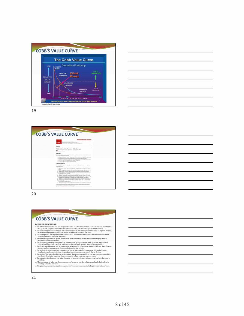
COBB’S VALUE CURVE
Reprinted with Permission
COBB’S VALUE CURVE
COBB’S VALUE CURVEDETAILED FUNCTIONS:1. The determination of the size and shape of the earth and the measurement of all data needed to define the
size, position, shape and contour of any part of the earth and monitoring any change therein.
2. The positioning of objects in space and time as well as the positioning and monitoring of physical features, structures and engineering works on, above or below the surface of the earth.
3. The development, testing and calibration of sensors, instruments and systems for the above mentioned purposes and other surveying purposes.
4. The acquisition and use of spatial information from close range, aerial and satellite imagery and the automation of these processes.
5. The determination of the position of the boundaries of public or private land, including national and international boundaries, and the registration of those lands with the appropriate authorities.
6. The design, establishment and administration of geographic information systems (GIS) and the collection, storage, analysis, management, display and dissemination of data.
7. The analysis, interpretation and integration of spatial objects and phenomena in GIS, including the visualisation and communication of such data in maps, models and mobile digital devices.
8. The study of the natural and social environment, the measurement of land and marine resources and the use of such data in the planning of development in urban, rural and regional areas.
9. The planning, development and redevelopment of property, whether urban or rural and whether land or buildings.
10. The assessment of value and the management of property, whether urban or rural and whether land or buildings or landed interests.
11. The planning, measurement and management of construction works, including the estimation of costs.
19
20
21
8 of 45
COBB’S VALUE CURVECOMMODITY SERVICES:1. The determination of the size and shape of the earth and the measurement of all data needed to
define the size, position, shape and contour of any part of the earth and monitoring any change therein.
2. The positioning of objects in space and time as well as the positioning and monitoring of physical features, structures and engineering works on, above or below the surface of the earth.
3. The development, testing and calibration of sensors, instruments and systems for the above mentioned purposes and other surveying purposes.
4. The acquisition and use of spatial information from close range, aerial and satellite imagery and the automation of these processes.
5. The determination of the position of the boundaries of public or private land, including national and international boundaries, and the registration of those lands with the appropriate authorities.
6. The design, establishment and administration of geographic information systems (GIS) and the collection, storage, analysis, management, display and dissemination of data.
7. The analysis, interpretation and integration of spatial objects and phenomena in GIS, including the visualisation and communication of such data in maps, models and mobile digital devices.
8. The study of the natural and social environment, the measurement of land and marine resourcesand the use of such data in the planning of development in urban, rural and regional areas.
9. The planning, development and redevelopment of property, whether urban or rural and whether land or buildings.
10. The assessment of value and the management of property, whether urban or rural and whether land or buildings or landed interests.
11. The planning, measurement and management of construction works, including the estimation of costs.
COBB’S VALUE CURVEBRAND NAME SERVICES:
2. The positioning of objects in space and time as well as the positioning and monitoring of physical features, structures and engineering workson, above or below the surface of the earth.
3. The development, testing and calibration of sensors, instruments and systems for the above mentioned purposes and other surveying purposes.
5. The determination of the position of the boundaries of public or private land, including national and international boundaries, and the registration of those lands with the appropriate authorities.
9. The planning, development and redevelopment of property, whether urban or rural and whether land or buildings.
10. The assessment of value and the management of property, whether urban or rural and whether land or buildings or landed interests.
11. The planning, measurement and management of construction works, including the estimation of costs.
COBB’S VALUE CURVEEXCLUSIVE SERVICES:
5. The determination of the position of the boundaries of public or private land, including national and international boundaries, and the registration of those lands with the appropriate authorities.
22
23
24
9 of 45

JEFF’S 10 COMMANDMENTSON BUSINESS PRACTICE
III. KNOW THE LAW OF CASH FLOW
Case flow is critical for any business at any size. You must know the basic laws of cash flow and put them into your practice.
25
26
27
10 of 45
28
29
30
11 of 45

JEFF’S 10 COMMANDMENTSON BUSINESS PRACTICE
IV. HAVE A WRITTEN CONTRACT. Having a contract will help to avoid one of the common denominators of almost all litigation: MISCOMMUNICATION.
CONTRACT BASICS
Contract – An agreement between two of more persons which creates an obligation to do or not to do something. A contract is a promise or set of promises for the breach of which the law gives a remedy, or the performance of which the law in some way recognizes as a duty.
CONTRACT BASICS
Oral Contract – A contract not in writing, made by verbal agreement.
Written Contract – Simply, an agreement reduced to writing.
Contract Under Seal – A formality that can extend the statute of limitations and may eliminate the need for consideration.
L.S. – The abbreviation for Locus Sigilli. Latin for “the place of the seal.”
31
32
33
12 of 45
WRITTEN CONTACT PROTECTIONS:Limitations on Liability:
Personal Liability and Asset Protection
Company Liability and Asset Protection
Litigation Fees and Expenses:
Recovery of Unpaid Invoices
Recovery of Litigation Expenses
Miscommunication:
Establish Fees
Establish Project and Payment Schedules
Establish Standard of Care
Establish Legal Jurisdiction
CONTRACT ESSENTIAL ELEMENTS
Offer and Acceptance (Identify Parties)
Legal Purpose (Surveying Services)
Subject Matter (Scope of Services)
Consideration (Fee for Services)
Legal Capacity (Over 19 & Not Incapacitated)
Execution (Signatures)
CONTRACT OPTIONAL ELEMENTS Project Identification Standard of Care Deliverables Schedule
Payment Terms Applicable Law Attorney’s Fees Contingency Clause Additional Services Offer Expiration Date Termination Clause
Statement of Warranties
34
35
36
13 of 45

REVIEW ELEMENTSESSENTIAL:
Offer & Acceptance
Legal Purpose
Subject Matter
Consideration
Legal Capacity
Execution
OPTIONAL: Project Identification Standard of Care Deliverables Schedule Payment Terms Applicable Law Attorney’s Fees Contingency Clause Additional Services Offer Expiration Date Termination Clause Statement as to Warranties
THE ONE‐PAGE CONTRACT
Offer & Acceptance, Project Identification, and Legal Purpose:
February 2, 2020
Mr. Abram Halfacre
1313 Mockingbird Lane
Meridian, Mississippi 39305
FAX TRANSMISSION: (601) 555‐1313(Or Email Transmission)
RE: Property Identification (Identify Property)Brief Description of the ProjectAnd Services Being Provided
THE ONE‐PAGE CONTRACT
Offer & Acceptance, Project Identification, and Legal Purpose:
Dear Mr. Halfacre:
This letter shall serve as a Letter of Engagement, whereby Abram Halfacre, hereinafter referred to as Client, engages Acme Surveying Company, LLC, hereinafter referred to as Surveyor, to perform land surveying services on the above described property (the Property). Execution of this letter will confirm acceptance and shall constitute an agreement between Client and Surveyor.
37
38
39
14 of 45

THE ONE‐PAGE CONTRACT
Subject Matter, Standard of Care, Deliverables:
Surveyor will provide a Boundary Survey of the Property which will include re‐establishment of property corners and boundary lines, location of permanent improvements to the property (i.e. buildings, fences, driveways, etc.), identification of encroachments (if any), determination of acreage, and preparation of a map of survey depicting the results of the survey. Six original survey maps will be provided. The survey will meet all applicable provisions of the State of Mississippi’s “Standards of Practice” for property surveys.
THE ONE‐PAGE CONTRACTConsideration, Schedule, Payment Terms, Applicable Law and Attorney’s Fees:
It is acknowledged that land surveying is a professional service and not an exact science, therefore our fee for services is estimated at $2,500.00, subject to unforeseen circumstances or unexpected difficulties (see below). The survey will be completed within three (3) weeks from the date of receipt of an executed copy of this agreement. Surveyor will make every reasonable effort to meet this schedule, however, this is not a guarantee. All invoices are due and payable within 15‐days of receipt. A late fee of 1.50% per month will apply. In the event collection proceeding become necessary, Mississippi law will apply and Attorney’s fees and cost of collection will be reimbursed to Surveyor.
THE ONE‐PAGE CONTRACT
Contingency Clause, Additional Services, Statement of Hourly Rates, Termination Clause and Legal Capacity:
If unforeseen circumstances or unexpected difficulties are encounter, the Client will be consulted before Surveyor proceeds further. If additional services are deemed necessary, Surveyor will perform those services at an hourly rate of $150.00. Surveyor will only perform additional services with Client’s written or verbal approval. This offer will expire if not executed within 15 days. Either party may terminate this agreement with or without cause. Upon termination, Surveyor will be reimbursed for services performed. This agreement contains no warranties either expressed or implied. Persons signing below certify that they have legal capacity as the individuals, representatives, and/or agents for the parties to this contract.
40
41
42
15 of 45

THE ONE‐PAGE CONTRACT
Execution:
FOR SURVEYOR:
___________________________________
Date: _____________________
Thomas Jefferson, Chief Surveyor
THE ONE‐PAGE CONTRACT
Execution:
FOR CLIENT:
________[signature]______________ Date: ___________
By: _______________________________________
Printed Name and Title
ONE PAGE CONTACT
43
44
45
16 of 45

LETTER OF UNDERSTANDING
SUPREME COURT OF ALABAMA
2005 Ala. LEXIS 180
October 21, 2005
46
47
48
17 of 45
JEFF’S 10 COMMANDMENTSON BUSINESS PRACTICE
V. UNDERSTAND THE DIFFERENCE BETWEEN A “COMPLETE” AND AN
“ACCURATE” SURVEY A complete survey and an accurate survey are two separate concepts. A complete survey will follow all the requirements of good practice, while an accurate survey achieves correct results. The goal is to attain both, rendering the survey valid.
2016 MINIMUM STANDARDS
Sec. 1. Purpose ‐ … For a survey of real property, and the plat, map or record of such survey, to be acceptable to a title insurance company for the purpose of insuring title to said real property free and clear of survey matters certain specific and pertinent information must be presented for the distinct and clear understanding between the insured, the client, the title company, the lender, and the surveyor professionally responsible for the survey. [Emphasis added.]
2016 Minimum Standard Detail Requirements for ALTA/NSPS Land Title Surveys, Sec. 1, Para. 2. Effective Date of Feb. 23, 2016.
49
50
51
18 of 45
2016 MINIMUM STANDARDS
Sec. 1. Purpose
… In order to meet such needs, clients, insurers, insureds, and lenders are entitled to rely on surveyors to conduct surveys and prepare associated plats and maps that are of a professional quality and appropriately uniform, complete and accurate. [Emphasis added.]
2016 Minimum Standard Detail Requirements for ALTA/NSPS Land Title Surveys, Sec. 1, Para. 3. Effective Date of Feb. 23, 2016.
2016 MINIMUM STANDARDS
Of course this begs the question:
What is a complete and accurate survey of property?
2016 MINIMUM STANDARDS
Sec. 1. Purpose
… To that end, and in the interests of the general public, the surveying profession, title insurers and abstracters, the ALTA and the NSPS jointly promulgate the within details and criteria setting forth a minimum standard of performance for ALTA/NSPS Land Title Surveys.
2016 Minimum Standard Detail Requirements for ALTA/NSPS Land Title Surveys, Sec. 1, Para. 3. Effective Date of Feb. 23, 2016.
52
53
54
19 of 45

2016 MINIMUM STANDARDS
Sec. 1. Purpose
A complete 2016 ALTA/NSPS Land Title Survey includes:
(i) the on‐site field work [per] Sections 5,
(ii) the preparation of a plat or map [per] Section 6 … and its relationship to documents provided [per] Section 4,
(iii) any information from Table A … and,
(iv) The certification [per] Section 7.
2016 Minimum Standard Detail Requirements for ALTA/NSPS Land Title Surveys, Sec. 1, Para. 3. Effective Date of Feb. 23, 2016.
2016 MINIMUM STANDARDS
In other words, a complete survey is a survey that follows all of the requires of the ALTA/NSPS standards of practice. The standards can be followed completely yet still be inaccurate if the wrong property were surveyed. The survey would be invalid.
“LAND SURVEYOR’S LIABILITY TO UNWRITTEN RIGHTS”
By Curtis M. Brown
Reprinted in: THE CURT BROWN CHRONICLES
By Michael J. Pallamary
2011, Author House, 323 thru 330
55
56
57
20 of 45
BROWN’S DILEMMA
Brown Recants
“In my early writings, I generally advocated that surveyors should locate land boundaries in accordance with a written deed; all conveyances based upon unwritten rights should be referred to attorneys for resolution. Within recent years, there have been cases, one in particular, wherein surveyors have been held liable for failure to react to a change in ownership created by prolonged possession. ….Brown, Curtis M., “Land Surveyor’s Liability to Unwritten Rights,” 1979. Reprinted in: The Curt Brown Chronicles, 2011, Michael J. Pallamary, 323‐330.
BROWN’S DILEMMABrown Recants
“Can a surveyor monument the lines of ownership obtained by unwritten means? To my knowledge absolutely nothing in the law prevents him from doing so. Clearly from my conversations with attorneys, this is not the unauthorized practice of law. If the surveyor chooses to claim that a possessory right has ripened into a fee title, he is certainly privileged to do so. The real question is What should he do?”Brown, Curtis M., “Land Surveyor’s Liability to Unwritten Rights,” 1979. Reprinted in: The Curt Brown Chronicles, 2011, Michael J. Pallamary, 323‐330.
58
59
60
21 of 45
61
62
63
22 of 45

BROWN’S DILEMMA
Brown Criticized as a “Fence‐Line” Surveyor
“The principle enunciated [by Brown] is that of
occupation, i.e., the idea that possession of land [the
fence line in this case] is sometimes the best evidence
for the location of a boundary. To many readers of
this essay, this will seem self‐evident, and they may
have utilized such a principle in their own work.”Williams, Mitchell G., “The Great Dilemma—or, When is a Fence Just a Fence?” 1980. Reprinted in: The Curt Brown Chronicles, 2011, Michael J. Pallamary, 334‐346.
BROWN’S DILEMMA
Brown Criticized as a Fence‐Line Surveyor
“It is to these readers that I address what follows, for
this principle is based on a basic misunderstanding
of both the nature of boundary lines and the legal
role of the land surveyor.”Williams, Mitchell G., “The Great Dilemma—or, When is a Fence Just a Fence?” 1980. Reprinted in: The Curt Brown Chronicles, 2011, Michael J. Pallamary, 334‐346.
64
65
66
23 of 45
BROWN’S DILEMMABrown Criticized as a Fence‐Line Surveyor
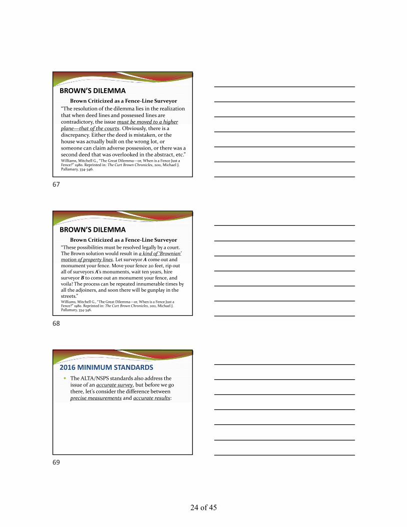
“The resolution of the dilemma lies in the realization that when deed lines and possessed lines are contradictory, the issue must be moved to a higher plane—that of the courts. Obviously, there is a discrepancy. Either the deed is mistaken, or the house was actually built on the wrong lot, or someone can claim adverse possession, or there was a second deed that was overlooked in the abstract, etc.”Williams, Mitchell G., “The Great Dilemma—or, When is a Fence Just a Fence?” 1980. Reprinted in: The Curt Brown Chronicles, 2011, Michael J. Pallamary, 334‐346.
BROWN’S DILEMMABrown Criticized as a Fence‐Line Surveyor
“These possibilities must be resolved legally by a court. The Brown solution would result in a kind of ‘Brownian’ motion of property lines. Let surveyor A come out and monument your fence. Move your fence 20 feet, rip out all of surveyors A’s monuments, wait ten years, hire surveyor B to come out an monument your fence, and voila! The process can be repeated innumerable times by all the adjoiners, and soon there will be gunplay in the streets.”Williams, Mitchell G., “The Great Dilemma—or, When is a Fence Just a Fence?” 1980. Reprinted in: The Curt Brown Chronicles, 2011, Michael J. Pallamary, 334‐346.
2016 MINIMUM STANDARDS
The ALTA/NSPS standards also address the issue of an accurate survey, but before we go there, let’s consider the difference between precise measurements and accurate results:
67
68
69
24 of 45
2016 MINIMUM STANDARDS
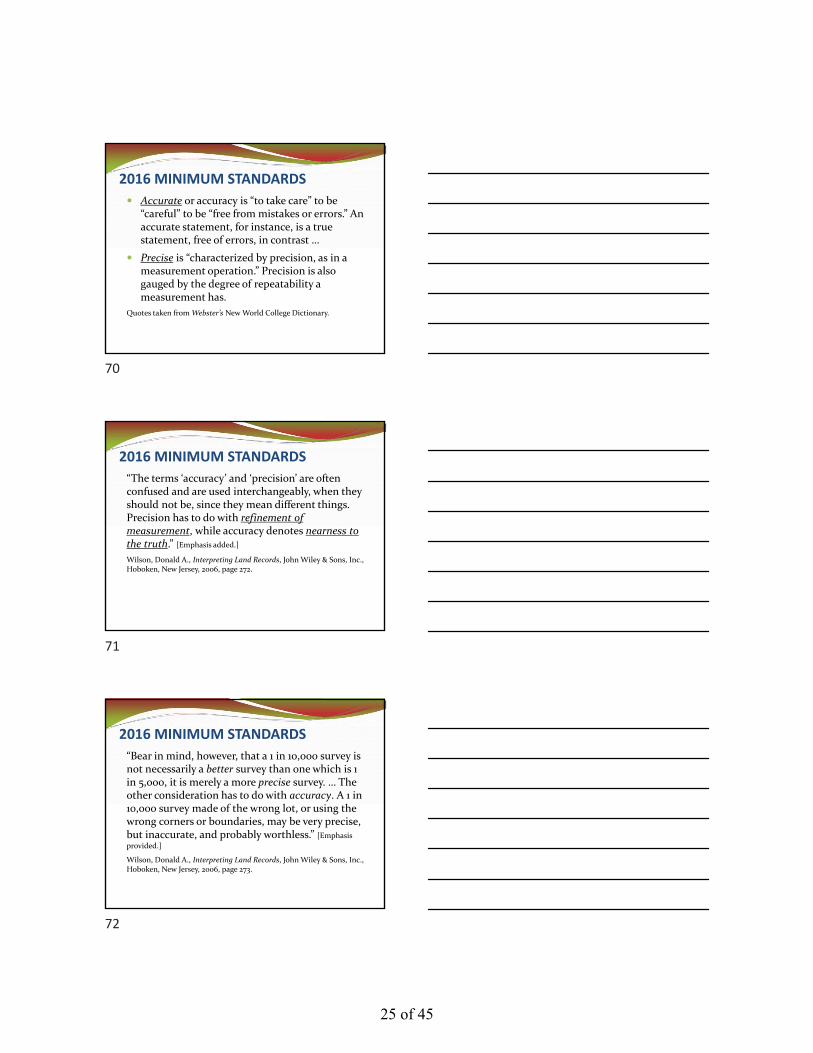
Accurate or accuracy is “to take care” to be “careful” to be “free from mistakes or errors.” An accurate statement, for instance, is a true statement, free of errors, in contrast …
Precise is “characterized by precision, as in a measurement operation.” Precision is also gauged by the degree of repeatability a measurement has.
Quotes taken from Webster’s New World College Dictionary.
2016 MINIMUM STANDARDS
“The terms ‘accuracy’ and ‘precision’ are often confused and are used interchangeably, when they should not be, since they mean different things. Precision has to do with refinement of measurement, while accuracy denotes nearness to the truth.” [Emphasis added.]
Wilson, Donald A., Interpreting Land Records, John Wiley & Sons, Inc., Hoboken, New Jersey, 2006, page 272.
2016 MINIMUM STANDARDS
“Bear in mind, however, that a 1 in 10,000 survey is not necessarily a better survey than one which is 1 in 5,000, it is merely a more precise survey. … The other consideration has to do with accuracy. A 1 in 10,000 survey made of the wrong lot, or using the wrong corners or boundaries, may be very precise, but inaccurate, and probably worthless.” [Emphasis
provided.]
Wilson, Donald A., Interpreting Land Records, John Wiley & Sons, Inc., Hoboken, New Jersey, 2006, page 273.
70
71
72
25 of 45

2016 MINIMUM STANDARDS
“That is one reason the courts have emphasized monumentation and the determination of correct boundaries rather than whether a survey was 1 part in 5,000 versus 1 part in 10,000.” [Emphasis added.]
Wilson, Donald A., Interpreting Land Records, John Wiley & Sons, Inc., Hoboken, New Jersey, 2006, page 273.
If the focus of a survey of property is to identify the true and correct property corners and the true and correct property lines, then an accurate survey would do that. Figure 1, to the right identifies that we have hit the bullseye but the precision of our measurements is low.
In contrast, Figure 2 demonstrates that our measurements have a high degree of precision but we missed the mark—the focus of the survey. We precisely measured the wrong piece of property. Our survey results are completely inaccurate but our measurements are highly precise.
73
74
75
26 of 45

2016 MINIMUM STANDARDS
When you combine high accuracy with high precision, you get valid results. Results that are “well grounded on principles or evidence; able to withstand criticism or objection, as an argument; sound.” Webster’s.
What do the ALTA/NSPS standards have to say about an accurate survey?
2016 MINIMUM STANDARDS
Sec. 3. D. Boundary Resolution ‐ The boundary lines and corners of any property being surveyed as part of an ALTA/NSPS Land Title Survey shall be established and/or retraced in accordance with appropriate boundary law principles governed by the set of facts and evidence found in the course of performing the research and fieldwork. [Emphasis added.]
2016 Minimum Standard Detail Requirements for ALTA/NSPS Land Title Surveys, Section 3.D.
2016 MINIMUM STANDARDSSec. 3. E. iii. Measurement Standards ‐ … Relative Positional Precision is a measure of how precisely the surveyor is able to monument and report those positions; it is not a substitute for the application of proper boundary law principles. A boundary corner or line may have a small Relative Positional Precision because the survey measurements were precise, yet still be in the wrong position (i.e. inaccurate) if it was established or retraced using faulty or improper application of boundary law principles. [Emphasis added.]
2016 Minimum Standard Detail Requirements for ALTA/NSPS Land Title Surveys, Sec.3.E.iii.
76
77
78
27 of 45
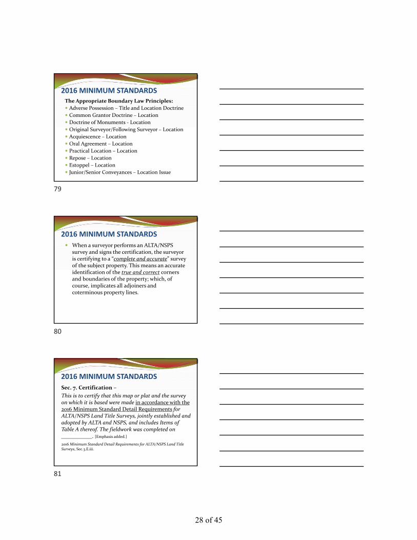
2016 MINIMUM STANDARDSThe Appropriate Boundary Law Principles:
Adverse Possession – Title and Location Doctrine
Common Grantor Doctrine – Location
Doctrine of Monuments ‐ Location
Original Surveyor/Following Surveyor – Location
Acquiescence – Location
Oral Agreement – Location
Practical Location – Location
Repose – Location
Estoppel – Location
Junior/Senior Conveyances – Location Issue
2016 MINIMUM STANDARDS
When a surveyor performs an ALTA/NSPS survey and signs the certification, the surveyor is certifying to a “complete and accurate” survey of the subject property. This means an accurate identification of the true and correct corners and boundaries of the property; which, of course, implicates all adjoiners and coterminous property lines.
2016 MINIMUM STANDARDS
Sec. 7. Certification –
This is to certify that this map or plat and the survey on which it is based were made in accordance with the 2016 Minimum Standard Detail Requirements for ALTA/NSPS Land Title Surveys, jointly established and adopted by ALTA and NSPS, and includes Items of Table A thereof. The fieldwork was completed on ___________. [Emphasis added.]
2016 Minimum Standard Detail Requirements for ALTA/NSPS Land Title Surveys, Sec.3.E.iii.
79
80
81
28 of 45

2016 MINIMUM STANDARDS
Most other standards across the country have confused these concepts (as Don Wilson discussed), and actually define “accuracy” by the precision of the survey measurements.
2015 MISSISSIPPI STANDARD OF PRACTICE
APPENDIX A – Classification of Surveys
Class A Surveys ‐ Surveys of extensively developed and expensive properties which require maximum surveying accuracy. This includes, but is not limited to, surveys of urban business district properties and highly developed commercial properties. [Emphasis added.]
Class B Surveys ‐ Surveys of properties which are subject to costly improvements and justify a high degree of surveying accuracy. This includes …. [Emphasis added.]
Class C Surveys ‐ Surveys of residential and surrounding areas ….
Class D Surveys ‐ Surveys of all remaining properties….
2015 MISSISSIPPI STANDARD OF PRACTICE
APPENDIX B
82
83
84
29 of 45

JEFF’S 10 COMMANDMENTSON BUSINESS PRACTICE
VI. A SURVEY MAY BE “ACCURATE” BUT THE SURVEYOR MAY STILL BE HELD
LIABLE BECAUSE IT WASN’T “COMPLETE”
The survey must be complete and accurate in order to be valid. From a liability standpoint, best practices suggest that the practitioner would strive for valid results as opposed to invalid results.
CONNECTICUT SUPERIOR COURT
Case No. FBTCV166059810S
June 5, 2019
85
86
87
30 of 45

JEFF’S 10 COMMANDMENTSON BUSINESS PRACTICEVII. UNDERSTAND THE RELATIONSHIP BETWEEN THE TITLE POLICY AND THE BOUNDARY SURVEY
Many surveyors are unaware of the relationship between the title policy and the boundary survey. The title company can choose to insure the accuracy of the boundary survey.
88
89
90
31 of 45

TITLE INSURANCE AND BOUNDARY SURVEYS
Sec. 1. Purpose ‐ … For a survey of real property, and the plat, map or record of such survey, to be acceptable to a title insurance company for the purpose of insuring title to said real property free and clear of survey matters certain specific and pertinent information must be presented for the distinct and clear understanding between the insured, the client, the title company, the lender, and the surveyor professionally responsible for the survey. [Emphasis added.]
2016 Minimum Standard Detail Requirements for ALTA/NSPS Land Title Surveys, Sec. 1, Para. 2. Effective Date of Feb. 23, 2016.
TITLE INSURANCE AND BOUNDARY SURVEYS
Let’s take the question one step further. Let’s say that the title company removes the survey exception from the title policy based on the idea that it has received an accurate survey, when in fact it has not.
91
92
93
32 of 45

TITLE INSURANCE AND BOUNDARY SURVEYS
What happens when the title company has to pay out on the policy when it is discovered that there is, in fact, an encroachment that would have been discovered had the survey been an accurate as opposed to merely having precise measurements?
TITLE INSURANCE AND BOUNDARY SURVEYS
“Wolfe, the original owner, testified that he watched Wegner place the original stakes and that the stakes were in the same location when he sold the property to the Hannemans and when he showed the stakes to the realtor involved in the Hanneman/Geiger transaction. Thiessen [the following surveyor] testified that because the pipe did not meet his accuracy [precision] expectations, he decided not to use it as a boundary marker.”
Gilbert v. Geiger, 2008 Wisc.App. LEXIS 21 (Wisc.App.2008).
TITLE INSURANCE AND BOUNDARY SURVEYS
“As a result of this survey it was discovered that the 1963 survey prepared by Conklin Associates had erroneously located the New York State‐New Jersey boundary line which served as the dividing line of the Wells and Wulster properties. The true boundary was, in fact, approximately 20 feet further south than the survey of Conklin Associates had indicated.”
Commonwealth Land Title v. Conklin Assoc., 377 A.2d 740 (N.J. Super.1977).
94
95
96
33 of 45

TITLE INSURANCE AND BOUNDARY SURVEYS
“Thus, those residences which abutted the southern border of the Wulster property encroached upon and overlapped approximately six‐tenths of an acre of the Wulster tract. Desirous of an expeditious resolution of the problem, Wulster contacted his neighbors to the south and initiated negotiations with them and their title companies.”
Commonwealth Land Title v. Conklin Assoc., 377 A.2d 740 (N.J. Super.1977).
TITLE INSURANCE AND BOUNDARY SURVEYS
“After an extended discussion, a settlement was eventually reached whereby Wulster received $30,000 for the encroachment. As a result, this action was initiated by the two title companies, suing [for indemnification] as subrogees, and by the McGoverns suing as uninsured property owners who had contributed $4,000 to the settlement.”
Commonwealth Land Title v. Conklin Assoc., 377 A.2d 740 (N.J. Super.1977).
Superior Court of Connecticut
Judicial District of Hartford at Hartford
2008 Conn. Super. LEXIS 2774
November 5, 2008
97
98
99
34 of 45

Commonwealth v. CJM“Professional negligence or malpractice is defined as the failure of one rendering professional services to exercise that degree of skill and learning commonly applied under all the circumstances in the community by the average prudent, reputable member of the profession with the result of injury, of loss, or damage to the recipient of those services.”Commonwealth Land Title v. CJM, PC, 2008 Conn.Super. LEXIS 2774 (Conn.Super.2008).
Commonwealth v. CJM“While the standards require a surveyor to cite all visible encroachments and need not cite any invisible encroachments, the standards do not allow the surveyor categorically to state there are no encroachments when he cannot observe whether or not there are encroachments. His obligation under the standards is, rather, to cite that there are no visible encroachments.”Commonwealth Land Title v. CJM, PC, 2008 Conn.Super. LEXIS 2774 (Conn.Super.2008).
100
101
102
35 of 45

Commonwealth v. CJM“The survey certified to Commonwealth recognized the distinction. It certified to no ‘visible easements,’ but as to encroachments, it certified to ‘no encroachments.’ This was a breach of surveyors’ professional standards. Particularly is this so when defendants’ own expert testified that it was common knowledge that adjacent buildings in cities encroach upon each other’s property lines.”Commonwealth Land Title v. CJM, PC, 2008 Conn.Super. LEXIS 2774 (Conn.Super.2008).
JEFF’S 10 COMMANDMENTSON BUSINESS PRACTICE
The “Ultimate Issue” in any boundary dispute case is the “property” boundary between the disputing parties. No other line really matters.
VIII. YOU ARE RESPONSIBLE FOR THE “ULTIMATE ISSUE” IN ALL BOUNDARY
DETERMINATIONS
The Ultimate Issue Rule
Federal Rules of Evidence
Rule 704.
Opinion on Ultimate Issue. (a) Except as provided in subdivision (b), testimony in the form of an opinion or inference otherwise admissible is not objectionable because it embraces an ultimate issue to be decided by the trier of fact.
103
104
105
36 of 45

The Ultimate Issue Rule
TEXAS COURT RULES
Texas Rule of Evidence
Article VII. Opinions and Expert Testimony
Rule 704. Opinion on an Ultimate Issue
An opinion is not objectionable because it embraces the ultimate issue.
The Ultimate Issue Rule
KANSAS STATUTES
Texas Rule of Evidence
Chapter 60. Procedure, Civil
Article 4. Rules of Evidence
§ 60‐456. Testimony in the Form of Opinion
(d) Testimony in the form of opinions or inferences otherwise admissible under this article is not objectionable because it embraces the ultimate issue or issues to be decided by the trier of fact.
The Ultimate Issue Rule“In all courts, evidence is the purview of the jury (or judge as ‘trier of the facts’ if there is no jury); the law is always in the purview of the court. A Georgia decision permitted the surveyor to testify as to his opinion on the ultimate issue of the case without invading the province of the jury, so long as the subject matter was an appropriate one for opinion evidence. This is quite unusual. North Carolina still retains the majority approach in that the expert land surveyor cannot give an opinion as to where a true boundary line is located, for that decision is the ultimate fact in issue to be determined by the jury from the evidence presented during the trial.”Robillard, Walter G., Lane J. Bouman and Hon. Robert Shelton, Clark on Surveying and Boundaries, Seventh Edition at 49.
106
107
108
37 of 45

The Ultimate Issue Rule
“Rule 704, provides that opinion testimony ‘is not objectionable because it embraces an ultimate issue to be decided by the trier of fact.’ This rule abrogates the doctrine that opinion testimony should be excluded for the reason that it goes to the ultimate issue which should be decided by the trier of fact.”Green Hi‐Win Farm, Inc. v. Neal, 349 S.E.2d 614, 616, 617 (N.C.App. 1986).
The Ultimate Issue Rule
“No witness can give opinions on the ultimate fact that is being tried. Permitting an expert to tell the members of the jury what they must decide is usurping their exclusive rights. … The surveyor is more or less limited in the responses to the questions asked.”Robillard, Walter G. and Donald A. Wilson. Evidence and Procedures for Boundary Location, Sixth Edition at 549‐550.
The Ultimate Issue Rules
“A Mississippi court ruled on the question of whether the surveyor could be asked, ‘Where is the true line?’ The court replied: ‘This is not a matter about which they could give their opinion.’” Robillard, Walter G. and Donald A. Wilson. Evidence and Procedures for Boundary Location, Sixth Edition at 550. According to the endnotes, quoting from the case of Gichner v. Antonio Title Co., 410 F.2d 238 (Miss.1969).
109
110
111
38 of 45
The Ultimate Issue Rules
Mississippi Rules of Evidence
Rule 704. Opinion on ultimate issue.
Testimony in the form of an opinion or inference otherwise admissible is not objectionable because it embraces an ultimate issue to be decided by the trier of fact.
The Ultimate Issue RuleMississippi Rules of Evidence Commentary to Rule 704. Rule 704 abolishes the “ultimate issue rule” which existed in pre‐rule Mississippi practice. The ultimate issue rule was often unnecessarily restrictive and generally difficult to apply. More often than not the invocation of the rule served to deprive the trier of fact of useful information. Rule 704 clarifies much of the confusion over the ultimate issue rule. An opinion is no longer objectionable solely on grounds that it ‘invades the province of the jury.’
The Ultimate Issue Rule
Mississippi Rules of Evidence
Commentary to Rule 704.
The abolition of the ultimate issue rule does not result in the admission of all opinions. It is an absolute requirement under Rules 701 and 702 that opinions must be helpful to a determination of the case before they are admissible. Furthermore, under Rule 403 evidence is excluded which wastes time.
112
113
114
39 of 45

The Ultimate Issue Rule
Nebraska Rules of Evidence
Case Notes on Rule 704.
Under this section, the test is not whether the expert's opinion or inference invades the province of the jury, but whether the opinion or inference is otherwise admissible and will assist the trier of factto understand the evidence or determine a fact in issue ….
JEFF’S 10 COMMANDMENTSON BUSINESS PRACTICE
IX. DON’T BE AN ADVOCATE FOR YOUR CLIENT, YOU OWE A DUTY TO THE
ADJOINERS AS WELL
“The surveyor does have moral obligations to the public and among them is the duty to never subtract from the rights of adjoiners. Every boundary survey for a client establishes the boundary of an adjoiner.”Brown, Curtis M., “The Professional Status of Land Surveyors,” Surveying and Mapping, Vol. XXI, No. 1, 1969, at 63‐71.
CLIENT ADVOCACY
“When a surveyor is employed to establish the position of a point or line in which two or more persons are interested he should act as an honorable, unprejudiced party and seek to find the true position, regardless of consequences. …Clark, Frank Emerson, Fundamentals of Law for Surveyors, 1939, International Textbook Company, Scranton, Penn. at 1.
115
116
117
40 of 45

CLIENT ADVOCACY
“It is therefore of the utmost importance that the surveyor should act in the same manner as does a judge on the bench rather than as a partisan employee of one of the persons concerned. By performing his duties in this way, the surveyor makes friends and also gains the reputation of being just.”Clark, Frank Emerson, Fundamentals of Law for Surveyors, 1939, International Textbook Company, Scranton, Penn. at 1.
CLIENT ADVOCACY
Kansas Administrative Code
(f) In all professional reports, statements, and testimony, each licensee shall meet the following requirements: (1) Be completely objective and truthful; and (2) include all relevant and pertinent information. § 66‐6‐4. (f)(1)&(2), Kansas Administrative Code.
CLIENT ADVOCACY
Kansas Administrative Code(g) When serving as an expert or technical witness before any court, commission, or other tribunal, each licensee shall express only opinions founded on the following: (1) An adequate knowledge of the facts at issue; (2) a background of technical competence in the subject matter; and (3) an actual, good‐faith belief in the
accuracy and propriety of the licensee's testimony. § 66‐6‐4. (g)(1)(2)&(3), Kansas Administrative Code.
118
119
120
41 of 45
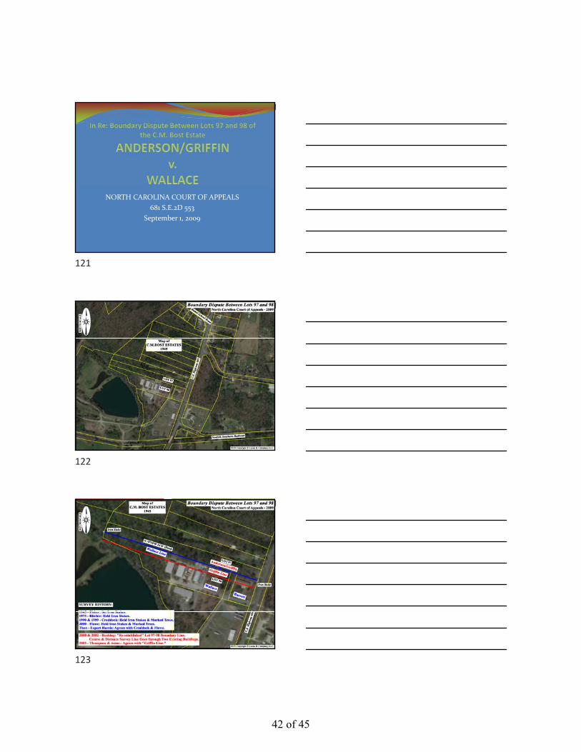
NORTH CAROLINA COURT OF APPEALS
681 S.E.2D 553
September 1, 2009
121
122
123
42 of 45

MONTANA SUPREME COURT
2011 MT 195
August 16, 2011
124
125
126
43 of 45

JEFF’S 10 COMMANDMENTSON BUSINESS PRACTICE
X. GOOD ETHICS IS GOOD BUSINESS. “It takes a lifetime to build a good reputation, but you can lose it in a minute.”Will Rogers
ALABAMA COURT OF CIVIL APPEALS
587 So.2d 387
August 9, 1991
127
128
129
44 of 45
Lawler v. Hare“In this case, the trial court determined that Lawler failed to provide the appropriate direction and supervision for Mr. Baker. Mr. Baker testified that he and his crew did the survey and plat for the Hares. Lawler testified that he never visited the property and was not even in Alabama when the survey was completed.”Lawler and Company v. Hare, 587 So.2d 387 (Ala.App.1991).
Lawler v. Hare“In view of the fact that Mr. Baker actually performed the survey and that Lawler never visited the property, we cannot say that the trial court erred in determining that the requisite supervision was not present in this case.”Lawler and Company v. Hare, 587 So.2d 387 (Ala.App.1991).
Lawler v. Hare
“Additionally, I observe that out of a simple fee dispute case, the trial court’s judgment, if it stands, may very well establish a new standard that could stifle a professional’s effective use of auxiliary personnel. Indeed, as the same pertains to licensed land surveyors, it appears to suggest that the licensee be on one end of the chain.”Lawler v. Hare, 587 So.2d 387 (Ala.App.1991).
130
131
132
45 of 45