big cypress national preserve - nps.gov ... andstories associated withprimaryinterpretive themes to...
TRANSCRIPT

.
.
.
.
.
.
.
.
nlor Scans1111.2-1;-6c, q
BIG CYPRESSNATIONAL PRES ERVE
NATIONAL PARK SERVICE

0
0
0
United States Department of the Interior
IN REPI.YREFER TO:
K1817(HFC-IP)BICY
July 11, 2003
Memorandum
To: Superintendent, Big Cypress National Preserve
From: Associate Manager, Interpretive Planning,. Harpers Ferry Center
Subject: Distribution of Approved Long-Range Interpretive Plan for Big Cypress
National Preserve
The Big Cypress National Preserve Long-Range Interpretive Plan was approved by your
memorandum, dated April 22, 2003. All changes noted in the memorandum have been
incorporated in this final document.
Twenty bound copies are being sent to you with this memorandum, along with one unbound
copy for your use in making additional copies as needed in the future.
We ave certainly appfeciated)e fine cooperation and help of your staff on this project.
Sam Vaughn
Enclosure (21)
NATIONAL PARK SERVICE
Harpers Ferry Center
P.O. Box 50
Harpers Ferry, West Virginia 25425-0050
Copy to:Sandra Snell-Dobert, Chief of Interpretation, BICY
Carol A. Clark, Deputy Superintendent, BICY

bcc:HFC-FilesHFC-DailiesHFC - Keith Morgan (5)
HFC - Sam Vaughn
HFC - Dixie ShackelfordCorky Mayo, WASOHFC - John GrabowskiHFC- Terry LindsayHFC-LibraryDSC-Technical Information. CenterK.Morgan/lmt/7/2/03
• LONG -RANGE INTERPRETIVE PLAN
BIG CYPRESS NATIONAL PRESERVE•
JULY 2003
•
•
•
prepared by
•
•
Department of the InteriorNational Park Service
Big Cypress National Preserve
Harpers Ferry CenterInterpretive Planning

0
0
0
9
0
0
0
0
•
•
•
•
•
•
•
•
•
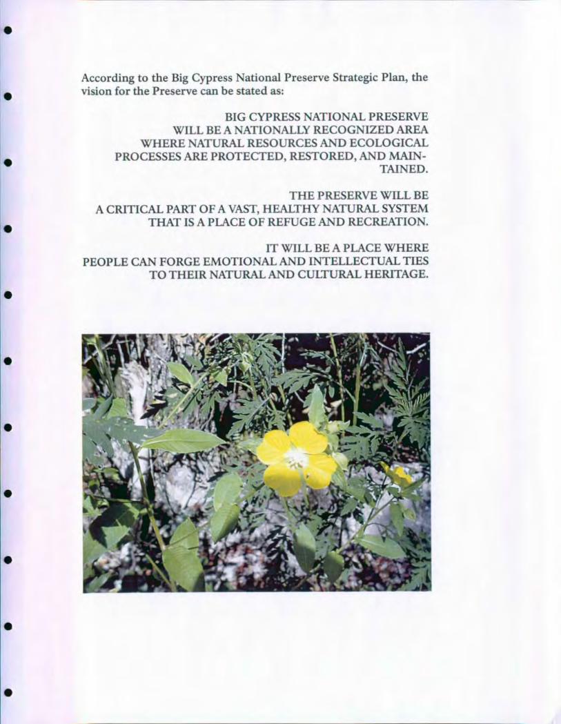
According to the Big Cypress National Preserve Strategic Plan, thevision for the Preserve can be stated as:
BIG CYPRESS NATIONAL PRESERVEWILL BE A NATIONALLY RECOGNIZED AREA
WHERE NATURAL RESOURCES AND ECOLOGICALPROCESSES ARE PROTECTED, RESTORED, AND MAIN-
TAINED.
THE PRESERVE WILL BE
A CRITICAL PART OF A VAST, HEALTHY NATURAL SYSTEMTHAT IS A PLACE OF REFUGE AND RECREATION.
IT WILL BE A PLACE WHEREPEOPLE CAN FORGE EMOTIONAL AND INTELLECTUAL TIES
TO THEIR NATURAL AND CULTURAL HERITAGE.
0

0
0
•
0
0
0
I
0
0
0
TABLE OF CONTENTS
BACKGROUND FOR PLANNING ........................... i
INTRODUCTION ..........................................
PRESERVE PURPOSE .......................................2
RESOURCE SIGNIFICANCE ................................3
THEMES ..................................................4
VISITOR EXPERIENCE OBJECTIVES ........................7
EXISTING CONDITIONS .................................... 9
ISSUES .................................................... i6
VISITATION AND VISITOR USE DATA ...................... 21
INTERPRETIVE PROGRAM DESCRIPTION ...............24
INTRODUCTION ..........................................24
PRE- ARRIVAL INFORMATION AND ORIENTATION .......25
ARRIVAL EXPERIENCE ... ........ . . .. .....................26
PRESERVE- WIDE RECOMMENDATIONS ..................27Personal Services ........................................... 28Education Program .........................................30Publications ................................................33Research and Planning ......................................34Partnership Opportunities ...................................36Access ....................................................39
DEVELOPMENT RECOMMENDATIONS ............ ....... . ..41
i- 75 CORRIDOR - ALLIGATOR ALLEY ......................43
FLORIDA 29/US 41 CORRIDOR - TAMIAMI TRAIL ..........46
TURNER RIVER/BIRDON LOOP ............................6i
TURNER RIVER ROAD ....................................62
TABLE OF CONTENTS
LOOP ROAD ..............................................64
BACKCOUNTRY ..........................................68
SUMMARY, STRATEGIES, AND PRIORITIES ...............71
INTRODUCTION .........................................7i
PROJECT SUMMARIES ....................................73
PLANNING TEAM AND CONSULTANTS ...................79
APPENDICES ............................................. 8o
A. SPECIAL POPULATIONS ...............................8o
B. EVALUATION .......................................... 94
BACKGROUND FOR PLANNING
INTRODUCTION
THE EMPLOYEES OF BIG CYPRESS NATIONAL PRESERVE
HAVE A DUTY TO SAFEGUARD AND ENHANCE. THE ECO-
LOGICAL PROCESSES ANDTHE NATURAL, SCENIC, CULTUR-
AL, RECREATIONAL, AND EDUCATIONAL VALUES OF THE
BIG CYPRESS WATERSHED
This Long- Range Interpretive Plan (LRIP) presents a visitor experience
vision for the Preserve based on purpose, significance, and mission
identified in the Preserve's Strategic Plan. It proposes development and
management activities that prepare Preserve staff to effectively respond
to current visitor experience demands; it also identifies a media and
activity action plan that best meets future visitor needs and effectively
tells interpretive themes and area stories.
The Long- Range Interpretive Plan sets the interpretation direction for
the Preserve during the next ten years. It is a conceptual plan that lays
foundation for the next phase of a comprehensive interpretive planning
process - media planning, design and production, and the organization
of staff and activities into annual interpretive plans. It is also a measure
against which annual accomplishments can be evaluated.
The planning process facilitates participation of Preserve staff, inter-
pretive partners and media specialists in evaluating the current inter-
pretive program and focusing future interpretation on significant
resources, themes, and issues. Goal- driven team planning develops
interpretive proposals to enhance opportunities for visitors to under-
stand, enjoy, and appreciate the reasons for which the Preserve was
established.
This plan was prepared in accordance with Director's Order 12 -
Conservation Planning and Environmental Impact Analysis, Director's
Order 2 - Park Planning, National Park Service Management Policies,
and Southeast Regional Office planning directives.
1
0
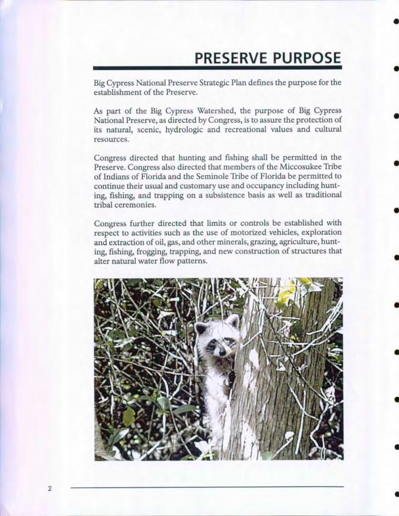
PRESERVE PURPOSE
Big Cypress National Preserve Strategic Plan defines the purpose for theestablishment of the Preserve.
As part of the Big Cypress Watershed , the purpose of Big CypressNational Preserve , as directed by Congress, is to assure the protection of
its natural , scenic, hydrologic and recreational values and culturalresources.
Congress directed that hunting and fishing shall be permitted in thePreserve . Congress also directed that members of the Miccosukee Tribe
of Indians of Florida and the Seminole Tribe of Florida be permitted to
continue their usual and customary use and occupancy including hunt-
ing, fishing, and trapping on a subsistence basis as well as traditional
tribal ceremonies.
Congress further directed that limits or controls be established with
respect to activities such as the use of motorized vehicles , exploration
and extraction of oil, gas, and other minerals, grazing, agriculture, hunt-
ing, fishing , frogging , trapping , and new construction of structures that
alter natural water flow patterns.
2
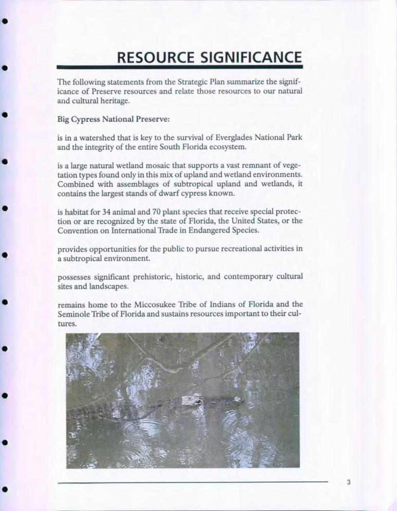
RESOURCE SIGNIFICANCE
The following statements from the Strategic Plan summarize the signif-icance of Preserve resources and relate those resources to our naturaland cultural heritage.
Big Cypress National Preserve:
is in a watershed that is key to the survival of Everglades National Parkand the integrity of the entire South Florida ecosystem.
is a large natural wetland mosaic that supports a vast remnant of vege-tation types found only in this mix of upland and wetland environments.Combined with assemblages of subtropical upland and wetlands, itcontains the largest stands of dwarf cypress known.
is habitat for 34 animal and 70 plant species that receive special protec-
tion or are recognized by the state of Florida, the United States, or theConvention on International Trade in Endangered Species.
provides opportunities for the public to pursue recreational activities in
a subtropical environment.
possesses significant prehistoric, historic, and contemporary cultural
sites and landscapes.
remains home to the Miccosukee Tribe of Indians of Florida and the
Seminole Tribe of Florida and sustains resources important to their cul-
tures.
3
THEMES
Primary interpretive themes describe those ideas,. concepts, or messagesabout Big Cypress National Preserve that are so important all visitorsshould understand them. Based on the site's purpose and significance,themes provide guidelines for making decisions concerning whichinterpretive stories will be told to visitors and what. interpretive facilitiesand activities will be required to tell those stories. Primary themes donot include everything that may be interpreted; however, they doinclude those ideas that are critical to understanding significance ofPreserve resources. All interpretive efforts (both media and personalservice) should relate to one or more of the themes; moreover, eachtheme should be addressed by some part of the interpretive program.
WATER
Preserving the Big Cypress watershed is key to the survival of theSouth Florida ecosystem.
Fresh water flowing through the Big Cypress Swamp provides a steadysupply of life- giving nourishment to the Ten Thousand Islands, a vitalestuary system.
Wetlands are one of the most endangered ecosystems in the world.Development, recreational use and non- point source pollutants threat-en the Big Cypress Swamp from all sides.
Subtle geologic features influence water flow and vegetation patternswhich, in turn, affect wildlife, fire frequency, and soil compaction.
BIOLOGICAL DIVERSITY
Acting as custodian for ecological and biological processes, BigCypress National Preserve provides habitat and protection for agreat diversity of plant and animal species.
The diversity of habitat types found in Big Cypress, from pinelands,mixed hardwood hammocks, wet prairies, dry prairies, marshes, andestuarine mangrove forests provide for a diversity of plant and animalspecies.
Rare sub- tropical and temperate plants and animals have retreated tothis remaining stronghold. Rare orchids, Florida panthers, red- cockad-ed woodpeckers and unusual ferns are found here and few other placesin the world.
4
THEMES
The vast biological diversity existing in Big Cypress National Preserve.makes it one of the most Unusual natural areas in the world.
The Big Cypress is a wetland interspersed with pine islands and hard-
wood hammocks. One may experience a variety of ecological commu-
nities as they are modified and characterized by the presence or absence
of water depending on hydroperiod.
Fire and living things have evolved together. Fire is responsible for
sculpting the landscape. Prescribed fire returns nutrients to the ecosys-
tem and prevents excessive fuel buildup.
Exotic species such as Melaleuca (Melaleuca quinquenervia), Brazillian
Pepper (Schinus terebinthifolius), Old World Climbing Fern (Lygodium
microphyllum), Waterlettuce (Pistia stratiotes), Hydrilla (Hydrilla verti-
cillata), Air Potato (Dioscorea bulbifera) and Australian pine (Casuarina
equisetifolia) threaten native plant communities. With no natural ene-
mies, exotics multiply rapidly and crowd out native species.
HUMAN/CULTURE
Big Cypress National Preserve reveals stories from times long past
and into the future, reflecting a pattern of changing culture and
human involvement.
A rich history of human involvement with the swamp spans time. The
Miccosukee Tribe of Indians of Florida and the Seminole Tribe of
Florida,. escaped slaves, land speculators, timber harvesters, hunters,
fishermen, guides, cattlemen, and recreationists have.all left their trails
through the swamp.
The establishment of Big Cypress National Preserve is a story of coop-
eration and conflict between various user groups to stop a threat to a
treasured place.
RECREATION/MULTI- USE
Big Cypress National Preserve manages a spectrum of human activ-
ities, recreational and commercial.
Big Cypress National Preserve provides an important oasis of wildness
for recreation, reflection, and rejuvenation.
5
THEMFS
Providing a unique environment with scenic vistas and wild areas, BigCypress National Preserve hosts opportunities for human activities.Water birds, alligators, turkey, deer, raccoons and many other creaturescall the Big Cypress their own. With increasing development in SouthFlorida, opportunities to view such wildlife are becoming rare.
Multiple use mandates make Big Cypress National Preserve differentfrom other National Park Service units . Oil exploration, hunting, andoff- road vehicle use add challenge to the mission of preservation andprotection.
Open space, quiet places, and wilderness are endangered in SouthFlorida. Big Cypress National Preserve, along with other natural areas inthe region, is vital to the quality of life in the state.
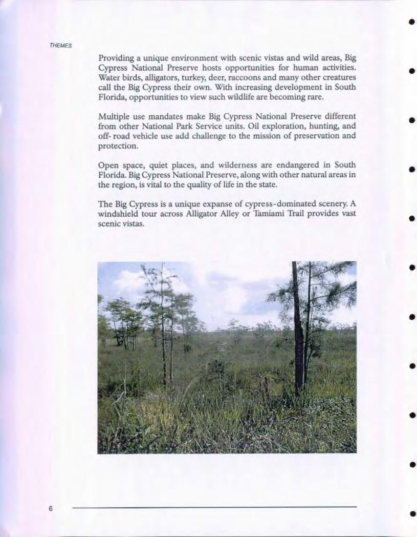
The Big Cypress is a unique expanse of cypress-dominated scenery. Awindshield tour across Alligator Alley or Tamiami Trail provides vastscenic vistas.
.l„ ' -,. I Oi 6 . • 111. 41
6
VISITOR EXPERIENCE OBJECTIVES
Visitor experience may be described as those memories visitors accrue
during their contact with a place. Often the most memorable experi-
ences occur informally. The best experience for some visitors could be
a casual drive through a cypress swamp. Others may remember the gen-
tle pattern of flight of an egret across a marl prairie. Surprise at finding
an alligator basking between the road and canal may become another
visitor's most memorable experience.
Resources and facilities provide opportunity for a variety of experiences
throughout the Preserve. Visitor experience objectives describe desired
ends or visions for the Preserve's future to be achieved through plan-
ning, design, development and operation. The following section
describes visitor experience objectives that should be facilitated by
Long- Range Interpretive Plan proposals.
VISITORS WILL HAVE OPPORTUNITY TO:
Learn information and stories associated with primary interpretive
themes to the depth that they choose and through a variety of
media.
• Enjoy improved visibility and image of the Preserve with local,
regional, and national communities.
• Participate in and enjoy a variety of active and inactive, safe, non-
damaging recreational activities ranging the spectrum from wild-
ness to social, including accessibility to off- road areas for adven-
ture, risk taking, and quiet solitude.
• Obtain information necessary to safely, enjoyably, and easily visit
natural and cultural features, visitor facilities, activities, and servic-
es.
• Understand the economic, environmental, recreational, and social
effects of Big Cypress on the South Florida environment and be
inspired to wisely use, develop, and preserve natural resources in
the future in their own sphere of influence.
• Experience current and historic lifestyles of the region to under-
stand similarities and differences between contemporary and his-
toric people.
• Participate in activities appropriate for audiences with differing lev-
els of interest, ability, understanding, sophistication, and time
7
VISITOR EXPERIENCE OBJECTIVES
frames; layers of involvement provide opportunity for each activity
to build on previous ones.
• Foster environmental consciousness and a sense of individualresponsibility for wise stewardship of the environment in general
and the Preserve resources in particular.
• Understand the interrelationships of the primary resources within
the Preserve and those of the South Florida ecosystems as a whole.
• Receive current, accurate, balanced information.
• Understand that the Big Cypress landscape is the product of prehis-
toric, historic, and continuing changes in natural and cultural envi-ronments.
• Participate in an array of interpretive opportunities developed incooperation with local, state, tribal, and federal agencies.
• Obtain thorough orientation to the variety and significance ofresources and the opportunities to experience those resources at avariety of levels to meet the needs of most visitors.
• Experience individual media, non- personal and personal, thatcomplements all other media; it will be obvious to visitors that allmedia and activities were planned, designed, produced, and pre-sented to build upon each other rather than compete or repeat.
• Enhance their curiosity to learn more about the resources they drivethrough as they cross the Preserve.
• Understand and appreciate Big Cypress' natural and cultural histo-ry, and be able to relate it to the broader scope of South Florida andAmerican experience.
• Participate in a scenic drive through a variety of landscapes repre-senting South Florida ecosystems.
• Explore the diversity of Big Cypress' natural and cultural resources
and be inspired to participate in perpetuation of the area's natural
and cultural heritage.
• Find universal accessibility to resources, media, and activities that
are culturally inviting to all constituents.
• Interact with National Park Service staff and programs that provide
opportunity to understand and support National Park Service mis-
sion and contribute to perpetuation of Preserve values.
8
EXISTING CONDITIONS
Visitors to Big Cypress National Preserve currently have few options for
an extended exploration of the area unless they are off- road vehicle
users or backcountry hikers. The following conditions are found along
each route.
•
Visitor Use and Administrative Areas
Long-Range Interpretive Plan
5 10 15 Miles
B1q Cypress National Preserve
U1rt. d f^ D.p.rme= of UN aea.A.rNone" P &Tk ON.w
ECT-COL LAW O L.p . 11/11.1
9
EXISTING CONDITIONS
INTERSTATE 75 - ALLIGATOR ALLEY
Recreational accesses allow visitors to enter the Preserve by foot fromeither north or south of the interstate. These recreational accesses (milemarker 70) have vault toilets and one bulletin board with standard trailinformation at each trailhead. An off- road vehicle trail on the south sideof the interstate leads the walker into hardwood hammocks andpinelands. There is no designated trail. The north side leads the hikerinto the Bear Island/Addition Lands area. There is no designated trail.Another recreational access point is planned for L- 28 at mile marker 53onI-75.
Further along the interstate to the east at mile marker 63, a FloridaDepartment of Transportation rest area provides the visitor an oppor-tunity to. stop. There is presently no information about the Preserve atthe rest area. Just east of the rest area, the Florida National. Scenic Trailgoes north into the Addition Lands and south into theCorndance/Turner River units of the Preserve.
Plans are underway for a series of low frequency FM radio broadcaststations for this highway. This will be a cooperative effort between theFlorida Department of Transportation, National Park Service, and otherinterested parties.
STATE HIGHWAY 29
From just south of Sunniland to just south of Everglades City, FloridaHighway 29 forms the western border of Big Cypress National Preserve.An access (walk in or bicycle in) from this road opens into the BearIsland Unit of the Preserve. Bicyclists use this route infrequently, most ofthose attending interpretive bicycle tours on winter weekends.
Recently purchased property near Deep Lake allows access by foot tothe lake, a sinkhole, full of fish and delightful. Deep Lake is reportedlythe only sinkhole of this size in South Florida. It is approximately 90 feetdeep. Barron Collier had a hunting and fishing lodge here, the founda-tion of which can still be found. The lake has a dedicated following ofpeople who grew up there with their families in the twenties and thirties.The property is being cleaned up and readied for public access; howev-er, now old picnic tables are the only visitor amenities.
The Everglades Area Chamber of Commerce leases property owned bythe National Park Service at the intersection of Florida 29 and US 41 tooperate a visitor information center. This information center is small
10
EXISTING CONDITIONS
and in need of major repair. The chamber has rejected offers to partic-
ipate in a new facility at that site. Their lease extends another 14 years.
The National Park Service is building a new facility funded with federal
highways money through the Florida Department of Transportation
adjacent to US 41 between Highway 29 and the national preserve head-
quarters building.
Boat access from the Everglades City area into the Preserve is available
through Halfway Creek, Turner River, and Barron River.
HIGHWAY 41 - TAMIAMI TRAIL
This corridor was designated a state scenic highway in 1999, and a
National Scenic Byway in 2000, but it offers few visitor amenities. The
Denver Service Center has completed a Scenic Highway Improvements
Conceptual Design Plan for additional safety and amenity development
along the highway. The plan proposes turn lanes into areas of interest
and parking lots at several locations to alleviate the problem of visitors
stopping along this busy highway to look at birds and alligators.
Seagrape Drive provides a bulletin board, boat ramp, and popular fish-
ing from shore. Dona Drive has a dump station that also operates as a
visitor contact point in the winter season when volunteers staff a booth.
HP Williams roadside park at the turnoff for the Turner River Road (see
below) is a popular picnic and alligator viewing area but has no inter-
pretive facilities.
Burns Lake campground has been closed to the public to eliminate
competition with a nearby privately owned campground. It is used as a
hunter camp in the fall and a group camp occasionally in the winter. A
bulletin board has been used in the past to post interpretive information
and services.
Kirby Storter roadside park is owned by the Florida Department of
Transportation. An old boardwalk previously used for access into a
cypress strand has been closed for several years due to unsafe condi-
tions. The Scenic Highway Improvements Conceptual Design Plan calls
for current parking areas on the roadside to be removed. A parking area
and interpretive trail will be located just west of the present Kirby
Storter parking areas.
A bulletin board welcomes campers to Monument Lake Campground,
the only fee campground in the Preserve. A small amphitheater with a
11
EXISTING CONDITIONS
fire pit, screen, and electricity hosts campfire programs on two nights in
the winter season (December 15- April 1). Benches are inadequate for
the number of campers using the area.
The National Park Service now owns an abandoned gas station atMonroe Station. This building has been listed on the National Register.
Unfortunately, the building is in very poor condition and is beyond
repair. Termites have riddled the entire structure. A nearby fenced lot
formally used to store off- road vehicles will become a public parking
area for backcountry users.
Big Cypress Visitor Center, the Preserve's primary and only visitor cen-
ter, is located in an old gas station/airport building. A small reception
area displays local wildlife (birds, snakes, and small mammals). A table
case displays a Florida panther while a small exhibit case holds a collec-
tion of tree snails. A small sales area supplied by the Florida National
Parks and Monument Association vends books and maps. A 50- seattheater allows on- request showing of a 1214- minute movie, The LivingWaters of Big Cypress. The movie, now pressed onto laserdisc, is popu-lar with visitors but is outdated and showing it. This facility, the movie,and the displays are sorely inadequate and do not meet NPS standards
for interpretation.
The Florida National Scenic Trail travels north and south from the visi-tor center. Guided interpretive walks on the trail are generally wet walks
with visitors often knee to waist deep in water and mud.
Midway Campground, a short distance east of the visitor center, offersfree camping with a vault toilet but few other amenities. A bulletin boardpresents campground information and other materials. No other visitorservices are available between Midway Campground and the Preserve'seastern boundary.
TURNER RIVER ROAD
This road goes north from US 41 into the Bear Island area . It does notprovide access onto I- 75 although it passes under the interstate. Along
Turner River road a canal attracts myriad wildlife . This is wherePreserve staff send visitors who want to slow down, get off main high-
ways and actually see the Preserve.
A 17- mile loop drive follows Turner River Road to Wagonwheel Road
and down Birdon Road to return to US 41. These gravel/dirt roads aregenerally in good repair but get washboard surface in late winter.
12
EXISTING CONDITIONS
Two walkable trails lead off Turner River Road. Concho Billy Trail is an
off- road vehicle trail that follows an old oil road to an oil pad and
beyond. The trail passes through a variety of habitat types, however, it is
also a primary off- road vehicle (ORV) access point potentially causing
considerable conflicts between hikers and ORVs. Further up the Turner
River Road, just south of I- 75, the Fire Prairie Trail goes west into the
Deep Lake Unit. This area is closed to off- road vehicle traffic and pro-
vides a pleasant walk into a prairie ecosystem.
At the end of the road, Bear Island Campground is a pleasant out of the
way area popular with off- road vehicle users and hunters. Two desig-
nated off- road vehicle routes depart from Bear Island forming a 20-
mile loop. Bicycling is allowed on any of these trails.
LOOP ROAD
This road is a rough, partially paved, mostly dirt track through wonder-
ful cypress and prairie terrain. The west end is very wild with goodwildlife viewing opportunities.
Gator Hook Nature Trail is proposed to follow an old logging tram fromthe Loop Road east into the Robert's Lake Strand.
At Sweetwater Strand a viewing deck is planned adjacent to the road toallow relaxed viewing of this lovely cypress strand.
The southern terminus of the Florida National Scenic Trail intersectsLoop Road. The section of the trail from the visitor center to Loop Roadis not heavily used due to its continuous wetness, but it is a uniqueexperience and delightful in the driest months.
Two primitive campgrounds along Loop Road, Pinecrest and Mitchell'sLanding (also known as Redbird Lane), have no amenities and aremostly used by hunters and off- road vehicle drivers.
The Loop Road Education Center is in Big Cypress National Preserve,but has been operated through Everglades National Park since itsinception. Across the road from the education center the Y2 mile TreeSnail Hammock Nature Trail loops through a mature hardwood ham-mock. Old signposts correspond to a brochure no longer maintained.Mosquitoes make this trail unbearable in all but the driest winter.
13
EXISTING CONDITIONS
. . AVAILABLE VISITOR ACTIVITIES
Driving tours Listed above.
Backcountry camping by hiking or off- road vehicle - Dispersed high
ground campsites throughout the Preserve. Off- road vehicle campers
must use trails where designated.
Off- road Vehicle Use - Little interpretation or education has been
offered to this user group. In the implementation of the Off- RoadVehicle Management Plan an education program has been initiated. It
includes orientation to the rules and regulations of the Preserve and will
be modified for the future to include other information.
Canoeing/Kayaking - Popularity of Halfway Creek and Turner Rivercontinually increases as information spreads about the attractions ofthese tunnel creeks. Everglades National Park and Big Cypress NationalPreserve interpreters lead canoe trips on both waterways.
Hunting and Fishing - Hunting and fishing are allowed in the Preserve
as authorized in the enabling legislation.
Birding and Wildlife Viewing - This activity is becoming very popular
as ecotourism groups discover that Big Cypress has better birding thanmany other places in South Florida. Turner River Road is the most pop-ular locale for this activity. If the Loop Road were in better condition ittoo would be very popular.
Hiking - Seasonally, Big Cypress has many opportunities for hiking.
Wet season presents challenges daunting to most hikers including knee
to waist deep water, mud and heat, humidity and mosquitoes. The dry
season, particularly January, February, and March, provides excellent
opportunities for extended hiking. The Loop and Deep Lake Units and
several other units designated by the Off- Road Vehicle Management
Plan do not allow off- road vehicle use. These areas are more amenable
to a true wild hiking experience than many other locations. During the
winter season, wet- walks are provided by National Park Service inter-
preters. This big adventure is popular with those who learn about it,
although sporadic advertising has kept program attendance low.
Environmental Education - In 1999, the Preserve obtained a Parks as
Resources for Knowledge in Science grant from the National Park
Foundation and Exxon. This grant enabled the Preserve to establish a
fledgling environmental education program in coordination with the
14
EXISTING CONDITIONS
Collier County schools. Sixth grade students have the opportunity to
track radio collars like, panthers wear, do water quality and quantity
measurements, test soil, and make other assessments of three habitat
types in the Preserve. A ranger visits schools prior to the field trip to
present an orientation slide program. Students are given facts about
safety, including snakes and alligators, and told to be prepared to get wet
and muddy. Teachers are provided with a curriculum of pre and post
field trip activities for classroom work. The curriculum is closely tied to
Sunshine State Standards and was developed in close coordination with
teachers. A converted house on US 41 houses a temporary
Environmental Education Center.
Web Pages - The current web page, www.nps.gov/bicy, provides
thumbnail information about visitor services and opportunities. Draft
expanded web pages are underway including hiking, fishing, off- roadvehicle use, birding, kids, and panther news.
CONCLUSION
Many opportunities for development of interpretive experiences for thepublic exist in Big Cypress National Preserve. Observations and visitorsurveys show that most of the Preserve's heavy winter visitation is
drive- through visitors on their way to Everglades National Park and theFlorida Keys. There is a large population on each coast interested inactivities and services that are easily accessible. The main constituencyfor non- personal services is the drive- through visitor using US 41 andI- 75 as well as the Internet visitor.
15
ISSUES
OFF- ROAD VEHICLE USE
Off- road vehicles (ORVs) such as swamp buggies and airboats have tra-ditionally operated within the Preserve. Later three and four wheelers
were added to the ORV use. This use under past management practices
has resulted in significant resource damage. Sensitive habitats including
prairies have been severely impacted. Current implementation of theRecreational Off- Road Vehicle Management Plan will change the char-
acter of vehicle use within the Preserve. The plan calls for designated
ORV trails throughout sections of the Preserve remaining open to
ORVs, closure of prairies and other areas impacted and changes therequirements for permits. Communication, education, and interpreta-tion will be key for all users as changes occur. Great opportunity exists
to reach this potential audience with conservation and stewardshipmessages.
LACK OF NAME RECOGNITION AND KNOWLEDGEOF RESOURCES AND AVAILABLE AMENITIES
Big Cypress National Preserve is not well- known by potential con-
stituents who live in and visit the major population centers of each coast
of South Florida. The I- 75 and US 41 corridors that cross the Preserve
provide visitors an opportunity to view Preserve landscapes. It is a rare
opportunity for the National Park Service to have such a large potential
audience to experience what is described as the critically endangered
natural system in South Florida. However, most travelers speed through
the resource without knowing about many opportunities to understand
the significance of what they are seeing. Education and interpretation
will be key in keeping public lands wild in the fast growing area.
VISITOR INFORMATION/ORIENTATION
A small information center operated by the Everglades Area Chamber ofCommerce at the corner of US 41 and Florida 29 is in need of major
repair. The Chamber of Commerce has rejected offers to participate in
a new facility at that location. In addition, a new facility is planned
between Highway 29 and the current Preserve headquarters building to
provide visitor information and orientation.
16
0
ISSUES
•
•
•
•
•
FUTURE OF INTERPRETIVE PROGRAM
Big Cypress' interpretive program is young and lacks media to orient,identify, and interpret the important natural and cultural resourcesentrusted to the Preserve. Visitors have few opportunities to access parkfeatures, to know what they are seeing, and to understand the complex-ities that the Preserve faces in managing and protecting these resources.The current visitor center is inadequate to visitor needs and is not up toNPS standards for visitor facilities or interpretive media. A completeremodel of the existing building with expansion into other sectionsincluding garage bays or a new building is sorely needed.
FUTURE OF ENVIRONMENTAL EDUCATION PRO-GRAM
Short term grant- based funding for a Preserve environmental educationprogram established a temporary Environmental Education Center.Funding for continuation of the program is uncertain.
FLORIDA PANTHER RECOVERY
Approximately 50 Florida panthers roam the wild areas of SouthFlorida. Half of these use Big Cypress National Preserve regularly.Although public opinion is positive, educational efforts are still needed
to protect the remaining population of panthers.
COMPREHENSIVE EVERGLADES RESTORATIONPLAN (CERP)
CERP will affect Big Cypress National Preserve in ways not yet known.The Southwest Florida Feasibility Study will have impacts on BigCypress and vice versa. Education of the public about these issues willprepare them for changes the projects will create.
MULTI- SPECIES RECOVERY PLAN
The multi- species recovery plan addresses critical recovery of habitatsand needs of species such as Cape Sable seaside sparrow and manatees.These habitat preservation efforts will be critically linked to interpretiveefforts, especially outreach in the local communities.
17
ISSUES
FIRE MANAGEMENT
Fire is an ongoing issue in Florida. Public opinion for prescribed burn-
ing is positive. Education and public information must continue to pro-
vide knowledge needed to perpetuate efforts begun a decade or more
ago:
HUNTING AND FISHING
Education of users and non- users enhances understanding of human
impacts on the resource and ways to minimize those impacts. Many
users underestimate the value of public lands in maintaining these
recreational opportunities.
WATER QUALITY/QUANTITY
The Preserve, because it is an enclosed watershed for most of its area,
holds some of the purest fresh water in South Florida. Surrounding
waters in canals and agricultural runoff areas, however, are some of the
poorest water quality in the state. Quantities on the eastern side of the
Preserve are often affected by canal structures to the north and east. As
south Florida begins to implement the Comprehensive Everglades
Restoration Plan, changes in water flow and other issues will become a
lasting legacy and challenge. Interpretation can play a major role in vis-
itor use and perception of water and water issues in the state.
HABITAT PROTECTION
South Florida's human population is expanding rapidly. Wild places
become rarer every year. The importance of protection of habitat and
preservation of wild lands are messages that need to be spread. Many
people take public land for granted. Eyes opened to the importance of
this valuable piece of our nation's heritage will keep portions of South
Florida wild.
ROAD, BRIDGE, AND CULVERT CONSTRUCTION
Construction projects create unavoidable inconvenience to Preserve
visitors. Information services will alleviate some of the complaints and
holdups.
18
DIMINISHING WADING BIRD POPULATIONS
Wood storks, roseate spoonbills, and other species have problems nest-
ing in years when human intervention of water quantity and timing do
not correspond to natural water patterns. Although the National Park
Service and many other agencies have done a good job informing peo-
ple about the need for compatible wildlife and human interaction, con-
tinuing efforts are needed to assure compatible interaction.
WILDLIFE SAFETY
Human, alligator, and other wildlife encounters have resulted in few
injuries; however, the opportunities for negative encounters increase as
the number. of visitors increase. Multi- lingual safety information is
needed to respond to the increase in non- English speaking visitors.
HIGHWAY SAFETY
Speed and volume of traffic on both I- 75 and US 41 create unsafe con-
ditions for visiting a National Park Service unit. Safety consideration
needs to be addressed.
BACKCOUNTRY USE
Many people using backcountry areas do not understand and apply
minimum impact techniques. Leave- No- Trace® concepts need to be
taught to backcountry users.
POACHING OF PLANTS AND ANIMALS
Many visitors and local residents are not aware of Preserve rules and
regulations. Others simply ignore them due to lack of enforcement.
Information and interpretation are needed to educate potential inno-
cent pilferers and to encourage those who observe rule infractions to
report incidents.
EXOTIC PLANTS
Many non- native invasive plants impact native species in the Preserve.
Educational efforts can assist in efforts to reduce invasive seed intro-
duction and to increase "eyes" in the field to report outbreaks.
ISSUES
19
•
ISSUES
CULTURAL HISTORY OF THE PRESERVE
Although the Preserve has a rich cultural history, knowledge of that his-tory is lacking . The Southeast Region Archaeology Center has donebasic archaeological resource inventories , but further studies , includinga paleolimnology of Deep Lake and basic secondary source research onPreserve history, need to be done.
ENCROACHMENT BY DEVELOPMENT ON ALL SIDES
Development on all sides of the Preserve threatens to create anotherisland unit of the National Park Service. Education may assist locals inplanning and zoning decisions that will make a difference in the future.
OIL AND GAS EXPLORATION
Increasing pressure to develop oil and gas resources will occur. An Oiland Gas Management Plan is being developed to replace the currentMinerals Management Plan.
ACCESSIBILITY
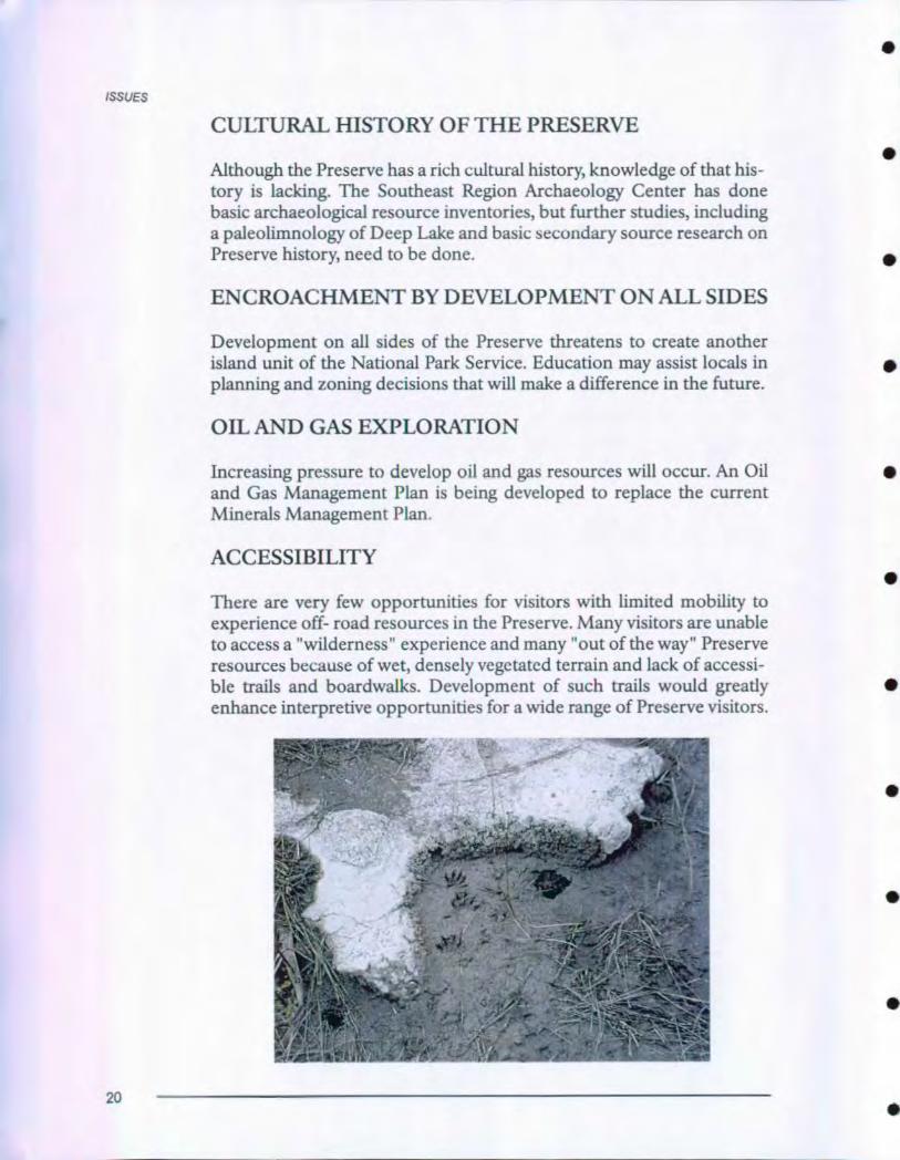
There are very few opportunities for visitors with limited mobility toexperience off- road resources in the Preserve. Many visitors are unableto access a "wilderness" experience and many "out of the way" Preserveresources because of wet, densely vegetated terrain and lack of accessi-ble trails and boardwalks . Development of such trails would greatlyenhance interpretive opportunities for a wide range of Preserve visitors.
20
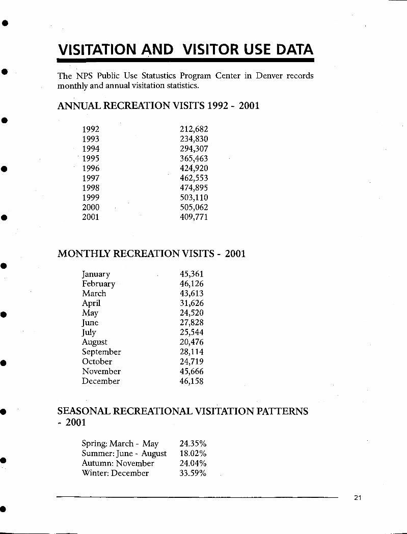
VISITATION AND VISITOR USE DATA
The NPS Public Use Statustics Program Center in Denver recordsmonthly and annual visitation statistics.
ANNUAL RECREATION VISITS 1992 - 2001
1992 212,6821993 234,8301994 294,3071995 365,4631996 424,9201997 462,5531998 474,8951999 503,1102000 505,0622001 409,771
MONTHLY RECREATION VISITS - 2001
January 45,361February 46,126March 43,613April 31,626May 24,520June 27,828July 25,544August 20,476September 28,114October 24,719November 45,666December 46,158
SEASONAL RECREATIONAL VISITATION PATTERNS- 2001
Spring: March - May 24.35%Summer: June - August 18.02%Autumn: November 24.04%Winter: December 33.59%
21
VISITATION AND VISITOR USE DATA
VISITOR CHARACTERISTICS AND EXPECTATIONS
The Visitor Services Project, University of Idaho Cooperative ParkStudies Unit, conducted a visitor study in Big Cypress National Preserveduring January 2- 10, 1999. Visitors returned 582 of 857 questionnairesdistributed for a 68% response rate.
The following summary of this report profiles Big Cypress NationalPreserve visitors.
• Over one- half (62%) of the visitor groups was family groups. Sixtypercent of visitor groups were groups of two. Fifty- two percent ofvisitors were over 50 years old.
• Sixty- one percent of visitors were making their first visit to BigCypress National Preserve. Most of the visitor groups (81 %) spentless than a day at the park. Of those groups that spent less than a day
at the park, 71 % spent four hours or less.
• United States visitors were from Florida (32%), New York (3%), and42 other states including Washington D.C. International visitorscomprised 21% of Big Cypress National Preserve visitors. Theywere from Germany (32%), Canada (21%), England (16%), and 18other countries.
• The sources of information most used by 390 visitor groups werefriends or relatives (29%), previous visits (28%), travel guide/tourbook (27%), and highway information signs (23%).
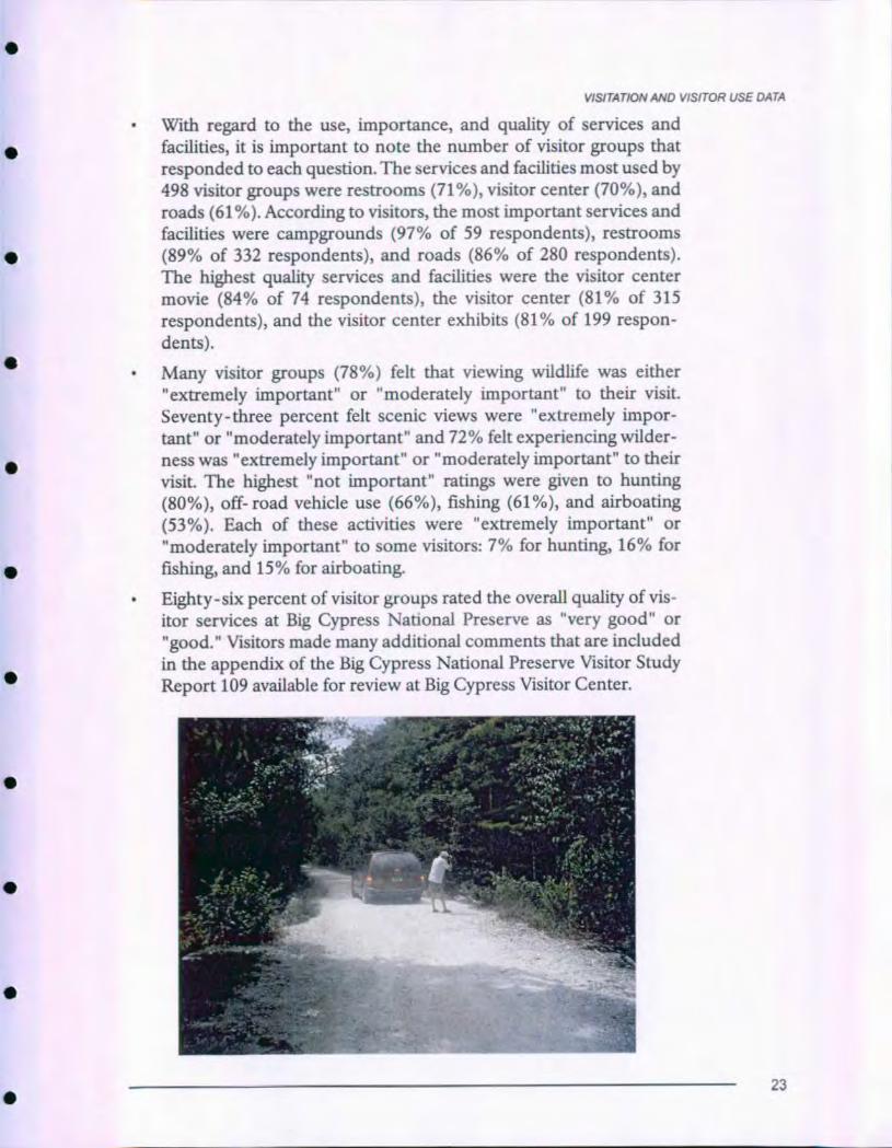
On this visit, the most common activities were sightseeing (66%),viewing birds (66%), visiting the visitor center (63%), viewingwildlife other than birds (60%), and driving through to reachanother destination (60%).
• On this visit, the most commonly visited sites within Big CypressNational Preserve were the visitor center (60%) and H.P. WilliamsPark (28%). The least visited sites include Bear Island Campground
(4%) and the Florida National Scenic Trail (4%). The visitor centerwas the site listed most often as the first site visited within the park
(47%), followed by H.P. Williams Park (14%).
• Most of the visitor groups (90%) indicated that the issue of wildlifehabitat is either "extremely important" or "moderately important"
to the future of Big Cypress National Preserve. Eighty- six percent
of groups rated endangered species as an "extremely important" or"very important" issue, and 83% indicated that water quality is"extremely important" or "very important" to the future of BigCypress National Preserve.
22
VISITATION AND VISITOR USE DATA
• With regard to the use, importance , and quality of services and
facilities , it is important to note the number of visitor groups that
responded to each question. The services and facilities most used by
498 visitor groups were restrooms ( 71 %), visitor center (70%), and
roads (61 %). According to visitors, the most important services and
facilities were campgrounds ( 97% of 59 respondents), restrooms
( 89% of 332 respondents ), and roads ( 86% of 280 respondents).
The highest quality services and facilities were the visitor center
movie (84% of 74 respondents ), the visitor center (81% of 315
respondents), and the visitor center exhibits (81% of 199 respon-
dents).
• Many visitor groups (78%) felt that viewing wildlife was either
" extremely important " or "moderately important " to their visit.
Seventy-three percent felt scenic views were "extremely impor-
tant" or "moderately important" and 72% felt experiencing wilder-
ness was "extremely important " or "moderately important " to their
visit . The highest " not important " ratings were given to hunting
(80%), off- road vehicle use (66%), fishing (61%), and airboating
(53%). Each of these activities were "extremely important" or
"moderately important " to some visitors : 7% for hunting , 16% for
fishing, and 15% for airboating.
• Eighty-six percent of visitor groups rated the overall quality of vis-
itor services at Big Cypress National Preserve as "very good" or
"good ." Visitors made many additional comments that are included
in the appendix of the Big Cypress National Preserve Visitor Study
Report 109 available for review at Big Cypress Visitor Center.
23
INTERPRETIVE PROGRAMDESCRIPTION
INTRODUCTION
This section of the LRIP proposes educational and informational mediaand personal services to enhance the interpretive future of Big CypressNational Preserve. It responds to the assessment of existing and plannedvisitor use programs described in the BACKGROUND FOR PLAN-NING section of the plan. Proposals are specific enough to defineinterpretive concepts but not so prescriptive they thwart the creativity offuture media designers and Preserve interpretive staff.
Interpretive proposals will be described for each of the following: Pre-arrival Information and Orientation, Arrival Experience, Preserve- wideRecommendations, Development Recommendations, I- 75 CorridorAlligator Alley, Florida 29/US 41 Corridor Tamiami Trail, TurnerRiver/Birdon Loop, Turner River Road, Loop Road, and Backcountry.
Most recommendations in this plan are based on existing approvedplans, such as the General.. Management Plan, the Off- Road VehicleManagement Plan, and the Scenic Highway Improvement ConceptualDesign Plan. Recommendations for facility construction, building mod-ifications or relocation, and landscape design concepts may be pro-posed in this section to achieve visitor experience objectives. The feasi-bility and design of these concepts will need further evaluation inimplementation plans, such as schematic design plans or design conceptplans.
24
PRE-APPRIVAL INFORMATIONAND ORIENTATION
•
•
•
Anticipation and excitement about Big Cypress National Preserveshould begin.long before visitors arrive at the Preserve. Potential visitorsand others seeking knowledge of the Preserve will have convenientaccess to adequate, accurate information and interpretation of themes,resources, activities, and programs while at home and as they travel tothe Preserve.
From their homes potential visitors can find information through tele-phone, publications distributed by mail, local media broadcasts, and thePreserve's home page address on the Internet.
A variety of publications (see page 33) will inform potential visitors andothers interested in the Preserve about what to expect, including chal-lenges of the swamp experience and how to prepare for it.
People accessing the Preserve website on the Internet will learn aboutsignificant resources, resource management programs and specialactivities, programs, and visitor services. The website will include anexpanded "virtual visitor center" that provides evocative interpretationfor people who cannot visit the area. Electronic versions of site bulletins(see page 34) provide detailed information about specific topics. Asbandwidth problems in the National Park System are solved, short dig-itized video clips of footage from the proposed swamp walk education-al outreach video (see page 32) and new visitor center interpretive film(see page 59) can easily be incorporated into the website. Pages dedicat-ed to each division or each function (interpretation, protection,resource management, park management and administration, etc.) maybe developed and linked to a central page. Links to other South Floridawebsites will allow people to contact partnership entities for specificinformation about related sites.
The video version of interpretive film (see page 60) made available toregional tourism offices, local cable television and other closed circuitsystems will reach a large number of potential visitors in urban areas onboth Florida coasts.
As visitors approach the region, they will be attracted to the Preserve bycooperative promotion of visitor experience opportunities throughFlorida cultural and natural sites, state and local tourism media, andbrochures distributed at state and regional welcome centers.Descriptions of the Preserve can create images of an intriguing naturallandscape with a multitude of wildlife and many opportunities forrecreational and educational experiences.
25
ARRIVAL EXPERIENCE
Arrival information will make visitors aware that roads across BigCypress National Preserve are more than commuter routes betweenNaples and Miami. They also offer access to an array of natural and cul-tural features and recreational opportunities. Arrival information willencourage visitors to explore and discover the Preserve in its manyexpressions.
Visitors can easily identify the Preserve entrance. Changes in landscapecharacter from that experienced on the approach create a sense ofarrival at a special place. Entrance and exit signs on I- 75 and US 41 needto be prominently displayed and identify Big Cypress National Preserveand National Park Service. Visitors traveling between EvergladesNational Park and Big Cypress National Preserve will find a clear dis-tinction between the areas and sense that both are equally important asNational Park Service units.
Immediately before or after the Preserve entrance visitors will findreadily available , easily accessible and clearly stated orientation , direc-tions and information about how to best experience resources . Signs,roads, trails , and information will make desired travel routes easy to fol-low, interesting to the senses , and barrier free. Location of contact facil-ities that provide additional information and interpretation must beclearly identified . Signs will direct visitor attention to four TravelersInformation Radio Stations , one at each entrance to the Preserve on I-75 and US 41. Each station will provide information appropriate to itslocation with content written and narrated in an interpretive style. Eachstation will welcome visitors to the Preserve , describe visitor experienceopportunities , encourage visitors to observe the resources as they drivethrough the area and identify and encourage participation in availableexperience opportunities . Each will invite people to escape fast pacedhighway travel to explore Preserve resources , introduce the concept of aSouth Florida ecosystem and the need for preservation of these impor-tant resources , and identify nearby visitor contact facilities as essentialstops for additional visitor information . Design and installation of radiofacilities will be coordinated with the National Park Service TISCoordinator, WASO Office of Operations Engineering.
26
PRESERVE-WIDERECOMMENDATIONS
Resources and facilities throughout the Preserve give visitors manyopportunities to participate in a variety of activities appropriate foraudiences with different levels of interest, understanding, and sophisti-cation. Most visitors will find activities that match their preferred levelof involvement with the area. Some may choose in- depth education.Others will select activities appropriate for an extensive involvementwith South Florida environments. Still others can pursue a casual. parkdriving experience. A few may only want to get away from their work fora short time or to picnic in a pleasant area. Whatever their level of inter-est visitors can quickly identify options and select the ones most likely tomeet their needs.
Easy, convenient access to all significant Preserve resources, programs,and facilities will minimize distractions from non- preserve attractions.Interpretive programs and services contribute to clean, comfortable vis-itor use areas and a safe environment throughout the Preserve. Polite,sensitive, knowledgeable, courteous, professional, and efficient staff,and innovative media will provide accurate interpretation based on thebest available documented research.
Entry signing, directional signing and orientation and interpretationwayside exhibits throughout the Preserve need to be coordinated. Signsand wayside exhibits need to reflect design compatibility and consisten-cy. This long- range interpretive plan recommends an updatedPreserve- wide sign plan be developed in conjunction with a waysideexhibit proposal and plan (see page 34) and the Scenic HighwayImprovements Conceptual Design plan to consider location, message,and design of all signs and wayside exhibits.
Visitors who tour the area will find a variety of experience opportunitiesthat help them acquire an understanding and appreciation of Preservevalues and a sense of the importance of protecting those resources. Theinterpretation program will incorporate a variety of media, includingpersonal services, exhibits, waysides, publications, audiovisuals, andweb pages to meet the needs of varied existing and potential audiences.At many places in the Preserve, the drive and vistas are so powerful aformal interpretation activity may be a distraction. At other sites, mediacan help explain how these magnificent natural features were formed.
Wayside exhibits can play a significant role in informing visitors aboutresources and the management actions necessary to protect and per-petuate them for future generations. Interpretation of fire at Big Cypress
27
PRESERVE-WIDE RECOMMENDATIONS
is a major story. Each year several fires burn thousands of acres. Natural
fires and fires set by aborigines were an important factor in Big Cypresslong before the arrival of Europeans. Now fire management concen-trates on suppression and prescribed fire to reduce hazardous fuel lev-els and maintain habitat vitality. Movable wayside exhibits that describethe management action of prescribed fires will be developed and placedtemporarily at appropriate locations within the Preserve during and fol-lowing fires.
The Preserve will produce public service announcements and shortaudiovisuals to highlight specific management issues, especially issuessignificantly affected by adjacent communities. Audio spots can easilybe incorporated into travelers information station messages atentrances. Video and audio spots are adaptable to visitor contact facili=ties on I- 75, the new information center on US 41 and at Big CypressVisitor Center. Both audio and visual spots at Everglades City, Naples,Fort Myers, Fort Lauderdale, and Miami can reach large audiences innearby communities and as they travel through the Preserve.
PERSONAL SERVICES
Personal service activities will continue to be an essential component ofthe overall interpretive operation.
Personal services tailored to the needs of individuals or groups helppeople understand and appreciate the significance of the Preserve. Suchactivities have the advantage over most other media of being tailored tothe needs of individuals or groups. Live interpreters, whether behind aninformation desk, leading a tour, conducting a children's educationprogram in the swamp, or informally roving through sites frequented byvisitors are the best interactive devices in helping people experience,understand, and appreciate the Preserve's significance. Most personalservices unfortunately reach only a small number of the Preserve's totalvisitation. For this reason, effective use of personal services will requirestationed assignments at visitor contact facilities and roving contacts atthe most frequented field sites. Continued staffing at the Big CypressVisitor Center, staffing at an information center proposed nearCarnestown, roving at key contact sites, conduct of environmental edu-cation activities, and occasional talks, guided walks, bike tours, andcanoe treks will constitute the Preserve's personal service program.
Frequent interaction between Preserve staff and other visitor serviceproviders ensure that potential visitors have accurate information aboutexperience opportunities and preparation needed for a safe and enjoy-able visit.
28
PRESERVE-WIDE RECOMMENDATIONS
A good training program is vital to ensure a well designed personal serv-ice interpretive progran'i that includes consistency and high quality,especially for jointly operated interpretive activities. In addition toteaching what goes on at various sites, a training program will focus oncontent, accuracy, completeness, and interpretive and communicationskills necessary for preparing and presenting programs and activities.
Visitation to various sections of the Preserve will be monitored regular-ly and personal service activities scheduled in response to changing vis-itation patterns to assure maximum visitor contact possible within allot-ted budget.
The personal service interpretive program will be routinely examined toevaluate its thematic depth and diversity. Continuous appraisal of theprogram should focus activities on specific resources and compellingstories. Appraisals also assure that visitor desires and management needsare met with the greatest possible effectiveness.
Preserve staff will continue to sponsor and/or assist with special eventsboth on and offsite.
Uniformed employees, volunteers, and cooperating association salesclerks will staff visitor center information and sales desks. Staff will givedirections to various points of interest in the Preserve and give informa-tion about special activities. Personal services at the visitor contact sta-tions give personal attention to regulations, safety, resource manage-ment issues, and other matters affecting Preserve use.
Roving interpretation at roadside overlooks and developed areas pro-vide informal visitor contact that encourages personal discussion ofPreserve themes. Rangers may present a variety of short, interpretivetalks at visitor contact facilities and campgrounds. Talks could focus onthe Preserve landscape and cultural and natural themes to interpret spe-cific resources in context of the entire Preserve and visitor perspectives.
Communication between Preserve staff and neighbors through out-reach programs create a positive personal relationship and effectivelycommunicates important resource based messages to local communitiesnear the Preserve. Interpretation plays an important role in educatingthe public about Preserve and adjacent land issues. Interpreters areresponsible for informing the public about the values of the Preserveand surrounding resources. They educate the public about the role andresponsibility of the National Park Service in land conservation. Theyalso encourage the public to accept personal responsibility in preservingthe Preserve and conserving resources in their own communities.
29
PRESERVE-WIDE RECOMMENDATIONS
The Preserve management team should consider establishment of aDivision of Interpretation as recommended in the Draft InterpretivePlan (1993) prepared by Southeast Regional Office. The increasing spe-cialization of disciplines across the National Park Service and the 1999
re-establishment of a Regional Chief of Interpretation in the SoutheastRegion support such an organizational structure. Reorganization of thePreserve management structure to include a Division of Interpretationwould require minimal change to staffing needed to implement the cur-
rent organization.
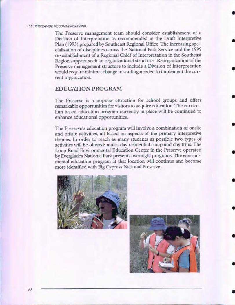
EDUCATION PROGRAM
The Preserve is a popular attraction for school groups and offers
remarkable opportunities for visitors to acquire education. The curricu-
lum based education program currently in place will be continued to
enhance educational opportunities.
The Preserve's education program will involve a combination of onsite
and offsite activities, all based on aspects of the primary interpretivethemes. In order to reach as many students as possible two types of
activities will be offered: multi-day residential camp and day trips. The
Loop Road Environmental Education Center in the Preserve operated
by Everglades National Park presents overnight programs. The environ-mental education program at that location will continue and become
more identified with Big Cypress National Preserve.
30
PRESERVF- WIDE RECOMMENDATIONS
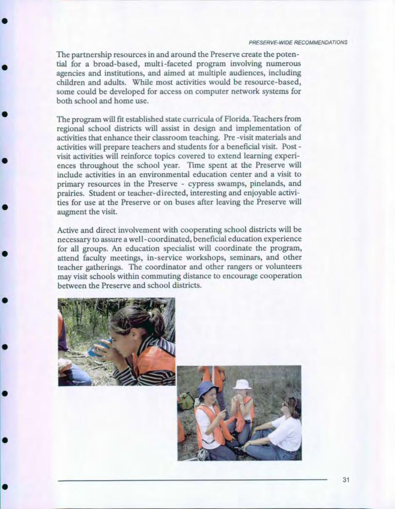
The partnership resources in and around the Preserve create the poten-tial for a broad - based , multi-faceted program involving numerousagencies and institutions, and aimed at multiple audiences , includingchildren and adults . While most activities would be resource - based,some could be developed for access on computer network systems forboth school and home use.
The program will fit established state curricula of Florida. Teachers fromregional school districts will assist in design and implementation ofactivities that enhance their classroom teaching. Pre -visit materials andactivities will prepare teachers and students for a beneficial visit. Post -visit activities will reinforce topics covered to extend learning experi-ences throughout the school year . Time spent at the Preserve willinclude activities in an environmental education center and a visit toprimary resources in the Preserve - cypress swamps, pinelands, andprairies . Student or teacher-directed, interesting and enjoyable activi-
ties for use at the Preserve or on buses after leaving the Preserve will
augment the visit.
Active and direct involvement with cooperating school districts will be
necessary to assure a well - coordinated , beneficial education experience
for all groups. An education specialist will coordinate the program,
attend faculty meetings , in-service workshops, seminars , and other
teacher gatherings . The coordinator and other rangers or volunteers
may visit schools within commuting distance to encourage cooperation
between the Preserve and school districts.
31
PRESERVE-WIDE RECOMMENDATIONS
During school breaks, the education program may be adapted to pro-vide teacher workshops for continuing education credits. Many self-directed activities developed for the education program may be madeavailable to individuals and family groups visiting the Preserve year-round.
The committee that developed the education program will be expandedand continue to function as an advisory and implementation group. Thecommittee will include representatives, especially classroom teachers,from school districts participating in the program, education associa-tions, university professors, and state department of education. Thecommittee may also assist with classroom and teacher workshops.
A house on US 41 - Tamiami Trail near Ochopee Post Office has beenconverted for temporary use as an environmental education center. Apermanent environmental education facility is needed as soon as possi-ble to add stability to the program. The permanent structure. must pro-vide adequate space to accommodate classroom and lab facility forschool groups. The site will be located off the main highway to reducesafety risks for children participating in the education program. An off-road location would also enhance educational experiences by placingthe program. center in resources reflecting the Preserve's natural andcultural values.
The Youth Environmental Services Program,.a state funded work reha-bilitation and education institution, supports the Big CypressWilderness Institute on Turner River Road, a work camp for seriousjuvenile offenders. Institute managers have requested National ParkService involvement in the program including a "curriculum" of guestspeakers. The Preserve can provide services that include ranger talks fororientation to the Preserve and classroom and field sessions by thePreserve wildlife biologist, exotic plant control specialist, fire suppres-sion officer, and others. This will help fulfill the Preserve's mission ofpublic education and the Institute's requirement to provide education tothe students in order to receive state funds to operate the facility andprograms.
An educational outreach video, "Swamp Walk," shot on digital videoformat will be developed for use in the environmental education pro-gram. It can be used as pre- visit orientation and training to prepareteachers and students in their classroom before visiting the Preserve. Itcan demonstrate activities that will be encountered at the Preserve todispel unnecessary fears. Footage for the "Swamp Walk" video will beshot by camera operator accompanying a field trip school group, gettingin the water with students, eavesdropping on reactions and comments,
32
PRESERVE-WIDE RECOMMENDATIONS
•
•
•
•
observing as they test water and practice scientific method to show theentire education process. The primary function of the video is to sup-port curriculum, but it could also be used effectively in fundraisingactivities.
PUBLICATIONS
Publications play an important role in the Preserve's interpretive pro-gram. Publication recommendations (including photographs, literature,or their electronic equivalents) can be divided into three types: generalpublications, general Preserve publications, and "site bulletin" topicalpublications.
General publications about South Florida subjects are readily availablethrough commercial sources. The cooperating association of thePreserve offers an excellent array of high quality products for sale in thevisitor center. The current product line will be continued and newproducts sought to improve, augment, or replace existing inventory.
The Preserve's primary information/interpretation brochure will bereplaced with a larger folder. Additional space will accommodate newtext, redesigned map and expanded graphics to encompass new devel-opments proposed in this long- range interpretive plan, off- road vehi-cle management plan and scenic highway improvement conceptualdesign plan. The new folder will build from and link to the proposedwayside exhibit system, new visitor contact facility exhibits, new audio-visual program and new wayside development plan to more effectivelyidentify interpretive opportunities available throughout the Preserve.
A small, moderately priced attractive educational booklet will providean affordable publication desired by most visitors. High color, profusegraphics/photos and little text will encourage use as visitors tour thePreserve. It could also provide a high quality souvenir to share withfriends and family and help visitors remember experiences.
A handbook describing and illustrating cultural and natural resources ofthe Preserve will provide the medium level of detail attractive to manyvisitors.
A more comprehensive treatment of the Preserve, perhaps a hard cover"coffee table" book, can provide information about changing land use inthe region. Describing history of land use, establishment of the Preserveand present land use management, and questioning where we go fromhere, the book will encourage support for the Preserve and provideideas for global conservation.
33
PRESERVE-WIDE RECOMMENDATIONS
A series of site bulletins for many topics will be developed, printed fordistribution onsite and through mail, and published on the Preserve'sInternet website. A site bulletin related to canals could explain the rea-sons for canal construction historically and in the present and describethe effects of canal construction on natural processes. It can include achecklist and description of wildlife most likely encountered along bor-row canals and may identify plants and trees associated with thesehuman- made aquatic environments. Additional site bulletins will bedeveloped as needs are identified. Suggestions for topics include Floridapanther, water, wildlife and safety during human/alligator interactions.Multi- lingual safety information is needed to respond to the increase innon- English speaking visitors. All park- produced publications will bedesigned to reflect a family resemblance.
Road Guides for Turner River- Birdon Loop and Loop Road ScenicDrive will be developed by Preserve staff to interpret significantresources and stories along those two routes. Attractive, inexpensivepublications can provide visitors interesting interpretation, effectivewayfinding, and an attractive souvenir.
RESEARCH AND PLANNING
Preparation of a long- range interpretive plan is the initial step in the
National Park Service comprehensive interpretive planning and media
planning, design, and production processes. Preserve staff will program
the following specialized and detailed plans to implement proposals in
this long- range interpretive plan.
A detailed wayside exhibit proposal and wayside exhibit design andproduction plan will be developed as soon as possible to implement thewayside exhibit concepts identified in this plan. Preserve staff can com-plete all or part of this planning effort in consultation with HarpersFerry Center or they may contract with a commercial planning anddesign firm or with Harpers Ferry Center to complete the exhibit pro-posal and design/production plan. To follow either route the followingsteps will be necessary.
The first step toward a wayside exhibit proposal determines the scope ofthe project. A wayside exhibit planner and designer will work withPreserve staff to identify all the exhibits that will be developed and toestablish the topic and purpose for each exhibit. The planner will pre-pare an exhibit proposal, which becomes the guiding outline for theproject, and a project agreement, which identifies the project budgetand schedule. The wayside exhibit proposal will address specific
34

0
PRESERVE-WIDE RECOMMENDATIONS
44
0
•
•
•
resources, terrain, and interpretive features at road pullouts, trails, andgathering points throughout Big Cypress National Preserve. Proposedexhibits will provide continuity of theme, design, and interpretive per-spective. Exhibits may use the National Park Service unigrid design tolink all Big Cypress sites and to relate Big Cypress wayside exhibits toother national park sites such as Everglades and Biscayne. The designwill provide a National Park Service identity at disparate sites and givevisitors a consistent visual vocabulary to help them easily assimilatecontent of each exhibit.
The wayside exhibit proposal will recommend material for each exhib-it. Most exhibit panels should be screen- printed and embedded infiberglass that resists weathering and vandalism and can be replacedinexpensively. Some exhibits, such as major map components at trail-heads and orientation panels, may be fabricated by direct digital print-ing to accommodate future changes in trail configuration, parking lots,and other features. Bases and hardware will be standard National ParkService design; however, design and fabrication will take into accountthe Preserve's special conditions that accelerate corrosion. The selecteddesign should be compatible with the Preserve's natural and developedlandscape.
The scope of the wayside exhibit design and production plan willinclude 50 to 60 wayside exhibits. This includes original full- size pan-els as well as small trailside exhibits, duplicate exhibits, and a few bul-letin cases. Once the plan project is launched Preserve staff will be thesubject- matter experts and will be expected to provide the bulk of ref-erence and graphic materials for creation of the exhibits. Harpers FerryCenter or other contract designers will be the media experts. They writeall exhibit text, collect all the final graphics, oversee the creation ofmaps, art, and contract photography, and create the full- color exhibitlayouts for Preserve staff revision and approval. Harpers Ferry Centercan also oversee all the production stages of the project. The plan willrecommend site development for most wayside exhibits. The goal of therecommendations will be a stable, erosion- resistant area for people tostand while reading the exhibit, improved accessibility, enhanced
attraction to the exhibit site, and a blend of the exhibit with the Preserve
landscape and walkways. Completion of the project may take two to
three years.
Coordination of the Wayside Exhibit Proposal and the Scenic HighwayImprovement Conceptual Design Plan is critical. Effective and efficientimplementation of wayside exhibit proposals and trail, boardwalk,parking and overlook proposals from each plan will avoid finishedproducts of each plan appearing haphazard and arbitrary.
35
PRESERVE-WIDE RECOMMENDATIONS
A visitor survey completed in 1999 provides basic data for interpretive
program planning. Additional visitor studies will routinely evaluate
effectiveness of existing and proposed interpretive and visitor experi-
ence programs in meeting the needs of the visitor types profiled in the
1999 study. Because of ever changing demographics these studies
should be conducted on a five to ten year cycle. More frequent,
thoughtful use of focus groups and other evaluation techniques will
assure that Preserve interpretive and other services are tailored to cur-
rent customers. Appendix B includes analysis of evaluation techniques
recommended for Big Cypress National Preserve.
The Preserve will seek funding for cultural resource studies. Ongoing
archeological resources inventories will be continued. New research
will be initiated to increase knowledge of Big Cypress' role in the under-
ground railroad, the settlement period and Calusa, Miccosukee Tribe of
Indians of Florida and Seminole Tribe of Florida use of the area.
PARTNERSHIP OPPORTUNITIES
The following description of partnership opportunities expresses Big
Cypress National Preserve interest in and collaboration with other
South Florida visitor service providers. Successful implementation ofthis long- range interpretive plan depends on continuation and expan-
sion of existing partnerships and initiation of new ones, especially with
visitor service providers in the immediate vicinity of the Preserve.
Positive cooperation among all providers of tourism services will help
each respond to the opportunities and challenges that face them.
Preserve interpretation can play a major role in resource preservation by
working in partnership with. the Preserve's protection and resource
management staff and other partners.
Many sites in the region offer visitor experience opportunities related to
South Florida natural and cultural stories. Visitors traveling to Big
Cypress National Preserve and other sites should find opportunities to
participate in an integrated, progressional program of interpretive
activities produced by the National Park Service and partners to offer a
complete, balanced South Florida experience.
Florida National Parks and Monument Association is a major
provider of information, interpretation, and education for South Florida
national parks and preserves. They sell Big Cypress, Everglades, Dry
Tortugas, and Biscayne titles at National Park Service visitor centers and
provide donated materials and funds to support visitor service pro-
grams.
36
0
PRESERVE-WIDE RECOMMENDATIONS
Everglades National Park has two entrances near the Preserve. The
Shark Valley entrance offers a visitor center and a two- hour conces-sioner operated tram tour through the Everglades interior. It also pro-vides an opportunity to orient visitors who are traveling west into the
Preserve. Basic personal service information and publications about
Preserve resources and stories can be distributed at the Shark ValleyVisitor Center. At the Gulf Coast Visitor Center, an hour and a half boat
tour of the Ten Thousand Islands and canoe rentals are available
through private concession. Both sites offer ranger- led activities duringthe winter season.
Two canoe trails begin off US 41 in Big Cypress National Preserve and
extend through a portion of Everglades National Park to terminate at
Chokoloskee Bay. The eight- mile Turner River Canoe Trail begins a
half- mile west of H. P. Williams roadside park and passes through
scenery that changes from freshwater cypress forests to open prairie, totropical saltwater mangrove swamp. Halfway Creek Canoe Trail begins
at Seagrape Drive near Preserve headquarters.
Loop Road Environmental Education Center inside Big Cypress
National Preserve is operated by Everglades National Park. The resi-
dential education center includes a chickee with picnic tables and food
storage box, platform tents, grills, restrooms, and campfire circle. Study
habitats used within the Preserve include pineland, sawgrass marsh,
cypress slough, hardwood hammock, and freshwater pond.
Coordination of education center overnight activities with day activities
in the Preserve will result in a well- balanced regional resource educa-
tion program.
Everglades Area Chamber of Commerce leases property to operate awelcome station at the US 41/Florida 29 intersection. The property and
lease that was originally negotiated with the Collier Corporation have
now been transferred to the National Park Service and is part of Big
Cypress National Preserve.
Fakahatchee Strand State Preserve, west of Big Cypress National
Preserve, claims the major drainage of southwestern Big Cypress Swamp
and the largest and most unusual of the strands. Its forest of mixed bald
cypress, native royal palms, and abundant epiphytic plants is extremely
rare. The unusual wildlife of Fakahatchee includes threatened and
endangered species such as the Florida panther that ranges between
Fakahatchee and Big Cypress preserves. A 2000- foot long boardwalk
meandering through old growth cypress enables visitors to easily expe-
rience the beauty of this unusual swamp. A scenic drive leads visitors
through a variety of habitats.
37
PRESERVE-WIDE RECOMMENDATIONS
Florida Panther National Wildlife Refuge, administered by Ten
Thousand Islands National Wildlife Refuge, lies adjacent to the Big
Cypress National Preserve's northwest boundary. The refuge manages
habitat protection programs, monitors wildlife populations, and con-
ducts research on habitat enhancement for Florida panthers. The refuge
is closed to all public access and use, but the refuge office in Naples
includes several exhibits.
Collier Seminole State Park features a wealth of vegetation and wildlife
typical of the Everglades region. A wilderness preserve located in. amangrove swamp is a prime example of how the region looked before
arrival of the first European explorers. A limited number of visitors are
allowed to visit the preserve section of the park by canoe each day for
wildlife and scenery observation and for primitive camping. Activities inother sections of the park include tent and recreational vehicle camping,fishing, boating and canoeing, hiking, boat tours, interpretive center,
and self guided nature trail featuring a boardwalk system and observa-tion platform overlooking a salt marsh.
The Seminole Tribe of Florida has opened a museum on the BigCypress Seminole Indian Reservation as an educational tool for bothtribal members and the non- Seminole community. The purpose of the
museum is to preserve, interpret and share the culture, language andcustoms of the Seminole Tribe of Florida. The site features exhibits on
the history of the Seminole people, a Seminole village and over one mile
of boardwalk for a nature trail. The proximity of this facility to thePreserve offers opportunity for Preserve staff to refer visitors to a loca-tion where they can receive interpretation of local native culture from
the Seminole people. It offers reciprocal opportunity for the museum toprovide visitors information about the Preserve.
The Miccosukee Tribe of Indians of Florida operates a cultural cen-ter along the Tamiami Trail east of the Preserve boundary. A culturalcenter offers opportunities for visitors to experience local culture as told
and lived by the Miccosukees. The proximity of this facility to thePreserve offers opportunity for Preserve staff to refer visitors to a loca-
tion where they can receive interpretation of local native culture from
the Miccosukee. It offers reciprocal opportunity for the cultural center
to provide westbound visitors information about the Preserve.
Other partnership opportunities will be explored throughout the
region. Partnerships will be sought with regional school districts toencourage education programs, with friends groups to assist interpreta-tion and with professional/educational organizations to conductresearch, resource management, and visitor surveys. Activities may
38
0
PRESERVE-WIDE RECOMMENDATIONS
•
is
include sharing of expertise and funding for training, historical and nat-ural research, special events and seminars, exhibit planning and devel-
opment, site promotion, and tours. Visitors and regional residents will
benefit from expanded, multifaceted visitor experience opportunities.Integration of interpretive themes will present a more complete, bal-anced story, and resources of each partner will be more efficiently uti-
lized.
ACCESS
Equal, reasonable, and universal access will be provided to the extentfeasible for all people, including those with sight, hearing, learning, and
mobility impairments; visitors who do not speak English; and the elder-ly and young children. Accommodation will be made for access toresources and most interpretive media. Guidelines and regulations areavailable to assist the staff and media/facility designers.
Public Law 90- 480, the Architectural Barriers Act, and the American'sWith Disabilities Act establish standards for physical access. Any newfacilities constructed, as a matter of course, will be designed for acces-sibility of visitors and employees.
All new interpretive media will conform to National Park Service June1999 Programmatic Accessibility Guidelines for Interpretive Media (seeAppendix A).
Existing programs and facilities will be made accessible as a high prior-
ity. A few premiere sites will be selected by interpretive and resourcemanagement staff for "Wilderness- on- Wheels" experiences. Creating,in locations where feasible, boardwalks or hard surfaced trails would
allow visitors with physical disabilities a chance to leave the roadway and
parking areas. Accessible trails would also appeal to visitors who have
limited time in the Preserve, yet desire short walks and time- off from
driving. Short trails into a variety of plant communities and several
landscapes will provide most visitors relatively easy access to the diver-
sity of Preserve resources. Kirby Storter is an example of trails that can
easily be adapted for boardwalk access.
Areas that cannot be made physically accessible will be interpreted by
alternative methods at nearby facilities to enable all visitors to under-
stand and appreciate the resource. Trailhead exhibits and publications
can bring distant, inaccessible sights to visitors in outdoor locations at
trailheads or overlook parking areas. Examples of sites that can benefit
from alternative access include Deep Lake, Gator Hook, Big Cypress
Visitor Center, and Kirby Storter.
39
PRESERVE-WIDE RECOMMENDATIONS
Basic orientation at Deep Lake will be provided at the parking lot for
visitors who do not or cannot walk to the lake. Wayside exhibits at the
parking lot can' use photos to present scenes of vegetation sheltering the
trail to the lake and views of the lake that are otherwise accessible only
by a long walk. Deep Lake developments and encouragement to visitors
need to be carefully balanced with protection of the resource until pale-
olimnological assessment can be done.
Distance and uneven terrain on the Gator Hook Trail leading into a
quiet, beautiful section of the Preserve prevent many visitors from see-
ing this significant resource. Alternative accessibility should be provid-
ed through the Loop Road Guide publication and wayside media at the
trailhead.
A variety of media are needed at Big Cypress Visitor Center to assure
visitors an opportunity to receive essential information and interpreta-
tion when the visitor center is closed. Brochure boxes may distributeinformation outside the building and wayside exhibits in the landscaped
plaza near the canal can provide interpretation. Access to the Florida
Trail is restricted to those visitors who have time and energy for a stren-
uous walk. Alternative accessibility may be provided with visual orien-
tation media in the visitor center and by wayside media at the trailhead
near the visitor center.
A trailhead wayside exhibit with color photographs will encourage peo-
ple to walk the proposed Kirby Storter Trail. The exhibit can also show
trail and cypress scenes for those who cannot or do not walk the trail.
40
0
DEVELOPMENTRECOMMENDATIONS
0
0
•
Many locations have the same kinds of developments planned. This gridis followed by detailed discussions of each location, includingvisitor/information stations. Visitor/information stations are not includ-ed in the grid since most of their developments are not shared by otherlocations.
Location Signs Trail Trail- Bro- Way- Bulle- Road Traveler Board- Mus- Publi-Head chure side tin Guide Informa- walk eum cationExhibi t Dispen Exhibit Case tion Exhibi t
ser Station
1-75 Entrances X X1-75 Corridor X1-75 X X XRecreationalAccess Points1-75 Rest Area X X XFL 29 Corridor XDeep Lake X X XHalfway X XCanoe TrailHeadq uarters X XTurner River X XCanoe Launchand TrailH.P. Williams X XRoadsidePark/TurnerRiverKirby Storter X XRoadsideParkMonument X X XLakeCampg roundMidway X X XCampground40 Mile Bend XTurner River / XBirdon LoopInterpretiveRoutePrairie Trail X XFire Prairie X XTrailBear Island X XCampground
41

DEVELOPMENT RECOMMENDATIONS
Pineland Trail x XLoop Road x XInterpretive
RouteGator Hook x X X
TrailFlorida Trail X
Tree Snail x X XHammock
Trail /EducationCenter
Slough Pullou t x& Trail
Primitive XCampgroundsBackcount ry X
42
0
•
•
•
•
•
•
1-75 CORRIDOR - ALLIGATOR ALLEY
As visitors travel through the Preserve on Interstate 75 they will haveopportunities for an overview of an ecosystem. Visitors should be ableto easily find information about the Preserve and interpretation ofPreserve resources that gives them a basic understanding of the broadconcept of the Everglades ecosystem. Although express interpretationtreats sawgrass to cypress in a few quick exposures, visitors will beencouraged to seek further experience with Preserve resources on thisor future travels across South Florida.
ENTRANCE
Entrance/exit signs and travelers information radio stations at Preserveboundaries will welcome visitors, identify the Preserve mission, encour-age participation in Preserve experience opportunities and direct visi-tors to sources of additional information at visitor contact facilities. (Seedescription of sign and radio proposals on page 26).
CORRIDOR
In addition to the entrance travelers information stations describedabove, four low frequency FM radio broadcast stations utilizing existingtowers will provide short interpretive "spots." The broadcast system willbe planned cooperatively by a committee including representatives fromBig Cypress National Preserve, Everglades National Park, FloridaDepartment of Transportation, Florida Gulf Coast University, and theGovernor's Office.
RECREATIONAL ACCESS POINT (MILE MARKER 70)
At the eastbound facility, one of two wall mounted bulletin cases on thecomfort station will be replaced with an orientation panel exhibit tohelp identify the Preserve and clue visitors that this is a national parksite. The other bulletin case will be retained and updated to displaychanging information about Preserve programs, special events, andexperience opportunities such as bird migrations. The existing devel-oped walkway to the trailhead will support two or three low profilewayside exhibits to attract visitors' attention and interpret parkresources. Possible topics include Big Cypress National Preserve habi-tat seen from this location, protection of the Florida panther (relating tothe site- specific chain link fence seen here and all along I- 75 for pan-ther protection), and the importance of the Big Cypress watershed. Anupright trailhead exhibit located at the end of the walkway will intro-
43
1-75 CORRIDOR - ALLIGATOR ALLEY
duce visitors to the trail and encourage them to take a short walk into thePreserve along Cypress Lane, a wide vehicle track that goes all the wayto Highway 41' as an ORV trail complex. Only the first two miles areabove grade and stay dry most of the year.
Duplicates of most wayside exhibits proposed for the eastbound recre-ational access area will be placed at the westbound pull- off as well. Theupright trailhead exhibit will be omitted since there is no developed trailinto the Preserve from this location. If a trail is developed at this loca-tion in the future the upright panel would be appropriate at this locationas well.
REST AREA (MILE MARKER 63)
The rest area near the midpoint of the I- 75 traverse of the Preservereceives a high level of visitation. Existing facilities can be adapted foreffective information and interpretation of Preserve and other SouthFlorida resources and stories. After installation of enhanced interpreta-tion and information media, signs on the interstate east and west of therest area can inform travelers that a stop at this location offers interpre-tation in addition to refreshments, restrooms, and relaxation.
Wayside exhibits will be considered for three locations. Exterior restnook areas located at the north and south entrances of the visitor build-ing are suitable locations for a low profile exhibit identifying and orient-ing visitors to the Preserve. Wayside exhibits at glass alcoves on northand south sides of the building, placed either inside or outside thebuilding to be viewed from inside, will focus visitor attention toward thePreserve and illustrate the resources and activities available to Preservevisitors. A trailhead exhibit at the Florida Trail, which can be accessed byvisitors at the rest area, will introduce the expected experience, addresssafety precautions, and interpret significance of the trail.
The focal point of the rest area is the restroom building. The building isair conditioned and inviting. It offers opportunity to consider interiormuseum exhibits; however, the building belongs to Florida Departmentof Transportation and sits on a transportation right- of- way. NationalPark Service and Department of Transportation staff should explore thedesirability and feasibility of installing interior exhibits to supplementthe exterior wayside exhibits proposed for the rest area.
The only location available for interior exhibits under current configu-ration of the building is a map wall between the men and women rest-rooms. The best areas for exhibits are the overhead skylight area, the
44
•
1-75 CORRIDOR - ALLIGATOR ALLEY
•
window nook area that looks out toward the Preserve, and whererefreshment machines are presently located. Consideration should begiven to relocation of the refreshment machines to an exterior site.Placement near the parking lot would be more convenient to visitorswho stop in the lot but do not enter the building. Removing themachines from the building would provide more space for dynamicinterior exhibits. A secondary, less desirable location for the machinesmight be found inside the building, possibly at the map wall. Exhibitscould then be placed in the space currently occupied by the machines.Accommodating both functions inside, however, will add to congestionand reduce the effectiveness of both functions.
If interior exhibits are deemed feasible, the Preserve will develop an
exhibit plan in cooperation with FDOT. The plan would evaluate the
space available for exhibits and recommend specific exhibit themes and
designs. Interpretive staff at the Preserve may develop exhibit proposals
or contract with commercial planners or Harpers Ferry Center
Department of Exhibits for assistance of a exhibit planner and/or
designer. The plan should consider murals, hanging birds and small
three- dimensional exhibits that do not significantly intrude into the
limited space available in the building. Audiovisual elements are not
appropriate because of noise; in addition, exhibits proposed must
quickly and effectively convey desired messages without creating con-
gestion in this multiple use area.
45
FLORIDA 29/US 41 CORRIDOR-TAMIAM I TRAIL
Paved highway corridors allow visitors easy access to the interior of the
Preserve. Designation of US 41 between Collier- Seminole State Park
and the Preserve east boundary as a state and federal scenic highway and
implementation of a Scenic Highway Improvement Conceptual Design
plan will encourage many visitors to experience Preserve resources.
Frequent parking areas will enable visitors to escape traffic, leave their
automobiles and pause to enjoy the scenes, sounds and smells of
cypress, pinelands, hardwood hammocks, and freshwater marl prairies.
Some pullouts may have a conspicuous absence of facilities to offer
opportunities for quiet, reflective contemplation. Others may provide
minimal interpretation devices, perhaps wayside exhibits, where such
devices may enhance visitor understanding and appreciation of the
resources surrounding the pullout. A few pullouts will offer additional
development, perhaps an exhibit shelter and trails (a variety of difficul-
ty levels, including wheelchair accessible trails) that encourage visitors
to become more intimately involved with Preserve resources.
WILDLIFE FENCE AND INTER- AGENCY COOPERA-
TION
A travelers information station radio broadcast on Florida 29 between
Miles City and Deep Lake will introduce the Florida panther and relat-
ed management programs. It can describe the Florida panther and its
range and habitat, explain the reason for high fences bordering the
highway, and identify cooperative management programs among Big
Cypress National Preserve, Florida Panther National Wildlife Refuge,
and Fakahatchee Strand State Preserve to assure survival of the species.
The station can inform people of the opportunity to explore the pan-
ther's habitat by stopping at Deep Lake developed area.
DEEP LAKE
The metal building currently located at the Deep Lake Trailhead is being
converted to a fire station. Development as a day use area with a short
trail to Deep Lake is compatible with current use as a fire station. Exotic
plants will need to be removed from the area and protection for native
plants including orchids instituted. Archeological resources, including
the foundation of the old Collier hunting lodge and any evidence of
Calusa occupancy, will have to be carefully protected. Final determina-
46
FLORIDA 29/US 41 CORRIDOR
tion of use of this area will be made in the Addition Lands GeneralManagement Plan which is being developed.
Once the General Management Plan is completed and approved, vari-ous options for visitor use, such as trail and boardwalk with viewingplatform overlooking the lake could enhance visitor enjoyment of thearea. Two to four interpretive wayside exhibits may be appropriate tointerpret the significance of the lake, the hardwood hammock habitatsurrounding the lake, and the rich wildlife found there. Wayside exhibitson the easily accessible portions of the trail near the trailhead can illus-trate scenes from less accessible sections.
INFORMATION CENTER - OCHOPEE
As visitors enter the Preserve they will promptly (within three miles)find orientation to South Florida that provides information on how toexperience the wild side of Florida.
Under the Scenic Highway Improvements Conceptual Design plan, anew welcome center will be built near the headquarters building inOchopee. A new center will serve as a major information and orienta-tion facility and a centralized first stop to introduce and integrate infor-mation about the vast resources in the south Florida region. The infor-mation center will introduce Preserve interpretive themes, orient visi-tors to the Preserve and provide information about nearby experienceopportunities. Multi- agency representation will probably consist ofsome cooperative exchange of information with Everglades NationalPark, Fakahatchee Strand State Preserve, the U. S. Fish and WildlifeService, and other interested parties. Guest speakers may be drawn fromthese and other agencies to participate in formal interpretive program-ming. Staffing, however, will most likely consist of Big Cypress NationalPreserve employees only.
Exterior Elements
Scenic Highway Improvement Conceptual Design plan recommendsrestrooms, picnic tables, new Preserve entrance sign, open air informa-tion kiosk in front of building, and landscaping. Signs at the Preserveentrance would direct visitors arriving from the west on US 41 and fromthe north on Florida 29 to the facility. A travelers information station(see page 26, ARRIVAL EXPERIENCE) would encourage visitors tomake this facility an essential stop for information and orientation aboutexploring the region's resources.
47
FLORIDA 29/US 41 CORRIDOR
Outdoor orientation/interpretation should be available at a kiosk near
the parking lot with information about the Preserve and associated
parks, refuges, preserves, and reservation sites. Media could include a
combination of wayside exhibits with interpretive text and graphics, a
bulletin case with information of a changeable nature and a brochure
dispenser to distribute Preserve brochures and site bulletins. The out-
door media will summarize orientation and interpretation provided
inside the center for visitors who arrive early or late in the day or at other
times the building is closed.
Interior Elements
Inside the building, visitors will enter a lobby designed to give them asense of the character of south Florida and the Preserve . A staffed infor-mation desk will be large enough to accommodate two employees, andbe equipped with telephone , remote start switch for audiovisuals, andadequate storage for brochures.
A wall map adjacent to the information desk can identify nearby sitesand a site brochure display near the information desk will provide addi-tional information about those sites. Orientation exhibits in the lobbywill reduce congestion at the desk by answering some of the most com-monly asked questions. The exhibits will identify visitor opportunities atnearby sites to allow visitors to independently explore trip- planningoptions.
Interpretive exhibits located away from the information desk musteffectively use the limited space available and be relevant, meaningfuland interpretive, especially to children. Exhibits will be dynamic, inter-active, and provide accurate information. They will introduce Preserveand nearby resources in a brief but enticing manner. Visitors can choose
from a variety of options to plan an extended stay or to efficiently uselimited time as they travel through the Preserve. There is a need, how-ever, to make sure visitors are aware that highways through the Preserve
are more than scenic routes connecting Naples and Miami. The high-ways also offer access to an array of natural and cultural features andrecreational opportunities. Exhibits will encourage visitors to discover
the many expressions of the Preserve to understand its purpose and sig-nificance.
An exhibit plan for the information center will be needed to determinespecific orientation and interpretation exhibit needs and to guide
design, production, and installation. The plan will include label copy,design elements, and graphic components for each exhibit.
48
FLORIDA 29/US 41 CORRIDOR
A 100- seat theater separated from the information desk and exhibit areacan be used to show films and also function as assembly point forPreserve staff and public meetings. A 10- 15- minute film will be pro-duced and shown in the theater to provide orientation to the area. Thefilm can reveal the cumulative richness and depth of visitor opportuni-ties in South Florida. It must invite visitors to further explore thePreserve and nearby sites to experience their resources.
A small sales area might be located in the information center to provideconvenience items; however, sales will not be the dominant feature ofthe building.
Administrative space to support operation of the facility will includestaff offices, unisex restroom for employees, a storage room forbrochures, and two maintenance rooms, one a janitorial wet section andthe other a dry maintenance storage area.
HALFWAY CREEK CANOE TRAIL
Visitors who have personal or rental canoes can escape the highway andparking area for immersion in the tranquil natural environment of aSouth Florida coastal marsh and mangrove.
The Preserve will consider a trailhead wayside exhibit here. It couldintroduce visitors to proper expectations of a canoe trip through marshand mangrove, address safety concerns, and illustrate scenes of thewater trail that visitors without canoes cannot visit. Consideration willbe given to the development of a waterproof trail guide publication inpartnership with Everglades National Park. The publication can providemap, interpretation, and safety messages for this trail and Turner RiverCanoe Trail, including the connections between the two trails throughthe mangroves and at Chokoloskee Bay. The publication may be pro-duced and distributed as a sales item through the cooperating associa-tion at Everglades and Big Cypress.
PRESERVE HEADQUARTERS
With development of additional visitor use areas on US 41, a new infor-mation center at Ochopee and enhanced visitor contact at Big CypressVisitor Center, the need for information and orientation functions at theHeadquarters will diminish. An orientation exhibit and bulletin caseoutside the building for after- hours visitors will supplement the per-sonal service provided at an entry desk.
49
FLORIDA 29/US 41 CORRIDOR
TURNER RIVER CANOE LAUNCH AND TRAIL
Visitors who have access to personal or rental canoes will have oppor-tunity to escape the highway and parking area for immersion in the tran-'quil, natural environment of a South Florida coastal marsh and man-grove.
The Preserve plans to improve the access of this site for paddlers. TheScenic Highway Improvements Conceptual Design plan recommendsconstruction of a new parking area screened from US 41, landscapedisland in the parking area, double vault toilet, canoe rack, and concreteboat ramp.
Trailhead wayside exhibits placed here will introduce visitors to theproper expectations of the trip and address Preserve safety concerns.Wayside exhibits can also illustrate scenes of the trail that visitors with-out canoes cannot visit. Consideration will be given to the developmentof a waterproof trail guide publication developed in partnership withEverglades National Park. The publication can provide, interpretationand safety messages for Turner River Canoe Trail and Halfway CreekCanoe Trail, including the connections between the two trails throughthe mangroves and at Chokoloskee Bay. The publication may be pro-duced and distributed as a sales item through the cooperating associa-tion at Everglades and Big Cypress.
H P WILLIAMS ROADSIDE PARK /TURNER RIVER
The roadside park at this location and nearby reaches of Turner RiverRoad offer travelers on US 41 the most convenient opportunity toquickly and easily see a wide variety of wildlife while picnicking andrelaxing from their travels.
Proposed development of a double vault toilet, concrete sidewalk at theparking lot, and a 12 foot by 200 foot boardwalk viewing platform over-looking a borrow canal will enhance visitor experience opportunitiesfor wildlife viewing. Two wayside exhibits will be developed for the pro-posed viewing platform. Appropriate topics may be alligators, includingalligator safety messages, and fish identification, including fish conser-vation messages. A single panel wayside exhibit at the parking lot willdescribe three additional experience opportunities available from here:a short drive along Turner Road to view borrow canal wildlife, theTurner River - Birdon Loop drive (see page 61), and the Turner RiverRoad drive to Bear Island Campground (see page 62). Preserve inter-preters and volunteer ornithologists may provide roving contacts and
50
FLORIDA 29/US 41 COHHIDOR
•
•
bird watching walks and photography at this site ( see page 28, PER-SONAL SERVICES).
^_ftl %16
KIRBY STORTER ROADSIDE PARK
At this roadside strand visitors will have opportunity to escape the high-
way and parking area for immersion in the calming cypress environment
of water, trees , and wildlife . Some of their basic Big Cypress National
Preserve questions can be answered here . How do alligators and people
share the area? What is a strand ? What are those things hanging in the
trees ? What are those noises?
The Scenic Highway Improvements Conceptual Design plan recom-
mends several developments to improve visitor experience opportuni-
ties at this site. A new parking lot off US 41 west of the current devel-
oped area will have concrete sidewalks and double vault toilets. A pro-
posed boardwalk trail six feet wide with several benches will provide
easy access for most visitors into the cypress strand. A loop boardwalk at
the end of the trail and two spur boardwalks to viewing platforms with
benches overlooking a small "gator hole" encourages visitors to spend
time enjoying the resources in this area.
51
FLORIDA 29/US 41 CORRIDOR
Several wayside exhibits can be effective at this location. A waysideexhibit at the beginning of the boardwalk near the parking lot will intro-duce visitors to the opportunity here and encourage them to walk the
trail. Color photos on this exhibit can provide alternative access to views
of resources on the trail for visitors who cannot or choose not to walk
the trail. A few small wayside exhibits along the route can identify
important features. Boardwalk terminus points along the loop or spursections can offer wayside exhibits that describe the importance of
mature cypress forests and identify the protection they afford to wildlife
and the watershed. This is an ideal place to present universal concepts
that interpret how humans have interacted and perceived the swamp
over time.
MONUMENT LAKE CAMPGROUND
Double panel wayside exhibits will replace the existing orientationexhibits at the campground entrance. One wayside exhibit panel willcontain interpretive information about surrounding resources and amap of the developed area; the other will be a bulletin case for fre-quently changing information. A brochure dispenser can provide infor-mation about other visitor opportunities campers may want to explore.Campfire programs will continue to be offered as use demands during
the visitor season.
BIG CYPRESS VISITOR CENTER
The visitor center provides visitors respite from their travels and oppor-tunity for conveniences to make travel more enjoyable. It introduces allPreserve themes and stories and provides detailed interpretation thatplaces Preserve resources in context with the South Florida ecosystem.
It provides a central point from which to explore the Preserve for thosewho can spend considerable time and a vicarious experience andencouragement to return for those who cannot further explore during
this visit.
Implementation of new.developments proposed in the Scenic Highway
Improvement Conceptual Design plan will enhance visitor experience
opportunities. A new parking area east of the visitor center building with
a new entry and exit from US 41 will make access to the facility much
safer. A restroom facility will be conveniently located between the park-
ing lot and visitor center. Removal of two existing driveways between
US 41 and the current parking lot, reconstruction of the canal through
those two sites, and establishment of new landscape elements between
the visitor center and US 41 will buffer sights and sounds of the highway.
Landscape around the building will facilitate access to external features,
52
FLORIDA 29/US 41 CORRIDOR
such as wildlife viewing platforms and Florida Trail. A six- foot wide
boardwalk will border the canal from the new parking lot to the west of
the visitor center building. Several viewing platforms with benches will
overlook the canal from the boardwalk.
Outdoor Elements
.As visitors approach the visitor center on US 41 directional signs will
clearly define the approach to parking areas. Immediately upon arrival
in the parking lot visitors should find signs, landscape and parking lot
design that focuses attention toward their primary goal, the visitor cen-
ter.
A landscaped plaza with sheltered wayside exhibit kiosk adjacent to the
visitor center can create an exciting visitor experience. Landscape will
also contribute to a feeling of being away from the congestion of the
highway and parking lot. Wayside exhibits and a brochure dispenser to
distribute the Preserve folder and site bulletins can summarize orienta-
tion and interpretation provided inside the visitor center for visitors
who arrive early or late in the day or during other times the facility is
closed. Wayside exhibits at this location may include orientation to the
Florida Trail and an interpretive loop trail described below.
New landscaping between the visitor center and borrow canal will invite
visitors to view aquatic plants and wildlife from a boardwalk overlook-
ing the canal. Wayside exhibits on the boardwalk will introduce visitors
to the extensive variety of plants and wildlife in the Preserve and invite
them to further explore more isolated areas.
An interpretive loop trail that links the canal viewing area to the Florida
Trail near the visitor center will provide visitors an opportunity to
meander a short distance through dwarf- cypress prairie. A boardwalk
and combination of low profile trail origin signs and smaller trailside
signs are recommended for this trail. Interpretation on the signs can
present trail safety messages, clarify that the trail represents a small
example of the plant and animal variety in the Preserve and explain
ranger services performed to protect resources and visitors. Helicopter,
fixed wing plane, fire trucks, and other equipment may frequently be
seen from the trail.
Together, interpretation at the borrow canal and on the loop trail offers
wonderful opportunities for visitors to compare the effects of human
made canal systems and natural landscapes on plant, animal, and,human
populations.
53
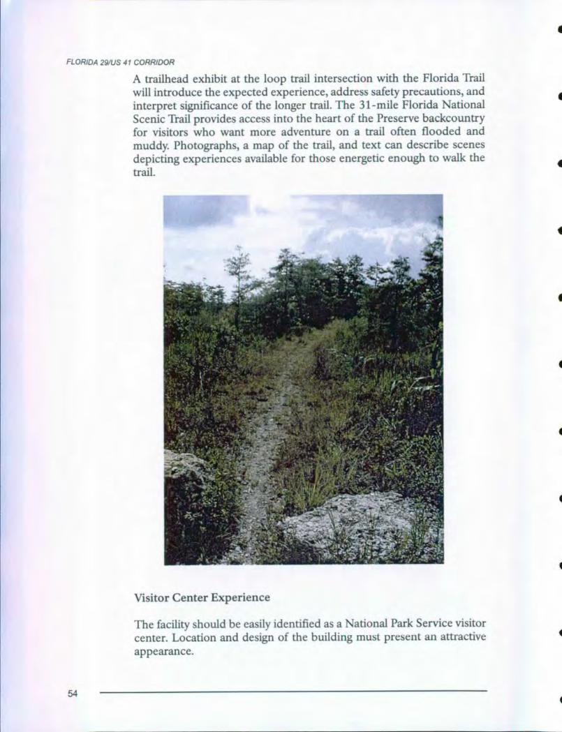
FLORIDA 291US 41 CORRIDOR
A trailhead exhibit at the loop trail intersection with the Florida Trail
will introduce the expected experience , address safety precautions, and
interpret significance of the longer trail . The 31- mile Florida National
Scenic Trail provides access into the heart of the Preserve backcountry
for visitors who want more adventure on a trail often flooded and
muddy. Photographs , a map of the trail , and text can describe scenes
depicting experiences available for those energetic enough to walk the
trail.
Visitor Center Experience
The facility should be easily identified as a National Park Service visitor
center . Location and design of the building must present an attractive
appearance.
54
FLORIDA 29/US 41 CORRIDOR
All functional areas of the visitor center must effectively use the limitedspace available and be relevant, meaningful and interpretive, especiallyto children. Visitors can easily differentiate among functional areas, suchas orientation/information, sales, exhibits, auditorium, and restrooms.Routes to each functional area must be visible and clearly signed.Personal contact with Preserve staff promptly upon entering the visitorcenter contributes to a welcoming atmosphere. A variety of personalservice and information media will orient visitors to the Preserve,explain experience opportunities, tell visitors what they can do to havea safe visit, explain how the Preserve is managed for a diversity of uses,and identify other points of interest in the region.
Visitor center interpretation can reiterate pre- visit information andprovide additional information to facilitate a deeper level of under-standing of the area. It will provide context for visitor experiencesthroughout the Preserve. It can also provide a vicarious experience forvisitors who will not see backcountry areas. Upon leaving the visitorcenter, most visitors should understand the Preserve's primary inter-pretive themes.
Visitor center information needs to dispel the perception that BigCypress National Preserve is only a scenic motor road connectingNaples and Miami. It also offers access to an array of natural and cul-tural features and recreational opportunities. One goal of the visitorcenter is to encourage visitors to explore and discover the Preserve in itsmany expressions.
Building Modifications
Expansion of the space dedicated to exhibits may be possible. Whenoutside restrooms are installed as recommended by the Scenic HighwayImprovements Conceptual Design plan, consideration will be given toremoving interior restrooms adjacent to the lobby. The exhibit area maybe expanded into space currently occupied by the restrooms.Consideration will also be given to opening the north wall currentlyoccupied by cooperating sales, and redesign the adjacent maintenanceworkshop bay as a exhibit area if the maintenance operation vacates thatarea.
Exhibit Plan
Though space in the visitor center is limited, it is presently under uti-lized. An exhibit plan should be developed to recommend modificationof exhibits and interior building structure to accommodate visitor use.Professional exhibit planner/designers can evaluate the space and make
55
FLORIDA 29/US 41 CORRIDOR
recommendations to improve visitor circulation, effectively accommo-date visitor center functions (information/orientation, interpretation,sales, and restrooms) and improve quality and layout of museumexhibits. Consideration will be given to incorporating the followingconcepts in the exhibit plan.
Lobby
Visitor center users will first enter a lobby for information and direc-tions. Features will include a staffed information desk, cooperatingassociation sales area, and orientation exhibits. Location of these threefunctional areas will allow free visitor flow to and from the theater anda proposed exhibit area without interfering with visitors at the informa-tion desk or in the sales display area.
Location of the information desk will be directly accessible to visitors
upon entry to warmly and promptly welcome them and facilitate circu-
lation in the lobby area. The desk must be designed so it does not look
like a barrier and must meet accessibility standards for employees and
visitors. An orientation map must be on the north- facing wall. The desk
design will accommodate, but separate, information and sales functions
while enhancing proximity, visibility, and accessibility of both functions
to visitors.
A permit station, either a desk or window, will be located to separate thepermit process from other visitor center functions. Ideally, this functionshould occur in a separate facility to segregate user types, but staffingmay require it to remain in the visitor center.
Current, accurate, balanced, and detailed information can be mosteffectively presented by personal service communication at the infor-mation desk. Visitors near the desk will receive prompt, courteous, highquality service during orientation and interpretation.
A cooperating association sales area will remain in the lobby but relo-cate to the space between the information desk and the west wall. Thatwill keep the sales area within sight of the information desk staff butplace it out of the main circulation path to the theater and proposed newexhibit area so visitors can conveniently enter directly into either ofthose areas from the lobby. A cash register will be needed at the salesdesk, and a storage area, safe, and cooperating association workspacemust be located nearby. Adequate display and circulation space will beprovided to encourage people to browse.
56
•FLORIDA 29/US 41 CORRIDOR
•
•
•
•
•
•
•
•
•
Exhibits proposed for the lobby will focus on information/orientationand basic presentation of primary interpretive themes. Location ofexhibits will effectively utilize available space without impeding visitorflow toward the information desk.
Orientation exhibits mounted near the desk and tourism literature dis-plays will identify resources and activities in the Preserve and surround-ing areas. Visitors will have easy access to detailed information aboutthings to see and do. Orientation exhibits can also answer commonlyasked questions about the Preserve. For example, how is a national pre-serve different from a national park? An interactive compact disk com-ponent might be included in one or more of the exhibits to orient visi-tors to Preserve experience opportunity locations and to other sitesrelated to the Preserve themes.
Interpretive exhibits summarizing the Preserve's primary themes mustbe relevant and meaningful, especially to children. They should bedynamic, visually engaging, three dimensional, possibly interactive(touchable, not necessarily computer generated), and provide accurateinformation. Each exhibit will provide a broad- brush presentation of itsmessage using high graphics and minimal text.
A Discovery Station may be appropriate to efficiently use the limitedspace available for exhibits. It can incorporate a variety of media andelements can be easily changed to reflect changes in Preserve manage-ment concerns or to reflect seasonal changes in Preserve resources. Theportable station could be transported to regional schools and commu-nity gatherings as part of the Preserve's environmental education pro-gram to encourage school system participation in the interpretive pro-gram. It can also be very effective as a temporary exhibit for display atconventions, special events, regional malls and other community gath-erings to provide public information and generate support for Preservemanagement programs.
Sufficient circulation space will be provided for users to move amongthe information area, exhibits, theater, and restrooms without congest-ing the lobby. As much natural light as possible will be admitted into thelobby, but not into the exhibit area and theater.
Expanded Exhibit Area
If the interior of the visitor center is modified as proposed (see page 55,Building Modifications), an exhibit area in space currently occupiedby the maintenance workshop can accommodate more interactivemuseum exhibits. Detailed proposals for exhibits would be included in
57
FLORIDA 29/US 41 CORRIDOR
an exhibit plan (see page 55). Consideration will be given to incorpora-
tion of the following recommendations in the exhibit plan for an
expanded exhibit area.
The main goal for expanded exhibits is understanding, appreciation,
and stewardship that encourage preservation of resources. Exhibits will
focus on Preserve interpretive themes and reinforce, not duplicate mes-
sages in the interpretive film shown in the theater. Exhibits will focus on
extant resources and encourage people to visit them to relate interior
exhibits to the "real" resources of the Preserve. The exhibits will leave
backcountry use, safety, and general visitor use messages to be handled
by trailhead exhibits and information desk personnel.
Expanded exhibits will effectively portray the significance of the
Preserve and how the Preserve fits into the South Florida environment.
They will help visitors understand the complexity of the ecosystem, how
the system works, its expanse and far- reaching impacts. Individual
exhibits might concentrate on endangered species, the importance of
Big Cypress/Everglades hydrologic relationship, and human use of the
Preserve. Exhibits based on recent research will reflect the interest and
sophistication of today's visitors. New exhibits would tell the story of
Florida's natural resources within a larger context that includes social,
economic, and cultural aspects of the region.
Simple, easy to maintain interactive exhibits would involve several levels
of visitor interest. Video components would attract visitors and effec-
tively bring resources to life for both children and adults. Ambient
sound elements accompanying ecosystem exhibits are highly desirable.
Sound baffling for audio in exhibit areas of high visitor flow will need to
be considered in exhibit planning.
Exhibits will provide basic understanding of the natural and cultural
environment for people who cannot spend a lot of time in the Preserve.
Exhibits should encourage sensitive use for those who utilize Preserve
resources frequently. Full size, three- dimensional dioramas will give
visitors a sense of the complexity and dynamism of the South Florida
ecosystem. They can provide a vicarious experience for visitors who
cannot more intimately explore the Preserve resources. Three- dimen-
sional dioramas can also unveil the hidden elements of resources that
are below the surface of the waters and soils of the Preserve for all visi-
tors. Exhibits might present models of Preserve environments, showing
a cross section from the sky to surface plants and animals, down through
soils to reveal secrets even visitors to backcountry areas cannot see.
58
FLORIDA 29/US 41 CORRIDOR
Where feasible, elements of the exhibits should be positioned wherevisitors can pick them up for closer, tactile examination. The full- scaleexhibits proposed above create opportunity for interactive personalservice and media interpretation that engulfs exhibit hardware, theinterpreter, and the visitor in a living exhibit.
Audiovisual Theater
Several equipment upgrades are recommended for the current theater.A caption board will be added to video projection equipment to effec-tively provide captions of narration for visitors with hearing disabilitieswith less distraction from audiovisual program images. Audio elementsof the theater space will be redesigned. New acoustical treatment willminimize hard surfaces to improve sound projection. Speaker alignmentwill be redesigned for optimum audio quality. Currently the speakers arerecessed in false columns that dictate screen size and face straight out, apoor alignment. Architectural structure of the false columns will beinvestigated and the columns removed if feasible. The viewing screenwill be enlarged and reformatted to accommodate a variety of projectionequipment.
An "exit only" door opening from the west wall of the auditorium intothe lobby will enhance safety and visitor convenience. An opening atthat location will create an alternate escape from the room during emer-gencies, provide more direct access from the theater to the proposedexhibit area described above, and reduce congestion from people enter-ing and exiting the room through a single door.
To expand effectively limited visitor center space available for exhibits,consideration will be given to placing large, colorful murals, photo-graphs or posters on the rear half of the east and west interior walls ofthe theater. In this position they can easily be viewed by visitors enter-ing the room without distracting from audiovisual programs duringprojection. One mural might depict a cypress swamp such as SweetwaterStrand with its dense vegetation and wildlife; the other might depict thevast open landscape of a fresh water marl prairie giving way to pinelandsand hardwood hammocks. Visitors waiting for the film to begin wouldhave a sense of the complexity and beauty of the Preserve environmentas they search the images of plants, animals, and landscapes for hiddensecrets.
Audiovisual Programs
The motion picture routinely shown in the auditorium will be replacedwith a new program that better complements visitor experience objec-tives. The new interpretive film will reflect updated interpretation, sci-
59

FLORIDA 29/US 41 CORRIDOR
ence, resource management, and visitor use. The film will place BigCypress National Preserve in the context of the South FloridaEverglades ecosystem and demonstrate the highest interpretive values.Footage for the film will be shot on 16mm film with high productionvalue including aerials, multiple shoots, wildlife, and wet/dry seasons toentice visitors to explore the Preserve further. Producing two versions ofthe interpretive film, one for showing in- park and another for offsiteuse, can maximize use of the film. A 12- 14- minute stereo version will beshown in the theater at the visitor center. A 26- minute stereo versioncan be used as a sales item, for community outreach activities and forshowing on local and regional PBS broadcasts.
The interpretive film will also serve as programmatic access for thosevisitors who may not immerse themselves in the Preserve backcountry,but instead choose to stand on its edge and learn about it.
MIDWAY CAMPGROUND
Double panel wayside exhibits will be located near the campgroundentrance. A wayside exhibit panel will contain interpretive informationabout surrounding resources and a map of the developed area. A bul-letin case for frequently changing information may also support abrochure dispenser to provide information about other visitor opportu-nities campers may want to explore.
FORTYMILE BEND
The general management plan for the Preserve proposed interpretivedevelopment, possibly wayside exhibits and a developed pull- off, forthe Preserve east entry at Fortymile Bend. Information and interpreta-tion is needed to introduce arriving visitors to resources along US 41and Loop Road, each an integral part of the interpretive experience forvisitors. Visitors currently do not have access to information and inter-pretation of these resources until they travel approximately 15 miles toBig Cypress Visitor Center almost half way across the Preserve. Sincesite selection and design for a development at this location was notincluded in the Scenic Highway Improvements Conceptual Design plan,alternative methods to inform, orient and interpret to visitors promptlyupon arrival and between Fortymile Bend and the visitor center must bedeveloped. A travelers information station radio broadcast is proposedearlier in this plan to welcome visitors (see page 26, ARRIVAL EXPE-RIENCE). At least one additional traveler information station is pro-posed for a location approximately five miles west of Fortymile Bend tointerpret the cypress environment through which visitors are traveling.
60
TURNER RIVER/BIRDON LOOP
Turner River Road (839), Wagonwheel Road (837), and Birdon Road (841)
offer visitors opportunities for a wildlife windshield tour near a main highway
through the Preserve. Visitors can choose to stay in the privacy and comfort
of their own automobile or leave the car to walk short trails for deeper immer-
sion in the resource. Visitors will be able to experience a rural landscape and
understand the human changes wrought on the landscape and how wildlife has
adapted to those changes.
MOTOR INTERPRETIVE ROUTE
In addition to the wayside exhibit proposed to introduce the motor interpretive
route at H P Williams roadside park (see page 50), Preserve staff will design
and publish a Road Guide - Turner River/Birdon Loop to interpret significant
features encountered along the route. A guide to the drive, including interpre-
tation of cypress, pinelands, and fresh water marl prairies and identification of
common wildlife frequenting the area, will offer an effective onsite interpre-
tive and way-finding tool for visitors who want a more in-depth visit than pro-
vided by the wayside. The road guide will also provide an attractive educa-
tional souvenir for sharing with others after the visit.
The guide will be available at Big Cypress Visitor Center and Ochopee infor-
mation center, and it may be distributed at the entrance to the drive at H P
Williams developed area.
PRAIRIE TRAIL
A short boardwalk trail through the prairie surrounding Turner River/Birdon
Loop road will provide visitors an opportunity to escape the road and their cars
for immersion in a roadside prairie/pineland ecotone environment. Interpretive
media and physical contact with the resource will help visitors understand the
topographic story here as well as learn what a prairie is.
This seasonally wetland without trees will support the interpretation of grass-
es, sedges, flowering plants, and wildlife with wayside exhibits. An introduc-
tory exhibit at the entrance will be appropriate, followed by a series of small
trailside exhibits that identify prairie plants and flowers along the route.
61
TURNER RIVER ROAD
Turner River Road offers visitors an opportunity to travel deep into thePreserve for a feeling of adventure without leaving the safety and com-fort of their automobile.
FIRE PRAIRIE TRAIL
Visitors who use this trail for walking and bicycle riding can see a por-tion of backcountry from the convenience and relative safety of a trail.The trail surface, routing and length, and the absence of interpretiveexhibits will give visitors a sense that they have left development and aretruly experiencing backcountry. Location of this trail, a greater distancefrom routes frequently traveled by automobiles, provides visitors agreater sense of isolation and immersion in the resources of the Preservethan found at many other sites.
A trailhead wayside exhibit will introduce the desired visitor experience,describe the trail, address safety precautions, and invite visitors to stepbeyond the edge of the road and enjoy the Preserve's resources. A bul-letin case at the trailhead can post resource notices like mosquito andsnake warnings and lightening hazards in summer.
BEAR ISLAND CAMPGROUND
Bear Island offers a primitive camping experience for visitors who wantto stay overnight on the fringe of Preserve backcountry areas to explorepineland, cypress, and slough environments. A durable information signor bulletin case at the campground entrance will provide visitors essen-tial information about regulations for the area and "Leave- No- Trace"minimum impact activities.
PINELAND TRAIL
Development of a Pineland Trail will provide another opportunity forvisitors to escape their automobiles for immersion in the resource. Thetrail can show pine flatwoods as a product of fire. If not burned period-ically, either by nature or people, pinelands will grow into hardwoodforests. The absence of fire in many areas has led to advanced plant suc-cession, shifts in wildlife habitat, and the accumulation of hazardousfuel levels. The pine flatwoods, therefore, provide a good location tointerpret the role of fire in shaping the Big Cypress landscape.
62

TURNER RIVER ROAD
A trailhead wayside exhibit will introduce the desired visitor experience,
describe the trail, address safety precautions, and invite visitors to step
beyond the edge of the road and enjoy the Preserve's pineland
resources.
63
LOOP ROAD
Loop Road offers exploration and adventure by vehicle and self- guided
interpretive experiences. Visitors can sense they are in the "wild" and
get a feeling for the swamp. The road should continue to promote low
speed travel, provide viewing stops and encourage short walks that
allow visitors to escape their automobile for immersion in the resources
bounding the road. Signs on US 41 must easily identify the location of
Loop Road. Signs near the entrance to the scenic drive at Monroe
Station and Fortymile Bend must clearly give directions, describe
attractions of the resources, and indicate considerations to be taken into
account before attempting the drive. Other signs and interpretive
devices must be kept to a minimum to facilitate a sense of adventure and
exploration.
MOTOR INTERPRETIVE ROUTE GUIDE
Preserve staff will design and publish a Road Guide - Loop Road Scenic
Drive to interpret significant features encountered along the route. Theguide will include interpretation of different plant communitiesencountered and identification of common wildlife frequenting thearea. It will provide an effective onsite interpretive and wayfinding toolfor visitors who want a more in- depth visit than simply driving through
the area. The guide will be a less intrusive, more vandal resistant andeffective method of interpreting than wayside exhibits. The road guidewill also provide an attractive educational souvenir for sharing with oth-
ers after the visit.
Road guides may be distributed at Big Cypress Visitor Center and
Ochopee information center. They may also be distributed near theentrance to the drive at Monroe Station and Fortymile Bend when asecure area can be developed at those locations. Until security can be
assured at those locations, the booklet may be distributed at the Loop
Road Environmental Education Center.
GATOR HOOK TRAIL
A wilderness swamp experience at Gator Hook will give visitors oppor-
tunity, real and vicarious, to escape the highway and parking area for
immersion in a quiet natural environment. Visitors can experience a
sense of being "out there." History of logging, natural quiet, solitude,
and a diversity of habitat types are possible interpretive stories related toPreserve themes.
64
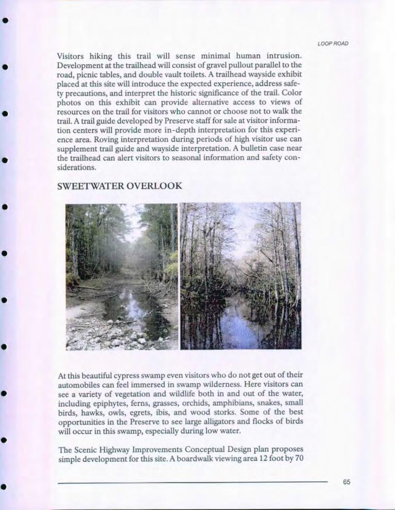
P ROAL
Visitors hiking this trail will sense minimal human intrusion.Development at the trailhead will consist of gravel pullout parallel to theroad, picnic tables, and double vault toilets. A trailhead wayside exhibitplaced at this site will introduce the expected experience, address safe-
ty precautions, and interpret the historic significance of the trail. Colorphotos on this exhibit can provide alternative access to views ofresources on the trail for visitors who cannot or choose not to walk the
trail. A trail guide developed by Preserve staff for sale at visitor informa-
tion centers will provide more in-depth interpretation for this experi-
ence area . Roving interpretation during periods of high visitor use cansupplement trail guide and wayside interpretation. A bulletin case nearthe trailhead can alert visitors to seasonal information and safety con-
siderations.
SWEETWATER OVERLOOK
At this beautiful cypress swamp even visitors who do not get out of their
automobiles can feel immersed in swamp wilderness. Here visitors can
see a variety of vegetation and wildlife both in and out of the water,
including epiphytes, ferns, grasses, orchids, amphibians, snakes, small
birds, hawks, owls, egrets, ibis, and wood storks. Some of the best
opportunities in the Preserve to see large alligators and flocks of birds
will occur in this swamp, especially during low water.
The Scenic Highway Improvements Conceptual Design plan proposes
simple development for this site. A boardwalk viewing area 12 foot by 70
65
LOOP ROAD
foot on each side of the road and gravel pullouts parallel to the road willmake viewing easier and safer for visitors who get out of their cars.Because of the remoteness of this location and the tremendous wildlifeactivity present here, the long- range interpretive planning team thinksthis site can speak for itself. No interpretive media will be placed here.The Road Guide - Loop Road Scenic Drive (see page 64) might includeillustrations to identify some of the wildlife most often seen at this loca-tion.
FLORIDA TRAIL
The 31- mile Florida National Scenic Trail provides access into the heartof the Preserve backcountry for visitors who want more adventure on atrail often flooded and muddy.
A gravel pullout, 8 foot by 150 foot, will be developed parallel to eachside of Loop Road west of the trailhead. A trailhead wayside -exhibit willintroduce the expected experience, address safety precautions, andinterpret the significance of the trail. Photographs, a map of the trail,and text can describe scenes depicting experience available for thoseenergetic enough to walk the trail. Trails Illustrated will be contacted tosee if they would be interested in doing a map of the Preserve along thelines of those done for other parks.
TREE SNAIL HAMMOCK TRAIL/EDUCATION CEN-TER
This trail provides visitors a hardwood hammock experience. Visitorscan take an easy walk on a loop trail through a hardwood. hammock tolook for tree snails and learn about the diversity to be discovered even insmall habitats. Elements of the human story can also be woven into thisexperience.
Because the Loop Road Environmental Education Center offers pro-tection not found on more isolated sections along Loop Road, waysideexhibits are recommended for this location. Until a site to orient visitorsto Loop Road scenic drive is developed at or near Fortymile Bend, atrailhead exhibit for the Loop Road Drive may be placed at the educa-tion center to introduce visitors to the experience and features of thescenic drive. An inset map and text label can direct visitors to Tree SnailHammock Trail and provide information about things to look for as theywalk the short trail. A brochure dispenser can make available the RoadGuide - Loop Road Scenic Drive publication to visitors who have notacquired one at the visitor center. A wayside exhibit describing the Loop
66
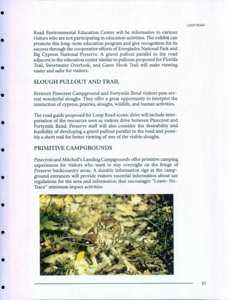
LOOP ROAD
Road Environmental Education Center will be informative to curiousvisitors who are not participating in education activities . The exhibit canpromote this long- term education program and give recognition for itssuccess through the cooperative efforts of Everglades National Park andBig Cypress National Preserve . A gravel pullout parallel to the roadadjacent to the education center similar to pullouts proposed for FloridaTrail, Sweetwater Overlook , and Gator Hook Trail will make viewing
easier and safer for visitors.
SLOUGH PULLOUT AND TRAIL
Between Pinecrest Campground and Fortymile Bend visitors pass sev-
eral wonderful sloughs . They offer a great opportunity to interpret the
interaction of cypress , prairies, sloughs , wildlife, and human activities.
The road guide proposed for Loop Road scenic drive will include inter-pretation of the resources seen as visitors drive between Pinecrest and
Fortymile Bend . Preserve staff will also consider the desirability and
feasibility of developing a gravel pullout parallel to the road and possi-
bly a short trail for better viewing of one of the visible sloughs.
PRIMITIVE CAMPGROUNDS
Pinecrest and Mitchell's Landing Campgrounds offer primitive camping
experiences for visitors who want to stay overnight on the fringe of
Preserve backcountry areas . A durable information sign at the camp-
ground entrances will provide visitors essential information about useregulations for the area and information that encourages "Leave - No -Trace" minimum impact activities.
67
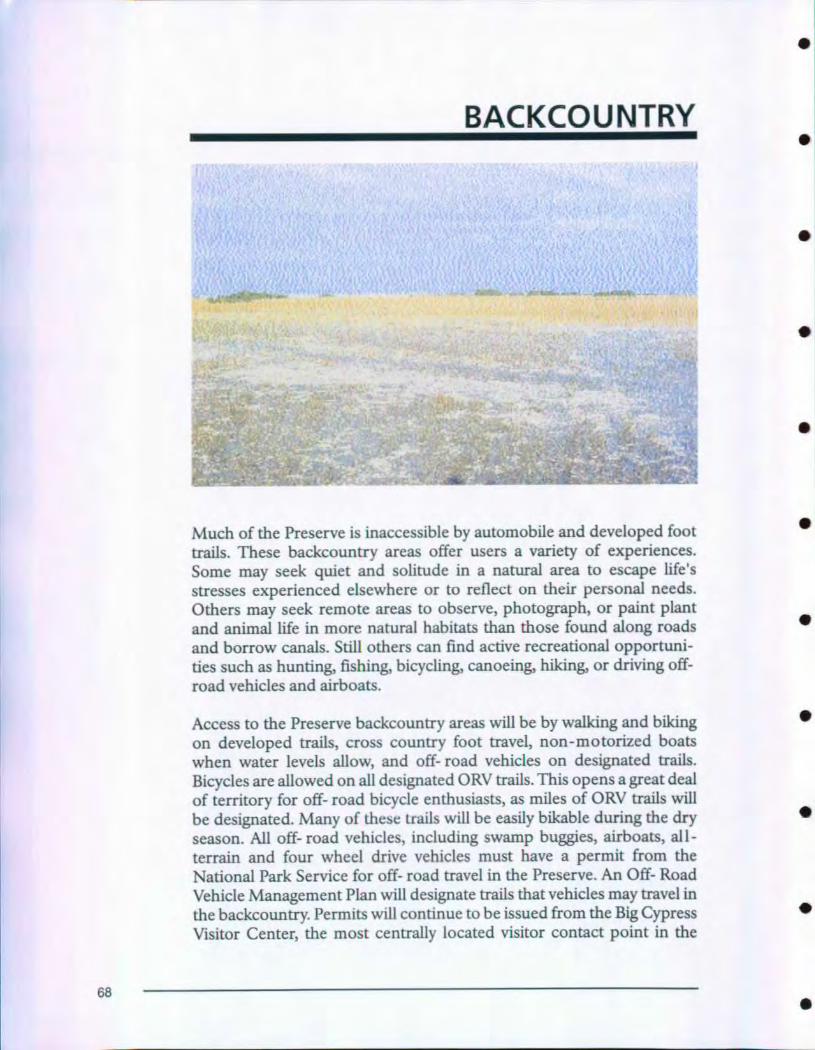
•
BACKCOUNTRY
Much of the Preserve is inaccessible by automobile and developed foot
trails. These backcountry areas offer users a variety of experiences.
Some may seek quiet and solitude in a natural area to escape life's
stresses experienced elsewhere or to reflect on their personal needs.
Others may seek remote areas to observe, photograph, or paint plant
and animal life in more natural habitats than those found along roads
and borrow canals. Still others can find active recreational opportuni-
ties such as hunting, fishing, bicycling, canoeing, hiking, or driving off-
road vehicles and airboats.
Access to the Preserve backcountry areas will be by walking and biking
on developed trails, cross country foot travel, non-motorized boats
when water levels allow, and off- road vehicles on designated trails.
Bicycles are allowed on all designated ORV trails. This opens a great deal
of territory for off- road bicycle enthusiasts, as miles of ORV trails will
be designated. Many of these trails will be easily bikable during the dry
season . All off- road vehicles, including swamp buggies, airboats, all -
terrain and four wheel drive vehicles must have a permit from theNational Park Service for off- road travel in the Preserve. An Off- Road
Vehicle Management Plan will designate trails that vehicles may travel in
the backcountry. Permits will continue to be issued from the Big Cypress
Visitor Center, the most centrally located visitor contact point in the
68
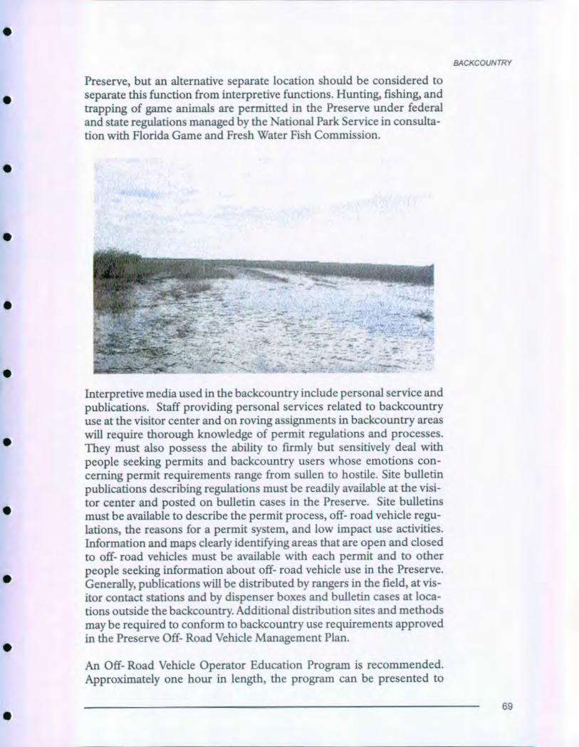
BACKCOUNTRY
Preserve , but an alternative separate location should be considered toseparate this function from interpretive functions. Hunting, fishing, andtrapping of game animals are permitted in the Preserve under federaland state regulations managed by the National Park Service in consulta-tion with Florida Game and Fresh Water Fish Commission.
r.
`- ^`•^Sic
^.`-^
N^04Ani^ r
Interpretive media used in the backcountry include personal service andpublications. Staff providing personal services related to backcountry
use at the visitor center and on roving assignments in backcountry areas
will require thorough knowledge of permit regulations and processes.They must also possess the ability to firmly but sensitively deal with
people seeking permits and backcountry users whose emotions con-cerning permit requirements range from sullen to hostile. Site bulletin
publications describing regulations must be readily available at the visi-
tor center and posted on bulletin cases in the Preserve. Site bulletins
must be available to describe the permit process, off- road vehicle regu-
lations, the reasons for a permit system, and low impact use activities.Information and maps clearly identifying areas that are open and closed
to off- road vehicles must be available with each permit and to otherpeople seeking information about off- road vehicle use in the Preserve.Generally, publications will be distributed by rangers in the field, at vis-
itor contact stations and by dispenser boxes and bulletin cases at loca-tions outside the backcountry. Additional distribution sites and methods
may be required to conform to backcountry use requirements approved
in the Preserve Off- Road Vehicle Management Plan.
An Off- Road Vehicle Operator Education Program is recommended.Approximately one hour in length, the program can be presented to
69

BACKCOUNTRY
ORV opefators when they bring their vehicle in for inspection prior toobtaining a permit to, use the vehicle on the Preserve. The program pre-sented at Big Cypress Visitor Center at Oasis or near the visitor center ina ORV permit station will include safety, tread lightly concepts, orienta-tion to the. Preserve and to the ORV program. A video or slide presenta-tion will supplement personal services of a uniformed employee whowill always be present to offer assistance and answer questions.
Bulletin,cases at trailheads for designated ORV trails in the Preserve willdisplay maps and regulations. Case design must provide easy access forchanging displayed materials as the principle of flexible, adaptive man-agement will rule this aspect of Big Cypress National Preserve for manyyears to come.
70
0
SUMMARY, STRATEGIES,AND PRIORITIES
•
•
•
i
•
INTRODUCTION
Completing all the recommendations outlined in this plan will take con-siderable time, energy, staff, and financial resources. The following listsummarizes proposals presented in this plan, identifies possible fund-ing/implementation strategies, assigns responsibility, and establishesprioritized phases of implementation to help focus energy of thePreserve staff and partners.
Implementation of all aspects of this plan will depend on being able tobreak projects down into steps that can be accomplished with incre-mental funding or by existing staff. The Preserve management team willprioritize and select from recommended projects and strategies annual-ly to produce an Annual Implementation Plan based on funding andstaffing availability. Analyzing and breaking each project into steps to beincorporated into Annual Implementation Plans will be the first priori-ty for National Park Service expenditures. The project will be depend-ent upon satisfying applicable compliance with NPS planning policyand environmental guidance.
While phasing new projects proposed in this plan, Preserve staff willcontinue ongoing operations. Some of the recommendations in this plancan and will be continued or implemented with existing staff, funds, andpartnerships. Some must be completed before others can be initiated.These projects are identified as Phase 1. The implementation of otherprojects is essential to tell stories which reflect new interpretive themesand to resolve issues identified in this plan. The National Park Servicewill aggressively pursue the implementation of the recommendations inthis plan identified as Phase 2 as opportunities for partnership andfunding permit. Phase 3 projects are ones that must be delayed untilother projects are implemented, advanced planning completed, or largeamounts of funding accumulated.
The Preserve staff will develop necessary funding requests to begin thefederal funding process . They will also initiate contacts with potentialpartnership organizations to implement projects well suited to alterna-
tive funding.
71
SUMMARY, STRATEGIES, AND PRIORITIES
This implementation section of the plan does not include funding esti-
mates; estimates can easily become outdated during the 7- 10 year lifeexpectancy of the document. Preserve staff can develop accurate esti-mates when requests to fund projects are initiated or updated. Estimates
for projects that may be completed by Harpers Ferry Center (audiovi-sual, museum exhibits, publication, and wayside exhibit advanced plan-
ning, design, production, and equipment costs) can be obtained fromthe HFC Manager's office. Estimated costs will also be determined bycompliance issues and choice in media. Costs will be addressed inupcoming media plans as an addendum to this Long- Range InterpretivePlan under the Comprehensive Interpretive Planning Process.
72
0
PROJECT SUMMARIES•
•
•
0
•
•
ORGANIZATION / PARTNERSHIP
Project Strategy
Continue to expand ONPS,cooperative promotion partnership,of Preserve through other state/localvisitor sites (Pg 25) tourism
Continue and expand the role ONPSof interpretation in outreachactivities that communicateresource based messages tolocal communities (Pg 29)
Analyze desirability of manage- ONPSment team reorganization toestablish a Division ofInterpretation (Pg 30)
Continue to expand partnership ONPS, feeopportunities with nearby program,visitor sites (Pg 36) volunteer
ACCESSIBILITY
Project
Select areas and design andinstall facilities to create"Wilderness on Wheels"experience opportunities(Pg 39)
Improve visual landscapeand facilities surroundingtrailhead at Deep Lake (Pg 46)
Develop or improve trails atDeep Lake (Pg 46), Big CypressVC (Pg 52), Pinelands (Pg 62),Slough Pullout (Pg 67)
Strategy
Fee program,volunteerdonation,grants
ONPS, feeprogram,volunteer
ONPS,volunteer,repair/rehab
Redesign Big Cypress Visitor ONPSCenter interior to improveaccessibility, circulation,and function (Pg 55)
Responsibility Phase
1
1
2
1
Responsibility Phase
2
3
3
2
73
PROJECT SUMMARIES
MEDIA
Project Strategy Responsibility Phase
Design, produce and install ONPS , FDOTentrance and exit signs at 4locations (Pg 26,43)
Design, produce and install 20 ONPS, FDOTinformation and wayfindingsigns (Pg 26,43 ,53,64,67) andTIS information signs (Pg 26,43,46,60)
Produce and install 4 moveable ONPS, Airwayside exhibits to interpret Qualitycontrolled fire (Pg 28) Division,
NRPP, fireprogram
Produce and install a Preserve ONPS,- wide system of 50- 60 cooperatinginterpretive/orientation wayside association,exhibits (Pg 35,43,44,47,49,50, fee program,51,52,53,61,62,63,65,66) corporate
partnership
Install brochure dispensers at ONPS5 locations (Pg 48,52,53,60,66)
Produce and install bulletin cases ONPSat 8 locations (Pg 43,48,52,60,62,65)
Design and construct outdoor ONPS,wayside exhibit kiosks at Ochopee corporate(Pg 47) and Big Cypress Visitor partnershipCenter (Pg 53)
Collaborate with Florida DOT ONPS,to enhance experience, education FDOTand interpretation in visitorcontact facility at I- 75 rest area(Pg 44)
Produce and install orientation ONPS,and interpretation exhibits/ HFCfurnishings at Ochopee visitorcontact facility, includinginformation desk/sales area (Pg 48)
2
2
3
3
2
3
1
2
74
•
•
•
•
•
•
Produce and install orientation ONPS,and interpretation exhibits/ HFCfurnishings in lobby at BigCypress Visitor Center (Pg 56)
Produce and install new museum ONPS,exhibits in Big Cypress Visitor HFCCenter to interpret the naturaland cultural heritage of BICYecosystems (Pg 57)
Plan and produce a new ONPS,12- 14 minute interpretive corporateaudiovisual program, including partnership,captioning, for Big Cypress HFCVisitor Center (Pg 25,59)
Produce a 26 minute video version ONPS,of interpretive film for outreach corporate(Pg 60) partnership,
HFC
Plan and produce educational ONPS,outreach "Swamp Walk" video Parks- as-for use in environmental educa- Classrooms,tion program (Pg 25,32) grant
Expand website to include ONPS,"virtual" visitor center, electronic volunteersite bulletins and video clips (Pg 25)
Frequently update public service ONPS,announcements and audiovisual volunteerclips and spot announcements (Pg 28)
Design and install 10 travelers ONPS,information stations/radio FDOTtransmission systems (Pg 43,46,60)
Design and install a theater, ONPSincluding projection equipment,in new visitor contact facility atOchopee (Pg 49)
Plan and produce a 10- 15 minute ONPS,HFC,orientation video for the new corporateOchopee visitor contact facility partnership(Pg 49)
PROJECT SUMMARIES
3
3
2
3
2
1
1
2
2
2
75
PROJECT SUMMARIES
Upgrade projection equipment ONPS 1at Big Cypress Visitor Center theater(Pg 59)
Request new, expanded official HFC 2Preserve brochure to reflect newinterpretive directions and facilities(Pg 33)
Develop a moderately priced Cooperating 1"souvenir" booklet (Pg 33)
Request new official Preserve
association
HFC 2handbook (Pg 33)
Develop comprehensive "coffee Cooperating 3table" book, "Changing LandUse" (Pg 33)
Develop five new site bulletins to
association,corporatepartnership
ONPS, 1expand site bulletin series (Pg 34) cooperating
association,
volunteer,
donation
Write, design and print two new Cooperating 2trail guide publications - Halfway associationCreek and Turner River CanoeTrails (Pg 49) and Gator Hook Trail (Pg 64)
Write, design and print two new Cooperating 2road guide publications - Turner associationRiver (Pg 34,61) and Loop Road(Pg 34,64)
PERSONAL SERVICES
Project Strategy Responsibility Phase
Increase staffing to maintain ONPS, 2stationed assignments at Big volunteerCypress Visitor Center and OchopeeInformation Center (Pg 29,47,56)
Assign staff to roving interpretation ONPS 1at key contact sites (Pg 29,50,65,69)
76

0
PROJECT SUMMARIES
•
•
0
Talks at contact facilities and ONPS,selected field areas will be ' volunteeroffered as use demands (Pg 29,52)
Guided walks , bike tours , ONPS, feeCanoe Treks at several locations interpretationthroughout the Preserve (Pg 28,50)
Continually update training ONPS,SEROprogram in response to changingprograms , staff and audience (Pg 29,70)
Maintain and build a annualspecial events program (Pg 29)
Develop and maintain coop-erating association sales areasat Ochopee (Pg 29,49) and BigCypress VC (Pg 29,56)
Multi- day residential environ-
mental education camp activities
will continue at Loop Road and
become more identified with Big
Cypress National Preserve (Pg 30)
Continue environmental educa-tion day trips at various locationsthroughout the Preserve (Pg 30)
An education specialist and anadvisory group will be retainedto expand the curriculumbased education program (Pg 31)
Offer a variety of pre- visit andpost- visit materials andactivities to meet needs of avaried environmental educationaudience (Pg 31)
ONPS, feeinterpretation,volunteer
Cooperating
association,ONPS
ONPS,
partnership,volunteer,Parks- as-Classrooms,
grants
ONPS,Parks-as- Classrooms,grants
ONPS,volunteer,partnership
Donation,Parks- as-Classrooms
Develop a cooperative education ONPS,YESprogram with Florida's YouthEnvironmental Services program (Pg 32)
Establish a permanent environ- ONPSmental education facility (Pg 32)
1
1
1
2
2
I
1
1
2
1
2
77
PROJECT SUMMARIES
RESEARCH/PLANNING
Project Strategy Responsibility Phase
Draft Preserve - wide wayside ONPS,HFCexhibit proposals (Pg 35)
Develop Preserve - wide wayside ONPS,HFCexhibit design /production plan (Pg 35)
Conduct visitor surveys andongoing and annual evaluationsof interpretive program andand specific activities (Pg 36)
Explore opportunity to developexhibit plan to guide design,production and installation ofexhibits at I- 75 Rest Area (Pg 45)
Develop exhibit plan to guidedesign, production andinstallation of exhibits at newOchopee contact facility (Pg 48)
Develop exhibit plan to guidedesign, production of informa-tion /orientation and museumexhibits at Big Cypress VisitorCenter (Pg 55)
CPSU,ONPS,university
research
ONPS,HFC,fee program
ONPS,HFC,
fee program,
cooperating
association
ONPS,HFC,fee program,
cooperating
association
Revise Preserve- wide sign ONPSplan to reflect recommenda-tions approved in this long-range interpretive plan (Pg 27)
Conduct cultural resource ONPS,CPSU,studies necessary to enhance SERO,interpretation of Preserve partnershiphuman/cultural theme -Archeological Inventories,Underground Railroad , SettlementPeriod , and Calusa, Miccosukee,Seminole Use (Pg 36)
1
2
1
2
2
2
1
2
78
PLANNING TEAM & CONSULTANTS
0
0
A
National Park Service staff, representatives of partnership organiza-tions, and consultants completed this long- range interpretive plan.
BIG CYPRESS NATIONAL PRESERVE
Lisa Andrews, Education SpecialistNoreen Brown, VUAIsobel Kalafarski, Park RangerWesley Leishman, Interpretive SpecialistSandra Snell- Dobert, Chief of Interpretation
HARPERS FERRY CENTER
John Grabowska, Audiovisual ProducerTerry Lindsay, Wayside Exhibit PlannerKeith Morgan, Park Ranger - Planner
EVERGLADES NATIONAL PARK
Sandy Dayhoff, Environmental Education Specialist
Bob DeGross, District Interpreter - Shark Valley
Candace Tinkler, District Interpreter - Gulf Coast
FAKAHACHEE STRAND STATE PRESERVE
Tom Bemans, Park Ranger
79
APPENDIX A:
Special Populations:Programmatic Accessibility
Guidelines for Interpretive Media
National Park Service
Harpers Ferry Center
June 1999
Prepared by
Harpers Ferry Center
Accessibility Task Force
Contents
Statement of Purpose
Audiovisual Programs
Exhibits
Historic Furnishings
Publications
Wayside Exhibits
80
APPENDIX A
•
•
•
•
•
•
0
STATEMENT OF PURPOSE
This document is a guide for promoting full access to interpretive mediato ensure that people with physical and mental disabilities have access tothe same information necessary for safe and meaningful visits toNational Parks. Just as the needs and abilities of individuals cannot bereduced to simple statements, it is impossible to construct guidelines forinterpretive media that can apply to every situation in the National ParkSystem.
These guidelines define a high level of programmatic access which canbe met in most situations. They articulate key areas of concern and notegenerally accepted solutions. Due to the diversity of park resources andthe variety of interpretive situations, flexibility and versatility are impor-tant.
Each interpretive medium contributes to the total park program. Allmedia have inherent strengths and weaknesses, and it is our intent tocapitalize on their strengths and provide alternatives where they aredeficient. It should also be understood that any interpretive medium isjust one component of the overall park experience. In some instances,especially with regard to learning disabilities, personal services, that isone- on- one interaction, may be the most appropriate and versatileinterpretive approach.
In the final analysis, interpretive design is subjective, and dependent onaesthetic considerations as well as the particular characteristics andresources available for a specific program. Success or failure should beevaluated by examining all interpretive offerings of a park. Due to the
unique characteristics of each situation, parks should be evaluated on acase by case basis. Nonetheless, the goal is to fully comply with NPS
policy:
"...To provide the highest level of accessibility possible and feasiblefor persons with visual, hearing, mobility, and mental impairments,consistent with the obligation to conserve park resources and pre-serve the quality of the park experience for everyone."
NPS Special Directive 83- 3, Accessibility for Disabled Persons
81
APPENDIX A
Audiovisual Programs
Audiovisual programs include video programs, and audio and interac-
tive programs. As a matter of policy, all audiovisual programs produced
by the Harpers Ferry Center will include some method of captioning.
The Approach used will vary according to the conditions of the instal-
lation area and the media format used, and will be selected in consulta-
tion with the parks and regions.
The captioning method will be identified as early as possible in theplanning process and will be presented in an integrated setting where
possible. To the extent possible, visitors will be offered a choice in view-
ing captioned or uncaptioned versions, but in situations where a choice
is not possible or feasible, a captioned version of all programs will be
made available. Park management will decide on the most appropriateoperational approach for the particular site.
Guidelines Affecting Visitors with Mobility Impairments
i. The theater, auditorium, or viewing area should be accessible andfree of architectural barriers, or alternative accommodations will beprovided. UFAS 4-1-
2. Wheelchair locations will be provided according to ratios outlined inUFAS 4. 1.2(i8a).
3. Viewing heights and angles will be favorable for those in designatedwheelchair locations.
4. In designing video or interactive components, control mechanismswill be placed in accessible location, usually between g" and 48" fromthe ground and no more than 24" deep.
Guidelines Affecting Visitors with Visual Impairments
Simultaneous audio description will be considered for installationswhere the equipment can be properly installed and maintained.
Guidelines Affecting Visitors with Hearing Impairments
i. All audiovisual programs will be produced with appropriate captions.
2. Copies of scripts will be provided to the parks as a standard proce-dure.
3. Audio amplification and listening systems will be provided in accor-dance with UFAS 4.i.2(i8b).
Guidelines Affecting Visitors with Learning Impairments
i. Unnecessarily complex and confusing concepts will be avoided.
2. Graphic elements will be chosen to communicate without reliance onthe verbal component.
3. Narration will be concise and free of unnecessary jargon and techni-cal information.
82
•
APPENDIX A
•
•
•
•
•
•
Exhibits
Numerous factors affect the design of exhibits, reflecting the uniquecircumstances of the specific space and the nature of the materials to beinterpreted. It is clear that thoughtful, sensitive design can go a long wayin producing exhibits that can be enjoyed by a broad range of people.Yet, due to the diversity of situations encountered, it is impossible toarticulate guidelines that can be applied universally.
In some situations, the exhibit designer has little or no control over thespace. Often exhibits are placed in areas ill suited for that purpose, theymay incorporate large or unyielding specimens, may incorporate sensi-tive artifacts which require special environmental controls, and roomdecor or architectural features may dictate certain solutions. All in all,exhibit design is an art which defies simple description. However, onecentral concern is to communicate the message to the largest audiencepossible. Every reasonable effort will be made to eliminate any factorslimiting communication through physical modification or by providingan alternate means of communication.
Guidelines Affecting Visitors with Mobility Impairments
Note: The Americans with Disabilities Act Accessibility Guidelines
(ADAAG) is the standard followed by the National Park Service and is
therefore the basis for the accessibility standards for exhibits, where
applicable.
i. Height/position of labels: Body copy on vertical exhibit walls shouldbe placed at between 36" and 6o" from the floor.
2. Artifact Cases:
a. Maximum height of floor of artifact case display area shall be nohigher than 30" from the floor of the room. This includes vitrinesthat are recessed into an exhibit wall.
b. Artifact labels should be placed so as to be visible to a personwithin a 43" to 51" eye level. This includes mounting labels within thecase at an angle to maximize its visibility to all viewers.
3. Touchable Exhibits: Touchable exhibits positioned horizontallyshould be placed no higher than 30" from the floor. Also, if theexhibit is approachable only on one side, it should be no deeper than
4. Railings/barriers: Railings around any horizontal model or exhibitelement shall have a maximum height of 36" from the floor.
5. Information desks: Information desks and sales counters shallinclude a section made to accommodate both a visitor in a wheelchairand an employee in a wheelchair working on the other side. A sectionof the desk/counter shall have the following dimensions:
31
83

APPENDIX A
a. Height from the floor to the top: 28 to 34 inches. (ADAAG 4.32.4)
b. Minimum knee clearance space: 27" high, 30" wide and ig"deep of clearance underneath the desk is the minimum space
required under ADAAG 4.32.3, but a space 30" high, 36" wide and
24" deep is recommended.
.c. Width of top surface of section: at least 36 inches . Additional
space must be provided for any equipment such as a cash register.
d. Area underneath desk: Since both sides of the desk may have toaccommodate a wheelchair, this area should be open all the waythrough to the other side. In addition, there should be no sharp or
abrasive surfaces underneath the desk. The floor space behind thecounter shall be free of obstructions.
6. Circulation Space:
a. Passageways through exhibits shall be at least 36" wide.
b. If an exhibit passageway reaches a dead- end, an area 6o" by 78"should be provided at the end for turning around.
c. Objects projecting from walls with their leading edges between
27" and 8o" above the floor shall protrude no more than 4" in pas-sageways or aisles. Objects projecting from walls with their leadingedges at or below 27" above the floor can protrude any amount.
d. Freestanding objects mounted on posts or pylons may overhang
a maximum of 12" from 27" to 8o" above the floor. (ADAAG 4.4.1)
e. Protruding objects shall not reduce the clear width of an acces-sible route to less than the minimum required amount. (ADAAG
4.4.1)
f. Passageways or other circulation spaces shall have a minimumclear head room of 8o". For example, signage hanging from the ceil-ing must have at least 8o " from the floor to the bottom edge of thesign . (ADAAG 4.4.2)
7. Floors:
a. Floors and ramps shall be stable, level, firm and slip- resistant.
b. Changes in level between 1/4" and 1/2" shall be beveled with a
slope no greater than 1:2. Changes in level greater than 1/2" shall be
accomplished by means of a ramp that complies with ADAAG 4.7 or
4.8. (ADAAG 4.5.2)
c. Carpet in exhibit areas shall comply with ADAAG 4.5.3 for pileheight, texture, pad thickness, and trim.
8. Seating - Interactive Stations/Work Areas: The minimum knee spaceunderneath a work desk is 27" high, 30" wide and 1g" deep, with aclear floor space of at least 30" by 30" in front. The top of the desk or
84
0
APPENDIX A
•
•
•
•
•
•
work surface shall be between 28" and 34" from the floor. (ADAAG
4.32, Fig-45)
Guidelines Affecting Visitors with Visual Impairments
i. Tactile models and other touchable exhibit items should be usedwhenever possible. Examples of touchable exhibit elements includerelief maps, scale models, raised images of simple graphics, repro-duction objects, and replaceable objects (such as natural history orgeological specimens, cultural history items, etc.).
2. Typography - Readability of exhibit labels by visitors with variousdegrees of visual impairment shall be maximized by using the follow-ing guidelines:
a. Type size - No type in the exhibit shall be smaller than 24 point.
b. Typeface - The most readable typefaces should be used whenev-er possible, particularly for body copy. They are: Times Roman,Palatino, Century, Helvetica and Universe.
c. Styles, Spacing - Text set in both caps and lower case is easier toread than all caps. Choose letter spacing and word spacing for max-imum readability. Avoid too much italic type.
d. Line Length - Limit the line length for body copy to no more
than 45 to 50 characters per line.
e. Amount of Text - Each unit of body copy should have a maxi-mum of 45- 6o words.
f. Margins - Flush left, ragged right margins are easiest to read.
Color:3-
a. Type/Background Contrast - Percentage of contrast between thetype and the background should be a minimum of 70% .
b. Red/Green - Do not use red on green or green on red as thetype/background color combination.
c. Do not place body copy on top of graphic images that impairreadability.
Samples: During the design process, it is recommended that samplesbe made for review of all size, typeface and color combinations forlabels in that exhibit.
4-
5. Exhibit Lighting:
a. All labels shall receive sufficient, even light for good readability.Exhibit text in areas where light levels have been reduced for conser-vation purposes should have a minimum of io footcandles of illumi-nation.
85
APPENDIX A
b. Harsh reflections and glare should be avoided.
c. The lighting system shall be flexible enough to allow adjustmentson- site.
d. Transitions between the floor and walls , columns or other struc-tures should be made clearly visible . Finishes for vertical surfacesshould contrast clearly with the floor finish . Floor circulation routesshould have a minimum of io footcandles of illumination.
6. Signage: When permanent building signage is required as a part of anexhibit project , the ADAAG guidelines shall be consulted . Signs,which designate permanent rooms and spaces, shall comply withADAAG 430.1, 430.4, 430.5, and 4.30.6 . Other signs, which providedirection to or information about functional spaces of the building,shall comply with ADAAG 4.30.1, 4.30 .2, 430.3, and 4 .30.5. Note:When the International Symbol of Accessibility (wheelchair symbol)is used, the word "Handicapped " shall not be used beneath thesymbol . Instead , use the word "Accessible".
Guidelines Affecting Visitors with Hearing Impairments
i. Information presented via audio formats will be duplicated in a visu-al medium, such as in the exhibit label copy or by captioning. Allvideo programs incorporated into the exhibit , which contain audio,shall be open captioned.
2. Amplification systems and volume controls should be incorporatedwith audio equipment used individually by the visitor, such as audiohandsets.
3. Information desks shall allow for Telecommunication Devices for theDeaf (TDD) equipment.
Guidelines Affecting Visitors with Learning Impairments
i. The exhibits will present the main interpretive themes on a variety oflevels of complexity, so people with varying abilities and interests canunderstand them.
2. The exhibits should avoid unnecessarily complex and confusing top-ics, technical terms, and unfamiliar expressions. Pronunciation aidsshould be provided where appropriate.
3. Graphic elements shall be used to communicate non- verbally.
4. The exhibits shall be a multi- sensory experience. Techniques tomaximize the number of senses used in the exhibits should beencouraged.
5. Exhibit design shall use color and other creative approaches to facil-itate comprehension of maps by visitors with directional impair-ments.
86
0
APPENDIX A
•
•
•
•
•
Historic Furnishings
Historically refurnished rooms offer the public a unique interpretiveexperience by placing visitors within historic spaces. Surrounded byhistoric artifacts visitors can feel the spaces "come alive" and relate moredirectly to the historic events or personalities commemorated by thepark.
Accessibility is problematical in many NPS furnished sites because ofthe very nature of historic architecture. Buildings were erected with afunctional point of view that is many times at odds with our modernviews of accessibility.
The approach used to convey the experience of historically furnishedspaces will vary from site to site. The goals, however, will remain thesame , to give the public as rich an interpretive experience as possiblegiven the nature of the structure.
Guidelines Affecting Visitors with Mobility Impairments
i. The exhibit space should be free of architectural barriers or a methodof alternate accommodation should be provided, such as slide pro-grams , videotaped tours, visual aids, dioramas, etc.
2. All pathways, aisles , and clearances shall (when possible) meet stan-dards set forth in UFAS 4.3 to provide adequate clearance for wheel-chair routes.
3. Ramps shall be as gradual as possible and not exceed a i" rise in 12"run, and conform to UFAS 4-8-
4. Railings and room barriers will be constructed in such a way as toprovide unobstructed viewing by persons in wheelchairs.
5. In the planning and design process, furnishing inaccessible areas,such as upper floors of historic buildings, will be discouraged unlessessential for interpretation.
6. Lighting will be designed to reduce glare or reflections when viewedfrom a wheelchair.
7. Alternative methods of interpretation, such as audiovisual programs,audio description, photo albums, and personal services will be usedin areas which present difficulty for visitors with physical impair-ments.
Guidelines Affecting Visitors with Visual Impairments
i. Exhibit typefaces will be selected for readability and legibility, andconform to good industry practice.
2. Audio description will be used to describe furnished rooms, whereappropriate.
87
APPENDIX A
3. Windows will be treated with film to provide balanced light levels andminimize glare.
q.. Where appropriate, visitor- controlled rheostat- type lighting will be
provided to augment general room lighting.
5. Where appropriate and when proper clearance has been approved,surplus artifacts or reproductions will be utilized as "hands- on" tac-
tile interpretive devices.
Guidelines Affecting Visitors with Hearing Impairments
i. Information about room interiors will be presented in a visual medi-
um such as exhibit copy, text, pamphlets, etc.
2. Captions will be provided for all AV programs relating to historic fur-nishings.
Guidelines Affecting the Visitors with Learning Impairments
i. Where appropriate, hands- on participatory elements geared to thelevel of visitor capabilities will be used.
2. Living history activities and demonstrations, which utilize the physi-cal space as a method of providing multi- sensory experiences, will beencouraged.
Publications
A variety of publications are offered to visitors, ranging from park fold-ers, which provide an overview and orientation to a park, to more com-prehensive handbooks. Each park folder should give a brief description
of services available to visitors with disabilities, list significant barriers,
and note the existence of TDD phone numbers, if available.
In addition, informal site bulletins are often produced to provide more
specialized information about a specific site or topic. It is recommend-
ed that each park produce an easily updatable "Accessibility SiteBulletin" which could include detailed information about the specific
programs, services, and opportunities available for visitors with disabil-
ities and to describe barriers which are present in the park. A template
for this site bulletin will be on the Division of Publications website for
parks to create with ease, a consistent look throughout the park service.
These bulletins should be in large type, i6 points minimum and follow
the large- print criteria below.
Guidelines Affecting Visitors with Mobility Impairments
i. Park folders, site bulletins, and sales literature will be distributed
from accessible locations and heights.
2. Park folders and Accessibility Site Bulletins should endeavor to carryinformation on the accessibility of buildings, trails, and programs byvisitors with disabilities.
88
•
APPENDIX A
•
•
•
•
•
•
Guidelines Affecting Visitors with Visual Impairments
i. Publications for the general public:
a. Text
(i) Size: the largest type size appropriate for the format.
(preferred main body of text should be iopt)
(2) Leading should be at least 20% greater than the font size used.
(3) Proportional letterspacing
(4) Main body of text set in caps and lower case.
(5) Margins are flush left and ragged right
(6) Little or no hyphenation is used at ends of lines.
(7) Ink coverage is dense
(8) Underlining does not connect with the letters being under-lined.
(9) Contrast of typeface and illustrations to background is high(70% contrast is recommended)
(io) Photographs have a wide range of gray scale variation.
(ii) Line drawings or floor plans are clear and bold, with limiteddetail and minimum 8 pt type.
(12) No extreme extended or compressed typefaces are used formain text.
(i3) Reversal type should be minimum of it point medium or boldsans- serif type.
b. The paper:
(i) Surface preferred is a matte finish. Dull- coated stock isacceptable.
(2) Has sufficient weight to avoid "show- through" on pagesprinted on both sides.
2. Large- print version publications:
a. Text
(i) Size: minimum16 point type.
(2) Leading is 16 on 2opt.
(3) Proportional letterspacing
(4) Main body of text set in caps and lower case.
(5) Margins are flush left and ragged right.
89
APPENDIX A
3.
(6) Little or no hyphenation is used at ends of lines.
(7) Ink,,overage is dense.
(8) Underlining does not connect with the letters being under-lined.
(9) Contrast of typeface and illustrations to background is high
(70% contrast is recommended)
(io) Photographs have a wide range of gray scale variation.
(ii) Line drawings or floor plans are clear and bold, with limiteddetail and minimum14 pt type.
(12) No extreme extended or compressed typefaces are used formain text.
(i3) Sans- serif or simple- serif typeface
(i4) No oblique or italic typefaces
(15) Maximum of 50 characters (average) per line.
(i6) No type is printed over other designs.
(r7) Document has a flexible binding, preferably one that allowsthe publication to lie flat.
(i8) Gutter margins are a minimum of 22mm; outside margin
smaller but not less than i3mm.
b. Paper:
(i) Surface is off- white or natural with matte finish.
(2) Has sufficient weight to avoid "show- through" on pagesprinted on both sides.
Maps:
a. The less clutter the map, the more visitors that can use it.
b. The ultimate is one map that is large- print and tactile.
c. Raised line/tactile maps are something that could be developedin future, using our present digital files and a thermaform machine.Lines are distinguished by lineweight, color and height. Areas aredistinguished by color, height, and texture.
d. The digital maps are on an accessible web site.
e. Same paper guides as above.
f. Contrast of typeface background is high. (70% contrast is rec-ommended)
g. Proportional letterspacing
h. Labels set in caps and lower case
90
APPENDIX A
i. Map notes are flush left and ragged right.
j. Little or no hyphenation is used as ends of lines.
k. No extreme extended or compressed typefaces are used for main
text.
1. Sans- serif or simple- serif typeface.
4. The text contained in the park folder should also be available on
audiocassette , CD and accessible web site. Handbooks, accessibility
guides, and other publications should be similarly recorded where
possible.
5. The official park publication is available in a word processing format.
This could be translated into Braille as needed.
Guidelines Affecting Visitors with Hearing Impairments
Park site bulletins will note the availability of such special services as
sign language interpretation and captioned programs.
Guidelines Affecting Visitors with Learning Impairments
i. The park site bulletin should list any special services available to these
visitors.
2. Publications:
a. Use language that appropriately describes persons with disabili-
ties.
b. Topics will be specific and of general interest. Unnecessary com-
plexity will be avoided.
c. Whenever possible, easy to understand graphics will be used to
convey ideas, rather than text alone.
d. Unfamiliar expressions, technical terms, and jargon will be
avoided. Pronunciation aids and definitions will be provided where
needed.
e. Text will be concise and free of long paragraphs and wordy lan-
guage.
Wayside Exhibits
Wayside exhibits, which include outdoor interpretive exhibits and signs,
orientation shelter exhibits, trailhead exhibits, and bulletin boards, offer
special advantages to visitors with disabilities. The liberal use of photo-
graphs, artwork, diagrams, and maps, combined with highly readable
type, make wayside exhibits an excellent medium for visitors with hear-
ing and learning impairments. For visitors with sight impairments, way-
sides offer large type and high legibility.
Although a limited number of NPS wayside exhibits will always be inac-
91
APPENDIX A
cessible to visitors with mobility impairments, the great majority are
placed at accessible pullouts, viewpoints, parking areas, and trailheads.
The NPS accessibility guidelines for wayside exhibits help insure a stan-
dard of quality that will be appreciated by all visitors. Nearly everyone
benefits from high quality graphics, readable type, comfortable base
designs, accessible locations, hard- surfaced exhibit pads, and well-
landscaped exhibit sites.
While waysides are valuable on- site "interpreters," it should be remem-
bered that the park resources themselves are the primary things visitors
come to experience. Good waysides focus attention on the features they
interpret, and not on themselves. A wayside exhibit is only one of the
many interpretive tools which visitors can use to enhance their appreci-
ation of a park.
Guidelines Affecting Visitors with Mobility Impairments
i. Wayside exhibits will be installed at accessible locations whenever
possible.
2. Wayside exhibits will be installed at heights and angles favorable for
viewing by most visitors including those in wheelchairs. For standard
NPS low- profile units the recommended height is 30 inches from the
bottom edge of the exhibit panel to the finished grade; for vertical
exhibits the height of 6- 28 inches.
3. Trailhead exhibits will include information on trail conditions which
affect accessibility.
4. Wayside exhibit sites will have level, hard surfaced exhibit pads.
5. Exhibit sites will offer clear, unrestricted views of park features
described in exhibits.
Guidelines Affecting Visitors with Visual Impairments
1. Exhibit type will be as legible and readable as possible.
2. Panel colors will be selected to reduce eyestrain and glare, and to
provide excellent readability under field conditions. White should
not be used as a background color.
3. Selected wayside exhibits may incorporate audio stations or tactileelements such as models, texture blocks, and relief maps.
4. For all major features interpreted by wayside exhibits, the park
should offer non- visual interpretation covering the same subject
matter. Examples include cassette tape tours, radio messages, and
ranger talks.
5. Appropriate tactile cues should be provided to help visually impairedvisitors locate exhibits.
92
APPENDIXA
Guidelines Affecting Visitors with Hearing Impairments
i. Wayside exhibits will communicate visually, and will rely heavily ongraphics to interpret park resources.
2. Essential information included in audio station messages will beduplicated in written form, either as part of the exhibit text or withprinted material.
Guidelines Affecting Visitors with Learning Impairments
i. Topics for wayside exhibits will be specific and of general interest.Unnecessary complexity will be avoided.
2. Whenever possible, easy to understand graphics will be used to con-vey ideas, rather than text alone.
3. Unfamiliar expressions, technical terms, and jargon will be avoided.Pronunciation aids and definitions will be provided where needed.
4. Text will be concise and free of long paragraphs and wordy language.
93
APPENDIX B: EVALUATION
INTRODUCTION
Evaluation is an essential part of planning and operating a park inter-
pretive program. Over the years it has become increasingly evident that
interpretive facilities, media, and activities benefit from evaluation dur-
ing planning and development and following implementation of inter-
pretive program components. An ongoing evaluation process should
include three cycles of evaluation activities tailored to specific tasks and
questions.
Front- End Evaluations are appropriate when conceptual planning
considers themes, story lines , and program ideas.
Formative Evaluations are done during a process, such as early
fabrication of exhibits and test run of activities. Formative evalua-
tions are increasing in the Park Service, especially with the imple-
mentation of GPRA and value analysis.
Summative or Remedial Evaluations are performed at the end of
a process. Summative evaluations have been more common in gov-
ernment agencies. Performance is measured and assessed at the end
of a fiscal year. Achievement of media objectives is determined after
the media are installed for a period of time. Achievement of short-
term educational goals is measured at the conclusion of a program.
NATIONAL PARK SERVICE EVALUATION PROGRAM
Visitor Services Project assesses visitor backgrounds, preferences,
activities, and opinions through surveys. The Cooperative Park Study
Unit (CPSU) at the University of Idaho coordinates the program. An
evaluation was conducted at the Preserve in 1999.
Government Performance and Results Act (GPRA) holds offices and
parks accountable for defining and assessing desired outcomes.
Preserve staff conducts evaluation of goal accomplishment annually.
Value Analysis Program assesses the cost effectiveness of design and
construction projects in excess Of $500,000.
94
APPENDIX B
Post Occupancy Evaluation Program (POE) assesses the effectivenessof interpretive facilities and media. The program is coordinated byDenver Service Center and Harpers Ferry Center and may be appliedfollowing implementation of media proposals for Ochopee InformationCenter and Big Cypress Visitor Center.
Post Construction Evaluation coordinated by Denver Service Centerlooks at the quality of construction of facilities. built by DSC. Thisprocess may be applied to projects such as construction of a OchopeeInformation Center and implementation of proposals in the ScenicHighway Improvement Conceptual Design Plan.
Park Initiated Evaluations are conducted or contracted by parks withassistance from regional offices, service centers, and the WashingtonOffice of Interpretation and Visitor Services.
TECHNIQUES
The following techniques are recommended for consideration as ParkInitiated Evaluations for implementation at the Preserve. This is notintended as an all- inclusive list. These methods were selected becausethey can be applied with relative ease and because they represent tech-niques with low to moderate cost and time commitments that yieldmoderate to high value/benefits. A Field Guide for Evaluating NationalPark Service Interpretation , by Brett Wright and Marcella Wells, pro-vides a complete description of these and other techniques.
Importance/Performance Analysis
Cost- Low Time- Moderate Value/Benefit- High
This analysis, more quantitative than qualitative, is an empirical testused to obtain assessments of visitor satisfaction. The analysis helpsdetermine which areas of a program require the most resources andattention, which resources could be reduced or eliminated from partic-ular areas of a program, or which efforts should be maintained. Thistechnique is easily understood, easily displayed, easily interpreted toobtain data that can be applied readily to program decisions. It can beused to evaluate both overall program as well as single activities.
Auditing
Cost- Moderate Time- Moderate Value/Benefit-Moderate/High
95
APPENDIX B
Auditing helps supervisors guide development of interpretive activities
and interpreters improve their performance. The auditor and inter-
preter set and discuss objectives prior to the audit. The auditor then
conducts the formal audit using checklists adapted to the program being
audited. A post- audit conference, a direct two- way communication,
must take place as soon as possible after the formal audit. It provides
prompt feedback to the interpreter being audited and establishes a basis
for follow- up coaching. The evaluator is able to assess interpreter's
actual performance in terms of content and technique. Coaching
aspects of the audit lessen intimidation of the evaluation process and
provide opportunity to correct inconsistencies before they become
habit.
Interviewing
Cost - Low/Moderate Time - High Value/Benefit - High
There are three approaches to interviewing. In each a single interview-
er facilitates the conversation. Data gathered reveals the interviewees
perspective by allowing them to express their understanding of a situa-
tion in their own words. The Informal Conversational Interview, or
unstructured interview, presents open- ended questions in sponta-
neous, free- flowing conversation. The Interview Guide Approach, or
semi- structured interview, uses predetermined questions or issues, but
the interviewer adapts wording and sequence flexibly during the inter-
view. This approach may be used effectively for group interviews where
the facilitator focuses the conversation. The Standardized Open- Ended
Interview presents the same carefully worded questions in the same
sequence to all interviewees. This method reduces interviewer bias and
makes data analysis easier than other methods. Regardless of the
approach to interviewing, response rates for interviews are usually
higher than with a questionnaire and more complex issues can be
addressed.
Focus Groups
Cost - Low Time - Moderate Value/Benefit - High
Small focus groups are formed to discuss a specific question , concern, or
problem . A well- trained discussion leader uses a study guide to facili-
tate the topic of discussion . Focus groups are helpful as formative and
summative evaluations . They capitalize on the value of group dynamics
to assure a high level of validity while examining issues and concerns in
a social context . This technique yields qualitative information often
missed in statistical studies. It can be used to evaluate the message trans-
96
APPENDIX B
mitted, determine visitor perceptions, measure strengths and weak-nesses, or anticipate visitor needs for both personal and non- personalinterpretation. Focus Groups: A Tool for Evaluating InterpretiveServices, a National Park Service training package, describes proceduresfor conducting focus group evaluations.
Observation
Cost - Low Time - Moderate/High Value/Benefit -Moderate/High
This qualitative technique can effectively evaluate interpretive episodes
as they occur. Observing people in a natural setting can reveal high
quality information not revealed by more quantitative techniques.
Observational data helps understand the impacts of interpretive pro-
grams without encumbering visitors. It can be applied to interpretation
in a variety of overt and covert observation strategies (direct, indirect,
unobtrusive, interactive) to gather observational data. The evaluatormight observe Statistical Evidence such as program attendance and
other visitor use data. Physical Evidence of tile and carpet wear aroundexhibits, trail wear and wear on exhibit material can expose visitor
interests and desires. Archival Evidence includes permits, sales records,
number of complaints and compliments, and trail logs. Observationreveals interests through non- participation, time dedicated to a partic-
ular activity, body language and language and conversation reveals
interests. Use of video or audio tape, still photography, or time- lapse
photography illustrate Contrived Observation techniques.
Connoisseurship and Criticism
Cost - Moderate Time - Low/Moderate Value/Benefit -Moderate
The strength of this technique lies in its capability to turn trained obser-vation into statements about interpretive quality through interpretationand evaluation of what is observed. This qualitative method yields valu-able information about content, quality, and presentation of interpretiveactivities. An evaluator with training, experience, and refined perceptu-al capabilities conducts the evaluation. A critical narrative prepared bythe evaluator help interpreters see, understand, and appraise situationsbeing critiqued. The written critique includes three components. Adescriptive section presents a vivid and factual description of the situa-tion. An interpretive section accounts for the interactions perceived inthe situation by interpreting processes observed. The evaluator presentsvalue judgements based on criteria related to the specific situation andthe needs of the creator or presenter of the interpretive experience.
97

.
.
.
.
.
.
.
.
.
0