bridge # csah 3 over red lake river - dot.state.mn.us · 9289 sq. ft. / % sq. ft. / % n/a a - open...
TRANSCRIPT

2016 UNDERWATER
BRIDGE INSPECTION REPORT
BRIDGE #
DISTRICT: COUNTY: CITY/TOWNSHIP:
Date of Inspection:
Equipment Used:
Inspected By:
Report Written By:
Report Reviewed By:
Final Report Date:
7248
CSAH 3 over RED LAKE RIVER
District 2 Pennington St Hilaire
09/26/2016
Schroeder, Brian
Brian Schroeder
County Highway AgencyOwner:
MinnesotaSTATE:

UNDERWATER SUMMARY 3
UNDERWATER INSPECTION 4
UNDERWATER INSPECTION PROCEDURES 6
STRUCTURE INVENTORY 7
ELEMENTS 8
PICTURES 12
DRAWINGS 19
TABLE OF CONTENTS
PAGE NUMBER

Contractor:
(A) Monitor the accumulations of timber debris at Piers 1 during future inspections.(B) Reinspect the submerged substructure units at the normal maximum recommended (NBIS) interval of sixty (60) months.
Ayres Associates & Collins Engineers, Inc.
9687Contractor Job Number:
RECOMMENDATIONS
REPORT SUMMARY
UNDERWATER INSPECTION
The substructure units inspected at Bridge No. 7248, Piers 1 through 3, were found to be in good condition with no defects of structural significance observed. The channel bottom material consisted of soft, silty infill with up to 2 feet of probe rod penetration at Pier 1. The channel bottom at Pier 2 consisted of fine sand and random cobbles of up to 1 foot in diameter with up to 1 foot of probe rod penetration. A scour pocket was observed at the upstream nose of Pier 2 measuring 3 feet in radius and with a 1.7 foot depth. Light timber debris was observed of 6 inch diameter or smaller branches at the upstream nose of the upstream column of Pier 1.
(A) A scour pocket, 3 feet in radius with a depth of 1.7 foot, was observed at the upstream nose of Pier 2. (B) Light scaling was observed around all columns on all piers from 1 foot above to 3 feet below the waterline with a maximum penetration of 1/4 inch.(C) A light accumulation of timber debris consisting of 6 inch diameter or smaller branches was observed at the upstream nose of the upstream column of Pier 1 from the channel bottom up 4 feet.
INSPECTION FINDINGS
Page 3 of 20

The top of the pier cap on the downstream end of Pier 2.Water Level Reference:
WATERLINE DATUM
Waterline Elevation (feet):
The waterline was approximately 12.3 feet below reference.Description:
87.7
4.
Piers 1, 2, and 3Substructure(s) Inspected:
SUBSTRUCTURE INSPECTION DATA
General Shape:
7.2Maximum Water Depth at Substructure(s) Inspected (feet):
The piers each consist of two hexagonal reinforced concrete columns supporting a rectangular reinforced concrete pier cap. The columns are founded on pile supported rectangular footings.
Code:Item 62: Culvert:
6
Y 48 09/2016Code:Item 92B: Underwater Inspection:
Code:
(Minnesota specific codes are used for 92B and 113)
NBIS CODING INFORMATION5.
Item 60: Substructure:
Item 61: Channel and Channel Protection:
7Code:
District 2District:
CSAH 3
County:
The superstructure consists of four spans of multiple steel beams supporting a reinforced concrete deck. The superstructure is supported by two reinforced concrete abutments and three reinforced concrete piers. The piers are numbered 1 to 3 starting from the west.
Bridge Description:
057 - Pennington
Facility Carried:
BRIDGE DATA1.
UNDERWATER INSPECTION
Bridge #:
RED LAKE RIVERFeature Intersected:
7248
Underwater Visibility (feet):
Sunny, 60°FWeather Conditions:
3.0
3.
1.0Waterway Velocity (ft/sec):
09/26/2016
Professional Engineer/Team Leader:
INSPECTION DATA2.
Brian K. Schroeder, P.E.
Date of Underwater Inspection:
Brian K. Schroeder, P.E.Inspection Diver:
Page 4 of 20

885 Scour 1 EA 1
STRUCTURAL ELEMENT CONDITION RATING
Conditions
6.
I
Bridge is scour critical because abutment or pier foundation is rated as unstable due to observed scour at bridge site.
Item 113: Scour Critical Bridge: Code:
No (Mark your selection with an X)Yes X
205
CS3 CS4
Reinforced Concrete Column 66 EA
CS2ELEM # Unit CS1Element Description Quantity
Page 5 of 20

The routine underwater inspection of Bridge 7248 (CSAH No. 3 over the Red Lake River) was completed on September 26, 2016. The underwater inspection was conducted from shore. The inspection was conducted by a team consisting of a PE-Diver with a valid MnDOT Team leader certification, a backup diver and a dive tender. The inspection utilized commercial dive equipment and techniques (SSA and/or SCUBA) in accordance with OSHA regulations. Profiles were taken along the upstream and downstream faces of the bridge and around the periphery of substructure units to determine the presence, location and area of scour.
The bridge elements inspected consisted of three reinforced concrete piers. According to the bridge inventory or design drawings, the pier hexagonal reinforced concrete columns are founded on rectangular footings supported by piles. Inspection procedures followed FHWA guidance and the MnDOT Bridge and Structure Inspection Program Manual with channel bottom probing to search for foundations. The routine underwater inspection frequency is recommended to remain at 60 months based on those findings and risk factors. Also, inspection procedures should continue to follow the above approach and standard guidance with 100% Level I and 10% Level II intensity efforts.
INSPECTION PROCEDURES
UNDERWATER INSPECTION
Page 6 of 20

Spec. Feat.Pier Foundation (Material/Type)
1 - CONCCantilever ID
+ W A T E R W A Y +Number of Spans Historic Status
3 - FTG PILE
Underwater 60Culvert Type 3 - FTG PILE
Pinned Asbly.
09/26/2016
Barrel Length
309.7 ft. Navigation Control
Waterway Opening (sf.) 6090Structure Length
ft. Year Painted
0 - No nav. control on waterwayDeck Width (Out-to-Out) 32.6
+ P A I N T +
APPR: 0 TOTAL:5 - Not eligible
MAIN: 4
Main Span Length 83.5 ft.Drainage Area (sq. mi.)
B R I D G E D A T A +Main Span Detail
N - NOT REQUIRED+ M I S C.
Appr. Span Type Structure Flared
GR Termini N - NOT REQUIRED
Appr. Guardrail
Main Span Type 4 - Steel Continuous Median Width On Bridge
ft. Bridge Railing 0 - SUBSTANDARD
N - NOT REQUIRED
Main Span Design 01 - Beam Span
ft. GR Transition
Skew 0
Y/N Freq Date
Abutment Foundation (Material/Type)
1 - CONC Frac. Critical
2 - Riveted
D E P T H I N S P. +Appr. Span Design
0 - No flare+ I N
Appr. Span Detail Field Conn. ID
Parallel Structure N - No parallel structure
Pier Protection
0 - Not Required
Rating Date 01/27/20109289 sq. ft. Traffic
ft. 50B. Rt 0.00Sidewalk Width 50A. Lt 0.00
Roadway Area (Curb-to-Curb)
Posted Load 0 - Not Required
PostingStructure Area (Out-to-Out) 10096 sq. ft.
DBL:VEH: SEMI:
Rt 05 ARail Type Lt 05 C N - N/AN - N/A B N - N/A
N - Not Applicable Overweight Permit CodesCurb Height Lt
ft. Horizontal 1 - Object Markers
0.83 ft. Vertical0.83 ft. Rt
Wear Surf Install Year
sq. ft. Nav. Vert. Lift Bridge Clear. (ft.)
I - LOW RISK YearPrimer Type MN Scour Code
Painted Area
Unsound Paint % Nav. Clr. (ft.)Deck Material 1 - Concrete Cast-in-Place 0.0Wear Surf Type 1 - Monolithic Concrete
(concurrently placed with stru
Vert. 0.0 Horiz.
S I G N S +Operating Rating 2 - HS TRUCK
0 - None + B R I D G E
Inventory Rating 2 - HS TRUCK 18.4
30.6Deck Rebars Install Year
Deck Rebars
Finish TypeWear Course/Fill Depth 0.00 ft.
0 - None
Design Load 4 - H 20
+ C A P A C I T Y R A T I N G S +Deck Membrane
48 ° 1
Inspector Name Schroeder, Brian
Latitude Control Section (TH Only) Status' 13.59 ''
2 - 2-way traffic
Routine Inspection Frequency 24
Sect., Twp., Range
0.5 MI E OF JCT TH 32 Level of Service 1 - MAINLINE
- 43W Roadway Type6 - 152N
Detour Length 3.0 mi.R A T I N G S +
Custodian 02 - County Highway Agency
Owner 02 - County Highway AgencyDeck 8 Unsound
Deck %
C O N D I T I O N° 12 '
A - Open
Longitude 96 013+00.300 + N B I 10.76 '' Reference Point
Crew
+ I N S P E C T I O N +
Agency Br. No. 97
District 02
Bridge Match ID (TIS) 0 Userkey
CSAH 3 over RED LAKE RIVER
Minnesota Structure Inventory Report
Bridge ID: 7248
+ G E N E R A L + + R O A D W A Y +
Date: 02/03/2017
Sufficiency Rating 93.6Roadway Name or Description
3
City St Hilaire
Routine Inspection Date 11/01/2016
Desc. Loc.
Township CSAH 3
Number
NRoadway O/U Key Route On StructureMaint. Area Structurally Deficient
NRoute Sys 04 - CSAHCounty 057 - Pennington Functionally Obsolete
Lanes
Waterway Adequacy 8Max. Vert. Clear.
ft.Legislative District 01Bft.Potential ABC 2 - N/A ft.
ft.On - Off System Roadway Width 30.00 ft.
Vertical Clearance ft.1 - ON
Underclearances N
Service On 1 - Highway Appr. Surface Width+ S A F E T Y F E A T U R E S +
5 - Waterway Bridge Roadway Width 30.0
28.0 ft.
Service Under
ft.
ft. Approach Alignment 8Horizontal Clear.
ft.
ft.+ S T R U C T U R E + Lateral Clearance
HCADT ADTT7
Year Built 1962
MN Year Reconstructed Functional Class
%Channel 6
Substructure
0Superstructure 8
ON 2 UNDER
1848 YEAR 2008BMU Agreement ADT
Structure Evaluation 7If Divided
D I M E N S I O N S +Bridge Plan Location 3 - COUNTY
Deck Geometry 5NB-EB SB-WBDate Opened to Traffic
+ R D W Y
FHWA Year Reconstructed
MN Temporary Status
06 - Rural - Minor ArterialCulvert N
A P P R A I S A L R A T I N G S ++ N B I
Page 7 of 20

County:
City:
Township:
Township:Section: Range:
Span Type:
NBI Deck: Super: Sub: Chan: Culv:
Appraisal Ratings - Approach: Waterway:
Required Bridge Signs - Load Posting:
Horizntal:
Traffic:
Vertical:
MN Scour Code:
Open, Posted, Closed:
Location:
Route:
Control Section:
Local Agency Bridge Nbr.:
Ref. Pt.:
Maint. Area:
Length:
Deck Width:
Rdwy. Area/ Pct. Unsnd:
Paint Area/ Pct. Unsnd:
Culvert:
Pennington
St Hilaire
152N6 43W
4 - Steel Continuous 2 -Stringer/Multi-beam or Girder
8 8 7 6 N
8 8
0 - Not Required
1 - Object Markers
0 - Not Required
N - Not Applicable
I - LOW RISK
0.5 MI E OF JCT TH 32
04 - CSAH 3 013+00.300
309.7
32.6
9289 sq. ft. / %
sq. ft. / %
N/A
A - Open
ft.
ft.
Postings:List:
MINNESOTA BRIDGE INSPECTION REPORT
02/07/2017
BRIDGE 7248 CSAH 3 OVER RED LAKE RIVER
Unofficial Structurally Deficient N
NUnofficial Functionally Obsolete
Unofficial Sufficiency Rating 93.6
ELEMNBR ELEMENT NAME INSP. DATE QUANTITY
QTYCS 1
QTYCS 2
QTYCS 3
QTYCS 4REPORT TYPE
Reinforced Concrete Deck 09/26/2016 10096 SF 10096 0 0 012 Underwater
11/01/2016 10096 SF 10096 0 0 0Routine
Notes: UNDERSIDE OF DECK IS IN GOOD CONDITION WITH MINOR SUPERFICIAL CRACKS, (2010) No change (2016)South fascia has moderate cracking and spall between the 4th and 7th guard rail post. (2012) No change (2016)South fascia between the 5th and 6th post spall bottom edge 16"x6"x 2" deep. and South fascia moderate cracking over span 4. (2014) NoChange (2016)North side fascia minor cracking. (2016)
510 - Wearing Surfaces 9289 SF 9289 0 0 0
Notes: Top of Concrete Deck with Uncoated Rebar Notes: THERE ARE NUMEROUS POP-OUTS ON CONCRETE DECK SURFACE. (2010)2011, The bridge deck was scarifed and removed all delaminated area. With a 2" overlay. (2012)Good Condition 2014, No Change (2016)
Underwater 09/26/2016
9289 SF 9289 0 0 0Routine 11/01/2016
Steel Open Girder/Beam 09/26/2016 1237 LF 1237 0 0 0107 Underwater
11/01/2016 1237 LF 1237 0 0 0Routine
Notes: 4TH SPAN MINOR PAINT LOSE ON DIAPHRAGM (2010) No Chg (2012) No Chg (2014) No change 2016
515 - Steel Protective Coating 10965 SF 10746 219 0 0
Notes: [2016] Migrator assumed quantity of 999 SF and estimated the condition states.Beams about 10,197 sq. ft. surface area, Diaphragm about 768 sq. ft. Total of 10,965sq. ft.About 2% of finish in CS 2. (2016)
Underwater 09/26/2016
10965 SF 10746 219 0 0Routine 11/01/2016
Reinforced Concrete Column 09/26/2016 6 EA 6 0 0 0205 Underwater
11/01/2016 6 EA 6 0 0 0Routine
Notes: ALL APPEAR TO BE IN GOOD SHAPE (2010)Light surface scale at water line. (2012) No Chg (2014) No change (2016)
Reinforced Concrete Abutment 09/26/2016 106 LF 96 10 0 0215 Underwater
11/01/2016 106 LF 96 10 0 0Routine
Notes: [2016] Migrator added 40 LF to abutment quantity to account for wing walls (CS1:30 CS2:10 CS3:0 CS4:0).GOOD SHAPE (2010)No Chg. (2012)No Chg. (2014)
Wing wall notes: NE WINGWALL - GOOD SHAPE (2010) Spall at top. (2012)SE WINGWALL - GOOD SHAPE (2010)NW WINGWALL - GOOD SHAPE (2010)SW WINGWALL - GOOD SHAPE (2010)No Chg. (2014)West Abut. minor cracking and spall under 2nd beam. East abut. minor cracking. East abut. North top spall with rebar showing. 2016
Page 8 of 20

Reinforced Concrete Pier Cap 09/26/2016 98 LF 98 0 0 0234 Underwater
11/01/2016 98 LF 98 0 0 0Routine
Notes: GOOD SHAPE (2010)No Chg. (2012) No Chg (2014) No Change (2016)
Strip Seal Expansion Joint 09/26/2016 68 LF 68 0 0 0300 Underwater
11/01/2016 68 LF 68 0 0 0Routine
Notes: 2011, The bridge deck joint was replaced to a expansion joint device. (2012)Good Condition 2014Good condition, Need to clean dirt out of joint. 2016
Pourable Joint Seal 09/26/2016 90 LF 90 0 0 0301 Underwater
11/01/2016 90 LF 90 0 0 0Routine
Notes: 12-1-06 JOINTS SHOWING SIGNS OF LEAKAGE. NO CHG. (2010) The bridge deck was overlay in 2011. (2012) Good Condition 2014, No Change (2016)
Movable Bearing 09/26/2016 16 EA 16 0 0 0311 Underwater
11/01/2016 16 EA 16 0 0 0Routine
Notes: 12-1-06 MN/DOT CREW RESET AND REALIGNED EXPANSION BEARINGS AT BOTH ABUTS THIS SUMMER, BEARINGS ARENOW IN WORKING ORDER.APPEARS TO BE WORKING (2010)The bearing at both ends of the deck were cleaned and lubricate in 2011. The North East two bearings Pins could not be remove to clean andgrease. (2012) No Chg (2014) No Change (2016)
Fixed Bearing 09/26/2016 4 EA 4 0 0 0313 Underwater
11/01/2016 4 EA 4 0 0 0Routine
Notes: NO CHG. (2010) No Chg. (2012) No Chg (2014) No Change, Good condition. (2016)
Metal Bridge Railing 09/26/2016 617 LF 617 0 0 0330 Underwater
11/01/2016 617 LF 617 0 0 0Routine
Notes: APPEARS TO BE IN GOOD SHAPE (2010) No CHG (2012) No CHG 2014All of the railing in good condition, removed 6 from CS2 back to CS1. (2016)
515 - Steel Protective Coating 3335 SF 3335 0 0 0
Notes: [2016] Migrator assumed CS1 and a quantity of 999 SF.Railing about 1134sq. ft. /side, Post about 16.67 sq. ft. 64 post for a total of 1067sq. ft. Over all total 3335 sq. ft.All in good condition. 100% in CS1. (2016)
Underwater 09/26/2016
3335 SF 3335 0 0 0Routine 11/01/2016
Critical Deficiencies or Safety Hazards 09/26/2016 1 EA 1 0 0 0800 Underwater
11/01/2016 1 EA 1 0 0 0Routine
Notes: No critical structural deficiencies or serious safety hazards are present on this structure.
Concrete Decks - Cracking & Sealing 09/26/2016 0 LF 0 0 0 0810 Underwater
11/01/2016 0 LF 0 0 0 0Routine
Notes: 12-29-04 ANY CRACKS PRESENT ARE SUPERFICIAL. NO CHG. (2010)The bridge deck was overlay in 2011. (2012) 2014,Good condition 2016
Bituminous Approach Roadway 09/26/2016 2 EA 2 0 0 0822 Underwater
11/01/2016 2 EA 2 0 0 0Routine
Notes: EAST APPROACH BIT. BRAKING OUT. 2- 3"X2"X2" HOLES (2010)WAST APPROACH BIT. CRACKING AND BRAKING OUT (2010)In 2011 all approaches was replaced. (2012)Good Condition 2014Approaches and road was overlay in 2015. Good condition 2016
ELEMNBR ELEMENT NAME INSP. DATE QUANTITY
QTYCS 1
QTYCS 2
QTYCS 3
QTYCS 4
BRIDGE 7248 CSAH 3 OVER RED LAKE RIVER
REPORT TYPE
Page 9 of 20

Concrete Shear Cracking 09/26/2016 1 EA 1 0 0 0883 Underwater
11/01/2016 1 EA 1 0 0 0Routine
Notes: Use this element to monitor the presence of shear cracking on concrete elements. Pay particular attention to the concrete pier caps.
Scour 09/26/2016 1 EA 1 0 0 0885 Underwater
Other Bridge Signing 09/26/2016 1 EA 1 0 0 0891 Underwater
11/01/2016 1 EA 1 0 0 0Routine
Notes: NE END MARKER - GOOD (2012)SE END MARKER - GOOD (2012)SW END MARKER - Good (2012)NW END MARKER - GOOD (2012)No Chg. (2014)All signs in good condition. 2016
Slopes & Slope Protection 09/26/2016 1 EA 1 0 0 0892 Underwater
11/01/2016 1 EA 1 0 0 0Routine
Notes: EAST SLOPE MINOR SETTLING OF RIPRAP (2010)WEST SLOPE MINOR SETTLING (2010)No Chg. (2012) No Chg (2014) No change (2016)
Guardrail 09/26/2016 1 EA 0 0 1 0893 Underwater
11/01/2016 1 EA 0 0 1 0Routine
Notes: NE GUARD RAIL - GOOD (2010)SE GUARD RAIL - GOOD (2010)SW GUARD RAIL - GOOD (2010)NW GUARD RAIL - GOOD (2010)No Chg (2012) No Chg (2014)50' on the West North guardrail was damage. And waiting to be repair. 2016
Deck & Approach Drainage 09/26/2016 1 EA 1 0 0 0894 Underwater
11/01/2016 1 EA 1 0 0 0Routine
Notes: NE WINGWALL - NO SETTLING, END GOOD (2010)SE WINGWALL - LITTLE SETTLING, END SAME (2010)NW WINGWALL - NO SETTLING, END SAME (2010)SW WINGWALL - NO SETTLING, END SAME (2010)No Chg (2012) No Chg (2014) No change (2016)
Sidewalk, Curb, & Median 09/26/2016 1 EA 1 0 0 0895 Underwater
11/01/2016 1 EA 1 0 0 0Routine
Notes: CURBS ARE GOOD SHAPE (2010) No Chg. (2012) No Chg. (2014)Minor cracking by metal bridge railing post. 2016
Miscellaneous Items 09/26/2016 1 EA 0 1 0 0899 Underwater
11/01/2016 1 EA 0 1 0 0Routine
Notes: EAST SLOPE - SMALL BRUSH (2012)WEST SLOPE - BRUSH (2012)No Chg (2014)Need brushing under bridge deck by abutment. Debris around Pier #1. 2016
Protected Species 09/26/2016 1 EA 0 1 0 0900 Underwater
11/01/2016 1 EA 0 1 0 0Routine
Notes: Use this element to track the presence of protected species living on this structure.Cliff swallow nests present on the underside of bridge. 2016
General Notes: 12-1-06 LHB INC. INSPECTED BRIDGE IN SEPT. TO DETERMINE OPERATING AND INVENTORY RATINGS. PICS OFBEARING REPAIRS INCLUDED IN FILE. SEE ELEMENTS (2010)See Elements (2012) Update report with the underwater bridge inspection report, Aug 17,2012
58. Deck NBI:
ELEMNBR ELEMENT NAME INSP. DATE QUANTITY
QTYCS 1
QTYCS 2
QTYCS 3
QTYCS 4
BRIDGE 7248 CSAH 3 OVER RED LAKE RIVER
REPORT TYPE
Page 10 of 20

ELEMNBR ELEMENT NAME INSP. DATE QUANTITY
QTYCS 1
QTYCS 2
QTYCS 3
QTYCS 4
BRIDGE 7248 CSAH 3 OVER RED LAKE RIVER
REPORT TYPE
Inspector's Signature Reviewer's Signature
58. Deck NBI:
36A. Brdg Railings NBI:
36B. Transitions NBI:
36C. Appr Guardrail NBI:
36D. Appr GuardrailTerminal NBI:
59. Superstructure NBI:
60. Substructure NBI:
61. Channel NBI:
62. Culvert NBI:
71. Waterway Adeq NBI:
72. Appr RoadwayAlignment NBI:
Page 11 of 20
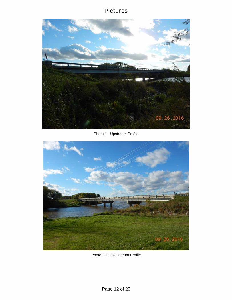
Photo 1 - Upstream Profile
Photo 2 - Downstream Profile
Pictures
Page 12 of 20

Pictures
Photo 3 - West Abutment
Photo 4 - East Abutment
Page 13 of 20

Pictures
Photo 5 - Pier 1 West Face
Photo 6 - Pier 1 East Face
Page 14 of 20

Pictures
Photo 7 - Pier 2 West Face
Photo 8 - Pier 2 East Face
Page 15 of 20

Pictures
Photo 9 - Pier 3 West Face
Photo 10 - Pier 3 East Face
Page 16 of 20

Pictures
Photo 11 - Typical at Waterline
Photo 12 - Upstream Channel
Page 17 of 20

Pictures
Photo 13 - Downstream Channel
Page 18 of 20

Page 19 of 20

Page 20 of 20