caspian sea - wikipedia, the free encyclopedia
DESCRIPTION
The Caspian Sea (Russian: Каспийское море, Azerbaijani: Xəzər dənizi,Kazakh: Каспий теңізі, Persian: دریای خزر Daryā-i Xazar, دریای مازندرانDaryā-i Māzandarān , Turkmen: Hazar deňizi, Georgian: კასპიის ზღვა) is thelargest enclosed inland body of water on Earth by area, variously classed as theworld's largest lake or a full-fledged sea.[2][3] The sea has a surface area of371,000 km2 (143,200 sq mi) (not including Garabogazköl Aylagy) and a volumeof 78,200 km3 (18,800 cu mi).[4] It is in an endorheic basin (it has no outflows)and is bounded to the northeast by Kazakhstan, to the northwest by Russia, tothe west by Azerbaijan, to the south by Iran, and to the southeast byTurkmenistanTRANSCRIPT
6/8/2014 en.wikipedia.org/wiki/Caspian_Sea
http://en.wikipedia.org/wiki/Caspian_Sea 1/11
Caspian Sea
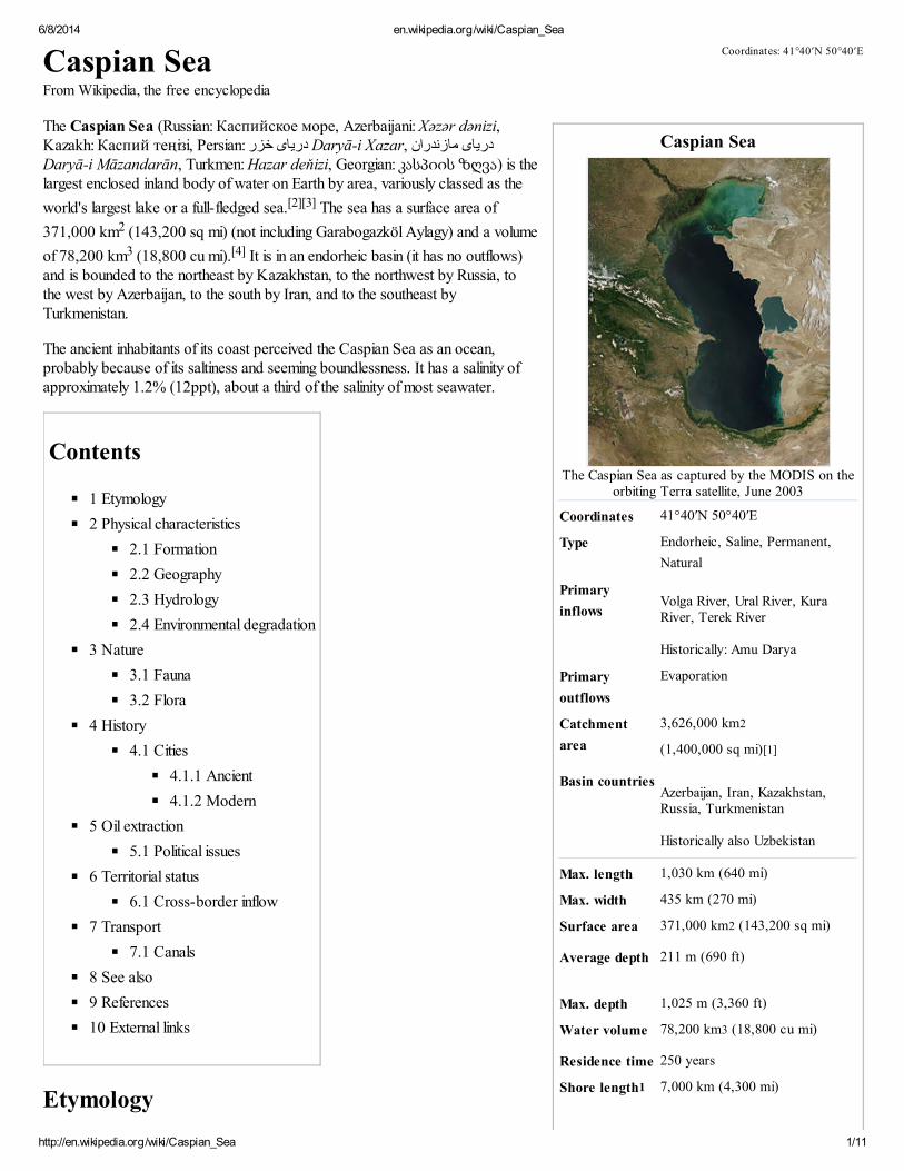
The Caspian Sea as captured by the MODIS on theorbiting Terra satellite, June 2003
Coordinates 41°40′N 50°40′E
Type Endorheic, Saline, Permanent,
Natural
Primary
inflowsVolga River, Ural River, KuraRiver, Terek River
Historically: Amu Darya
Primary
outflows
Evaporation
Catchment
area
3,626,000 km2
(1,400,000 sq mi)[1]
Basin countriesAzerbaijan, Iran, Kazakhstan,Russia, Turkmenistan
Historically also Uzbekistan
Max. length 1,030 km (640 mi)
Max. width 435 km (270 mi)
Surface area 371,000 km2 (143,200 sq mi)
Average depth 211 m (690 ft)
Max. depth 1,025 m (3,360 ft)
Water volume 78,200 km3 (18,800 cu mi)
Residence time 250 years
Shore length1 7,000 km (4,300 mi)
Caspian SeaFrom Wikipedia, the free encyclopedia
The Caspian Sea (Russian: Каспийское море, Azerbaijani: Xəzər dənizi,Kazakh: Каспий теңізі, Persian: دریای خزر Daryā-i Xazar, دریای مازندرانDaryā-i Māzandarān, Turkmen: Hazar deňizi, Georgian: კასპიის ზღვა) is thelargest enclosed inland body of water on Earth by area, variously classed as the
world's largest lake or a full-fledged sea.[2][3] The sea has a surface area of
371,000 km2 (143,200 sq mi) (not including Garabogazköl Aylagy) and a volume
of 78,200 km3 (18,800 cu mi).[4] It is in an endorheic basin (it has no outflows)and is bounded to the northeast by Kazakhstan, to the northwest by Russia, tothe west by Azerbaijan, to the south by Iran, and to the southeast byTurkmenistan.
The ancient inhabitants of its coast perceived the Caspian Sea as an ocean,probably because of its saltiness and seeming boundlessness. It has a salinity ofapproximately 1.2% (12ppt), about a third of the salinity of most seawater.
Contents
1 Etymology
2 Physical characteristics
2.1 Formation
2.2 Geography
2.3 Hydrology
2.4 Environmental degradation
3 Nature
3.1 Fauna
3.2 Flora
4 History
4.1 Cities
4.1.1 Ancient
4.1.2 Modern
5 Oil extraction
5.1 Political issues
6 Territorial status
6.1 Cross-border inflow
7 Transport
7.1 Canals
8 See also
9 References
10 External links
Etymology
Coordinates: 41°40′N 50°40′E
6/8/2014 en.wikipedia.org/wiki/Caspian_Sea
http://en.wikipedia.org/wiki/Caspian_Sea 2/11
Surface
elevation
−28 m (−92 ft)
Islands 26+
Settlements Baku (Azerbaijan), Rasht (Iran),
Aktau (Kazakhstan), Makhachkala
(Russia), Türkmenbaşy
(Turkmenistan) (see article)
References [1]
1 Shore length is not a well-defined measure.
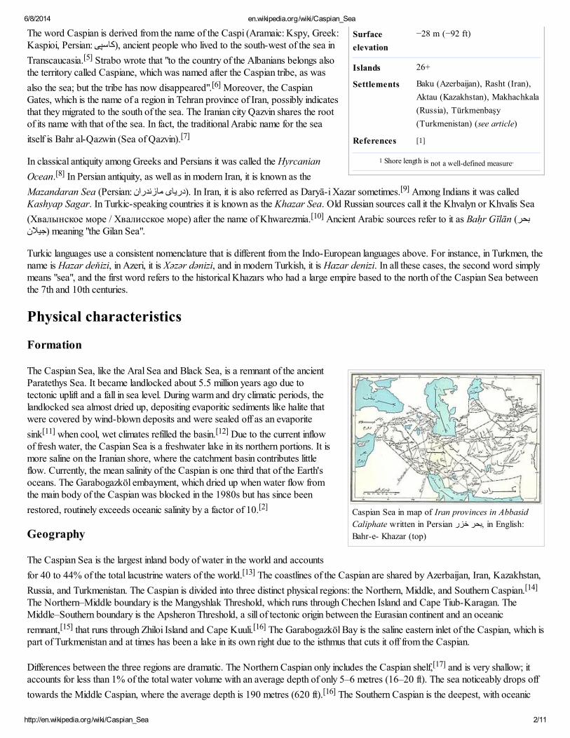
Caspian Sea in map of Iran provinces in Abbasid
Caliphate written in Persian بحر خزر, in English:
Bahr-e- Khazar (top)
The word Caspian is derived from the name of the Caspi (Aramaic: Kspy, Greek:Kaspioi, Persian: کاسپی), ancient people who lived to the south-west of the sea in
Transcaucasia.[5] Strabo wrote that "to the country of the Albanians belongs alsothe territory called Caspiane, which was named after the Caspian tribe, as was
also the sea; but the tribe has now disappeared".[6] Moreover, the CaspianGates, which is the name of a region in Tehran province of Iran, possibly indicatesthat they migrated to the south of the sea. The Iranian city Qazvin shares the rootof its name with that of the sea. In fact, the traditional Arabic name for the sea
itself is Bahr al-Qazwin (Sea of Qazvin).[7]
In classical antiquity among Greeks and Persians it was called the Hyrcanian
Ocean.[8] In Persian antiquity, as well as in modern Iran, it is known as the
Mazandaran Sea (Persian: دریای مازندران). In Iran, it is also referred as Daryā-i Xazar sometimes.[9] Among Indians it was calledKashyap Sagar. In Turkic-speaking countries it is known as the Khazar Sea. Old Russian sources call it the Khvalyn or Khvalis Sea
(Хвалынское море / Хвалисское море) after the name of Khwarezmia.[10] Ancient Arabic sources refer to it as Baḥr Gīlān (بحر."meaning "the Gilan Sea (جیالن
Turkic languages use a consistent nomenclature that is different from the Indo-European languages above. For instance, in Turkmen, thename is Hazar deňizi, in Azeri, it is Xəzər dənizi, and in modern Turkish, it is Hazar denizi. In all these cases, the second word simplymeans "sea", and the first word refers to the historical Khazars who had a large empire based to the north of the Caspian Sea betweenthe 7th and 10th centuries.
Physical characteristics
Formation
The Caspian Sea, like the Aral Sea and Black Sea, is a remnant of the ancientParatethys Sea. It became landlocked about 5.5 million years ago due totectonic uplift and a fall in sea level. During warm and dry climatic periods, thelandlocked sea almost dried up, depositing evaporitic sediments like halite thatwere covered by wind-blown deposits and were sealed off as an evaporite
sink[11] when cool, wet climates refilled the basin.[12] Due to the current inflowof fresh water, the Caspian Sea is a freshwater lake in its northern portions. It ismore saline on the Iranian shore, where the catchment basin contributes littleflow. Currently, the mean salinity of the Caspian is one third that of the Earth'soceans. The Garabogazköl embayment, which dried up when water flow fromthe main body of the Caspian was blocked in the 1980s but has since been
restored, routinely exceeds oceanic salinity by a factor of 10.[2]
Geography
The Caspian Sea is the largest inland body of water in the world and accounts
for 40 to 44% of the total lacustrine waters of the world.[13] The coastlines of the Caspian are shared by Azerbaijan, Iran, Kazakhstan,
Russia, and Turkmenistan. The Caspian is divided into three distinct physical regions: the Northern, Middle, and Southern Caspian.[14]
The Northern–Middle boundary is the Mangyshlak Threshold, which runs through Chechen Island and Cape Tiub-Karagan. TheMiddle–Southern boundary is the Apsheron Threshold, a sill of tectonic origin between the Eurasian continent and an oceanic
remnant,[15] that runs through Zhiloi Island and Cape Kuuli.[16] The Garabogazköl Bay is the saline eastern inlet of the Caspian, which ispart of Turkmenistan and at times has been a lake in its own right due to the isthmus that cuts it off from the Caspian.
Differences between the three regions are dramatic. The Northern Caspian only includes the Caspian shelf,[17] and is very shallow; itaccounts for less than 1% of the total water volume with an average depth of only 5–6 metres (16–20 ft). The sea noticeably drops off
towards the Middle Caspian, where the average depth is 190 metres (620 ft).[16] The Southern Caspian is the deepest, with oceanic
6/8/2014 en.wikipedia.org/wiki/Caspian_Sea
http://en.wikipedia.org/wiki/Caspian_Sea 3/11
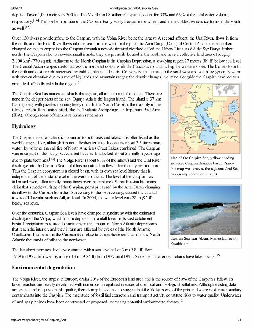
Map of the Caspian Sea, yellow shading
indicates Caspian drainage basin. (Since
this map was drawn, the adjacent Aral Sea
has greatly decreased in size)
Caspian Sea near Aktau, Mangistau region,
Kazakhstan.
depths of over 1,000 metres (3,300 ft). The Middle and Southern Caspian account for 33% and 66% of the total water volume,
respectively.[14] The northern portion of the Caspian Sea typically freezes in the winter, and in the coldest winters ice forms in the south
as well.[18]
Over 130 rivers provide inflow to the Caspian, with the Volga River being the largest. A second affluent, the Ural River, flows in fromthe north, and the Kura River flows into the sea from the west. In the past, the Amu Darya (Oxus) of Central Asia in the east oftenchanged course to empty into the Caspian through a now-desiccated riverbed called the Uzboy River, as did the Syr Darya farthernorth. The Caspian also has several small islands; they are primarily located in the north and have a collective land area of roughly
2,000 km2 (770 sq mi). Adjacent to the North Caspian is the Caspian Depression, a low-lying region 27 metres (89 ft) below sea level.The Central Asian steppes stretch across the northeast coast, while the Caucasus mountains hug the western shore. The biomes to boththe north and east are characterized by cold, continental deserts. Conversely, the climate to the southwest and south are generally warmwith uneven elevation due to a mix of highlands and mountain ranges; the drastic changes in climate alongside the Caspian have led to a
great deal of biodiversity in the region.[2]
The Caspian Sea has numerous islands throughout, all of them near the coasts. There arenone in the deeper parts of the sea. Ogurja Ada is the largest island. The island is 37 km(23 mi) long, with gazelles roaming freely on it. In the North Caspian, the majority of theislands are small and uninhabited, like the Tyuleniy Archipelago, an Important Bird Area(IBA), although some of them have human settlements.
Hydrology
The Caspian has characteristics common to both seas and lakes. It is often listed as theworld's largest lake, although it is not a freshwater lake. It contains about 3.5 times morewater, by volume, than all five of North America's Great Lakes combined. The Caspianwas once part of the Tethys Ocean, but became landlocked about 5.5 million years ago
due to plate tectonics.[13] The Volga River (about 80% of the inflow) and the Ural Riverdischarge into the Caspian Sea, but it has no natural outflow other than by evaporation.Thus the Caspian ecosystem is a closed basin, with its own sea level history that isindependent of the eustatic level of the world's oceans. The level of the Caspian hasfallen and risen, often rapidly, many times over the centuries. Some Russian historiansclaim that a medieval rising of the Caspian, perhaps caused by the Amu Darya changingits inflow to the Caspian from the 13th century to the 16th century, caused the coastaltowns of Khazaria, such as Atil, to flood. In 2004, the water level was 28 m (92 ft)below sea level.
Over the centuries, Caspian Sea levels have changed in synchrony with the estimateddischarge of the Volga, which in turn depends on rainfall levels in its vast catchmentbasin. Precipitation is related to variations in the amount of North Atlantic depressionsthat reach the interior, and they in turn are affected by cycles of the North AtlanticOscillation. Thus levels in the Caspian Sea relate to atmospheric conditions in the NorthAtlantic thousands of miles to the northwest.
The last short-term sea-level cycle started with a sea-level fall of 3 m (9.84 ft) from
1929 to 1977, followed by a rise of 3 m (9.84 ft) from 1977 until 1995. Since then smaller oscillations have taken place.[19]
Environmental degradation
The Volga River, the largest in Europe, drains 20% of the European land area and is the source of 80% of the Caspian’s inflow. Itslower reaches are heavily developed with numerous unregulated releases of chemical and biological pollutants. Although existing dataare sparse and of questionable quality, there is ample evidence to suggest that the Volga is one of the principal sources of transboundarycontaminants into the Caspian. The magnitude of fossil fuel extraction and transport activity constitute risks to water quality. Underwater
oil and gas pipelines have been constructed or proposed, increasing potential environmental threats.[20]
6/8/2014 en.wikipedia.org/wiki/Caspian_Sea
http://en.wikipedia.org/wiki/Caspian_Sea 4/11
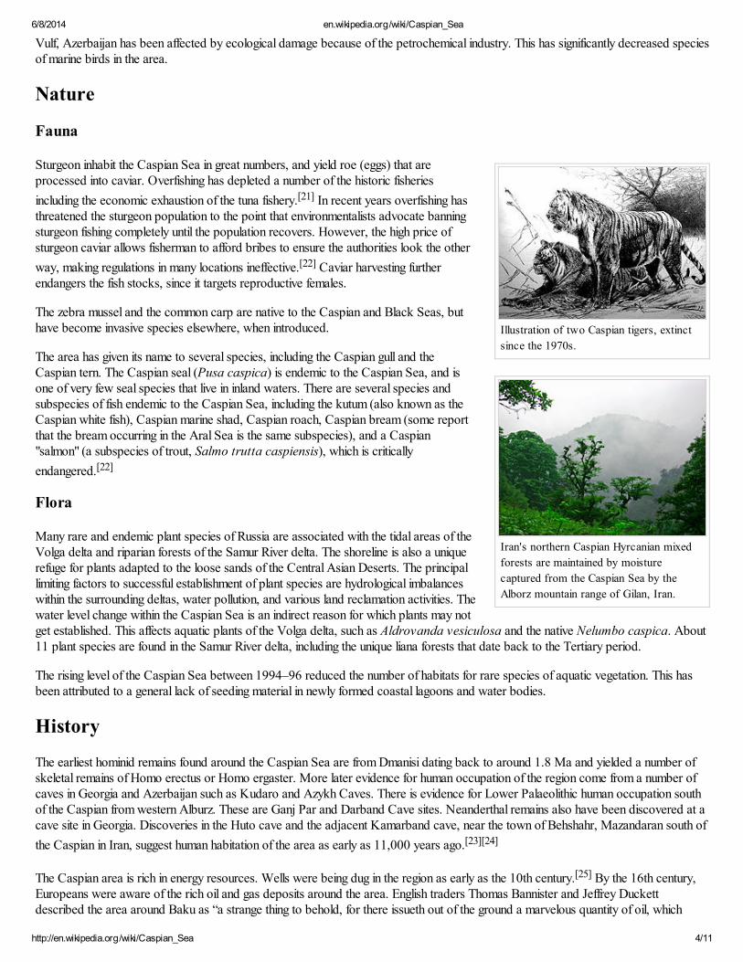
Illustration of two Caspian tigers, extinct
since the 1970s.
Iran's northern Caspian Hyrcanian mixed
forests are maintained by moisture
captured from the Caspian Sea by the
Alborz mountain range of Gilan, Iran.
Vulf, Azerbaijan has been affected by ecological damage because of the petrochemical industry. This has significantly decreased speciesof marine birds in the area.
Nature
Fauna
Sturgeon inhabit the Caspian Sea in great numbers, and yield roe (eggs) that areprocessed into caviar. Overfishing has depleted a number of the historic fisheries
including the economic exhaustion of the tuna fishery.[21] In recent years overfishing hasthreatened the sturgeon population to the point that environmentalists advocate banningsturgeon fishing completely until the population recovers. However, the high price ofsturgeon caviar allows fisherman to afford bribes to ensure the authorities look the other
way, making regulations in many locations ineffective.[22] Caviar harvesting furtherendangers the fish stocks, since it targets reproductive females.
The zebra mussel and the common carp are native to the Caspian and Black Seas, buthave become invasive species elsewhere, when introduced.
The area has given its name to several species, including the Caspian gull and theCaspian tern. The Caspian seal (Pusa caspica) is endemic to the Caspian Sea, and isone of very few seal species that live in inland waters. There are several species andsubspecies of fish endemic to the Caspian Sea, including the kutum (also known as theCaspian white fish), Caspian marine shad, Caspian roach, Caspian bream (some reportthat the bream occurring in the Aral Sea is the same subspecies), and a Caspian"salmon" (a subspecies of trout, Salmo trutta caspiensis), which is critically
endangered.[22]
Flora
Many rare and endemic plant species of Russia are associated with the tidal areas of theVolga delta and riparian forests of the Samur River delta. The shoreline is also a uniquerefuge for plants adapted to the loose sands of the Central Asian Deserts. The principallimiting factors to successful establishment of plant species are hydrological imbalanceswithin the surrounding deltas, water pollution, and various land reclamation activities. Thewater level change within the Caspian Sea is an indirect reason for which plants may notget established. This affects aquatic plants of the Volga delta, such as Aldrovanda vesiculosa and the native Nelumbo caspica. About11 plant species are found in the Samur River delta, including the unique liana forests that date back to the Tertiary period.
The rising level of the Caspian Sea between 1994–96 reduced the number of habitats for rare species of aquatic vegetation. This hasbeen attributed to a general lack of seeding material in newly formed coastal lagoons and water bodies.
History
The earliest hominid remains found around the Caspian Sea are from Dmanisi dating back to around 1.8 Ma and yielded a number ofskeletal remains of Homo erectus or Homo ergaster. More later evidence for human occupation of the region come from a number ofcaves in Georgia and Azerbaijan such as Kudaro and Azykh Caves. There is evidence for Lower Palaeolithic human occupation southof the Caspian from western Alburz. These are Ganj Par and Darband Cave sites. Neanderthal remains also have been discovered at acave site in Georgia. Discoveries in the Huto cave and the adjacent Kamarband cave, near the town of Behshahr, Mazandaran south of
the Caspian in Iran, suggest human habitation of the area as early as 11,000 years ago.[23][24]
The Caspian area is rich in energy resources. Wells were being dug in the region as early as the 10th century.[25] By the 16th century,Europeans were aware of the rich oil and gas deposits around the area. English traders Thomas Bannister and Jeffrey Duckettdescribed the area around Baku as “a strange thing to behold, for there issueth out of the ground a marvelous quantity of oil, which
6/8/2014 en.wikipedia.org/wiki/Caspian_Sea
http://en.wikipedia.org/wiki/Caspian_Sea 5/11
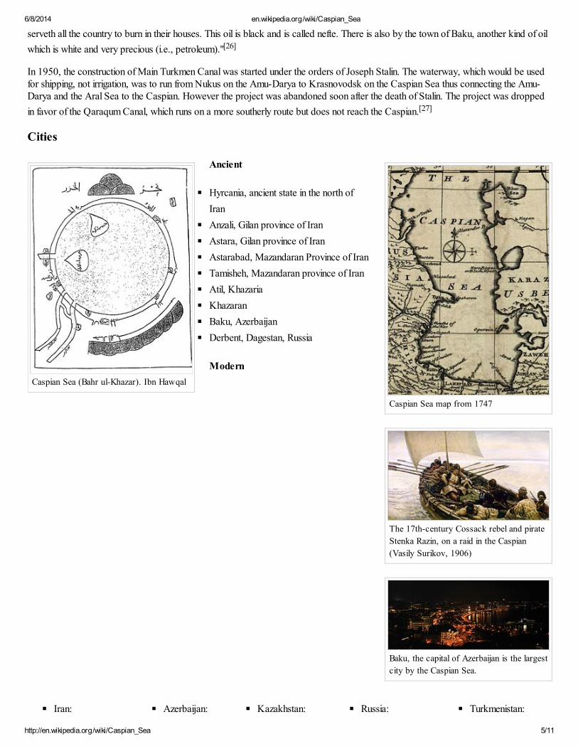
Caspian Sea (Bahr ul-Khazar). Ibn Hawqal
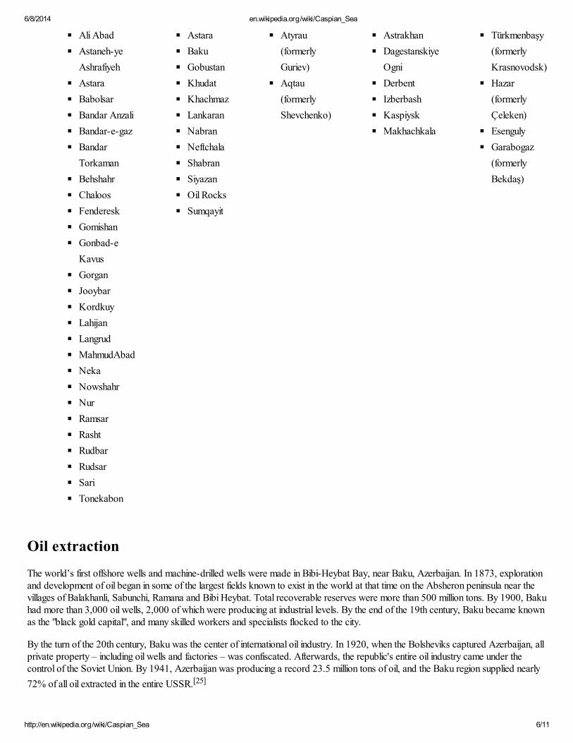
Caspian Sea map from 1747
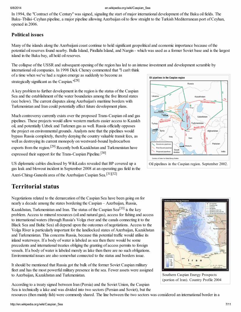
The 17th-century Cossack rebel and pirate
Stenka Razin, on a raid in the Caspian
(Vasily Surikov, 1906)
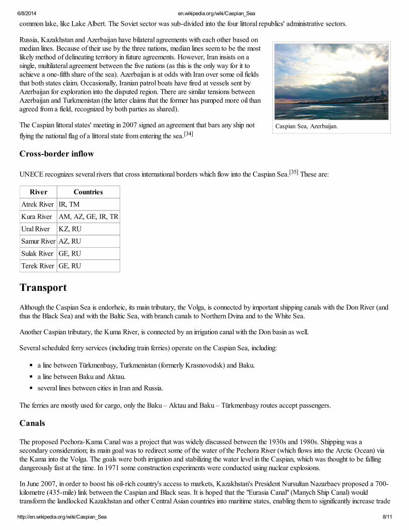
Baku, the capital of Azerbaijan is the largest
city by the Caspian Sea.
serveth all the country to burn in their houses. This oil is black and is called nefte. There is also by the town of Baku, another kind of oil
which is white and very precious (i.e., petroleum)."[26]
In 1950, the construction of Main Turkmen Canal was started under the orders of Joseph Stalin. The waterway, which would be usedfor shipping, not irrigation, was to run from Nukus on the Amu-Darya to Krasnovodsk on the Caspian Sea thus connecting the Amu-Darya and the Aral Sea to the Caspian. However the project was abandoned soon after the death of Stalin. The project was dropped
in favor of the Qaraqum Canal, which runs on a more southerly route but does not reach the Caspian.[27]
Cities
Ancient
Hyrcania, ancient state in the north of
Iran
Anzali, Gilan province of Iran
Astara, Gilan province of Iran
Astarabad, Mazandaran Province of Iran
Tamisheh, Mazandaran province of Iran
Atil, Khazaria
Khazaran
Baku, Azerbaijan
Derbent, Dagestan, Russia
Modern
Iran: Azerbaijan: Kazakhstan: Russia: Turkmenistan:
6/8/2014 en.wikipedia.org/wiki/Caspian_Sea
http://en.wikipedia.org/wiki/Caspian_Sea 6/11
Ali Abad
Astaneh-ye
Ashrafiyeh
Astara
Babolsar
Bandar Anzali
Bandar-e-gaz
Bandar
Torkaman
Behshahr
Chaloos
Fenderesk
Gomishan
Gonbad-e
Kavus
Gorgan
Jooybar
Kordkuy
Lahijan
Langrud
MahmudAbad
Neka
Nowshahr
Nur
Ramsar
Rasht
Rudbar
Rudsar
Sari
Tonekabon
Astara
Baku
Gobustan
Khudat
Khachmaz
Lankaran
Nabran
Neftchala
Shabran
Siyazan
Oil Rocks
Sumqayit
Atyrau
(formerly
Guriev)
Aqtau
(formerly
Shevchenko)
Astrakhan
Dagestanskiye
Ogni
Derbent
Izberbash
Kaspiysk
Makhachkala
Türkmenbaşy
(formerly
Krasnovodsk)
Hazar
(formerly
Çeleken)
Esenguly
Garabogaz
(formerly
Bekdaş)
Oil extraction
The world’s first offshore wells and machine-drilled wells were made in Bibi-Heybat Bay, near Baku, Azerbaijan. In 1873, explorationand development of oil began in some of the largest fields known to exist in the world at that time on the Absheron peninsula near thevillages of Balakhanli, Sabunchi, Ramana and Bibi Heybat. Total recoverable reserves were more than 500 million tons. By 1900, Bakuhad more than 3,000 oil wells, 2,000 of which were producing at industrial levels. By the end of the 19th century, Baku became knownas the "black gold capital", and many skilled workers and specialists flocked to the city.
By the turn of the 20th century, Baku was the center of international oil industry. In 1920, when the Bolsheviks captured Azerbaijan, allprivate property – including oil wells and factories – was confiscated. Afterwards, the republic's entire oil industry came under thecontrol of the Soviet Union. By 1941, Azerbaijan was producing a record 23.5 million tons of oil, and the Baku region supplied nearly
72% of all oil extracted in the entire USSR.[25]
6/8/2014 en.wikipedia.org/wiki/Caspian_Sea
http://en.wikipedia.org/wiki/Caspian_Sea 7/11
Oil pipelines in the Caspian region. September 2002.
Southern Caspian Energy Prospects
(portion of Iran). Country Profile 2004
In 1994, the "Contract of the Century" was signed, signaling the start of major international development of the Baku oil fields. TheBaku–Tbilisi–Ceyhan pipeline, a major pipeline allowing Azerbaijan oil to flow straight to the Turkish Mediterranean port of Ceyhan,opened in 2006.
Political issues
Many of the islands along the Azerbaijani coast continue to hold significant geopolitical and economic importance because of thepotential oil reserves found nearby. Bulla Island, Pirallahı Island, and Nargin - which was used as a former Soviet base and is the largestisland in the Baku bay, all hold oil reserves.
The collapse of the USSR and subsequent opening of the region has led to an intense investment and development scramble byinternational oil companies. In 1998 Dick Cheney commented that "I can't thinkof a time when we've had a region emerge as suddenly to become as
strategically significant as the Caspian."[28]
A key problem to further development in the region is the status of the CaspianSea and the establishment of the water boundaries among the five littoral states(see below). The current disputes along Azerbaijan's maritime borders withTurkmenistan and Iran could potentially affect future development plans.
Much controversy currently exists over the proposed Trans-Caspian oil and gaspipelines. These projects would allow western markets easier access to Kazakhoil, and potentially Uzbek and Turkmen gas as well. Russia officially opposesthe project on environmental grounds. Analysts note that the pipelines wouldbypass Russia completely, thereby denying the country valuable transit fees, aswell as destroying its current monopoly on westward-bound hydrocarbon
exports from the region.[29] Recently both Kazakhstan and Turkmenistan have
expressed their support for the Trans-Caspian Pipeline.[30]
US diplomatic cables disclosed by WikiLeaks revealed that BP covered up agas leak and blowout incident in September 2008 at an operating gas field in the
Azeri-Chirag-Guneshi area of the Azerbaijan Caspian Sea.[31][32]
Territorial status
Negotiations related to the demarcation of the Caspian Sea have been going on fornearly a decade among the states bordering the Caspian – Azerbaijan, Russia,
Kazakhstan, Turkmenistan and Iran. The status of the Caspian Sea[33] is the keyproblem. Access to mineral resources (oil and natural gas), access for fishing and accessto international waters (through Russia's Volga river and the canals connecting it to theBlack Sea and Baltic Sea) all depend upon the outcomes of negotiations. Access to theVolga River is particularly important for the landlocked states of Azerbaijan, Kazakhstanand Turkmenistan. This concerns Russia, because this potential traffic would utilise itsinland waterways. If a body of water is labeled as sea then there would be someprecedents and international treaties obliging the granting of access permits to foreignvessels. If a body of water is labeled merely as lake then there are no such obligations.Environmental issues are also somewhat connected to the status and borders issue.
It should be mentioned that Russia got the bulk of the former Soviet Caspian militaryfleet and has the most powerful military presence in the sea. Fewer assets were assignedto Azerbaijan, Kazakhstan and Turkmenistan.
According to a treaty signed between Iran (Persia) and the Soviet Union, the CaspianSea is technically a lake and was divided into two sectors (Persian and Soviet), but theresources (then mainly fish) were commonly shared. The line between the two sectors was considered an international border in a
6/8/2014 en.wikipedia.org/wiki/Caspian_Sea
http://en.wikipedia.org/wiki/Caspian_Sea 8/11
Caspian Sea, Azerbaijan.
common lake, like Lake Albert. The Soviet sector was sub-divided into the four littoral republics' administrative sectors.
Russia, Kazakhstan and Azerbaijan have bilateral agreements with each other based onmedian lines. Because of their use by the three nations, median lines seem to be the mostlikely method of delineating territory in future agreements. However, Iran insists on asingle, multilateral agreement between the five nations (as this is the only way for it toachieve a one-fifth share of the sea). Azerbaijan is at odds with Iran over some oil fieldsthat both states claim. Occasionally, Iranian patrol boats have fired at vessels sent byAzerbaijan for exploration into the disputed region. There are similar tensions betweenAzerbaijan and Turkmenistan (the latter claims that the former has pumped more oil thanagreed from a field, recognized by both parties as shared).
The Caspian littoral states' meeting in 2007 signed an agreement that bars any ship not
flying the national flag of a littoral state from entering the sea.[34]
Cross-border inflow
UNECE recognizes several rivers that cross international borders which flow into the Caspian Sea.[35] These are:
River Countries
Atrek River IR, TM
Kura River AM, AZ, GE, IR, TR
Ural River KZ, RU
Samur River AZ, RU
Sulak River GE, RU
Terek River GE, RU
Transport
Although the Caspian Sea is endorheic, its main tributary, the Volga, is connected by important shipping canals with the Don River (andthus the Black Sea) and with the Baltic Sea, with branch canals to Northern Dvina and to the White Sea.
Another Caspian tributary, the Kuma River, is connected by an irrigation canal with the Don basin as well.
Several scheduled ferry services (including train ferries) operate on the Caspian Sea, including:
a line between Türkmenbaşy, Turkmenistan (formerly Krasnovodsk) and Baku.
a line between Baku and Aktau.
several lines between cities in Iran and Russia.
The ferries are mostly used for cargo, only the Baku – Aktau and Baku – Türkmenbaşy routes accept passengers.
Canals
The proposed Pechora-Kama Canal was a project that was widely discussed between the 1930s and 1980s. Shipping was asecondary consideration; its main goal was to redirect some of the water of the Pechora River (which flows into the Arctic Ocean) viathe Kama into the Volga. The goals were both irrigation and stabilizing the water level in the Caspian, which was thought to be fallingdangerously fast at the time. In 1971 some construction experiments were conducted using nuclear explosions.
In June 2007, in order to boost his oil-rich country's access to markets, Kazakhstan's President Nursultan Nazarbaev proposed a 700-kilometre (435-mile) link between the Caspian and Black seas. It is hoped that the "Eurasia Canal" (Manych Ship Canal) wouldtransform the landlocked Kazakhstan and other Central Asian countries into maritime states, enabling them to significantly increase trade
6/8/2014 en.wikipedia.org/wiki/Caspian_Sea
http://en.wikipedia.org/wiki/Caspian_Sea 9/11
volume. While the canal would traverse Russian territory, it would benefit Kazakhstan through its Caspian Sea ports. The most likelyroute for the canal, the officials at the Committee on Water Resources at Kazakhstan's Agriculture Ministry say, would follow theKuma-Manych Depression, where currently a chain of rivers and lakes is already connected by an irrigation canal (Kuma-Manych
Canal). Upgrading the Volga–Don Canal would be another option.[36]
See also
Baku Oil Fields
Caspian people
Ekranoplan, a ground effect plane which was developed on the Caspian Sea.
Epoch of Extremal Inundations
Framework Convention for the Protection of the Marine Environment of the Caspian Sea
Shah Deniz gas field
South Caucasus pipeline
Southern Gas Corridor
Tengiz Field
Trans-Caspian Gas Pipeline
Trans-Caspian Oil Pipeline
References
Notes
1. ̂a b van der Leeden, Troise, and Todd, eds., The Water Encyclopedia. Second Edition. Chelsea, MI: Lewis Publishers, 1990, p. 196.
2. ̂a b c "Caspian Sea - Background" (http://www.caspianenvironment.org/newsite/Caspian-Background.htm). Caspian Environment
Programme. 2009. Retrieved 11 September 2012.
3. ^ "ESA: Observing the Earth – Earth from Space: The southern Caspian Sea"
(http://www.esa.int/esaEO/SEM5GYTLWFE_index_0.html). ESA.int. Retrieved 2007-05-25.
4. ^ Lake Profile: Caspian Sea (http://www.worldlakes.org/lakedetails.asp?lakeid=8762). LakeNet.
5. ^ Caspian Sea (http://www.britannica.com/eb/article-9110540) in Encyclopædia Britannica.
6. ^ "Strabo. Geography. 11.3.1" (http://www.perseus.tufts.edu/hopper/text?
doc=Perseus:text:1999.01.0198:book=11:chapter=4&highlight=caspiane). Perseus.tufts.edu. Retrieved 2011-04-14.
7. ^ Iran (5th ed., 2008), by Andrew Burke and Mark Elliott, p. 28 (http://www.lonelyplanet.com/shop_pickandmix/previews/iran-5-
history-preview.pdf), Lonely Planet Publications, ISBN 978-1-74104-293-1
8. ^ Hyrcania (http://www.livius.org/ho-hz/hyrcania/hyrcania.html). www.livius.org. Retrieved on 2012-05-20.
9. ^ Drainage Basins – Caspian Sea (http://www.briancoad.com/Introduction/caspianseabasin.htm). Briancoad.com. Retrieved on 2012-05-
20.
10. ^ Max Vasmer, Etimologicheskii slovar' russkogo yazyka, Vol. IV (Moscow: Progress, 1973), p. 229.
11. ^ In system dynamics, a sink is a place where a flow of materials ends its journey, removed from the system.
12. ^ Comparable evaporite beds underlie the Mediterranean.
13. ̂a b "Caspian Sea" (http://web.archive.org/web/20090122212158/http://irangazette.com/12.html). Iran Gazette. Archived from the
original (http://irangazette.com/12.html) on 2009-01-22. Retrieved 2010-05-17.
14. ̂a b Hooshang Amirahmadi (10 June 2000). The Caspian Region at a Crossroad: Challenges of a New Frontier of Energy and
Development (http://books.google.com/books?id=zMQp4_Shq90C&pg=PA112). Palgrave Macmillan. pp. 112–. ISBN 978-0-312-22351-
9. Retrieved 20 May 2012.
15. ^ Khain V. E. Gadjiev A. N. Kengerli T. N (2007). "Tectonic origin of the Apsheron Threshold in the Caspian Sea". Doklady Earth
Sciences 414: 552–556. doi:10.1134/S1028334X07040149 (http://dx.doi.org/10.1134%2FS1028334X07040149).

6/8/2014 en.wikipedia.org/wiki/Caspian_Sea
http://en.wikipedia.org/wiki/Caspian_Sea 10/11
Wikimedia Commons hasmedia related to CaspianSea.
Look up caspian sea inWiktionary, the freedictionary.
External links
Names of the Caspian Sea
(http://www.iranchamber.com/geography/articles/names_of_caspian_sea.php)
Caspian Sea Region (http://www.parstimes.com/caspian/)
Caspian Environment Programme (http://www.caspianenvironment.org/)
Framework Convention for the Protection of the Marine Environment of the
16. ̂a b Henri J. Dumont; Tamara A. Shiganova; Ulrich Niermann (20 July 2004). Aquatic Invasions in the Black, Caspian, and
Mediterranean Seas (http://books.google.com/books?id=CFZqnCfulHwC). Springer. ISBN 978-1-4020-1869-5. Retrieved 20 May 2012.
17. ^ A. G. Kostianoi and A. Kosarev (16 December 2005). The Caspian Sea Environment (http://books.google.com/books?
id=C1ajCHzI9OEC). Birkhäuser. ISBN 978-3-540-28281-5. Retrieved 20 May 2012.
18. ^ Caspian Sea frozen at Azerbaijani coast (http://ann.az/en/?p=19304)
19. ^ "Welcome to the Caspian Sea Level Project Site"
(http://web.archive.org/web/20110724171008/http://www.caspage.citg.tudelft.nl/project.html). Caspage.citg.tudelft.nl. Archived from
the original (http://www.caspage.citg.tudelft.nl/project.html) on 2011-07-24. Retrieved 2010-05-17.
20. ^ "Caspian Environment Programme" (http://www.caspianenvironment.org/newsite/Caspian-EnvironmentalIssues.htm).
caspianenvironment.org. Retrieved 30 October 2012.
21. ^ C. Michael Hogan Overfishing. Encyclopedia of Earth. eds. Sidney Draggan and Cutler Cleveland. National Council for Science and
the Environment, Washington DC
22. ̂a b Fishing Prospects (https://web.archive.org/web/20080905160627/http://www.iran-daily.com/1385/2757/html/focus.htm) at the
Wayback Machine (archived September 5, 2008). iran-daily.com (2007-01-14)
23. ^ "Major Monuments" (http://www.iranair.com/site/779/default.aspx). Iranair.com. Retrieved on 2012-05-20.
24. ^ Safeguarding Caspian Interests (https://web.archive.org/web/20090603170833/http://www.iran-daily.com/1385/2717/html/focus.htm)
at the Wayback Machine (archived June 3, 2009). iran-daily.com (2006-11-26)
25. ̂a b The Development of the Oil and Gas Industry in Azerbaijan
(http://www.azer.com/aiweb/categories/magazine/42_folder/42_articles/42_socarkhoshbakht.html) SOCAR
26. ^ Back to the Future: Britain, Baku Oil and the Cycle of History
(http://www.azer.com/aiweb/categories/magazine/63_folder/63_articles/63_adams.html) SOCAR
27. ^ Kharin, Nikolai Gavrilovich (2002). Vegetation Degradation in Central Asia Under the Impact of Human Activities
(http://books.google.com/books?id=jRfTAOWwH1MC&pg=PA56). Springer. pp. 56–58. ISBN 1-4020-0397-8.
28. ^ The Great Gas Game (http://www.csmonitor.com/2001/1025/p8s1-comv.html). Christian Science Monitor (2001-10-25)
29. ^ Sergei Blagov. Russia Tries to Scuttle Proposed Trans-Caspian Pipeline
(http://www.eurasianet.org/departments/insight/articles/eav032806.shtml) Eurasianet (2006-03-27)
30. ^ Russia Seeking To Keep Kazakhstan Happy (http://www.eurasianet.org/departments/business/articles/eav121107.shtml) Eurasianet
(2007-12-10)
31. ^ Tim Webb (2010-12-15). "WikiLeaks cables: BP suffered blowout on Azerbaijan gas platform | World news"
(http://www.guardian.co.uk/world/2010/dec/15/wikileaks-bp-azerbaijan-gulf-spill). London: The Guardian. Retrieved 2013-03-26.
32. ^ Walt, Vivienne (2010-12-18). "WikiLeaks Reveals BP's 'Other' Offshore Drilling Disaster"
(http://www.time.com/time/world/article/0,8599,2037830,00.html). TIME. Retrieved 2013-03-26.
33. ^ Khoshbakht B. Yusifzade. "8.3 The Status of the Caspian Sea – Dividing Natural Resources Between Five Countries"
(http://www.azer.com/aiweb/categories/magazine/83_folder/83_articles/83_yusifzade.html). Azer.com. Retrieved 2010-05-17.
34. ^ Russia Gets Way In Caspian Meet (https://web.archive.org/web/20080120180954/http://www.brtsis.com/rrubbbb.htm) at the
Wayback Machine (archived January 20, 2008). brtsis.com
35. ^ "Drainage basing of the Caspian Sea" (http://www.unece.org/env/water/blanks/assessment/caspian.pdf). unece.org.
36. ^ Caspian Canal Could Boost Kazakh Trade (http://www.businessweek.com/globalbiz/content/jul2007/gb2007079_528939.htm)
Business Week (2007-07-09)
6/8/2014 en.wikipedia.org/wiki/Caspian_Sea
http://en.wikipedia.org/wiki/Caspian_Sea 11/11
Caspian Sea
(http://www.caspianenvironment.org/reports/Framework_Convention.zip) (2003)
Target: Caspian Sea Oil (http://globalguerrillas.typepad.com/globalguerrillas/2004/07/long_term_gg_ta.html) John Robb, 2004
Dating Caspian sea level changes (http://www.caspage.citg.tudelft.nl/project.html)
Caspian Sea Is Dying (http://www.payvand.com/news/10/nov/1032.html)
Retrieved from "http://en.wikipedia.org/w/index.php?title=Caspian_Sea&oldid=617063512"
Categories: Caspian Sea Saline lakes Lowest points Azerbaijan–Iran border Iran–Turkmenistan border
Kazakhstan–Turkmenistan border Kazakhstan–Russia border Azerbaijan–Russia border Iran–Soviet Union relations
International lakes of Asia International lakes of Europe Disputed territories in Asia Border tripoints
This page was last modified on 15 July 2014 at 16:00.
Text is available under the Creative Commons Attribution-ShareAlike License; additional terms may apply. By using this site, youagree to the Terms of Use and Privacy Policy. Wikipedia® is a registered trademark of the Wikimedia Foundation, Inc., a non-
profit organization.