central corridor high-capacity transit study · task 9 1 1 task 10 1 1 1 task 11 1 1 1 task 12 1 1...
TRANSCRIPT
CENTRAL CORRIDOR HIGH-CAPACITY
TRANSIT STUDY
Capital Metro Board of Directors Briefing
March 24, 2014
2
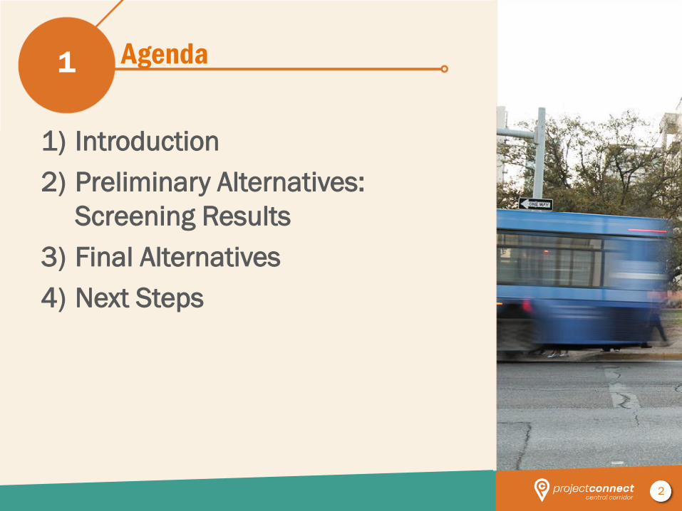
Agenda
1) Introduction
2) Preliminary Alternatives:
Screening Results
3) Final Alternatives
4) Next Steps
1
3
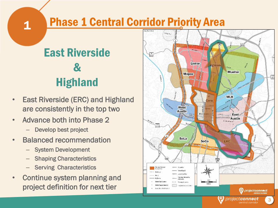
Phase 1 Central Corridor Priority Area 1
• East Riverside (ERC) and Highland
are consistently in the top two
• Advance both into Phase 2
– Develop best project
• Balanced recommendation
– System Development
– Shaping Characteristics
– Serving Characteristics
• Continue system planning and
project definition for next tier
East Riverside
&
Highland
4
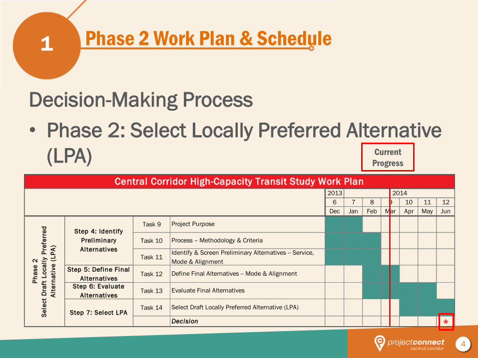
2013 2014
6 7 8 9 10 11 12
Dec Jan Feb Mar Apr May Jun
Task 9 1 1
Task 10 1 1 1
Task 11 1 1 1
Task 12 1 1
Task 13 1 1 1 1
Task 14 1 1 1
*
Evaluate Final Alternatives
Step 4: Identify
Preliminary
Alternatives
Central Corridor High-Capacity Transit Study Work Plan
Ph
ase
2
Se
lect
Dra
ft L
oca
lly P
refe
rre
d
Alt
ern
ati
ve
(L
PA
)
Identify & Screen Preliminary Alternatives -- Service,
Mode & Alignment
Select Draft Locally Preferred Alternative (LPA)Step 7: Select LPA
Decision
Process – Methodology & Criteria
Step 6: Evaluate
Alternatives
Step 5: Define Final
AlternativesDefine Final Alternatives -- Mode & Alignment
Project Purpose
Phase 2 Work Plan & Schedule
Decision-Making Process
• Phase 2: Select Locally Preferred Alternative
(LPA)
1
Current
Progress
5
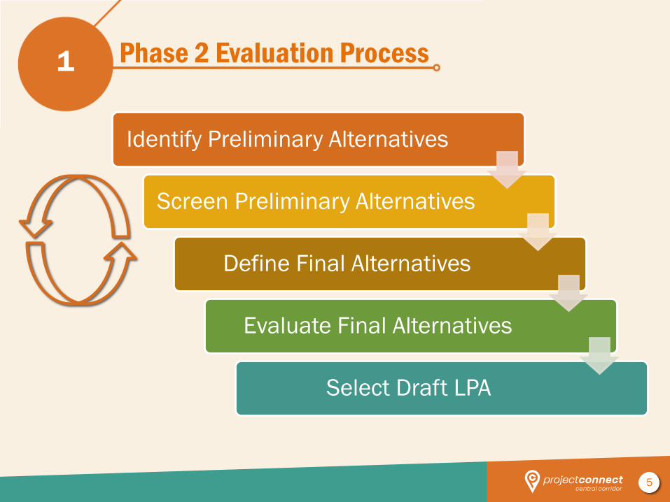
Phase 2 Evaluation Process
Identify Preliminary Alternatives
Screen Preliminary Alternatives
Define Final Alternatives
Evaluate Final Alternatives
Select Draft LPA
1
6
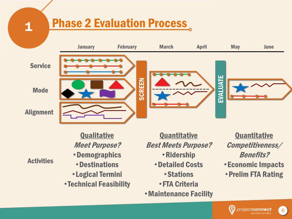
Phase 2 Evaluation Process 1
Service
Alignment
Mode
February March April May June
Qualitative
Meet Purpose?
•Demographics
•Destinations
•Logical Termini
•Technical Feasibility
January
SC
RE
EN
EV
ALU
ATE
Quantitative
Best Meets Purpose?
•Ridership
•Detailed Costs
•Stations
•FTA Criteria
•Maintenance Facility
Quantitative
Competitiveness/
Benefits?
•Economic Impacts
•Prelim FTA Rating
Activities
7
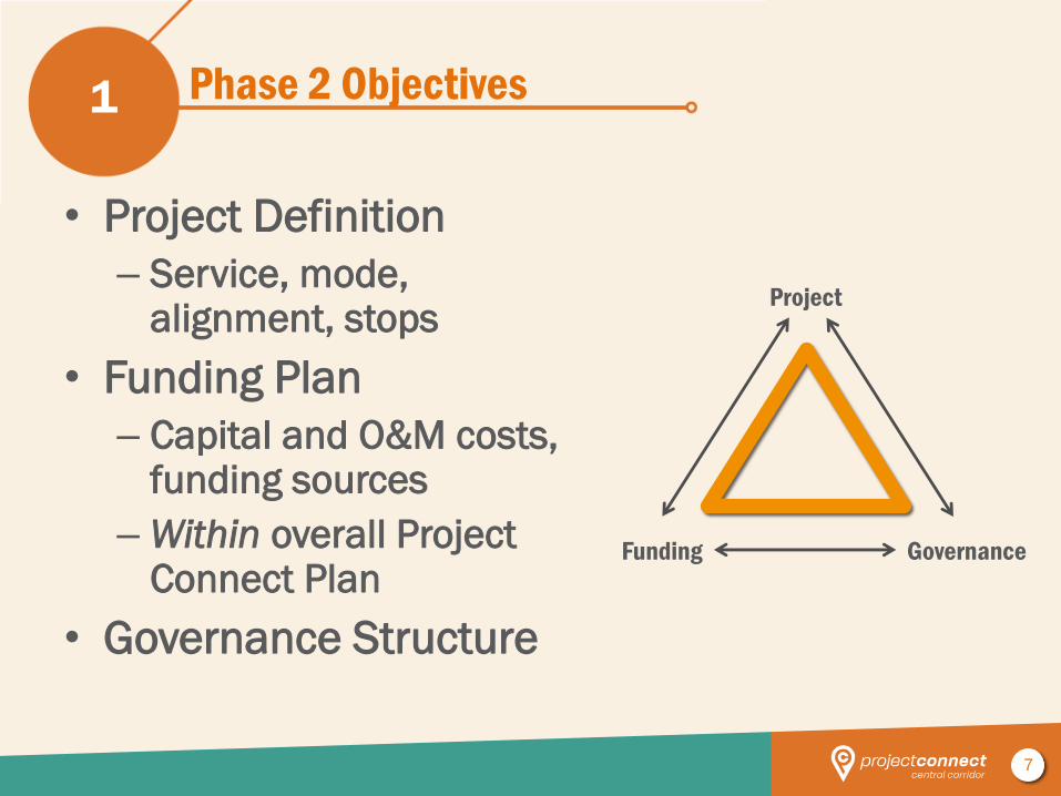
Phase 2 Objectives
• Project Definition
– Service, mode, alignment, stops
• Funding Plan
– Capital and O&M costs, funding sources
– Within overall Project Connect Plan
• Governance Structure
1
Project
Funding Governance
8
Preliminary Alternatives: Screening Results 2
9
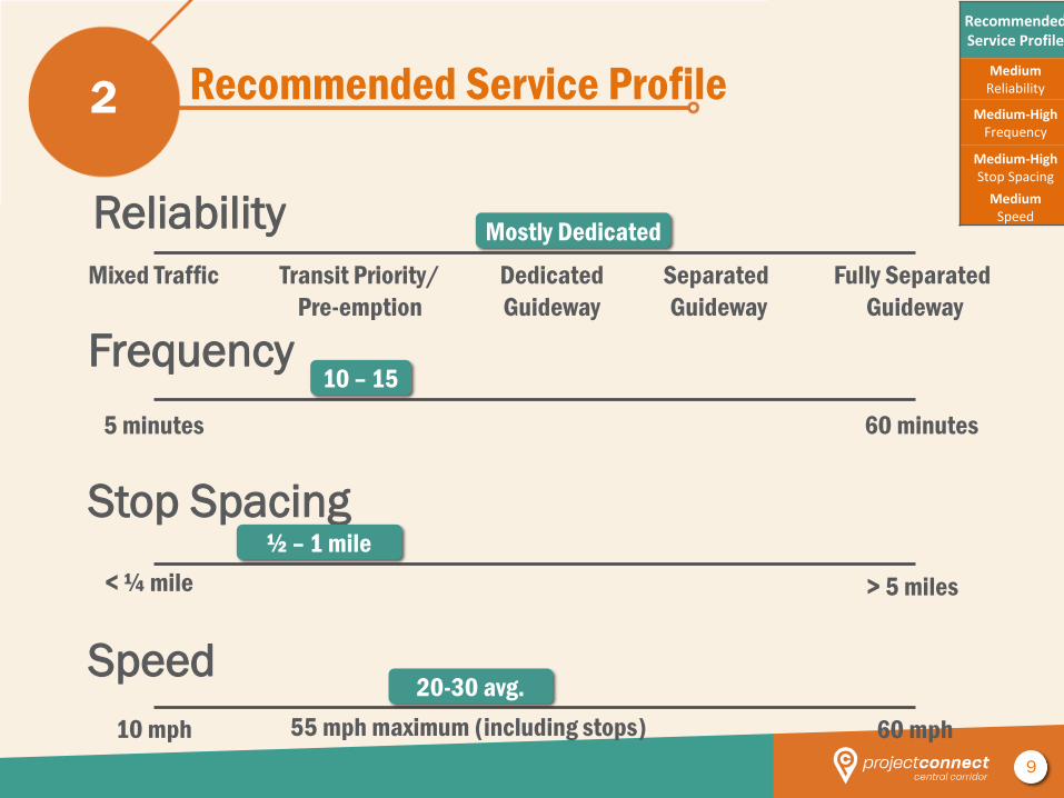
Recommended Service Profile 2
Speed
10 mph 60 mph
Mixed Traffic Fully Separated
Guideway
Transit Priority/
Pre-emption
Dedicated
Guideway
Separated
Guideway
Stop Spacing
> 5 miles < ¼ mile
Frequency
60 minutes 5 minutes
Reliability
55 mph maximum (including stops)
½ – 1 mile
Mostly Dedicated
10 – 15
20-30 avg.
Recommended Service Profile
Medium Reliability
Medium-High Frequency
Medium-High Stop Spacing
Medium Speed
10
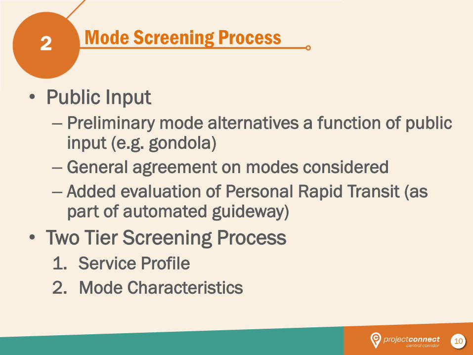
Mode Screening Process
• Public Input
– Preliminary mode alternatives a function of public input (e.g. gondola)
– General agreement on modes considered
– Added evaluation of Personal Rapid Transit (as part of automated guideway)
• Two Tier Screening Process
1. Service Profile
2. Mode Characteristics
2
11
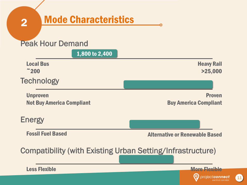
Mode Characteristics 2
Compatibility (with Existing Urban Setting/Infrastructure)
Less Flexible More Flexible
Local Bus
~200
Heavy Rail
>25,000
Energy
Alternative or Renewable Based Fossil Fuel Based
Technology
Proven
Buy America Compliant
Unproven
Not Buy America Compliant
Peak Hour Demand
1,800 to 2,400
12
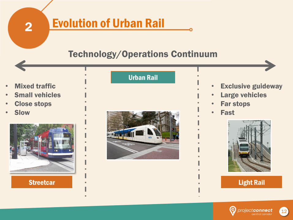
Evolution of Urban Rail 2
Technology/Operations Continuum
• Mixed traffic
• Small vehicles
• Close stops
• Slow
• Exclusive guideway
• Large vehicles
• Far stops
• Fast
Urban Rail
Streetcar Light Rail
13
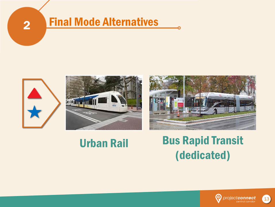
Final Mode Alternatives 2
Urban Rail Bus Rapid Transit
(dedicated)
14
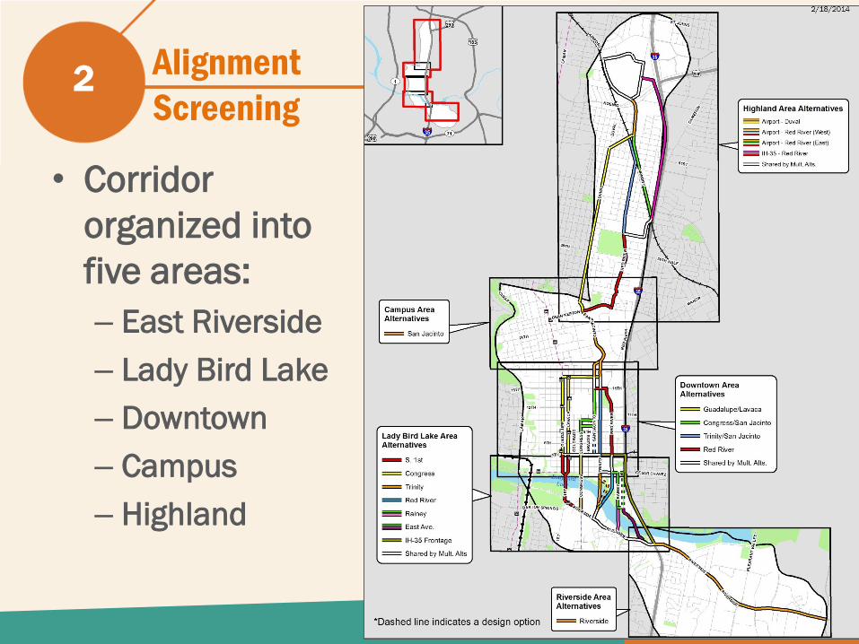
• Corridor
organized into
five areas:
– East Riverside
– Lady Bird Lake
– Downtown
– Campus
– Highland
2 Alignment
Screening
15
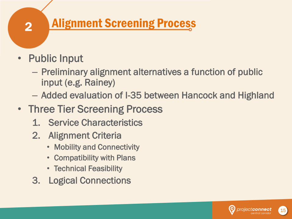
Alignment Screening Process
• Public Input
– Preliminary alignment alternatives a function of public input (e.g. Rainey)
– Added evaluation of I-35 between Hancock and Highland
• Three Tier Screening Process
1. Service Characteristics
2. Alignment Criteria
• Mobility and Connectivity
• Compatibility with Plans
• Technical Feasibility
3. Logical Connections
2
16
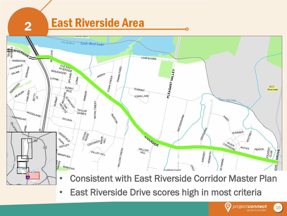
East Riverside Area 2
• Consistent with East Riverside Corridor Master Plan
• East Riverside Drive scores high in most criteria
17
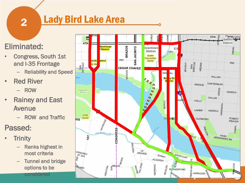
Lady Bird Lake Area 2
Eliminated:
• Congress, South 1st
and I-35 Frontage
– Reliability and Speed
• Red River
– ROW
• Rainey and East
Avenue
– ROW and Traffic
Passed:
• Trinity
– Ranks highest in
most criteria
– Tunnel and bridge
options to be
considered
18
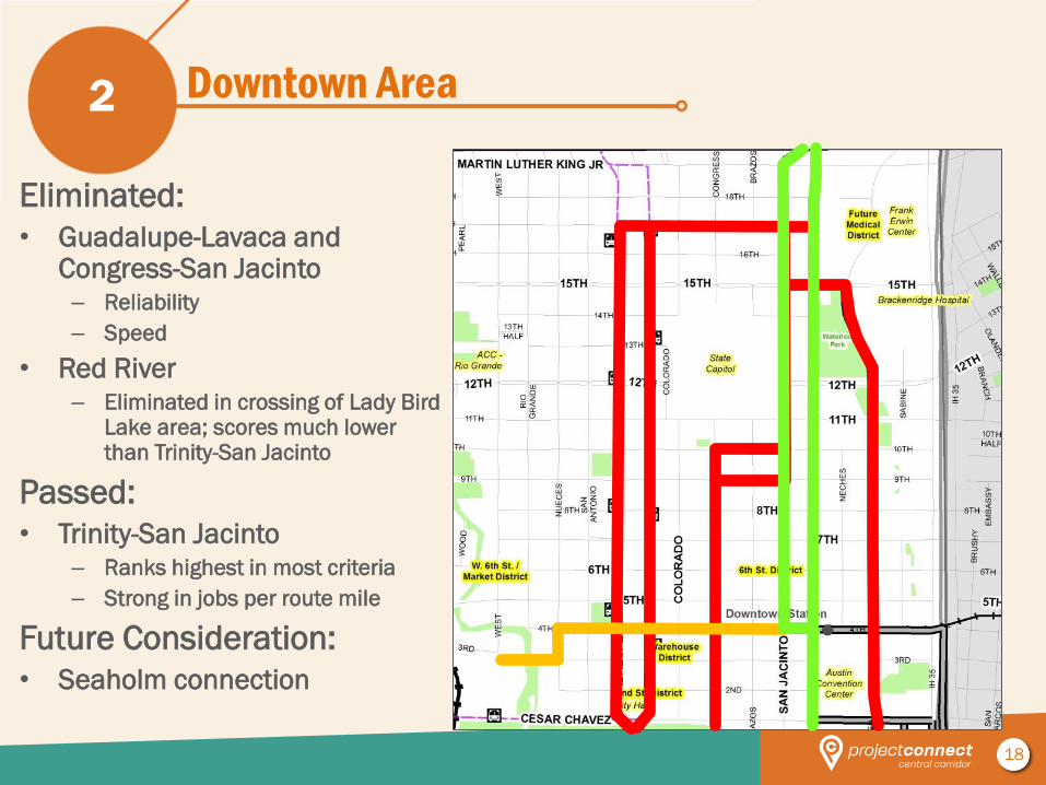
Downtown Area 2
Eliminated:
• Guadalupe-Lavaca and Congress-San Jacinto – Reliability
– Speed
• Red River – Eliminated in crossing of Lady Bird
Lake area; scores much lower than Trinity-San Jacinto
Passed:
• Trinity-San Jacinto – Ranks highest in most criteria
– Strong in jobs per route mile
Future Consideration:
• Seaholm connection
19
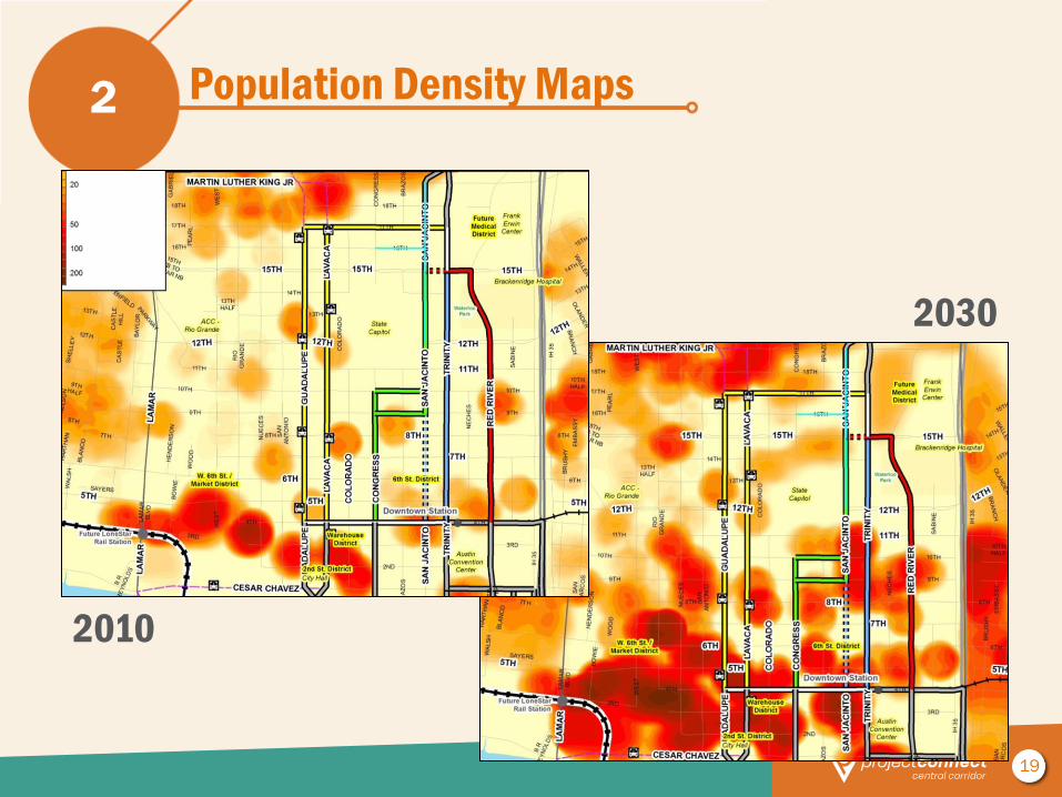
Population Density Maps 2
2010
2030
20
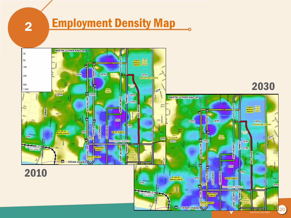
Employment Density Map 2
2010
2030
21
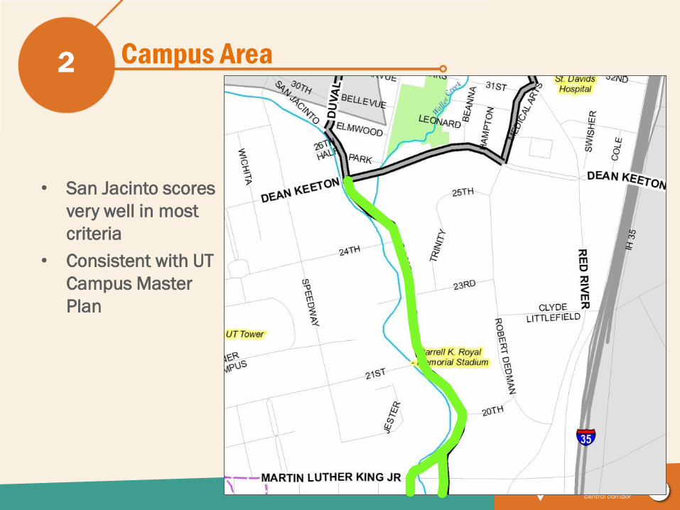
Campus Area 2
• San Jacinto scores
very well in most
criteria
• Consistent with UT
Campus Master
Plan
22
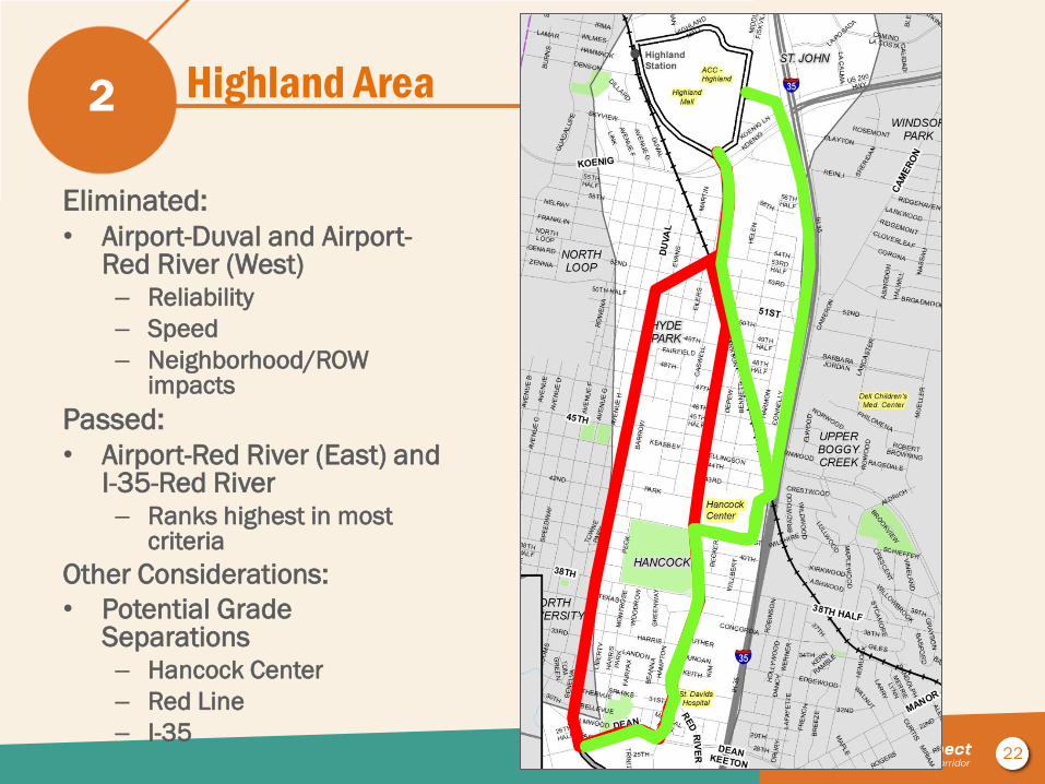
Highland Area 2
Eliminated:
• Airport-Duval and Airport-Red River (West) – Reliability
– Speed
– Neighborhood/ROW impacts
Passed:
• Airport-Red River (East) and I-35-Red River – Ranks highest in most
criteria
Other Considerations:
• Potential Grade Separations – Hancock Center
– Red Line
– I-35
23
Final Alternatives 3
24
Final Alternatives – Elements
• Number and locations of stops
• Vehicle types
• Vehicle maintenance facility options
• Alignment alternatives refinements
– Additional screening
• Operations plan – in progress
3
25
Terminus
options
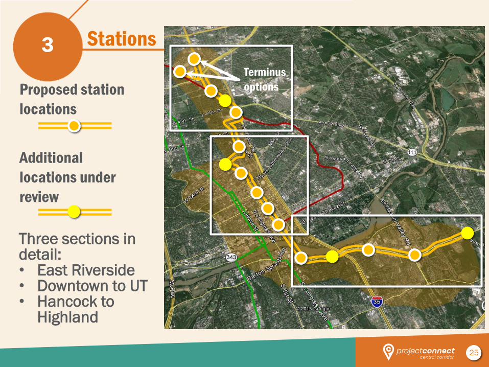
Stations 3
Proposed station
locations
Additional
locations under
review
Three sections in detail: • East Riverside • Downtown to UT • Hancock to
Highland
26
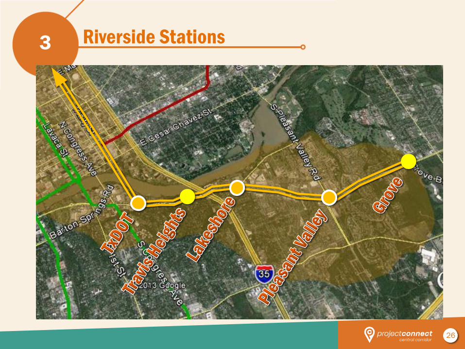
Riverside Stations 3
27
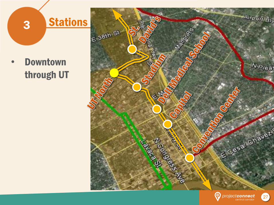
Stations 3
• Downtown
through UT
28
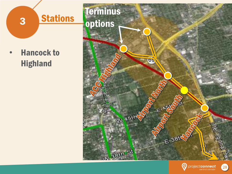
Stations 3
• Hancock to
Highland
Terminus
options
29
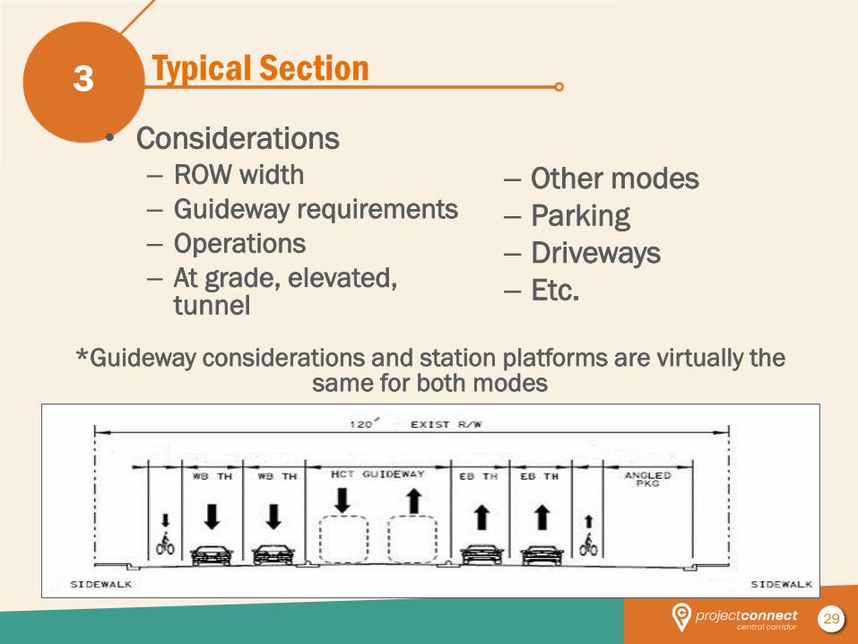
Typical Section
• Considerations – ROW width
– Guideway requirements
– Operations
– At grade, elevated, tunnel
3
– Other modes
– Parking
– Driveways
– Etc.
*Guideway considerations and station platforms are virtually the
same for both modes
30
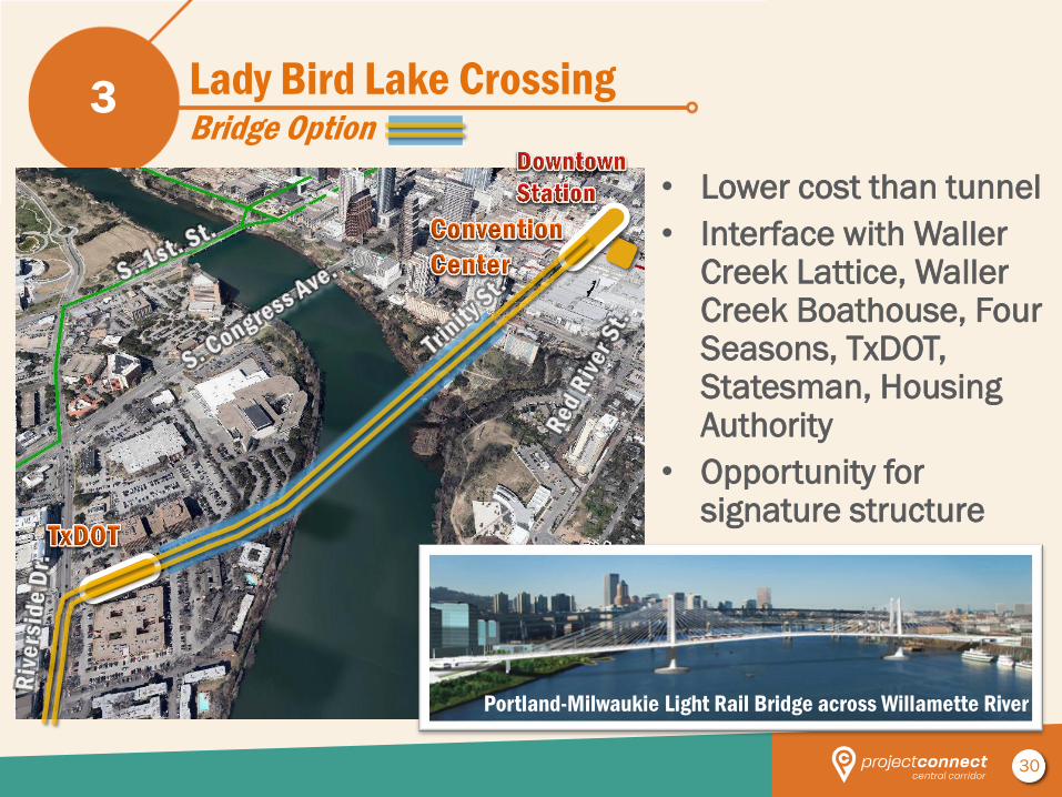
Lady Bird Lake Crossing Bridge Option
3
• Lower cost than tunnel
• Interface with Waller Creek Lattice, Waller Creek Boathouse, Four Seasons, TxDOT, Statesman, Housing Authority
• Opportunity for signature structure
Portland-Milwaukie Light Rail Bridge across Willamette River
31
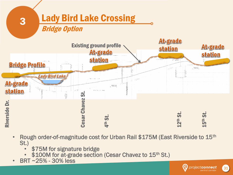
Lady Bird Lake Crossing Bridge Option
3
• Rough order-of-magnitude cost for Urban Rail $175M (East Riverside to 15th St.) • $75M for signature bridge • $100M for at-grade section (Cesar Chavez to 15th St.)
• BRT ~25% - 30% less
4th
St.
Ce
sar
Ch
ave
z S
t.
15
th S
t.
12
th S
t.
Existing ground profile
Riv
ers
ide
Dr.
32
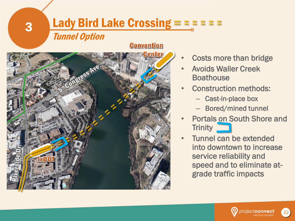
Lady Bird Lake Crossing Tunnel Option
3
• Costs more than bridge
• Avoids Waller Creek Boathouse
• Construction methods:
– Cast-in-place box
– Bored/mined tunnel
• Portals on South Shore and Trinity
• Tunnel can be extended into downtown to increase service reliability and speed and to eliminate at-grade traffic impacts
33
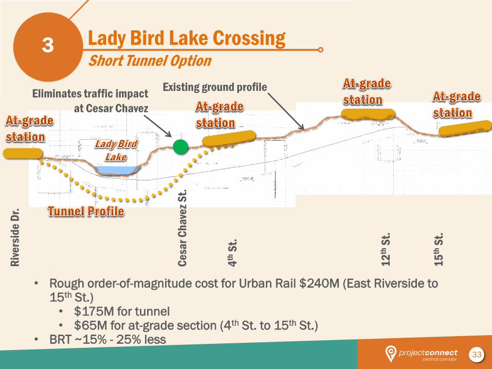
Lady Bird Lake Crossing Short Tunnel Option
3
• Rough order-of-magnitude cost for Urban Rail $240M (East Riverside to 15th St.) • $175M for tunnel • $65M for at-grade section (4th St. to 15th St.)
• BRT ~15% - 25% less
4th
St.
Ce
sar
Ch
ave
z S
t.
15
th S
t.
12
th S
t.
Existing ground profile Eliminates traffic impact
at Cesar Chavez
Riv
ers
ide
Dr.
34
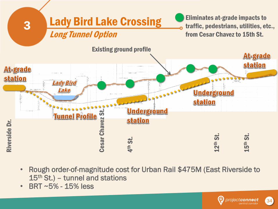
Lady Bird Lake Crossing Long Tunnel Option
3
• Rough order-of-magnitude cost for Urban Rail $475M (East Riverside to 15th St.) – tunnel and stations
• BRT ~5% - 15% less
Eliminates at-grade impacts to
traffic, pedestrians, utilities, etc.,
from Cesar Chavez to 15th St.
4th
St.
Ce
sar
Ch
ave
z S
t.
15
th S
t.
12
th S
t.
Riv
ers
ide
Dr.
Existing ground profile
35
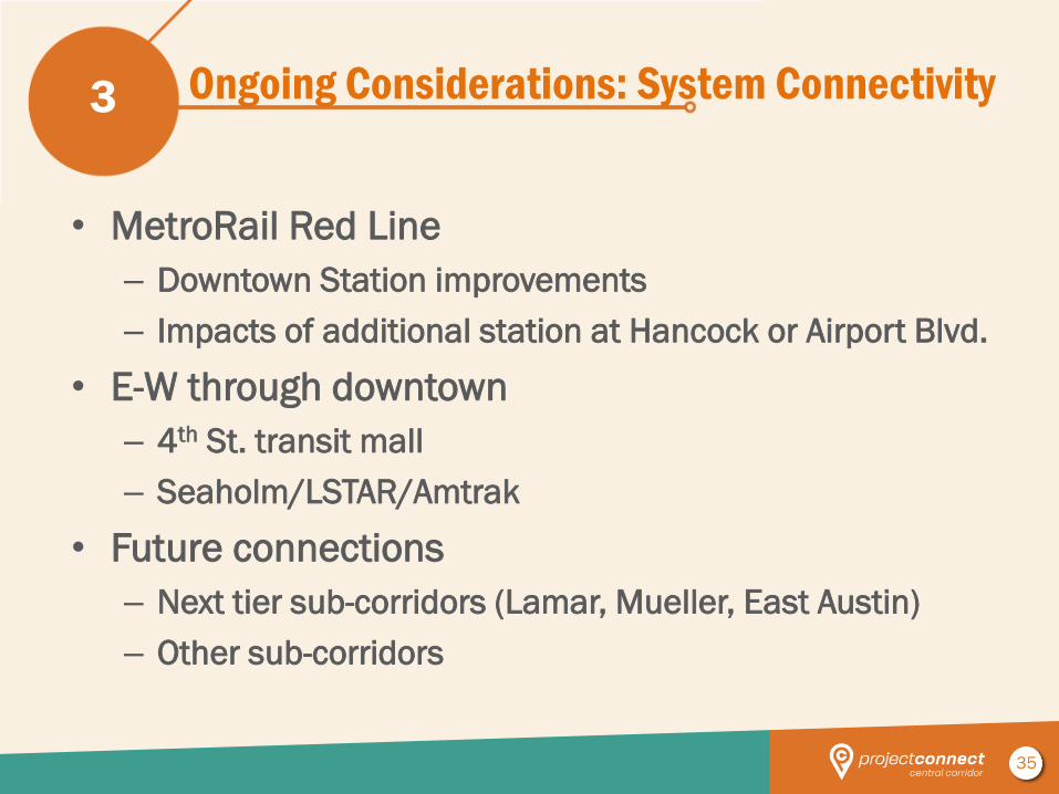
Ongoing Considerations: System Connectivity
• MetroRail Red Line
– Downtown Station improvements
– Impacts of additional station at Hancock or Airport Blvd.
• E-W through downtown
– 4th St. transit mall
– Seaholm/LSTAR/Amtrak
• Future connections
– Next tier sub-corridors (Lamar, Mueller, East Austin)
– Other sub-corridors
3
36
4 Next Steps
37
Next Steps
• Define Final Alternatives
– Typical Sections (side vs center), Stop
Locations, Grade Separation needs
– Quantities/Cost Estimates
– Operating Plan – peak/off-peak
frequencies, hours/days of operation,
fleet size
– Maintenance Facility Needs
• Develop Evaluation Methodology
• Begin Evaluation of Final Alternatives
4
38
Road to the LPA – Upcoming CCAG Meetings
• CCAG #11, April 11th – Operations plan
– Evaluation approach
– FTA process
– Project development timeline
• CCAG #12, May 2nd – Project team recommendation for LPA (end-to-end)
– System connectivity
– Rough order-of-magnitude (ROM) cost estimates
– Ridership estimates
– Funding and governance
• CCAG #13, May 16th – Phasing options (the project)
– System connectivity
– Scope and fee for additional system planning and project definition
• CCAG #14, June 13th – Action on recommended LPA and 1st Phase (the project)
4
THANK YOU
More Information:
Project Connect &
Central Corridor HCT Study projectconnect.com