chapter 6: groundwater - king county
TRANSCRIPT

FINAL EIS: Cedar Hills Regional Landfill, 2010 Site Development Plan 6-1 Chapter 6: Groundwater
Chapter 6: Groundwater
This chapter describes the hydrogeologic setting in the Cedar Hills Regional Landfill (CHRLF) vicinity, groundwater quality and beneficial use, critical aquifer recharge areas, the groundwater monitoring system at CHRLF, and the potential to affect groundwater resources by implementing any of the alternatives.
This environmental review determined there would be no significant unavoidable adverse impacts to groundwater during construction or operation of any of the alternatives.
6.1 Affected Environment
6.1.1 Hydrogeologic Setting
Groundwater occurs within the glacial strata (see Chapter 3) in two principal units: 1) local zones of discontinuous shallow groundwater that is “perched” above the regional aquifer, and 2) the regional aquifer.
Local perched groundwater zones occur directly beneath the landfill’s waste disposal areas (KCSWD 2008b) and are present in glacial till, ice-contact deposits, and recessional outwash deposits. These deposits consist of varying proportions of clay, silt, sand, and gravel left behind by glaciers that advanced over the region more than 14,000 years ago. The discontinuous perched groundwater zones are recharged by local precipitation and vertical leakage from small streams and drainage courses. Subsurface explorations on the CHRLF site indicate that none of these perched groundwater zones are laterally or vertically extensive, and many are only seasonally saturated (KCSWD 1999). Groundwater flow direction and velocity cannot be determined due to the discontinuous nature of these perched groundwater zones.
The glacial deposits that contain the perched groundwater zones sit atop advance glacial outwash deposits (sands, sandy gravels, silty sands, and silts) and older deposits (silty sands, silts, and clays) from prior glaciations. The regional aquifer occurs within these advance outwash and older deposits, and remains separated from the base of the CHRLF waste disposal areas by more than 200 feet of unsaturated strata. Local recharge to the regional aquifer occurs in the area of Queen City Lake through a gravel pit lake where precipitation seeps into highly permeable outwash deposits (Figure 6-1). Groundwater moves radially outward from this recharge area and northward onto the CHRLF site.
This recharge area functions as a groundwater divide between the Cedar River drainage to the south and the Lake Washington drainage to the north. Groundwater in the regional aquifer flows beneath the CHRLF site and then to the north and northeast through the Tiger Mountain gap (between Squak Mountain and Tiger Mountain) and beneath the Issaquah Creek Valley, eventually discharging into the Sammamish River and Lake Washington (KCSWD 2004). Figure 6-2 shows the flow in the regional aquifer beneath the CHRLF site. Average horizontal groundwater flow velocities calculated for the regional aquifer beneath
Groundwater Recharge
Recharge refers to the process of infiltration of water through the subsurface soils to replenish groundwater supplies.

D:\G
ISDA
TA\pr
ojects
\was
h\king
co\C
HRLF
\map
_doc
s\Fina
lDEI
S\CHR
LF_0
6-1_L
ocsG
rndWa
terFtr
s.mxd
- 9/8/
2009
@ 9:
56:33
AM
Fifteenmile CreekMcDonald CreekIssaquah Creek
Cedar
River
WebsterLake
FourLakes
LakeMcDonald
Queen CityLake
SpringLake
LakeKathleen
Gravel PitLake
West TigerMountainState Forest
SquakMountainState Park
CEDAR HILLSREGIONALLANDFILL
Queen City Farms
Squak
Mount
ain Rd
SE Jones Rd
230th A
ve SE
196th A
ve SE
SE 156th St
205th Ave SE
Webster Lake Rd
231st A
ve SE
Issaquah Hobart Rd
200th A
ve SE
Lake Francis Rd SE
244th A
ve SE
195th Pl SE
206th Ave SE
SE 129th St
204th Ave SE
Byers Rd SE
244th A
ve SE
240th A
ve SE
SE 132nd St
228th Ave SE
203rd Ave SE
SE 155
th Pl
234th Ave SE
SE 162nd St
234th Ave SE
SE 128th St
SE 145th St
SE 168th St
239th Pl SE
SE 158th St
Cedar G
rove Rd
196th A
ve SE
SE Lake Francis Rd
Renton Maple Valley Rd
SE May Valley Rd
SE 192nd St
SE 152nd St
SE 136th St
SE 138th Pl
SE 144th St
SE 159th St
SE 134th StSE 132nd Way
SE 168th St
SE 174th St
SE 168th St
SE 164th St
>>
>>>
>
Aç
Local Recharge Area forRegional Aquifer (USEPA 2003)StreamPark
Queen City FarmsBoundaryCedar Hills RegionalLandfill Boundary1000-Foot BufferBoundary
Locations of RegionalGroundwater Features
FIGURE 6-1
0 1,000 2,000
Feet
O
6-2 FINAL EIS: Cedar Hills Regional Landfill, 2010 Site Development Plan Chapter 6: Groundwater

FINAL EIS: Cedar Hills Regional Landfill, 2010 Site Development Plan Chapter 6: Groundwater
6-3

6-4 FINAL EIS: Cedar Hills Regional Landfill, 2010 Site Development Plan Chapter 6: Groundwater
the CHRLF site range from 0.015 feet/day in the south area, to 1.108 feet/day in the central area, to 0.595 feet/day in the north area (KCSWD 2008b).
A review of King County iMaps (2008) and Washington State Department of Ecology (Ecology) cleanup site maps (2008) indicates that there are no critical aquifer recharge areas or wellhead protection areas on or immediately adjacent to the landfill.
6.1.2 Surrounding Conditions Known to Impact Groundwater
Groundwater quality in the regional aquifer in the vicinity of the CHRLF has been affected by past land uses at the adjacent, privately-owned, Queen City Farms (QCF) Superfund site, including disposal of hazardous wastes. The QCF site occupies approximately 320 acres directly south of the landfill. Over the last 50 years, QCF site uses have included a pig farming operation that used municipal solid waste as feed, an animal rendering plant, unlined pits for disposal of liquid hazardous waste, unlined areas for disposal of solid waste, a general aviation airport, a solvent recovery operation, and gravel mining (KCSWD 1999). As shown in Figure 6-2, groundwater flows north from the QCF site beneath the CHRLF property.
6.1.3 Engineered Controls at the CHRLF to Protect Groundwater
Groundwater beneath the CHRLF is protected by several features. Underlying all waste areas, a dense glacial till deposit inhibits downward movement, and several hundred feet of unsaturated deposits separate the regional aquifer from waste areas. The dense glacial till has a very low permeability and provides protection against the migration of any contamination.
In all landfill disposal areas constructed after promulgation of WAC 173-304 in 1985, an impermeable landfill liner composed of high-density polyethylene (HDPE) is incorporated as well. A study of the chemical half-life characteristics of HDPE landfill liners (Koerner et al. 2005) predicted that the effective lifetime of an HDPE liner subjected to a temperature of 68ºF would be 449 years, on average. All proposed landfill areas to be constructed will have the HDPE liner system and will meet the protective criteria in WAC 173-351.
6.1.4 Groundwater Monitoring System
Federal and state regulations require groundwater monitoring at municipal solid waste landfills. For example, Washington Administrative Code (WAC) 173-351, Sections 200(11) and 415(1), requires groundwater monitoring. All groundwater monitoring requirements for the CHRLF are specified in the Municipal Solid Waste Handling Permit issued by Public Health (see Appendix B).
Groundwater has been monitored at the landfill since 1983. The current Groundwater Detection Monitoring Program consists of 38 monitoring wells in the regional aquifer. Additionally, KCSWD samples and monitors 9 wells and measures water levels in 11 wells in the perched groundwater zones (KCSWD 2008a).
Groundwater sampling is conducted quarterly, and data are evaluated using accepted statistical methods. Data are compared with federal drinking water standards (Maximum Contaminant Levels or MCLs) and the Washington State Groundwater Criteria (WSGWC).

FINAL EIS: Cedar Hills Regional Landfill, 2010 Site Development Plan 6-5 Chapter 6: Groundwater
There are primary standards that evaluate toxicity, and secondary standards that evaluate aesthetics such as taste and odor.
6.1.5 Groundwater Quality
KCSWD has been monitoring groundwater quality in the perched zones and the regional aquifer since the mid-1980s. Annual reports filed with Public Health – Seattle & King County (Public Health) and Ecology provide a summary of the data. An overview is provided below.
Water Quality in the Perched Groundwater Zones
Groundwater monitoring conducted as recently as 2009 indicates that two localized perched groundwater zones have been contaminated by historical activities at the landfill. Because these perched zones are of limited extent and cannot provide sufficient water quantities for area uses, they pose no risk to water supplies in the vicinity of the CHRLF.
Upgradient Water Quality in the Regional Aquifer
The upgradient monitoring wells (south of the CHRLF) define the water quality flowing to the CHRLF site. The water quality measured in the downgradient wells can be compared with water quality in the upgradient wells to determine the impact of the CHRLF on groundwater. A comparison of groundwater quality data upgradient and downgradient of the CHRLF indicates that the source of contamination is the regional aquifer upgradient of CHRLF, and that the contaminants are attenuated before reaching the monitoring wells downgradient of the site, and consequently before reaching drinking water wells near the CHRLF.
The QCF site is situated upgradient of CHRLF with respect to groundwater flow in the regional aquifer. Samples of groundwater flowing from the QCF site beneath the landfill show concentrations of the following chlorinated solvents and their breakdown products that exceed primary groundwater quality standards:
Tetrachloroethene (PCE) – Below the MCL of 5 µg/L and exceeds the WSGWC of 0.8 µg/L
Trichloroethene (TCE) – Exceeds the MCL of 5 µg/L by 8 times
Cis-1,2-Dichloroethene (DCE) – Present but below the MCL and WSGWC of 70 µg/L
Vinyl chloride (VC) – Below the MCL of 2 µg/L and exceeds the WSGWC of 0.02 µg/L
Other parameters that exceed groundwater quality standards are:
Arsenic – Exceeds the primary WSGWC of 0.00005 mg/L
Iron – Exceeds the secondary MCL and WSGWC of 0.3 mg/L
Manganese – Exceeds the secondary MCL and WSGWC of 0.5 mg/L
The presence and concentrations of these chemicals in upgradient monitoring wells at the landfill have been documented for many years by the CHRLF groundwater monitoring system.
6-6 FINAL EIS: Cedar Hills Regional Landfill, 2010 Site Development Plan Chapter 6: Groundwater
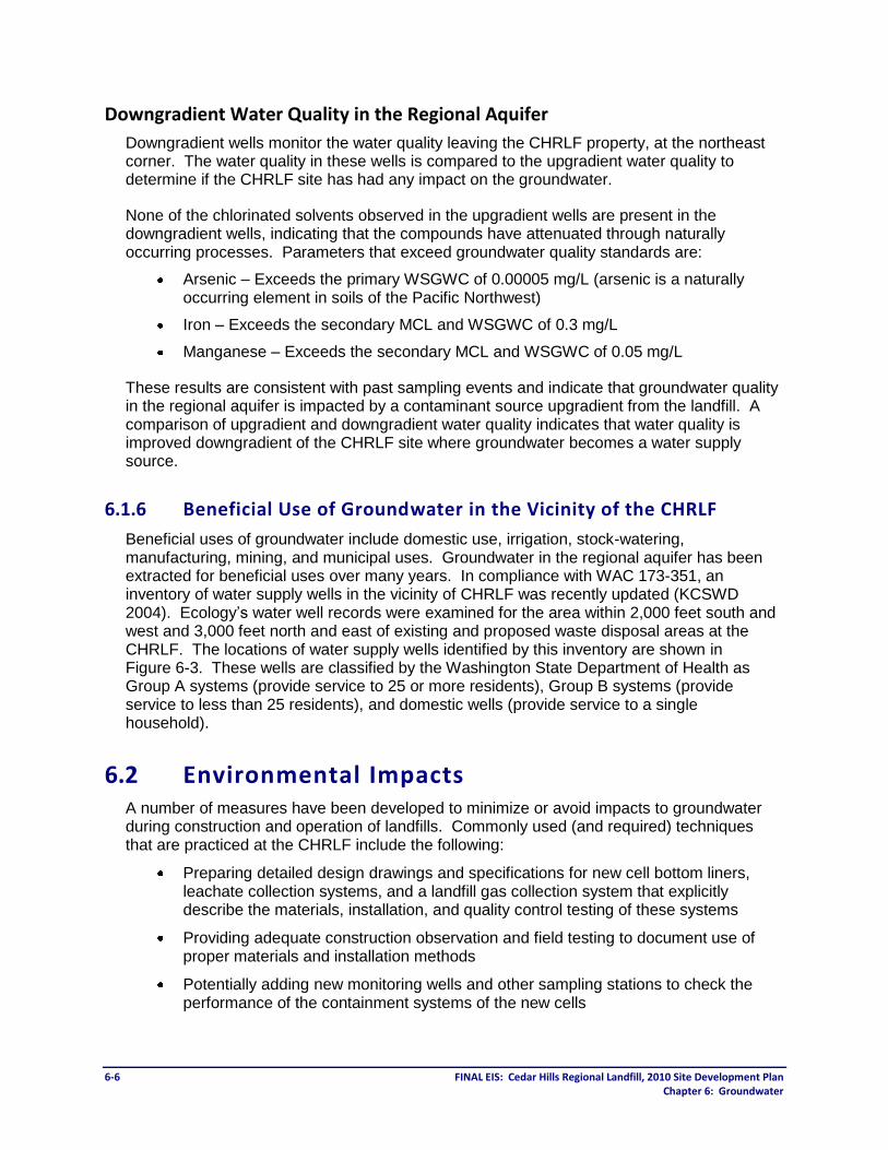
Downgradient Water Quality in the Regional Aquifer
Downgradient wells monitor the water quality leaving the CHRLF property, at the northeast corner. The water quality in these wells is compared to the upgradient water quality to determine if the CHRLF site has had any impact on the groundwater.
None of the chlorinated solvents observed in the upgradient wells are present in the downgradient wells, indicating that the compounds have attenuated through naturally occurring processes. Parameters that exceed groundwater quality standards are:
Arsenic – Exceeds the primary WSGWC of 0.00005 mg/L (arsenic is a naturally occurring element in soils of the Pacific Northwest)
Iron – Exceeds the secondary MCL and WSGWC of 0.3 mg/L
Manganese – Exceeds the secondary MCL and WSGWC of 0.05 mg/L
These results are consistent with past sampling events and indicate that groundwater quality in the regional aquifer is impacted by a contaminant source upgradient from the landfill. A comparison of upgradient and downgradient water quality indicates that water quality is improved downgradient of the CHRLF site where groundwater becomes a water supply source.
6.1.6 Beneficial Use of Groundwater in the Vicinity of the CHRLF
Beneficial uses of groundwater include domestic use, irrigation, stock-watering, manufacturing, mining, and municipal uses. Groundwater in the regional aquifer has been extracted for beneficial uses over many years. In compliance with WAC 173-351, an inventory of water supply wells in the vicinity of CHRLF was recently updated (KCSWD 2004). Ecology’s water well records were examined for the area within 2,000 feet south and west and 3,000 feet north and east of existing and proposed waste disposal areas at the CHRLF. The locations of water supply wells identified by this inventory are shown in Figure 6-3. These wells are classified by the Washington State Department of Health as Group A systems (provide service to 25 or more residents), Group B systems (provide service to less than 25 residents), and domestic wells (provide service to a single household).
6.2 Environmental Impacts A number of measures have been developed to minimize or avoid impacts to groundwater during construction and operation of landfills. Commonly used (and required) techniques that are practiced at the CHRLF include the following:
Preparing detailed design drawings and specifications for new cell bottom liners, leachate collection systems, and a landfill gas collection system that explicitly describe the materials, installation, and quality control testing of these systems
Providing adequate construction observation and field testing to document use of proper materials and installation methods
Potentially adding new monitoring wells and other sampling stations to check the performance of the containment systems of the new cells

D:\G
ISDA
TA\pr
ojects
\was
h\king
co\C
HRLF
\map
_doc
s\Fina
lDEI
S\CHR
LF_0
6-3_2
008W
aterW
ellInv
.mxd
- 9/3/
2009
@ 2:
20:30
PM
Fifteenmile CreekMcDonald CreekIssaquah Creek
Cedar
River
WebsterLake
FourLakes
LakeMcDonald
Queen CityLake
SpringLake
LakeKathleen
Gravel PitLake
West TigerMountainState Forest
SquakMountainState Park
CedarRiverTrail Site
CEDAR HILLSREGIONALLANDFILL
Squak
Mount
ain Rd
SE Jones Rd
230th A
ve SE
196th A
ve SE
SE 156th St
205th Ave SE
Webster Lake Rd
231st A
ve SE
Issaquah Hobart Rd
200th A
ve SE
Lake Francis Rd SE
244th A
ve SE
195th Pl SE
206th Ave SE
SE 129th St
204th Ave SE
Byers Rd SE
244th A
ve SE
240th A
ve SE
SE 132nd St
228th Ave SE
203rd Ave SE
SE 155
th Pl
234th Ave SE
SE 162nd St
234th Ave SE
SE 128th St
SE 145th St
SE 168th St
239th Pl SE
SE 158th St
Cedar G
rove Rd
196th A
ve SE
SE Lake Francis Rd
Renton Maple Valley Rd
SE May Valley Rd
SE 192nd St
SE 152nd St
SE 136th St
SE 138th Pl
SE 144th St
SE 159th St
SE 134th StSE 132nd Way
SE 168th St
SE 174th St
SE 168th St
SE 164th St
")
")
")
")
")
")")
")
")
")
")
")
")
")
")
")
")
")
")
")
")
")
")
")
")
")
")
")
")
")
")
")
")
")
")
")
")
")
")
")
")
")
")
")
")
")
")
")
")
")
")
")
")
")
")
")
")
")
")
")
")
")
")
")
")
")
")
")
")
")
")
")
")
")
")
")")
")
")
")
")
")
")
")
")
")
")
")
")
")
")
")
")
")
")
")
")
")
")
")
")
")
")")
")
")
")
")
")
")
")
")
")
")
")
")
")
")
")
")
")")
")
")
")
")
")
")
")
")
")
")
")
")
")
")
")
")
")
")
")
")
")
")
")
")
")
")
")
")
")
")
")
")
")
")
")
")
")
")
")
")
")
")
")
")
")
")
")
")
")
")
")
")
")
")
")
")
")
")")
")
")
")")
")
")
")
")
")
")
")")
")
")
")
")
")
")
")
")
")
")
")
")
")
")
")
")
")
")
")
")
")
")
")
")
")
") ")
")
")
")
")
")
") ")
")
")
")
")
")
")
")
")
")
")
")
")
")
")
")
")
")
")
")
")
")
")
")
")
")
")
")
")
_̂̂_
_̂
_̂̂_̂_
_̂_̂_̂_̂
_̂
_̂
_̂
_̂
_̂
_̂
_̂
_̂
_̂_̂_̂_̂̂_
_̂_̂
_̂
_̂
Group A Well") Group B Well_̂ Private Well
Water BodyStream
ParcelCedar Hills Landfill Boundary1000-foot Buffer BoundaryPark
2008 Water Supply Well Inventory
FIGURE 6-3
0 1,000 2,000
Feet
O
FINAL EIS: Cedar Hills Regional Landfill, 2010 Site Development Plan Chapter 6: Groundwater
6-7

6-8 FINAL EIS: Cedar Hills Regional Landfill, 2010 Site Development Plan Chapter 6: Groundwater
Properly decommissioning (sealing) monitoring wells that may be destroyed during construction (per State of Washington regulations), prior to the start of ground disturbance
Requiring the contractor to prepare an approved plan for containing hazardous materials stored and used on the site, including a Spill Prevention Control and Countermeasures (SPCC) Plan
Monitoring construction so that contaminated stormwater is contained during closure of the old stormwater facilities and installation of the new stormwater facilities
6.2.1 Direct Impacts
No impacts to groundwater during either construction or operation would be anticipated as a result of implementing any of the alternatives.
6.2.2 Indirect and Cumulative Impacts
Because there would be no direct impacts to groundwater under any of the alternatives, no indirect or cumulative impacts would occur.
6.3 Mitigation Measures Because no impacts to groundwater would be anticipated as a result of implementing any of the alternatives, no mitigation measures would be necessary.
6.4 Significant Unavoidable Adverse Impacts There would be no significant unavoidable adverse impacts to groundwater as a result of implementing any of the alternatives.