decennial census, american community survey (acs) and american factfinder (aff) basics 15 th annual...
TRANSCRIPT
Decennial Census, American Community Survey (ACS)
and American FactFinder (AFF) Basics
15th Annual Data Users Conference
November 14, 2013
Suzan Reagan
Sr. Program Mgr. Data Bank
The mystery behind finding the data you need!
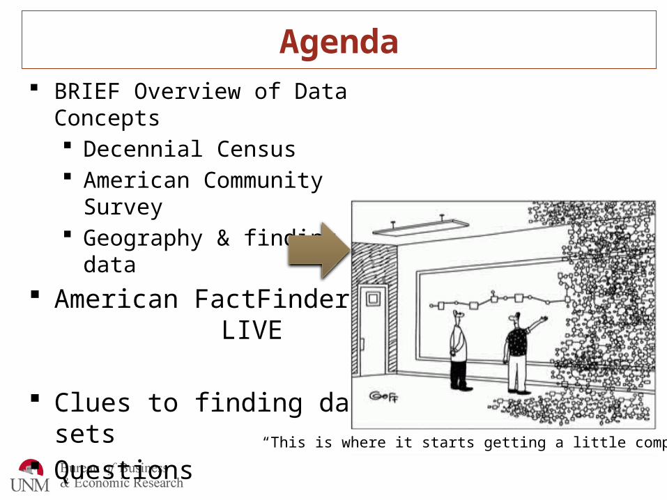
Agenda BRIEF Overview of Data Concepts
Decennial Census American Community Survey Geography & finding data
American FactFinder: LIVE
Clues to finding data sets Questions
“This is where it starts getting a little complicated.”
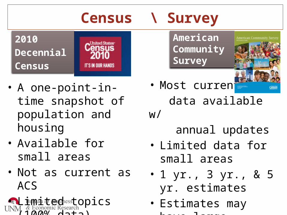
Census \ Survey2010 Decennial Census
• A one-point-in-time snapshot of population and housing
• Available for small areas• Not as current as ACS• Limited topics (100% data)
American Community Survey
• Most current data available w/ annual updates• Limited data for small
areas• 1 yr., 3 yr., & 5 yr.
estimates• Estimates may have large
margins of error
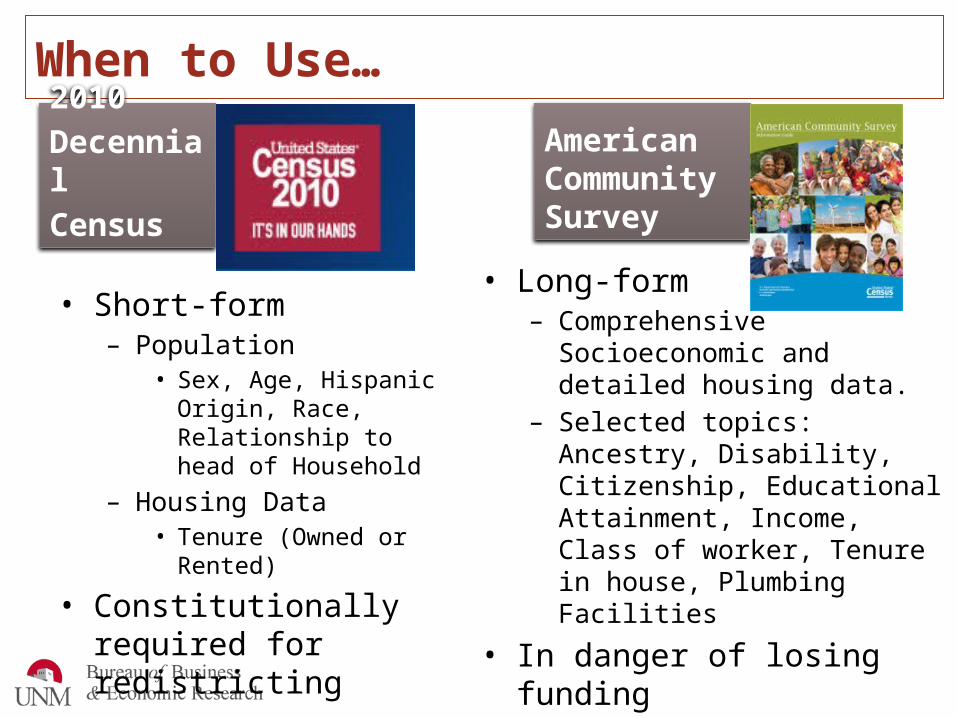
When to Use…2010 Decennial Census
• Short-form– Population
• Sex, Age, Hispanic Origin, Race, Relationship to head of Household
– Housing Data• Tenure (Owned or Rented)
• Constitutionally required for redistricting
American Community Survey
• Long-form – Comprehensive Socioeconomic and
detailed housing data. – Selected topics: Ancestry,
Disability, Citizenship, Educational Attainment, Income, Class of worker, Tenure in house, Plumbing Facilities
• In danger of losing funding
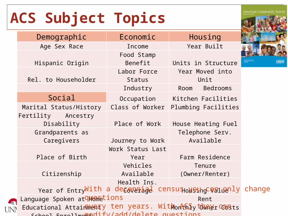
ACS Subject TopicsDemographic Economic Housing
Age Sex Race Income Year BuiltHispanic Origin Food Stamp Benefit Units in Structure
Rel. to Householder Labor Force Status Year Moved into UnitIndustry Room Bedrooms
Social Occupation Kitchen FacilitiesMarital Status/History Class of Worker Plumbing Facilities
Fertility Ancestry Disability Place of Work House Heating FuelGrandparents as Caregivers Journey to Work Telephone Serv. Available
Place of Birth Work Status Last Year Farm ResidenceCitizenship Vehicles Available Tenure (Owner/Renter)
Year of Entry Health Ins. Coverage Housing ValueLanguage Spoken at Home Rent
Educational Attainment Monthly Owner CostsSchool Enrollment
Residence 1 Year AgoVeteran Status
Period of Military ServiceVA Service-Connected Disability
With a decennial census you can only change questionsevery ten years. With ACS they can modify/add/delete questionsmore easily. Leads to consistency issues over time.

ACS Products• Data Profiles• Comparison profiles (across years)• Selected population profile tables
(race, ethnic, ancestry, tribal groups)• Subject tables• Ranking tables• Detailed tables• Geographic comparison tables• Thematic maps• Public use microdata sample file
(40% sample of ACS file, create crosstabs)

Data has context with Geography
Nation
Region
Division
State
County
Census Co. Division
Census tract
Block Group
Block
Nesting Hierarchy
No ACS data available for blocks and block group data require programming or alternate access tools

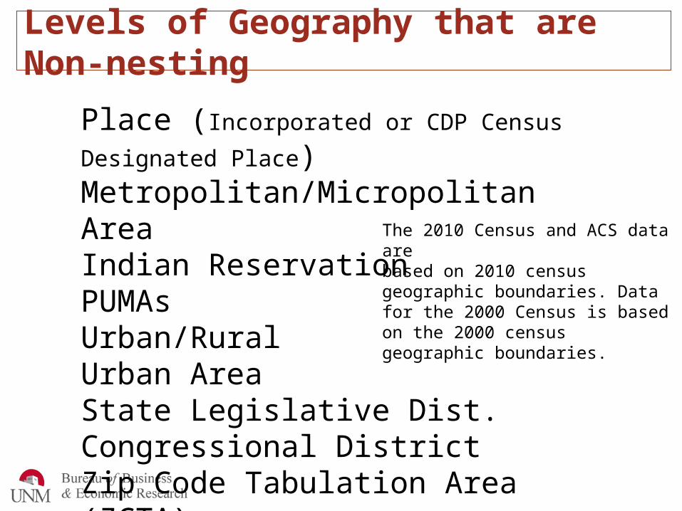
Levels of Geography that are Non-nesting
Place (Incorporated or CDP Census Designated Place)Metropolitan/Micropolitan AreaIndian ReservationPUMAsUrban/RuralUrban AreaState Legislative Dist. Congressional DistrictZip Code Tabulation Area (ZCTA)
The 2010 Census and ACS data arebased on 2010 census geographic boundaries. Data for the 2000 Census is based on the 2000 census geographic boundaries.
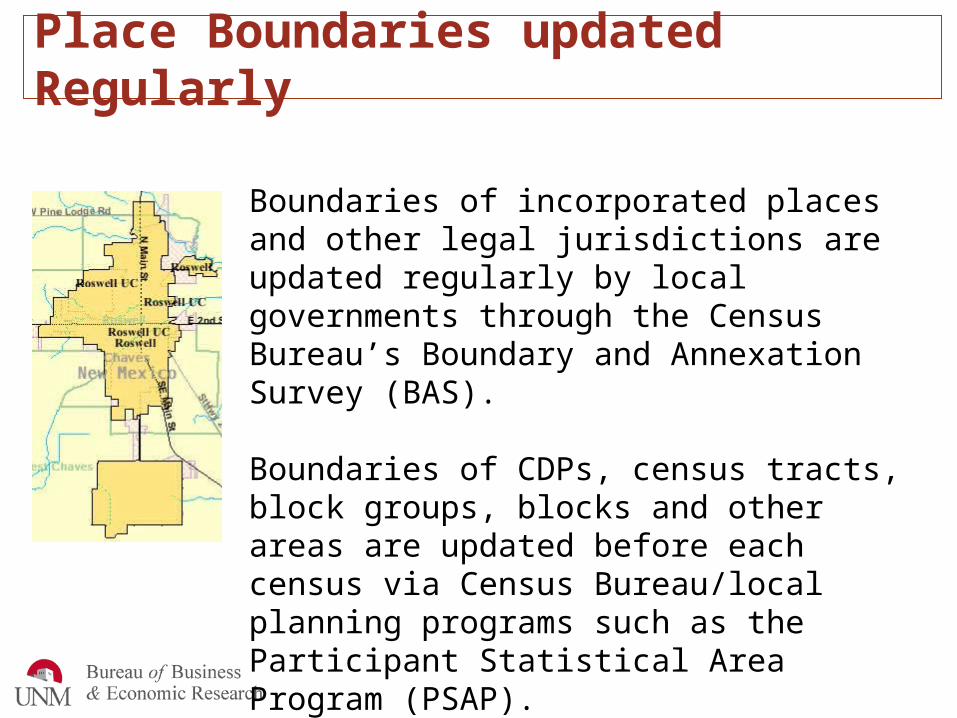
Place Boundaries updated Regularly
Boundaries of incorporated places and other legal jurisdictions are updated regularly by local governments through the Census Bureau’s Boundary and Annexation Survey (BAS).
Boundaries of CDPs, census tracts, block groups, blocks and other areas are updated before each census via Census Bureau/local planning programs such as the Participant Statistical Area Program (PSAP).
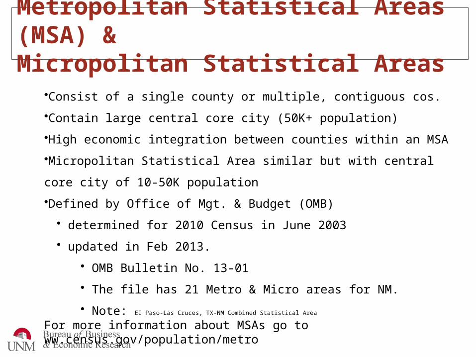
Metropolitan Statistical Areas (MSA) &Micropolitan Statistical Areas
•Consist of a single county or multiple, contiguous cos.
•Contain large central core city (50K+ population)
•High economic integration between counties within an MSA
•Micropolitan Statistical Area similar but with central core city of 10-50K population
•Defined by Office of Mgt. & Budget (OMB)
• determined for 2010 Census in June 2003
• updated in Feb 2013.
• OMB Bulletin No. 13-01
• The file has 21 Metro & Micro areas for NM.
• Note: EI Paso-Las Cruces, TX-NM Combined Statistical Area
For more information about MSAs go to ww.census.gov/population/metro
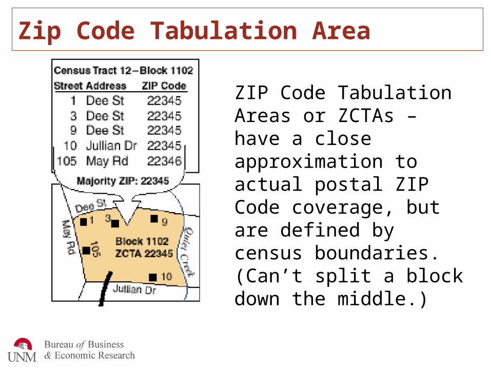
Zip Code Tabulation Area
ZIP Code Tabulation Areas or ZCTAs – have a close approximation to actual postal ZIP Code coverage, but are defined by census boundaries. (Can’t split a block down the middle.)
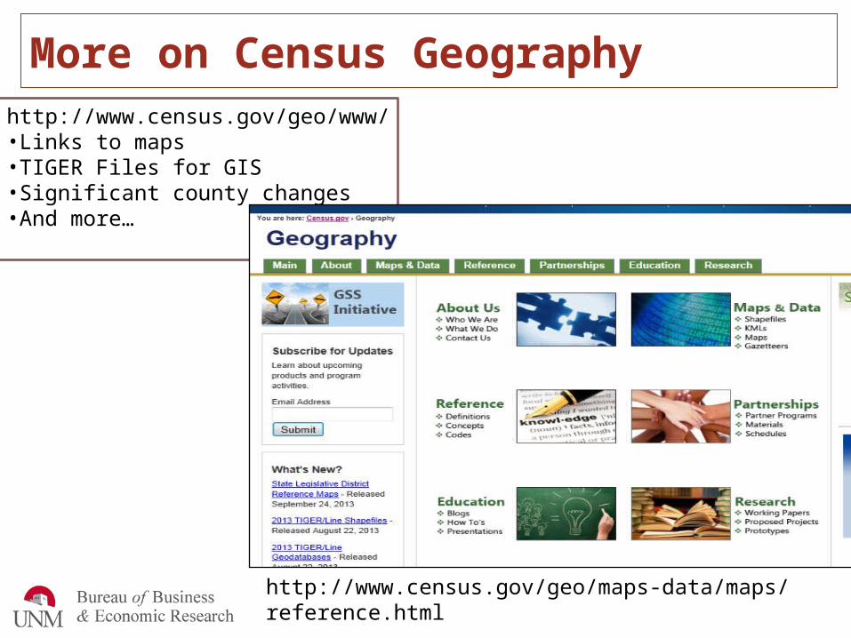
More on Census Geographyhttp://www.census.gov/geo/www/•Links to maps•TIGER Files for GIS•Significant county changes•And more…
http://www.census.gov/geo/maps-data/maps/reference.html
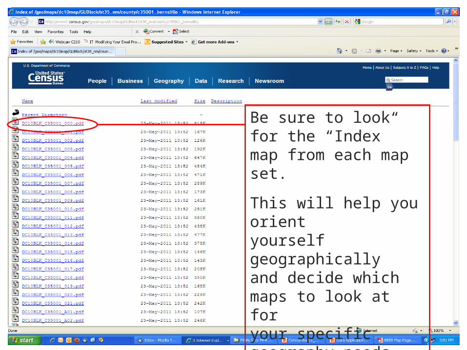
Census Map Directory
Be sure to look for the “Index” map from each map set.
This will help you orientyourself geographically and decide whichmaps to look at for your specificgeography needs.
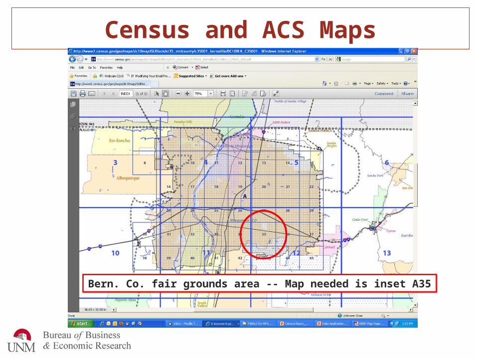
Census and ACS Maps
Bern. Co. fair grounds area -- Map needed is inset A35
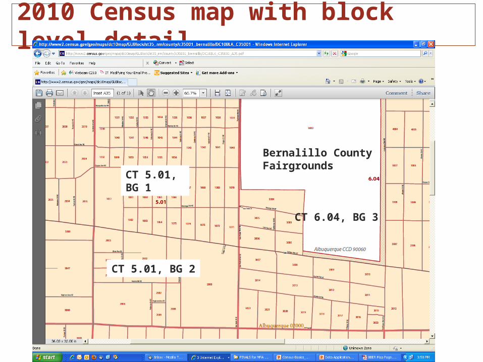
2010 Census map with block level detail
Bernalillo CountyFairgrounds
CT 6.04, BG 3
CT 5.01, BG 1
CT 5.01, BG 2

2010 Census map with Census tract level detail

Use links from BBER websitebber.unm.edu/maps.htm
Links to maps from 2010, 2000
and 1990 censuses
BBER has prepared one-page census tract and ZCTA outline maps
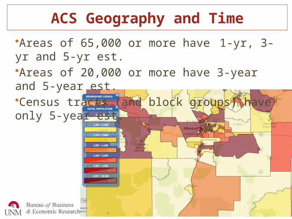
ACS Geography and Time•Areas of 65,000 or more have 1-yr, 3-yr and 5-yr est.•Areas of 20,000 or more have 3-year and 5-year est.•Census tracts (and block groups) have only 5-year est.
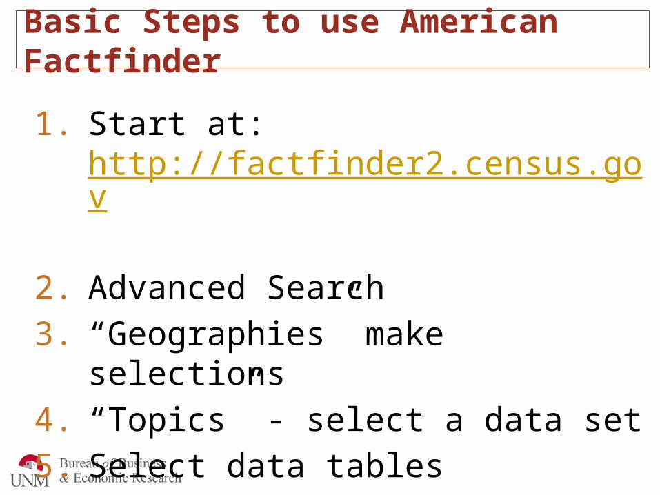
Basic Steps to use American Factfinder
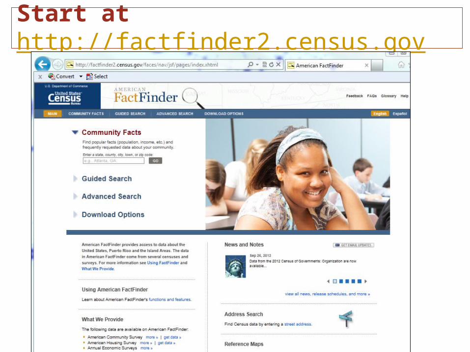
1. Start at: http://factfinder2.census.gov
2. Advanced Search
3. “Geographies” make selections
4. “Topics” - select a data set
5. Select data tables
6. View selected
7. Print or download
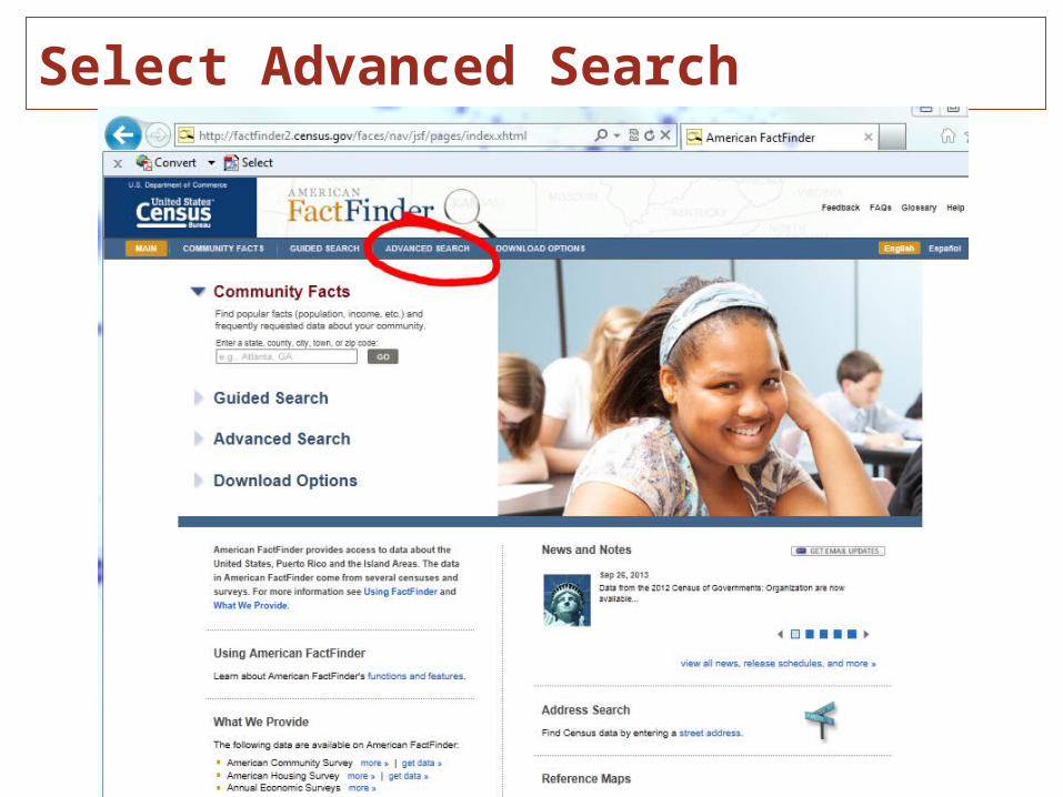
Select Advanced Search
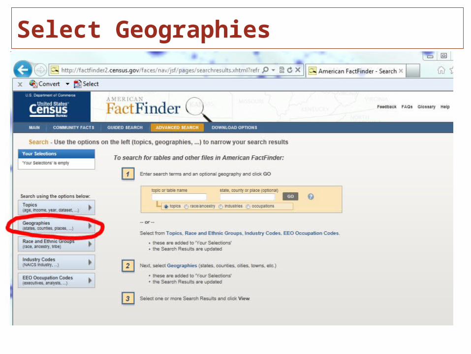
Select Geographies

Note: Your Selections

Narrow down tables with the “Topics”
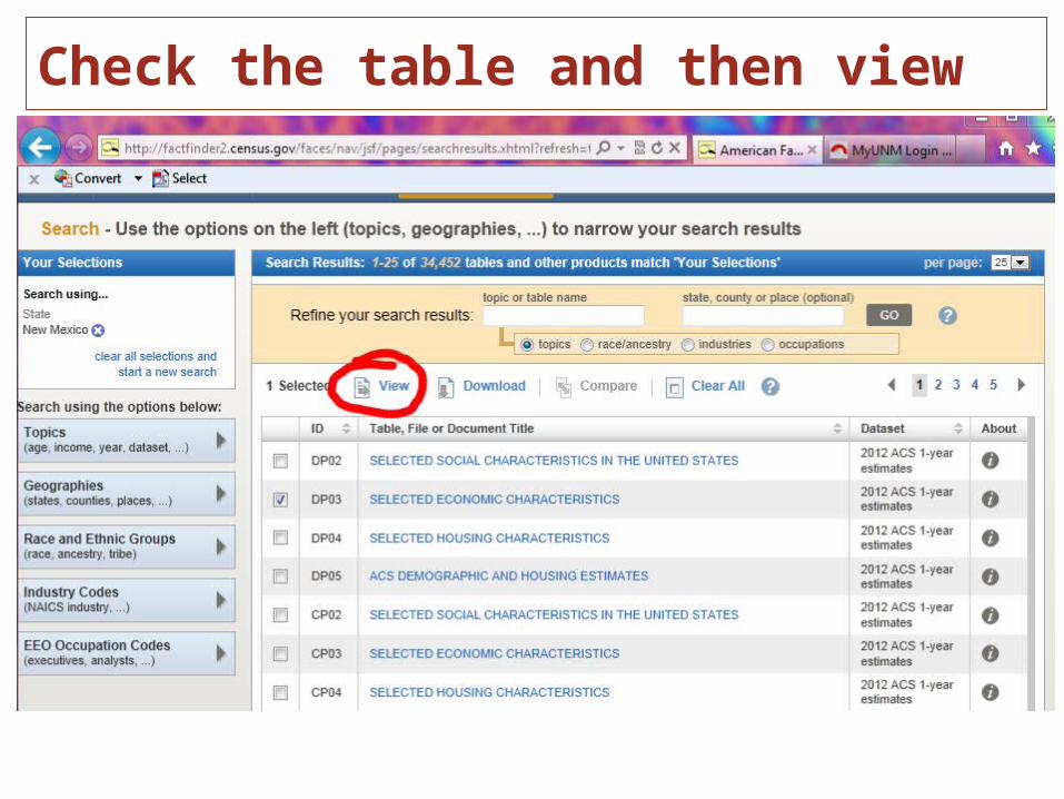
Check the table and then view
Who to Contact when you need assistance
• My contact information appears at the end of this presentation.
• Additionally, State Data Center affiliates in New Mexico are good contacts for census data and assistance. To find contacts in your area go to bber.unm.edu/affils.htm or see the handout in your folder.

Clues for finding the right data set
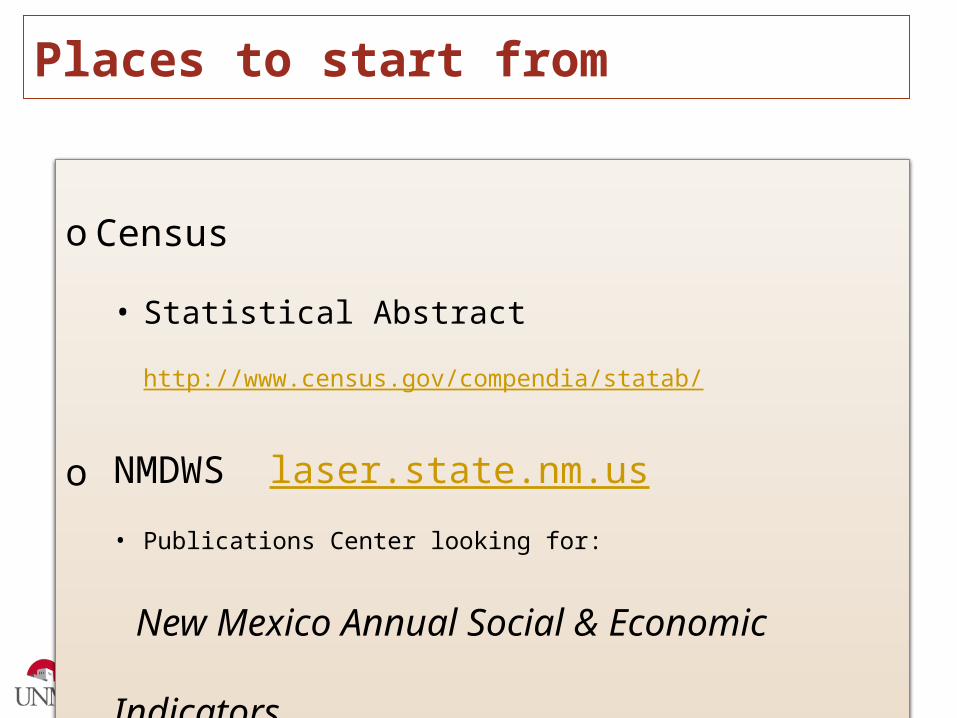
Places to start from
o Census
• Statistical Abstract http://www.census.gov/compendia/statab/
o NMDWS laser.state.nm.us
• Publications Center looking for:
New Mexico Annual Social & Economic Indicators
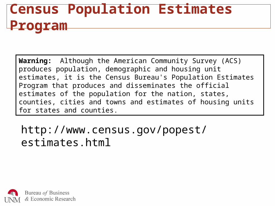
Census Population Estimates Program
Warning: Although the American Community Survey (ACS) produces population, demographic and housing unit estimates, it is the Census Bureau's Population Estimates Program that produces and disseminates the official estimates of the population for the nation, states, counties, cities and towns and estimates of housing units for states and counties.
http://www.census.gov/popest/estimates.html
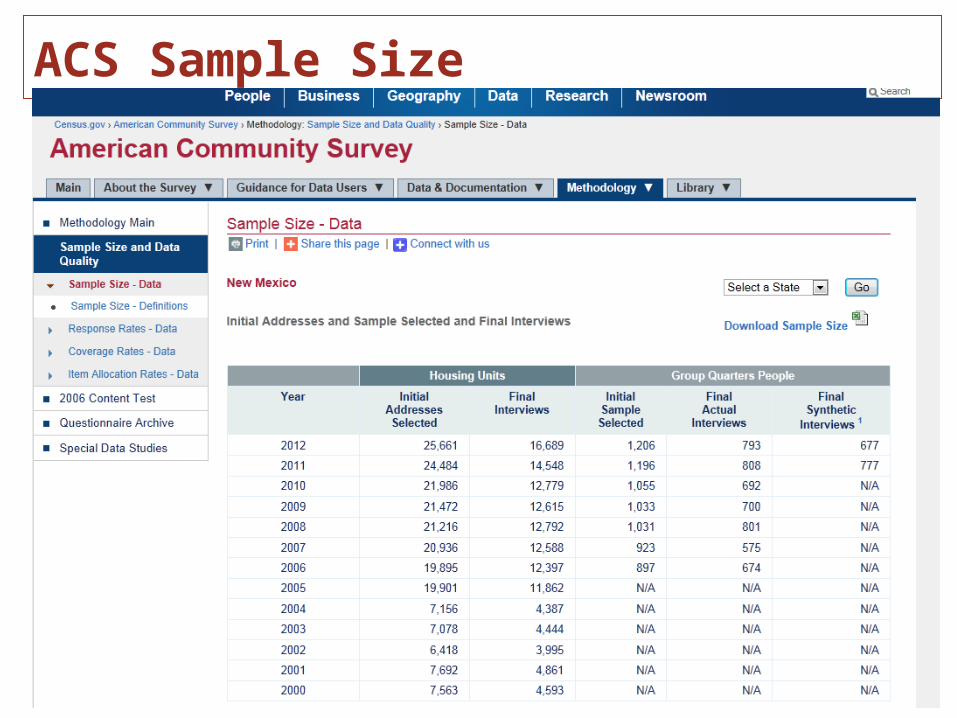
ACS Sample Size
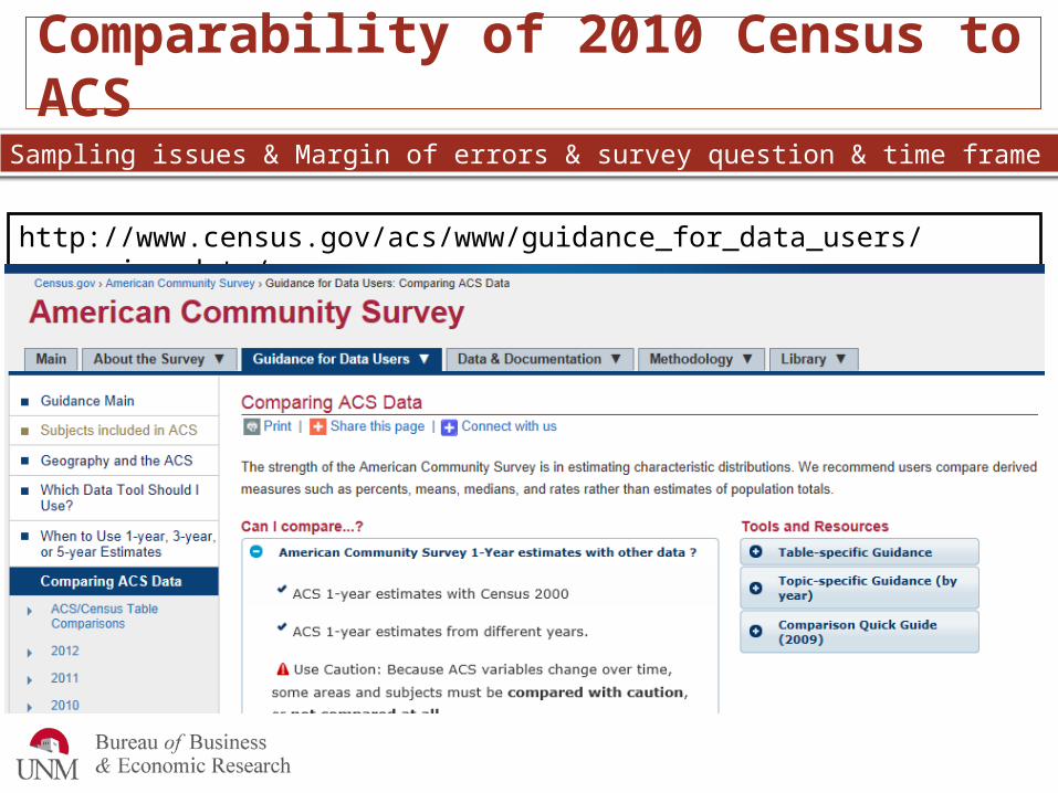
Comparability of 2010 Census to ACS
http://www.census.gov/acs/www/guidance_for_data_users/comparing_data/
Sampling issues & Margin of errors & survey question & time frame

ACS 1 year estimates 2012 – Released Today!
