delivering solutions validation of aerial lidar products ... · utilized to constrain lidar data
TRANSCRIPT
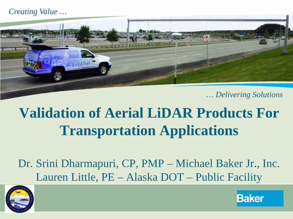
Creating Value …
… Delivering Solutions Validation of Aerial LiDAR Products For
Transportation Applications
Dr. Srini Dharmapuri, CP, PMP – Michael Baker Jr., Inc. Lauren Little, PE – Alaska DOT – Public Facility

Agenda
1. Requirements
2. LiDAR Technology Background
3. Methodology
4. Deliverables
REQUIREMENTS
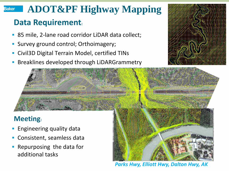
ADOT&PF Highway Mapping Data Requirement:
85 mile, 2-lane road corridor LiDAR data collect; Survey ground control; Orthoimagery; Civil3D Digital Terrain Model, certified TINs Breaklines developed through LiDARGrammetry
Engineering quality data Consistent, seamless data Repurposing the data for
additional tasks
Meeting:
Parks Hwy, Elliott Hwy, Dalton Hwy, AK
LiDAR TECHNOLOGY
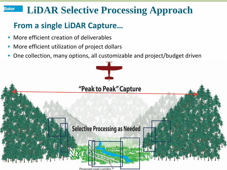
LiDAR Selective Processing Approach
More efficient creation of deliverables More efficient utilization of project dollars One collection, many options, all customizable and project/budget driven
From a single LiDAR Capture…
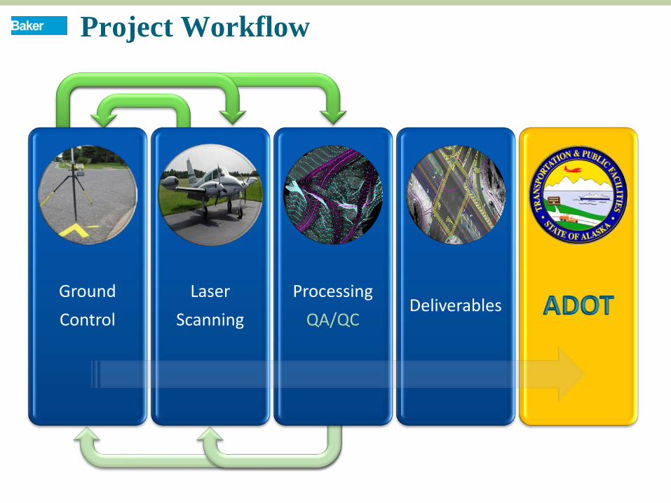
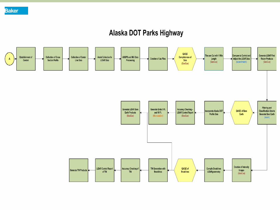
Project Workflow
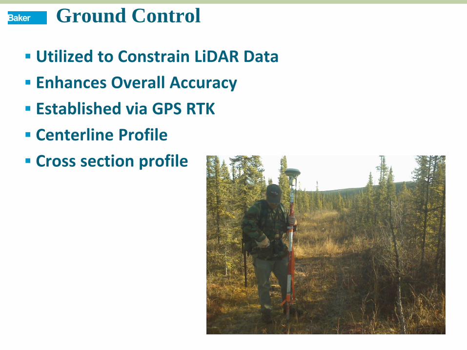
Ground Control
Laser Scanning
Processing QA/QC
Deliverables
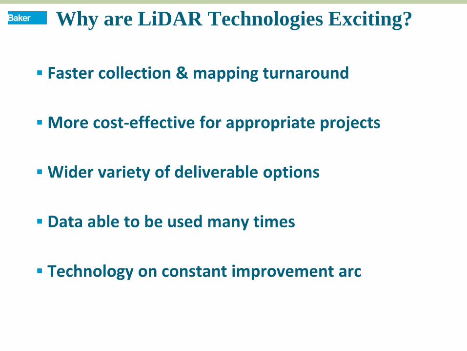
Why are LiDAR Technologies Exciting?
Faster collection & mapping turnaround
More cost-effective for appropriate projects
Wider variety of deliverable options
Data able to be used many times
Technology on constant improvement arc
METHODOLOGY

Parks Highway—Area of Interest
10
PROJECT AREA ADOT Parks Highway Mapping--
Proj.128484
Ground Control
Utilized to Constrain LiDAR Data Enhances Overall Accuracy Established via GPS RTK Centerline Profile Cross section profile
13
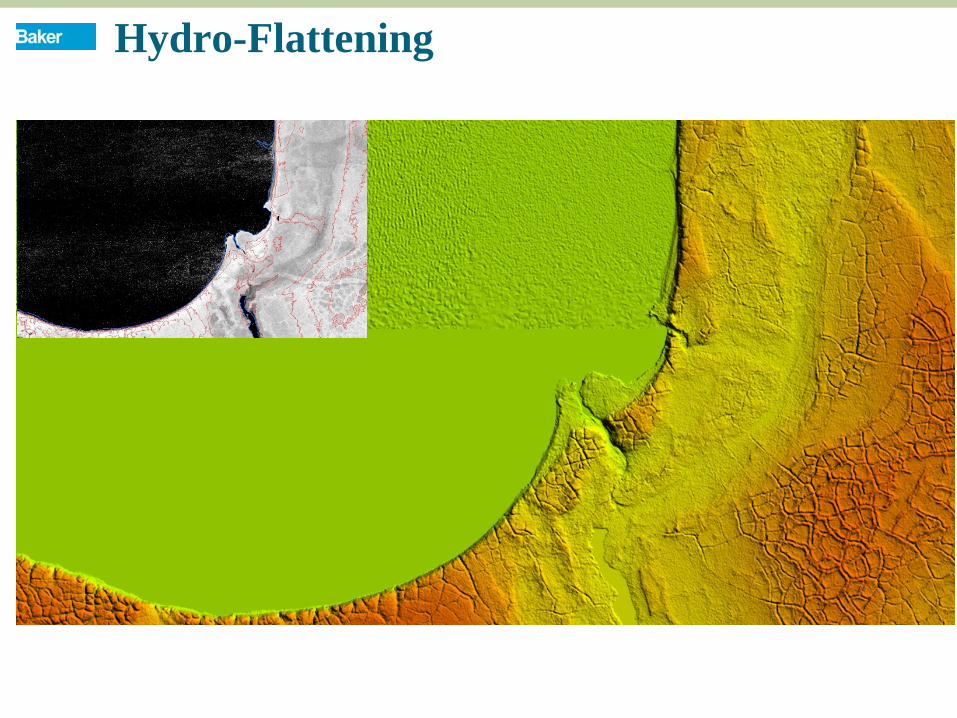
Hydro-Flattening
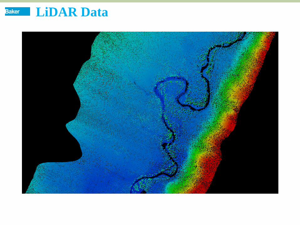
LiDAR Data
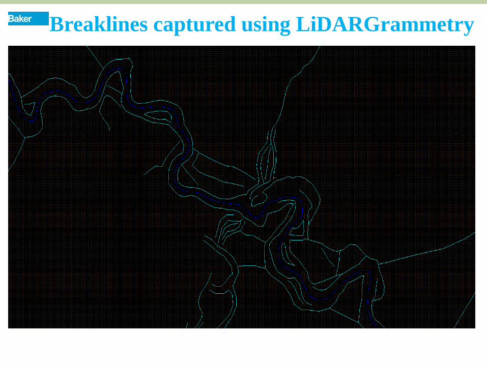
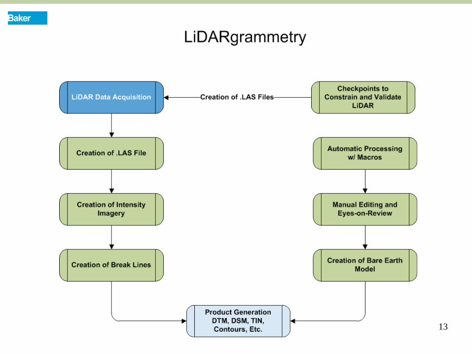
Breaklines captured using LiDARGrammetry
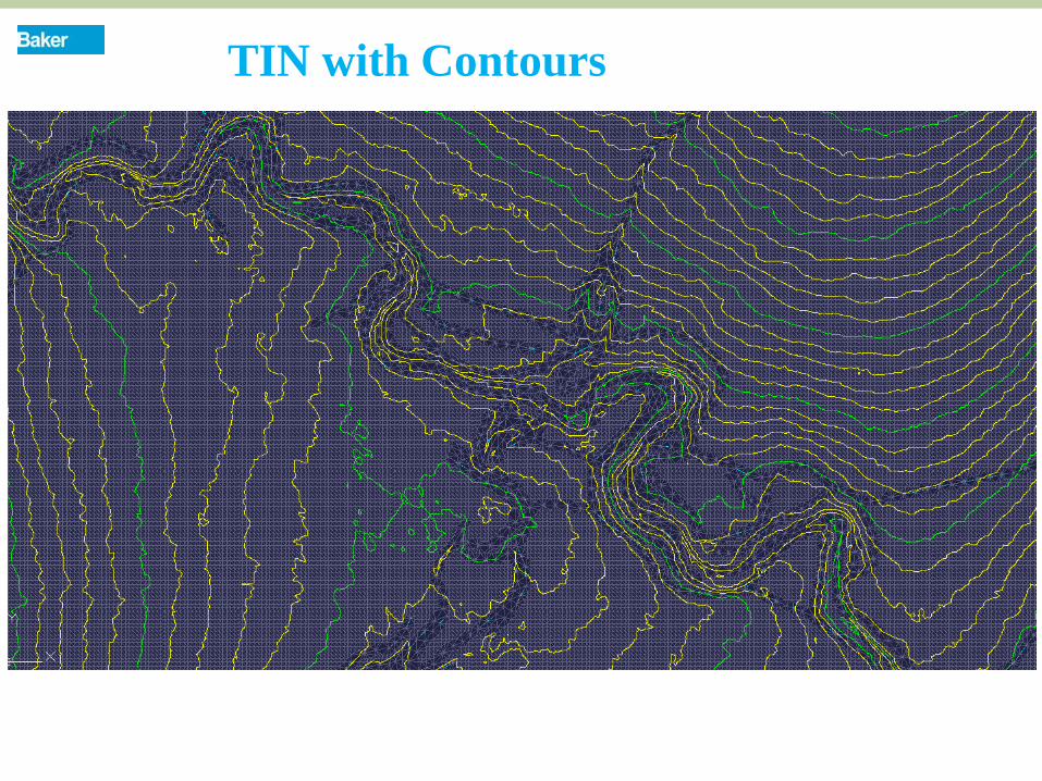
TIN with Contours
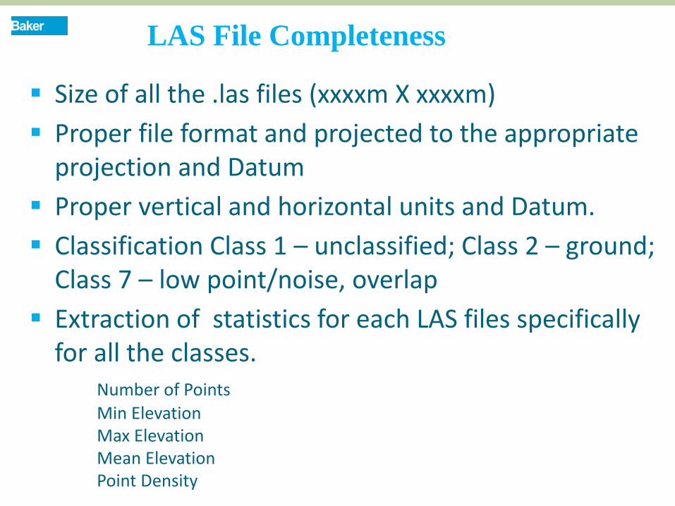
Size of all the .las files (xxxxm X xxxxm) Proper file format and projected to the appropriate
projection and Datum Proper vertical and horizontal units and Datum. Classification Class 1 – unclassified; Class 2 – ground;
Class 7 – low point/noise, overlap Extraction of statistics for each LAS files specifically
for all the classes. Number of Points Min Elevation Max Elevation Mean Elevation Point Density
LAS File Completeness
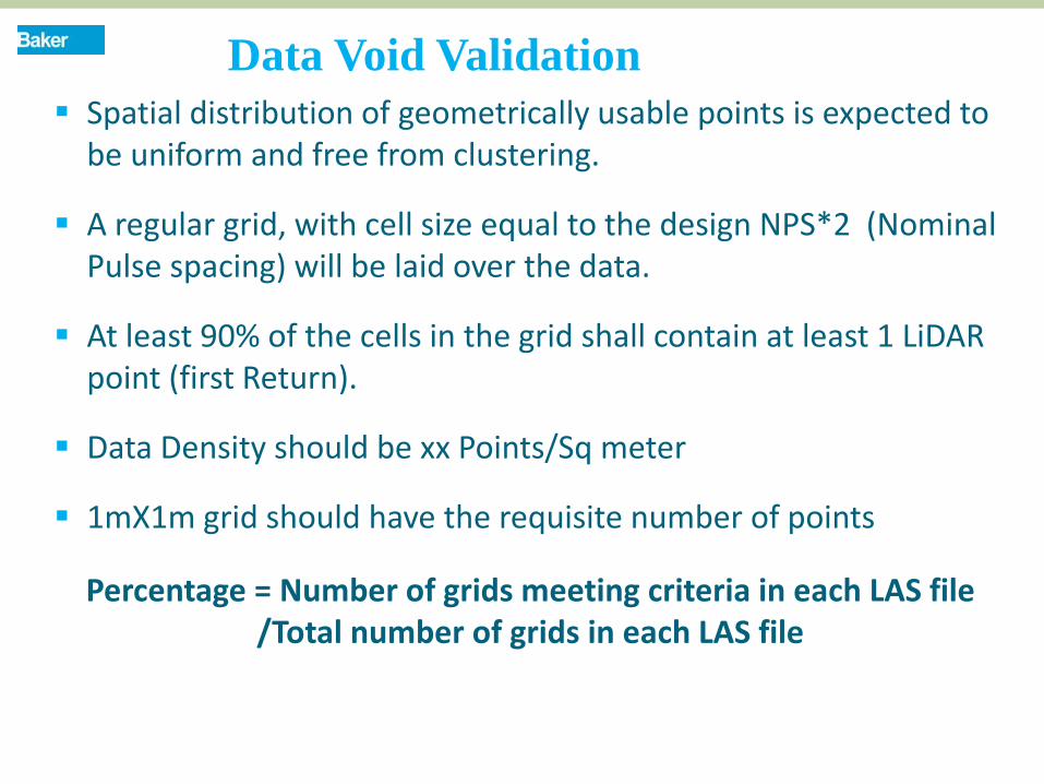
Spatial distribution of geometrically usable points is expected to be uniform and free from clustering.
A regular grid, with cell size equal to the design NPS*2 (Nominal Pulse spacing) will be laid over the data.
At least 90% of the cells in the grid shall contain at least 1 LiDAR point (first Return).
Data Density should be xx Points/Sq meter
1mX1m grid should have the requisite number of points
Percentage = Number of grids meeting criteria in each LAS file /Total number of grids in each LAS file
Data Void Validation

BREAK LINE ACCEPTANCE CATEGORY PASS/FAIL
Check for monotonicity of hydro breaklines. Automated
Verify that breakline vertices have z values equal to or less than the surrounding ground points.
Automated
Vertices should not have a 0 or null elevation
Automated
Culvert breaklines must snap to stream endpoints on both sides, and have the same elevation as the stream breakline at the snapping location.
Automated
Validation of Break Line
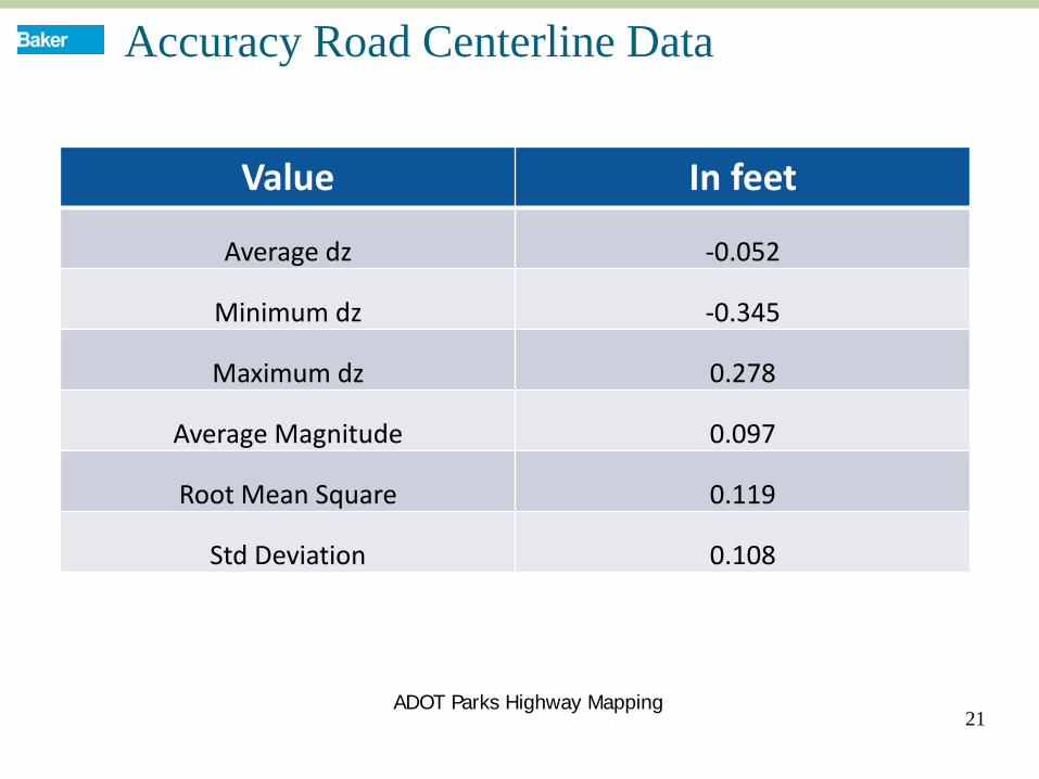
Accuracy Road Centerline Data
21
Value In feet
Average dz -0.052
Minimum dz -0.345
Maximum dz 0.278
Average Magnitude 0.097
Root Mean Square 0.119
Std Deviation 0.108
ADOT Parks Highway Mapping
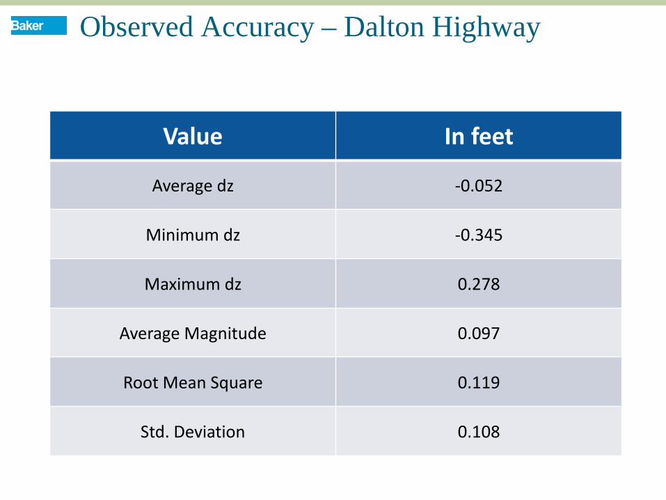
Observed Accuracy – Dalton Highway
Value In feet
Average dz -0.052
Minimum dz -0.345
Maximum dz 0.278
Average Magnitude 0.097
Root Mean Square 0.119
Std. Deviation 0.108
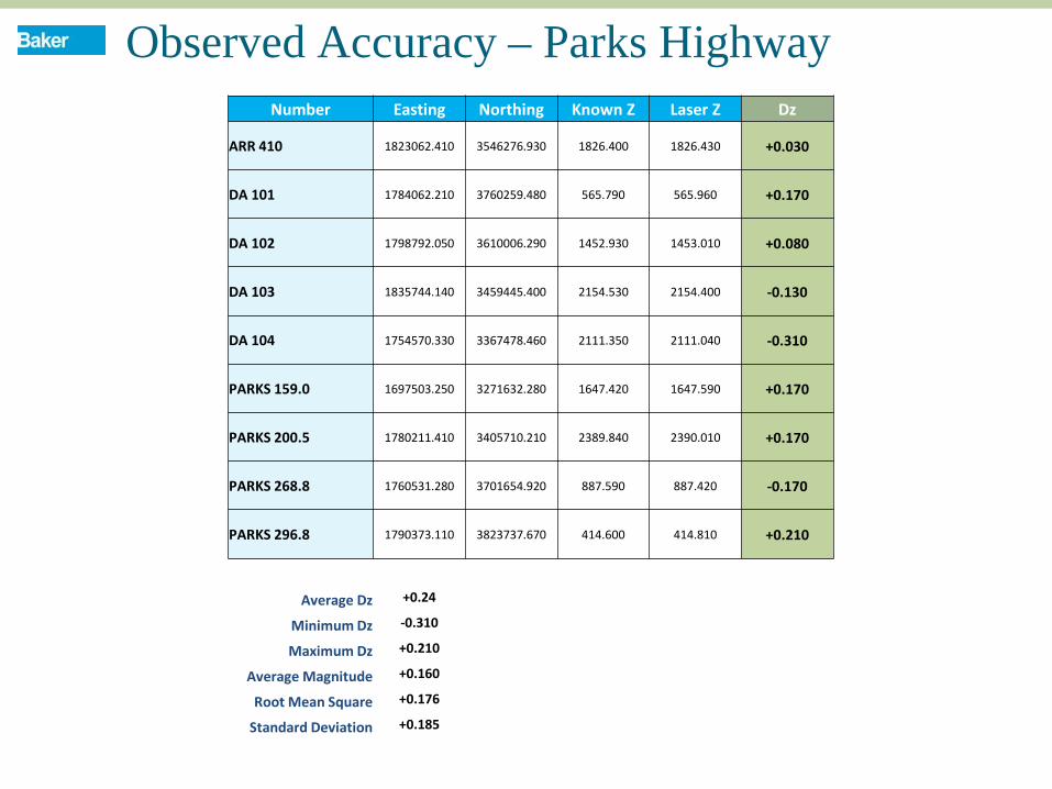
Observed Accuracy – Parks Highway Number Easting Northing Known Z Laser Z Dz
ARR 410 1823062.410 3546276.930 1826.400 1826.430 +0.030
DA 101 1784062.210 3760259.480 565.790 565.960 +0.170
DA 102 1798792.050 3610006.290 1452.930 1453.010 +0.080
DA 103 1835744.140 3459445.400 2154.530 2154.400 -0.130
DA 104 1754570.330 3367478.460 2111.350 2111.040 -0.310
PARKS 159.0 1697503.250 3271632.280 1647.420 1647.590 +0.170
PARKS 200.5 1780211.410 3405710.210 2389.840 2390.010 +0.170
PARKS 268.8 1760531.280 3701654.920 887.590 887.420 -0.170
PARKS 296.8 1790373.110 3823737.670 414.600 414.810 +0.210
Average Dz +0.24
Minimum Dz -0.310
Maximum Dz +0.210
Average Magnitude +0.160
Root Mean Square +0.176
Standard Deviation +0.185
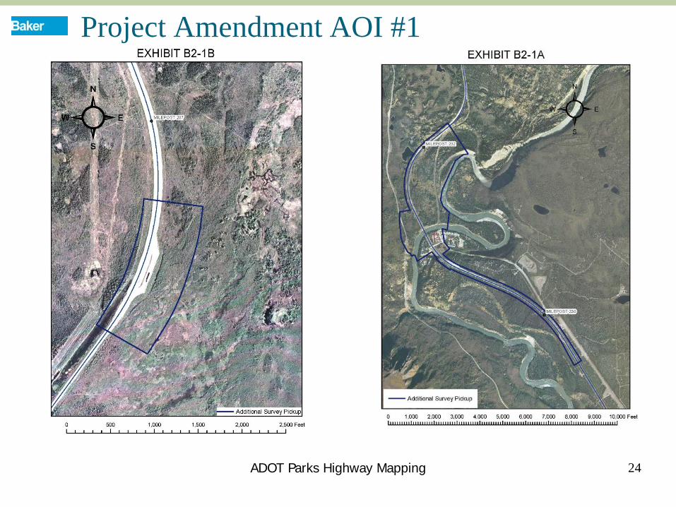
Project Amendment AOI #1
24 ADOT Parks Highway Mapping
Deliverables
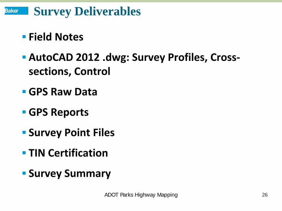
Survey Deliverables
Field Notes
AutoCAD 2012 .dwg: Survey Profiles, Cross-sections, Control
GPS Raw Data
GPS Reports
Survey Point Files
TIN Certification
Survey Summary
26 ADOT Parks Highway Mapping
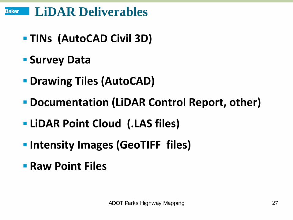
LiDAR Deliverables
TINs (AutoCAD Civil 3D)
Survey Data
Drawing Tiles (AutoCAD)
Documentation (LiDAR Control Report, other)
LiDAR Point Cloud (.LAS files)
Intensity Images (GeoTIFF files)
Raw Point Files
27
Items in red text above are delivered to client as of 10/16/12
ADOT Parks Highway Mapping
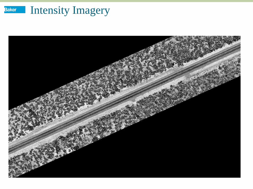
Intensity Imagery
28 ADOT Parks Highway Mapping--
Proj.128484
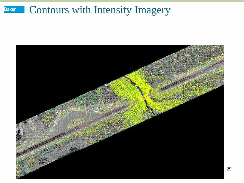
Contours with Intensity Imagery
29 ADOT Parks Highway Mapping--
Proj.128484
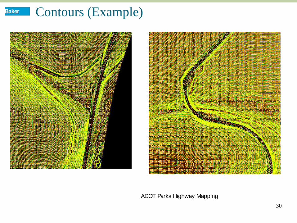
Contours (Example)
30
ADOT Parks Highway Mapping
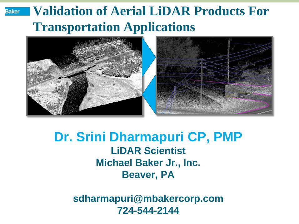
Dr. Srini Dharmapuri CP, PMP LiDAR Scientist
Michael Baker Jr., Inc. Beaver, PA
724-544-2144
Validation of Aerial LiDAR Products For Transportation Applications