development of a gis-based tool for distributed hydrologic ... · development of a gis-based tool...
TRANSCRIPT

Development of a GIS-based tool for distributed hydrologic
modeling with HEC-HMS using high-resolution geospatial data By: C.V. Castro
Abstract
The Hydrologic Engineering Center-Hydrologic Modeling System (HEC-HMS) is a widely-used
program for the assessment of watershed hydrology, but data input parameterization is often
excessive for the average end-user. A GIS-based tool is developed using the Python programming
language that automatically builds HEC-HMS parameter input files using the NFIE-Geo database.
Derived from NHDPlus topology, NFIE-Geo contains geospatially connected, high-resolution
data for 2.67-million stream reaches and catchments in the United States. The proposed tool is
optimized to collect standard geospatial data and prepare spatially-distributed HEC-HMS model
inputs by linking object-oriented databases. By running the proposed tool, event-based runoff is
able to be modeled with national hydrologic information and limited user input. The extraction
tool demonstrates how the topological attributes of a national hydrological database may be used
to simulate a HEC-HMS input file with high-resolution data and widespread applicability.

C.V. Castro
2
Table of Contents
Abstract ......................................................................................................................................................... 1
Introduction ................................................................................................................................................... 3
Overview ....................................................................................................................................................... 4
Input Data...................................................................................................................................................... 5
Topology ....................................................................................................................................................... 6
Downstream Connectivity ........................................................................................................................ 8
Sources, Sinks & Reservoirs ..................................................................................................................... 9
Parameter Estimation .................................................................................................................................. 10
Curve Number ......................................................................................................................................... 10
Lag Time ................................................................................................................................................. 11
Muskingum ............................................................................................................................................. 11
Model Output .............................................................................................................................................. 11
Case Studies ................................................................................................................................................ 11
Conclusion & Future Work ......................................................................................................................... 12
References ................................................................................................................................................... 13
Appendices .................................................................................................................................................. 14
1. County case studies ............................................................................................................................ 14
2. HEC-HMS hydrograph output (Fannin County) ............................................................................... 18
3. HEC-HMS .BASIN input file (Fannin County, 56 subbasins) .......................................................... 19
Table of Figures
Figure 1: Procedural Framework of the NFIE-Geo HEC-HMS Extraction Tool ........................................ 4 Figure 2: NHD Catchment Attributes (top) and NHD Flowline Attributes (bottom) .................................. 5 Figure 3: NFIE-Geo Unique Common Identifier Graphical Depiction ....................................................... 6 Figure 4: HEC-HMS Input File Example [* NFIE-Geo attribute data] ....................................................... 7 Figure 5: Example of Reach Downstream Connectivity.............................................................................. 8 Figure 6: Example of HMS Sinks, Sources, and Reservoirs Created with Tool .......................................... 9 Figure 7: Curve Number Lookup Table ..................................................................................................... 10 Figure 8: Table of Case Study Catchments and Length of Execution ....................................................... 12 Figure 9: Bexar County HMS Schematic (left) and GIS hydrologic topology (right) ............................... 14 Figure 10: Dallas County HMS Schematic (left) and GIS hydrologic topology (right) ............................ 14 Figure 11: McLennan County HMS Schematic (left) and GIS hydrologic topology (right) ..................... 15 Figure 12: Montgomery County HMS Schematic (left) and GIS hydrologic topology (right) ................. 15 Figure 13: Nacogdoches County HMS Schematic (left) and GIS hydrologic topology (right) ................. 16 Figure 14: Orange County HMS Schematic (left) and GIS hydrologic topology (right) .......................... 16 Figure 15: Taylor County HMS Schematic (left) and GIS hydrologic topology (right) ............................ 17 Figure 16: Travis County HMS Schematic (left) and GIS hydrologic topology (right) ............................ 17 Figure 17: HEC-HMS Hydrograph Output using Extraction Tool and NFIE-Geo Data ........................... 18

C.V. Castro
3
Introduction
As land use planning becomes increasingly complex, regional watershed assessments require
distributed hydrologic models presented in a streamlined and intuitive manner. The widely-used
hydrologic modeling tool, HEC-HMS, requires extensive input data and parameter estimations
(USACE, 2013a). The “difficult task of building input parameter files…ha[s] long been an
obstacle to the timely and cost-effective use of such complex models by resource managers,”
(Miller et al, 2002). Geographic information systems (GIS) have increasingly become optimized
to collect standardized geospatial data and prepare spatially-distributed model inputs. GIS-based
hydrologic simulation tools aid the user in developing rainfall-runoff models by linking spatial and
temporal variability for soils, topography, vegetation, and land use (Miller et al, 2007). Wide-
spread operational applicability of tools, such as AGWA, MIKE-SHE, and HEC-Geo HMS, has
been limited by the need for watershed pre-processing and/or data-intensive user input (DHI, 2006,
Miller et al, 2002, Miller et al, 2007, Shen et al, 2005, USACE, 2013b). As GIS-based hydrologic
modeling tools become increasingly sophisticated, non-experts are often challenged by the
intricacies of using each tool and obtaining pre-processing input data (Paniconi et al, 1999). This
paper presents a GIS-based tool that uses the NFIE-Geo national geodatabase to automatically
create parameterized HEC-HMS input files without the need for any user-input data,
programming, or hydrological expertise.
GIS-based tools have made it possible to address challenges of scale and variability in watershed
hydrology by geo-referencing spatial and vector data. Hydrologic processes, specifically for use
in HEC-HMS, require input data obtained through “field measurement, remote sensing, digital
elevation models, and numerical simulation, each…contain[ing] attributes of geographic position
within a common reference frame,” (Paniconi et al, 1999). Instead of representing physical
processes through labor-intensive models and data subsistence, it is possible to characterize
watershed hydrology through an information-based GIS environment for rapid application and
maintenance (Maidment, 1996). In the proposed HEC-HMS extraction tool, object-oriented
databases are spatially and topologically related using Python-programming in an ArcGIS
environment to alleviate the need for user-defined watershed delineation or spatial input data.
HEC-HMS is maintained as the hydrological interface due to its wide-spread use and familiarity
with water resources management.
NFIE-Geo, which is a geospatial database derived from NHDPlusV2, is used for the hydrologic
connectivity of 2.67-million catchments and reaches in the continental United States. NHDPlusV2
represents national hydrology through geospatially-connected stream vectors and elevation-
derived catchments, each attributed with sophisticated drainage characteristics and connectivity
information (NHDPlus, 2015). NFIE-Geo enhances the NHDPlusV2 database by appending first-
order Muskingum routing parameters to each reach for simulation of streamflow in the National
Flood Interoperability Experiment (Maidment, 2015). The proposed extraction tool demonstrates
how NFIE-Geo spatial information may be used to automatically simulate a rainfall-runoff input
file for seamless use with the HEC-HMS hydrological modeling software.

C.V. Castro
4
Overview
An optimized method for rapidly modeling volumetric flow is presented that uses GIS-based
spatial relationships within the NFIE-Geo hydrological database. Instead of requiring the user to
obtain, pre-process, and input raster data, the proposed tool automatically downloads necessary
spatial data for the area of interest. The user has the option of selecting a regional county or
uploading a shapefile boundary, such as a watershed, for the study area. Using the Arcpy library
within Python, the tool then automates the pre-processing and parameterization of geospatial data
necessary for a HEC-HMS input file. For widespread applicability, standard hydrological
methodologies were implemented, such as the SCS Curve Number (CN) method for watershed
losses, the SCS Unit Hydrograph method for overland flow transformation, and the Muskingum
method for reach routing.
Figure 1: Procedural Framework of the NFIE-Geo HEC-HMS Extraction Tool

C.V. Castro
5
Input Data
In order to calculate parameters for the SCS and Muskingum methodologies, several raster datasets
are obtained. Land use and soils information is required to estimate the infiltration capacity of the
watershed. The slope of the land surface is used to estimate the stormwater routing time over the
watershed. The Python code calls the NationalMap.Gov USGS web viewer to download National
Land Cover Database (NLCD) 2011 land use data and STATSGO2 soils information for the area
of interest. It is anticipated that future modifications of the tool will incorporate ESRI-services to
clip web-hosted raster data for the area of interest prior to geo-processing so that SSURGO soils
data may be used with a higher-resolution. ESRI elevation services were used to download the
NED30-meter digital elevation model (DEM).
The NFIE-Geo database is composed of 12 hydrological regions, each containing spatially
referenced data for NHD catchments, dams, flowlines, stream gages, subwatersheds, and
parameters used in river routing. The HEC-HMS objects may be populated with the NHD
catchment and flowline variables clipped to a user-defined county or watershed area. Some of the
GIS attributes for the NHD catchments and flowlines are shown below, which were used to
determine connectivity patterns in the HMS model.
Figure 2: NHD Catchment Attributes (top) and NHD Flowline Attributes (bottom)
To construct a GIS-based hydrology model for the study area, a common database must be defined
to connect complex spatial data (Maidment, 1996). The Python code creates a geodatabase using
the GIS-enabled arcpy function CreateFileGDB_management. The geodatabase is defined with a
local coordinate system using arcpy commands outputCoordinate System and SpatialReference.
The NHD data and raster files are converted to the geodatabase with FeatureClassToGeodatabase-
_conversion and RasterToGeodatabase_conversion.
With a common reference system, NHD and land surface data may be related to the study area
geometry and clipped for faster processing. The GIS-based arcpy commands
MakeFeatureLayer_management, SelectLayerByLocation_management, and CopyFeatures_
management are used to clip feature data. NHD catchments that Intersect the study area boundary
are extracted as the model Subbasins, and NHD flowlines that Have Their Center In the Subbasins
are extracted as model Reaches. Similarly, soils polygons that Have Their Center In model
Subbasins are clipped to catchment-area extents. The ExtractByMask command in GIS Spatial
Analyst is used to define areal extents of the land use and DEM raster layers.

C.V. Castro
6
Topology
In order to construct a GIS-based hydrologic model, the landscape must be represented by data
that is geographically connected. Since stormwater runoff may constitute both horizontal and
vertical fluxes, an elevation-based component is required for defining hydrologic processes over a
volume (Maidment, 1996). Derived by the NHDPlus topology, NFIE-Geo contains attributes that
spatially connect stream reaches and water bodies across the United States. In addition, NFIE-
Geo utilizes the National Elevation Dataset and Watershed Boundary Dataset to delineate 2.67-
million catchments so that each area represents a specific volume of flow (NHDPlus, 2015). Each
reach and catchment in the NFIE-Geo dataset is distinguished by a unique identifier that provides
connectivity information for geospatial applicability. In NFIE-Geo, the unique FEATUREID
attribute of any catchment matches the COMID attribute of the traversing reach, “thus the land and
water systems of the nation are connected,” (Maidment, 2015). The proposed tool determines
hydrologic geometry for any user-defined study area in the continental United States by
incorporating the unique topologic identifiers within NFIE-Geo. Moreover, since the average
reach length within NFIE-Geo is 2 kilometers, the proposed tool operates at a resolution applicable
for both regional and local analyses (Maidment, 2015).
Figure 3 depicts how
the NFIE-Geo unique
identifiers were used to
determine connectivity
patterns for the HMS
extraction tool. In this
example, both the
FEATUREID of the
catchment and the
COMID of the flowline
were identified by
‘1260407’ within the
NFIE-Geo database.
Each time a catchment
was created in the HMS
extraction tool, the
Python code would
search through all of the
flowline COMID’s for
the matching identifier
so that proper
geospatial connections
could be implemented.
Figure 3: NFIE-Geo Unique Common Identifier Graphical Depiction

C.V. Castro
7
Figure 4 shows the components of a HEC-HMS input parameter file corresponding to the previous
example. The matching common identifier ‘1260407’ is highlighted in yellow, which was used to
determine connectivity between the catchment and the reach. The junction topology was
determined using the reach attributes TONODE and NextDownID from the NFIE-Geo. A
description of data used to populate each HEC-HMS object is shown in the last column, and the
NFIE-Geo attributes are marked with an asterisk. Data for catchments, flowlines, and junctions
are repeated in the HMS input file for each unique watershed component.
HEC-HMS Objects Required for Input File Data used to Populate HMS Objects
Basin and HMS Model
Attributes
Basin: Orange User-defined county Last Modified Date: 05 May 2015 Date of script execution Last Modified Time: 10:19:41 Time of script execution Version 3.5 - Filepath Separator: \ - Unit System: English - Missing Flow To Zero: No - Enable Flow Ratio: No - Allow Blending: No - Compute Local Flow At Junctions: No - Enable Sediment Routing: No - Enable Quality Routing: No - End: -
Catchment Geospatial, Connectivity, and Hydrologic Parameters
Subbasin: Catchment-1260407 Subbasin FEATUREID* Description: - Canvas X: 3409279.18193 Subbasin Centroid X Canvas Y: 10994451.5823 Subbasin Centroid Y Area: 42.6599204102 Subbasin Area Downstream: Junction-630003374 Junction TONODE* Canopy: None - Surface: None - LossRate: SCS - Percent Impervious Area: 0.0 - Curve Number: 86.1 Land Use, soils Transform: SCS - Lag: 69.22 DEM, CN, Reach Length* Unitgraph Type: STANDARD - Baseflow: None End: -
Junction Geospatial and Connectivity
Data
Junction: Junction-63003374 Reach TONODE* Canvas X: 4351112.52337 Reach Downstream X Canvas Y: 10121696.8155 Reach Downstream Y Downstream: Flowline-8332480 End: Reach NextDownID*
Flowline Geospatial, Connectivity, and Routing Parameters
Reach: Flowline-1260407 Reach COMID* Description: Routing - Canvas X: 3404770.64811 Reach END_X Canvas Y: 10991368.9441 Reach END_Y From Canvas X: 3404409.15 Reach START_X From Canvas Y: 10997453.15 Reach START_Y Downstream: Junction-630003374 Junction TONODE* Route: Muskingum - Muskingum K: 0.6568 Reach Musk_k* Muskingum X: 0.3 Reach Musk_x* Muskingum Steps: 8.0 Reach Length* Channel Loss: None End: -
HMS Basin schematic Properties
Basin Schematic Properties: - Maximum View N: 5000.0 - Maximum View S: -5000.0 - Maximum View W: -5000.0 - Maximum View E: 5000.0 - Extent Method: Elements - Buffer: 0 - Draw Icons: Yes - Draw Icon Labels: Yes - Draw Map Objects: No - Draw Gridlines: No - Draw Flow Direction: No - Fix Element Locations: No - Fix Hydrologic Order: No - End: -
Figure 4: HEC-HMS Input File Example [* NFIE-Geo attribute data]

C.V. Castro
8
Downstream Connectivity
In some instances, several reach segments comprised a single catchment area, which were most
likely a result of automated geo-processing in the NHDPlus dataset. Since connectivity patterns
were determined by matching a unique subbasin FEATUREID with a single reach COMID, Python
cursors and dictionaries were implemented to determine downstream points that most closely
represented the watershed typology. A Python cursor may be used to iterate through a feature’s
attributes to return and/or manipulate recorded row data. A Python dictionary is a type of list that
contains a unique key and set of defined values. By combining cursors and dictionaries with for
loops, the tool is able to rapidly analyze and modify a large set of data.
A dictionary was created for each reach, designated by COMID, describing the downstream
flowline (NextDownID), stream type (FTYPE), and downstream coordinates (END_X, END_Y).
Outlets were determined by subtracting the list of downstream flowlines from the list of reaches.
An outlet reach would not contain a NextDownID within the set of reach COMID’s due to data
clipping extents. Similarly, downstream reach segments that did not correspond to a unique
subbasin were labeled as “DS2”, “DS3”, and so on, until a COMID/FEATUREID match was
found. This feature was necessary so that a catchment within the HMS model did not populate a
NextDownID downstream connection when such a reach did not exist. If the model determined
that the catchment’s downstream connection was an extraneous reach, it would populate the
connectivity with the next downstream segment (i.e. “DS2”, “DS3”) until the COMID matched
the subbasin FEATUREID.
In the example shown, selected
flowline ‘8332142’ has a
NextDownID of ‘8332736’. No
catchment FEATUREID (shown
in green) matches the
downstream COMID, therefore,
reach ‘8332736’ is an extraneous
segment. The tool automatically
skips over reach ‘8332736’ and
populates the downstream
connection with reach ‘8336416’
(shown at the top). The
connectivity coordinates for the
catchment are populated as the
downstream (X, Y) of the
extraneous segment, therefore
spatial geometry is maintained.
Figure 5: Example of Reach Downstream Connectivity

C.V. Castro
9
Sources, Sinks & Reservoirs
Sources and sinks are required in a HMS model when overall watershed drainage patterns extend
outside the study area. A source is used to describe flow introduced into the basin from an outside
watershed. A sink represents the watershed outlet or a catchment that continues to flow outside of
the boundary area extents. Reservoirs are required to route flow through large bodies of water
such as dams or ponds.
Sinks and sources were created by:
Dissolving the catchments to create an outside boundary of the study area
Using Erase_analysis to remove NHD flowlines from the study area
Intersecting the clipped NHD flowlines with the study boundary and creating Points
Calculating the Centroid of each Sink/Source Point
Matching the Centroid with a flowline (X,Y) coordinate within the study area
If the Centroid matched a flowline upstream coordinate, then a Source was created
If the Centroid matched a flowline downstream coordinate, then a Sink was created
Using the Python cursor and dictionary tools, reservoirs were created at the end of reaches with
FTYPE ‘Artificial Path’ and downstream FTYPE ‘Stream River’. An example of a sink, source,
and reservoir created with the HMS extraction tool is shown below.
Figure 6: Example of HMS Sinks, Sources, and Reservoirs Created with Tool

C.V. Castro
10
Parameter Estimation
In addition to automatically downloading required information and defining spatial connectivity,
the HMS tool systematically calculates all required hydrological parameters for the user. Using
the arcpy library and GIS processing, the following commands are executed:
Slope
- Spatial Analyst - Slope, Mean Percent Rise
- Zonal Statistics as Table
Curve Number
- Spatial Analyst – Reclassify (Land Use)
- Raster To Polygon
- Join - Soils ‘MUKEY’ matched to Hydrologic Code ‘A, B, C, or D’
- Union - Land Use and Soils
- Create Table Management (CN Lookup Table)
- Cursors (Individual CN)
- Add Geometry Attributes (Area)
- Intersect Analysis (Composite CN)
- Cursors (Append CN to Subbasins)
Muskingum
- Cursors (k Seconds to Hours)
- Cursors (Time Step)
Lag Time
o Cursors (NRCS Lag Time Equation)
Curve Number
The script reclassifies Land Use data from NLCD categories to Curve Number categories,
according to classifications found in the SCS TR-55 Table 2-2a – “Runoff Curve Numbers for
Urban Areas” (USDA, 1986). In the lookup table below, the reclassified CN categories may be
noted in the ‘Type’ field, while the original NLCD categories are listed under ‘Description’. The
hydrologic soils codes (A, B, C, D) were used to determine which curve number should be
attributed to each soils/land-use combination, according to SCS TR-55 CN values.
Figure 7: Curve Number Lookup Table
The Curve Number Lookup Table was used to calculate a composite CN for each catchment,
such that:
𝐶𝑁 = ∑ 𝐶𝑁𝑖𝐴𝑖
∑ 𝐴𝑖
Where:
CNi = Individual CN, calculated for each soil/land-use combination in the catchment
Ai = Individual Area, ft2, for each unique soil/land-use polygon

C.V. Castro
11
Lag Time
Additionally, the Lag Time (tL) was calculated using the NRCS Lag Time Equation, such that:
𝑡𝐿 =1.67 𝑙0.8[
1000𝐶𝑁 − 9]0.7
1900 𝑆0.5
Where:
l = Length of Longest Flow Path (ft)
CN = Composite CN
S = Average Terrain Slope (ft/ft)
tL = Lag Time (hr)
Muskingum
Finally, the Muskingum k and x parameters were already populated in the NFIE-Geo database
from a previous study (Cedric et al, 2011). Muskingum k describes the travel time of a flood wave,
while Muskingum x is a weighting factor for inflow/outflow attenuation. In order to be compatible
with HEC-HMS, the k parameter needed to be converted from seconds to hours. Furthermore,
HEC-HMS requires the number of subreaches for each flowline. The Muskingum subreaches were
determined by assuming a uniform wave celerity, c=0.28 m/s, as described in Cedric et al (2011).
𝑡 = ∆𝑥
𝑐
Where:
t = Reach Timestep, or number of subreaches for Muskingum routing
∆x = Reach Length, ft, or change in distance for each time step
c = wave celerity, assumed to be uniform 0.28 m/s
The Muskingum parameters were not optimized as part of the scope of this study. NFIE-Geo
values were assumed valid as a first estimate. Future modifications to the HMS extraction tool
will compare assumed Muskingum parameters to local flow data.
Model Output
When a HMS model is created by hand, all of the hydrological and connectivity information is
saved in a text file with the extension ‘BASIN’. By creating such a text file using the extraction
tool, the HMS software is able to read the required information and automatically populate a
hydrologic model. Each subbasin and reach has hydrological and connectivity information
appended into its attributes’ tables. The subbasin and reach feature classes are joined, and a Cursor
loops through the pairs to obtain object-oriented HMS input. The python command script.write is
then executed to create a .BASIN file for the study area. Appendix 3 shows a sample .BASIN file
created with the extraction tool for 56 catchments in Fannin County, TX.
Case Studies
The HMS extraction tool was used to test the capability of automatically creating HEC-HMS
models through open-source data using a county-selection as the only user input. Eight counties

C.V. Castro
12
in Texas were selected to explore the applicability of the tool in both urban and rural environments.
As shown in the table below, the HMS extraction tool was able to create eight county-wide HMS
models consisting of over 5,000 unique catchments in just under 40 minutes. The same HMS
processes by-hand may have taken anywhere from a few hours to several days, depending on the
extent of data and analysis required. Additionally, the Python tool alleviates the need for land
surface data accumulation or the need to learn a new modeling tool.
County Catchments Time (min)
Bexar 764 8
Dallas 433 7
McLennan 508 3
Montgomery 806 4
Nacogdoches 915 3
Orange 541 2
Taylor 454 4
Travis 929 8
TOTAL: 5,350 39
Figure 8: Table of Case Study Catchments and Length of Execution
The HMS networks created using the tool matched the GIS hydrological topology of the study
areas, as shown in Appendix 1. Additionally, Appendix 2 shows a volumetric hydrograph produced
with HMS input data that was populated with the extraction tool. This case study suggests that the
NFIE-Geo dataset contains the necessary connectivity information to develop functional
hydrological models for the United States.
Conclusion & Future Work
By running the proposed tool and choosing a frequency storm in HEC-HMS, event-based runoff
is able to be modeled with national hydrologic information and limited user input. For optimal
functionality, future tool modifications will include user-execution through a GIS Toolbox instead
of a standalone Python script. Furthermore, ESRI services will be used to download hydrologic
and geospatial data for the area of interest for more rapid processing. HMS outputs will be
compared to local models for optimization of parameters, including Muskingum k and x. Finally,
reservoir storage curves will be implemented into the Python code using established data and
calibration runs with local models. The final tool will be capable of producing information-based
hydrologic models, integrating latest GIS databases and technical capabilities, for an enhanced
modeling platform and user experience.

C.V. Castro
13
References
Cedric, H.D., D.R. Maidment, G.Y. Niu, Z.L. Yang, F. Habets, and V. Eijkout (2011). River
Network Routing on the NHDPlus Dataset. J. of Hydrometeorology. 12, p. 921.
DHI (2007). Mike SHE User Manual. Volume 2: Reference Guide. DHI Software.
Maidment (1996). GIS and hydrologic modeling – an assessment of progress. Presented at The
Third International Conference on GIS and Environmental Modeling. Jan. 22-26, 1996.
Maidment (2015). A conceptual framework for the National Flood Interoperability Experiment.
< https://www.cuahsi.org/Files/Pages/documents/13623/
nfieconceptualframework_revised_feb_9.pdf>.
Miller, S.N., D.J. Semmens, R.C. Miller, M. Hernandez, D.C. Goodrich, W.P. Miller, W.G.
Kepner, and D. Ebert (2002). GIS-based hydrologic modeling: The automated geospatial
watershed assessment. Proceedings of the Second Federal Interagency Hydrologic
Modeling Conference.
Miller, S.N., D.J. Semmens, D.C. Goodrich, M. Hernandez, R.C. Miller, W.G. Kepner, D.P. Gertin
(2007). The Automated Geospatial Watershed Assessment tool. Environmental Modelling
& Software, 22: 365-377.
NHDPlus (2015). NHDPlus Version 2: User Guide (Data Model Version 2.1). United States
Environmental Protection Agency.
Paniconi, C., S. Kleinfeldt, J. Deckmyn, and A. Giacomelli (1999). Integrating GIS and data
visualization tools for distributed hydrologic modeling. Transactions in GIS, 3(2) 97-118.
Shen, J., A. Parker. J. Riverson (2005). A new approach for a Windows-based watershed modeling
system based on a database-supporting architecture. Environmental Modelling &
Software, 20: 1127-1138.
USACE (2013a). Hydrologic Modeling System HEC-HMS. US Army Corps of Engineers.
Hydrologic Engineering Center. Version 4.0, CPD-74A. December 2013.
USACE (2013b). HEC-Geo HMS Geospatial Hydrologic Modeling Extension. US Army Corps of
Engineers. Institute for Water Resources. Hydrologic Engineering Center. Version 10.1.
USDA (1986). Urban Hydrology for Small Watersheds. TR-55. The U.S. Department of
Agriculture (USDA).

C.V. Castro
14
Appendices
1. County case studies
Figure 9: Bexar County HMS Schematic (left) and GIS hydrologic topology (right)
Figure 10: Dallas County HMS Schematic (left) and GIS hydrologic topology (right)

C.V. Castro
15
Figure 11: McLennan County HMS Schematic (left) and GIS hydrologic topology (right)
Figure 12: Montgomery County HMS Schematic (left) and GIS hydrologic topology (right)

C.V. Castro
16
Figure 13: Nacogdoches County HMS Schematic (left) and GIS hydrologic topology (right)
Figure 14: Orange County HMS Schematic (left) and GIS hydrologic topology (right)

C.V. Castro
17
Figure 15: Taylor County HMS Schematic (left) and GIS hydrologic topology (right)
Figure 16: Travis County HMS Schematic (left) and GIS hydrologic topology (right)

C.V. Castro
18
2. HEC-HMS hydrograph output (Fannin County)
Figure 17: HEC-HMS Hydrograph Output using Extraction Tool and NFIE-Geo Data

C.V. Castro
19
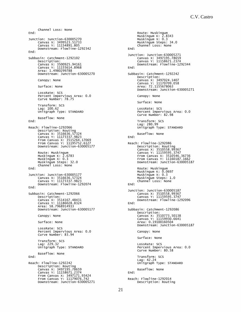
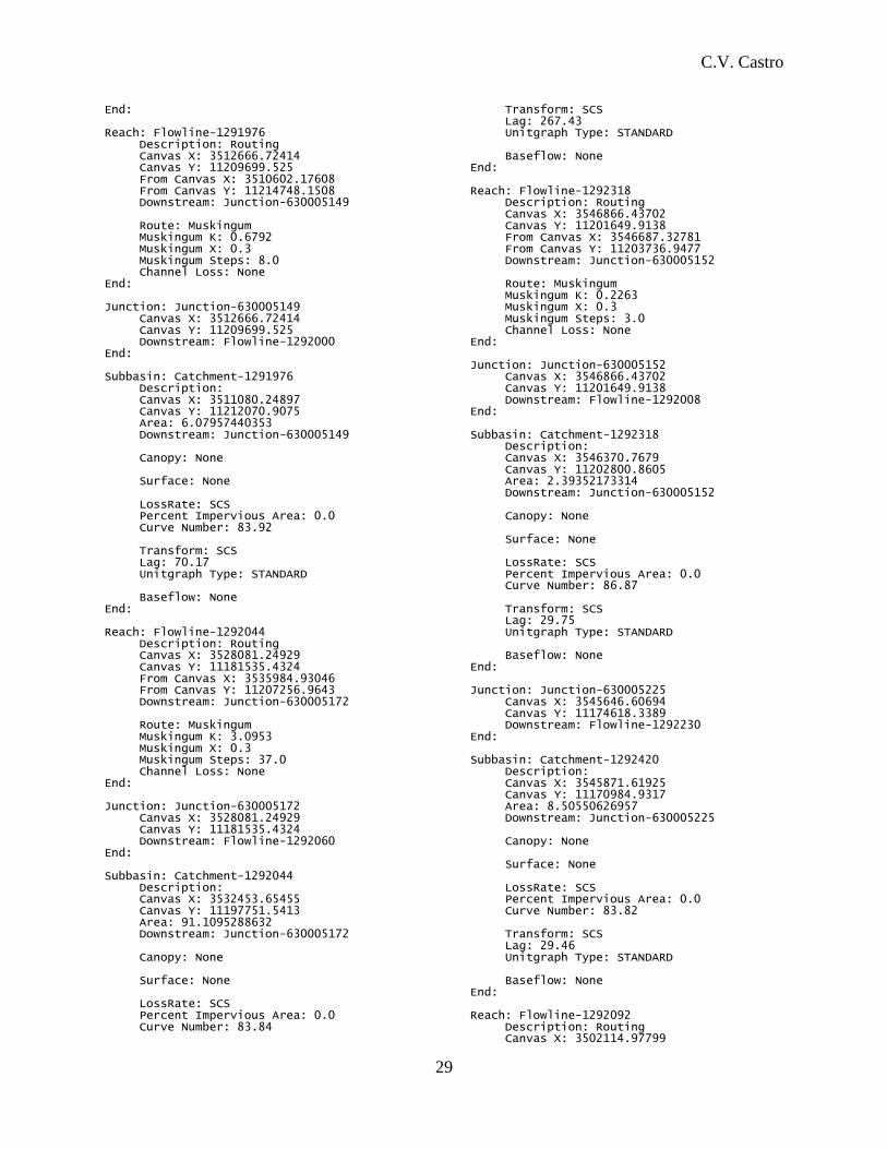
3. HEC-HMS .BASIN input file (Fannin County, 56 subbasins)
Basin: Fannin Last Modified Date: 26 April 2015 Last Modified Time: 15:48:50 Version 3.5 Filepath Separator: \ Unit System: English Missing Flow To Zero: No Enable Flow Ratio: No Allow Blending: No Compute Local Flow At Junctions: No Enable Sediment Routing: No Enable Quality Routing: No End: Junction: Junction-630005249 Canvas X: 3525927.51654 Canvas Y: 11220355.3643 Downstream: Flowline-1292300 End: Subbasin: Catchment-1291938 Description: Canvas X: 3527052.41235 Canvas Y: 11225394.3389 Area: 24.1135157148 Downstream: Junction-630005249 Canopy: None Surface: None LossRate: SCS Percent Impervious Area: 0.0 Curve Number: 83.89 Transform: SCS Lag: 138.01 Unitgraph Type: STANDARD Baseflow: None End: Reach: Flowline-1292238 Description: Routing Canvas X: 3510546.36736 Canvas Y: 11160187.1662 From Canvas X: 3515803.99897 From Canvas Y: 11170480.6988 Downstream: Junction-630005182 Route: Muskingum Muskingum K: 1.7917 Muskingum X: 0.3 Muskingum Steps: 21.0 Channel Loss: None End: Junction: Junction-630005182 Canvas X: 3510546.36736 Canvas Y: 11160187.1662 Downstream: Flowline-1292086 End: Subbasin: Catchment-1292238 Description: Canvas X: 3513260.43741 Canvas Y: 11167663.0065 Area: 42.1788818358 Downstream: Junction-630005182 Canopy: None Surface: None
LossRate: SCS Percent Impervious Area: 0.0 Curve Number: 83.48 Transform: SCS Lag: 205.64 Unitgraph Type: STANDARD Baseflow: None End: Reach: Flowline-1292300 Description: Routing Canvas X: 3525315.29491 Canvas Y: 11217388.9736 From Canvas X: 3525927.51654 From Canvas Y: 11220355.3643 Downstream: Junction-630005174 Route: Muskingum Muskingum K: 0.3809 Muskingum X: 0.3 Muskingum Steps: 5.0 Channel Loss: None End: Junction: Junction-630005174 Canvas X: 3525315.29491 Canvas Y: 11217388.9736 Downstream: Flowline-1292064 End: Subbasin: Catchment-1292300 Description: Canvas X: 3525608.63816 Canvas Y: 11219267.3889 Area: 6.1209428246 Downstream: Junction-630005174 Canopy: None Surface: None LossRate: SCS Percent Impervious Area: 0.0 Curve Number: 84.96 Transform: SCS Lag: 52.21 Unitgraph Type: STANDARD Baseflow: None End: Reach: Flowline-1292064 Description: Routing Canvas X: 3516636.57324 Canvas Y: 11173337.9823 From Canvas X: 3525315.29491 From Canvas Y: 11217388.9736 Downstream: Junction-630005177 Route: Muskingum Muskingum K: 5.4775 Muskingum X: 0.3 Muskingum Steps: 65.0 Channel Loss: None End: Junction: Junction-630005177 Canvas X: 3516636.57324 Canvas Y: 11173337.9823 Downstream: Flowline-1292074 End: Subbasin: Catchment-1292064

C.V. Castro
20
Description: Canvas X: 3525340.34514 Canvas Y: 11202471.1305 Area: 142.705143341 Downstream: Junction-630005177 Canopy: None Surface: None LossRate: SCS Percent Impervious Area: 0.0 Curve Number: 84.14 Transform: SCS Lag: 417.83 Unitgraph Type: STANDARD Baseflow: None End: Reach: Flowline-1292096 Description: Routing Canvas X: 3502114.97799 Canvas Y: 11156143.0924 From Canvas X: 3510558.99367 From Canvas Y: 11159595.3747 Downstream: Junction-630005190 Route: Muskingum Muskingum K: 1.2962 Muskingum X: 0.3 Muskingum Steps: 15.0 Channel Loss: None End: Junction: Junction-630005190 Canvas X: 3502114.97799 Canvas Y: 11156143.0924 Downstream: Flowline-1292102 End: Subbasin: Catchment-1292096 Description: Canvas X: 3510042.86821 Canvas Y: 11155064.2039 Area: 22.256909237 Downstream: Junction-630005190 Canopy: None Surface: None LossRate: SCS Percent Impervious Area: 0.0 Curve Number: 82.78 Transform: SCS Lag: 119.91 Unitgraph Type: STANDARD Baseflow: None End: Reach: Flowline-1292074 Description: Routing Canvas X: 3515803.99897 Canvas Y: 11170480.6988 From Canvas X: 3516636.57324 From Canvas Y: 11173337.9823 Downstream: Junction-630005227 Route: Muskingum Muskingum K: 0.4728 Muskingum X: 0.3 Muskingum Steps: 6.0 Channel Loss: None End: Junction: Junction-630005227 Canvas X: 3515803.99897
Canvas Y: 11170480.6988 Downstream: Flowline-1292238 End: Subbasin: Catchment-1292074 Description: Canvas X: 3515583.05874 Canvas Y: 11172610.1119 Area: 3.14980389134 Downstream: Junction-630005227 Canopy: None Surface: None LossRate: SCS Percent Impervious Area: 0.0 Curve Number: 82.86 Transform: SCS Lag: 82.61 Unitgraph Type: STANDARD Baseflow: None End: Reach: Flowline-1292000 Description: Routing Canvas X: 3514776.15932 Canvas Y: 11203150.982 From Canvas X: 3512666.72414 From Canvas Y: 11209699.525 Downstream: Junction-630005153 Route: Muskingum Muskingum K: 0.8969 Muskingum X: 0.3 Muskingum Steps: 11.0 Channel Loss: None End: Junction: Junction-630005153 Canvas X: 3514776.15932 Canvas Y: 11203150.982 Downstream: Flowline-1292014 End: Subbasin: Catchment-1292000 Description: Canvas X: 3512534.92136 Canvas Y: 11206401.5629 Area: 10.9564707891 Downstream: Junction-630005153 Canopy: None Surface: None LossRate: SCS Percent Impervious Area: 0.0 Curve Number: 84.2 Transform: SCS Lag: 92.33 Unitgraph Type: STANDARD Baseflow: None End: Reach: Flowline-1292102 Description: Routing Canvas X: 3499523.51733 Canvas Y: 11154891.805 From Canvas X: 3502114.97799 From Canvas Y: 11156143.0924 Downstream: Junction-630005270 Route: Muskingum Muskingum K: 0.4546 Muskingum X: 0.3 Muskingum Steps: 5.0
C.V. Castro
21
Channel Loss: None End: Junction: Junction-630005270 Canvas X: 3499523.51733 Canvas Y: 11154891.805 Downstream: Flowline-1292342 End: Subbasin: Catchment-1292102 Description: Canvas X: 3500925.94161 Canvas Y: 11155614.8968 Area: 1.4980299788 Downstream: Junction-630005270 Canopy: None Surface: None LossRate: SCS Percent Impervious Area: 0.0 Curve Number: 78.75 Transform: SCS Lag: 100.62 Unitgraph Type: STANDARD Baseflow: None End: Reach: Flowline-1292066 Description: Routing Canvas X: 3516636.57324 Canvas Y: 11173337.9823 From Canvas X: 3515264.17069 From Canvas Y: 11195752.6127 Downstream: Junction-630005177 Route: Muskingum Muskingum K: 2.6783 Muskingum X: 0.3 Muskingum Steps: 32.0 Channel Loss: None End: Junction: Junction-630005177 Canvas X: 3516636.57324 Canvas Y: 11173337.9823 Downstream: Flowline-1292074 End: Subbasin: Catchment-1292066 Description: Canvas X: 3514167.48431 Canvas Y: 11186028.8324 Area: 58.7968914933 Downstream: Junction-630005177 Canopy: None Surface: None LossRate: SCS Percent Impervious Area: 0.0 Curve Number: 83.94 Transform: SCS Lag: 229.32 Unitgraph Type: STANDARD Baseflow: None End: Reach: Flowline-1292242 Description: Routing Canvas X: 3497195.78659 Canvas Y: 11158671.2374 From Canvas X: 3497171.93424 From Canvas Y: 11179076.742 Downstream: Junction-630005271
Route: Muskingum Muskingum K: 2.8343 Muskingum X: 0.3 Muskingum Steps: 34.0 Channel Loss: None End: Junction: Junction-630005271 Canvas X: 3497195.78659 Canvas Y: 11158671.2374 Downstream: Flowline-1292344 End: Subbasin: Catchment-1292242 Description: Canvas X: 3497024.1407 Canvas Y: 11170709.058 Area: 72.1155678063 Downstream: Junction-630005271 Canopy: None Surface: None LossRate: SCS Percent Impervious Area: 0.0 Curve Number: 82.98 Transform: SCS Lag: 280.99 Unitgraph Type: STANDARD Baseflow: None End: Reach: Flowline-1292086 Description: Routing Canvas X: 3510558.99367 Canvas Y: 11159595.3747 From Canvas X: 3510546.36736 From Canvas Y: 11160187.1662 Downstream: Junction-630005187 Route: Muskingum Muskingum K: 0.0697 Muskingum X: 0.3 Muskingum Steps: 1.0 Channel Loss: None End: Junction: Junction-630005187 Canvas X: 3510558.99367 Canvas Y: 11159595.3747 Downstream: Flowline-1292096 End: Subbasin: Catchment-1292086 Description: Canvas X: 3510773.50138 Canvas Y: 11159930.6641 Area: 0.19100160504 Downstream: Junction-630005187 Canopy: None Surface: None LossRate: SCS Percent Impervious Area: 0.0 Curve Number: 80.58 Transform: SCS Lag: 42.24 Unitgraph Type: STANDARD Baseflow: None End: Reach: Flowline-1292014 Description: Routing

C.V. Castro
22
Canvas X: 3515264.17069 Canvas Y: 11195752.6127 From Canvas X: 3514776.15932 From Canvas Y: 11203150.982 Downstream: Junction-630005175 Route: Muskingum Muskingum K: 0.8389 Muskingum X: 0.3 Muskingum Steps: 10.0 Channel Loss: None End: Junction: Junction-630005175 Canvas X: 3515264.17069 Canvas Y: 11195752.6127 Downstream: Flowline-1292066 End: Subbasin: Catchment-1292014 Description: Canvas X: 3513554.4091 Canvas Y: 11199436.6888 Area: 16.6421377327 Downstream: Junction-630005175 Canopy: None Surface: None LossRate: SCS Percent Impervious Area: 0.0 Curve Number: 83.97 Transform: SCS Lag: 82.65 Unitgraph Type: STANDARD Baseflow: None End: Reach: Flowline-1292060 Description: Routing Canvas X: 3525930.62251 Canvas Y: 11175395.0126 From Canvas X: 3528081.24929 From Canvas Y: 11181535.4324 Downstream: Junction-630005173 Route: Muskingum Muskingum K: 0.7498 Muskingum X: 0.3 Muskingum Steps: 9.0 Channel Loss: None End: Junction: Junction-630005173 Canvas X: 3525930.62251 Canvas Y: 11175395.0126 Downstream: Flowline-1292062 End: Subbasin: Catchment-1292060 Description: Canvas X: 3525252.89511 Canvas Y: 11180431.054 Area: 12.8580100455 Downstream: Junction-630005173 Canopy: None Surface: None LossRate: SCS Percent Impervious Area: 0.0 Curve Number: 83.83 Transform: SCS Lag: 119.29 Unitgraph Type: STANDARD
Baseflow: None End: Reach: Flowline-1292304 Description: Routing Canvas X: 3510602.17608 Canvas Y: 11214748.1508 From Canvas X: 3510096.00133 From Canvas Y: 11217257.8339 Downstream: Junction-630005140 Route: Muskingum Muskingum K: 0.2918 Muskingum X: 0.3 Muskingum Steps: 3.0 Channel Loss: None End: Junction: Junction-630005140 Canvas X: 3510602.17608 Canvas Y: 11214748.1508 Downstream: Flowline-1291976 End: Subbasin: Catchment-1292304 Description: Canvas X: 3510192.28659 Canvas Y: 11215953.5703 Area: 2.52102222441 Downstream: Junction-630005140 Canopy: None Surface: None LossRate: SCS Percent Impervious Area: 0.0 Curve Number: 87.49 Transform: SCS Lag: 30.77 Unitgraph Type: STANDARD Baseflow: None End: Reach: Flowline-1292332 Description: Routing Canvas X: 3529504.5206 Canvas Y: 11172469.2374 From Canvas X: 3530746.17122 From Canvas Y: 11171328.9342 Downstream: Junction-630005176 Route: Muskingum Muskingum K: 0.2052 Muskingum X: 0.3 Muskingum Steps: 2.0 Channel Loss: None End: Junction: Junction-630005176 Canvas X: 3529504.5206 Canvas Y: 11172469.2374 Downstream: Flowline-1292070 End: Subbasin: Catchment-1292332 Description: Canvas X: 3533388.98702 Canvas Y: 11172606.2123 Area: 10.4381475537 Downstream: Junction-630005176 Canopy: None Surface: None LossRate: SCS Percent Impervious Area: 0.0 Curve Number: 84.86

C.V. Castro
23
Transform: SCS Lag: 23.15 Unitgraph Type: STANDARD Baseflow: None End: Junction: Junction-630005252 Canvas X: 3512590.87901 Canvas Y: 11216770.7559 Downstream: Flowline-1292306 End: Subbasin: Catchment-1291958 Description: Canvas X: 3512468.70973 Canvas Y: 11229668.4302 Area: 40.5745841135 Downstream: Junction-630005252 Canopy: None Surface: None LossRate: SCS Percent Impervious Area: 0.0 Curve Number: 83.91 Transform: SCS Lag: 198.44 Unitgraph Type: STANDARD Baseflow: None End: Reach: Flowline-1292306 Description: Routing Canvas X: 3513241.66527 Canvas Y: 11214416.4136 From Canvas X: 3512590.87901 From Canvas Y: 11216770.7559 Downstream: Junction-630005139 Route: Muskingum Muskingum K: 0.2878 Muskingum X: 0.3 Muskingum Steps: 3.0 Channel Loss: None End: Junction: Junction-630005139 Canvas X: 3513241.66527 Canvas Y: 11214416.4136 Downstream: Flowline-1291974 End: Subbasin: Catchment-1292306 Description: Canvas X: 3513042.83411 Canvas Y: 11215634.9159 Area: 3.0978921244 Downstream: Junction-630005139 Canopy: None Surface: None LossRate: SCS Percent Impervious Area: 0.0 Curve Number: 86.15 Transform: SCS Lag: 31.75 Unitgraph Type: STANDARD Baseflow: None End: Reach: Flowline-1292052 Description: Routing
Canvas X: 3497171.93424 Canvas Y: 11179076.742 From Canvas X: 3493173.22687 From Canvas Y: 11188068.6579 Downstream: Junction-630005228 Route: Muskingum Muskingum K: 1.3878 Muskingum X: 0.3 Muskingum Steps: 17.0 Channel Loss: None End: Junction: Junction-630005228 Canvas X: 3497171.93424 Canvas Y: 11179076.742 Downstream: Flowline-1292242 End: Subbasin: Catchment-1292052 Description: Canvas X: 3494600.93509 Canvas Y: 11184720.3888 Area: 31.7767631947 Downstream: Junction-630005228 Canopy: None Surface: None LossRate: SCS Percent Impervious Area: 0.0 Curve Number: 83.89 Transform: SCS Lag: 149.62 Unitgraph Type: STANDARD Baseflow: None End: Reach: Flowline-1292078 Description: Routing Canvas X: 3516249.10746 Canvas Y: 11170396.4147 From Canvas X: 3525865.70357 From Canvas Y: 11175109.1485 Downstream: Junction-630005178 Route: Muskingum Muskingum K: 1.229 Muskingum X: 0.3 Muskingum Steps: 15.0 Channel Loss: None End: Junction: Junction-630005178 Canvas X: 3516249.10746 Canvas Y: 11170396.4147 Downstream: Flowline-1292076 End: Subbasin: Catchment-1292078 Description: Canvas X: 3522609.77374 Canvas Y: 11172742.3062 Area: 31.8688112533 Downstream: Junction-630005178 Canopy: None Surface: None LossRate: SCS Percent Impervious Area: 0.0 Curve Number: 83.64 Transform: SCS Lag: 133.4 Unitgraph Type: STANDARD

C.V. Castro
24
Baseflow: None End: Junction: Junction-630005258 Canvas X: 3546687.32781 Canvas Y: 11203736.9477 Downstream: Flowline-1292318 End: Subbasin: Catchment-1291996 Description: Canvas X: 3546405.38948 Canvas Y: 11211392.329 Area: 29.6746886601 Downstream: Junction-630005258 Canopy: None Surface: None LossRate: SCS Percent Impervious Area: 0.0 Curve Number: 84.58 Transform: SCS Lag: 145.34 Unitgraph Type: STANDARD Baseflow: None End: Reach: Flowline-1292042 Description: Routing Canvas X: 3528081.24929 Canvas Y: 11181535.4324 From Canvas X: 3535946.11813 From Canvas Y: 11187194.7795 Downstream: Junction-630005172 Route: Muskingum Muskingum K: 1.1705 Muskingum X: 0.3 Muskingum Steps: 14.0 Channel Loss: None End: Junction: Junction-630005172 Canvas X: 3528081.24929 Canvas Y: 11181535.4324 Downstream: Flowline-1292060 End: Subbasin: Catchment-1292042 Description: Canvas X: 3533663.23124 Canvas Y: 11186285.2194 Area: 17.5364095677 Downstream: Junction-630005172 Canopy: None Surface: None LossRate: SCS Percent Impervious Area: 0.0 Curve Number: 83.48 Transform: SCS Lag: 141.0 Unitgraph Type: STANDARD Baseflow: None End: Reach: Flowline-1292230 Description: Routing Canvas X: 3535946.11813 Canvas Y: 11187194.7795 From Canvas X: 3545646.60694 From Canvas Y: 11174618.3389 Downstream: Junction-630005164
Route: Muskingum Muskingum K: 2.0706 Muskingum X: 0.3 Muskingum Steps: 25.0 Channel Loss: None End: Junction: Junction-630005164 Canvas X: 3535946.11813 Canvas Y: 11187194.7795 Downstream: Flowline-1292042 End: Subbasin: Catchment-1292230 Description: Canvas X: 3543924.68258 Canvas Y: 11183041.0307 Area: 47.7019631365 Downstream: Junction-630005164 Canopy: None Surface: None LossRate: SCS Percent Impervious Area: 0.0 Curve Number: 83.98 Transform: SCS Lag: 178.92 Unitgraph Type: STANDARD Baseflow: None End: Reach: Flowline-1292224 Description: Routing Canvas X: 3535946.11813 Canvas Y: 11187194.7795 From Canvas X: 3546616.31372 From Canvas Y: 11199663.4093 Downstream: Junction-630005164 Route: Muskingum Muskingum K: 1.8718 Muskingum X: 0.3 Muskingum Steps: 22.0 Channel Loss: None End: Junction: Junction-630005164 Canvas X: 3535946.11813 Canvas Y: 11187194.7795 Downstream: Flowline-1292042 End: Subbasin: Catchment-1292224 Description: Canvas X: 3543826.61308 Canvas Y: 11195719.9161 Area: 83.2578103018 Downstream: Junction-630005164 Canopy: None Surface: None LossRate: SCS Percent Impervious Area: 0.0 Curve Number: 84.06 Transform: SCS Lag: 168.12 Unitgraph Type: STANDARD Baseflow: None End: Junction: Junction-630005143 Canvas X: 3536093.52754

C.V. Castro
25
Canvas Y: 11208428.5965 Downstream: Flowline-1291986 End: Subbasin: Catchment-1291982 Description: Canvas X: 3537246.26458 Canvas Y: 11218856.4687 Area: 41.0146831895 Downstream: Junction-630005143 Canopy: None Surface: None LossRate: SCS Percent Impervious Area: 0.0 Curve Number: 84.35 Transform: SCS Lag: 164.55 Unitgraph Type: STANDARD Baseflow: None End: Junction: Junction-630005143 Canvas X: 3536093.52754 Canvas Y: 11208428.5965 Downstream: Flowline-1291986 End: Subbasin: Catchment-1291980 Description: Canvas X: 3541536.5171 Canvas Y: 11216023.8752 Area: 27.6337273017 Downstream: Junction-630005143 Canopy: None Surface: None LossRate: SCS Percent Impervious Area: 0.0 Curve Number: 84.48 Transform: SCS Lag: 158.33 Unitgraph Type: STANDARD Baseflow: None End: Reach: Flowline-1292236 Description: Routing Canvas X: 3516249.10746 Canvas Y: 11170396.4147 From Canvas X: 3524404.21967 From Canvas Y: 11164331.3046 Downstream: Junction-630005178 Route: Muskingum Muskingum K: 1.1794 Muskingum X: 0.3 Muskingum Steps: 14.0 Channel Loss: None End: Junction: Junction-630005178 Canvas X: 3516249.10746 Canvas Y: 11170396.4147 Downstream: Flowline-1292076 End: Subbasin: Catchment-1292236 Description: Canvas X: 3521318.76373 Canvas Y: 11165719.5182 Area: 16.8421962403 Downstream: Junction-630005178
Canopy: None Surface: None LossRate: SCS Percent Impervious Area: 0.0 Curve Number: 83.95 Transform: SCS Lag: 101.24 Unitgraph Type: STANDARD Baseflow: None End: Reach: Flowline-1291978 Description: Routing Canvas X: 3515857.04719 Canvas Y: 11208653.2572 From Canvas X: 3515145.16908 From Canvas Y: 11217428.6901 Downstream: Junction-630005256 Route: Muskingum Muskingum K: 1.0648 Muskingum X: 0.3 Muskingum Steps: 13.0 Channel Loss: None End: Junction: Junction-630005256 Canvas X: 3515857.04719 Canvas Y: 11208653.2572 Downstream: Flowline-1292314 End: Subbasin: Catchment-1291978 Description: Canvas X: 3516387.1891 Canvas Y: 11214137.1873 Area: 13.2268274899 Downstream: Junction-630005256 Canopy: None Surface: None LossRate: SCS Percent Impervious Area: 0.0 Curve Number: 84.14 Transform: SCS Lag: 108.89 Unitgraph Type: STANDARD Baseflow: None End: Reach: Flowline-1292314 Description: Routing Canvas X: 3515216.87674 Canvas Y: 11206244.7604 From Canvas X: 3515857.04719 From Canvas Y: 11208653.2572 Downstream: Junction-630005148 Route: Muskingum Muskingum K: 0.2711 Muskingum X: 0.3 Muskingum Steps: 3.0 Channel Loss: None End: Junction: Junction-630005148 Canvas X: 3515216.87674 Canvas Y: 11206244.7604 Downstream: Flowline-1291998 End: Subbasin: Catchment-1292314

C.V. Castro
26
Description: Canvas X: 3515747.1522 Canvas Y: 11207575.21 Area: 2.21752474851 Downstream: Junction-630005148 Canopy: None Surface: None LossRate: SCS Percent Impervious Area: 0.0 Curve Number: 87.23 Transform: SCS Lag: 25.96 Unitgraph Type: STANDARD Baseflow: None End: Reach: Flowline-1292050 Description: Routing Canvas X: 3497171.93424 Canvas Y: 11179076.742 From Canvas X: 3500805.01735 From Canvas Y: 11224010.5655 Downstream: Junction-630005228 Route: Muskingum Muskingum K: 5.9119 Muskingum X: 0.3 Muskingum Steps: 71.0 Channel Loss: None End: Junction: Junction-630005228 Canvas X: 3497171.93424 Canvas Y: 11179076.742 Downstream: Flowline-1292242 End: Subbasin: Catchment-1292050 Description: Canvas X: 3500650.85074 Canvas Y: 11203330.3626 Area: 109.61604498 Downstream: Junction-630005228 Canopy: None Surface: None LossRate: SCS Percent Impervious Area: 0.0 Curve Number: 83.88 Transform: SCS Lag: 397.75 Unitgraph Type: STANDARD Baseflow: None End: Junction: Junction-630005244 Canvas X: 3501399.98407 Canvas Y: 11226050.4975 Downstream: Flowline-1292290 End: Subbasin: Catchment-1291928 Description: Canvas X: 3502248.80074 Canvas Y: 11234707.5538 Area: 43.3589328429 Downstream: Junction-630005244 Canopy: None Surface: None
LossRate: SCS Percent Impervious Area: 0.0 Curve Number: 83.72 Transform: SCS Lag: 133.09 Unitgraph Type: STANDARD Baseflow: None End: Junction: Junction-630005185 Canvas X: 3502277.54291 Canvas Y: 11156499.1937 Downstream: Flowline-1292092 End: Subbasin: Catchment-1292090 Description: Canvas X: 3507581.38561 Canvas Y: 11160318.9799 Area: 6.75997383852 Downstream: Junction-630005185 Canopy: None Surface: None LossRate: SCS Percent Impervious Area: 0.0 Curve Number: 83.04 Transform: SCS Lag: 189.88 Unitgraph Type: STANDARD Baseflow: None End: Junction: Junction-630005141 Canvas X: 3515145.16908 Canvas Y: 11217428.6901 Downstream: Flowline-1291978 End: Subbasin: Catchment-1291950 Description: Canvas X: 3515578.09677 Canvas Y: 11224017.7294 Area: 14.1713645505 Downstream: Junction-630005141 Canopy: None Surface: None LossRate: SCS Percent Impervious Area: 0.0 Curve Number: 84.35 Transform: SCS Lag: 126.73 Unitgraph Type: STANDARD Baseflow: None End: Reach: Flowline-1291974 Description: Routing Canvas X: 3512666.72414 Canvas Y: 11209699.525 From Canvas X: 3513241.66527 From Canvas Y: 11214416.4136 Downstream: Junction-630005149 Route: Muskingum Muskingum K: 0.6525 Muskingum X: 0.3 Muskingum Steps: 8.0 Channel Loss: None End:

C.V. Castro
27
Junction: Junction-630005149 Canvas X: 3512666.72414 Canvas Y: 11209699.525 Downstream: Flowline-1292000 End: Subbasin: Catchment-1291974 Description: Canvas X: 3513577.98832 Canvas Y: 11212185.0907 Area: 3.55110155307 Downstream: Junction-630005149 Canopy: None Surface: None LossRate: SCS Percent Impervious Area: 0.0 Curve Number: 84.36 Transform: SCS Lag: 63.93 Unitgraph Type: STANDARD Baseflow: None End: Junction: Junction-630005226 Canvas X: 3524404.21967 Canvas Y: 11164331.3046 Downstream: Flowline-1292236 End: Subbasin: Catchment-1292422 Description: Canvas X: 3527545.37497 Canvas Y: 11161108.1101 Area: 28.1110130676 Downstream: Junction-630005226 Canopy: None Surface: None LossRate: SCS Percent Impervious Area: 0.0 Curve Number: 83.0 Transform: SCS Lag: 26.4 Unitgraph Type: STANDARD Baseflow: None End: Reach: Flowline-1292076 Description: Routing Canvas X: 3515803.99897 Canvas Y: 11170480.6988 From Canvas X: 3516249.10746 From Canvas Y: 11170396.4147 Downstream: Junction-630005227 Route: Muskingum Muskingum K: 0.0524 Muskingum X: 0.3 Muskingum Steps: 1.0 Channel Loss: None End: Junction: Junction-630005227 Canvas X: 3515803.99897 Canvas Y: 11170480.6988 Downstream: Flowline-1292238 End: Subbasin: Catchment-1292076 Description: Canvas X: 3516177.74647
Canvas Y: 11170497.1516 Area: 0.16853747181 Downstream: Junction-630005227 Canopy: None Surface: None LossRate: SCS Percent Impervious Area: 0.0 Curve Number: 80.77 Transform: SCS Lag: 46.89 Unitgraph Type: STANDARD Baseflow: None End: Reach: Flowline-1292062 Description: Routing Canvas X: 3525865.70357 Canvas Y: 11175109.1485 From Canvas X: 3525930.62251 From Canvas Y: 11175395.0126 Downstream: Junction-630005179 Route: Muskingum Muskingum K: 0.0314 Muskingum X: 0.3 Muskingum Steps: 0.0 Channel Loss: None End: Junction: Junction-630005179 Canvas X: 3525865.70357 Canvas Y: 11175109.1485 Downstream: Flowline-1292078 End: Subbasin: Catchment-1292062 Description: Canvas X: 3525805.57144 Canvas Y: 11175278.8674 Area: 0.0524346932737 Downstream: Junction-630005179 Canopy: None Surface: None LossRate: SCS Percent Impervious Area: 0.0 Curve Number: 82.86 Transform: SCS Lag: 41.42 Unitgraph Type: STANDARD Baseflow: None End: Reach: Flowline-1291986 Description: Routing Canvas X: 3535984.93046 Canvas Y: 11207256.9643 From Canvas X: 3536093.52754 From Canvas Y: 11208428.5965 Downstream: Junction-630005165 Route: Muskingum Muskingum K: 0.1354 Muskingum X: 0.3 Muskingum Steps: 2.0 Channel Loss: None End: Junction: Junction-630005165 Canvas X: 3535984.93046 Canvas Y: 11207256.9643 Downstream: Flowline-1292044

C.V. Castro
28
End: Subbasin: Catchment-1291986 Description: Canvas X: 3535534.37869 Canvas Y: 11207694.1989 Area: 1.1799300713 Downstream: Junction-630005165 Canopy: None Surface: None LossRate: SCS Percent Impervious Area: 0.0 Curve Number: 82.86 Transform: SCS Lag: 19.26 Unitgraph Type: STANDARD Baseflow: None End: Junction: Junction-630005175 Canvas X: 3515264.17069 Canvas Y: 11195752.6127 Downstream: Flowline-1292066 End: Subbasin: Catchment-1292012 Description: Canvas X: 3519721.74469 Canvas Y: 11215636.324 Area: 75.0573431626 Downstream: Junction-630005175 Canopy: None Surface: None LossRate: SCS Percent Impervious Area: 0.0 Curve Number: 84.09 Transform: SCS Lag: 290.66 Unitgraph Type: STANDARD Baseflow: None End: Junction: Junction-630005169 Canvas X: 3493173.22687 Canvas Y: 11188068.6579 Downstream: Flowline-1292052 End: Subbasin: Catchment-1292034 Description: Canvas X: 3486122.99051 Canvas Y: 11191853.1158 Area: 37.9541774276 Downstream: Junction-630005169 Canopy: None Surface: None LossRate: SCS Percent Impervious Area: 0.0 Curve Number: 83.45 Transform: SCS Lag: 124.16 Unitgraph Type: STANDARD Baseflow: None End: Junction: Junction-630005265
Canvas X: 3530746.17122 Canvas Y: 11171328.9342 Downstream: Flowline-1292332 End: Subbasin: Catchment-1292234 Description: Canvas X: 3533447.50153 Canvas Y: 11166879.9587 Area: 17.54634307 Downstream: Junction-630005265 Canopy: None Surface: None LossRate: SCS Percent Impervious Area: 0.0 Curve Number: 83.45 Transform: SCS Lag: 87.8 Unitgraph Type: STANDARD Baseflow: None End: Junction: Junction-630005173 Canvas X: 3525930.62251 Canvas Y: 11175395.0126 Downstream: Flowline-1292062 End: Subbasin: Catchment-1292232 Description: Canvas X: 3537037.76808 Canvas Y: 11174954.0091 Area: 73.8129748529 Downstream: Junction-630005173 Canopy: None Surface: None LossRate: SCS Percent Impervious Area: 0.0 Curve Number: 83.98 Transform: SCS Lag: 246.65 Unitgraph Type: STANDARD Baseflow: None End: Junction: Junction-630005185 Canvas X: 3502277.54291 Canvas Y: 11156499.1937 Downstream: Flowline-1292092 End: Subbasin: Catchment-1292240 Description: Canvas X: 3506477.5407 Canvas Y: 11190515.5144 Area: 157.089379883 Downstream: Junction-630005185 Canopy: None Surface: None LossRate: SCS Percent Impervious Area: 0.0 Curve Number: 84.0 Transform: SCS Lag: 620.94 Unitgraph Type: STANDARD Baseflow: None
C.V. Castro
29
End: Reach: Flowline-1291976 Description: Routing Canvas X: 3512666.72414 Canvas Y: 11209699.525 From Canvas X: 3510602.17608 From Canvas Y: 11214748.1508 Downstream: Junction-630005149 Route: Muskingum Muskingum K: 0.6792 Muskingum X: 0.3 Muskingum Steps: 8.0 Channel Loss: None End: Junction: Junction-630005149 Canvas X: 3512666.72414 Canvas Y: 11209699.525 Downstream: Flowline-1292000 End: Subbasin: Catchment-1291976 Description: Canvas X: 3511080.24897 Canvas Y: 11212070.9075 Area: 6.07957440353 Downstream: Junction-630005149 Canopy: None Surface: None LossRate: SCS Percent Impervious Area: 0.0 Curve Number: 83.92 Transform: SCS Lag: 70.17 Unitgraph Type: STANDARD Baseflow: None End: Reach: Flowline-1292044 Description: Routing Canvas X: 3528081.24929 Canvas Y: 11181535.4324 From Canvas X: 3535984.93046 From Canvas Y: 11207256.9643 Downstream: Junction-630005172 Route: Muskingum Muskingum K: 3.0953 Muskingum X: 0.3 Muskingum Steps: 37.0 Channel Loss: None End: Junction: Junction-630005172 Canvas X: 3528081.24929 Canvas Y: 11181535.4324 Downstream: Flowline-1292060 End: Subbasin: Catchment-1292044 Description: Canvas X: 3532453.65455 Canvas Y: 11197751.5413 Area: 91.1095288632 Downstream: Junction-630005172 Canopy: None Surface: None LossRate: SCS Percent Impervious Area: 0.0 Curve Number: 83.84
Transform: SCS Lag: 267.43 Unitgraph Type: STANDARD Baseflow: None End: Reach: Flowline-1292318 Description: Routing Canvas X: 3546866.43702 Canvas Y: 11201649.9138 From Canvas X: 3546687.32781 From Canvas Y: 11203736.9477 Downstream: Junction-630005152 Route: Muskingum Muskingum K: 0.2263 Muskingum X: 0.3 Muskingum Steps: 3.0 Channel Loss: None End: Junction: Junction-630005152 Canvas X: 3546866.43702 Canvas Y: 11201649.9138 Downstream: Flowline-1292008 End: Subbasin: Catchment-1292318 Description: Canvas X: 3546370.7679 Canvas Y: 11202800.8605 Area: 2.39352173314 Downstream: Junction-630005152 Canopy: None Surface: None LossRate: SCS Percent Impervious Area: 0.0 Curve Number: 86.87 Transform: SCS Lag: 29.75 Unitgraph Type: STANDARD Baseflow: None End: Junction: Junction-630005225 Canvas X: 3545646.60694 Canvas Y: 11174618.3389 Downstream: Flowline-1292230 End: Subbasin: Catchment-1292420 Description: Canvas X: 3545871.61925 Canvas Y: 11170984.9317 Area: 8.50550626957 Downstream: Junction-630005225 Canopy: None Surface: None LossRate: SCS Percent Impervious Area: 0.0 Curve Number: 83.82 Transform: SCS Lag: 29.46 Unitgraph Type: STANDARD Baseflow: None End: Reach: Flowline-1292092 Description: Routing Canvas X: 3502114.97799

C.V. Castro
30
Canvas Y: 11156143.0924 From Canvas X: 3502277.54291 From Canvas Y: 11156499.1937 Downstream: Junction-630005190 Route: Muskingum Muskingum K: 0.0428 Muskingum X: 0.3 Muskingum Steps: 1.0 Channel Loss: None End: Junction: Junction-630005190 Canvas X: 3502114.97799 Canvas Y: 11156143.0924 Downstream: Flowline-1292102 End: Subbasin: Catchment-1292092 Description: Canvas X: 3502079.66566 Canvas Y: 11156462.9512 Area: 0.0936271776927 Downstream: Junction-630005190 Canopy: None Surface: None LossRate: SCS Percent Impervious Area: 0.0 Curve Number: 82.89 Transform: SCS Lag: 12.14 Unitgraph Type: STANDARD Baseflow: None End: Junction: Junction-630005186 Canvas X: 3520279.88437 Canvas Y: 11155961.1157 Downstream: Flowline-1292094 End: Subbasin: Catchment-1292424 Description: Canvas X: 3522248.88843 Canvas Y: 11153828.5443 Area: 10.2501734388 Downstream: Junction-630005186 Canopy: None Surface: None LossRate: SCS Percent Impervious Area: 0.0 Curve Number: 81.21 Transform: SCS Lag: 12.52 Unitgraph Type: STANDARD Baseflow: None End: Reach: Flowline-1292290 Description: Routing Canvas X: 3500805.01735 Canvas Y: 11224010.5655 From Canvas X: 3501399.98407 From Canvas Y: 11226050.4975 Downstream: Junction-630005168 Route: Muskingum Muskingum K: 0.2344 Muskingum X: 0.3 Muskingum Steps: 3.0 Channel Loss: None
End: Junction: Junction-630005168 Canvas X: 3500805.01735 Canvas Y: 11224010.5655 Downstream: Flowline-1292050 End: Subbasin: Catchment-1292290 Description: Canvas X: 3501377.29884 Canvas Y: 11225082.9019 Area: 4.27428739848 Downstream: Junction-630005168 Canopy: None Surface: None LossRate: SCS Percent Impervious Area: 0.0 Curve Number: 85.42 Transform: SCS Lag: 32.75 Unitgraph Type: STANDARD Baseflow: None End: Junction: Junction-630005251 Canvas X: 3510096.00133 Canvas Y: 11217257.8339 Downstream: Flowline-1292304 End: Subbasin: Catchment-1291952 Description: Canvas X: 3508050.16437 Canvas Y: 11228001.6371 Area: 30.838142187 Downstream: Junction-630005251 Canopy: None Surface: None LossRate: SCS Percent Impervious Area: 0.0 Curve Number: 84.09 Transform: SCS Lag: 217.99 Unitgraph Type: STANDARD Baseflow: None End: Reach: Flowline-1291998 Description: Routing Canvas X: 3514776.15932 Canvas Y: 11203150.982 From Canvas X: 3515216.87674 From Canvas Y: 11206244.7604 Downstream: Junction-630005153 Route: Muskingum Muskingum K: 0.3474 Muskingum X: 0.3 Muskingum Steps: 4.0 Channel Loss: None End: Junction: Junction-630005153 Canvas X: 3514776.15932 Canvas Y: 11203150.982 Downstream: Flowline-1292014 End: Subbasin: Catchment-1291998 Description:

C.V. Castro
31
Canvas X: 3515665.13095 Canvas Y: 11204781.3455 Area: 2.61080542731 Downstream: Junction-630005153 Canopy: None Surface: None LossRate: SCS Percent Impervious Area: 0.0 Curve Number: 85.25 Transform: SCS Lag: 37.3 Unitgraph Type: STANDARD Baseflow: None End: Reach: Flowline-1292094 Description: Routing Canvas X: 3510558.99367 Canvas Y: 11159595.3747 From Canvas X: 3520279.88437 From Canvas Y: 11155961.1157 Downstream: Junction-630005187 Route: Muskingum Muskingum K: 1.3431 Muskingum X: 0.3 Muskingum Steps: 16.0 Channel Loss: None End: Junction: Junction-630005187 Canvas X: 3510558.99367 Canvas Y: 11159595.3747 Downstream: Flowline-1292096 End: Subbasin: Catchment-1292094 Description: Canvas X: 3517847.25797 Canvas Y: 11158333.8055 Area: 30.8184661102 Downstream: Junction-630005187 Canopy: None Surface: None LossRate: SCS Percent Impervious Area: 0.0 Curve Number: 83.58 Transform: SCS Lag: 102.87 Unitgraph Type: STANDARD Baseflow: None End: Reach: Flowline-1292070 Description: Routing Canvas X: 3525865.70357 Canvas Y: 11175109.1485 From Canvas X: 3529504.5206 From Canvas Y: 11172469.2374 Downstream: Junction-630005179 Route: Muskingum Muskingum K: 0.6481 Muskingum X: 0.3 Muskingum Steps: 8.0 Channel Loss: None End: Junction: Junction-630005179 Canvas X: 3525865.70357 Canvas Y: 11175109.1485
Downstream: Flowline-1292078 End: Subbasin: Catchment-1292070 Description: Canvas X: 3528572.6271 Canvas Y: 11170296.2947 Area: 9.50549120062 Downstream: Junction-630005179 Canopy: None Surface: None LossRate: SCS Percent Impervious Area: 0.0 Curve Number: 84.52 Transform: SCS Lag: 59.56 Unitgraph Type: STANDARD Baseflow: None End: Reach: Flowline-1292008 Description: Routing Canvas X: 3546616.31372 Canvas Y: 11199663.4093 From Canvas X: 3546866.43702 From Canvas Y: 11201649.9138 Downstream: Junction-630005222 Route: Muskingum Muskingum K: 0.2139 Muskingum X: 0.3 Muskingum Steps: 3.0 Channel Loss: None End: Junction: Junction-630005222 Canvas X: 3546616.31372 Canvas Y: 11199663.4093 Downstream: Flowline-1292224 End: Subbasin: Catchment-1292008 Description: Canvas X: 3550348.91668 Canvas Y: 11201498.3331 Area: 19.1405737596 Downstream: Junction-630005222 Canopy: None Surface: None LossRate: SCS Percent Impervious Area: 0.0 Curve Number: 83.71 Transform: SCS Lag: 32.02 Unitgraph Type: STANDARD Baseflow: None End: Reach: Flowline-1292342 Description: Routing Canvas X: 3499193.67489 Canvas Y: 11154502.5304 From Canvas X: 3499523.51733 From Canvas Y: 11154891.805 Downstream: Junction-630005272 Route: Muskingum Muskingum K: 0.0544 Muskingum X: 0.3 Muskingum Steps: 1.0 Channel Loss: None

C.V. Castro
32
End: Junction: Junction-630005272 Canvas X: 3499193.67489 Canvas Y: 11154502.5304 End: Subbasin: Catchment-1292342 Description: Canvas X: 3499925.22459 Canvas Y: 11154676.3965 Area: 0.340800723401 Downstream: Junction-630005272 Canopy: None Surface: None LossRate: SCS Percent Impervious Area: 0.0 Curve Number: 22.16 Transform: SCS Lag: 59.33 Unitgraph Type: STANDARD Baseflow: None End: Reach: Flowline-1292344 Description: Routing Canvas X: 3499193.67489 Canvas Y: 11154502.5304 From Canvas X: 3497195.78659 From Canvas Y: 11158671.2374 Downstream: Junction-630005272 Route: Muskingum Muskingum K: 0.5101 Muskingum X: 0.3 Muskingum Steps: 6.0 Channel Loss: None End: Junction: Junction-630005272
Canvas X: 3499193.67489 Canvas Y: 11154502.5304 End: Subbasin: Catchment-1292344 Description: Canvas X: 3500229.41342 Canvas Y: 11159723.5388 Area: 16.6920582333 Downstream: Junction-630005272 Canopy: None Surface: None LossRate: SCS Percent Impervious Area: 0.0 Curve Number: 82.42 Transform: SCS Lag: 80.72 Unitgraph Type: STANDARD Baseflow: None End: Basin Schematic Properties: Last View N: 5000.0 Last View S: -5000.0 Last View W: -5000.0 Last View E: 5000.0 Maximum View N: 5000.0 Maximum View S: -5000.0 Maximum View W: -5000.0 Maximum View E: 5000.0 Extent Method: Elements Buffer: 0 Draw Icons: Yes Draw Icon Labels: Yes Draw Map Objects: No Draw Gridlines: No Draw Flow Direction: No Fix Element Locations: No Fix Hydrologic Order: No End: