devil’s punchbowl -virtual field trip-€¦ · devil’s punchbowl-virtual field trip-school of...
TRANSCRIPT
Devil’s PunchbowlDevil’s Punchbowl--Virtual Field TripVirtual Field Trip--
School of School of
GEOGRAPHY & GEOLOGYGEOGRAPHY & GEOLOGY
Prepared by Prepared by Zachary Windus Zachary Windus
and Liz Kennyand Liz KennyCarolyn Eyles & Susan VajoczkiCarolyn Eyles & Susan Vajoczki
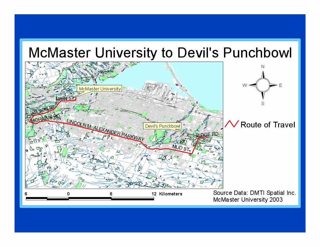
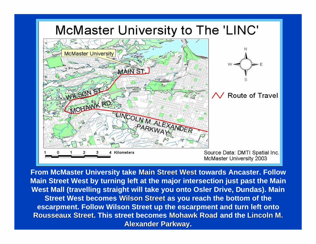
From McMaster University take Main Street WestMain Street West towards Ancaster. Follow Main Street West by turning left at the major intersection just past the Main West Mall (travelling straight will take you onto Osler Drive, Dundas). Main
Street West becomes Wilson StreetWilson Street as you reach the bottom of the escarpment. Follow Wilson Street up the escarpment and turn left onto
Rousseaux StreetRousseaux Street. This street becomes Mohawk RoadMohawk Road and the Lincoln M. Lincoln M. Alexander ParkwayAlexander Parkway.
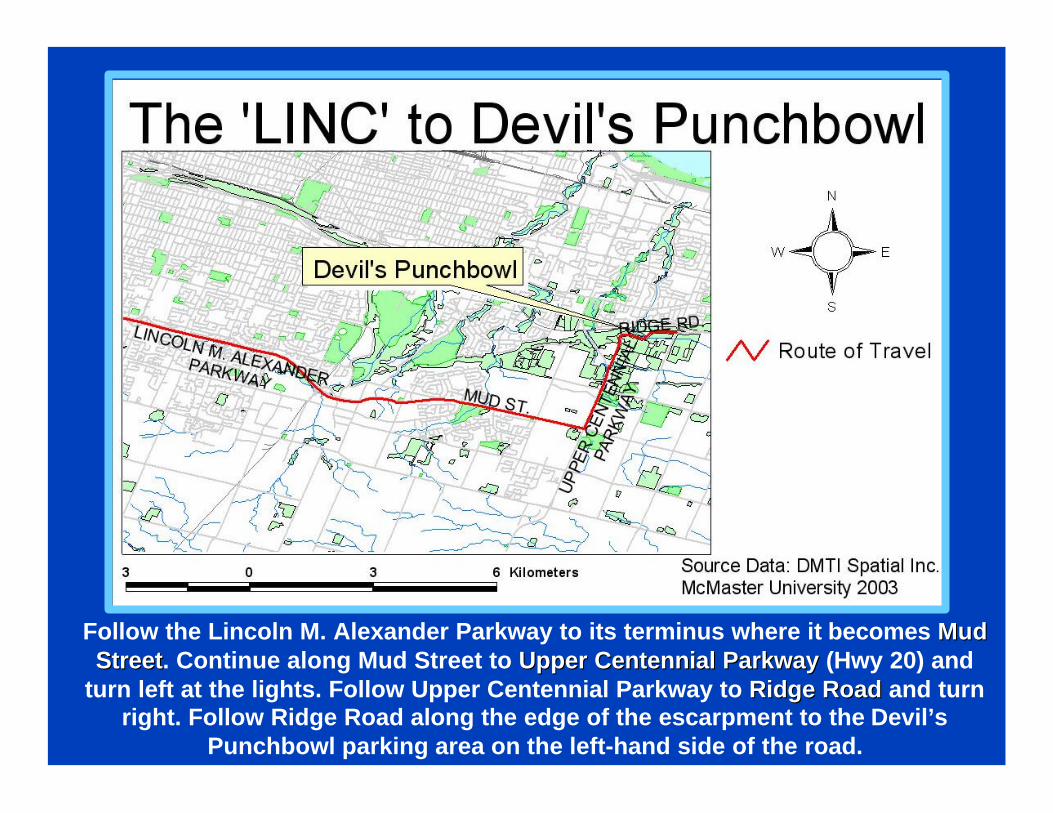
Follow the Lincoln M. Alexander Parkway to its terminus where it becomes Mud Mud StreetStreet. Continue along Mud Street to Upper Centennial ParkwayUpper Centennial Parkway (Hwy 20) and
turn left at the lights. Follow Upper Centennial Parkway to Ridge RoadRidge Road and turn right. Follow Ridge Road along the edge of the escarpment to the Devil’s
Punchbowl parking area on the left-hand side of the road.
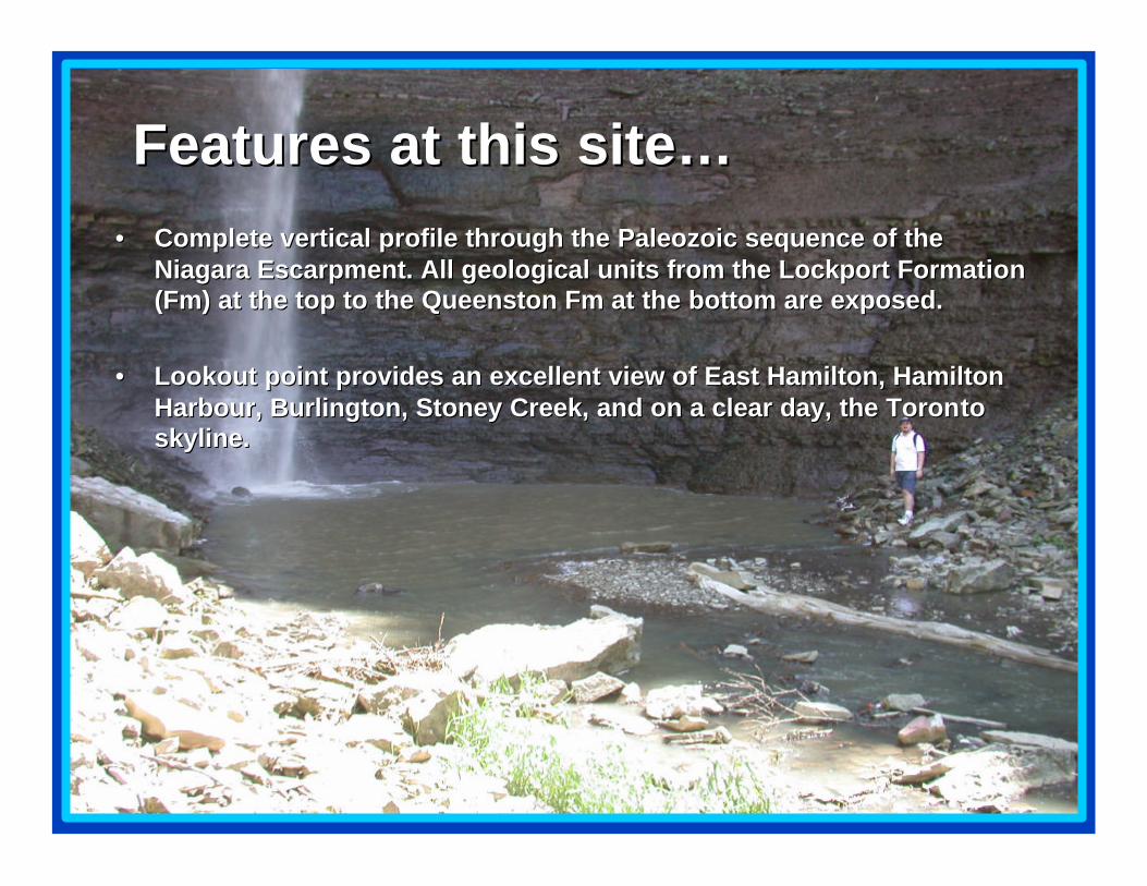
•• Complete vertical profile through the Paleozoic sequence of the Complete vertical profile through the Paleozoic sequence of the Niagara Escarpment. All geological units from the Lockport FormaNiagara Escarpment. All geological units from the Lockport Formation tion (Fm) at the top to the Queenston Fm at the bottom are exposed.(Fm) at the top to the Queenston Fm at the bottom are exposed.
•• Lookout point provides an excellent view of East Hamilton, HamilLookout point provides an excellent view of East Hamilton, Hamilton ton Harbour, Burlington, Stoney Creek, and on a clear day, the ToronHarbour, Burlington, Stoney Creek, and on a clear day, the Toronto to skyline. skyline.
Features at this site…Features at this site…
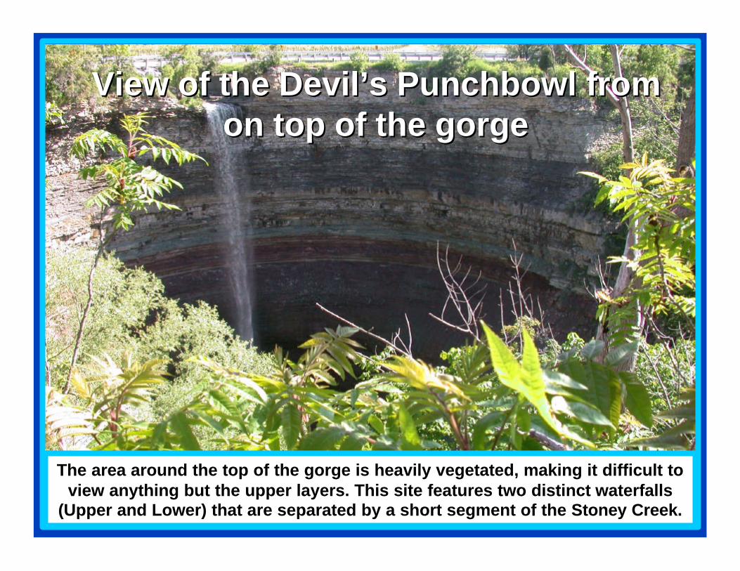
View of the Devil’s Punchbowl from View of the Devil’s Punchbowl from on top of the gorgeon top of the gorge
The area around the top of the gorge is heavily vegetated, making it difficult to view anything but the upper layers. This site features two distinct waterfalls
(Upper and Lower) that are separated by a short segment of the Stoney Creek.
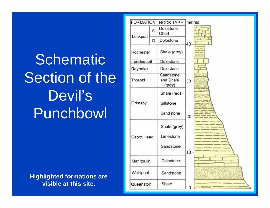
Schematic Section of the
Devil’s Punchbowl
Highlighted formations are visible at this site.
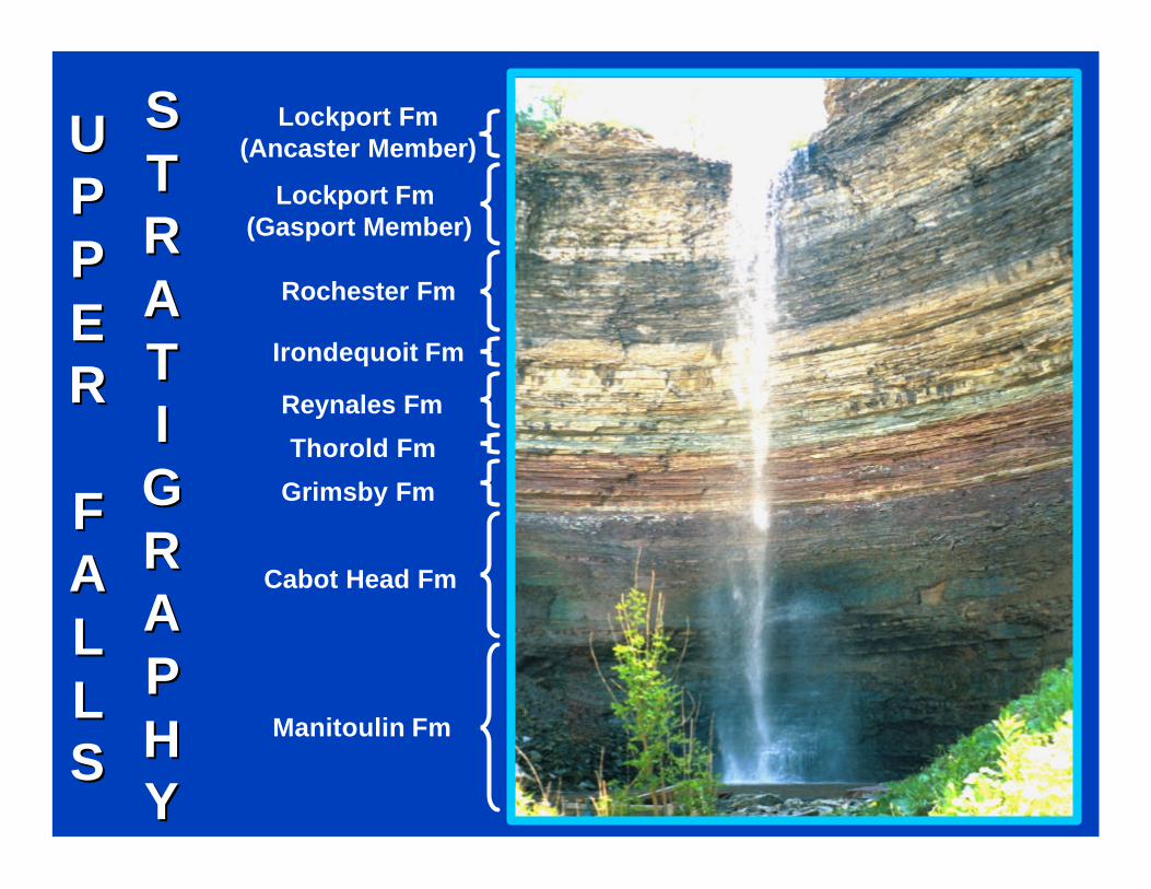
Lockport Fm(Ancaster Member)
Rochester Fm
Irondequoit Fm
Reynales Fm
Thorold Fm
Grimsby Fm
Cabot Head Fm
Manitoulin Fm
Lockport Fm (Gasport Member)
UUPPPPEERR
FFAALLLLSS
SSTTRRAATTIIGGRRAAPPHHYY
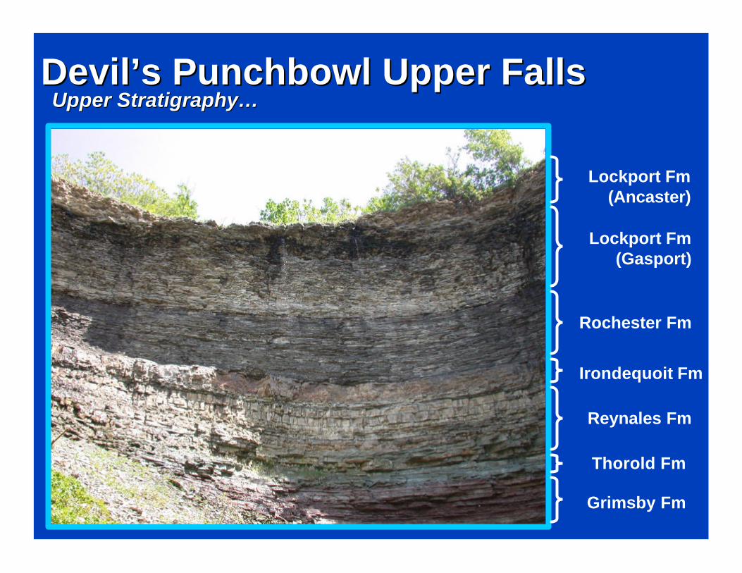
Devil’s Punchbowl Upper FallsDevil’s Punchbowl Upper FallsUpper Stratigraphy…Upper Stratigraphy…
Lockport Fm (Ancaster)
Rochester Fm
Irondequoit Fm
Reynales Fm
Thorold Fm
Grimsby Fm
Lockport Fm (Gasport)
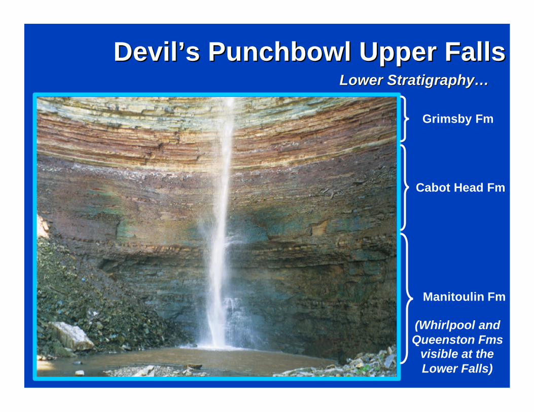
Lower Stratigraphy…Lower Stratigraphy…
Devil’s Punchbowl Upper FallsDevil’s Punchbowl Upper Falls
Grimsby Fm
Cabot Head Fm
Manitoulin Fm
(Whirlpool and Queenston Fms
visible at the Lower Falls)
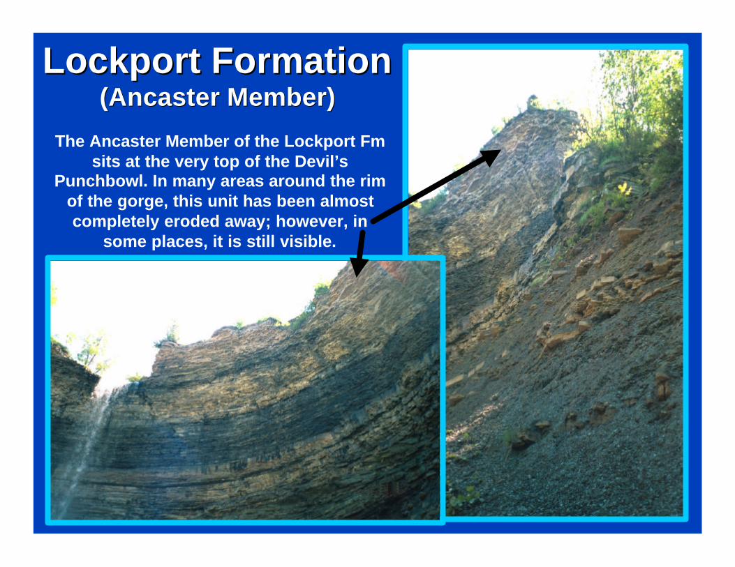
Lockport FormationLockport Formation(Ancaster Member)(Ancaster Member)
The Ancaster Member of the Lockport Fm sits at the very top of the Devil’s
Punchbowl. In many areas around the rim of the gorge, this unit has been almost completely eroded away; however, in
some places, it is still visible.
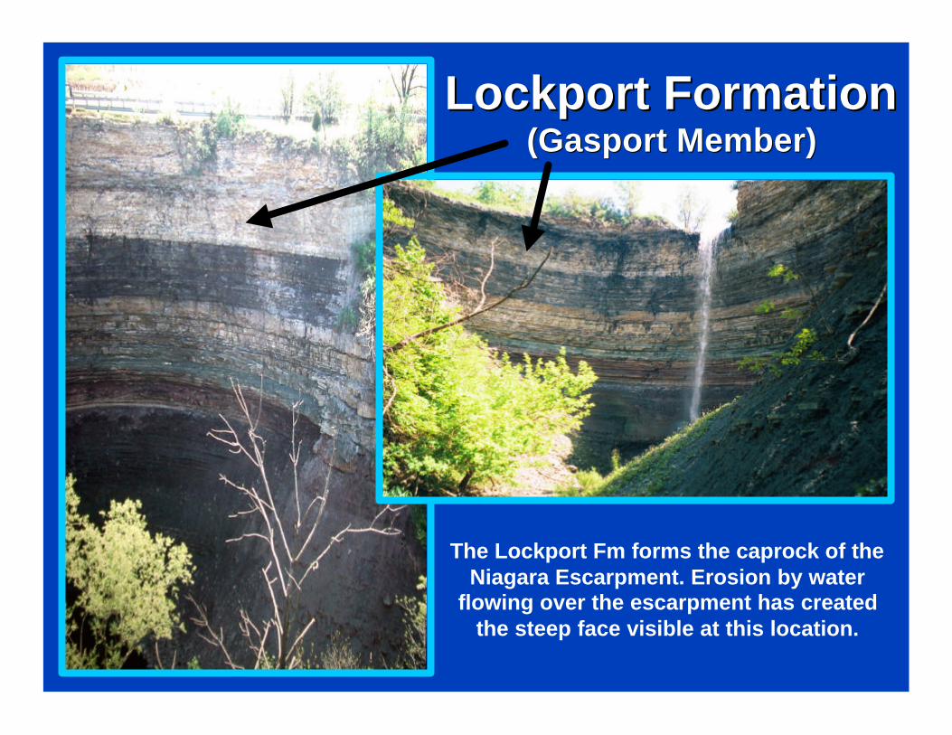
Lockport FormationLockport Formation(Gasport Member)(Gasport Member)
The Lockport Fm forms the caprock of the Niagara Escarpment. Erosion by water
flowing over the escarpment has created the steep face visible at this location.
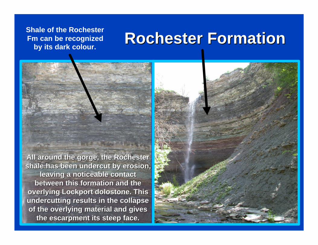
Rochester FormationRochester FormationShale of the Rochester Fm can be recognized
by its dark colour.
All around the gorge, the Rochester All around the gorge, the Rochester shale has been undercut by erosion, shale has been undercut by erosion,
leaving a noticeable contact leaving a noticeable contact between this formation and the between this formation and the
overlying Lockport dolostone. This overlying Lockport dolostone. This undercutting results in the collapse undercutting results in the collapse of the overlying material and gives of the overlying material and gives
the escarpment its steep face. the escarpment its steep face.
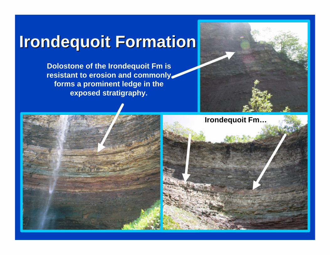
Irondequoit FormationIrondequoit Formation
Irondequoit Fm…Irondequoit Fm…
Dolostone of the Irondequoit Fm is resistant to erosion and commonly
forms a prominent ledge in the exposed stratigraphy.
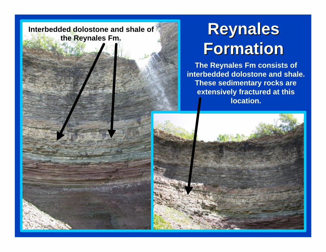
Reynales Reynales FormationFormation
The Reynales Fm consists of interbedded dolostone and shale.
These sedimentary rocks are extensively fractured at this
location.
Interbedded dolostone and shale of Interbedded dolostone and shale of the Reynales Fm.the Reynales Fm.
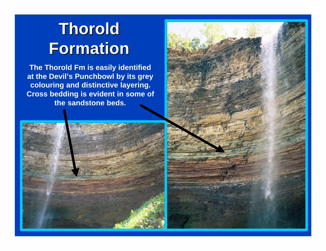
Thorold Thorold FormationFormation
The Thorold Fm is easily identified at the Devil’s Punchbowl by its grey colouring and distinctive layering.
Cross bedding is evident in some of the sandstone beds.
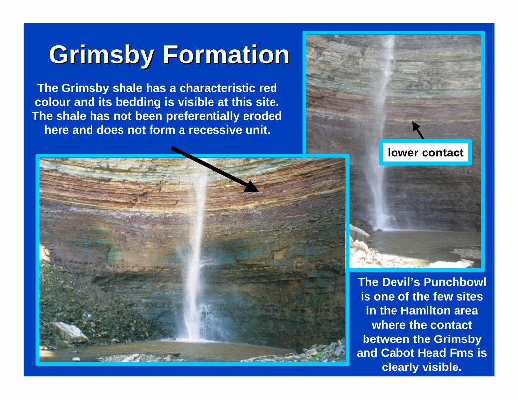
Grimsby FormationGrimsby Formation
The Devil’s Punchbowl is one of the few sites in the Hamilton area where the contact
between the Grimsby and Cabot Head Fms is
clearly visible.
lower contact
The Grimsby shale has a characteristic red colour and its bedding is visible at this site. The shale has not been preferentially eroded
here and does not form a recessive unit.
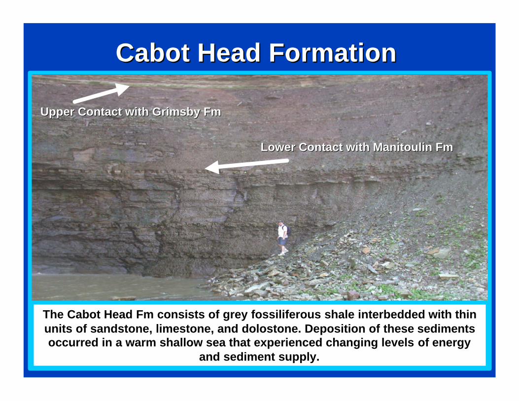
Cabot Head FormationCabot Head Formation
Upper Contact with Grimsby FmUpper Contact with Grimsby Fm
Lower Contact with Manitoulin FmLower Contact with Manitoulin Fm
The Cabot Head Fm consists of grey fossiliferous shale interbedded with thin units of sandstone, limestone, and dolostone. Deposition of these sediments occurred in a warm shallow sea that experienced changing levels of energy
and sediment supply.
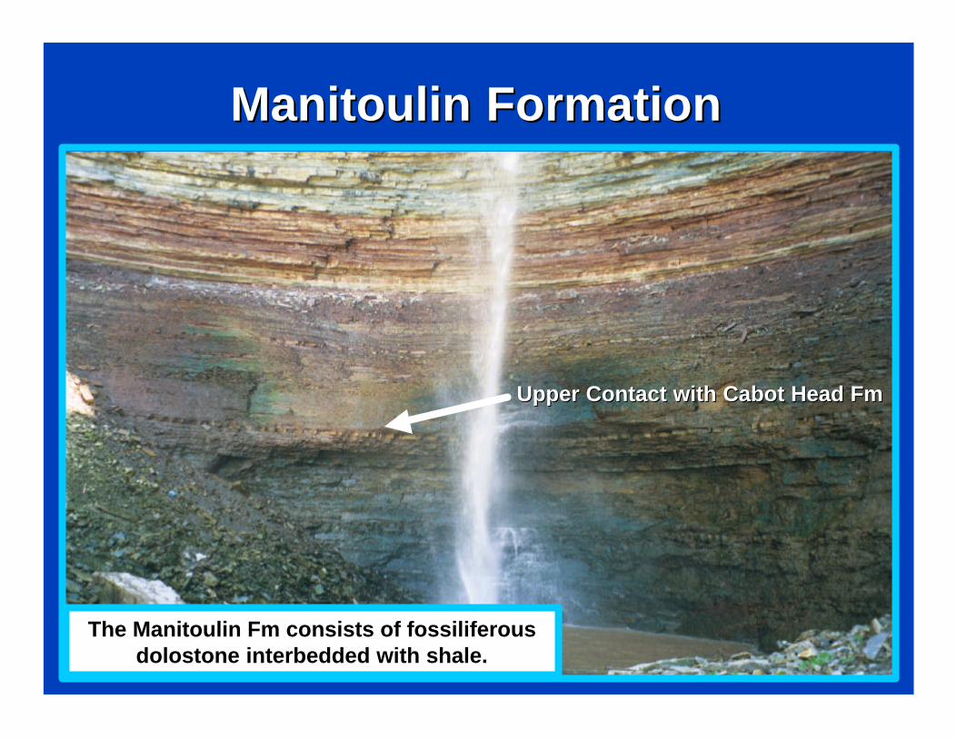
Manitoulin FormationManitoulin Formation
The Manitoulin Fm consists of fossiliferous dolostone interbedded with shale.
Upper Contact with Cabot Head FmUpper Contact with Cabot Head Fm
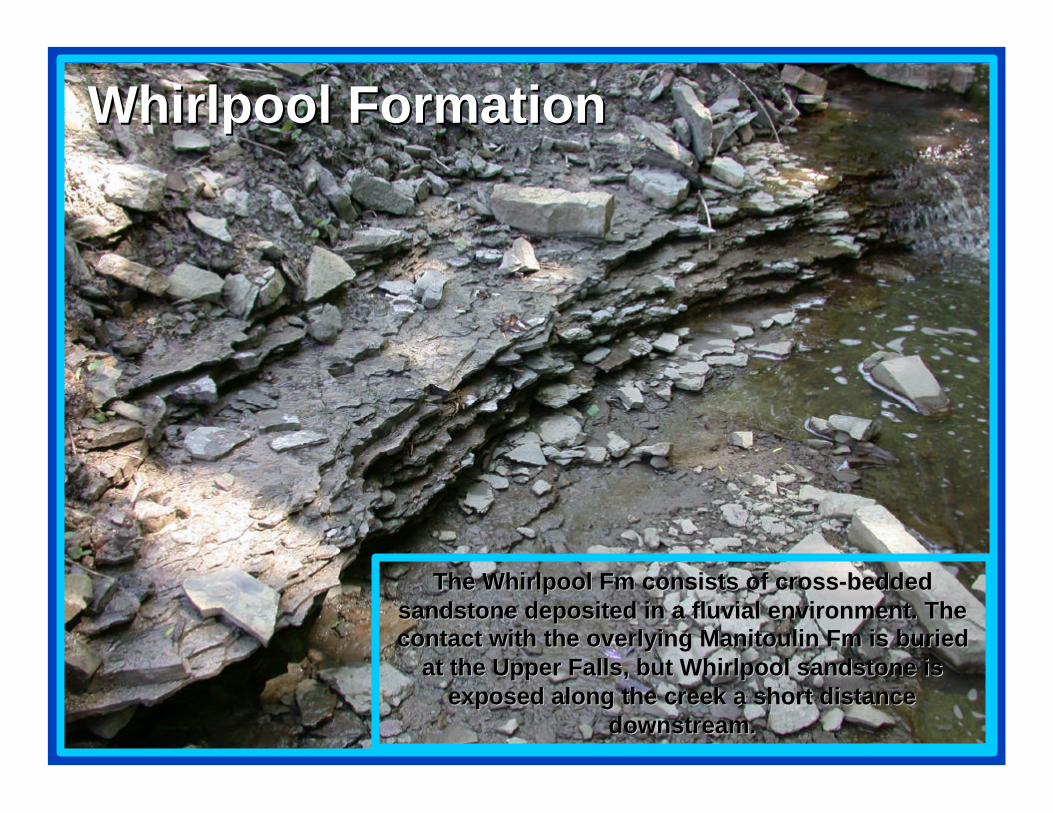
The Whirlpool Fm consists of crossThe Whirlpool Fm consists of cross--bedded bedded sandstone deposited in a fluvial environment. The sandstone deposited in a fluvial environment. The contact with the overlying Manitoulin Fm is buried contact with the overlying Manitoulin Fm is buried
at the Upper Falls, but Whirlpool sandstone is at the Upper Falls, but Whirlpool sandstone is exposed along the creek a short distance exposed along the creek a short distance
downstream. downstream.
Whirlpool FormationWhirlpool Formation
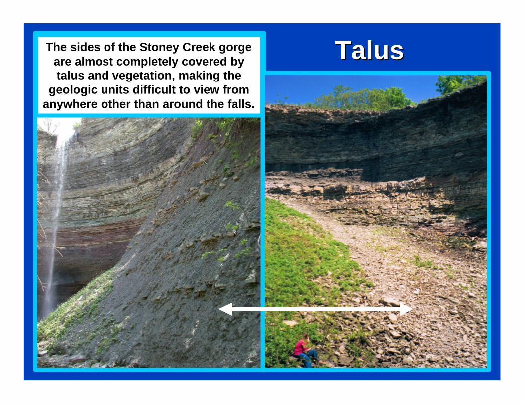
TalusTalusThe sides of the Stoney Creek gorge are almost completely covered by talus and vegetation, making the
geologic units difficult to view from anywhere other than around the falls.
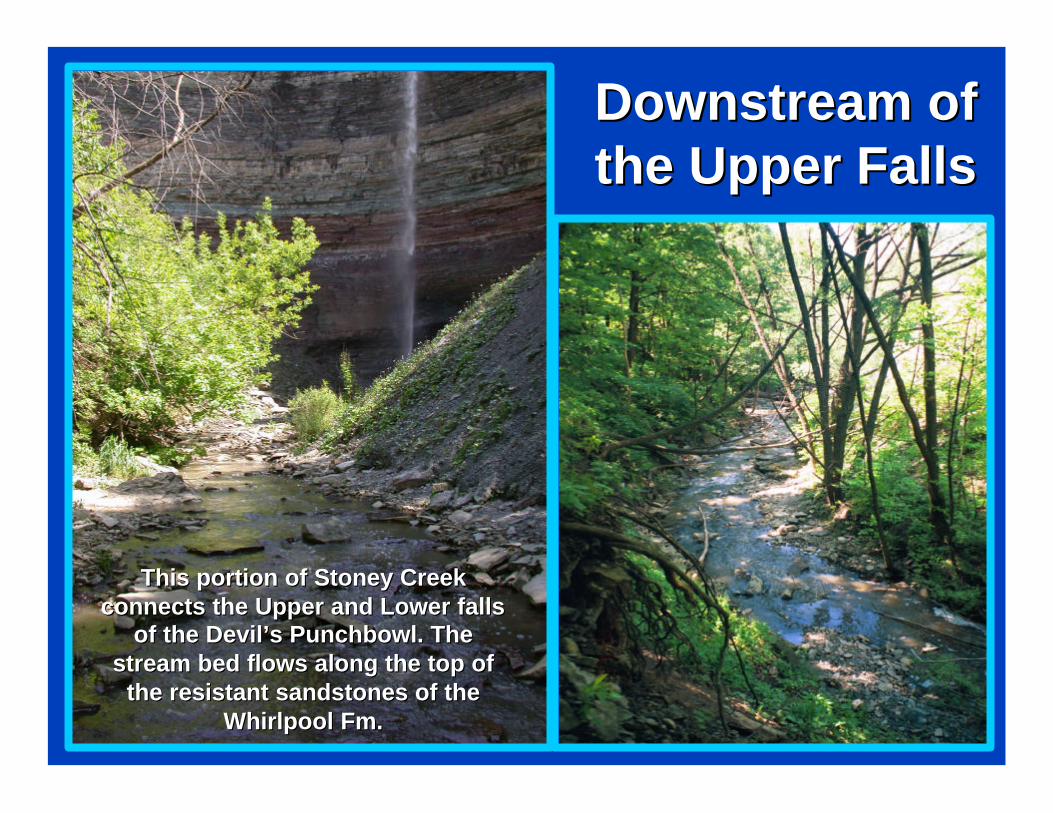
Downstream of Downstream of the Upper Falls the Upper Falls
This portion of Stoney Creek This portion of Stoney Creek connects the Upper and Lower falls connects the Upper and Lower falls
of the Devil’s Punchbowl. The of the Devil’s Punchbowl. The stream bed flows along the top of stream bed flows along the top of
the resistant sandstones of the the resistant sandstones of the Whirlpool Fm.Whirlpool Fm.
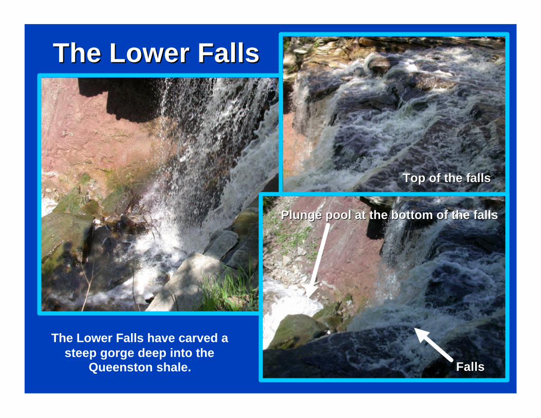
The Lower FallsThe Lower Falls
The Lower Falls have carved a steep gorge deep into the
Queenston shale.
Top of the fallsTop of the falls
Plunge pool at the bottom of the fallsPlunge pool at the bottom of the falls
FallsFalls
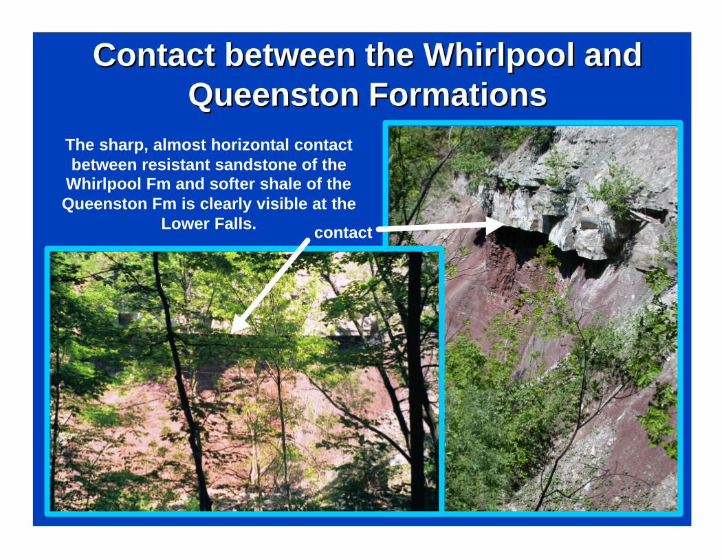
Contact between the Whirlpool and Contact between the Whirlpool and Queenston FormationsQueenston Formations
The sharp, almost horizontal contact between resistant sandstone of the
Whirlpool Fm and softer shale of the Queenston Fm is clearly visible at the
Lower Falls. contact
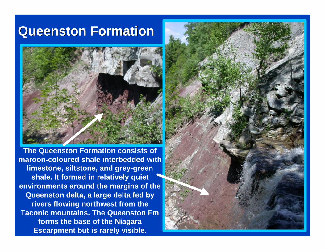
The Queenston Formation consists of maroon-coloured shale interbedded with
limestone, siltstone, and grey-green shale. It formed in relatively quiet
environments around the margins of the Queenston delta, a large delta fed by
rivers flowing northwest from the Taconic mountains. The Queenston Fm
forms the base of the Niagara Escarpment but is rarely visible.
Queenston FormationQueenston Formation
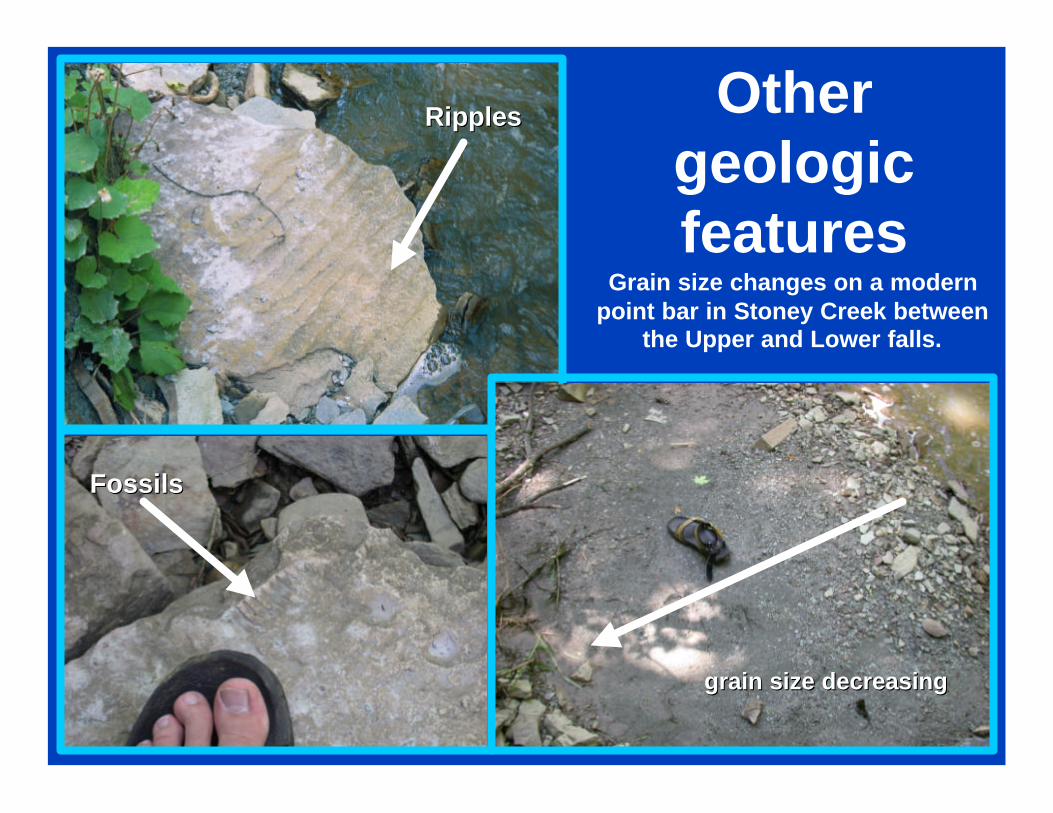
Other geologic features
grain size decreasinggrain size decreasing
Grain size changes on a modern point bar in Stoney Creek between
the Upper and Lower falls.
RipplesRipples
FossilsFossils
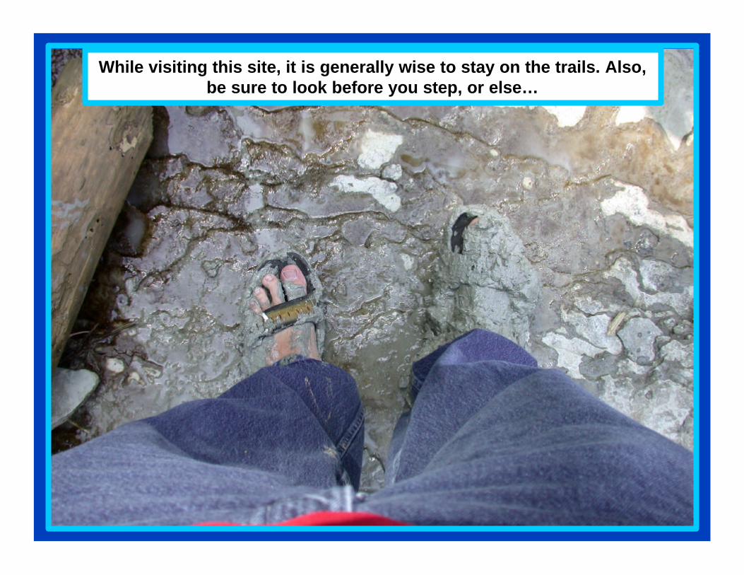
While visiting this site, it is generally wise to stay on the trails. Also, be sure to look before you step, or else…
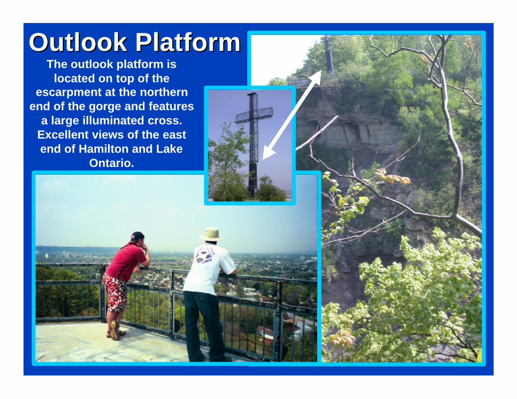
Outlook PlatformOutlook PlatformThe outlook platform is
located on top of the escarpment at the northern
end of the gorge and features a large illuminated cross.
Excellent views of the east end of Hamilton and Lake
Ontario.
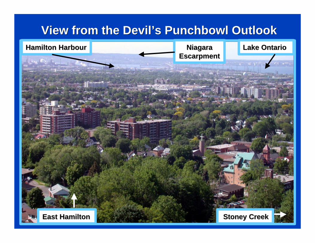
View from the Devil’s Punchbowl OutlookView from the Devil’s Punchbowl Outlook
East HamiltonEast Hamilton Stoney CreekStoney Creek
Niagara Niagara EscarpmentEscarpment
Lake OntarioLake OntarioHamilton HarbourHamilton Harbour
Acknowledgements:Acknowledgements:
Map Source Data: DMTI Spatial Inc.Map Source Data: DMTI Spatial Inc.
Photographs by Ben Cowie, Luisa DaSilva, Photographs by Ben Cowie, Luisa DaSilva, Liz Kenny, and Zachary WindusLiz Kenny, and Zachary Windus
Field assistance from Mark FranciscoField assistance from Mark Francisco
Based on earlier slide field trip prepared by Alvin Based on earlier slide field trip prepared by Alvin Chan and Sandra RolphChan and Sandra Rolph