dholera & auric srikanth kommu - geospatial … simulation corridor model for shendra (auric...
TRANSCRIPT
Geospatial World 2018 Geospatial World 2018
BIM for Infrastructure Projects
Srikanth Kommu
General Manager
DMICDC
DELHI MUMBAI INDUSTRIAL CORRIDOR
DEVELOPMENT CORPORATION
Dholera & Auric
13/02/2018 DMICDC 1
Industrial Cities
Geospatial World 2018 Geospatial World 2018
13/02/2018 2 DMICDC
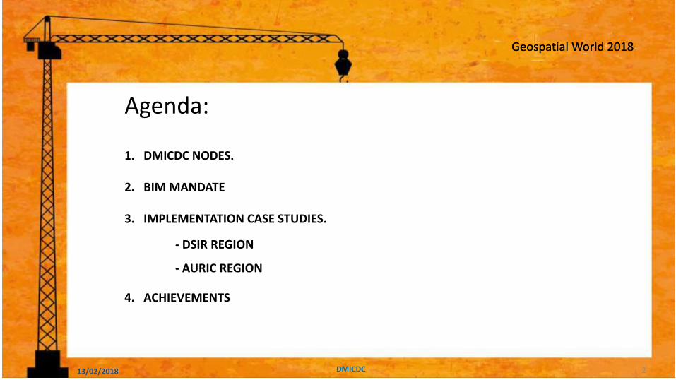
Agenda:
1. DMICDC NODES.
2. BIM MANDATE
3. IMPLEMENTATION CASE STUDIES.
- DSIR REGION
- AURIC REGION
4. ACHIEVEMENTS
Geospatial World 2018
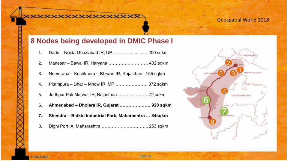
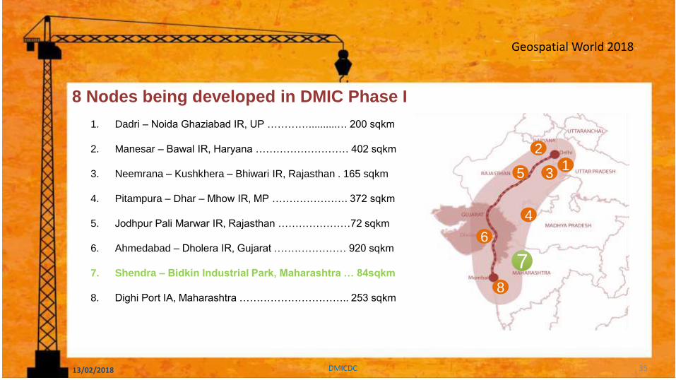
1. Dadri – Noida Ghaziabad IR, UP …………..........… 200 sqkm
2. Manesar – Bawal IR, Haryana ……………………… 402 sqkm
3. Neemrana – Kushkhera – Bhiwari IR, Rajasthan . 165 sqkm
4. Pitampura – Dhar – Mhow IR, MP …………………. 372 sqkm
5. Jodhpur Pali Marwar IR, Rajasthan …………………72 sqkm
6. Ahmedabad – Dholera IR, Gujarat ………………… 920 sqkm
7. Shendra – Bidkin Industrial Park, Maharashtra … 84sqkm
8. Dighi Port IA, Maharashtra ………………………….. 253 sqkm
1
2
3
4
5
8
6
8 Nodes being developed in DMIC Phase I
13/02/2018 DMICDC 3
7

Geospatial World 2018
3D Model Driven Approach Mandate for DMIC Nodes
– DMIC mandates the use of advanced computer based dynamic 3D-model driven approach for:
• Detailed planning
• Design, engineering
• Construction, and operation of the DMIC nodes.
– To allow:
• Simulation
• Visualization and engineering analysis
of all transportation, utility, building, civil works and geospatial infrastructures.
– The 3D Infrastructure Information Models are
to be used throughout the design,
construction and operational life-cycle of the
asset, including:-
• System collision detections
• Materials quantification
• Construction sequencing
• Project reviews
• Decision support
• Design analysis, and
• Quality assurance.
all phases of this program.
13/02/2018 DMICDC 4
Geospatial World 2018
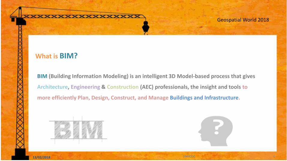
BIM (Building Information Modeling) is an intelligent 3D Model-based process that gives
Architecture, Engineering & Construction (AEC) professionals, the insight and tools to
more efficiently Plan, Design, Construct, and Manage Buildings and Infrastructure.
What is BIM?
13/02/2018 DMICDC 5
Geospatial World 2018
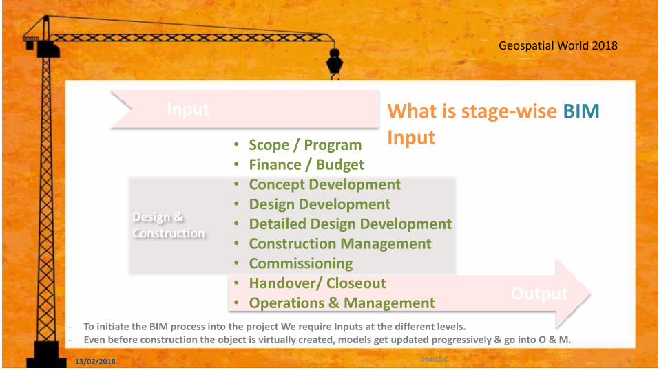
Design & Construction
Input What is stage-wise BIM Input
Output
- To initiate the BIM process into the project We require Inputs at the different levels. - Even before construction the object is virtually created, models get updated progressively & go into O & M.
• Scope / Program • Finance / Budget • Concept Development • Design Development • Detailed Design Development • Construction Management • Commissioning • Handover/ Closeout • Operations & Management
13/02/2018 DMICDC 6

Geospatial World 2018
What is BIM Input & Output Collaboration
2D Input to 3D Output Transformation
13/02/2018 DMICDC 7
Geospatial World 2018
13/02/2018 DMICDC 8

Geospatial World 2018
2010
Building Information Modelling – Case Studies.
13/02/2018 DMICDC 9
Geospatial World 2018 Geospatial World 2018
DHOLERA
SPECIAL
INVESTMENT
REGION
DHOLERA INDUSTRIAL CITY DEVELOPMENT LIMITED A “Platinum” Rated Green
City 13/02/2018 DMICDC 10

Geospatial World 2018
2010
Dholera Industrial City – The pivot of Resurgence of the Country & investment potential
13/02/2018 DMICDC 11

Geospatial World 2018
Activation Area 2010 Phase-2 Phase-1
Tim
eli
ne
Project Development Preliminary
Design Tendering and
Award
Detail Design and
Construction Handover
Operation & Maintenance S
tag
es
Roads Rail/Transit Airport Bridges Portable Water Recycle Water Industrial Water Waste Water
Storm Solid Waste
Treatment
Facilities
WTP/CETP/STP
Flood Management
Power Transmission &
Distribution Gas ICT Network
Administration Buildings
Analysis Simulatio
n Clash
Detection Estimatio
n
Construction
Sequencing
Design Review
Quality Assuranc
e
Infr
astr
uc
ture
O
bje
cti
ve
‘Information’ Considerations
Phase-3 2042 2010 2019 2025 2035
Project
Start
Project
Completion
13/02/2018 DMICDC 12
Geospatial World 2018
13/02/2018 DMICDC 13

Geospatial World 2018
2010
Why?
• Nationwide BIM Mandate
• Project BIM Mandate
• A differentiator to competition
• Demonstrate Leadership
• Standardize Project Delivery Process
• Improve profitability
13/02/2018 DMICDC 14
Geospatial World 2018
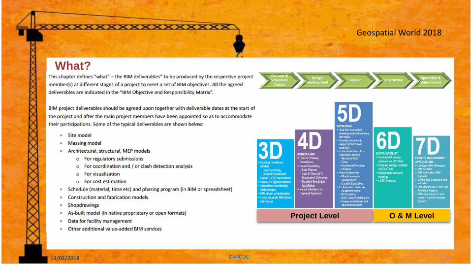
2010
What? Concept & Schematic
Design
Design Development
Tender Construction Operation & Maintenance
Project Level O & M Level
13/02/2018 DMICDC 15
Geospatial World 2018
2010
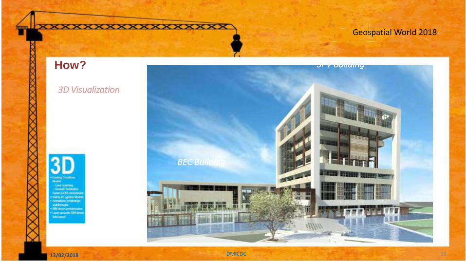
How?
3D Visualization
BEC Building
SPV Building
13/02/2018 DMICDC 16

Geospatial World 2018
2010
How?
Schedule Simulation/4D/Construction Planning
• Clash Detection & Coordination
• Program sequencing
• Improved quality
13/02/2018 DMICDC 17

Geospatial World 2018
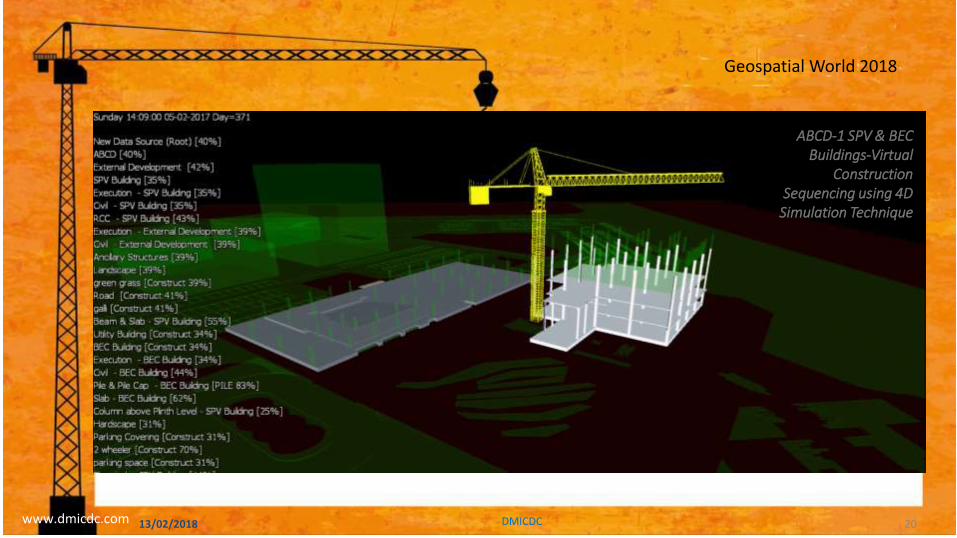
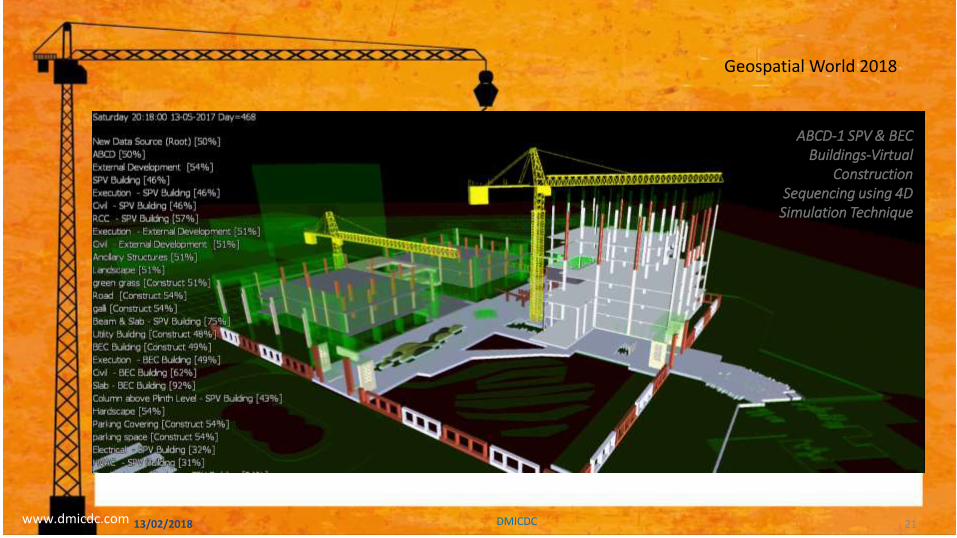
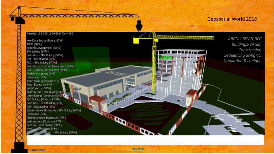
ABCD-1 SPV & BEC Buildings-Virtual
Construction Sequencing using 4D
Simulation Technique
13/02/2018 DMICDC 18

Geospatial World 2018
ABCD-1 SPV & BEC Buildings-Virtual
Construction Sequencing using 4D
Simulation Technique
13/02/2018 DMICDC 19
Geospatial World 2018
2010
Virtual Construction Sequencing using 4D Simulation Technique
www.dmicdc.com
ABCD-1 SPV & BEC Buildings-Virtual
Construction Sequencing using 4D
Simulation Technique
13/02/2018 DMICDC 20
Geospatial World 2018
2010
Virtual Construction Sequencing using 4D Simulation Technique
www.dmicdc.com
ABCD-1 SPV & BEC Buildings-Virtual
Construction Sequencing using 4D
Simulation Technique
13/02/2018 DMICDC 21
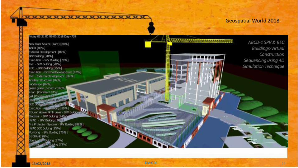
Geospatial World 2018
ABCD-1 SPV & BEC Buildings-Virtual
Construction Sequencing using 4D
Simulation Technique
13/02/2018 DMICDC 22
Geospatial World 2018
ABCD-1 SPV & BEC Buildings-Virtual
Construction Sequencing using 4D
Simulation Technique
13/02/2018 DMICDC 23

Geospatial World 2018
www.dmicdc.com
ABCD-1 SPV & BEC Buildings-Virtual
Construction Sequencing using 4D
Simulation Technique
13/02/2018 DMICDC 24

Geospatial World 2018
2010
How?
5D – Estimation Quantity Cost
13/02/2018 DMICDC 25
Geospatial World 2018
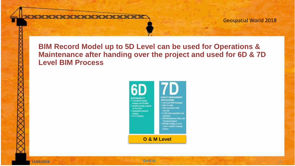
2010 BIM Record Model up to 5D Level can be used for Operations & Maintenance after handing over the project and used for 6D & 7D Level BIM Process
O & M Level
13/02/2018 DMICDC 26
Geospatial World 2018
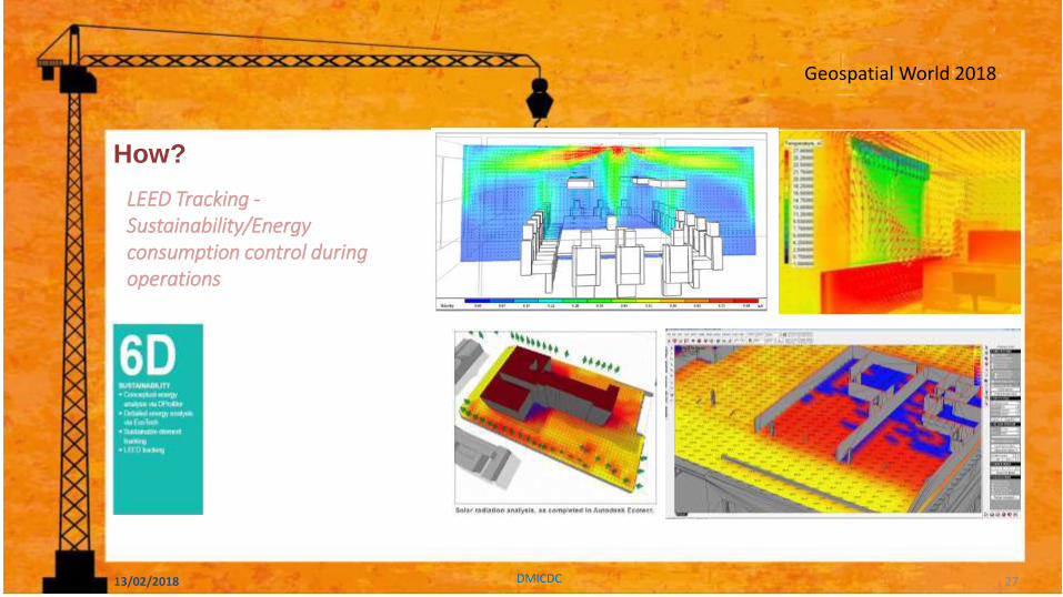
2010 How?
LEED Tracking -Sustainability/Energy consumption control during operations
13/02/2018 DMICDC 27

Geospatial World 2018
BIM for Facilities and Asset Management
How?
13/02/2018 DMICDC 28

Geospatial World 2018
Design & Construction O & M
BIM Stages
Projects
* 5D and 6D are being attempted to implement as EPC Contractor’s capabilities are limited
13/02/2018 DMICDC 29
Achievements - dholera
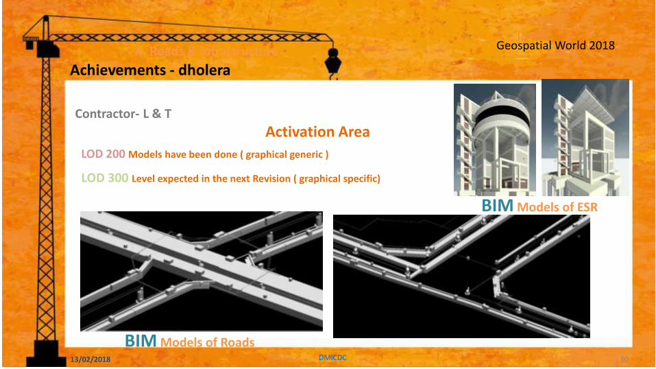
Geospatial World 2018 A. Roads & Infrastructure
Contractor- L & T
LOD 200 Models have been done ( graphical generic )
LOD 300 Level expected in the next Revision ( graphical specific)
Activation Area
BIM Models of ESR
BIM Models of Roads 13/02/2018 DMICDC 30
Achievements - dholera
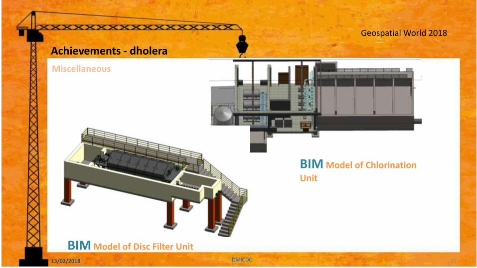
Geospatial World 2018
BIM Model of Chlorination
Unit
BIM Model of Disc Filter Unit
Miscellaneous
13/02/2018 DMICDC 31
Achievements - dholera
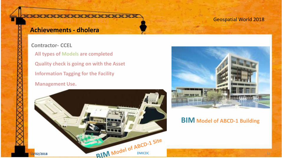
Geospatial World 2018 B. ABCD-1 (SPV & BEC)
Contractor- CCEL
All types of Models are completed
Quality check is going on with the Asset
Information Tagging for the Facility
Management Use.
BIM Model of ABCD-1 Building
13/02/2018 DMICDC 32
Achievements - dholera
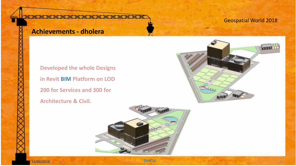
Geospatial World 2018
Developed the whole Designs
in Revit BIM Platform on LOD
200 for Services and 300 for
Architecture & Civil.
C. ABCD-2 (City Integrated Operations Centre)
13/02/2018 DMICDC 33
Achievements - dholera
Geospatial World 2018 Geospatial World 2018
Case Study 13/02/2018
34
Geospatial World 2018
1. Dadri – Noida Ghaziabad IR, UP …………..........… 200 sqkm
2. Manesar – Bawal IR, Haryana ……………………… 402 sqkm
3. Neemrana – Kushkhera – Bhiwari IR, Rajasthan . 165 sqkm
4. Pitampura – Dhar – Mhow IR, MP …………………. 372 sqkm
5. Jodhpur Pali Marwar IR, Rajasthan …………………72 sqkm
6. Ahmedabad – Dholera IR, Gujarat ………………… 920 sqkm
7. Shendra – Bidkin Industrial Park, Maharashtra … 84sqkm
8. Dighi Port IA, Maharashtra ………………………….. 253 sqkm
1
2
3
4
5
6
8
7
8 Nodes being developed in DMIC Phase I
13/02/2018 DMICDC 35
Geospatial World 2018
13/02/2018 DMICDC
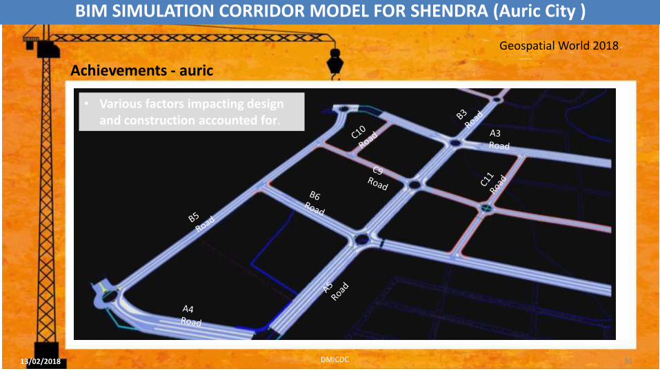
• Various factors impacting design and construction accounted for.
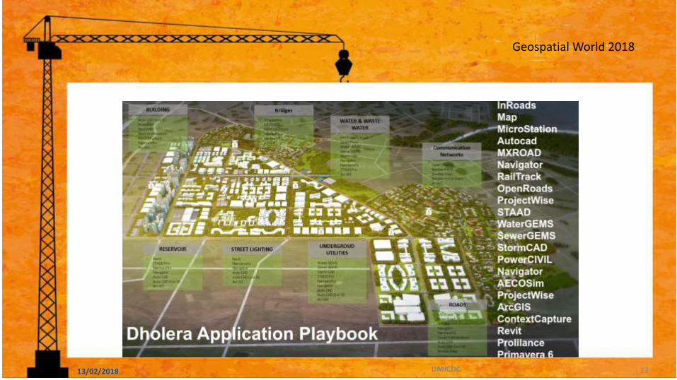
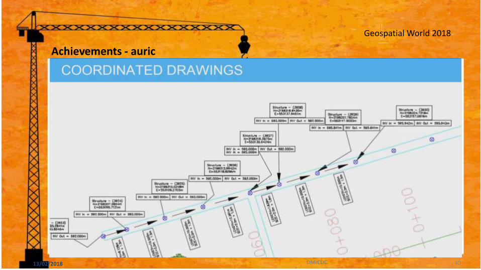
BIM SIMULATION CORRIDOR MODEL FOR SHENDRA (Auric City )
36
Achievements - auric

Geospatial World 2018
CABLE TRENCH
RESIDENTIAL SEWAGE
FIRE FIGHTING
POTABLE WATER
GRAVITY MAIN
STORM WATER DRAIN
STORM WATER PIPE
13/02/2018 DMICDC
• Aggregation/ intensity of interferences detected aided in determination of priority zones and element types such as residential sewerage line, cable trench etc.
• Later in the design process, and particularly for pre-construction planning stage, interference severity criteria was defined and interference rules configured that helped in supporting element level coordination.
Geospatial World 2018
13/02/2018 DMICDC
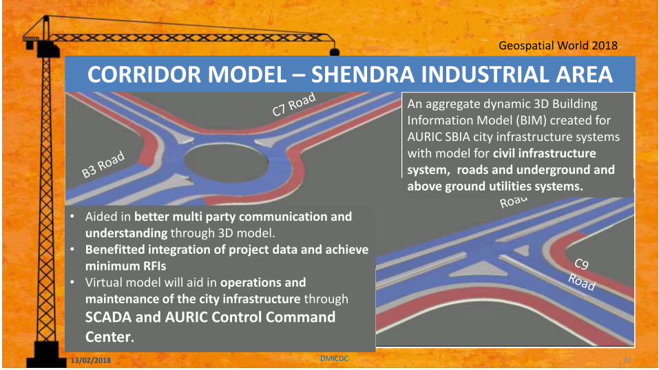
CORRIDOR MODEL – SHENDRA INDUSTRIAL AREA An aggregate dynamic 3D Building Information Model (BIM) created for AURIC SBIA city infrastructure systems with model for civil infrastructure system, roads and underground and above ground utilities systems.
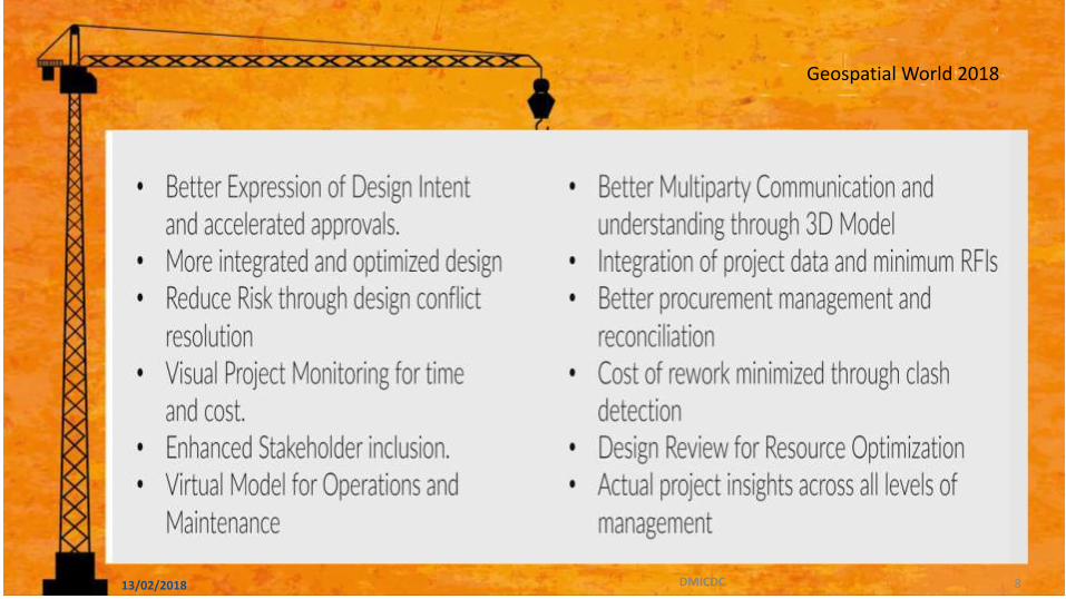
• Aided in better multi party communication and understanding through 3D model.
• Benefitted integration of project data and achieve minimum RFIs
• Virtual model will aid in operations and maintenance of the city infrastructure through
SCADA and AURIC Control Command Center.
38
Geospatial World 2018
13/02/2018 DMICDC
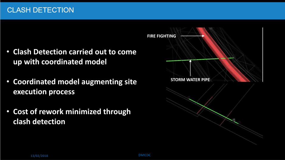
FIRE FIGHTING
• Clash Detection carried out to come up with coordinated model
• Coordinated model augmenting site execution process
• Cost of rework minimized through clash detection
STORM WATER PIPE
Geospatial World 2018
13/02/2018 DMICDC 40
Achievements - auric
Geospatial World 2018
13/02/2018 DMICDC
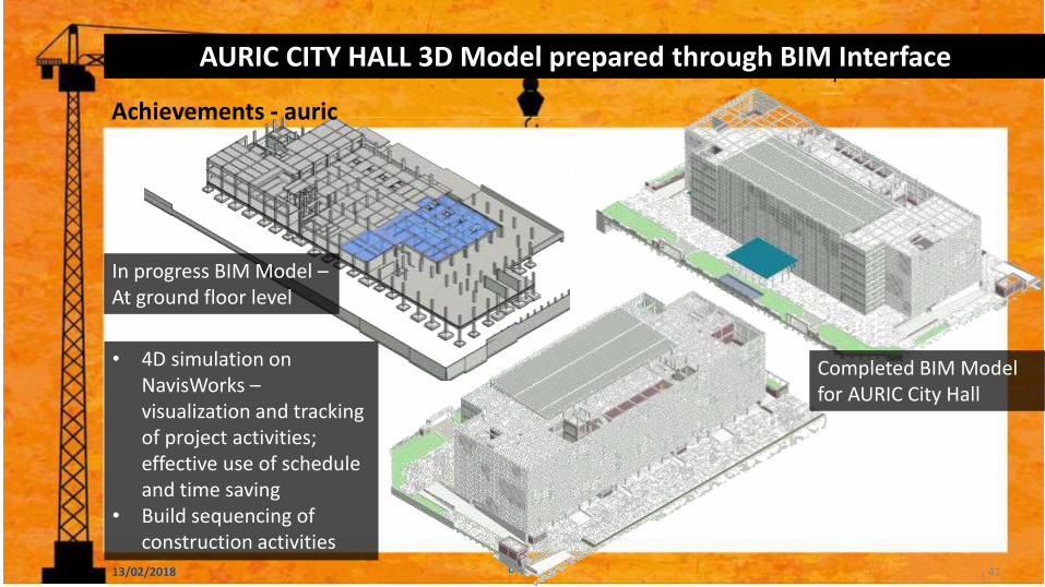
AURIC CITY HALL 3D Model prepared through BIM Interface
Completed BIM Model for AURIC City Hall
In progress BIM Model – At ground floor level
• 4D simulation on NavisWorks – visualization and tracking of project activities; effective use of schedule and time saving
• Build sequencing of construction activities
41
Achievements - auric
Geospatial World 2018
13/02/2018 DMICDC
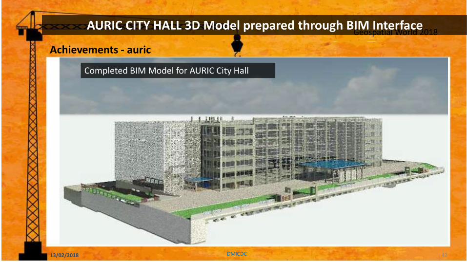
AURIC CITY HALL 3D Model prepared through BIM Interface
Completed BIM Model for AURIC City Hall
42
Achievements - auric
Geospatial World 2018
13/02/2018 DMICDC
AURIC CITY HALL 3D Model prepared through BIM Interface
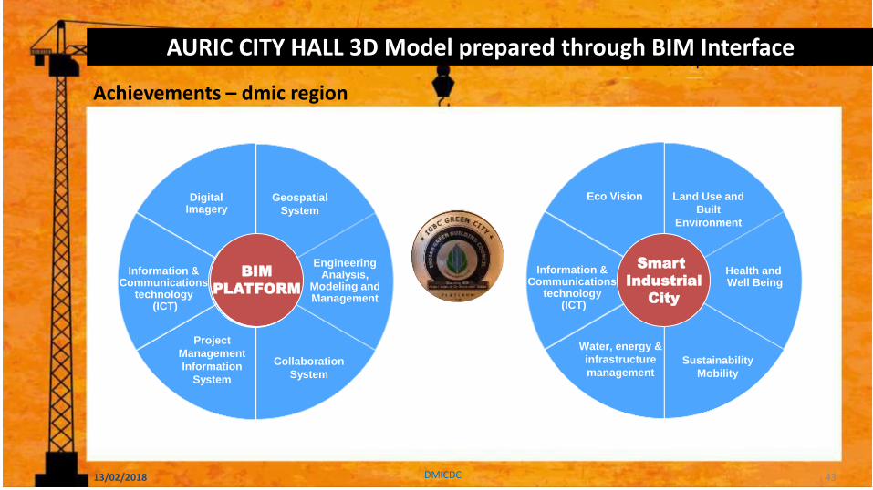
43
Geospatial
System
Engineering Analysis,
Modeling and Management
Collaboration
System
Project
Management
Information
System
Information & Communications
technology (ICT)
Digital Imagery
Digital
DHOLERA
Land Use and
Built
Environment
Health and Well Being
Sustainability
Mobility
Water, energy &
infrastructure
management
Information & Communications
technology (ICT)
Eco Vision
Smart
Industrial
City
Achievements – dmic region
BIM
PLATFORM
Geospatial World 2018
THANK YOU
www.dmicdc.com 13/02/2018 DMICDC