directions - doris.bmk.gv.at
TRANSCRIPT
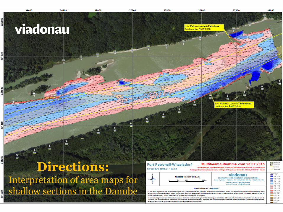
Directions: Interpretation of area maps for shallow sections in the Danube
RIGHT RIVERBANK
LEFT RIVERBANK
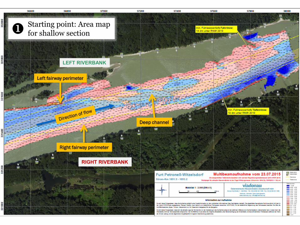
Starting point: Area map for shallow section
Left fairway perimeter
Right fairway perimeter
Deep channel

Where is the measurment data for the critical area taken from?
Bright red values = fairway depths between 2.00 m and 2.50 m - at date of measurement (in the example: 07/23/2015) - at Low Navigable Water Level (LNWL 2010)
further depth levels are indicated in accordance with the scale

Where is the measurement data for the shallowest part of the fairway taken from?
Minimum water depth in the fairway (entire width) below LNWL 2010 at date of measurement
Minimum water depth in the deep channel * below LNWL 2010 at date of measurement
* Deep channel = the area of the fairway which has the width required for a 4-unit convoy travelling downstream. The respective width of the fairway is dependant on the river bend radii involved. Accordingly, passing and overtaking within the confines of the deep channel is generally not possible. When necessary, and in accordance with Articles 6.04, 6.05 and 6.10 of the Waterway Traffic Act, vessels should wait at a suitable location until it is possible to proceed through a shallow area using the deep channel of the main fairway.
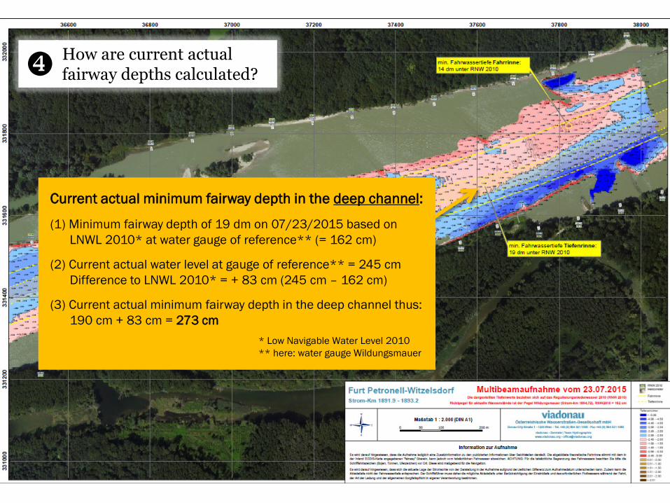
How are current actual fairway depths calculated?
Current actual minimum fairway depth in the deep channel:
(1) Minimum fairway depth of 19 dm on 07/23/2015 based on LNWL 2010* at water gauge of reference** (= 162 cm)
(2) Current actual water level at gauge of reference** = 245 cm Difference to LNWL 2010* = + 83 cm (245 cm – 162 cm)
(3) Current actual minimum fairway depth in the deep channel thus: 190 cm + 83 cm = 273 cm
* Low Navigable Water Level 2010 ** here: water gauge Wildungsmauer
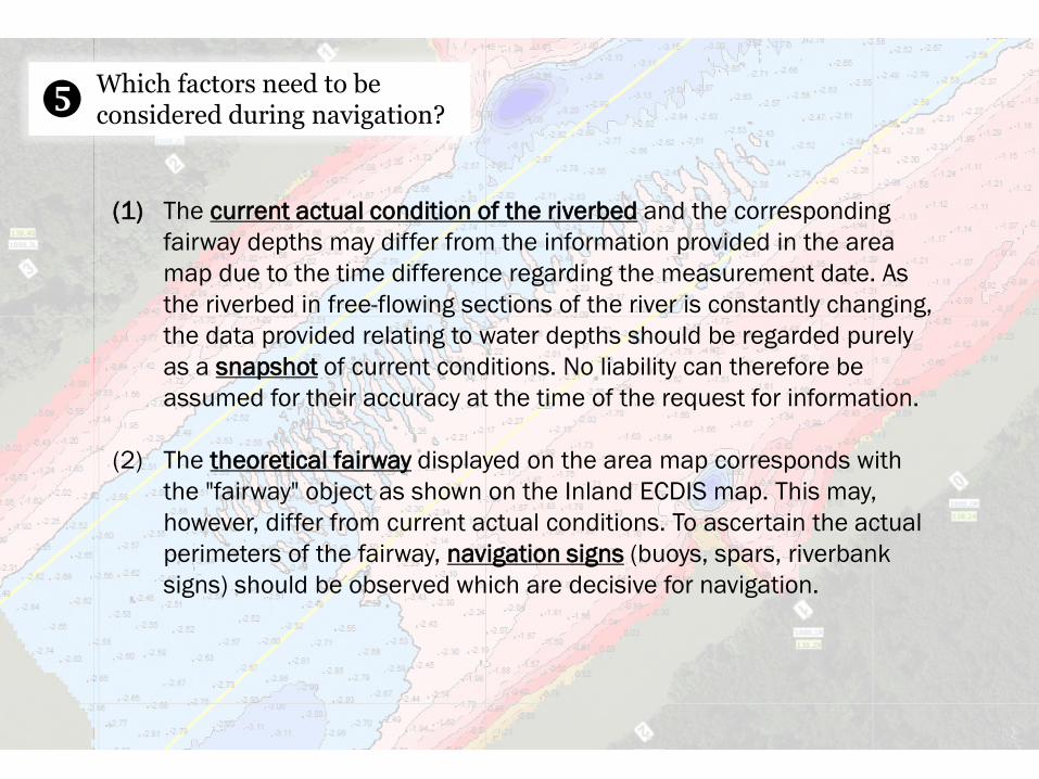
(1) The current actual condition of the riverbed and the corresponding fairway depths may differ from the information provided in the area map due to the time difference regarding the measurement date. As the riverbed in free-flowing sections of the river is constantly changing, the data provided relating to water depths should be regarded purely as a snapshot of current conditions. No liability can therefore be assumed for their accuracy at the time of the request for information.
(2) The theoretical fairway displayed on the area map corresponds with
the "fairway" object as shown on the Inland ECDIS map. This may, however, differ from current actual conditions. To ascertain the actual perimeters of the fairway, navigation signs (buoys, spars, riverbank signs) should be observed which are decisive for navigation.
Which factors need to be considered during navigation?

(3) No liability can be assumed for the accuracy of information, at the time of the request for information, regarding the shorelines and the actual course of groynes represented on an area map. Once again, the relevant navigation signs (buoys, spars, riverbank signs) are to be observed to ensure safe navigation.
(4) The draught loaded of a vessel cannot correspond with the depth of
the fairway. The draught loaded of the ship must be added to the squat resulting from the speed of the vessel and the required keel clearance (= safety distance from the riverbed) in order to calculate the necessary fairway depth.
Which factors need to be considered during navigation?