
Report of work at ROB within the MAGE European Training Network
Véronique Dehant

Participant Name Position Research activity
Effective Expected
8. ROB-Brussels Véronique Dehant Professor 70 70
Tim Van Hoolst Professor 85 70
Pascale Defraigne Senior Scientist
30 50
René Warnant Senior Scientist
5 50
Fabian Roosbeek Senior Scientist
5 50
Marie Yseboodt Scientist 100 100
Pascal Rosenblatt Scientist 100 0
Ellen Van den Acker/Ozgur Karatekin
Scientist 100 100
Laurent Morel/Mikael Beuthe
Scientist 100 100
Attilio Rivoldini PhD student 100 100
Jean-Francois Bodart/Julien Duron
PhD student 100 100
Jacques Sleewaegen/ Olivier Verhoeven/ Gregor Pfyffer
Scientist/PhD student
100 100
Total ROB-Brussels
995 990
+ Valery LaineyMAGE Postdoc
PHOBOS/DEIMOS

Parameters :
•Temperature profile
•Bulk iron and olivine weight fraction
•Pressure gradient.
Modeling of the Martian mantle
Recently taken into account :•The effect of iron concentration in the respective minerals on the electrical conductivity
•The possible presence of partial melting in the upper mantle
• Empirical relation between olivine and the non-olivine mineralogical system.

Direct Problem
Direct Problem Inversion : Marginal density for temperature

Collaboration with U Nantes, CETP, IPGP, OMP
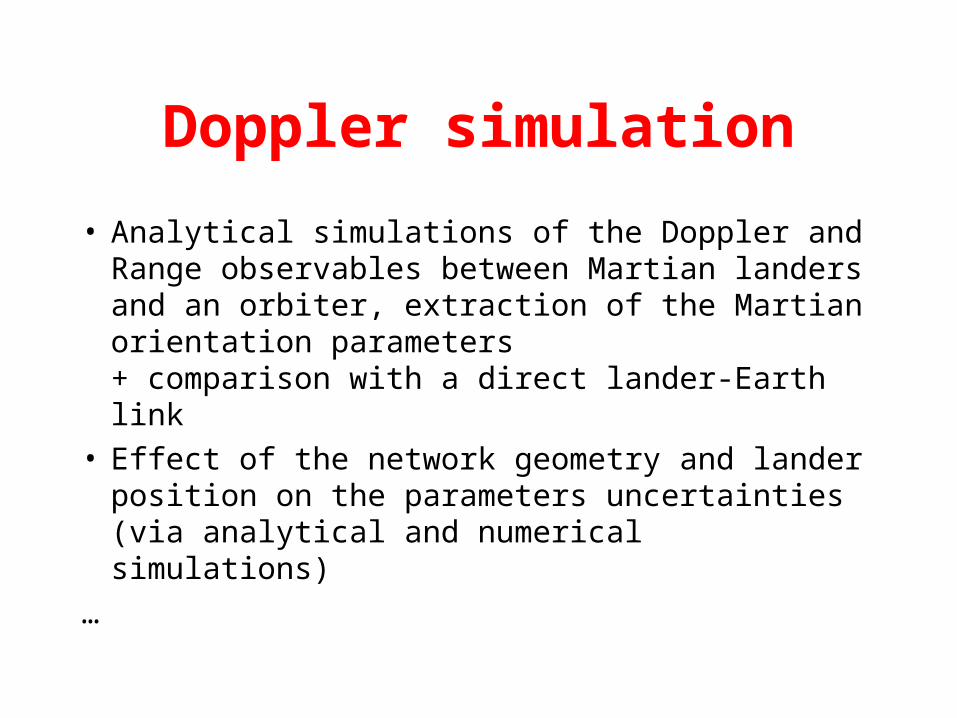
Doppler simulation
• Analytical simulations of the Doppler and Range observables between Martian landers and an orbiter, extraction of the Martian orientation parameters + comparison with a direct lander-Earth link
• Effect of the network geometry and lander position on the parameters uncertainties (via analytical and numerical simulations)
…

jours 7000700 700 700 7000 0 0

GINS : For accurate S/C Orbit DeterminationDYNAMO : For Geophysical Parameters Determination
S/C Tracking data from: the Earth the planetary surface
S/C Tracking data sets: Doppler & Ranging(corrected from propagation effect) “Angular” position of S/C w.r.t. planetary surface (MPO)
DYNAMONormal matrices
Stacking + Resolution
Physical & Dynamics parameters:gravity field, K2 Love number, station positions, …
A PRIORI ORBIT (numerical integration of S/C motion)
Gravity field + DE406 ephemeris (Sun, Mercury, Earth, …) + relativistic corrections + K2 Love Number + Librations+ Desaturation (epoch, intensity)+ Non-gravitational accelerations (or modeling)+ State Vector (from navigation or previous adjustment)
ADJUSTED ORBIT:State Vector, DesaturationData biases, modeling of non-gravitational forces
Predicted S/C Tracking data(given positions of the tracking stations)
Least Squares Adjustment onTRACKING MEASUREMENTS
GINS
Accelerometer data(or attitude mode: Quaternions)
Normal matrices:physical & dynamics information
MEASUREMENTS
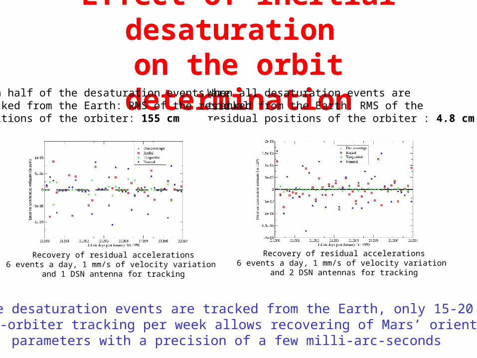
Effect of inertial desaturation on the orbit determination
When all the desaturation events are tracked from the Earth, only 15-20 minutes of lander-orbiter tracking per week allows recovering of Mars’ orientation
parameters with a precision of a few milli-arc-seconds
When all desaturation events are tracked from the Earth: RMS of the residual positions of the orbiter : 4.8 cm
Recovery of residual accelerations6 events a day, 1 mm/s of velocity variation
and 2 DSN antennas for tracking
When half of the desaturation events are tracked from the Earth: RMS of the residual positions of the orbiter: 155 cm
Recovery of residual accelerations6 events a day, 1 mm/s of velocity variation
and 1 DSN antenna for tracking

Variations of the low degree zonal (J2 to J5) coefficients of Mars’
gravity field
Strong seasonal variation of gravity field due to sublimation/condensation of
the atmospheric CO2
To constrain CO2 seasonal mass variations
between polar caps and the atmosphere
Prediction of changes of the first zonal terms of the gravity field provided by
GCM (Global Circulation Model) simulations of the atmosphere
Ls (Solar Longitude)From Laboratoire de Météorologie
Dynamique (LMD), France
From NASA
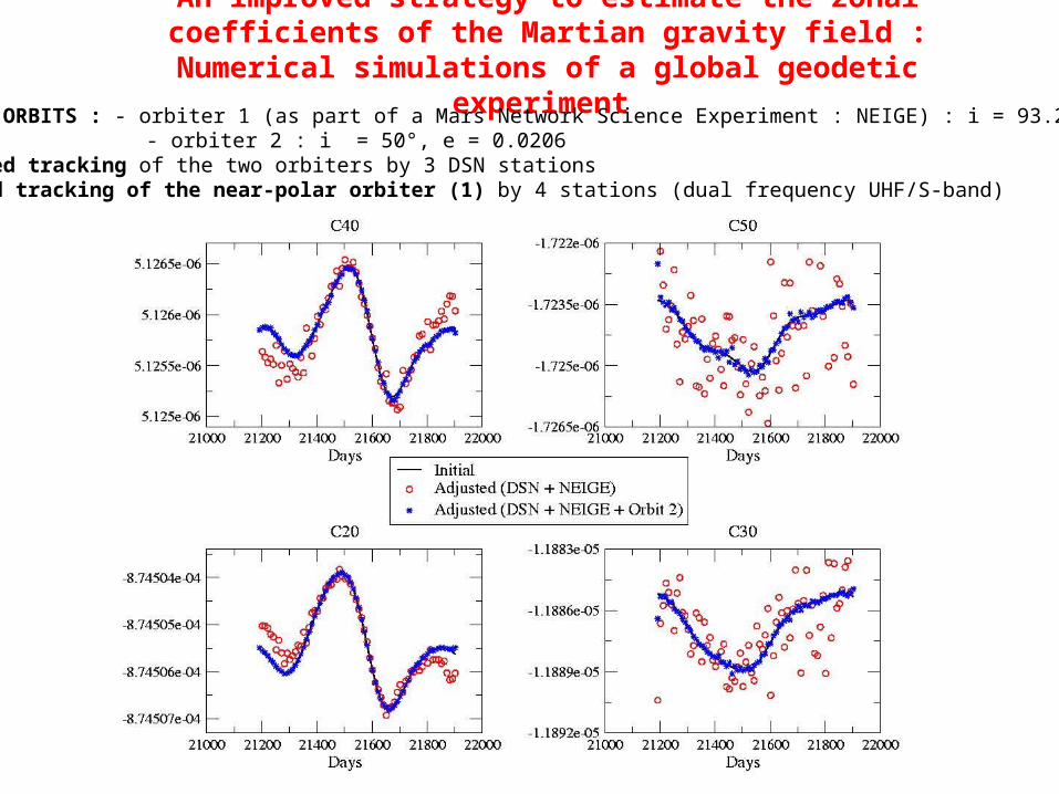
An improved strategy to estimate the zonal coefficients of the Martian gravity field : Numerical simulations of a global geodetic
experiment • Satellite ORBITS : - orbiter 1 (as part of a Mars Network Science Experiment : NEIGE) : i = 93.2°, e = 0.001
- orbiter 2 : i = 50°, e = 0.0206• Earth-based tracking of the two orbiters by 3 DSN stations• Mars-based tracking of the near-polar orbiter (1) by 4 stations (dual frequency UHF/S-band)

Martian lithosphere and wavelets
• Aim: lithosphere thickness on Mars• Method:1. Input data : topography2. Model : flexure of a thin elastic spherical shell3. Output : predicted gravity anomalies4. Localization of anomalies with spherical wavelets5. Comparison of predicted/observed gravity
anomalies• Conclusion: large thickness at Tharsis, small at
Hellas

Flexure model

Topography and gravity anomalies:the case of Mars
MGS RS and MOLA Science Teams: Zuber et al., 2000, Science 287, 1788.
Different mechanisms at work at different places:Ex1: isostatic compensation at Hellas
(no lithosphere resistance)Ex2: little compensation at Tharsis
(high lithosphere rigidity, or high loading density)Ex3: internal loading at Isidis
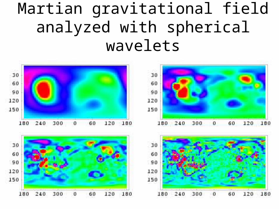
Martian gravitational field analyzed with spherical wavelets

Martian gravity anomalies from Mars Express data
Collaboration with:1. Jean-Pierre Barriot (CNES/Toulouse) for the software2. Martin Paetzold (PI of MaRS) for the data• Input data: line-of-sight Doppler residuals in areas
of interest (poles…)• Method: Least-squares inversion of residuals with a
priori knowledge • Result: local maps of gravity anomalies• Work in progress: data is coming!

Radio science dataon particular targets
ROB
determination of gravity anomalies
ROB+OMP
Knowledge of Phobos ephemerides
ROB+BdL
Interpretation in terms of properties of the interior of Phobos
ROB
Quality factor of MarsROB+IPGP
Study of lithosphere propertiesIPGP
Work in progress!Thanks to MAGE!


