dsd-int 2016 keynote lecture 2016: from global to local: the latest developments - verlaan
TRANSCRIPT

Outline
Motivation – global to local A Global Tide and Surge Model (GTSM): Delft3D FM
Initial model development Calibration with OpenDA Applications Towards the next version
Regional storm surge models Regional SAL effects
Innundation modelling (local) Innundation risk in Mozambique Xynthia flood

Impacts of storm December 6th 2013

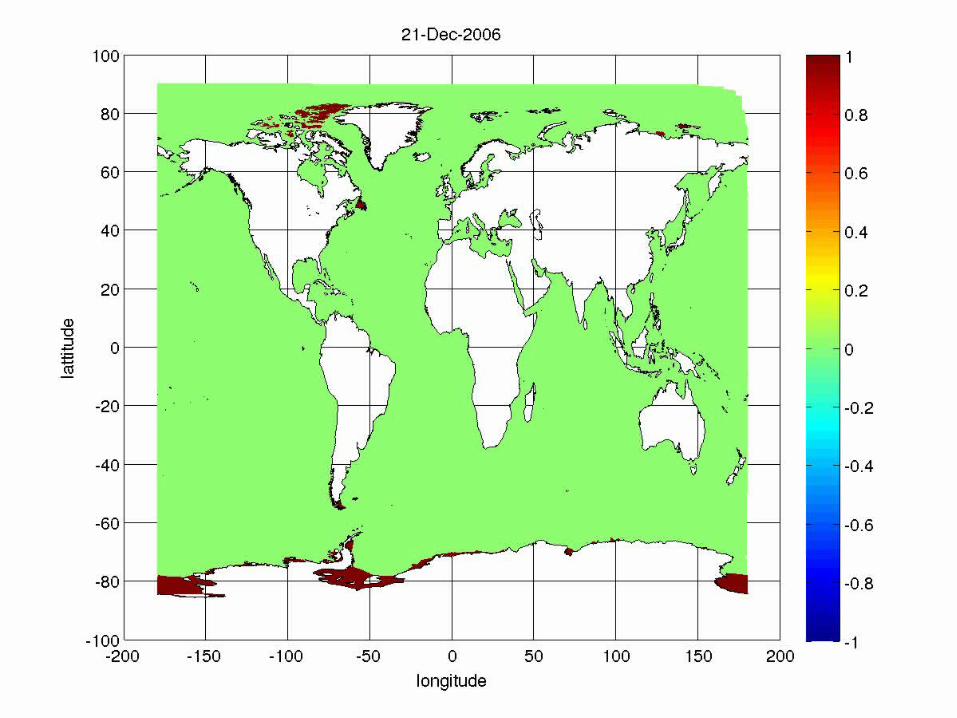
Global effects of South pole ice
Present day ice line Weddell sea covered by ice

A Global Tide and Surge Model

Grid in Delft3D FM (D-Flow FM module)
This D-Flow FM grid uses triangles and rectangles for local grid refinement. Resolution is based on Courant number.
Unstructured approach - with grid refinement in shallow areas
July 5 2016
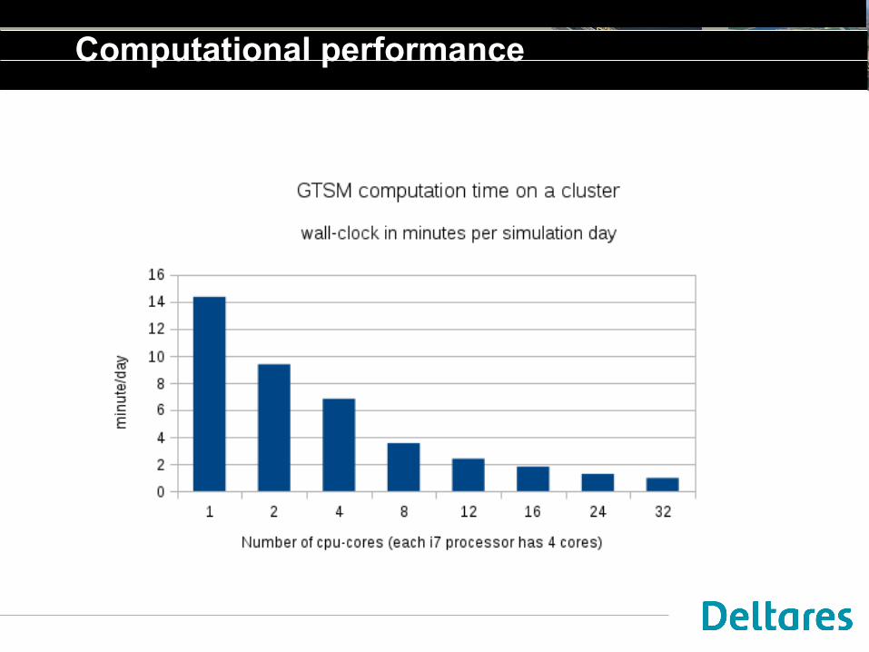
Computational performance

Calibration GTSM version 1

Model calibration
ModelpParameters ym Model output
yo Measurements
- CompareJ(p)Cost function

• Open source (LGPL) data-assimilation toolbox
• Library of data-assimilation algorithms:
– Simplex, conjugate gradient, LBFGS, DUD, ...
– EnKF, ENSR, steady-state, particle filter, ...
• Set of interfaces: models, observations, algorithms,...
• Platform for cooperation
• Association
11www.openda.org
What is OpenDA?

Model connectors
Hydrodynamics
• D-Flow FM (Delft3D FM Suite)
• Delft3D-FLOW
• EFDC
• Nemo
Waves
• SWAN / Delft3D-WAVE
Water quality
• DELWAQ* / Delft3D-WAQ
• HSPF
Rainfall runoff
• HBV
• OpenStreams*
• Mike-SHE
• MCRM
• Sacramento
Sewer systems
• SOBEK-FLOW (Delft3D FM Suite)
• WANDA
Groundwater
• Modflow*
CFD
• OpenFOAM*
Oil-gas reservoirs
• Eclipse*
Air quality
• Lotos-Euros
• Chimere

Calibration of the Model
FES2012
Altimeter observations:- assimilated FES2012 gridded data- very accurate on deep water
Calibration parameters: - Depth & Friction- 7 regions
Automated calibration:- 21 parameters- deep water series Jan2007
347 locations

Calibration results for deep water
Region Before After
Arctic 5.1 cm 3.2 cm
N. Atlantic 9.4 7.4
S. Atlantic 12.1 8.4
N. Pacific 8.1 6.2
S. Pacific 11.2 7.3
Indian Ocean 11.7 8.2
S. Ocean 12.4 10.2
Total 10.2 7.4

Reanalysis

July 5 2016
Highwater exceedance estimates
Reanalysis with ERA-interim meteo-forcing (1979-present)
Cooperation:Sanne Muis

July 5 2016
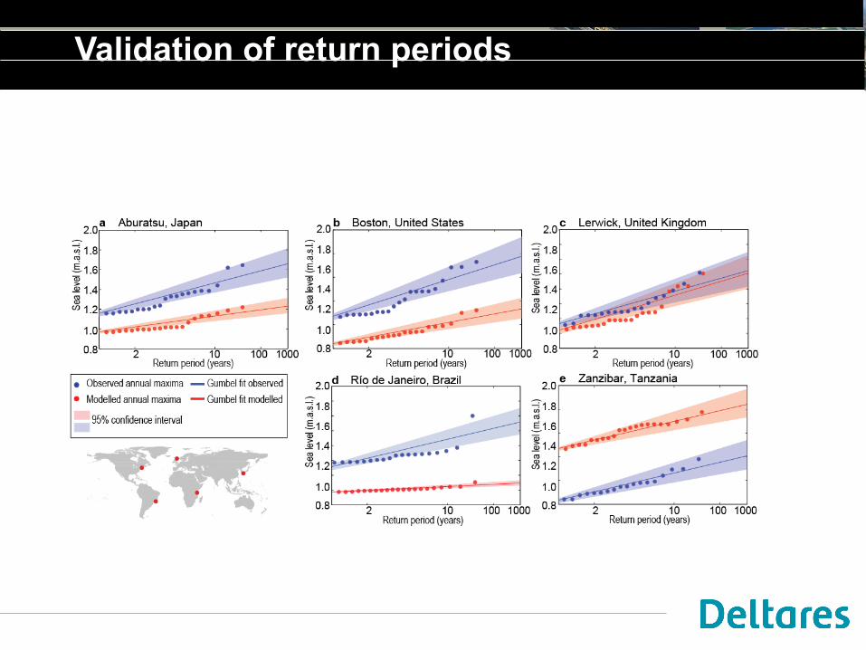
Validation of return periods

July 5 2016
GTSM-ERA-interim
GTSM-spiderweb
Without coastal refinement
Dietrich et al 2009

GLOSSIS operational forecasts
Hurricane Matthew
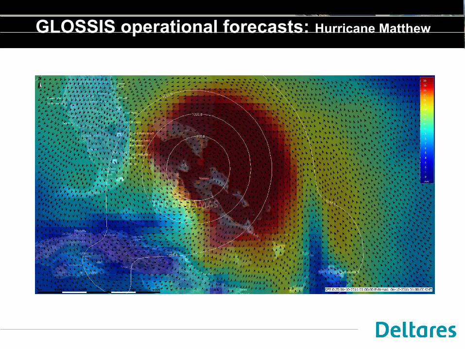
GLOSSIS operational forecasts: Hurricane Matthew
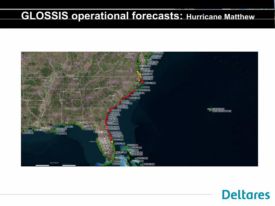
GLOSSIS operational forecasts: Hurricane Matthew
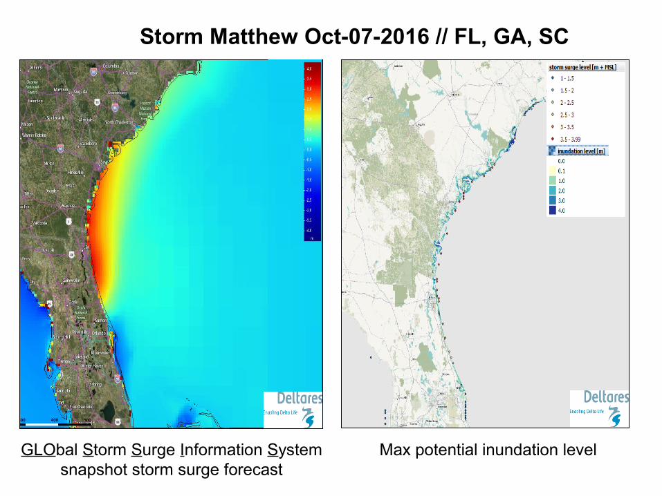
Storm Matthew Oct-07-2016 // FL, GA, SC
GLObal Storm Surge Information Systemsnapshot storm surge forecast
Max potential inundation level

Towards GTSM-v2

Grid refinement
Bathymetry gradient based refinement:

Sensitivity to resolution
2x finer in deep water
2x finer in shallow water

Tidal dissipation through generation of internal tides (IT)

IT dissipation – Anisotropic phenomenon
Barotropic tidal dissipation sources:• Bottom friction (dominant in shallow waters)• Generation of internal waves when flowing over rough topography in
stratified oceans (dominant in deep waters)
New anisotropic numerical implementation
Dissipation=f(Stratification, bathymetry gradient, cross-slope flow)
• Mid-ocean ridges and trenches (e.g. Mid-Atlantic Ridge)
• Continental shelves (e.g. Bay of Biscay)• Island chains (e.g. Hawaiian Ridge)
Literature values: = 1TW (4TW total)
( )1ITτ = CρNκ h u h- Ñ Ñg

Model sensitivity to grid resolution
Internal Tides dissipation (W/m2) distribution:
Model is now sensitive to user defined parameters for IT dissipation: Tuning possible.
RMSE reduction with IT dissipation:
• Deep waters:~3 cm• Coast: ~3.2 cm

Self Attraction and Loading (SAL)

SAL – Implementation in GTSM
SAL is the sum of three effects:
Deformation of the seafloor under the weight of the column of water (Earth is a elastic body)
Redistribution of Earth mass changes the gravitational field
Gravitational attraction induced by the mass of the ocean on the ocean itself
LOADING
SELF ATTRACTION
Literature ~ 10% of astronomical tide Reality: Spatial and temporal significant variability.
SAL potential in spherical harmonics Calculation of field at every time step, analogous to Tide Generating Forces
Reduction of errors in tidal representation of ~50 % in coastal stations and ~60% in deep waters
Minimal increase in computational times.
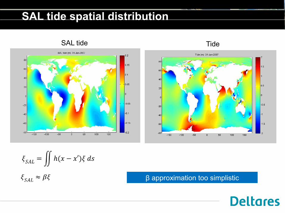
SAL tide spatial distribution
β approximation too simplistic
SAL tide Tide

Regional impact of SAL

Real-time data-assimilation

DCSM-v6 assimilation locations

Impact Kalman filter +6h
Computation for Vlissingen at Dec 5 19u
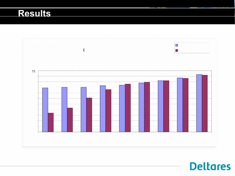
Results
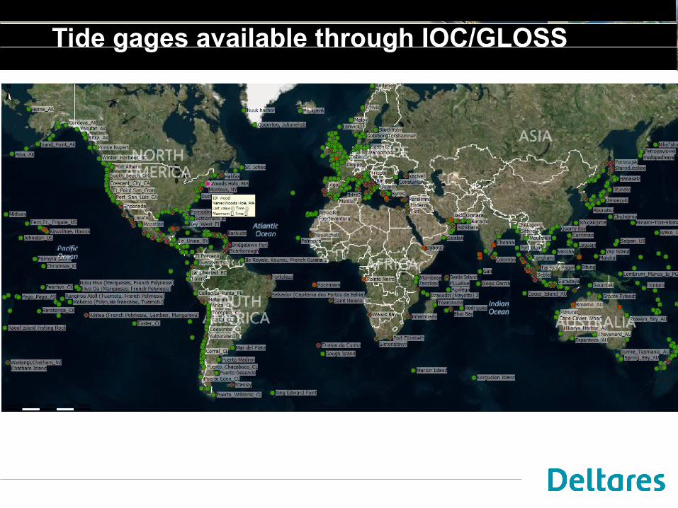
Tide gages available through IOC/GLOSS
Satellite Data

JASON-3 Sealevel example
Todo

ASCAT Scatterometer winds
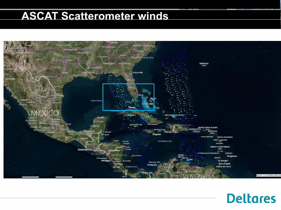
ASCAT Scatterometer winds

ASCAT Scatterometer winds

Data assimilation - future

Localization
“OpenDA-NEMO framework for Ocean Analysis and Predictions”, N. Van Velzen, M. U. Altaf, M. Verlaan, and A.W. Heemink, submitted to Ocean Dynamics
Sealevel
Observed Sealevel

Ensemble Kalman filter
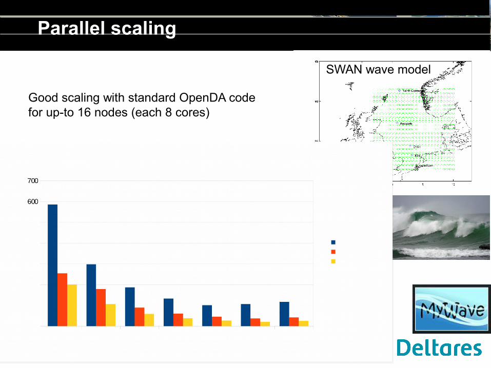
Parallel scaling
Good scaling with standard OpenDA code for up-to 16 nodes (each 8 cores)
SWAN wave model

Floodrisk Mozambique
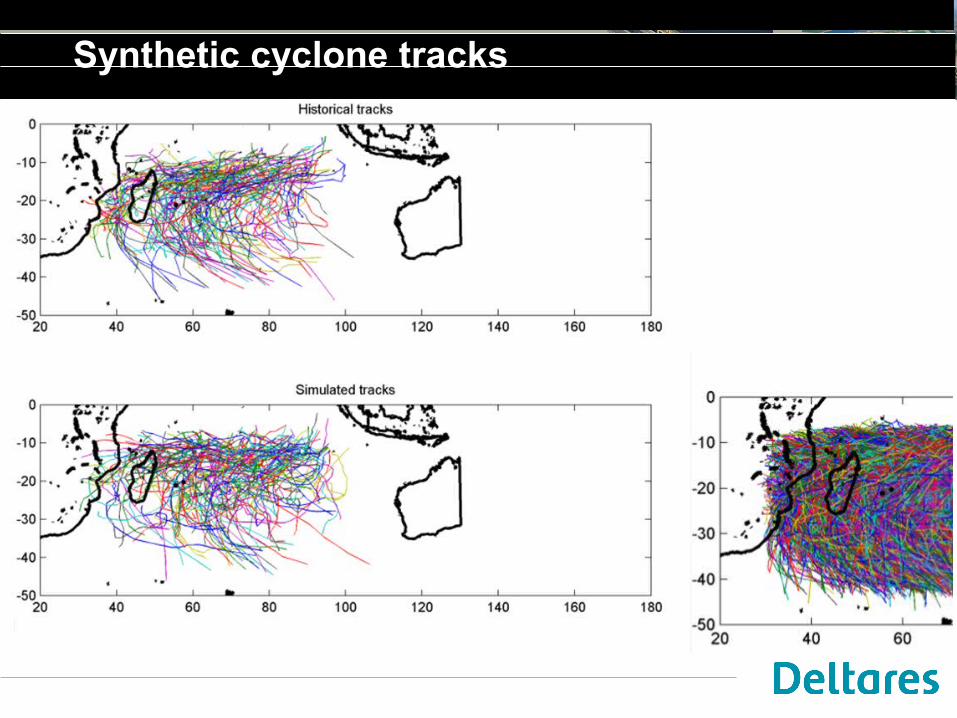
Synthetic cyclone tracks

Regional model

Example TC track
Preliminary results

Example TC track and surge
Preliminary results

Synthetic cyclones
Maximum surge levelfor 6 sample tracks out of more than 1000 cyclones that enter the area
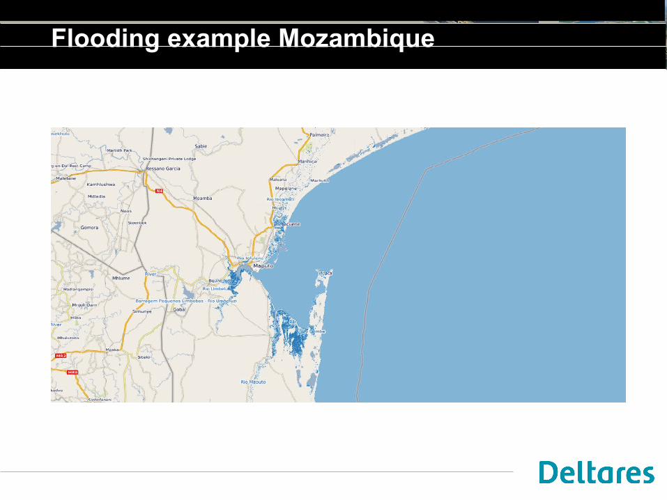
Flooding example Mozambique

Xynthia storm

Xynthia storm surge
February 27 2010

Flooding computations
Grid 90m approx. 700x1000
Computation time (no MPI):• Delft3D FM (10minutes)• Lisflood-FP (18minutes)
Results sensitive to:• DEM• Boundary conditions• Friction
Future plans
• Complete GTSM version 2 including calibration with OpenDA• Incorporate real-time satellite observations in Delft-FEWS • Develop real-time data-assimilation of satellite data• Incorporate more accurate tropical cyclone estimates in global risk
estimates• Incorporate wave effects for coastal flood risk
• Develop coastal inundation models• Develop strategy for systematic validation of inundation models

Questions?
Thanks to …
Arthur van DamDirk EilanderEdward MelgerFirmijn ZijlHerman KernkampHessel WinsemiusJoao Lima RegoKun JanMaialen Irazoqui ApececheaSander van der PijlSanne MuisTony Minns
Albrecht WeertsAlja VrielingAnnette ZijderveldArno KockxArjo SegersDaniel TwigtJulius SumiharLora BuckmanMarieke EleveldNils van VelzenSandra Gaytan AguilarSimone de KleermaekerStef Hummel
…and others…