east mulberry corridor plan - city of fort collins 3 introduction 1 east mulberry corridor plan will...
TRANSCRIPT

1
INTRODUCTION 1
East Mulberry Corridor Plan
1. IntroductionPurpose and Context of This Plan
The East Mulberry Corridor Plan represents a joint planning effort between Larimer County, the City of Fort Collins and concerned citizens. This partnership is unique. The study area is primarily in unincorporated Larimer County, yet inside the Fort Collins Growth Management Area (GMA). This plan reflects significant cooperation among both jurisdictions and citizens in balancing complex issues, seizing available op-portunities and combining policy directions to create a uni-fied plan.
The 1997 Larimer County Master Plan has a number of specific policy elements that strongly influence the study area. One of this plan’s key concepts states urban areas situated in a community’s GMA will be integrated with the more detailed plans of that adjacent community. Urban development is encouraged to locate inside city limits, or if not possible, for the development to locate inside the GMA overlay zoning districts that can or will soon be annexed. In 1997, the City of Fort Collins City Plan identified this area’s need for detailed planning as a priority. As a result, City Council included the East Mulberry Corridor Plan in the 2001-2002 work program, acknowledging the importance of work-ing jointly to develop this plan with Larimer County. For the City, an initial primary plan objective was to implement City Plan’s citywide perspective to the specific circumstances in the East Mulberry Corridor study area. After exploring the concerns raised about the study area, it became apparent that this plan should address additional key issues such as the provision and maintenance of public facilities and services, annexation, costs of improvements, redevelopment, and streetscape design.
Most of this study area’s development occurred under County jurisdiction long before the Larimer County and City of Fort Collins Intergovernmental Agreement for the Fort Collins Growth Management Area was adopted in 1980. In addition, the East Mulberry Corridor study area has intensive urban
Appendix A - Related Goals: Larimer County Master Plan and City of Fort Collins City Plan.
See
Chapter Abbrieviations/Acronyms:CAC - Citizen Advisory CommitteeGMA - Growth Management AreaI-25 - Interstate 25SH 14 - State Highway 14TAC - Technical Advisory Committee

2 3
INTRODUCTION 1
East Mulberry Corridor Plan
uses and housing densities that were created in the 1950s and 1960s, long before the County implemented land use review authority. Because of this development history, the area is unique in terms of the opportunities and problems presented to residents, business, property owners, and both the City and County. Larimer County was very interested in a plan-ning process that worked with area residents, landowners and service providers in a manner that encouraged innovative ideas to upgrade aging infrastructure, such as roads and storm drainage facilities. In addition, the County will consider adop-tion of new urban standards to ensure that all new devel-opment is consistent with the East Mulberry Corridor Plan’s vision and City Plan.
Annexation was a crucial issue. Assessing the long-term im-pacts of City annexation was important for both the City and County. With increasing development submittals, potential zoning conflicts, and questions raised about the additional provisions of infrastructure and services, coordination of City and County efforts were needed to develop this plan. Final recommendations derived from the East Mulberry Corridor Plan will aid decision-makers in dealing with this area’s long-term growth impacts.
The Need for this Plan
For most people the phrases, “East Mulberry Street” or “Highway 14”, conjure up images of a busy thoroughfare heading into north Fort Collins. Even in the early days, this area was a center of bustling activity at the fringes of “the Fort,” full of traffic, commerce and travelers.
Today, East Mulberry Street is still recognized as a primary entryway into the city. This area is woven into the urban area to the west, and is a part of Fort Collins’ GMA.
In the face of continued growth and change, impacts are changing the area’s quality of life. Concerned citizens have shared their views about these impacts. Traffic congestion is increasing. Streets are in disrepair. In many areas, curb and gutter is lacking. Due to three existing floodplains within this study area, storm drainage is a major concern. Safety is a par-ticular issue for anyone traveling — whether by vehicle, bike, bus, or on foot. Larimer County does not have the financial capacity to provide the full range of urban services needed for the study area. The bottom line is this area’s infrastructure will continue to decline. Ultimately, existing property owners
How does annexation occur?
Colorado Revised Statutes 31-12 govern an-nexations. There are 3 types of annexations voluntary annexations, involuntary annexa-tions, and annexation elections.
Voluntary annexations occur when an applicant submits a petition for annexation to the City requesting that a specific piece of land be annexed. In this case, over 50% of the property owners owning over 50% of the land within the area to be annexed must consent to the annexation. Voluntary an-nexations generally occur when a developer wants to develop a County property that happens to be within the Fort Collins Urban Growth Area and abuts the City Limits. In order for such a property to obtain any devel-opment approval, the City and County have agreed (in this case) to require the property to first voluntarily annex into the City so that any development proposals can be reviewed under the City’s jurisdiction.
Involuntary annexations are otherwise known as the annexation of enclaves. An enclave is unincorporated County territory that is entirely surrounded by a municipality. The State Statute gives a municipality the au-thority to annex an enclave without property owner consent at such time that the enclave has been surrounded by the municipality by three or more years.
An annexation election is when and elec-tion is held within the area proposed to be annexed to determine if the majority of such votes cast is for annexation into the City. If so, the municipality, by ordinance, may thereafter annex said area.
FAQ

2 3
INTRODUCTION 1
East Mulberry Corridor Plan
will be assessed to fund their infrastructure improvements. Depending in which jurisdiction the home or business re-sides, these improvements will need to be coordinated with either the City and/or County. With continued inaction, qual-ity of the East Mulberry Corridor area could mean:
• more deterioration of streets and other facilities• missed opportunities for redevelopment• lack of certain facilities and services• inadequate funding for needed infrastructure improve-
ments• lack of partnerships for public/private development • a piecemeal, rather than “whole picture” approach to fu-
ture solutions• lost chances for enhancing the corridor as a key entryway
into Fort Collins
This plan has evaluated a wide range of issues including:
• Needs and expectations of residents and property owners• Maintenance of existing land uses and support future
expansion• Better choices for future transportation, open areas, and
land use patterns• Alternatives for maintaining and enhancing this area’s
economic viability• Costs and financing of upgrading infrastructure• Impacts of possible City annexation of all or part of this
study area
The East Mulberry Corridor study area is unique among other urban areas set aside for future community growth. It presents problems and possibilities, not only within this study area, but also for the entire community. As the pressures of development continue, the timing is right for the County, the City, affected business interests, and area residents to work together to resolve the issues and capture this area’s oppor-tunities.
Study Area
The East Mulberry Corridor study area encompasses about 2,500 acres. It is bounded by Interstate 25 to the east, East Vine Drive to the north, Lemay Avenue to the west and the Poudre River to the South. While most of the study area is outside city limits, it is within the Fort Collins GMA.
Vicinity and Study Area Maps on pages 9 and 10.
See
View of the South Frontage Road, illustrating the need for urban street standards.
Existing hotels along East Mulberry Street illustrating the need for urban sign standards.

4 5
INTRODUCTION 1
East Mulberry Corridor Plan
Appendix B - History of the East Mulberry Street Area.
See
Brief History of Study Area
Over the past 75 years, the East Mulberry Corridor area has been shaped by developments including: State Highway 14 (SH 14) bypass, Interstate 25, agriculture, prohibition, a Greeley water line, and the Fort Collins Downtown Airport.
SH 14 began as a dirt road surrounded by farms and ranches, stretching from Fort Collins east beyond Ault and west to Poudre Canyon. At some point, the highway became East Lincoln Avenue as you entered downtown Fort Collins. Between 1954 and 1956, an extension of East Mulberry Street starting at Riverside Avenue and going east to Lincoln Avenue/Summit View Drive was built, creating the SH 14 Bypass. According to the City's 1957 Master Street Plan, it had become the main highway and was envisioned as becoming a green parkway leading vehicles into downtown along the Poudre River. This bypass soon became more traveled than the older East Lincoln Avenue and by 1957, it was no longer a bypass but relabeled as SH 14.
Also during the 1960s, US 87/SH 185, a small state and feder-al highway, was designated as part of the new federal interstate system, Interstate 25. Located 3 miles east of Fort Collins, the north-south I-25 and SH 14 corridors intersected and grew in importance.
The corridor began to see a growth in businesses. Most early businesses were agriculturally-related or liquor establish-ments. Farmers raised mainly corn and beets up until World War II. Wartime labor shortages found farmers converting growing fields to pasturelands requiring little labor, only irri-gation. The primary agricultural products became cattle and sheep, which were shipped via railroad to Chicago and other processing hubs. An 1896 law, prohibiting the selling of liquor within Fort Collins city limits, led to the high number of bars and liquor stores locating in the corridor area.
Another event that shaped development was the construction of the Greeley water transmission line that ran diagonal northwest to southeast along East Lincoln Avenue/Summit View Drive. Many of the early businesses and homes were built on this diagonal to tap into the line for a steady water supply. Only later did the City of Fort Collins and other util-ity companies provide water to developing areas east of city limits.
1963 aerial of the roundabout at SH 14 and US 87/SH 185 (now I-25) interchange.
1968 aerial showing a 12 year-old SH 14 bypass.
4 5
INTRODUCTION 1
East Mulberry Corridor Plan
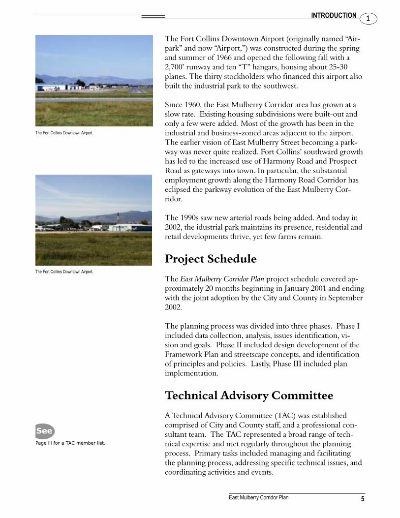
The Fort Collins Downtown Airport (originally named “Air-park” and now “Airport,”) was constructed during the spring and summer of 1966 and opened the following fall with a 2,700’ runway and ten “T” hangars, housing about 25-30 planes. The thirty stockholders who financed this airport also built the industrial park to the southwest.
Since 1960, the East Mulberry Corridor area has grown at a slow rate. Existing housing subdivisions were built-out and only a few were added. Most of the growth has been in the industrial and business-zoned areas adjacent to the airport. The earlier vision of East Mulberry Street becoming a park-way was never quite realized. Fort Collins’ southward growth has led to the increased use of Harmony Road and Prospect Road as gateways into town. In particular, the substantial employment growth along the Harmony Road Corridor has eclipsed the parkway evolution of the East Mulberry Cor-ridor.
The 1990s saw new arterial roads being added. And today in 2002, the idustrial park maintains its presence, residential and retail developments thrive, yet few farms remain.
Project Schedule
The East Mulberry Corridor Plan project schedule covered ap-proximately 20 months beginning in January 2001 and ending with the joint adoption by the City and County in September 2002.
The planning process was divided into three phases. Phase I included data collection, analysis, issues identification, vi-sion and goals. Phase II included design development of the Framework Plan and streetscape concepts, and identification of principles and policies. Lastly, Phase III included plan implementation.
Technical Advisory Committee
A Technical Advisory Committee (TAC) was established comprised of City and County staff, and a professional con-sultant team. The TAC represented a broad range of tech-nical expertise and met regularly throughout the planning process. Primary tasks included managing and facilitating the planning process, addressing specific technical issues, and coordinating activities and events.
Page iii for a TAC member list.
See
The Fort Collins Downtown Airport.
The Fort Collins Downtown Airport.

6 7
INTRODUCTION 1
East Mulberry Corridor Plan
Public Involvement Process
The City of Fort Collins and Larimer County remain com-mitted to a public involvement process that includes max-imum citizen involvement and participation, fairness, and opportunities to listen and respond to issues and concerns. On-going communication was emphasized between the TAC, appointed and elected officials, and the public.
Citizen involvement was a major part of the planning pro-cess. The public information and communication activities were designed to generate broad awareness and interest in the planning process. These efforts included newsletters, press releases and articles, television, advertisements and a plan web site (www.fcgov.com/eastmulberry).
The East Mulberry Corridor Plan’s public involvement process was open to all with a careful focus on people and groups with particular interests in the study area.
An extensive mailing list was developed and included both residential/business property owners and tenants in the study area. This mailing list, which totaled over 3,000 addresses, was used as one of the primary notification techniques to en-courage participation at public events and activities through-out the planning process.
In the Fall of 2000, a questionnaire entitled. “Issues & Op-tions,” was distributed to this mailing list to provide staff with preliminary feedback on pertinent issues, concerns, and ideas. This questionnaire did not represent a statistically valid sur-vey, however this early input was useful as a basis for starting the planning process and providing during the first phase.
After this initial step, public involvement and communication activities fell into three primary categories:
• Citizen Advisory Group• Public Outreach and Events• Requested Information and Communication
Citizens Advisory Committee
City and County staff appointed a Citizens Advisory Com-mittee (CAC), who’s primary purpose was to advise staff and TAC, and act as a sounding board addressing the issues associated with this plan. CAC was created to ensure ongo-
Appendix C - Issues and Options Questionnaire Response Highlights.
See

6 7
INTRODUCTION 1
East Mulberry Corridor Plan
ing, well-informed representation from all geographic areas within the study area. In addition, both businesses and resi-dents were included, as well as special interest groups in and outside of the study area. Each CAC member was selected to represent not only the point of view of their informal constit-uency, but also to represent or advocate the plan back to their “home” neighborhoods and constituents. CAC members typically represented multiple interests.
The CAC met monthly for the duration of the planning process, and reviewed progress, contributed ideas, and made recommendations.
Public Outreach
Public events like open houses and workshops were held for broader audiences, and contained background informa-tion to orient attendees to the planning process, as well as new developments. These events offered the attendees many opportunities at a variety of levels to give both general and site-specific input.
These open events reflected a high level of public interest and participation and, as more information was made available, attendance increased.
Requested Information & Communication
In addition to public events, staff continually contacted indi-vidual property and business owners and tenants for further review and input concerning this plan. Many civic groups, organizations and neighborhoods requested or were provided with presentations on the plan’s progress and implications. In addition, numerous one-on-one meetings with property and/or business owners were held.
A summary of key public events includes:
• 16 Citizens Advisory Committee meetings• 62 staff and TAC meetings• 16 property/business owner meetings• 3 neighborhood meetings• 15 City/County appointed and elected officials meet-
ings• 6 presentations to civic groups/organizations
Page iv for a CAC member list.
See

8 9
INTRODUCTION 1
East Mulberry Corridor Plan
• 3,000 study area residents and businesses were mailed the Issues & Options questionnaire
• 5 public open houses/workshops (15,000 notification postcards mailed)
Adoption
The East Mulberry Corridor Plan was adopted by the City of Fort Collins on September 17, 2002 and by Larimer County September 18, 2002.
Appendix D for official resolutions.
See

8 9
INTRODUCTION 1
East Mulberry Corridor Plan

10 11
EXISTING CONDITIONS & ISSUE ANALYSIS 2
East Mulberry Corridor Plan

10 11
EXISTING CONDITIONS & ISSUE ANALYSIS 2
East Mulberry Corridor Plan
2. Existing Conditions & Issue AnalysisIntroduction
First this chapter analyzes existing study area conditions such as related plans, land use, zoning, infrastructure, public ser-vices, cultural resources, and affordable housing. Secondly, it includes a list of key issues. Thirdly, this chapter summarizes opportunities and constraints influencing the planning and future development of this study area.
Study Area Overview
The East Mulberry Corridor Plan’s study area extends for just over three miles from the current edge of the City of Fort Collins to I-25. In this short distance, many of the opportu-nities and challenges facing our community emerge. Highly evident is the complex interface between urban and rural, and between City and County. The East Mulberry Street Cor-ridor has long been the front door to the City of Fort Collins, despite its County location. An extensive mix of commercial and industrial uses has evolved over the past several decades, much of it in a pattern of commercial strip development. Yet significant areas of vacant lands also remain, providing oppor-tunities for new development patterns and uses. For a detailed market analysis of the study area, see Chapter 3. A further review of future facilities, services and analysis of projected costs associated with these public projects is summarized in Chapter 10.
Even with the extensive existing and anticipated develop-ment, important natural values are also present in the study area. The Poudre River closely parallels SH 14 for more than a mile yet remains physically and visually isolated from the highway over most of that distance. Cooper Slough and other wildlife habitats also occur in the study area and illustrate the need for incorporating resource protection measures into this plan. Chapter 7 provides an overview of the natural features, waterways, and open lands in the study area and the resource protection measures that were considered in the development of this plan.
Chapter 3 - Market Analysis Chapter 10 - Implementation Chapter 7 - Open Areas & Natural Lands.
See
Chapter Abbrieviations/Acronyms:CAC - Citizen Advisory CommitteeCDOT - Colorado Department of TransportationBSD - Boxelder Sanitation DistrictELCO - East Larimer County Water DistrictFEMA - Federal Emergency Management AgencyGMA - Growth Management AreaI-25 - Interstate 25NCWCD - Northern Colorado Water Conservancy DistrictPFA - Poudre Fire AuthorityPSD - Poudre School DistrictPVREA - Poudre Valley Rural Electric AuthoritySH 14 - State Highway 14TAC - Technical Advisory Committee
Link Lane at SH 14 looking north, illustrating the need for upgraded urban services.
12 13
EXISTING CONDITIONS & ISSUE ANALYSIS 2
East Mulberry Corridor Plan
With an I-25 interchange, an airport and a thriving com-mercial market, SH 14 is and will remain a vital transporta-tion link. Chapter 6 provides an overview of this area’s street network, focusing on SH 14, as well as other streets, in terms of their classification and suitability for meeting current and anticipated transportation needs. Pedestrian, bicycle and other transportation modes are also addressed.
Considered one of Fort Collins’ gateways, the East Mulberry Street Corridor is highly visible, and it is essential to integrate urban design and landscape treatments. Chapter 8 addresses its visual quality and proposes future streetscape improve-ments.
Related Plans A number of related regional, County, and City plans and studies have been adopted that influence development of the East Mulberry Corridor Plan. Affecting elements from these documents are summarized in the remainder of this section or in an appendix.
Area Plans
The Larimer County Master Plan, adopted in 1997, serves as a policy document for development decisions in the County. This plan includes a number of more specific policy elements that have a strong bearing on the study area.
City of Fort Collins City Plan, adopted in 1997, defines a vision, structure plan, principles and policies for the overall community. The East Mulberry Corridor Plan is identified as an element of City Plan and included in the 2001-2002 City Council work program.
Completed in March of 1999, the City’s Mountain Vista Sub-area Plan shares a border with the East Mulberry Corridor Plan. The key element is the identification of Low Density Mixed-Use Neighborhood and Employment land uses along East Vine Drive.
Northern Colorado Regional Communities I-25 Corridor Plan,a regional planning effort by many communities, addresses the two-mile-wide interstate corridor extending from the Berthoud vicinity north to Wellington. Key elements address interchange and arterial street improvements, recommend commuter rail alignment, find locations for feeder bus ser-
Chapter 6 - Transportation Chapter 8 - Urban & Streetscape Design.
See
Appendix A - Related Goals: Larimer County Master Plan and City of Fort Collins City Plan.
See

12 13
EXISTING CONDITIONS & ISSUE ANALYSIS 2
East Mulberry Corridor Plan
vice, and create design standards for developments within this corridor.
The City’s I-25 Subarea Plan is an element of City Plan, as-sessing growth related issues along a 6 mile stretch of I-25 between Douglas Road to the north, and County Road 32 to the south and extending approximately 1 mile to the east and west. It generally reflects a more detailed area assessment than the Northern Colorado Regional Communities I-25 Cor-ridor Plan. The SH 14 and I-25 interchange lies within these boundaries and this plan recommends: a future land use mix, focused commercial centers at intersections, support for rural development pattern and open lands in between primary in-terstate interchanges, preservation of important natural areas agricultural lands, and view corridors, and lastly, improve primary gateways into communities.
Transportation Plans
Larimer County Transportation Plan, City of Fort Collins Master Street Plan, and CDOT, the County and City’s Interstate 25/SH 14 Interchange Area Study, US 287/SH 14 Access Management Report, and Northern Colorado Truck Mobility/SH-14 Reloca-tion Study all affect transportation for this area. Please refer to Chapter 6 for detailed descriptions of these transportation plans and their influence.
Drainage Plans
Dry Creek Master Plan, Cooper Slough/Boxelder Creek Master Plan, and Dry Creek Flood Control Project Plan, are all existing plans or drainage improvements under way, to reduce poten-tial flooding in this area. Descriptions of these drainage plans and their influence are discussed later in this chapter, under Opportunities and Constraints.
Zoning
Although zoning is not a “plan,” it is one tool used to imple-ment other planning initiatives. This study area includes a mix of City and County zoning, highlighted in the maps at the end of this chapter. The zoning is predominantly com-mercial and industrial, with a small area of residential zoning in the southern portion of the study area.
County Zoning Map and City Zoning Map on pages 29 and 30.
See
Looking west from the junction of the entrance ramp to southbound I-25 and SH 14.
Chapter 6 - Transportation.
See

14 15
EXISTING CONDITIONS & ISSUE ANALYSIS 2
East Mulberry Corridor Plan
Land Use
Exisiting Development
Development within the study area consists of a mix of co-existing agricultural, residential, industrial, commercial and institutional uses. Add the presence of a major region-serving transportation thoroughfare and two local government enti-ties, and there are bound to be land use conflicts. Typical chal-lenges facing existing development in the study area are:§ Lack of property assemblage for redevelopment§ Inconsistent design quality § Differing City and County regulations (e.g. setbacks,
floodplain regulations, etc.)§ Conflicts between neighborhoods and commercial areas§ Poor overall appearance of the study area
The following tables illustrate the current land use compo-sition of the study area. It is also shown graphically in the Existing Land Use Map at the end of this chapter.
Land use in the study area includes 14 categories per the Larimer County Assessor’s Existing Land Use records. The largest land use is agriculture, comprising just over 37% of the land area. Industrial and commercial uses are the next largest land use with 20% of the land area. Residential use is third, with just over 7% of the land area.
Table 2-1Land Use Inventory
Land Use Acreage % of TotalAgricultural 969 37%
General Industrial/Commercial 521 20%
Roads/Infrastructure 357 15%
Vacant 295 11%
Single Family 198 8%
Public Lands 79 3%
Mobile Home 67 3%
Services 36 1%
Multi-Family 25 1%
Other Tax Exempt 10 < 1%
Total 2557 100%
Existing Land Use Map on page 31.
See
Existing commercial uses along the North Frontage Road.

14 15
EXISTING CONDITIONS & ISSUE ANALYSIS 2
East Mulberry Corridor Plan
Existing Ownership Patterns
Almost 96% of the land in the study area is privately owned; the remaining 4% is in public ownership.
Table 2-2Ownership Inventory
Ownership Acreage % of TotalPrivate 2,112 82%
Roads/Infrastructure 357 15%
Public 79 3%
Total 2548 100%
Note: It is not determined which ‘vacant’ lands are private versus public and all are indicated as private at this time.
Transportation
See Chapter 6 for information on existing conditions.
Infrastructure
With the majority of this area’s development occurring in the 1960s, much of the street and drainage infrastructure was not constructed to current County/City standards. Depending on which jurisdiction is in place, existing property owners will need to coordinate future infrastructure improvements with either the City or County. Chapter 10 discusses future fund-ing assessment.
Streets
Please refer to Chapter 6 for detailed information about exist-ing street conditions.
Drainage
The study area is located primarily within the lower Dry Creek Basin and the Cooper Slough Basin, with a small por-tion in the Boxelder Creek Basin.
Dry Creek Basin
The Dry Creek Basin drains from north to south and ulti-mately into the Poudre River across from the Fort Collins Downtown Airport.
Chapter 6 - Transportation.
See
Water Features Inventory Map on page 31.
See
Chapter 10 - Implementation.
See

16 17
EXISTING CONDITIONS & ISSUE ANALYSIS 2
East Mulberry Corridor Plan
Cooper Slough/Boxelder Creek Basin
Cooper Slough, the other major basin within the study area, lies west of I-25 and flows north to south. The Cooper Slough joins Boxelder Creek near Prospect Road and I-25 and then flows into the Poudre River. Storm Water
Storm water flows from north to south through the study area and ultimately discharges into the Poudre River. No underground storm sewer system exists within the study area. Storm water is collected and routed via roadside borrow ditches and channels. Pipe and box culverts are utilized to pass storm water under major roads. Because East Mulberry Street is also SH 14, the Colorado Department of Transporta-tion (CDOT) maintains the majority of the culverts. The few drainage facilities that do exist consist of sections of curb & gutter, valley pans, and roadway inlets that drain into adja-cent borrow ditches and channels. The City and County own these drainage facilities. With the exception of new develop-ments, such as Buffalo Run and Wal-Mart on the east end of the study area, there has been little or no attempt to detain storm water on a local or regional basis.
Irrigation Canals
Two irrigation canals cross the study area – the Lake Canal and the Cache la Poudre Irrigation Company Canal. Both canals are active.
Floodplains
This study area includes portions of the floodplains of the Poudre River, Dry Creek, Cooper Slough, and a small section Boxelder Creek. All floodplains are designated by both the City and Federal Emergency Management Agency (FEMA), with the exception of the Poudre River, which is FEMA des-ignated only. The types of floodplains within the study area are: floodway, 100-year floodplain and 500-year floodplain. See the Water Features Map for floodplain boundaries.
Utilities
Water
The City of Fort Collins and the East Larimer County Wa-ter District (ELCO) both supply water to the East Mulberry Corridor study area. The City services the area west of Lemay
A portion of the Cooper Slough.
Water Features Inventory Map on page 32.
See

16 17
EXISTING CONDITIONS & ISSUE ANALYSIS 2
East Mulberry Corridor Plan
Avenue and ELCO the area east of Lemay Avenue. There are two exceptions. First, the City supplies water to the Buffalo Run neighborhood on the southeast corner of Lemay and Lincoln Avenues. Second, the City maintains a 24” water transmission line in the frontage road on the south side of East Mulberry Street. Properties on the south side of Mul-berry Street between Lemay Avenue and Timberline Road that redevelop will likely receive City water service from this water line.
In addition to City and ELCO water lines, the City of Gree-ley owns two water transmission lines, (24” and 27”) that pass through the study area. These transmission lines, which do not serve the East Mulberry Corridor area, roughly follow the alignment of south Summit View Drive. The Northern Colorado Water Conservancy District (NCWCD) also has a 24” transmission line that runs southeast along East Lincoln Avenue to Mulberry Street, continuing east within the study area.
ELCO currently has a grid of waterlines ranging in size from 11⁄2” to 16” that service the majority of the study area. ELCO has several improvements planned, including a 12” line be-ginning at Summit View Drive and extending to the east, and a 20” line extending between East Vine Drive and Redman Road west of I-25. ELCO is also supplying water to the new Wal-Mart retail center. It is probable that future development within the study area will have water supplied by ELCO.
Existing and planned proposed waterline locations are shown in the Existing Utilities Inventory Map at the end of this chapter.
Light and Power
The Poudre Valley Rural Electric Authority (PVREA) cur-rently provides electrical power to portions of the study area outside of city limits. As properties annex into the City, light and power service will be transferred to City utilities, along with maintenance of equipment.
Sanitary Sewer
Both the City and BSD provide sanitary sewer collection within the study area. The City sewer collection system serves the area west of Lemay Avenue and operates a 42” sewer line that runs east along East Mulberry Street to Timberline Road, then extends south to a wastewater treatment facility. Anheus-
Framework Plan Map on page 73.
See
Existing Utilities Inventory Map on page 33.
See

18 19
EXISTING CONDITIONS & ISSUE ANALYSIS 2
East Mulberry Corridor Plan
er-Busch also has a 16” force main that runs south from their brewery, located at 2351 Busch Drive, through the study area.
BSD collects the majority of the sanitary sewage within the study area. They service numerous sewer lines, and plan many future improvements. These proposed improvements consist of several sewer lines, including a line running paral-lel to, and approximately 0.25 miles north of SH 14. BSD’s wastewater treatment plant has considerable unutilized capacity and it is likely that the majority of this area’s future requirements will be thier responsibility.
Existing and proposed sanitary sewer facilities are shown on the Existing Utilities Inventory Map at the end of this chap-ter.
Public Services
Parks and Recreation
Currently no developed parks exist within the study area. The nearest park is Romero Park, located adjacent to the west side of the study area. There are, however, several natural areas present along the Poudre River. While these natural areas do permit public access, it is difficult. Residents are also in close proximity to the off-street multi-use trail running along the Poudre River, which provides connections to several parks outside of the study area. The trailhead is located just south of Mulberry Street on Timberline Road. This same trailhead provides access to a soft surface trail to Riverbend Ponds.
Schools
Currently no Poudre School District (PSD) schools exist in the study area. The following schools currently serve the study area: Laurel, Irish, and Tavelli Elementary Schools; Lesher and Lincoln Junior High Schools; and Poudre Senior High Schools.
Poudre Fire Authority
The Poudre Fire Authority (PFA) currently has two stations that service the study area. Fire Station No. 1 is located at 505 Peterson Street. Fire Station No. 6 is located at 2511 Donnella Court. These stations cover areas east of Peterson Street and west of County Road 19.
Poudre River Trail, adjacent to the study area.

18 19
EXISTING CONDITIONS & ISSUE ANALYSIS 2
East Mulberry Corridor Plan
Police Services
The study area is currently serviced by the main Fort Col-lins Police Station, located at 300 Laporte Avenue, and the Larimer County Sheriff ’s Department, serving all calls east of 1300 East Mulberry Street.
Civic Services
Currently, the study area is served by the City’s Main Library at 201 Peterson Street, the Northside Aztlan Community Center at 112 East Willow Street, the Edora Pool & Ice Cen-ter at 1801 Riverside Avenue, and the Mulberry Pool at 424 West Mulberry Street.
Cultural Resources
No comprehensive surveys of historic resources exist for the study area. A windshield survey for historic structures was conducted in July 2001. Several potentially historic structures were located, including farmhouses, outbuildings and related facilities that appear to date back to the early 1900s. Further study would be necessary to determine the historical signifi-cance of these structures.
Also, an inventory map showing ages of existing properties was created using data from the Larimer County Property Assessor’s Office. Structures are grouped in decade incre-ments, according to date built. The map provides a general impression of where historical properties are most likely to be located, and also shows a few properties built pre-1900. There are also several structures that are over fifty years old, the first requirement for designation as a historic property.
Affordable Housing
Since most of the study area is outside city limits, little atten-tion has been given to providing affordable housing. Accord-ing to the Fort Collins Land Use Code, a development proj-ect must meet several guidelines to be considered an afford-able housing project. First, at least 75% of the gross acreage to be developed must be residential dwelling units or mobile home park spaces. Second, at least 10% of the dwelling units must be available to rent or for sale to households earning 80% or less of the median income of city residents. An ad-justment is required for family size and that those households are not paying more than 30% (for a rental unit) or 38% (for
Structure Age Inventory Map on page 34.
See
Example of a structure with possible historical significance.

20 21
EXISTING CONDITIONS & ISSUE ANALYSIS 2
East Mulberry Corridor Plan
purchasing a unit) to housing costs. Third, the affordable dwelling units need to be built in the initial phase or along-side the market rate units, and lastly, the affordable dwelling units need to be on record at the Larimer County Clerk and Recorder Office as being affordable and occupied for twenty years.
According to these guidelines, there is only one affordable housing project in the study area, Buffalo Run, located on the southeast corner of Lemay and Lincoln Avenues. There is a second affordable housing project just north of the study area, Bull Run, located on the northwest corner of Summit View Drive and East Vine Drive.
While some other residential areas could be considered affordable, there have not been any other formal projects developed in the study area. An overview map, highlight-ing those areas with lower average home prices than those of Fort Collins, as well as the two affordable housing projects, is included at the end of this chapter. The lower cost homes are divided into two categories: Mobile Home Parks, and Single Family Homes.
Urban & Streetscape Design
See Chapter 8 for information on existing conditions.
Natural Areas & Open Lands
See Chapter 7 for information on existing conditions.
Issues Identification
One of the early steps in the planning process was an effort to identify the issues that should be addressed in this plan. This section lists these issues.
The issues listed below were identified through a series of interactions with the community and included the “Issues & Options Questionnaire” mailed to property owners and resi-dents of the study area.
Comments were received from a series of public events as well as discussions with the Citizens Advisory Committee (CAC). Issues identified were important, providing a foun-dation for the direction of this plan, developing the vision
Areas of Lower Cost & Affordable Housing Map on page 35.
See
Appendix C - Issues and Options Questionnaire Response Highlights.
See

20 21
EXISTING CONDITIONS & ISSUE ANALYSIS 2
East Mulberry Corridor Plan
and goals, and creating physical design and implementation strategies.
In order to organize the numerous comments, they were sorted into 5 topics:
1. Land Use2. Transportation3. Infrastructure and Public Services4. Urban and Streetscape Design5. Natural Areas & Open Lands
For each of these topics, a sampling of comments is provided below, including some of the major and/or most frequently cited issues.
1. Land Use
• The plan should promote a balanced mix of land uses.• Is there a need for an additional grocery store within
the study area?• Opportunities exist for expansion of commercial,
residential and larger employment uses.• If airport becomes available for redevelopment, what
are the appropriate uses for that area?• This plan needs to address the overall area and not
just a narrow corridor along East Mulberry Street. • Current Business Uses. Protecting existing business-
es is important.
2. Transportation
• Roads. Deterioration, maintenance, and repair. Private roads in the area are aging. The residents and businesses along the roads can’t afford to pay to repair them.
• Traffic flow on East Mulberry Street.• How existing transportation projects will affect the
study area?• How will this planning process deal with the truck
traffic?• Access. It is important that the planning process ad-
dress the number of access points along East Mulberry Street.
• Facilitate alternative modes of transportation. The area needs sidewalks, bike lanes, and pedestrian cross-ings.

22 23
EXISTING CONDITIONS & ISSUE ANALYSIS 2
East Mulberry Corridor Plan
3. Infrastructure and Public Services
• Infrastructure funding. An identification of funding priorities and a realistic assessment of what can be ac-complished is needed.
• Affects of annexation on existing businesses and resi-dents.
• Timing of annexation (voluntary/involuntary). • Annexation. A concern for residents is that once the
area is annexed, taxes go up, but improvements would lag behind. Another concern is that land use regula-tions and processes are more flexible in the County than in the City.
4. Urban & Streetscape Design
• Neighborhood Atmosphere. This plan should balance the need for the corridor to serve as a gateway for the whole city with the need to have a neighborhood feel.
• Building appearance, storage yards and street frontage should be enhanced to improve the overall appearance of the corridor.
• Area lacks quality design and landscaping of both ex-isting and new development.
• How can the Mulberry Street Corridor become a true gateway into Fort Collins?
• Design Standards - trees, lighting, curbs and other changes are expensive. It’s difficult for small busi-nesses to absorb these costs.
5. Natural Areas and Open Lands
• Need for protection of wildlife habitat and natural areas.
• Keep development away from Cooper Slough drain-age way.
• Is public access needed to natural areas?• What recreational opportunities exist within the study
area?• Are there plans for acquisition of additional open
space?
Opportunities and Constraints
Using this list of key issues, an assessment was made of op-portunities and constraints influencing the planning and future development of the study area and adjoining neighbor-hoods. The initial assessment was developed after analyzing
Opportunities & Constraints Map on page 36.
See
22 23
EXISTING CONDITIONS & ISSUE ANALYSIS 2
East Mulberry Corridor Plan
existing conditions, CAC meetings, TAC recommendations and public event comments. This helped to form another foundation layer for the next element of the plan, the Vi-sion & Goals. For each of the 5 topics, a brief discussion of opportunities and constraints is provided below. These are discussed in more detail in their respective sections and are referenced in the Opportunities & Constraints Map at the end of this chapter.
1. Land Use
The study area is primarily developed, but several large parcels of undeveloped land remain. The plan should pro-mote a balanced mix of land uses and address existing and new development. New land uses should include residential, commercial, industrial and employment. The plan should promote and protect existing land uses while ensuring an ap-propriate future land use mix. The study area should provide locations for industrial expansion, while also providing places for people to live. Careful planning of future land uses will be necessary to avoid conflicts with existing uses.
Planned and Approved Development
Development plans are being prepared for the majority of the undeveloped parcels. Coordination of these development plans with the overall vision of the East Mulberry Corridor Plan is essential.
Neighborhood Commercial Center
City Plan identified the northern half of the intersection of Greenfields Court and SH 14 as a neighborhood commercial center. In addition to economic viability, the design of the neighborhood center at this or other identified locations must consider appropriate types and mixes of development, com-patibility with surrounding land uses, protection of natural resources, design of adequate transportation network, easy access for pedestrians, and public transit. The development may further increase traffic conflicts on the existing road sys-tem and near adjacent residential neighborhoods.
Employment District
The study area can support additional employment districts established in an undeveloped area or as part of redevelop-ment initiative. New employment centers will help establish other commercial services and residential districts in the area

24 25
EXISTING CONDITIONS & ISSUE ANALYSIS 2
East Mulberry Corridor Plan
but may further increase traffic on the existing road system.
Airport
As market forces change within the study area, redevelopment of existing properties becomes a more pressing issue. As identified in this plan, several opportunities exist for rede-velopment, both short- term and long-term. Perhaps the biggest barrier to redevelopment is the assemblage of land for an economically feasible project. As development pressures increase in the study area, strategies and incentives to address land assembly will be critical to redevelopment success.
The Fort Collins Downtown Airport represents an example of a long-term potential redevelopment project. If the airport should cease operations in the future, its location and access make it an attractive target for redevelopment. The planning process identified the potential for a large-scale employment center on the airport site, which could serve as a complement to downtown Fort Collins. It should be noted, however, that any redevelopment effort on the airport site would be market-driven and privately initiated. Once those conditions are in place, strategies for implementing redevelopment or “ready-ing the environment” would likely be joint public-private efforts.
Targeted investment areas for future development include industrial/agricultural business along with the commercial “nodes” at the Greenfields Court and Timberline Road inter-sections on East Mulberry Street. The planning process envi-sions a mixed-use, neighborhood commercial center within the Greenfields Court intersection area and an employment-supportive activity center at the Timberline Road intersection.Areas targeted for future development within new vacant lands will primarily be concentrated in the northern half of the study area. This development area is likely to be primar-ily residential in nature, designed to support commercial activities along the East Mulberry Street corridor. This plan envisions market-driven strategies for future development in these areas, allowing private sector investment to guide development patterns. The public sector role in new develop-ment will be to ensure that consistent development quality is maintained and the overall community vision is achieved. 2. Transportation
The existing transportation network within the study area is largely developed to rural County street standards, with the

24 25
EXISTING CONDITIONS & ISSUE ANALYSIS 2
East Mulberry Corridor Plan
exception of Timberline Road. As properties annex into the City, the challenge will evaluate the best funding mechanism for existing property owners to pay for future street improve-ments to meet urban standards, in order for the City to take over maintenance of these facilities. Several constraints exist in planning for future streets: including existing development, Fort Collins Downtown Airport, Cooper Slough and the railroad.
Most of the study area lacks pedestrian and bicycle facilities making it difficult to negotiate through the study area. As new streets are developed, on-street bike lanes and sidewalks will significantly improve the situation. In addition, off-street multi-use trails should be implemented over time to provide connections between outlying areas and through the study area. The Framework Plan recommends bike and pedestrian networks be improved through the construction of on-street bike lanes on every new street classified as a commercial lo-cal and above, in additional to the construction of sidewalks as required in LCUASS. All existing local streets should be assessed for the need to be constructed with sidewalks accord-ing to LCUASS. Furthermore, it recommends a network of well-connected off-street multi-use trails to accommodate all user types and skill levels. These trails are designed to be part of the citywide trail system.
For existing streets that do not have bike lanes or sidewalks, a special improvement district can be established to fund the necessary improvements. In some cases, sidewalks will not be able to be constructed in compliance with LCUASS, due to existing constraints, such as development or topography.
Finally, as the proposed street network is developed, op-portunities for incorporating expanded transit service in the area should be explored, especaillyTimberline Road and East Mulberry Street.Building on the future transit facilities outlined in City Plan’s Structure Plan Map, additional transit routes are proposed to extend into new development within the study area. This transit element, however, needs to be assessed on a citywide multi-modal approach, as mentioned in Chapter 6. Further detailed analysis will to be conducted as part of the Transpor-tation Master Plan Update, currently underway at the writing of this plan.
In order to enhance transit as a viable option within the study area, inter-modal connections must be provided. Pedestrian and bicycle facilities need to be directly connected to transit

26 27
EXISTING CONDITIONS & ISSUE ANALYSIS 2
East Mulberry Corridor Plan
stops, as well as bike lanes, off-street multi-use trails and side-walks that connect people’s trip origin to their destination. In addition, transit supportive development guidelines and standards, as outlined in the City’s Land Use Code, need to be implemented within the transit service zones. This consists of integrating the transit stop into the site plan of the devel-opment with strong linkages to activity centers, commercial, employment, housing and recreational opportunities. Devel-opments should also take into account transit-oriented de-velopment principals when site planning along transit routes at major stops or transfer points. This involves designing for pedestrians, increasing density with a mix of land uses, and orienting building entrances to the transit stop.
3. Infrastructure & Public Services
In assessing the primary facilities and services within the study area, opportunities for providing future infrastructure and services exist by the City, other providers and partner-ships with property owners.
As properties annex, it is anticipated that water and sanitary sewer service will continue to be provided be ELCO and BSD respectively, and the City will take over light and power service from PVREA. Police services will eventually transfer over to the City as well. Coordination of services between County and City will continue, however, as it is expected to take some time for the entire study area to annex within mu-nicipal boundaries.
The County does not provide public services such as recre-ation or library facilities. While new neighborhoods within the City will incorporate park and recreation facilities accord-ing to urban standards, no future library facilities are planned for this area.
Both major basins within the study area, Dry Creek and Cooper Slough, are the subjects of on-going master planning efforts. The Dry Creek Master Plan and the Cooper Slough/Boxelder Creek Master Plan are currently underway. Both plans are to be completed at the end of 2002, and will have ana-lyzed several improvement alternatives within their respec-tive basins. These plans will also recommend other necessary improvements for the area.
The Dry Creek Flood Control Project Plan, completed in Sep-tember of 2001, calls for additional storm water detention

26 27
EXISTING CONDITIONS & ISSUE ANALYSIS 2
East Mulberry Corridor Plan
upstream of the Mulberry Corridor area with controlled releases to reduce area flooding. The Dry Creek Master Plan and the Cooper Slough/Boxelder Master Plan, once completed, will identify several drainage improvement alternatives for the area. Previous studies, however, have already identified suggested improvements in the Dry Creek basin. The first of these major improvements was constructed with the 1998 Timberline Road Extension Project, for the Dry Creek basin. These improvements included building a channel and bridges at East Mulberry Street and Lincoln Avenue, (Poudre River to the Fort Collins Downtown Airport). Remaining projects in the Dry Creek basin include the construction of channel and road crossings for flows generated in the lower Dry Creek basin from Timberline Road to Willow Street.
The technical work for the Cooper Slough/Boxelder Master Plan has been completed and will be presented for public input in the first half of 2003. The main components in the Cooper Slough area focus on reducing damages in the business park area along East Mulberry Street, west of I-25. These pro-posed projects include storm sewers and channel improve-ments. This updated master plan will also provide guidance for new development due to strong interest for development within this basin. It also determines the quantity of flow that currently spills into the Cooper Slough basin from the Boxelder Creek basin. The City is working closely with the County in developing the master plan for this area.
4. Urban & Streetscape Design
Opportunity lies in the new urban design standards for de-velopment projects relating to architecture and site planning elements and will ensure quality projects and an improved aesthetic appearance, especially along the East Mulberry Street Corridor. Prior to annexation, the County should es-tablish new development standards into their land use code to match the City’s urban design standards, anticipating eventual incorporation.
One element of the East Mulberry Corridor Plan is to develop a new streetscape design concept for the corridor between Riv-erside Avenue and I-25. While in a few locations new land-scaping has been installed in conjunction with the Timberline Road and Lemay Avenue street improvements; no unified design has been developed for the corridor.

28 29
EXISTING CONDITIONS & ISSUE ANALYSIS 2
East Mulberry Corridor Plan
5. Natural Areas & Open Lands
Within the study area, several natural areas and wetlands exist near the airport and Cooper Slough area. These areas should be preserved and protected utilizing both City and County natural area regulations. Open lands outside of these areas previously mentioned have not been identified for acquisition by either the City or County. Existing private development is impacting some of these areas. Future development should be evaluated to minimize negative impacts and protect these natural features to the maximum extent feasible. See Chapter 7 for a further discussion on natural areas and open lands.

28 29
EXISTING CONDITIONS & ISSUE ANALYSIS 2
East Mulberry Corridor Plan

30 31
EXISTING CONDITIONS & ISSUE ANALYSIS 2
East Mulberry Corridor Plan

30 31
EXISTING CONDITIONS & ISSUE ANALYSIS 2
East Mulberry Corridor Plan

32 33
EXISTING CONDITIONS & ISSUE ANALYSIS 2
East Mulberry Corridor Plan

32 33
EXISTING CONDITIONS & ISSUE ANALYSIS 2
East Mulberry Corridor Plan

34 35
EXISTING CONDITIONS & ISSUE ANALYSIS 2
East Mulberry Corridor Plan

34 35
EXISTING CONDITIONS & ISSUE ANALYSIS 2
East Mulberry Corridor Plan

36 37
MARKET ANALYSIS 3
East Mulberry Corridor Plan

36 37
MARKET ANALYSIS 3
East Mulberry Corridor Plan
3. Market AnalysisIntroduction
Future growth in the East Mulberry Corridor study area represents a unique development opportunity for the City of Fort Collins and Larimer County. This area provides a critical link between I-25 and Downtown Fort Collins, and has the potential to create an alternative urban development pattern, different from previous historic trends and more in tune with the community vision. The following chapter provides gen-eral market context and parameters for future development in the area influenced by the East Mulberry Street Corridor. It is meant to further aid the planning process and provide additional guidance for future land use considerations. This market analysis is the first step in developing a market strategy that achieves the following:
• Balances community vision with market realities• Identifies and removes (market, regulatory, financial,
physical) barriers to investment • Evaluates the “delivery system” – those groups that affect
the delivery of real estate products to the market (property owners, developers, lenders, regulatory agencies, etc.)
• Tells an accurate and unbiased “story” to potential investor audiences
• Moves the East Mulberry Corridor Plan closer to implemen-tation
• Determines public and private sector roles in develop-ment and redevelopment
• “Sets the stage” for redevelopment• Facilitates strategic infrastructure phasing/funding• Develops an annexation strategy
The remainder of this chapter outlines the key components of the market analysis: forecasts of regional and study area socio-economic indicators (households and employment); esti-mates of development demand by land use type (office, retail, industrial and housing); and an analysis of targeted areas for commercial development.
A strip of motels along SH 14.
Chapter Abbrieviations/Acronyms:CAC - Citizen Advisory CommitteeI-25 - Interstate 25MPO - Metropolitan Planning OrganizationR&D - research & developmentSF - square feetTAC - Technical Advisory Committee
New commercial pad sites at the northwest corner of East Mulberry Street and Lemay Avenue.

38 39
MARKET ANALYSIS 3
East Mulberry Corridor Plan
Socioeconomic Forecast
In order to quantify economic growth within the City of Fort Collins and the East Mulberry Corridor study area, a regional analysis of historical demographic market information was completed. The purpose of reviewing historical trends was to establish a context for the development that has occurred in the region. Growth projections for the region prepared by the Metropolitan Planning Organization (MPO) were then analyzed and compared to projections prepared by national demographic data providers. The numbers prepared by the MPO appear to be the most current and comprehensive. Therefore, this data series was used as a basis for projections of development activity within the City of Fort Collins mar-ket area. Capture rates for the City were applied to regional growth totals to arrive at estimates of households and employ-ment. These household and employment figures were then converted to development estimates by land use type (hous-ing, retail, and office/industrial).
The projections of development growth within the City uti-lized both a “top-down” and a “bottom-up” approach. From a “top-down” perspective, regional growth control totals were held constant, while a “bottom-up” approach considered allocations of growth within the region based on the City’s development potential.
Table 3-1 summarizes socioeconomic forecasts for the North Front Range region and the City of Fort Collins market area. City forecasts for households and retail/non-retail (office and industrial) employment were based on the following market factors:
• Potential for a greater diversity of housing choices • Potential to increase overall density of development • Greater live/work opportunities• Opportunity to capitalize on the regional proximity/
access/transit availability

38 39
MARKET ANALYSIS 3
East Mulberry Corridor Plan
Table 3-1Socioeconomic Forecast SummaryNorth Front Range & City of Fort Collins Market Area
* Region includes North Front Range communities of Fort Collins, Loveland, Greeley, Windsor, Berthoud and Johnstown
Market Area and Supply and Demand
The potential local and region-serving nature of the East Mulberry Corridor study area indicates that it will likely draw users from an expanded trade area within the North Front Range area. For the purposes of this analysis, however, it is still useful to consider supply and demand conditions rela-tive to the study area’s immediate market area. Therefore, the study area’s supply and demand characteristics were analyzed and compared to the overall Fort Collins market by land use type. These comparisons are summarized in the following sections, along with demand estimates by land use type for the Fort Collins Market Area and the East Mulberry Corridor study area.
Area 1998 2005 2010 2015 2020
North Front Range Region* Total Households 125,712 180,766 220,156 259,750 298,900Employment Retail Employment 29,720 44,932 55,807 66,658 77,500 Retail Development (SF) 8,916,000 13,479,600 16,742,200 19,997,500 23,250,000 Non-Retail Employment 106,323 158,079 195,409 234,879 268,600 Office/Industrial Development (SF) 21,264,600 31,615,900 39,081,800 46,975,800 53,720,000
City of Fort Collins Total Households 49,212 59,031 68,167 77,303 87,241 % Regional Market Share 39.1% 32.7% 31.0% 29.8% 29.2%Employment Total Retail Employment 12,559 15,480 17,080 18,679 21,815 Retail Development (SF) 4,395,600 5,418,000 5,978,000 6,537,600 7,635,200 % Regional Market Share 49.3% 40.2% 35.7% 32.7% 32.8% Total Non-Retail Employment 43,600 57,471 64,934 72,396 82,996 Office/Industrial Development (SF) 8,720,000 11,494,200 12,986,800 14,479,200 16,599,200 % Regional Market Share 41.0% 36.4% 33.2% 30.8% 30.9% So
urce
: Nor
th Fr
ont R
ange
MPO
and L
eland
Con
sultin
g Gro
up.

40 41
MARKET ANALYSIS 3
East Mulberry Corridor Plan
Office Supply Characteristics
Summary office supply characteristics for the Fort Collins market area and the East Mulberry Corridor are presented as follows:
Fort Collins Market Area
• Current office lease rates in the Fort Collins market area range from $10.00 to $24.00 per square foot (full service), with Class A lease rates ranging from $17.00 to $24.00 per square foot, Class B lease rates ranging from $13.00 to $16.00 per square foot, and Class C lease rates ranging from $10.00 to $12.00 per square foot. Over the last three years, office lease rates in the Fort Collins market area have increased approximately 5% annually.
• Current office vacancy rates in the Fort Collins mar-ket area average 6.9%. The marketwide vacancy rate declined from 9.2% in 1998 and 13.8% in 1999, and is considered to be at or near market equilibrium.
• New office construction in the Fort Collins market area totaled 108,000 square feet in 2000. Approxi-mately 359,000 square feet of new office construction is planned for 2001.
East Mulberry Corridor Study Area
• The limited amount of office space in the study area is comprised primarily of Class B and C space, with lease rates ranging from $10.00 to $12.00 per square foot; slightly lower than the Fort Collins market area range of $10.00 to $16.00 per square foot for these classes.
Office Demand Characteristics
• Future demand for new office space is derived from three principal sources: expansion of exist-ing industry, relocation of new companies into the market, and creation of new firms. The first two factors are addressed through an analysis of employment projections by industry classifica-tion. The third factor, creation of new firms, is addressed by including a factor for self-employed individuals, a sector historically not recorded in state-based employment calculations. Table 3-2

40 41
MARKET ANALYSIS 3
East Mulberry Corridor Plan
summarizes future demand for office space within the Fort Collins market area over the next ten years.
Table 3-2Office Demand SummaryFort Collins Market Area
Annual Employment Growth: 3.4%
Office Vacancy Rate (2000): 6.9%
Office Lease Rates (Class A/B): $13.00 - $24.00
New Office Construction (2000): 108,100 SF
Proposed Office Construction (2001+): 358,500 SF
1998 Office Employment*: 36,500
2005 Office Employment*: 46,100
2010 Office Employment*: 54,500
1998-2005 Total Employment Growth: 9,600
2006-2010 Total Employment Growth: 8,400
Office Square Feet Per Employee: 200
1998-2005 Total Demand for Office Space (SF): 1,900,000
2006-2010 Total Demand for Office Space (SF): 1,700,000
1998-2005 Average Annual Demand for Office Space (SF) 250,000 to 300,000
2006-2010 Average Annual Demand for Office Space (SF) 300,000 to 350,000
*Primarily workers in finance, insurance, real estate (FIRE), services and government sectors.
• Demand for new office space in the study area is estimated based on a 5% to 7% market share. This market share would result in demand for approxi-mately 15,000 to 25,000 square feet of new office space annually over the next ten years.
Retail Supply Characteristics
Summary retail supply characteristics for the Fort Collins market area and the study area are presented as follows:
Sour
ce: C
ity of
For
t Coll
ins A
dvan
ce P
lannin
g Dep
t, Rea
ltec I
nc, N
orth
Fron
t Ran
ge M
PO, a
nd Le
land C
onsu
lting G
roup
.

42 43
MARKET ANALYSIS 3
East Mulberry Corridor Plan
Fort Collins Market Area
• Current retail lease rates in the Fort Collins mar-ket area range from $12.00 to $30.00 per square foot (triple net). The lease rates for new space range from $18.00 to $30.00 per square foot, while lease rates for prime space range from $12.00 to $18.00 per square foot, and lease rates for secondary space range from $10.00 to $12.00 per square foot. Over the last three years, retail lease rates in the Fort Collins market area have increased approximately 10% annually.
• Current retail vacancy rates in the Fort Collins mar-ket area average 8.1%. The marketwide vacancy rate declined from 9.6% in 1999, and is considered to be at or near market equilibrium.
• New retail construction in the Fort Collins market area totaled 144,000 square feet in 2000. Approxi-mately 557,000 square feet of new retail construction is planned for 2001.
East Mulberry Corridor Area
• With the exception of new development at Lemay Avenue and East Mulberry Street, retail space in or proximate to the study area is comprised primarily of secondary space. Lease rates range from $8.00 to $12.00 per square foot (triple net), slightly lower than the Fort Collins market area range of $10.00 to $12.00 per square foot.
Retail Demand Characteristics
Future demand for retail/service space is determined by the potential level of retail expenditures in a given trade area. The size of the market trade area for development varies by type of retail/service space analyzed, traffic patterns in the area, the type and location of competitive centers and proximity to the customer base. As reflected in Table 3-3, projected household retail expenditures during the next ten years are determined by multiplying growth in households with that portion of household income typically spent on general retail and service purchases. This reflects demand for retail space generated by new household formation.

42 43
MARKET ANALYSIS 3
East Mulberry Corridor Plan
Table 3-3Retail Demand SummaryFort Collins Market Area
* Categories include those featured in a community and/or neighborhood center.
• Demand for new retail space in the study area is esti-mated based on an 8% to 10% market share. This market share would result in demand for approximately 10,000 to 20,000 square feet of new retail space annually over the next ten years.
Annual Retail Sales Growth: 8.9%Commercial Retail Vacancy Rate (2000): 8.1%Commercial Retail Lease Rates (New): $18.00 - $30.00New Retail Construction (2000): 143,900 SFProposed Retail Construction (2001+): 556,900 SF
1998 Households: 49,2002005 Households: 59,0002010 Households: 68,200
1998-2005 Household Growth: 9,8002006-2010 Household Growth: 9,200
2005 Average Annual Household Expenditures for Select Categories*: $15,6002010 Average Annual Household Expenditures for Select Categories*: $20,900
1998-2005 Aggregate Sales Potential from Household Growth: $152,880,0002006-2010 Aggregate Sales Potential from Household Growth: $192,280,000
Imported Sales from Outside Market Area: 40%
1998-2005 Total Retail Sales Potential: $214,032,0002006-2010 Total Retail Sales Potential: $269,192,000
1998-2005 Supportable New Retail (SF): 1,000,000 to 1,100,0002006-2010 Supportable New Retail (SF): 1,300,000 to 1,400,000
2006-2010 Average Annual Demand for Retail Space (SF): 150,000 to 200,0002006-2011 Average Annual Demand for Retail Space (SF): 250,000 to 300,000 So
urce
: City
of F
ort C
ollins
Adv
ance
Plan
ning D
ept, R
ealte
c Inc
, Nor
th Fr
ont R
ange
MPO
, and
Lela
nd C
onsu
lting G
roup
.

44 45
MARKET ANALYSIS 3
East Mulberry Corridor Plan
Industrial Supply Characteristics
Fort Collins Market Area
Summary industrial supply characteristics for the Fort Collins market area and the study area are presented as follows:
• Current industrial lease rates in the Fort Collins market area range from $5.00 to $11.00 per square foot (triple net). Lease rates for research and development (R&D) space range from $8.00 to $11.00 per square foot and lease rates for warehouse space ranging from $5.00 to $8.30 per square foot. Over the last three years, industrial lease rates in the Fort Collins market area have increased approxi-mately 2% annually.
• Current industrial vacancy rates in the Fort Collins mar-ket area average 2.4%. The marketwide vacancy rate de-clined from 4.6% in 1999, and is considered to be under-supplied.
• New industrial construction in the Fort Collins market area totaled 141,000 square feet in 2000. Approximately 108,000 square feet of new industrial construction is planned for 2001.
East Mulberry Corridor Area
• Industrial space in, or proximate to the study area is comprised primarily of light industrial service and warehouse space, with lease rates ranging from $5.00 to $8.00 per square foot, comparable to Fort Collins market area averages.
Industrial Demand Characteristics
Similar to office space, demand for new industrial space is also derived from the expansion of existing industry, reloca-tion of new companies into the market, and creation of new firms. The first two factors are addressed through an analysis of employment projections by industry classification. The third factor, creation of new firms, is addressed by including a factor for self-employed individuals, a sector historically not recorded in state-based employment calculations. Table 3-4 summarizes future demand for industrial space within the Fort Collins market area over the next ten years. This re-flects demand for industrial space generated by employment growth.

44 45
MARKET ANALYSIS 3
East Mulberry Corridor Plan
Table 3-4Industrial Demand SummaryFort Collins Market Area
Annual Employment Growth: 3.4%Industrial Vacancy Rate (2000): 2.4%Industrial Lease Rates: $5.00 - $11.00New Industrial Construction (2000): 141,000 SFProposed Industrial Construction (2001): 108,000 SF
1998 Industrial Employment*: 15,3002005 Industrial Employment*: 19,4002010 Industrial Employment*: 22,900
Total Employment Growth: 1998-2005 4,100 2006-2010 3,500
Industrial Square Feet Per Employee: 500
Total Demand for Industrial Space (SF): 1998-2005 2,100,000 2006-2010 1,800,000
Average Annual Demand for Industrial Space (SF): 1998-2005 300,000 to 325,000 2006-2010 350,000 to 400,000
*Primarily workers in construction, wholesale and manufacturing sectors.
Demand for new industrial space in the study area is estimat-ed based on a 10% to 12% market share. This market share would result in demand for approximately 40,000 to 50,000 square feet of new industrial space annually over the next ten years.
Housing Supply Characteristics
Fort Collins Market Area
• The average single-family home price in the Fort Col-lins market area was approximately $205,000 in 2000, up 5% over the 1999 figure.
• Single family construction has historically represented between 60% and 65% of new residential develop-ment, with average annual construction of 1,200 to 1,300 units.
Sour
ce: C
ity of
For
t Coll
ins A
dvan
ce P
lannin
g Dep
t, Rea
ltec I
nc, N
orth
Fron
t Ran
ge M
PO, a
nd Le
land C
onsu
lting G
roup
.

46 47
MARKET ANALYSIS 3
East Mulberry Corridor Plan
• Multifamily construction has historically represented between 35% and 40% of new residential develop-ment, with average annual construction of 400 to 500 units.
• Apartment rents in the Fort Collins market area gen-erally average between $406 and $799 (depending on unit type, location and year of construction). Monthly rents average $571 for one-bedroom units, $740 for two-bedroom units and $799 for three bedroom units. The marketwide average rent was $658.
• Apartment vacancy rates in the Fort Collins market area averaged between 0.7% and 2.8% (depending on location and year of construction), with a marketwide average of 1.8%.
East Mulberry Corridor Area
• Owner-occupied residential development in the study area generally consists of low- to middle-income housing, with products ranging from mobile homes (900 units) to single family detached homes (534 units). The majority of these units were constructed in the 1970s and 1980s, with current values primarily in the range of $150,000 to $200,000.
• Multifamily rental housing in the Northeast sub-mar-ket (where the study area is located) generally consists of older projects, with average rents lower than the Fort Collins market as a whole ($606, compared to $658) and slightly higher vacancy rates (2.1%, com-pared to 1.8%).
Housing Demand Characteristics
Future demand for single- and multi-family housing is driven by an increase in the population base among income-qualified buyers and renters, as well as buyers/renters already existing in the market. The analysis presented in Table 3-5 summariz-es both of these segments of future demand to the year 2010.

46 47
MARKET ANALYSIS 3
East Mulberry Corridor Plan
Table 3-5Housing Demand SummaryFort Collins Market Area
Annual Population Growth: 2.8%Annual Housing Construction (Units): 1,500 to 1,700
1998 Households: 49,2002005 Households: 59,0002010 Households: 68,200
Total Household Growth: 1998-2005 9,800 2006-2010 9,200
Estimated Percent Single Family Households: 65%
Total Demand for Single Family Housing (Units): 1998-2005 6,400 2006-2010 6,000
Average Annual Demand for Single Family Housing (Units): 1998-2005 900 to 1,000 2006-2010 1,100 to 1,300
Estimated Percent Multi-Family Households: 35%
Total Demand for Multi-Family Housing (Units): 1998-2005 3,400 2006-2010 3,200
Average Annual Demand for Multi-Family Housing (Units): 1998-2005 400 to 500 1998-2006 600 to 700
Demand for new housing (single family and multifamily) in the study area is estimated based on a 5% to 7% market share. This market share would result in demand for approximately 60 to 90 single family units and 30 to 50 multifamily units an-nually over the next ten years.
Sour
ce: C
ity of
For
t Coll
ins A
dvan
ce P
lannin
g Dep
t, Rea
ltec I
nc, N
orth
Fron
t Ran
ge M
PO, a
nd L
eland
Con
sultin
g Gro
up.

48 49
MARKET ANALYSIS 3
East Mulberry Corridor Plan
Summary of Market Opportunities
Table 3-6 summarizes market opportunities within the study area by land use type. The timing of these opportunities is also addressed. As shown, there are ample opportunities across several land use categories for development and rede-velopment within the next ten years. Opportunities by Land Use Type:
Office/Industrial
• Opportunity to increase employment base due to regional access
• Local service office space to support residential/employment base
• Increased housing density supports live/work opportuni-ties
Retail
• Opportunity to capitalize on regional proximity/access/transit availability
• Build on existing destination orientation (at or near I-25 interchange)
• Convenience/service retail for surrounding employment/residential base
Housing
• Diversify housing choices – denser ownership housing (townhomes, condos)
• Increase density – more multifamily housing• Greater live/work opportunities

48 49
MARKET ANALYSIS 3
East Mulberry Corridor Plan
Table 3-6Market Opportunity SummaryEast Mulberry Corridor's Potential For Development
Neighborhood Commercial Center
The purpose of this section is to provide additional analyses relating to conceptual plans prepared for the East Mulberry Corridor Plan by EDAW (hired consultants), TAC and CAC. Two conceptual plans were prepared, both of which were grounded in market and economic realities. Concept A as-sumed that the airport would remain in place and envisioned a “gateway” neighborhood commercial center at the Green-fields Court intersection area. Concept B assumed that the airport would eventually be redeveloped and therefore, envi-sioned a “gateway” employment and commercial center at the Timberline Road intersection area. These two intersection areas have been targeted for future non-residential develop-ment in support of surrounding neighborhoods. The analysis
Land Uses Short-Term(1 to 3 Years)
Mid-Term(3 to 5 Years)
Long-Term(5+ Years)
RetailSpecialty Retail XEntertainment Retail XNeighborhood-Serving XCommunity-Regional XOfficeClass A High-Rise XCorporate Campus XClass B Mid-Rise XIncubator Space XIndustrialOffice/Warehouse XOffice/R&D XLight Industrial X“Flex” Space XWarehouse/Distribution XIncubator Space XHousingSingle Family Detached XRental Apartments XRowhouse/Townhouse XCondominiums XLive/Work Lofts XAffordable Housing X

50 51
MARKET ANALYSIS 3
East Mulberry Corridor Plan
presented herein is meant to further inform the planning process and provide additional guidance for future land use considerations related to these two intersection areas.
Market Support Conclusions
Study Area
• Based on projected household and employment growth in the trade area surrounding the study area, there is likely support for only one significant concen-tration of neighborhood commercial development and one significant concentration of employment-generat-ing development. These development concentrations or “nodes,” should be encouraged at key locations, so as not to dilute the benefits of new development.
• The study area has the potential to attract new com-mercial and office/industrial development at key intersections. The Greenfields Court and Timberline Road intersection areas represent the best opportuni-ties for this type of concentrated development.
• Based on their unique trade area characteristics, the Greenfields Court intersection area is best suited for neighborhood commercial development and the Timberline Road intersection area is best suited for employment-generating development.
Greenfields Court Intersection Area
• This area likely offers a better opportunity for a signif-icant concentration of neighborhood commercial de-velopment. In addition, its proximity to I-25 offers an opportunity to compete for region-serving commer-cial development. It is likely that, given these factors, neighborhood commercial will “lead” non-residential development within this intersection area.
• Neighborhood commercial uses supportable in this area include: grocery store, drug store, restaurants/fast food outlets, and general support retail/service space.
• This area is also a viable office/industrial location, but it is likely to be of a smaller scale, in support of neigh-borhood commercial development.

50 51
MARKET ANALYSIS 3
East Mulberry Corridor Plan
Timberline Road Intersection Area
• This area is also a viable neighborhood commer-cial location, but it is likely to be more in support of employment development. The level of neighbor-hood commercial development will depend not only on residential growth in the Timberline Road trade area, but also on the level of new employment. The presence (or absence) of the airport will significantly influence this level of future employment growth.
• Neighborhood commercial uses supportable in this area include: restaurants/fast food outlets and general support retail/service space.
• If the airport retains its current location and level of operation, this area will likely continue to develop as a lower-cost industrial location within the Fort Collins market. Ancillary commercial development serving this industrial area will be somewhat limited. Future residential growth in the trade area will support new commercial development, which may be limited by the developing retail competition at East Mulberry Street and Lemay Avenue.
• Office/industrial uses supportable in this area include: light industrial, manufacturing, warehouse and limited “flex” space.
• If, however, the airport is eventually redeveloped, this area has the potential to be a “gateway” employment center, due to its access and visibility within the study area, availability of land for redevelopment, and prox-imity to downtown. Under this scenario, uses sup-portable would be more office/”flex” space and ancil-lary commercial.
The remainder of this section summarizes the analyses sup-porting the conclusions outlined above.
Support for Neighborhood Retail Development
For each of the intersection areas, Greenfields Court and Timberline Road, a preliminary trade area was estimated based on physical boundaries (streets, open space, etc.), concentrations of residential development and location of

52 53
MARKET ANALYSIS 3
East Mulberry Corridor Plan
competition. For a neighborhood retail center, the primary trade area from which residents shop is likely to encompass a 2 to 3-mile radius around the center, or a drive time of ap-proximately 5 to 10 minutes. While the distance between the intersections results in slightly overlapping trade areas, neigh-borhood commercial centers at these two intersections will likely serve very different customers.
Table 3-7 summarizes the estimates of retail demand for the two intersections over the next 20 years. Based on growth in households and income, estimates of potential retail expendi-tures within the trade area were prepared. The level of retail space supported by these expenditures was then calculated. As shown, both areas generate a significant amount of retail spending potential and supportable retail space.
The Greenfields Court trade area generates a somewhat higher amount of supportable retail space, due to two factors: 1) its ability to better serve new residential development east of I-25; and 2) the greater likelihood for new, higher-income housing development to occur in its trade area. In addition, its proximity to I-25 and the region-serving potential that the state highway represents adds to its attractiveness as a retail location.

52 53
MARKET ANALYSIS 3
East Mulberry Corridor Plan
Table 3-7Retail Potential at Key Intersections2000 to 2020
Assumption Factors
Greenfields
Area
Timberline
AreaTotal Households:
2000 1,004 1,2242005 2,174 2,2862010 3,533 3,4932020 4,433 3,975
Total New Households:2000-2005 1,170 1,0622005-2010 1,359 1,2072010-2020 900 482
Avg. Household Income:2005 3% $63,000 $60,0002010 3% $73,034 $69,5562020 3% $84,667 $80,635
Total New Retail Spending Potential:2005 25% $18,427,500 $15,930,0002010 25% $24,813,392 $20,988,6572020 25% $19,050,015 $9,716,515
Total New Supportable Retail Space:2005 $200 92,138 79,6502010 $232 107,021 90,5252020 $269 70,875 36,150
Total 2000 to 2020 270,034 206,325** Does not reflect impact of competition at Lemay Avenue and East Mulberry Street.
The Timberline Road intersection area benefits from a “clos-er-in” location with respect to existing housing concentrations and better linkages to neighborhoods north and south. Its lower amount of supportable retail space in the longer term reflects its “infill” status and the concentration of established household incomes in its trade area. In addition, its proximity to the developing retail competition at East Mulberry Street and Lemay Avenue may further limit its emergence as a major retail location.
In summary, the Greenfields Court area likely offers a bet-ter opportunity for neighborhood commercial development. In addition, its proximity to I-25 offers an opportunity to compete for region-serving commercial development. It is likely that, given these factors, neighborhood commercial will “lead” non-residential development within this intersection
Sour
ce: C
ity of
For
t Coll
ins, C
larita
s Inc
, and
Lelan
d Con
sultin
g Gro
up.

54 55
MARKET ANALYSIS 3
East Mulberry Corridor Plan
area. The Timberline Road area is also a viable neighborhood commercial location, but it is likely to be more in support of employment development.
Support for Office/Industrial Development
Demand for new office/industrial space is estimated by translating projected employment growth in the trade area into office/industrial space requirements (based on estimated space per employee). Table 3-8 summarizes the estimates of office/industrial demand for the two trade areas over the next 20 years.
Table 3-8Office/Industrial Potential at Key Intersections2000 to 2020
As shown, the Timberline Road trade area generates a signifi-cantly higher amount of potential office/industrial space based on employment growth. The presence or absence of the airport at this intersection will affect the type and character of this office/industrial space.
If the Fort Collins Downtown Airport retains its current location and level of operation, the Timberline Road area will likely continue to develop as an affordable industrial location within the Fort Collins market. Its market share of future office/industrial growth will be limited under this scenario
Assumption Factors
GreenfieldsArea
Timberline Area
Total Employment: 2000 1,083 2,8572005 1,539 3,9812010 2,107 5,3342020 2,424 6,068
Total New Employment: 2000-2005 456 1,1242005-2010 568 1,3532010-2020 317 734
Total New Supportable Office/Industrial Space: 2005 250 114,000 281,0002010 250 142,000 338,2502020 250 79,250 183,500
Total 2000 to 2020 335,250 802,750 Sour
ce: C
ity of
For
t Coll
ins, U
rban
Land
Insti
tute,
and L
eland
Con
sultin
g Gro
up.

54 55
MARKET ANALYSIS 3
East Mulberry Corridor Plan
and new development will be primarily limited to “in-fill-ing” the existing industrial area around the intersection. If, however, the airport is eventually opened for redevelopment, the Timberline Road area has the potential to be a “gateway” employment center, due to its access and visibility within the study area, availability of land and proximity to Downtown. The Greenfields Court area benefits from its proximity to I-25, however, its lack of north-south access and need for more “place-making” efforts makes it a less attractive site for a major employment center. Its lower amount of supportable office/industrial space in the longer term reflects these limita-tions.
Land Use Programming Considerations
Based on the potential opportunities and barriers associated with each of the two intersection areas, land use program-ming should focus on the development of a “gateway” neigh-borhood commercial development at the Greenfields Court intersection and an “infill” office/industrial development at the Timberline Road intersection.
Table 3-9 presents an example of a market supportable land use program for the “gateway” neighborhood commercial center at the Greenfields Court intersection.
Considerations for each of these intersection areas as the City and County move towards implementation of the East Mulberry Corridor Plan will likely be very different. For the Greenfields Court “gateway” commercial center, significant “place-making” efforts will be required (landscaping, open space, design standards, infrastructure improvements, etc.), while Timberline Road efforts will be focused on incremental improvements to enhance the area’s physical environment. Of course, should the Airport be redeveloped, the strategy for the Timberline Road area changes considerably and becomes a “gateway place-making” effort similar to the Greenfields Court location.

56 57
VISIONS & GOALS 4
East Mulberry Corridor Plan
Table 3-9Greenfields “Gateway” Commercial CenterLand Use Program
Notes: Land use estimates assume following market shares of study area development (2000-2010): Office 26%, Retail 75% and Housing 41%.
Land Use Type
Units
Building SF
FAR/Density
Land SF
Land Acres
Retail: Neighborhood Retail 97,800 40% 244,500 Grocery Retail 55,000 30% 183,333 Community Retail 72,400 30% 241,333 Subtotal Retail 225,200 669,167 15Office/Flex: Local Service Office 243,800 50% 487,600 Office/Flex 97,800 50% 195,600 Subtotal Office/Flex 341,600 683,200 16Housing: Medium Density 1,095 876,000 20 2,384,910 Subtotal Housing 1,095 876,000 2,384,910 55Civic: Civic Building 20,000 40% 50,000 Subtotal Civic 20,000 50,000 1Total 1,095 1,462,800 3,787,277 87 So
urce
: Lela
nd C
onsu
lting G
roup
.

56 57
VISIONS & GOALS 4
East Mulberry Corridor Plan
4. Vision and GoalsIntroduction
A vision describes a desired future; an area’s long-term urban development pattern over the next twenty years. In defining a vision for the East Mulberry Corridor Plan, an appropriate first step is to review the overall vision that has been established for the community, building on the work that has been ac-complished through prior efforts such as City Plan and the Larimer County Master Plan.
City Plan defines a vision for the overall community. This vision is based on the belief that properly managed growth and change can expand the variety of opportunities for cur-rent and future generations without spoiling the qualities that make Fort Collins and adjacent areas a great place to live. More specifically, the overall community vision in City Plan is to have: a compact land use pattern, a vital downtown and supporting districts that serve as focal points and centers of activity, a variety of pleasant residential neighborhoods and places linked by inviting streetscapes, walkways, and open lands.
The East Mulberry Corridor Plan’s vision and goals reinforce and demonstrate the intent of City Plan while addressing more area-specific issues associated with the city’s east-central quadrant. The vision and goals work together, providing the framework, foundation and direction for this plan.
The Larimer County Master Plan, adopted in 1997, serves as a policy document for development decisions in the County. This plan also includes a number of more specific policy elements that have a strong bearing on the study area and its eventual annexation. Among these is the statement that the preferred location of urban land use is within urban bound-aries where urban levels of service are available. It states that “The County will not provide urban services.” As a result, the East Mulberry Corridor Plan’s vision reflects a gradual tran-sition of annexing properties into the City.
Appendix A - Related Goals: Larimer County Master Plan and City of Fort Collins City Plan.
See
Chapter Abbrieviations/Acronyms:CAC - Citizen Advisory CommitteeI-25 - Interstate 25SH 14 - State Highway 14
Sketch of possible streetscape enhancements.
EDAW

58 59
VISIONS & GOALS 4
East Mulberry Corridor Plan
The vision is also based on extensive citizen involvement. This included working closely with the CAC to complete a series of visioning exercises. The greater public was also involved during open houses and through a mailed question-naire, completed in October 2000.
The goals set a direction for future planning decisions about particular aspects or parts of the vision. Similar to the format of City Plan, these lead to the next step in realizing the plan – developing more specific principles and policies, which will then form the foundation for implementation.
The Vision
The East Mulberry Corridor study area will serve as a main entryway into Fort Collins and will be woven into the urban fabric around it. This study area will continue to provide a unique mix of land use opportunities. There will be indus-try and commerce, housing and community facilities such as branch libraries, day care and recreational centers. It will be a healthy and prosperous commercial and industrial hub for the city, an area that remains viable for small business and industry. It will provide a range of commercial, industrial and housing opportunities. Neighborhood commercial centers will be located in appropriate proximity to neighborhoods in order to allow for convenient access to services and the day-to-day needs of households.
A safe, efficient, transportation system will be developed in the study area that provides travel choices to its users. Direct connections will be established between destinations within the study area, as well as primary travel corridors to adjoining areas to the north and south. East Mulberry Street will con-tinue to be a primary travel corridor supporting travel-related businesses, shopping and employment. Alternative transpor-tation options will be provided including pedestrian, bicycle and transit systems for residents, employees and visitors.
The study area’s irrigation canals and natural drainage ways will be enhanced along with established buffers to create a greenway system. Recognized sensitive natural areas will be protected with minimal public access. Other portions of these greenways provide a vital connection to the Poudre River and a regional trail system. A combination of active and passive recreation opportunities will be provided in order to accommodate various interests of residents and visitors. The interface between the Poudre River and East Mulberry Street
Example of multi-use trail.

58 59
VISIONS & GOALS 4
East Mulberry Corridor Plan
businesses will be enhanced to protect important riparian habitat.
The study area will be safe from flooding hazards and local stormwater drainage facilities will have adequate capacity to drain flows from the area to the Poudre River. Water qual-ity features will be recommended to improve the stormwater water quality before it reaches the Poudre River.
The attractiveness and character of the study area will be enhanced through innovative site design, landscape improve-ments and new building design. The study area should in-corporate water conservation principles in developing the streetscape concept along East Mulberry Street. Significant views of the foothills will be maintained or enhanced. As one enters SH 14 from I-25, traveling west, the character and visual appearance will change between each primary intersec-tion. Transitions from interstate-related destinations, shop-ping and employment will occur, along with recognized entry monuments creating a positive experience for travelers enter-ing the community.
The Goals
Goals are listed below. They are intended to reinforce City Plan concepts in a manner that meets specific needs identified for the study area. Related goals that have been sufficiently addressed in the City Plan Community Goals section are not repeated in this plan. For a comprehensive description of these goals, please refer to City Plan.
In addition, the goals identified are consistent with the gen-eral direction set forth for urban areas in the Larimer County Master Plan.
The goals for East Mulberry Corridor Plan are organized into seven categories:
• Land Use• Transportation• Community Image and Design• Economy• Housing• Environment• Fiscal Management
Appendix A - Related Goals: Larimer County Master Plan and City of Fort Collins City Plan.
See

60 61
VISIONS & GOALS 4
East Mulberry Corridor Plan
These categories have been organized to ease translation of the goals into specific strategies over time. Most of the goals have implications that overlap into other categories as well. The housing, environment, and open lands categories have already been sufficiently addressed in City Plan.
Goal statements using the reference “should” reflects a future direction in which the outcome is encouraged, but not neces-sarily an essential outcome of this plan. Goal statements using the reference “will” reflect a future direction where the out-come is an essential component of this plan and where every effort to achieve the goal is exerted.
Land Use
Goal LU-1 Residential neighborhoods will be linked and integrated with supporting neighborhood commercial uses, providing such immediate daily needs as groceries, laundry, day care, clinics, and other retail goods.
Goal LU-2 Agriculture related business uses will be encouraged to con-tinue.
Goal LU-3 A variety of commercial uses serving residents, businesses and travelers will be located along East Mulberry Street/SH 14 between I-25 and Lemay Avenue.
Goal LU-4 The study area will include a shopping destination to serve the greater Fort Collins community.
Goal LU-5 Land use designations in and around the existing private Fort Collins Downtown Airport should not conflict with the on-going airport operations.
Goal LU-6 The potential for future re-development of the existing air-port should be considered in the development of the public infrastructure, including the overall street system, storm drainage, utilities and future land uses.
Goal LU-7 New industrial uses and storage yards should be set back from East Mulberry Street and behind existing industrial/commercial uses.
Goal LU-8 Utilize land use decisions to reduce the demand on the trans-portation system.

60 61
VISIONS & GOALS 4
East Mulberry Corridor Plan
Goal LU-9 Provide employment opportunities within the study area including offices, light manufacturing, research and develop-ment and institutions; developed as planned business parks; to promote excellence in the design of buildings, outdoor spaces, transportation facilities and streetscapes.
Transportation
Goal T-1 The current transportation system should be improved and expanded to provide safe and efficient transportation choices, including transit and other non-auto means of travel.
Goal T-2 The study area will have a more productive and cost efficient transit system.
Goal T-3 The transportation system will be well integrated with the surrounding state, regional and county systems, as well as the citywide system of streets, transit, and bikeways, both existing and proposed.
Goal T-4 New additions to the street network will provide increased connectivity between existing and proposed development.
Goal T-5 The future transportation system will be located or designed to address impacts on railroads, riparian corridors, wetlands, and other natural resources.
Community Appearance and Design
Goal CA-1 Tailored, specialized urban design and development standards for buildings and site planning, agreeable to both the City and County will be provided for properties not eligible for an-nexation.
Goal CA-2 The East Mulberry Street Corridor will be redeveloped over time through a combination of public and private programs, to include such improvements as landscaping, drainage, entry monuments, building, and signage design to enhance the cor-ridor as a primary “gateway” into the community.
Goal CA-3 As an implementation strategy, the County will initiate sign code revisions to its urban standards consistent with City sign code standards for new and redeveloping uses along the East Mulberry Street Corridor.
Goal CA-4 Landscape improvements within the corridor should be designed to support water conservation practices. Utilizing

62 63
FRAMEWORK PLAN 5
East Mulberry Corridor Plan
drought tolerant plant species and efficient irrigation design wherever possible.
Economy
Goal E-1 Economic development opportunities should be explored to encourage the redevelopment of under-utilized areas and incompatible uses.
Housing
Goal H-1 A variety of housing types will be provided to both provide housing close to employment and shopping and to add diver-sity.
Environment
Goal ENV-1 Adequate buffers will be provided between the Poudre River and East Mulberry Street to retain its environmental quality, provide recreational use, and encourage wildlife habitat.
Goal ENV-2 Natural drainageways will be preserved and protected where native vegetation, wetlands or other natural features predomi-nate, and restored where native vegetation is absent or dimin-ished.
Goal ENV-3 Natural areas along Cooper Slough will be preserved and protected to the extent feasible.
Goal ENV-4 Man-made ditches and canals should be enhanced to provide recreational opportunities where feasible through such mea-sures as preservation of existing native vegetation, addition of new landscaping and trails, and other site amenities to create a system of area greenways.
Fiscal Management
Goal FM-1 Current public facility needs should be identified, such as streets, utility infrastructure, stormwater, and community facilities; and funding mechanisms put in place to finance them.
Goal FM-2 Future public facility needs, and potential funding mecha-nisms to provide these facilities, should be identified.
Goal FM-3 Funding mechanisms should be coordinated between City, County and other jurisdictions

62 63
FRAMEWORK PLAN 5
East Mulberry Corridor Plan
5. Framework Plan Introduction
The objective of the Framework Plan is to integrate existing and proposed land use, transportation systems, and open lands into a composite map. It will guide future growth and rede-velopment efforts within the East Mulberry Corridor study area. This framework builds on the guidance provided by City Plan while addressing the specific needs and present issues. It will be used as a growth management tool to provide policy direction for citizens, staff, and City and County decision-makers. This Framework Plan enables us to take a detailed look at the study area, such as the balance of industrial, office, commercial and residential uses. Key long-term issues include preferred locations for future neighborhood shopping, em-ployment centers, SH 14 design improvements and preserva-tion of the Cooper Slough drainage system.
This chapter contains a description of key plan components, including market demand, proposed land uses, and projected population and employment. Additional information describ-ing the principles and policies that underlie the Framework Plan is provided in Chapter 9. The main elements, includ-ing land use, transportation, and open lands are discussed in further detail in the remainder of this chapter, except for the transportation elements which are presented in a Chapter 6.
The Framework Plan includes several planning objectives that were identified during the planning process. These objectives are discussed below, organized into three groups or themes: Land Use, Transportation, and Open Lands.
Planning Objectives
Land Use
1. Establish a neighborhood-scale mixed-use commercial center:
• Creating a focus for both new and existing residential development.
Chapter 9 - Principals & Policies Chapter 6 - Transportation.
See
Chapter Abbrieviations/Acronyms:I-25 - Interstate 25SH 14 - State Highway 14
The Super Wal-Mart at the northwest corner of East Mulberry Street and Lemay Avenue.

64 65
FRAMEWORK PLAN 5
East Mulberry Corridor Plan
• Combining housing, neighborhood retail, grocery store, office services, as well as adjacency to a core office park, and access to off-street multi-use trails.
• Linking existing and future neighborhoods to neighbor-hood-oriented commercial uses to meet daily needs.
2. Provide a variety of employment opportunities:
• Identifying new employment centers located at key in-tersections, as a component to the new vision and image of the East Mulberry Street Corridor.
• Maintaining and expanding the existing industrial base
• Creating a healthy and prosperous commercial and industrial hub for the City, while remaining viable for small businesses and industry.
• Retaining and enhancing present and future core ele-ments of the local economy, mainly the industrial and commercial uses located adjacent to the airport, East Mulberry Street and I-25.
3. Provide a variety of commercial uses serving residents, businesses and travelers:
• Maintaining the community-wide and regional destina-tion shopping center at Lemay Avenue/SH 14.
• Continuing to provide a mix of services and shopping focused on travelers and the adjacent businesses through the existing and future commercial uses along SH 14.
• Serve both existing and future residential areas through centrally–located, neighborhood–oriented, retail shop-ping centers.
4. Support a mix of housing types and balance the uses be-tween residential and non-residential:
• Encouraging a diverse population.
• Identifying locations for new mixed-use residential neighborhoods, supporting local adjacent land uses and providing additional homes for the community-at-large.
• Recommending existing residential areas to continue providing a greater variety of housing choices.

64 65
FRAMEWORK PLAN 5
East Mulberry Corridor Plan
Transportation
1. Establish a balanced multi-modal transportation system:
• Developing a safe, efficient transportation system that provides travel choices.
• Establishing direct connections between destinations within the area, as well as primary travel corridors to adjoining areas.
• Continuing to support East Mulberry Street as a prima-ry travel corridor for travel-related businesses, shopping and employment.
• Including alternative transportation options such as pedestrian, bicycle and transit systems for residents, employees and visitors.
2. Identify East Mulberry Street as a major gateway into Fort Collins.
• Continuing to serve as a main entryway into Fort Col-lins.
• Providing a foundation creating an improved image by recommending physical improvements to the road, landscape, future businesses and signage.
• Enhancing the area’s attractiveness and character through innovative site design, landscape improvements and new building design.
• Improving general aesthetics along SH 14 and continu-ing to maintain key views of the foothills. From the I-25 exit, the character and visual appearance along SH 14 will change between each primary intersection. There will be a transition from interstate-related destinations to shopping and employment with recognizable entry monuments to create a positive experience for travelers entering the community.
Open Lands
1. Enhance existing drainageways and natural areas to create an interconnected system of open lands:
• Continuing to provide environmental, recreational and transportation benefits to the community through the existing system of open lands.

66 67
FRAMEWORK PLAN 5
East Mulberry Corridor Plan
• Preserving, enhancing and improving connections of the existing natural and manmade open lands system providing a comprehensive system for drainage, habitat, transportation and recreational purposes.
• Providing a vital connection to the Poudre River and regional trail system, while protecting the recognized sensitive natural areas by maintaining minimal public access.
City Plan’s Structure Plan Comparison
Larimer County does not have an adopted land use frame-work plan for this area. Consequently, City Plan’s Structure Plan was used as a basis for developing this Framework Plan. This plan represents an opportunity to look at the study area in more detail. The Framework Plan combines the existing land use pattern with future land uses, transportation system and open lands. In addition, it responds to specific conditions and circumstances that are unique to this study area.
For the most part, the Framework Plan is consistent with the City Structure Plan in the location and amount of each land use. The biggest change is the addition of employment land use at the two intersections of SH 14/Timberline Road and SH 14/Greenfields Court. The neighborhood commercial center is approximately in the same location off Greenfields Court and SH 14, as reflected in the City Structure Plan. There are also some smaller changes. Low Density Mixed-Use Neighborhood and Medium Density Mixed-Use Neighbor-hood zoning are decreased approximately 50 acres in this Framework Plan. There is also a slight decrease in Urban Estate and an increase in Open Lands zoning.
This Framework Plan shows a more extensive street network as a result of a new and more detailed travel demand model-ing analysis. Several existing constraints, such as the railroad, Cooper Slough and existing development, prevented full compliance of urban street connectivity standards.
Framework Plan Map on page 73.
See

66 67
FRAMEWORK PLAN 5
East Mulberry Corridor Plan
Table 5-1 City Structure PlanFuture Land Use Comparison
Future Land Use Acres Units Population Employ-ment
Commercial 34 -- -- 268
Industrial 370 -- -- 2,163
Low Density Mixed-Use Neighborhoods 456 1,547 3,571 2
Medium Density Mixed-Use Neighborhoods 78 636 1468 --
Neighborhood Commercial 14 17 39 157
Open Lands (refers to buf-fers, lakes, canals, etc.) 87 -- -- 9
Urban Estate 28 34 78 0
Total 1,066 2,234 5,156 2,599
Housing, Employment and Population Projections
Another key component of this plan was to create a balanced community where people live, work and play. The study area is currently home to 3,341 residents and employs over 6,000 people. Based on the market analysis in Chapter 3, the area supports new residential, employment, commercial and in-dustrial demand. The resulting demand is an annual absorp-tion rate of 60-90 single-family units and 30-50 multi-family units through 2010. The demand for new office, commercial and industrial space is approximately 15,000 to 25,000 square feet of new office space, 10,000 to 20,000 square feet of new retail space, and 40,000 to 50,000 square feet of new indus-trial space annually over the next ten years. The total market demand for these land uses by year 2010 is described Table 5.2 below.

68 69
FRAMEWORK PLAN 5
East Mulberry Corridor Plan
Table 5-2Market Demand to 2010
Land Use Type Forecasted Demand
Residential 1,350 units
Office/Employment 4,120,000 sf
Commercial 270,000 sf
Industrial 820,000 sf
The Framework Plan Map encapsulates this plan’s vision and goals. Existing land use is comprised primarily of industrial, commercial and residential. Below, Table 5-3 identifies the acreage, population and employment of existing land uses.
Table 5-3 Existing Land Use
Land Use Acres Units Population EmploymentTotal 1,492 3,341 6,245
The study area’s “build-out” land use area composition will consist of 30% industrial, 30% residential, 15% commer-cial and 15% open lands and natural areas. Other land uses comprise the remaining 10%. Below, Table 5-4 identifies the acreage and breakdown of potential development per land use classification, based on assumptions regarding likely densities and physical limitations. The study area will eventually be home to approximately 7,000 people and provide over 9,700 jobs.
Framework Plan Map on page 73. Existing Land Use Map on page 31.
See

68 69
FRAMEWORK PLAN 5
East Mulberry Corridor Plan
Table 5-4 Framework Plan SummaryFuture Development Characteristics (Vacant Lands)
Land Use Acres Units Population Employment
Commercial 45 -- -- 351
Employment 69 0-200 0-500 870
Industrial 278 -- -- 1,591
Low Density Mixed-Use Neighborhoods 407 1,380 3,186 2
Medium Density Mixed-Use Neighborhoods
43 359 717 20
Neighborhood Commercial 23 26 60 246
Public Open Lands (refers to buffers, lakes, canals, etc.) 188 -- -- --
Urban Estate 14 17 39 0
Total 1,066 1,703 3,931 3,217
Land Use Composition
The following is a description of each of the detailed land use designations identified for the East Mulberry Corridor study area.
Urban Estate Residential
The Urban Estate Residential designation is intended to be a setting for a predominance of low-density and large-lot hous-ing. The main purpose of this designation is to acknowledge the existing subdivisions that have developed within unincor-porated portions of the study area. The Framework Plan does not include any new Urban Estate Residential land use.

70 71
FRAMEWORK PLAN 5
East Mulberry Corridor Plan
Low Density Mixed-Use Neighborhoods
This designation is intended for predominately single-fam-ily residential uses, including supporting land uses that serve a neighborhood. Typically, new low-density neighborhoods are clustered around and integral with an associated neigh-borhood commercial center and supporting medium density mixed-use neighborhoods. The low-density residential uses identified in the Framework Plan include existing residential uses (predominately south of East Mulberry Street) and new development sites north of East Mulberry Street extending to Vine Drive.
Given the 407-acre size of this study and the layout of the proposed major street pattern, about two major low-density neighborhoods could be established. The development of these neighborhoods should include an internal connected street grid. There should only be minimal intersections with Vine Drive due to the arterial nature of this street and con-flicts with the railroad. Major street connections to/from these new neighborhoods will be via Vine Drive, Greenfields Court and Timberline Road. A new neighborhood center will provide services to these neighborhoods. These new neigh-borhoods will accommodate approximately 1,400 households with a population of 3,200.
Medium Density Mixed-Use Neighborhoods
This designation is intended to accommodate more concen-trated housing within easy walking distance of neighborhood commercial areas. A medium density residential area is lo-cated adjacent to the neighborhood commercial center. This location is on the north side of SH 14 at a future extension of Greenfields Court, about one mile west of I-25. Approxi-mately 25 acres of new medium density residential is planned, accommodating 200 units and an estimated 450 residents.
A second Medium Density Mixed-Use Neighborhood des-ignation is planned just north and adjacent to the Mulberry and Lemay Crossings shopping center. This designation will provide an additional 18 acres to accommodate approximately 220-320 units and an estimated 400-600 new residents.
Employment
The Employment designation is intended to provide locations for a variety of workplaces, including light industrial uses, offices, and institutions. This designation is also intended to

70 71
FRAMEWORK PLAN 5
East Mulberry Corridor Plan
of approximately 90 acres and 1,000 employees, will create gateway to Fort Collins from I-25.
Commercial
The Commercial designation is intended to be a setting for a wide range of community and regional retail uses. This desig-nation includes a neighborhood commercial center, which is discussed separately below, additional commercial uses adja-cent to SH 14, and the area east of Lemay Avenue that serves community-wide and regional needs. The Framework Plan identifies a total of approximately 50 acres for new commer-cial development.
Neighborhood Commercial Center
A mixed-use neighborhood is intended to provide an optimal balance of residential, retail and office uses within walking distance of each other. A 20-acre neighborhood commercial center has been designated for the north portion of the in-tersection of SH 14 and Greenfields Court. This mixed-use center would include neighborhood-oriented retail, a grocery store, office and residential uses. Bringing buildings together along pedestrian- oriented street fronts creates the character of the neighborhood commercial center. Close access to the commercial center would be provided by on-street parking adjacent to the primary retail businesses along Greenfields Court and intersecting local streets. Additional parking would be located behind the buildings in lots that could be shared with the proposed employment center immediately to the south.
Ground floor retail uses with upper level offices and/or apartments, in combination with an anchor grocery and the adjacent office buildings, will create a dynamic center for the community. Within a quarter mile walking distance and sur-rounding this retail core, higher density residential uses, like apartments and condominiums, will maximize the capture area to the center. Numerous single-family homes are an easy 10-minute walk to the retail center.
This vibrant neighborhood commercial center is further ac-centuated by its proximity to planned trails along the Lake Canal and Cooper Slough; supporting a multi-modal ap-proach to this center of activity.
Neighborhood Commercial Center Concept on page 74.
See

72 73
FRAMEWORK PLAN 5
East Mulberry Corridor Plan
Industrial
The Industrial designation is intended to provide a location for a variety of workplaces, such as manufacturing, ware-housing and distributing; indoor and outdoor storage; and a wide range of commercial and industrial operations. A total of 268 acres in and around the existing industrial park(s) and the airport, as well as land adjacent to I-25 north of SH 14, have been identified as areas for expansion for this land use. Expansion of industrial uses should be provided adjacent to existing industrial uses including the airport area and west of I-25.
Parks and Trails
Based on a neighborhood park standard of 2.5 acres per 1000 people, one new neighborhood park (approximately 10 acres) will be needed to serve existing and future residents. Two mini-parks, approximately 2 acres in size, are to be located north of Vine Drive.
Trails are planned along the outside edge of the natural buf-fer areas of Cooper Slough, Lake Canal, and the future Dry Creek Channel improvements. These trails create an inte-grated system that will serve residents of the study area as well as other City and County residents. The trail system provides a connection from local residential, employment and com-mercial areas to other neighborhoods, the Poudre River Trail, local parks, natural areas, and other on-street and off-street trail systems.
Open Lands and Natural Areas
This study area’s natural features and buffers include Cooper Slough, Lake Canal and the Poudre River. Wetland systems, riparian areas and other drainage corridors are also pres-ent. This plan provides for the preservation, restoration and enhancement of these existing natural areas. They provide a valuable wildlife habitat and contribute to the area’s scenic quality. Additional information is provided in Chapter 7.
Chapter 7 - Open Areas & Natural Lands.
See

72 73
FRAMEWORK PLAN 5
East Mulberry Corridor Plan

74 75
TRANSPORTATION 6
East Mulberry Corridor Plan

74 75
TRANSPORTATION 6
East Mulberry Corridor Plan
Chapter Abbrieviations/Acronyms:
BNSF - Burlington Northern Santa Fe RailroadCDOT - Colorado Department of TransporationGMA - Growth Management AreaI-25/I-80 - Interstate 25/Interstate 80LCR 5 - Larimer County Road 5LCUASS - Larimer County Urban Area Street StandardsLOS - level of serviceMSP - Master Street PlanROW - right-of-waySH 14 - State Highway 14US 287 - United States Highway 287vpd - vehicles per day
6. TransportationIntroduction The East Mulberry Corridor Plan’s proposed transportation network consists of vital transportation routes for local, re-gional and interstate mobility. It incorporates the Framework Plan’s vision with the goals and objectives from local, county, regional, and state transportation plans. This comprehensive planning process examined the area’s existing transportation system as well as the interrelated issues associated with the proposed land uses and area-specific community design ele-ments.
An understanding of the interactions between land use and design is very important in the context of mobility, traffic congestion, environmental degradation, and quality of life is-sues. While past transportation systems have been planned in reaction to growth, the East Mulberry Corridor Plan realizes the implications of growth and has taken a proactive approach to transportation and land use planning. As a result, this plan at-tempts to direct appropriate growth to optimal targeted areas.
This chapter will summarize the data collection, analyses and recommendations of the transportation network for the study area. Information on roadway, bicycle, pedestrian and transit facilities, plans and recommendations are included.
Existing Transportation System
The study area currently consists of predominantly a non-urban network of roadways, a few on-street bike lanes, the Poudre River Trail, one transit route, and a few sidewalks. In addition, there is a railroad corridor that defines the northern border of the study area with an active switching yard and rail spur servicing near-by businesses.
Also located within the study area is the Fort Collins Down-town Airport. This airport is a privately-owned facility and does not operate under the guidance of the Federal Aviation Administration. Principal use of this airport is for recreational flying and is not considered a component of the Fort Collins transportation system.
Looking west along the SH 14 frontage road.

76 77
TRANSPORTATION 6
East Mulberry Corridor Plan
Existing Street Network
Primary arterials currently serving the area are SH 14, (also known as East Mulberry Street,) Timberline Road, Lemay Av-enue, and Lincoln Avenue. SH 14 is identified and governed by the Colorado Department of Transportation (CDOT) as a state highway and is subject to State Highway Access Code regu-lations. The existing US 287/SH 14 Access Management Report outlines necessary improvements for SH 14 in accordance with state regulations. Two separate roadway/access control categories have been assigned to SH 14 and the parallel front-age road system. Between I-25 and Link Lane, CDOT classi-fies SH 14 as an expressway, while between Riverside Avenue and Link Lane, it’s assigned the non-rural arterial (NR-B) classification. In addition, SH 14 is signed as a truck route and serves as a primary corridor for freight movement into and through the city and region.
There is also a discontinuous network of county collector, lo-cal streets, and CDOT frontage roads located throughout the study area. These include industrial, commercial and varying degrees of residential streets.
Existing Road Conditions
Many of the study area’s existing roads are in disrepair and need to be improved to City standards, prior to annexa-tion. The existing conditions range from cracked asphalt and inadequate paving depth, to roads with no curb or gutter that utilize a borrow ditch or swale system for drainage.
Existing Traffic Control
Traffic control within the study area consists of five separate types.
1. Traffic Signal2. Four-way Stop3. Two or One-way (‘T’ Intersection) Stop4. Yield5. Uncontrolled
Signalized intersections are only along SH 14 and Lemay Avenue, while stop, yield or uncontrolled intersections are scattered throughout the study area.
Appendix E - Existing Transportation Conditions Summary for a detailed list of street classifications and approximate roadway widths.
See
Appendix E, Table 6-3, Road Conditions.
See

76 77
TRANSPORTATION 6
East Mulberry Corridor Plan
Lane Assignment
The assignment of lane usage varies throughout the study area. Typically, most intersections of lower classification streets have only one approach lane with all movements, left or right, being shared from the same lane. As the classifica-tion of a street increases, the number of through lanes may increase with left turn or right turn lanes also being added. See the Existing Lane Assignments Map on page 95, for a lane assignment summary of the major classification streets and other locations where additional laneage, such as an auxiliary lane, exist.
Existing Transit Service
Transfort, the City’s transit system, currently provides bus service on Lincoln Avenue and portions of the frontage road along East Mulberry Street. The bus route runs from the Downtown Transit Center at 250 North Mason Street to Centro Way and John Deere Road on the eastern border of the study area. Service is limited to peak hours Monday through Friday and between 12:20 pm and 5:51 pm on Satur-days. There is no Sunday service.
Existing Bicycle Network
Two primary bicycle routes currently serve the study area. They include the on-street bike lanes on Lemay Avenue and Timberline Road. The majority of the existing roadways were built prior to the Larimer County Urban Area Street Standards (LCUASS) which requires on-street bike lanes for roadways classified as commercial local, collector or arterial streets. With development or redevelopment, additional roadway width can be required for on-street bike lanes to accommo-date bike traffic within and leading to activity areas. Roadways with on-street bike lanes have been included in recent devel-opment in the area, such as 12th Street, Magnolia Street, and East Mulberry Street, west of Link Lane, near the Wal-Mart Supercenter.
The off-street bikeways or multi-use trail system currently consists of the Poudre River Trail. The trail extends from the western edge of the study area near the Lemay Avenue and East Mulberry Street intersection, eastward to Timber-line Road, and then travels southeast outside the study area. There are three grade separated trail crossings: SH 14, Lemay Avenue, and Timberline Road. A newly-constructed bike and pedestrian bridge over the Poudre River runs parallel to
Existing Traffic Control Measures Map on page 94 and Existing Lane Assignments Map on page 95.
See

78 79
TRANSPORTATION 6
East Mulberry Corridor Plan
SH 14 connecting the trail and SH 14 bike lanes to Riverside Avenue.
Existing Pedestrian Network
No comprehensive network of sidewalks or pedestrian facili-ties exists within the study area. Most of the current pedestri-an system is composed of private walkways located adjacent to buildings, connecting the building entrance to its parking lot. As a result, much of the study area is not in compliance with the Americans with Disabilities Act.
Existing Railroad Operations
There are two railroad companies with facilities in or near the study area. Burlington Northern Santa Fe (BNSF) maintains a main line to Wyoming along the northern edge of the study area. This line services approximately six to eight trains daily. The Great Western Railroad operations include a switching yard and spur within the study area. The purpose of the spur is to serve adjacent industrial land uses and businesses for freight shipments and to store freight cars. There can be 30 to 50 freight cars parked on the spur at any given time.
Related Plans
US 287/SH 14 Access Management Report
Access to SH 14 is governed by CDOT. Any public street or private access point must meet the requirements of the State Highway Access Code. A joint planning effort was initiated, in year 2000, to reassess access management along SH 14. To implement this report, Larimer County, CDOT, and the City of Fort Collins signed an intergovernmental agreement in 2001. The recommended access improvements along SH 14, between Riverside Avenue and I-25, as well as specifications for locations and types of access, are contained in the report and summarized in Appendix E, along with original report maps, Figures 5-10 through 5-15.
Interstate 25/SH 14 Interchange Area Study
This study documents the results of a transportation analy-sis for the SH 14 corridor, specifically between Timberline Road and Larimer County Road 5 (LCR 5). Proposed actions consist of modifying the existing I-25/SH 14 interchange to
Appendix E - Existing Transportation Conditions Summary.
See

78 79
TRANSPORTATION 6
East Mulberry Corridor Plan
improve safety and to increase the interchange capacity, while developing an access plan for SH 14. (Access plan recommen-dations between Timberline Road and I-25 are included in the US 287/SH 14 Access Management Report.)
Specific improvements at the interchange include:
• Reconstruct the existing cloverleaf interchange to a dia-mond interchange in several phases.
• Install new traffic signals at the interchange ramp termi-nals.
• Construct a pedestrian/bike structure over I-25 along the north side of SH 14.
• Relocate the existing frontage road on the east side of I-25 to provide more separation between the frontage road and the northbound exit and entrance ramps.
• Construct a Park-n-Ride facility in the northwest quad-rant of the interchange.
Northern Colorado Truck Mobility/SH 14 Relocation Study
Due to the current language contained in the City of Fort Collins Ballot Issue 2A, the ‘Proposed Citizen-Initiated Or-dinance Truck Route Relocation’ (Ordinance No.142,1999), City of Fort Collins staff is prohibited from exploring truck route relocation options within the City’s GMA. Any poten-tial relocation of SH 14 must be a minimum of two miles north of Douglas Road, the current northern boundary of the GMA.
Per the mandates on this ballot, The Northern Colorado Truck Mobility / SH 14 Relocation Study examined three key issues. First, assessment of non-route based strategies to encourage through truck traffic to use the interstate system as opposed to the SH 14/US 287 route. Second, a comprehensive evalu-ation of alternative routes located at least two miles north of the Fort Collins GMA. Finally, to research for funding mechanisms that could be pursued to fund the study recom-mendations.
Non-route based strategy recommendations included devel-opment of a marketing committee to reinforce selection of the Interstate 25/80 routes for through truck traffic, and con-
The I-25/Harmony Road interchange with its recent landscaping improvements.

80 81
TRANSPORTATION 6
East Mulberry Corridor Plan
ducting a study to address incident management for all types of travelers, including local and regional truck traffic. This study also recommended continued regulatory enforcement of existing weight and safety regulations.
Three potential alternative route corridors were identified for future consideration when the City of Fort Collins, Lar-imer County and the Upper Front Range Regional Planning Council agree to move this issue forward. These corridors would be included in the next logical planning step, most likely a National Environmental Policy Act level of analysis. This study noted that given the current and planned indus-trial and commercial nature of the East Mulberry Street/SH 14 corridor, as well as the proximity to the City’s Central Business District this route would remain a primary route for commercial truck traffic for the foreseeable future.
Other Related Projects
Other projects have been identified in or near the study area through previous planning efforts, or contained within the City’s existing Master Street Plan (MSP). They include, the realignment and grade separated crossing of Lemay Avenue at the BNSF railroad line, the realignment and grade separated crossing of Timberline Road at the BNSF railroad line, and the future interchange at Vine Drive and I-25.
The Lemay Avenue improvements were previously identi-fied and discussed as part of the Mountain Vista Subarea Plan. These improvements consist of a grade separated crossing at the BNSF railroad track and roadway realignment from the Lincoln Avenue intersection northward to Vine Drive. The Timberline Road improvements include a grade separated crossing at the BNSF railroad track and roadway realignment from the intersection at International Boulevard northward to Vine Drive. The potential interchange at Vine Drive and I-25 is part of the City’s existing MSP. Conceptual improvements include realigning the interchange a few hundred feet to the south.
Transportation Modeling Assessment
The transportation modeling process is summarized below.
Existing Master Street Plan on page 96.
See

80 81
TRANSPORTATION 6
East Mulberry Corridor Plan
Traffic Forecasting
Traffic projections for the study area are based on the City of Fort Collins Traffic Forecast Model, which forecasts the increases of future automobile trips. Future vehicle traffic projections were generated assuming full build-out of the study area. Each plan alternative was modeled to provide on-going evalu-ation references for projected land use changes.
During the planning process, the traffic forecast model was revised to reflect the recommended land use and roadway network of the Framework Plan. In addition, several trans-portation analysis zones were disaggregated to provide a more detailed analysis of the land use variables. A final model run was conducted to extract the projected Year 2020 daily traf-fic volumes and trip distribution to assure that the proposed roadway network can adequately accommodate the projected travel demand for the preferred land use scenario.
Level of Service
The City of Fort Collins has adopted Level of Service (LOS) standards based on performance for all modes of transporta-tion. These standards are also contained within the County-adopted LCUASS, for areas within the Fort Collins GMA. These standards are applied to automobiles, bicycles, pedes-trians, and transit service. Applying LOS standards ensure that roadways, bicycle and pedestrian facilities, are well connected into the surrounding transportation network. For non-auto travel modes, bicycles, pedestrians and public transit, the LOS standards do not require forecasts of user volumes of demand. Instead, they are designed to provide widespread availability of adequate facilities. Evaluations for automobiles require forecasting roadway LOS, for both supply and demand.
Roadway capacity is a key factor in determining roadway LOS. The LOS of a roadway is an assessment of the relation-ship between total roadway capacity and the volume of ve-hicles using the roadway at any given time, typically the peak morning and evening rush hours.
Congestion on roadways is measured in terms of LOS A through F, with LOS A representing unconstrained traffic flow and LOS F representing very high congestion, which can be viewed as exceeding the capacity of the roadway. The North Front Range Regional Transportation Plan sets a LOS threshold D, whereas, the Fort Collins Multi-Modal Level of Service Manual presents a threshold range of acceptable LOS C through E.
Projected Year 2020 Traffic Volumes and Level os Service Map on page 97.
See

82 83
TRANSPORTATION 6
East Mulberry Corridor Plan
Table 6-1Level of Service
LOS A Free flow. Users unaffected by other in the traffic system
LOS B Stable Flow. Slight decline in the freedom to maneuver from LOS A.
LOS C Stable flow. Operation of the vehicle becomes significantly affected by the interaction of others in the traffic system.
LOS D Approaching unstable flow. High volumes of traffic speeds adversely affected, and freedom to maneuver is severely restricted.
LOS E Unstable flow. Operating conditions are at, or very near capacity. All speeds are low and the freedom to maneuver is extremely impaired.
LOS F
Exceeding Capacity. Point at which arrival flows exceed discharge flows causing queuing delays. Stoppages may occur for long periods of time because of the downstream congestion. Travel times are also substantially increased.
This study area’s modeling effort projected daily traffic vol-umes for the year 2020 based on the land use and roadway network data. These volumes and LOS grade, shown on page 97, represent the future demand on the roadway network in the study area. In general, the recommended Framework Plan is projected to adequately accommodate the future travel demands. As new development occurs in and around the study area, however, a more detailed analysis should be done to determine the proposed development’s impact on such issues as, existing and new intersections, signal timing, and the frequency of connecting driveways. Unfortunately, such variables cannot be reliably forecast 20 years into the future.
Model forecasts of future roadway LOS must rely on an approach, which compares predicted volume to predicted capacity. These “volume to capacity” ratios are then used to determine the LOS letter grade rating (A through F). The transportation modeling analysis of the Framework Plan has resulted in the following specific findings:
• The proposed roadway system within the study area would provide a circulation system that meets all accept-

82 83
TRANSPORTATION 6
East Mulberry Corridor Plan
able LOS standards, except for a small segment of Duff Drive that connects Lemay Avenue to International Bou-levard. The projected LOS for this segment of roadway is expected to operate at LOS E. The addition of appropriate turn lanes at intersections and high volume driveways, limited access points and a continuous center turn lane would improve this road segment to an acceptable LOS.
• East Mulberry Street is projected to carry daily traffic volumes in the range of 42,000 to 51,500 vehicles per day (vpd). The City’s current MSP shows East Mulberry Street as a 6-lane arterial, which is consistent with the travel demand shown in the model. The projected LOS for East Mulberry Street is LOS C.
• Lemay Avenue is shown as a 4-lane arterial in the City’s current MSP. Forecast modeling shows Lemay Avenue is projected to carry approximately 25,000 - 28,000 vpd through the study area, which can be accommodated by a four-lane facility.
• The City’s current MSP shows Vine Drive as a 4-lane arterial and Timberline Road as a 6-lane arterial by the year 2015. The final model run was conducted as such, in order to be consistent with this street plan. For both Vine Drive and Timberline Road, the resulting year 2020 daily traffic projections do not indicate the need to change these roadway classifications to accommodate the travel demand expected over the next 20 years. In fact, widening Tim-berline Road to six lanes can be considered a long-term improvement project.
• The projected daily traffic volumes on the 2-lane arterial roadways range from as low as 3,100 vpd on sections of Greenfields Court, to as high as 10,700 vpd on Lincoln Avenue, between Link lane and International Boulevard. This amount of daily traffic can be adequately accommo-dated by a 2-lane arterial and would operate between LOS A and D.
• The daily traffic volumes on the 2-lane collector roadways within the study area are projected to be in the range of 1,100 vpd to 5,200 vpd. LOS for these roadways is ex-pected to operate between LOS A and C, with the excep-tion of the above mentioned segment of Duff Drive. The projected 1,400 vpd on the proposed northern collector street from Greenfields Court to Timberline Road is classified as a collector because of the east to west and the

84 85
TRANSPORTATION 6
East Mulberry Corridor Plan
north to south connectivity constraints in the area, as well as the potential for a neighborhood center in the vicinity.
"What if" Scenario
The following scenario is provided as a possible future con-dition, essentially a "what if" scenario, that revolves around whether or not certain roadway improvements are realized.
Scenario: What happens to the street network if the proposed street improvements and connections aren’t realized – es-sentially a Null Alternative? For example, if Mulberry Street remains 4 lanes, Lincoln Avenue remains 2 lanes, Interna-tional Boulevard is not extended, and Donella Court is not connected, but the land uses are fully developed? The following conclusions can be made with regard to the Null Alternative model run in comparison to the final Frame-work Plan model run: • Even with the constrained capacity associated with four
lanes, East Mulberry Street is expected to carry daily traf-fic volumes in the range of 41,000 to 48,000 vpd.. If it is not widened to 6 lanes, and the daily traffic volume pro-jections are realized, East Mulberry Street will be heavily congested for numerous hours of the day. A review of the projected traffic volumes on alternative routes such as Greenfields Court, Timberline Road, Link Lane, Lincoln Avenue and Lemay Avenue would suggest that there is extra capacity available. This extra capacity could poten-tially accommodate some additional traffic resulting from a “spill-over” affect as a result of not widening East Mul-berry Street. In addition, roadway users will opt to find other, less congested routes, thereby increasing demand on other portions of the roadway network.
• Some sections of East Mulberry Street are projected to carry even higher traffic volumes in the Null Alternative than in the Framework Plan, due to the absence of the east to west extension of International Boulevard. The extension of International Boulevard acts to relieve traffic on East Mulberry Street, Vine Drive, and Lincoln Avenue.
• In the Null Alternative, Lincoln Avenue is projected to carry daily traffic volumes as high as 12,000 vpd, generally in the range of 1,300 - 2,500 vpd higher than in the final Framework Plan. A 2-lane arterial can reasonably accom-modate both of these volumes.

84 85
TRANSPORTATION 6
East Mulberry Corridor Plan
• Daily traffic volumes along Timberline Road are projected to be significantly higher in the Null Alternative due to the discontinuity in the area’s east-west roadways. For example, to access Lemay Avenue, vehicles are forced to use Timberline Road in combination with East Mulberry Street or Vine Drive rather than the proposed alternative of taking the International Boulevard extension.
• In the Null Alternative, the internal roadways, in general, would function below capacity, with the exception of East Mulberry Street. Plus, the lack of new roads compromises the continuity of the roadway network resulting in circu-itous circulation routes.
Proposed Street Network and Classification
See the Proposed Street Classification Map on page 98, for recommended roadway classifications and the number of through lanes for the Framework Plan. This map illustrates the future 6-lane, 4-lane, and 2-lane arterials, and the pro-posed collector streets for the study area. Only those road-ways with a classification of collector or higher are shown. These roadway classifications are based on the street classifi-cation system in the City’s MSP. Specifications for its func-tional street classifications are described in LCUASS (Chapter 7, Street Design and Technical Criteria). Street patterns and connectivity standards are described in the City’s Land Use Code (Article 3, Section 6.3).
The Framework Plan offers numerous street improvements, extensions and recommendations. The recommendations include the following;
• Upgrade the existing conditions of all sub-standard road-ways to City standards as outlined in the LCUASS or an agreed upon standard prior to annexation and/or the City assuming full responsibility for the street maintenance.
• Improve and widen East Mulberry Street to a 6-lane high-way within 20 years and connect and improve the frontage roads as identified in the US 287/SH 14 Access Management Report, based on the need from the traffic forecasting vol-umes. Forecasted Timberline Road traffic volumes, how-ever, indicate that the roadway will not require 6–lanes of travel within the 20-year horizon.
Proposed Street Classification Map on page 98 and the Framework Plan Map on page 73.
See

86 87
TRANSPORTATION 6
East Mulberry Corridor Plan
• Implement the improvements for East Mulberry Street and the frontage roads as development takes place and funds become available.
• Continue to implement the recommended improvements as outlined in the Interstate 25/SH 14 Interchange Area Study.
• Explore Timberline Road further as a potential enhanced travel corridor as outlined in City Plan.
• Maintain Lemay Avenue, from East Mulberry Street to Vine Drive, as a 4-lane arterial as shown on the City’s current MSP. A grade separated crossing will be built for Lemay Avenue at the BNSF railroad line.
• Restrict turning movements when warranted for public safety concerns, at the Lincoln Avenue and Timberline Road intersection. Restrictions may be limited to either a three-quarter movement or to a right-in/right-out, due to the close proximity of the Timberline Road and East Mulberry Street intersection.
• Connect local streets as necessary to improve connectivity and circulation as new development or redevelopment oc-curs. This is especially encouraged in the existing indus-trial area around the Fort Collins Downtown Airport.
• Consistent with the existing CDOT designation, the City recognizes East Mulberry Street/SH 14 (between I-25 and Riverside Drive) as a primary city truck route, connect-ing to the existing US 287 Laporte bypass northwest of the city. This route currently is signed as a truck route and operates as the primary freight-hauling corridor into and through the northern Fort Collins area.
• With the projected land uses and existing development around Weicker Drive an extension of the street across the Cooper Slough is not critical to the operation of the street network. Without the Weicker Drive extension, the traffic would be diverted to the nearby frontage road or to East Mulberry Street via the John Deere Road intersection. Please refer to Chapter 7, Open Lands and Natural Areas, regarding additional constraints and information regard-ing the Cooper Slough.

86 87
TRANSPORTATION 6
East Mulberry Corridor Plan
Master Street Plan Changes
The following comprehensive list identifies specific changes recommended for the City’s MSP as part of this planning ef-fort.
• Reclassify and extend Greenfields Court as a 2-lane north to south arterial between East Mulberry Street and Vine Drive. The proposed alignment will connect to the 2-lane arterial that was identified east of the BNSF railroad line in the Mountain Vista Subarea Plan and currently shown on the MSP.
• Add Delozier Drive as a collector from the East Mulberry frontage road northward to the proposed northern collec-tor.
• Add the above mentioned northern collector located south of the railroad spur extending from Greenfields Court to Timberline Road.
• Extend International Boulevard as a 2-lane arterial that will function as the primary east to west alternative to East Mulberry Street. This roadway will extend from Green-fields Court to Timberline Road, travel northwest around the airport and extend southward, connecting with Lemay Avenue.
• Reclassify Lincoln Avenue from a 4-lane arterial to a 2-lane arterial from International Boulevard to Timberline Road.
• Add the I-25 and East Mulberry Street frontage road sys-tems as collector streets, with appropriate turn lanes and development access points.
• Extend Donella Court to the east and west as a collec-tor to allow for future connectivity improvements in the study area. The eastern connection should connect to Greenfields Court and serve the proposed neighborhood commercial center. While the western extension should connect to International Boulevard.
• Add Duff Drive from Link Lane to Lemay Avenue as a collector.
• Extend the collector classification for Link Lane, north.
Proposed Street Network Map on page 99 and the Existing Master Street Plan on page 96.
See

88 89
TRANSPORTATION 6
East Mulberry Corridor Plan
• Add Airpark Drive as a collector from East Mulberry Street to the south edge of the Fort Collins Downtown Airport.
• Add Industrial Drive as a collector from the future in-tersection at East Mulberry Street to the new alignment ending at Airway Avenue.
• Fit the design of the roadways into the character of the neighborhood, the projected impact of the proposed travel behavior, and any existing conditions, which will affect the construction of the roadway. Collector streets as pro-posed are 2-lane roadways with turn lanes as appropriate at intersections with arterials and collectors. The proposed street alignments are shown to indicate approximate loca-tions of collectors. Given the area’s existing constraints and existing roadways, however, many of the proposed alignments have already been approved with a project, or are restricted by the location of existing roadways and development, natural features, and man made constraints such as the airport, ditches, and the railroad line.
In the event the Fort Collins Downtown Airport redevelops, the following additions need to be made to the MSP: the realignment of the Lincoln Avenue/Timberline Road intersec-tion and the connection of several collector streets to Interna-tional Boulevard. These changes and connections consist of the following:
• Realign the Lincoln Avenue / Timberline Road intersection approximately 600 feet to the north.
• Connect Link Lane to the extension of Interna-tional Boulevard.
• Connect Airpark Drive to the extension of Inter-national Boulevard.
• Connect Industrial Drive to the proposed exten-sion of Donella Court.
Proposed Bikeway Network
At present, there are few facilities dedicated to bicycle travel in the study area. To create a viable bicycle transportation infra-structure, the Proposed Bikeway Network Map is composed of both on-street bike lanes and off-street multi-use trails. To successfully implement a safe and efficient bicycle network,
Framework Plan Overlay Map on page 157.
See
Proposed Bikeway Network Map on page 100.
See

88 89
TRANSPORTATION 6
East Mulberry Corridor Plan
it is important for new streets, and for the improvement of existing streets, to include on-street bike lanes. If bicycling is to be a practical transportation mode, it requires the same connectivity and directness of linkages to destinations that au-tomotive modes typically have. For this reason, the Bikeway Network Map has identified numerous bike lanes and multi-use trails that lead to the planned neighborhood commercial and employment centers, parks, residences, and other activity centers in the study area.
The map is also recommending a well connected off-street multi-use trail system to accommodate all user types, skill levels, and riders that are not comfortable using on-street bike lanes. The trails system is planned to be part of the citywide off-street trail system with linkages to the above mention origins and destinations, the proposed on-street bike lanes, as well as other trails and destinations throughout the city. These linkages mean that trails will serve not only a recreational function, but also as a means of bicycle and other non-mo-torized forms of transportation. Inter-modal connections to transit stops and the proposed Park-n-Ride facility are also important to increase bicycle usage as a viable means of trans-portation.
The bicycle improvements are shown in the Proposed Bike-way Network Map and described below. In some instances constraints such as right-of-way (ROW), topographical features, existing development, natural resources, or util-ity infrastructure may compromise the map’s goals. In these cases, alternatives need to be designed and implemented to adequately and safely accommodate bike traffic.
On-street Bike Lanes
All streets classified as a collector or arterial on the Proposed Street Network Map will accommodate bike traffic with bike lanes as required by the LCUASS. Proposed improvements include:
• Comply on-street facilities to LCUASS on Timberline Road and Lemay Avenue the entire length of the study area in conjunction with the grade separated and realign-ment projects.
• Implement the US 287/SH 14 Access Management Report’s recommendation for bike lanes on the East Mulberry Street frontage road system.
Proposed Street Network Map on page 99.
See

90 91
TRANSPORTATION 6
East Mulberry Corridor Plan
• Construct paved bike lanes/shoulders on the I-25 frontage road system for the entire length of the study area.
• Construct bike lanes on both the Greenfields Court con-nection to the north and the extension of International Boulevard to the east and west in accordance with
LCUASS.
• Construct bike lanes on the existing and proposed collec-tor streets in accordance with LCUASS.
• Build the bike/pedestrian bridge over I-25 as recommend-ed in the I-25/SH 14 Interchange Area Study, Phase 6.
• Provide facilities that connect to the transit stops in the study area and to the off-street multi-use trail system from the bike lanes.
Off-Street Multi-Use Trails
• Implement and construct the current multi-use trails as identified in the City of Fort Collins Parks and Recreation Policy Plan Master Plan. This plan includes trails aligned along the western edge of the Cooper Slough, and por-tions of the Lake Canal northwest of Timberline Road.
• Construct an off-street multi-use trail on the north side of East Mulberry Street from Summit View Drive to Airpark Drive and at the SH 14/Greenfields Court intersection in conjunction with the on-street frontage road bike lanes as recommended in the US 287/SH 14 Access Manage-ment Report to improve the corridor’s bike mobility. The East Mulberry Corridor is recognized by the North Front Range Transportation & Air Quality Planning Council as a regionally significant bikeway.
• Construct underpasses for the planned Cooper Slough Trail at East Mulberry Street and at Vine Drive in con-junction with stormwater improvements.
• Continue the planned Lake Canal Trail southward across Timberline Road to East Mulberry Street and connect into the Cooper Slough Trail. This Lake Canal Trail ex-tension will include a path through the realigned frontage road intersection with Greenfields Court, north of East Mulberry Street.
• Construct a parallel trail system along the Dry Creek Channel improvements and the western extension of

90 91
TRANSPORTATION 6
East Mulberry Corridor Plan
International Boulevard in conjunction with stormwater improvements.
• Create a new multi-use trail that branches off of the Lake Canal Trail and travels directly west to the proposed trail system along the International Boulevard extension around the airport.
Proposed Pedestrian Network
Sidewalks and walkways are the most readily identifiable ele-ment of the pedestrian infrastructure. Other factors, however, such as connectivity between origins and destinations, inter-modal connections, ease of street crossings, crosswalk design, signalization at intersections, mixed land uses, community design, separation from traffic, and streetscape elements, sig-nificantly impact the pedestrian environment and whether or not people choose to travel by foot.
Although several existing neighborhoods in the study area are within walking distance of the services provided in existing or proposed activity areas, the lack of continuous sidewalks, pedestrian signals, crosswalks, and other improvements make walking difficult and unsafe. Recommended pedestrian improvements, in compliance with LCUASS, include new sidewalks and safer crosswalks with pedestrian signals that connect points of origin and destination. Also recommended are improving safety lighting at both street and pedestrian levels, providing parking at the side or rear of businesses with building entrances directly connected to the public sidewalk, and adding site amenities such as benches and street trees.
Retrofitting existing streets with sidewalks presents special challenges, including right-of-way limitations and existing physical barriers, such as homes or existing development. As a result, some new sidewalks may be difficult to construct in compliance with LCUASS.
Proposed Transit Service
Implementing a more efficient transit system in the study area requires an evaluation of the Transfort system as a whole with an emphasis on providing inter-modal connections. As new development occurs in the study area, exact stop locations will need to be identified. For this reason, the study area’s pro-posed transit service routes will be analyzed in further detail as part of the update to the City’s Transportation Master Plan

92 93
TRANSPORTATION 6
East Mulberry Corridor Plan
and future Transfort service planning efforts.
The East Mulberry Corridor Plan recommends new transit routes in addition to improving inter-modal connections to transit stops. For example, making transit stops accessible by bicycle and easy to reach by foot should significantly increase the ridership within the transit service zone (a 1⁄4 mile radius around stops). Also, paramount to collecting transit trips within the transit service zones, is direct sidewalk or walk-way connections from adjacent development since most trips include a pedestrian trip at one or both ends. Finally, it is not enough for new development to locate within the transit ser-vice zones, instead stops need to be incorporated into the site planning process. Facilities will then be capable of accommo-dating the riders, when expanded transit service is provided to the study area. Transit supportive development guidelines and standards, as well as transit-oriented development should be followed at major transit stops or transfer centers along all existing or proposed transit routes.
Transfort currently identifies East Mulberry Street as a high frequency route (20-minute service) in the Long-Range Tran-sit System of City Plan. For the study area and continuing east past I-25, this street may become more regionally signifi-cant as a transit corridor. In order to keep the transit service timely, effective and efficient, transit stops are proposed to oc-cur on street with the appropriate bus bay design as outlined in LCUASS.
Transfort currently identifies 30-minute service routes along Lincoln Avenue, Lemay Avenue and Timberline Road. Pro-posed changes include the following:
• Relocate the transit route on Lincoln Avenue to the pro-posed extension of International Boulevard.
• Increase the frequency of the Timberline Road route to 20- minute service from Prospect Road to Mountain Vista Drive.
• Explore further the concept of upgrading the Timberline Road route to an Enhanced Travel Corridor, consistent with City Plan.
• Create a new 30-minute transit route between the fu-ture Mountain Vista community commerical district and the neighborhood commercial center along Greenfields
Proposed Transit Service Map on page 101.
See

92 93
TRANSPORTATION 6
East Mulberry Corridor Plan
Court. This proposed route would utilize the Green-fields Court extension to Mountain Vista Drive and loop through the commercial center of Mountain Vista Drive and return via the same route.
• Design and construct efficient pedestrian and bike con-nections to the existing and future transit stops in the study area. This includes direct pedestrian connections from existing and new developments, sidewalk systems, multi-use trails, and other facilities utilized for transporta-tion.
Multi-modal Facilities
A proposed Park-n-Ride facility is identified in the vicinity of the I-25 and SH 14 interchange, as recommended in the Inter-state 25/SH 14 Interchange Study Area. The exact location of the facility has not been determined. It is anticipated that it would contain, at a minimum, surface parking, a drop-off location, secure bicycle storage and bus bays and shelters with infor-mation. This facility would be planned and built in conjunc-tion with CDOT. A public/private partnership should also be explored as a potential strategy to create a shared facility while reducing capital costs and necessary land.

94 95
TRANSPORTATION 6
East Mulberry Corridor Plan

94 95
TRANSPORTATION 6
East Mulberry Corridor Plan

96 97
TRANSPORTATION 6
East Mulberry Corridor Plan

96 97
TRANSPORTATION 6
East Mulberry Corridor Plan

98 99
TRANSPORTATION 6
East Mulberry Corridor Plan

98 99
TRANSPORTATION 6
East Mulberry Corridor Plan

100 101
TRANSPORTATION 6
East Mulberry Corridor Plan

100 101
TRANSPORTATION 6
East Mulberry Corridor Plan

102 103
OPEN AREAS AND NATURAL LANDS 7
East Mulberry Corridor Plan

102 103
OPEN AREAS AND NATURAL LANDS 7
East Mulberry Corridor Plan
7. Open Lands and Natural AreasIntroduction
Within the East Mulberry Corridor study area, exists a sub-stantial existing development pattern. Despite the amount of development, large tracts of agricultural land, wetlands and riparian systems remain. Much of the study area is also back-dropped by scenic views to the foothills and higher mountains, creating an important visual element. The open lands and natural areas also provide natural buffers between the intense development and help define the character of the study area.
The study area is bisected by the Dry Creek, Lake Canal, Cooper Slough, and a small portion by Boxelder Creek drain-age areas. The Poudre River flanks the southern boundary of the study area. Each of these drainage areas contributes to the visual character and quality and provides important wildlife habitat. These areas are also complimented by a number of smaller drainage areas, ditches, canals and wetlands. This chapter describes the natural features, waterways, and open lands in the study area that were considered in the develop-ment of this plan.
Natural Areas Protection
The study area’s natural areas are not only important visual resources for passing motorists and residents, but provide components of a larger natural system. This natural system provides separation between residential and industrial land and increases the value of surrounding development. These areas contribute to regional stormwater management and reduce air and water pollution. Many people have expressed concerns about the possible encroachment of development into the natural buffers surrounding these resources. The protection of this area’s natural areas and their buffers, in-cluding the Poudre River, Cooper Slough and Lake Canal, is an important component of this plan. This plan proposes the preservation, restoration and enhancement of the natural
Chapter Abbrieviations/Acronyms:CDOW - Colorado Division of WildlifeCNHP - Colorado Natural Heritage ProgramSH 14 - State Highway 14US 287 - United States Highway 287USFWS - United States Fish and Wildlfe ServiceUSGS - United States Geological Survey
Open field in study area.
Cooper Slough between SH 14 and East Vine Drive.

104 105
OPEN AREAS AND NATURAL LANDS 7
East Mulberry Corridor Plan
areas found in the study area. The result would be a system of interconnected wildlife habitat and movement corridors. These areas should be buffered from future development to further protect sensitive habitats and their associated wildlife species.
Poudre River Corridor
The Poudre River corridor establishes the southern bound-ary of the study area and is recognized as a significant natural resource within the greater Fort Collins area. The interface between the river and existing businesses along East Mul-berry extends from Lemay Avenue to the west and Timber-line Road to the east. Between SH 14 and the Poudre River area, the existing zoning is Commercial for both the City and County. Floodplain regulations, however, differ between jurisdic-tions. The question of developing a consistent, agreed-upon floodplain standard for both jurisdictions will not be resolved as part of this planning process. In addition to the floodplain regulations along the Poudre River, Fort Collins has a 300-foot buffer zone standard for natural habitats and features along this portion of the river. Future development of the southern portions of the affected properties will need to ad-dress the existing regulations of the jurisdiction in question.
Cooper Slough
The Cooper Slough Drainage Basin encompasses a larger area beyond the study area boundaries from Douglas Road to the north and Poudre River to the south. The actual Cooper Slough wetlands begin just north of Vine Drive and extend to just south of SH 14. The City is in the process of updating the Cooper Slough drainage basin master plan, which should be completed by the end of 2002.
The natural area buffer standards also differ between the City and County. Larimer County has a buffer standard of a 100-foot setback from the edge of the wetland boundary. The City standard is a 300-foot setback. Both jurisdictions allow for modifications to the setback requirements based on specific conditions and findings associated with development review. This is another issue where developing a consistent standard between each jurisdiction will not be resolved as part of this planning process.
The US 287/SH 14 Access Management Report recommends the existing Weicker Drive alignment extend westward across
Chapter 9 - Principals and Policies for specifics relating to the preservation of these features.
See

104 105
OPEN AREAS AND NATURAL LANDS 7
East Mulberry Corridor Plan
Cooper Slough. Based on the travel demand modeling find-ings and environmental concerns on wetland impacts, the East Mulberry Corridor Plan is not recommending this alignment across the Slough.
Existing City natural habitats and features standards are based on findings from the Colorado Division of Wildlife (CDOW). A future re-evaluation of Cooper Slough condi-tions by the CDOW and other collaborative scientific analysis would help the City in providing an update to existing regula-tions.
Lake Canal
The Lake Canal represents a man-made irrigation and drain-age canal extending diagonally through the center of the study area. Most of the length of the canal reflects non-natural-ized conditions. Although, a few sections of the canal banks include riparian shrub and tree stands that have grown over time.
Specific environmental assessment information is included in the following sections below.
Other Natural Areas
Two City-owned natural areas exist in the study area: King-fisher Point and Springer Natural Area. These areas preserve large tracts of the Poudre River corridor. Other City-owned natural areas located in the immediate vicinity, are Riverbend Ponds, Williams, Bignall, and Nix natural areas.
Small pockets of existing wetlands on private lands exist west of Timberline Road, including portions of Dry Creek above the Fort Collins Downtown Airport. Another wetland area exists on the eastside of Timberline Road, encompassing an area of approximately 30 acres on private land. The City has identified this wetland as an important natural feature with a 100-foot buffer setback requirement.
Along portions of existing ditch and canals, native tree and understory vegetation is present. As properties develop adja-cent to these waterways, individual ecological impact assess-ment studies will need to take place to determine appropriate mitigation measures and setback requirements.
Natural Resources Inventory Map on page 111.
See

106 107
OPEN AREAS AND NATURAL LANDS 7
East Mulberry Corridor Plan
Wildlife Habitat
The existing habitat types present in the study area include open water, wetlands, wet meadow, disturbed grassland (i.e., dominated by non-native species), riparian forest, riparian shrubland and “urban” plains forest. See Table 7-1, Existing General Wildlife Habitat Types, below. This assessment of va-cant lands (within the study area, as of 2002) encompasses ap-proximately 582 acres. Of these, the most valuable habitats are the riparian complexes (woodland, shrubland, open water and wetlands) associated with the Poudre River, Dry Creek, Lake Canal, Cooper Slough and Boxelder Creek. Riparian habitats normally support a high diversity of plant and animal species, many of which are present here in high abundance. Due to their rarity and recent developments in the study area, the need to protect the species and their habitats is even higher.
Table 7-1Existing General Wildlife Habitat Types (Vacant Lands)
Habitat Acres Percentage
Upland Grassland 364 62.4%
Marsh & Wet Meadow 112 19.3%
Riparian Forest 51 8.7%
Open Water (Aquatic) 40 6.8%
Urban Plains Forest 8 1.3%
Riparian Shrub 7 1.2%
Riparian Grassland 2 0.3%
Total 582 100.0%
Source: City of Fort Collins Natural Areas Inventory
Sensitive Wildlife Habitats
The study area's sensitive wildlife habitats several existing riparian and wetland systems. See Table 7-2, Sensitive Wildlife Habitat Types. Of the 582 acres of existing wildlife habitat, sensitive wildlife habitat acres total approximately 211. Other upland grasslands presently vacant are not targeted for protec-tion and will be impacted by future development (364 acres shown in Table 7-1).
The Framework Plan shows natural area buffers in three ar-eas, the Cooper Slough, existing wetlands (just east of Tim-berline Road), and lands between the Poudre River and SH

106 107
OPEN AREAS AND NATURAL LANDS 7
East Mulberry Corridor Plan
14. These natural area buffers total approximately 240 acres, and implementation strategies should be explored to preserve and protect them.
Table 7-2Sensitive Wildlife Habitat Types
Habitat Acres Percentage
Marsh & Wet Meadow 112 53.1%
Open Water (Aquatic) 40 18.7%
Riparian Forest 51 24.1%
Riparian Shrubland 7 3.3%
Riparian Grassland 2 0.7%
Total 211 100.0%
Source: City of Fort Collins Natural Areas Inventory
Riparian habitats comprise 28% of all sensitive habitats. One of the most productive wildlife habitats is the Poudre River corridor, which forms the southern boundary of the study area. The area west of Riverside Avenue is included as one of the Colorado Natural Heritage Program’s Potential Conser-vation Areas. According to the CNHP, this riparian corridor consists of native cottonwoods (Populus spp.), non-native willow (crack willow, Salix fragilis) and native willow (coyote willow, Salix exigua). The understory is made of non-native species such as smooth brome (Bromus inermis), reed canary grass (Phlaris arundinacea), leafy spurge (Euphorbia esula) and orchard grass (Dactylus glomeratus). This area provides critical habitat for many plant and wildlife species and is an impor-tant wildlife movement corridor. The mosaic of cottonwood groves and riparian shrubland provides an important natural and scenic edge to the study area. Other important riparian habitats in or near the study area include Boxelder Creek, Lake Canal and Dry Creek.
Wetlands account for about 53% of the sensitive wildlife habi-tats. Key wetland areas include Cooper Slough, which extends from about 1⁄2 mile north of Vine Drive south to SH 14. The slough once continued further south, connecting to Boxelder Creek, but has now been channelized south of SH 14. The slough consists of a mosaic of wetland types, including open water, grass and shrubland wetlands systems. According to CDOW, the slough is an important winter concentration

108 109
OPEN AREAS AND NATURAL LANDS 7
East Mulberry Corridor Plan
area for waterfowl. In winter, waterfowl use it and adjacent agricultural fields as feeding areas. Another important wa-terfowl concentration area is the wetland located 1,000-feet southeast from the intersection of Summit View Drive and East Mulberry Street, along Summit View Drive. This wet-land includes an unusual mix of open water, grass, shrub and forested wetland communities.
Wildlife
The City and County have long recognized the natural re-source values inherent within the riparian community along the Poudre River and have acquired numerous natural areas and parks along its course. Many of these same resource val-ues occur, perhaps to a lesser extent, on other drainage areas within the study area, such as Dry Creek, Lake Canal and Cooper Slough. Throughout the year, these riparian commu-nities support high numbers of songbirds, amphibian spe-cies and insects. They are also frequently used in the winter by various waterfowl and other waterbirds, including wood duck, goldeneye and snipe. Because of the vegetative cover, food and open water, (typically found in riparian habitats) and because urban development often encroaches on both sides, these corridors are important avenues for wildlife movement. Mammals that use riparian corridors as habitat and for daily/seasonal movements include raccoon, beaver, muskrat, coy-ote, red fox, river otter, mule deer and white-tailed deer.
While of lesser importance, there are other habitats in the study area that satisfy important life requirements for a variety of wildlife. Agricultural fields and open water represent feed-ing and resting sites for waterfowl, both during the breeding season and in winter months. Agricultural fields and “old fields” (disturbed areas dominated by nonnative grasses and forbs) are important foraging areas for many raptor species that visit or breed in Fort Collins, including northern harrier, sharp-shinned hawk, Swainson’s hawk, American kestrel and red-tailed hawk.
Sensitive Wildlife
The following sensitive species are known or suspected to oc-cur in the study area. Any occurrence of these species should be treated as an important natural resource deserving protec-tion with minimal human contact. The occurrence informa-tion is based on: 1.) CNHP report of known sensitive species occurrences within the Fort Collins, Horsetooth Reservoir, and Laporte USGS

108 109
OPEN AREAS AND NATURAL LANDS 7
East Mulberry Corridor Plan
7.5-minute quadrangles (B. Van Dusen, 03-05-01).2.) CDOW Natural Diversity Information Source web site's species list for Larimer County.3.) City of Fort Collins Checklists for Amphibians, Reptiles, Birds and Mammals (April 1998 updates). 4.) Cache la Poudre River Natural Areas Management Plan (City of Fort Collins, January 2002).
Plants
See Table 7-3 below for information about the study area's sensitive plants.
Table 7-3Sensitive Plants
Fish and Amphibians
Native species of fish, classified by the State of Colorado to be either “Threatened” or “Species of Special Concern”, known to occupy various waterways within Fort Collins, and could occur within the study area’s drainages, include: common shiner (Notropis cornutus) which is listed as a “Threatened” species and the plains topminnow (Fundulus sciadicus) which is listed as a “Species of Special Concern”. The northern leopard frog (Rana pipiens) is a Colorado “Species of Special Concern” and is known to occupy drainages, wetlands and ponds within the city, including several of the natural areas within the study area.
Mammals
See Table 7-4 below for information about the study area's sensitive mammals.
American Black Currant(Ribes americanum)
A Colorado “Imperiled” plant species, that has been found on the east-side of the Springer Natural Area, located within the study area. It is known to occur on only one other site in Colorado.
Showy Prairie GentianA Colorado “Rare” plant species that is found in the wet meadow off the Riverbend Ponds Natural Area parking lot on Summit View Drive. This diminutive plant is found only at a few sites in Colorado.
Ute Ladies’ Tresses(Spiranthes diluvalis)
A federally “Threatened” species, its habitat includes moist soils near springs, lakes or perennial streams. It may also occur in meadows or near riparian woodlands. This species has not been found in the study area.

110 111
OPEN AREAS AND NATURAL LANDS 7
East Mulberry Corridor Plan
Table 7-4Sensitive Mammals
Parks and Trails
Consistent with the City Parks and Recreation Master Plan, one 10-acre neighborhood park, and two 2-acre mini-parks are planned for the study area. All of these park facilities are lo-cated to serve new residential development. No existing parks are located within the study area, as the County does not provide these facilities.
Both City Plan and the Larimer County Comprehensive Parks Master Plan identify off-street trails. Trails are planned adja-cent to the natural area buffers for Cooper Slough and Lake Canal. The purpose of these regional multi-use trails is to provide linkages between neighborhoods, employment, shop-ping destinations, recreation opportunities, other regional trail systems, and ultimately, other adjoining communities. As individual development projects are reviewed, a more detailed analysis will need to occur to determine the preferred align-ment of these multi-use trails.
Bald Eagle (Haliaeetus leucocephalus)
Although not known to breed along the portion of Poudre River corridor within the city, this federal and state-listed “Threatened” species does routinely winter-over and migrate through Fort Collins. They are regularly observed within the study area.
Barrow’s Goldeneye (Bucephala islandica)
A Colorado “Species of Special Concern”, they have been seen within the study area at the River-bend Ponds Natural Area. Uncommon to Colorado, this species is only likely to winter and migrate through Fort Collins.
Western Burrowing Owl(Athene cunicularia)
A state-listed “Threatened” species, it is a possibility that burrowing owls could inhabit edges of old fields and agricultural fields within the study area. These owls, however, tend to nest in areas sup-porting active prairie dog towns, and none are known to exist within the study area.
Preble’s Meadow Jumping Mouse (Zapus hudsonius preblei)
A federal and state-listed “Threatened and Endangered” species, their potential habitat includes brushy riparian growth. The Poudre River and Boxelder Creek are designated by the United States Fish and Wildlife Service (USFWS) as potential mouse habitat, requiring surveys prior to land distur-bance. At the time of this plan, City and County trapping efforts have not documented the presence of this species in the atudy area.
River Otter (Lutra canadensis)
This state-listed “Endangered” species occasionally uses the Poudre River and its tributaries, and could therefore exist within the study area.
Chapter 5 - Framework Plan and Chapter 6 - Transportation for more details about parks and trails.
See

110 111
OPEN AREAS AND NATURAL LANDS 7
East Mulberry Corridor Plan

112 113
URBAN & STREETSCAPE DESIGN 8
East Mulberry Corridor Plan

112 113
URBAN & STREETSCAPE DESIGN 8
East Mulberry Corridor Plan
8. Urban and Streetscape Design Introduction
One of the top 5 issues that emerged from the Issues & Op-tions Questionnaire was the appearance of buildings and landscaping in the East Mulberry Street Corridor. While this questionnaire was not a scientific survey, the responses pro-vided important feedback from people living and working within the study area. Approximately 70% of respondents, the highest response for any questionnaire issue, indicated that a “better overall appearance” was important or very important. It was also reflected in responses that measured level of satisfaction – a 53% majority of respondents, with an opinion, said they were dissatisfied or very dissatisfied with the appearance of outdoor storage. Almost half, or 47%, of the respondents were dissatisfied or very dissatisfied with build-ing and landscape appearance. Clearly, the appearance of the corridor is a concern that should be addressed.
This chapter contains a discussion of the existing conditions followed by design objectives and conceptual plans for the corridor.
Existing Corridor Character and Analysis
The corridor has been divided into 3 different zones: Zone A from I-25 extending west one 1⁄2 mile, Zone B from the end of Zone A to Timberline Road, and Zone C from Timberline Road to Riverside Avenue. Overall, there are two recurring elements that are common to all zones:
§ A proliferation of large pole-mounted signs (including billboards).
§ A frontage road parallel and in close proximity to SH 14 that is lacking landscaping.
Example of current urban and streetscape design on the north side of SH 14.
Chapter Abbrieviations/Acronyms:APP - Art in Public PlacesCDOT - Colorado Department of TransportationI-25 - Interstate 25NEPA - National Environmental Policy ActROW - right of waySH 14 - State Highway 14US 287 - United States Highway 287
Appendix C - Issues and Options Questionnaire Response Highlights.
See

114 115
URBAN & STREETSCAPE DESIGN 8
East Mulberry Corridor Plan
Zone A: I-25 to One-Half Mile West
As the northeastern gateway, the East Mulberry Street Cor-ridor establishes an important first impression of Fort Col-lins. As travelers enter the corridor from the interstate, the first thing travelers see is the I-25/SH 14 interchange. This interchange should be treated similarly to the one at I-25/Harmony Road, using sandstone veneer landscape walls and low-maintenance landscaping to create a pleasing entrance. This consistent design makes a subtle statement about the City and County’s commitment to quality, as well as show-casing regionally appropriate and ecologically sensitive de-signs. Enhanced landscaping should also be incorporated into the Interstate 25/SH 14 Interchange Area Study. This study recommends many improvements, including the conversion of the existing interchange from “cloverleaf ” to a “diamond” layout.
Zone A contains numerous, fairly new buildings and viable businesses. These existing businesses could be maintained in their current site configuration, but need enhancement by incorporating landscaping along both the ROW edge, and the property fronts. Appropriate maintenance of signage, build-ings and landscaping should be encouraged. This zone, partic-ularly as one exits or enters the interstate system on the west side of SH 14, is the first opportunity to establish a “gateway” element and/or design feature for the corridor.
Figure 8-1Zone A - I-25 to One-Half Mile West
East Mulberry St / SH 14
Interstate 25/SH 14 Interchange Area Study on page 78.
See

114 115
URBAN & STREETSCAPE DESIGN 8
East Mulberry Corridor Plan
Zone B: One Half-Mile from I-25 to Timberline Road.
Zone B includes opportunities for new development and re-development along both sides of SH 14, potentially adding to the positive visual appearance of the corridor. Opportunities to provide additional landscaping between the frontage roads and SH 14 will also strengthen the overall visual appearance. Appropriate zoning, design guidelines, and public review of all developments in this zone will help promote a significant new identity for the East Mulberry Street Corridor.
New development located within the triangular pieces of land between the SH 14 and the frontage road should support adjoining commercial and office uses, and not only focus on highway-oriented businesses.
Figure 8-2Zone B - One-Half Mile West of I-25 to Timberline Road
East Mulberry St / SH 14Timbe
rline R
d

116 117
URBAN & STREETSCAPE DESIGN 8
East Mulberry Corridor Plan
Zone C: Timberline Road to Riverside Avenue
Zone C is the longest stretch of the corridor, providing an opportunity for a major gateway intersection, and the creat-ing of a “smaller” more intimate scale of development given the smaller lots and closer proximity of the buildings to the highway. Several under utilized lots exist that could be rede-veloped into more active uses. Again, assuring that adequate zoning and design guidelines are in place will substantially aid in the gradual changes of this zone. As sites redevelop, no parking should be allowed in front of the buildings. This will push the buildings to the highway, creating a more intimate environment that will then transition to the city grid that starts just west of Riverside Avenue. With parking in the rear of the buildings, visitors to any business can still experience the views of the Poudre River.
Parcels south of the highway are impacted by a combination of existing floodplain regulations and natural area buffers. North side parcels are only identified for long term rede-velopment, should the airport close at its current location. Therefore, any redevelopment, showing physical improve-ments along this side of the highway, is not slated in the foreseeable future.
Figure 8-3Zone C - Timberline Road to Riverside Avenue
Riverside Av
East Mulberry St / SH 14
Lema
y Av

116 117
URBAN & STREETSCAPE DESIGN 8
East Mulberry Corridor Plan
Urban Design and Streetscape Objectives
Based on citizen comments, including the questionnaire ref-erenced previously, improving the appearance of the corridor is one of this plan’s primary goals. Specific urban design and streetscape objectives include:
§ Screen undesirable views while still allowing visibility of ground and building-mounted signage.
§ Focus attention to the river, natural areas and mountains beyond.
§ Unify the corridor’s appearance and reduce visual clutter by developing a coherent streetscape design treatment.
§ Adopt appropriate zoning or design guidelines for the cor-ridor that promote quality building design and site plan-ning.
§ Capitalize on opportunities for increasing the amount of landscape area between the highway and the frontage road and/or adjacent development.
§ Provide landscape areas that enhance the corridor’s ap-pearance and support water conservation
§ Existing pole signage should be phased out over time to be in compliance with the City’s sign standards.
§ Create a “gateway” to Fort Collins.§ Enhance the appearance of buildings, site planning, land-
scaping, signage and streetscape. § Design new development to be attractive and with distinc-
tive architectural character.
A “gateway” is defined in two ways: (1.) a portal or place through which everyone travels, or (2.) a sequence of fo-cal points, experiences, or nodes, connected with a cohesive treatment that can be applied to a longer length. The se-quence is then perceived as a recognizable unit, or a gateway.
This plan recommends the second definition is the most ap-propriate for the East Mulberry Street Corridor.
Urban Design
Physical landscape improvements are only one component of making a place. Each building, collection of buildings, open space, and the combined urban form produced by the inter-relationships of these elements, creates a place that, if designed well, can make a corridor memorable. The key to maintaining
East Mulberry Street at Lemay Avenue streetscape improvements.

118 119
URBAN & STREETSCAPE DESIGN 8
East Mulberry Corridor Plan
a memorable place is the integration of design, market realities, ecology, and engineering. Currently, sites adjacent to SH 14 portray a heavy asphalt/concrete face to those traveling along this highway. For some time, the precedent of having the parking facing the frontage road, with little to no care in the landscaping, nor for maintenance of the ‘entryways’ to these businesses, has existed. Also, the eclectic mix of architecture, built of varying heights, from one to four stories, adds to the appearance of disarray along this corridor.
Future decisions, on where redevelopment occurs, how it occurs, and what it looks like, will affect the long-term urban form of the corridor. Policy changes should be considered in order to create the desired place that the leaders and citizens of Fort Collins envision for the future of this gateway corridor. These policy changes, if approved, will then provide a basis for further implementation actions including zoning changes, the creation of an overlay district with associated design guidelines, and the incorporation of a streetscape design strat-egy. The corridor also needs to consider the following urban design elements:
§ Create Streets for People - Identify street typologies, incorporate pedestrian zones and provide easily-recogniz-able and appropriately-located signage and wayfinding.
§ Incorporate History and Architecture - Identify those historic elements that are appropriate to be protected. Fur-ther, identify and maintain historic architectural elements.
§ Land Use Decisions - Land use decisions affect the need for transportation, and visa versa. Transportation can be used as a tool to guide land uses. Future development that occurs through an integrated market, planning and trans-portation process, will substantially help in the image, sustainability and longevity of the individual businesses/homes in the area.
§ Attracting Investment - Transportation, urban design and landscape improvements will all contribute to making the East Mulberry Street Corridor more attractive to re-development and new development.
Streetscape Concept Plan
The proposed streetscape design concept for the East Mul-berry Street Corridor incorporates several design elements together including buildings, earthen berms, walls, art and landscaping. The vision of the overall appearance of the cor-ridor is to provide an attractive and positive image for this

118 119
URBAN & STREETSCAPE DESIGN 8
East Mulberry Corridor Plan

120 121
URBAN & STREETSCAPE DESIGN 8
East Mulberry Corridor Plan
primary entryway into Fort Collins. The streetscape elements should be designed to maximize the vision, while maintain-ing visibility to businesses, using water conservation measures (such as drought tolerant plant material), and incorporating native masonry material.
On the previous page, the Streetscape Concept Plan Map, shows the location of prototypical treatments of the corridor and references more detailed drawings of each. The corridor is divided into 3 sections, A,B and C, to indicate different streetscape treatments. Key focal points are also indicated, with the primary focal point of the streetscape concept oc-curring at the Timberline Road intersection. At this location are long distance views to the foothills, closer views to natural features associated with Dry Creek and the Poudre River, and adequate land area for walls, landscaping and sculpture.
At strategic locations along the corridor, there are opportuni-ties for focal points. The focal points are important elements of the overall streetscape concept and should be viewed as a sequence of entry features creating a unified theme. If suc-cessful, these focal points can form a lasting, positive impres-sion as one enters the city from I-25.
At a minimum, the focal point areas should include new landscaping, berming and site walls. The walls should be of a similar design as the walls at the Harmony/I-25 Interchange. To strengthen these focal areas, utilize the Art in Public Places Program (APP) to include elements such as sculptures, to be placed within these landscaped areas along the corridor. The major piece should be located at the northeast corner of the Timberline Road intersection. Secondary pieces can be lo-cated along the corridor, as shown on the Streetscape Concept Plan and in the enlargements of selected areas. Appropriate themes for the sculptures could include local settings, history, prominent people and culture of the City of Fort Collins. The proposed streetscape concept for East Mulberry Street Corridor is a conceptual design. Implementation of this concept will need to be coordinated with CDOT and would require an NEPA (National Environmental Policy Act) Pro-cess environmental assessment prior to determining the final streetscape design. The final design template could be altered through the environmental planning process.

120 121
URBAN & STREETSCAPE DESIGN 8
East Mulberry Corridor Plan
Section A
Figures 8-4 and 8-5 illustrate the proposed median design at intersections where turn lanes are present. This median should be planted with ornamental trees, shrubs and shade trees in all areas that are at least 7’ wide, as measured from the face of curb. Concrete splash plates are needed to protect the landscaping from road gravel and salts.
Figure 8-4Section A - Turn Lane Intersections
Figure 8-5Section A - Turn Lane Intersections
Section B
Section B applies to the majority of the length of the corri-dor from I-25 to just east of Link Lane. Similar to what exists today, Figures 8-6 and 8-7 show the recommended depressed median with no vertical obstructions to vehicles. On the out-side edges is a shoulder and raised curb, with a landscape area separating the highway from the frontage road. Bike lanes run parallel to either side of the frontage roads; providing good access. Pedestrian walks are proposed on the outside of the
Turn Lane and Taper0' to 12'
LandscapeArea
7' to 20'
Enhanced Crosswalk
Splash Plate and Trees to Middle of Taper
Landscape Area
Turn Lane and Taper

122 123
URBAN & STREETSCAPE DESIGN 8
East Mulberry Corridor Plan
frontage roads, at the edge of the ROW and separated from the roadway by a tree lawn. A double row of trees, on either side of the frontage road, will provide a unifying element to the streetscape, while still allowing for views of business signage from under the tree canopies. Additional landscap-ing should be added behind the walk to screen parking and storage areas according to City standards. The US 287/SH 14 Access Management Report states that no parking will be allowed along this area’s frontage roads.
Figure 8-6Section B - I-25 to Link Lane
Figure 8-7Secyion B - I-25 to Link Lane
US 287/SH 14 Access Management Report on page 78.
See
Parking Area
Screening South Frontage Road Landscape Area Eastbound SH 14 Depressed Median Westbound SH 14 Landscape Area North Frontage Road
Parking Area
Screening
Detached Walk
5'5.5'Landscape
Area
BikeLane
6'
2' to 12' Lanes
24'
BikeLane
6'
LandscapeArea18.5'
Shoulder
10'
3' to 12'Lanes
36'
Shoulder
4'
Swag
20'
Shoulder
4'
3' to 12'Lanes
36'
Shoulder
10'
Landscape Area18.5'
BikeLane
6'
BikeLane
6'5.5'Landscape
Area
DetachedWalk
5'250' ROW
Parking Area Screening
North Frontage Road
Westbound SH 14
Landscape Area
Depressed Median
Eastbound SH 14
Landscape Area
South Frontage Road
Parking Area Screening
2' to 12'Lanes
24'
Curb & Gutter typ.

122 123
URBAN & STREETSCAPE DESIGN 8
East Mulberry Corridor Plan
Section C
Section C is applied to areas west of Link Lane. The differ-ence between Section B and Section C is the introduction of a raised median with splash plates and landscaping, and bicycle lanes on East Mulberry Street, see Figures 8-8 and 8-9. Recent improvements near the Lemay Avenue/SH 14 intersection raised the medians, however, the landscaping was not altered. These medians could be renovated with trees and shrubs in conjunction with other future streetscape improve-ments.
Figure 8-8Zone C - Link Lane to Lemay Avenue
Figure 8-9Zone C - Link Lane to Lemay Avenue
Parking Area
Screening South Frontage Road Landscape Area Eastbound SH 14Landscaped Median
with Splashplate Westbound SH 14 Landscape Area North Frontage Road
Parking Area
Screening
Detached Walk
5'5.5'Landscape
Area
BikeLane
6'
2' to 12' Lanes
24'
BikeLane
6'
LandscapeArea18.5'
Shoulder
10'
3' to 12'Lanes
36'
Shoulder
4'
RaisedMedian
20'
Shoulder
4'
3' to 12'Lanes
36'
Shoulder
10'
Landscape Area18.5'
BikeLane
6'
BikeLane
6'5.5'Landscape
Area
DetachedWalk
5'250' ROW
2' to 12'Lanes
24'
Curb & Gutter typ.
Parking Area Screening
North Frontage Road
Westbound SH 14
Landscape Area
Eastbound SH 14
Landscape Area
South Frontage Road
Parking Area Screening
Landscape Area w/ Splashplate

124 125
URBAN & STREETSCAPE DESIGN 8
East Mulberry Corridor Plan
Other Concept Areas
Proposed concept plans, with more detailed streetscape, have been developed for 3 areas along the highway. Greenfields Court Intersection Plan, Timberline Road Intersection Plan, and Lemay Avenue to Riverside Avenue Plan. In these loca-tions, open areas currently exist and provide opportunities for potential gateway improvements. These areas also provide opportunities for an off-street trail in to connect the frontage road bike lanes through the major intersections.
Greenfields Court Intersection Plan
At Greenfields Court, the frontage road is proposed to be realigned away from East Mulberry Street to allow for stack-ing distances for turn lanes . The resulting frontage road realignment provides open areas adjacent to East Mulberry Street. Opportunities for expanded streetscape improvements in these areas are shown in Figure 8-10. Development within these areas should be minimized to strengthen the open gate-way effect at this intersection. A potential secondary sculp-ture location, along with additional landscaping is shown at the northeast corner. Signage for development outside of this area should be located near the frontage road intersections and designed in a low monument style to minimize visual impacts on the gateway concept. Potential trail locations are also shown.
Figure 8-10Greenfields Court Intersection Plan
Lake Canal
Buffer Area
East Mulberry Street / SH 14
Gree
nfield
s Cou
rt
Frontage Road
Buffer Area
TrailCooper Slough
Wetlands
3' to 4' High Sandstone Veneeer Wall
Potential Secondary Sculpture
View into Open Space

124 125
URBAN & STREETSCAPE DESIGN 8
East Mulberry Corridor Plan
Timberline Road Intersection Plan
The Timberline Road intersection provides the great-est opportunity for expanded gateway improvements and primary sculpture location, see Figure 8-11. Sandstone veneer walls, landscaping, and sculptures can collectively establish this intersection as corridor gateway. Berming and landscaping provide screen-ing from the storage yards and parking lots beyond. A multi-purpose trail is proposed to extend through the open space along the north side of the highway . Transit stops are planned on East Mulberry Street, on either side of the intersection.
On the south side of the intersection, the frontage roads will be realigned to allow for additional stack-ing distance for turn lane traffic. The open land on the southeast corner should be designed to complement the walls and landscaping on the north side of the highway. The trail along Dry Creek will pass under the highway, allowing an unimpeded pedestrian and bicycle connection to the Poudre River Trail.
Berm, Shrubs & Evergreen Trees Screen Views to Storage Yards
Figure 8-11Timberline Road Intersection Plan
Bridge Over Canal
Poten
tial Se
conda
ry Sc
ulptur
e
Linco
ln Av
enue
Multi-purpose Trail
Shade Tree
East
Mulbe
rry St
reet/S
H 14
Transi
t Stop
Timberline Road
Transi
t Stop
Evergreen TreesOrnamental Trees
Potential Secondary
Sculpture
3-4' High Sandstone Veneer Wall
Shrub Mass
Dry Creek
2 Tiered Standstone Veneer Wall (3-4'
High each level
Primary Gateway Sculpture
Canal

126 127
PRINCIPALS & POLICIES 9
East Mulberry Corridor Plan
Lemay Avenue to Riverside Avenue Plan
Near the Poudre River, the topography be-comes greatly depressed on either side of the road. A new trail bridge was recently added on the south side of the existing East Mulberry Street Bridge, see Figure 8-12. At the western end, the concrete block landscape wall, land-scaping and city signage should be replaced and enlarged with sandstone veneer walls and landscaping, in keeping with the rest of the corridor.
The existing median barrier on the East Mul-berry Street Bridge could be replaced with an architecturally enhanced barrier, and raised planted median similar to the North College Avenue Bridge improvements.
Eastbound, the southeast corner of the Lemay Avenue intersection is a good opportunity for additional walls, landscaping and a secondary sculpture. On both sides of the highway, trees should be added near the trail to provide shade.
Figure 8-12Lemay Avenue to Riverside Avenue Plan
Evergreen Trees as Backdrop
3' to 4' High Standstone Veneer Wall
Evergreen & Shade Trees Screen Water Treatment Facility
Riversid
e Aven
ue
Railroad
Potential Location of Secondary
Sculpture
Soften Railing with Trees
and Shrubs
Overhead Electric Line
Poudre River Trial
Upgrade Barrier
Trees Provide Shade for Trail
Poudre River
Lemay Avenue
East
Mulbe
rry St
reet /
SH 14
Potential Secondary
SculptureTree and
Shrub Backdrop 3' to 4'
High Sandstone
Veneer Wall
View
to R
iver

126 127
PRINCIPALS & POLICIES 9
East Mulberry Corridor Plan
9. Principles and PoliciesIntroduction
The East Mulberry Corridor Plan principles and policies provide guidelines that help achieve the vision and goals expressed by the community for the study area. The principles and poli-cies statements described below were developed through an 18-month process that consolidated the values and ideals expressed through public open houses, a community survey, Council and Board work-sessions, a Citizens Advisory Com-mittee and a Technical Advisory Committee.
Prior to developing specific principles and policies, TAC assessed existing policy language within City Plan and the Larimer County Master Plan for general direction, with the in-tent of developing new statements addressing the study area’s unique conditions and not repeating what already exists.
These principles and policies are an extension of the plan’s vi-sion and Framework Plan, and provide recommendations for implementation.
Principles and Policies
A principle is defined as a general or fundamental rule, doc-trine or assumption; a policy is defined as a definite course or method of action, selected to guide and determine present and future decisions. The following pages contain a complete list, with the principals in bold. They are organized into the following categories:
Land Use - EMC.LUTransportation - EMC.TCommunity Appearance Design - EMC.CADHousing - EMC.HOpen Areas and Natural Lands - EMC.ONLParks and Trails - EMC.PTGrowth and Fiscal Management - EMC.GFM
See Chapter 5 - Framework Plan Chapter 10 - Implementation.
See
Chapter Abbrieviations/Acronyms:CDOT - Colorado Department of TransportationI-25 - Interstate 25LCUASS - Larimer County Urban Area Street StandardsMPO - Metropolitan Planning OrganizationROW - right of waySH 14 - State Highway 14TAC - Technical Advisory CommitteeUS 287 - United States Highway 287

128 129
PRINCIPALS & POLICIES 9
East Mulberry Corridor Plan
Land Use
Principle EMC.LU – 1 Future residential neighborhoods will be integrated with existing residential subdivisions, and be within close proximity to shopping, recreation and employ-ment destinations.
Policy EMC.LU – 1.1 A majority of undeveloped lands north of East Mulberry Street, east of Timberline Road, and west of Cooper Slough, will be designated for new residential neighborhoods.
Policy EMC.LU – 1.2 Future residential uses will be set back a minimum of 1/4 mile from I-25, and 1/16 mile away from East Mulberry Street.
Policy EMC.LU – 1.3 Existing residential neighborhoods should be maintained to provide a variety of housing types.
Principle EMC.LU – 2 The East Mulberry Corridor area will support com-mercial uses to serve community-wide, neighborhood, and travelers’ needs.
Policy EMC.LU –2.1 The primary community-wide (regional) commercial shop-ping center within the study area is located at the northeast corner of Lemay Avenue and East Mulberry Street. Other large retail uses may locate within the commercial land use designation along East Mulberry Street as smaller parcels con-solidate in the future.
Policy EMC.LU – 2.2 A neighborhood commercial center will be located at Green-fields Court and north of East Mulberry Street to provide neighborhood-oriented services within close proximity to the existing and future residents.
Policy EMC.LU – 2.3 Commercial business and travel-related services will be located primarily along the frontage roads of East Mulberry Street. Future development limitations should be assessed for those properties within the floodplains of the Poudre River, Dry Creek and Cooper Slough.
Principle EMC.LU – 3 The East Mulberry Corridor study area will support quality employment districts for a variety of primary workplaces and supporting uses.
Policy EMC.LU – 3.1 Employment districts will include the development of planned office and business parks that promote quality design and construction of buildings, outdoor spaces, transporta-tion facilities and streetscapes. They should encompass the

128 129
PRINCIPALS & POLICIES 9
East Mulberry Corridor Plan
development of workplaces consistent with the availability of public facilities and services and should continue the vitality and quality of life in adjacent residential neighborhoods.
Policy EMC.LU – 3.2 The Employment District’s primary uses will include offices and institutions, light industrial uses, and research and devel-opment activities.
Policy EMC.LU – 3.3 Secondary uses, such as hotels, restaurants, convenience shopping, and housing, will complement or support the pri-mary employment workplace uses.
Principle EMC.LU – 4 The East Mulberry Corridor study area supports the re-tention of existing industrial and agricultural business uses and their future expansion.
Policy EMC.LU – 4.1 Existing and future industrial uses will be supported and fo-cused along I-25 frontage and around the Fort Collins Down-town Airport area.
Policy EMC.LU – 4.2 Redevelopment and new development, of industrial uses and storage yards, should contribute to an attractive appear-ance adjacent to East Mulberry Street, with storage yards set behind buildings, or out of view of East Mulberry Street and adjacent non-industrial uses.
Policy EMC.LU – 4.3 Agricultural-related business uses, such as livestock auctions, cooperatives, veterinary supply, implement dealerships and stockyard activities, located within the East Mulberry Cor-ridor area, will be allowed to continue as part of the industrial land use designation and zoning.
Policy EMC.LU-4.4 The private sector will determine if and when the Fort Col-lins Downtown Airport will be redeveloped.
Policy EMC.LU – 4.5 In the event the Fort Collins Downtown Airport is redevel-oped, the Framework Overlay Plan Map (on page 157) will become applicable and will provide direction on the appropri-ate land uses, street connections, storm drainage decisions, and extension of public infrastructure.
Transportation
Principle EMC.T – 1 The transportation system within the East Mulberry Corridor study area will be improved and expanded to provide a variety of safe and efficient transportation choices.

130 131
PRINCIPALS & POLICIES 9
East Mulberry Corridor Plan
Policy EMC.T – 1.1 Establish and create a well-connected street network through-out the study area to increase connectivity within the study area and to other local and regional destinations.
Policy EMC.T – 1.2 Capitalize on opportunities to connect existing streets in developed areas as new development or redevelopment oc-curs, to relieve intersection congestion and improve circula-tion patterns. Examples of streets to connect include, but are not limited to, Donella Court, Magnolia Street, International Boulevard, Webster Avenue, and the frontage roads along East Mulberry Street.
Policy EMC.T – 1.3 The study area will have a more-productive and cost-efficient transit system, servicing higher density land uses by linking to other destinations throughout the city, thus increasing mobil-ity for all sectors of the population, including all ages, income levels, and people with disabilities.
Policy EMC.T – 1.4 Incorporate the existing and proposed bikeway and pedestrian networks, as part of the transportation system, along roadways as well as multi-use trails (off-street) just outside of the natu-ral habitat and features buffers along Cooper Slough, Lake Canal, and other ditches.
Policy EMC.T – 1.5 Plan and design multi-use trails to function as both recre-ational and transportation facilities for all skill and user types, with well-connected trail access points to surrounding de-velopments, such as the adjacent Mountain Vista and Poudre River areas.
Policy EMC.T – 1.6 A park-n-ride facility should be located near the northwest corner of the I-25/SH 14 Interchange and should be integrat-ed with transit service connections. A specific parcel should be identified and coordinated with the US 287/SH 14 Access Management Report.
Principle EMC.T – 2 The planning of future streets and trails should be coordinated with, and minimize impacts on, existing development, railroads and natural areas.
Policy EMC.T – 2.1 Future street connections, shown on the Framework Plan Map on page 73, and adjacent to the existing Fort Collins Downtown Airport, will not conflict with the on-going air-port operations.

130 131
PRINCIPALS & POLICIES 9
East Mulberry Corridor Plan
Policy EMC-LU – 2.2 A neighborhood commercial center will be located at Green-fields Court and north of SH 14 to provide neighborhood oriented services within close proximity to the existing and future residents. On-street parking should be incorporated along Greenfields Court and intersecting local streets within the neighborhood commercial center to provide close access and add to the pedestrian oriented street fronts.
Policy EMC.T – 2.3 Based on both the current travel demand modeling results and existing natural resources within the Cooper Slough drainageway, Weicker Drive will not extend across the Cooper Slough from the industrial park to the east, to the planned extension of Greenfields Court to the west.
Policy EMC.T – 2.4 Future residential development, adjacent to existing railroad switching and storage facilities, should be located and de-signed to reduce impacts associated with railroad operations, by providing appropriate landscape buffers, screening and safety fencing.
Policy EMC.T − 2.5 Traffic-calming techniques will be explored for streets leading to existing and future neighborhoods from commercial s and industrial land uses, reducing encroachment of heavy truck traffic and other related traffic through residential neighbor-hoods, such as Greenfields Court, Dawn Avenue, Pleasant Acres Drive and East Locust Street.
Principle EMC.T - 3 Transportation, land use, and community design de-cisions will be integral parts of creating policies that enhance modal choices and reduce points of conflict, while maintaining and improving connectivity and ac-cessibility within the East Mulberry Corridor.
Policy EMC.T – 3.1 Focus land use patterns on compact mixed-use developments that locate jobs, shopping and services near housing along transportation corridors that incorporate transit supportive design elements, such as the neighborhood commercial cen-ter and medium density housing near Greenfields Court and East Mulberry Street.
Policy EMC.T – 3.2 On-street parking should be explored along Greenfields Drive and intersecting local streets within the neighborhood commercial center to provide close access and add to the pe-destrian oriented street fronts.
Policy EMC.T – 3.3 Land use development will provide and allow for a well-con-nected direct pedestrian / sidewalk system and bike network

132 133
PRINCIPALS & POLICIES 9
East Mulberry Corridor Plan
from points of origin to destinations, including transit stops along East Mulberry Street.
Policy EMC.T – 3.4 Lessen potential accidents among transportation choices by reducing points of conflict by utilizing grade separated cross-ings at major roadways such as the multi-use trail underpasses of East Mulberry Street and by utilizing access management techniques.
Policy EMC.T – 3.5 Land use and transportation improvements shall be developed in a manner that is consistent with the US 287/SH 14 Access Management Report
Community Appearance and Design
Principle EMC.CAD – 1 As the East Mulberry Corridor study area becomes more urban, the overall appearance of new buildings, site planning, landscaping, signage and infrastructure, will be improved and enhanced by using urban stan-dards.
Policy EMC.CAD – 1.1 Specialized study area land use and design, mutually agreed to by both the City and County, will be incorporated into the Larimer County Land Use Code, as supplemental regulations for development review of properties not eligible for annexation.
Policy EMC.CAD – 1.2 The design of new commercial buildings and associated site planning, for properties adjacent to the East Mulberry Street frontage roads, should be in character with the abutting exist-ing residential neighborhoods. Compatibility in character is achieved through techniques such as: repeating roof lines and pitches, maintaining height limits, using similar proportions in building mass and outdoor spaces, using similar relation-ships to the street, window and door patterns, and/or the use of building materials that have color shades and textures similar to those existing in the immediate area.
Policy EMC.CAD – 1.3 Street lighting along East Mulberry Street should focus on intersection and frontage road illumination, and meet safety requirements and integrate quality design. Off-street lighting should be evaluated, in the development review process, to further ensure the functional and security needs of a project are met in a way that does not adversely affect the adjacent properties or neighborhood.

132 133
PRINCIPALS & POLICIES 9
East Mulberry Corridor Plan
Policy EMC.CAD – 1.4 Future telecommunication monopoles will not be allowed within the study area except for locations at least 1⁄4 mile north of the SH 14/East Mulberry Street centerline. Planning and design for future facilities should first assess co-locating with existing buildings or other high facilities.
Policy EMC,CAD 1.5 Landscape plant material used for streetscape improvements should be selected to support water conservation practices such as using drought tolerant plant species and efficient ir-rigation system.
Housing
Principle EMC.H – 1 The East Mulberry Corridor study area will support a mix of housing by both maintaining existing housing stock and encouraging new development of a variety of housing types and choices.
Policy EMC.H – 1.1 A variety of housing types will be developed within new neighborhoods and located close to neighborhood shopping, employment and recreation.
Policy EMC.H – 1.2 Existing mobile home parks and manufactured housing that meets affordable housing criteria, should be encouraged to continue, while new opportunities for additional affordable housing will be encouraged.
Open Areas and Natural Lands
Principle EMC. ONL – 1 Natural resources within the East Mulberry Corridor study area will be maintained and protected to the maximum extent feasible.
Policy EMC. ONL – 1.1 The interface, between the Poudre River riparian habitat and development along East Mulberry Street, should be coor-dinated to retain environmental quality, encourage wildlife habitat and, where impacts can be appropriately buffered, provide recreational use.
Policy EMC. ONL – 1.2 Natural drainageways, wetlands and the associated natural area buffers, will be preserved and protected. Proposed habitat enhancements must not impact the existing integrity of these features.
Policy EMC. ONL – 1.3 The Cooper Slough’s natural drainageways, wetlands, and wildlife habitat, will be preserved and protected. A 300-foot natural area buffer, as measured from the outer edge of the wetlands to the boundary of development lots, will protect the Cooper Slough from development on both sides.

134 135
PRINCIPALS & POLICIES 9
East Mulberry Corridor Plan
Policy EMC.ONL – 1.4 Storm drainage improvements to Dry Creek, Cooper Slough and Boxelder Creek, will be designed to balance flood pro-tection and environmental enhancement by buffering and minimizing environmental impacts to the extent possible.
Parks and Trails
Principle EMC.PT – 1 The East Mulberry Cooridor study area will be served by parks, multi-use trails and other recreational facili-ties, to support existing and planned neighborhoods, and to integrate with other facilities within the com-munity.
Policy EMC.PT – 1.1 Existing man-made irrigation ditches and canals, should be enhanced to provide multi-use trails where feasible; including preservation of existing native vegetation, addition of new na-tive landscaping and trails, and utilization of other site ameni-ties to create an open lands system.
Policy EMC.PT – 1.2 Proposed parks and trails should be integrated with the city-wide system, including facilities in the adjacent Mountain Vista and Poudre River areas.
Policy EMC.PT – 1.3 Property owners, ditch companies and railroads should be involved in the planning of park and trail facilities.
Policy EMC.PT – 1.4 Where a multi-use trail underpass is identified, the design of the facility should also consider such underpass to be a poten-tial wildlife movement corridor, and should be designed to accommodate the wildlife.
Growth and Fiscal Management
Principle EMC.GFM 1 Existing and future facility and service needs and cor-responding funding mechanisms, for implementing the East Mulberry Corridor Plan, will be assessed.
Policy EMC.GFM – 1.1 Existing public facilities and services will be assessed to deter-mine what funding mechanisms have been utilized to provide and maintain them.
Policy EMC.GFM – 1.2 Future public facilities and services will be assessed; and potential-funding mechanisms, to provide these facilities and maintenance, will be explored.

134 135
PRINCIPALS & POLICIES 9
East Mulberry Corridor Plan
Policy EMC.GFM – 1.3 A combination of public, private and/or joint partnership programs, will be implemented to encourage long-term rede-velopment along East Mulberry Street, by funding improve-ments such as drainage, streetscape, entry monuments, build-ing design and signage.
Policy EMC.GFM – 1.4 Future transportation and storm drainage project funding options should be coordinated together, to assess the overall impacts for property owners.
Policy EMC.GFM – 1.5 Prior to annexation, interim strategies for collecting develop-ment fees from individual projects to contribute to a cross-jurisdictional pool of funds for larger off-site improvements, should be coordinated between the City, County, CDOT, and North Front Range Metropolitan Planning Organization (MPO).
Policy EMC.GFM – 1.6 Once funding mechanisms have been explored and feasible solutions have been identified, initial creation and on-going maintenance of these funding mechanisms should be accom-plished.
Policy EMC.GFM – 1.7 Existing residential areas, such as Country Side Park, will be encouraged to annex. The City may not require the neighbor-hood to upgrade public facilities to meet current City stan-dards prior to annexation, however, it should be understood that the City, upon annexation, will not assume responsibility for maintaining such public facilities. As an alternative, area residents, with County administrative assistance, may orga-nize to create a special improvement district(s), should they wish to upgrade the facilities and request City maintenance.
Policy EMC.GFM – 1.8 All Special Improvement Districts, formed by the County in cooperation with area property owners, will construct the as-sociated improvements to LUCASS and County urban drain-age standards.
Policy EMC.GFM – 1.9 The County and City’s different regulatory approaches to Poudre River floodplain requirements, should be resolved by mutual agreement of both jurisdictions.
Policy EMC.GFM – 1.10 Storm drainage improvements, required to manage the area’s flood flows along Dry Creek and adjacent local drainage, should be identified in this plan, to initiate support for fund-ing future capital improvements.

136 137
IMPLEMENTATION 10
East Mulberry Corridor Plan
Policy EMC.GFM – 1.11 The County should review and revise the Larimer County Land Use Code regarding signage. The objective would be to replace the 1963 sign code with urban sign standards generally compatible with those of other county communities, the ad-opted Development Design Standards for the I-25 Corridor, and the design goals of this plan.
Policy EMC.GFM – 1.12 Market studies have documented this study area as a signifi-cant component of the larger Fort Collins business communi-ty. Existing small businesses, including agricultural uses and basic industry, should be encouraged to remain and expand in the study area. Private and public interests should examine all appropriate tools, such as the existing Enterprise Zone, to strengthen the area’s position in the economic community.
Principle EMC.GFM – 2 Given that the City will eventually annex the East Mul-berry Corridor study area, there is a need for the City to coordinate the provision of urban services with the County and other service providers, and the timing of future public improvements.
Policy EMC.GFM – 2.1 An annexation assessment will be developed to plan for the eventual transition from County development standards to urban development standards within Fort Collins municipal boundaries; including providing public facilities and services, timing of annexation, implementing funding mechanisms, and other related issues.
Policy EMC.GFM – 2.2 The City will pursue voluntary annexation of eligible prop-erties contiguous to existing municipal boundaries, and in the event an enclave is established, will consider involuntary annexation after 3 years, consistent with the Colorado Revised Statutes.
Policy EMC.GFM – 2.3 The City will coordinate with CDOT to transfer main-tenance of future improvements along the East Mulberry Street/SH 14 ROW to the City; including landscaping, entry-way features, and other streetscape elements.
Policy EMC.GFM – 2.4 Development and re-development activity, within the Poudre River corridor, shall comply with existing floodplain regula-tions. This plan will identify limitations to development, and properties eligible for annexation within the study area.

136 137
IMPLEMENTATION 10
East Mulberry Corridor Plan
10. ImplementationIntroduction
This chapter summarizes potential strategies and funding sources for moving the East Mulberry Corridor Plan toward implementation. Webster’s Dictionary defines implementa-tion as “a means for accomplishing an end” or “an action to put into effect.”
As explained throughout the planning process, no one strat-egy will accomplish the objectives of this plan, but rather a series of strategies occurring simultaneously over time, which promote excitement and capture the interest of potential stra-tegic partners. Therefore, part of the recommended imple-mentation strategy for the study area is the design of a process that focuses on multiple strategies moving forward over time.
Strategy definition is broad as it applies here – it includes public, private or public-private physical projects, social pro-grams, and educational programs; public relations, goodwill-building programs; and policy reform. Strategically, it is most important to maintain a number and variety of programs that are constantly being introduced and continuously moving forward. This strategy builds community goodwill; enhances quality-of-life; provides opportunities for public participation; allows special-interest groups to have a role in the planning effort; sends a message that the study area is successful and making positive strides; and, creates an increasingly attrac-tive environment for investment and development. Investors, developers and lenders seek out environments with market opportunity and prospects for success, devoid of obstacles and sound in sustainability.
To minimize repetition, please see Chapter 2 for detailed as-sessments of existing conditions. The first half of this chapter summarizes strategies outlined in the Implementation Action Plan. The second half of the chapter discusses marketing and economic development, funding sources and mechanisms.
New low monument sign complying with City sign standards.
Chapter Abbrieviations/Acronyms:ADA - Americans with Disabilities ActCAC - Citizen Advisory CommitteeCDOT - Colorado Department of TransportationBSD - Boxelder Sanitation DistrictELCO - East Larimer County Water DistrictEPA - Environmental Protection AgencyFEMA - Federal Emergency Management AgencyGMA - Growth Management AreaGOCO - Great Outdoors COloradoI-25 - Interstate 25IGA - Intergovernmental AgreementLCUASS - Larimer County Urban Area Street StandardsNCWCD - Northern Colorado Water Conservancy DistrictNEPA - National Environmental Policy ActPFA - Poudre Fire AuthorityPRPP - Parks & Recreation Policy PlanPSD - Poudre School DistrictPVREA - Poudre Valley Rural Electric AuthoritySH 14 - State Highway 14SID - Special Improvement DistrictTAC - Technical Advisory CommitteeTDU - Transfer of Density Units

138 139
IMPLEMENTATION 10
East Mulberry Corridor Plan
Implementation Action Plan Strategies
The Implementation Action Plan summarizes the proposed implementation “actions” for each planning category, identi-fies public/private entity responsible for leading and/or assist-ing coordination of actions, and recommends timing of key actions.
Table 10-1Implementation Action Plan - Part 1
ACTION
IMPLEMENTING AGENCY
POTENTIAL STRATEGIES
TIMING
w/ pla
n ado
ption
6 mos
- 1 yr
2 - 5
yrs6 -
10 yr
s10
+ yrs
LEAD(s) COORD./PARTNER(s)
1. Land Use – Existing Development City - Advance PlanningCounty - Planning
City/County Private Sector
1.1 Existing Development Amend City Structure Plan Map XAmend City/County Land Use Codes X XEstablish Development Standards XEncourage/Support Advocacy Groups X X X X
1.2 Redevelopment Owner Infrastructure Participation X X X X1.3 New Development Amend City Structure Plan Map X
Establish Development Standards XInfrastructure Participation
2. Transportation City - Transportation DeptCDOT, County,/City Transportation Dept,Private Sector
2.1 New Street Networka. New Collector/Arterial Streetsb. New SH 14 Cross Section Fort Collinsc. Park 'n Ride Facility
Amend Master Street Plan XCoordination of Agencies X X X XJoint Adoption (FC/LC/State) X
2.2 Transit
a. Capital Construction
Facilities/Services Improvements X X X XCoordination of Agencies X X X XAmend Transit Plan X
2.3 Pedestrian/Bikewaya. Sidewalks
b. On-Street Bike Lanes
Pedestrian Planning and Access Funds X X XAmend Bikeway Map XCoordination of Agencies X X X X
3. Natural Areas & Open Areas City - Natural Resources DeptCounty - Planning
Local Advocacy Groups,Neighborhoods, CDOW
3.I Natural Resources3.2 Cooper Slough Resource Management Plan X
Consistent Standards – City/County X XAcquisition/Conservation Easements X X X
3.3 Poudre River Interface Consistent Standards – City/County X XAcquisition/Conservation Easements X X XHabitat Restoration X X XDrainage Improvements X X XLand Acquisition X X X X
3.3 Other Natural Areas

138 139
IMPLEMENTATION 10
East Mulberry Corridor Plan
ACTION
IMPLEMENTING AGENCY
POTENTIALSTRATEGIES
TIMING
w/ pla
n ado
ption
6 mos
- 1 yr
2 - 5
yrs6 -
10 yr
s10
+ yrs
LEAD COORD./PARTNER4. Public Facilities City - Water, Wastewater,
Stormwater, Advance Planning Depts
Area Special Districts, PVREA, Xcel Energy, Private Sector Interests
4.I Utilities a. Water/Wastewater Boxelder, ELCO Continue Service: Xb. Electric PVREA Transfer Service - City X X X Xc. Natural Gas Xcel Energy Continue Service: X
4.2 Police Needs Assessment X X XIncreased Staffing
4.3 Fire Coordinated Planning/Design with PFA X
5. Parks and Trails City - Parks & Recreation Dept, County - Planning
Local Advocacy Groups, Neighborhoods, Private Sector (Ditch Companies, Railroad)
5.I Neighborhood Park Coordinated Planning/Design X X X X
5.2 Mini-Parks5.3 Off-Street Multiuse Trails State Lottery (GOCO),
City - Parks & Rec, Transportation, and private development
Design and Cooridna-tion X X X X
6. Urban and Streetscape Design
City - Advance Planning, County - Planning
City - Engineering Dept, County - Engineering, CDOT, Private Sector
NEPA Study X X XEstablish Development/Design Standards
X X X
6.I Streetscape Amend Sign Codes X X XStreetscape Designs X X X
6.2 Urban Design7. Marketing and Economic Development
Northeast Business Associa-tion
Colorado Office of Economic Development, City, County, Chamber of Commerce
Expand NEBA X XEncourage Advocacy Groups X X X
Expand DDA XImprovement Districts X XMarketing X X X X
Table 10-2Implementation Action Plan - Part 2

140 141
IMPLEMENTATION 10
East Mulberry Corridor Plan
1. Land Use
Existing Development
Implementation strategies to address existing challenges and support existing development are: amend City Structure Plan Map, add supplemental regulations to the County’s Land Use Code, establish consistent land use and design standards, and encourage advocacy groups.
The City Structure Plan Map should be amended concur-rently with Plan adoption based on land use recommenda-tions of the East Mulberry Corridor Plan “Framework Plan Map” showing existing and future land uses. For properties not eligible for annexation, Larimer County will develop supplemental regulations including design and development standards to be added to the County Land Use Code.
Over time the City and County will work towards developing consistent land use and design standards for development in this area between both jurisdictions. To further implemen-tation of marketing and economic development, advocacy groups should be and encouraged to support growth within the study area.
Future Redevelopment
Implementation strategies to address other future redeveolp-ment area are similar to previous mentioned strategies for existing deveolpment.
If in the event the existing Fort Collins Downtown Airpark redevelops, a future Framework Plan Overlay Map was de-veloped to help guide land use and transportation decisions when this change occurs. The existing airport was recognized as a significant industrial use representing approximately 120 acres. The Framework Plan Overlay Map shows future street connections through this property, as well as expanded em-ployment land use. It is projected that an additional 53 acres of employment uses will be developed, and approximately 650 new jobs created.
Again, if and when this property sells and redevelops, the plan overlay will be activated and replace this portion of the adopted Framework Plan. The intent, in creating this separate plan overlay map, was to anticipate this change if it occurs as determined by the private market.
Framework Plan Overlay Map on page 157.
See

140 141
IMPLEMENTATION 10
East Mulberry Corridor Plan
New Development
Future development within the study area will consist of tar-geted investment areas identified in the planning process and “new vacant lands”, which reflect opportunities that have not been identified yet.
Implementation strategies designed to encourage develop-ment in these targeted areas will focus on “readying the envi-ronment” for private investment. Economic and regulatory incentives will be key components of this strategy element.
For development projects within the city limits, other im-plementation strategies may include amendments to City Structure Plan, zoning, revisions to the Land Use Code devel-opment standards and infrastructure improvements. New development not eligible for annexation will be administered under the County’s supplemental regulations of their Land Use Code. The County and property owners through a special improvement district will coordinate infrastructure improvements to streets and storm drainage facilities.
2. TransportationNew Street Network
The Framework Plan recommends a network and configu-ration of streets that are capable of servicing the area within existing connectivity constraints. Implementation strategies include amending the master street plans for both the County and the City to reflect these new streets, their classification, and conceptual alignments. Once the master street plans are changed, any new development or redevelopment should account for the new street classifications in the site planning. Existing streets will need to be brought up to City standards by the property owners prior to the City assuming mainte-nance of the streets. One example for property owners to upgrade streets is to create special improvement districts.
There are several means to implement SH 14 to the recom-mended 6-lane arterial street design. First, the City, County and CDOT should jointly adopt the new SH 14 cross section recommended in this plan. Second, implementation strategies and funding sources identified in the US 287/SH 14 Access Management Report include options such as contributions from new developments or redevelopment by property owners, City, County or CDOT’s Capital Improvement Funds, or by the creation of a special overlay district.

142 143
IMPLEMENTATION 10
East Mulberry Corridor Plan
As any development occurs throughout the study area, every effort should be made to provide increased roadway connec-tivity. Due to the existing natural and man-made constraints, new and existing streets need to be designed and connected to create a street network that provides multiple routes and disperses traffic.
Street Construction and Maintenance
Existing Developments
When an existing development is annexed, and its streets do not conform to the City’s street design standards, there is no requirement that its streets be immediately reconstructed to current design standards. The City will provide the same level of maintenance services as the County provided prior to an-nexation. This usually includes minor surface maintenance, such as crack sealing and pothole filling, but does not include asphalt overlays, nor total street reconstruction at the City’s expense. In some cases, the streets are privately maintained by designation on the plat of the subdivision and are the respon-sibility of a homeowner’s association,. In this case the street maintenance will continue to be the responsibility of the as-sociation.
The City will test a street’s structural strength to determine if it meets City standards. If the street meets standards and is also safe for bicycles and pedestrians and has proper drainage, then the City would take over all maintenance responsibili-ties. If it does not meet City standards, the property own-ers would need to fund the necessary improvements, which could include drainage, safety, and structural improvements, before the City will accept the street for perpetual mainte-nance. Thus, the City will not upgrade a street in an existing development without participation from affected property owners, usually through the use of a special improvement district.
The City will also review a street for the need for sidewalks, curbs and gutters. Safety for bicyclists and pedestrians is considered on a case-by-case basis. If safety is not an issue and proper water drainage is provided, curbs, gutters and sidewalks can be delayed until they are needed. When these improvements are needed, the property owners are expected to pay for them. There will be ample opportunity for public input and comments before any decisions are made to up-grade streets.

142 143
IMPLEMENTATION 10
East Mulberry Corridor Plan
As described above, certain infrastructure costs, namely street upgrades to existing subdivisions, are the responsibility of the existing residents or businesses. A Special Improvement District (SID) is a financial mechanism explicitly authorized by Colorado Revised Statutes to fund street and road construc-tion. Formation of a SID may be initiated by a petition filed with the City that has been signed by the owners of property to be assessed for more than 50% of the total costs of the proposed improvements. Prior to or upon annexation, the County could provide assistance for the formation of a SID; alternatively the City could provide assistance at any time after annexation.
Future Development or Redevelopment
According to the Larimer County and City of Fort Collins Inter-governmental Agreement for the Fort Collins Growth Management Area, any new streets built within the GMA boundary prior to annexation must conform to LCUASS, which is consistent with City design standards. This requirement is designed to eliminate the necessity of upgrading streets after an area an-nexes to the City. These standards include street paving and utility installation requirements, and the provision of curbs, gutters, sidewalks, landscaping and streetlights.
Transit
Specific transit implementation strategies include: amend-ments to the Transit Development Plan (an element of the Trans-portation Master Plan), construction of facilities and services improvements, and coordination of agencies.
Pedestrian/Bikeway
Specific pedestrian and bikeway implementation strategies include: amend the bikeways map, identify pedestrian plan-ning and access funds and coordination of agencies to develop pedestrian and bikeway facilities.
3. Natural Areas & Open Lands
Large City-designated natural areas in the study area are Coo-per Slough and the Poudre River. Smaller designated areas are Kingfisher Point and Springer Natural Area. Consistent with its vision and goals, this plan recommends a number of these areas for preservation based on the presence of significant natural features.
Chapter 6 - Transportation.
See

144 145
IMPLEMENTATION 10
East Mulberry Corridor Plan
City and County implementation actions to preserve all the study area’s natural resources include:
§ Use a variety of funding mechanisms to purchase land or acquire conservation easements to further preserve the study areas natural features.
§ Coordinate study area planned habitat, transportation and stormwater improvements where feasible.
§ Conduct plant and wildlife surveys of the study area’s sensitive, threatened, and endangered species. A sensitive species inventory will be useful in providing management guidelines for preservation and enhancement of riparian corridors and buffers.
• Enforce existing state and federal regulations focused on the preservation of natural features for floodplains, endan-gered species, wetlands and important wildlife habitats.
§ Enhance the connectivity between the various drainage areas, natural areas, wetland systems and the Poudre River through habitat restoration, drainage improvements and land acquisition.
Poudre River Corridor
There are several potential implementation strategies for preserving the river corridor. One is to require and enforce a consistent natural area buffer along the river. Currently it ranges from 25 to 300-feet, depending on the habitat value of the natural feature. More important is to coordinate an interface, between the Poudre River riparian habitat and development along East Mulberry Street, to retain environ-mental quality, enhance wildlife habitat, increase connectivity to other natural and trail systems, and provide limited recre-ational use.
Cooper Slough
A primary implementation strategy, to protect Cooper Slough, is to develop a resource management plan, focusing on pres-ervation and enhancement of this important wetland system. In addition, the County and City need to adopt a consistant buffer standard.
4. Public Facilities
Utilities
The City would normally provide public utilities to newly-annexed areas, and would collect the appropriate develop-ment and user fees. Within the Fort Collins GMA and the
Implementation Action Plan - pages 138-139.
See

144 145
IMPLEMENTATION 10
East Mulberry Corridor Plan
study area, however, the City has negotiated “service area agreements,” with water and sewer service providers, known as Special Districts (not to be confused with Special Improve-ment Districts). These Special Districts are quasi-municipal corporations created by a vote of residents within the district boundaries. Several Special Districts (e.g. ELCO and BSD) were created in the 1960s to provide water and sewer service to areas outside of Fort Collins. The service area agreements, between the City and these districts, determine which agency can best provide water and sewer service to certain areas, both inside and outside city limits. The exception is stormwater and electrical power, which will be provided by the City to all annexed areas.
Existing development would normally retain existing utility services (except for stormwater and electric power) upon an-nexation. Services would not change unless the existing ser-vice, such as a septic system, failed and created a public health hazard. When a connection is made to City water and sewer utilities (but not electricity) the appropriate connections fees are charged.
Water
ELCO currently serves the study area by connecting to their existing transmission lines.
The City would consider supplying future developments by tapping their 24” transmission line to Anheuser-Busch.. The City recognizes, however, that the study area is serviced by ELCO and would want their concurrence before additional consideration.
Water service improvements for the study area would include:
§ Installation of transmission lines within future arterial roadways.
§ Installation of smaller distribution to connect to ELCO’s transmission lines.
§ Supply of water rights.
Sanitary Sewer
BSD is the wastewater collection and treatment service pro-vider for the study area and adjacent regions to the north, east and south. The BSD wastewater collection and treatment infrastructure already in place, along with the improvements planned for the future, will provide the requisite capacity for

146 147
IMPLEMENTATION 10
East Mulberry Corridor Plan
the growth-related needs of the study area.
Collection system expansions will be needed to serve specific properties in the undeveloped areas. BSD has conceptual plans in place for this eventuality. On an as-needed basis, contingent on land use densities and anticipated wastewater flows, BSD may upgrade the collection system.
The study area’s treatment plant capacity consists of a BSD treatment plant with considerable unutilized capacity. The plant can accommodate the growth within the study area and the surrounding areas. BSD intends to address the EPA’s impending Clean Water Act requirements through an upgrade of the existing treatment processes, possibly within the next 4-7 years. The time frame of such upgrades is subject to: the timing of changes in the study area’s urbanization and water quality constraints, and to the assurance that future growth and changed water quality requirements can be readily ac-commodated.
The proposed sanitary sewer improvements within the study area include:
§ Installation of an 18” transmission line in an east-west alignment about 0.25 miles north of SH 14, extending north across Vine Drive toward Mountain Vista Drive.
§ Installation of smaller collection lines within proposed developments to connect to BSD’s major interceptors.
§ Once new sanitary sewer lines are in place, existing home and business owners currently on septic systems will have the option to utilize the new sewer system.
Storm Water
Currently there are very few storm water facilities, such as pipes and inlets, within the study area. Required drainage improvements on future roads will most likely consist of:
§ New street cross sections with curb, gutter and sidewalk, and storm drain piping facilities that would convey flows to the Poudre River
§ Storm drain piping and channels along major and minor arterial streets
§ Roadway and area inlets§ Pipe culverts and box/bridge structures to convey flows
under roadways
When the joint County and City Stormwater Master Plan,
Appendix F - LCUASS Appendix G, "Policy Standards for Maintenance and Improvement of Annexed Infrastructure."
See

146 147
IMPLEMENTATION 10
East Mulberry Corridor Plan
encompassing all 12 drainage basins, is completed and the capital projects are identified, these projects will be rated in the citywide stormwater capital improvement rating system. Those rated the highest will be recommended to City Coun-cil for funding.
Irrigation Canals
Two irrigation canals cross the study area – the Lake Canal and the Cache la Poudre Irrigation Company Canal. Both canals are active. Future development costs will include:
§ New bridges required to cross the canals§ Crossing fees required by the canals to install utilities and/
or roadways
Floodplains
The City of Fort Collins Poudre River floodplain regulations are more restrictive than Larimer County’s FEMA-based regulations. The primary difference is the City’s floodway definition of 0.1 foot rise in floodwater elevation for the 500-year product corridor discharge versus the County’s .5 foot rise.
The City also prohibits these improvements within the flood-way or product corridor: modifications for development, fill, new development, residential/commercial uses, building ad-ditions, remodels, redevelopment of existing developed areas, and any floatable materials. While the County’s two floodway restrictions are: no use can limit or restrict the flow capacity of the floodway or channel of the main stream or a tributary to the main stream, and no storage of materials or equipment.
Other than the Poudre River, the City is remapping all of the floodplains in Fort Collins to reflect the new rainfall standard adopted in 1999. This means that there will be a wider City-designated floodplain for streams that have a FEMA-desig-nated floodplain. At some point, for those floodplains that are currently designated by FEMA, the revised mapping will be submitted to FEMA for adoption.
Light & Power
Conversion from PVREA to City electric utility service is done at no cost to the customer. PVREA rates are lower than City rates due to a Colorado law, the Service Rights Fee Act, which requires former PVREA customers to pay a 25% sur-charge on monthly City electric utility bills for a period of ten

148 149
IMPLEMENTATION 10
East Mulberry Corridor Plan
years.
Natural gas for the study area is provided by Xcel Energy and its current service methods are not immediately affected by annexation or growth.
Police Services
The study area is currently serviced by both the Fort Collins Police and the Larimer County Sheriff ’s Department. The County serves all calls east of 1300 East Mulberry Street and the City west. Additional police facilities are not needed to accommodate growth in the study area.
Staffing, however, will need to be increased. As the City expands its police services to annexed areas, the usual result is a substantial increase in the level of police protection; in the form of improved emergency response times, more frequent patrol service, better crime prevention, home security inspec-tion programs, and traffic enforcement. There are substantial City/County differences in both the amount of resources provided, and the area of law enforcement jurisdiction. The number of law enforcement officers per capita for the County is 0.8 officers per 1,000 people. It is significantly lower than the goal of the City to achieve 1.5 officers per 1,000 people. In addition, the County averages 7 patrol units covering an area of 2,640 square miles versus the City’s 12 patrol units per 47 square miles.
Poudre Fire Authority
The PFA currently has two stations that service the study area. Based on existing coverage areas, no additional stations are planned to accommodate growth in the study area. The PFA does, however, require fire hydrants be placed at 800’ intervals in residential areas and 600’ intervals in commercial areas. Capital costs to adhere to these requirements as well as future staffing increases should be considered.
Civic Services
No implementation strategies are proposed. Existing facili-ties appear to adequately serve the study area, however, the need for new civic facilities should be evaluated as population density increases. The Mountain Vista Subarea Plan, a plan for the area immediately north of the study area, recommends a branch library, police substation and recreational facility, which could possibly serve the study area’s future needs.

148 149
IMPLEMENTATION 10
East Mulberry Corridor Plan
Schools
According to PSD, 5 new schools are being planned over the next six years. These include 3 new elementary schools; two are planned for locations south of Harmony Road and a loca-tion for the third is yet to be determined. There is one poten-tial elementary school site located adjacent to the study area on Vine Drive. Lastly, a new high school south of Harmony Road is planned for 2004. PSD also has another potential site for a new school north of Vine Drive.
PSD uses population projections to determine the need for new schools. It has not been determined if yet another new school will be needed in the study area.
5. Parks and Trails
The City ‘s Parks and Recreation Policy Plan (PRPP) standard for park provision is 7 acres per 1,000 residents, with 2.5 acres allocated to neighborhood parks and 4.5 acres allocated to community parks. A neighborhood park should generally oc-cur in every square mile and be within 1/3 mile of the resi-dences that they are intended to serve. Proximity or co-loca-tion with a school is preferred.
According to these standards, there is a shortage of neighbor-hood park space. The PRPP recommends developing 3 parks in the general area – 1 located between SH 14 and Vine Drive (east of Timberline Road), and 2 mini-parks. It also recom-mends several on-street trails along Lincoln Avenue, East Mulberry Street and Summit View Drive. This will amply serve existing and future residents.
The PRPP and this plan also recommend several on-street trails along Lincoln Avenue, East Mulberry Street and Sum-mit View Drive. Theses on-street trails are intended to con-nect to the citywide park system’s proposed off-street trail network. Trails are planned along the edge of the natural buf-fer areas of Cooper Slough, Lake Canal, Dry Creek Channel improvements and along Timberline Road. These trails create an integrated system that will serve residents of the study area as well as other area residents. The off-street trail system provides a connection from local residential and commercial areas to other neighborhoods, the Poudre River Trail, local parks and natural areas and other on-street and off-street trail systems. The proposed parks and trails within the study area are consistent with the PRPP. Currently the City has fund-ing opportunities from a number of sources including impact

150 151
IMPLEMENTATION 10
East Mulberry Corridor Plan
fees, open space taxes, general fund, GOCO, sales tax and the capital improvement program. The City should explore these sources to implement these plan elements 6. Urban & Streetscape Design
Streetscape Design
Within the public right-of-way, the streetscape should be implemented to improve the overall appearance of the cor-ridor including signage, and other site amenities. Specific strategies include:
§ Seek ways to implement proposed improvements, includ-ing streetscape enhancements along the corridor, special focal point areas, and parks and trails projects through special districts, partnerships, grants, and state and federal funding mechanisms.
§ Amend County sign codes to be consistant with the
City’s.
§ Develop streetscape design for adoption and funding fo-construction.
Urban Design
The urban design of existing and new development in the East Mulberry Street Corridor should contribute to the plan’s overall vision of an aesthetic entryway into the Fort Collins community. To implement this vision, plan recommendations include:
§ The principles and policies described in Chapter 9 should be followed, as well the implementation recommenda-tions for land use contained in this chapter.
§ Conduct NEPA study for SH 14 project.
§ The current City design standards will be followed for in-corporated areas and lands that are eligible for annexation.
§ Specialized land use and design standards for unincorpo-rated lands within the study area shall be developed and incorporated into the County’s Land Use Code as supple-mental regulations for development review of properties not eligible for annexation. The regulations should build upon the design concepts found in Chapter 8, as well as other policies found in this plan.

150 151
IMPLEMENTATION 10
East Mulberry Corridor Plan
7. Marketing and Economic Development
Current marketing and economic development efforts for commercial development within the study area are limited to private organizations/entities such as the Northeast Busi-ness Association. While these organizations promote business development in the area, there is not a cohesive, comprehen-sive effort to market the study area. In addition, the study area’s competitive position within the regional market will be greatly enhanced if it can be marketed as a distinct and recog-nizable area, with a unique image and theme.
For example, the entirety of the study area is contained within the Larimer County Enterprise Zone, designated by the Colorado Office of Economic Development and International Trade to provide tax incentives to new and expanding businesses. This would be an important incentive to market for business attraction, retention and expansion efforts.
Actions to enhance the study area’s economic development potential, then, should focus on the following:
§ Develop a unique theme or image for the study area§ Design marketing materials/information around the
theme or image§ Designate liaisons, or key contacts, within the public and
private sectors to monitor efforts§ Evaluate potential programs, policies, and incentives
which would foster economic development within the study area
§ Encourage public-private cooperation for marketing ef-forts
As development/redevelopment pressures increase within the study area, there will be the need for a proactive, rather than reactive approach to economic development. Critical to the success of this proactive approach will be the joint coopera-tion of the public and private sectors. Public/private initiatives that could be pursued to further this approach include the following:
§ Expand area business associations (e.g., Northeast Busi-ness Association)
§ Encourage/support advocacy groups § Develop marketing materials§ Streamlined development approvals§ Business retention/expansion program§ Formulate business incentives packages (enterprise zones)
Improvement Districts & Enterprise Zone Map on page 158.
See

152 153
IMPLEMENTATION 10
East Mulberry Corridor Plan
§ Public financial contribution to economic development § Land assembly§ Development incentives§ Land banking§ Urban renewal§ Expansion of the Downtown Development Authority
district
Funding Sources and Mechanisms
Funding Principles
In evaluating potential funding mechanisms for implement-ing needed strategies within the study area, the following principles should be considered:
§ Identify all area “stakeholders” who will benefit from improvements/strategies
§ Calculate the “gap” between traditional funding sources and needs
§ Funding mechanisms to “fill the gap” must be creative, yet practical
§ Match the funding mechanism with the timing or phasing of the improvement/strategy
§ Funding requires public and private participation§ Public investment has to leverage private investment
The last principle listed is the most critical in project fund-ing. Since the public sector is likely to be the “lead” entity in implementation, particularly those which involve public im-provements, it is important to strategically “leverage” public investment with the expectation that private investment will follow. Truly strategic public investments should “return” a multiplier effect in private investment – a $5: $1 ratio of pri-vate to public investment is a good target.
Public and Private Funding Sources
Potential funding sources for needed improvements/strategies could come from public and/or private sources. Public sec-tor funding would include traditional sources such as capital improvement plans, development impact fees, general fund revenues and state/federal funding programs. Funding which would involve both public and private sector sources would include improvement districts, property assessments, and private contributions.

152 153
IMPLEMENTATION 10
East Mulberry Corridor Plan
As noted earlier, funding requires public and private sec-tor participation. In today’s fiscal environment, public sec-tor entities do not have the financial wherewithal to solely fund improvements. Private contributions, either direct (e.g. assessments) or indirect (e.g. tax revenues) are necessary to implement needed improvements/strategies. For example, given the potential level of new development within the study area over the next twenty years, revenues from sales and property taxes could be “captured” for use in funding needed strategies/improvements.
The assessments, at the end this chapter, summarize the fol-lowing:
Implementation Action Plan – summarizes potential implemen-tation strategies by major planning category, potential imple-menting entities and timing.
Long-Term Revenue Potential Analysis– summarizes potential tax revenue generation (sales and property tax) from new devel-opment within the study area over the next twenty years.
Implementation Funding Assessment – summarizes implemen-tation costs by major planning category, potential sources of funding and funding gaps associated with strategies/improvements.
Related Projects Implementation Funding Assessment – summarizes implementation costs for related projects (outside of study area) by major planning category, potential sources of funding and funding gaps associated with strategies/improvements.
Existing Special Districts/Enterprise Zone
Two County-designated, local improvement districts exist in the study area. One is the Larimer County Improvement District 1985-1 for road improvements in Sunrise Acres. The second is Larimer County Improvement District 2001-1 for streets and drainage improvements, in compliance with LCUASS stan-dards, in the Fort Collins Industrial Park. At the time of this plan, this district was in the design phase.
The state-designated Larimer County Enterprise Zone, in part of the study area, allows private enterprise to expand or new businesses to locate and be eligible to receive state incentives for job creation and investment. Additional information is available from the local zone administrator located at the Lar-imer County Workforce Center.
Improvement Districts & Enterprise Zone Map on page 158.
See
Long-Term Revenue Potential Assessment - page 154, Funding Assessment - page 155, and Related Projects Funding Assessment - page 156.
See

154 155
IMPLEMENTATION 10
East Mulberry Corridor Plan
Long-Term Revenue Potential Analysis
Property Tax Revenue Assumptions/FactorsTotal New Development @ Build-Out:
Single Family Housing (units) 2,050 Multifamily Housing (units) 1,100 Commercial (Sq Ft) 640,000 Industrial (Sq Ft) 1,170,000 Office/Employment (Sq Ft) 600,000
Total New Development Market Value: Single Family Housing (units) $512,500,000 $250,000 $/Unit Market Value Multifamily Housing (units) $110,000,000 $100,000 $/Unit Market Value Commercial (Sq Ft) $51,200,000 $80 $/SF Market Value Industrial (Sq Ft) $70,200,000 $60 $/SF Market Value Office/Employment (Sq Ft) $54,000,000 $90 $/SF Market Value
Total New Development Assessed Value: Single Family Housing (units) $51,250,000 10% Assessment Ratio -- Residential Multifamily Housing (units) $11,000,000 10% Assessment Ratio -- Residential Commercial (Sq Ft) $14,848,000 29% Assessment Ratio -- Commercial Industrial (Sq Ft) $20,358,000 29% Assessment Ratio -- Commercial Office/Employment (Sq Ft) $15,660,000 29% Assessment Ratio -- Commercial
Total Assessed Value $113,116,000 Annual Property Tax Revenue $1,108,197 0.009797% City Property Tax Mill Levy
Sales Tax RevenueTotal New Commercial Development (Sq Ft) 640,000 Total New Annual Retail Sales $160,000,000 $250 Estimated Sales Per SFAnnual Sales Tax Revenue $4,800,000 3% City Sales Tax Rate
Total Annual Tax Revenue $5,908,197 So
urce
: Lela
nd C
onsu
lting G
roup
.

154 155
IMPLEMENTATION 10
East Mulberry Corridor Plan
Improvement/Project Estimated Total Cost
Dev/Prop Owner Paid
City Cap / Exp Fees
County Cap / Exp Fees*
Other Funding Source
Funding Gap
1. T R A N S P O R T A T I O N1.1. Existing Street Network
a. Existing Local Streets TBD TBD Improvement District**b. Existing Collector Streets $6,350,000 TBD TBD Improvement District** TBDc. Existing 2 - Lane Arterials (Lincoln Av) $4,200,000 TBD TBD Improvement District** TBDd. Existing 4-Ln Arterial-Timberline Rd (Mulberry to International) $2,400,000 40% St Oversizing (60%)
1.2 New Street Networka. New Local Streets TBD 100%b. New Collector $7,760,000 72% St Oversizing (28%)c. 2 - Lane Arterials International Blvd (Timberline to Greenfields) $10,610,000 54% St Oversizing (46%)d. 2 - Lane Arterial International Blvd (Lemay to Timberline) $7,880,000 54% St Oversizing (46%) $7,880,000
1.3 Transit Network (Part of Transportation Master Plan Update)
a. New Buses/Stops TBD TBD TBD TBD1.4 Pedestrian Network
a. Sidewalks See Street Costs1.5 Bikeway Network
a. On-Street Bikelanes See Street Costsb. Off-Street Multi-Use Trails See Parks/Trails Costs
1.6 Multi-Modal Facilitiesa. Park -n- Ride TBD TBD State/Public/Private Funds TBD
Transportation Subtotal $39,200,0002. N A T U R A L R E S O U R C E S2.1 Cooper Slough
a. Resource Management Plan TBD TBD TBDb. Acquisition/Conservation Easements TBD
Natural Resources Subtotal $03. P U B L I C F A C I L I T I E S3.1 Water/Wastewater
a. Water Improvements $2,525,500b. Wastewater Improvements $2,252,500
3.2 Police Servicesa. Increase staffing $5,300,000 Police TBD
Public Facilities Subtotal $10,078,0004. P A R K S A N D T R A I L S4.1 Neighborhood Park
a. Neighborhood Park (10 ac) $1,500,000 Park Funds4.2 Mini-Parks
a. Two Mini-Parks (2 ac) $1,800,000 Park Funds4.3 Off-Street Multiuse Trails
a. Off-Street Multiuse Trails $27,900,000 $13,950,000 Lottery Funds/GOCO TBDParks and Trails Subtotal $31,200,0005. U R B A N D E S I G N A N D S T R E E T S C A P E5.1 Urban Design
a. Urban Design Elements $3,072,000 TBD TBD State/City/Dev./SID TBD5.2 Streetscape
a. Streetscape Design/Improvements $1,523,000 TBD TBD State/City/Dev./SID TBDUrban Design and Streetscape Subtotal $4,595,0006. U R B A N D R A I N A G E6.1 Storm Drainage (part of Master Plan Update) TBD6.2 Floodplain TBDA L L I M P R O V E M E N T S T O T A L $85,073,000* State roadways are not eligible for County Capital Expansion Fees.** Funded by affected property owners.
Sour
ce: C
ity o
f For
t Col
lins,
ED
AW
Inc,
Felsb
urg
Hol
t and
Ulle
vig,
Sea
r Bro
wn,
and
Lela
nd C
onsu
lting
Gro
up.
Implementation Funding Assessment

156 157
IMPLEMENTATION 10
East Mulberry Corridor Plan
Improvement/ProjectEstimated
Total Cost***
Developer/Property Owner
Paid
City Capital / Expansion
Fees
County Capital / Expansion
Fees*
Other Funding Source
Funding Gap
1. T R A N S P O R T A T I O N
a. Lemay Grade-Separated Crossing/Alignment $27,000,000 3 Street
Oversizing 3
b. Timberline Grade-Separated Crossing/Alignment $27,000,000 3 Street
Oversizing 3
c. SH 14 Access Management Plan $28,165,000 State Funds
d. I-25 / SH 14 Interchange $23,400,000 State Funds
e. I-25 / Vine Drive Interchange $18,660,000 State Funds
2. C I V I C F A C I L I T I E S
a. Branch Library $3,200,000 Library Funds 3
3. P O L I C E S E R V I C E S
a. Increased Staffing $2,900,000 Police Funds
R E L A T E D P R O J E C T S T O T A L $130,325,000
* State roadways are not eligible for County Capital Expansion Fees.** Funded by affected property owners.*** Estimates done in Year 2000
Sour
ce: C
ity o
f For
t Col
lins,
ED
AW
Inc,
Felsb
urg
Hol
t and
Ulle
vig,
Sea
r Bro
wn,
and
Lela
nd C
onsu
lting
Gro
up.
Related ProjectsImplementation Funding Assessment
(outside the of study area)

156 157
IMPLEMENTATION 10
East Mulberry Corridor Plan

158