edinburgh local development plan
TRANSCRIPT

NOVEMBER 2016EDINBURGH LOCAL DEVELOPMENT PLAN
The Local Development Plan sets out policies and proposals to guide development.
The Action Programme sets out actions to deliver the Plan.
The Report of Conformity explains how engagement informed the Plan.
The Habitats Regulations Appraisal assesses the Plan’s impact on internationally important bird habitats.
The Transport Appraisal identifies transport actions to support the Plan.
The Education Appraisal identifies new and expanded schools to support the Plan.
The Equalities & Rights Impact Assessment checks what impact the Plan will have on people.
The Environmental Report assesses the impact of the Plan and explains the selection of new housing sites.
The Housing Land Study sets out the assumption on housing land availability which inform the Local Development Plan.
See the documents, supplementary guidance, and other information at:www.edinburgh.gov.uk/localdevelopmentplanwww.edinburgh.gov.uk/supplementaryguidance
MAIN ISSUES REPORT
OCTOBER 2011
Published in 2011 Published in 2013 Published in 2014
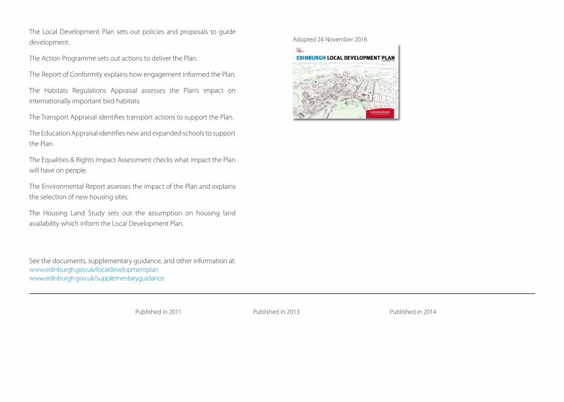
Adopted 24 November 2016

Contents
1 Introduction 2
Part 1 Strategy and Proposals
1 Aims and Strategy 7
2 A Plan to Protect and Enhance the Environment 9
3 A Plan to Provide Jobs, Homes and Services in the Right Locations 19
4 A Plan That Can Deliver 42
5 A Plan for All Parts of the City 43
Part 2 Policies
1 Delivering the Strategy 89
2 Design Principles for New Development 93
3 Caring for the Environment 99
4 Employment and Economic Development 108
5 Housing and Community Facilities 114
6 Shopping and Leisure 119
7 Transport 126
8 Resources and Services 132
Appendix A Conservation Areas 136
Appendix B Shopping Centres 138
Appendix C Table of Financial and Other Contributions 143
Appendix D CEC Land Ownership Schedule 144
Appendix E Glossary 153
Appendix F Index of Policies 160
Edinburgh Local Development Plan November 2016
1

ForewordEdinburgh is a successful, growing city. This growth continues even in
this time of economic challenges. It is driven by the city’s assets, which
include its citizens, its centres of employment and learning, and its quality
of life. This growth needs to be guided and shaped in order to maintain
and promote those assets and to deliver the Council’s objectives. That is
what this plan is for.
We will use this plan to provide a clear and fair basis for planning decisions,
which in turn provides a stable framework for investment in Edinburgh.
This adopted Plan has been shaped by the thousands of responses
received at earlier stages of the project. We wish to thank everyone for
their contributions so far, and now ask that everyone works together to
deliver the Plan and its aims.
Councillor Alex LunnVice-Convener of the Planning Committee
1 Introduction
1 For the first time in over 30 years, Edinburgh has one plan covering the
whole of the Council area. Across Edinburgh’s Old and New Towns, from the
Waterfront areas of Granton and Leith to the Pentland Hills, from Queensferry
and Kirkliston to Craigmillar and Newcraighall and many other places in
between, the Edinburgh Local Development Plan (LDP) provides a clear and
consistent planning framework. Now adopted, the LDP replaces two local
plans - the Edinburgh City Local Plan and the Rural West Edinburgh Local
Plan.
2 The LDP sets out policies and proposals relating to the development and
use of land in the Edinburgh area. The policies in the LDP will be used to
determine future planning applications. The planning system rests on the
powers which planning authorities have to manage development and to take
enforcement action against breaches of planning control. When appropriate,
the Council will remove, modify or stop unauthorised developments and
changes of use. These powers are used at the discretion of the Council.
3 The LDP will also inform decisions on investment opportunities and the
provision of infrastructure and community facilities. It is hoped that local
residents and community groups use the LDP to better understand and get
involved in the planning issues affecting their areas.
4 There are two main parts to the LDP:Councillor Ian PerryConvener of the Planning Committee
Edinburgh Local Development Plan November 2016
2

Part 1 Strategy and Proposals
This explains what the LDP means for Edinburgh over the next 5 to 10 years.
It sets out the plan’s five core aims and anticipated land use changes – the
main development proposals and where they are expected to take place. It
also includes site briefs and development principles to guide some proposals.
Part 1 highlights which areas and features of the city will be protected and,
where possible, enhanced.
Part 2 Policies
This sets out the policies which the Council will use to ensure that
development helps meet the core aims of the LDP. Planning applications
will be assessed against relevant policies. The policies are presented in 8
sections:
• Delivering the Strategy
• Design Principles for New Development
• Caring for the Environment
• Employment and Economic Development
• Housing and Community Facilities
• Shopping and Leisure
• Transport
• Resources and Services
The LDP also includes a Proposals Map which illustrates the policies and
proposals on an Ordnance Survey base map.
5 The LDP itself cannot make development happen. Investment is needed
from private sector developers and a range of public sector organisations
to bring forward development proposals and supporting infrastructure.
The LDP is accompanied by an Action Programme which sets out how the
Council intends the plan to be implemented. It includes a list of actions
required to deliver the policies and proposals, including who is to carry out
the action and the timescales involved.
6 In Scotland’s four city regions, the development plan is made up of a Strategic
Development Plan (SDP) as well as the LDP. The SDP for the Edinburgh city
region has been prepared by SESPlan, the Strategic Development Planning
Authority for Edinburgh and South East Scotland. SESplan comprises six
member authorities – The City of Edinburgh, East Lothian, Fife, Midlothian,
Scottish Borders and West Lothian.
7 The SDP vision is that:
‘By 2032, the Edinburgh City Region is a healthier, more prosperous and sustainable place which continues to be internationally recognised as an outstanding area in which to live, work and do business’.
It includes eight aims and a spatial strategy aimed at meeting three
key challenges - climate change, demographic change and sustainable
economic growth.
Edinburgh Local Development Plan November 2016
3

Introduction
Main Issues Report
Proposed Plan
Second Proposed Plan
Adopted Plan
3 months consultation
Representations (6 weeks)
Representations (6 weeks)
Examination
October 2011
March 2013
June 2014
Novem
ber 2016
The first Proposed LDP (March 2013) was prepared on the basis of the Proposed SDP.
A representation period followed in 2013. Scottish Ministers approved the Strategic
Development Plan in June 2013 and required SESplan to prepare Supplementary
Guidance to distribute an increased overall housing requirement amongst the six Council
areas. These changes led to the preparation of the Second Proposed Plan, which was
published for representations from August to October 2014. An examination to deal with
the representations ran from June 2015 to June 2016. It recommended modifications,
leading to the adopted Plan.
The main stages in the LDP programme are summarised below .
8 Edinburgh’s LDP is consistent with the SDP and its Supplementary Guidance
on Housing Land and has a key role in helping to meet its aims and deliver
its strategy.
9 The Council is preparing supplementary guidance in connection with:
• Policy Emp 2 Edinburgh BioQuarter
• Policy Ret 9 in relation to alternative uses in town centres
• Policy Del 1 in relation to developer contributions
• Policy RS 1 in relation to heat mapping.
This approach allows more detailed consideration of these topics in
consultation with all interested parties. Once adopted, this supplementary
guidance will form part of the development plan and be treated as such in
determining planning applications.
10 In addition, the Council will continue to prepare, use and review its non-
statutory guidelines (referred to collectively as Council guidance in this
plan), development briefs and frameworks to provide detailed advice on a
range of planning matters.
4
Edinburgh Local Development Plan November 2016

Introduction 5
Part 1
Strategy and Proposals
Edinburgh Local Development Plan November 2016

City Centre:
Waterfront:
West Edinburgh:
South East:Regeneration,
Housing
SE:
BioQuarter
Business &Industry
Airport
Heriot-Watt
IndustryMixed Use Regeneration
Business Investment, Public Transport, Housing
Shopping & Entertainment, Offices, Transport Hubs, Housing
Housing
SE:Housing
SE:Housing
CRAMONDMUIRHOUSE
TRINITY LEITH
INVERLEITHDAVIDSON’S MAINS
CORSTORPHINE MURRAYFIELD
SIGHTHILL
WESTER HAILES
COLINTON
FAIRMILEHEAD
MORNINGSIDE
GILMERTON
GRACEMOUNT
MEADOWBANK
DUDDINGSTON
CRAIGMILLAR
QUEENSFERRY
GRANTON
PORTOBELLOKIRKLISTON
NEWBRIDGE
RATHO
BALERNO
CURRIE
JUNIPER GREEN
STRAITON BONNYRIGG
DANDERHALL
SHAWFAIR
DALKEITH
MUSSELBURGH
City by-pass
City by
-pas
s
City by-pass
River Almond & country estates
Union Canal
Water of Leith & Pentland Hills
Blackford & Braid Hills
Holyrood Park
Esk
Valley
Major new development in Strategic development area
New housing allocations elsewhere
Employment centre
Large area of regeneration
Green belt controlling out-ward growth of city
Greenspace
Tram line safeguards
Watercourse
Figure 1 LDP Spatial Strategy Summary Map Indicative only - not part of the Proposals Map
6

Part 1 Section 1 - Aims and Strategy
1 Aims and Strategy
12 The Strategic Development Plan for Edinburgh and South East Scotland
(SDP) identifies four Strategic Development Areas in Edinburgh. These will
be the biggest areas of change over the next 5-10 years, providing a focus
for new housing development, investment opportunities and job creation
in locations with good accessibility to existing or planned public transport
services. The LDP includes significant development proposals in these areas.
It also supports change elsewhere in the city, for example, regeneration
opportunities, redevelopment of vacant sites, green network improvements,
new uses for empty commercial units and increased densities in appropriate
locations.
13 The LDP supports Edinburgh’s role as Scotland’s capital city and recognises
its importance as a key driver of the Scottish economy. Whilst the LDP
promotes change and supports the growth of the city, it also places
considerable importance on retaining and where possible enhancing
Edinburgh’s built and natural assets for future generations. The green belt
plays an important role in directing the planned growth of the city and
supporting regeneration. The quality of Edinburgh’s buildings, streets and
spaces influences the wellbeing of people living and working in the city and
helps attract investment and create jobs. The LDP policies to protect and
enhance the built and natural environment are therefore an integral part
of the overall strategy. Figure 1 summarises the LDP’s spatial strategy and
shows what it means for different parts of the city.
11 The challenge for this Local Development Plan (LDP) is to help make
Edinburgh the best place it can be, for everyone, now and in the future.
This is not an easy challenge. We are living in tough economic times when
difficult choices have to be made between competing priorities. In facing
this challenge, the LDP aims to:
1. support the growth of the city economy
2. help increase the number and improve the quality of new homes being built
3. help ensure that the citizens of Edinburgh can get around easily by sustainable transport modes to access jobs and services
4. look after and improve our environment for future generations in a changing climate and
5. help create strong, sustainable and healthier communities, enabling all residents to enjoy a high quality of life.
These aims are inter-linked and each can have impacts, both positive and
negative, on the other four. The role of the LDP is to balance these aims to
maximise the benefits of development for the good of Edinburgh. The LDP
aims support the vision and outcomes outlined in the Council’s Strategic
Plan 2012-2017.
7
Edinburgh Local Development Plan November 2016

Part 1 Section 1 - Aims and Strategy
14 Edinburgh is a successful and growing city. The LDP strategy directs future
growth to four Strategic Development Areas – major redevelopment
opportunities in the City Centre, continuing regeneration at Edinburgh
Waterfront, urban expansion with new tram and rail infrastructure at West
Edinburgh and housing and business development on a range of sites in
South East Edinburgh. In addition to new greenfield housing allocations in
West Edinburgh and South East Edinburgh Strategic Development Areas,
new sites have also been identified at Queensferry, Currie and Balerno.
15 The plan continues to promote the reuse of previously developed land and
relies on windfall sites to contribute to meet the city’s housing requirement.
Potential large scale regeneration opportunities are shown on Figure 1.
These are supported by the LDP’s policies and some have master plans
or development briefs to guide their development. Prior to identifying
additional greenfield housing sites, consideration has been given to
potential new brownfield opportunities within the existing urban area. The
LDP maintains a green belt around Edinburgh whilst ensuring the strategic
growth requirements of the SDP can be accommodated. Key elements of
the green belt controlling the outward growth of the city are identified on
Figure 1.
16 The LDP strategy directs new housing to sites which best meet a range
of assessment criteria including landscape impact, green belt boundaries,
accessibility to public transport and infrastructure capacity. One of
the new housing sites (at Brunstane) will result in further coalescence
between Edinburgh and Musselburgh. Whilst development resulting in the
coalescence of settlements is not normally supported, it is justified in this
instance because this site compared favourably to other possible options
in the housing site assessment - see Volume 2 of the Environmental Report
Second Revision.
8
Edinburgh Local Development Plan November 2016

Part 1 Section 2 - A Plan to Protect and Enhance the Environment
2 A Plan to Protect and Enhance the Environment
1) Climate Change
17 The Climate Change (Scotland) Act 2009 and the Planning etc. (Scotland)
Act 2006 place a duty on the Council to act in the best way to reduce
emissions, adapt to climate change and prepare development plans to
further sustainable development. Scottish Planning Policy (SPP) also requires
development plans to ensure that the siting, design and layout of all new
development will limit likely greenhouse gas emissions.
18 The Council’s commitment to fulfilling these duties is evident throughout the
LDP, with policies addressing both the reduction of greenhouse emissions
and the ability to adapt to a changing climate. The LDP:
• promotes development in sustainable locations and requires new
buildings to include carbon reduction measures
• promotes sustainable and active travel
• supports small to medium scale, decentralised and community based
renewables, and the greater use of micro-generation of renewable energy
• supports the adaptation of existing homes to reduce energy use, including
listed buildings and those located in conservation areas, provided there is
no adverse impact on historic character and appearance
• aims to enhance the city’s green network by encouraging land
management practices which capture, store and retain carbon, prevent
and manage flood risk
• supports the delivery of facilities needed to divert waste away from landfill
and promote the prevention, reuse, recycling and recovery of materials
(including heat from waste), with disposal to landfill as the final option.
Figure 2 Current national and city sustainability targets
TARGETS
Carbon dioxide Reduce carbon emissions by over 40% across the city by 2020 (Sustainable Edinburgh 2020: base year 1990)
Energy use Reduce energy consumption by at least 12% by 2020 (Sustainable Edinburgh 2020: base year 1990)
Energy generation More renewable energy, with renewable energy technologies contributing at least 40% of energy consumed in the city by 2020 (Sustainable Edinburgh 2020)
Renewable sources to generate the equivalent of 100% of Scotland’s gross annual electricity consumption by 2020 (national target)
Heat Renewable sources to provide equivalent of 11% of Scotland’s heat demand by 2020 (national target)
Waste 70% of all waste to be recycled by 2025 (Zero Waste Plan). No more than 5% of all waste going to landfill by 2025 (Zero Waste Plan).
2) Edinburgh’s Environmental Assets
19 Edinburgh’s natural and historic environment contributes to its distinctive
character, local appeal and world-wide reputation. The city lies between
the internationally important habitat of the Firth of Forth and the dramatic
backdrop of the Pentland Hills Regional Park. The Old and New Towns of
Edinburgh World Heritage Site and Edinburgh’s conservation areas comprise
9
Edinburgh Local Development Plan November 2016

Part 1 Section 2 - A Plan to Protect and Enhance the Environment
architecturally significant neighbourhoods and villages, together with many
individual listed buildings. These interact with the city’s open hills and
wooded river valleys, to create a unique and diverse townscape. The LDP
area supports a range of protected plants and animals and also contains
archaeological remains providing valuable evidence of how we used to live.
20 Edinburgh’s built, cultural and natural heritage are valuable assets which
contribute to broader strategic objectives of sustainable economic
development, regeneration and community development and provide the
context for good urban design. The proper conservation and management
of these assets is an integral part of the wider planning function of the
Council.
21 The detailed policies in Part 2 Section 3 (Caring for the Environment) will
be used to ensure development proposals protect and, where possible,
enhance the important features of the historic and natural environment.
Historic Environment
22 Edinburgh contains the greatest concentration of built heritage assets in
Scotland. There are many elements of Edinburgh’s built heritage worthy
of protection. The Edinburgh Built Heritage Strategy aims to ensure an
understanding of Edinburgh’s heritage assets in order that they can be
protected and conserved for existing and future generations, and managed
in a co-ordinated and structured manner.
World Heritage Sites
23 Two of Edinburgh’s most widely acclaimed assets are its World Heritage Sites.
World Heritage Sites are places of outstanding universal value, recognised
under the terms of the 1972 UNESCO Convention concerning the Protection
of the World Cultural and Natural Heritage. The ‘Old and New Towns of
Edinburgh’ became a World Heritage Site in 1995, and the ‘Forth Bridge’
became a World Heritage Site in 2015. The boundaries are shown in Figure
3a and Figure 3b and on the Proposals Map.
24 UNESCO requires every world heritage site to have a management plan
which says how the Outstanding Universal Value (OUV) of the Site will be
protected. OUV is the collection of attributes which make the area special
and give Edinburgh its international importance.
Figure 3a - The Old and New Towns of Edinburgh World Heritage Site
10
Edinburgh Local Development Plan November 2016

Part 1 Section 2 - A Plan to Protect and Enhance the Environment
25 Edinburgh’s World Heritage Site
Management Plans have been
prepared by a partnership of the
Council, Historic Environment
Scotland and Edinburgh World
Heritage. They provide a link
between the international
requirements of World
Heritage, the planning process
and the wider management
issues involved in protecting
complex Sites in Edinburgh.
The Management Plans informs
separate Action Plans and may
be a material consideration for
decisions on planning matters.
Listed Buildings
26 Listed Buildings are buildings of
special architectural or historic
interest. Edinburgh has the
greatest concentration of listed
buildings in Scotland - around
5,000 listed items comprising
31,500 individual buildings. 75%
of buildings in the World Heritage
Site are listed.
27 Listed buildings have statutory protection, which means that listed building
consent is required for the demolition of a listed building, or its alteration or
extension in any manner which would affect its character. Some proposals
may also require planning permission. Development plan policies have a
role to play in helping to protect listed buildings, their setting and features
of special interest.
Conservation Areas
28 Across Edinburgh there are a number of designated conservation areas.
These are areas of special architectural or historic interest, the character
or appearance of which should be conserved or enhanced. A quarter of
Edinburgh’s urban area lies within a conservation area. Each conservation
area has its own unique character and appearance that is identified in a
character appraisal. The underlying principle behind the designation of
the conservation areas is to maintain the variety of character that illustrates
the history of Edinburgh. An ongoing review of conservation areas will
consider amendments to boundaries, opportunities for enhancement, and
the designation of new conservation areas. In conservation areas, consent
is required for changes such as demolitions and window alterations, which
elsewhere in the city wouldn’t require permission. This additional level of
control helps to ensure that small scale incremental changes do not damage
the character of the conservation areas. The Proposals Map and Appendix A
show which parts of the city are covered by conservation areas.
Inventory of Gardens and Designed Landscapes
29 The national Inventory of Gardens and Designed Landscapes is compiled
by Historic Environment Scotland and includes 21 sites in Edinburgh. The
Figure 3b - Forth Bridge World Heritage Site
11
Edinburgh Local Development Plan November 2016

Part 1 Section 2 - A Plan to Protect and Enhance the Environment
Inventory sites are identified on the Proposals Map and the Council is
required to consult Historic Environment Scotland on proposals affecting
these. The Council will protect Inventory sites and consider whether
restoration or improvement of historic landscape features can be achieved
through development proposals.
Archaeology
30 Edinburgh has a wealth of archaeological resources, from buildings to buried
remains and marine wrecks, dating from earliest prehistory to the 20th
century. This archaeological resource is finite and non-renewable. It contains
unique information about how the city’s historic and natural environment
developed over time. In addition to providing a valuable insight into the
past, archaeological remains also contribute to a sense of place and bring
leisure and tourism benefits. Care must be taken to ensure that these are not
needlessly destroyed by development.
31 The Council maintains a Historic Environment Record of known designated
and non-designated archaeological remains which in 2013 contains 63
nationally important scheduled monuments protected by the Ancient
Monuments and Archaeological Areas Act 1979.
32 There may also be many potentially important archaeological features
which have not yet been discovered. These are therefore not included in
national or local records. Scottish Planning Policy sets out the Government’s
approach to protecting archaeological remains and the weight to be given
to archaeological considerations when assessing against the benefits of
development. Detailed advice is provided in Planning Advice Note 2/2011
Planning and Archaeology.
Natural Environment
33 Edinburgh’s open spaces and landscape features contribute to the structure
and identity of the city, enhance the quality of life of residents and the city’s
appeal as a place for tourism and investment. The city’s natural environment
also supports a diversity of habitats, flora and fauna.
Green Belt
34 The Edinburgh Green Belt extends beyond the City of Edinburgh Council
area, into East Lothian and Midlothian. Its purpose is to:
• direct planned growth to the most appropriate locations and support
regeneration
• protect and enhance the quality, character, landscape setting and identity
of the city and neighbouring towns
• protect and give access to open space within and around the city and
neighbouring towns.
Green belt designation can also be used to prevent the coalescence of
settlements.
35 The LDP defines green belt boundaries to meet these purposes, ensuring
that the strategic growth requirements of the SDP can be accommodated.
The boundaries of the green belt shown on the Proposals Map are largely
unchanged from previous local plans. However, some areas have been taken
out of the green belt for the following reasons:
• land in West Edinburgh and South East Edinburgh Strategic Development
Areas to meet SDP strategic housing requirements
12
Edinburgh Local Development Plan November 2016

Part 1 Section 2 - A Plan to Protect and Enhance the Environment
• sites at Queensferry, Currie and Balerno also to meet SDP strategic housing
requirements
• Edinburgh Airport, Royal Highland Centre, International Business Gateway,
Heriot–Watt Campus and Hermiston Village to accord with Scottish
Planning Policy.
36 To ensure the Edinburgh Green Belt continues to meet its objectives in terms
of directing planned growth, protecting landscape setting and providing
access to open space, the LDP controls the types of development that will be
allowed in the green belt. The LDP also promotes opportunities to enhance
the appearance of the green belt and to increase countryside access.
Landscape
37 The Council’s Natural Heritage Strategy sets out how planning can help
meet the objectives of national landscape policy and the commitments of
the European Landscape Convention and Scotland’s Landscape Charter.
38 Special Landscape Areas (SLAs) are designated to protect locally important
landscapes from development which would harm their character and
appearance. 22 SLAs are identified on the Proposals Map due to their
distinctive characteristics and qualities, which contribute to the city’s unique
setting and sense of place. These include examples of Edinburgh’s coastal
margin, hills, valleys and designed landscapes, which are described in the
‘Statements of Importance’ prepared for each SLA.
39 Outwith the SLAs, a range of design and environmental policies and
guidance highlight the value and potential of all landscapes. The LDP
recognises that development can bring benefits through conserving and
enhancing landscape character and important topographical features and
creating future landscapes of quality and character in the provision of new
green infrastructure.
Trees and Woodland
40 Trees and woodland make an important contribution to the character and
quality of the urban area and countryside providing biodiversity, landscape
and cultural benefits. Specific legislation protects trees in conservation areas
and those covered by a Tree Preservation Order. The Edinburgh and Lothians
Forestry and Woodland Strategy provides a long term vision for woodland
creation and management to increase woodland cover and create better
Figure 4 Edinburgh Green Belt
13
Edinburgh Local Development Plan November 2016

Part 1 Section 2 - A Plan to Protect and Enhance the Environment
links. Opportunities will be taken to deliver the Strategy through greenspace
proposals and management of the woodland resource throughout the city.
Biodiversity
41 The Council’s Natural Heritage Strategy sets out how planning can meet
the objectives of national policy on biodiversity and fulfil the commitments
of the Biodiversity Duty and the Scottish Geodiversity Charter. Planning
decisions must comply with environmental legislation on international and
national protected sites and species. In addition, Local Nature Reserves and
Local Nature Conservation Sites are identified to protect biodiversity at the
local level and are shown on the proposals map. The plan includes policies
relating to a range of biodiversity designations.
42 LDP policies and Council guidance also recognise the value and potential
of biodiversity outwith designated areas and set out key principles for
enhancing habitat and ecosystems.
Water and Air
43 The water environment is a key natural resource which requires stringent
protection from the potentially harmful effects of new development, both
on ecological quality and in adding to flood risk. Within the urban area,
some built and some unbuilt areas have experienced flooding in extreme
weather conditions. The Council, with others, has a responsibility to reduce
overall flood risk. It has completed a flood prevention scheme for the Braid
Burn and is implementing one for the Water of Leith. It has also identified
unbuilt areas of land which fulfil an important flood function, and which
should be allowed to flood in order to protect other, built-up areas from
floodwater. These are shown on the Proposals Map as areas of importance
for flood management. A flood map published by the Scottish Environment
Protection Agency shows some areas on Edinburgh’s waterfront potentially
at medium to high risk of coastal flooding, taking into account climate
change. The LDP does not prevent development in such locations but will
require all proposals to consider and address any potential risk of flooding.
44 The planning system has a role to play in the protection of air quality, by
ensuring that development does not adversely affect air quality in Air Quality
Management Areas (AQMAs) or, by cumulative impacts, lead to the creation
of further AQMAs in the city. These are areas where air quality standards
are not being met, and for which remedial measures should therefore be
taken. AQMAs have been declared for five areas in Edinburgh - the city
centre, St John’s Road, Corstorphine, Great Junction Street in Leith, Glasgow
Road (A8) at Ratho Station and Inverleith Row/Ferry Road junction. Poor air
quality in these locations is largely due to traffic congestion. The Council
has prepared an action plan setting out measures intended to help reduce
vehicle emissions within these areas. The Council monitors air quality in
other locations and may need to declare further AQMAs.
3) Creating Successful Places
Place-making and Design
45 Edinburgh’s distinct geography and rich and varied heritage of buildings and
urban design combine to create a cityscape of excellence. New development,
through its design and contribution to place-making, should enhance not
detract from the city’s overall character and quality of environment. Good
14
Edinburgh Local Development Plan November 2016

Part 1 Section 2 - A Plan to Protect and Enhance the Environment
design can help achieve a wide range of social, economic and environmental
goals, creating places that are successful and sustainable. The design of a
place can define how people live, how much energy they use, how efficient
transport systems are and whether businesses succeed. The LDP’s design
related policies aim to raise design quality and create successful places.
Council guidance supports these policies and provides more detailed
information and advice.
46 This LDP is also supported by a wide range of area and site specific design
guidance aimed at promoting high quality place-making and design. These
frameworks, development briefs and master plans can be viewed on the
Council’s website. Their role is to guide and control development, taking
account of the particular characteristics of a site or area and addressing
matters such as mix of uses, form and height of buildings, streets and public
spaces. In creating high quality places, the spaces between buildings i.e.
streets, civic squares and public realm, should be given as much consideration
as the design of buildings.
47 The site briefs and development principles included in Part 1 Section 5 set
out key design requirements to guide the development of new housing
sites and other major development opportunities. Master plans should
be prepared by developers as part of the planning application process to
demonstrate how their proposals meet the LDP’s design and place-making
objectives and any site specific requirements. Master plans should also
provide information on the mix of uses, how a development relates to the
surrounding area and, where relevant, proposals on an adjacent site and
development phasing.
Green Network
48 The green network is the linking together of natural, semi-natural and man-
made open spaces to create an interconnected network that provides
recreational opportunities, improves accessibility within the urban area and
to the surrounding countryside and enhances biodiversity and the character
of the landscape and townscape, including the setting of new development.
Edinburgh’s green network forms part of a wider Central Scotland Green
Network (CSGN), which is identified as a national development in National
Planning Framework 3. The Council is a signatory to the CSGN declaration
and is working in partnership with neighbouring authorities and other
stakeholders to support and deliver a range of projects.
49 Some parts of the green belt contribute to Edinburgh’s green network. Key
elements include the Pentlands Hill Regional Park, Bonaly Country Park,
Cammo estate, the Water of Leith, the Union Canal, Waterfront Promenade
and the proposed South East Wedge parkland.
50 Through various policies, the LDP aims to protect, promote and enhance
the wildlife, recreational, landscape and access value of the green network.
Developments are expected to incorporate elements that positively
contribute to the green network through, for example:
• providing new open space and/or improving the quality of, or access to
existing public open space, thus, reducing areas of deficiency
• incorporating existing landscape features in new development and
providing new landscape planting and other green infrastructure along
water courses, coast and urban edge
15
Edinburgh Local Development Plan November 2016

Part 1 Section 2 - A Plan to Protect and Enhance the Environment
Figure 5 Green Network• extending and linking to the existing path and active
travel network where opportunities arise
• providing for a range of different recreational uses
which promote healthy living
• providing new and/or enhancing existing wildlife
habitats through building and landscape design, thus,
preventing habitat fragmentation where possible
• managing surface water drainage, treatment and flood
risk through sustainable urban drainage, providing
amenity and biodiversity benefits e.g. green roofs,
swales and ponds
• mitigating and adapting to the impacts of climate
change e.g. resource efficient design, planting trees to
capture carbon, intercept and absorb rainfall.
51 Enhancements of the green network will be required
to mitigate any impacts from development on existing
wildlife habitats or potential connections between them,
or other features of value to natural heritage, green space,
landscape and recreation. Developers must ensure that
green networks are considered in the preparation of
future planning applications. Figure 5 is an indicative
map of Edinburgh’s green network illustrating existing
provision and opportunities to improve and/or extend
the network.
52 Development on greenfield housing sites provides opportunities to extend existing green
corridors into the wider countryside. Green network enhancement should be an integral
part of the new LDP housing proposals. Green network opportunities are highlighted in the
housing site briefs in Part 1 Section 5.
Indicative only - not part of the Proposals Map
16
Edinburgh Local Development Plan November 2016

Part 1 Section 2 - A Plan to Protect and Enhance the Environment
53 In 2010, the Council prepared an Open Space Strategy based on an audit
of open space resources across Edinburgh. Its purpose is to ensure a co-
ordinated and consistent approach to meeting Edinburgh’s open space
needs and protecting and developing the city’s network of open spaces. The
Strategy sets standards for the provision of different types of open space and
identifies where these standards are not currently met.The Strategy, together
with 12 accompanying action plans, identifies opportunities to improve the
quantity and quality of open space provision in Edinburgh. A replacement
strategy was published in draft in 2016.
54 The LDP includes 11 greenspace proposals (Table 1). The majority of these
relate to the creation of major new greenspace in conjunction with wider
redevelopment proposals. These will play an important role in meeting
the open space needs of new residents and will also bring benefits for
neighbouring existing communities. Where possible, these proposals will
be incorporated into Edinburgh’s green network by creating and improving
connections to other spaces.
Table 1: Greenspace Proposals
Proposal Comments
Reference: GS 1
Name: Dalry Community Park
Proposal: Extension and enhancement of public park
Opportunity to enhance and extend an existing park to meet existing deficiencies in provision and as part of public open space requirements associated with the redevelopment of Fountainbridge.
Table 1: Greenspace Proposals
Proposal Comments
Reference: GS 2
Name: Leith Western Harbour Central Park
Proposal: Provision of 5.2 hectare publicly accessible park
The approved proposals for Western Harbour include a new park with formal and informal recreational facilities for all ages.
Reference: GS 3
Name : Leith Links Seaward Extension
Proposal: Sports pitches, allotments and other recreational uses laid out in a linear greenspace.
The housing-led redevelopment of former industrial land east of Salamander Place is centred on a linear extension of Leith Links. A landscape design study approved in 2008 shows how the extension can connect with the Links by reshaping and enlarging the existing allotments.
Reference: GS 4
Name: South East Wedge Parkland
Proposal: Parkland, open land and structure planting
Land around Craigmillar/Greendykes retained in the green belt will be landscaped to provide multi-functional parkland, woodland and country paths linking with parallel developments in Midlothian.
Reference: GS 5
Name: Niddrie Burn Parkland
Proposal: New park
The Council has carried out work to remove culverts and form a new channel for the Niddrie Burn as part of the urban expansion proposals at Greendykes. This is the first phase in creating a new park.
Reference: GS 6
Name: IBG Open Space
Proposal: Three areas of parkland - 1) along A8 corridor; 2) central parkland and 3) archaeology park
The West Edinburgh Landscape Framework (approved in December 2011) identifies strategic landscape design and open space requirements. Three main areas of open space are proposed as key elements of the International Business Gateway.
17
Edinburgh Local Development Plan November 2016
Part 1 Section 2 - A Plan to Protect and Enhance the Environment
Table 1: Greenspace Proposals
Proposal Comments
Reference: GS 7
Name: Gogar Burn
Proposal: Diversion of Gogar Burn
Proposed diversion of the Gogar Burn as shown on the Proposals Map. This will bring benefits in terms of reducing flood risk, improving water quality and enhancing biodiversity
Reference: GS 8
Name: Inverleith Depot
Proposal: Conversion of service depot into greenspace
The Council is keeping the operational role of its service depots under review. If that process determines that the depot at Inverleith Park is no longer required for depot functions or other services, it can be converted into green space. The type(s) of greenspace should be identified at that stage in consultation with the local community and should take account of local and citywide needs.
Reference: GS 9
Name : Broomhills Park
Proposal: New large park in housing-led development site
The centre of the Broomhills housing site (Proposal HSG 21) is a raised knoll which must remain undeveloped to reduce impact on the landscape setting of the city. This is an opportunity to create a new community park which benefits from attractive views. It should be landscaped and maintained to meet the Council’s large greenspace standard.
Reference: GS 10
Name : Clovenstone Drive
Proposal: Greenspace enhancement
Proposals to enhance existing greenspace in conjunction with housing development on adjacent site (Proposal HSG31). Will include provision of play space and upgrading of football pitch.
Reference: GS 11
Name : Newmills Park
Proposal: New linear park
Proposal to create a new 3 hectare linear park in conjunction with housing development on adjacent site (Proposal HSG 37). It should be landscaped and maintained to meet the Council’s large greenspace standard.
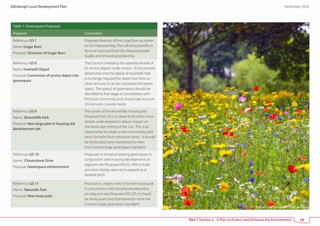
Figgate Park: Edinburgh Living Lanscapes
18
Edinburgh Local Development Plan November 2016

Part 1 Section 3 - A Plan to Provide Jobs, Homes and Services in the Right Locations
3 A Plan to Provide Jobs, Homes and Services in the Right Locations
1) Economic Development
55 The Council’s economic strategy seeks sustainable growth through
investment in jobs – focussing on development and regeneration, inward
investment, support for businesses and helping unemployed people
into work or learning. A successful Edinburgh economy will have wider
implications across the city region and for Scotland as a whole. The LDP has
a key role in helping to deliver this strategy.
56 The strength of Edinburgh’s economy is based on a range of key sectors,
for example tourism, financial services, life sciences and higher education.
Edinburgh also has a wide range of cultural, arts and sports venues which
bring economic benefits as well as enhancing the wellbeing of residents and
visitors. The LDP supports existing businesses, makes specific provision for
a growing student population, continues to promote previously identified
economic proposals and highlights new investment opportunities.
57 There are many economic development opportunities across the city,
available to accommodate businesses of varying types and sizes (see Figure
6). These include seven special economic areas, strategic office locations in
the city centre, Leith and Edinburgh Park, and planned industrial estates and
areas such as Newbridge.
Figure 6 Opportunities for Economic Development
58 Economic growth is a key aim of the Strategic Development Plan. The SDP
requires the LDP to retain existing levels of strategic employment land and
provide a generous range and choice of employment sites in accessible
locations. It also recognises the important role of the Edinburgh city region
as a key driver of the Scottish economy. Strategic enhancement of Edinburgh
City Centre
Strategic Business Centre
Business and Industry Area
Special Economic Area
Indicative only - not part of the Proposals Map
19
Edinburgh Local Development Plan November 2016

Part 1 Section 3 - A Plan to Provide Jobs, Homes and Services in the Right Locations
Airport has the status of a national development along with associated
provision for business space/mixed use and a new National Showground
Facility. In this context the plan identifies land for the expansion of Edinburgh
Airport, proposals for business and mixed use at the International Business
Gateway and a safeguarded site to the south of the A8 for a new National
Showground Facility. The Scottish Government has also identified two
enterprise locations in Edinburgh in recognition of their importance to the
national economy - Leith Docks (low carbon/renewables) and Edinburgh
BioQuarter (life sciences).
Edinburgh’s Special Economic Areas
59 The LDP identifies seven ‘special economic areas’ (see Table 2), all of which
are of national or strategic economic importance, providing or with the
potential to provide a significant number of jobs. The plan includes individual
policies for six of these sites (Policy Emp 2 – Emp 7) to ensure development
proposals realise their economic potential. A slightly different approach is
taken for Leith Docks where economic proposals will be assessed using the
general Policy Emp 8 and the area based Policy Del 3.
Table 2 Special Economic Areas
Area Main Purpose
Name: Edinburgh BioQuarter
Location: East of A7, South East Edinburgh
Site area: 72 ha
Relevant LDP policy - Emp 2
The Edinburgh BioQuarter (EBQ) aims to become a top 10 global centre of excellence for life sciences offering opportunities for academic, commercial and clinical research and development with health care, teaching facilities and appropriate support services and facilities focused on the Edinburgh Royal Infirmary. Its development is being promoted by a partnership of the Council and Scottish Enterprise, University of Edinburgh and NHS Lothian.
Name: Riccarton University Campus and Business Park
Location: South of A71,
South West Edinburgh
Site area: 153 ha
Relevant LDP policy - Emp 3
The campus comprises Heriot-Watt University and the adjacent business park. A Master Plan was approved in January 2001. In 2013, it was identified as the preferred location for a National Performance Centre for Sport.
Its main purpose is academic teaching and research and business uses with a functional link to the University.
There is currently 20.28 hectares of undeveloped land available within Riccarton Research Park.
Name: Edinburgh Airport
Location: North of A8, West Edinburgh
Site area: 380 ha
Relevant LDP policy - Emp 4
The connectivity provided by Edinburgh Airport supports and enhances Scotland’s economy. The most recent Airport Master Plan was prepared by the former owner in July 2011 and agreed by the Council in March 2012. The Master Plan sets out development intentions for airport and related uses up to 2020 with more indicative proposals from 2020-2040.
20
Edinburgh Local Development Plan November 2016

Part 1 Section 3 - A Plan to Provide Jobs, Homes and Services in the Right Locations
Table 2 Special Economic Areas
Area Main Purpose
Name: Royal Highland Centre
Location: North of A8, West Edinburgh
Site area: 129 ha
Relevant LDP policy - Emp 5
The main purpose of the RHC site is for showground uses. Its owners, the Royal Highland and Agricultural Society of Scotland, intend to bring forward major proposals to expand and enhance facilities on their current site. A Master Plan has been prepared as part of a planning application. Proposals include a new exhibition hall, Centre for Excellence including retail facilities, Agribusiness and office uses, hotel, improved internal circulation and a new entrance boulevard onto Eastfield Road.
The RHC may need to relocate to the south of the A8 in the longer term to allow for airport expansion.
Name: International Business Gateway
Location: North of A8, West Edinburgh
Site area: 136 ha
Relevant LDP policy - Emp 6
The International Business Gateway is a key location to attract international markets and secure appropriate business led mixed use development. National Planning Framework 3 identifies West Edinburgh, including the International Business Gateway, as being a significant location for investment. The International Business Gateway is a key location to attract international markets and secure appropriate business led mixed use development. It will come forward in a series of phases incorporating business development and supporting uses. The supporting uses include an opportunity for housing development as identified in Table 4. The Development Principles in Part 1 Section 5 identify the requirements for the consideration of proposals for the IBG through the development management process, indicating how business development and other uses can be accommodated together.
Table 2 Special Economic Areas
Area Main Purpose
Name: RBS Headquarters, Gogarburn
Location: South of A8, West Edinburgh
Site area: 45 ha
Relevant LDP policy - Emp 7
The main purpose of the site is for office development in a high quality landscape setting. A tram stop is to be provided to the north east of the site, increasing accessibility by public transport. Part of the site remains undeveloped and provides the opportunity for additional office and ancillary development.
Name: Leith Docks
Location: Northern and eastern part of Leith Waterfront
Site area: 128 hectares
Relevant LDP policy - Emp 8 and Del 3
The main purpose of this area is for business and industry.
The National Renewables Infrastructure Plan highlights the potential of Leith Docks as a suitable location for the manufacturing and servicing of wind turbines and other equipment to support the off-shore renewables industry.
2) Housing and Community Facilities
60 Edinburgh is a growing city as a result of increased birth rates, residents living
longer and people moving into the area for work or study. Its population
is now 477,000 (National Records of Scotland, 2011 Census). Population
and household changes have implications for housing need which in turn
influences the amount of housing land to be identified in LDPs. Providing
more and better homes for people is one of the overall aims of the plan,
to help meet housing need and support economic growth. The LDP also
recognises that a growing population increases the need for local shops and
community facilities such as schools, health care services and community
centres.
61 A housing needs and demand assessment (HNDA) for South East Scotland
21
Edinburgh Local Development Plan November 2016

Part 1 Section 3 - A Plan to Provide Jobs, Homes and Services in the Right Locations
was undertaken as part of the preparation of the Strategic Development
Plan and local housing strategies across the SESplan area. The SESplan area,
which covers Edinburgh, the Lothians, Scottish Borders and part of Fife,
functions as one housing market area. This means that some of the housing
demand generated by the city can and will be met in the wider city region.
62 The approved SDP indicates that land for a total of 107,560 new homes
will be required across the SESPlan area in the period up to 2024. SESPlan
has prepared Supplementary Guidance which sets out how much of this
requirement should be met in each Council area. The requirement for the
City of Edinburgh Council area is:
2009 - 2019 2019 – 2024 Total 2009-2024
22,300 7,210 29,510
63 The rate at which housing sites are developed is constrained by a variety
of factors including market conditions. The SDP accepts that the required
housing targets will be challenging to deliver. It stresses the importance
of ensuring growth is accompanied by the appropriate infrastructure. It
also requires greenbelt release to be minimised. Current programming
assumptions are subject to consultation with the house-building industry
and are monitored and updated through an annual housing land audit.
64 Figure 7a shows the current programming assumptions (drawing on the
2015 housing land audit) for existing sites and new sites as identified through
this plan. Alternate figures presented by the house-building industry assume
a more significant on-going shortfall extending over the plan period and
beyond. There has been a recent increase in completions and the Council
considers it has identified land with sufficient total capacity overall. However
Figure 7a signals a shortfall in the effective housing supply to 2019 and
potential on-going difficulties in maintaining a 5 year land supply.
Figure 7a Current anticipated programming of the Housing Land Supply (November 2015)
2015-2019 2019-2024Remainder 2024-2026
Total 2015-2026
Remaining SDP Supply Target from 2015
15,034 7,210 2,884 25,128
Plus 10% to ensure generosity
16,537 7,931 3,172 27,640
Effective supply 6,410 4,774 1,490 12,674
Contribution from sites capable of becoming effective
0 2,324 826 3,150
Windfall 1,694 2,116 846 4,656
Total supply from existing sources (derived from 2015 HLA)
8,104 9,214 3,162 20,480
Required New LDP allocation
8433 -1283 10 7,160
Brownfield 221 519 75 815
West Edinburgh SDA 175 1,400 400 1,975
South East Edinburgh SDA
756 1,396 280 2,432
Outwith SDA 162 1,080 288 1,530
Total new LDP allocations
1,314 4,395 1,043 6,752
Estimated shortfall 7,119 -5,678 -1,033 408
22
Edinburgh Local Development Plan November 2016

Part 1 Section 3 - A Plan to Provide Jobs, Homes and Services in the Right Locations
65 Figure 7b shows additional sites, as included in Table 4, which are also
identified for inclusion in the plan to assist in meeting the SDP housing
target. They are not currently accounted for in Table 7a as an assumed
programming remains to be established through the annual audit process.
Figure 7b Additional capacity from existing new sites.
Site Approximate Additional Capacity
Gilmerton Station Road HSG 24 160
Ravelrig Road Balerno 120
Edmonstone 170
The Wisp 71
Lang Loan 220
Total additional potential 742
66 The Council has a clear role in working with developers and other agencies
to ensure that there are no land use planning barriers to an increased take
up of its identified stock of housing land. This will be facilitated through
Supplementary Guidance to set out a realistic approach to enabling
infrastructure provision taking into account financial viability and looking at
innovative approaches to forward and gap funding. This will be particularly
important if the considerable potential of the waterfront is to be realised.
67 It may take time for any increase in the uptake of the identified land supply
and this may create pressure for the release of additional land through
Policy Hou 1. However any shortfall in the housing land supply, whilst
carrying considerable weight, does not over-ride other considerations such
as directing development to sustainable locations, securing green belt
objectives and the appropriate provision of infrastructure.
68 The current housing target is based on a ten year period and the development
plan is to be reviewed every five years. The process of preparing a new SDP
is already underway and the plan will be due for replacement in 2018. An
early review of this local development plan is proposed in order to ensure a
timeous response to any revised strategic housing target and to secure an
ongoing sufficient supply of housing land.
69 The City Housing Strategy 2012-2017 was approved in December 2011. It
aims to deliver three outcomes:
• People live in a home they can afford
• People live in a warm, safe home in a well-managed neighbourhood; and
• People can move if they need to.
This LDP can help meet these outcomes through the identification of sites
to increase the housing supply and the inclusion of policies on affordable
housing, sustainable building and design and place-making.
70 The proposals listed in Tables 3 and 4 provide a generous supply of land
for housing development on a range of sites across the city. Proposals HSG
1 – HSG 18, EW 1a-c, EW 2a-d, CC 2 – CC 4 relate to sites which already have
planning permission for housing development or were identified as housing
proposals in previous local plans. Sites HSG 19 – HSG 37, Del 4 and Emp
6 are new housing opportunities identified to meet Edinburgh’s housing
requirement. Detailed information on these proposals is provided in Part 1
Section 5. Apart from sites identified for development in this plan to deliver
the planned growth of the city, housing on greenfield land is unlikely to be
supported.
23
Edinburgh Local Development Plan November 2016

Part 1 Section 3 - A Plan to Provide Jobs, Homes and Services in the Right Locations
71 The plan aims to ensure that housing development on the sites listed in
Tables 3 and 4 and any other site that emerges during the period of the
plan, provides for a range of housing needs, meets climate change and
sustainable development objectives and is of a high quality in terms of site
layout and design. It also includes policies to ensure development doesn’t
detract from the appearance of or cause nuisance or disturbance in existing
housing areas.
72 Since its introduction in 2001, the Council’s affordable housing policy has
delivered nearly 700 new affordable homes. The availability of affordable
housing continues to be a major issue in Edinburgh and the Council and its
partners are using a range of innovative and flexible approaches to increase
the supply of new affordable homes. More information is available in the
Council’s Housing Strategy 2012 -2017. One element is the LDP requirement
for all private development of 12 or more homes to include 25% affordable
housing (Policy Hou 6).
73 In addition to providing affordable housing, the LDP also recognises the
housing needs of particular groups such as students, gypsies, travellers and
travelling showpeople.
Table 3 Existing Housing Proposals
Housing Proposal Comments
Reference: HSG 1
Name : Springfield, Queensferry
Site area: 13 hectares
Estimated total capacity: 150
The site lies on the western edge of the town between existing housing at Springfield and the line of the replacement Forth Crossing. Proposals should include playing fields, changing facilities and amenity open space. Opportunity to create a link road from Bo’ness Road to Society Road should be investigated.
Reference: HSG 2
Name: Agilent, South Queensferry
Site area: 14 hectares
Estimated total capacity: 450 (440*)
Planning permission granted for a housing-led mixed use development on the site of former Agilent plant.
Reference: HSG 3
Name: North Kirkliston
Site area: 44 hectares
Estimated total capacity: 680 (153*)
Site identified in previous local plan to meet strategic housing need. Planning permission granted and development underway.
Reference: HSG 4
Name : West Newbridge
Site area: 20 hectares
Estimated total capacity: 500
Opportunity for housing-led regeneration in heart of Newbridge. Environmental concerns such as the proximity of the site to industrial uses and impact of aircraft noise must be addressed through a comprehensive master plan for the whole site. Proposals should accord with the West Edinburgh Strategic Design Framework.
The finalised site capacity, design and layout should be informed by an adequate flood risk assessment.
* homes still to be built (calculated from the 2015 Housing Land Audit)
24
Edinburgh Local Development Plan November 2016

Part 1 Section 3 - A Plan to Provide Jobs, Homes and Services in the Right Locations
Table 3 Existing Housing Proposals
Housing Proposal Comments
Reference: HSG 5
Name : Hillwood Road, Ratho Station
Site area: 5 hectares
Estimated total capacity: 50-100
Opportunity for housing development and community facilities (either provided on site or elsewhere in Ratho Station). Environmental concerns such as the proximity of the site to nearby sources of noise, including aircraft noise must be addressed through a comprehensive master plan for the site and proposals should accord with the West Edinburgh Strategic Design Framework.
The finalised site capacity, design and layout should be informed by an adequate flood risk assessment.
Reference: HSG 6
Name : South Gyle Wynd
Site area: 3 hectares
Estimated total capacity: 204
Planning permission granted for housing development on site adjacent to the Forrester’s and St Augustine’s High Schools.
Reference: HSG 7
Name : Edinburgh Zoo
Site area: 4 hectares
Estimated total capacity: 80
Land on the western edge of the zoo which is no longer required for zoo purposes. Opportunity for high quality housing development within a mature landscape setting.
Reference: HSG 8
Name: Telford College (North Campus)
Site area: 3 hectares
Estimated total capacity: 330 (119*)
Redevelopment of former college site. Planning permission granted and development underway.
Reference: HSG 9
Name: City Park
Site area: 2 hectares
Estimated total capacity: 200
A Statement of Urban Design Principles has been prepared by the Council to guide housing development.
Table 3 Existing Housing Proposals
Housing Proposal Comments
Reference: HSG 10
Name: Fairmilehead Water Treatment Works
Site area: 11 hectares
Estimated total capacity: 275 (150*)
Planning permission granted for the redevelopment of the former Scottish Water treatment works. The existing tanks have been decommissioned to make the site suitable for housing use.
Reference: HSG 11
Name: Shrub Place
Site area: 2 hectares
Estimated total capacity: 410
Redevelopment of former transport depot and Masonic hall for housing and other uses. A Statement of Urban Design Principles has been prepared by the Council to guide development.
Reference: HSG 12
Name: Lochend Butterfly
Site area: 5 hectares
Estimated total capacity: 590 (198*)
Major redevelopment opportunity on land located in the east of the city. Planning permission granted and development underway.
Reference: HSG 13
Name: Eastern General Hospital
Site area: 4 hectares
Estimated total capacity: 295 (231*)
Redevelopment on former hospital site. Proposals to retain three existing buildings (two of which are listed). Planning permission granted for housing including 64 affordable units and a care home. The affordable housing is complete and comprises a mix of tenures.
Reference: HSG 14
Name: Niddrie Mains
Site area: 21 hectares
Estimated total capacity: 814 (498*)
This proposal forms part of the wider regeneration of Craigmillar led by PARC. Development which has already taken place includes housing, two new primary schools, a new neighbourhood office and public library and refurbishment of the White House. Future housing proposals should accord with the Craigmillar Urban Design Framework.
* homes still to be built (calculated from the 2015 Housing Land Audit)
25
Edinburgh Local Development Plan November 2016

Part 1 Section 3 - A Plan to Provide Jobs, Homes and Services in the Right Locations
Table 3 Existing Housing Proposals
Housing Proposal Comments
Reference: HSG 15
Name: Greendykes Road
Site area: 3 hectares
Estimated total capacity: 145
The site is expected to become available for housing once a decision is made on the future of Castlebrae High School. Proposals should accord with the Craigmillar Urban Design Framework
Reference: HSG 16
Name: Thistle Foundation
Site area: 8 hectares
Estimated total capacity: 256 (179*)
Redevelopment opportunity in the heart of Craigmillar. Planning permission granted and development underway.
Reference: HSG 17
Name: Greendykes
Site area: 12 hectares
Estimated total capacity: 990 (841*)
A vacant site within an established residential area. Its redevelopment forms part of the wider regeneration of Craigmillar. Planning permission granted on part of the site and development underway.
The finalised site capacity, design and layout should be informed by an adequate flood risk assessment.
Reference: HSG 18
Name: New Greendykes
Site area: 26 hectares
Estimated total capacity: 878 (829*)
Longstanding proposal for new housing on greenfield land to south of Greendykes. Outline planning permission granted in 2010 for 1000 houses. The proposal includes a mix of unit sizes and types, 200 of which are affordable.
The finalised site capacity, design and layout should be informed by an adequate flood risk assessment.
City Centre
Reference: CC 2
Name: New Street
Site area: 3 hectares
Estimated total capacity: 250
Housing as part of a major mixed use redevelopment opportunity. Proposals should accord with the New Street Development Principles (set out in Table 10).
Table 3 Existing Housing Proposals
Housing Proposal Comments
Reference: CC 3
Name: Fountainbridge
Site area: 37 hectares
Estimated total capacity: 1,200 (994*)
Housing as part of mixed use redevelopment of former brewery site. Development underway with nearly 200 new homes provided. Proposals should accord with the Fountainbridge Development Principles (set out in Table 10).
Reference: CC 4
Name : Quartermile
Site area: 8 hectares
Estimated total capacity: 1,110 (340*)
Regeneration of the historic Edinburgh Royal Infirmary site creating a sustainable, mixed-use urban community. Nearly 400 homes already built. Further details provided in Table 10.
Edinburgh Waterfront
Reference: EW 1a
Name: Leith Waterfront (Western Harbour)
Site area: 49 hectares
Estimated total capacity: 3,000 (1,873*)
Major housing-led mixed use regeneration opportunity on land to west of Ocean Terminal shopping centre next to recently built flatted development. Proposals should accord with the Leith Waterfront Development Principles (set out in Table 11).
Reference: EW 1b
Name: Central Leith Waterfront
Site area: 61 hectares
Estimated total capacity: 2,720
The mixed use regeneration of Central Leith Waterfront will provide a significant number of new homes. Proposals should accord with the Leith Waterfront Development Principles (set out in Table 11).
Reference: EW 1c
Name: Leith Waterfront (Salamander Place)
Site area: 13 hectares
Estimated total capacity: 1,500 (1,355*)
Housing-led regeneration on former industrial land. Planning permission granted on western part of site for 781 units incorporating a wide range of house types. Proposals should accord with the Leith Waterfront Development Principles (set out in Table 11).
* homes still to be built (calculated from the 2015 Housing Land Audit)
26
Edinburgh Local Development Plan November 2016

Part 1 Section 3 - A Plan to Provide Jobs, Homes and Services in the Right Locations
Table 3 Existing Housing Proposals
Housing Proposal Comments
Edinburgh Waterfront
Reference: EW 2a
Name: Forth Quarter
Site area: 45 hectares
Estimated total capacity: 1,800 (1,041*)
Major housing-led mixed use regeneration opportunity. Nearly 800 homes already built along with offices, superstore and a new park. Proposals should accord with the Granton Waterfront Development Principles (set out in Table 11).
Reference: EW 2b
Name: Central Development Area
Site area: 41 hectares
Estimated total capacity: 2,050 (1,747*)
Housing-led mixed use development. Some housing completed along a new avenue. Proposals should accord with the Granton Waterfront Development Principles (set out in Table 11).
Reference: EW 2c
Name: Granton Harbour
Site area: 38 hectares
Estimated total capacity: 1,980 (1,634*)
Housing-led mixed use development. Some housing development in accordance with an approved master plan. Proposals should accord with the Granton Waterfront Development Principles (set out in Table 11).
Reference: EW 2d
Name: North Shore
Site area: 16 hectares
Estimated total capacity: 850
Opportunity for housing-led mixed use development. Implementation of this proposal unlikely to come forward in the short term. Proposals should accord with the Granton Waterfront Development Principles (set out in Table 11).
* homes still to be built (calculated from the 2015 Housing Land Audit)
Footnote: depending on the current planning status of the site proposals should address the required delivery of infrastructure in accordance with the relevant General Development Principles in Part 1 Section 5 of the Plan and with Policies Tra 8 and Del 1.
Table 4 New Housing Proposals
Housing Proposal Comments
Sites in West Edinburgh
Reference: HSG 19
Name: Maybury
Site area: 75 hectares
Estimated number of houses : 1,700-2,000
Proposal for housing-led development on land to the north and south of Turnhouse Road. Development must accord with the Maybury and Cammo Site Brief
Reference: HSG 20
Name: Cammo
Site area: 28 hectares
Estimated total capacity: 500-700
New housing site on land to the west of Maybury Road. Development must accord with the Maybury and Cammo Site Brief
Reference: Policy Emp 6
Name: International Business Gateway (IBG)
Site area: n/a
Estimated number of houses: to be confirmed through the master plan process
An opportunity for housing development as a component of business-led mixed use proposals is identified. However this is subject to further consideration through the master plan process in terms of the extent that this would contribute to place making and sustainable development objectives and to the primary role of the site in supporting strategic airport enhancement and international business development. The continuing master plan process for the IBG will demonstrate the relative balance of uses that would be appropriate. The development principles in Part 1 Section 5 identify the requirements for the consideration of proposals for the IBG through the development management process. Proposals must also accord with the provisions of Policy Emp 6.
27
Edinburgh Local Development Plan November 2016

Part 1 Section 3 - A Plan to Provide Jobs, Homes and Services in the Right Locations
Table 4 New Housing Proposals
Housing Proposal Comments
Reference: Policy Del 4
Name: Edinburgh Park/South Gyle
Site area: n/a
Estimated number of houses : 450-700 ∆
Policy Del 4 supports the introduction of housing and other uses into an area currently dominated by employment uses. This new approach represents the first step in changing the character of the Edinburgh Park/ South Gyle area in line with place making and sustainable development objectives. Proposals must accord with the Edinburgh Park and South Gyle Development Principles.
Sites in South East Edinburgh
Reference: HSG 21
Name: Broomhills
Site area: 30 hectares
Estimated total capacity: 425-595
A site to the west of Burdiehouse Road, incorporating a public park (Proposal GS 9). Development must accord with the Broomhills and Burdiehouse Site Brief.
Reference: HSG 22
Name: Burdiehouse
Site area: 14 hectares
Estimated total capacity: 250-350
Planning permission has now been granted for development in the western part of the site and development has commenced. This proposal incorporates additional land to north and east. Development must accord with the Broomhills and Burdiehouse Site Brief.
Table 4 New Housing Proposals
Housing Proposal Comments
Reference: HSG 23
Name: Gilmerton Dykes Road
Site area: 2.5 hectares
Estimated total capacity: 50-70
Small site located to the south of Gilmerton Dykes Road.
Development must accord with the Gilmerton Site Brief.
Reference: HSG 24
Name: Gilmerton Station Road
Site area: 36 hectares
Estimated total capacity: 600-650
Proposals for housing-led development on land to the north of Gilmerton Station Road as detailed in the Gilmerton Site Brief.
Reference: HSG 25
Name: The Drum
Site area: 6 hectares
Estimated total capacity: 125-175
Housing proposal on land to the north of Drum Street Development must accord with the Gilmerton Site Brief.
Reference: HSG 26
Name: Newcraighall North
Site area: 9 hectares
Estimated total capacity: 220
Planning permission was granted for 160 houses on the site in 2012. The site may provide the opportunity for a greater number of houses. Development must accord with the Newcraighall Site Brief.
Reference: HSG 27
Name: Newcraighall East
Site area: 17 hectares
Estimated total capacity: 275-385
Planning permission was granted for housing on the majority of the site in 2012. This site is larger with a higher estimated capacity. Development must accord with the Newcraighall/Brunstane Site Brief.
Reference: HSG 28
Name: Ellen’s Glen Road
Site area: 4 hectares
Estimated number of houses : 220-260
Housing proposal incorporating land currently occupied by the Blood Transfusion Centre of Liberton Hospital and an area of semi-natural open space adjacent to Malbet Wynd. Proposals must accord with the Ellen’s Glen Road Site Brief.
∆ The estimated number of houses expected to be built in the period of this plan i.e. up to 2026. This site may provide additional housing beyond 2026.
28
Edinburgh Local Development Plan November 2016

Part 1 Section 3 - A Plan to Provide Jobs, Homes and Services in the Right Locations
Table 4 New Housing Proposals
Housing Proposal Comments
Reference : HSG 29
Name: Brunstane
Site Area: 48 hectares
Estmated total capacity: 950-1,330
Proposal for housing-led development on land to the south of Brunstane Burn and north of Newcraighall Road. Development must accord with the Newcraighall/Brunstane Site Brief.
Reference: HSG 30
Name: Moredunvale Road
Site area: 5 hectares
Estimated total capacity: 188
Proposal for housing development and open space improvements. Proposals must accord with Moredunvale Development Principles.
Reference: HSG 39
Name: North of Lang Loan
Site Area: 13 hectares
Estimated total capacity: 220
Planning permission in principle for housing on this site was granted in 2016. Development principles are set out in Part 1 Section 5.
Reference: HSG 40
Name: South East Wedge South: Edmonstone
Site Area: 28 hectares
Estimated total capacity: 170-370
Planning permission in principle for housing on this site was granted in 2016. Development principles are set out in Part 1 Section 5.
Reference: HSG 41
Name: South East Wedge North: The Wisp
Site Area: 2 hectares
Estimated total capacity: 71
Planning permission for housing on this site was granted in 2016. Development principles are set out in Part 1 Section 5.
Table 4 New Housing Proposals
Housing Proposal Comments
Elsewhere in the City
Reference: HSG 31
Name: Curriemuirend
Site area: 6 hectares
Estimated total capacity: 150 - 180
Proposal for housing and allotments with opportunity to improve the quality of green space at Clovenstone Drive (Proposal GS10). Proposals must accord with the Curriemuirend Development Principles.
Reference : HSG 32
Name : Builyeon Road, Queensferry
Site Area: 41.5 hectares
Estimated total capacity: 700 - 980
Proposal for housing-led development on land to the south of Builyeon Road. Development must accord with the Builyeon Road Development Principles contained in the Queensferry South Site Brief.
Reference : HSG 33
Name : South Scotstoun, Queensferry
Site Area: 20 hectares
Estimated total capacity: 312-437
Proposal for housing development on land to the north of the A90. Development must accord with the South Scotstoun Development Principles contained in the Queensferry South Site Brief.
Reference : HSG 34
Name : Dalmeny
Site Area: 1 hectare
Estimated total capacity: 12 -18
Proposal for small housing development on land to the west of Bankhead Road. Development must accord with the Dalmeny Development Principles contained in the Queensferry South Site Brief.
Reference: HSG 35
Name: Riccarton Mains Road, Currie
Site area: 1 hectare
Estimated total capacity: 25 -35
Well contained site on the edge of Currie, located to the west of Riccarton Mains Road. Opportunity to provide additional housing on land within walking distance of schools and local services.
29
Edinburgh Local Development Plan November 2016

Part 1 Section 3 - A Plan to Provide Jobs, Homes and Services in the Right Locations
Table 4 New Housing Proposals
Housing Proposal Comments
Reference : HSG 36
Name : Curriehill Road, Currie
Site Area: 2.5 hectares
Estimated total capacity: 50 - 70
Housing proposal on land to the west of Curriehill Road. Development must accord with Curriehill Road Development Principles contained in the Balerno and Currie Site Brief.
Reference : HSG 37
Name : Newmills Road, Balerno
Site Area: 8 hectares
Estimated total capacity: 175 - 245
Proposal for housing development on land to the west of Newmills Road. Development must accord with the Newmills Road Development Principles contained in the Balerno and Currie Site Brief.
Reference : HSG 38
Name : Ravelrig Road, Balerno
Site Area: 14 hectares
Estimated total capacity: 120
Planning permission in principle was granted in December 2015 for housing development on the site. Proposals must accord with the Development Principles set out in Section 5 of the Plan and the planning conditions attached to the decision notice granting planning permission in principle (reference PPA-230-2140).
Footnote: depending on the current planning status of the site, proposals should address the required delivery of infrastructure in accordance with the relevant General Development Principles and with Policies Tra 8 and Del 1.
Schools and Healthcare Provision
74 Table 5 and Proposals SCH 1–SCH 10 on the Proposals Map identify
school proposals which involve development on new sites. An education
assessment was undertaken as part of the preparation of the LDP. This sets
out the implications of the proposed housing growth on existing schools
and identifies what is needed in terms of new and expanded educational
facilities. New primary schools are required in West Edinburgh (SCH 6), South
East Edinburgh (SCH 7, SCH 8 and SCH 9) and Queensferry (SCH 10). The
LDP Action Programme sets out the mechanisms for delivering new and
expanded education facilities where required in conjunction with LDP
housing proposals.
75 Anticipated population growth in Edinburgh and the housing proposals
identified in Tables 3 and 4 will have implications for the provision of primary
care and other community health services. The Council and NHS Lothian will
work in partnership to identify actions to adjust existing health care facilities
and services to meet the future needs of Edinburgh’s population. This could
mean services being provided in a different way or the provision of new
facilities.
Table 5 School Proposals
Existing School Proposals
Reference: SCH 1
Name : Portobello High School
Site area: 7.4 hectares
Planning permission has been granted for a replacement school on a site at Portobello Park. Proposal is for a three storey building and two sports pitches.
Reference: SCH 2
Name: High School, Craigmillar
Site area: Not yet determined
A new high school is to be built as part of the ongoing regeneration of Craigmillar. It is anticipated to open in 2020 and to occupy a central location near other local services. The site for the new school has not yet been identified. Proposals should accord with the Craigmillar Urban Design Framework.
Reference: SCH 3
Name : New Greendykes
Site area: Not yet determined
Indicative proposal for new two-stream primary school if required in association with new Greendykes housing proposal HSG 18. Exact location of the site for the new school has not yet been determined.
30
Edinburgh Local Development Plan November 2016

Part 1 Section 3 - A Plan to Provide Jobs, Homes and Services in the Right Locations
Table 5 School Proposals
Existing School Proposals
Reference: SCH 4
Name : North of Waterfront Avenue, Granton
Site area: 1.2 hectares
New primary school to be provided as part of major housing-led regeneration proposals at Granton Waterfront.
Reference : SCH 5
Name : Western Harbour, Leith
Site area: 1.1 hectares
New primary school to be provided as part of major housing-led regeneration proposals at Leith Waterfront.
New School Proposals
Reference: SCH 6
Name : Maybury
Site area: 2 hectares
New primary school to provide educational facilities in conjunction with housing growth in West Edinburgh.
Reference: SCH 7
Name : Gilmerton
Site area: 2 hectares
New primary school to provide educational facilities in conjunction with housing growth in South East Edinburgh.
Reference: SCH 8
Name : Broomhills
Site area: 2 hectares
New primary school to provide educational facilities in conjunction with housing growth in South East Edinburgh. This is a preferred option in the revised education appraisal and may not be required.
Reference: SCH 9
Name : Brunstane
Site area: 2 hectares
New primary school to provide educational facilities in conjunction with housing growth in South East Edinburgh.
Reference: SCH 10
Name : Queensferry - South
Site area: 2 hectares
New primary school to provide educational facilities in conjunction with new housing in Queensferry.
3) Shopping and Leisure
76 Shopping and leisure uses are major providers of jobs, especially for young
people, and have strong links with other economic activities, particularly
tourism. In Edinburgh, shopping and leisure uses are mainly provided in a
network of centres distributed across the city.
• City Centre: The retail core of the city centre is the largest shopping
centre in the Edinburgh City Region with a wide range of shops and other
entertainment, leisure and cultural uses and excellent public transport
services.
• Town Centres: The other eight town centres serve as a focal point for
their local communities providing a diverse mix of shopping facilities and
other commercial and community services. Each of the town centres is
characterised by traditional shop units under tenements located on main
roads with good bus services.
• Commercial Centres: Seven shopping malls and retail parks of varying size
and character. The individual characteristics of each centre are described
in Table 7.
• Local Centres: There are 61 local centres (with four more proposed)
located across the city. These contribute to the quality of life and sense of
identity of neighbourhoods by providing local shops and other services
within walking distance. Sizes vary from larger local centres such as Wester
Hailes, Easter Road and Davidson’s Mains to smaller parades of shops in
the villages of Currie and Queensferry.
31
Edinburgh Local Development Plan November 2016

Part 1 Section 3 - A Plan to Provide Jobs, Homes and Services in the Right Locations
Figure 8 Shopping Centres
Table 6 Network of Shopping Centres
1 : City Centre
Edinburgh City Centre Retail Core
2 : Other Town Centres
Corstorphine Gorgie / Dalry Leith/Leith Walk
Morningside / Bruntsfield Nicolson St / Clerk Street Portobello
Stockbridge Tollcross
3 : Commercial Centres
Cameron Toll Craigleith Hermiston Gait
Meadowbank Newcraighall / The Jewel Ocean Terminal
The Gyle
4 : Existing Local Centres
Ashley Terrace Balgreen Road Blackhall
Boswall Parkway Broughton Street Bryce Road, Currie
Buckstone Terrace Chesser Chesser Avenue
Colinton Comiston Road Corslet Place, Currie
Craiglockhart Craigmillar Dalkeith Road
Davidsons Mains Drylaw Drumbrae
Dundas Street Dundee Street East Craigs
Easter Road Ferry Road (East) Ferry Road (West)
Forrest Road Gilmerton Goldenacre
Gracemount Hillhouse Rd/Telford Rd Jocks Lodge
Juniper Green Liberton Brae Main Street, Balerno
Main Street, Kirkliston Marchmont North Marchmont South
Mayfield Road Milton Road West Moredun Park Road
Muirhouse / Pennywell Oxgangs Broadway Parkhead
Pentland View Court, Currie Piershill Polwarth Gardens
Queensferry (Centre) Ratcliffe Terrace Restalrig Road
Rodney Street Roseburn Terrace Saughton Road North
Scotstoun Grove, Queensferry Sighthill Stenhouse Cross
Viewforth
Indicative only - not part of the Proposals Map
City Centre Retail Core
8 Town Centres
61 Local Centres
4 Proposed New Local Centres
7 Commercial Centres
Table 6 Network of Shopping Centres
4 : Existing Local Centres
Walter Scott Avenue Waterfront Broadway West Maitland Street
Western Corner Whitehouse Road Wester Hailes
5 : Proposed new Local Centres
Fountainbridge Granton Waterfront Western Harbour
Brunstane
32
Edinburgh Local Development Plan November 2016

Part 1 Section 3 - A Plan to Provide Jobs, Homes and Services in the Right Locations
77 The LDP continues to support the existing network of city, town and local
centres. These are important focal points for people who live and work in
Edinburgh, providing shopping, leisure and community facilities in locations
which can be easily accessed by walking, cycling or public transport. It also
recognises the valuable role of commercial centres as popular destinations
for shopping and leisure activities.
78 The recession has had a significant adverse impact on many conventional
retail businesses. Growth in consumer spending has slowed and it is unlikely
that spending rates will increase again in the next five years. Some high
street brands have gone into administration, leaving empty units. Others
are considering cutting floorspace targets or reducing their number of
stores. How customers make purchases is also changing, with more on-line
spending, which also has implications for how we plan for retail uses.
79 Prioritising the city centre remains a key objective of the LDP. The Council aims
to strengthen the position of the city to maintain its shopping role within
the region and to attract more investment. The planned redevelopment of
the Edinburgh St James will bring major benefits to the city centre providing
additional retailing floorspace, significant environmental improvements
and a more vibrant mix of uses (Proposal CC 1). A change in policy from
previous plans aims to improve the overall shopping experience in the city
centre by allowing uses other than shops in ground floor units in the retail
core. Supplementary Guidance will set out how this change of policy will be
applied.
80 Policies will continue to direct new development to existing centres, with
town centres being given priority over commercial centres. There is not
expected to be sufficient growth in retail spending over the next five years
to support further expansion of commercial centres (over and above that
which already has planning permission), whilst also sustaining the existing
network of town and local centres. Despite recent economic improvements
and some increase in retail spending, the view of retail analysts is that the rate
of spending growth will be well below that experienced in recent decades
and largely offset by factors such as more efficient use of sales space and the
continued increase in internet shopping. Justification for any net increase in
retail provision in Edinburgh is expected to come mainly from population
growth. However, there may also be opportunities to improve the quality
of shopping and leisure facilities, including changes to layout of the centre
and unit sizes. Table 7 takes account of these considerations and provides
information on each of the commercial centres, including its characteristics,
current expansion proposals and anticipated future role.
81 The factors affecting retail spending and provision will be kept under review,
particularly as Edinburgh is a growing city where the population is expected
to increase. Whilst the city and town centres are likely to remain the preferred
locations for new shopping and leisure development, the policies relating
to commercial centres may be revised in future plans.
Table 7 Commercial Centres
Centre Existing Role and Characteristics Current Commitments and Future Role
Cameron Toll Enclosed shopping centre, built in 1984. Located in South East Edinburgh on major transport intersection well served by bus. 45 units including a superstore.
Permission granted in 2012 for additional 8,600 m² retail space and a cinema which will enhance its leisure role.
33
Edinburgh Local Development Plan November 2016

Part 1 Section 3 - A Plan to Provide Jobs, Homes and Services in the Right Locations
Table 7 Commercial Centres
Centre Existing Role and Characteristics Current Commitments and Future Role
Craigleith Retail park opened in 1996. Recently reconfigured with a mix of bulky goods, fashion and large food store (20 units in total). Located in North West Edinburgh close to major transport routes but not well served by buses.
No current proposals for expansion, reconfiguration or enhancement.
Hermiston Gait Retail park opened in 1995 originally with bulky goods focus. Now includes a food store. Located in West Edinburgh next to City Bypass and M8 motorway, and close to railway station and the tram route. Poor bus service and limited walking catchment. Currently has 10 units.
Permission granted for small retail and food and drink units to serve as a gateway to rail and tram stops and improve public realm and pedestrian links.
Main purpose should continue to be for bulky goods.
Meadowbank Smaller retail park with supermarket and high representation of homeware and clothing stores. Located in North East Edinburgh on major transport route with good bus services. Opened 1997. Currently has 10 units.
No current proposals for expansion, reconfiguration or enhancement.
Newcraighall / The Jewel
One of the largest out-of-centre shopping areas in UK. Contains a superstore, some retail warehouses and many other shops. Planning permission was recently granted for a multiplex cinema. Located on the edge of the urban area, it provides shopping facilities for the south east of the City and beyond. The first phase was opened in 1989. Although improvements in public transport access have been made, bus and walking catchment is still limited.
The centre as a whole now has 60 units.
Planning permission was granted in 2011 to reconfigure the centre. Retail floorspace is capped at 71,502sqm. There is a commitment to limit retail unit sizes and the amount of new floorspace.
Table 7 Commercial Centres
Centre Existing Role and Characteristics Current Commitments and Future Role
Ocean Terminal Edinburgh’s newest shopping mall (opened 2001) offers a range of high street retailing, including an anchor department store, dining and a multiplex cinema over three floors. Serving north Edinburgh and planned as part of the Waterfront regeneration. Well served by buses. 80 units.
Located in Edinburgh Waterfront, an area where significant regeneration is still proposed, although on a smaller scale than envisaged previously.
Any future increase in floorspace must reflect the scale and phasing of residential development.
Gyle Enclosed, managed shopping centre (built 1993) with some ancillary services. Providing shopping facilities in the west of the city, it is located on the urban edge close to the City Bypass and major business park. Well served by buses and next to the tram route. However, its catchment is restricted by rail lines and major roads. 75 units.
Permission granted for 5,000 sq.m. extension to provide a new anchor store.
Future opportunity to enhance the community and leisure role of the centre to support housing growth in West Edinburgh.
82 In 2011, the Council approved a town centres strategy and has appointed
town centre co-ordinators to support businesses and help deliver
improvements identified in town centre action plans. This plan recognises
that Edinburgh’s town centres have had varying levels of resilience to the
economic downturn. Policy Ret 9 in Part 2 Section 6 indicates the intention
to prepare separate Supplementary Guidance for each of the town centres,
in consultation with local communities and businesses. These will promote
an appropriate mix of uses and set out criteria for assessing change of use
proposals in town centres.
34
Edinburgh Local Development Plan November 2016

Part 1 Section 3 - A Plan to Provide Jobs, Homes and Services in the Right Locations
83 Table 8 provides information on four new local centres to be provided as part
of large mixed use development proposals at Granton, Leith, Fountainbridge
and Brunstane. It also includes a proposal to redevelop and enhance the
local centre at Craigmillar, a key component of wider regeneration proposals.
Table 8 Shopping Proposals
Reference: S1
Name: Niddrie Mains Road, Craigmillar
Proposed Use: Redevelopment and enhancement of local centre
Opportunity to enhance the role of the local centre through the development of new retail units and other local facilities as part of the wider regeneration of Craigmillar.
Reference: S2
Name : Granton Waterfront
Proposed Use: Creation of a new local centre
The approved master plan proposes a new local centre in the Granton Harbour area as part of the overall regeneration of the area. The location of this centre is shown on the Proposals Map.
Reference: S3
Name : Leith Waterfront - Western Harbour
Proposed Use: Creation of a new local centre
The approved master plan and framework propose a new local centre as part of the overall regeneration of the area. This has been part implemented by a superstore at Sandpiper Drive.
Reference: S4
Name : Fountainbridge
Proposed Use: Creation of new local centre
The approved Fountainbridge Development Brief proposes a new local centre as part of the overall regeneration of the area. The indicative location of this centre is shown on the Proposals Map.
Two retail units have been secured beneath student accommodation on Fountainbridge North. The master plan for the outline permission for Fountainbridge South supports active frontages at ground level, including retail units arranged around a new commercial amenity space.
Table 8 Shopping Proposals
Reference: S5
Name : Brunstane
Proposed Use: Creation of new local centre
The site brief proposes a new local centre to meet local convenience needs centrally located within the site. The indicative location of this new centre is shown on the Proposals Map and should comprise of commercial units located under flatted development.
4) Transport
84 Reducing the need to travel and promoting use of sustainable modes of
transport are key principles underpinning the LDP Strategy. Future growth
of the city based on excessive car use and dependency would have serious
consequences in terms of congestion and deteriorating air quality. This
will have a knock on effect on the economy and environment and would
also disadvantage people who do not have access to a car. An improved
transport system based on sustainable alternatives to the car is therefore
a high priority for Edinburgh. This is the central objective of the Council’s
Local Transport Strategy, which proposes continued investment in public
transport (including tram), walking and cycling.
85 The policies in Part 2 Section 7 support the transport strategy, by seeking
to minimise travel demand and encourage a shift to more sustainable
forms of travel. Major travel generating developments should take place in
locations well served by public transport, walking and cycling networks, and
development in non-central locations with limited sustainable travel options
will be resisted. The LDP also helps reduce car dependency by encouraging
higher densities in accessible locations and mixed use developments which
35
Edinburgh Local Development Plan November 2016

Part 1 Section 3 - A Plan to Provide Jobs, Homes and Services in the Right Locations
bring homes, shops and work places closer together, and by paying careful
attention to the design of development and to the supply and quality of car
and cycle parking provision.
86 A number of public transport improvements have been introduced in
recent years, for example, bus priority measures on main roads and park
and ride facilities. Other projects have started and will be completed over
the next few years. Scottish Government, Network Rail and the Council are
all committed to investing further in public transport infrastructure in and
around Edinburgh.
87 The re-introduction of tram services will be an important part of an
integrated transport network in Edinburgh. The tram link between the city
centre and the Airport became operational in summer 2014. The Proposals
Map safeguards two routes to extend the tram network. Work is underway
on the Edinburgh and Glasgow Improvement Programme to improve rail
connections between Scotland’s two main cities and includes the new
Edinburgh Gateway Station and improvements at Waverley and Haymarket
Stations. The Borders railway opened in 2015. A new Forth Road crossing is
due to be completed in 2017. This will become the main route for general
traffic allowing the existing Forth Road Bridge to become a dedicated public
transport/walking/cycling corridor.
88 Edinburgh is a compact city and well suited to travel by cycle or on foot. As
part of its Active Travel Action Plan, the Council is looking to increase the
number of people walking and cycling, both as a means of transport and for
pleasure. This takes into account the need to provide for people with limited
mobility. The LDP includes safeguards for a number of public transport
improvements, footpaths and cycleways. The implementation of these
proposals will further improve accessibility across the city by sustainable
transport modes.
89 There is a clear link between new development and impact on the transport
network. As part of the LDP preparation, a transport appraisal has been
undertaken to understand the transport effects of the new strategic housing
sites and to identify the transport interventions needed to mitigate these. This
work builds on previous transport studies which have identified a number of
key measures necessary to support existing proposals. For example, the West
Edinburgh Transport Appraisal undertaken in 2010 identified the transport
measures required to support development proposals at Edinburgh Airport,
the Royal Highland Centre and International Business Gateway (policies Emp
3 – Emp 5). These include the tram, Edinburgh Gateway Station and new
and widened roads and junction improvements. The North East Edinburgh
Transport Appraisal identified the need for a new east-west street at Leith
Waterfront to support environmental improvements and accommodate
additional traffic. Proposals T16 - T20 are required in conjunction with new
housing proposals in West and South East Edinburgh.
36
Edinburgh Local Development Plan November 2016

Part 1 Section 3 - A Plan to Provide Jobs, Homes and Services in the Right Locations
Figure 9 Transport Overview Map Table 9 Transport Proposals and Safeguards
Public Transport
Reference: T1
Name : Edinburgh Tram
The first phase of the tram line has now been completed and is operational. The plan safeguards long term extensions to the network connecting with the waterfront, to the south east and Newbridge.
Reference: T2
Name : Edinburgh Glasgow Improvement Project safeguards
There are two railway safeguards required as part of the Edinburgh Glasgow Improvement Project. The Almond Chord to the south of Dalmeny will allow Glasgow and Dunblane services to access Edinburgh Gateway Station and will increase public transport accessibility to West Edinburgh from West and Central Scotland. The route shown is indicative at this time. Part of the Abbeyhill branchline to the east of the city centre is needed for new turnback facilities to allow reversing of trains.
Reference: T3
Name: Rail Halts at Portobello, Piershill and Meadowbank
Required to ensure development does not prejudice future re-use of existing abandoned halts. Re-introduction of passenger services is not currently considered viable by the rail authority but this may change.
Reference: T4
Name : Rail Halts on the South Suburban Rail Line
Required to ensure development does not prejudice future re-use of existing abandoned halts. Re-introduction of passenger services is not currently considered viable by the rail authority but this may change.
37
Edinburgh Local Development Plan November 2016

Part 1 Section 3 - A Plan to Provide Jobs, Homes and Services in the Right Locations
Table 9 Transport Proposals and Safeguards
Reference: T5
Name : Orbital Bus Route
The Orbital Bus Route will create an east-west public transport link across the city. A disused railway line between Danderhall and the City Bypass at Straiton is safeguarded for appropriate public transport use or use as a cycle / footpath. The other parts of the orbital bus route are either within the land of existing roads or have yet to be identified in detail and can therefore not be safeguarded in this plan. The environmental effects of the proposed orbital bus route, including the loss of any green belt, will be fully considered through the development management process.
Reference: T6
Name : Newcraighall to QMUC public transport link
Development led improvement associated with housing development on Newcraighall East (HSG 27). Further information is provided in the Newcraighall Site Brief.
Active Travel
Reference: T7
Name : Various off-road cycle/footpath links
The Proposals Map shows proposed and potential cycle/footpath links and new access points. Many of these are included in the Council’s Core Paths Plan and Active Travel Action Plan’s ‘Family Network’. The creation of these links will help meet climate change and sustainable development objectives. The proposed coastal footpath and cycle link at Joppa will only be supported if there are no adverse impacts on the nature conservation interests of the Firth of Forth Special Protection Area (see Policy Env13)
Table 9 Transport Proposals and Safeguards
Road Access and Capacity
Reference : T8
Name : Eastfield Road and dumbbells junction
Improvements required to support development in West Edinburgh. Dualled road with bus priority and segregated cycle and pedestrian provision along whole length from A8 dumbbells junction to roundabout at the airport. Additional carriageway to be provided on land to east of existing road line. Existing dumbbells to be replaced by upgraded and signalised roundabouts giving bus priority. Widening on A8 approaches to and possibly through junction to provide bus priority.
Reference : T9
Name : Gogar Link Road
Required to support long term development in West Edinburgh. Largely single carriageway through IBG with some widening to allow public transport priority. Link may be bus/cycle/pedestrian only.
Reference : T10
Name: A8 additional junction
Required to support development in West Edinburgh. New junction on A8 west of dumbbells to serve Royal Highland Centre development north and, potentially in the future, south of the A8.
Reference : T11
Name : Improvements to Newbridge Roundabout
Required to support development in West Edinburgh. Improvements to provide public transport priority and capacity improvements on the approach roads.
38
Edinburgh Local Development Plan November 2016

Part 1 Section 3 - A Plan to Provide Jobs, Homes and Services in the Right Locations
Table 9 Transport Proposals and Safeguards
Reference : T12
Name : Improvements to Gogar Roundabout
Required to support development in West Edinburgh. Likely to include extra lane on inside of existing roundabout. May also require some widening of approaches.
Reference: T13
Name : Sheriffhall Junction Upgrade
Grade separation of existing roundabout junction on city bypass. Should incorporate bus priority and safe crossing of the bypass for pedestrians and cyclists.
Reference: T14
Name : New Street in Leith Docks
Route for extension of Ocean Drive to support port development. Likely to be required by 2015.
Reference: T15
Name : West of Fort Kinnaird road to The Wisp
Link between The Wisp and Newcraighall Road to improve traffic conditions on the approaches to Fort Kinnaird Retail Park.
Reference: T16
Name: Maybury Junction
Proposal to increase junction capacity, including consideration of access from Turnhouse Road, and efficiency of traffic signals. Will provide bus priority and better provision for pedestrians and cyclists. Required to mitigate the impact of new housing development at Maybury (HSG 19) and Cammo (HSG20).
Reference: T17
Name: Craigs Road Junction
Proposed improvements to Craigs Road and increased junction capacity/bus priority at junction with Maybury Road. Includes new signalised cross roads allowing bus, pedestrian and cycle access to and from Craigs Road. Required to mitigate the impact of new housing development at Maybury (HSG 19) and possibly to Cammo (HSG20).
Table 9 Transport Proposals and Safeguards
Reference: T18
Name: Barnton Junction
Proposal to increase junction capacity based on increasing the efficiency of the traffic signals. Required to mitigate the impact of new housing development at Maybury (HSG 19) and Cammo (HSG20).
Reference: T19
Name: Gilmerton Crossroads
Proposal to increase junction capacity based on improved efficiency of traffic signals. An access and parking strategy for Drum Street is proposed to alleviate congestion caused by parked cars close to the junction. Required to mitigate the impact of new housing development at Gilmerton Station Road (HSG 24).
Reference: T20
Name: Burdiehouse Junction
Proposal to increase junction capacity based on improved efficiency of traffic signals to ease congestion and maintain or improve bus priority for north to south traffic. Required to mitigate the impact of new housing development at Broomhills (HSG 21) and Burdiehouse (HSG 22).
5) Resources and Services
90 The LDP has a role in supporting development which meets needs vital
to modern life. These include the use of natural resources such as energy
and materials, and the provision of network services such as water supply,
drainage and telecommunications.
Sustainable Energy
91 The Council requires new buildings to include carbon reduction measures.
This will help meet climate change targets but only by a small amount, at
least in the short term. There is also a need to help make existing buildings
more efficient and to support new low and zero carbon energy generation
developments.
39
Edinburgh Local Development Plan November 2016

Part 1 Section 3 - A Plan to Provide Jobs, Homes and Services in the Right Locations
92 The majority of on-shore capacity for meeting national targets will come from
large-scale developments such as wind farms. These are not appropriate
for location in Edinburgh’s urban area or surrounding countryside, much of
which is green belt and/or is in close proximity to Edinburgh Airport. The
LDP instead supports small-scale wind turbines and other forms of low and
zero carbon energy generation, including solar panels, combined heat and
power, district heating, ground source heat pumps, energy-from-waste and
biomass.
Waste
93 Scotland’s national waste strategy, the Zero Waste Plan, is based on a waste
hierarchy. This means that waste should be:
• prevented,
• reused,
• recycled or
• recovered, and that the
• landfilling of waste is the last resort.
The waste hierarchy is being implemented through the Waste (Scotland)
Regulations 2012. These will lead to a significant increase in the number
and range of waste management facilities needed in order to collect, sort
and treat all waste (municipal, commercial and industrial) which would
otherwise have gone to landfill.
94 The main types of installation that will be needed are: composting and
anaerobic digestion facilities; transfer stations; materials recycling facilities;
and plants for mechanical, biological and thermal treatment. There will also
be opportunities to capture heat and power generated through the waste
recovery process. Some developments may include a combination of the
above processes.
Figure 10 Waste Management Safeguards
Safeguarded Waste Management Facility
Operational Quarry (where waste management facilities supported by Policy RS3)
40
Edinburgh Local Development Plan November 2016

Part 1 Section 3 - A Plan to Provide Jobs, Homes and Services in the Right Locations
95 The Zero Waste Plan identifies the total operational capacity for waste
management at both national and regional level. In the Edinburgh city
region, some of the need will be met by a new waste management facility
at Millerhill in Midlothian, dealing mainly with household waste.
96. Edinburgh’s household waste is only a quarter of total waste produced in
the city, so more new facilities will be needed in the city region. The location
of these facilities will depend mainly on the procurement of services from
private waste management operators. However, the European Waste
Framework Directive establishes the proximity principle. This aims to limit
the environmental impact of transporting waste by ensuring all waste is
managed as near as possible to its place of production.
97 Proximity can be relative – currently some waste types have to be transported
elsewhere because the particular material recovery processes do not take
place in Scotland. Edinburgh, as a concentration of homes and businesses,
generates a significant amount of waste and so, where possible, should make
some provision to deal with its own waste. Accordingly, this plan supports
existing and new waste management facilities.
Other Resources and Services
98 The plan also:
• safeguards extraction of economically viable mineral deposits
• ensures that new development is adequately served by water supplies
and drainage
• supports expansion of modern telecommunications, including the
introduction of public wireless connectivity in public areas.
41
Edinburgh Local Development Plan November 2016

Part 1 Section 4 - A Plan That Can Deliver
4 A Plan That Can Deliver
99 A successful plan is one that achieves the right balance between ambition and
pragmatism. This plan is visionary and aims to make Edinburgh the best it can be.
But it also takes account of the resources available to implement the policies and
proposals, particularly in the context of current economic uncertainty.
100 In identifying new housing proposals, consideration was given to whether
the sites can be made available for development and whether any necessary
enhancements, in terms of accessibility or infrastructure are feasible.
101 The growth of the city, through increased population and housing, business and
other development, will require new and improved infrastructure such as schools,
public transport, changes to the road network and access to suitable greenspace.
To ensure the city grows in a sustainable way, the infrastructure provision and
enhancements associated with new development must be delivered. Otherwise
future generations will have to deal with unacceptable levels of traffic congestion
and housing areas with poor access to public transport and local services.
102 The plan will help in two ways. Firstly, it provides opportunities for business
and service uses to locate close to new housing. The housing site briefs identify
suitable locations for commercial units which could be occupied by a range of
uses including healthcare practices and local services. Secondly, it is accompanied
by an Action Programme which sets out how the infrastructure and services
required to support the growth of the city will be delivered.
103 The timeous delivery of this infrastructure to address the individual and
cumulative impacts of development is an important consideration. Policy Del 1
sets out a policy requirement to ensure that appropriate developer contributions
are sought to enable this delivery at the appropriate time. Part of this approach
will include the establishment of cumulative contribution zones.
104 In these zones contributions will be sought to address the impact of a number
of sites within areas defined relative to schools, transport infrastructure, public
realm and green space requirements. These will be based on the transport and
education appraisals and the Open Space Strategy carried out by the Council
during the plan preparation process. The relative zones will be mapped and
defined through Supplementary Guidance. The geographical extent of a
contribution zones relates to the type and nature of the action in relation to
transport, education, public realm and green space.
105 Developer contributions must be proportionate and attributable to the impacts
of the development. They also have to be realistic in light of current economic
circumstances otherwise they may impede development. This is particularly
important given the emphasis placed on securing the required uplift in housing
completions. In this context mechanisms for forward and gap funding may also
have to be considered.
106 To address the detail of these matters within the development plan statutory
Supplementary Guidance is to be prepared. This should enable a clear
understanding of what is required at the outset, provide the required basis for the
Council’s approach to developer contributions, define cumulative contribution
zones in map form and address community concerns about the timeous provision
of the required infrastructure. This should set a clear foundation for future action
programmes which will be updated annually to provide a framework for the
implementation of the specific actions required to ensure delivery.
42
Edinburgh Local Development Plan November 2016
5 A Plan for All Parts of the City
110 This plan provides support for four major development opportunities in the
City Centre which were identified in previous plans or through the planning
application process (Proposals CC1 – CC4). Table 10 summarises the main
elements of these proposals. With the exception of Quartermile where
development is well underway, it sets out key development principles to
guide any new or revised proposals on these important sites.
111 Other major changes expected to take place in the City Centre in the next
five or so years include the introduction of tram services running between
York Place and the Airport, further investment and redevelopment along
Princes Street, and at Haymarket, West Port/King’s Stables and Dewar Place.
A number of major public realm projects are also likely to be implemented.
All future proposals in the city centre will be assessed in relation to Policy Del
2. Figure 11 illustrates the city centre locations where major change is either
proposed or anticipated. There are not expected to be many other large scale
redevelopment opportunities in the City Centre in the next five or so years.
However, the cumulative effect of a number of smaller developments could
bring significant benefits for the City Centre and Edinburgh as a whole.
107 The LDP strategy focuses the growth of the city on four Strategic Development
Areas. This approach is consistent with the SDP and the Council’s economic
strategy. This section of the plan sets out the main proposals, anticipated
changes and key investment opportunities in each of the four Strategic
Development Areas. It also explains what the plan means for others parts of
the city, smaller settlements and the countryside.
City Centre
108 Edinburgh’s city centre is the vibrant hub of the city region – it’s the regional
shopping centre and an important tourist destination with a wide range
of entertainment and cultural attractions. It has excellent public transport
connections and provides employment for over 80,000 people. Edinburgh
city centre’s stunning setting and iconic architecture is celebrated
internationally. It incorporates Scotland’s only urban World Heritage Site and
many listed buildings and important green spaces. The city centre is also
an area where people live, with a wide range of housing types and styles
contributing to its character.
109 The plan aims to ensure that development in the city centre achieves the
right balance between a number of competing priorities – from realising
its economic potential, to protecting its built and natural heritage, from
promoting its role as a capital city to making it an attractive place to live.
43
Edinburgh Local Development Plan November 2016
Part 1 Section 5 - A Plan for All Parts of the City

City Centre Retail Core
EdinburghSt James
New Street
West Port/King’s Stables
Chambers St Public Realm
Quartermile
Fountainbridge
Tram Line Safeguard
Haymarket Dewar Place
Figure 11 City Centre Overview Map
Indicative only - not part of the Proposals Map
Edinburgh Local Development Plan November 2016
Part 1 Section 5 - A Plan for All Parts of the City 44

Table 10 City Centre Proposals - Development Principles
Reference: CC 1
Location : Edinburgh St James
Description: Comprehensive redevelopment of the existing shopping mall, hotel, vacant offices and multi-storey car park. A development brief was approved in 2007.
Development Principles
Proposals should create the opportunity for:
• a more outward-looking and less dominating form of development than currently exists, with new buildings that are well integrated into the surrounding townscape, for example by re-establishing an active frontage to Leith Street
• a significant expansion of retail floorspace
• provision of offices, hotel, housing, leisure and cultural uses
• replacement provision of off-street short stay car parking for public use
• a new civic space and public pedestrian routes to strengthen links with the surrounding area, especially St Andrews Square and Princes Street
• development that enhances local views into and across the site and contributes positively to the historic skyline from more distant views.
Reference: CC 2
Location: New Street
Description: Mixed use redevelopment to create a sustainable and integrated city quarter in the heart of Edinburgh’s Old Town. A Master Plan was approved in 2006. Redevelopment is underway.
Development Principles
Proposals will be expected to provide for:
• a mix of uses including housing, offices, small business units, hotels, shops (including a small supermarket), food and drink premises and community facilities
• a close-grained layout which reflects the distinctive spatial pattern of the Old Town, provides a new strategic route between East Market Street and Canongate and includes a
Indicative only - not part of the Proposals Map
Indicative only - not part of the Proposals Map
45
Edinburgh Local Development Plan November 2016
Part 1 Section 5 - A Plan for All Parts of the City

new civic space within the site.
• new buildings, including landmark buildings, which respect the form and contours of the Waverley Valley and which preserve or enhance important existing views and the potential to create new views into and across the site.
Reference: CC 3
Location: Fountainbridge
Description: Comprehensive mixed use redevelopment of the land previously occupied by the Fountainbridge Brewery. Located close to the city centre and includes the Edinburgh terminus of the Union Canal. There are two approved development briefs for the site (Fountainbridge, 2005 and Tollcross, 2006). Development is underway.
Development Principles
Proposals will be expected to:
• provide mixed use development including a local centre, residential, office, small business units, retail, leisure, community and tourist/visitor facilities
• create a layout which integrates with adjoining neighbourhoods in Dalry, Tollcross and Viewforth
• improve north-south linkages, in particular provide a strong pedestrian/cycle link to Haymarket that reduces the barrier effect of the West Approach Road
• create new public spaces and streetscape consistent with the approved Fountainbridge Public Realm Strategy
• proposals should explore potential for expansion of water space and should provide attractive frontages to the canal, safeguarding its nature conservation. Proposals should also take the opportunity, where appropriate, to enhance the use, physical appearance and condition of the canal, where this would be of benefit to development implemented through Proposal CC 3.
• contribute to the improvement of Dalry Community Park (Proposal GS 1).
• protect and enhance key townscape views.
Reference: CC 4
Location: Quartermile
Description: Redevelopment of the historic Edinburgh Royal Infirmary site to create a sustainable, mixed-use urban community is well underway. The development involves a network of pedestrian routes and landscaped public spaces to draw the park directly into its heart. New development is combined with refurbishment of the historic buildings. On completion, Quartermile will be home to almost 2000 residents with 3000 people employed in its offices, shops, restaurants and a hotel.
S
Fountainbridge
West Approach Road
Viewforth
Dundee Street
Gilmore Park
Gilmore Place
Yeaman Place
Housing-led mixed use development
Commercial-led mixed use
New green space
Cycle/footpath safeguarded route
New Civic Space
SchoolS
FIR 16 Fountainbridge App. A
Indicative only - not part of the Proposals Map
46
Edinburgh Local Development Plan November 2016
Part 1 Section 5 - A Plan for All Parts of the City

Edinburgh Waterfront
112 North Edinburgh has seen 40 years of decline in industrial activity and
port-related use of land. This has created an opportunity for mixed-use
regeneration on the largest scale and has started to help meet the city’s
growth needs, particularly for new housing. The regeneration of Edinburgh
Waterfront has been guided by master plans and frameworks prepared in
collaboration with the principal landowners.
113 These documents have set out long-term strategies which aim to:
• transform the waterfront into one of the city’s landmark features
• attract high quality developments which will contribute towards
economic prosperity in the city region
• create distinctive high density urban quarters and build exemplar
sustainable communities with a reduction in the influence of the car in
design and layout
• support regeneration in adjoining areas and provide an incentive for the
construction of the tram.
114 For much of the waterfront, the basis for the current vision remains
unchanged. There is no identified demand for large-scale industrial uses in
Granton or Central and Western Leith. There is still an overall housing need,
and the Council still aspires to realise the waterfront’s potential as a series of
attractive and memorable places.
115 This plan therefore continues to support the regeneration of Granton
Waterfront and part of Leith Waterfront for housing and other uses.
However, current economic conditions mean that progress on the ground
will be slower than envisaged. Policy Del 3 sets out the principles which
development must implement, if the full potential of the city’s waterfront is
to be realised.
116 A new opportunity has emerged in the northern and eastern parts of Leith
Waterfront (Leith Docks). The national renewable energy targets referred to
in Figure 2 create the prospect of a much larger off-shore renewable energy
industry in the North Sea. New large-scale industrial development in suitable
ports will be needed to construct and service wind turbines and other
equipment. The National Renewables Infrastructure Plan (2010) identifies
Leith as the best location to accommodate major operations, supported by
other east coast ports.
117 This is an opportunity to realise several LDP aims, in particular growing the
number and range of jobs in the city and helping address climate change.
The LDP therefore designates the north and eastern docks as a Business and
Industry Area in which proposals are assessed using Policy Emp 8 in Part 2
Section 4. Other plan policies will also be relevant, including those which
protect nationally and internationally designated nature conservation sites
and key views across the city.
118 This change in policy designation means that the docks area of Leith
Waterfront will now be unavailable for housing development. The short term
implications of this change are addressed partly through the identification
47
Edinburgh Local Development Plan November 2016
Part 1 Section 5 - A Plan for All Parts of the City

of additional housing opportunities in Leith Waterfront and Granton as
described in Table 11. Any longer term implications for the housing land
supply across the city region will be considered through the SDP. Figure 12
shows how Edinburgh Waterfront has been subdivided for the purposes of
the plan. Proposals in areas EW 1a-e should be guided by the Leith Waterfront
Development Principles and in areas EW 2a-d by the Granton Waterfront
Development Principles
The Council recognises that only part of the housing capacity within the
Edinburgh Waterfront will be delivered within the plan period, but considers
that the local development plan should retain the proposals in full, because
the longer term strategic importance of the waterfront outweighs the
limited deliverability of the housing within the plan period.
48
Edinburgh Local Development Plan November 2016
Part 1 Section 5 - A Plan for All Parts of the City
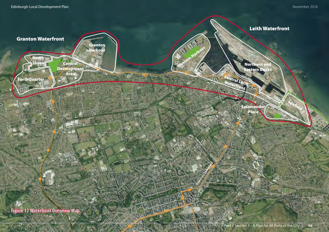
Granton Waterfront
Leith Waterfront
North Shore
ForthQuarter
Central Development
Area
Western Harbour
Central Leith Waterfront
Northern and Eastern Docks
Tram
Line S
afeg
uard
Granton Harbour
Sea� eldSalamander Place
Figure 12 Waterfront Overview Map.
Edinburgh Local Development Plan November 2016
49Part 1 Section 5 - A Plan for All Parts of the City

Table 11 Edinburgh Waterfront Development Principles
Leith Waterfront
Reference: EW 1a
Location: Leith Western Harbour
Description: Housing-led mixed use development with an approved master plan. Around a third of the estimated maximum housing capacity has been implemented.
Development Principles
Proposals will be expected to:
• complete the approved street layout and perimeter block urban form
• revise the housing mix towards a greater number of townhouses than identified in the master plan, where it would be appropriate in terms of place-making and would accelerate completions,
• meet the Council’s Large Greenspace Standard by delivering the Western Harbour Central Park (Proposal GS2)
• complete the partly implemented new local centre by providing smaller commercial units under flatted development on the other corners of the centre’s junction
• deliver school provision as specified in the Action Programme
• create a publicly-accessible waterside path around the perimeter of the area, connecting east and west
• design new housing to mitigate any significant adverse impacts on residential amenity from existing or new general industrial development
• review the flood risk assessment that has already been provided for this site.
Reference: EW 1b
Location: Central Leith Waterfront
Description: Area of commercial and housing-led mixed use development sites in various ownerships. Forth Ports Ltd has decided to retain land at the Britannia Quay and south of Edinburgh Dock in port related use, and therefore a modified approach to the development of this area from what is included in the Leith Docks Development Framework (2005) is required. The bullet points below within the development principles remain applicable, but the development framework will be reviewed in order to provide a revised approach to the development of the area, including a revised diagram representing this approach. The feasibility and route of the east-west cycle path shown on the Proposals Map will be further considered within the review of the development framework.
Development Principles
Proposals will be expected to:
• locate any major office development within the strategic business centre identified on the Proposals Map
• create a publicly-accessible waterside path connecting east and west
• help meet the Council’s open space standards through financial contributions to major improvements to or creation of off-site spaces
• design new housing to mitigate any significant adverse impacts on residential amenity from existing or new general industrial development
• review the flood risk assessment that has already been provided for this site
LDP provisions relating to Ocean Terminal are set out in Table 7 and Policy Ret 4.
Housing-led mixed use development
Commercial-led mixed use
Business & Industry area
New green space
Cycle/footpath safeguarded route
New major streets
Tram line safeguard
School safeguardS
Indicative only - not part of the Proposals Map
Indicative only - not part of the Proposals Map
50
Edinburgh Local Development Plan November 2016
Part 1 Section 5 - A Plan for All Parts of the City

Housing-led mixed use development
Commercial-led mixed use
Business & Industry area
New green space
Cycle/footpath safeguarded route
New major streets
Tram line safeguard
School safeguardS
Table 11 Edinburgh Waterfront Development Principles
Leith Waterfront (continued)
Reference: EW 1c
Location: East of Salamander Place
Description: Housing-led mixed use development on sites in various ownerships. Housing shown in the Salamander Place Development Brief (2007) is under construction. There is now also an opportunity for housing to the east of the Leith Links Seaward Extension (Proposal GS 3). This land was identified for industry in the previous local plan and the development brief, but is no longer needed due to the increase in industrial land elsewhere in Leith Waterfront.
Development Principles
Proposals should provide for:
• (west) the key streets and frontages set out in the approved development brief
• implementation of the park extension
• (east) the key streets and frontages identified in the above diagram
• streetscape improvements along Salamander Street
• the design of new housing to mitigate any significant adverse impacts on residential amenity from existing or new general industrial development
• review the flood risk assessment that has already been provided for this site.
Reference: EW 1d and e
Location: Seafield (EW 1d) and Northern and Eastern Docks (EW 1e)
Description: Area of general industrial, storage and business development and port-related uses. Identified in this plan as a Special Economic Area. Identified nationally as an Enterprise Area, which has implications for tax and a speedier development management process. There is potential for new deep water berth(s) outside the current port lock gates. In order to provide a flexible context for renewable industry-related developments, this LDP does not set detailed layout or design principles.
Development Principles
Proposals should take account of the following:
• within the Northern and Eastern Docks (EW 1e), proposals will be assessed to ensure there are no adverse impacts on the nature conservation interests of the Firth of Forth Special Protection Area or other relevant Natura 2000 sites. Policy Env 13 will apply.
• the character and sense of place in The Shore is important to the tourism potential of Leith. Views from The Shore will be a factor in considering proposals for new larger buildings.
• the Seafield area (EW 1d) is the subject of a waste management / combined heat and power safeguard (see Policy RS 3).
• existing pedestrian footpaths at Marine Esplanade and Albert Road have the potential form part of a coastal cycle route and be extended to Salamander Street and Leith Links. These routes avoid the secure port area, which is no longer expected to be available as a section of the wider Edinburgh Promenade.
• review the flood risk assessment that has already been provided for this site.
Indicative only - not part of the Proposals Map
Indicative only - not part of the Proposals Map
51
Edinburgh Local Development Plan November 2016
Part 1 Section 5 - A Plan for All Parts of the City

Table 11 Edinburgh Waterfront Development Principles
Granton Waterfront
Reference: EW 2a
Location: Forth Quarter
Description: Housing-led mixed use development on land primarily owned by National Grid. An approved master plan has been partly implemented, with several housing blocks, a major office development, a college and a new large park. A proposed new Local Centre to meet the convenience shopping needs or local residents and workers has been delivered in the form of a large foodstore. Additional housing capacity is now available on land formerly designated as part of a strategic business centre.
Development Principles
Proposals will be expected to:
• complete the approved street layout and perimeter block urban form
• provide housing-led development on sites formerly identified for major business-led development
• provide a housing mix that is appropriate to the site in terms of place-making and would maximise completions within this urban regeneration proposal within the plan period
• deliver school provision as specified in the Action Programme
• provide a strategic flood risk assessment
Reference: EW 2b
Location: Central Development Area
Description: Housing-led mixed use development on land assembled by a joint-venture regeneration company. Some housing development has been completed along a new avenue in accordance with an approved master plan. Additional housing capacity is now available on land formerly designated as part of a strategic business centre.
Development Principles
Proposals will be expected to:
• complete the approved street layout and perimeter block urban form
• provide housing-led development on sites formerly identified for major business-led development
• provide a housing mix that is appropriate to the site in terms of place-making and would maximise completions within this urban regeneration proposal within the plan period
• deliver school provision as specified in the Action Programme
• expressly encourage the enhancement of employment and a ‘destination’ through existing and new commercial, cultural, tourist and retail opportunities
• provide a strategic flood risk assessment.Indicative only - not part of the Proposals Map
Indicative only - not part of the Proposals Map
Housing-led mixed use development
Commercial-led mixed use
Business & Industry area
New green space
Cultural use or housing led regeneration
Cycle/footpath safeguarded route
New major streets
Tram line safeguard
School safeguardS
52
Edinburgh Local Development Plan November 2016
Part 1 Section 5 - A Plan for All Parts of the City

Housing-led mixed use development
Commercial-led mixed use
Business & Industry area
New green space
Cycle/footpath safeguarded route
New major streets
Tram line safeguard
School safeguardS
Table 11 Edinburgh Waterfront Development Principles
Granton Waterfront (continued)
Reference: EW 2c
Location: Granton Harbour
Description: Housing-led mixed use development on land owned by Forth Ports Limited and others. Some housing development has been completed in accordance with an approved master plan.
Development Principles
Proposals will be expected to:
• complete the approved street layout and perimeter block urban form
• provide a housing mix that is appropriate to the site in terms of place-making and would maximise completions within this urban regeneration proposal within the plan period
• meet the convenience shopping needs of new and future residents by implementing the proposed Local Centre (Proposed S2)
• complete the relevant section of the waterside Edinburgh Promenade
• provide for retained and improved mooring facilities and boat storage and retain Middle Pier as a ‘working pier’
• include tourism and waterfront-related leisure and entertainment uses
• provide a strategic flood risk assessment.
Reference: EW 2d
Location: North Shore
Description: Area identified for housing-led mixed use development in an approved master plan. However, the slower pace of development in the waterfront means that the North Shore area is unlikely to be available for residential development within the first half of this LDP period. Temporary consents for light industrial development would allow productive use of this area and address the small business needs targeted by Policy Emp 9 without prejudicing residential amenity in new development to the south.
Development Principles
Proposals will be expected to:
• be compatible with future residential development in Forth Quarter and the Central Development Area
• complete the relevant section of the waterside Edinburgh Promenade
• avoid prejudicing future housing-led redevelopment on their sites or on adjacent land
• provide a strategic flood risk assessment.
Indicative only - not part of the Proposals Map
Indicative only - not part of the Proposals Map
53
Edinburgh Local Development Plan November 2016
Part 1 Section 5 - A Plan for All Parts of the City

West Edinburgh
119 West Edinburgh focuses on land along the A8 corridor and new tram
route and around the proposed Edinburgh Gateway inter-modal station
at Gogar. It includes a number of major existing uses such as the Airport,
Royal Highland Centre, Gyle and Hermiston Gait shopping centres and a
range of employment/investment locations as shown on Figure 13. National
planning policy identified the potential of this area for nationally important
economic development through the enhancement of the Airport and Royal
Highland Centre and opportunity for an International Business Gateway.
The implementation of already committed public transport proposals,
in particular the tram, will greatly enhance the accessibility of the West
Edinburgh area.
120 This plan continues to support these important economic development
opportunities and also major office development at Edinburgh Park/South
Gyle and, previously identified, housing led regeneration proposals at
Newbridge and Ratho Station. The Strategic Development Plan identifies
West Edinburgh as a strategic growth area. A range of new opportunities
for housing development are therefore being brought forward in the LDP.
Transport assessments have been undertaken to identify key transport
interventions, including measures to encourage public transport use, walking
and cycling as well as junction upgrades and other road improvements
required to support the proposed development.
121 Housing is proposed on two greenfield sites at Maybury and Cammo and
as an integrated component of business led mixed use proposals in the IBG
and Edinburgh Park/SouthGyle. Proposals must accord with the relevant
Site Brief or Development Principles to ensure high quality development
consistent with the aims of the plan.
54
Edinburgh Local Development Plan November 2016
Part 1 Section 5 - A Plan for All Parts of the City

Station
Airport
Royal Highland Centre
International Business Gateway
Maybury
Cammo
Edinburgh Park/South Gyle
Tram Line Safeguard
Napier University
Hermiston Gait
RBS Gogarburn
Figure 13 West Edinburgh Overview Map
Indicative only - not part of the Proposals Map
55
Edinburgh Local Development Plan November 2016
Part 1 Section 5 - A Plan for All Parts of the City

West Edinburgh - General Development Principles
122 All proposals will be required to make appropriate contributions to the
delivery of the infrastructure necessary to support the development strategy.
The general development principles below outline the anticipated main
transport and education actions for West Edinburgh.
123 The Council’s approach to infrastructure delivery is set out in Policy Del 1
and its associated Supplementary Guidance. Policy Tra 8 is also relevant in
requiring cumulative and cross boundary transport impacts to be addressed.
Development should only progress subject to sufficient infrastructure
already being available or where it is demonstrated that it can be delivered
at the appropriate time. Further assessment of individual and cumulative
impacts may be required to further detail the required mitigation.
Transport Assessment
Contributions to address the area wide transport interventions, detailed
below and as specified through Supplementary Guidance, will be applied
through a cumulative contribution zone. Delivery will be monitored and
managed through the Action Programme. The Council’s approach to secure
timeous delivery of the required infrastructure is to be detailed through its
Supplementary Guidance.
Detailed Transport Assessments, where required, should include modelling
of the cumulative effect of increased traffic flows on the trunk and local road
networks (taking into account all known proposed development and any
potential cross-boundary impacts). This should draw on the conclusions
of the Council’s Transport Appraisal and further work being carried out to
assess the wider cumulative and cross-boundary impacts on the trunk road
network and should show how mode share targets are to be met.
Education Appraisal
Contributions to the required education provision, as detailed below and
as specified through Supplementary Guidance, will be applied where
appropriate through a cumulative contribution zone drawing on the
conclusions of the Council’s Education Appraisal. The Council’s approach to
secure timeous delivery of the required schools capacity as outlined below is
to be detailed through Supplementary Guidance. Delivery will be monitored
and managed through the action programme.
56
Edinburgh Local Development Plan November 2016
Part 1 Section 5 - A Plan for All Parts of the City

124 The following sections indicate the main infrastructure requirements which
were identified following initial assessment and should be considered in the
context of Policy Del 1.
Scope of transport mitigation subject to further assessment and the detail
to be included in Supplementary Guidance (Del 1):
• Eastfield Road and Dumbells junction (T 9)
• Gogar Link Road (T 20)
• A8 additional junction (T 11)
• Improvements to Newbridge Roundabout (T 12)
• Bus Priority Measures on M8 and A89
• Improvements to Gogar Roundabout (T 13)
• Maybury Junction (T 17)
• Barnton Junction (T 19)
• Craigs Road Junction (T 18)
Scope of education mitigation subject to further assessment and the detail
to be included in Supplementary Guidance (Del 1):
• New Maybury (ND) primary school (SCH6)
• Extension to Gylemuir (ND) Primary School
• Extension to Hillwood (ND) Primary School
• Extension to Fox Covert (RC) Primary
• Extension at St Cuthbert’s RC Primary School
• High School Extension (ND) - Further detailed assessment is necessary to
determine where the additional capacity would be best provided; either
at The Royal High School, Craigmount High School or Forrester High
School or a combination across some, or all, of these schools, and or
• Extension to St Augustines (RC) High School
All proposals will be required to make appropriate contributions to new and
improved infrastructure as detailed in Part 2 Section 1 of the Plan.
57
Edinburgh Local Development Plan November 2016
Part 1 Section 5 - A Plan for All Parts of the City

higher density housing
height constraint
S
Edinburgh Gateway Station
Tram Stop to Gyle
to Gogar Link Rd
to A8
MA
YB
UR
Y R
OA
D
QUEENSFERRY ROAD
CRAIGS ROAD
TURN
HO
USE RO
AD
GLASGOW ROAD
CA
MM
O W
AL
K
CAMMO ESTATE PARK
EDINBURGH INTERNATIONAL
AIRPORT
EDINBURGH - FIFE RAILWAY
CRAIGS ROAD
site boundary
housing
long term redevelopment opportunity
bus route
junction improvement
street improvement & frontage
existing footpath / cyclepath
new footpath / cyclepath
tram line
Green network:
green corridor
high point of site
pedestrian / cycle bridge
proposed school
commercial / retail opportunities
new woodland
S
MAYBURY
CAMMO
Maybury and Cammo Site Brief
Indicative only - not part of the Proposals Map
58
Edinburgh Local Development Plan November 2016
Part 1 Section 5 - A Plan for All Parts of the City

Maybury and Cammo Site Brief - Development Principles
Description
The Maybury and Cammo sites lie within the Almond basin, set against the backdrop of Lennie
Hill with views to the Pentlands to the south. These housing sites are served by bus, rail and
tram connections and will be physically integrated with their surroundings by street design and
green corridors linking to Cammo Estate Park and the River Almond to the north and the Gyle,
Edinburgh Park and IBG to the south.
Comprehensive master planning and phasing of development will be required drawing
upon place-making and street design principles to create distinctive and sustainable urban
communities at the gateway to the City.
Maybury (HSG 19)
• development should start in the eastern part of the site forming an extension of the existing
built up area.
• pedestrian/cycle bridge must be provided linking site with Edinburgh Gateway Station and
providing onward connections to the Gyle and Edinburgh Park to the south and IBG to the
west.
• new 30 m wide green network link is to be provided from new pedestrian/cycle bridge through
the Maybury site to connect via Cammo Walk and Cammo Estate park to the north. This will
provide a new, strategic, north-south green network link to the west of the City. No vehicular
access should be taken through the green corridor.
• opportunity to change the character of Turnhouse Road through street design providing
avenue trees, verges and incorporating existing stone walls. New residential development
should be positioned to address Turnhouse Road. A new reduced speed limit will be required.
• the entirety of Craigs Road should be widened on the southern edge to facilitate all vehicle
movements.
• opportunity for higher density development within 400 metres of pedestrian/cycle bridge.
• site layout must allow bus route to be formed linking Craigs Road with Turnhouse Road.
• development must respect the ridgeline of Craigs Road and elevated slopes within the site
• opportunity to create a community focal point providing local services in a accessible location
close to new pedestrian/cycle bridge. This should include a new primary school, civic space and
units suitable for local shopping (maximum 800 (gross) sq.m.) and healthcare facilities.
• provision of new woodland and grassland habitat (30m depth) to create a strong green belt
boundary adjoining Craigs Rd along the northern edge of the site.
• provision of two new large greenspaces to meet the two hectare green space standard as
required by the Open Space Strategy. There is potential to create local green space on the high
point of the site next to Maybury Road.
• proposals should enable co-ordination with long term redevelopment opportunity of existing
industrial/employment sites for high quality employment or residential uses, incorporating
pedestrian, cycle and public transport safeguards
• Address the General Development Principles on transport and education for West Edinburgh
(as set out in paragraphs 122-124)
• Address appropriate and safe access from Turnhouse Road and Craigs Road
• Proposals should address a new footway/cycleway along the south-west side of Turnhouse
Road and upgrading of bus infrastructure on Turnhouse Road
• Address any identified impacts on the safe operation of the local road network
• Provision of new bus infrastructure on internal roads and Maybury Road
• High quality pedestrian and cycle routes within the site
• Further investigation/consultation is required to determine the nature of any flood risk on the
site and whether further assessment and mitigation measures are required.
Cammo (HSG 20)
• the site layout should provide maximum accessibility by public transport, including direct
pedestrian links to enhanced bus infrastructure and services on Maybury Road and to the north
east corner of the site to minimise distance to bus stops for services along Queensferry Road.
• opportunity to change the character of Maybury Road through street design, to enable and
improve path connections across Maybury Road and create residential frontage with reduced
speed limit.
59
Edinburgh Local Development Plan November 2016
Part 1 Section 5 - A Plan for All Parts of the City

• proposals should enable views through the site to focal points of Mauseley Hill, Cammo Water
Tower, Cammo Estate Park and the Pentland Hills from within the site and Maybury Road by
means of street design and open space provision.
• the context of the Designed Landscape should be enhanced through sensitively designed
development and an appropriate landscape framework.
• provision of new woodland, grassland and wetland habitat (40 m depth) to create strong green
belt boundaries along the southern and western edges of the site. This should include a multi
user path overlooked by new housing.
• improve the quality of the water environment through works to realign and improve the bank
side treatment of the Bughtlin Burn.
• provide green network connections through the site and enhance off-site links to improve the
connectivity of the Cammo Estate from the Bughtlin, Drumbrae and East Craigs residential areas
to the east and, via changes to Cammo Walk, to the south.
• Address the General Development Principles on transport and education for West Edinburgh
(as set out in paragraphs 122-124)
• Appropriate access from Maybury Road including the potential for two junctions, with traffic
signals
• Safe pedestrian crossing of Maybury Road including the potential for a signal controlled
pedestrian crossing
• Address any identified impacts on the safe operation of the local road network
• The finalised site capacity, design and layout should be informed by an adequate flood risk
assessment.
International Business Gateway - Development Principlesscription
International business development and ancillary uses, hotel and conference facilities and
potentially housing and education. A more detailed vision for the area is set out in the West
Edinburgh Strategic Design Framework, approved in May 2010. Policy Emp 6 applies.
International Business Gateway
• the IBG must be master planned and developed in a phased manner. Master plans should
incorporate an appropriate mix of uses to help support the main purpose of the IBG as a
location for international business development.
• proposals should contribute to the creation of a sustainable extension of the city based on
a grid pattern with a focus on place-making, good public transport and footpath and cycle
connections, parkland (Proposal G S6) and a strong landscape structure (see West Edinburgh
Landscape Framework).
• the preferred location for initial phases of development is within 250 metres of tram stops.
Higher density development and uses which attract high volumes of visitors should be located
close to a tram stop.
• the prevailing building height should be four storeys with some higher landmark buildings and
lower building heights adjacent to structural green spaces.
• any necessary road infrastructure improvements should be identified, taking into account
the general development principles for West Edinburgh and the relevant transport proposals
listed in Table 9. Car parking provision for all uses should be set at levels which help achieve
sustainable transport objectives in the context of Policy Tra 2.
• the central parkland area of open space will be of particular importance in meeting the
Council’s large greenspace standard and should be designed and maintained accordingly
• a flood risk assessment shall be carried out in order to inform the capacity, design and layout of
development proposals.
60
Edinburgh Local Development Plan November 2016
Part 1 Section 5 - A Plan for All Parts of the City

Edinburgh Park/South Gyle - Development Principles
The Vision
To create a thriving business and residential community, well integrated with the rest of the city
through good public transport, pedestrian and cycle connections, a more balanced mix of uses
and facilities and high quality public realm and green spaces. Policy Del 4 applies.
General
• Proposals should help contribute towards realising the long term vision for Edinburgh Park/
South Gyle.
• Where possible, proposals should incorporate new cycle and pedestrian links through the site
and consider how these connect to other uses and routes across the Edinburgh Park and South
Gyle area.
• a flood risk assessment shall be carried out in order to inform the design and layout of
development proposals. Consideration should be given to any culverted watercourses within
the site and pluvial flooding.
Area EP 1
Description - development opportunities in this area include undeveloped land and the
potential to reconfigure existing surface car parks to accommodate new buildings.
• proposals should incorporate a mix of business and residential uses and ancillary uses. The
creation of a commercial hub adjacent to Edinburgh Park station is supported.
• development should work with and extend the existing grid layout to ensure a cohesive
townscape framework and deliver sustainable movement through the site.
• the continuation of the existing north to south greenspace corridor and creation of new
pedestrian and cycle links through the site are essential requirements. The potential exists to
create a strategic pedestrian/cycle route linking Wester Hailes, Broomhouse and Sighthill to
Edinburgh Gateway Station.
Area EP 2
Description - redevelopment opportunity on vacant land and adjacent sites currently occupied
by vacant office buildings.
• proposals should incorporate a mix of business and residential uses and create an element of
active commercial frontage onto South Gyle Broadway.
• a mixed use development provides the opportunity to create new pedestrian and cycle routes
through the site.
Areas EP 3 – EP5
Description - sites occupied by a variety of low density commercial property with the potential
for some incremental change over time.
• in EP 3 and EP 4, commercial and mixed use proposals will be supported. Where practicable,
development should provide increased permeability, create a direct relationship with South
Gyle Broadway and improve the pedestrian and cycling environment along South Gyle
Crescent.
• EP5 should remain in predominantly business and industrial use. Where opportunities arise,
consideration should be given to improving accessibility for pedestrians and cyclists.
Gyle Centre
Description - commercial centre which currently has 75 units
• any expansion of the Gyle shopping centre to meet the needs of the expanding population in
West Edinburgh should provide an active frontage to South Gyle Broadway, contribute to the
green network and provide good pedestrian connections to the tram stop and wider area.
• the opportunity exists to create of a new green space incorporating the tram halt and a north-
south pedestrian cycle route, framed by additional development to help the centre contribute
to the long term vision for the area.
61
Edinburgh Local Development Plan November 2016
Part 1 Section 5 - A Plan for All Parts of the City

Edinburgh Park / South Gyle Development Principles
Indicative only - not part of the Proposals Map
City of Edinburgh by-pass
Bankhead Drive
South Gyle Broadway
Gyle
EP3
EP2
EP4
EP5
EP1
Housing-led mixed use redevelopment
Mixed use redevelopment (short/long term)
Business led redevelopment (short/long term)
Mixed use area, Business, residential and ancillary uses and commercial hub.
Current development opportunity
Business led redevelopment
Business area
EP1
EP2
EP5
EP3&4
New green space
Tree lines movement corridor
Primary pedestrian/cycle route
Secondary pedestrian/cycle route
Enhanced pedestrian/cycle route
Heavy/light rail interchange
Tram halt
Potential vehicular access
Building line
62
Edinburgh Local Development Plan November 2016
Part 1 Section 5 - A Plan for All Parts of the City
South East Edinburgh
125 South East Edinburgh is expected to experience major change over the next
five to seven years. The plan incorporates a number of existing proposals,
some of which have started but are not yet completed and others that
have still to be implemented. These include housing development at
Greendykes, mixed use regeneration at Craigmillar and life sciences related
business development at Edinburgh BioQuarter. The LDP allocates a
number of additional housing sites across South East Edinburgh to meet
SDP requirements – two sites within the existing urban area at Ellen’s Glen
Road and Moredunvale, two sites along the Burdiehouse corridor, three sites
along the Gilmerton corridor, one site north of Lang Loan, two sites at the
south east wedge and three sites at Newcraighall/Brunstane. It includes
sites briefs for the new LDP housing proposals and Development Principles
for the BioQuarter.
63
Edinburgh Local Development Plan November 2016
Part 1 Section 5 - A Plan for All Parts of the City

Edmonstone
City By-pass
Lasswade Road
Gilmerton Road
Fort Kinnaird Retail Park
Craigmillar
Newcraighall
BioQuarter
Broomhills
Burdiehouse
Gilmerton Station Road
Gilmerton Dykes Road
Drum
Moredunvale Road
Greendykes
South East Wedge
Parkland
Brunstane
Wisp
Ellen’s Glen Road
North of Lang Loan
Figure 14 South East Edinburgh Overview Map
Indicative only - not part of the Proposals Map
64
Edinburgh Local Development Plan November 2016
Part 1 Section 5 - A Plan for All Parts of the City

South East Edinburgh General Development Principles
126 All proposals will be required to make appropriate contributions to the
delivery of the infrastructure necessary to support the development strategy.
The general development principles below outline the anticipated main
transport and education actions for South East Edinburgh.
127 The Council’s approach to infrastructure delivery is set out in Policy Del 1
and its associated Supplementary Guidance. Policy Tra 8 is also relevant in
requiring cumulative and cross boundary transport impacts to be addressed.
Development should only progress subject to sufficient infrastructure
already being available or where it is demonstrated that it can be delivered
at the appropriate time. Further assessment of individual and cumulative
impacts may be required to further detail the required mitigation.
Transport Assessment
Contributions to address the area wide transport interventions, detailed
below and as specified through Supplementary Guidance, will be applied
through a cumulative contribution zone. Delivery will be monitored and
managed through the action programme. The Council’s approach to secure
timeous delivery of the required infrastructure is to be detailed through its
Supplementary Guidance.
Detailed Transport Assessments, where required, should include modelling
of the cumulative effect of increased traffic flows on the trunk and local road
networks (taking into account all known proposed development and any
potential cross-boundary impacts). This should draw on the conclusions
of the Council’s transport appraisal and further work being carried out to
assess the wider cumulative and cross-boundary impacts on the trunk road
network and should show how mode share targets are to be met.
Education Appraisal
Contributions to the required education provision, as set out below and
as detailed through Supplementary Guidance, will be applied where
appropriate through a cumulative contribution zone drawing on the
conclusions of the Council’s education appraisal. The Council’s approach to
secure timeous delivery of the required schools capacity is to be detailed
through Supplementary Guidance. Delivery will be monitored and managed
through the action programme.
128 The following sections indicate the anticipated infrastructure requirements
which were identified following initial assessment and should be considered
in the contact of Policy Del 1.
South East Edinburgh (South)
Scope of transport mitigation subject to further assessment and the detail
to be included in Supplementary Guidance (Del 1):
• Straiton junction on the A720
• T14 Sheriffhall Junction
• Gimerton junction (A720)
• Burdiehouse junction (Proposal T 21)
• Gilmerton Crossroads (T 20) junction capacity upgrade
65
Edinburgh Local Development Plan November 2016
Part 1 Section 5 - A Plan for All Parts of the City

• Access and parking strategy for Drum Street
• Improved capacity and other enhancements to bus services.
Scope of education mitigation subject to further assessment and the detail
to be included in Supplementary Guidance (Del 1):
• A new Gilmerton primary school (SCH 7) and new Broomhill primary
school (SCH 8), and/or
• Extension to Gilmerton (ND) primary school, Gracemount (ND) primary
school and Liberton and Craigour Park if required due to catchment
changes
• Extension to St John’s Vianney (RC) Primary School and St Catherine’s (RC)
Primary School
and
• Extension to South East Edinburgh High Schools- subject to further
detailed assessment as to whether the additional capacity would be best
provided; either at Liberton High School or Gracemount High School.
South East Edinburgh (North)
Scope of transport mitigation subject to further assessment and the detail
to be included in Supplementary Guidance (Del 1):
• Sheriffhall roundabout (T 14)
• West of Fort Kinnaird Road to the Wisp (T 16)
• Gilberstoun link (T 8)
• Old Craighall Junction
Scope of education mitigation subject to further assessment and the detail
to be included in Supplementary Guidance (Del 1):
• Option 1 - New Brunstane Primary School (SCH 9)
• Option 2 - As option 1, but additional extension to Newcraighall Primary
School
• New Greendykes Primary School (SCH 3)
• Extension to Castlebrae High School or Replacement Castlebrae High
School (SCH 2)
66
Edinburgh Local Development Plan November 2016
Part 1 Section 5 - A Plan for All Parts of the City

site boundary
housing
bus route
junction improvement
street improvement & frontage
existing footpath / cyclepath
new footpath / cyclepath
bus gate
Green network:
new greenspace
commercial / retail opportunities
new woodland
S proposed school (2ha)
BURDIEHOUSE
S
BROOMHILLS
to Straiton Pond, Midlothian and onward to Straiton, Roslin & Bilston
and Bonnyrigg
to Ellen’s Glen & Craigmillar Castle Park
LANG LOAN
Bu
rdie
house B
urn
Va
lley
Pa
rk (c
ore
pa
th)
to Morton Mains
FROGSTON ROAD EAST
A720 CITY BY-PASS
BR
OO
MH
ILLS
RO
AD
CAPTAIN’S ROAD
long term redevelop-ment opportunity
Broomhills, Burdiehouse and Lang Loan Site Brief
NORTH OF LANG LOAN
green corridor
vehicular access
Indicative only - not part of the Proposals Map
67
Edinburgh Local Development Plan November 2016
Part 1 Section 5 - A Plan for All Parts of the City

• proposals for housing (including the finalised site capacity, design and layout), the school (if
necessary), and any other uses provided on the site, should be informed by an adequate flood
risk assessment. In addition, proposals should in particular avoid development in the area at
risk of flooding in the south of the site, adjacent to the burn. Sustainable urban drainage will be
required as appropriate, and as referred to in the bullet point relating to tree belts above.
Burdiehouse (HSG 22)
• address the relevant General Development Principles on transport and education for South East
Edinburgh set out in paragraphs 126-128 above.
• vehicular access to be taken from Burdiehouse Road.
• opportunity to change the character of Burdiehouse Road through street design, to enable and
improve path connections across Burdiehouse Rd, provide street verges and trees, upgrade bus
stops and create residential frontage with a reduced speed limit.
• site layout should enable a bus route to be formed providing a link from ‘The Murrays’ to
Burdiehouse Road, regulated by bus gate.
• active frontage should be provided onto Burdiehouse Road, incorporating streetscape
enhancements.
• Tree planting to the south west of the site to form a new green belt boundary to the west of
Burdiehouse Limekilns.
• Woodland planting along the south east boundary, which should enhance the connectivity of
woodland habitat and incorporate a multi-user path link to Burdiehouse Burn Valley Park.
• off-site multi-user path connection to link with the paths network in Midlothian via Straiton
Pond, with 4m wide landscape treatment to the west across open ground, including verge,
hedgerow and hedgerow trees.
• local open space proposals should :
a) provide amenity greenspace setting and retain views to the category B listed Limekilns
b) improve semi-natural habitat and amenity value of the Local Nature Reserve, extend
woodland along the southern bank of the Burdiehouse Burn and incorporate off-road path
links to the Burdiehouse Burn Valley Park.
Broomhills, Burdiehouse and Lang Loan Site Brief - Development Principles
Description
These sites provide the opportunity to integrate new homes with the existing townscape and
landscape setting, whilst enhancing important approaches to the city through street design. The
housing sites will support the creation of vibrant urban areas served by public transport.
New open spaces will sit within the context of the Pentland Hills, the city skyline and Burdiehouse
Burn valley and provide a focus for community life, enhance habitats and connect to local routes
and the Midlothian core path network.
Broomhills (HSG 21)
• address the relevant General Development Principles on transport and education for South East
Edinburgh set out in paragraphs 126-128 above.
• vehicular access should be taken from Frogston Road East and Burdiehouse Road with no direct
route between the two access points. No vehicular access (including emergency) to be taken
from Broomhills Road.
• opportunity to change the character of Burdiehouse Rd through street design, to enable and
improve path connections across Burdiehouse Rd, provide street verges and trees, upgrade bus
stops and create a residential frontage with a reduced speed limit.
• substantial public park should be provided on highest part of the site in line with open space
Proposal GS 9 to reflect landscape constraint of elevated terrain and outward views to the
Pentland Hills and the city skyline.
• tree belts should be provided to create a strong green belt boundary to the south and west of
the site, as shown on the diagram. The width of these tree belts will depend upon the layout
and design of housing and open space on the site. The tree belts should incorporate existing
tree cover, provide habitat enhancements integrated with sustainable urban drainage provision
and include a multi-user path to connect Burdiehouse Burn Valley Park to path networks at
Morton Mains and Mortonhall.
• a green corridor should be provided incorporating pedestrian and cycleway connections
through site from Old Burdiehouse Road.
68
Edinburgh Local Development Plan November 2016
Part 1 Section 5 - A Plan for All Parts of the City

c) integrate the design and layout of the open space with the Area of Importance for Flood
Management and beyond this area, provide additional amenity and biodiversity benefits
through SUDs. The design should recognise different management and maintenance
requirements.
• the finalised site capacity, design and layout should be informed by an adequate flood risk
assessment.
• land released from the greenbelt to the south east has potential for development subject to
similar principles.
North of Lang Loan (HSG 39)
• Address the General Development Principles on transport and education for South-East
Edinburgh (as set out in paragraphs 126-128)
• Pedestrian and cycle links with the housing areas to the west and north of the site and along
Lang Loan
• Lasswade Road/ Gilmerton Dykes Street/Captain’s Road Junction Improvement
• Upgrading of bus stops on Lasswade Road
• Secure any required archaeological works
• Landscaping to achieve integration with adjacent housing areas and establishment of new
green belt boundary along Lang Loan.
Gilmerton and South East Site Briefs - Development Principles
Description
A range of sites at Gilmerton of varying sizes and character provide the opportunity to provide
new housing and local facilities, well served by public transport and with good connections
to existing communities and the surrounding countryside. The new housing and associated
landscape framework should enhance the quality and character of the urban edge and respond
to the wooded grounds of The Drum and former Gilmerton House.
Gilmerton Dykes Road (HSG 23)
• vehicular access to be taken directly from Gilmerton Dykes Road
• Appropriate boundary treatment and landscaping retaining scope for integration with the
wider area and for potential pedestrian/cycle connections to potential future adjacent housing
areas.
• Address the General Development Principles on transport and education for South-East
Edinburgh (as set out in paragraphs 126-128)
• Address any identified impacts on the safe operation of the local road network
• Make appropriate provision for a cycle link from Gilmerton Road to Laswade Road
• Upgrade bus stops on Laswade Road/Gilmerton Road
• Enable enhanced peak period bus capacity on Gilmerton Road
• Make provision for a new footway along Gilmerton Dykes Road
Gilmerton Station Road (HSG 24)
• address the General Development Principles on transport and education for South East
Edinburgh (as set out in paragraphs 126-128).
• address any identified impacts on the safe operation of the local road network
• opportunity to change character of Gilmerton Station Road, through street design
incorporating trees and verges and addressed by new residential development.
• provide green network connections linking the site with existing local paths to the north and east.
69
Edinburgh Local Development Plan November 2016
Part 1 Section 5 - A Plan for All Parts of the City

• provision of a new multi-user path link from Gilmerton Dykes Road to Gilmerton Station Road
(to connect to the transport safeguard along disused Edinburgh, Loanhead and Roslin branch
line)
• create path connection to proposal site HSG 23
• provision of new 2ha public park in accordance with open space strategy standards.
• connect existing woodland habitat to north and south of site using street trees and design of
new park
• appropriate boundary treatment to south-west, retaining scope for potential pedestrian/cycle
connections and to allow integration with potential development in the future.
• existing industrial/employment land to south east of site could provide additional housing in
longer term, subject to enhancement of existing wooded boundary.
• Land released from the greenbelt to the south west has potential for development subject to
similar principles.
The Drum (HSG 25)
• address the General Development Principles on transport and education for South East
Edinburgh (as set out in paragraphs 126-128).
• address appropriate and safe access from the site onto Drum Street
• address any identified impacts on the safe operation of the local road network
• provide cycle link – Gilmerton Road to Laswade Road and from Drum Street to the SE Wedge
Parkland
• Upgrade bus stops and enhance peak capacity on Gilmerton Road
South East Wedge South: Edmonstone (HSG 40)
• Address the General Development Principles on transport and education for South-East
Edinburgh (as set out in paragraphs 126-128)
• Traffic signals at the Wisp/Old Dalkeith Road
• Speed limit restrictions on the Wisp
• Create a development layout that retains and enhances any elements of historic landscape
structure
• Incorporate sizeable areas of open space and parkland and retain views and open aspects to
the south and east
• Ensure the visual separation from Danderhall through sensitive design and screen planting
• Integrate a network of footpaths, cycleways and open space to be part of the wider Green
network
• Ensure appropriate grouting and mine entry treatment works are carried out prior to
commencement of development
• Achieve additional boundary planting along both road boundaries
• Address required local road and footway improvements and mitigation measures
• Secure any required archaeological works
South-East Wedge North: The Wisp (HSG 41)
• Address the General Development Principles on transport and education for South-East
Edinburgh (as set out in paragraphs 126-128)
• Ensure appropriate grouting and mine entry treatment works are carried out prior to
commencement of development
• Secure any required archaeological works
• Design and maintenance schedule to secure the green-space link on the western boundary of
the site
• Pathways and cycle routes both internally and connected to the proposed development
70
Edinburgh Local Development Plan November 2016
Part 1 Section 5 - A Plan for All Parts of the City

S
to A7, Old Dalkeith Road
to Lasswade Road & Stration Pond/Loandhead
to South East Wedge Parkland
FERNIE
HIL
L D
RIV
E
NEWTO
FT S
TREET
DRUM
STREET
GIL
MERTON R
OAD
GILMERTON ROAD
GILMERTON DYKES ROAD
GILMERTON STATION ROAD
THE DRUM
NORTH OF LANG LOAN
site boundary
housing
long term redevelopment opportunity
junction improvement
street improvement & frontage
new footpath / cyclepath
cycle/footpath & possible public transport service
Green network:
proposed school (2ha)
commercial / retail opportunities
new woodland
S
Gilmerton & South East Site Brief
vehicular access
green corridor
existing footpath / cyclepath
Indicative only - not part of the Proposals Map
71
Edinburgh Local Development Plan November 2016
Part 1 Section 5 - A Plan for All Parts of the City

HSG 30
WISP
EDMONSTONE
site boundary
housing
street improvement & frontage
new footpath / cyclepath
existing footpath / cyclepath
vehicular access
Green network:
new woodland
Gilmerton & South East Site Brief
other developments in the LDP
green space proposal (GS4 and GS5)
HSG 15
HSG 16
GS 4
HSG 18
HSG 17
Edinburgh Bioquarter
Emp 2
HSG 18
green corridor Craigmillar to Dalkeith link core path CEC4
GS 5
Indicative only - not part of the Proposals Map
72
Edinburgh Local Development Plan November 2016
Part 1 Section 5 - A Plan for All Parts of the City

BRUNSTANE HOUSE
BRUNSTANE STATION
EDINBURGH COLLEGE
A1
A1
NEWCRAIGHALL STATION
EAST COAST RAILWAY
S
S
John Muir Way
NEWCRAIGHALL ROAD
MUSSELBURGH
NEWCRAIGHALL VILLAGE
GILBERSTOUN
NEWCRAIGHALL NORTH
LAND ALLOCATED FOR DEVELOPMENT
IN EAST LOTHIAN
QUEEN MARGARET UNIVERSITY
FORT KINNAIRD NEWCRAIGHALL
EAST
NEWHAILES HOUSE
MILTON ROAD EAST
BRUNSTANE
EDINBURGH ROAD
site boundary
housing
bus route
street improvement & frontage
existing footpath / cyclepath
new footpath / cyclepath
Green network:
green corridor
proposed school (2ha) at Brunstane / school grounds extension at Newcraighall
commercial / retail opportunities
new woodland
S
vehicular access
local centre
Core Path CEC 5 to Innocent Railway
Vista to Arthur’s Seat
Core Path CEC 5 to Innocent Railway
new greenspace
Scheduled Ancient Monument
Newcraighall and Brunstane Site Brief
Indicative only - not part of the Proposals Map
73
Edinburgh Local Development Plan November 2016
Part 1 Section 5 - A Plan for All Parts of the City

Newcraighall and Brunstane Site Brief - Development Principles
Description
These sites provide the opportunity for new housing together with new and improved school
and local facilities on the eastern side of the Council area. The sites are well served by bus and
rail connections with the opportunity for these to be further enhanced. Existing and enhanced
footpath and cycle links and green corridor proposals will ensure development is well connected
between sites and to existing communities.
Newcraighall North (HSG 26)
• vehicular access to be taken from Whitehill St / Newcraighall Road at two or three points. No
vehicular access to be taken from Gilberstoun.
• layout should create pedestrian and cycleway connections through the site, including one
along an east-west green corridor.
• opportunity for retail/commercial units as part of street frontage to Whitehill Street /
Newcraighall Road.
Newcraighall East (HSG 27)
• address the relevant General Development Principles on transport and education for South East
Edinburgh set out in paragraphs 126-128 above.
• new woodland should be provided along the southern boundary of the site as shown on the
diagram.
• the finalised site capacity, design and layout should be informed by an adequate flood risk
assessment.
• site layout should enable a bus route to be formed north-south through the site. It is intended
that this connect to QMUC across land allocated for development in East Lothian. A bus gate at
the site boundary should prevent general vehicular access through this route.
• layout should create pedestrian and cycleway connections through the site.
• a new green corridor should be created along the course of the power lines running through
the site, extending grassland habitat with the opportunity for connections outwith the Council
area. This greenspace should be fronted by new development in order to improve community
safety and aid place-making.
• layout should make provision for an extension of Newcraighall Primary School’s grounds.
• opportunity for retail/commercial units as part of street frontage to Whitehill Street /
Newcraighall Road.
Brunstane HSG 29
• address the relevant General Development Principles on transport and education for South East
Edinburgh set out in paragraphs 126-128 above.
• transport assessments should identify any appropriate commensurate mitigation which may
be required with respect to the A1/Newcraighall Road junction and to the junctions on the
A199, taking into account any cumulative impact with traffic from other development sites.
Particular attention should be given to the proposed new junction on Milton Road East, and
the management of additional traffic generation onto Milton Road East and Newcraighall Road
including associated improvements to pedestrian cycle crossing facilities.
• the site layout should allow for the proposed new bus route to be formed linking Milton Road
East with Newcraighall Road. Appropriate consultation with service providers should take place
in order to identify the bus service improvements which can be undertaken in the plan period,
taking into account access, routes and frequency of service, and including the proposed new
bus route. Proposals should provide for an appropriate upgrading of existing bus stops and an
increase in cycle parking facilities at Brunstane and Newcraighall stations.
• vehicular access should be taken from Milton Road East and Newcraighall Road, forming a new
vehicular crossing over the East Coast railway line. The potential for a new pedestrian/cycle
bridge within the eastern part of the site should be investigated, together with an investigation
as to whether or not a second vehicular crossing of the East Coast railway line should be
provided in the interests of safety, as identified within the transport appraisal. Any crossings of
the East Coast railway line should be on bridges over the railway line, and not at grade.
• no vehicular access to be taken from Gilberstoun area.
• opportunity to enhance existing core and other paths along the boundaries of the site, and in
particular the Brunstane Burn Core Path (John Muir Way) on the northern boundary of the site
74
Edinburgh Local Development Plan November 2016
Part 1 Section 5 - A Plan for All Parts of the City

including pedestrian crossing where vehicular access meets the path. New multi-user path links
should be formed to the Innocent Railway Core Path, Brunstane Burn Core Path and the disused
railway line to the north of Newcraighall, with path connections also to housing at Gilberstoun,
Newcraighall and Brunstane railway station.
• the impact on the setting of Brunstane House should be minimised through the appropriate
design and layout of housing on the site, including the provision of sufficient open space and
landscaping to the north and east as shown on the diagram. The extent of the open space is
indicative only and the exact area will depend on the design and layout of housing on the site.
Sufficient open space should also be similarly provided in order to retain an open setting for the
two scheduled monuments of Brunstane Moated Site and Brunstane Enclosure, also meeting a
large greenspace deficiency to the south west of the site.
• a landscape framework should be provided to the boundary of Newhailes House garden and
designed landscape inventory site, with a buffer as shown on the diagram (again indicative and
depending on the design and layout of housing on the site) and detailed siting and design of
dwellings should respect views to Arthur’s Seat from the grounds of Newhailes House.
• management proposals should have regard to the above stated historic environment assets.
Historic Environment Scotland should be consulted on these matters when development
proposals are being prepared.
• establish statutory safeguards to overhead powerlines to the north and south of the site.
Design principles should seek to integrate overhead powerlines with site layout. To the south,
allotment provision should compliment consented allotments at Newcraighall North. To the
north, powerline way leave should be designed to provide for semi natural greenspace and
habitat connectivity with informal recreation.
• expand grassland habitat (under pylons) and provide woodland connectivity across the site
• Streets and open spaces should be designed to benefit from views to the coast to the north,
Arthur’s Seat to the west and Pentland Hills to the southwest.
• opportunity to create a community focal point including a new primary school and local
centre.
• proposals for housing (including the finalised site capacity, design and layout), the school, and
any other uses provided on the site, should be informed by an adequate flood risk assessment.
Enhance sustainable urban drainage will be required as appropriate to address current/future
water quality pressures and to ensure no detrimental impacts to the recently designated
bathing waters at Fishers Row.
• proposals should fully address any necessary site remediation in relation to mining legacy
constraints, and should take account of any need for prior extraction of minerals in the context
of Scottish Planning Policy.
75
Edinburgh Local Development Plan November 2016
Part 1 Section 5 - A Plan for All Parts of the City

ELLEN’S GLEN ROAD
MA
LB
ET WYND
EL
LE
N’S
GL
EN
RO
AD
LAS
SW
AD
E RO
AD
site boundary
housing
vehicular access
Ellen’s Glen Road
other redevelopment opportunity
Green network:
new footpath / cyclepath
street improvement and frontage
existing footpath / cyclepath
Core Path CEC 1 Burdiehouse Burn
Valley Park
Ellen’s Glen Road Site Brief
Description
Proposal (HSG 28) to provide new housing on the site currently occupied by the relocating
Scottish National Blood Transfusion Service and semi-natural green space adjacent to Malbet
Wynd. The site currently occupied by Liberton Hospital could provide additional housing if the
site becomes available in the future.
Development Principles
• No houses on the site to be occupied unless and until a direct vehicular access from Lasswade
Road has been provided across the Liberton Hospital site.
• Additional vehicular access to be taken from Ellen’s Glen Road and Malbet Wynd.
• Address the General Development Principles on transport and education for South-East
Edinburgh (as set out in paragraphs 126-128).
• A mix of housing types including detached, semi-detached, terraces, ‘colony style’ housing and
flats.
• New pedestrian/cycle link on land near to Stenhouse Burn to compensate for the narrow
footway on Ellen’s Glen Road.
• New pedestrian/cycle link from Malbet Wynd through the site to connect via Ellen’s Glen Road
to the Burdiehouse Burn Valley Park Core Path
• New local greenspace to meet the Council’s Greenspace Standard.
• Appropriate retention of trees around pedestrian/cycle link as informed by a tree survey.
• Development to provide residential frontage onto Ellen’s Glen Road.
If the site currently occupied by Liberton Hospital becomes available in the future, proposals
would be expected to provide not only for a direct vehicular access from Lasswade Road to the
HSG 28 site but also to ensure appropriate retention of trees along Lasswade Road and elsewhere
across the site as informed by a tree survey.
Indicative only - not part of the Proposals Map
76
Edinburgh Local Development Plan November 2016
Part 1 Section 5 - A Plan for All Parts of the City

EDINBURGH BIOQUARTER
Allo
tme
nts
MO
RE
DU
NV
ALE
RO
AD
site boundary
housing
Moredunvale Road
new and existing greenspace
Green network:
new footpath / cyclepath
Moredunvale Development Principles
Description - Proposal (HSG 30) to provide new housing on approximately half of the site and
improve the quality of the remaining open space
Development Principles
• Address the General Development Principles on transport and education for South East
Edinburgh (as set out in paragraphs 126-128)
• The finalised site capacity, design and layout should be informed by an adequate flood risk
assessment
• land around the high rise flats to be kept as green space.
• opportunity to provide play space, allotments and growing spaces as green space
improvements .
• opportunity to create links to the wider green network
• proposals should provide better pedestrian and cycle access between the site and the
surrounding area.
• remediation work may be required to develop the site due to the history of coal and limestone
mining.
Indicative only - not part of the Proposals Map
77
Edinburgh Local Development Plan November 2016
Part 1 Section 5 - A Plan for All Parts of the City

Edinburgh BioQuarter Development Principles
Description - Edinburgh BioQuarter is a partly-implemented urban extension focused on the
Edinburgh Royal Infirmary and the associated medical school. Land has been allocated to create
the potential for further clinical and teaching development and related commercial research and
development - collectively known as life science uses.
The combination of a major teaching hospital, a leading university and sufficient developable
land in one place is rare. It is a unique opportunity to establish a commercial life science centre of
a scale comparable with others globally, with major benefits for the city and national economies.
To reach that level, a floorspace target of 245,000sq.m. of life science uses has been estimated.
Development Principles
• a higher density, more urban form of development than previously planned, with less land
taken up by surface car parking is required to realise the BioQuarter’s potential. A compact
urban approach is also more likely to foster a sense of place, attractive to workers and visitors.
• supporting uses are appropriate to promote place-making and provide local services and
evening and weekend activity. However, the type and quantity of ancillary uses must support,
not jeopardise, the overall life science purpose of the BioQuarter.
• development at the BioQuarter must respect the site’s sensitive location within the wider
landscape setting of the city. The extent of development and building heights, particularly on
the upper slopes, must be carefully managed.
• the BioQuarter should front onto and connect with the adjacent South East Wedge Parkland
(Proposal GS 4), a key element of the Plan’s Spatial Strategy (Figure 1)
• the BioQuarter may require to contribute to improvements to the A720 Sheriffhall junction
improvements.
More detailed development principles are set out in Supplementary Guidance for Edinburgh
BioQuarter and the South East Wedge Parkland.
Edinburgh BioQuarter
78
Edinburgh Local Development Plan November 2016
Part 1 Section 5 - A Plan for All Parts of the City
Elsewhere across the LDP area
129 Outwith the areas identified for strategic growth, the LDP has a role to play in
promoting development opportunities and protecting and enhancing the
environment.
130 An area where significant change is expected is Queensferry. In addition to
the Queensferry Crossing due to open by the end of 2016 and development
on a number of existing housing sites, the LDP identifies new housing
allocations at Builyon Road, South Scotstoun and Dalmeny. New housing
is also proposed on sites at Currie and Balerno and an opportunity for
housing together with greenspace improvements has been identified at
Curriemuirend. Where appropriate to guide development, site briefs and
development principles have been prepared for these housing sites
131 Throughout the LDP area, regeneration opportunities will continue to
emerge as vacant and underused sites and buildings are brought back into
beneficial use. Planning applications will be assessed using relevant policies
to ensure these developments help meet LDP objectives.
132 A number of major transport projects, including the Queensferry Crossing
and the tram, will be completed in the next few years. The LDP also includes
a number of proposals and safeguards for other public transport, footpath
and cycle links which, when implemented, will improve connections across
the city.
133 Edinburgh’s Green Belt and Countryside Area will be protected and where
possible enhanced. The LDP directs the planned growth of the city to
specified sites and generally supports development within the urban area
subject to relevant policy considerations. Development in the green belt and
countryside will therefore only be permitted in exceptional circumstances.
79
Edinburgh Local Development Plan November 2016
Part 1 Section 5 - A Plan for All Parts of the City

South West Edinburgh and South Queensferry General Development Principles
134 All proposals will be required to make appropriate contributions to the
delivery of the infrastructure necessary to support the development
strategy. The general development principles below outline the anticipated
main transport and education actions for South West Edinburgh and South
Queensferry.
135 The Council’s approach to infrastructure delivery is set out in Policy Del 1
and its associated Supplementary Guidance. Policy Tra 8 is also relevant in
requiring cumulative and cross boundary transport impacts to be addressed.
Development should only progress subject to sufficient infrastructure
already being available or where it is demonstrated that it can be delivered
at the appropriate time. Further assessment of individual and cumulative
impacts may be required to further detail the required mitigation.
Transport Assessment
Contributions to address the area wide transport interventions, detailed
below and as specified through Supplementary Guidance, will be applied
through a cumulative contribution zone. Delivery will be monitored and
managed through the action programme. The Council’s approach to secure
timeous delivery of the required infrastructure is to be detailed through its
Supplementary Guidance.
Detailed Transport Assessments, where required, should include modelling
of the cumulative effect of increased traffic flows on the trunk and local road
networks (taking into account all known proposed development and any
potential cross-boundary impacts). This should draw on the conclusions
of the Council’s transport appraisal and further work being carried out to
assess the wider cumulative and cross-boundary impacts on the trunk road
network and should show how mode share targets are to be met.
Education Appraisal
Contributions to the required education provision, as set out below and
as detailed through Supplementary Guidance, will be applied where
appropriate through a cumulative contribution zone drawing on the
conclusions of the Council’s education appraisal. The Council’s approach
to secure timeous delivery of the required schools capacity is to be detailed
through Supplementary Guidance. Delivery will be monitored and managed
through the Action Programme.
136 The following sections indicate the anticipated infrastructure requirements
which as identified following initial assessment:
South West Edinburgh
Scope of transport mitigation subject to further assessment and the detail
to be included in Supplementary Guidance (Del 1):
• Gillespie Crossroads
• Hermiston Park & Ride
Scope of education mitigation subject to further assessment and the detail
to be included in Supplementary Guidance (Del 1):
• Extension to Currie (ND) Primary School (SCH 10).
80
Edinburgh Local Development Plan November 2016
Part 1 Section 5 - A Plan for All Parts of the City
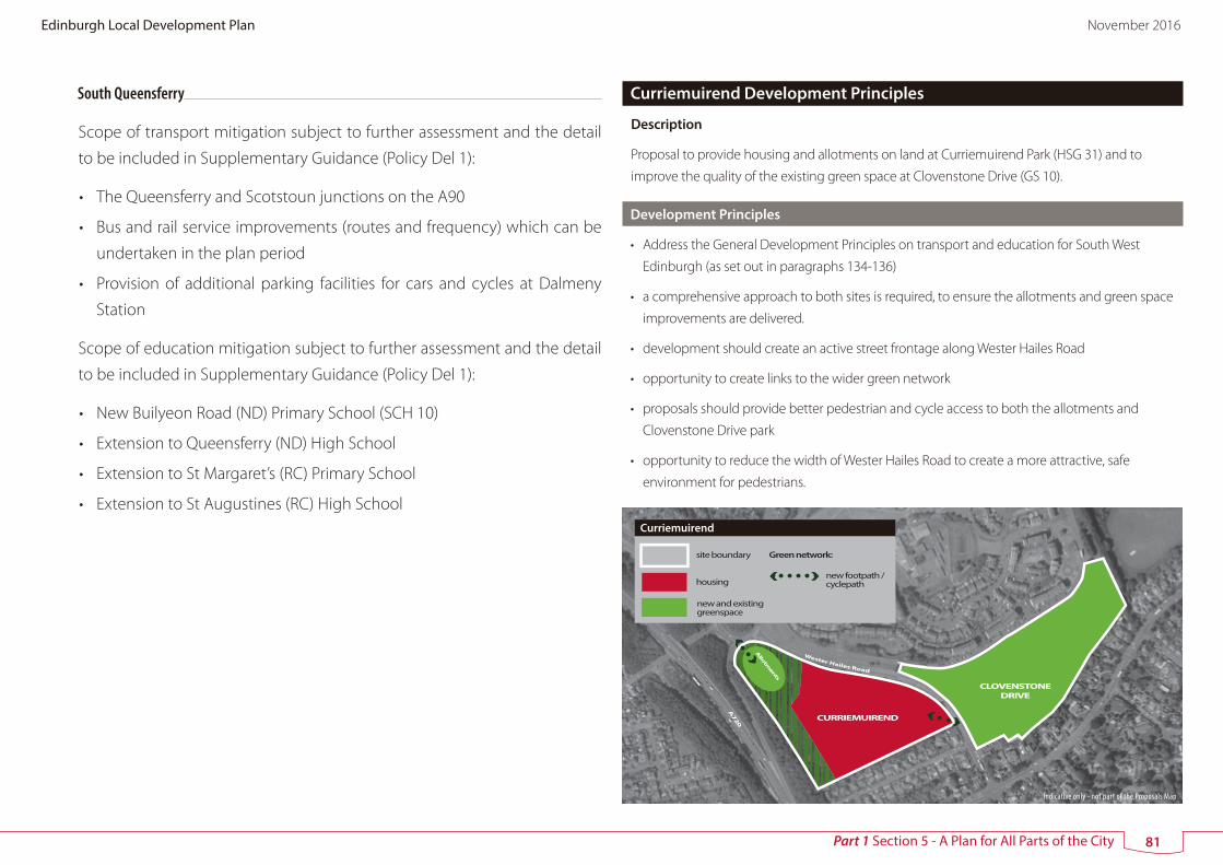
South Queensferry
Scope of transport mitigation subject to further assessment and the detail
to be included in Supplementary Guidance (Policy Del 1):
• The Queensferry and Scotstoun junctions on the A90
• Bus and rail service improvements (routes and frequency) which can be
undertaken in the plan period
• Provision of additional parking facilities for cars and cycles at Dalmeny
Station
Scope of education mitigation subject to further assessment and the detail
to be included in Supplementary Guidance (Policy Del 1):
• New Builyeon Road (ND) Primary School (SCH 10)
• Extension to Queensferry (ND) High School
• Extension to St Margaret’s (RC) Primary School
• Extension to St Augustines (RC) High School
Allotm
ents
CURRIEMUIREND
CLOVENSTONE DRIVE
A720
Wester Hailes Road
site boundary
housing
Curriemuirend
new and existing greenspace
Green network:
new footpath / cyclepath
Curriemuirend Development Principles
Description
Proposal to provide housing and allotments on land at Curriemuirend Park (HSG 31) and to
improve the quality of the existing green space at Clovenstone Drive (GS 10).
Development Principles
• Address the General Development Principles on transport and education for South West
Edinburgh (as set out in paragraphs 134-136)
• a comprehensive approach to both sites is required, to ensure the allotments and green space
improvements are delivered.
• development should create an active street frontage along Wester Hailes Road
• opportunity to create links to the wider green network
• proposals should provide better pedestrian and cycle access to both the allotments and
Clovenstone Drive park
• opportunity to reduce the width of Wester Hailes Road to create a more attractive, safe
environment for pedestrians.
Indicative only - not part of the Proposals Map
81
Edinburgh Local Development Plan November 2016
Part 1 Section 5 - A Plan for All Parts of the City

Dundas Castle
Stoney�ats
FERRYMUIR
ECHLINE
Builyeon Rd
South Approach to the Forth Replacement Crossing
Core Path CEC 10 Newbridge to Queensferry and Kirkliston
inn
er h
azar
d z
one
limit
mid
dle
haz
ard
zon
e lim
it
ou
ter h
azar
d z
one
limit
BUILYEON ROAD
SOUTH SCOTSTOUN
SOUTH SCOTSTOUN
DALMENY
QUEENSFERRY
AGILENT
SPRINGFIELD
BUILYEON ROAD
site boundary
housing
new woodland
vehicular access
Builyeon Road and South Scotstoun, Queensferry
other redevelopment opportunity Green network:
new footpath / cyclepath
existing footpath / cyclepath
street improvement and frontage
A90
NATIONAL CYCLE ROUTE 1
DA
LME
NY
JUN
CT
ION
TO HIGH SCHOOL
PROVOST MILNE GROVE
FORMER AGILENT WORKS (existing
planning permission)
S
existing SUDs basin
South Approach to the Forth Replacement Crossing
SCOTSTOUN AVENUE
S proposed school (2ha)
junction improvement
TO DALMENY STATION
A90
Location Map
Safeguarding zone for oil
storage installation
Indicative only - not part of the Proposals Map
82
Edinburgh Local Development Plan November 2016
Part 1 Section 5 - A Plan for All Parts of the City

and appearance
• include a new primary school towards centre of site
• opportunity for commercial and community uses within the site, possibly in the north west and
north east parts of the site where they could also form part of the frontage to the main road.
There is also a possible redevelopment opportunity with respect to existing commercial uses to
the north of the site (which could be incorporated into the development on the site) and with
respect to the redundant northbound carriageway to the east of the site.
• provision of new local greenspace in accordance with open space strategy standards.
South Scotstoun Site Brief (HSG 33)
• address the General Development Principles on transport and education for south Queensferry
set out in paragraphs 134-136 above.
• vehicular access to be taken from B800 Queensferry to Kirkliston Road and Provost Milne Grove.
However, there should be no provision for traffic through the site between B800 and Scotstoun
Avenue, apart from buses in the event that this is considered appropriate using a bus gate.
There should be no vehicular access from the eastern end of the site into Dalmeny. Appropriate
traffic calming measures may be considered for Scotstoun Avenue.
• retain field trees and supplement the existing tree lined track along the southern boundary
with new native woodland of minimum 20 metres depth to extend the existing green network
along the whole southern boundary of the site as shown on the diagram, thus establishing
a new robust green belt boundary along the A90, and connecting woodland habitat.
Opportunity to replace coniferous plantation with mixed native woodland and provide street
planting where appropriate.
• opportunity to provide a new footpath/cycleway extending from HSG 32, across the A90 and
B800, along the western part of the southern boundary within the extended green network,
linking to the existing footpath/cycleway (National Cycle Route 1) extending to Dalmeny to the
east, and North Queensferry to the north.
• opportunity to change the character of the B800 through street design, also enabling path
connections across the B800, thus facilitating the new footpath/cycleway referred to above
• new pedestrian/cycle routes should be provided, forming north-south path connections, thus
Queensferry South Site Brief
Builyeon Road Site Brief (HSG32)
• address the General Development Principles on transport and education for South Queensferry
set out in paragraphs 134-136 above
• vehicular access to be taken from Builyeon Road (A904).
• a substantial landscaped buffer, with additional tree planting, should be provided along the
southern boundary of the site with the new approach road, as shown on the diagram. The
landscaped buffer should be of sufficient width to soften the visual impact of development on
the site from the new approach road, provide a robust green belt boundary and mitigate noise
impact. Additional tree planting should constitute native woodland species, and have regard
to any ecological mitigation measures specified as part of the replacement crossing and oil
pipeline.
• the landscaped buffer should integrate with that provided within the western part of HSG 33,
with an opportunity to incorporate a footpath/cycleway, including a bridge over the existing
A90 carriageway (which is being retained as a public transport link only to the existing Forth
Road Bridge) to the retail and housing area to the east of the site.
• Opportunity to change the character of Builyeon Road (A904), through street design, including
new development frontage with the road where this is possible, upgrading or providing of new
bus stops or shelters, roadside footpaths and traffic calming (including reducing the speed limit
through traffic regulation orders).
• new pedestrian/cycle routes (taking into account the Forth Replacement Crossing as
appropriate) should be provided, particularly forming north-south path connections by linking
new pedestrian/cycle routes to the existing network north of the A904, thus allowing the new
housing to integrate fully with the existing urban area including the town centre to the north
of the site. The use of avenue tree planting and retention/re-use of the existing stone wall is
encouraged.
• the residential amenity of existing housing should be taken into account in the design of all
new pedestrian/cycle routes and links.
• landscape effects of any noise attenuation measures to be considered in terms of site design
83
Edinburgh Local Development Plan November 2016
Part 1 Section 5 - A Plan for All Parts of the City

allowing the new housing to integrate fully with the existing urban area including the town
centre to the north of the site.
• the need to respect the residential amenity of existing housing should be taken into account in
the design of all new pedestrian/cycle routes and links.
• bus stops should be upgraded as appropriate on Kirkliston Road, Scotstoun Avenue and in
Dalmeny.
• careful consideration should be given to the layout and design of the proposed new housing
and associated open space, in order to protect the residential amenity of the houses directly
overlooking the site along the northern boundary and along the proposed access at Provost
Milne Grove.
• landscape effects of any noise attenuation measures to be considered in terms of site design
and appearance from A90.
• new development to front onto the green network and provide natural surveillance.
• provision of new local greenspace in accordance with open space strategy standards.
• proposals should take into account the restrictions resulting from the safeguarding zone for the
oil storage installation shown in the diagram, where it may not be possible to build houses, or
there may be a restriction on the number and location of houses. Any areas not developed for
housing should be retained as informal open space.
Dalmeny Development Principles (HSG 34)
• address the General Development Principles on transport and education for South Queensferry
set out in paragraphs 134-136 above.
• upgrading of bus stops in Bankhead Road/Main Street
• vehicular access to be taken from Bankhead Road.
• pedestrian access to be provided from Main Street.
• street frontage and high quality stone boundary wall to be provided to Bankhead Road.
• retention of view corridors from Main Street to Forth Road and Rail Bridge.
• development subject to a height constraint of 1-1.5 storeys.
• the use of traditional materials and the continuation of traditional rural built form are
considered essential.
• supplement tree and hedge planting to the north of the village to form a defensible green belt
boundary.
84
Edinburgh Local Development Plan November 2016
Part 1 Section 5 - A Plan for All Parts of the City

RAVELRIG ROAD
NEWMILLS ROAD
Kirknewton Core Path
CEC 16
OLD NEWMILLS
ROADTransport safeguard for re-routing of NCN 75 between Kirknewton and Balerno via o�-road route.
WATER OF LEITH
Core Path 18
LANARK ROAD WEST
BALERNO
CU
RR
IEH
ILL
RO
AD
FORTH VIEW CRESCENT
CURRIEHILL STATION
Riccarton Core Path, CEC 17, to Riccarton, Hermiston and Union Canal
Riccarton Core Path, CEC 17, to Currie, Water of Leith and Bonaly
CURRIEHILL ROAD
RICCARTON MAINS ROAD
Edinburgh - G
lasgow via Shotts ra
ilway
WATER OF LE IT
H
NEWMILLS ROAD
CURRIEHILL ROAD
RICCARTON MAINS ROAD
Location Map
CURRIE
BALERNO
RAVELRIG ROAD
site boundary
housing
street improvement & frontage
new woodland
Newmills Road, Balerno and Curriehill Road, Currie
new footpath / cyclepath
Green network:
existing footpath / cyclepath
new greenspace
vehicular access
commercial / retail opportunities
Indicative only - not part of the Proposals Map
85
Edinburgh Local Development Plan November 2016
Part 1 Section 5 - A Plan for All Parts of the City

Balerno and Currie Site Briefs
Curriehill Road Development Principles (HSG 36)
• address the General Development Principles for South-West Edinburgh (as set out in paragraphs 134-136)
• address any identified impacts on the safe operation of the local road network
• provide a new footway along the east boundary frontage (Curriehill Road) to link with existing footway
network
• improve high quality pedestrian/cycle link to Curriehill Station (may involve upgrading existing link)
• help provide additional cycle parking at Curriehill Station
• upgrade existing bus stop facilities in Riccarton Avenue
• the finalised site capacity design and layout should be informed by an adequate flood risk assessment
• vehicular access to be taken from Curriehill Road.
• direct pedestrian links to be formed between Curriehill Road and Curriehill Station through the site.
Connections also to be made to the Kirknewton Core Path to the west boundary of the site.
• development to provide a residential street frontage to the railway line and part way along Curriehill
Road with part of the hedgerow removed.
• opportunity for flatted development and commercial/retail units to the north of the site by the railway
line.
• retain hedgerow to the south and tree planting along the western edge of the site to provide an
appropriate green belt boundary and undeveloped land adjacent to a minor watercourse.
Newmills Road Development Principles (HSG 37)
• address the General Development Principles for South-West Edinburgh (as set out in paragraphs 134-136)
• provide a new footway along the east frontage boundary
• address any identified impacts on the safe operation of the local road network
• improve pedestrian/cycle crossing facilities on A70, in vicinity of Newmills Road junction – may be
requirement for signal control
• upgrade cycle routes between Newmills Road and Curriehill Station
• provide additional cycle parking at Curriehill Station
• provide a new bus stop facilities on A70, in vicinity of Newmills Road
• possible contribution to extended car park at Curriehill Station
• vehicular access to be taken from Newmills Road and Lanark Road West.
• new linear park (proposal GS11) of approximately 50m width to be formed to the western edge of
the site as part of an off road, multi user path between the Water of Leith Walkway and Kirknewton,
in addition to a local path connection to Addistoun Crescent. The new park will address the large
greenspace deficiency to the north of Balerno, enhance connectivity of native broadleaf woodland
habitat and integrate SUDs measures. It could also provide new allotments.
• access from Lanark Road West to run along outer eastern edge of linear park. Residential streets to front
onto the proposed linear park to the west and Newmills Road to the east.
• new wooded green belt boundary to be formed on prominent break of slope to the north of the site of
a minimum 30m depth.
Ravelrig Road Development Principles (HSG 38)
• address the General Development Principles on education and transport (as set out in paragraphs
134-136)
• address any required local road/junction improvements
• provide green network connections and a landscape framework with the layout and landscaping
achieving integration with neighbouring housing sites
• create pedestrian and cycle connections to adjoining housing areas, particularly to the south and east
• substantial woodland edge to be retained with recreational access to form a new green belt boundary
along the northern boundary of the site
• a Bird Hazard Management assessment and associated plan will be required to ensure the proposals
address any required mitigation measures emerging
• secure any required archaeological works.
86
Edinburgh Local Development Plan November 2016
Part 1 Section 5 - A Plan for All Parts of the City

Part 2 Policies
87
Edinburgh Local Development Plan November 2016

137 Planning applications will be assessed against the following policies to
ensure that future development helps to meet the core aims of the plan. All
relevant policies will be considered in assessing each application. Part 2 of
the plan is set out in eight sections
1 Delivering the Strategy
2 Design Principles for New Development
3 Caring for the Environment
4 Employment and Economic Development
5 Housing and Community Facilities
6 Shopping and Leisure
7 Transport
8 Resources and Services
138 Policies are often expressed positively, in terms of what kinds of development
will be permitted or encouraged. Where a policy states that certain types of
development will be permitted, it should also be understood that failure to
meet the Council’s expectations and aspirations may provide grounds for
refusal of planning permission.
88
Edinburgh Local Development Plan November 2016
Part 2 Section 1 - Delivering the Strategy
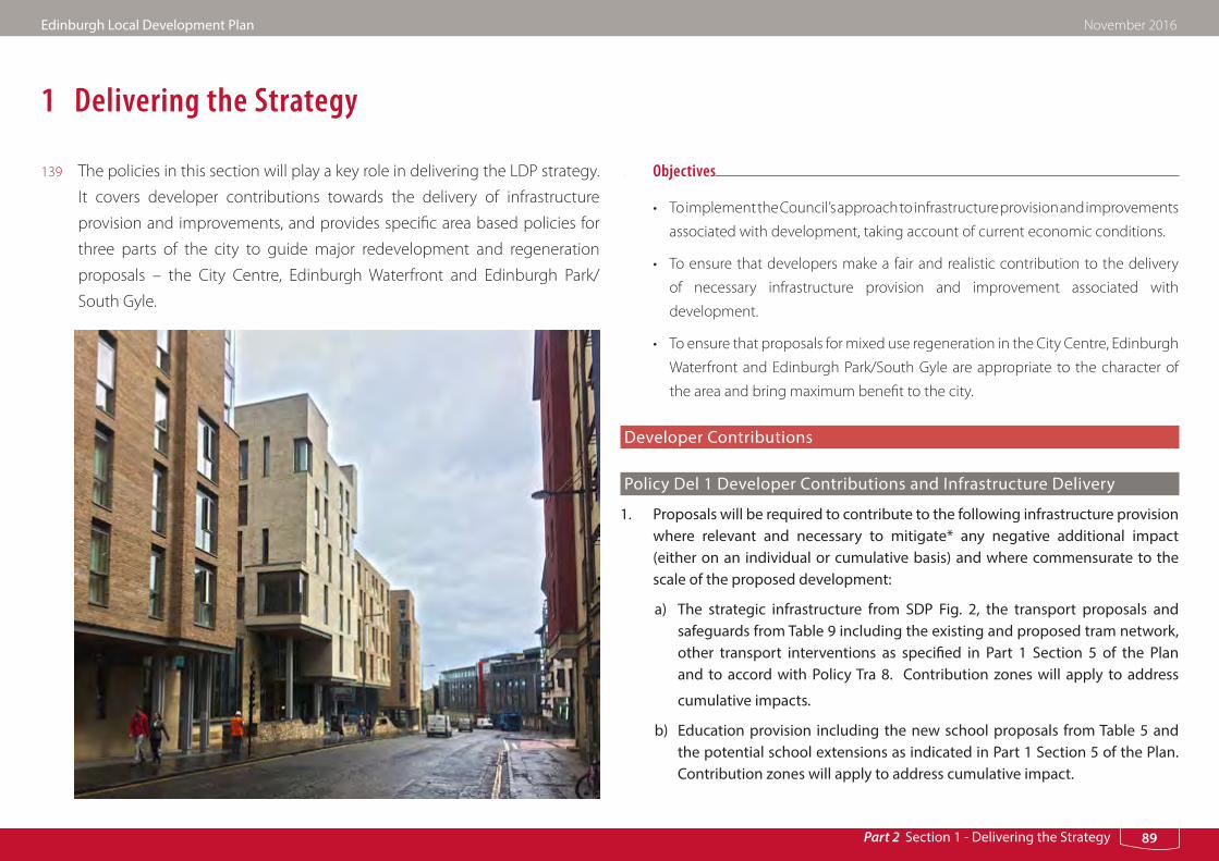
1 Delivering the Strategy
139 The policies in this section will play a key role in delivering the LDP strategy.
It covers developer contributions towards the delivery of infrastructure
provision and improvements, and provides specific area based policies for
three parts of the city to guide major redevelopment and regeneration
proposals – the City Centre, Edinburgh Waterfront and Edinburgh Park/
South Gyle.
Objectives
• To implement the Council’s approach to infrastructure provision and improvements
associated with development, taking account of current economic conditions.
• To ensure that developers make a fair and realistic contribution to the delivery
of necessary infrastructure provision and improvement associated with
development.
• To ensure that proposals for mixed use regeneration in the City Centre, Edinburgh
Waterfront and Edinburgh Park/South Gyle are appropriate to the character of
the area and bring maximum benefit to the city.
Developer Contributions
Policy Del 1 Developer Contributions and Infrastructure Delivery
1. Proposals will be required to contribute to the following infrastructure provision where relevant and necessary to mitigate* any negative additional impact (either on an individual or cumulative basis) and where commensurate to the scale of the proposed development:
a) The strategic infrastructure from SDP Fig. 2, the transport proposals and safeguards from Table 9 including the existing and proposed tram network, other transport interventions as specified in Part 1 Section 5 of the Plan and to accord with Policy Tra 8. Contribution zones will apply to address
cumulative impacts.
b) Education provision including the new school proposals from Table 5 and the potential school extensions as indicated in Part 1 Section 5 of the Plan. Contribution zones will apply to address cumulative impact.
89
Edinburgh Local Development Plan November 2016
Part 2 Section 1 - Delivering the Strategy

c) Green space actions if required by Policy Hou 3, Env 18, 19 or 20. Contribution zones may be established where provision is relevant to more than one site.
d) Public realm and other pedestrian and cycle actions, where identified in the Council’s public realm strategy, or as a site specific action. Contribution
zones may be established where provision is relevant to more than one site.
2. Development should only progress subject to sufficient infrastructure already being available or where it is demonstrated that it can be delivered at the appropriate time.
In order to provide further detail on the approach to implementation of this policy and to provide the basis for future action programmes Supplementary Guidance** will be prepared to provide guidance including on:
a) The required infrastructure in relation to specific sites and/or areas
b) Approach to the timely delivery of the required infrastructure
c) Assessment of developer contributions and arrangements for the efficient conclusion of legal agreements
d) The thresholds that may apply
e) Mapping of the cumulative contribution zones relative to specific transport, education, public realm and green space actions.
f ) The Council’s approach should the required contributions raise demonstrable commercial viability constraints and/or where forward or gap funding may be required.
* Further assessments may be required to detail the required mitigation
** This guidance should be submitted to Ministers within one year from the date of adoption of this Plan. In the event that timing of the findings of the Cumulative Impact Transport and Land Use Appraisal Working Group would delay inclusion of details on cross boundary issues an interim approach will be detailed through the Supplementary Guidance to be confirmed through the replacement development plan.
140 This policy is intended to ensure that infrastructure is provided to facilitate new
development.
Developer Contributions
141 Anticipated transport and schools requirements relative to specific areas (General
Development Principles) and sites (Development Principles) are set out in Part 1
Section 5 of the plan. Appendix C details the provisions for which contributions
would be sought. These include:
• School capacity increases including new schools
• Traffic management and other transport improvements to address the individual
and cumulative impact of proposed development including on the Trunk Road
Network.
• Green Space Actions
142 The Council has already forward funded the completed section of the tram network
and contributions will continue to be sought from future development which
impacts on or creates a need for this infrastructure. This approach to developer
contributions may apply to other items of required infrastructure such as schools
where advance provision is necessary to enable the development strategy.
143 Further detail of anticipated requirements and the approach to delivery including
the use of cumulative contributions zones, a framework for consideration of financial
viability issues and possible approaches to forward and gap funding will be set out
through the Supplementary Guidance as referenced in Policy Del 1.
144 An Action Programme will then be rolled forward annually to monitor timescales
and identify the need for further action and the parties responsible.
145 The Council recognises that the scale of proposed development may also impact
on other infrastructure including health and community facilities. Policy Hou 10
90
Edinburgh Local Development Plan November 2016
Part 2 Section 1 - Delivering the Strategy

is relevant in this respect. However, there is a current lack of information on the
scale of such requirements and how they should be addressed. Whilst it may be
appropriate to seek contributions for such provision any requirement would need
to be considered on a case by case basis where a clear justification can be provided
in the context of Circular 3/2012. The feasibility of including such additional
contributions and the impact on development viability would also have to be
assessed.
Area Specific Policies - Opportunities for major mixed use development/regeneration
146 Policies Del 2 - Del 4 will guide development in three major regeneration areas,
the City Centre, Edinburgh Waterfront and Edinburgh Park/South Gyle. These
policies aim to ensure that development and regeneration proposals incorporate
an appropriate mix of uses consistent with the character of the wider area and its
role in meeting the objectives of the plan.
Policy Del 2 City Centre
Development which lies within the area of the City Centre as shown on the Proposals Map will be permitted which retains and enhances its character, attractiveness, vitality and accessibility and contributes to its role as a strategic business and regional shopping centre and Edinburgh’s role as a capital city. The requirements in principle will be for:
a) comprehensively designed proposals which maximise the potential of the site in accordance with any relevant development principles, development brief and/or other guidance
b) a use or a mix of uses appropriate to the location of the site, its accessibility characteristics and the character of the surrounding area.
c) Where practicable, major mixed use developments should provide offices,
particularly on upper floors. At street level, other uses may be more appropriate to maintain city centre diversity, especially retail vitality on important shopping frontages
d) the creation of new civic spaces and traffic-free pedestrian routes where achievable.
Housing as part of mixed use development will be encouraged on appropriate sites to help meet housing need and create strong, sustainable communities.
147 This policy guides development in the City Centre to ensure proposals provide
an appropriate mix of uses and are of a high quality of design taking account of
the characteristics of the historic environment. Given the demand for office space
in the City Centre and the importance of office jobs to the economy, the policy
requires office provision to be included in major mixed use development proposals
wherever possible. Development principles for the Fountainbridge, Edinburgh St
James and New Street sites are provided in Table 10 (Part 1 Section 5).
Policy Del 3 Edinburgh Waterfront
Planning permission will be granted for development which will contribute towards the creation of new urban quarters at Leith Waterfront and Granton Waterfront (specifically EW 1a, b & c and EW 2 a -d on the Proposals Map). The requirements in principle will be for:
a) comprehensively designed proposals which maximise the development potential of the area
b) the provision of a series of mixed use sustainable neighbourhoods that connect to the waterfront, with each other and with nearby neighbourhoods
c) proposals for a mix of house types, sizes and affordability
d) the provision of open space in order to meet the needs of the local community, create local identity and a sense of place
91
Edinburgh Local Development Plan November 2016
Part 2 Section 1 - Delivering the Strategy
e) the provision of local retail facilities and leisure and tourism attractions, including water related recreation in and around retained harbours
f ) transport measures agreed with the Council, including a contribution to the proposed tram network and other necessary public transport improvements, the eastwards extension of Ocean Drive and the provision of a network of paths for pedestrians and cyclists, including an east-west path that will form part of the city-wide coastal promenade (safeguarded routes for these are shown on the Proposals Map).
In Seafield and Leith’s northern and eastern docks (EW 1d and e), planning permission will be granted for industrial and port-related development and compatible uses provided it complies with other relevant policies in this plan.
Development should accord with the Leith Waterfront or Granton Waterfront Development Principles.
148 The purpose of this policy is to ensure the regeneration of Edinburgh’s Waterfront
comes forward in a planned manner within the context of a long term vision. It sets
out key development principles to guide housing led regeneration on large parts
of the site, with more detailed guidance provided in the relevant site briefs. The
policy also recognises that some parts of the Waterfront will remain in business and
industrial uses. Development Principles for Leith Waterfront and Granton Waterfront
are set out in Table 11 (Part 1 Section 5).
Policy Del 4 Edinburgh Park/South Gyle
Within the boundary of Edinburgh Park/South Gyle as shown on the Proposals Map, planning permission will be granted for development which maintains the strategic employment role of the area and also introduces a wider mix of uses. The requirements in principle will be for;
a) comprehensively designed proposals which maximise the development potential of the area
b) development for office and other business uses as part of mixed use proposals
c) housing as a component of business-led mixed use proposals
d) the creation of a new commercial hub adjacent to Edinburgh Park Station
e) additional leisure and community uses at Gyle shopping centre
f ) an extension of the existing green space corridor (known as the Lochans) space
g) improved pedestrian and cycle links through the site and to provide strong, safe connections with services and facilities in the surrounding area
Development should accord with the Edinburgh Park/South Gyle Development Principles.
149 This policy aims to promote a better mix of uses in Edinburgh Park/South Gyle
and still retain its important role as a strategic business location. The vision is to
change the character of the Edinburgh Park/South Gyle area over time from a
business dominated environment with limited evening and weekend activity to a
thriving mixed use and well integrated part of the city. The Edinburgh Park/South
Gyle Development Principles set out in Part 1 Section 5 provide guidance on how
development can help deliver the long term vision for this area.
92
Edinburgh Local Development Plan November 2016
Part 2 Section 1 - Delivering the Strategy

Part 2 Section 2 - Design Principles for New Development
2 Design Principles for New Development
150 The Council encourages innovation and well designed developments that relate
sensitively to the existing quality and character of the local and wider environment,
generate distinctiveness and a sense of place, and help build stronger communities.
Policies Des 1–Des 13 will be used to assess planning applications to meet the
following objectives. More detailed advice on how to interpret and apply these
policies can be found in Council guidance including in the Edinburgh Design
Guidance document.
Objectives
a) To ensure that new development is of the highest design quality and respects, safeguards and enhances the special character of the city
b) To ensure that the city develops in an integrated and sustainable manner
c) To create new and distinctive places which support and enhance the special character of the city and meet the needs of residents and other users
Policy Des 1 Design Quality and Context
Planning permission will be granted for development where it is demonstrated that the proposal will create or contribute towards a sense of place. Design should be based on an overall design concept that draws upon positive characteristics of the surrounding area. Planning permission will not be granted for poor quality or inappropriate design or for proposals that would be damaging to the character or appearance of the area around it, particularly where this has a special importance.
151 This policy applies to all new development, including alterations and extensions. The
Council expects new development to be of a high standard of design. The Council’s
policies and guidelines are not be used as a template for minimum standards. The
purpose of the policy is to encourage innovation in the design and layout of new
buildings, streets and spaces, provided that the existing quality and character of
the immediate and wider environment are respected and enhanced and local
distinctiveness is generated.
93
Edinburgh Local Development Plan November 2016

Part 2 Section 2 - Design Principles for New Development
Policy Des 2 Co-ordinated Development
Planning permission will be granted for development which will not compromise:
a) the effective development of adjacent land; or
b) the comprehensive development and regeneration of a wider area as provided for in a master plan, strategy or development brief approved by the Council.
152 This policy applies to all development involving one or more new buildings.
The Council encourages a comprehensive approach to redevelopment and
regeneration wherever possible, and the preparation of development frameworks
or master plans, to identify the full design potential for creating successful places.
Piecemeal development is less likely to lead to the creation of well-defined and
cohesive networks of streets and spaces. In exceptional cases, it may be necessary
for the Council to use its powers of compulsory purchase to assemble a site for
development and enable a satisfactory outcome to be achieved.
Policy Des 3 Development Design - Incorporating and Enhancing Existingand Potential Features
Planning permission will be granted for development where it is demonstrated that existing characteristics and features worthy of retention on the site and in the surrounding area, have been identified, incorporated and enhanced through its design.
153 This policy is relevant for all new development involving one new building or more.
Its aim is to ensure that development proposals are informed by a detailed analysis
and understanding of the site. The incorporation of existing features including
built structures, archaeology, trees and woodland, landscape character, views and
biodiversity can enhance a development’s sense of place and contribution to the
wider habitat and green network. Where practicable, proposals should provide new
habitat to further the conservation of biodiversity.
Policy Des 4 Development Design – Impact on Setting
Planning permission will be granted for development where it is demonstrated that it will have a positive impact on its surroundings, including the character of the wider townscape and landscape, and impact on existing views, having regard to:
a) height and form
b) scale and proportions, including the spaces between buildings
c) position of buildings and other features on the site
d) materials and detailing
154 This policy applies to all new development of one or more buildings. Where the
built environment is of high quality and has a settled townscape character, new
development proposals will be expected to have similar characteristics to the
surrounding buildings and urban grain. Where the surrounding development
is fragmented or of poor quality, development proposals should help repair the
urban fabric, establish model forms of development and generate coherence and
distinctiveness – a sense of place. The siting and design of development should
also be guided by views within the wider landscape and an understanding of local
landscape character, including important topographical features, e.g. prominent
ridges, valleys and patterns of vegetation.
94
Edinburgh Local Development Plan November 2016

Part 2 Section 2 - Design Principles for New Development
Policy Des 5 Development Design – Amenity
Planning permission will be granted for development where it is demonstrated that:
a) the amenity of neighbouring developments is not adversely affected and that future occupiers have acceptable levels of amenity in relation to noise, daylight, sunlight, privacy or immediate outlook
b) the design will facilitate adaptability in the future to the needs of different occupiers, and in appropriate locations will promote opportunities for mixed uses
c) community security will be promoted by providing active frontages to more important thoroughfares and designing for natural surveillance over all footpaths and open areas
d) a clear distinction is made between public and private spaces, with the latter provided in enclosed or defensible forms
e) refuse and recycling facilities, cycle storage, low and zero carbon technology, telecommunications equipment, plant and services have been sensitively
integrated into the design
155 This policy applies to all new development for one or more new buildings.
Buildings must meet the needs of users and occupiers, with consideration given
to impacts on neighbouring properties to ensure no unreasonable noise impact
or loss of daylight, sunlight or privacy. Buildings should be designed to be flexible
in use and interact closely with the street, providing continuity of urban frontage
and natural surveillance. Cul-de-sac and single access residential layouts and gated
communities should be avoided to help the integration of new development into
the wider neighbourhood. Ancillary facilities must be sensitively integrated into the
design of buildings to avoid impacting upon the surrounding townscape.
Policy Des 6 Sustainable Buildings
Planning permission will only be granted for new development where it has been demonstrated that:
a) the current carbon dioxide emissions reduction target has been met, with at least half of this target met through the use of low and zero carbon generating technologies.
b) other features are incorporated that will reduce or minimise environmental resource use and impact, for example:
i. measures to promote water conservation
ii. sustainable urban drainage measures that will ensure that there will be no increase in rate of surface water run-off in peak conditions or detrimental impact on the water environment. This should include green roofs on sites where measures on the ground are not practical
iii. provision of facilities for the separate collection of dry recyclable waste and food waste
iv. maximum use of materials from local and/or sustainable sources
v. measures to support and encourage the use of sustainable transport, particularly cycling, including cycle parking and other supporting facilities such as showers.
156 This policy applies to all development involving one or more new buildings. The
purpose of this policy is to help tackle the causes and impacts of climate change,
reduce resource use and moderate the impact of development on the environment.
157 Buildings account for a substantial proportion of total carbon emissions through
the energy they consume. Local authorities, through their planning and building
standards responsibilities have a key role in helping to meet the Scottish
Government’s target for nearly zero carbon homes and buildings by 2016. Scottish
Building Standards set carbon dioxide emissions reduction targets. At March 2013,
95
Edinburgh Local Development Plan November 2016

Part 2 Section 2 - Design Principles for New Development
the Building Standards target was a 30% carbon dioxide reduction from 2007 levels.
This target figure is expected to rise over the LDP period.
158 To meet criterion a), proposals for new development must accord with the current
carbon dioxide emissions reduction target (as set out by Scottish Building Standards)
and also demonstrate that at least half of this reduction will be met through low and
zero carbon technologies. This specified requirement linked to the anticipated rising
Building Standards targets meets the Council’s obligations under Section 3F of the
Town and Country Planning (Scotland) Act 1997.
159 Low and zero carbon technologies can be renewable energy sources such as solar
panels and micro-wind, heat pumps, combined heat and power and district heating
infrastructure, and equipment such as mechanical ventilation and heat recovery
which uses fossil fuels but results in significantly lower carbon dioxide emissions
overall. Existing technologies are able to meet half of the current Building Standards
target and the above policy assumes that further innovation will enable such
technologies to keep pace with the target as it rises.
160 The Council will set out the up-to-date requirement in the S1 Sustainability Form
which applicants are required to complete to demonstrate compliance with the
above policy. Further advice is available in Council guidance.
161 Steps must be taken to ensure that the rate of surface water run-off is not increased
by the development proposed. This can be achieved by the use of sustainable
urban drainage systems (SUDS) which is a comprehensive design approach to the
management of water on a site, to delay run-off and encourage filtration through
the use of porous surfaces, detention ponds, and swales in ways which enhance
amenity and biodiversity and avoid pollution effects. Where ground SUDS cannot
be provided for practical reasons, then building designs to manage heavy rainfall
such as green roofs should be provided. It is also important that new developments
create an environment that encourages more sustainable lifestyles, for example, by
including waste management facilities that support recycling targets.
Policy Des 7 Layout Design
Planning permission will be granted for development where:
a) a comprehensive and integrated approach to the layout of buildings, streets, footpaths, cycle paths, public and private open spaces, services and SUDS features has been taken
b) new streets within developments are direct and connected with other networks to ensure ease of access to local centres and public transport and new public or focal spaces are created where they will serve a purpose
c) the layout will encourage walking and cycling, cater for the requirements of public transport if required and incorporate design features which will restrict traffic speeds to an appropriate level and minimise potential conflict between pedestrians, cyclists and motorised traffic
d) car and cycle parking areas and pedestrian and cycle paths are overlooked by surrounding properties
e) safe and convenient access and movement in and around the development will be promoted, having regard especially to the needs of people with limited mobility or special needs
f ) public open spaces and pedestrian and cycle routes are connected with the wider pedestrian and cycle network including any off-road pedestrian and cycle routes where the opportunity exists.
162 This policy is relevant for all new development involving one or more new buildings.
The layout of development should enhance community safety and urban vitality
and provide direct and convenient connections on foot and by cycle. Where new
road space is required as an integral and necessary part of new development,
layouts should not encourage greater car use or cause or add to congestion in the
surrounding area.
96
Edinburgh Local Development Plan November 2016

Part 2 Section 2 - Design Principles for New Development
Policy Des 8 Public Realm and Landscape Design
Planning permission will be granted for development where all external spaces, and features, including streets, footpaths, civic spaces, green spaces boundary treatments and public art have been designed as an integral part of the scheme as a whole, and it has been demonstrated that:
a) the design and the materials to be used are appropriate for their intended purpose, to the use and character of the area generally, especially where this has a special interest or importance
b) the different elements of paving, landscaping and street furniture are coordinated to avoid a sense of clutter, and in larger schemes design and provision will be coordinated over different phases of a development
c) particular consideration has been given, if appropriate, to the planting of trees to provide a setting for buildings, boundaries and road sides and create a robust landscape structure
d) a satisfactory scheme of maintenance will be put in place.
163 This policy applies to all development proposing new public space as part of the
overall scheme. High quality, well designed public spaces are crucial elements of the
urban environment and in making successful places. The Council encourages the
preparation of public realm strategies to coordinate design and provide information
on future maintenance in other major development schemes.
Policy Des 9 Urban Edge Development
Planning permission will only be granted for development on sites at the green belt boundary where it:
a) conserves and enhances the landscape setting and special character of the city
b) promotes access to the surrounding countryside if appropriate
c) includes landscape improvement proposals that will strengthen the green belt boundary and contribute to multi-functional green networks by improving amenity and enhance biodiversity.
164 This policy applies to all new development situated at the edge of the urban area. A clear demarcation between town and country is important to the defensibility of the Green Belt boundary and its objectives.
Policy Des 10 Waterside Development
Planning permission will only be granted for development on sites on the coastal edge or adjoining a watercourse, including the Union Canal, where the proposals:
a) provides an attractive frontage to the water in question
b) where appropriate, maintains, provides or improves public access to and along the water’s edge
c) maintains and enhances the water environment, its nature conservation or landscape interest including its margins and river valley
d) if appropriate, promotes recreational use of the water.
165 This policy applies to all new development adjoining a watercourse. The city’s several natural water courses add to the variety of scenery within the urban area and the city’s biodiversity interest. They have considerable potential to enhance adjacent development by offering recreational value and contributing to the green network. Proposals along the Firth of Forth may also need to be assessed in terms of any impact on the internationally designated Natura 2000 site – see Policy Env13.
97
Edinburgh Local Development Plan November 2016

Part 2 Section 2 - Design Principles for New Development
Policy Des 11 Tall Buildings – Skyline and Key Views
Planning permission will only be granted for development which rises above the building height prevailing generally in the surrounding area where:
a) a landmark is to be created that enhances the skyline and surrounding townscape and is justified by the proposed use
b) the scale of the building is appropriate in its context
c) there would be no adverse impact on important views of landmark buildings, the historic skyline, landscape features in the urban area or the landscape setting
of the city, including the Firth of Forth.
166 Proposals for development that would be conspicuous in iconic views of the city
will be subject to special scrutiny. This is necessary to protect some of the city’s most
striking visual characteristics, the views available from many vantage points within
the city and beyond, of landmark buildings, the city’s historic skyline, undeveloped
hillsides within the urban area and the hills, open countryside and the Firth of Forth
which create a unique landscape setting for the city. In addition, the height of new
buildings may need to be suppressed where necessary so that the city’s topography
and valley features continue to be reflected in roofscapes. This policy will play an
important role in protecting the setting of the World Heritage Sites.
167 A study undertaken for the Council identifies key public viewpoints and is used
in assessing proposals for high buildings. Further advice is provided in Council
guidance.
Policy Des 12 Alterations and Extensions
Planning permission will be granted for alterations and extensions to existing buildings which:
a) in their design and form, choice of materials and positioning are compatible with the character of the existing building
b) will not result in an unreasonable loss of privacy or natural light to neighbouring properties
c) will not be detrimental to neighbourhood amenity and character
168 Every change to a building, street or space has the potential to enrich or, if poorly
designed, impoverish a part of the public realm. The impact of a proposal on the
appearance and character of the existing building and street scene generally must
be satisfactory and there should be no unreasonable loss of amenity and privacy for
immediate neighbours.
Policy Des 13 Shopfronts
Planning permission will be granted for alterations to shopfronts which are improvements on what already exists and relate sensitively and harmoniously to the building as a whole. Particular care will be taken over proposals for the installation of illuminated advertising panels and projecting signs, blinds, canopies, security grills and shutters to avoid harm to the visual amenity of shopping streets or the character of historic environments.
169 Shopfront design, shop designs and shopfront advertising play an important role in
the visual environment of the city. Important traditional or original features on older
buildings, such as stall risers, fascias and structural framing of entrances and shop
windows, should be retained and incorporated into the design. In conservation
areas and on listed buildings, design and materials used will be expected to be of a
high standard, and not damaging to existing fabric of buildings or wider character.
Detailed advice on shopfronts is provided in Council guidance.
98
Edinburgh Local Development Plan November 2016

Part 2 Section 3 - Caring for the Environment
3 Caring for the Environment The Historic Environment
171 Policies Env 1 – Env 6 will be used to assess proposals affecting Edinburgh’s world
heritage sites, conservation areas and listed buildings. The Council’s guidance on
Conservation Areas and Listed Buildings provide further advice. Policy Env 7 relates
to historic landscapes and policies Env 8 and 9 cover archaeological resources.
Policy Env 1 World Heritage Sites
Development which would harm the qualities which justified the inscription of the Old and New Towns of Edinburgh and/or the Forth Bridge as World Heritage Sites or would have a detrimental impact on a Site’s setting will not be permitted.
172 This policy requires development to respect and protect the outstanding universal
values of the World Heritage Sites and their settings. Setting may include sites in
the immediate vicinity, viewpoints identified in the key views study and prominent
landscape features throughout the city.
Policy Env 2 Listed Buildings - Demolition
Proposals for the total or substantial demolition of a listed building will only be supported in exceptional circumstances, taking into account:
a) the condition of the building and the cost of repairing and maintaining it in relation to its importance and to the value to be derived from its continued use
b) the adequacy of efforts to retain the building in, or adapt it to, a use that will safeguard its future, including its marketing at a price reflecting its location and condition to potential restoring purchasers for a reasonable period.
c) the merits of alternative proposals for the site and whether the public benefits to be derived from allowing demolition outweigh the loss.
170 Protection of the historic and natural environment for the benefit of future
generations is an important role of the planning system. The purpose and context
of Edinburgh’s most important environmental designations including the World
Heritage Site, Conservation Areas and Green Belt are explained in Part 1 of the plan.
Policies Env 1 – Env 22 will be used in assessing planning applications to meet the
following objectives;
Objectives
• To ensure that the unique qualities of the city, its historic environment and the
character of its urban areas are safeguarded for the future
• To protect important landscape and natural features of the environment,
including the city’s Green Belt setting
• To protect and enhance the nature conservation and biodiversity interest of the
city
• To protect natural resources
99
Edinburgh Local Development Plan November 2016

Part 2 Section 3 - Caring for the Environment
Policy Env 3 Listed Buildings - Setting
Development within the curtilage or affecting the setting of a listed building will be permitted only if not detrimental to the architectural character, appearance or historic interest of the building, or to its setting.
Policy Env 4 Listed Buildings – Alterations and Extensions
Proposals to alter or extend a listed building will be permitted where
a) those alterations or extensions are justified;
b) there will be no unnecessary damage to historic structures or diminution of its interest; and
c) where any additions are in keeping with other parts of the building.
173 In determining applications for planning permission or listed building consent,
the Council is required to have special regard to the desirability of preserving the
building, its setting or any features of special architectural or historic interest that it
possesses. Applications for the demolition or substantial alteration of a listed building
must be accompanied by a thorough structural condition report demonstrating
that the proposals are necessary or justified. Information must be provided on the
proposed replacement building; these should be of comparable quality in terms
of construction and design. The loss of a listed building will only be justified in
exceptional circumstances. Scottish Historic Environment Policy (SHEP) and Council
guidance provide further advice for applications relating to Listed Buildings.
Policy Env 5 Conservation Areas – Demolition of Buildings
Proposals for the demolition of an unlisted building within a conservation area but which is considered to make a positive contribution to the character of the area will only be permitted in exceptional circumstances and after taking into account the considerations set out in Policy Env 2 above.
Proposals for the demolition of any building within a conservation area, whether listed or not, will not normally be permitted unless a detailed planning application is approved for a replacement building which enhances or preserves the character of the area or, if acceptable, for the landscaping of the site.
Policy Env 6 Conservation Areas - Development
Development within a conservation area or affecting its setting will be permitted which:
a) preserves or enhances the special character or appearance of the conservation area and is consistent with the relevant conservation area character appraisal
b) preserves trees, hedges, boundary walls, railings, paving and other features which contribute positively to the character of the area and
c) demonstrates high standards of design and utilises materials appropriate to the historic environment.
Planning applications should be submitted in a sufficiently detailed form for the effect of the development proposal on the character and appearance of the area to be assessed.
174 The purpose of the above policies is to protect and, where possible, enhance the
character and appearance of Edinburgh’s many conservation areas. By controlling
the demolition of buildings and ensuring new development is of appropriate design
and quality, their aim is to protect the City’s heritage for future generations.
175 Applications for demolition will be permitted only where this does not erode the
character and appearance of the conservation area. The general presumption will be
in favour of retaining buildings that make a positive contribution to the conservation
area, particularly where it can be demonstrated that the building is able to support a
new viable use, or might be capable of such in the future. Conservation Area Consent
may be subject to conditions or a legal agreement to link demolition works to the
100
Edinburgh Local Development Plan November 2016

Part 2 Section 3 - Caring for the Environment
provision of the proposed replacement building or, in exceptional circumstances, to
require temporary landscaping.
176 Design statements are required for new developments in a conservation area. This
statement should include reference to the relevant Conservation Area Character
Appraisal and Council guidance on Conservation Areas and Listed Buildings and
show how these have informed the proposed design.
Policy Env 7 Historic Gardens and Designed Landscapes
Development will only be permitted where there is no detrimental impact on the character of a site recorded in the Inventory of Gardens and Designed Landscapes, adverse effects on its setting or upon component features which contribute to its value. Elsewhere, adverse effects on historic landscape features should be minimised. Restoration of Inventory sites and other historic landscape features is encouraged.
177 This policy aims to protect sites included in the national Inventory of Gardens
and Designed Landscapes (shown on the Proposals Map) and other historic
landscape features elsewhere across the Council area. An understanding of how
the landscape has evolved can help inform a development proposal. A historical
landscape appraisal may be requested from applicants to allow full assessment of
the implications of development and identify restoration opportunities.
Policy Env 8 Protection of Important Remains
Development will not be permitted which would:
a) adversely affect a scheduled monument or other nationally important archaeological remains, or the integrity of their setting
b) damage or destroy non-designated archaeological remains which the Council considers should be preserved in situ.
Policy Env 9 Development of Sites of Archaeological Significance
Planning permission will be granted for development on sites of known or suspected archaeological significance if it can be concluded from information derived from a desk-based assessment and, if requested by the Council, a field evaluation, that either:
a) no significant archaeological features are likely to be affected by the development or
b) any significant archaeological features will be preserved in situ and, if necessary, in an appropriate setting with provision for public access and interpretation or
c) the benefits of allowing the proposed development outweigh the importance of preserving the remains in situ. The applicant will then be required to make provision for archaeological excavation, recording, and analysis, and publication of the results before development starts, all to be in accordance with a programme of works agreed with the Council.
178 The objective of the above policies is to protect and enhance archaeological
remains, where possible by preservation in situ in an appropriate setting. In some
cases, depending on the nature of the remains and character of the site, the Council
may require provision for public access and interpretation as part of the proposed
development. When preservation in situ is not possible, recording and/or excavation
followed by analysis and publication of the results will be required.
179 Developers should seek early advice from the Council’s Archaeologist for sites
where historic remains are known or thought likely to exist. Where a development
may affect a scheduled monument or its setting, early contact should be made with
Historic Environment Scotland.
101
Edinburgh Local Development Plan November 2016

Part 2 Section 3 - Caring for the Environment
Natural Environment
180 Policies Env 10 to Env 16 will play an important role in ensuring development
proposals protect and where possible enhance Edinburgh’s natural heritage. Further
advice can be found in Council guidance.
Policy Env 10 Development in the Green Belt and Countryside
Within the Green Belt and Countryside shown on the Proposals Map, development will only be permitted where it meets one of the following criteria and would not detract from the landscape quality and/or rural character of the area:
a) For the purposes of agriculture, woodland and forestry, horticulture or countryside recreation, or where a countryside location is essential and provided any buildings, structures or hard standing areas are of a scale and quality of design appropriate to the use.
b) For the change of use of an existing building, provided the building is of architectural merit or a valuable element in the landscape and is worthy of retention. Buildings should be of domestic scale, substantially intact and structurally capable of conversion.
c) For development relating to an existing use or building(s) such as an extension to a site or building, ancillary development or intensification of the use, provided the proposal is appropriate in type in terms of the existing use, of an appropriate scale, of high quality design and acceptable in terms of traffic impact.
d) For the replacement of an existing building with a new building in the same use provided:
1) the existing building is not listed or of architectural / historic merit;
2) the existing building is of poor quality design and structural condition,
3) the existing building is of domestic scale, has a lawful use and is not a temporary structure; and
4) the new building is of a similar or smaller size to the existing one, lies within the curtilage of the existing building and is of high design quality.
181 It is necessary to control the type and scale of development in the green belt to
enable it to fulfil its important role in terms of landscape setting and countryside
recreation as described in Part 1. However, the purpose of the green belt is not to
prevent development from happening. This policy sets out the circumstances in
which development in the green belt can be supported.
182 In Edinburgh, Countryside areas i.e. land outwith existing settlements, which
are not designated green belt are considered to be of equivalent environmental
importance. For this reason, it is appropriate to apply the same level of protection to
both green belt and Countryside areas.
183 The key test for all proposals in the green belt and Countryside areas will be to
ensure that the development does not detract from the landscape quality and/or
rural character of the area. The Council’s guidance ‘Development in the Countryside
and Green Belt’ provides more detailed advice.
Policy Env 11 Special Landscape Areas
Planning permission will not be granted for development which would have a significant adverse impact on the special character or qualities of the Special Landscape Areas shown on the Proposals Map
184 This policy aims to protect Edinburgh’s unique and diverse landscape which
contributes to the city’s distinctive character and scenic value. Special Landscape
Areas (SLA) are local designations, which safeguard and enhance the character and
quality of valued landscapes across the Council area.
185 A Statement of Importance has been prepared for each SLA and can be viewed on
the Council’s website. This sets out the essential qualities and characteristics of the
area and the potential for enhancement. The Statements of Importance should be
102
Edinburgh Local Development Plan November 2016

Part 2 Section 3 - Caring for the Environment
used to guide development proposals in SLAs and will be a material consideration
in assessing planning applications. A landscape and visual impact assessment is
likely to be needed in support of proposals affecting a SLA.
Policy Env 12 Trees
Development will not be permitted if likely to have a damaging impact on a tree protected by a Tree Preservation Order or on any other tree or woodland worthy of retention unless necessary for good arboricultural reasons. Where such permission is granted, replacement planting of appropriate species and numbers will be required to offset the loss to amenity.
186 This policy recognises the important contribution made by trees to character,
biodiversity, amenity and green networks. In assessing proposals affecting trees, the
Council will consider their value, taking into account current Scottish Government
guidance – presently contained in its Policy on Control of Woodland Removal and UK
Forest Standard – and their status such as Tree Preservation Order, heritage tree, Ancient
Woodland and Millennium Woodland, along with information from tree surveys.
187 Where necessary to protect trees, the Council will use its powers to make and
enforce Tree Preservation Orders.
Nature Conservation
Policy Env 13 Sites of International Importance
Development likely to have a significant effect on a ‘Natura 2000 site’ will be permitted only if either:
a) the development will not adversely affect the integrity of the area; or
b) it has been demonstrated that:
c) there are no alternative solutions and
d) there are imperative reasons of overriding public interest for permitting the development, including reasons of a social or economic nature.
e) compensatory measures are provided to ensure that the overall coherence of the Natura network is protected.
188 The Plan area covers internationally important sites known as ‘Natura 2000 sites’,
designated under the Conservation (Natural Habitats, &c) Regulations 1994. These
are the Firth of Forth, Forth Islands (part), and Imperial Dock Lock Special Protection
Areas. Where a proposal may affect an internationally protected site, the Council will
carry out a Habitats Regulation Appraisal. If it considers the proposal is likely to have
a significant effect, the Council must then undertake an appropriate assessment.
The appropriate assessment will consider the implications of the development
for the conservation interests for which the area has been designated. Applicants
will be required to provide information to inform the appropriate assessment.
Development which could harm any of these internationally important areas will
only be approved in exceptional circumstances.
103
Edinburgh Local Development Plan November 2016

Part 2 Section 3 - Caring for the Environment
Policy Env 14 Sites of National Importance
Development which would affect a Site of Special Scientific Interest will only be permitted where an appraisal has demonstrated that:
a) the objectives of the designation and the overall integrity of the area will not be compromised or
b) any significant adverse effects on the qualities for which the area has been designated are clearly outweighed by social or economic benefits of national importance.
189 Sites of Special Scientific Interest (SSSIs) are areas of land (including land covered
by water) which are considered by Scottish Natural Heritage (SNH) to be of special
interest by reason of their natural features, i.e. their flora, fauna or geological or
geomorphological features. Development which could harm an SSSI will be required
to demonstrate reasons which clearly outweigh the nature conservation interest of
the site and justify a departure from the national policy to protect such sites.
Policy Env 15 Sites of Local Importance
Development likely to have an adverse impact on the flora, fauna, landscape or geological features of a Local Nature Reserve or a Local Nature Conservation Site will not be permitted unless it can be demonstrated that:
a) the reasons for allowing the development are sufficient to outweigh the nature conservation interest of the site
b) the adverse consequences of allowing the development for the value of the site have been minimised and mitigated in an acceptable manner.
190 The purpose of this policy is to protect sites of local nature conservation value and
designated Local Nature Reserves from damaging development. The network of
Local Nature Conservation sites and Local Nature Reserves is shown on the Proposals
Map. Many of these provide connectivity between internationally and nationally
important sites and contribute to green networks. A Site Report has been prepared
for each LNCS.
Policy Env 16 Species Protection
Planning permission will not be granted for development that would have an adverse impact on species protected under European or UK law, unless:
a) there is an overriding public need for the development and it is demonstrated that there is no alternative
b) a full survey has been carried out of the current status of the species and its use of the site
c) there would be no detriment to the maintenance of the species at ‘favourable conservation status*’
d) suitable mitigation is proposed
191 European Protected Species (EPS) are covered by the Habitats Regulations. EPS
found in the Edinburgh area are bats, otters, and great crested newts. Other species-
specific legislation to be taken into account includes the Protection of Badgers Act
1992 and those species listed in the Schedules of the Wildlife and Countryside Act
1981. If the presence of an EPS or other protected species is suspected, appropriate
survey work must be carried out to enable the Council to assess the likely impact of
development on the species.
* The EU Habitats Directive defines ‘favourable conservation status’ as the distribution and
population of the species being at least the same as when the Directive came into force
in 1994.
104
Edinburgh Local Development Plan November 2016
Part 2 Section 3 - Caring for the Environment
Countryside Access and Open Space
Policy Env 17 Pentlands Hills Regional Park
Development which supports the aims of the Pentlands Hills Regional Park will be permitted provided it has no unacceptable impact on the character and landscape quality of the Park.
192 This policy aims to ensure that proposals for outdoor recreation activities, whilst
likely to be supported in principle, do not detract from the special rural character of
the Regional Park. Proposals will also be assessed in terms of other relevant policies
such as Env 10 Green Belt and Env 11 Landscape Quality.
Open Space
193 The Proposals Map shows the significant areas of open space identified in an audit
of the city. The criteria in Policy Env 18 will be applied to development proposals
affecting all such open spaces citywide. Proposals affecting a playing field will be
considered against relevant criteria in both Policy Env 18 and Policy Env 19.
Policy Env 18 Open Space Protection
Proposals involving the loss of open space will not be permitted unless it is demonstrated that:
a) there will be no significant impact on the quality or character of the local environment and
b) the open space is a small part of a larger area or of limited amenity or leisure value and there is a significant over-provision of open space serving the immediate area and
c) the loss would not be detrimental to the wider network including its continuity or biodiversity value and either
d) there will be a local benefit in allowing the development in terms of either alternative equivalent provision being made or improvement to an existing public park or other open space or
e) the development is for a community purpose and the benefits to the local community outweigh the loss.
194 This policy aims to protect all open spaces, both public and privately owned, that
contribute to the amenity of their surroundings and the city, provide or are capable
of providing for the recreational needs of residents and visitors or are an integral part
of the city’s landscape and townscape character and its biodiversity. The Council
will only support development on open space in exceptional circumstances, where
the loss would not result in detriment to the overall network and to open space
provision in the locality. Such circumstances tend to exist where large areas of
residential amenity space have been provided without a clear purpose of sense of
ownership. The Council’s Open Space Strategy sets the standards to be met for
open space provision across Edinburgh and will be used to assess whether there
is an over provision of open space in the immediate area (criterion b). To accord
with criterion d), proposals for alternative provision or improvements to open space
should normally address an identified action in the Open Space Strategy.
Policy Env 19 Protection of Outdoor Sports Facilities
In addition to the requirements of Policy Env 18, the loss of some or all of a playing field or sports pitch will be permitted only where one of the following circumstances applies:
a) The proposed development is ancillary to the principal use of the site as outdoor sports facilities
b) The proposed development involves a minor part of outdoor sports facilities and would not adversely affect the use or potential of the remainder for sport and training
c) An alternative outdoor sports facility is to be provided of at least equivalent
105
Edinburgh Local Development Plan November 2016

Part 2 Section 3 - Caring for the Environment
sporting value in a no less convenient location, or existing provision is to be significantly improved to compensate for the loss
d) The Council is satisfied that there is a clear excess of sports pitches to meet current and anticipated future demand in the area, and the site can be developed without detriment to the overall quality of provision.
195 Outdoor sports facility provision must be considered as a city-wide resource and in
terms of its contribution to local needs. The Council’s assessment of provision in the
city as a whole has concluded that the amount of pitches, whether or not in public
ownership or publicly accessible, is equivalent to the need. However, there needs
to be significant improvements in quality. On this evaluation, the loss of pitches to
development cannot be justified in principle. However, the loss might be acceptable
if alternative equivalent provision is to be made in an equally convenient location.
Development has been allowed where other pitches serving the local community are
to be equipped with all-weather playing surfaces. The Open Space Strategy identifies
the locations where such investment is to be concentrated in multi-pitch venues.
Policy Env 20 Open Space in New Development
The Council will negotiate the provision of new publicly accessible and useable open space in new development when appropriate and justified by the scale of development proposed and the needs it will give rise to. In particular, the Council will seek the provision of extensions and/or improvements to the green network.
196 This policy ensures that development proposals (other than housing which is
covered by Policy Hou 3) include appropriate open space provision and, where the
opportunity arises, contribute to Edinburgh’s green network. The term ‘open space’
covers green space and civic space.
Protection of Natural Resources
Policy Env 21 Flood Protection
Planning permission will not be granted for development that would:
a) increase a flood risk or be at risk of flooding itself
b) impede the flow of flood water or deprive a river system of flood water storage within the areas shown on the Proposals Map as areas of importance for flood management
c) be prejudicial to existing or planned flood defence systems.
197 This purpose of this policy is to ensure development does not result in increased flood
risk for the site being developed or elsewhere. Identified areas of importance for flood
management are identified on the Proposals Map. It is essential to maintain strict
control over development in these areas. Proposals will only be favourably considered if
accompanied by a flood risk assessment demonstrating how compensating measures
are to be carried out, both on and off the site, and that any loss of flood storage capacity
is mitigated to achieve a neutral or better outcome. In some circumstances, sustainable
flood management or mitigation measures may not be achievable.
198 Culverting of watercourses can exacerbate flood risk and have a detrimental effect on
biodiversity. Any further culverting across the city will be opposed, and the removal of
existing culverts will be sought when possible.
199 New development can add to flood risk if it leads to an increase in surface water run-
off. It is also at risk from water flowing over land during heavy rainfall. Policy Des 6 states
that these risks should be avoided by the use of sustainable drainage techniques (SUDs).
106
Edinburgh Local Development Plan November 2016

Part 2 Section 3 - Caring for the Environment
Policy Env 22 Pollution and Air, Water and Soil Quality
Planning permission will only be granted for development where:
a) there will be no significant adverse effects for health, the environment and amenity and either
b) there will be no significant adverse effects on: air, and soil quality; the quality of the water environment; or on ground stability
c) appropriate mitigation to minimise any adverse effects can be provided.
200 Pollution can arise from many sources and activities including traffic and transport,
domestic heating, industrial processes, agriculture, waste disposal and landfill. Air,
soil and water quality can all be affected and harmed by some forms of development
and land can present a potential pollution or safety threat if it has been contaminated
or destabilised by previous activities. Air, noise and light pollution can also be a
source of harm to health and amenity.
201 The potential risk and significance of pollution will be considered when assessing
planning applications, in consultation where necessary with relevant agencies, such
as Scottish Environment Protection Agency and the Health and Safety Executive.
Proposals will be assessed to ensure development does not adversely affect air
quality in identified Air Quality Management Areas (AQMAs) or, by cumulative
impacts, lead to the creation of further AQMAs in the city.
107
Edinburgh Local Development Plan November 2016

Part 2 Section 4 - Employment and Economic Development
4 Employment and Economic Development
Offices
Policy Emp 1 Office Development
High quality office developments, including major developments, will be supported:
a) in the City Centre as identified on the Proposals Map
b) in the other strategic business centres identified on the Proposals Map at Edinburgh Park/South Gyle, the International Business Gateway and Leith, preferably as part of business led mixed use proposals
c) in town or local centres as identified in Table 6 and on the Proposals Map (where of an appropriate scale).
Where it is demonstrated that sites in locations a-c above are unavailable or unsuitable, other accessible mixed use locations may be considered where:
• in proximity to public transport nodes, compatible with the accessibility of the location by public transport and with the character of the local environment and
• for any development exceeding 2,500 square metres an assessment of impact has been prepared which demonstrates that the impact on existing town centres
is acceptable.
203 This policy supports a range of suitable locations for office development
in recognition of the important role of the financial sector and other office
based businesses in providing jobs and contributing to economic growth.
204 The city centre remains the prime location for office development, due to proximity
to other office, service and transport hubs. There are a number of existing proposals
202 The following policies aim to help deliver the Council’s Economic Strategy by
promoting economic development in sustainable locations, with a particular focus
on opportunities for office development and Edinburgh’s ‘special employment areas’.
The policies take full account of the need to protect and enhance environmental
quality and to protect a range of existing business and industrial sites and premises.
Objectives
• To promote sustainable growth in jobs
and investment in Edinburgh’s economy
• To protect a range of existing business
and industry locations of importance
for a mixed and varied economy
• To maintain and enhance the diversity of
jobs available in the city, paying special
attention to small business needs
108
Edinburgh Local Development Plan November 2016

Part 2 Section 4 - Employment and Economic Development
with planning permission which will provide additional office space in the City
Centre including the Edinburgh St James, Caltongate, Haymarket, Fountainbridge
and the Exchange District. To meet continuing demand for office space in the
city centre, major redevelopment opportunities should include significant office
provision, and where possible large, flexible floor-plates as part of the overall mix
of uses. A development brief may be prepared when a redevelopment opportunity
arises to ensure proposals incorporate an appropriate mix of uses to support
economic growth and the important shopping and leisure role of the city centre.
205 The plan identifies three other strategic office locations at Edinburgh Park/SouthGyle,
the International Business Gateway (IBG) and Leith. Each is different in character but
all are in accessible locations providing readily available opportunities sites for office
development. In order to create an attractive place in which to invest, work and
visit, proposals should incorporate a mix of uses. Proposals in the IBG should be for
international businesses.
206 To meet economic growth objectives, the plan applies a flexible approach to
office proposals in other mixed use locations across the city. Such proposals will be
supported provided the scale of development is appropriate in terms of accessibility
by public transport and the character of the area.
Special Economic Areas
207 These are areas of national or strategic economic importance, providing or with
the potential to provide a significant number of jobs. The ‘special economic
areas’ are Edinburgh BioQuarter, Riccarton University Campus and Business Park,
Edinburgh Airport, Royal Highland Centre, International Business Gateway and RBS
Headquarters at Gogarburn. The growth of these areas, through new businesses and
the expansion of existing businesses, will make a significant contribution towards
meeting the plan’s economic development objectives. Ancillary uses are likely to be
supported in these areas to meet place-making objectives, help attract investment
and complement the business uses. However, other uses must not undermine
the main purpose of these areas as set out in Table 2 in Part 1 Section 3 and their
contribution to the economy of the city region and, in some cases, Scotland as a
whole.
Policy Emp 2 Edinburgh BioQuarter
Development within the boundary of Edinburgh BioQuarter as defined on the Proposals Map will be granted provided it accords with the BioQuarter Development Principles (Part 1 Section 5) to be further detailed through Supplementary Guidance.
208 Supplementary Guidance will be prepared to support the future development of
the Edinburgh BioQuarter for Life Sciences research and directly related commercial
developments. Proposals within the BioQuarter will be assessed against this
guidance. Proposals will also be assessed against the BioQuarter Development
Principles (Part 1 Section 5) and other relevant local plan policies, for example on
matters such as design, accessibility, landscaping, biodiversity and relationship
with the neighbouring green belt and the South East Wedge Parkland Green Space
Proposal GS4.
109
Edinburgh Local Development Plan November 2016

Part 2 Section 4 - Employment and Economic Development
Policy Emp 3 Riccarton University Campus and Business Park
Development for the following purposes will be supported within the boundary of Riccarton University Campus and Business Park, provided proposals accord with the approved master plan and other relevant local development plan policies.
1) Academic teaching and research.
2) Uses ancillary to the University, including student residential accommodation and sport and recreational facilities.
3) Business uses, including the research and development of products and processes, where a functional linkage with the University’s academic activities
can be demonstrated.
209 This policy support the future development of Heriot-Watt University and expansion
of the adjacent business park for research and development and other business uses
which have strong links to the University’s academic activities. Proposals will also be
assessed against other relevant local plan policies, for example on matters such as
design, accessibility, landscaping, biodiversity and relationship with the green belt.
This policy also supports the development of the National Performance Centre for
Sport and directly related development.
Policy Emp 4 Edinburgh Airport
The development and enhancement of Edinburgh Airport will be supported within the airport boundary defined on the Proposals Map. The approved master plan will inform this process. Proposals for ancillary services and facilities will only be permitted where it can be demonstrated that these have strong and direct functional and locational links with the airport and are compatible with the operational requirements of the airport.
All development proposals within the airport boundary must accord with the West Edinburgh Strategic Design Framework (WESDF) and other relevant local development
plan policies. Supporting information will be required to demonstrate how proposals will contribute to meeting the mode share targets set out in the WESDF.
Land to the north of the existing airport boundary is safeguarded to provide a second main parallel runway, if required in the future, to meet air passenger growth forecasts. Within this area, green belt policy will apply (policy Env 10). Proposals which would prejudice the long-term expansion of Edinburgh Airport will not be supported.
210 The purpose of this policy is to guide proposals for airport expansion in accordance
with National Planning Framework 3. Further planning guidance is set out in the
West Edinburgh Strategic Design Framework (WESDF). The policy covers proposals
for airport and related uses that require planning permission (some airport proposals
are ‘permitted development’ i.e. planning permission is not needed). Compliance
with the WESDF and other relevant local plan policies will ensure airport proposals
are acceptable in terms of scale and location, accessibility by public transport,
pedestrians and cyclists, traffic generation and car parking and other environmental
considerations.
Policy Emp 5 Royal Highland Centre
The development and enhancement of the Royal Highland Centre (RHC) will be supported within the boundary defined on the Proposals Map, provided proposals accord with the approved master plan. Ancillary uses will only be permitted where it can be demonstrated that these are linked to the primary activities of the RHC.
All development proposals within the RHC boundary must accord with other local development plan policies, and the West Edinburgh Strategic Design Framework (WESDF) provides further guidance for such proposals. Supporting information will be required to demonstrate how proposals will contribute to meeting the mode share targets set out in the WESDF.
The site of the Royal Highland Centre may be required for airport uses in the long term to meet air passenger growth forecasts. Therefore, development which would
110
Edinburgh Local Development Plan November 2016

Part 2 Section 4 - Employment and Economic Development
prejudice the long-term expansion of Edinburgh Airport will not be supported, except where it is compatible with the current use of the site by the Royal Highland Centre, in the context of this policy.
Land at Norton Park as shown on the Proposals Map is safeguarded for the future relocation of the RHC and its development as Scotland’s National Showground. Within this area, green belt policy will apply (policy Env 10). Proposals which would prejudice the future development of the Norton Park site for showground purposes will not be permitted.
211 This policy guides proposals for the further development and enhancement of the
Royal Highland Centre on land to the north of the A8. The policy also safeguards the
site for the long term expansion of Edinburgh Airport, and in turn safeguards land
at Norton Park to the south of the A8 for the long term relocation of the RHC, in
accordance with National Planning Framework 3. Further planning guidance on the
long term expansion of Edinburgh Airport is set out within the Edinburgh Airport
Master plan. The Norton Park site will remain in the green belt until required for the
relocation of the RHC. Compliance with the WESDF and other relevant local plan
policies will ensure RHC proposals are acceptable in terms of scale and location,
accessibility by public transport, pedestrians and cyclists, traffic generation and
car parking, landscaping, sustainable building, drainage and flood management,
habitat protection and enhancement, place-making and design and impact on
setting and views, including wider townscape impacts.
Policy Emp 6 International Business Gateway
Proposals for the development of an International Business Gateway (IBG) within the boundary defined on the Proposals Map will be supported. The following uses are supported in principle:
• International business development (as described below)
• Hotel and conference facilities;
• Uses ancillary to international business development, such as child nursery facilities, restaurants and health and sports clubs.
• Housing as a component of a business – led mixed use proposal subject to further consideration through the master plan process, appropriate infrastructure provision and where consistent with the objectives of the National Planning Framework 3.
All IBG proposals must accord with the IBG development principles and other relevant local development plan policies. The West Edinburgh Strategic Design Framework (WESDF), supported by master plans where appropriate, provides further guidance for development proposals, including guidance about the required contributions towards meeting the mode share targets.
212 The purpose of this policy is to support the development of this nationally important
economic development opportunity and ensure proposals accord with National
Planning Framework 3. Further planning guidance is set out in the West Edinburgh
Strategic Design Framework (WESDF). The main purpose of the IBG is to attract
inward investment and create new jobs for Scotland. New housing will support
place-making and sustainability objectives. International business development
may take various forms, including the development of global/European/UK
headquarters and accommodation supporting high-value corporate functions for
international organisations. Compliance with the WESDF, the IBG Development
Principles (Part 1 Section 5) and other relevant local plan policies will ensure IBG
proposals are acceptable in terms of scale and location, accessibility by public
transport, pedestrians and cyclists, traffic generation and car parking, landscaping,
sustainable building, drainage and flood management, habitat protection and
enhancement, place-making and design and impact on setting and views, including
wider townscape impacts.
111
Edinburgh Local Development Plan November 2016

Part 2 Section 4 - Employment and Economic Development
Policy Emp 7 RBS Headquarters Gogarburn
Office and ancillary development will be supported within the boundary shown on the Proposals Map provided proposals are compatible with the existing function of the site, are acceptable in terms of impact on green belt objectives and accord with other relevant local development plan policies
213 This policy supports the future development of this site for economic development
purposes, in recognition of its importance to Edinburgh’s economy and financial
sector in particular. Proposals will also be assessed against other relevant local
plan policies, for example on matters such as design, accessibility, landscaping,
biodiversity and green belt.
Other Business and Industry Sites
214 In addition to the special economic areas, other business and industry areas and
individual sites play an important role in providing jobs, investment opportunities and
valued local services. The plan supports proposals for economic development purposes
on all existing employment sites, subject to relevant local development plan policies. A
thriving city economy needs an adequate supply of land for business and industry. The
plan therefore includes policies to control the redevelopment of employment sites for
other uses. Policy Emp 8 covers business and industry areas identified on the Proposals
Map. Policy Emp 9 relates to sites larger than one hectare lasted used for employment
purposes - these are not specifically identified on the Proposals Map.
Policy Emp 8 Business and Industry Areas
Planning permission will be granted for business, industrial or storage development on sites identified on the Proposals Map as part of a ‘Business and Industry Area’. Development, including change of use, which results in the loss of business, industrial or storage floorspace or potential will not be permitted in these areas.
215 This policy aims to retain a range of employment sites across the city where new
and existing businesses can operate, expand or relocate. It applies to land at Leith
Docks, large industrial areas such as Sighthill and Newbridge and other smaller
estates dispersed across the city.
216 Leith Docks is of national economic importance, identified in the National
Renewables Infrastructure Plan as an opportunity for manufacturing industry to
support off shore renewable energy industry. Other business and industry areas are
vital to the local economy and have been designed to cater for a diversity of uses
and building sizes. Most are in locations which can be easily accessed by heavy
goods vehicles which use the trunk road network. Small scale proposals for ancillary
uses which support local businesses and provide services for their employees may
be supported as an exception to this policy.
Policy Emp 9 Employment Sites and Premises
Proposals to redevelop employment sites or premises in the urban area for uses other than business, industry or storage will be permitted provided:
a) the introduction of non-employment uses will not prejudice or inhibit the activities of any nearby employment use;
b) the proposal will contribute to the comprehensive regeneration and improvement of the wider area;
c) and, if the site is larger than one hectare, the proposal includes floorspace designed to provide for a range of business users.
Planning permission will be granted for the development for employment purposes of business and industrial sites or premises in the urban area.
217 This policy applies to sites or premises in the urban area currently or last in use for
employment purposes not covered by Policies Emp 2 – Emp 8. It provides support
112
Edinburgh Local Development Plan November 2016

Part 2 Section 4 - Employment and Economic Development
for such sites to remain in employment use but recognises the potential benefits of
redevelopment for other uses.
218 The policy aims to help meet the needs of small businesses by ensuring that if where
large (i.e. greater than one hectare) business or industry sites are to be redeveloped
for other uses, proposals must include some new small industrial/business units.
The justification for this criteria lies in the Edinburgh Small Business Study, updated
in 2011, which identified that businesses with fewer than 10 employees, account for
around 14% of the city’s employees and that the current supply of suitable premises
is insufficient to meet market demand.
219 Redevelopment proposals on all employment sites, regardless of size, need to take
account of impact on the activities of neighbouring businesses and any regeneration
proposals for the wider area.
Policy Emp 10 Hotel Development
Hotel development will be permitted:
a) in the City Centre where developments may be required to form part of mixed use schemes, if necessary to maintain city centre diversity and vitality, especially retail vitality on important shopping frontages
b) within the boundaries of Edinburgh Airport, the Royal Highland Centre and the International Business Gateway
c) in locations within the urban area with good public transport access to the city centre.
220 Tourism is the third biggest source of employment in Edinburgh, providing jobs for
over 31,000 people. Maintaining and developing this key sector in the city’s economy
relies upon sufficient provision of high-quality tourist accommodation. In 2006 a
study looking at tourist accommodation demand and supply was commissioned by
the Council and others. The study identified the particular importance of hotels to
generating economic benefit from growth in tourism and satisfying the main sources
of demand for accommodation. The study identified a theoretical requirement for
4,000 new hotel rooms in Edinburgh by 2015 to help meet predicted growth in
demand. The city centre is the preferred location for most visitors, but accessible
locations with good public transport accessibility within the urban area also offer
opportunities for new hotel development.
113
Edinburgh Local Development Plan November 2016

Part 2 Section 5 - Housing and Community Facilities
5 Housing and Community Facilities Objectives
• To meet the requirement for additional housing in Edinburgh whilst protecting
environmental quality in established housing areas
• To promote more sustainable, better balanced communities
• To ensure that provision is made for necessary community facilities
Policy Hou 1 Housing Development
1 Priority will be given to the delivery of the housing land supply and the relevant infrastructure* as detailed in Part 1 Section 5 of the Plan including:
a) sites allocated in this plan through tables 3 and 4 and as shown on the proposals map
b) as part of business led mixed use proposal at Edinburgh Park/South Gyle
c) as part of the mixed use regeneration proposals at Edinburgh Waterfront (Proposals EW1a-EW1c and EW2a-2d and in the City Centre)
d) on other suitable sites in the urban area, provided proposals are compatible with other policies in the plan
2 Where a deficit in the maintenance of the five year housing land supply is identified (as evidenced through the housing land audit) greenfield/greenbelt housing proposals may be granted planning permission where:
a) The development will be in keeping with the character of the settlement and the local area
b) The development will not undermine green belt objectives
c) Any additional infrastructure required* as a result of the development and to take account of its cumulative impact, including cross boundary impacts, is either available or can be provided at the appropriate time.
d) The site is effective or capable of becoming effective in the relevant timeframe.
221 Edinburgh needs more housing to provide homes for an increasing population
and support economic growth. More housing increases the need for community
facilities such as schools, health care facilities and community centres in easily
accessible locations. This plan looks beyond the amount of housing to be provided.
It also aims to address issues of quality, affordability, environmental quality in existing
housing areas and the housing needs of particular groups such as students, gypsies,
travellers and travelling showpeople. Policies Hou 1 – Hou 10 will be used to assess
planning applications to meet the following objectives
114
Edinburgh Local Development Plan November 2016

Part 2 Section 5 - Housing and Community Facilities
e) The proposal contributes to the principles of sustainable development.
* This should be addressed in the context of Policy Del 1, Tra 8 and the associated Supplementary Guidance.
222 Policy Hou 1 reflects the emphasis on delivery of the identified land supply. However,
it also sets out a mechanism through which to bring forward additional land if a 5
year supply is not maintained. The criteria which apply reflect the considerations
already established through SESplan (Policy 7) as well as the Scottish Planning
Policy presumption in favour of sustainable development. Whilst the green belt is
established by the plan this should not automatically preclude housing development
where the relevant balance of considerations points to approval and the objectives
of the city wide designation of green belt are maintained.
Policy Hou 2 Housing Mix
The Council will seek the provision of a mix of house types and sizes where practical, to meet a range of housing needs, including those of families, older people and people with special needs, and having regard to the character of the surrounding area and its accessibility.
223 It is important to achieve a good mix of dwelling types and sizes to avoid the creation
of large areas of housing with similar characteristics. This approach supports more
socially diverse and inclusive communities by offering a choice of housing and a
range of house types to meet the needs of different population groups, from single-
person households to larger and growing families.
Policy Hou 3 Private Green Space in Housing Development
Planning permission will be granted for development which makes adequate provision for green space to meet the needs of future residents.
a) In flatted or mixed housing/flatted developments where communal provision will be necessary, this will be based on a standard of 10 square metres per flat (excluding any units which are to be provided with private gardens). A minimum of 20% of total site area should be useable greenspace.
b) For housing developments with private gardens, a contribution towards the greenspace network will be negotiated if appropriate, having regard to the scale of development proposed and the opportunities of the site.
224 This policy ensures an appropriate level of greenspace provision in new housing
developments.
225 This policy applies to mainstream housing, whether flatted or otherwise. All
mainstream housing should be provided with either individual private gardens
or communal areas of greenspace, or a combination of both. In some sites, some
of the greenspace provision should be in the form of publicly accessible space
to connect with the wider network. The site briefs for the new strategic housing
proposals in West and South East Edinburgh show this type of provision.
226 The Council expects most housing development to meet these greenspace
requirements in full within the site. However exceptions may be justifiable if there
are good reasons why this cannot happen, for example where justified by the
following policy on density. The Council’s Open Space Strategy sets standards
for publicly-accessible large and local greenspace and play space and identifies
actions to address any deficiencies or meet other needs. A proposal which does not
meet the full requirements of policy Hou 3 on-site may be supported if appropriate
provision or financial contribution is made to implement an identified action in the
Open Space Strategy which will address a deficiency in the area.
227 The policy does not apply to housing built for occupation by particular groups such
as students or the elderly. In these circumstances, provision appropriate to their
particular needs will be negotiated.
115
Edinburgh Local Development Plan November 2016

Part 2 Section 5 - Housing and Community Facilities
Policy Hou 4 Housing Density
The Council will seek an appropriate density of development on each site having regard to:
a) its characteristics and those of the surrounding area
b) the need to create an attractive residential environment and safeguard living conditions within the development
c) the accessibility of the site includes access to public transport
d) the need to encourage and support the provision of local facilities necessary to high quality urban living.
Higher densities will be appropriate within the City Centre and other areas where a good level of public transport accessibility exists or is to be provided. In established residential areas, proposals will not be permitted which would result in unacceptable damage to local character, environmental quality or residential amenity.
228 The aim of this policy is to promote an appropriate density of development, taking
account of site characteristics and location. There are many benefits of higher density
development – it makes efficient use of urban land, helps maintain the vitality and
viability of local services and encourages the effective provision of public transport.
However higher densities are not always appropriate. Particular care will be taken in
established residential areas to avoid inappropriate densities.
Policy Hou 5 Conversion to Housing
Planning permission will be granted for the change of use of existing buildings in non-residential use to housing, provided:
a) a satisfactory residential environment can be achieved
b) housing would be compatible with nearby uses
c) appropriate open space, amenity and car and cycle parking standards are met
d) the change of use is acceptable having regard to other policies in this plan including those that seek to safeguard or provide for important or vulnerable uses.
229 A significant contribution to housing needs has been made over the years by
the conversion of redundant commercial buildings to housing. This has included
office buildings in the New Town which were originally houses, warehouses in
Leith and vacant hospital and school buildings. The recycling of buildings achieves
sustainability goals and provides the essential means by which the historic character
of different localities can be maintained. It can help to create the high density, mixed
use environments which are appropriate for central sites. It is an objective of the
Plan to resist the conversion of empty shop units to residential use, and to safeguard
these for shopping and small business use (see Policy Ret 10). However, conversions
to residential use could be supported where the shop unit has been vacant for a
significant period of time and been actively marketed, where there is local need and
demand for a range of housing types and for town centre living.
116
Edinburgh Local Development Plan November 2016

Part 2 Section 5 - Housing and Community Facilities
Policy Hou 6 Affordable Housing
Planning permission for residential development, including conversions, consisting of 12 or more units should include provision for affordable housing amounting to 25% of the total number of units proposed. For proposals of 20 or more dwellings, the provision should normally be on-site. Whenever practical, the affordable housing should be integrated with the market housing.
230 Government policy states that where a shortage of affordable housing has been
identified, this may be a material consideration for planning and should be addressed
through local development plans.
231 Affordable housing is defined as housing that is available for rent or for sale to
meet the needs of people who cannot afford to buy or rent the housing generally
available on the open market. Affordable housing is important in ensuring that key
workers can afford to live in the city as well as helping meet the needs of people on
low incomes.
232 A key aim is that affordable housing should be integrated with market housing on
the same site and should address the full range of housing need, including family
housing where appropriate. Provision on an alternative site may be acceptable where
the housing proposal is for less than 20 units or if there are exceptional circumstances.
Where planning permission is sought for specialist housing an affordable housing
contribution may not always be required depending on the nature of the specialist
housing being proposed and economic viability considerations.
233 Further information on affordable housing requirements is provided in planning
guidance. The details of provision, which will reflect housing need and individual site
suitability, will be a matter for agreement between the developer and the Council.
Policy Hou 7 Inappropriate Uses in Residential Areas
Developments, including changes of use, which would have a materially detrimental effect on the living conditions of nearby residents, will not be permitted.
234 The intention of the policy is firstly, to preclude the introduction or intensification
of non-residential uses incompatible with predominantly residential areas and
secondly, to prevent any further deterioration in living conditions in more mixed
use areas which nevertheless have important residential functions. This policy
will be used to assess proposals for the conversion of a house or flat to a House in
Multiple Occupation (i.e. for five or more people). Further advice is set out in Council
Guidance
Policy Hou 8 Student Accommodation
Planning permission will be granted for purpose-built student accommodation where:
a) The location is appropriate in terms of access to university and college facilities by walking, cycling or public transport
b) The proposal will not result in an excessive concentration of student accommodation (including that in the private rented sector) to an extent that would be detrimental to the maintenance of balanced communities or to the established character and residential amenity of the locality.
235 It is preferable in principle that student needs are met as far as possible in purpose-
built and managed schemes rather than the widespread conversion of family
117
Edinburgh Local Development Plan November 2016

Part 2 Section 5 - Housing and Community Facilities
housing. Increasing the amount of purpose-built student accommodation assists
the growth of the universities and the attractiveness of the city as a centre for Higher
Education. In general such provision can take place at relatively high densities. Open
space and car parking provision can be tailored to reflect the nature of the proposed
use. However these considerations should not compromise design quality.
236 Developments should be close to the universities and colleges and accessible
by public transport. In assessing the degree of concentration of student
accommodation, the Council will take into account the nature of the locality in
terms of mix of land use and housing types, the existing and proposed number of
students in the locality. Further advice is provided in Council guidance.
Policy Hou 9 Sites for Gypsies, Travellers and Travelling Showpeople
The development of a site for caravans for gypsies, travellers and/or travelling showpeople will be permitted provided:
a) it has been demonstrated that a site is needed in the location proposed
b) the site would not detract from the character and appearance of the area
c) the site would not detract from the amenity currently enjoyed by residents in the area
d) the site can be adequately screened and secured and provided with essential services
e) it has been demonstrated that the site will be properly managed.
237 To support the provision of a site or sites in appropriate locations for gypsies,
travellers and travelling showpeople to meet their needs and help avoid the illegal
and unmanaged use of land for this purpose, or the overnight parking of vehicles on
roadside verges. There is a commitment to working in consultation with the gypsy
and travelling community to identify an appropriate site(s) in the context of this
policy.
Policy Hou 10 Community Facilities
Planning permission for housing development will only be granted where there are associated proposals to provide any necessary health and other community facilities relative to the impact and scale of development proposed. Development involving the loss of valuable health or other community facilities will not be allowed, unless appropriate alternative provision is to be made.
238 The intention of this policy is to ensure that new housing development goes hand
in hand with the provision of a range of community facilities when this is practicable
and reasonable, such as the development planned for regeneration areas. Facilities
such as local doctor and dental surgeries, local shops, community halls and meeting
rooms are necessary to foster community life. Equally, the Council will seek to
retain facilities of proven value, if threatened by redevelopment proposals without
prospect of replacement.
118
Edinburgh Local Development Plan November 2016

Part 2 Section 6 - Shopping and Leisure
6 Shopping and Leisure
New Retail Development
240 In line with national and strategic planning policy, Policies Ret 1 – Ret 6 apply a
sequential approach to the identification of preferred locations for new retail
development. They provide policy guidance to assist the assessment of proposals
for retail development at different locations throughout the plan area - the City
Centre Retail Core, town centres, commercial centres, local centres and out-of-
centre locations (see Table 6 in Part 1).
Policy Ret 1 Town Centres First Policy
Planning permission will be granted for retail and other uses which generate a significant footfall including commercial leisure use, offices, community and cultural facilities and where appropriate libraries, education and healthcare facilities following a town centre first sequential approach in the following order of preference:
• Town centres (including city and local centres)
• Edge of town centre
• Other commercial centres as identified in the plan
• Out of centre locations that are or can be made accessible by a choice of transport modes
Where a retail or leisure development with a gross floorspace over 2,500sq.m. or occasionally for smaller proposals, if proposed outwith a town centre and contrary to the development plan, a retail impact analysis will be required sufficient to demonstrate that there is no significant adverse effect on the vitality and viability of existing town centres. Town and local centres within adjoining council areas will also be considered when assessing retail impact if they fall within the intended catchment area of the proposal.
239 This section focuses on the important role of town, local and other centres in
providing shopping, entertainment, places to eat and drink and local services in
accessible locations. Centres which provide a strong mix of uses and a focal point
for local residents contribute to creating and maintaining sustainable communities.
Objectives
• To sustain and enhance the city centre as the regional focus for shopping,
entertainment, commercial leisure and tourism related activities and encourage
appropriate development of the highest quality
• To maintain the existing and proposed broad distribution of centres throughout
the city and sustain their vitality and viability
• To ensure that some basic convenience provision is made or retained within
walking distance of all homes
• To improve the appearance, quality and attractiveness of all centres
119
Edinburgh Local Development Plan November 2016

Part 2 Section 6 - Shopping and Leisure
City Centre Retail Core
Policy Ret 2 City Centre Retail Core
Planning permission for retail development in the city centre retail core will be granted having regard to the following considerations:
a) whether the proposal will provide high quality, commercially attractive units to a high standard of design that will strengthen the role of Edinburgh as a regional shopping centre, safeguard historic character and improve the appearance of the city centre
b) whether the proposal will reinforce the retail vitality of the shopping streets in the retail core
c) whether the proposal has paid special attention to upper floors if not to be used for retail purposes, and how these may be put to, or brought into beneficial use which will enhance city centre character
d) whether the proposal will help to create a safe and attractive pedestrian environment, safeguard historic character and improve the appearance of the city centre including the public realm.
Planning permission will be granted for retail development on sites which adjoin or can form an effective extension to the city centre retail core if it is clear that no suitable sites are available within the city centre retail core, and subject to considerations a) to d) above.
241 This policy supports proposals for additional retailing floorspace in or adjacent to
the city centre retail core. It recognises that the success of this regional shopping
centre depends not just on the quantity and quality of shopping facilities but also
the appearance of the shopping environment taking account of its historic character
and ease of movement, by pedestrians in particular.
242 A number of non-statutory planning documents have been prepared to guide
development proposals in the city centre retail core and will be a material
consideration in the determination of planning applications. These identify key
issues which retail development proposals should address, for example encouraging
a mix of uses on upper floors, promoting evening activity, providing flexible retail
floorplates and enhancing public realm.
Town Centres
Policy Ret 3 Town Centres
Planning permission will be granted for retail development within a town centre, where it has been demonstrated that:
a) there will be no significant adverse effects on the vitality and viability of the city centre retail core or any other town centre
b) the proposal is for a development that will be integrated satisfactorily into the centre and will help to maintain a compact centre
c) the proposal is compatible, in terms of scale and type, with the character and function of the centre
d) the proposal will reinforce the retail vitality and improve the appearance, including public realm
e) or can form an effective extension to the centre by promoting linked trips with safe and easy access to the town centre, where it is clear the proposal will help to improve the accessibility of the centre for all transport modes.
Planning permission will be granted for retail development on sites which adjoin the boundary of a town centre or can form an effective extension to the centre, and if it is clear that no suitable sites are available within the town centre itself, and subject to considerations a) to e) above.
120
Edinburgh Local Development Plan November 2016

Part 2 Section 6 - Shopping and Leisure
243 This policy applies to the following eight town centres – Corstorphine, Gorgie/
Dalry, Leith/Leith Walk, Morningside/Bruntsfield, Nicolson Street/Clerk Street,
Portobello, Stockbridge and Tollcross. The boundaries of each centre are shown
on the Proposals Map and will be kept under review. Boundary changes may be
recommended through the preparation of supplementary guidance
244 This policy supports proposals for retail development in or adjacent to Edinburgh’s
eight town centres in recognition of their important role in providing shopping and
services in locations well served by public transport. Development opportunities
are seldom available within town centres, especially to meet the requirements
of larger stores, and are more likely to arise on edge of town centre sites. Edge of
centre development should benefit rather than compete with the town centre.
Such proposals will need to demonstrate how the development integrates with the
existing centre in terms of appearance and pedestrian connections.
Commercial Centres
Policy Ret 4 Commercial Centres
Proposals for additional retail floorspace in a Commercial Centre (see Table 6 and Proposals Map) will not be supported unless it can be demonstrated that:
a) the proposal will address a quantitative or qualitative deficiency within its catchment area, and will be restricted to a scale which makes good this deficiency
b) all potential town centre and edge of town centre options (including the city centre retail core) have been thoroughly assessed and can be discounted as unsuitable or unavailable
c) the proposal will not have significant adverse individual or cumulative impacts on any other town, local or commercial centre and, in particular, will not impact adversely on the strategy and objectives for enhancing the vitality and retail attractiveness of the city centre retail core
d) the scale, format and type of development proposed is compatible with the future role of the centre as defined in relevant planning consents and outlined in Table 7.
e) the proposal will assist in making the centre more accessible by public transport, walking and cycling, contribute to less car travel, and will improve the appearance and environment of the centre.
245 Policy Ret 4 covers seven commercial centres in Edinburgh – Cameron Toll,
Craigleith, Hermiston Gait, Meadowbank, Newcraighall/The Jewel (which includes
Fort Kinnaird retail park and an Asda superstore) Ocean Terminal and The Gyle. The
purpose of this policy is to indicate the circumstances in which additional retail
floorspace in a commercial centre will be supported.
246 The plan supports and values the role of the commercial centres in providing
shopping and leisure facilities. However, within a context of the economic downturn
and anticipated decline in retail spending, there is not expected to be any significant
gap in retail floorspace provision in the LDP period to justify expansion of any of the
commercial centres.
247 The effect of this policy is to complement policies Ret 2 and Ret 3 by directing any
new retail development to the city or town centres in the first instance. This approach
will help support the role of the city centre and town centres and promote investor
confidence in these locations.
248 Where there may be an opportunity for a centre to continue to evolve to meet the
needs of the population it serves, this is indicated in Table 7 Commercial Centres.
Local Centres
Policy Ret 5 Local Centres
Planning permission for retail development in or on the edge of a local centre will be
121
Edinburgh Local Development Plan November 2016

Part 2 Section 6 - Shopping and Leisure
permitted provided the proposal:
a) can be satisfactorily integrated into the centre
b) is compatible, in terms of scale and type, with the character and function of the centre
c) makes a positive contribution to the shopping environment and appearance of the centre
d) would not have a significant adverse impact on the city centre retail core or any town or local centre
e) is easily accessible by public transport, foot and cycle.
Proposals for non-retail development in a local centre which would have a detrimental impact on the function of the centre will not be permitted.
249 This policy applies to the local centres listed in Table 6 in Part 1 Section 3 and in
Appendix B. It supports new retailing development of an appropriate scale and type
in local centres and protects local centres from development which would threaten
their future existence or undermine their role. ‘Edge of local centre’ will only apply
to sites physically adjoining the existing boundary of the centre. This policy also
protects the network of existing local centres as these help contribute to the overall
LDP objective relating to sustainable communities and quality of life.
Out-of-Centre Development
250 New retail development should be in locations which can be easily accessed on foot,
by cycle and by public transport as well as by car and preferably in close proximity
to other local services and community facilities to allow linked trips. This helps
explain why existing and proposed centres are the preferred locations for new retail
development. Policy Ret 6 will be used to assess proposals for retail development in
out-of-centre locations.
Policy Ret 6 Out-of-Centre Development
Proposals for retail development in an out-of-centre location will only be permitted provided it has been demonstrated that:
a) the proposal will address a quantitative or qualitative deficiency or will meet the needs of an expanding residential or working population within its catchment area
b) all potential sites, either within or on the edge of an identified centre (see Table 6), have been assessed and can be discounted as unsuitable or unavailable
c) the proposal will not have a significant adverse effect, either individually or cumulatively with other developments, on the vitality and viability of any existing centre.
d) the site is or can be made easily accessible by a choice of transport modes and will reduce the length and overall number of shopping trips made by car.
251 This policy recognises that in exceptional circumstances, there may be retail
proposals that can justify an out of centre location, for example smaller units
to meet the needs of a growing population or where a gap in provision can be
demonstrated. Proposals for non-local provision, for example a free-standing retail
warehouse which would trade over a wide area and provide essentially for car-borne
shopping, would not be acceptable in terms of this policy.
252 There are benefits in providing small scale, convenience stores (up to 250sq.m. gross
floorspace) in locations easily accessible on foot or by cycle. These will complement
the role of the identified centres and therefore for such proposals it is not necessary
to demonstrate that there is no site suitable and available in or adjacent to an
identified centre (criterion b) in Policy Ret 6). The other requirements of Policy Ret
6 do need to be satisfied. This will allow, for example, large scale housing proposals
to include local shopping facilities to serve new residents. This will also help meet
create more sustainable communities, one of the overall objectives of the plan.
122
Edinburgh Local Development Plan November 2016

Part 2 Section 6 - Shopping and Leisure
Entertainment and Leisure Uses
253 Policies Ret 7 and Ret 8 apply a sequential approach to the location of entertainment
and leisure uses such as cinemas, theatres, restaurants, night clubs, ten pin bowling,
bingo halls and soft play centres. These policies will also be applied to proposals
for visitor attractions supporting Edinburgh’s role as a major tourist destination and
cultural centre of international importance.
254 The preferred locations for entertainment and leisure development are the City
Centre (as shown on the Proposals Map), the eight nine town centres and as part of
mixed use regeneration proposals at Leith Waterfront and Granton Waterfront.
Policy Ret 7 Entertainment and Leisure Developments - Preferred Locations
Planning permission will be granted for high quality, well designed arts, leisure and entertainment facilities and visitor attractions in the City Centre, at Leith and Granton Waterfront and in a town centre, provided:
a) the proposal can be integrated satisfactorily into its surroundings with attractive frontages to a high quality of design that safeguards existing character
b) the proposal is compatible with surrounding uses and will not lead to a significant increase in noise, disturbance and on-street activity at unsocial hours to the detriment of living conditions for nearby residents
c) the development will be easily accessible by public transport, foot and cycle.
255 The purpose of this policy is to identify the preferred locations for entertainment and
leisure development and to ensure that such proposals make a positive contribution
in terms of the type of use and quality of design, are in accessible locations and do
not introduce unacceptable noise and late night disturbance.
256 The City Centre has a mixed use character and provides a wide range of leisure
uses, arts and cultural establishments and pubs and restaurants. Whilst recognising
the importance of such uses to the local and national economy, the policy takes
account of potential impact on the environment and local residents.
257 Entertainment and leisure uses will be a key component of the major regeneration
proposals at Leith Waterfront and Granton Waterfront and are also appropriate in
town centres, contributing to the diversity and vitality.
Policy Ret 8 Entertainment and Leisure Developments – Other Locations
Planning permission will be granted for entertainment and leisure developments in other locations provided:
a) all potential City Centre, or town centre options have been thoroughly assessed and can be discounted as unsuitable or unavailable
b) the site is or will be made easily accessible by a choice of means of transport and not lead to an unacceptable increase in traffic locally
c) the proposal can be integrated satisfactorily into its surroundings with attractive frontages to a high quality of design that safeguards existing character
d) the proposal is compatible with surrounding uses and will not lead to a significant increase in noise, disturbance and on-street activity at unsocial hours to the detriment of living conditions for nearby residents.
258 This policy sets out criteria for assessing proposals for entertainment and leisure
developments in other locations, such as commercial centres, local centres and
elsewhere in the urban area. Key considerations include accessibility by public
transport, design quality and impact on the character of the area and local residents.
123
Edinburgh Local Development Plan November 2016

Part 2 Section 6 - Shopping and Leisure
Alternative Use of Shop Units
Policy Ret 9 Alternative Use of Shop Units in Defined Centres
In the City Centre Retail Core and town centres, change of use proposals which would undermine the retailing function of the centre will not be permitted. Detailed criteria for assessing proposals for the change of use of a shop unit to a non-shop use will be set out in supplementary guidance. Supplementary Guidance will detail an approach tailored to different parts of the city centre retail core and each town centre to be informed by town centre health checks which will assess the centres strengths, vitality and viability, weaknesses and resiliencies.
The change of use of a shop unit in a local centre to a non-shop use will be permitted provided:
a) the change of use would not result in four or more consecutive non-shop uses and;
b) the proposal is for an appropriate commercial, community or business use, which would complement the character of the centre and would not be detrimental to its vitality and viability.
259 This plan aims to protect the important retailing function of defined centres but
recognises the benefits of a wide range of complementary service, leisure and other
community uses. The right mix of shopping and other uses will vary in the different
centres and in the case of the city and town centres, in different parts of the centre.
The policy applies to ground floor units only or basement/first floor units that are
directly accessed from the pavement.
260 Within the City Centre Retail Core, a strong, high quality retail offer is a key aspect
of sustaining and enhancing the city centre and policies are required to ensure that
shopping continues to be the predominant use. However in order to achieve a
diverse, thriving and welcoming city, a more flexible approach to the introduction of
complementary uses that support the main shopping function and encourage use
into the evening is proposed. Supplementary guidance will be prepared to guide
the mix of uses in different parts of the City Centre Retail Core and set out criteria for
assessing proposals for uses other than shops.
261 Previous local plans incorporated a standard approach to change of use applications
in town centres based on identifying primary frontages where there should be a
greater proportion of units in shop use. However, each town centre is different in
terms of the current mix of uses and how well it is meeting the needs of those
who live, work and shop in the surrounding area. In order to take account of these
differences, this plan proposes a tailored approach for each town centre. Separate
supplementary guidance will be produced to guide change of use applications in
each of the nine town centres. The supplementary guidance may also recommend
changes to the town centre boundaries to be included in the next Local Development
Plan.
262 The policy aims to avoid areas of ‘dead frontage’ and reduced pedestrian flow which
would detract from the character and vitality of the centre by requiring that at least
one unit in every four is in shop use. Beyond this requirement, the policy applies
a flexible approach to change of use applications in local centres provided the use
will be beneficial to the local community such as providing services, hot food or
entertainment facilities. In local centres, former shop units may also be suitable for
business use, providing a beneficial use for vacant properties and opportunities for
small start up businesses and job creation close to where people live.
Policy Ret 10 Alternative Use of Shop Units in Other Locations
Outwith defined centres, planning applications for the change of use of a shop unit will be determined having regard to the following:
124
Edinburgh Local Development Plan November 2016

Part 2 Section 6 - Shopping and Leisure
a) where the unit is located within a speciality shopping street (defined on the Proposals Map and in Appendix B), whether the proposal would be to the detriment of its special shopping character
b) where the unit is located within a predominantly commercial area, whether the proposal would be compatible with the character of the area
c) whether the proposal would result in the loss of premises suitable for small business use
d) whether there is a clear justification to retain the unit in shop use to meet local needs
e) where residential use is proposed, whether the development is acceptable in terms of external appearance and the standard of accommodation created.
263 The purpose of this policy is to guide proposals for change of use involving
shop units not located within defined centres.
264 Independent and specialist retailers may be found in secondary locations
throughout the city. But their concentration in some streets in the Old Town
and on the fringes of the City Centre has given these a distinctive shopping
character and interest worthy of protection The defined speciality shopping
streets are Cockburn Street; High Street (parts) Lawnmarket and Canongate;
Victoria Street and West Bow, Grassmarket; Jeffrey Street and St Mary’s Street;
Stafford Street, William Street and Alva Street in the New Town. More detailed
information on the frontages to which Policy Ret 10 applies is provided in
Appendix B.
265 In parts of the city, mainly the City Centre and Leith, there are concentrations
of commercial uses including retail, food and drink, and entertainment uses
which, although not fulfilling the role of a local centre, do make a positive
contribution to the vibrancy of the city. Proposals incompatible with the
commercial character of such areas will be resisted.
266 Single convenience shops and parades of small shops play an important
role in meeting neighbourhood shopping needs and creating a sense of
community, particularly in areas not well served by the network of shopping
centres. It may be necessary to resist the loss of shop units to ensure local
needs, particularly for people without access to car, are met
267 The Council’s Guidance for Business provides advice on relevant design and
amenity considerations for the conversion of shop units to residential use.
Policy Ret 11 Food and Drink Establishments
The change of use of a shop unit or other premises to a licensed or unlicensed restaurant, café, pub, or shop selling hot food for consumption off the premises (hot food take-away) will not be permitted:
a) if likely to lead to an unacceptable increase in noise, disturbance, on-street activity or anti-social behaviour to the detriment of living conditions for nearby residents or
b) in an area where there is considered to be an excessive concentration of such uses to the detriment of living conditions for nearby residents.
268 The provision of food and drink establishments in areas where people live is a
recognisable component of urban living. However, such uses can cause a number
of problems for local residents. Particular care will be taken to prevent an excessive
concentration of hot food shops, pubs and bars in areas of mixed but essentially
residential character. The Council’s Guidance for Businesses identifies sensitive areas
in this regard namely Tollcross, Grassmarket, Nicolson/Clerk Street and Broughton
Place/Picardy Place and their environs.
125
Edinburgh Local Development Plan November 2016

Part 2 Section 7 - Transport
7 Transport Transport and New Development
270 All planning applications involving the generation of person-trips should provide
information on the demands that will be made on the road network and transport
system. A comprehensive Transport Assessment must be submitted with planning
applications for proposals generating a significant amount of travel or in particularly
traffic sensitive locations. The aim of an assessment is to ensure maximum feasible
sustainable transport access to a development. It should include a prediction of the
number of trips likely to be made to the development and the modal split, together
with details of measures to improve or maximise access by public transport, walking
and cycling and minimise and deal with impacts of car journeys associated with the
proposal. The Assessment should include a reference to traffic reduction and mode
share targets set out in the Local Transport Strategy, the LDP Transport Appraisal
and other relevant transport studies current at the time of application. Where
appropriate, Policy Del 1 will be used to secure developer contributions towards
transport interventions necessary to mitigate the effects of development or meet
sustainable travel targets.
Policy Tra 1 Location of Major Travel Generating Development
Planning permission for major development which would generate significant travel demand will be permitted on suitable sites in the City Centre. Where a non City Centre site is proposed, the suitability of a proposal will be assessed having regard to:
a) the accessibility of the site by modes other than the car
b) the contribution the proposal makes to Local Transport Strategy objectives and the effect on targets in respect of overall travel patterns and car use
c) impact of any travel demand generated by the new development on the existing road and public transport networks.
In general, applicants should demonstrate that the location proposed is suitable with regard to access by walking, cycling and public transport and that measures will be
269 The relationship between land uses and how people move between them is
fundamental in promoting sustainable development. The policies in this section
complement the Council’s Local Transport Strategy.
Objectives
• To minimise the distances people need to travel
• To promote and prioritise travel by sustainable means i.e. walking, cycling and by
public transport.
• To minimise the detrimental effects of traffic and parking on communities and
the environment
• To ensure that development does not prejudice the implementation of future
road, public transport and cycle and footpath proposals.
126
Edinburgh Local Development Plan November 2016

Part 2 Section 7 - Transport
taken to mitigate any adverse effects on networks and bring accessibility by and use of non-car modes up to acceptable levels if necessary.
271 The policy applies to major offices, retail, entertainment, sport and leisure uses and
other non-residential developments which generate a large number of journeys
by employees and other visitors. These developments should be accessible by a
choice of means of transport which offer real alternatives to the car. For this reason,
a location in the City Centre will normally be preferable. Major travel generating
developments will also be encouraged to locate in the identified town centres and
employment centres, provided that the scale and nature of the development is such
that it can be reached conveniently by a majority of the population in its catchment
area by walking, cycling or frequent public transport services.
272 Out-of-centre development will only be acceptable where it can clearly be
demonstrated that the location is suitable, and that access by sustainable forms of
transport and car parking provision and pricing mean that the development will be
no more reliant on car use than a town centre location. This means that good public
transport, walking and cycling accessibility will still need to be assured.
273 Applications should be accompanied by travel plans to demonstrate how
development, particularly in out of centre locations, will meet the requirements of
Policy Tra 1. Travel plans should accord with Scottish Government guidance and
will be monitored to assess their impact on reducing demand for car travel and
maximising use of existing and new transport infrastructure. Travel plans may also
be relevant when assessing residential applications in terms of Policy Hou 4 Housing
Density or Policy Tra 2 Private Car Parking.
Car and Cycle Parking
Policy Tra 2 Private Car Parking
Planning permission will be granted for development where proposed car parking provision complies with and does not exceed the parking levels set out in Council guidance. Lower provision will be pursued subject to consideration of the following factors:
a) whether, in the case of non-residential developments, the applicant has demonstrated through a travel plan that practical measures can be undertaken to significantly reduce the use of private cars to travel to and from the site
b) whether there will be any adverse impact on the amenity of neighbouring occupiers, particularly residential occupiers through on-street parking around the site and whether any adverse impacts can be mitigated through control of on-street parking
c) the accessibility of the site to public transport stops on routes well served by public transport, and to shops, schools and centres of employment by foot, cycle and public transport
d) the availability of existing off-street parking spaces that could adequately cater for the proposed development
e) whether the characteristics of the proposed use are such that car ownership and use by potential occupiers will be low, such as purpose-built sheltered or student housing and ‘car free’ or ‘car reduced’ housing developments and others providing car sharing arrangements
f ) whether complementary measures can be put in place to make it more convenient for residents not to own a car, for example car sharing or pooling arrangements, including access to the city’s car club scheme.
127
Edinburgh Local Development Plan November 2016

Part 2 Section 7 - Transport
274 The purpose of this policy is to ensure car parking provided as part of development
proposals accords with the Council standards which are tailored to local
circumstances, including location, public transport accessibility and economic
needs, but generally fulfil the wider strategy of encouraging sustainable, non-car
modes. The standards express the maximum amount of car parking that different
types of development may provide.
275 The policy sets out the circumstances in which a lesser amount of car parking than the
standards require may be appropriate to help reduce car use. This is only likely to be
acceptable in locations where there are existing or planned on-street parking controls.
276 At least half the space saved by omitting or reducing car parking should be given
over to landscape features and additional private open space (see Policy Hou 3), so
that residents will have the amenity benefits of a car-free environment.
Policy Tra 3 Private Cycle Parking
Planning permission will be granted for development where proposed cycle parking and storage provision complies with the standards set out in Council guidance.
277 The provision of adequate cycle parking and storage facilities is important in
meeting the objective of the Local Transport Strategy to increase the proportion
of journeys made by bicycle. The Council’s parking standards set out the required
levels of provision of cycle parking and storage facilities in housing developments
and a range of non-residential developments.
Policy Tra 4 Design of Off-Street Car and Cycle Parking
Where off–street car parking provision is required or considered to be acceptable, the following design considerations will be taken into account:
a) surface car parks should not be located in front of buildings where the building would otherwise create an active frontage onto a public space or street, and
main entrances to buildings should be located as close as practical to the main site entrance
b) car parking should preferably be provided at basement level within a building and not at ground or street level where this would be at the expense of an active frontage onto a public street, public space or private open space
c) the design of surface car parks should include structural planting to minimise visual impact
d) the design of surface car parking or entrances to car parking in buildings should not compromise pedestrian safety and should assist their safe movement to and from parked cars, for example, by the provision of marked walkways.
e) Space should be provided for small-scale community recycling facilities in the car parking area in appropriate development, such as large retail developments.
Cycle parking should be provided closer to building entrances than general car parking spaces and be designed in accordance with the standards set out in Council guidance.
278 This policy sets out important design considerations for car and cycle parking
provision including environmental quality, pedestrian safety and security. Poorly
located or designed car parking can detract from the visual appearance and vitality
of the surrounding area. Car parking in front of supermarkets which widely separates
entrances from main roads, is an added discouragement to public transport use and
walking, and detracts from urban vitality and safety. A high standard of design for
surface car parking will be sought, with landscaping to soften its visual impact, and in
larger car parks the provision of marked walkways for ease of pedestrian movement
and safety. New off-street car parking provides an opportunity to expand the city’s
network of small recycling points to complement larger community recycling
centres. Provision of well located high quality cycle parking suitable to the type
of development and to users is an essential component of the Council’s efforts to
encourage cycling.
128
Edinburgh Local Development Plan November 2016

Part 2 Section 7 - Transport
Policy Tra 5 City Centre Public Parking
Planning permission will be granted for well-designed, short-stay, public off-street car parks at suitable locations in the City Centre to meet the needs of shoppers and leisure visitors, provided there will be no adverse effects for the historic environment.
279 Additional purpose-built off-street car parking can be justified in the city centre, to
meet the needs of shoppers and leisure visitors primarily, to boost the city centre’s
shopping functions and enable it to compete more effectively with other shopping
centres. Off-street car parking provision is also to be preferred to the wide-spread
use of streets in the city centre for parking; it is less visible and obtrusive and could
enable pavements to be widened. The west and north-west edges of the city centre
retail core have in particular been identified as areas where short- and medium-
stay public off-street parking would be beneficial and reduce the amount of traffic
circulating and seeking spaces to park. However, the location and design of built car
parks in Edinburgh city centre’s historic environment is challenging. New off street
car parks should include provision for motorcycles and cycles.
Policy Tra 6 Park and Ride
Park and ride facilities will be permitted on sites closely related to public transport corridors and railway stations provided visual impacts can be mitigated through careful design and landscaping.
280 Safe, convenient and secure park and ride facilities linked to efficient public transport
services can help reduce congestion. Planning permission has been granted for an
extension to the park and ride facilities at Hermiston. This policy sets out criteria
which will be used to assess proposals for any additional new park and ride facilities.
Where a green belt location can be justified to meet transport objectives, the Council
will minimise any adverse effects on landscape setting through careful siting, design
and landscaping.
Transport Proposals and Safeguards
281 The LDP identifies a number of transport proposals and safeguards. These are shown
on the Proposals Map with details set out in Table 9 in Part 1. These proposals relate
to the significant known transport infrastructure which is required to accommodate
new development (and in particular housing development) proposed in the local
development plan, and where land needs to be safeguarded by the plan in order
to allow the transport interventions to take place. In addition, other more local
potential transport interventions relating to specific development proposals are
set out within the development principles and site briefs for these proposals, and
these are generally intended to inform the master plan process for the particular
development proposals concerned. Policy Tra 8 below ensures that development
proposals address these transport interventions.
Policy Tra 7 Public Transport Proposals and Safeguards
Planning permission will not be granted for development which would prejudice the implementation of the public transport proposals and safeguards listed in Table 9 and shown indicatively on the Proposals Map.
282 To ensure that development proposals take account of committed and potential
public transport proposals. These are required to reduce reliance on travel by private
car and help meet climate change targets and sustainable development objectives.
Policy Tra 8 Provision of Transport Infrastructure
Development proposals relating to major housing or other development sites, and which would generate a significant amount of traffic, shall demonstrate through an appropriate transport assessment and proposed mitigation that:
a) Identified local and city wide individual and cumulative transport impacts can be timeously addressed in so far as this is relevant and necessary for the proposal
129
Edinburgh Local Development Plan November 2016

Part 2 Section 7 - Transport
b) Any required transport infrastructure in Table 9 and in the general and site specific development principles has been addressed as relevant to the proposal.
c) The overall cumulative impact of development proposals throughout the SESplan area (including development proposals in West Lothian, East Lothian and Midlothian) has been taken into account in so far as relevant to the proposal. Assessment should draw on the findings of the Cumulative Impact Transport and Land Use Appraisal Working Group once these become available.
283 The approach to the delivery of the required transport infrastructure is set out
in Policy Del 1 (Developer Contributions and Infrastructure Delivery), and will be
detailed within the Supplementary Guidance required through the policy.
284 Policy 8 of the SDP requires local development plans to take into account the
cross boundary transport implications of all policies and proposals. Policy 9 of the
SDP requires local development plans to provide policy guidance that will require
sufficient infrastructure to be available, or its provision to be committed, before
development can proceed, and pursue the delivery of infrastructure through
developer contributions, funding from infrastructure providers or other appropriate
means.
285 The proposals in Table 9 and transport interventions in the development principles
and site briefs take into account the cumulative impact of development proposals
within the Edinburgh Local Development Plan as far as known at this time. However,
further assessment is required to inform the detail of the necessary transport
proposals and other interventions. In addition, the effects of development elsewhere
within the city region are being considered within the study by the Cumulative
Impact Transport and Land Use Appraisal Working Group, which is led by Transport
Scotland and involves the constituent authorities within the SESplan area.
286 The outcome of this study will inform local development plans about the cumulative
effect of development on major roads within the city region, including the M9, M8/
A8, A720 (city bypass) and A1. Transport Scotland has identified potential transport
improvements to the trunk road network which are detailed in the plan through the
general development principles.
287 The Supplementary Guidance proposed through Policy Del 1 will address the
delivery of the infrastructure required for the strategy of the plan in accordance with
the SDP. The Council will update its action programme annually in order to detail the
actions required, those responsible and the relevant timescales.
288 It will also detail the need for further transport assessment to address cumulative
impacts and the suitability of any proposed mitigation setting out a robust framework
for assessment of development on sites allocated in the plan, and development
which may separately come forward, including housing development on windfall
sites progressed through Policy Hou 1. The guidance will take into account the
findings of the cross boundary Cumulative Impact Transport and Land Use Appraisal
Working Group. In the event that the findings of the Cumulative Impact Transport
and Land Use Appraisal Working Group are not available when the guidance is being
prepared the guidance will set out an interim approach to ensure these matters are
taken into account pending further consideration in the next review of the Local
Development Plan.
Policy Tra 9 Cycle and Footpath Network
Planning permission will not be granted for development which would:
a) prevent the implementation of proposed cycle paths/footpaths shown on the Proposals Map
b) be detrimental to a path which forms part of the core paths network or prejudice the continuity of the off-road network generally
c) obstruct or adversely affect a public right of way or other route with access rights unless satisfactory provision is made for its replacement
130
Edinburgh Local Development Plan November 2016

Part 2 Section 7 - Transport
d) prejudice the possible incorporation of an abandoned railway alignment into the off-road path network
289 Encouragement of walking and cycling is at the heart of government and Council
proposals to promote more sustainable travel improve health and provide equally
for people who for whatever reason do not own a car. Edinburgh has an extensive,
highly attractive and, in some parts, relatively well connected off-road network
based on abandoned railway alignments, paths along river banks and the canal
towpath. Many of these are included in the Council’s Core Paths Plan. In addition
to existing well-established paths, the Core Paths Plan identifies opportunities for
extensions and connections.
290 This policy ensures that development proposals do not obstruct or damage existing
cycle paths and footpaths and other routes with access rights and do not prejudice
the future implementation of potential additions or improvements to off-road
routes across the city.
Policy Tra 10 New and Existing Roads
Planning permission will not be granted for development which would prejudice the proposed new roads and road network improvements listed in Table 9 and shown indicatively on the Proposals Map.
291 The Council does not generally support new road construction or road improvements
aimed at increasing capacity on the road network. However in some cases roads
proposals are necessary to mitigate the effects of development on the road network
or to improve existing congestion levels. The details of planned new roads and
improvements to the road network across the LDP area are set out in Table 9. This
policy ensures that future development does not prejudice the implementation of
these roads proposals.
Policy Tra 11 Rail Freight
Planning permission will not be granted for development which would prejudice the retention of viable freight transfer facilities at Seafield and Portobello.
292 There are rail freight transfer facilities at a limited number of locations in Edinburgh:
Powderhall, Portobello and in Leith Waterfront. The Powderhall facility is used only
for road-to-rail waste transfer. If this use stops, the site is safeguarded for other
potential waste management roles. The re-designation of Leith Docks for industrial
purposes assumes that a rail-sea freight transfer capability will be retained. Keeping
a reduced general freight rail head to the east in Seafield will complement the
safeguard for a waste management facility in that location (see Policy RS 3). It is also
prudent to retain the rail freight capability at Portobello.
Policy Tra 12 Edinburgh Airport Public Safety Zones
Development will not be permitted within the Airport Public Safety Zones, as defined on the Proposals Map. This includes new or replacement houses, mobile homes, caravan sites or other residential buildings. Depending on the circumstances of individual proposals, the following types of development may be permitted as an exception to this general policy:
a) extensions and changes of use or
b) new or replacement development which would be associated with a low density of people living, working or congregating.
In assessing applications, the Council will take account of the detailed guidance and assessment criteria in Circular 8/2002: Control of Development in Public Safety Zones.
293 Public Safety Zones are identified at either end of Edinburgh Airport’s main runway.
In these zones, special development restrictions apply to control the number of
people on the ground at risk of death or injury in the event of an aircraft accident on
take-off or landing.
131
Edinburgh Local Development Plan November 2016

8 Resources and Services
Sustainable Energy
Policy RS 1 Sustainable Energy
Planning permission will be granted for development of low and zero carbon energy schemes such as small-scale wind turbine generators, solar panels and combined heat and power/district heating/energy from waste plants and biomass/woodfuel energy systems provided the proposals:
a) do not cause significant harm to the local environment, including natural heritage interests and the character and appearance of listed buildings and conservation areas
b) will not unacceptably affect the amenity of neighbouring occupiers by reason of, for example, noise emission or visual dominance.
295 This policy is intended to support developments of appropriately sited and designed
freestanding wind turbines. All wind turbine proposals will be assessed for their
individual and cumulative effect on the landscape and biodiversity, taking account
of other turbines proposals approved or proposed in the surrounding area. Given
the importance of protecting the landscape setting of the city, it is unlikely that
wind turbines located in the green belt will accord with Policy RS1 and Policy Env 10.
296 Proposals to fit micro-generation equipment onto existing buildings will be assessed
using the above policy and non-statutory guidance for householders.
297 Where development for energy from waste or biomass is proposed, the Council
expects the opportunity for local reuse of heat energy to be explored. Where
potential uses for such heat are firmly identified, the necessary connections should
either be implemented or safeguarded. Such proposals will be assessed for their
294 The following policies relate to development proposals for the use of natural
resources or for provision of certain services. Policies protecting natural resources
are in Section 2 – Caring for the Environment. The policy requiring carbon reduction
measures and space for recycling in new development is in Section 1 – Design
Principles.
Objectives
• To support appropriate energy generation and waste management development
to help meet national targets
• To support the provision of other necessary resources and services: mineral
extraction, water and drainage and telecommunications.
132
Edinburgh Local Development Plan November 2016
Part 2 Section 8 - Resources and Services

impact on air quality using Policy Env 22. Supplementary Guidance will be prepared
regarding heat mapping and consideration of the potential to establish district
heating and/or cooling networks and associated opportunities for heat storage and
energy centres - as well as regarding how implementation of such initiatives could
best be supported.
Waste
Policy RS 2 Safeguarding of Existing Waste Management Facilities
Development in the area immediately surrounding an existing or safeguarded waste management facility (as identified on the Proposals Map) will only be allowed if it is demonstrated that there will be no adverse implications for the approved waste handling operations.
Policy RS 3 Provision of New Waste Management Facilities
Planning permission for new waste management facilities will be granted:
a) on the existing sites safeguarded through Policy RS 2
b) on land designated ‘Business and Industry’ on the Proposals Map
c) on other suitable sites within the urban area provided there will be no significant adverse impact on residential amenity or the environment
d) on operational or former quarries including those identified through Policy RS 5, provided the waste management operation would not sterilise the identified mineral extraction potential.
Seafield is designated EW 1d on the Proposals Map for a waste management facility incorporating thermal treatment with energy recovery. Other development proposals at Seafield will only be permitted if they do not adversely affect this waste management option.
Policy RS 4 Waste Disposal Sites
Planning permission for new landfill or land raise sites will not be granted. An exception may be made where it is demonstrated that there will be significant environmental benefits and no dis-benefits and the proposal will address an identified shortfall in landfill capacity established at the national or regional level.
298 Policy RS 2 continues the safeguarding of the existing three Community Recycling
Centres (Craigmillar, Seafield, Sighthill) and Powderhall Waste Transfer Station. It
also safeguards an existing waste management site at Braehead Quarry, off Craigs
Road, where there is sufficient separation from the new housing proposed in this
Plan. The policy also applies to development proposals in the immediate vicinity of
the safeguarded sites and is intended to ensure that such development does not
introduce conflict between uses, for example in terms of noise or air quality.
299 Policy RS 3 supports the principle of new facilities at those sites. Modern waste
management facilities are highly controlled and can be similar in impact to general or
light industrial processes. Many waste management facilities would be appropriate
in locations designated for industrial or storage and distribution uses. Accordingly,
Policy RS 3 continues to support new facilities in industrial areas and introduces the
scope for low impact waste management uses on suitable sites elsewhere in the
urban area. These may include a fourth community recycling centre.
300 Land at Seafield (identified as EW 1d) has unique locational advantages: it is
sufficiently remote from housing areas; it has the benefit of rail access; and it has an
outlet in nearby regeneration and potentially industrial uses for energy recovered
after thermal treatment. Accordingly, it’s potential as a location for energy from
waste and combined heat and power uses should be retained in any development
proposals.
301 Policy RS 3 identifies quarries as opportunities to locate new waste management
facilities which comply with the minerals policy below. This could be done by
133
Edinburgh Local Development Plan November 2016
Part 2 Section 8 - Resources and Services

establishing such facilities on a temporary basis or by siting and designing them
in a way which does not sterilise the mineral resource or significantly constrain
quarrying operations.
302 This Plan does not identify opportunities for the disposal of residual municipal waste
or other forms of waste to landfill sites. It similarly opposes (through Policy RS 4)
land raise operations unless there will be demonstrable benefits to the appearance
of the environment and no harmful impacts and the need for additional relevant
landfill capacity in the Plan area has been established at the national or regional
level.
Minerals
Policy RS 5 Minerals
Planning permission will be granted for development to extract minerals from the quarries identified on the Proposals Map: Hillwood, Bonnington Mains, Ravelrig and Craigiehall Quarry. Development which would prevent or significantly constrain the potential to extract minerals from these sites with economically viable mineral deposits will not be allowed.
303 It is important to protect economically viable mineral deposits from sterilisation by
permanent development. The only mineral resource within the area likely to be
economically viable in the Plan period is hard rock. There are three operational
quarries in the LDP area - Hillwood (dormant), Bonnington Mains and Ravelrig.
The above policy is intended to protect that resource, and to ensure that new
development does not introduce conflict which would prejudice mineral operations.
304 The Plan area also includes deposits of coal in the west and south east and small
areas of peat in the south west. Proposals for their extraction will be assessed for
their environmental and traffic impact using other policies in this Plan. An additional
consideration, when assessing proposals affecting peat, is its role as a carbon sink.
Water Supply and Drainage
Policy RS 6 Water and Drainage
Planning permission will not be granted where there is an inadequate water supply or sewerage available to meet the demands of the development and necessary improvements cannot be provided.
305 Scottish Water has replaced the main storage and treatment facilities in Edinburgh,
at Fairmilehead and Alnwickhill, with a new facility at Glencorse in Midlothian.
Further, smaller scale, enhancements of the water supply and sewerage network
may be needed to serve new development. For larger developments this will be
identified and delivered as described in Policy Del 1.
Telecommunications
Policy RS 7 Telecommunications
Planning permission will be granted for telecommunications development provided:
a) the visual impact of the proposed development has been minimised through careful siting, design and, where appropriate, landscaping
b) it has been demonstrated that all practicable options and alternative sites have been considered, including the possibility of using existing masts, structures and buildings and/or site sharing
c) the proposal would not harm the built or natural heritage of the city.
306 The provision of new telecommunications infrastructure is essential to economic
competitiveness. The telecommunications industry must be enabled to expand
and diversify, but this must be undertaken sensitively and imaginatively, and
with minimum environmental impact. Telecommunications equipment such
as antennas, mobile phone masts and base stations can have a significant visual
134
Edinburgh Local Development Plan November 2016
Part 2 Section 8 - Resources and Services

impact in both urban and rural areas. Telecommunications operators are therefore
required to demonstrate that all practicable options to minimise impact have been
explored, and the best solution identified.
307 There will be a limited number of locations, including city landmarks such as
Arthur’s Seat and Salisbury Crags, where the impact of an installation cannot be
satisfactorily minimised, and where it will therefore be unacceptable in principle.
In other locations, individual proposals may be acceptable but where there is a
concentration of these uses, consideration will be given to the cumulative visual
impact. Conditions will be imposed on any consent, requiring the removal of any
mast or apparatus and the reinstatement of a site to its former condition when it
becomes redundant.
308 Edinburgh is one of ten UK cities to receive early delivery of high speed broadband
and large areas of wireless connectivity in public areas. The latter will require
installation of new equipment, some of which may require planning permission or
conservation area / listed building consent. These will be assessed using the above
policy if appropriate and a separate non-statutory guideline on telecommunications.
135
Edinburgh Local Development Plan November 2016
Part 2 Section 8 - Resources and Services

Appendix A - Conservation Area Boundaries
Appendix A - Conservation Area Boundaries
136
Edinburgh Local Development Plan November 2016

Appendix A - Conservation Area Boundaries
There are currently 49 Conservation Areas
Abbeyhill Colonies Balerno Barnton Avenue Blacket Colinton Coltbridge & Wester Coates Corstorphine
Craiglockhart Hills Craigmillar Park Cramond Currie Dalmeny Dalry Colonies Dean
Duddingston Gilmerton Grange Hawthornbank(North Fort St) Colonies Hermiston Inverleith Juniper Green
Kirkliston Leith Lochend (Restalrig Park) Colonies
Marchmont, Meadows & Bruntsfield Merchiston & Greenhill Morningside Morton Mains
New Town Newhaven Old Town Pilrig Plewlands Portobello Queensferry
Ratho Rosebank Colonies Shandon Shaw’s Place (Pilrig) Colonies Slateford (Flowers) Colonies South Side Stockbridge Colonies
Swanston Thistle Foundation Village Trinity Victoria Park Waverley Park West End West Murrayfield
137
Edinburgh Local Development Plan November 2016
Appendix B - Shopping Centres
Appendix B - Shopping CentresThe extent of the City Centre Retail Core, town centres, local centres and speciality streets
are shown on the Proposals Map. This is appendix lists the properties included within the
boundaries of these shopping areas to assist in the use of the policies in Part 2 Section 6
Shopping and Leisure
City Centre Retail Core
1-3 Alva Street4-33 Castle St14-16, 24 Elder Street6a-36 Frederick Street33a-111a George Street2-56 Hanover Street2-4 Hope Street5-37 Leith Street1-27 Multrees Walk34a North Castle Street10-147 Princes Street23-46 Queensferry Street2-204 Rose Street31, 65-69, 87-89, 101-103 Rose Street North Lane71, 101, 127-129 Rose Street Lane South7-99 Shandwick Place1-13 South Charlotte Street8-20 South St Andrew Street1-2, 8 St Andrew Square1-111 St James Centre1-19 Waterloo Place3 Waverley Bridge 16, 28-50 West Register Street
12 Calton Road7 Charlotte Lane1 Elder Street Lane3a-31 Frederick Street30-108 George Street3-55 Hanover Street27 James Craig Walk2 Melville Street18 North Bridge1a-3 Princes Street1-21 Queensferry Street12-13 Randolph Place3-167 Rose Street36-44, 52, 70-78, 90 Rose Street North Lane120-122, 146-150 Rose Street Lane South2-56 Shandwick Place3-19 South St Andrew Street7-21 South St David Street30-42 St Andrew Square3 Thistle Street South West Lane2-14 Waterloo Place1-9 Waverley Steps1, 5-9, 13-19 West Register Street
Town Centres
Bruntsfield / Morningside 2 Bruntsfield Avenue 103-219 Bruntsfield Place 7-23 Church Hill Place 2 Colinton Road 42 Forbes Road 1A Maxwell Street 1 Millar Crescent 33-95 Morningside Road, 4-216 Morningside Road3 -5, 2 Viewforth
78-226 Bruntsfield Place1 Cannan Lane6-16 Church Hill Place1 Falcon Road West 90 Lemington Terrace 1-3 Merchiston Place 145-265 Morningside Road302-426 Morningside Road
Corstorphine 5-9 Clermiston Road 1-17 Glasgow Road 2-4 Manse Road16-30 Meadow Place Road 109-309 St John’s Road
5-5A Featherhall Avenue 1-4 Gylemuir Road 1-12 Ormiston Terrace38-160 St John’s Road 3 Station Road
Gorgie/Dalry 2- 8 Alexander Drive 6 – 8 Caledonian Road15 -191 Dalry Road87 – 345 Gorgie Road99 Gorgie Park Road1-3 Wardlaw Street4 Wardlaw Street1 Westfield Road39 Westfield Road
4 Caledonian Place
18 -128 Dalry Road 92 – 306 Gorgie Road340 -390 Gorgie Road3,4 Orwell Place8 Orwell Terrace
138
Edinburgh Local Development Plan November 2016

Appendix B - Shopping Centres
Town Centres
Leith & Leith Walk 1-31 Albert Place 3-5 Bangour Road 107-117 Brunswick Street 170-174 Constitution Street1-10 Croall Place5-7 Dalmeny Street 1-17 Duke Street1-201 Great Junction Street9-41 Haddington Place2 Henderson Street
2-4 Leith Walk 1-381 Leith Walk6 Middlefield 10 Montgomery Street 3 Pirrie Street
3 Balfour Street1-10 Brunswick Place88-96 Brunswick Street2-5 Crighton Place
6 Dalmeny Street 2-22 Duke Street1-75 Elm Row 2-174 Great Junction Street
1-5 Henderson Street4 Jane Street
68-378 Leith Walk 4 Manderston Street 1 Montgomery Street 2-42 Newkirkgate
Nicolson Street / Clerk Street
1 Chambers Street5-85 Clerk Street18 Hope Park Terrace 5-45 Newington Road2-88 Newington Road2-140 Nicolson Street 1-24 St Patrick Square 1-67 South Bridge 2-98 South Clerk Street6-8 Salisbury Place 19-20 West Preston Street
2-66 Clerk Street9 Hunter Square
59-115 Newington Road
1-129 Nicolson Street 1-9 St Patrick Street 78-108 South Bridge1-75 South Clerk Street21, 44 West Crosscauseway
Town Centres
Portobello 4-10 Bath Street 49-51Pipe Street 62-332 Portobello High Street
3-19 Brighton Place 79-205 Portobello High Street
Stockbridge 2 -10 Baker’s Place1-21 Comely Bank Road1-6 Glanville Place6-62 Hamilton Place11-20 North West Circus Place1-77 Raeburn Place2&3 St Stephen Place 2-78 St Stephen Street
5-7 Baker’s Place2-36 Deanhaugh Street8 Gloucester Street9-11 Mary’s Place34-36 North West Circus Place2-110 Raeburn Place7-63 St Stephen Street
Tollcross 1-11 Earl Grey Street 73 Fountainbridge 2 Gillespie Crescent 1-69 Home Street, 105-141 Lauriston Place 1-43 Leven Street 3, 4 Lochrin Place 125-165 Lothian Road
2-48 Earl Grey Street48-50 East Fountainbridge 1-10 Gillespie Place 2-66 Home Street4 -52 Lochrin Buildings 2-44 Leven Street118-144 Lothian Road
Local Centres
139
Edinburgh Local Development Plan November 2016

Appendix B - Shopping Centres
Local Centres
Ashley Terrace 30 - 36 Ashley Terrace 37 - 50 Ashley Terrace
Balgreen Road 472 - 480 Gorgie Road 191 - 229 Balgreen Road
Blackhall 5 - 1 Craigcrook Place 16 Marischal Place
1 Craigcrook Terrace 232 - 248 Queensferry Road
Boswall Parkway 2 - 14 Wardieburn Drive 31 - 53 Boswall Parkway
Broughton Street 10 - 40 Broughton Street 42 - 76 Broughton Street 2 Picardy Place 1 Forth Street 2a Broughton Place 1 - 9 East London Street
1 - 7 Barony Street 42 - 54 London Street 19 - 45 Broughton Street 49 - 87 Broughton Street 91 - 115 Broughton Street
Bryce Road, Currie 120 - 124 Lanark Road West 56, 60 - 62 Bryce Road
Buckstone Terrace 2 - 16 Buckstone Terrace
Chesser 536 - 560 Gorgie Road 1 Chesser Avenue
Chesser Avenue 1 - 9 Hutchison Terrace 1 – 9 Fruitmarket Place
1 - 11 Newmarket Road
Colinton 7 - 23 Bridge Road 10 - 64 Bridge Road
Comiston Road 2 - 34 Comiston Road 1 - 19 Comiston Road 6 - 22 Morningside Drive
36 - 42 Comiston Road 1 - 23 Morningside Drive
Corslet Place, Currie 13 - 17 Bryce Road 1 - 11 Corslet Place
Craiglockhart 2 - 4 Craiglockhart Road North 118 - 142 Colinton Road
Craigmillar 1 - 2 Craigmillar Castle Road 1 - 13 Niddrie Mains Road 196 - 200 Peffermill Road
3 - 9 Craigmillar Castle Road 2 - 106 Niddrie Mains Road 161 Duddingston Road West
Local Centres
Dalkeith Road 152 – 218 Dalkeith Road
Davidsons Mains 36 - 38 Cramond Road South 8 - 14 Main Street 15 - 51 Main Street
51 - 55 Quality Street 44 - 80 Main Street 61 - 89 Main Street
Drylaw 645 - 683 Ferry Road 20 - 26 & 28 - 40 Easter Drylaw Place
Drumbrae 24 - 42 Duart Crescent
Dundas Street 122 - 160 Dundas Street 3-23 Henderson Row
Dundee Street 137 - 183 Dundee Street
East Craigs 1 - 4 Bughtlin Market
Easter Road 1 - 107 Easter Road 4 - 162 Easter Road 1 Maryfield - 10 Earlston Place (London Road) 3 - 28 East Norton Place (London Road) 1 - 21 Cadzow Place (London Road)
Ferry Road (East) 1 - 53 Ferry Road 2 - 12 North Junction Street
28 - 44 Ferry Road 86 - 90 Coburg Street
Ferry Road (West) 109 - 147 Ferry Road 120 - 142 (excluding 122) Ferry Road
27 - 28 Summerside Place 144 - 162 Ferry Road
Forrest Road 1 - 6 Greyfriars Place 4 - 32 Forrest Road
1 - 61 Forrest Road 1 - 22 Teviot Place
Gilmerton 1 - 13 Drum Street 8 - 38 Drum Street
27 - 55 Drum Street 2 Ferniehill Road
Goldenacre 1 Inverleith Gardens 1 Goldenacre Terrace 1 - 27 Montagu Terrace
1 - 2 Bowhill Terrace 58 - 66 Inverleith Row
Gracemount 1 - 21 Gracemount Drive 2 Gracemount Drive
62 Captains Road
140
Edinburgh Local Development Plan November 2016

Appendix B - Shopping Centres
Local Centres
Hillhouse Rd/Telford Rd 2 - 14 Telford Road 1 - 9 Telford Road
12 - 34 Hillhouse Road 2 - 4 Strachan Road
Jocks Lodge 1 - 5 Wolseley Place 1 - 18 Willowbrae Road
1 - 7 Wolseley Terrace 15 - 23 Jocks Lodge; 23a - 25 Jocks Lodge; 27, 29 Jocks Lodge; 35 Jocks Lodge
Juniper Green 574 - 606 Lanark Road 534 - 546d Lanark Road
553 - 573 Lanark Road 529 - 539 Lanark Road
Liberton Brae 129 -149 Liberton Brae
Main Street, Balerno 6 - 48 Main Street 15 - 29 Main Street
Main Street, Kirkliston 22 - 28, 66, 74 - 86 Main Street 1 - 5 Station Road
27 - 35 Main Street
Marchmont North 39 - 43 Warrender Park Road 26 – 34 Warrender Park Road 48 -60 Warrender Park Road 27a - 35 Marchmont Road 22 - 30 Marchmont Crescent 15 - 30 Argyle Place
2 - 8 Warrender Park Road 22 - 36 Marchmont Road 23 - 29 Marchmont Crescent 26 - 28 Roseneath Place 5 - 17 Roseneath Street
Marchmont South 94 - 110 Marchmont Road 123 - 129 Marchmont Road 2 - 4 Spottiswoode Road 20 - 21 Strathearn Road
126 – 146 Marchmont Road 1 - 5 Spottiswoode Road 92 - 104 Marchmont Crescent 2 - 10 Beaufort Road
Mayfield Road 55 - 69 Mayfield Road
Milton Road West 2 - 10 Milton Road West 96 - 98 Duddingston Park
Moredun Park Road 70 - 92 Moredun Park Road 101 - 117 Moredun Park Road
Muirhouse / Pennywell 39 - 47 Pennywell Road 1 - 15 Pennywell Court
49 - 63 Pennywell Road 2 - 16 Pennywell Court
Local Centres
Oxgangs 1 - 18 Oxgangs Broadway 2 Oxgangs Bank 343 Oxgangs Road North 345 Oxgangs Road North 4 Oxgangs Path
Parkhead 283 - 291 Calder Road 8 - 10 Parkhead Gardens
299 - 345 Calder Road
Pentland View Court, Currie
1 - 9 Pentland View Court
Piershill 4 - 42 Piersfield Terrace 89 Northfield Broadway
161 - 177 Piersfield Terrace 88 - 100 Northfield Broadway
Polwarth Gardens 1 - 7 Polwarth Gardens 2 - 14 Polwarth Crescent
2 - 18 Polwarth Gardens 38 - 44 Merchiston Avenue
Queensferry (Centre) 1 - 52, High Street, South Queensferry (odd and even) 2 - 6 Hopetoun Road (even) 15 & 19 West Terrace 12 & 14A West Terrace
23 - 45 Hopetoun Road (odd) 5 & 7 Mid Terrace 1 Old Post Office Close (now part of Orocco Pier Hotel)
Ratcliffe Terrace 44 - 78 Ratcliffe Terrace 27 - 63 Ratcliffe Terrace
2 Fountainhall Road 1 Grange Loan
Restalrig Road 133 - 165 Restalrig Road
Rodney Street 1 - 25 Rodney Street 2 - 54 Rodney Street
Roseburn Terrace 1 - 59 Roseburn Terrace 2 - 28 Roseburn Terrace
Saughton Road North 73 - 89 Saughton Road North A - H 100 Saughton Road North
Scotstoun Grove, Queensferry
1 - 7, 9 Scotstoun Grove
Sighthill 483 - 501 Calder Road
141
Edinburgh Local Development Plan November 2016

Appendix B - Shopping Centres
Local Centres
Stenhouse Cross 1 - 12 Stenhouse Cross
Viewforth 1 - 12 St Peters Buildings 119 - 139 Gilmore Place
Walter Scott Avenue 62 - 104 Walter Scott Avenue
Waterfront Broadway 3 Waterfront Broadway
West Maitland Street 1 - 14 West Maitland Street 1 - 3 Grosvenor Street
5 - 32 West Maitland Street
Western Corner 1 - 7 Western Corner 127 - 31 Corstorphine Road
113 - 125 Corstorphine Road 50 - 84 Corstorphine Road
Whitehouse Road 185 - 199 Whitehouse Road
Wester Hailes 1 & 2 Westside Plaza 3 – 34 & 36 Wester Hailes Centre (odd and even)
Proposed new Local Centres:
FountainbridgeWestern HarbourGranton WaterfrontBrunstane
Speciality Shopping Streets
Cockburn Street 11 - 71 Cockburn Street 2 - 54 Cockburn Street
Grassmarket 1 - 9 Grassmarket 8 - 98 Grassmarket 1 - 13 Cowgatehead
15 - 29 Grassmarket65 - 89 Grassmarket
High Street/Lawnmarket/Canongate
94 - 112 Canongate 154 - 172 Canongate 246 - 278 Canongate 1 - 137 High Street 124 - 180 High Street 351 - 381 High Street 322 - 346 Lawnmarket
97 - 145 Canongate175 - 223 Canongate259 - 299 Canongate2 - 60 High Street205 - 219 High Street435 - 521 Lawnmarket
Jeffery Street/St Mary’s Street
1 - 37 Jeffery Street 2 - 68 St Mary’s Street
2 - 16 Jeffery Street
Victoria Street/West Bow
1 - 9 Victoria Street 80 - 118 West Bow
8 - 46 Victoria Street87 - 105 West Bow
William Street/Stafford Street/Alva Street
3 - 31 William Street 2 - 26 William Street 14 - 18 Stafford Street 34 - 36 Alva Street
33 - 51 William Street28 - 38 William Street11 - 15 Stafford Street
142
Edinburgh Local Development Plan November 2016

Appendix C - Table of Financial and Other Contributions
Appendix C - Table of Financial and Other Contributions Infrastructure items for which financial or other contributions may be sought include
those set out in the following table:
Item Circumstances • Types of development
- Location
School capacity, including new schools • Housing developments- Citywide, including in contribution zones and other locations if
required by Policies Del 1
Traffic management, including junction improvements
• Local, major & national development (specific scale thresholds may be set in guidance)
- Citywide including in contribution zones and other locations if required by Policies Del 1
Edinburgh Tram Project • Local, major & national development (specific scale thresholds set in guidance)
- In identified contribution zone
Public realm and other pedestrian and cycle actions
• Local, major & national development (specific scale thresholds may be set in guidance)
- Citywide, including in contribution zones and other locations if required by Policies Del 1. Where identified in Council’s public realm strategy*, or as site specific action in Action Programme.
Other transport improvements • Local, major & national development (specific scale thresholds may be set in guidance)
- Citywide, including in contribution zones and other locations if required by Policies Del 1
Primary healthcare infrastructure capacity
• Housing, care homes and student housing developments- In identified contribution zones*
Green space actions • Housing developments if required by Policy Hou 3. Other local, major or national development if required by Policy Env 18, 19 or 20.
- Citywide, including in contribution zones
* No relevant actions identified prior to Plan’s adoption.
143
Edinburgh Local Development Plan November 2016

Appendix D - CEC Land Ownership Schedule
Appendix D - CEC Land Ownership ScheduleDescription of land owned by the planning authority
Grid X Grid Y Reference to policies, proposals or views contained in the local development plan which relate to the occurrence of development of the land
City Centre
Land to north of Canongate, east of New Street
326309 673763 Proposal CC 2 New Street - mixed use development
New Street Development Principles
Land to south of East Market Street, east of New Street
326158 673775 Proposal CC 2 New Street - mixed use development
New Street Development Principles
Land at junction between Brandfield Street and Grove Street
324419 672949 Proposal CC 3 Fountainbridge – mixed use development
Fountainbridge Development Principles
Land between Upper Grove Place and Grove Street
324388 673036 Proposal CC 3 Fountainbridge – mixed use development
Fountainbridge Development Principles
Land between Fountainbridge and Union Canal
324326 672715 Proposal CC 3 Fountainbridge – mixed use development
Fountainbridge Development Principles
Land adjacent to 18 Gilmore Place
324767 672740 Proposal CC 3 Fountainbridge – mixed use development
Fountainbridge Development Principles
Land at 5-11 Gilmore Place
324885 672807 Proposal CC 3 Fountainbridge – mixed use development
Fountainbridge Development Principles
Land at 8-14 Gilmore Place
324870 672834 Proposal CC 3 Fountainbridge – mixed use development
Fountainbridge Development Principles
Description of land owned by the planning authority
Grid X Grid Y Reference to policies, proposals or views contained in the local development plan which relate to the occurrence of development of the land
Land at 2-6 Gilmore Place 324884 672836 Proposal CC 3 Fountainbridge – mixed use development
Fountainbridge Development Principles
Land at Thornybauk, north of Cameo Cinema
324866 672896 Proposal CC 3 Fountainbridge – mixed use development
Fountainbridge Development Principles
Land at West Tollcross, south of fire station
324856 672922 Proposal CC 3 Fountainbridge – mixed use development
Fountainbridge Development Principles
Land at Tollcross Primary School
324750 672911 Proposal CC 3 Fountainbridge – mixed use development
Fountainbridge Development Principles
Land north of Tollcross Primary School
324725 672972 Proposal CC 3 Fountainbridge – mixed use development
Fountainbridge Development Principles
Land between Dunbar Street and Ponton Street
324821 672989 Proposal CC 3 Fountainbridge – mixed use development
Fountainbridge Development Principles
Land east of Ponton Street
324784 672979 Proposal CC 3 Fountainbridge – mixed use development
Fountainbridge Development Principles
Land at Thornybauk, south of 89-95 Fountainbridge
324766 673007 Proposal CC 3 Fountainbridge – mixed use development
Fountainbridge Development Principles
144
Edinburgh Local Development Plan November 2016

Appendix D - CEC Land Ownership Schedule
Description of land owned by the planning authority
Grid X Grid Y Reference to policies, proposals or views contained in the local development plan which relate to the occurrence of development of the land
Land at Thornybauk, south of 83-87 Fountainbridge
324798 673009 Proposal CC 3 Fountainbridge – mixed use development
Fountainbridge Development Principles
Land between Gibson Terrace and Dorset Place
324146 672532 Proposal CC 3 Fountainbridge – mixed use development
Fountainbridge Development Principles
Land south of Fountain Park, north of Dundee Street
324146 672639 Proposal CC 3 Fountainbridge – mixed use development
Fountainbridge Development Principles
Land adjacent to Western Approach Road between Dalry Road and Grove Street
324237 672942 Proposal CC 3 Fountainbridge – mixed use development
Fountainbridge Development Principles
Narrow strip of with north –south orientation between Dundee Street and Caledonian Crescent
323939 672690 Proposal CC 3 Fountainbridge – mixed use development
Fountainbridge Development Principles
Land between Western Approach Road and Dalry Road (Dalry Park)
323783 672641 Proposal GS 1 Dalry Community Park – extension and enhancement of park
Edinburgh Waterfront
Strip of land to north of Lindsay Place
325844 676994 Proposal EW 1a Leith Waterfront (Western Harbour) – housing led mixed use development
Leith Waterfront Development Principles
Land between Chancelot Mill and Lindsay Road
326109 676933 Proposal EW 1b Leith Waterfront (Central Leith) – Mixed Use development
Leith Waterfront Development Principles
Land at North Leith Sands
326302 676914 Proposal EW 1b Leith Waterfront (Central Leith) – Mixed Use development
Leith Waterfront Development Principles
Description of land owned by the planning authority
Grid X Grid Y Reference to policies, proposals or views contained in the local development plan which relate to the occurrence of development of the land
Small strip of land to north of Travelodge, off Ocean Drive
326519 676862 Proposal EW 1b Leith Waterfront (Central Leith) – Mixed Use development
Leith Waterfront Development Principles
Land at Ocean Drive/Ocean Way, north of Constitution Place, east of Victoria Bridge
327294 676749 Proposal EW 1b Leith Waterfront (Central Leith) – Mixed Use development
Leith Waterfront Development Principles
Land at and to west of Tower Street
327485 676530 Proposal EW 1b Leith Waterfront (Central Leith) – Mixed Use development
Leith Waterfront Development Principles
Land to north of Leith Links, including Mary’s RC Primary School
327745 676001 Proposal EW 1c Leith Waterfront (Salamander Place) – housing led mixed use development
Leith Waterfront Development Principles
Land at Carron Place 327895 676110 Proposal EW 1c Leith Waterfront (Salamander Place) – housing led mixed use development
Leith Waterfront Development Principles
Small area of land to south-east of Salamander Yards
328072 675981 Proposal EW 1c Leith Waterfront (Salamander Place) – housing led mixed use development
Strip of land to east of West Shore Road, west of Inchcolm House
321983 677221 Proposal EW 2a Granton Waterfront (Forth Quarter) -housing led mixed use development
Granton Waterfront Development Principles
Small area to east of West Shore Road, east of Inchcolm House
322140 677186 Proposal EW 2a Granton Waterfront (Forth Quarter) -housing led mixed use development
Granton Waterfront Development Principles
Strip of land to east of Marine Drive
321815 676655 Proposal EW 2b Granton Waterfront (Forth Quarter) -housing led mixed use development
Granton Waterfront Development Principles
145
Edinburgh Local Development Plan November 2016

Appendix D - CEC Land Ownership Schedule
Description of land owned by the planning authority
Grid X Grid Y Reference to policies, proposals or views contained in the local development plan which relate to the occurrence of development of the land
Small area of land immediately to west of Granton Square
323651 677097 Proposal EW 2b Granton Waterfront (Forth Quarter) -housing led mixed use development
Granton Waterfront Development Principles
Land between West Granton Road and West Harbour Road
323440 677165 Proposal EW 2b Granton Waterfront (Central Development Area) -housing led mixed use development
Granton Waterfront Development Principles
Area of land to north of West Shore Road
322898 677417 Proposal EW 2b Granton Waterfront (Central Development Area) -housing led mixed use development
Granton Waterfront Development Principles
Land to north of junction between Crewe Road North and West Granton Road
322763 676754 Proposal EW 2b Granton Waterfront (Central Development Area) -housing led mixed use development
Granton Waterfront Development Principles
Land to south of West Harbour Road
323447 676165 Proposal EW 2b Granton Waterfront (Central Development Area) -housing led mixed use development
Granton Waterfront Development Principles
Land to north and south of West Shore Road
322359 677322 Proposal EW 2d Granton Waterfront (North Shore) - housing led mixed use development
Granton Waterfront Development Principles
Area of land to west of Caroline Park Avenue
322599 677123 Proposal SCH 4 North of Waterfront Avenue, Granton -new primary school
Granton Waterfront Development Principles
Area of land between Leith Links and Salamander Street
327914 676101 Proposal GS 3 – Leith Links Seaward Extension- Housing –led redevelopment of former industrial land east of Salamander Place
Granton Waterfront Development Principles
Description of land owned by the planning authority
Grid X Grid Y Reference to policies, proposals or views contained in the local development plan which relate to the occurrence of development of the land
West Edinburgh
Land to north of Gogar Roundabout
317321 672700 Policy Emp 6 International Business Gateway – special economic area
IBG Development Principles
Land at Eastfield Road (park and ride site)
315384 672583 Policy Emp 6 International Business Gateway – special economic area
IBG Development Principles
Land adjacent to Gogarburn
315960 672762 Policy Emp 6 International Business Gateway – special economic area
IBG Development Principles
Small area of land at Gogar Farm
316824 672529 Policy Emp 6 International Business Gateway – special economic area
IBG Development Principles
Area of land between Castle Gogar and west of Gogar Burn
316594 672793 Proposal GS 6 IBG Open Space – Strategic Landscape Design and Open Space
IBG Development Principles
Area of land to east of East Mains of Ingliston
315402 672892 Proposal GS 6 IBG Open Space – Strategic Landscape Design and Open Space
IBG Development Principles
Narrow strip of land at Edinburgh Park and land to south of it
319091 671496 Policy Del 5 Edinburgh Park and South Gyle - business led mixed uses
Edinburgh Park and South Gyle Principles
Land to south and east of Premier Inn, Edinburgh Park
318413 671310 Policy Del 5 Edinburgh Park and South Gyle - business led mixed uses
Edinburgh Park and South Gyle Principles
Triangle of land to south of Ettrick House, South Gyle
318463 671439 Policy Del 5 Edinburgh Park and South Gyle - business led mixed uses
Edinburgh Park and South Gyle Principles
146
Edinburgh Local Development Plan November 2016

Appendix D - CEC Land Ownership Schedule
Description of land owned by the planning authority
Grid X Grid Y Reference to policies, proposals or views contained in the local development plan which relate to the occurrence of development of the land
Land between South Gyle Crescent and Edinburgh –Glasgow railway line
319092 671489 Policy Del 5 Edinburgh Park and South Gyle - business led mixed uses
Edinburgh Park and South Gyle Principles
Land to east of Cultins Road, south of South Gyle Crescent
318662 671410 Policy Del 5 Edinburgh Park and South Gyle - business led mixed uses
Edinburgh Park and South Gyle Principles
Land between South Gyle Crescent and South Gyle Crescent Lane
318640 671622 Policy Del 5 Edinburgh Park and South Gyle - business led mixed uses
Edinburgh Park and South Gyle Principles
Land between South Gyle Crescent and Broadway Park
318878 671621 Policy Del 5 Edinburgh Park and South Gyle - business led mixed uses
Edinburgh Park and South Gyle Principles
Land to east of South Gyle Crescent, opposite Drummond House
318536 671804 Policy Del 5 Edinburgh Park and South Gyle - business led mixed uses
Edinburgh Park and South Gyle Principles
Narrow strip of land to east of Cammo Walk
317846 674586 Proposal HSG 20 Cammo housing led development
Maybury and Cammo Site Principles
South East
Land to east of Edinburgh Royal Infirmary
329520 670523 Policy Emp 2 Edinburgh Bioquarter –Special Economic Area
Bioquarter Development Principles
Land at Peffer Place 328979 671926 Policy Emp 8 Business and Industry Areas (Peffer Industrial Estate/Castlebrae)
Narrow band of land to north of Kings Haugh, adjacent to Braid Burn
328603 672044 Policy Emp 8 Business and Industry Areas (Peffermill Industrial Estate/Prestonfield Park)
Land to south of Kings Haugh at Peffermill Industrial Estate
328452 671818 Policy Emp 8 Business and Industry Areas (Peffermill Industrial Estate/Prestonfield Park)
Description of land owned by the planning authority
Grid X Grid Y Reference to policies, proposals or views contained in the local development plan which relate to the occurrence of development of the land
Land between Niddrie Mains Road and cycle track to north
329339 671831 Proposal HSG 14 Niddrie Mains – Housing
Land at Castlebrae Community High School
329275 671282 Proposal HSG 15 Greendykes Road – Housing
Land bounded by Greendykes Avene/Tudsbury Avenue and Greendykes Road
329689 671146 Proposal HSG 17 Greendykes – Housing
Land to west of Greendykes Road
329592 671003 Proposal HSG 18 New Greendykes – Housing
Strip of land located to south-east of Niddrie Burn Parkland
330190 671078 Proposal HSG 18 New Greendykes – Housing
Land to south-west of Cloverfoot Cottages, off The Wisp
330190 671078 Proposal HSG 18 New Greendykes – Housing
Land adjacent to Wauchope Place
329286 671721 Proposal SCH 2 High School, Craigmillar – new high school
Land in south-west corner of Hunters Hall Public Park
330188 671069 Proposal SCH 3 New Greendykes – new two stream primary schools
Land to north of Niddrie Mains Road, east of Craigmillar Police Station
329036 671695 Proposal S 1 Niddrie Mains Road – Enhancement of Craigmillar Local Centre
Large area of land between The Wisp and Edinburgh Bioquarter
330148 670455 Proposal GS 4 South East Wedge Parkland
Area of land to west of The Wisp, near Cloverfoot Cottages
330470 671060 Proposal GS 4 South East Wedge Parkland
147
Edinburgh Local Development Plan November 2016

Appendix D - CEC Land Ownership Schedule
Description of land owned by the planning authority
Grid X Grid Y Reference to policies, proposals or views contained in the local development plan which relate to the occurrence of development of the land
Strip of land running between Hunters Hall Public Park to south of New Greendykes
329918 670985 Proposal GS 5 Niddrie Burn Parkland
Land at Craigmillar Castle Waste Management Site
328441 670916 Policy RS 2 Craigmillar Castle Waste Management Site
ELSEWHERE
Strip of land at Sighthill Industrial Estate bounded by Edinburgh Glasgow railway line to north and Cultins Road to west
3189920 671331 Policy Emp 8 Business and Industry Areas (Sighthill)
Area of land at Sighthill Industrial Estate to east of Bankhead Drive
319374 671023 Policy Emp 8 Business and Industry Areas (Sighthill)
Area of land to north of A89 at Newbridge Roundabout
312367 672771 Policy Emp 8 Business and Industry Areas (Newbridge)
Small area of land on east side of Newbridge roundabout at intersection between M8 and A8
312592 672619 Policy Emp 8 Business and Industry Areas (Newbridge)
Small area of land at Harvest Road, Lochend Industrial Estate, north of Bathgate Junction
312644 672187 Policy Emp 8 Business and Industry Areas (Newbridge)
Land adjoining Cliftonhall Road at Newbridge Estate between Huly Hill and the Edinburgh Glasgow railway line
312441 672228 Policy Emp 8 Business and Industry Areas (Newbridge)
Description of land owned by the planning authority
Grid X Grid Y Reference to policies, proposals or views contained in the local development plan which relate to the occurrence of development of the land
Land at Lochend Industrial Estate between A8 and Queen Ann Drive
312117 672563 Policy Emp 8 Business and Industry Areas (Newbridge)
Land between Harvest Drive and Hillwood Primary School
312943 672258 Policy Emp 8 Business and Industry Areas (Newbridge)
Land between Claylands Road and Airdrie Bathgate railway line at Newbridge Industrial Estate
312077 671699 Policy Emp 8 Business and Industry Areas (Newbridge)
Land between Edinburgh Glasgow Line to the north and Airdrie Bathgate railway line to the south bisected by Cliftonhall Road at Newbridge Industrial Estate
311484 671893 Policy Emp 8 Business and Industry Areas (Newbridge)
Land between Newcraighall Road and Whitehill Road, Newcraighall Industrial Estate
331195 671602 Policy Emp 8 Business and Industry Areas (Newcraighall)
Land at Edinburgh Park and Ride to south of Newcraighall Road
331825 671653 Policy Emp 8 Business and Industry Areas (Newcraighall)
Land between Newcraighall Road and south suburban line, adjacent to A1 trunk road, Newcraighall Industrial Estate
331496 671928 Policy Emp 8 Business and Industry Areas (Newcraighall)
148
Edinburgh Local Development Plan November 2016

Appendix D - CEC Land Ownership Schedule
Description of land owned by the planning authority
Grid X Grid Y Reference to policies, proposals or views contained in the local development plan which relate to the occurrence of development of the land
Land to south of Sir Harry Lauder Road, A1 Industrial Park/Freightliner Terminal, Portobello
330761 673485 Policy Emp 8 Business and Industry Areas (Portobello)
Narrow strip of land to west of Sir Harry Lauder Road at Telferton Industrial Estate, Portobello
329954 673232 Policy Emp 8 Business and Industry Areas (Portobello)
Land to south of Glasgow Road
313617 672476 Proposal HSG 4 Hillwood Road, Ratho Station – Housing development and community facilities
Land between South Gyle Access and Broomhouse Road
319490 671765 Proposal HSG 6 South Gyle Wynd -Housing development
Small area of land to south of Arneil Place
322879 676036 Proposal HSG 8 Telford College - Redevelopment of former college site.
Land between Pilton Drive and West Winnelstrae
323460 675966 Proposal HSG 9 City Park - Housing development
Land bounded by Edinburgh City Bypass and Wester Hailes Road
320327 669186 Proposal HSG 29 Curriemuirend – Housing and allotments
Curriemuirend Development Principles
Land between Moredunvale Road and Moredunpark Road
328838 669810 Proposal HSG 30 Moredunvale – Housing development and open space improvements
Moredundale Development Principles
Land at Portobello Public Park, off Milton Road
330603 673113 Proposal SCH 1 Portobello High School –Replacement High School
Area of land between Inverleith Park and Grange Cricket Ground
324352 675002 Proposal GS 8 Inverleith Depot – Green Space
Description of land owned by the planning authority
Grid X Grid Y Reference to policies, proposals or views contained in the local development plan which relate to the occurrence of development of the land
Land to south-east of Clovenstone Drive, Curriemuirend
320634 669269 Proposal GS 10 Curriemuirend –Enhance existing open space in conjunction with housing
Land site bounded by Turnhouse Golf Club to west and Craigs Road to south
317409 673787 Policy RS 2 Braehead Quarry, Craigs Road – Waste Management Facility Safeguard
Land at Sighthill Industrial Estate bounded by Bankhead Crossway North and Bankhead Avenue
319365 671066 Policy RS 2 Sighthill Recycling Centre-Waste Management Facility Safeguard
Land between Water of Leith and Broughton Road, west of Redbraes Park
352842 675554 Policy RS 2 Powderhall Waste Management Site - Waste Management Facility Safeguard
Land to west of Seafield Road East, east of sewage pumping station, off Fillyside Road
329160 675467 Policy RS 3 Seafield Waste Management Site - Waste Management Facility Safeguard
Transport Infrastructure
Land to south of Huly Hill, Newbridge to north of Edinburgh Interchange
312314 672579 Proposal T 1 Edinburgh Tram –Phase 1 between airport and city centre and safeguards for long-term extensions
Land adjacent to Alexandra Business Park, Newbridge
312405 672186 Proposal T 1 Edinburgh Tram –Phase 1 between airport and city centre and safeguards for long-term extensions
Land to north of Bathgate Junction, Lochend Industrial Estate, Newbridge
312649 672189 Proposal T 1 Edinburgh Tram –Phase 1 between airport and city centre and safeguards for long-term extensions
Land off Harvest Road to south-east of Connect Business Park
313030 672236 Proposal T 1 Edinburgh Tram –Phase 1 between airport and city centre and safeguards for long-term extensions
149
Edinburgh Local Development Plan November 2016

Appendix D - CEC Land Ownership Schedule
Description of land owned by the planning authority
Grid X Grid Y Reference to policies, proposals or views contained in the local development plan which relate to the occurrence of development of the land
Land to south-east of Hillwood Rise, Ratho Station
313579 672257 Proposal T 1 Edinburgh Tram –Phase 1 between airport and city centre and safeguards for long-term extensions
Land off A8 to west of Ingliston Castle
313997 672455 Proposal T 1 Edinburgh Tram –Phase 1 between airport and city centre and safeguards for long-term extensions
Land between East Mains of Ingliston and Hilton Hotel, Edinburgh Airport
315399 672854 Proposal T 1 Edinburgh Tram –Phase 1 between airport and city centre and safeguards for long-term extensions
Land between East Mains of Ingliston and Gogar Burn, north of Gogarburn Junction
316146 672755 Proposal T 1 Edinburgh Tram –Phase 1 between airport and city centre and safeguards for long-term extensions
Land between Gogar Burn and Gogar Burn Junction
316768 672642 Proposal T 1 Edinburgh Tram –Phase 1 between airport and city centre and safeguards for long-term extensions
Land surrounding 194 Glasgow Road
316824 672533 Proposal T 1 Edinburgh Tram –Phase 1 between airport and city centre and safeguards for long-term extensions
Land to north of Glasgow Road at Gogar Roundabout
317339 672709 Proposal T 1 Edinburgh Tram –Phase 1 between airport and city centre and safeguards for long-term extensions
Area of land between Gyle Shopping Centre to north of Fife railway line at Edinburgh Park
317900 671903 Proposal T 1 Edinburgh Tram –Phase 1 between airport and city centre and safeguards for long-term extensions
Land between Novotel Hotel at Edinburgh Park and Jenners Depository, off Balgreen Road
320548 671805 Proposal T 1 Edinburgh Tram –Phase 1 between airport and city centre and safeguards for long-term extensions
Land on either side of Water of Leith at Murrayfield
322289 672538 Proposal T 1 Edinburgh Tram –Phase 1 between airport and city centre and safeguards for long-term extensions
Description of land owned by the planning authority
Grid X Grid Y Reference to policies, proposals or views contained in the local development plan which relate to the occurrence of development of the land
Land between Russell Road/Balbirnie Place and junction between west Granton Road and Waterfront Broadway
322361 674615 Proposal T 1 Edinburgh Tram –Phase 1 between airport and city centre and safeguards for long-term extensions
Land between Balbirnie Place and Haymarket Station
323647 673048 Proposal T 1 Edinburgh Tram –Phase 1 between airport and city centre and safeguards for long-term extensions
Land between Princes Street and Queen Street
325657 674125 Proposal T 1 Edinburgh Tram –Phase 1 between airport and city centre and safeguards for long-term extensions
Land at Ocean Drive, east of Tower Place Leith
327296 676745 Proposal T 1 Edinburgh Tram –Phase 1 between airport and city centre and safeguards for long-term extensions
Land between Trinity Road and Wardie Square
324532 677061 Proposal T 1 Edinburgh Tram –Phase 1 between airport and city centre and safeguards for long-term extensions
Land between Edinburgh Bioquarter and New Greendykes
329685 670643 Proposal T 1 Edinburgh Tram –Phase 1 between airport and city centre and safeguards for long-term extensions
Land between Green Dykes and New Greendykes
329816 670912 Proposal T 1 Edinburgh Tram –Phase 1 between airport and city centre and safeguards for long-term extensions
Land between Newcraighall Road adjacent to Newcraighall railway station (park and ride site)
331814 671703 Proposal T 1 Edinburgh Tram –Phase 1 between airport and city centre and safeguards for long-term extensions
Small area of land to south-east of Royal Elizabeth Yard
314297 676075 Proposal T 2 Edinburgh Glasgow Improvement Project Safeguards –Almond Chord
Small area of land at New Greendykes, south-east of Greendykes Road
329866 670797 Proposal T 6 Greendykes Public Transport Link- Improvement to link ERI and Bioquarter
150
Edinburgh Local Development Plan November 2016

Appendix D - CEC Land Ownership Schedule
Description of land owned by the planning authority
Grid X Grid Y Reference to policies, proposals or views contained in the local development plan which relate to the occurrence of development of the land
Area of land at Lang Loan on north side of Edinburgh City Bypass
327892 667014 Proposal T 8 various off-road cycle/footpath links
Land between Guardwell Crescent and Burdiehouse Burn
328343 669567 Proposal T 8 various off-road cycle/footpath links
Land to east of A1 trunk road at Brunstane
331359 672146 Proposal T 8 various off-road cycle/footpath links
Land west of Gilbertstoun, Brunstane
331458 672317 Proposal T 8 various off-road cycle/footpath links
Land on seafront, Eastfield, Portobello
332561 673285 Proposal T 8 various off-road cycle/footpath links
Land east of Liberton Dams, east of Liberton Road
327187 670483 Proposal T 8 various off-road cycle/footpath links
Land at Chesser to east of Water of Leith walkway near New Mart Gardens
321877 670976 Proposal T 8 various off-road cycle/footpath links
Land between Powderhall Depot and Redbraes Park
325897 675590 Proposal T 8 various off-road cycle/footpath links
Land near junction of Fillyside Road and Seafield Road East
329433 675353 Proposal T 8 various off-road cycle/footpath links
Land to east of Craigentinny Avenue North
328983 675330 Proposal T 8 various off-road cycle/footpath links
Land to south of Citadel Place, Leith
326666 676598 Proposal T 8 various off-road cycle/footpath links
Land at Granton seafront, north of West Shore Road, west of Hanging Craig
322338 677443 Proposal T 8 various off-road cycle/footpath links
Description of land owned by the planning authority
Grid X Grid Y Reference to policies, proposals or views contained in the local development plan which relate to the occurrence of development of the land
Land between Ferry Road path and West Winnelstrae
323505 676006 Proposal T 8 various off-road cycle/footpath links
Land between Western Approach Road and Caledonian Crescent
324050 672798 Proposal T 8 various off-road cycle/footpath links
Land to north and east of St Augustine’s RC High School
319386 671921 Proposal T 8 various off-road cycle/footpath links
Land to north-east of Gogar Roundabout
317579 672741 Proposal T 8 various off-road cycle/footpath links
Land between Silverknowes Dell and Silverknowes Road East
320947 675573 Proposal T 8 various off-road cycle/footpath links
Land to north of Western Approach Road between 209 Dalry Road and Edinburgh-Glasgow Central Railway Line
323529 672711 Proposal T 8 various off-road cycle/footpath links
Land between Sauchiebank and Russell Road
323396 672836 Proposal T 8 various off-road cycle/footpath links
Land to south of Balbirnie Place
323319 672954 Proposal T 8 various off-road cycle/footpath links
Land to north and south of Western Approach Road between Edinburgh-Glasgow Central Railway Line and South Suburban feeder line (east)
323094 672681 Proposal T 8 various off-road cycle/footpath links
151
Edinburgh Local Development Plan November 2016

Appendix D - CEC Land Ownership Schedule
Description of land owned by the planning authority
Grid X Grid Y Reference to policies, proposals or views contained in the local development plan which relate to the occurrence of development of the land
Land to north and south of Western Approach Road between and south suburban railway feeder line (east) and south suburban railway feeder line (west)
322754 672654 Proposal T 8 various off-road cycle/footpath links
Small area of land south of 478 Lanark Road West, Balerno
316607 667023 Proposal T 8 various off-road cycle/footpath links
Land in north-east corner of Pilrig Park
326543 675799 Proposal T 8 various off-road cycle/footpath links
Land at East Mains of Ingliston
315392 672810 Proposal T 10 Gogar Link Road –single carriageway through IBG to allow public transport priority
Land to south of Castle Gogar
316496 672773 Proposal T 10 Gogar Link Road –single carriageway through IBG to allow public transport priority
Land west of Gogar Roundabout
317220 672657 Proposal T 10 Gogar Link Road –single carriageway through IBG to allow public transport priority
Land to south of A8, east of Ratho Station
313733 672554 Proposal T 11 A8 Additional road junction
Most of land at Gogar Roundabout
317491 672589 Proposal T 13 Improvements to Gogar Roundabout
Land on western side of Sheriffhall Roundabout
331781 667985 Proposal T 14 Sheriffhall Junction Upgrade -Grade separation of existing roundabout
Land at junction between Drum Street and Newtoft Street
329248 668679 Proposal T 20 Gilmerton Crossroads- Junction reconfiguration
152
Edinburgh Local Development Plan November 2016

Appendix E - Glossary
Appendix E - GlossaryBULKY GOODS
Goods of such a size that they could not normally be transported by customers
traveling by foot, cycle or bus and therefore need to be carried away by car or
delivered to customers, and which require large areas to display them.
BUSINESS USE
Class 4 of the Town and Country Planning (Use Classes) (Scotland) Order 1997
which includes general office, light industry or research and development which
can be carried out without detriment to the amenity of any residential area.
COMMERCIAL CENTRES
Centres of strategic importance which have a more specific focus on shopping
or shopping/leisure uses and do not have the diverse mix of uses found in town
centres.
COMMUNITY
The term community includes individuals and groups, and can be based on
location (for example people who live in, work in or use an area) or common
interest ( for example businesses, sports or heritage groups)
CONSERVATION AREA
An area designated under the Planning (Listed Buildings and Conservation Areas)
(Scotland) Act 1997 as being of special architectural or historic interest, the
character and interest of which it is desirable to preserve or enhance.
ACTIVE FRONTAGE
Ground floor building frontage designed to allow people to see and walk inside
and out.
AFFORDABLE HOUSING
Housing that is for sale or rent, to meet the identified needs of people who cannot
afford to buy or rent housing generally available on the open market.
AIR QUALITY MANAGEMENT AREAS
Designated parts of the city where the Council considers that air quality objectives
are unlikely to be achieved
BIODIVERSITY
The variety of life on earth, both plant and animal species, commonplace and rare,
and the habitats in which they are found.
BIODIVERSITY DUTY
A duty placed upon every public sector body and office-holder to further the
conservation of biodiversity in line with the Scottish Biodiversity Strategy.
[Introduced by the Nature Conservation (Scotland) Act 2004]
BROWNFIELD
Land which has been previously developed. The term includes derelict land and
land occupied by redundant buildings.
153
Edinburgh Local Development Plan November 2016
Appendix E - Glossary
CORE PATHS
Under the terms of the Land Reform (Scotland) Act 2003, the Council has prepared
a plan for a system of ‘core paths’ to give people reasonable access throughout
their area for walking, cycling, horse riding and to inland water.
COUNCIL GUIDANCE
Guidance (other than that which is supplementary guidance), prepared, consulted
on and approved by the Council on a range of planning matters. Council guidance
will a material consideration in determining planning applications.
COUNTRYSIDE
References to the ‘Countryside’ (with a capital letter) relate specifically to the
‘Countryside Policy Area’ shown on the Proposals Map. References to ‘countryside’
relate to open land in the rural area and may include both ‘green belt’ and
‘Countryside Policy Area’
COUNTRYSIDE RECREATION
Passive or active outdoor recreational pursuits or land uses. This may involve very
limited buildings, which do not, of themselves, disrupt the peace and tranquility
of the countryside (or neighbouring urban area) or threaten the character and
amenity of the landscape and its enjoyment by others.
DENSITY
The floorspace or number of dwellings in a development divided by its land area.
DEVELOPMENT BRIEF
A document approved by the Council providing guidance on how a specific
site of significant size or sensitivity should be developed in line with the relevant
planning and design policies. It will usually contain some indicative vision of
future development form.
EFFECTIVE HOUSING LAND SUPPLY
Land identified for housing which is free or expected to be free of development
constraints in the period up to 2026 and will therefore be available for the
construction of housing.
EMPLOYMENT USE
Generally businesses, general industry or storage and distribution uses, each
defined in the Town and Country Planning (Use Classes)(Scotland) Order 1997.
EUROPEAN LANDSCAPE CONVENTION
A treaty which promotes the protection, management and planning of European
landscapes and organises European co-operation on landscape issues.
GREEN BELT
Land defined in adopted local plans or local development plans which protects
and enhances the landscape setting and identity of Edinburgh and protects and
gives access to open space around the city and smaller settlements.
GREENFIELD
Land which has not previously been developed, or fully-restored formerly derelict
land which has been brought back into active or beneficial use for agriculture,
forestry, environmental purposes, or outdoor recreation.
GREEN NETWORK
The linking together of natural, semi-natural and man-made open spaces to create
an interconnected network that extends outwith the urban area and provides
154
Edinburgh Local Development Plan November 2016

Appendix E - Glossary
recreational opportunities, improves accessibility and enhances biodiversity and
the character of the landscape and townscape.
GREENSPACE
Any vegetated land or structure, water or geological feature in the urban area
including playing fields, grassed areas, trees, woodlands and paths
HOUSING IN MULTIPLE OCCUPATION (HMO)
The term ‘house in multiple occupancy’ in relation to houses, means accommodation
which is the only or principal residence of more than five unrelated people. This
approach also applies, in general, to flatted accommodation, although in smaller
properties, proposals involving more than four unrelated people living together
may be considered to constitute a HMO.
HOUSING LAND AUDIT
Assessment of housing land across The City of Edinburgh Council, East Lothian,
Midlothian and West Lothian as at 31 March each year. It is undertaken jointly by
the four councils in consultation with housing providers.
INFRASTRUCTURE
Physical networks which serve development such as roads, paths, street lighting,
supplies of water, gas, electricity and waste water drainage and services for
occupants of developments such as public transport measures, schools and
healthcare.
LIFE SCIENCES
The scientific study of living things – plants, animals and humans
LISTED BUILDING
A building identified by Historic Environment Scotland as being of special
architectural or historical interest as set out in the Planning (Listed Buildings and
Conservation Areas) (Scotland) Act 1997. Categorised A, B, C(s) to reflect their
relative importance.
LOCAL NATURE RESERVES
Area of nature conservation interest with value for education and informal
enjoyment designated by a local authority under the National Parks and Access
to the Countryside Act (1949) as amended.
LOCAL NATURE CONSERVATION SITES
Sites considered by the Council to be of local importance for wildlife or for their
geological or geomorphological interest, usually following consultation with local
voluntary nature conservation organisations, and therefore worthy of a measure
of protection in this local plan.
LOCAL CENTRE
For the purposes of this Plan a local centre is a shopping centre, usually of 10
units or greater, serving a local retail function. The local centres are listed in Table
6. In some instances, centres of less than 10 units have been included in order to
provide a local centre within 15 minutes walk of residents where possible.
LOCAL TRANSPORT STRATEGY
Document prepared by the Council setting outs its transport objectives and an
implementation programme.
LOW AND ZERO CARBON TECHNOLOGY
Equipment provided on-site or integrated into buildings and which use solely
155
Edinburgh Local Development Plan November 2016

Appendix E - Glossary
renewable sources, resulting in zero carbon dioxide emissions, or which include
use of fossil fuels but with significantly lower carbon dioxide emissions overall,
which may include combined heat and power (CHP) and/or a range of other
methods.
MAJOR OFFICE DEVELOPMENT
Proposals for office development exceeding 1,000 sq.m. gross floorspace, and
those proposals of less than 1,000 sq.m., which could be linked to existing or
proposed developments on adjacent sites, to create combined developments
which together exceed 1,000 sq.m.
MASTER PLAN
A detailed document that explains how a site or sites will be developed, usually
prepared by or on behalf of the landowner, including a representation of the
three-dimensional form of proposals and an implementation programme.
MATERIAL CONSIDERATION
Any consideration relevant to the use and development of land taken into account
when determining a planning application.
MODE SHARE TARGET
The percentage of journeys made by different types of transport.
NATIONAL PLANNING FRAMEWORK 3 (NPF)
NPF 3 is the Scottish Government’s statutory strategy for Scotland’s long term
spatial development.
NATIONAL RENEWABLES INFRASTRUCTURE PLAN (N-RIP)
A document prepared by Scottish Enterprise and Highlands and Islands Enterprise
to assist the development of a globally competitive off-shore renewables
industry in Scotland through the creation of infrastructure to support large scale
manufacturing, assembly, deployment and operations, and maintenance of
offshore renewable energy devices.
NATURA 2000
Sites selected by the European Commission for designation as Special Areas
of Conservation (SACs) under the Habitats Directive or classified as Special
Protection Areas (SPAs) under the Wild Birds Directive are referred to collectively
in the Regulations as European sites. The network of sites across the European
Community is known as Natura 2000.
NON-SHOP USES
Defined as uses not covered by Class 1 of the Town and Country Planning (Use
Classes) (Scotland) Order 1997.
OPEN SPACE
Includes ‘greenspace’ (see definition) and ‘civic space’ consisting of squares, market
places and other paved or hard landscaped areas with a civic function.
PLACE-MAKING
This is the process of creating better places, places that people enjoy being in. It
is achieved through developers, public sector agencies and local communities
working together.
PLANNING ADVICE NOTES (PAN)
A series of documents, produced by the Scottish Government, to provide advice
and information on technical planning matters.
156
Edinburgh Local Development Plan November 2016

Appendix E - Glossary
PLANNING CONDITIONS
Conditions attached to a planning permission that are enforced through planning
legislation.
PUBLIC REALM
The parts of the city (whether publicly or privately owned) that are available for
everyone to see and use without charge 24 hours a day, including streets, squares
and parks.
PUBLIC TRANSPORT NODE
A point of interchange on the public transport network.
RENEWABLE ENERGY
Natural energy from sources which will never run out such as sunlight, wind, rain,
tides, waves and geothermal heat.
SCHEDULED ANCIENT MONUMENTS
Section 1 of the Ancient Monuments and Archaeological Areas Act, 1979 requires
the Secretary of State for Scotland to maintain a schedule of monuments of
national importance and to publish from time to time a list of such monuments
(referred to as Scheduled Monuments). This responsibility passed to Scottish
Ministers on 1 July 1999.
SCOTLAND’S LANDSCAPE CHARTER
A voluntary charter which encourages action from all sectors of society to fulfil its
vision that, within a generation, we can be proud of all our landscapes.
SCOTTISH GEODIVERSITY CHARTER
A voluntary charter which encourages signatories, including the City of Edinburgh
Council, to raise awareness of geodiversity and integrate it into policy and
decision-making.
SCOTTISH PLANNING POLICY (SPP)
SPP is the statement of the Scottish Government’s policy on nationally important
land use matters.
SHOP UNIT
Premises accessed directly from the street and designed primarily for shop use.
SITE OF SPECIAL SCIENTIFIC INTEREST (SSSI)
Areas of land or water that are of special interest by reason of their flora, fauna or
geological or physiographical features. Designated by SNH under the provisions of
the Wildlife and Countryside Act 1981 and in accordance with specific guidelines
to protect the special interest of the site from damage or deterioration.
SOUTH-EAST WEDGE
The South-East Wedge refers to the area to the south of the existing built-up areas
of Craigmillar and Niddrie, east of Little France, and north and east of Danderhall.
It includes parts of the City of Edinburgh and Midlothian Council areas.
SPECIAL LANDSCAPE AREAS (SLA)
An area designated by a local authority in development plans as being of special
landscape character requiring special protection against inappropriate forms of
development.
SPECIAL PROTECTION AREA (SPA)
An area of international importance for rare, threatened or migratory species
157
Edinburgh Local Development Plan November 2016

Appendix E - Glossary
of birds. Proposed developments must be considered against the risk to the
ecological integrity of the site under the terms of EU Directive 79/409/EEC on the
Conservation of Wild Birds (commonly known as the Birds Directive).
STRATEGIC DEVELOPMENT PLAN
In Scotland’s four city regions, Strategic Development Plans provide a long
term vision, a spatial strategy and strategic policies and proposals, setting clear
parameters for Local Development Plans.
SUPPLEMENTARY GUIDANCE
Guidance prepared, consulted on and adopted by the Planning Authority to deal
with further information or detail in respect of particular LDP issues. Supplementary
guidance must be expressly identified in the LDP and be submitted to Scottish
Ministers. Once adopted, supplementary guidance forms part of the development
plan.
SUSTAINABLE DEVELOPMENT
Development that meets the needs of the present without compromising the
ability of future generations to meet their own needs.
SUSTAINABLE URBAN DRAINAGE
A comprehensive approach to surface water management which aims through
a combination of design measures to minimise the quantity and improve the
quality of water before it is discharged from a development site so as to help
prevent flooding and pollution.
TOWN CENTRE
Centres that provide a diverse and sustainable mix of activities and land uses
which create an identity that signals the function and wider role.
TOWNSCAPE
The urban equivalent of landscape; for example, the appearance of streets.
TRANSPORT ASSESSMENT
Transport Assessment concerns person trips, not car trips. It is a comprehensive
assessment that should enable all the potential transport impacts of a proposed
development or redevelopment to be fully understood. The objective should
be to encourage sustainable travel in relation to the transport mode hierarchy.
The assessment should be presented in clear language so that lay people can
understand the implications.
TRAVEL PLAN
Tool for an organisation to manage its transport needs to encourage safe, healthy
and sustainable travel options. It is site based, reflecting the different needs and
problems of different locations. The principal objective of a plan is typically to
minimise car use associated with a development.
TREE PRESERVATION ORDER (TPO)
Made by a local authority under the Town and Country Planning (Scotland) Act
1997 to protect trees of importance for amenity.
URBAN AREA
The built up parts of the Council area i.e. the city and smaller settlements. The
urban area is shown on the Proposals Map as those parts of the Council area not
covered by green belt or countryside policy area designations.
158
Edinburgh Local Development Plan November 2016
Appendix E - Glossary
URBAN DESIGN FRAMEWORK
Urban design frameworks show how planning and design policies should be
implemented, and what principles should be followed by developers and their
designers. They may be used to co-ordinate more detailed master plans and are
likely to be prepared for any area where the likelihood of significant change calls
for co-ordinated action.
VITALITY AND VIABILITY (OF TOWN CENTRES)
Vitality is a measure of how lively and busy a town centre is. Viability is a measure
of its capacity to attract ongoing investment, for maintenance, improvement and
adaptation to changing needs.
WASTE/WASTE MANAGEMENT
Includes any substance that constitutes a scrap material or an effluent or other
unwanted surplus substance arising from the application of any process; and any
substance or article that requires to be disposed of as being broken, worn out,
contaminated or otherwise spoiled (but does not include explosives).
WINDFALL
A site which becomes available for development during the plan period which
was not anticipated when the plan was being prepared
WORLD HERITAGE SITE
A cultural or natural site considered by UNESCO World Heritage Committee to
be of ‘outstanding universal value’ and therefore one that needs to be preserved
as part of the world heritage of humankind. The historic core of Edinburgh,
essentially the Old and New Town, was inscribed in 1995. The Forth Bridge was
inscribed in 2015.
159
Edinburgh Local Development Plan November 2016

Appendix F - Index of Policies
Appendix F - Index of Policies Section 1 Delivering the Strategy Policy Del 1 Developer Contributions and Infrastructure Delivery 89
Policy Del 2 City Centre 91
Policy Del 3 Edinburgh Waterfront 91
Policy Del 4 Edinburgh Park/South Gyle 92
Section 2 Design Principles For New Development Policy Des 1 Design Quality and Context 93
Policy Des 2 Co-ordinated Development 94
Policy Des 3 Development Design - Incorporating and Enhancing Existing and Potential Features 94
Policy Des 4 Development Design – Impact on Setting 94
Policy Des 5 Development Design – Amenity 95
Policy Des 6 Sustainable Buildings 95
Policy Des 7 Layout Design 96
Policy Des 8 Public Realm and Landscape Design 97
Policy Des 9 Urban Edge Development 97
Policy Des 10 Waterside Development 97
Policy Des 11 Tall Buildings – Skyline and Key Views 98
Policy Des 12 Alterations and Extensions 98
Policy Des 13 Shopfronts 98
Section 3 – Caring for the EnvironmentPolicy Env 1 World Heritage Sites 99
Policy Env 2 Listed Buildings – Demolition 99
Policy Env 3 Listed Buildings – Setting 100
Policy Env 4 Listed Buildings – Alterations and Extensions 100
Policy Env 5 Conservation Areas – Demolition of Buildings 100
Policy Env 6 Conservation Areas - Development 100
Policy Env 7 Historic Gardens and Designed Landscapes 101
Policy Env 8 Protection of Important Remains 101
Policy Env 9 Development of Sites of Archaeological Significance 101
Policy Env 10 Development in the Green Belt and Countryside 102
Policy Env 11 Special Landscape Areas 102
Policy Env 12 Trees 103
Policy Env 13 Nature Conservation Sites of International Importance 103
Policy Env 14 Nature Conservation Sites of National Importance 104
Policy Env 15 Nature Conservation Sites of Local Importance 104
Policy Env 16 Species Protection 104
Policy Env 17 Pentlands Hills Regional Park 105
Policy Env 18 Open Space Protection 105
Policy Env 19 Protection of Outdoor Sports Facilities 105
Policy Env 20 Open Space in New Development 106
Policy Env 21 Flood Protection 106
Policy Env 22 Pollution and Air, Water and Soil Quality 107
160
Edinburgh Local Development Plan November 2016

Appendix F - Index of Policies
Section 4 – Employment and Economic Development
Policy Emp 1 Office Development 108
Policy Emp 2 Edinburgh BioQuarter 109
Policy Emp 3 Riccarton University Campus and Business Park 110
Policy Emp 4 Edinburgh Airport 110
Policy Emp 5 Royal Highland Centre 110
Policy Emp 6 International Business Gateway 111
Policy Emp 7 RBS Headquarters Gogarburn 112
Policy Emp 8 Business and Industry Areas 112
Policy Emp 9 Employment Sites and Premises 112
Policy Emp10 Hotel Development 113
Section 5 - Housing and Community FacilitiesPolicy Hou 1 Housing Development 114
Policy Hou 2 Housing Mix 115
Policy Hou 3 Private Green Space in Housing Development 115
Policy Hou 4 Housing Density 116
Policy Hou 5 Conversion to Housing 116
Policy Hou 6 Affordable Housing 117
Policy Hou 7 Inappropriate Uses in Residential Areas 117
Policy Hou 8 Student Accommodation 117
Policy Hou 9 Sites for Gypsies, Travellers and Travelling Showpeople 118
Policy Hou 10 Community Facilities 118
Section 6 - Shopping and LeisurePolicy Ret 1 Town Centres First 119
Policy Ret 2 City Centre Retail Core 120
Policy Ret 3 Town Centres 120
Policy Ret 4 Commercial Centres 121
Policy Ret 5 Local Centres 121
Policy Ret 6 Out-of-Centre Development 122
Policy Ret 7 Entertainment and Leisure Developments - Preferred Locations 123
Policy Ret 8 Entertainment and Leisure Developments - Other Locations 123
Policy Ret 9 Alternative Use of Shop Units in Defined Centres 124
Policy Ret 10 Alternative Use of Shop Units in Other Locations 124
Policy Ret 11 Food and Drink Establishments 125
Section 7 - Transport Policy Tra 1 Location of Major Travel Generating Development 126
Policy Tra 2 Private Car Parking 127
Policy Tra 3 Private Cycle Parking 128
Policy Tra 4 Design of Off-Street Car and Cycle Parking 128
Policy Tra 5 City Centre Public Parking 129
Policy Tra 6 Park and Ride 129
Policy Tra 7 Public Transport Proposals and Safeguards 129
Policy Tra 8 Provision of Transport Infrastructure 129
Policy Tra 9 Cycle and Footpath Network 130
Policy Tra 10 New and Existing Roads 131
Policy Tra 11 Rail Freight 131
Policy Tra 12 Edinburgh Airport Public Safety Zones 131
161
Edinburgh Local Development Plan November 2016

Appendix F - Index of Policies
You can find out more about the LDP at www.edinburgh.gov.uk/localdevelopmentplan
Section 8 - Resources and Services Policy RS 1 Sustainable Energy 132
Policy RS 2 Safeguarding of Existing Waste Management Facilities 133
Policy RS 3 Provision of New Waste Management Facilities 133
Policy RS 4 Waste Disposal Sites 133
Policy RS 5 Minerals 134
Policy RS 6 Water and Drainage 134
Policy RS 7 Telecommunications 134
162
Edinburgh Local Development Plan November 2016

You can get this document on tape, in Braille, large print and various computer formats if you ask us. Please contact Interpretation and Translation Service (ITS) on 0131 242 8181 and quote reference number 16-1084. ITS can also give information on community language translations. You can request more copies of this booklet by emailing
Maps reproduced by permission of Ordnance Survey on behalf of HMSO. © Crown Copyright and database right 2016. All rights reserved. Ordnance Survey Licence Number 100023420.
Cities revealed aerial photography copyright The GeoInformation Group 2015.
Other aerial images by Guthrie Aerial Photography.
NW NE
SW SEView the Proposals Map online at:
www.edinburgh.gov.uk/localdevelopmentplan

AIM1: Support the growth of the city economy AIM2: Help increase the number and improve the quality of new homes being built AIM3: He lp ensu re tha t the c i t i zens o f Edinburgh can get around easily by sustainable transport modes to access jobs and services AIM4: Look after and improve our environment for future generations in a changing climate AIM5: Help create s trong, sus tainable and healthier communit ies, enabling all residents to enjoy a high quali t y of li fe.