energy efficient investigation of oceanic environment using...
TRANSCRIPT

Energy Efficient Investigation of OceanicEnvironment using Large-scale UWSN and
UANETsSwarnalatha Srinivas∗, Ranjitha P†, R Ramya‡ and Narendra Kumar G§
∗Dept. of Electronics & Communication, UVCE, Bangalore UniversityBangalore, Karnataka 560001, INDIA
†Dept. of Electronics & Communication, UVCE, Bangalore UniversityBangalore, Karnataka 560001, INDIA
‡Dept. of Electronics & Communication, UVCE, Bangalore UniversityBangalore, Karnataka 560001, INDIA
§Dept. of Electronics & Communication, UVCE, Bangalore UniversityBangalore, Karnataka 560001, INDIA
Abstract—Investigating coastal oceanic environment is ofgreat interest in pollution monitoring, tactical surveillanceapplications, exploration of natural undersea resources andpredicting wave tides. Deployment of underwater sensornetworks for real time investigation is the major challenge.Acoustic communication intends to be an open solution forcontinuous wireless sensor network in underwater scenarios. Inthis paper large-scale underwater Sensor Networks (UWSN) andUnderwater Ad-hoc Networks (UANETs) using Solar-PoweredAutonomous Underwater Vehicles (SAUV) to explore the oceanicenvironment is proposed. A kong wobbler carrying base stationwith acoustic communication devices is considered, whichlocates the pre-deployed underwater sensor modules throughacoustic communication. The sensor modules are installedwith various sensors and video capturing devices to studythe underwater resources as well as for surveillance needsfor predicting the environmental conditions. The simulationresults are encouraging as this approach is extremely helpful insurveillance as the intruders are tracked and real-time videostreaming is done.
Keywords: Underwater Ad-hoc Networks (UANET’s), UnderwaterSensor Networks (UWSN), Solar-Powered Autonomous UnderwaterVehicles (SAUV), Acoustic Communication, Underwater AcousticSensor Networks (UW-ASN), Geographic Adaptive Fidelity (GAF)Protocol, Kong Wobbler.
I. INTRODUCTION
Underwater environment investigation is vital in predictingwave tides, pollution monitoring, oceanic data collection, tacti-cal surveillance applications, disaster prevention and exploringnatural resources. The largely unexplored vastness of the
ocean, covering about 79% surface of the earth, has fascinatedhuman race for a very long time. The traditional approachfor ocean-bottom or ocean column monitoring is to deployunderwater sensors that record data during the monitoringmission, and then recover the instruments finds disadvantages:
• Real time monitoring is critical especially in surveil-lance or in environmental monitoring applications suchas seismic monitoring wherein the recorded data cannotbe accessed until the instruments are recovered, whichmay happen several months after the beginning of themonitoring program.
• No interaction is possible between onshore control sys-tems and the monitoring instruments which impedesadaptive tuning of the instruments nor it is possible toreconfigure the system.
• In case of failures, it is not possible to detect them beforethe instruments are recovered which leads to the completefailure of a monitoring mission.
• The amount of information that can be recorded duringthe monitoring mission by every sensor is limited by thecapacity of the onboard storage devices in the instru-ment.[1]
To assess the aqueous environment, its role and function callfor the need of large-scale, long term and distributed infor-mation collection networks for periodic oceanic monitoring.The large scale aquatic applications demand us to build large-scale underwater Sensor Networks (UWSN) and Underwater
IJCSI International Journal of Computer Science Issues, Vol. 10, Issue 1, No 1, January 2013 ISSN (Print): 1694-0784 | ISSN (Online): 1694-0814 www.IJCSI.org 566
Copyright (c) 2013 International Journal of Computer Science Issues. All Rights Reserved.
Ad-hoc Networks (UANETs) to explore the inhibited oceans.A large number of sensor nodes are used for long-termexploration of oceanic environment and gathering scientificdata in collaborative monitoring missions. Energy efficientrouting protocols are the most important criteria for the designof underwater sensor networks since the sensor nodes willbe powered by batteries with limited power capacity. Powerfailure of a sensor node not only affects the node itself butalso its ability to forward data packets to the other nodes. It isseen that in simple acoustic propagation models that multi-hoprouting saves energy in underwater networks with respect tosingle hop communications, especially with distances of theorder of some kilometers. In the proposed work UnderwaterAcoustic Sensor Networks (UW-ASN) consisting of variablenumber of sensors that are deployed to perform collaborativemonitoring tasks over a given area which is implementedadopting GAF (Graphical Adaptive Fidelity) protocol whichproves to be an energy efficient routing protocol as thetransmitting power is altered according to the distance of theneighboring nodes.
II. KONG WOBBLER
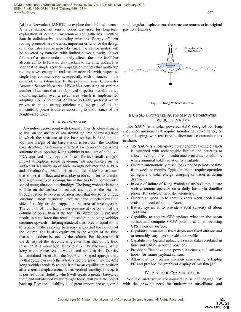
A wireless access point with kong wobbler structure is madeto float on the surface of sea around the area of investigationto which the structure of the base station is fixed on thetop. The weight of the base station is less than the wobblerbase structure, maintaining a ratio of 1:4 to prevent the wholestructure from toppling. Kong wobbler is made up of non toxicFDA approved polypropylene chosen for its overall strength,impact absorption, sound deadening and non toxicity on thesurface of sea made up of high strength polymer and is PBAand phthalate free. Vacuum is maintained inside the structurethat allows it to float and uses play grade sand for its weight.The sand remains in a compartment that has been permanentlysealed using ultrasonic technology. The kong wobbler is madeto float on the surface of sea and anchored to the sea bedthrough cables to keep in position such that due to its uniquestructure it floats vertically. They are hand-launched over theside of a ship or air dropped in the area of investigation.The column of fluid has greater pressure at the bottom of thecolumn of ocean than at the top. This difference in pressureresults in a net force that tends to accelerate the kong wobblerstructure upwards. The magnitude of that force is equal to thedifference in the pressure between the top and the bottom ofthe column, and is also equivalent to the weight of the fluidthat would otherwise occupy the column. For this reason, ifthe density of the structure is greater than that of the fluidin which it is submerged, tends to sink. The buoyancy of thekong wobbler exceeds its weight and tends to rise. Densityis maintained lesser than the liquid and shaped appropriatelyso that force can keep the whole structure afloat. The floatingkong wobbler tends to restore itself to an equilibrium positionafter a small displacement. It has vertical stability, in case itis pushed down slightly, which will create a greater buoyancyforce and unbalanced by the weight force, will push the objectback up. Rotational stability is of great importance as given a
small angular displacement, the structure returns to its originalposition, (stable).
Fig. 1. Kong Wobbler structure
III. SOLAR-POWERED AUTONOMOUS UNDERWATERVEHICLES (SAUV)
The SAUV is a solar powered AUV designed for longendurance missions that require monitoring, surveillance, orstation keeping, with real time bi-directional communicationsto shore.
• The SAUV is a solar-powered autonomous vehicle whichis equipped with rechargeable lithium ion batteries toallow maximum mission endurance even under conditionswhere minimal solar radiation is available.
• Operate autonomously at sea for extended periods of timefrom weeks to months. Typical missions require operationat night and solar energy charging of batteries duringdaytime.
• In case of failure of Kong Wobbler Sauv’s Communicatewith a remote operator on a daily basis via Satellitephone, RF radio, or acoustic telemetry.
• Operate at speed up to about 3 knots when needed andcruise at speed of about 1 knot.
• Battery system is to provide a total capacity of about1500 whrs.
• Capability to acquire GPS updates when on the oceansurface and compute SAUV position at all times usingGPS when on surface.
• Capability to maintain fixed depth and fixed altitude andto smoothly vary depth or altitude profile.
• Capability to log and upload all sensor data correlated intime and SAUV geodetic position.
• Provide sufficient volume, power, interfaces, and softwarehooks for future payload sensors.
• Allow user to program missions easily using a LaptopPC and provide for graphical display of mission.[13]
IV. ACOUSTIC COMMUNICATION
Wireless underwater communication is challenging taskwith the growing need for underwater surveillance and
IJCSI International Journal of Computer Science Issues, Vol. 10, Issue 1, No 1, January 2013 ISSN (Print): 1694-0784 | ISSN (Online): 1694-0814 www.IJCSI.org 567
Copyright (c) 2013 International Journal of Computer Science Issues. All Rights Reserved.
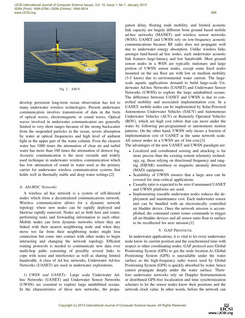
Fig. 2. SAUV
develop persistent long-term ocean observation has led tomany underwater wireless technologies. Present underwatercommunication involves transmission of data in the formof optical waves, electromagnetic or sound waves. Opticalwaves involved in underwater communication are generallylimited to very short ranges because of the strong backscatterfrom the suspended particles in the ocean, severe absorptionby water at optical frequencies and high level of ambientlight in the upper part of the water column. Even the clearestwater has 1000 times the attenuation of clear air and turbidwater has more than 100 times the attenuation of densest fog.Acoustic communication is the most versatile and widelyused technique in underwater wireless communication whichhas low attenuation of sound in water used as the primarycarrier for underwater wireless communication systems thatholds well in thermally stable and deep water settings.[2]
A. AD-HOC Networks
A wireless ad hoc network is a system of self-directednodes which form a decentralized communications network.Wireless communication allows for a dynamic networktopology where new nodes can be rapidly deployed andlikewise rapidly removed. Nodes act as both host and router,performing tasks and forwarding information to each other.Mobile nodes can form dynamic networks where they arelinked with their nearest neighboring node and when theymove too far from their neighboring nodes might loseconnection but come into contact with other nodes to begininteracting and changing the network topology. Efficientrouting protocols is needed to communicate new data overmulti-hop paths consisting of possibly several links tocope with noise and interference as well as sharing limitedbandwidth. A class of Ad hoc networks, Underwater Ad-hocNetworks (UANET) are used in underwater explorations.
1) UWSN and UANETs: Large scale Underwater Ad-hoc Networks (UANET) and Underwater Sensor Networks(UWSN) are essential to explore large uninhibited oceans.In the characteristics of these new networks, the propa-
gation delay, floating node mobility, and limited acousticlink capacity are hugely different from ground based mobilead-hoc networks (MANET) and wireless sensor networks(WSN). UANET and UWSN rely on low-frequency acousticcommunications because RF radio does not propagate welldue to underwater energy absorption. Unlike wireless linksamongst land-based ad hoc nodes, each underwater acousticlink features large-latency and low bandwidth. Most groundsensor nodes in a WSN are typically stationary and largeportion of UWSN sensor nodes, except some fixed nodesmounted on the sea floor are with low or medium mobility(3-5 knots) due to environmental water current. The large-scale aquatic applications demand to build large-scale Un-derwater Ad-hoc Networks (UANET) and Underwater SensorNetworks (UWSN) to explore the large uninhabited oceans.The difference between UANET and UWSN is due to con-trolled mobility and associated implementation cost. In aUANET, mobile nodes can be implemented by Solar-PoweredAutonomous Underwater Vehicles (SAUV) and AutonomousUnderwater Vehicles (AUV) or Remotely Operated Vehicles(ROV), which are high cost robots that can move under thewater by following pre-programmed or autonomous motionpatterns. On the other hand, UWSN only incurs a fraction ofimplementation cost of UANET at the same network scale.All sensor nodes in a UWSN are of low-cost.[3]The advantages of the new UANET and UWSN paradigm are:
• Localized and coordinated sensing and attacking is farmore precise than the existing remote telemetry technol-ogy, eg, those relying on directional frequency and rang-ing (DIFAR) sonobuoy or magnetic anomaly detection(MAD) equipment.
• Scalability of UWSN ensures that a large area can becovered for time-critical applications.
• Casualty ratio is expected to be zero if unmanned UANETand UWSN platforms are used.
• Implementing reusable underwater nodes reduces the de-ployment and maintenance cost. Each underwater sensorunit can be bundled with an electronically controlledair bladder device. Once the network mission is accom-plished, the command center issues commands to triggerall air-bladder devices and all sensor units float to surfaceto be recollected for next mission.[1]
V. GAF PROTOCOL
In underwater applications, it is vital to let every underwaternode know its current position and the synchronized time withrespect to other coordinating nodes. GAF protocol uses GlobalPositioning System (GPS) to get the node location.As GlobalPositioning System (GPS) is unavailable under the watersurface as the high-frequency radio waves used by GlobalPositioning System (GPS) is quickly absorbed by water, hencecannot propagate deeply under the water surface. There-fore underwater networks rely on Doppler Instrumentationor distributed GPS-free localization and time synchronizationschemes to let the sensor nodes know their positions and thenetwork clock value. In other words, before the network can
IJCSI International Journal of Computer Science Issues, Vol. 10, Issue 1, No 1, January 2013 ISSN (Print): 1694-0784 | ISSN (Online): 1694-0814 www.IJCSI.org 568
Copyright (c) 2013 International Journal of Computer Science Issues. All Rights Reserved.
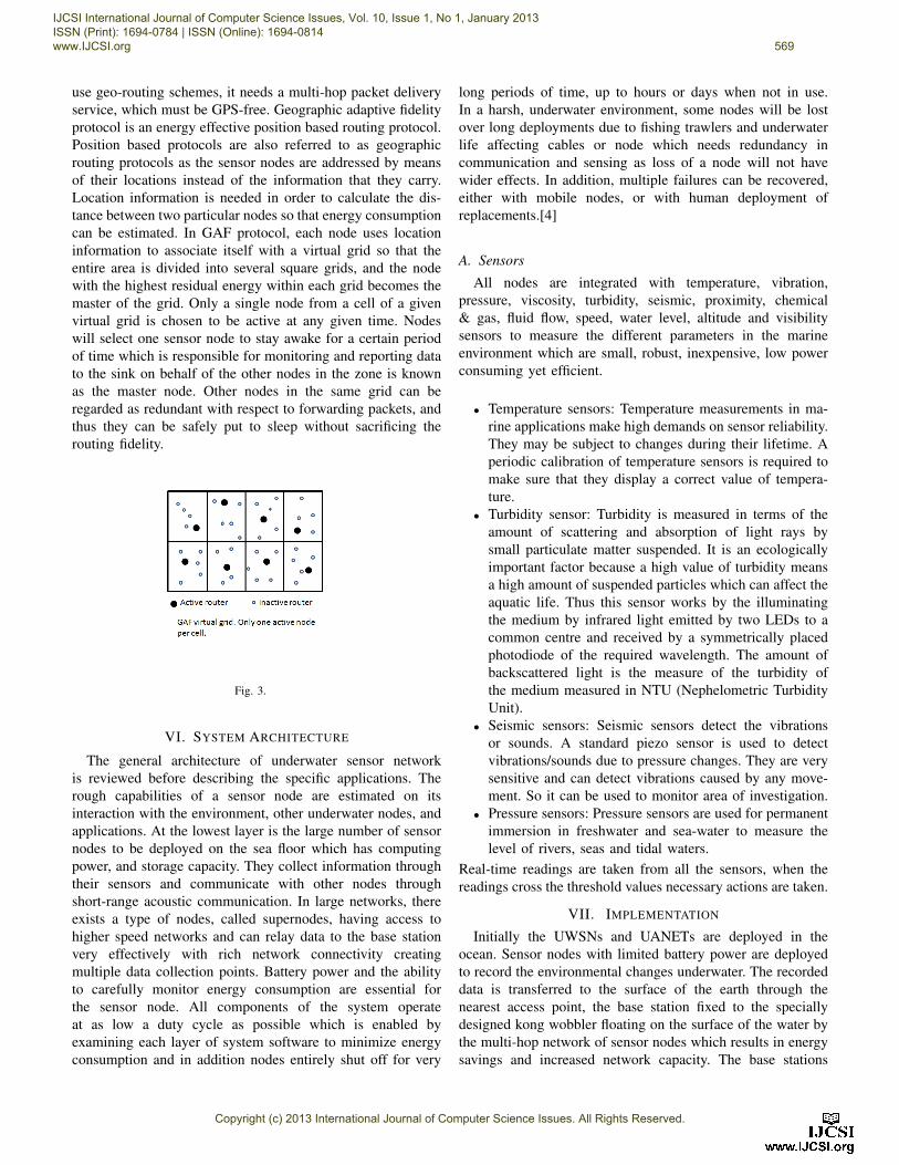
use geo-routing schemes, it needs a multi-hop packet deliveryservice, which must be GPS-free. Geographic adaptive fidelityprotocol is an energy effective position based routing protocol.Position based protocols are also referred to as geographicrouting protocols as the sensor nodes are addressed by meansof their locations instead of the information that they carry.Location information is needed in order to calculate the dis-tance between two particular nodes so that energy consumptioncan be estimated. In GAF protocol, each node uses locationinformation to associate itself with a virtual grid so that theentire area is divided into several square grids, and the nodewith the highest residual energy within each grid becomes themaster of the grid. Only a single node from a cell of a givenvirtual grid is chosen to be active at any given time. Nodeswill select one sensor node to stay awake for a certain periodof time which is responsible for monitoring and reporting datato the sink on behalf of the other nodes in the zone is knownas the master node. Other nodes in the same grid can beregarded as redundant with respect to forwarding packets, andthus they can be safely put to sleep without sacrificing therouting fidelity.
Fig. 3.
VI. SYSTEM ARCHITECTURE
The general architecture of underwater sensor networkis reviewed before describing the specific applications. Therough capabilities of a sensor node are estimated on itsinteraction with the environment, other underwater nodes, andapplications. At the lowest layer is the large number of sensornodes to be deployed on the sea floor which has computingpower, and storage capacity. They collect information throughtheir sensors and communicate with other nodes throughshort-range acoustic communication. In large networks, thereexists a type of nodes, called supernodes, having access tohigher speed networks and can relay data to the base stationvery effectively with rich network connectivity creatingmultiple data collection points. Battery power and the abilityto carefully monitor energy consumption are essential forthe sensor node. All components of the system operateat as low a duty cycle as possible which is enabled byexamining each layer of system software to minimize energyconsumption and in addition nodes entirely shut off for very
long periods of time, up to hours or days when not in use.In a harsh, underwater environment, some nodes will be lostover long deployments due to fishing trawlers and underwaterlife affecting cables or node which needs redundancy incommunication and sensing as loss of a node will not havewider effects. In addition, multiple failures can be recovered,either with mobile nodes, or with human deployment ofreplacements.[4]
A. Sensors
All nodes are integrated with temperature, vibration,pressure, viscosity, turbidity, seismic, proximity, chemical& gas, fluid flow, speed, water level, altitude and visibilitysensors to measure the different parameters in the marineenvironment which are small, robust, inexpensive, low powerconsuming yet efficient.
• Temperature sensors: Temperature measurements in ma-rine applications make high demands on sensor reliability.They may be subject to changes during their lifetime. Aperiodic calibration of temperature sensors is required tomake sure that they display a correct value of tempera-ture.
• Turbidity sensor: Turbidity is measured in terms of theamount of scattering and absorption of light rays bysmall particulate matter suspended. It is an ecologicallyimportant factor because a high value of turbidity meansa high amount of suspended particles which can affect theaquatic life. Thus this sensor works by the illuminatingthe medium by infrared light emitted by two LEDs to acommon centre and received by a symmetrically placedphotodiode of the required wavelength. The amount ofbackscattered light is the measure of the turbidity ofthe medium measured in NTU (Nephelometric TurbidityUnit).
• Seismic sensors: Seismic sensors detect the vibrationsor sounds. A standard piezo sensor is used to detectvibrations/sounds due to pressure changes. They are verysensitive and can detect vibrations caused by any move-ment. So it can be used to monitor area of investigation.
• Pressure sensors: Pressure sensors are used for permanentimmersion in freshwater and sea-water to measure thelevel of rivers, seas and tidal waters.
Real-time readings are taken from all the sensors, when thereadings cross the threshold values necessary actions are taken.
VII. IMPLEMENTATION
Initially the UWSNs and UANETs are deployed in theocean. Sensor nodes with limited battery power are deployedto record the environmental changes underwater. The recordeddata is transferred to the surface of the earth through thenearest access point, the base station fixed to the speciallydesigned kong wobbler floating on the surface of the water bythe multi-hop network of sensor nodes which results in energysavings and increased network capacity. The base stations
IJCSI International Journal of Computer Science Issues, Vol. 10, Issue 1, No 1, January 2013 ISSN (Print): 1694-0784 | ISSN (Online): 1694-0814 www.IJCSI.org 569
Copyright (c) 2013 International Journal of Computer Science Issues. All Rights Reserved.
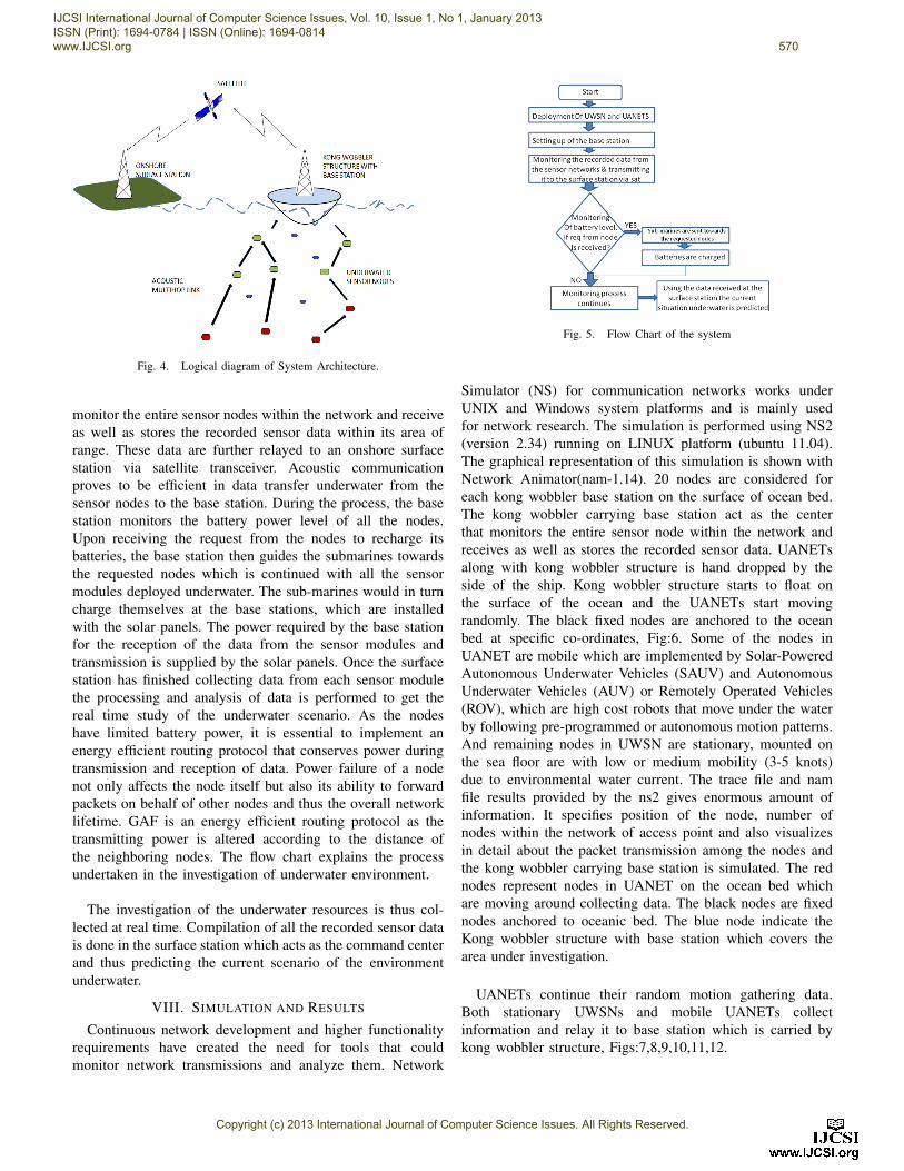
Fig. 4. Logical diagram of System Architecture.
monitor the entire sensor nodes within the network and receiveas well as stores the recorded sensor data within its area ofrange. These data are further relayed to an onshore surfacestation via satellite transceiver. Acoustic communicationproves to be efficient in data transfer underwater from thesensor nodes to the base station. During the process, the basestation monitors the battery power level of all the nodes.Upon receiving the request from the nodes to recharge itsbatteries, the base station then guides the submarines towardsthe requested nodes which is continued with all the sensormodules deployed underwater. The sub-marines would in turncharge themselves at the base stations, which are installedwith the solar panels. The power required by the base stationfor the reception of the data from the sensor modules andtransmission is supplied by the solar panels. Once the surfacestation has finished collecting data from each sensor modulethe processing and analysis of data is performed to get thereal time study of the underwater scenario. As the nodeshave limited battery power, it is essential to implement anenergy efficient routing protocol that conserves power duringtransmission and reception of data. Power failure of a nodenot only affects the node itself but also its ability to forwardpackets on behalf of other nodes and thus the overall networklifetime. GAF is an energy efficient routing protocol as thetransmitting power is altered according to the distance ofthe neighboring nodes. The flow chart explains the processundertaken in the investigation of underwater environment.
The investigation of the underwater resources is thus col-lected at real time. Compilation of all the recorded sensor datais done in the surface station which acts as the command centerand thus predicting the current scenario of the environmentunderwater.
VIII. SIMULATION AND RESULTS
Continuous network development and higher functionalityrequirements have created the need for tools that couldmonitor network transmissions and analyze them. Network
Fig. 5. Flow Chart of the system
Simulator (NS) for communication networks works underUNIX and Windows system platforms and is mainly usedfor network research. The simulation is performed using NS2(version 2.34) running on LINUX platform (ubuntu 11.04).The graphical representation of this simulation is shown withNetwork Animator(nam-1.14). 20 nodes are considered foreach kong wobbler base station on the surface of ocean bed.The kong wobbler carrying base station act as the centerthat monitors the entire sensor node within the network andreceives as well as stores the recorded sensor data. UANETsalong with kong wobbler structure is hand dropped by theside of the ship. Kong wobbler structure starts to float onthe surface of the ocean and the UANETs start movingrandomly. The black fixed nodes are anchored to the oceanbed at specific co-ordinates, Fig:6. Some of the nodes inUANET are mobile which are implemented by Solar-PoweredAutonomous Underwater Vehicles (SAUV) and AutonomousUnderwater Vehicles (AUV) or Remotely Operated Vehicles(ROV), which are high cost robots that move under the waterby following pre-programmed or autonomous motion patterns.And remaining nodes in UWSN are stationary, mounted onthe sea floor are with low or medium mobility (3-5 knots)due to environmental water current. The trace file and namfile results provided by the ns2 gives enormous amount ofinformation. It specifies position of the node, number ofnodes within the network of access point and also visualizesin detail about the packet transmission among the nodes andthe kong wobbler carrying base station is simulated. The rednodes represent nodes in UANET on the ocean bed whichare moving around collecting data. The black nodes are fixednodes anchored to oceanic bed. The blue node indicate theKong wobbler structure with base station which covers thearea under investigation.
UANETs continue their random motion gathering data.Both stationary UWSNs and mobile UANETs collectinformation and relay it to base station which is carried bykong wobbler structure, Figs:7,8,9,10,11,12.
IJCSI International Journal of Computer Science Issues, Vol. 10, Issue 1, No 1, January 2013 ISSN (Print): 1694-0784 | ISSN (Online): 1694-0814 www.IJCSI.org 570
Copyright (c) 2013 International Journal of Computer Science Issues. All Rights Reserved.

Fig. 6. Simulation in ns2
Fig. 7. Simulation in ns2
IX. CONCLUSION
This paper has summarized our ongoing research in un-derwater sensor networks, including applications and researchchallenges. It is explained that traditional approach to deployunderwater sensors that record data during the monitoringmission, then recovering the instruments is not a feasibleand the need of large-scale long-term and distributed infor-mation collection networks for periodic oceanic monitoringis essential. GAF (Graphical Adaptive Fidelity) protocol wasadopted as it proves to be an energy efficient routing protocol.it is also explained that acoustic communication is the mostversatile technique in underwater wireless communication.The applications of large scale Underwater Ad-hoc Networks(UANET) using Solar-Powered Autonomous Underwater Ve-hicles (SAUV) and Underwater Sensor Networks (UWSN)and their reliability in implementing a localized, precise, andlarge-scale networking efficiently than any existing small-scaleUnderwater Acoustic Network (UAN) is described. The mainobjective of the paper is to develop advanced communicationtechniques for efficient real time investigation of large uninhib-ited oceans. Development of underwater communication andnetworking for enhanced oceanic monitoring is also essentialfor pollution monitoring, tactical surveillance, exploration ofnatural undersea resources, predicting wave tides and variousapplications.
Fig. 8. Simulation in ns2
Fig. 9. Simulation in ns2
REFERENCES
[1] Ian F. Akyildiz, Dario Pompili, Tommaso Melodia. Challenges forEfficient Communication in Underwater Acoustic Sensor Networks.ACMSigbed Review.
[2] Jun-Hong Cui, Jiejun Kong, Mario Gerla, Shengli Zhou. Challenges:Building Scalable and Distributed Underwater Wireless Sensor Networks(UWSNs) for Aquatic Applications. Special Issue of IEEE Network onWireless Sensor Networking, May 2006.
[3] Jiejun Kong, Jun-hong Cui, Dapeng Wu, Mario Gerla.BUILDING UN-DERWATER AD-HOC NETWORKS AND SENSOR NETWORKS FORLARGE SCALE REAL-TIME AQUATIC APPLICATIONS.IEEE MIL-COM, 2005.
[4] John Heidemann, Yuan Li, Affan Syed, Jack Wills, Wei Ye.UnderwaterSensor Networking: Research Challenges and Potential Applications.TheIEEE Wireless Communications and Networking Conference, Las Vegas,Nevad, USA, April 2006.
[5] Sudhakar Pillai M, Pranav P D, and Narendra Kumar G.MANET BasedDynamic Power Conscious Emergency Communication Module.LISS,2010, China.
[6] Giuseppe Anastasi, Marco Conti, Mario Di Francesco, Andrea Pas-sarella.Energy Conservation in Wireless Sensor Networks: a Survey.
[7] Robert Been, David T. Hughes, Arjan Vermeij.Heterogeneous underwaternetworks for ASW: technology and techniques. OCEANS 2010 IEEESydney.
[8] Lanbo Liu, Shengli Zhou, and Jun-Hong Cui. Prospects and Problemsof Wireless Communication for Underwater Sensor Networks. Journal:Wireless Communications & Mobile Computing - Underwater SensorNetworks: Architectures and Protocols.
[9] Ian F. Akyildiz , Dario Pompili, Tommaso Melodia.Underwater acousticsensor networks: research challenges. Telecommunications (ICT).2010IEEE 17th International Conference.
[10] Raja Jurdak, Cristina Videira Lopes, Pierre Baldi. BATTERY LIFETIMEESTIMATION AND OPTIMIZATION FOR UNDERWATER SENSORNETWORKS.
IJCSI International Journal of Computer Science Issues, Vol. 10, Issue 1, No 1, January 2013 ISSN (Print): 1694-0784 | ISSN (Online): 1694-0814 www.IJCSI.org 571
Copyright (c) 2013 International Journal of Computer Science Issues. All Rights Reserved.
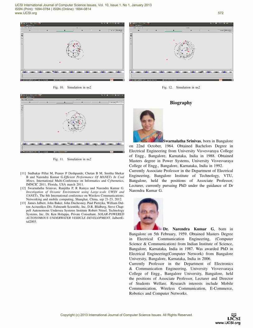
Fig. 10. Simulation in ns2
Fig. 11. Simulation in ns2
[11] Sudhakar Pillai M, Pranav P Deshpande, Chetan B M, Smitha ShekarB and Narendra Kumar G.Efficient Performance Of MANETs In CoalMines, International Multi-Conference on Informatics and Cybernetics,IMNCIC 2011, Florida, USA march 2011.
[12] Swarnalatha Srinivas, Ranjitha P, R Ramya and Narendra Kumar G.Investigation of Oceanic Environment using Large-scale UWSN andUANETs, The 8th International conference on Wireless Communications,Networking and mobile computing, Shanghai, China, sep 21-23, 2012.
[13] James Jalbert, John Baker, John Duchesney, Paul Pietryka, William Dal-ton Acoustikos Div. Falmouth Scientific, Inc. D.R. Blidberg, Steve Chap-pell Autonomous Undersea Systems Institute Robert Nitzel, TechnologySystems, Inc. Dr. Ken Holappa, Private Consultant. SOLAR-POWEREDAUTONOMOUS UNDERWATER VEHICLE DEVELOPMENT, JalbertE-tal2003.
Fig. 12. Simulation in ns2
Biography
Swarnalatha Srinivas, born in Bangaloreon 22nd October, 1964. Obtained Bachelors Degree inElectrical Engineering from University Visvesvaraya Collegeof Engg., Bangalore, Karnataka, India in 1988. ObtainedMasters degree in Power Systems, University VisvesvarayaCollege of Engg., Bangalore, Karnataka, India in 1992.Currently Associate Professor in the Department of ElectricalEngineering, Bangalore Institute of Technology, VTU,Bangalore, held the positions of Associate Professor,Lecturer, currently pursuing PhD under the guidance of DrNarendra Kumar G.
Dr. Narendra Kumar G, born inBangalore on 5th February, 1959. Obtained Masters Degreein Electrical Communication Engineering, (ComputerScience & Communication) from Indian Institute of Science,Bangalore, Karnataka, India in 1987. Was awarded PhD inElectrical Engineering(Computer Network) from BangaloreUniversity, Bangalore, Karnataka, India in 2006.Currently Professor in the Department of Electronics& Communication Engineering, University VisvesvarayaCollege of Engg., Bangalore University, Bangalore, heldthe positions of Associate Professor, Lecturer and Directorof Students Welfare. Research interests include MobileCommunication, Wireless Communication, E-Commerce,Robotics and Computer Networks.
IJCSI International Journal of Computer Science Issues, Vol. 10, Issue 1, No 1, January 2013 ISSN (Print): 1694-0784 | ISSN (Online): 1694-0814 www.IJCSI.org 572
Copyright (c) 2013 International Journal of Computer Science Issues. All Rights Reserved.

Ranjitha P and R Ramya are students doing research underthe guidance of Prof. Narendra Kumar G.
IJCSI International Journal of Computer Science Issues, Vol. 10, Issue 1, No 1, January 2013 ISSN (Print): 1694-0784 | ISSN (Online): 1694-0814 www.IJCSI.org 573
Copyright (c) 2013 International Journal of Computer Science Issues. All Rights Reserved.