esri and weatherbug: creating a climate of change...weatherbug protect—case study summary of...
TRANSCRIPT

ESRI and WeatherBug: Creating a Climate of ChangeHow ESRI's GIS Technology Has Changed WeatherBug’s Business
April 24, 2007

Agenda
• Corporate Overview• Solution Summary• Customer Case Study• Benefits to Business• Q&A

Corporate Overview
• Founded in 1993• Profitable• Headquarters in Germantown, Maryland• 250 Employees• Largest weather sensor and camera network in the world• Partnership with the National Weather Service• WeatherBug—top 15 Web property with 4.6M average daily visitors*• Partnerships with over 6,000 schools and 110 TV broadcast stations
*Source: comScore Media Metrix February 2007

Broadcast
Business Footprint
Interactive
Mobile
Commercial
Government
Education

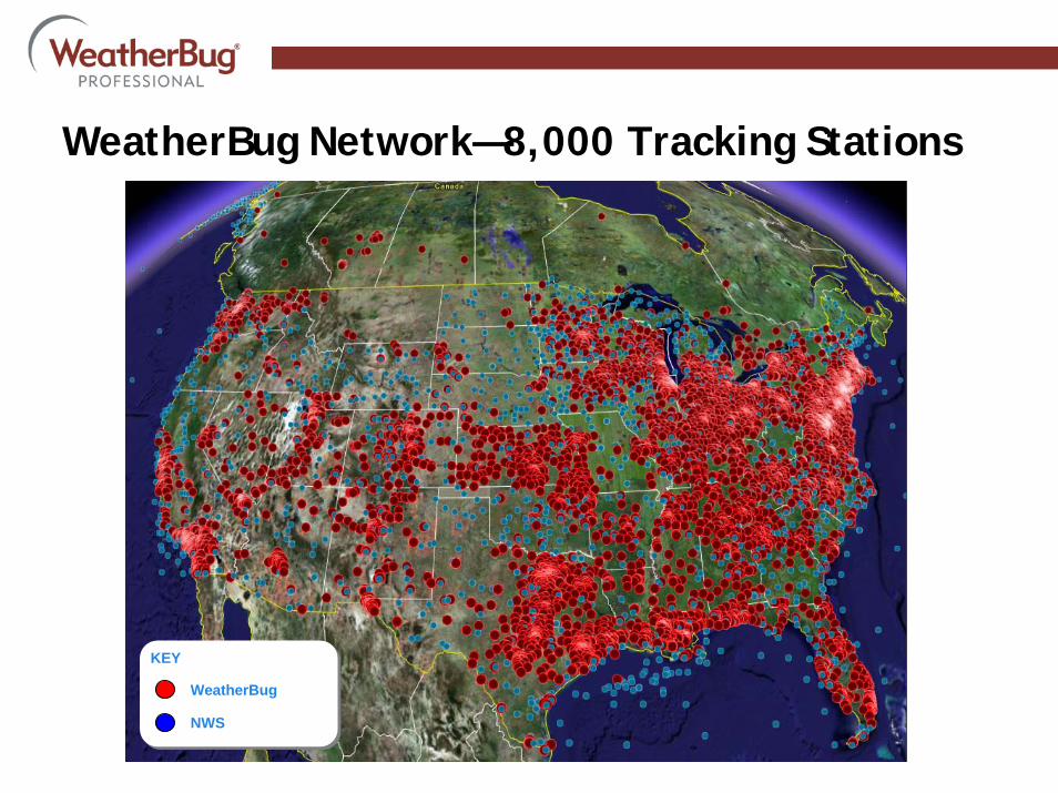
NWS—1,200 Tracking Stations
KEY
WeatherBug
NWS
KEY
WeatherBug
NWS
WeatherBug Network—8,000 Tracking Stations

WeatherBug Weather Tracking Station
• Commercial-grade system• Records 27 different weather variables• Includes digital display• MotionCam option

• ~750 servers• “Microsoft Shop” – 2000/2003 Servers• ESRI GIS • 24/7 NOC Support• Extreme Networks Switches• Cisco Routers• F5 Load Balancers / DNS• Netscreen Firewalls• Giggabit connectivity from multiple ISP’s•~ 2 billion requests for data every day
Network Overview CDN
Data Center Unit 2
Data Center Unit 2
Data Center Unit 3
Data Center Unit 3
Consumer Data Center Cluster
Professional Svcs Data Center Cluster
Global Load Balancing and Failover
Data Center Unit 1
Data Center Unit 1
Data Center Unit 4
Data Center Unit 4


Impacts Safety and National Security

Continuity of Operations and Safety Solutions
Natural Disasters AccidentsLoss of Services

Web Mapping Services
• Hosted GIS feed• Customized set of data layers

How The Service Works1. Create account and contacts. Link contacts
to locations and weather profile.
2. Weather data flows into the alert GIS engine from WeatherBug stations, NWS and the lightning network.
3. GIS engine plots the weather data on a high resolution 5km grid and generates pending alerts.
4. WeatherBug meteorologists analyze the alerts in a 24/7 Meteorology center and authorize pending alerts for delivery to subscribed contacts.
5. Direct Text two-way alert messages are sent to the contacts—based on their locations and alert types.
6. Managers can track alert delivery in real time
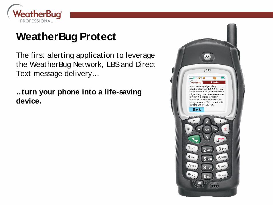
WeatherBug Protect
The first alerting application to leverage the WeatherBug Network, LBS and Direct Text message delivery…
…turn your phone into a life-saving device.

WeatherBug Protect
Weather Advantages• The only true LBS weather alerting solution—precise location
equals precise alerts. • Proprietary live, streaming, high resolution weather alerts
• More precise than NWS alerts• No irrelevant alerts• Lightning alerts• Heat alerts
• Custom call for action—based on your policy• Message acknowledgment

Customized Weather Alerts
Alert Type Description
Lightning Threat Detailed radar input with the early detection of cloud-to-cloud and cloud-to-air lightning provides a good prediction of where a cloud-to-ground lightning may strike in the next 30 minutes.
Lightning Strike10 miles
The lightning network that WeatherBug Protect uses can detect lightning strikes with an average error that is better than 200 meters.
Wind Gust: 50mph, 10 miles
Very important for marine and ground transportation. Wind gust is a local event that is detected by WeatherBug’s weather tracking stations.
Heat Index: 95F, 100F, 105F
Heat index is calculated from the temperature and humidity values reported by WeatherBug’s weather tracking stations. School districts, outdoor recreation businesses and retail all associate weather policies with heat index.
Wind Chill: 32F, 0F
A calculation based on temperature and wind speed for cold and freezing weather conditions.
Rain Rate: 1, 2, 4”/hr, 10 miles
Rain rate can be a very good predictor of flash flooding potential.
All NWS Alerts Subscribers can customize WeatherBug Protect service to send them alerts that are issued by the National Weather Service.

WeatherBug Protect—Case Study
February 28, 2007—Broward County, FloridaAs Broward County schools were preparing for dismissal on Wednesday, February 28, 2007, a fast-moving and powerful storm began to intensify, impacting seven cities within Broward County.

WeatherBug Protect—Case Study
1:00 PM—WeatherBug begins disseminating alerts of approaching lightning through WeatherBug Protect enabled phones to Broward County schools.

WeatherBug Protect—Case Study
1:11 PM—WeatherBug issues lightning strike alerts through WeatherBug Protect enabled phones to Broward County schools.

WeatherBug Protect—Case Study
1:35 PM—WeatherBug MetDesk forecasters identify potential tornadic activity and proactively contact clients to advise of extreme weather and possible tornadoes.

WeatherBug Protect—Case Study
1:38 PM—WeatherBug Protect relays official National Weather Service (NWS) Severe Thunderstorm Warning.

WeatherBug Protect—Case Study
1:42 PM—WeatherBug Protect relays official NWS tornado warning.

WeatherBug Protect—Case Study
1:45 PM—Broward County schools equipped with WeatherBug Protect enabled phones move students to secure areas and delay dismissaluntil 2:30 PM.

WeatherBug Protect—Case Study
NOAA map of tornado path
1:55 PM—A tornado touchdown is reported in Tamarac, Broward County and rips through a golf course community.

WeatherBug Protect—Case Study
Summary of Events1:00 PM WeatherBug begins disseminating alerts of approaching lightning through
WeatherBug Protect enabled phones to Broward County schools.
1:11 PM WeatherBug issues lightning strike alerts through WeatherBug Protect enabled phones to Broward County schools.
1:35 PM WeatherBug MetDesk forecasters identify potential tornadic activity and proactively contact clients to advise of extreme weather and possible tornadoes.
1:38 PM WeatherBug Protect relays official National Weather Service (NWS) Severe Thunderstorm Warning.
1:42 PM WeatherBug Protect relays official NWS tornado warning.
1:45 PM Broward County schools equipped with WeatherBug Protect enabled phones move students to secure areas and delay dismissal until 2:30 PM.
1:55 PM A tornado touchdown is reported in Tamarac, Broward County and rips through a golf course community.

WeatherBug
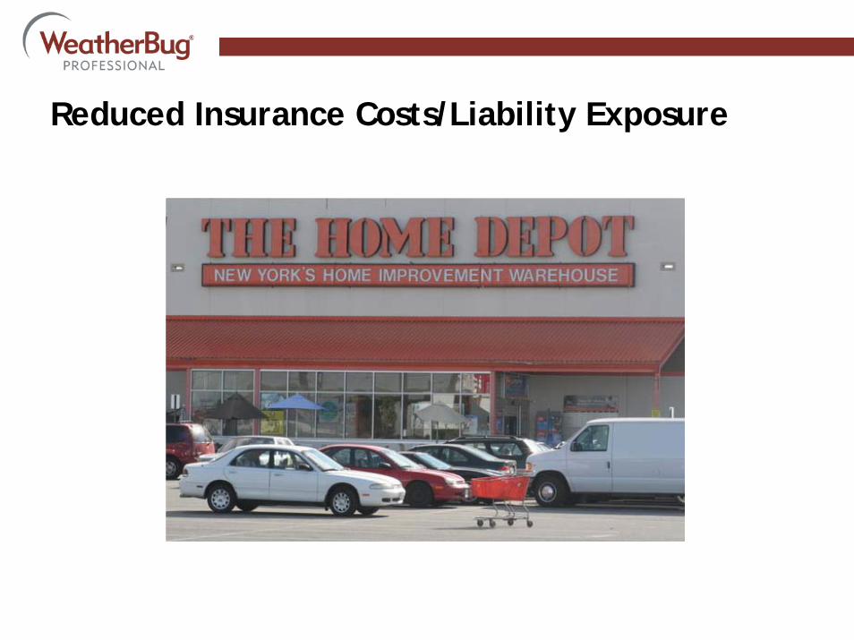
Reduced Insurance Costs/Liability Exposure

Improved Customer Service & Safety

Relevant Product Offerings

Improved Logistics

Mass Notification

New Store Construction

EOC Situational Awareness

WeatherBug Impacts on Business Decisions
• Reduced insurance costs/liability exposure• Improved customer service & enhanced employee and safety• Relevant product offerings based on live and forecasted weather
information• Adjust inventory based on weather sensitivity• Improved logistics through severe weather notification• Mass notification to store employees/management• New store construction forecasts and alerts

Demos
• Web Services• WeatherBug Protect Alert

Contact Information
Christian Solomine Business Development Manager WeatherBug Professional ServicesOffice: (303) 770-1441Mobile: (303) 522-4430 Email: [email protected]