esri’s arcgis pro
TRANSCRIPT

1
Downloading, Installing, and
Licensing
Esri’s ArcGIS Pro
Academic Edition
2.8.F2021.2
Mapping Applications and Resource Center Jesse D. Jones College of Science, Engineering and Technology
Murray State University

2
Contents Before You Install ArcGIS Pro .......................................................................................................................... 3
Minimum system requirements: ................................................................................................................ 3
Getting a Murray State AGO Account ............................................................................................................. 3
Murray State University / Esri’s ArcGIS Online for Education Account ....................................................... 3
Downloading ArcGIS Pro ................................................................................................................................. 7
Licensing ArcGIS Pro ................................................................................................................................... 9
Other ArcGIS Pro extensions................................................................................................................... 9
Installation of ArcGIS Pro .............................................................................................................................. 10
Welcome to the ArcGIS Pro Setup program .................................................................................................. 12
Master Agreement .................................................................................................................................... 13
Esri Customer Experience Program (no screenshot) ................................................................................. 14
ArcGIS Successfully Installed ..................................................................................................................... 15
ArcGIS Pro Authorization (licensing phase) .............................................................................................. 15
ArcGIS Pro Sign In ...................................................................................................................................... 16
Licensing Notes ............................................................................................................................................. 18
Working in ArcGIS Pro ............................................................................................................................... 18
Software Updates ..................................................................................................................................... 18
Getting Help .............................................................................................................................................. 18
Murray State University is part of the state-wide license agreement between Esri and the Council on Post-secondary Education (CPE). The Mapping Applications and Resource Center, located in Blackburn Science Building, 4th Floor, covers the cost of the yearly license agreement fee, allowing all Murray State University faculty, staff, and students access to the world’s leading geospatial software, ArcGIS. Our maintenance fee also provides access to ArcGIS Online for Education and world-class online training course which allows faculty, staff, and students to gain essentially knowledge and enhance skills in the growing body of geospatial data management and use. The software provided, including ArcGIS Pro, is a fully-functional suite of software and extensions. Licensing is valid as long as one is a currently-employed faculty or staff person of Murray State University, or a currently-enrolled Murray State University student. Software and its extensions are for the express use of Murray State University in the conduct of academic coursework, for academic research, and to support the physical infrastructure of Murray State University. Any other use is strictly prohibited and may result in the loss of access privileges. By creating an AGO account, you are accepting the conditions of the Esri – Murray State University – CPE site license agreement. Questions regarding the acceptable use of any of the licensed Esri products should be directed to the Esri Contract Representative, Mr. Michael Busby ( [email protected] ), GIS Coordinator, Mapping Applications and Resource Center, Murray State University.
3
Before You Install ArcGIS Pro There are a few prerequisites to cover before ArcGIS Pro can be installed on a computer.
First, check to make sure the target laptop or desktop actually meets the system requirements to run ArcGIS Pro.
Minimum system requirements:
Windows 10 or Windows 8.1 2 Core CPU 4GB RAM 32GB of free space available on the hard drive 24-bit graphics card with 4GB of dedicated RAM
ArcGIS Pro requires Windows 8.1 or 10. Apple computers are not supported. ArcGIS Pro can be installed on a Mac computer only after creating a virtual computer environment using Boot Camp or Parallels, or similar product.
If you are not sure if your computer can run ArcGIS Pro, follow this link to install “Can You Run It?” and find out.
Second, faculty, staff, and students are required to have a Murray State University ArcGIS Online for Education account. The AGO account allows the software to be downloaded and licensed.
Please note: Esri’s ArcGIS Pro is strictly for education and academic research purposes.
Getting a Murray State AGO Account Murray State University / Esri’s ArcGIS Online for Education Account
Fall 2021, Murray State instituted SSO (“Single Sign-On”) for our AGO environment. SSO allows faculty, staff, and students to utilize their current Murray State sign-on credentials to access Esri’s AGO environment, including ArcGIS Pro.
ArcGIS Pro is licensed through Murray State University’s ArcGIS Online for Education (AGO). Faculty, staff, and students are required to have a Murray State University AGO account in order to download and license ArcGIS Pro.
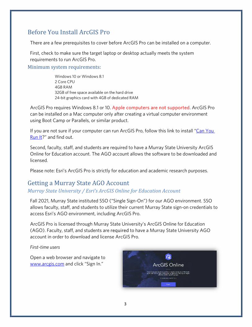
First-time users
Open a web browser and navigate to www.arcgis.com and click “Sign In.”

4
First time users will see this login screen. As a first-time user, you will not have a username nor password.
Murray State University’s AGO uses your Murray State username and password so click on “Your ArcGIS organization’s URL” dropdown box.
The ArcGIS login prompt will be replaced with a textbox. Enter murraystate into the textbox, making the URL murraystate.maps.arcgis.com the fully-qualified URL.
Check the “Remember this URL” box.

5
You will see a new screen offering the opportunity to sign in to the Murray State University AGO.
Click “Murray State University Credentials.”
You will see the familiar Murray State University Login page. Enter your Murray State University Username and Password and click LOGIN.

6
The Murray State University Access Notice will appear. Click OK to continue.
The Murray State University / Esri Access Notice will appear. Click Accept to continue.
You are now inside the Murray State University ArcGIS Online for Education (AGO) site.
This process has created an account for you within Murray State’s AGO. You will need to remember and use the URL murraystate.maps.arcgis.com for future sign-in attempts and to use the AGO resources.

7
Downloading ArcGIS Pro In the upper right-hand corner you will see your first name and your Murray State University AGO account name. Click your username to access your account options.
Click My settings.
On the My settings page, click Licenses on the left menu.

8
By default, your User Type is “GIS Professional Advanced.” Ignore the Role.
Click the Download button to begin downloading the English version of ArcGIS Pro 2.8. Make sure to remember the location of the download folder.

9
Licensing ArcGIS Pro
By default, all Murray State University faculty, staff, and students are licensed to use ArcGIS Pro.
Other ArcGIS Pro extensions are currently licensed on an as-needed basis.
Some of the popular or necessary ArcGIS Pro extensions are listed below. If you are taking one of the many GIS courses on campus, you might already be licensed* for an extension. If you are doing research outside of a class project, you can request a license for an ArcGIS Pro extension.
3D Analyst Aviation Airports Aviation Charting
Bathymetry Business Analyst Data Interoperability
Data Reviewer Defense Mapping Geostatistical Analyst
Image Analyst Locate XT Location Referencing
Maritime Network Analyst Production Mapping
Publisher Spatial Analyst Workflow Manager
*Indicates an extension you may already have access to based on class registration.
Murray State University and the Mapping Applications and Resource Center (MARC) support additional Esri App bundles and Applications.
For information about an ArcGIS extension or to request an additional extension, email [email protected] or [email protected].
10
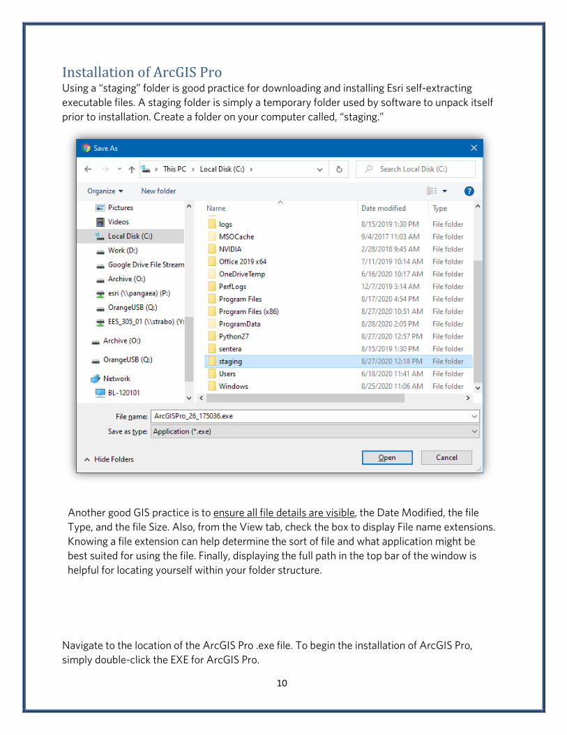
Installation of ArcGIS Pro Using a “staging” folder is good practice for downloading and installing Esri self-extracting executable files. A staging folder is simply a temporary folder used by software to unpack itself prior to installation. Create a folder on your computer called, “staging.”
Another good GIS practice is to ensure all file details are visible, the Date Modified, the file Type, and the file Size. Also, from the View tab, check the box to display File name extensions. Knowing a file extension can help determine the sort of file and what application might be best suited for using the file. Finally, displaying the full path in the top bar of the window is helpful for locating yourself within your folder structure.
Navigate to the location of the ArcGIS Pro .exe file. To begin the installation of ArcGIS Pro, simply double-click the EXE for ArcGIS Pro.
11
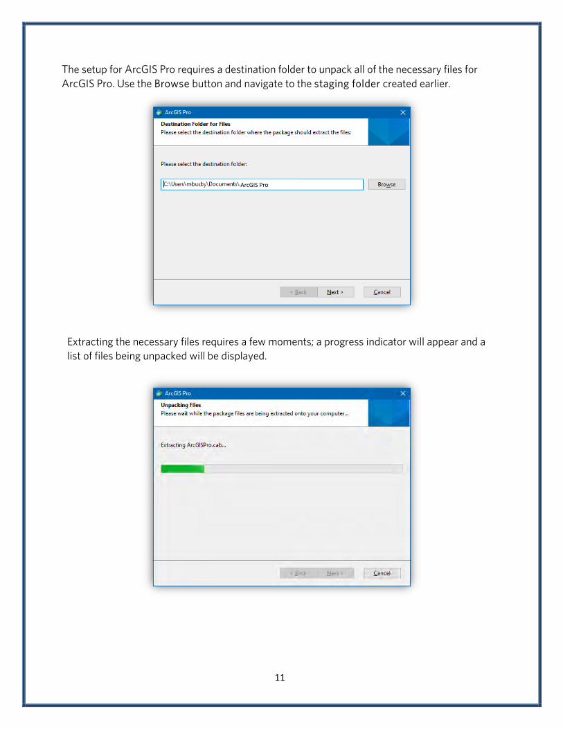
The setup for ArcGIS Pro requires a destination folder to unpack all of the necessary files for ArcGIS Pro. Use the Browse button and navigate to the staging folder created earlier.
Extracting the necessary files requires a few moments; a progress indicator will appear and a list of files being unpacked will be displayed.
ArcGIS Pro

12
When the files have been successfully extracted, leave the “Launch the setup program” boxed checked and Close the window to begin installation.
Welcome to the ArcGIS Pro Setup program ArcGIS Pro will examine your computer, see if it meets the minimum system requirements, and check the hard drive for space. Next >

13
A screen displaying a few reminders and warnings will appear. Next >
Master Agreement This is the typical End User License Agreement (EULA). The software is for educational use only, for use to complete homework, and to assist with faculty-directed/guided research. Any other use is restricted and expressly forbidden. Make sure you accept the agreement in order to install the software. Next>

14
Esri Customer Experience Program (no screenshot) Do not join the Esri Customer Experience Program. Next >
Destination Folder
Never change the destination folder unless you really want to muck up your install. Next>
Take a Break While ArcGIS Pro Installs
Get coffee; the installation is going to take a while.

15
ArcGIS Successfully Installed When the installation completes, leave the “Run ArcGIS Pro now” box checked. Finish
ArcGIS Pro Authorization (licensing phase) ArcGIS Pro takes a while to load. The splash screen will appear and below the logo messages will display indicating progress.

16
ArcGIS Pro Sign In Use the ArcGIS organization URL and enter murraystate in the field provided. Check the “Remember this URL” box. Continue.
Click the blue “Murray State University” button begin the authorization process.

17
Provide your Murray State University username and password. If all has gone according to plan, a window similar to the one below should appear.
ArcGIS Pro will sign you in, gather information about the extensions you are licensed to use, then present you with the initial dashboard to get started. You are now ready to rock-and-roll. Commence GIS!
18
Licensing Notes ArcGIS Pro requires a persistent internet connection. In other words, the computer must be connected to the internet. If the computer were to lose connection to the internet, ArcGIS Pro will run for about 60 minutes and then close. Working in ArcGIS Pro Frequently save your work. Perhaps 2 or 3 times an hour. Esri GIS software is very sophisticated and represents one of the largest collections of programming objects outside of a Microsoft software product, and complicated software crashes. MXD files are NOT your data. Your data is your data and MXD files are like HTML/XML files in that they simply reference your data, create links to your data, but do not contain your data nor contain the entirety of your project. Software Updates Please be advised ArcGIS Pro will perform software updates automatically. While this may sound nice, your version may become different than the version used in class over time. Updates can be controlled under “Settings.” Getting Help Troubleshooting & Help The ArcGIS Pro does not come with technical support. However, Esri has an abundant amount of free help available to address a wide array of issues and concerns.
Esri User Forums User forums are a good way to discover information of technical issues, or to figure out ways to use the software in addressing a particular research problem. Google Chances are, someone has already experienced a dilemma and has documented a solution. Perform a google search, either formed as a specific question, e.g. “how do I create a buffer in ArcGIS Pro 2.8” or simply by using search terms, like “watershed delineation ArcGIS Pro 2.8.” Always include the software version in searches as the process can change between software versions. YouTube Esri has a YouTube channel, EsriTV. EsriTV has hundreds of videos demonstrating technology, from fundamental “how-to” tasks, to more sophisticated analysis, and topical videos on geospatial technology.