everest three sides of - high mountain glacial … tahr is a relative of wild goats. opposite page:...
TRANSCRIPT

24 n at u r a l h i s to ry April 2013
Lan
gta
ng
Ri t
Rekk
ing
& ex
pedi
tio
n pv
t Ltd
Yon
gYu
t ku
msR
i
0 n a beautiful, clear morning in May 2012, I head-ed through a forest high above the Imja River in Nepal’s Sagarmatha National Park. Rarely used by trekking groups or visitors, it is a trail I discovered
years ago while living in this region, known as Khumbu, conducting the fieldwork for my PhD in geography. The trail contours along steep, north-facing slopes that are blanketed by a thick cloud forest of Himalayan fir, silver birch, and numerous tree and dwarf rhododendrons. The national flower, the blood-red Rhododendron arboreum, was in full bloom. Old-man’s-beard lichens draped the limbs, catching moisture from the early morning mists that were beginning to lift. On either side of the trail bloomed purple and yellow primroses and blue star-shaped gentians. These pioneers of spring foretold the ar-rival of the many hundreds of flowers to come.
I pretended not to look at a lone musk deer, the fanged, tree-climbing resident of moist forests in Nepal and Tibet, that stood frozen beneath a lone rhododendron tree just below me. I carefully stepped over the large pile of his tiny, bullet-shaped scat that clearly announced that I was an in-vader of his marked territory. These creatures once were
rare because poachers hunted them for the musk pods in their bellies that are used for making perfume. Yet musk deer had be-come quite common in this part of the park, thanks to the enforcement of wildlife protection laws since the mid-1970s.
A small group of shaggy, goatlike Hi-malayan tahr browsed on the drier, shrub-by south-facing slopes directly across the
river. Ten years ago they posed a serious threat to many communities when local crops became their preferred food source. Now they are becoming increasingly scarce because the snow leopard, with its taste for tahr, has re-turned to these slopes. Scalps purported to come from the yeti, the legendary apelike creature that everyone’s uncle claims to have seen, are probably made of the red-dish hide of a Himalayan tahr, or so some scientists think.
An orange-barred leaf warbler and red-breasted rose-finch sang in the distance, the first of many songbirds that would return to the region within the next several weeks. Gliding silently above was a lone lammergeier (German for “lamb vulture”), or bearded vulture, with a wingspan of ten feet.
The trail emerges from the cool forest into a high-altitude shrubland of dwarf rhododendron. The most conspicuous, the sunpati (R. anthopogon), has an aromatic scent that is among the most pleasing that I have ever encountered—in small quantities, that is. Porters often complain of “sunpati headaches” if their routes take them through too many miles of the pungent shrub.
Looming above is one of the grandest sights in the en-
There’s more To a mounTain Than The summiT
By Alton C. Byers
Three Sides ofEverest
24-35 NH Byers 413.indd 24 4/28/13 2:08 PM

Himalayan tahr is a relative of wild goats. Opposite page: Mount Everest rises in the distance, in a view from the north, in Tibet.
24-35 NH Byers 413.indd 25 4/28/13 2:09 PM

26 n at u r a l h i s to ry April 2013
tire world—the black, pyramid-shaped, ice-clad, and wind-blasted summit of Mount Everest. Tibetans revere it as Qomolangma (“holy mother”), and local Nepalis used that name until the Nepali government renamed it Sagarmatha (a Sanskrit word often translated as “mother of the universe”) in the early 1960s for political reasons. The mountain successfully resisted all Western attempts to climb it for thirty-two years, beginning with the first British reconnaissance in 1921 through numerous attempts until Edmund Hillary and Tenzing Norgay’s successful climb in 1953. Fifty-nine years later, in the spring of 2012, almost 400 climbers summited. Even so, the world’s high-est pinnacle casts its spell on all who dare approach it.
The 1,500-mile-long Himalaya mountain range separates the Asian mainland from the Indian
subcontinent. The curious band of yellowish rock that stretches across Everest’s exposed face actually began as sediments on the bottom of what was once the Tethys Ocean. Unimaginable heat and pressure over the eons caused these sediments to metamorphose into marble,
slate, and gneiss, and the slow-motion collision of the northward-moving Indian tectonic plate with the Eur-asian plate thrust the rocks upward toward the skies. The Himalayas are still growing, as evidenced by the frequency of earthquakes in the region. A magnitude 6.9 earthquake in September 2011 triggered massive ava-lanches that resulted in tragic loss of life in Nepal and especially the Indian state of Sikkim to the east, where the epicenter was located.
Mountains in the region have also been largely shaped by the sculpting action of ice. Valleys are U-shaped af-ter thousands of years of glaciers gouging their relentless paths. Debris-covered glaciers, an indication of glacial stagnation that began with the end of the Little Ice Age in the 1850s, dominate the valleys of the high country. Lateral moraines—the deposits of boulders, rocks, and soil that form on each side of a glacier—are a common sight in the upper Imja and other Khumbu valleys. The famous Tengboche monastery is located on an ancient terminal moraine, the deposit of material that indicates the farthest extent that a glacier reached.
Map pr epa r ed f o r N at u r a l H is t o r y © J o e l eMo NNier , w w w.Mapa r t is t .c o M
24-35 NH Byers 413.indd 26 4/28/13 2:09 PM

27April 2013 n at u r a l h i s to ry
More recent evidence of this dynamic environment in-cludes the large gullies that are periodically flooded by torrents—spates of snowmelt or rainfall or floodwaters from glacial lakes that have burst out and sluiced down mountainsides. Less dramatic are the globular landforms known as solifluction (moving soil) lobes, where saturated soils have flowed slowly downward on steep mountain slopes.
Most people iden-tify Mount Everest with Khumbu, or the south-ern side of the mountain, a region inhabited by the charismatic Sherpa people and, more recently, by Rai laborers and lodge man-agers from farther south. Following Hillary and Norgay’s lead, the bulk of the annual climbs, treks,
research, cleanup expeditions, TV specials, IMAX and Hollywood films, and special events—such as the May 2011 summit climb and paraglide down to Syangboche airstrip by Sano Babu Sunuwar and Lhakpa Tshering Sherpa—take place on this side.
But Everest contains two other sides as well. All of the early-twentieth-century British attempts to reach
the summit took place on the north side, in the Ti-bet Autonomous Region of China, prior to the clos-ing of Tibet and opening of Nepal in the late 1940s and early ’50s. On the north side, commonly associated with the famous Rong-buk monastery, a road used by motor vehicles leads to Base Camp, a tent village that hosts several dozen foreign climbing expedi-tions per year and, more recently, thousands of Chi-nese tourists. Finally, the
Rhododendron arboreum, Nepal’s national flowe
Pete
r Pr
oko
sch
Red panda, an animal that is active during twilight and night hours, sleeps in trees during the daytime.
Pete
r Pr
oko
sch
24-35 NH Byers 413.indd 27 4/28/13 2:09 PM

28 n at u r a l h i s to ry April 2013
Kama Valley in eastern Tibet is the gateway to the tech-nically challenging east face of Everest, which has been successfully climbed by only a handful of people. Since its access is so difficult, this seasonally inhabited valley is much more pristine than either of the other two sides. The Qomolangma National Nature Preserve, created in 1989, protects the valley.
Geographically, Everest lies with-in the subtropical
Asian monsoon zone, where more than 80 percent of the
annual precipitation falls between June and September. Most of the thousands of people who visit Khumbu each year do so in the fall or spring seasons, avoiding the mon-soon rain and attendant leeches found at lower elevations. Having spent a summer there in the 1980s, however, I have always felt that the Khumbu monsoon period is one
The southern flanks of the mountains near Eve est, below, are part of Nepal’s Sagarmatha National Park. Right: Tibet’s Kama Valley, the gateway to Everest’s eastern flank, is uninhabited except for seasonalyak herders. Access to the valley is limited to several months per year because snow blocks most of the passes.
24-35 NH Byers 413.indd 28 4/28/13 2:10 PM

29April 2013 n at u r a l h i s to ry
of the world’s best-kept secrets. The days are normally sunny and partly cloudy until the early afternoon, when the clouds finally make their way up the valleys and to the villages. The rains, usually mild, arrive in the late afternoon or evening, encouraging the subalpine and al-pine wildflower bloom throughout the period.
During the monsoon season in the Kama Valley, a low-pressure system caused by prevailing winds draws mois-ture up the Arun River, creating conditions much wetter than those in Khumbu or in the Rongbuk region of Tibet. Old-growth forests of spruce, fir, hemlock, and rhododen-dron ascend to 15,000 feet. Clouded leopard, Himalayan tahr, musk deer, Himalayan black bear, barking deer, and other large mammals are found in these forests in rela-tive abundance. As opposed to the dry, eroded, human- and cattle-impacted alpine shrub/grasslands of Khumbu, the alpine slopes in the Kama Valley are lush and verdant grasslands, a seasonal breeding ground for yaks since the 1920s. The shrub juniper and dwarf rhododendron have been removed by yak herders to increase grazing land, but this conversion to grassland has also facilitated the dra-Pe
ter
Pro
kosc
h
Gille
s Pr
ivat
- fl
ickr
.co
m/P
ho
tos/
stey
nar
d
24-35 NH Byers 413.indd 29 4/28/13 2:10 PM

30 n at u r a l h i s to ry April 2013
matic growth of once rare blue sheep populations, which in turn has encouraged the return of the equally rare snow leopard during the past several decades.
Access to Kama Valley is limited to only several months per year because snow blocks most of the passes during the rest of the year. Only 200 foreigners—their luggage carried by yaks, since portering is unknown in Tibet—visit the region per year. This daunting trek takes two weeks to complete, and any expedition must be entirely self-sufficient in terms of emergencies and evacuation plans. Located downwind of the Everest snow plume,
the valley’s passes can also be blocked by more than three feet of snow falling over the course of one day.
On the north side of mountain, the Himalayas represent a much higher topographic barrier to the monsoon, and the region is dry year-round. Partly as a result, glaciers on the north side of Everest are retreating at a faster rate than those on the south, since little moisture replenishes the snow that would ensure their continued growth.
Ten years ago, the topic of climate change in the Everest region was practically unheard of. Today it is widely dis-cussed among visitors and Sherpas alike. Dramatic indica-tors of climate change can be seen in phenomena such as the recession of glaciers and the formation and expansion of glacial lakes. Traditional planting dates are often de-layed because of the late arrival of spring rains, and young crops are vulnerable to the often devastating downpours
c
om
par
ativ
E al
pin
E rE
SEar
ch
, mun
ich
, GEr
man
y
Mount Taboche was photographed by the author in 2007, top, for com-parison with the composite image, above, taken in the 1950s by the Austrian climber-cartographer Erwin Schneider. The waters of a glacial lake, visible in the distance, are held back by a glacial moraine. The route toward the Everest Base Camp is upriver along the glacial river that enters the valley from the right and passes in front of the moraine.
24-35 NH Byers 413.indd 30 4/28/13 2:10 PM

31April 2013 n at u r a l h i s to ry
once the rain does arrive. People claim that more snow and more rain are falling than at any time in living mem-ory. The monsoon used to end by the end of August but now extends well into, if not to the end of, September.
As on all mountains, vegetation patterns on Mount Everest depend largely on altitude, slope, as-pect, precipitation, geology, and human use. On the south-fac-ing side, warm and dry shrub grasslands were created by herders hundreds to thousands of years ago, and they now cover the highly modified, but stable, slopes. On the moist and cool north-facing slopes, fir, birch, and rhododendron forests grow. Above 13,000 feet, shrub juniper and dwarf rhododendron also contribute to the geomorphic glue that holds the thin, young, and frag-ile alpine soils in place. Above 16,700 feet only sparse-ly distributed cushion plants can survive. In 1938, the mountaineer Eric Shipton found a saw-wort (Saussurea gnaphalodes) on a slope of scree (loose rock debris) at an altitude of 21,000 feet on the north flank of Mount Ever-est—the world record for the highest known vascular plant growth.
At the entrance of Sagarmatha National Park, altitude 9,200 feet, Himalayan blue pine dominates the landscape, sprinkled with Himalayan hemlock, prickly oak, rhodo-dendron, and Wallich’s yew—trees that benefit from the heavier rainfall at these lower altitudes. Fir-birch-rhodo-
dendron forests occur between 8,200 and 12,800 feet, mostly on north-facing aspects. Maple, whitebeam, and tree juniper oc-cur occasionally, as do a great variety of dwarf and tree-form rhododendrons, par-ticularly colorful in the early to late spring, blossoming and fad-ing in sequence until the beginning of the monsoon rains. Huge ancient juniper trees cluster around monas-teries where they have been protected for
hundreds of years, showing how large these and other trees can grow if left undisturbed.
The northern side of Mount Everest is sparsely pop-ulated. The only year-round residents are the
Buddhist monks at the Rongbuk monastery, and the Kama Valley is uninhabited except for seasonal Tibetan yak herders. But the Khumbu region has been heavily affected
Erw
in S
chn
EidE
r, K
hum
bu, n
Epa
l, 1
956–
1961
/co
urtE
Sy o
f th
E aS
Soc
iati
on
for
co
mpa
rat
ivE
alpi
nE
rESE
arc
h, m
unic
h, G
Erm
any
mar
y lo
oSE
mo
rE
alto
n c.
byE
rS, 2
007/
thE
mo
unta
in in
Stit
utE
Delphinium blooming on the route to Tibet’s Rongbuk Monastery
24-35 NH Byers 413.indd 31 4/28/13 2:10 PM

32 n at u r a l h i s to ry April 2013
by human activities, especially during the past twenty to thirty years with the exponential growth of mountain-eering, trekking, and adventure tourism. The most com-mon damage includes the removal of slow-growing alpine shrubs and cushion plants by lodge owners, porters, and climbing parties for use as fuel. Such clearing accelerates soil erosion and decreases slope stability, as I was able to quantify in the 1980s. Other disturbances in the alpine zone are caused by increased numbers of pack animals, primarily yak and dzo (a mix of yak and cow), brought in to accommodate growing numbers of tourists. Water-borne health hazards have accelerated as a result of im-proper human waste disposal. Camping sites, base camps, and high camp regions are marred by accumulations of solid waste.
In 2004, the Mountain Institute and American Alpine
Club joined with local people in the upper Imja Valley to form the first Khumbu Alpine Conservation Commit-tee. This community organization began active efforts to protect and restore its alpine ecosystems by promoting the use of imported kerosene as a fuel alternative to wood from juniper and alpine cushion plants. Juniper cover has regained a strong foothold in the last decade, but much more work remains to be done to remedy the growing problems of solid waste and human waste management.
The 3,500 Sherpa people who live on the Nepal side of the mountain in Khumbu are believed to be descen-dants of the original Sherpa pioneers who arrived from Tibet 500 years ago. Pangboche and Dingboche villages were already well known as meditation sites by the time of the migration, however, and Sherpa legends state that shepherds grazed their herds here well before the arrival of their ancestors. Geographer Stan Stevens writes of “certain
Rhododendron forest in Sagarmatha National Park
24-35 NH Byers 413.indd 32 4/28/13 2:11 PM
33April 2013 n at u r a l h i s to ry
ruins in high places in the Dudh Kosi valley” be-lieved to have been early shepherd huts. Testing of charcoal and soil samples I have collected shows that humans began cut-ting and burning the south-facing Himalayan forests between 3,000 and 5,000 years ago. Fir-birch-rhododendron forest (still common on most north-facing slopes) was opened up over time, most likely by Rai or Gurung ethnic groups from the south transforming the land for cattle grazing.
In 1976, the government of Nepal surveyed and documented the tract
for Sagarmatha National Park, which now encompasses 443 square miles. New Zealanders worked with the staff of Nepal’s Department of National Parks and Wildlife Conservation to de-sign a management plan. This strategic and beneficial partnership drew on the New Zealanders’ extensive experience in managing their own mountain parks as well as their long familiarity with the Khumbu region, embodied in none other than Edmund Hillary.
At first the Sherpa people did not
greet the park and its staff with enthusiasm. Reforesta-tion exclosures built in the 1980s by park wardens were criticized as taking away valuable grazing land. Because the animals’ browsing habits heavily damage vegetation, goats were banned and removed from the park, which an-gered goat owners. The sudden presence of the military, assigned to patrol against poaching in national parklands, created new tensions. Regulations prohibiting the har-vesting of shrub juniper in the alpine zone continued to be ignored by dozens of trekking lodges. But today many of these former attitudes have changed, and local residents now view the blue pine and fir forests reestablished on the slopes with pride.
Established in 1989, the Qomolangma National Na-ture Preserve covers an area of 13,500 square miles, including the Kama Valley, in the Tibet Autonomous Region of China. Compared with the Nepal side, the Pe
ter
Pro
kosc
h
Pete
r Pr
oko
sch
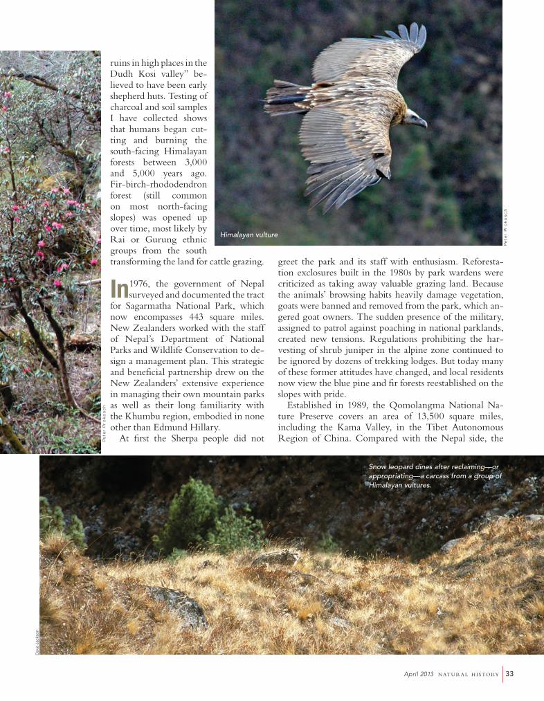
Himalayan vulture
Snow leopard dines after reclaiming—or appropriating—a carcass from a group of Himalayan vultures.
Dave
Jac
kson
24-35 NH Byers 413.indd 33 4/28/13 2:11 PM

34 n at u r a l h i s to ry April 2013
A glacial river flows in Sagarmatha National Park
Tibetan terrain is generally much higher in elevation but considerably less rugged. An estimated 68,000 people live in the preserve, engaged in agriculture, animal husbandry, or both. Unlike the high-altitude plateau that most people associate with Tibet, the preserve contains a diversity of landscapes that range from subtropical, densely forested river valleys below 6,500 feet to ice-clad peaks of the Higher Himala-yas at 26,000 feet and above. The preserve provides habitat for the rare snow leopard, kiang (wild ass), and black-necked crane as well as Tibet’s only popu-lations of the Assamese macaque. Langur monkeys, Himalayan palm civets, jungle cats, musk deer, and tahrs are also found in abundance.
During the 1970s and 1980s, Khumbu was frequently cited as a case study of
poor land management. Scientific and popular articles at that time proclaimed that the region was suffering from extensive deforestation as the result of a grow-ing population, the influx of Tibetan refugees in the early 1950s, increased and unregulated tourism, and
Pete
r Pr
oko
sch
Monsoon clouds hover over yak herders in Kama Valley
24-35 NH Byers 413.indd 34 4/28/13 2:11 PM

35April 2013 n at u r a l h i s to ry
the breakdown of traditional Sherpa practices of natural resource management. At the same time, a much smaller, but equally vocal, contingent of people held the exact op-posite view. “There are more trees in Khumbu now than there were in 1950, and I have the photographs to prove it,” said Charles Houston, an American physician, high-altitude expert, and member of the 1953 K2 expedition.
Who was right? For answers, I turned to one of the best mentors that I’ve ever had, and whom, incidentally, I never met: the Austrian climber-cartographer Erwin Schneider, who passed away in the late 1980s. Between 1955 and 1963, Schneider completed a field survey of the Khumbu region that included the use of terrestrial photogrammetry—determining geometric properties of objects and making maps from photographs taken at high-altitude vantage points. In 1984, while living in Khumbu, I was given a packet of Schneider’s photo-graphs taken in the 1950s. I instantly realized that they might help to resolve some of the controversy concern-ing the changes in the landscape. Beginning in 1984 and in the course of later research expeditions, I retraced Schneider’s footsteps to replicate his photographs. From the start it became clear that Charles Houston was right, after all: the landscapes of the 1950s were essentially un-changed thirty years later.
Replicating the photographs taken by Schneider, Hous-ton, and others in the 1950s also provided a unique oppor-
tunity to demonstrate just how dynamic a landscape the Everest region was. The scars and impacts of destructive glacial-lake-outburst floods, landslides, and torrents that had occurred in the interim could be easily seen.
In the fall of 2007, I was climbing at 18,000 feet in the upper reaches of the Imja River watershed, near where Erwin Schneider had taken one of his photographs. The view in front of me now revealed a dramatic change. The Imja Glacier that I had hoped to rephotograph was gone, replaced by a lake almost half a mile long. Icebergs as big as houses had broken off the former glacier and now floated aimlessly in the water. Dozens of such glacier lakes holding hundreds of millions of gallons of water have been created in the Khumbu region since the early 1960s. Usually con-tained by dams of loose boulders and soil, these lakes pres-ent a risk of glacial-lake-outburst floods. One such event in 1998 in the Hinku Valley of Makalu Barun National Park in Nepal destroyed trails and seasonal settlements for more than fifty miles downstream, and the damage is still visible in satellite images taken a decade later.
The mountain itself, however, will adapt. Mount Ever-est has survived the spread of humankind over the Earth, the sweep of ice ages and interglacial periods, the slow migration of flora and fauna up and down its slopes, and the recent discovery of its lower slopes by farmers, yak
herders, and adventure tourists. It will continue to tower among the clouds long, long beyond human memory.
Reprinted by arrangement from the book The Call of Everest: The History, Science, and Future of the World’s Tallest Peak by Conrad Anker. Copyright ©2013 National Geographic Society.
Alton C. Byers, a National Geo-graphic explorer, is a moun-tain geographer, photographer, writer, and climber with more than thirty years of experience working in major mountain re-gions throughout the world. His areas of expertise include applied research, community-based al-pine conservation and restoration methods, and climate-change impacts in high mountain environments. In 1990 Byers joined the Mountain Institute (www.mountain.org), where he is Director of Science and Exploration, and has since lived and worked in Nepal, Peru, and West Virginia directing various programs for the organization. Among other awards he is the recipient of the Sir Edmund Hillary Mountain Legacy Medal from the Nepali NGO Mountain Legacy.
Jo W
ilki
ns/
skyl
ine
Trek
s
24-35 NH Byers 413.indd 35 4/28/13 2:12 PM