for the bradlees/juster site and vicinity plan bradlees and... · white horse pike area...
TRANSCRIPT

WHITE HORSE PIKE AREA REVITALIZATION PLAN
For the Bradlees/Juster Site and Vicinity
Including the Redevelopment/Rehabilitation Plan for
Block 62 Lot 2
Stratford Borough Camden County, New Jersey
Adopted by the Stratford Borough Council in accordance with Ordinance 2014:18 on December 9, 2014 and revised in
accordance with Ordinance 2015:03 on April 14, 2015
___________________________ Leah Furey Bruder, AICP, PP # 585100 The original of this document was signed and sealed in accordance with NJAC 13:41-1.3.b
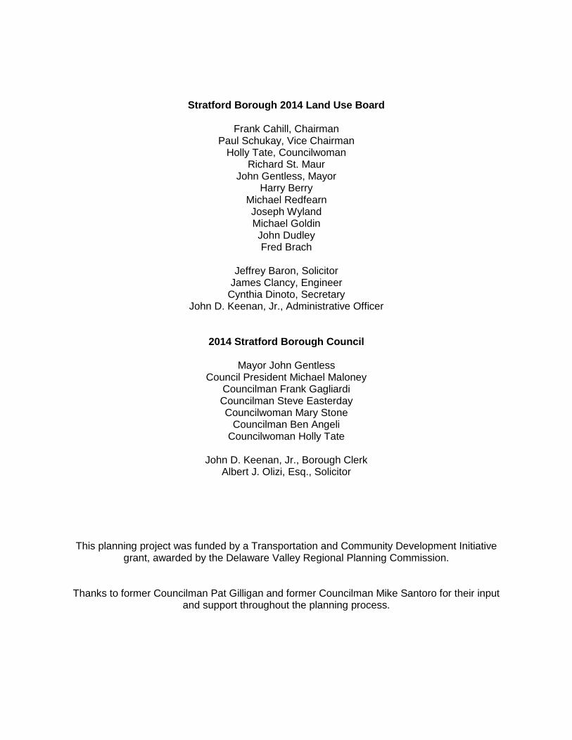
Stratford Borough 2014 Land Use Board
Frank Cahill, Chairman
Paul Schukay, Vice Chairman Holly Tate, Councilwoman
Richard St. Maur John Gentless, Mayor
Harry Berry Michael Redfearn Joseph Wyland Michael Goldin John Dudley Fred Brach
Jeffrey Baron, Solicitor
James Clancy, Engineer Cynthia Dinoto, Secretary
John D. Keenan, Jr., Administrative Officer
2014 Stratford Borough Council
Mayor John Gentless Council President Michael Maloney
Councilman Frank Gagliardi Councilman Steve Easterday Councilwoman Mary Stone
Councilman Ben Angeli Councilwoman Holly Tate
John D. Keenan, Jr., Borough Clerk
Albert J. Olizi, Esq., Solicitor
This planning project was funded by a Transportation and Community Development Initiative
grant, awarded by the Delaware Valley Regional Planning Commission.
Thanks to former Councilman Pat Gilligan and former Councilman Mike Santoro for their input and support throughout the planning process.

TABLE OF CONTENTS
I. Introduction ...................................................................................................................1
A. Project Description and Overall Goals .................................................................1
B. Revitalization Planning Project Goals ..................................................................3 C. White Horse Pike Corridor Revitalization Area Overview ..............................4
II. Planning Framework ...................................................................................................6
A. Designated Rehabilitation Area and Revitalization Planning .......................6
B. Rehabilitation Area Planning Process ................................................................7 C. Public Participation ..................................................................................................8
III. Framework for Revitalization ..................................................................................11
A. Opportunities and Constraints Analysis ..........................................................11 B. Defining Character and Sense of Place ............................................................12
C. Design Standards ...................................................................................................13 D. Infrastructure, Pedestrian, and Transportation Improvements .................14
IV. Anchors and Key Components of the Revitalization Area .............................18 A. PATCO and NJ Transit ..........................................................................................18 B. Bradlees/Juster Site (Block 62 Lot 2) .................................................................19
C. Rowan University School of Osteopathic Medicine (formerly UMDNJ) ...22
D. Woodmere Apartments .........................................................................................24
V. Revitalization Plan .....................................................................................................27
A. Block 62 Lot 2 –Bradlees/Juster Site .................................................................27 B. White Horse Pike Overlay Revitalization Area Design Standards ........... 32
C. Opportunity Sites ......................................................................................... 35
D. Incentives for Investment ............................................................................ 37
VI. Implementation .............................................................................................. 38
A. Next Steps ................................................................................................... 38
VII. Redevelopment Plan Requirements ....................................................... 39
A. Redevelopers and Applicants .................................................................... 39
B. Redevelopment Entity and Approving Authority..............................................39
C. Statutory Requirements .........................................................................................41 D. Time Limits ...............................................................................................................43
MAPS MAP 1 Aerial Photo showing Bradlees Site Rehabilitation Area MAP 2 Vacant and Underutilized Properties MAP 3 Proposed White Horse Overlay (WHO) District Appendices Appendix 1 Bradlees site wetland delineation Appendix 2 UMDNJ wetland delineation Appendix 3 Concept sketch New Road Intersection

This page is intentionally blank.

I. Introduction
A. Project Description and Overall Goals Stratford Borough was awarded a Transportation and Community Development Initiative (TCDI) planning grant by the Delaware Valley Regional Planning Commission (DVRPC) in 2012 for the preparation of a “Revitalization Plan for the Bradlees Site and Transit Area”. The intent of the project was to build upon the progress that the Borough had already made in 2011 toward planning for revitalization of the Borough’s two substantial “greyfield” sites and to expand the scope of the effort to allow the Borough to plan not only for the transformation of the underutilized and run-down former Bradlees shopping center site, but to also include the surrounding areas, which encompass a highway commercial corridor that includes retail, office, service and multi-family residential uses, a hospital and medical school campus, and a commuter train station and bus hub. This commercial corridor includes some successful businesses and anchor institutions, but also includes struggling small businesses, vacant and poorly maintained buildings, uncoordinated signage, numerous driveway cuts, and vast parking lots that contribute to the overall sense that the area is stressed. The TCDI grant also enabled the Borough to bring together various stakeholders and to coordinate a participatory planning process. Overall the grant project was intended to lay the foundations for productive redesign and reuse of the former Bradlees site in the context of the surrounding area and also to consider how the distinct but interrelated surrounding areas could be made part of a comprehensive and mutually supportive plan that may be implemented incrementally as economic conditions improve and as opportunities arise. With this revitalization planning effort, the Borough aims to reposition depressed sites so that instead of being viewed as failed or failing retail/service sites they may be viewed as areas of opportunity for redevelopment. The revitalization and redevelopment plan will lay the foundations for private and public investment and redevelopment that will transform stagnant properties into vibrant and successful sites and that will connect the area’s assets to create a
more attractive and inviting area overall. The Borough wishes to create and support a revitalization strategy that is both visionary and practical, and to ensure that the zoning provisions do not inhibit the type of development that is desired. The planning effort began when Borough Council determined that the former Bradlees site had been stagnant and deteriorating for too long, and with the idea that the marketability and value of the property may be increased with creative thinking and coordination with surrounding properties. Borough officials determined that tolerating the existing conditions will only perpetuate the conditions and cast a shadow on the community overall. The Borough does not want to sit idly by waiting while the former Bradlees site continues to deteriorate. The Borough envisions a framework that sets forth a vision and plan for improvements, but that is flexible enough to respond to market demands and individual initiative. While complaints about the former Bradlees site are frequent, and residents view the site as an eyesore and a drain on the Borough, the site is also viewed as an opportunity. Because of its size and location, it is anticipated that the successful revitalization of this site will have ripple effects on other properties in the area – raising the standard for design and reinvigorating interest in the area. As with any prominent redevelopment site, there are a variety of opinions within the community about the best use of the site and the best means to achieve it. The ultimate goal is to facilitate transformation of the former Bradlees site from a depressed marginal shopping center to a successful center of activity and a destination that is seamlessly interconnected with a revitalized White Horse Pike area. In order to accomplish this goal in today’s environment the Borough will work with RowanSOM (School of Osteopathic Medicine)
White Horse Pike Area Revitalization Plan – Bradlees Site and Vicinity March 2015
Page 2 of 43
along with other private property owners and agencies to forge cooperative relationships and partnerships that will enable the goals of each to be advanced while stabilizing the Borough’s tax base and improving the experience and quality of life for Stratford residents and visitors. Specifically, the TCDI grant project includes the preparation of a Redevelopment/Rehabilitation Plan for the 22 acre former Bradlees site, along with a vision plan for the White Horse Pike area (and design standards) to encourage additional redevelopment of and investment in surrounding properties in a coordinated manner. The foremost goal of the project is to facilitate the redevelopment and improvement of the former Bradlees site property so that it may be returned to fully productive use, with a healthy mix of uses that can adapt to the changing needs of the market. Achieving this goal will be a catalyst for additional redevelopment and private investment in the area. The secondary goals include establishing long term cooperative relationships between the Borough, institutional, and private stakeholders; which include the Rowan School of Osteopathic Medicine (formerly UMDNJ)1, Kennedy Hospital, New Jersey Transit and DRPA regarding the Lindenwold PATCO station, and providing organizing principles for ongoing cooperation. These principles include improving the pedestrian environment, enabling revitalization, redesign, and reuse of underutilized properties, and expanding the property tax base. In order to reach the primary goal, the site needed to be viewed in the broader economic, geographic, and social context, rather than as an isolated development parcel. All of the project goals are mutually supportive. With this planning project the Borough aimed to bridge the gaps between more expansive but general regional planning efforts undertaken by DVPRPC, Camden County, and other entities over the last ten years, and the details needed to effectuate local implementation. The project has and will continue to lay the foundations to create synergies between the former Bradlees site, the Kennedy/RowanSOM campus, the PATCO/NJ Transit train station, and the broader White Horse Pike corridor.
1 When Stratford initiated the Revitalization planning effort (and when the TCDI grant was awarded), the medical school was known as the University of Medicine and Dentistry of New Jersey (UMDNJ). As a result of the merger mandated by the New Jersey legislature, effective July 1, 2013 the school is known as Rowan School of Osteopathic Medicine (SOM).

White Horse Pike Area Revitalization Plan – Bradlees Site and Vicinity March 2015
Page 3 of 43
B. Revitalization Planning Project Goals Before undertaking the revitalization planning effort, a set of goals for the project were established. These goals were intended to guide the project and assist in coordinating between the participants in the project. The goals for the TCDI Revitalization Planning Project are:
1. Bridge the gaps between broader regional planning efforts and the details needed to effectuate local implementation of land use and transportation improvement plans.
2. Lay the foundations to enable synergy to develop between the former
Bradlees/Juster site, the RowanSOM/Kennedy campus, the PATCO High Speed Line train station/NJ Transit Bus hub, and other residential and commercial properties in the area, for the mutual benefit of the entities, the general public, and the Borough. The uses have the potential to be complementary, and though in close physical proximity they are currently essentially isolated from each other.
3. Initiate meetings and provide a framework to work cooperatively with stakeholders to
improve the areas around the Bradlees site and to foster complementary uses and site design that will improve the aesthetics of the area, support economic activity in the Borough, and improve the function of infrastructure and other community assets.
4. Assess potential impacts of redevelopment and mitigate the potential for any
detrimental impacts to the extent possible through policy, design, and transportation infrastructure planning.
5. Coordinate site, building, and roadway design in the vicinity of the former Bradlees
site, RowanSOM /Kennedy campus, and the PATCO train station/NJ Transit Bus hub for a healthy environment that is more walkable (and safe), more efficient, and more sustainable.
6. Set the stage for transformation of underutilized buildings and sites into economically
and socially productive uses by facilitating desired redevelopment and maximizing private investment.
7. Create and adopt a redevelopment/revitalization plan for the former Bradlees/Juster
site and design standards and zoning recommendations for the White Horse Pike.
8. Follow adoption of the plan and standards with outreach efforts to encourage implementation. This includes outreach to particular property owners as well as potential redevelopers.
9. Ensure that the redeveloped Bradlees/Juster site is an integral part of the community
and a financial asset that contributes revenue in support of the local budget.
10. Communicate the Borough’s ideas and objectives for the site in narrative and illustrative form, and provide support and clear expectations for interested investors or redevelopers.

White Horse Pike Area Revitalization Plan – Bradlees Site and Vicinity March 2015
Page 4 of 43
C. White Horse Pike Corridor Revitalization Area Overview Overall, Stratford’s Revitalization Plan aims to lay the foundations for productive redesign and reuse of the former Bradlees/Juster site in the context of the surrounding area and also to consider how the distinct but interrelated surrounding areas may be made part of a comprehensive and mutually supportive revitalization plan. It is anticipated that the revitalization plan may be implemented incrementally as economic conditions improve. The former Bradlees/Juster site is central to the planning effort, but a plan that also includes the surrounding areas will be more effective at combating the problems that plague the underperforming White Horse Pike commercial corridor. The appearance and character of the White Horse Pike commercial corridor have a detrimental effect on the community’s identity and sense of value. The Borough envisions a framework that sets forth a vision and plan for improvements, but that is flexible enough to respond to market demands and individual initiative. The former Bradlees/Juster shopping center (also known as Stratford Plaza) was built in the early 1960s when the population of Stratford and the surrounding communities was growing rapidly, which coincided with the period when America was becoming a largely suburban nation. Stratford Borough’s population increased from 1,356 people in 1950 to its peak of 9,801 people in 19702, a 723% increase over twenty years. In its heyday Stratford Plaza served the shopping needs of the surrounding area, as ever more families moved to the suburbs and increasingly had access to one or more cars. Properties along this stretch of the White Horse Pike were also adapting to the new environment, as traffic on the roadway increased and many formerly residential properties were converted for commercial use. The White Horse Pike corridor in Stratford and the adjacent towns includes a mix of retail, service, office, recreational, and residential uses, but these uses are uncoordinated – they are neighbors, but each stands alone. Changes in land development patterns and changes in retailing over the last twenty to thirty years, together with lack of management have left some shopping centers such as Stratford Plaza (Bradlees/Juster) largely vacant and decaying. Though the dilapidated Bradlees/Juster site is the most obvious manifestation of a “greyfield” or “dead mall” in Stratford, it is reflective of a problem that has plagued many older shopping malls throughout the region and the country. Shopping centers such as Stratford Plaza that have been dubbed “greyfields” or “dead malls” are characterized by empty store fronts and vast areas of unused asphalt parking lots.3 Typically the buildings are outdated, often in a state of disrepair, and fail to generate the revenue to justify reinvestment or continued existence as a purely retail center. The detrimental effects of persistent vacancy, “dark” buildings and underutilized parking areas on a community have been well documented. In addition to the visual blight inflicted upon the community, the deteriorated vacant buildings reduce the tax base (when tax assessments are reduced due to the conditions), represent lost job opportunities, and waste valuable land and space in areas where development makes good planning sense. To maintain a vibrant local economy, it is vital that a large site such as Stratford Plaza, located in a developed suburban area with existing infrastructure and convenient access to transportation routes (i.e. smart growth areas), be maintained and updated to remain relevant in the marketplace. It is inefficient
2 U.S. Census Bureau 3 Where as “brownfields” typically have environmental contamination and “greenfields” are undeveloped areas, “greyfields” are previously developed and are ripe for physical and economic development.
White Horse Pike Area Revitalization Plan – Bradlees Site and Vicinity March 2015
Page 5 of 43
from an economic and environmental perspective to push development further into the suburban fringe when there are available and conveniently located sites such as the former Bradlees/Juster site that could be valuable for contributing to the satisfaction of local demand and improving the community. Though greyfield sites face numerous challenges, creative thinking about the future of the site together with policies and regulations that will enable effective redevelopment will set the stage for breathing new life into the property. Despite the fact that the Stratford Plaza site is underperforming and unattractive, the site remains a valuable asset in the community. Though the idea of changing the dynamics of the White Horse Pike commercial corridor is daunting, there are specific steps that will set the stage for improvement. The former Bradlees/Juster site is surrounded by a number of properties and uses that are also susceptible to and ripe for change. It is anticipated that the value of the former Bradlees/Juster site as well as the value of other underutilized properties in the area will be enhanced by developing a plan that responds to and capitalizes on the collective activities and uses in the area, and that will become part of a comprehensive plan for the area. The vacant and underutilized properties in the area are shown on MAP 2. This map draws into focus the extent of the opportunities and also the challenge of bringing it all together. The Revitalization planning study area includes the former Bradlees/Juster site, as well as the area south of Laurel Road and east of the “nut section” neighborhood. The White Horse Pike Overlay Area has been defined for properties in the study area that may be ripe for change, that may benefit from coordination with surrounding properties, and that are viewed as areas of opportunity. The White Horse Pike Overlay (WHO) Area is shown on MAP 3. The area is located in close proximity to the Lindenwold PATCO/NJ Transit station, which provides access to trains to and from Philadelphia as well as Atlantic City and is also a stop on several bus routes. The access drive to the former Bradlees site is less than 700 feet from the access to the PATCO parking area, and it is another 700 feet to the station door (in total approximately ¼ mile, which is a 5 minute walk).
White Horse Pike Area Revitalization Plan – Bradlees Site and Vicinity March 2015
Page 6 of 43
II. Planning Framework A. Designated Rehabilitation Area and Revitalization Planning Two properties were designated by Stratford Borough Council as an Area in Need of Rehabilitation in accordance with Resolution 2011-32 on March 3, 2011, after review and referral by the Land Use Board on February 24, 2011. The former Bradlees/Juster site, or Stratford Plaza, (also known as AEJ Stratford, LLC or the Juster site), Block 62 Lot 2, has been determined to be an Area in Need of Rehabilitation. Another site known as Laurel Mills Plaza, Block 116 Lots 14 and 14.04, was also designated as an Area in Need of Rehabilitation and a Redevelopment Plan for that site was adopted in August of 2011 (and amended in 2014). The Rehabilitation Area Resolution 2011-32, together with the Stratford Borough Revitalization Planning Report (February 2011), provide an overview of the rehabilitation planning process, a description of the study area, and details about the conditions within the study area. The report also reviews the relationship of the study area to the Borough’s Master Plan (2006) and the New Jersey State Development and Redevelopment Plan, and explains the conditions that warranted the rehabilitation area designation. The designation was made in order to avail the Borough of the tools available to encourage redevelopment and rehabilitation as intended by New Jersey’s Local Redevelopment and Housing Law. In order to allow for a more focused and efficient planning process for each of the two designated rehabilitation area sites, the Borough decided to prepare a separate Redevelopment/Rehabilitation Plan for each of the sites. Both of the Rehabilitation Area properties are of particular importance to the community, as they represent significant pieces of real estate relative to the Borough overall, their decline has had detrimental impacts on the community overall, and the level of vacancy and deferred maintenance continue to have a decadent effect on the surrounding area. The revitalization planning effort presents an opportunity to consider how to reinvent the sites in a manner that will respond to market demands and consumer preferences, while also improving the community overall. As described in the Introduction, the Borough decided that while the Bradlees/Juster site is central to the revitalization and redevelopment of the White Horse Pike corridor in Stratford, it is not the only property in need of improvement and should not be viewed in isolation. There are numerous developed sites that have fallen into disrepair, that exhibit signs of continually deferred maintenance, that have persistent vacancies, that have obsolete site design, that do not function as originally intended and have not adequately adapted to meet current needs or demand, and that appear to be having a detrimental effect on the surrounding area. There are also a few undeveloped or underdeveloped properties that have the potential to contribute value to the area overall. The intent of the Revitalization and Redevelopment/Rehabilitation plan is to enable, facilitate and encourage private investment in the areas; and to enable the Borough to play a more active role in defining the future use and design of the area than would be available in the private market and with conventional zoning.
The Revitalization Plan sets goals and objectives and identifies opportunities for redevelopment and revitalization of the White Horse Pike corridor in Stratford, and also includes the specific requirements of New Jersey’s Local Redevelopment and Housing Law for a Redevelopment/Rehabilitation Plan for the Bradlees/Juster site. In order to accomplish both,

White Horse Pike Area Revitalization Plan – Bradlees Site and Vicinity March 2015
Page 7 of 43
the Borough has followed the process for a rehabilitation area and plan, but has also expanded the planning process to be a collaborative and inclusive effort that has included holding numerous public work sessions, engaging interested stakeholders, preparing conceptual sketches, and considering optimal locations for demonstration projects. This document constitutes the Redevelopment Plan for the former Bradlees Site Rehabilitation Area.
B. Rehabilitation Area Planning Process The Local Redevelopment and Housing Law (LRHL) at N.J.S.A. 40A:12A-1 et seq. governs local redevelopment and rehabilitation activities in New Jersey. When adopted in 1992 the intent of the LRHL was to codify, simplify and concentrate prior enactments related to housing and redevelopment, to promote the advancement of community interest, and to promote physical development that will be conducive to social and economic improvement. The LRHL provides a legal mechanism that may be utilized by municipalities in their efforts to arrest and reverse negative, blighting influences that may be taking a toll on the community and to encourage revitalization. A Redevelopment Area designation requires a showing that the area meets the criteria set forth in the statute and exhibits signs of blight. The process for designating a Rehabilitation Area is simpler than designating a Redevelopment Area. The Rehabilitation Area designation requires a review of the property with regard to the statutory rehabilitation criteria, review by the Planning Board, and a straight forward resolution designating the area by the governing body. A rehabilitation area designation affords the municipality the opportunity to undertake a planning effort similar to that which is undertaken for a redevelopment area, except that the municipality may not use the eminent domain power to acquire property and may not utilize long term tax exemption. However, short term (5 year) tax exemption may still be used to assist in making a redevelopment/rehabilitation project feasible. The former Bradlees/Juster site was designated as an “Area in Need of Rehabilitation” in March of 2011 (Resolution 2011-32). The required steps for preparing and adopting a Redevelopment/Rehabilitation Plan are set forth below.
1. The Borough Council may prepare, or direct the Planning Board to prepare, a
Redevelopment Plan for the Redevelopment or Rehabilitation Area. The Redevelopment Plan must contain an “outline for the planning, development, redevelopment or rehabilitation of the project area” sufficient to cover the items set forth in the Local Redevelopment and Housing Law (N.J.S.A. 40A:12A-7). The requirements include:
a. Relationship to local objectives b. Proposed land uses and building requirements c. Identification of any land to be acquired d. Relationship to Master Plans of adjacent municipalities, County, and State Plan e. Housing Provisions (if applicable) f. Relationship to municipal Master Plan g. Relationship to Township’s land development regulations (supersede existing
or optional overlay)
2. The Borough Council adopts the Redevelopment Plan by ordinance in accordance with the requirements of the law. The redevelopment plan is referred to the Planning Board for review and recommendation by resolution (in accordance with N.J.S.A.

White Horse Pike Area Revitalization Plan – Bradlees Site and Vicinity March 2015
Page 8 of 43
40A:12A-7(e)). The redevelopment plan may include permitted uses, area and dimensional requirements, recommendations for site design and standards, and an illustrative plan.
3. The Borough Council, as the redevelopment entity, oversees implementation of the
redevelopment plan. Redevelopment projects must be carried out in accordance with the Redevelopment Plan.
4. The Borough Council, as the redevelopment entity, selects redevelopers to
undertake the redevelopment project(s) to implement the plan and may enter into redevelopment agreements to spell out responsibilities and expectations.
5. Site Plans for properties in the redevelopment/rehabilitation area are reviewed by the
Planning Board as they normally are.
C. Public Participation Stakeholder involvement has been critical to the revitalization planning effort. The Borough has held five (5) open public work sessions throughout 2012 and 2013, in addition to four (4) meetings in 20114. Several of the meetings were held as joint meetings of Borough Council and the Joint Land Use Board. The Borough determined early on that an inclusive and collaborative planning process would enable any interested resident, organization, or business to share ideas and opinions related to the revitalization of the White Horse Pike corridor and the vicinity of the former Bradlees site in particular. An open planning process would allow the Borough to gather ideas and input, to establish a unified vision, and to garner support for the project. Establishing a unified vision does not promise that every idea or opinion is specifically addressed, or that everyone will be 100% satisfied with the plan, but aims to ensure that the greatest possible numbers of ideas are considered and that the greatest possible numbers of interested parties support the shared vision and goals. A participatory process where many individuals have a stake in or support the desired end result will also improve the likelihood of long term implementation. An overview of each of the work sessions held in 2012 and 2013 follows. 1. May 24, 2012 Work Session Meeting This meeting was held as a joint meeting of Borough Council and the Land Use Board at 7pm. In addition to normal public notice, notice was provided to the public via the Borough’s “email blast”. The meeting kicked off the TCDI Grant project. The agenda included a summary of work done and progress made to date, an overview of TCDI Grant Project scope, a New Jersey Complete Streets video, and a discussion about Goals and Objectives. The discussion covered:
A summary of the Revitalization Planning Report prepared in February 2011 to synthesize the findings of previous reports and studies on the White Horse Pike Area
Overview of the Rehabilitation Area Designations made in March 2011 and the required contents of a Redevelopment/Rehabilitation Plan.
An overview of the values that have emerged for planning the area, and additions to the list.
4 Meetings were held on August 23, August 30, September 28, and October 26, 2011.
White Horse Pike Area Revitalization Plan – Bradlees Site and Vicinity March 2015
Page 9 of 43
Discussion about the Complete Streets concept and how it may be applicable and implemented in Stratford.
Review the recommendations for improvements to bicycle and pedestrian facilities set forth in the Lindenwold Station Transit Hub Study (2009).
2. June 26, 2012 Work Session Meeting This meeting was also held as a joint meeting of Borough Council and the Land Use Board at 7pm. In addition to normal public notice, notice was provided to the public via the Borough’s “email blast”. This meeting continued the discussion about potential uses and design within the Revitalization Area as well as some of the pitfalls. The discussion included:
Opportunities and Constraints Analysis
Defining the geographic area for White Horse Pike Overlay zone.
Discussion about Permitted Uses (including debating the possibility for student housing)
Potential for complementary uses to create synergy with UMDNJ (now RowanSOM) as well as concern about State (tax exempt) entities taking over additional land in Stratford.
Next Steps, including educating stakeholders about the revitalization planning effort and setting up meetings with institutional stakeholders
3. October 2, 2012 Institutional Stakeholders Meeting This meeting was held in the afternoon and was geared toward bringing together the “Institutional Stakeholders”, which included the Borough, Camden County Planning, DVRPC, New Jersey Department of Transportation, New Jersey Transit, Kennedy Hospital, UMDNJ (now RowanSOM), Stratford Holdings (Foundation of UMDNJ), and Rowan University. The discussion covered:
Infrastructure, pedestrian, and transportation improvements that could enhance the function of the area and benefit all.
Discussion about uses complementary to the University and Hospital, including housing needs for the student population.
The proposed White Horse Pike access road, which is a priority for Kennedy and UMDNJ.
Potential location of the proposed access roadway (the current proposal put forth by UMDNJ could be altered if conditions permit).
Stratford Holdings (Foundation) discussed intent for their land, including the possibility of acting as developer even though this is not their typical approach.
Relationship of the Bradlees site and UMDNJ campus to the PATCO/ NJ Transit Station, and the potential for mutually supportive improvements.
4. November 27, 2012 Business Stakeholders Meeting This meeting was held at 7pm and property owners along the White Horse Pike in Stratford, south of Laurel Road were specifically invited along with members of the general public. The meeting was geared toward bringing together private property owners (most of which are businesses). The discussion covered:
An overview of the planning project, process, and progress to date
Discussion about zoning regulations and other regulatory hurdles that may inhibit redevelopment or investment.

White Horse Pike Area Revitalization Plan – Bradlees Site and Vicinity March 2015
Page 10 of 43
Other issues that hamper redevelopment, rehabilitation, and investment in the area and what (if anything) the Borough can do to help.
What types of incentives could stimulate additional activity.
Ideas and concerns of business owners based on their experiences in the area (including the frustration of some with absentee landlords, hesitance to be the first one to invest, and the need for incentives).
5. January 29, 2013 Work Session Meeting This meeting was held at 7pm at Borough Hall and all of the stakeholders who had asked to be included in future notices along with members of the general public were invited to attend. The meeting was geared toward addressing some of the more difficult issues head on (such as persistent and increasing commercial vacancy), outlining the parameters for the White Horse Pike Overlay, and establishing consensus about the addition of residential uses in the revitalization area. The discussion covered:
An inventory of vacant and significantly underutilized land and buildings in the revitalization study area.
The potential contents of the “White Horse Pike Overlay” including permitted uses and conditional uses, incentives for lot consolidation and aggregation, design standards.
Potential parameters for multi-family housing as part of a mixed use development
Framework for the Revitalization Plan, the principles upon which the plan would be built.
Several property owners expressed their desires for future development as well as identified the obstacles to such development.
White Horse Pike Area Revitalization Plan – Bradlees Site and Vicinity March 2015
Page 11 of 43
III. Framework for Revitalization A. Opportunities and Constraints Analysis By observing the area, talking with stakeholders, reviewing the studies, analyses, and plans created for the White Horse Pike region over the last decade, and studying the positive features and disadvantages of the area, a list of opportunities and constraints was developed. The list consolidates many of the ideas and concerns raised throughout the public work sessions. The opportunities and constraints analysis has assisted in crafting a framework for revitalization and has informed the goals, objectives, and proposals set forth in the plan.
Opportunities and Strengths 1. Excellent location and accessibility in terms of proximity to regional highways, public
transit, employment centers, stable residential neighborhoods. 2. Good visibility along regional highway and roads.
3. High traffic volume (many potential customers and residents).
4. Large tracts of underutilized land in an otherwise developed area (+/-22 acres at the
Juster site and +/- 8 acres at Woodmere Apartments, as well as other scattered).
5. Access to existing infrastructure and people.
6. Lack of contamination (not “brownfields”).
7. Proximity to transit (PATCO, AC Line, bus routes) linking the Borough to Philadelphia, Atlantic City and points between.
8. Existing stable institutions and uses in the area provide a strong foundation for future
development (Rowan/UMDNJ, Kennedy Hospital, PATCO/NJ Transit, Woodmere Apartments, bowling center, etc).
9. Potential for complementary development and synergy with existing RowanSOM and
Kennedy Hospital campus to create a strong “sense of place”.
10. There are successful examples of redesigning and repurposing similarly situated outdated suburban shopping centers in the region and across the country.
11. Growth in Camden County households is anticipated, the potential for local moves due
to changes in life stage (such as empty-nest, marriage, divorce, etc) as well as growth at the University may increase the demand for new types of housing.
Constraints and Weakness 1. Significant vacancies and the fragmented and tired appearance of existing commercial
buildings and sites along the White Horse Pike corridor may be a deterrent to new investment.

White Horse Pike Area Revitalization Plan – Bradlees Site and Vicinity March 2015
Page 12 of 43
2. Altering the cycle of disinvestment and decline is challenging, so risk for new investors may be high. Rents paid by discount retailers may be enough to keep landowners afloat, but not enough to justify investment in the site.
3. Changing shopping demographics and consumer preferences limit the prospects for
adapting existing retail stores for new retail tenants without substantial changes (investment).
4. Current economic conditions, including the recent recession have limited growth and
investment.
5. Substantial site improvements are expensive relative to existing assets, and need to be off set by certainty about future income.
6. Resistance to change and the view by some that underutilized sites must continue to be
used for their original purpose (such as strip mall shopping).
7. Lack of motivation, interest, effort, and investment by property owners. Lack of organization among property owners to reflect collective interests.
8. Voluntary vacancy (such as when a store leaves a property, but retains a leasehold).
9. Traffic congestion, poor and inefficient access, and difficult/dangerous traffic maneuvers.
10. Absence of a “downtown” or defining character.
11. Expansion of tax exempt development (such as university or hospital) would hurt the
Borough’s bottom line.
B. Defining Character and Sense of Place The Revitalization Plan aims to foster civic identity in Stratford and to cultivate a sense of place. This identity or sense of place would be a source of pride for residents, and would assist with marketing for businesses and institutions. To do this, land use planning must be considered in the context of the kind of place the Borough wishes to create. In other words the land use regulations must permit and demand the type of development that is desired, and must provide clear guidance on the character and design that is sought. Too often zoning regulations are static requirements that promote single use, isolated development and do not enable “place making”. Regulatory barriers that impede good design must be removed, but design is not the only obstacle to be addressed. The Revitalization Plan emphasizes the establishment of a variety of uses that complement one another both in terms of the interaction and complementarities between uses, and in terms of site and building design. Care must be taken in fostering relationships between buildings and their surroundings. Place making is enhanced with amenities that improve aesthetics, appeal to the pedestrian and encourage informal interaction among people. Wide sidewalks, landscaping, good lighting, coordinated signage, a sense of enclosure (for pedestrians), transparency, places to sit and to escape harsh weather, and places that provide visual interest are important ingredients for place making. The construction of an appealing physical environment will support the business community and engage residents!
White Horse Pike Area Revitalization Plan – Bradlees Site and Vicinity March 2015
Page 13 of 43
The Borough may also cultivate its identity with signage and distinctive features. The importance of using design features to frame and connect public places and significant destinations in the community can not be overemphasized. Development and redevelopment must mingle different uses in a way that enlivens the community. The effect that a place has on the human experience can not be relegated to an after thought. Site design affects people’s willingness to visit a place. In planning for the future of underutilized commercial sites, the need for various land uses, site and building design, and relationship to the “big picture” must all be considered.
C. Design Standards During the public work sessions held over the course of two years there was significant discussion about the potential positive impacts of improved urban form and overall coordinated design within and among sites along the White Horse Pike Corridor. While cosmetic improvements alone are not enough to combat the problems of a blighted corridor, building and site design play an important role in defining neighborhood character and in creating or enhancing unique places, such as gateways, special districts, or neighborhoods. The beauty and appearance of a place impacts how it is perceived and how it functions. Site design can also impact the speed of traffic and can reduce motorist and pedestrian anxiety. As is the case with most commercial corridors that were developed in the 1950s and 1960s, the White Horse Pike is in need of cosmetic improvements. The current roadway character, travel speeds, parcel size, mishmash of building types, and the variety of businesses operating in the area create a retail and service environment that makes it difficult for any one property owner to make upgrades that could have an impact on the overall appearance of the area. Though each property owner only controls their own limited property frontage, a coordinated design strategy will tie the area together while still allowing for individual expression. A unified design theme will allow for the establishment of a coherent identity, one that invites and encourages residents, business owners, customers, and visitors, to have confidence in and invest in the community. Branding will also be important in letting people know what Stratford has to offer, so that the Borough may effectively compete with other destinations in the region. The Revitalization Plan espouses a set of design principles that should be adhered to in crafting design standards for the revitalization of the White Horse Pike. The design standards will communicate the Borough’s design expectations and should be adopted as part of the zoning code for the area so that the requirements are clear to developers and property owners; and so that they are enforceable by the Borough. Design standards will address the scale and siting of buildings, the layout of roadways and parking, landscaping, lighting, crosswalks, streetscape, facade treatment, and signs. The most effective design standards provide benchmarks for a coordinated design theme to unify elements within a site and between sites. Skeptics may voice concern that design standards make development more expensive. However a set of clear standards will ensure that expectations are unambiguous and will enable a quicker design and approval process. The intent of the design standards is to raise the bar from a design standpoint and to avoid thoughtless building and site design. This may eliminate some individuals or businesses from the pool of potential investors, but it will also entice others who will appreciate a level of insurance that their investment will be protected, since other surrounding properties will be held to the same standard. The investment of time and money in “good” design will ensure that the value of the resulting development and the value to the community overall are increased and maintained.
White Horse Pike Area Revitalization Plan – Bradlees Site and Vicinity March 2015
Page 14 of 43
In order to upgrade the appearance of the White Horse Pike Corridor, building and site design should avoid:
Monotony
Lack of variation in mass, form, texture, material, and color.
Dominance of expansive parking lots
Excessive curb cuts
Sign Clutter
Bland and unmemorable buildings
On the other hand, building and site design should promote:
Variation and articulation of façade planes and roof lines
Staggered setbacks, with a carefully designed semi-public realm between the sidewalk and the front door
Prominent windows and entrances
Quality materials, including one unifying material such as brick or fieldstone to be used as an element in all buildings
Vary height based on use and/or setback (higher building permitted at a larger setback, so shorter buildings are along street edge (pedestrian scaled and more consistent with existing development pattern)
Consistent outdoor lighting and street furniture (such as trash receptacles and benches)
Human scaled development to encourage pedestrian movements and window shopping type amenities
A connected network of streets The overall design of the area will also be enhanced with the provision of way-finding signage along pedestrian routes and within low-speed traffic areas that includes:
Signs and special landscaping at gateway areas
Directional and identification signs for parking areas
Directional signs to destinations and districts
Identification of residential neighborhoods, including multi-family developments
Pedestrian trail blazing signs to guide and affirm pedestrians
D. Infrastructure, Pedestrian, and Transportation Improvements Transportation infrastructure is the backbone of the Revitalization Plan. Stratford’s main traffic artery, the White Horse Pike, is also a State highway (U.S. Route 30). When the White Horse Pike was initially paved in the early 1920s it was the longest stretch of paved surface in the world. Of course the roadway was not initially designed to provide the functions and volume of service that it provides today. What was initially a turnpike chartered to run from Camden to Stratford and eventually toward Atlantic City, has become a congested four lane roadway where it passes through Stratford and the surrounding municipalities. Though initially intended to connect distinct urban areas, essentially the entire length of White Horse Pike in Camden County has evolved into a commercial corridor. The progression of the development pattern
White Horse Pike Area Revitalization Plan – Bradlees Site and Vicinity March 2015
Page 15 of 43
along this stretch of the White Horse Pike, including the area through Stratford, has resulted in many small commercial lots (along with some larger ones), each with their own building design (often homes retrofitted for commercial use or homes demolished to make way for commercial use) and driveways. Because the roadway was initially a 2 lane road, many structures are built close to the current edge of pavement, leaving little space for shoulders, sidewalks, and green buffers. Many of the commercial lots along White Horse Pike are shallow, which limits the potential for independent redevelopment. The consolidation of lots, or even coordination among lots, will allow for a larger scale of development along with a reduction in the number of driveways, which will make the whole of the corridor greater than the sum of its parts. The revitalization plan maintains that the agglomeration of uses that currently inhabit the White Horse Pike corridor area in Stratford could all be accommodated, but in a more effective and comfortable design. The redesign of properties along this roadway to better accommodate current needs, while also making traffic and cosmetic improvements, is key to Stratford’s revitalization plan. The design of the roadway and the properties with frontage upon it influences the driver experience (not to mention the pedestrian experience) and impacts a driver’s decision about whether to stop. Areas where there are no transitions between paved parking areas and the paved roadway detract from the appearance of the area and may contribute to driver and pedestrian anxiety. In addition to the White Horse Pike itself, there are public transportation assets in the immediate area and there is potential for significant improvements to the pedestrian environment. Together this transportation infrastructure provides the backbone for the revitalization effort. The distance from the former Bradlees/Juster site to the PATCO train station door is about one quarter of a mile. This is an easily walkable distance, yet the pedestrian route is not attractive or comfortable.5 Similarly, the RowanSOM and Kennedy campus is within a reasonable walking distance of the station, but again the route is not attractive or comfortable. Given the proximity of the institutions, commercial areas, and transportation hub, it seems that improvements to the pedestrian experience would significantly impact (increase) pedestrian traffic, and would also increase customer traffic to the businesses along the pedestrian routes. Creating a coherent and attractive network of walking (and bicycling) paths will improve the overall perception and desirability of the area. Together the combination of a mutually supportive mix of uses, thoughtful building and site design, way-finding signage, and improved pedestrian facilities, will work together to promote all-day activity, increased transit ridership, and cross-pollination among uses. A further benefit is that increased transit use will reduce congestion on highways, and the various improvements recommended may also result in reduced traffic accidents. Though a generality, it seems to hold true that people will walk among uses and to public transit if they must (for example if they can not drive or do not have a car), but many more people will choose to walk (or bicycle) if the route appears attractive, interesting, and safe. Improved walkability will invite and encourage people to not only come to the area for work or school, but will also encourage interaction between uses. 1. Transportation and Pedestrian Infrastructure Goals and Objectives The revitalization plan recommends implementation of the following goals and objectives related to improving transportation and pedestrian infrastructure. Development proposals and applications for properties in the area should be mindful of these goals and objectives and
5 One quarter mile (1,320 feet) is considered a 5 minute walk at a casual pace.

White Horse Pike Area Revitalization Plan – Bradlees Site and Vicinity March 2015
Page 16 of 43
incorporate them whenever possible. These items may also be included in the White Horse Pike Overlay, which will provide design standards that are in addition to the underlying zoning.
1. Sidewalk and streetscape improvements along White Horse Pike/Route 30 frontage. Separate pedestrians from vehicles with vegetated strip at least 5 feet wide and provide a pedestrian sidewalk at least 5 feet wide, with shade trees along the inside of the sidewalk. Add pocket parks and street furniture (benches, trash receptacles) at appropriate locations.
2. Pedestrian and streetscape improvements along New Road. Install 5 foot sidewalks in
locations where they are missing and create a consistent landscape design along the pedestrian pathway.
3. Integrate installation of pedestrian signals, crosswalks and curb ramps into an overall
plan and provide for incremental implementation with public improvements (when grant money is awarded) and private improvements when site plans are proposed. Specific locations for improvements should be coordinated with the Borough.
4. Reconfigure the intersection of Route 30 (White Horse Pike) and New Road to eliminate
jug handle in favor of left turn lanes from the White Horse Pike with left turn signals. Work with RowanSOM/Kennedy, and other property owners (Juster, Woodmere, and others) to establish support for a plan, and work with NJDOT to have this project considered and prioritized.
5. Coordinate the location of a new boulevard access to the RowanSOM/Kennedy campus
from the White Horse Pike (at the New Road intersection) and design a roadway that will improve traffic flow and access for the University and adjacent sites, will provide a strong presence for both the University and surrounding uses, will upgrade aesthetics, and will maximize value for the area. See Appendix 3.
6. Work with NJDOT to vacate the land area of the jug handle (when the jug handle is
eliminated) to enable reconfiguration of access to Bradlees/Juster site and the Foundation/RowanSOM site, as well as potentially add developable area, which would be a benefit to the general public as well as the affected properties. See Appendix 3.
7. Improve the pedestrian environment along White Horse Pike, Laurel Road, New Road,
and make other connections as needed between RowanSOM/Kennedy, White Horse Pike businesses, and the PATCO/NJ Transit station; including crosswalks, signals, sidewalks, and landscaping.
8. Enable a variety of uses and an increase in permitted floor area for new two or three
story buildings, and provide design requirements for the former Bradlees/Juster site to encourage alteration of the entire site layout to improve the form and function of the site, enhance the value, and raise the standard of design for the area.
9. Capitalize on the Borough’s assets and resources; and make the most of opportunities
for growth of compatible and complementary uses to foster a walkable “college town” atmosphere.
10. Control the frequency, location, and width of driveways. Encourage lot consolidation
and shared access for redevelopment of properties along White Horse Pike. Large
White Horse Pike Area Revitalization Plan – Bradlees Site and Vicinity March 2015
Page 17 of 43
numbers of driveways in close proximity to one another are generally associated with increased numbers of vehicular accidents. The revitalization plan identifies some key opportunities to connect parking areas and consolidate lots, but property owners and potential developers are encouraged to come forth with additional ideas.
2. Connection between White Horse Pike and RowanSOM/Kennedy Campus In 2005 UMDNJ commissioned a wetlands investigation for lots 10, 16, 17, 18 in Block 62, which are owned by the University, in anticipation of additional development on the site to accommodate expansion of programs and services. A wetland delineation had also been prepared for the Bradlees site in 2006 for the then-proposed Next Generation medical facility. The wetland delineation that was prepared for the Bradlees site is included as Appendix 1 and the wetland delineation that was prepared for UMDNJ (now Rowan SOM) is included as Appendix 2. Though completed separately, the two wetland delineations are generally consistent in that they show freshwater wetland areas to the west and south of the vacant former Bradlees building. The wetland area on lot 2 (the Bradlees/Juster) is limited, with a larger wetland area located on UMDNJ/RowanSOM’s lot 18. The wetland area extends approximately 250 feet to the north of the front of the Bradlees building (on adjacent lot 18), and there is a potentially developable upland area on lot 18 between the existing RowanSOM parking lot and the Bradlees/Juster parking lot, NJDOT jug handle, and the lease parcel within the rehabilitation area. A review of the wetlands delineations provides an overview of the potential for and limits on additional development and interconnections between the sites; and assists in establishing a realistic idea of how the sites may be connected and integrated.
White Horse Pike Area Revitalization Plan – Bradlees Site and Vicinity March 2015
Page 18 of 43
IV. Anchors and Key Components of the Revitalization Area
A. PATCO and NJ Transit The presence of the train station and bus hub in Lindenwold, immediately east of the revitalization study area has a significant impact on the character and potential development in the area, both in terms of encouraging uses that may benefit from accessibility by transit and in terms of the opportunity to attract the more than 3,300 daily commuters to live, shop, and do personal business in the area. Currently the Lindenwold station is primarily accessed by vehicles, and has 3,337 parking spaces surrounding the station. Though it is not the Borough’s intent to apply for formal designation by NJ Transit as a “transit village”, the Transit Village program principles of planning for mobility, reducing vehicle miles travelled, and encouraging community interaction are embraced by the Revitalization Plan6. The needs of drivers, pedestrians, cyclists, and transit vehicles must be balanced in designing safe connections between the parking areas, the train station/bus hub, shopping areas, institutions, and places of employment in order to make the area more “walkable”. Consideration has been given to the types of uses that would benefit from close proximity to the transit station, and uses that could in turn support (i.e. increase ridership) the trains. For example, increasing the number of residents and jobs around the transit station in a coordinated and well planned manner will support the use of transit. The 2009 Lindenwold Station Transit Hub Study, prepared by the DVRPC in cooperation with a steering committee consisting of stakeholders from the surrounding jurisdictions, made recommendations for improvements to traffic, pedestrian access (sidewalks, crosswalks, signals), the internal station area, and bicycle facilities around the transit station area. Several of the recommendations in the study relate specifically to the potential to increase ridership and improve connectivity and pedestrian and bicycle linkages between the UMDNJ (RowanSOM) campus, the Bradlees/Juster site (since the need for redevelopment was obvious), and the Lindenwold transit station. An illustrative summary of the recommendations is included as Appendix 4.
In 2005 Lindenwold Borough created a redevelopment area and an ambitious plan for a transit village on the land around the train station. If implemented the plan would have transformed the PATCO parking area (which would be replaced by structured parking) with mixed use buildings. Though Lindenwold had applied for “transit village” designation by New Jersey Transit, the designation process was not completed and the slogging economy made the necessary investments less likely. In addition, Stratford’s 2008 Redevelopment Plan for the Bradlees site (subsequently repealed) had recommended a mixed use development with retail on first floor and residential above, as well as medical and office uses to support a “transit village” style development. Though the transit village designation and development in Lindenwold have not come to fruition, the potential to improve physical and psychological connection between the former Bradlees site, the PATCO/NJ Transit station, and the RowanSOM/Kennedy campus remains viable and is central to this plan.
6 The New Jersey Department of Transportation (NJDOT) and NJ Transit spearhead a multi-agency smart growth partnership known as the Transit Village Initiative to create incentives for municipalities to redevelop or revitalize the areas around transit stations using design standards for transit oriented development (TOD). The transit village initiative is intended as a model for smart growth that encourages growth and investment in areas where infrastructure and public transit already exist.

White Horse Pike Area Revitalization Plan – Bradlees Site and Vicinity March 2015
Page 19 of 43
B. Bradlees/Juster Site (Block 62 Lot 2) The former Bradlees/Juster site consists of one (1) tax lot totaling approximately 22 acres. An aerial photo of the site is included as MAP 1. The site contains an existing 162,832 square foot shopping center and a 10,249 square foot freestanding building along with a vast paved parking area sufficient to accommodate approximately 800 cars. The shopping center was constructed in the early 1960s and was originally anchored by Pantry Pride food market at one end and J.M. Fields department store at the other. The department store featured the same mix of merchandise found in most modern-day discount retailers such as housewares, clothing, sporting goods, electronics, and lawn and garden. Both J.M. Fields and Pantry Pride were owned by Food Fair when it filed for bankruptcy in 1978. After closing in 1979 the J.M. Fields store was replaced by Jefferson Ward, and later Bradlees, while Pantry Pride became Thriftway and Phar-mor before the Goodwill Store. The Bradlees store has now been vacant for more than ten years and the overall site has not seen any significant investment in decades. The information about the site on the property owner’s website is outdated and the marketing efforts appear to be half-hearted.
An easement dedicated to the New Jersey Department of Transportation exists on the northern portion of the site, which contains a jug handle that enables motorists travelling south (east) on the White Horse Pike (Route 30) to make a U-turn or to turn left onto New Road. The jug handle also connects to the Bradlees/Juster site, serving as an ingress and egress point to the White Horse Pike. North of the jug handle is a portion of the lot that is leased to the Foundation of University of Medicine and Dentistry of New Jersey, which in turn has leased it on a short term basis to John Bertino, who operates classic car business (Black Tie Classics) on the leased area and on adjacent lot 4. The leased area currently contains a 4,686 square foot building and parking area. The former Bradlees/Juster site is almost entirely covered by impervious surfaces, the exceptions being the southwestern and southern perimeter of the site where there is a wetlands area associated with Quaker Run, and the center of the NJDOT jug handle area. There are presently three tenants at the shopping center (Goodwill Store, Hair Fashioners, and Tejas Grill), which constitutes an occupancy rate of approximately 22%. Though Goodwill had signaled its intent to vacate the site when their lease expired in January 2014, they are still operating at the site. If Goodwill does leave the property and another tenant does not replace them, the property will then be more than 90% vacant. While the property has been functional in the past, there is general consensus in the community that the current conditions warrant intervention, as the status quo has been ineffective at combating the persistent problems and vacancies at the site and has not incited the property owner to revitalize or redevelop the site. The property is clearly underutilized and both the buildings and site design are obsolete. The expansive, barren, unkempt parking lot and largely vacant deteriorating structure detracts from the commercial setting of the White Horse Pike corridor. It is not only that the property is not being put to its optimal use, but that the property has been allowed to deteriorate to the point that it is approximately 78% vacant and significant rehabilitation or reconstruction would be needed for any potential occupants of the building. Portions of the site have been completely unproductive for years. Sections of the structure are boarded up and have become shabby and dilapidated. The parking area is in poor condition and is lacking in clear circulation patterns, maintenance, and landscaping. These conditions
White Horse Pike Area Revitalization Plan – Bradlees Site and Vicinity March 2015
Page 20 of 43
have persisted for many years. The pad at the front of the site formerly contained a gas station (the former groundwater contamination is addressed below). The property is surrounded to the north and to the east across the White Horse Pike by a variety of commercial uses typical of the White Horse Pike corridor. Further to the east is the Lindenwold train station, which hosts trains to and from Philadelphia (PATCO) and Atlantic City (NJ Transit). Land to the south consists of a car wash and lube shop with frontage on the White Horse Pike and the Woodmere Apartment complex on lots 8 and 9. Land to the west is owned by RowanSOM. The lot immediately to the west (lot 18) is largely vacant, but the area further west contains the RowanSOM Stratford campus and Kennedy University Hospital. The former Bradlees/Juster site appears to be stuck in an inescapable cycle of decline, as vacancies beget more vacancies, which further reduces the appeal of the center. While discount retail tenants have occasionally expressed interest in locating at the site, the rent that such tenants bring is typically not sufficient to justify a significant investment to improve the site, thus perpetuating the cycle of decline. According to ownership, a large tenant with a long term lease is needed in order to enable investment in the site, yet an improved site is needed to attract a desirable tenant. The assessed value of the Juster site was reduced from $4,843,900 in 2011 to $2,600,000 in 2013. This reduction in assessed value resulted in a 41% reduction in property tax revenue from $265,061 in 2011 to $157,845 in 2013. Redevelopment of the site will increase the value of the property, which will benefit the property owner, the community overall, and the municipal and school budget. Areas of Environmental Concern at Former Bradlees/Juster Site A gas station, M & M Gas n’ Go, was formerly located along the White Horse Pike frontage of the site. As a result of the underground storage of hazardous substances (two 10,000 gallon leaded gasoline tanks and one 1,000 gallon kerosene tank) associated with the gasoline filling station, groundwater contamination above the NJDEP’s groundwater quality standards was measured at monitoring wells on the site. Tank removal, investigation, and remediation work was completed under the supervision of the NJDEP. The NJDEP issued a No Further Action Letter for the site on April 7, 2011. There were also areas of concern (AOC) identified on the “Black Tie Classics” site (Block 62 lots 2 and 4), which the NJDEP identified as in need of remediation as recently as April 2011 (according to records on file at Borough Hall). These properties include the UMDNJ Foundation’s leasehold area on the Juster site (which is leased back to John Bertino) and the UMDNJ Foundation’s property that is also currently leased to John Bertino. The areas of concern (AOCs) identified in a 2006 Preliminary Assessment report and at a site visit in 2007 may still need to be addressed prior to further development or redevelopment. The AOCs included reporting on tank removal, removal and remediation of a chemical storage cabinet, remediation of discharges from electrical transformers, and soil samples were required to demonstrate whether there are regulatory concerns from hydraulic lift and oil water separator units. As redevelopment of this area is contemplated, a meeting with the State’s Brownfields Redevelopment Interagency Team (BRIT) may be worthwhile. The BRIT enables and facilitates dialogue among state agencies, the municipality and the developer of affected sites. This dialogue may assist in identifying opportunities and obstacles, as well as applicable financial and technical assistance, early on in the planning process of a project so the issues may be addressed with minimal impact and delay.

White Horse Pike Area Revitalization Plan – Bradlees Site and Vicinity March 2015
Page 21 of 43
Recommendations for Bradlees/Juster Site The Redevelopment/Rehabilitation Plan for the former Bradlees site (Block 62 Lot 2) aims to catalyze the transformation of this property from an outdated and underutilized shopping center and parking lot to a thriving and attractive center of activity that is woven into the fabric of the community and that is supported by and supportive of surrounding uses. The Plan encourages transformation of the site from a marginal and mostly vacant shopping center to an activity center and a destination that is connected to the rest of the community. The revitalization of this site with suitable uses and with careful design will advance the Borough’s economic, land use, and design goals. In marketing the site to potential redevelopers or tenants, the former Bradlees/Juster site should be framed in the context of the surrounding area and the many benefits of the location, and it should be viewed as a blank slate rather than as an obsolete shopping center that needs a facelift. While reuse of some or all of the structures is possible, the potential to demolish all or some of the existing structures should be considered. The redesign of the site to respond to modern design criteria, customer preferences, and market demands will increase the developability, marketability, and value of the site. This property is key to linking the Borough’s transportation, commercial, institutional, and residential assets and defining a sense of place. Though the site is an eyesore in the community, it also represents a significant opportunity to capitalize on the assets and activities in the surrounding area. Though the Borough has reached out to the ownership in an effort to engage them in the revitalization planning process, response has been tepid. The possibility of a change of ownership has been floating around but has not yet come to fruition. Throughout the revitalization planning process there has been a lack of consensus among the members of the governing body as to whether redevelopment and revitalization of the former Bradlees site should include a residential component, and if so what type and how much. While experience on other similarly situated sites demonstrates that mixed use development that includes residential units as part of an overall plan may be the key to successful transformation of “greyfield” sites, there has been some hesitation among some Borough leaders about the implications of such transformation. There is consensus that in order to invite and incite the kind of investment needed to turn the site around, a plan is needed. As such, the possibility that the former Bradlees/Juster site may remain as a primarily retail and office center has been considered. In order to be successful the site needs to be redesigned and rebranded; which will require significant investment. In order to become a true destination and to be integrated with the surrounding uses, the amount and configuration of uses on the site must be altered. If the site is sold to a redeveloper, it is likely that redevelopment would entail demolition and reconfiguration of the site. The Borough’s revitalization plan is intended to communicate the Borough’s ideas and facilitate the commitment of time and resources by a qualified redeveloper. Once the site changes hands (or if the current owner decides to participate in revitalizing the site), the Borough should work with the owner/redeveloper to ensure that the redevelopment proposal is consistent with the Borough’s goals as set forth in this Plan and will also satisfy the owner/redeveloper’s need to make the project viable. Working together with a potential redeveloper will ensure that the Borough’s vision for the site and the surrounding area converges with the redeveloper’s vision, which will reduce risk and increase the potential for mutually beneficial outcome. The land development standards for the former Bradlees/Juster site are included in Section V.A. below.

White Horse Pike Area Revitalization Plan – Bradlees Site and Vicinity March 2015
Page 22 of 43
If a redeveloper proposes to retain some or all of the existing structures, the improvements to the site must include façade renovations with an overall design scheme and quality materials, installation of parking lot islands and landscaping, adding pedestrian paths and textured pavement crosswalks, an updated and consistent sign package, and the addition of new retail or mixed use buildings along the new access road connecting to RowanSOM (from the New Road intersection) and/or the White Horse Pike frontage. The design and character of the site should be developed in the context of the transportation and infrastructure improvements described above and the other surrounding uses described below. The existence of the RowanSOM campus directly adjacent to the former Bradlees/Juster site represents an opportunity to develop complementary uses that will capitalize on the resources brought by RowanSOM. If uses directly related to the University are contemplated for the Bradlees/Juster site, then the Borough should proactively participate in the planning process in order to ensure that the property may be developed with a mix of synergistic uses, while keeping the property and the improvements on the Borough’s property tax rolls. The Borough wishes to play an active role in facilitating redevelopment of the site that will be mutually beneficial to the Borough, the property owner/redeveloper, and the community overall.
C. Rowan University School of Osteopathic Medicine (formerly UMDNJ)
The University of Medicine and Dentistry of New Jersey (UMDNJ) was established in 1976, and was affiliated with Kennedy Health System/University Medical Center. Kennedy Health System includes hospitals in Stratford (adjacent to the RowanSOM campus), Cherry Hill and Washington Township, and remains the school’s principal teaching hospital. In 2012 the New Jersey state legislature passed the New Jersey Medical and Health Sciences Education Restructuring Act which would dissolve the University of Medicine and Dentistry of New Jersey and merge the School of Osteopathic Medicine with Rowan University. With UMDNJ dissolved, the School of Osteopathic Medicine (SOM) was merged with Rowan University on July 1, 2013 and is now known as RowanSOM. The medical school in Stratford is one of the top medical schools for geriatric care in the nation, and offers both medical and combination degrees. It is one of the largest graduate medical education programs in the country, with approximately 650 medical students and another 200 students in the Graduate School of Biomedical Sciences. Class sizes have expanded in recent years, with 135 students in the class of 2013 and 150 students in the class of 2014. According to the President of the University, some growth is expected in the coming years, perhaps increasing total enrollment by 100 students or so.
Together the University and the hospital have a significant presence in Stratford, which has been viewed by the Borough alternately as a blessing and a curse. On one hand the school and hospital provide medical services and employment opportunities to the community, and the presence of the University confers a degree of prestige on the host community. On the other hand the tax exempt institutions that comprise the hospital and the University occupy significant real estate in the community and do not contribute to the local budget. The presence of the University and hospital campus presents significant opportunities for collaboration to define the character of the area and to create a mixed use “college town” atmosphere with complementary uses and businesses. However, there is also concern that growth of the University will “creep” to other properties within the Borough, which would also become tax exempt.

White Horse Pike Area Revitalization Plan – Bradlees Site and Vicinity March 2015
Page 23 of 43
The campus is currently located on and accessed from Laurel Road (County route 673), but is directly adjacent to properties with frontage on the south or west side of the White Horse Pike. Though it is in close proximity to the PATCO high speed line/NJ Transit station, as well as other potentially complementary amenities such as the former Bradlees site and the Woodmere Apartments, the campus is disconnected from nearby facilities. Over the last several years there have been general discussions about UMDNJ’s (now RowanSOM) desire to create a new boulevard access from the White Horse Pike (Route 30), which would improve access and visibility and create a presence on the state highway. In pursuit of this effort, the University approached the New Jersey Health Foundation, Inc. (Foundation) about the acquisition of property with frontage on the White Horse Pike that would enable the desired access. The Foundation is a not-for-profit corporation that was established in 2002 to support medical, dental, and other healthcare education and research, including support of the University of Medicine and Dentistry of New Jersey (the University), and for other scientific, charitable, literary, and educational purposes. The Foundation had not typically invested in real estate, but decided to assist the University in accomplishing its objective. FUMDNJ Stratford Holdings LLC was established as a limited liability company organized to own real property. The sole member of FUMDNJ Stratford Holdings LLC is the Foundation of the University of Medicine and Dentistry of New Jersey. FUMDNJ Stratford Holdings, LLC owns block 62 lot 4 in Stratford and also has a long term lease on the portion of the former Bradlees/Juster site north of the NJDOT jug handle. Both sites are in turn currently leased to the operator of Black Tie Classics (a classic cars dealer). Known as the “Stratford Campus Access Improvement Project”, the proposal to develop access from the existing campus out to the White Horse Pike had been discussed informally and was depicted in the 2009 Lindenwold Station Transit Hub Study prepared by the DVRPC (Delaware Valley Regional Planning Commission). A large portion of Stratford’s Revitalization planning area was included in the 2009 DVRPC study. UMDNJ also shared a 2009 schematic site plan showing the potential location of the roadway connection. In early 2013 UMDNJ submitted an application to NJDOT seeking approval for the access from the White Horse Pike. One of the Borough’s planning goals has been to improve communication and coordination between the Borough and the university and hospital. Not only was it important to have acquaintances at the university and hospital, but also to have on-going contact with the individuals who would influence policy making on program expansion, construction, physical improvements, and the development of partnerships. At work sessions organized by the Borough in support of this revitalization planning effort, there have been discussions about the location of access on the White Horse Pike and the potential to coordinate among various property owners and state agencies in order to provide better access, prominent visibility, and improved traffic flow, and the potential to provide connections between private properties that are adjacent to one another but currently disjointed. On January 30, 2013 UMDNJ submitted a Major Access Permit application to the New Jersey Department of Transportation for a proposed “right-in/ right-out” driveway access from the White Horse Pike (Route 30) between the Laurel Road and New Road intersections. The proposed driveway would be on lot 4 in block 62, which currently contains a building (part of he Black Tie Classics site) that would be razed for the project. The stated purpose of the new driveway is to provide access to UMDNJ campus (now RowanSOM) and Kennedy Hospital from Route 30/White Horse Pike. Considering the discussions that had recently taken place between the Borough, UMDNJ representatives, Camden County Planning, and others about a more mutually beneficial location for the access just days before receiving it, the submission to NJDOT was a surprise.
White Horse Pike Area Revitalization Plan – Bradlees Site and Vicinity March 2015
Page 24 of 43
From a big picture planning standpoint, the driveway location proposed in UMDNJ’s submission to NJDOT is not ideal. The proposal submitted would accomplish the University’s objective of providing a new access point and more prominent visibility, but it would allow only right turn movements, and it would not do anything to truly connect the campus to the surrounding area. The concept of providing improved access and visibility to RowanSOM and Kennedy Hospital is supported by this Revitalization Plan; however the Plan supports an alternative location for the access at the New Road intersection. Appendix 3 shows a conceptual idea of a preferred alternative for the access road. The Revitalization Plan supports the provision of an access boulevard that connects to the White Horse Pike at the New Road intersection. This would enable the full range of turning movements, would eliminate the need for a separate access point to the University further north (west) on White Horse Pike, would provide a direct connection to the train station for both motorists and pedestrians, would provide an opportunity for an impressive entry with signage and landscaping, would enable linkages with redevelopment at the Bradlees/Juster site, and would enlarge the land area potentially available for other uses (the Foundation site, leased portion of Juster site, and vacated portion of jug handle). All of these benefits would accrue to both the affected properties and the community overall. In order to effectuate this access plan, which is central to the Revitalization Plan, the Borough should endeavor to work with RowanSOM, the NJDOT, and owners or potential redevelopers of the former Bradlees site.
D. Woodmere Apartments This complex, located directly south of the Bradlees/Juster site, currently contains 222 apartment units, owned and managed by Woodmere Investment Associates/SEB Realty. The existing apartments are on lot 9 in block 62 and SEB Realty also owns the +/-8 vacant acres directly adjacent to (in front of) the site along the White Horse Pike frontage (lot 8). There are two easements across the vacant property for the two access roads into the existing apartment complex and for the identification signs at the entrances. Woodmere Apartments maintains a high occupancy level (92%), but the owners indicate that they adhere to strict guidelines in screening prospective tenants, which is what keeps occupancy below 100%. Tenants at the property include students attending RowanSOM. The owners of this property have signaled that they intend to continue investing in their property and that they would like to be an active participant in Stratford’s revitalization effort. Specifically, the owners would like to improve the existing apartment complex simultaneous with the addition of new multi-family residential buildings on the vacant parcel, in the context of the overall revitalization scheme for the area. A brief explanation of the history and events that led to the current zoning of the vacant 8 acre parcel is important in considering whether the current zoning remains appropriate and whether it should be altered. White Horse Stratford Associates (SEB Realty) acquired the +/-8 vacant acres from Medford Village East Associates (Samost) in 2005. When they purchased the vacant property (lot 8), it was in the R-3 residential zone, but was soon after placed in the R-4 zone which permits multi-family residential units at a density of 16 units an acre with a 25% affordable housing set aside. This zoning was put in place in 2007 (consistent with the recommendations of the 2006 Master Plan) in an effort to partially satisfy the Borough’s fair share affordable housing obligation. The R4 zoning was crafted to enable the development of approximately 128 additional rental units including 32 units for low and moderate income

White Horse Pike Area Revitalization Plan – Bradlees Site and Vicinity March 2015
Page 25 of 43
households. At the time that the zoning was put in place the property owners objected because the subsidy that would be required to make 25% of new units affordable rendered the development infeasible from a financial perspective. When the Third Round COAH rules were changed in 2008, the Borough crafted a new affordable housing plan, which was also intended to advance the Borough’s redevelopment goals at that time. The Borough’s 2008 Fair Share Plan relied upon the proposed redevelopment of three different properties to meet the Borough’s cumulative Fair Share obligation and did not include Lot 8 in Block 62 as a compliance site, though the R4 zoning remained in place. However, the redevelopment areas that were relied upon in the 2008 Fair Share Plan were subsequently repealed, so the 2008 Fair Share Plan is no longer viable. The 2008 Fair Share Plan was not formally reviewed or approved by COAH, and for several years the COAH rules have remained the subject of ongoing litigation, and a final decision as to how the municipal affordable housing obligations will be calculated has not yet been rendered. Though new affordable housing rules were proposed in June 2014, the rules have been widely considered untenable, and whether the rules will be adopted and ultimately upheld remains to be seen. When there is some clear direction as to what number and type of affordable units are needed for the Borough to comply, it will be easier for the Borough to craft a reasonable compliance plan. At this juncture, the existing R-4 zoning on Block 62 Lot 8 demonstrates the Borough’s intent to provide opportunities for the provision of affordable housing, but the inclusionary zoning for this particular location is neither approved nor mandated by the Council on Affordable Housing (COAH). Though the Borough wishes to maintain a realistic opportunity for the provision of affordable housing, there is no regulatory mandate that would prevent this zoning from being altered. From a planning standpoint, the zoning does not in fact provide a “realistic” opportunity for the provision of affordable housing if the affordable unit set aside obligation (currently 25%) renders development of the site unrealistic from a financial perspective. The owners of the Woodmere site indicate that they are willing and able to work with the Borough to reinvigorate their property with the construction of new “upscale” apartment units along with improvements to the existing apartments. The existing apartments would be given facelifts and re-branded with new roadway and building names, and exterior improvements. There have been some informal discussions about the potential for the Woodmere property to be connected via a roadway to the former Bradlees/Juster site and to the RowanSOM/Kennedy campus by extension. These connections (for both motorists and pedestrians), together with coordinated site and building design would begin to create the critical mass needed to alter the character of the area and enable people to move comfortably between the sites. The location of a viable connection point will need to be studied, but one possible scenario is to eliminate the two existing driveways from the White Horse Pike into the site, in favor of one driveway, which could be aligned with Stratford Avenue. The boulevard access road would provide access to the new and existing residential units and could provide a connection across the creek (Quaker Run) which separates Woodmere from the Bradlees/Juster site (with necessary approvals and permitting from NJDEP) in order to connect Woodmere to a new network of roads and driveways on the former Bradlees/Juster site and onto the RowanSOM campus. The redesign of the Woodmere Apartments site, together with the redesign of the Bradlees/Juster site would also provide the opportunity to stabilize the banks and reduce stormwater runoff into the creek using vegetative buffers, rain gardens, detention areas, etc. The presence of a receptive and responsive property owner that has the desire and means to invest in the Borough will be an asset to the Revitalization effort. Though smaller than the former Bradlees/Juster site, the SEB Realty site also represents a significant and less

White Horse Pike Area Revitalization Plan – Bradlees Site and Vicinity March 2015
Page 26 of 43
encumbered piece of developable property. If developed in the context of the Borough’s overall vision for the area, the Woodmere site presents an opportunity to demonstrate the area’s potential. If ownership is able to get a project off the ground and contribute to the implementation of the larger vision for the area in a relatively short time frame, it may serve as a catalyst for further development in the area. Recommendation Reduce the permitted density on block 62 Lot 8 from 16 units per acre (with 25% affordable set aside) to 12 units per acre with a 10% affordable housing set aside. This would yield roughly 96 new units (with 10 deed restricted affordable). The affordable requirement would apply only to the number of new units constructed or created, but the affordable units could be established either within the existing apartment complex or among the new units (as part of a site plan approval, specific units would be identified and deed restricted for a period of 30 years, following the Uniform Housing Affordability Controls). The new zoning for the site would include bulk and setback requirements, design standards for buildings (including a requirement that each unit have access to the outside rather than access to an interior hallway), landscaping, trash enclosures, and parking areas, recommendations for linking access drives with adjacent properties, and specific direction as to the provision and administration of the affordable units.
White Horse Pike Area Revitalization Plan – Bradlees Site and Vicinity March 2015
Page 27 of 43
V. Revitalization Plan In order for the revitalization plan to be successful, the stakeholders must agree that the problems facing the corridor and the deteriorating condition of the properties in the corridor are not acceptable, that the value of the properties is too significant to let them continue to fail, and that the active pursuit of revitalization is the only viable path forward. The potential to harness the economic energy of the area and turn the fate of the corridor around will be more conceivable with a defined strategy and plan in place. The standards set forth in the Revitalization Plan are intended to address the form and character of development, to guide developers, property owners, and public entities to make improvements that will shape the built environment consistent with the desired outcome. Density and bulk requirements are addressed, but they are not the only regulatory standards in determining the suitability of a proposal for a particular site. Current Commercial (C) zoning requirements for properties along the White Horse Pike are somewhat discordant with reality and desired effect. For example the 50 foot front yard setback requirement is not feasible in many locations along the White Horse Pike. Another example is the 17 foot sign height requirement with no design guidelines; this lack of direction does nothing to reduce roadside clutter and uncoordinated design. The Revitalization Plan encourages lot consolidation or re-subdivision to form larger tracts of developable land or tracts more suitable for redevelopment and revitalization. Connection between and coordination among adjacent sites is also recommended. Particular opportunities for lot consolidation or coordination are identified in section C below. The Revitalization Plan proposes alternative land use regulations for the designated rehabilitation area as set forth below. The design standards are intended to raise the bar for design and improve the overall aesthetics and “sense of place” in the area. For the former Bradlees/Juster site, the standards set forth below supersede the prior zoning. For the other properties in the White Horse Pike Overlay (WHO), the intent is for the underlying zoning to govern use, and for the WHO standards to supplement the bulk, area, and design requirements (and supersede where there is a conflict). The White Horse Overlay provides site and design standards that would apply to all properties within the area when redevelopment or new development is proposed. Throughout the White Horse Overlay area, aggregation of smaller lots to create larger development tracts is encouraged, along with coordinated signage, shared access and parking for complementary uses.
A. Block 62 Lot 2 –Bradlees/Juster Site
1. Permitted types of structures and development.
a. Planned Commercial Development. Multiple buildings are permitted on one parcel of land when they are designed in a coordinated manner, under common ownership, and with shared access and parking.
2. Permitted uses
a. Planned Commercial Development7
7 For the purposes of the Revitalization Plan, Planned Commercial Development is a commercial area that is
proposed for development as a single entity. A planned commercial development may contain one or more structures (with appurtenant common areas) to accommodate permitted uses, and may be located on one or more adjacent lots,

White Horse Pike Area Revitalization Plan – Bradlees Site and Vicinity March 2015
Page 28 of 43
b. Professional, Medical, and Business Offices
c. Retail Stores including but not limited to supermarkets, home improvement stores,
and department stores
d. Restaurants and taverns including full service and fast food with or without liquor license, but not including drive-through windows.
e. Banks and financial institutions, including up to four (4) drive through lanes
f. Personal and Business Services such as salons and spas, health clubs/fitness centers, dry cleaners, copy and shipping centers, computer repair, etc
g. Hotels and Conference Centers
h. Private daycare facilities and child development centers
i. Private educational facilities and private indoor recreation
3. Prohibited Uses
a. In addition to the prohibited uses in section 17.52.090 of the Borough Code, any use
not specifically permitted above is prohibited.
b. The plan specifically prohibits strictly residential use of the site.
4. Permitted Accessory Uses
a. Off street parking and parking garages, in accordance with the requirements of Section 17.68.020, except that for shopping centers and planned commercial developments the required parking ratio is 4.5 spaces per 1,000 square feet.
b. Off street loading in accordance with the requirements of section 17.68.010N c. Signs as regulated in accordance with section 17.60 and the requirements below. d. Storm water management structures and facilities e. Trash and recyclables enclosures as required below. f. Storage, inside a building only.
g. Gazebos, benches, and other outdoor furniture in common areas as shown on a site
plan prior to final approval.
provided that it is designed as an integrated development with the provision of common access and drives, shared parking, a unified architectural and building scheme, a unified signage and graphic plan, and a coordinated storm drainage and open space layout.

White Horse Pike Area Revitalization Plan – Bradlees Site and Vicinity March 2015
Page 29 of 43
5. Bulk and Area Regulations for Block 62 Lot 2
a. Table of Bulk and Area Regulations
Standard Required for Planned Commercial
Minimum Tract size 20 acres
Minimum Lot size8 2 acres
Minimum Lot width 200 feet
Minimum Street frontage 200 feet
Minimum lot depth 300 feet
Minimum building side yard each side
30 feet
Minimum front yard setback 25 feet for one story, 40 feet for 2 stories 100 feet for 3 stories
Minimum rear yard setback 30 feet
Minimum front yard parking setback
20 feet to right of way
Minimum side and rear yard pavement and parking setback
20 feet
Maximum impervious cover 75%
Maximum Building Height 45 feet or 3 stories
Minimum building set back from another building on the same site
25 feet
Maximum Floor Area Ratio See provisions below
b. Floor Area Ratio. An increase in Floor Area Ratio (FAR) above .2 is permitted for
one story buildings if at least 50% of the existing buildings are demolished in favor of new construction and improved site design. An additional increase is also permitted for three story buildings when a parking structure is provided. 1. For the purposes of the Redevelopment Plan a “story” is that portion of a building
included between the surface of any floor and the surface of the next floor above it or, if there is no floor above it, then the space between the floor and the ceiling above it. The interior of the roof shall not be considered a ceiling. A story must have functional leasable area, and for the purposes of determining Floor Area Ratio, stories above the first floor must cover a minimum of 50% of the first floor area.
2. Permitted Floor Area Ratio
i. .2 for one story buildings ii. .23 for one story building when at least 50% of existing structures are
demolished
8 Subdivisions may be required for reasons of financing or title. Such subdivisions will be permitted only as part of an overall plan for the tract and with cross access and parking provisions.

White Horse Pike Area Revitalization Plan – Bradlees Site and Vicinity March 2015
Page 30 of 43
iii. .35 for two story buildings iv. .45 for 3 story buildings .v. .65 for 3 story building when parking structure is provided
6. Design Requirements. Prospective redevelopers and site designers should consult with
the Borough to coordinate and conceptualize the site's role in the overall Revitalization Plan. A cohesive design is required for the overall tract. Phased implementation may be permitted at the discretion of the approving authority, and must be set forth in a Redevelopment Agreement.
a. Multi-story buildings are encouraged in order to make efficient use of land and to
create a sense of place that relates to the surrounding uses.
b. At least 20% of the building frontage of newly constructed buildings must fall
within the range of the minimum front yard setback and a maximum of 50 feet
from the front property line (whether along White Horse Pike or newly created
right of way from the New Road intersection), in order to define and add interest
to the streetscape, increase visibility, and encourage pedestrianism.
c. Sidewalks are required along all streets, including White Horse Pike/Route 30,
along building frontages and along access driveways. Sidewalks must also be
designed to provide logical connection points with adjacent properties. Sidewalks
must be a minimum of four feet wide.
d. The redevelopment should respond to the new roadway connection between
RowanSOM/Kennedy and White Horse Pike in a way that supports connectivity
between the site and surrounding uses.
e. Shade trees at 40 foot intervals and landscaping shall be provided along
sidewalk areas and along the right-of-way.
f. The development should provide centrally located outdoor space that will be a
social gathering place and encourage cross pollination among uses; with
landscape, hardscape, and street furniture.
g. Crosswalks at points where an access driveway meets the right-of-way and at
main intersections and pedestrian crossings within the site must be constructed
with textured pavement. These areas may be identified in coordination with the
Borough at the time of site plan review.
h. Driveways. (a) All driveways on the site must be interconnected. (b) Main entrance driveways must be designed with a boulevard type entrance

White Horse Pike Area Revitalization Plan – Bradlees Site and Vicinity March 2015
Page 31 of 43
i. Bicycle racks must be incorporated into the site plan in a safe and convenient
location.
j. Architectural elevations showing all sides of each building must be submitted
along with a site plan application.
k. Architectural design features shall be employed to create visual interest at the
street level, and to integrate each building with the surrounding area.
1. Brick or stone work should be incorporated where practicable as a unifying
material across individual buildings, and where possible and practical the
brick or stone should be coordinated with adjacent properties.
2. Each building or use with a door to the outside must have a prominent
entryway flanked by large first floor windows that cover at least 40% of the
principal facade, and a walkway leading from the entryway to the public
realm.
3. Entryways for commercial buildings shall provide shelter for pedestrians,
such as awnings or porticos.
4. Building facades shall be broken up at a maximum of sixty foot intervals with
facade variations or projections and recesses at least two feet in depth.
5. Upper and lower cornice lines must be articulated.
6. All sides of a building visible to the public must be designed with treatment
similar to the front facade.
7. Variations in rooflines (parapets or other architectural screening) shall be
used to completely screen HVAC and roof-mounted equipment, to provide
interest, and reduce the scale of large buildings.
8. Outdoor seating for restaurants should be delineated with decorative fencing,
walls or bollards, and landscaping. When outdoor seating abuts a parking
area, a structural impediment shall be provided to protect the area.
l. Corner buildings should delineate the intersection with special architectural
treatment and landscaping that responds to the street frontages and pedestrian
vantage points. Similar treatment should be provided where a building sits at a
visual terminus, such as at the terminus of a main access drive into the site.
m. Shared and interconnected parking areas are encouraged, but the applicant must
demonstrate the location and availability of adequate parking for all uses in
accordance with §17.68 (and as modified above).
n. Parking structures are permitted and encouraged. Parking structures must be
shielded from the public view by surrounding them with a liner building (on the
first floor with commercial space) or by placing the structure behind other
buildings so that the parking garage is not prominently visible on the site. The
maximum height for a parking structure is 35 feet.

White Horse Pike Area Revitalization Plan – Bradlees Site and Vicinity March 2015
Page 32 of 43
o. Shared parking for complementary uses is recommended, but any reduction in
total number of spaces provided must be supported by a parking and traffic
study.
p. Measures to enhance sustainability should be considered in planning the site;
such as using water and energy efficiently, using sustainable design elements
and building materials, installing solar panels to generate power, collecting
rainwater for irrigation, reducing waste, generally minimizing impacts to the
environment, and ensuring a healthy indoor environment.
q. The requirements of section V.B. (WHO Design Standards) of the Revitalization
Plan also apply.
B. White Horse Pike Overlay Revitalization Area Design Standards The White Horse Pike Overlay standards apply to the properties shown on MAP 3.
1. Public Realm. a. Each site must provide right-of-way sufficient to install a 5 foot wide
green/landscaped strip and a 5 foot wide sidewalk. b. The sidewalk and pedestrian amenities must be shown on the site plan and installed
by the developer. c. The landscape strip will separate pedestrian and vehicle traffic. The area must be
planted with grass and street trees at 50 foot intervals. This area separates pedestrian and vehicle traffic, provides and attractive street edge, and encourages walking.
d. Benches and trash receptacles should be installed at areas with high volumes of pedestrian traffic.
2. Site Design.
a. Crosswalks at intersections and at points where pedestrian traffic is expected must be constructed with textured pavement.
b. Driveways must be designed to interconnect with, or provide the potential to connect
with, adjacent properties where practical in order to promote connectivity, limit the number of curb cuts along roads, provide a safe and efficient internal circulation plan, and relieve congestion.
c. Shared and interconnected parking areas are encouraged, but the applicant must
demonstrate the location and availability of adequate parking for all uses.
White Horse Pike Area Revitalization Plan – Bradlees Site and Vicinity March 2015
Page 33 of 43
d. Enclosures for trash and recyclable materials are required. 1. Trash enclosures must be sufficiently sized to contain dumpsters/containers for
trash and recyclable materials. 2. Trash enclosures shall be masonry structures, with an exterior facade to match
the principal buildings. 3. Trash enclosure gates shall be decorative fencing materials with a steel frame
and self closing. 4. Trash enclosures shall be a minimum of six feet in height. 5. Trash enclosures are not permitted in any required buffer or front yard areas, and
must be a minimum of 5 feet from property lines. 6. Trash enclosures must be surrounded on three sides by evergreen trees and
shrubs, a minimum of 3 feet high at the time of planting.
e. Lighting. Light fixtures within the revitalization area should be designed to complement the buildings and architectural theme. Lighting should be designed to accent attractive site and landscape features. A decorative light fixture chosen by the Borough shall be utilized. Either the post top or arm mount luminaries may be used depending on the location. Lighting plans shall be in accordance with the requirements of chapter 17.
f. Buffers. A buffer a minimum of 10 feet wide must be provided around the perimeter
of the property, and where an adjacent lot contains existing residential development,
the buffer must be planted with evergreen trees and shrubs a minimum of 6 feet and
3 feet high respectively at the time of planting. Where adjacent nonresidential
properties are interconnected, and designed with complementary site design and
architecture, the buffer may be reduced to five feet, and is not required where
driveways, sidewalks, and parking areas connect to one another.
i. For properties under one acre in area, the buffer along the property frontage
may include the sidewalk. The minimum green buffer area between the
sidewalk and a building or parking area is 6 feet and must contain
landscaping.
ii. For properties over one acre in area, the buffer along the property frontage is
10 feet in addition to the sidewalk. 3. Building Design.
a. Architectural elevations showing all sides of each building must be submitted along with a site plan application.
b. Architectural design features shall be employed to create visual interest at the street
level, and to integrate the building with the surrounding area. c. Each building or use with a door to the outside must have a prominent entryway
flanked by large first floor windows, and a walkway leading from the entryway to the public realm.
White Horse Pike Area Revitalization Plan – Bradlees Site and Vicinity March 2015
Page 34 of 43
d. Entryways for commercial buildings shall provide shelter for pedestrians, such as awnings or porticos.
e. Building facades at the street level shall be broken up at twenty-five-to-fifty-foot
intervals with facade variations or projections and recesses f. All sides of a building visible to the public must be designed with the same treatment
as the front facade. g. Variations in rooflines, parapets, or other acceptable screening shall be used to
completely screen HVAC and roof-mounted equipment, to provide interest and reduce the scale of buildings.
h. Outdoor seating for restaurants is encouraged and should be delineated with
decorative fencing, walls, planters or bollards, and landscaping. When located within 100 feet of a residential lot or zone, the outdoor seating area must be closed between the hours of 10pm and 7am.
i. Corner buildings should delineate the intersection with special architectural treatment
and landscaping responding to the street frontages and pedestrian vantage points.
4. Signs. Signs shall conform to the requirements of § 17.60, in addition to the following. The requirements below supersede §17.60 when there is a conflict.
a. One freestanding sign per street frontage is permitted.
b. All permitted freestanding signs shall be monument-style signs no more than eight
feet in height.
c. Freestanding monument signs.
1. For lots with 200 feet or less of frontage, the area of the sign may not exceed 40
square feet and the entirety of the sign including the sign copy area, supports
and decorative features may not exceed 70 square feet.
2. For lots with more than 200 feet of frontage, the area of the sign may not exceed
80 square feet and the entirety of the sign including the sign copy area, supports,
and decorative features may not exceed 120 square feet in area.
d. The base and support structure shall be designed to complement the building and
site design (a brick or stone base is recommended).
e. All illuminated signs shall be externally illuminated with a shielded light source, or
internally illuminated channel-type letters. Fully illuminated sign boxes and neon
lighting are not permitted.
f. Facade signs must be channel letters (not box signs) and shall not exceed 10% of
the principal façade area or 80 square feet, whichever is less.
g. Freestanding and ground signs shall have a landscaped area around the base. The
landscaped area shall be a minimum of 1.5 times the area of the sign. For example,
a twenty-four-square-foot sign must have a minimum thirty-six-square-foot
landscaped area at the base consisting of evergreen shrubs, ground cover and
seasonal flowers.

White Horse Pike Area Revitalization Plan – Bradlees Site and Vicinity March 2015
Page 35 of 43
h. Sign details must be submitted for review prior to final site plan approval.
i. Directional signs not exceeding 4 square feet that do not include advertising are
permitted within the site.
C. Opportunity Sites
Opportunities for redevelopment and revitalization abound along the White Horse Pike corridor, and there are many creative ways that properties may be configured to create efficient and effective development. The list that follows is not exhaustive, but provides an inventory of some of the properties that should be considered for redevelopment and revitalization in the context of the overall revitalization plan.
1. Former Bradlees/Juster Site. Block 62 Lot 2 The Borough and owner or prospective redeveloper must forge a cooperative relationship so that they may work toward mutually beneficial outcome. The current property owner (Juster) perceives the Borough as hostile and discouraging, whereas the Borough wants to see the site thrive and perceives the current owner as a disinterested absentee owner. The current owner has found that discount retailers are interested in the site, yet the rent that these retailers will pay does not typically justify the type of investment needed to improve and revitalize the site.
The owner or redeveloper of this site must be an active participant (along with the Borough, NJDOT, RowanSOM, Woodmere) in determining the best means to achieve goals related to access, interconnectivity, and transportation improvements. Redevelopment of the site must be designed to ensure that there will be no increase in stormwater run-off from the site. Implementation of best management practices will be recommended in order to reduce run off and improve infiltration, without using a large portion of the site for a surface basin. Such improvements could include vegetative swales, rain gardens, subsurface dry wells (reinforced concrete) or other acceptable measures. Quaker Run, a tributary of the North Branch of Timber Creek, conveys water from the area west of the White Horse Pike that includes the former Bradlees site and Woodmere Apartments, toward the North Branch of Big Timber Creek. The stormwater management mechanisms in this area need to be improved in order to sustain improved development in the area.
2. Stratford Holdings/UMDNJ Foundation Site. Block 64 Lot 4 and leased portion of Lot 2. If the recommendations in section IV C above are realized, the land area currently used for the NJDOT jug handle could be returned to private use, which would increase the developable area along the White Horse Pike north (west) of the New Road intersection. This area could then be developed with two story buildings which could include a combination of office and retail uses.
3. Woodmere Apartments Site. Block 62, Lots 8 and 9. See section IV D above for
description and recommendations. The renovation and re-branding of this site together with the reconfiguration of access and the development of new residential units will not only improve this site, but will have ripple effects on the surrounding area.

White Horse Pike Area Revitalization Plan – Bradlees Site and Vicinity March 2015
Page 36 of 43
4. 30 Strikes/La Martinique. Block 58, Lots 28, 29, 30, 31, 32, 34, and 35; together with lots
33, 36 (auto repair), and 37 (vacant), which are separately owned but in the same block. There is currently a sign on the bowling facility indicating that 22,000 square feet are available for lease. In order to make the site an entertainment destination the parking area and White Horse Pike frontage should be designed to make it comfortable and inviting for patrons of all ages.
5. Bruce Perazelli property. Block 52 Lots 13, 13.01, 13.02 and 14; together with lot 15
(Stratford Tire owned by Leo Smith). This tract has frontage on New Road and Berlin Road and is immediately across from the PATCO station. The site may be suited to retail and restaurant uses. The existing office on the site could be relocated within Stratford.
6. Webers site. Block 61 Lots 7, 7.01, and 8; together with the remainder of the lots in
Block 61 between Arlington and Hunt.
Together lots 7, 7.01, and 8 contain 1.3 acres which are currently available. Though Weber’s is still seasonally operating, the site is for sale. Perhaps the business could be expanded and revitalized. Alternatively, adding additional lots within the block would further increase the potential scale of a redevelopment. With three road frontages the site may be designed with a safe and efficient circulation pattern. While lot 8 is within the Commercial zoning district, the remainder of the block is not. The entirety of the block is included in the White Horse Overlay, with minimum lot size requirements to ensure that commercial development of the block will be done in a coordinated manner and to encourage transformation of the entire block over time, rather than leaving one or two isolated residential lots. It is recommended that the “white horse” statue at the site be retained (moved as needed), as a relic and as a design element that may tie the present to the past even as the form and function of the site changes.
7. TD Bank Vacant site. Block 52 Lot 10.01. It is recommended that the edges of this site be designed to ensure an attractive public realm consistent with the goals of this Plan including the installation of a 5 foot wide landscape strip with street trees at 50 foot intervals and pedestrian sidewalk a minimum of 5 feet wide. This site is significant in that it is located at the New Road intersection, which may be redesigned in accordance with the plan. The site may be interconnected with the TD Bank site, which will enhance access to both sites.
8. Kalinowski property. Block 59, Lot 3.
This 18,750 square foot property is currently vacant and is surrounded on two sides by the Stratford Court Apartments and on one side by a professional office. The site is within the Commercial zone and therefore permits retail, service, and office uses. Given the surrounding apartment uses, the location on a side street and relatively small site size; it is recommended that multifamily residential development of the site be permitted as an alternative to commercial use. If the R-3 zoning density is permitted (maximum of 10 units per acre), then the site could potentially be developed with a maximum of four townhouse units each with its own garage. The WHO design standards would also apply to the site.

White Horse Pike Area Revitalization Plan – Bradlees Site and Vicinity March 2015
Page 37 of 43
9. ELP Inc site. Block 53 Lots 2 and 6. Together these lots are over 3 acres on Berlin Road.
D. Incentives for Investment
The Borough will consider whether financial or permitting incentives are possible for those willing to invest in the revitalization plan and implement its objectives. Implementation of the following ideas may provide additional incentive and encouragement for further investment:
1. Create a coordinated identity and sense of place with signage and branding.
2. Once redevelopment is underway consider the creation of an Improvement District to coordinate and raise funds for capital improvements and streetscape, and to promote and market the area.
3. Provide zoning incentives for the creation of public benefits such as public spaces with the goal of creating a central public space that is activated by surrounding retail and residential uses, which may host planned community activities and informal interaction.
4. Extend and implement bike lanes between PATCO station and the larger redevelopment sites, RowanSOM, and residential areas. Install bicycle facilities in appropriate locations.

White Horse Pike Area Revitalization Plan – Bradlees Site and Vicinity March 2015
Page 38 of 43
VI. Implementation The intent of the revitalization plan is to provide direction and support for the Borough’s vision, goals, and objectives over the long term. The most immediate step toward implementation is to adopt a unified vision that may assist in setting the wheels of revitalization in motion. Municipal efforts to encourage private investment and attract desirable businesses can be hampered by shifting economic conditions or negative public opinion (even if the detractors are a vocal few). The Borough will need to foray into new territory, creating recruitment strategies to attract synergistic businesses and evaluating the types of economic incentives that are likely to bring reinvestment to vacant, chronically underused sites such as the former Bradlees/Juster site. Revising the land development code to include the recommendations of the Revitalization Plan will ensure consistency between regulations and the larger vision for the community and will ensure that property owners and potential redevelopers have clear guidance to meet the Borough’s objectives. Streamlining the land development approval process for projects that meet the Borough’s planning goals and guidelines will invite developers to engage with the Borough and seriously consider investing here. Tools such as short term tax abatement/exemption may be applied for the designated Rehabilitation Areas when an incentive is needed to spur investment in quality development.
A. Next Steps Following the adoption of the Revitalization/Rehabilitation Plan, the Borough will continue to implement the revitalization strategy. Next steps include:
1. Meet with NJ DOT representatives to discuss potential changes to White Horse Pike roadway at intersection with New Road including the possible elimination of the jug handle, potential funding, and timing. Prepare a “problem statement” for submission to NJDOT.
2. Prepare and circulate draft ordinance to Borough Council for
Redevelopment/Rehabilitation Plan and White Horse Pike Overlay. (This was done in November and December 2014)
3. Hold public hearing at Borough Council meeting, present overview of plan and
ordinances, and accept public comment. Adopt Bradlees Site Redevelopment/Rehabilitation Plan and White Horse Pike zoning overlay.
4. Adopt (or update if needed) an ordinance to enable short term tax abatement for
development proposals that implement the goals and objectives for the revitalization area (including conformance with design standards).
5. Distribute executive summary and concept illustrations to interested redevelopers, and
hold an information session for interested redevelopers. 6. Facilitate meetings with potential redevelopers and property owners to advance the
goals of the Redevelopment/Rehabilitation Plan and TCDI project and to ensure project feasibility.
7. Continue to apply for “Safe Routes to Transit” funds for pedestrian and streetscape
improvements as recommended in the Revitalization plan (along New Road, crosswalks across White Horse Pike, etc).

White Horse Pike Area Revitalization Plan – Bradlees Site and Vicinity March 2015
Page 39 of 43
VII. Redevelopment Plan Requirements The Stratford Borough Council will serve as the redevelopment entity responsible for preparation of and the execution of the Redevelopment/Rehabilitation Plan. The Redevelopment/Rehabilitation Plan includes an outline for the planning, development, redevelopment and rehabilitation of the project area in accordance with the Local Redevelopment and Housing Law (N.J.S.A. 40A:12A-1 et. seq.). The Borough Council, acting as the redevelopment entity, acknowledges that refinements to the Redevelopment Plan may periodically be necessary in order to ensure that the Plan is responsive to current conditions and reflects the Borough’s goals and objectives. Amendments to the Plan will be adopted by ordinance in accordance with the requirements of Local Redevelopment and Housing Law.
A. Redevelopers and Applicants
Potential redevelopers should approach Borough Council, in its capacity as the Redevelopment Entity, to initiate a dialogue about the potential to become a designated Redeveloper for the Rehabilitation Area. Designated redevelopers will enter into a redevelopment agreement with the Borough. The role of Borough Council acting as the Redevelopment Entity is described further in section B below. Designated redevelopers will work with the Borough to redevelop the area consistent with the Redevelopment/Rehabilitation Plan. The establishment of a Redevelopment Agreement may streamline the redevelopment and approval process, delineate time lines, expectations, roles and responsibilities, and may open opportunities to support project feasibility. A property owner that has not been designated as redeveloper may also make application to the Land Use Board for a site plan proposal and may apply for variances from the Redevelopment/Revitalization Plan standards, consistent with Municipal Land Use Law and the Borough’s Land Development Code. All applicants are encouraged to work with the Borough in developing a concept plan to meet the intent of the Revitalization Plan and the needs of the developer.
B. Redevelopment Entity and Approving Authority
1. The Stratford Borough Council is hereby designated the Redevelopment Entity to implement this Redevelopment/Rehabiltiation Plan (N.J.S.A. 40A:12A-4).
2. The Borough Council, acting as the Redevelopment Entity may take the actions
authorized by N.J.S.A. 40A:12A-8 in order to effectuate the plan. 3. When necessary for the implementation of this plan, the Redevelopment Entity shall
enter into a contract with a redeveloper for any improvement, construction or other work forming a part of this redevelopment plan. (N.J.S.A. 40A:12A-4(c)) The redeveloper may be chosen through a Request for Proposals, a Request for Qualifications or through direct negotiations.
White Horse Pike Area Revitalization Plan – Bradlees Site and Vicinity March 2015
Page 40 of 43
4. The Stratford Borough Joint Land Use Board shall review and approve all plans and
proposals for development that require a subdivision or site plan approval with respect to conformance with this Redevelopment Plan and zoning and land use ordinances, and conformance with the standards and requirements that may be set forth in a redevelopment agreement established between the Borough and the redeveloper.
5. The redeveloper shall be required to furnish escrows and performance guarantees as
required by the Stratford Borough Land Use Board (N.J.S.A. 40:55D-53), and in accordance with any Memorandum of Understanding signed by the Redeveloper and the Borough Council.
6. The designated redeveloper shall agree to comply with all design standards and
development regulations established in this plan for the Redevelopment Area. “C” variances may be reviewed and considered by the Joint Land Use Board, but a designated Redeveloper may not request a “D” variance, instead the Redeveloper may request a change to the redevelopment plan, which must be amended by ordinance. A property owner may apply for a “D” (use) variance consistent with Municipal Land Use Law.
7. The Redevelopment Entity may make plans for carrying out a program of voluntary
rehabilitation of buildings and improvements and may make plans for the enforcement of laws, codes and regulations relating to the use and occupancy of buildings, and may require the repair, rehabilitation, demolition or removal of buildings or improvements consistent with the Redevelopment Plan.
8. The Redevelopment Entity shall be empowered under N.J.S.A. 40A:12A-1 et. seq. and
N.J.S.A. 40A:21-1 et. seq. to allow for the implementation of alternative tax structures to assist in realizing the Redevelopment/Rehabilitation Plan land uses and objectives and to make redevelopment projects economically feasible. The establishment of redevelopment agreements including provisions for short term or long term tax abatement or exemption may benefit the Borough by getting properties back on the tax roles and increasing the value of properties over time. Alternative tax structures may be mutually beneficial for the Borough and the redeveloper. Each project and payment structure shall be subject to an individualized program through negotiation and will be based on the specific circumstances and development budget.
a. Short term exemption and abatement (N.J.S.A. 40A-21). The short term
exemption and abatement is an inducement for property owners to invest in their properties, as it ensures that the improvements will not result in an immediate increase in their property taxes. The Borough must adopt an ordinance to permit tax abatement/exemption. This tool may be used in the rehabilitation area for adaptive reuse and improvements to existing buildings, construction of new buildings, and the improvement or expansion of commercial or industrial structures. Tax exemption may be granted from property taxes on all or a portion of the added assessed value from an improvement or new construction. A Payment in Lieu of Taxes (PILOT) may then be established and a schedule is established for phasing into full taxation at the end of the five year period.
Tax abatement is a reduction in taxes granted for a portion of the existing assessed value of the property. Abatement is potentially available for improvements to

White Horse Pike Area Revitalization Plan – Bradlees Site and Vicinity March 2015
Page 41 of 43
residential dwellings and multi-family structures, for the conversion of non-residential dwellings to residential use, for the construction of residential dwellings and new commercial and industrial buildings, but not for improvements to commercial or industrial buildings.
The Borough Council acting as the Redevelopment Entity may also investigate and pursue any State or Federal grant programs for environmental assessments and investigations of the Rehabilitation Area properties and subsequent remediation if any is found to be necessary. The Redevelopment Entity may utilize all provisions enumerated in N.J.S.A. 40A:12A-1 et. seq. in furtherance of the goals and objectives herein.
C. Statutory Requirements
As described below, the Redevelopment/Rehabilitation Plan is in full compliance with the Local Redevelopment and Housing Law (N.J.S.A. 40A:12A-1, et seq). 1. Relationship to Definite Local Objectives
The Redevelopment/Rehabilitation Plan is a comprehensive plan for the property that includes a description of the relationship of the Plan to local objectives as to appropriate land uses, density of population, improved traffic and circulation, public utilities, recreational and community facilities and other public improvements. The Revitalization and Redevelopment/Rehabilitation Plan has been prepared to carry out the Borough’s goals and objectives, which have evolved from an open public planning process.
2. Proposed Land Uses and Building Requirements
The Redevelopment/Rehabilitation Plan includes maps and narrative descriptions to identify and describe the proposed land uses and building requirements within the project area.
3. Relocation Provisions
This plan does not anticipate that relocation of any residents will be necessary, as there are no residential dwellings within the designated Rehabilitation Area. It is expected that the redevelopment of the site may require the relocation of up to three (3) existing businesses (tenants) within the existing shopping center, but this relocation will take place through private negotiation, with the potential for the existing tenants to move into other commercial space within the Borough. To the extent possible Borough will assist the property owner and existing tenants to identify alternative business locations within Stratford.
4. Identification of Property to be Acquired.
The Redevelopment/Rehabilitation Plan has not identified any specific parcels for acquisition by the Redevelopment Entity/Agency. The Rehabilitation Area designation provides the Borough the tools to facilitate redevelopment and/or adaptive reuse of the property, but does not afford the Borough the ability to acquire property using the eminent domain power. The Borough anticipates that the Redevelopment/Rehabilitation

White Horse Pike Area Revitalization Plan – Bradlees Site and Vicinity March 2015
Page 42 of 43
Plan will incentivize redevelopment of the property and that any sale/purchase of the property will take place through private negotiation on the free market.
5. Relationship to Other Plans.
The Redevelopment/Rehabilitation Plan has no significant effect on the Master Plans of contiguous municipalities, the Master Plan of the County of Camden or the State Development and Redevelopment Plan. This plan is in fact consistent with the goals of the State Plan in that the State Plan includes the entirety of Stratford Borough within the Metropolitan Planning Area (PA-1). PA-1 is a smart growth area. Within Planning Area 1, the State Plan’s intention is to:
Provide for much of the State’s future redevelopment Promote growth in compact forms Stabilize older suburbs Protect the character of existing stable communities Redesign areas of sprawl Revitalize cities and towns
The Metropolitan Planning Area (PA-1) is viewed as a key area for accommodating market forces through redevelopment and demand for development in an efficient way.
The Camden County Improvement Authority has supported and authored several planning studies, analyses, and plans in order to provide information and lay the groundwork for local and regional economic development efforts. Camden County has recently embarked on a planning process to develop a new Master Plan, and representatives of the County have attended several of the Borough’s public work sessions.
6. Affordable Housing Inventory and Replacement. The implementation of the Revitalization and Redevelopment/Rehabilitation Plan for the
Bradlees/Juster site will not have any impact on existing housing units affordable to low and moderate income households, or any existing residential properties. The provision of replacement housing will not be needed, as no housing units are proposed to be removed.
7. Relationship to Municipal Land Use Law
The Redevelopment/Rehabilitation Plan describes its relationship to the Municipal Land Use Law and creates no conflict with existing local development regulations. This Redevelopment Plan will supersede the underlying zoning standards except as specifically indicated in the Proposed Land Use section of the Plan.
8. Stratford Borough’s Master Plan
The Redevelopment Plan is substantially consistent with the goals and objectives set forth in the Borough’s 2006 Master Plan. The Master Plan’s intentions with regard to land use, housing, and economic development are to:

White Horse Pike Area Revitalization Plan – Bradlees Site and Vicinity March 2015
Page 43 of 43
Maintain a balance of land uses within the Borough that encourages living, working and recreation within the community
Revise the Land Use Ordinance as needed to insure compatibility with new growth demands for housing, commercial and industrial uses within the community and reduce the stress on environmentally sensitive lands
Rezone areas of the community where appropriate to reflect current uses or uses deemed to be in the long-term best interest of the community.
Provide a variety of housing types that meet the housing needs and desires of the community.
Provide Stratford’s regional fair share of affordable housing for low and moderate income families in concert with the Borough’s Fair Share Plan
Expand and diversify the economic profile of the Borough establishing Stratford as an important economic player along the New Jersey State Highway Route 30 Corridor (Route 30).
Retain and promote existing business Promote nonresidential development that is consistent with the natural
capacity of the land and availability of infrastructure to support the economic success of the business community.
Encourage redevelopment and full occupancy in existing commercial locations.
Encourage dialogue with developers regarding opportunities within the community.
Promote redevelopment and offer business incentives
The Master Plan encourages the adoption of a redevelopment plan to encourage redevelopment and discourage blight, vacancies, and further deterioration of land along the Route 30 corridor and on Warwick Road.
D. Time Limits 1. Reasonable Time for Development. The redeveloper of a specific project within the
rehabilitation area shall begin the development of land and construction of improvements within a reasonable period of time to be determined in a redevelopment agreement contract between the Borough and the duly designated redeveloper. (N.J.S.A. 40A:12A-8(f)).
2. Expiration of Redevelopment/Rehabilitation Plan. The provisions and regulations
specified in this plan shall continue in effect for an unspecified period of time, until the Redevelopment/Rehabilitation Plan is repealed or superseded by the adoption of a new plan for the same properties.
3. Upon completion of the improvements outlined in a Redevelopment Agreement between
the Borough and a Redeveloper, the conditions warranting the initial Rehabilitation Area determination shall be determined by the Borough Council to no longer exist.


Appendix 1

Appendix 2

Appendix 3