from gps and google maps to spatial computingshekhar/gian/slides/16.12.ccc_sc_jnu_sm… · from gps...
TRANSCRIPT
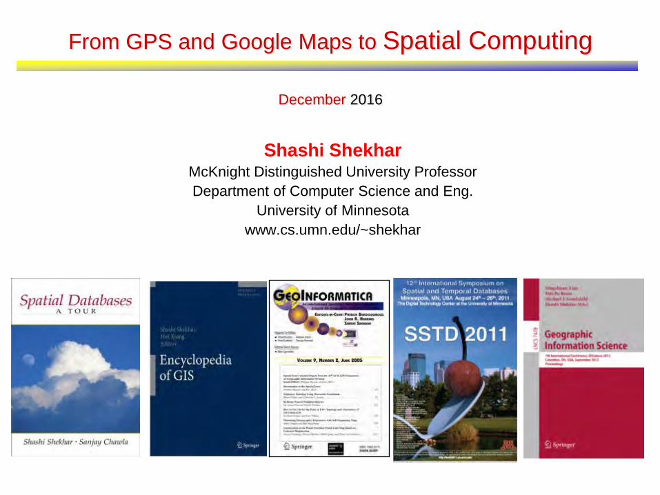
From GPS and Google Maps to Spatial Computing
December 2016
Shashi Shekhar McKnight Distinguished University Professor Department of Computer Science and Eng.
University of Minnesota www.cs.umn.edu/~shekhar

Outline
• Introduction – Spatial Computing Audience: Niche => Everyone – Spatial Computing 2020 - Workshop
• GPS • Location Based Services • Spatial Statistics • Spatial Database Management Systems • Virtual Globes & Remote Sensing • Geographic Information Systems • Conclusions
2
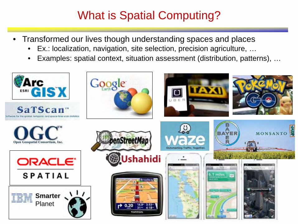
What is Spatial Computing?
• Transformed our lives though understanding spaces and places • Ex.: localization, navigation, site selection, precision agriculture, … • Examples: spatial context, situation assessment (distribution, patterns), …
Smarter Planet

The Changing World of Spatial Computing
Last Century Last Decade
Map User Well-trained few Billions
Mappers Well-trained few Billions
Software, Hardware
Few layers, e.g., Applications: Arc/GIS, Databases: SQL3/OGIS
Almost all layers
User Expectations & Risks
Modest Many use-case & Geo-privacy concerns

It is widely used by Government!
Geospatial Information and Geographic Information Systems (GIS): An Overview for Congress
5
May 18th, 2011
Folger, Peter. Geospatial Information and Geographic Information Systems (GIS): Current Issues and Future Challenges. Congressional Research Service. June 8th, 2009.

6
It is only a start! Bigger Opportunities Ahead!

7
7
CCC Visioning Workshop: Making a Case for Spatial Computing 2020 http://cra.org/ccc/spatial_computing.php
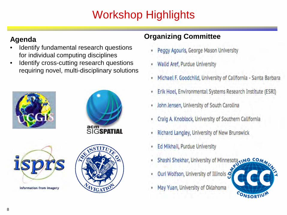
Workshop Highlights
8
Organizing Committee Agenda • Identify fundamental research questions
for individual computing disciplines • Identify cross-cutting research questions
requiring novel, multi-disciplinary solutions

9
2012 CCC Workshop: Spatial Computing Visioning
• Ten Opportunities
1. Spatial Abilities Predict STEM Success 2. Emerging Spatial Big Data 3. Augmented Reality Systems 4. Time-Travel in Virtual Globes 5. Spatial Predictive Analytics 6. Persistent Environment Hazard Monitoring 7. Geo-collaborative Systems, Fleets, and Crowds 8. Localizing Cyber Entities 9. GPS Deprived Environment 10. Beyond Geo

Outline
• Introduction • GPS
– Outdoors => Indoors • Location Based Services • Spatial Statistics • Spatial Database Management Systems • Virtual Globes & Remote Sensing • Geographic Information Systems • Conclusions
10

Global Positioning Systems (GPS)
• Positioning ships – Latitude f(compass, star positions) – Longitude Prize (1714) => marine chronometer – accuracy in nautical miles
• Global Navigation Satellite Systems
– Use: Positioning, Clock synchronization – Infrastructure: satellites, ground stations, receivers, …
Trilateration
http://answers.oreilly.com/topic/2815-how-devices-gather-location-information/
http://en.wikipedia.org/wiki/Global_Positioning_System

Positioning Precision
12

Trends: Localization Indoors and Underground
• GPS works outdoors, but, – We are indoors 80% of time! – Ex. malls, hospitals, airports, …
• Leveraging existing indoor infrastructure
– Blue Tooth, Wi-Fi, …
• How to represent indoors space?

14
Trends: Localizing Cyber Entities, e.g., tweets, pictures, …
Even before cable news outlets began reporting the tornadoes that ripped through Texas on Tuesday, a map of the state began blinking red on a screen in the Red Cross' new social media monitoring center, alerting weather watchers that something was happening in the hard-hit area. (AP, April 16th, 2012)

Outline
• Introduction • GPS • Location Based Services
– Queries => Persistent Monitoring • Spatial Statistics • Spatial Database Management Systems • Virtual Globes & Remote Sensing • Geographic Information Systems • Conclusions
15

Location Based Services
• Location: Where am I? (street address, <latitude, longitude>) • Directory:
– What is around me? – Where is the nearest clinic (or ambulance)?
• Routes: What is the shortest path to reach there?
16

17
Traditional SBD: Spatial Graphs • Spatial Graph Examples
– Roadmaps, rail-road networks, air-routes – Electric grid, Gas pipelines, supply chains, …
• Graph data sub-genre – Nodes, Edges, Routes, … – Flow networks with capacity constraints
• Use cases: – Geo-code, Map-matching, … – Connectivity, Shortest paths, … – Travel-time based nearest store, hospital, … – Logistics, supply-chain management, …
Graph Data for UMN Campus Courtesy: Bing

Dynamic Nature of Transportation Network

Next Generation Navigation Services
Eco-Routing Best start time Road-capacity aware

20
Next Generation Navigation Services
Eco-Routing Best start time Road-capacity aware

21
Routing Challenges: Lagrangian Frame of Reference
Q? What is the cost of Path <A,C,D> with start-time t=1 ? Is it 3 or 4 ? Path T = 0 T = 1 T = 2 T = 3
<A,C,D> 4 3 5 4
<A,B,D> 6 4 4 3
Lagrangian Graph
Snapshots of a Graph
Details:A Critical-Time-Point Approach to All-Start-Time Lagrangian Shortest Paths: A Summary of Results, (w/ V. Gunturi et al.), Proc. Intl. Symp. on Spatial and Temporal Databases, Springer LNCS 6849, 2011. Complete results accepted for the IEEE Transactions on Knowledge and Data Engineering.
1 1

Spatio-temporal Graphs: Computational Challenges
Ranking changes over time Waits, Non FIFO Behavior Violates stationary assumption in Dynamic Programming
*Flights between Minneapolis and Austin (TX)
Violate assumption of Dijkstra/A*
Details:A Critical-Time-Point Approach to All-Start-Time Lagrangian Shortest Paths: A Summary of Results, (w/ V. Gunturi et al.), Proc. Intl. Symp. on Spatial and Temporal Databases, Springer LNCS 6849, 2011. Complete results accepted for the IEEE Transactions on Knowledge and Data Engineering.
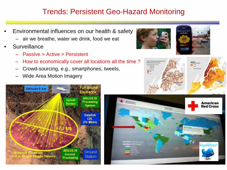
Trends: Persistent Geo-Hazard Monitoring
• Environmental influences on our health & safety – air we breathe, water we drink, food we eat
• Surveillance – Passive > Active > Persistent – How to economically cover all locations all the time ? – Crowd-sourcing, e.g., smartphones, tweets, – Wide Area Motion Imagery

Outline
• Introduction • GPS • Location Based Services • Spatial Statistics
– From Mathematical (e.g., hotspot) – To Spatial (e.g., hot features)
• Spatial Database Management Systems • Virtual Globes & Remote Sensing • Geographic Information Systems • Conclusions
24

Spatial Statistics: Mathematical Concepts
• Spatial Statistics – Quantify uncertainty, confidence, … – Is it (statistically) significant? – Is it different from a chance event or rest of dataset?
• e.g., SaTScan finds circular hot-spots
• Model Auto-correlation, Heterogeneity, Edge-effect, … – Point Process, e.g., Ripley’s K-functions, SatScan – Geo-statistics, e.g., Kriging, GWR – Lattice-based models
25

26
Ex.: Spatial Auto-Regression Parameter Estimation
Name Model
Classical Linear Regression
Spatial Auto-Regression
εxβy +=
εxβWyy ++= ρ
framework spatialover matrix odneighborho -by- : parameter n)correlatio-(auto regression-auto spatial the:
nnWρ
• Maximum Likelihood Estimation
• Computing determinant of large matrix is a hard (open) problem! – size(W) is quadratic in number of locations/pixels. – Typical raster image has Millions of pixels – W is sparse but not banded.
A parallel formulation of the spatial autoregression model for mining large geo-spatial datasets, SIAM Intl.Workshop on High Perf. and Distr. Data Mining, 2004.
SSEnnL −−−−=2
)ln(2
)2ln(ln)ln(2σπ
ρWI

Co-locations/Co-occurrence
• Given: A collection of different types of spatial events
• Find: Co-located subsets of event types
Details: Discovering colocation patterns from spatial data sets: a general approach, (w/ H. Yan et al.), IEEE Transactions on Knowledge and Data Engineering, 16(12), Dec. 2004.

30
MDCOP Motivating Example : Input • Manpack stinger
(2 Objects)
• M1A1_tank
(3 Objects)
• M2_IFV
(3 Objects)
• Field_Marker
(6 Objects)
• T80_tank
(2 Objects)
• BRDM_AT5 (enemy) (1 Object)
• BMP1 (1 Object)
31
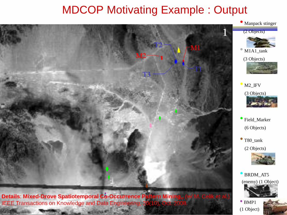
MDCOP Motivating Example : Output • Manpack stinger
(2 Objects)
• M1A1_tank
(3 Objects)
• M2_IFV
(3 Objects)
• Field_Marker
(6 Objects)
• T80_tank
(2 Objects)
• BRDM_AT5 (enemy) (1 Object)
• BMP1 (1 Object)
Details: Mixed-Drove Spatiotemporal Co-Occurrence Pattern Mining,, (w/ M. Celik et al.) IEEE Transactions on Knowledge and Data Engineering, 20(10), Oct. 2008.


Legionnaires’ Disease Outbreak in New York
33 Source: Ring-Shaped Hotspot Detection: A Summary of Results, IEEE ICDM 2014 (w/ E. Eftelioglu et al.)
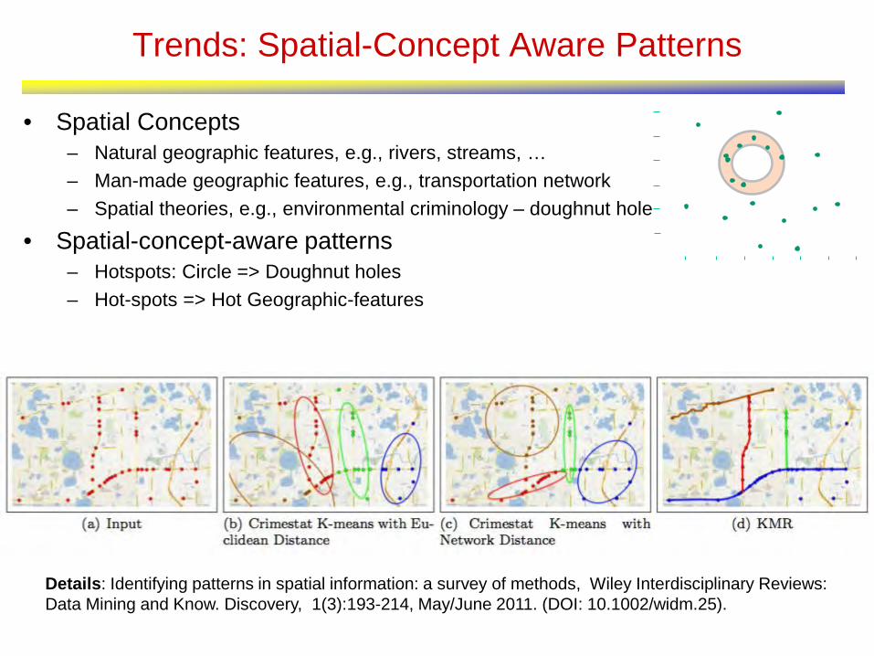
Trends: Spatial-Concept Aware Patterns
• Spatial Concepts – Natural geographic features, e.g., rivers, streams, … – Man-made geographic features, e.g., transportation network – Spatial theories, e.g., environmental criminology – doughnut hole
• Spatial-concept-aware patterns – Hotspots: Circle => Doughnut holes – Hot-spots => Hot Geographic-features
Details: Identifying patterns in spatial information: a survey of methods, Wiley Interdisciplinary Reviews: Data Mining and Know. Discovery, 1(3):193-214, May/June 2011. (DOI: 10.1002/widm.25).

Outline
• Introduction • GPS • Location Based Services • Spatial Statistics • Spatial Database Management Systems
– Scalability => Privacy
• Virtual Globes & Remote Sensing • Geographic Information Systems • Conclusions
35
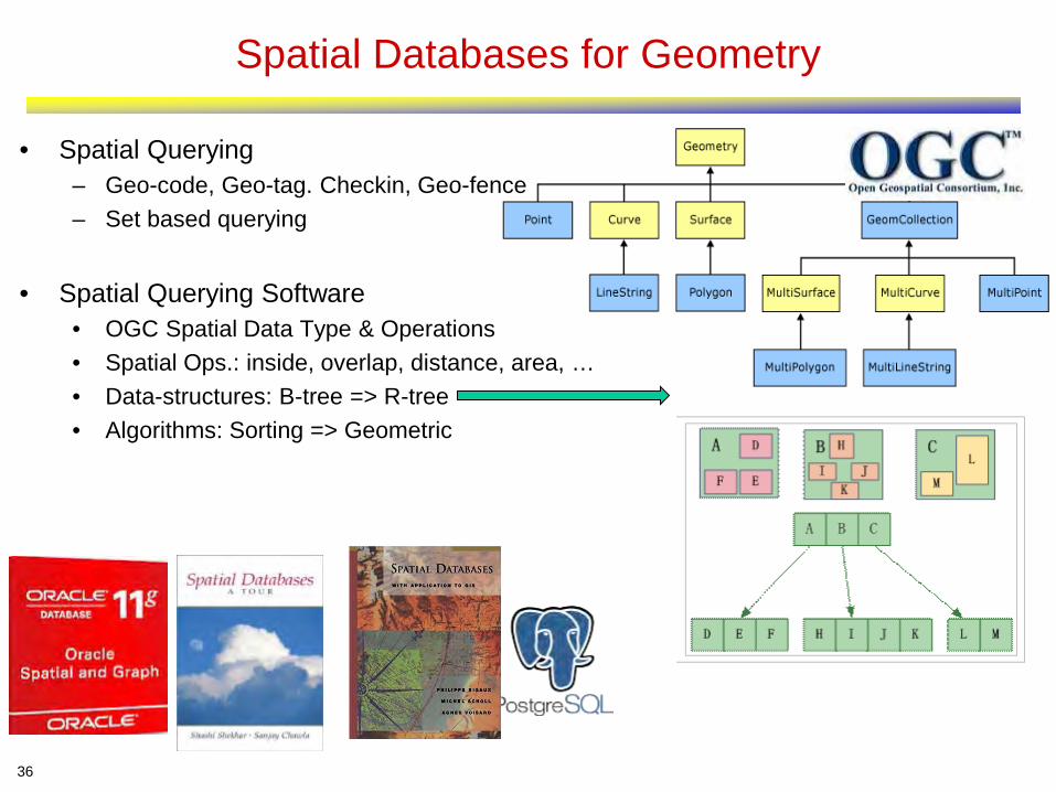
Spatial Databases for Geometry
• Spatial Querying – Geo-code, Geo-tag. Checkin, Geo-fence – Set based querying
• Spatial Querying Software
• OGC Spatial Data Type & Operations • Spatial Ops.: inside, overlap, distance, area, … • Data-structures: B-tree => R-tree • Algorithms: Sorting => Geometric
36

Geo-Security & Geo-Privacy • Operational Security Advice by US Army: Avoid Geo-tags!
– Q. Why?

Social Media Roundup
“I ran a little experiment. On a sunny Saturday, I spotted a woman in Golden Gate Park taking a photo with a 3G iPhone. Because iPhones embed geodata into photos that users upload to Flickr or Picasa, iPhone shots can be automatically placed on a map. At home I searched the Flickr map, and score—a shot from today. I clicked through to the user’s photostream and determined it was the woman I had seen earlier. After adjusting the settings so that only her shots appeared on the map, I saw a cluster of images in one location. Clicking on them revealed photos of an apartment interior—a bedroom, a kitchen, a filthy living room. Now I know where she lives.”
The following was published in Wired Magazine in 2009

Challenge: Geo-privacy, …
• Emerging personal geo-data – Trajectories of smart phones, Google map search, …
• Privacy: Who gets my data? Who do they give it to? What promises do I get? • Groups: Civil Society, Economic Entities, Public Safety ,Policy Makers

Outline
• Introduction • GPS • Location Based Services • Spatial Statistics • Spatial Database Management Systems • Virtual Globes & Remote Sensing
– Quilt => Time-travel & Depth
• Geographic Information Systems • Conclusions
40

Remote Sensing – Agriculture Monitoring

Virtual Globes & Volunteered Geo-Information
• Virtual Globes – Visualize Spatial Distributions, Patterns – Visual drill-down, e.g., fly-through
• Volunteered Geo-Information – Allow citizens to make maps & report
43

Opportunities: Time-Travel and Depth in Virtual Globes
• Virtual globes are snapshots
• How to add time? – Ex. NASA NEX, Google Earth Engine, – Ex. Google Timelapse: 260,000 CPU
core-hours for global 29-frame video
http://googleblog.blogspot.com/2013/05/a-picture-of-earth-through-time.html

Global Population
Global Temperature
State
Nexus Dashboard
Sea-Surface Temperature Anomaly
Aral Sea Shrinkage (1978-2014) Due to Cotton Farms
Alerts
Global Population
Trends
Emerging Raster SBD

Outline
• Introduction • GPS • Location Based Services • Spatial Statistics • Spatial Database Management Systems • Virtual Globes & Remote Sensing • Geographic Information Systems
– Geo => Beyond Geo
• Conclusions
46

Geographic Information Systems & Geodesy
• GIS: An umbrella system to – capture, store, manipulate, analyze, manage, and
present diverse geo-data. – SDBMS, LBS, Spatial Statistics, … – Cartography, Map Projections, Terrain, etc. – Q? How to model time? Spatio-temporal?
• Reference Systems – Which countries in North Korea missile range? – 3D Earth surface displayed on 2D plane – Spherical coordinates vs. its planar projections – Q? What are reference systems for time?
47 Original Correction
http://odt.org/hdp/

Opportunities: Beyond Geographic Space
• Spaces other than Earth – Challenge: reference frame?
• Ex. Human body – What is Reference frame ?
• Adjust to changes in body • For MRIs, X-rays, etc.
– What map projections? – Define path costs and routes to reach a brain tumor ?
Oliver, Dev, and Daniel J. Steinberger. "From geography to medicine: exploring innerspace via spatial and temporal databases." Advances in Spatial and Temporal Databases. Springer Berlin Heidelberg, 2011. 467-470.
http://convergence.ucsb.edu/issue/14
Outer Space Moon, Mars, Venus, Sun, Exoplanets, Stars, Galaxies
Geographic Terrain, Transportation, Ocean, Mining
Indoors Inside Buildings, Malls, Airports, Stadiums, Hospitals
Human Body Arteries/Veins, Brain, Neuromapping, Genome Mapping
Micro / Nano Silicon Wafers, Materials Science
Outline
• Introduction • GPS • Location Based Services • Spatial Statistics • Spatial Database Management
Systems • Virtual Globes & Remote Sensing • Geographic Information Systems • Conclusions
49

Recommendations
• Spatial Computing has transformed our society – It is only a beginning! – It promises an astonishing array of opportunities in coming decade
• However, these will not materialize without support • Universities
– Institutionalize spatial computing • GIS Centers, a la Computing Centers of the 1960’s
– Incorporate spatial thinking in STEM curriculum • During K-12, For all college STEM students?
• Government – Increase support spatial computing research – Larger projects across multiple universities – Include spatial computing topics in RFPs – Include spatial computing researchers on review panels – Consider special review panels for spatial computing proposals
50

Primary Sources
• Spatial Computing, Communications of the ACM, 59(1), Jan. 2016. • From GPS and Virtual Globes to Spatial Computing 2020, Computing
Community Consortium Report, 2013. www.cra.org/ccc/visioning/visioning-activities/spatial-computing