geographic data – the basis of gis in this lesson you will learn: the concept of spatial data in...
Post on 18-Dec-2015
222 views
TRANSCRIPT

Geographic Data – the basis of GIS
In this lesson you will learn:
• the concept of spatial data in GIS
• spatial object types
• feature classes
• feature information – geography vs. attributes
• the attribute database
• geographic coordinate bases
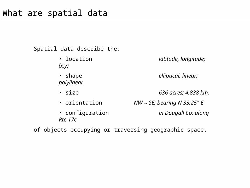
What are spatial data
Spatial data describe the:
• location latitude, longitude; (x,y)
• shape elliptical; linear; polylinear
• size 636 acres; 4.838 km.
• orientation NW → SE; bearing N 33.25° E
• configuration in Dougall Co; along Rte 17c
of objects occupying or traversing geographic space.

Map objects in GIS
Decatur city, Illinois
40 miles across
source: American FactFinder, U.S. Bureau of the Census, http://factfinder.census.gov/
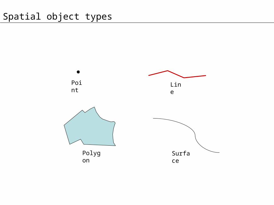
Spatial object types
Polygon
LinePoint
Surface

Spatial object
Dimensional space
Location Orientation Size
0-d√
1-d√ √ length
2-d√ √ area = length *
width
3-d√ √ Volume =
length * width* height
Spatial object geometry

Features
Image source: U.S. Geological Survey
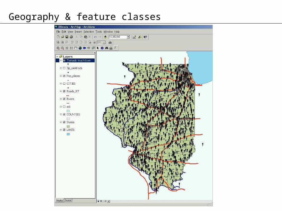
Geography & feature classes

Attribute data
source: U.S. Bureau of the Census, American FactFinder, Census 2000
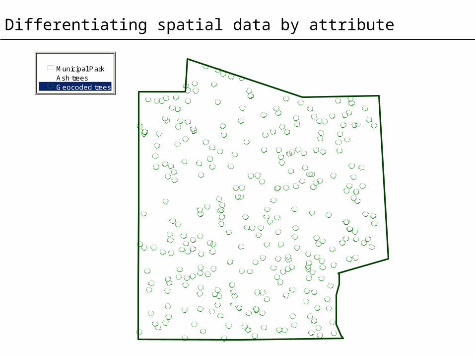
Differentiating spatial data by attribute
Geocoded treesAsh trees Municipal Park
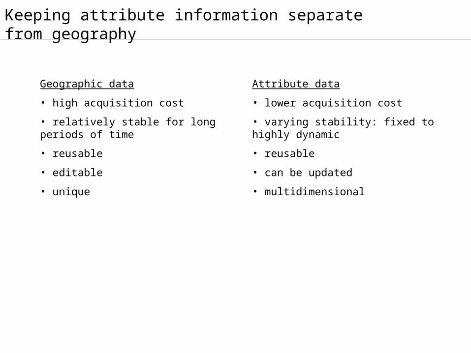
Keeping attribute information separate from geography
Geographic data
• high acquisition cost
• relatively stable for long periods of time
• reusable
• editable
• unique
Attribute data
• lower acquisition cost
• varying stability: fixed to highly dynamic
• reusable
• can be updated
• multidimensional

Point feature geography
ID Type X Y Z
A01 point 1000 900 ….
A02 point 3000 2000 ….
….
….
….
….
….
….X (easting)
1000 2000 3000
1000
2000
Y (northing)
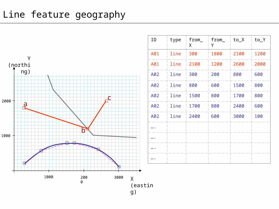
Line feature geography
X (easting)
1000 2000 3000
1000
2000
Y (northing)
ID type from_X from_Y to_X to_Y
A01 line 300 1800 2100 1200
A01 line 2100 1200 2600 2000
A02 line 300 200 800 600
A02 line 800 600 1500 800
A02 line 1500 800 1700 800
A02 line 1700 800 2400 600
A02 line 2400 600 3000 100
….
….
….
….
a
b
c
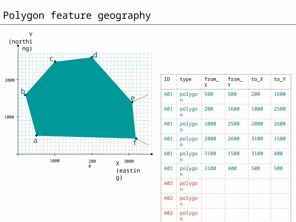
Polygon feature geography
ID type from_X from_Y to_X to_Y
A01 polygon 500 500 200 1600
A01 polygon 200 1600 1000 2500
A01 polygon 1000 2500 2000 2600
A01 polygon 2000 2600 3100 1500
A01 polygon 3100 1500 3100 400
A01 polygon 3100 400 500 500
A02 polygon
A02 polygon
A02 polygon
….
….
X (easting)
1000 2000 3000
1000
2000
Y (northing)
a
b
c d
e
f

Surface feature geography
“Prism” model
“Fishnet” model“Contour” model
“TIN” model
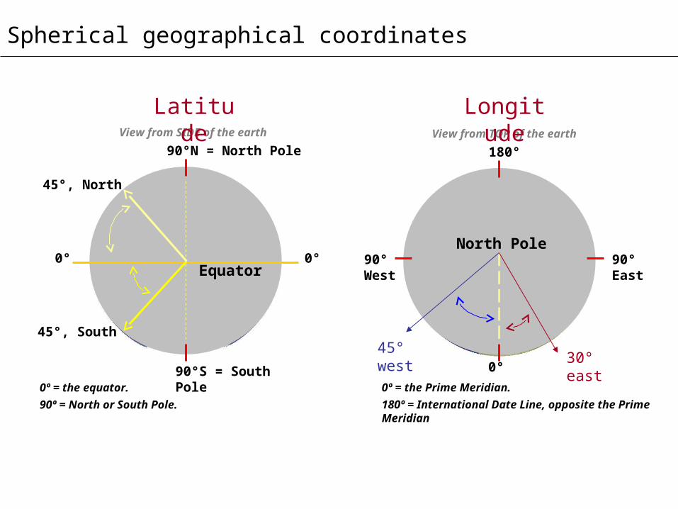
Spherical geographical coordinates
0º = the Prime Meridian.
180º = International Date Line, opposite the Prime Meridian
0°
North Pole
View from TOP of the earth
90°West
90°East
180°
45° west
Longitude
30° east
0º = the equator.
90º = North or South Pole.
View from SIDE of the earth
0° 0°
90°N = North Pole
90°S = South Pole
Equator
45°, North
Latitude
45°, South

Datums
Common datums:
a. Horizontal
i. NAD27 (North American Datum, 1927)
ii. NAD83 (North American Datum, 1983)
iii. WGS84 (World Geodetic System, 1984)
b. Vertical (orthometric, relative to mean sea level)
i. NGVD29 (National Geodetic Vertical Datum, 1929), formerly NAVD29
ii. NAVD88 (North American Vertical Datum, 1988)
c. Vertical (3-d ellipsoid-based, as height above ellipsoid (HAE))
i. WGS84 (World Geodetic System, 1984)
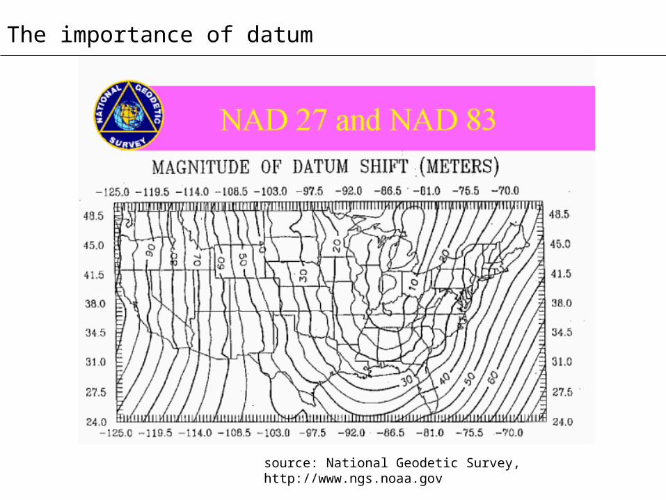
The importance of datum
source: National Geodetic Survey, http://www.ngs.noaa.gov
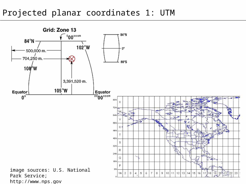
Projected planar coordinates 1: UTM
image sources: U.S. National Park Service; http://www.nps.gov
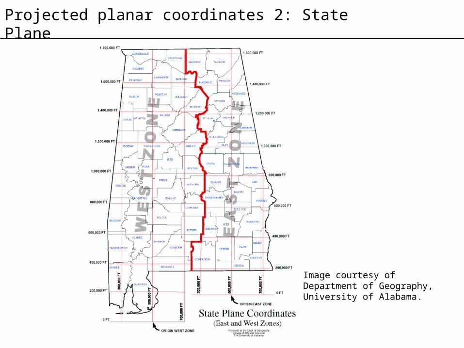
Projected planar coordinates 2: State Plane
Image courtesy of Department of Geography, University of Alabama.

Recipe for disaster – mixing coordinates
Gaia’s Grand Gondwanaland
Serving size: 1 modern southern hemisphere
Serving hint: combine with a little Laurasia for added PANGEA
Ingredients1 African plate1 Antarctic plate1 Australian plate 1 Indian plate1 Nazca plate1 Pacific plate1 Scotia plate1 South American plate
Directions
Preheat Earth’s core to 3000-5000° C and set timer to approximately 200 Ma (million years before present).
Gently crack and separate the Australian plate from the Antarctic plate along its western edge; drift Australian plate east and northward. Delineate Brazilian Plateau from west African lowlands, separate South American plate
Makes: 1 Africa, 1 Antarctica, 1 Australia, 1 Indian subcontinent, 1 Madagascar, and 1 South America
Other coordinate systems in GIS

Looking forward: new types of spatial data
GIS enables a wide variety of new spatial data types, including
images• aerial photos• satellite remote sensing imagery• LIDAR, radar & other active sensor imagery• map scans• still photos and video
spatial analysis models• networks• Theissen/Voronoi polygons• triangulated irregular networks• nearest neighbors• DEMs (digital elevation models)• buffers• grids
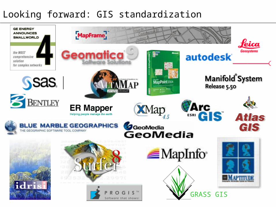
Looking forward: GIS standardization
GRASS GIS

What you have learned:
• Spatial data describe the location, shape, orientation, size, and configuration of objects occupying geographic space.
• The four fundamental types of spatial objects in GIS are: points, lines, polygons, and surfaces.
• Spatial objects are organized into feature classes. All features within a feature class share the same geographic identity and object geometry.
• GIS organizes geographic data separate from attribute data.
• The spatial databases for point, line, and polygon objects are typically structured as: points: a unique ID and the point’s geographic coordinates;lines: a unique ID and pairs of coordinates denoting the from and to nodes of each line segmentpolygons: a unique ID and pairs of coordinates denoting the end vertices of each polygon edgesurfaces: contour, fishnet, TIN, or prism data model.
• Location coordinates in spatial databases are commonly either true geographical coordinates or projected planar coordinates. State Plane coordinates are typically more accurate than UTM planar coordinates and therefore better suited to GIS.
• Know the basis of any coordinate system before using it. Don’t mix datums, coordinate systems, or projections.
• GIS makes use of other non-cartographic types of spatial objects, including images, networks, buffers, Theissen polygons, grids, TINs, DEMs, and nearest neighbors.
• Though there is a increasing degree of standardization in GIS technologies, there remain some proprietary elements to GIS software and terminology.