geography 405/605. spatial analysis “the study of the locations and shapes of geographic features...
Post on 21-Dec-2015
215 views
TRANSCRIPT

Geography 405/605

Spatial Analysis
• “The study of the locations and shapes of geographic features and the relationships between them.” ESRI definition
• “Spatial analysis is a set of methods whose results change when the locations of the objects being analyzed changes.” Longley et al. definition

Geoprocessing
• “A GIS operation used to manipulate GIS data. A typical geoprocessing operation takes an input dataset, performs an operation on that dataset, and returns the result of the operation as an output dataset.” ESRI definition
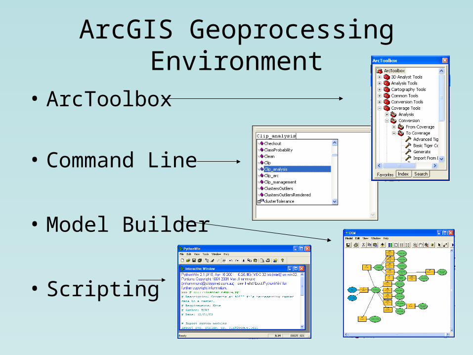
ArcGIS Geoprocessing Environment
• ArcToolbox
• Command Line
• Model Builder
• Scripting

ArcToolbox• Toolbox• Toolset• Tool• Models• Scripts
• Can beaccessedfromArcMap orArcCatalog
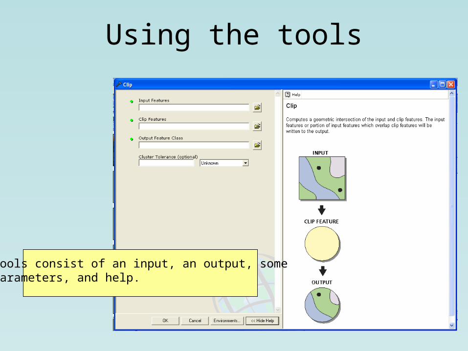
Using the tools
Tools consist of an input, an output, someparameters, and help.

Additional Help

Custom Toolboxes
• Users can create custom toolboxes and fill them with existing and new tools. Custom toolboxes are a convenient way to access often used tools.

Environments
• Set working directory• Set default coordinate system• Set default cluster tolerance• Set spatial extent• Set raster cell size

Command Line
• Quick and easy if you know what you are doing
• Can repeat the same tasks for several feature classes or rasters quickly
• Commands are similar to ArcINFO aml• Instant feedback tells you if the processing
is successful• Easy to
document

Model Builder• Useful as a documentation tool
• Communicate to others your methods
• Drag and drop interface
• Chain together several processes and let it run overnight
• Can set variables to make the model flexible

Documentation• Your model can be exported as a jpeg or
as HTML
• You can create help for others who might use your model
• Model Builder uses existing tools from ArcToolbox, so interpretation is easy

Variables• A variable is a parameter, such as an input
file, that can be made flexible. A variable could be created that would allow the user to choose his or her own input files.
• Models can be static (use fixed datasets) or flexible (use variables) depending upon your needs.