geography challenge medieval europe€¦ · geography!skills%...
TRANSCRIPT
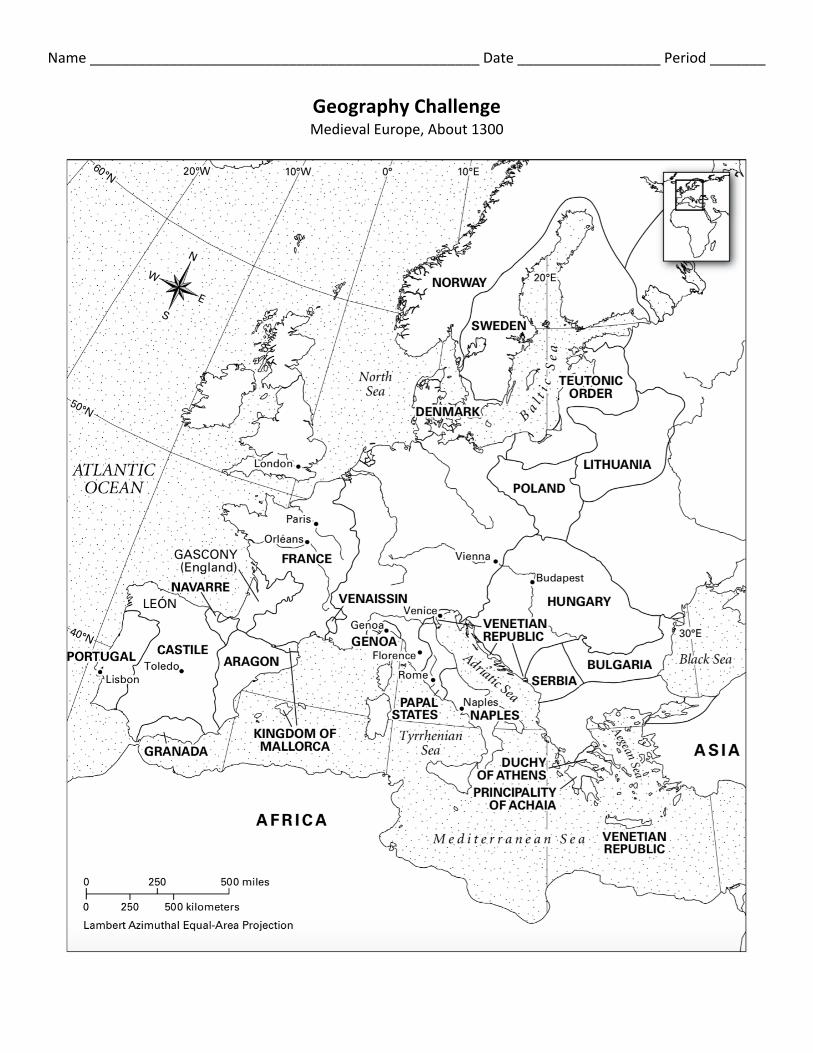
Name _________________________________________________ Date __________________ Period _______
Geography Challenge Medieval Europe, About 1300

Geography Skills
DIRECTIONS: Analyze the maps provided to you on the webpage. Then answer the following questions and fill out the map as directed. Coloring is not necessary, but encouraged.
1. Locate the Holy Roman Empire and the Byzantine Empire. Label them on your outline map.
2. Locate and label Constantinople.
3. Some parts of medieval Europe were actually islands. Locate and label these islands on your map. (Ireland, Corsica, England, Sardinia, Scotland, Sicily)
4. The Byzantine Empire includes lands on which two continents?
5. Locate and label the Seine, Thames, Elbe, Tiber, and Danube rivers. Label the cities that are located along these rivers. Why do you think large medieval cities were located along rivers?
Critical Thinking
DIRECTIONS: Answer the following questions in complete sentences.
6. During medieval times, overland travel was dangerous, due to physical barriers, as well as wild animals and thieves. Because of this, sea travel was preferred. Based on what you know of the physical geography of Europe, why might its people have taken advantage of this form of transportation?
7. The Roman Empire and the Holy Roman Empire are two different empires that existed at different times in history. The Roman Empire controlled all the land around the Mediterranean Sea, including present-‐day Spain, France, and England, and as far north as the Carpathian Mountains and the Black Sea. The Roman Empire ended around 476 C.E. The Holy Roman Empire, on the other hand, began around the year 800 C.E. How did the land areas controlled by the two empires differ?