geospatial enterprise architecture what does it mean to me? and why you should care!
DESCRIPTION
Geospatial Enterprise Architecture What does it mean to me? and Why you should care!. Tim Haithcoat Missouri Spatial Data Information Service [email protected]. Have you been asked?. How would you unify, simplify, stream-line, or consolidate state geo-operations? - PowerPoint PPT PresentationTRANSCRIPT
2105 Laurel Bush Road, Suite 200Bel Air, Maryland 21015(443) 640-1075http://www.nsgic.org
Geospatial Enterprise Architecture
What does it mean to me?and
Why you should care!
Tim HaithcoatMissouri Spatial Data Information Service

Slide 2 -- April 25, 2006
Have you been asked?• How would you unify, simplify, stream-line, or
consolidate state geo-operations?• What elements of your agencies or organizations use
geospatial technologies and why?• How much is being spent on geospatial?• Are you duplicating capability and data?• Where are the opportunities to leverage investments in
the geospatial arena?• How can you reduce costs in hardware, software, and
data resource acquisition, management, and use?• What standards for geospatial data development,
accuracy, or technology acquisition are you using?

Slide 3 -- April 25, 2006
Have your peers recognized that . . .
• Geographic information is used in a growing number of business settings in and outside of government
• Geographic information and services are not addressed consistently within and between organizations
• Interoperability among providers and consumers of geographic data and services requires a common understanding of terminology and functional capability/capacity
• Development of common multi-jurisdictional approaches to the use of geographic information and services requires inclusion in a state’s Enterprise Architecture initiatives
• Individual agencies developing internal geospatial architectures without specific participation in multi-agency / enterprise efforts
• Location-based services and Service Oriented Architectures being built in state government require geospatial information
Slide 4 -- April 25, 2006
Have you desired . . .• to promote consideration of location as a component of agency
business activities and processes• to support description and sharing of geospatial resources across
organizations both horizontally and vertically• to build geospatial considerations into all aspects of agency enterprise
architecture development• to adopt existing guidelines, standards, and policies established by
FGDC, OGC, and ISO for development, management, and use of geospatial resources
• to measure performance in the use and management of geospatial resources
• to assess program development across government for geospatial aspects so as to leverage these shared requirements for greater gain
• to compare where your state is to others in terms of geospatial maturity

Slide 5 -- April 25, 2006
Goals of EA• Provide a structured approach to business process
assessment and re-engineering• Classification of business processes, data concepts,
standards, services (components and interfaces) for each organization
• Reference framework to store models that explain the services and data behind them
• Opportunity to improve efficiencies within an organization
• Identify potential for services and data re-use for multiple purposes
Slide 6 -- April 25, 2006
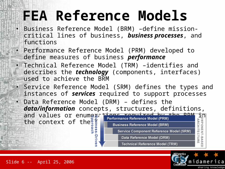
FEA Reference Models• Business Reference Model (BRM) –define mission-critical lines of
business, business processes, and functions• Performance Reference Model (PRM) developed to define
measures of business performance• Technical Reference Model (TRM) –identifies and describes the
technology (components, interfaces) used to achieve the BRM• Service Reference Model (SRM) defines the types and instances of
services required to support processes• Data Reference Model (DRM) – defines the data/information
concepts, structures, definitions, and values or enumerations required by the BRM in the context of the TRM
Slide 7 -- April 25, 2006
Geospatial Community of Practice
• Convened a workgroup of federal and non-federal participants to develop a Geospatial Profile of the FEA– Affiliated with the Architecture and Infrastructure Committee
(AIC) of the Federal CIO Council– Ad-hoc Working Group of the FGDC– Membership includes major federal agencies, state and local
members, professional organizations (NSGIC, NACO, NASCIO, GITA)
Slide 8 -- April 25, 2006
Requirements for Geospatial Profile in Enterprise Architecture
• Geographic information is used in a majority of business settings in and outside of government
• Geographic information and services are not addressed consistently within and between organizations
• Interoperability among providers and consumers of geographic data and services requires a common understanding of semantics and functional capabilities
• Development of common multi-jurisdictional / organizational approaches to the use of geographic information and services requires inclusion in Enterprise Architecture
Slide 9 -- April 25, 2006
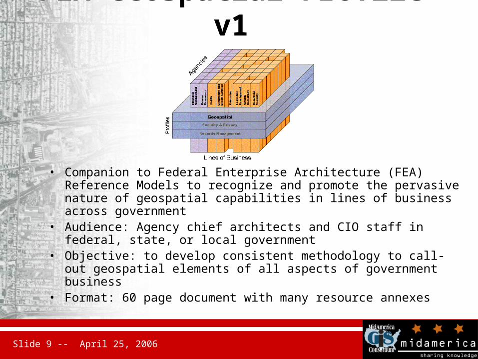
FEA Geospatial Profile v1
• Companion to Federal Enterprise Architecture (FEA) Reference Models to recognize and promote the pervasive nature of geospatial capabilities in lines of business across government
• Audience: Agency chief architects and CIO staff in federal, state, or local government
• Objective: to develop consistent methodology to call-out geospatial elements of all aspects of government business
• Format: 60 page document with many resource annexes
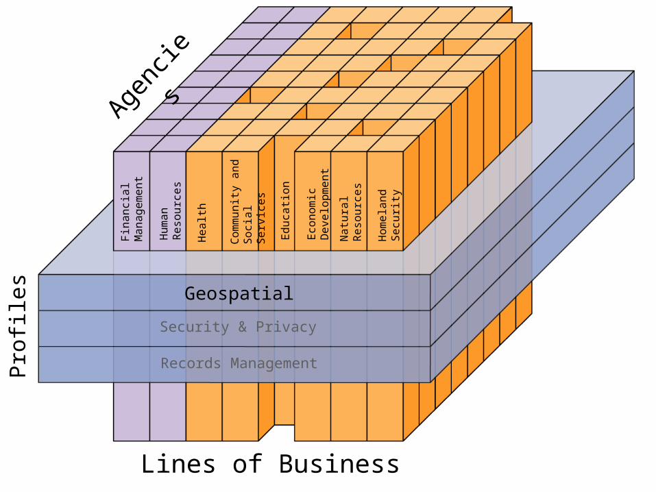
Geospatial
Security & Privacy
Records Management
Eco
nom
ic
Develo
pm
ent
Educa
tion
Com
munit
y a
nd
Soci
al Serv
ices
Healt
h
Hum
an
Reso
urc
es
Fin
anci
al
Managem
ent
Natu
ral
Reso
urc
es
Hom
ela
nd
Secu
rity
Agenc
ies
Lines of Business
Pro
files
Slide 11 -- April 25, 2006
Initiative History & Status, April 2006
• Drafted a Charter for a Geospatial WG under the FGDC and CIO AIC, refined work plan
• Convened writing teams for the Introduction section, and to provide geospatial guidance for each of the relevant FEA Reference Models
• Posted Version 1.0 Draft of Geospatial Profile 10January2006• Plan evaluation pilot to interpret Profile in context of common
event. Pilot focused on homeland security and emergency information exchange in facilities - how they are defined, structured, and shared - rolling out currently
• Developing Next Steps for revision of Profile version 2.0 - targeted for early-mid summer
• Integrating with OMB’s newly launched Geospatial Line of Business activities

Slide 12 -- April 25, 2006
Geospatial Profile V1 Outline• Executive Summary• Introduction to the
Geospatial Profile– Objectives – Audience – Document Structure
• Introduction to Geospatial Concepts – Cross-cutting nature of
geospatial – Overview of Geospatial
Capabilities– The NSDI
• Business Reference Model
• Data Reference Model• Service Components
Reference Model• Technology Reference
Model• Performance Reference
Model and Maturity Model– Appendix A: References – Appendix B: Glossary – Appendix C: FEA Overview– Appendix D: Use Case and Scenarios– Appendix E: Geospatial Activity for BRM– Appendix F: Geospatial Business Language– Appendix G: Geospatial Service Components– Appendix H: Geospatial Standards List– Appendix I: Acronym List
Slide 13 -- April 25, 2006
1. Introduction
• Opportunities for use of geospatial information and services
• Overview of the Federal Enterprise Architecture (FEA)
• Objectives• Audience• Policy context:
– OMB Circulars, Executive Order, E-Gov Act 2002
• Document organization
Slide 14 -- April 25, 2006
Objectives• to promote consideration of location as a component
of agency business activities and processes• to support description and sharing of geospatial
resources across organizations• to build geospatial considerations into all aspects of
agency enterprise architecture development.• to reinforce existing guidelines, standards, and
policies established by OMB, FGDC, and ISO for development, management, and use of geospatial resources
• to measure performance in the use and management of geospatial resources.

Slide 15 -- April 25, 2006
2. Geospatial Concepts
• Geospatial information examples
• Geospatial services discussion
• NSDI– The National Map and Framework data– Geospatial One-Stop and Clearinghouse
network

Slide 16 -- April 25, 2006
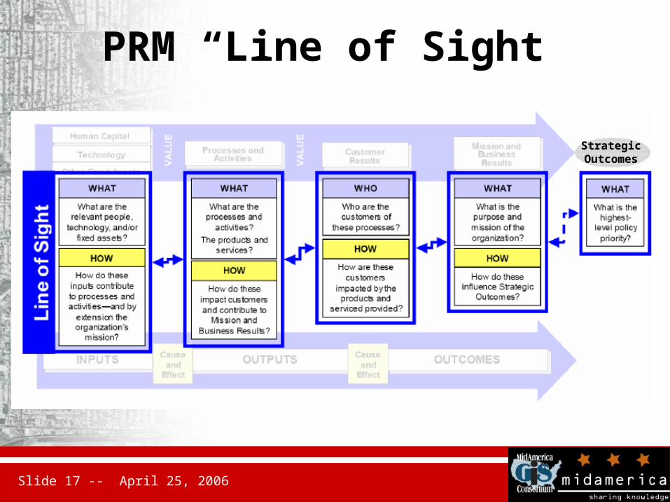
3. Performance RM• Goals:
– Help produce enhanced performance information to improve strategic and daily decision-making
– Improve the alignment and better articulate the contribution of inputs to outputs, thereby creating a clear “line of sight” to desired results
– Identify performance improvement opportunities that span traditional organizational structures and boundaries
Slide 17 -- April 25, 2006
PRM “Line of Sight”
StrategicOutcomes

Slide 18 -- April 25, 2006
Possible Areas to Measure Performance
Mission and Business Results: This includes the Measurement Categories of Services for Citizens, Support Delivery of Services, and Management of Government Resources.
Citizens and citizen servicesInstitutional effectivenessPublic participation and accountability Supports improved decision makingSupports NSDI
Customer Results: This includes the Measurement Categories of Customer Benefit, Service Coverage, Timeliness and Responsiveness, Service Quality, and Service Accessibility.
Ease of use measuresBroad data-sharing capabilitiesData availability and accessibility
Slide 19 -- April 25, 2006
Possible Areas to Measure Performance
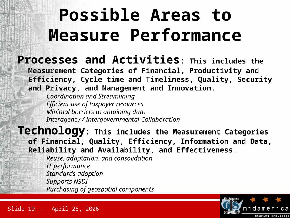
Processes and Activities: This includes the Measurement Categories of Financial, Productivity and Efficiency, Cycle time and Timeliness, Quality, Security and Privacy, and Management and Innovation.
Coordination and StreamliningEfficient use of taxpayer resourcesMinimal barriers to obtaining dataInteragency / Intergovernmental Collaboration
Technology: This includes the Measurement Categories of Financial, Quality, Efficiency, Information and Data, Reliability and Availability, and Effectiveness.
Reuse, adaptation, and consolidationIT performanceStandards adoptionSupports NSDIPurchasing of geospatial components

Slide 20 -- April 25, 2006
4. Business RM
• Four Business Areas, 39 official Lines of Business*, many subordinate business activities
• Geospatial characteristics of specific business activities are highlighted in Appendix D.
* RFI for a Geospatial LoB recently released!!

Slide 21 -- April 25, 2006
FEA Business Reference Model
Slide 22 -- April 25, 2006
Approach to evaluating geospatial aspects of business activities:
• Approach to evaluating geospatial aspects of business activities:– Analyze business activity descriptions to determine possible roles
for location based information in the execution of the business activity.
– Determine the function of geospatial data, technology, and services in carrying out those activities.
– Develop or refine a business statement that describes the role of geospatial data and technologies in support of the business activity.
• Questions template to identify geospatial capabilities with subject experts
Slide 23 -- April 25, 2006
Recommended geospatial business functions
• Development of geospatial policies, standards, and guidance
• Implement geospatial services with common and documented interfaces
• Dissemination of geospatial data to external users

Slide 24 -- April 25, 2006
5. Data Reference Model• Promotes data sharing and discovery
through three capabilities exposed for agency data resources:– Data context (taxonomies)– Data sharing (exchange schema and
format)– Data description (metadata)
• Full reconciliation with the FEA DRM version 2.X is not included in this Profile
Slide 25 -- April 25, 2006
Data context (taxonomies)
• Spatial contexts exist to reference location using addresses, coordinates, grid reference systems, and place names
• ISO 19115 includes a Topic Category system for thematic content classification

Slide 26 -- April 25, 2006
Data sharing (exchange)
• Use of Framework Data Content standards for exchange (ANSI/INCITS)
• Use of standard formats and services for exchange (OGC GML, WFS)
• Use of geospatial data formats for exchange

Slide 27 -- April 25, 2006
Data description (metadata)
• Reference to FGDC Content Standard for Digital Geospatial Metadata (CSDGM) in active use
• Recommends future use of ISO 19115 and its XML encoding (ISO TS 19139) for the format and transfer of geospatial metadata
Slide 28 -- April 25, 2006
6. Service Component Reference Model
• Defined as a “baseline for categorizing and aligning federal business applications into common, reusable Service Components, … categorized into appropriate service domains and service types.”
• Appendix F includes a table of SRM extensions that highlight candidate geospatial service components within existing domains/types

Slide 29 -- April 25, 2006
FEA Service domains and types
Slide 30 -- April 25, 2006
7. Technology RM
The Geospatial TRM is intended to support three principal uses in conjunction with standards profiles:– Ensuring interoperability among internal and
external systems and users– Guiding the design of system and technical
architectures, and– Providing the basis for assessing architectural
compliance for technical solutions.
Slide 31 -- April 25, 2006
Geospatial aspects of TRM
• In the context of the TRM organization, geospatial standards and specifications are identified to improve interoperability in enterprise solutions– ISO, W3C, OGC, OASIS, FGDC and other
standards are referenced
Slide 32 -- April 25, 2006
Appendices• References• Glossary and acronyms• Use case and scenarios• Geospatial activity examples• Geospatial Business Language• Geospatial Service Components• Geospatial Standards List• Geospatial Integration Maturity Model
Slide 33 -- April 25, 2006
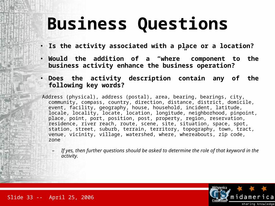
Business Questions• Is the activity associated with a place or a location?
• Would the addition of a “where” component to the business activity enhance the business operation?
• Does the activity description contain any of the following key words?
Address (physical), address (postal), area, bearing, bearings, city, community, compass, country, direction, distance, district, domicile, event, facility, geography, house, household, incident, latitude, locale, locality, locate, location, longitude, neighborhood, pinpoint, place, point, port, position, post, property, region, reservation, residence, river reach, route, scene, site, situation, space, spot, station, street, suburb, terrain, territory, topography, town, tract, venue, vicinity, village, watershed, where, whereabouts, zip code, zone
– If yes, then further questions should be asked to determine the role of that keyword in the activity.

Slide 34 -- April 25, 2006
Business Questions (cont)• Does the place/position/location/address have or could it have an impact
on the way that an activity is conducted? In other words, does the activity vary by place/position/location/address or do the characteristics of a place/position/location/address impact the activity?
– If yes, then further questions should be asked to elicit more about how that activity varies spatially and what geospatial information and services may be relevant to the activity.
• Does the activity require the use of or could it benefit from having a map/aerial photograph/satellite image?
• Would a map/aerial photograph/satellite image be helpful in the conduct of the activity or increase the effectiveness of individuals or groups conducting the activity?
Slide 35 -- April 25, 2006
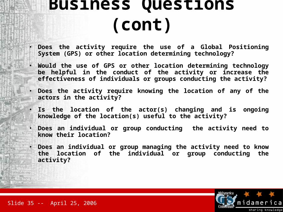
Business Questions (cont)• Does the activity require the use of a Global Positioning System
(GPS) or other location determining technology?
• Would the use of GPS or other location determining technology be helpful in the conduct of the activity or increase the effectiveness of individuals or groups conducting the activity?
• Does the activity require knowing the location of any of the actors in the activity?
• Is the location of the actor(s) changing and is ongoing knowledge of the location(s) useful to the activity?
• Does an individual or group conducting the activity need to know their location?
• Does an individual or group managing the activity need to know the location of the individual or group conducting the activity?
Slide 36 -- April 25, 2006
Geospatial Business Language
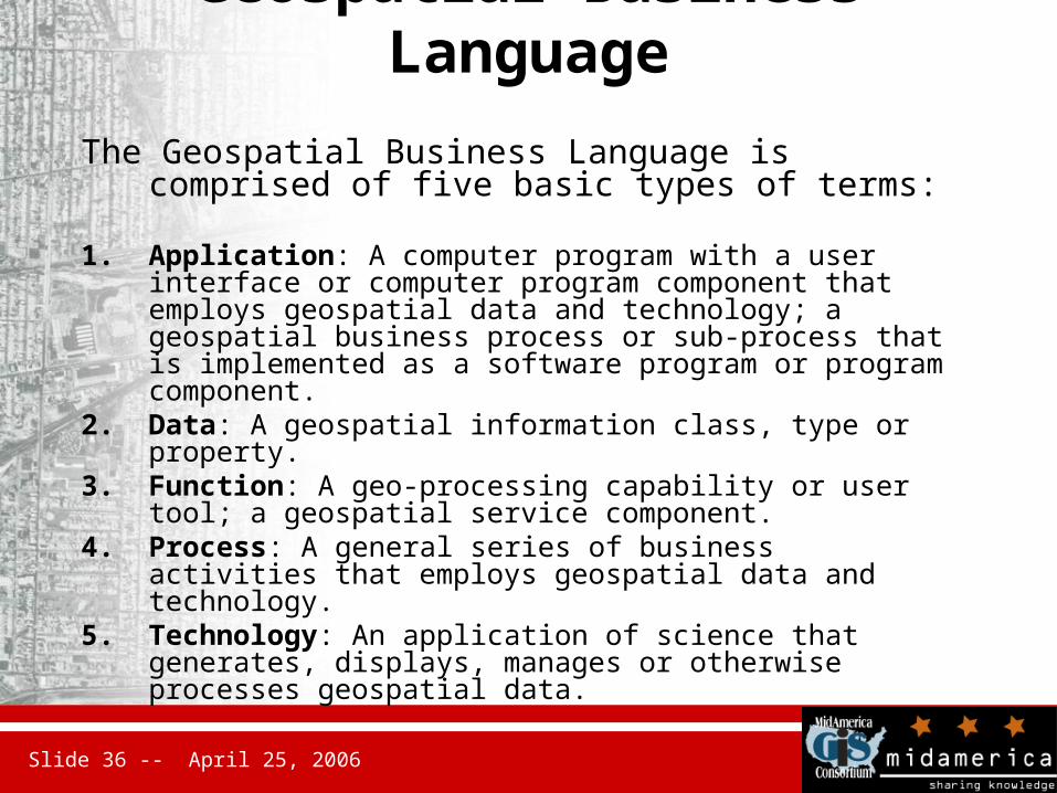
The Geospatial Business Language is comprised of five basic types of terms:
1. Application: A computer program with a user interface or computer program component that employs geospatial data and technology; a geospatial business process or sub-process that is implemented as a software program or program component.
2. Data: A geospatial information class, type or property.3. Function: A geo-processing capability or user tool; a
geospatial service component.4. Process: A general series of business activities that employs
geospatial data and technology.5. Technology: An application of science that generates,
displays, manages or otherwise processes geospatial data.
Slide 37 -- April 25, 2006
Geospatial Integration Maturity Model
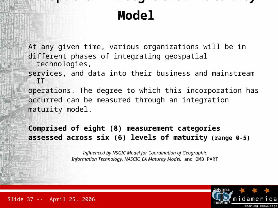
At any given time, various organizations will be in different phases of integrating geospatial technologies, services, and data into their business and mainstream IT operations. The degree to which this incorporation has occurred can be measured through an integration maturity model.
Comprised of eight (8) measurement categoriesassessed across six (6) levels of maturity (range 0-5)
Influenced by NSGIC Model for Coordination of GeographicInformation Technology, NASCIO EA Maturity Model, and OMB PART
Slide 38 -- April 25, 2006
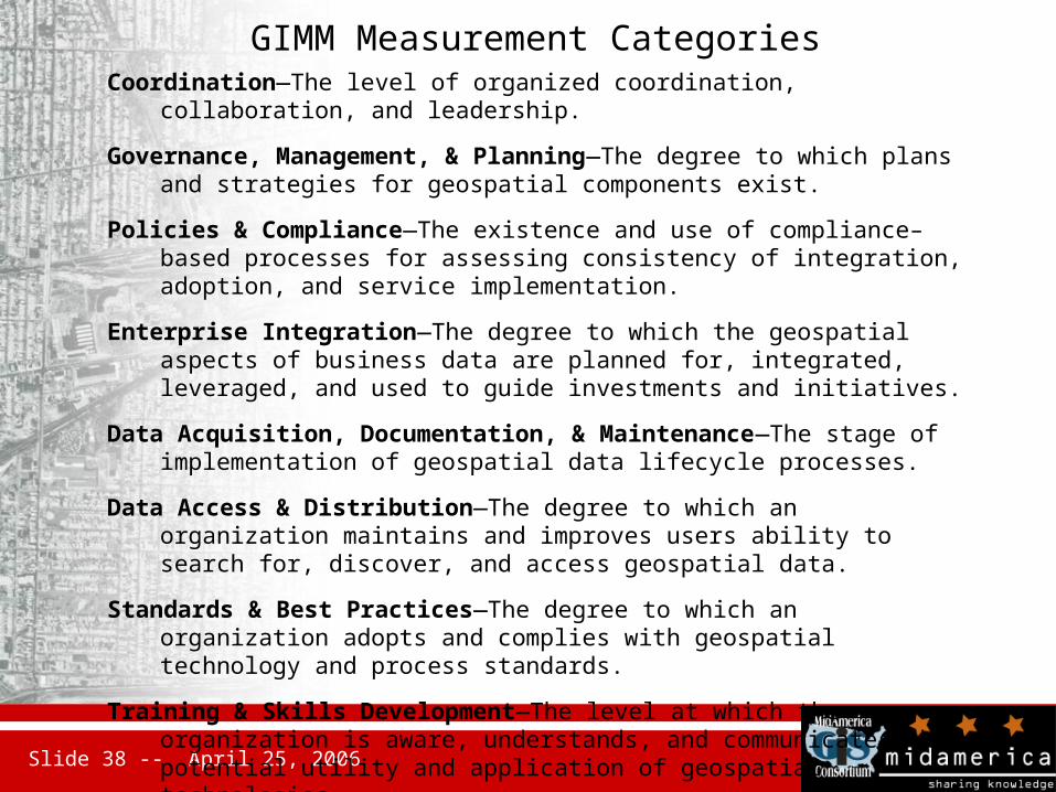
GIMM Measurement CategoriesCoordination—The level of organized coordination, collaboration, and leadership.
Governance, Management, & Planning—The degree to which plans and strategies for geospatial components exist.
Policies & Compliance—The existence and use of compliance–based processes for assessing consistency of integration, adoption, and service implementation.
Enterprise Integration—The degree to which the geospatial aspects of business data are planned for, integrated, leveraged, and used to guide investments and initiatives.
Data Acquisition, Documentation, & Maintenance—The stage of implementation of geospatial data lifecycle processes.
Data Access & Distribution—The degree to which an organization maintains and improves users ability to search for, discover, and access geospatial data.
Standards & Best Practices—The degree to which an organization adopts and complies with geospatial technology and process standards.
Training & Skills Development—The level at which the organization is aware, understands, and communicates the potential utility and application of geospatial technologies.
Slide 39 -- April 25, 2006
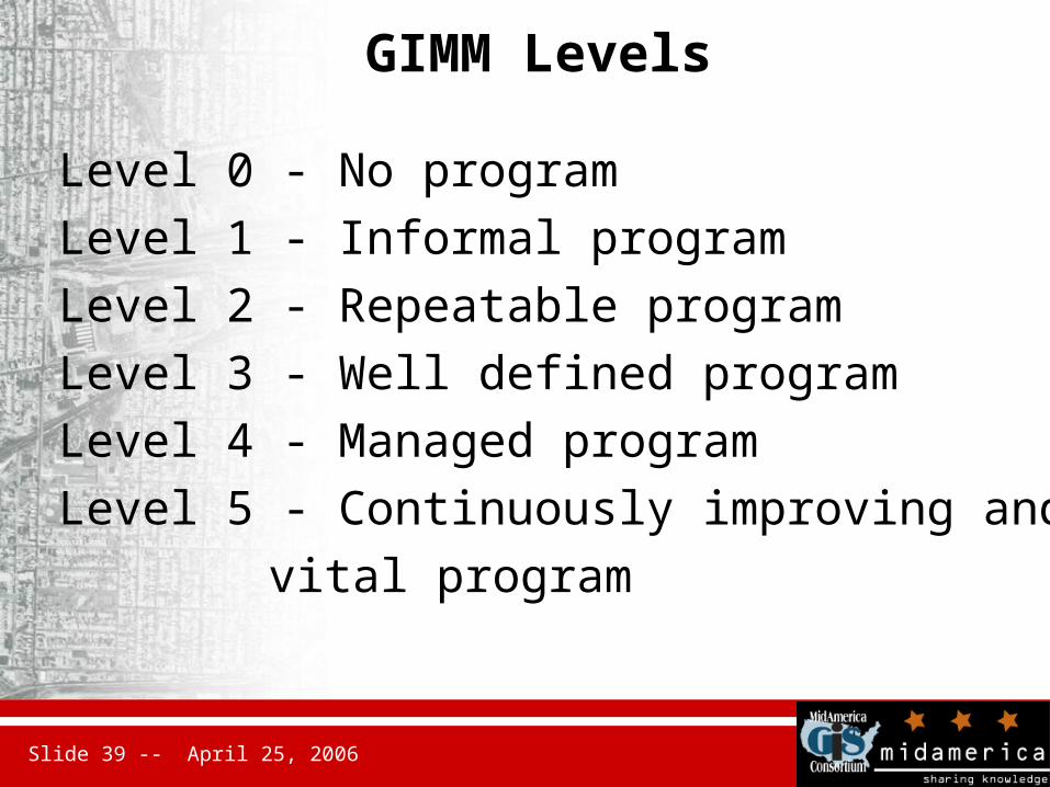
GIMM Levels
Level 0 - No program
Level 1 - Informal program
Level 2 - Repeatable program
Level 3 - Well defined program
Level 4 - Managed program
Level 5 - Continuously improving and
vital program
Slide 40 -- April 25, 2006
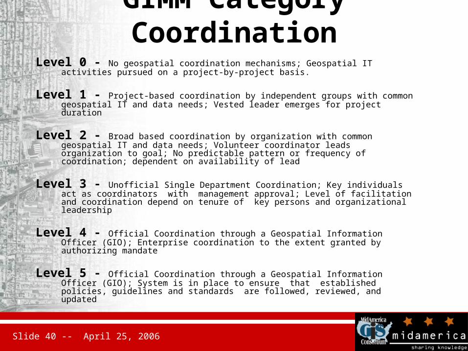
GIMM Category Coordination
Level 0 - No geospatial coordination mechanisms; Geospatial IT activities pursued on a project-by-project basis.
Level 1 - Project-based coordination by independent groups with common geospatial IT and data needs; Vested leader emerges for project duration
Level 2 - Broad based coordination by organization with common geospatial IT and data needs; Volunteer coordinator leads organization to goal; No predictable pattern or frequency of coordination; dependent on availability of lead
Level 3 - Unofficial Single Department Coordination; Key individuals act as coordinators with management approval; Level of facilitation and coordination depend on tenure of key persons and organizational leadership
Level 4 - Official Coordination through a Geospatial Information Officer (GIO); Enterprise coordination to the extent granted by authorizing mandate
Level 5 - Official Coordination through a Geospatial Information Officer (GIO); System is in place to ensure that established policies, guidelines and standards are followed, reviewed, and updated
Slide 41 -- April 25, 2006
Next Steps
• Working on revised outline and content for Version 2.0 to be completed later in 2006 based on comments received through AIC/FEA PMO – Focus on Business Managers and relevance to that constituency group
• Conduct pilot project in two phases:– Interpretation of Profile by IT/business staff in several
organizations new to the document– Implementation pilot of identified capabilities of common re-
use potential among agencies

Slide 42 -- April 25, 2006
Pilot of Geospatial EA Principles
• Pilot activity is proposed to interpret and deploy resources following the Geospatial Profile to support specific mission requirements using multiple-agency data and services – Interpret Profile in context of a common emergency management
scenario with local, state, and federal players
– Build on existing capabilities and commitments
– Establish maintainable/sustainable capability
– Provide comment back to Profile and FEA processes
• Planning sessions held in Jan-April 2006, probably to include federal agencies, North Carolina and other states, as well as local governments

Slide 43 -- April 25, 2006