geoweb 2007 deemed a success
TRANSCRIPT

7/28/2019 GeoWeb 2007 Deemed a Success
http://slidepdf.com/reader/full/geoweb-2007-deemed-a-success 1/7
GeoWeb 2007 Deemed a Success
Online Exclusive By Amielle Lake
The GeoWeb 2007 conference wrapped up on July 27, 2007, and, from all appearances, was amajor success. Participation was up, with more than 260 delegates worldwide and the presence of “big-name” speakers such as Vinton Cerf (co-inventor of the Internet Protocol), Michael Jones(Google Earth), Vincent Tao (Microsoft), Jack Dangermond (ESRI) and Geoff Zeiss (Autodesk). The meeting brought together a diverse crowd of people, including traditional GIS/databasevendors (e.g., ESRI, Intergraph, Autodesk, Oracle, Microsoft), “neo-geo” and open-source folks,and people from the wider IT domain (e.g., BEA, Sony, Adobe, Real Networks) as well participants from many levels of government and academia. A variety of themes was apparent, andmost were highlighted in the remarks of invited, keynote and plenary speakers.
Delegates network at GeoWeb 2008.
Ron Lake opened the conference by challenging delegates to think about the implications of theGeoWeb as well as to use the conference to meet with other delegates and revisit old ideas andthink them anew. He also announced the GeoWeb Prize to be offered to students for GeoWeb 2008and kicked in $10,000 from Galdos Systems to start things off. Other vendors were encouraged todo likewise. Lake underscored the impact of the Web on geospatial technology as well as theimpact of geospatial technology on the Web itself. Opening Presentation

7/28/2019 GeoWeb 2007 Deemed a Success
http://slidepdf.com/reader/full/geoweb-2007-deemed-a-success 2/7
The conference got off to a great start with a thoughtful and provocative presentation by invitedspeaker Vinton Cerf: “adapt or die.” Cerf reflected on the lessons from the development of theInternet Protocol (IP) and what this might mean for the GeoWeb. He urged standards developers tocarefully layer their protocols/specifications and make sure that limited semantics are placed in the
lower layers. Common data models supporting particular application domains also were considered critical. Theimportance of identifying an address space for IP was key to the success of IP and equally in theGeoWeb, where it would provide a means to identify geographic objects.
Ontologies, offering a deeper representation of geographic semantics, also were stressed, and Cerf felt this was essential in the long run for any deeper sort of interoperability. He later related this toa discussion of data structures in response to a question from the audience: “do we share the samemodel of the world?” The means of referencing external objects on the Internet needed to be partof this framework.
He also spoke of the need to fully embrace time in any geographic models, as time was asimportant to geography as space, and these two concepts shouldn’t be separated. Cerf exhorted theaudience to think beyond the framework of Earth and ensure that geographic notions include timeintrinsically, so we can look at the past as well as future plans.
Cerf questioned whether or not XML (he referred to it as a “single-layer system”) was enough tosupport the abstraction and layering concept as well as providing increased semantic structure asone moved upward in the layering. He cautioned against too many semantics in a single layer. Keynote Speaker
Cerf was followed by the first keynote speaker of the conference, Jack Dangermond, ESRI CEO,who noted that the GeoWeb was the next “dimension or pattern” of GIS, and discussed the rolesand virtues of what he referred to as GIS servers in the context of the GeoWeb.
He stated that this wasn’t only a question of business or technology, but could be significant interms of our ability as humans to deal with the challenges facing our planet and species. He spoke passionately about the need for a new approach that stressed openness and collaboration as well asincorporated user-generated data and data collected and processed by GIS professionals. Hestressed that this “geographic approach” must deal with the “full stack,” including data collectionand measurement, analysis and action, whether that be design or other forms of action in the world
—a “sort of nervous system” to “detect and respond to change.”

7/28/2019 GeoWeb 2007 Deemed a Success
http://slidepdf.com/reader/full/geoweb-2007-deemed-a-success 3/7
Attendees listen to a keynote address.
To illustrate his argument, he described several examples in which geographic informationtechnology was used in this manner from epidemiology to conflict resolution and disaster response. He noted that we are still in the early stages of using geographic technologies to make adifference in the world, and he called on the audience to work to move this forward.
Dangermond speculated on the developments that are coming in the IT space generally and the
impact that this would have on geographic information technology, including increased performance (“think what a million-fold increase in performance will mean”), ubiquitousconnectivity and everything fused with everything.
One of the themes repeated throughout the conference was that of the role of user-generated data inrelation to traditional data collection by government and corporate professionals. In response toquestions, Dangermond noted that although user-generated data would become enormously moreimportant, they weren’t going to eliminate the need for existing data collection, as the latter waswired into the fundamental business processes of governments and corporations. He took the position that the data generated and maintained by GIS workflows and professionals would beintegrated with data generated by more informal user activities, and this would lead to a richer information environment for everyone. In the question period, Cerf asked that audience members follow the Geopedia or GeoWiki modeland enable anyone to contribute geographic information: “lower the barrier to entry to zero.”Dangermond was more skeptical about the merits of GeoWiki and again stressed the need tointegrate user- and professionally generated data. Both agreed that this could be done with an openframework in place.

7/28/2019 GeoWeb 2007 Deemed a Success
http://slidepdf.com/reader/full/geoweb-2007-deemed-a-success 4/7
Jeanne Foust, ESRI global manager for SDI, noted that “The GeoWeb Conference is a greatgathering of the GIS and the Web Services community coming together. ESRI was happy to participate.” The conference then broke into three parallel sessions for technical presentations.
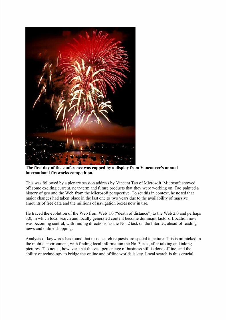
The first day was capped by a magnificent fireworks display, part of Vancouver’s annualinternational fireworks competition. This was part of the Night at the Museum dinner receptionsponsored by Oracle and Microsoft and held at the Vancouver City Museum. Day Two
Day two of the conference part was kicked off by keynoter Geoff Zeiss, vice president for technology at Autodesk, who reflected on the changing state of infrastructure design/development,especially in North America and Europe, and the particular challenges for IT professionalsoccasioned by an aging workforce, and an aging and deteriorating infrastructure. He saw in these
challenges unique opportunities to bridge the gaps between CAD/design and GIS/operations, pointing to developments in Building Information Models (BIM) and IFC, which allowed object-oriented views of buildings (building as composed of meaningful components). He stressed therole of open standards (such as GML) and open-source software to help bridge the gaps. Zeiss noted that huge sums of money were being spent on construction, but, during the last decade, productivity in the sector had actually decreased. He decried the “islands of information” thatisolated design, construction and operation, leading to huge inefficiencies and operationaldatabases that were inaccurate and at times useless. He stressed that the inability of the utilitysector to enfranchise its field workforce to assist in data collection and verification had further eroded the accuracy and utility of operational databases.
He felt, however, that these problems could be solved and the keys to the solution lay inconvergence (CAD/BIM/GIS), enfranchisement of the field-operations staff (i.e., user-generateddata), open standards (OGC, ISO, IFC, etc.) and open source. For the latter, he tried to dispelcommon myths of open source, noting that corporations and individuals had made a lot of successfrom open-source projects in GIS and the wider IT world. He urged those interested in open sourceto look at software at http://www.osgeo.org. Further paper presentations followed his address, again in three parallel tracks. The afternoon started with vendor spotlights: vendor presentations that didn’t compete with
anything but networking.
7/28/2019 GeoWeb 2007 Deemed a Success
http://slidepdf.com/reader/full/geoweb-2007-deemed-a-success 5/7
The first day of the conference was capped by a display from Vancouver’s annualinternational fireworks competition.
This was followed by a plenary session address by Vincent Tao of Microsoft. Microsoft showedoff some exciting current, near-term and future products that they were working on. Tao painted ahistory of geo and the Web from the Microsoft perspective. To set this in context, he noted thatmajor changes had taken place in the last one to two years due to the availability of massiveamounts of free data and the millions of navigation boxes now in use.
He traced the evolution of the Web from Web 1.0 (“death of distance”) to the Web 2.0 and perhaps3.0, in which local search and locally generated content become dominant factors. Location now
was becoming central, with finding directions, as the No. 2 task on the Internet, ahead of readingnews and online shopping.
Analysis of keywords has found that most search requests are spatial in nature. This is mimicked inthe mobile environment, with finding local information the No. 3 task, after talking and taking pictures. Tao noted, however, that the vast percentage of business still is done offline, and theability of technology to bridge the online and offline worlds is key. Local search is thus crucial.
7/28/2019 GeoWeb 2007 Deemed a Success
http://slidepdf.com/reader/full/geoweb-2007-deemed-a-success 6/7
He saw the future evolution in terms of a series of steps: maps and directions (“where is thisdentist?”), then map search plus yellow pages (where we are today) to using local knowledge(“where is the best dentist in this area?”) and integrating local services (e.g., synch calendar withthat of the dentist).
Microsoft stresses a unified 2-D and 3-D model in one environment with tight coupling to all of theapplications in the user’s environment, such as Outlook, Hot Mail and MSN. He noted the differentneeds of the consumer, enterprise, enterprise developer and advertiser.
For Tao, the key was to provide rich application programming interfaces to empower thecommunity: “Microsoft will build the roads, and developers will build the cars to drive uponthem.” He envisaged a world with “millions of virtual Earths” and an open API to integrate theminto any desktop or Web-based application.
Like all of the speakers, he underscored the importance of user-generated data and localknowledge. And Microsoft provided a series of demonstrations showing the integration of Virtual
Earth and a host of other applications. He also showed off a preview of its PhotoSynth technologythat can generate 3-D geometry models from photographs mined from Flickr and similar Websites. Things then lightened up with two free-wheeling “Spark Sessions” dealing with Data Security and3-D Geo. The Data Security Spark Session featured three lead developers building a data securityinfrastructure for Web Services. This highlighted the use of the OASIS SAML/XACMLspecifications and feature. The 3-D Geo session offered varied opinions on the wisdom and possibility of separating presentation and content. Final Day
The final day of the conference was led off by a thoroughly engaging presentation by MichaelJones of Google, who reflected on talks during the week and asked the audience to reflect on thechanges that have happened in the last year. Jones raised and then answered two key questions. “What’s interesting about Google Earth?” He felt that it’s compelling to anyone, even if they haveno understanding of geo anything. What they like is that they can “see their house”; that the program is about them. “What is a GeoWeb?” What makes the Web a web isn’t the Internet. What makes it a web is thatthe documents are linked in a pattern, and this pattern provides semantic utility to users.
So the meaning of the GeoWeb is about linking geo data to other things and data. This is and wasthe missing part in the regular world of GIS and what makes the GeoWeb important. Tounderstand the importance of this, Jones asked the audience to look back on the Internet beforeAlta Vista. Wasn’t the Web like the geo world today? A lot of information, and a lot of peopletrying to catalog and organize this information, but no automated processes to collect, organize andenable the searching of this information.

7/28/2019 GeoWeb 2007 Deemed a Success
http://slidepdf.com/reader/full/geoweb-2007-deemed-a-success 7/7
All the efforts of national SDI projects (e.g., Geospatial Onestop and INSPIRE) really are projectsthat were and are driven by the need to link data about places to other information and other places. He also noted that people’s expectations respecting the use of geoinformation are changing rapidly.As for the regular Web (“the Web of documents”), where you have come to expect search to
provide a reasonably useful answer, we now are starting to expect that from our geo searches aswell. Jones illustrated these points using Google Earth and Google Maps, skillfully painting a story based on the conference and showing how he could share this with friends or the world at large. The conference wrapped early in the afternoon with a panel session on the Future of the GeoWeb2012, with Peter Batty, Jones, Tao and Lake. Each offered their vision of things five years hence.“I’ve been attending this conference for a number of years now, and it continues to get better eachyear,” said Michael Gerlek, LizardTech’s chief software architect. “Good technical papers,interesting panels and great opportunities for random interactions with some very bright people.”