gisconnex whitepaper rh v5
DESCRIPTION
GIS ConnectionTRANSCRIPT

1
White Paper
Published 07/30/2010
GISConneX The ESRI/SAP Integration Solution for
Asset Data Management
IMAGEM Software International
300 E State St., Redlands, CA 92373 •
Tel.: +1 909 991 8841 http://www.gisconnex.com

2
Summary
SUMMARY ........................................................................................................................................... 2
EXECUTIVE SUMMARY ...................................................................................................................... 3
COMPANY INFORMATION ................................................................................................................. 3
UTILITIES BUSINESS DRIVERS FOR INTEGRATION SAP AND GIS .............................................. 4
GISCONNEX - INTEGRATION SOFTWARE PRODUCT..................................................................... 5
Key software elements in GISConneX .............................................................................................. 5
Advantages of GISConneX ............................................................................................................... 5
HOW THE GISCONNEX SOLUTION MEETS ASSET INVENTORY MANAGEMENT BUSINESS REQUIREMENTS ................................................................................................................................. 7
GISConneX ADM functionalities ........................................................................................................ 7
GISConneX ADM Editor includes the following specific functionalities: ..................................... 7
GISConneX ADM Technical Object Map ........................................................................................ 8
IMPLEMENTATION AND RESOURCING STRATEGIES .................................................................... 8
GISConneX Installation ....................................................................................................................... 9
GISConneX Configuration ................................................................................................................. 9
GISConneX Customization ................................................................................................................. 9
GISConneX Training ............................................................................................................................ 9
HIGH LEVEL SCHEMATIC OF TECHNICAL ARCHITECTURE ....................................................... 10
Architectural Components description ......................................................................................... 10
ESRI/SAP REQUIRED SOFTWARE: ................................................................................................. 11
INFORMATION ON HARDWARE REQUIRED .................................................................................. 12

3
Executive Summary With GISConneX, a utility is able to optimize the use of SAP ERP and ESRI GIS, maximizing the
business advantages of the EAM (Enterprise Asset Management) implementation by creating a single operational picture of its asset and customer information. This approach has many business benefits as described in this document.
GISConneX is a packaged software solution supported through release cycles based on ESRI
and SAP state-of-the-art technology that provides tremendous benefits if compared with “home-made” alternatives. These benefits include: Faster Time to Value, Higher Return on Assets all with Lower total-cost-of-ownership in a supported and sustainable manner. GISConneX is a SAP certified solution.
Company Information
IMAGEM Software International is a Redlands, California-based technology company that provides packaged technology and extensive knowledge of the Utilities business, for improving the competitiveness and profitability of Utility companies through the integration of ERP (SAP) and GIS (ESRI) systems at the data, process and interface levels. Based on extensive experience with systems integration projects for large utility companies IMAGEM has developed the software solution package GISConneX.
GISConneX provides a COTS option for SAP and ESRI integrations. IMAGEM is an Official ESRI Partner and Official SAP Software Solution Partner.
Imagem US address: IMAGEM Software International 300 E State St., Redlands, CA 92373 • Tel.: +1 909 991 8841
Website: www.gisconnex.com Imagem Software International is a subsidiary of Imagem Sistemas de Informações Ltda, a
Brazilian company dedicated to GIS, providing end-to-end GIS solutions that include software, services and data.
Imagem is the exclusive distributor of ESRI and Miner&Miner products in Brazil and is among the top 10 international distributors of ESRI globally. Imagem has more than 200 employees and annual revenues are around 25 million US dollars.
Imagem experience with SAP integration began in 2001 with integration between GIS and SAP R/3 and SAP BW at ITAU Bank in São Paulo. SAP expertise was also developed at the large utility companies of AES Sul and AES Eletropaulo where ESRI GIS was integrated with PM, PS and MAM, after these integration experiences Imagem has transformed this expertise into the standard product GISConneX.

4
Utilities Business Drivers for Integration SAP and GIS
In utilities companies that use GIS and SAP separately, you could found disparate data, limited analytics, disconnected data from the field, lack of big picture and other problems. Integrating both you could have the best of both worlds as illustrated below.
GIS is the basis for the network topology and location of assets while SAP is the reference for
business processes and financial data. The integration of SAP and ESRI GIS in the context of EAM (Enterprise Asset Management)
results in process optimization and competitive advantages for utilities. The use of geospatial intelligence integrated with EAM, ensures that the company will have benefits from the full potential of ERP with all the versatility of GIS, supporting more accurate decision making, aligned with business needs.

5
GISConneX - Integration Software Product GISConneX is a software package product that provides built-in integration between SAP and
ESRI software. GISConneX assures information integrity between ESRI Feature and SAP objects with SAP certified calls and procedures and ESRI’s ArcObjects.
GISConneX’s software solution is based on ESRI and SAP state-of-the-art technology that provides tremendous benefits if compared with “home-made” alternatives. These benefits include: Faster Time to Value, Higher Return on Assets all with Lower TCO in a supported and sustainable manner.
Key software elements in GISConneX
Easily embeddable into customer environment;
Configurable – adapts to business processes and data models;
Keeps GIS Network Data and SAP Inventory Data secure;
Improves access to asset information to optimize work management process;
User friendly and intuitive interface;
Enables Transactional and Long Transaction environments;
Advantages of GISConneX GISConneX has many advantages over a fully customized solution. Some of these points
include:
Eliminates the need for intermediate databases and avoids point-to-point problems and data replication issues;
GISConneX manages the logical connection between ESRI features with SAP technical objects providing direct, real-time access to both systems data, avoiding data redundancy;
GISConneX uses standard ESRI and SAP transactions to handle operations like selecting a piece of equipment from the list, installing it at a functional location (created in GIS) and changing its status in SAP (system status and user status);
No batch process to export/import data required;
No need to develop and maintain custom interfaces between ESRI and SAP;
GISConneX is adaptable to current and future requirements through configuration and a scalable architecture;
GISConneX is based on market technology standards and is interoperable;
GISConneX provides Maintenance and Software Technical Support ensuring the continuity of the solution to updated SAP and ESRI versions;
Supports full data management integrity in SAP;
Quick deployment for ArcGIS and SAP environments as the integration points are already available
Easily deliver to ArcGIS developers the capability to build custom searches, manage SAP data and extend existent tools through the GISConneX API.

6
GISConneX Asset Data Management (ADM) is the ¨Foundation Module¨ that provides a seamless integration between ESRI GIS and SAP objects maintaining data integrity between the two systems. Clients can add additional modules such as:
GISConneX Work Management (WM) which extends the SAP functionalities to manage work orders and notifications to group work orders that should be executed by the same crew in the same area/ functional location;
GISConneX Project Design (PD) which integrates a graphical designing tool such as Telvent M&M Designer with SAP PS;
GISConneX Mobile which extends the functionalities of the previous modules to the field;
GISConneX Thematic Maps (TM) provide pre-defined map reports based on work maintenance data and history;
The modules of GISConneX software can be seen in the illustration below:
GISConneX Modules in the EAM Process
SAP PMPlant Maintenance
SAP PSProject System
SAP IS-UIndustry Solution for Utilities
SAP MIMobile Infrastructure
Customer Management(GISConneX CM)
Project Design(GISConneX PD)
Work Management(GISConneX WM)
Asset Data Management(GISConneX ADM)
Mobile (GISConneX Mobile)
Call Center
Emergency Mgt
Planning, Designing, Construction
Maintenance
and
Work Order Management
Work Coordination and Scheduling
Mobile Workforce Mgt/ Crew routing & Vehicle Tracking
Analytics and Executive Dashboard
Compliance and Permitting
Thematic Maps(GISConneX TM)
ESRI
(Figure 1. – GISConneX System Context and Modules)

7
How the GISConneX solution meets Asset Management Business Requirements
GISConneX delivers Asset Management capabilities through an integrated approach that takes advantage of the SAP PM and ESRI ArcGIS Desktop functionalities. ArcGIS will provide the tools that are used to create, edit, and manage the assets. The GISConneX ADM module provides the tools for this Asset Management functionality and provides the integration with SAP. The ADM module allows that asset management be supported by network topology and geographical location in GIS and provides management data (SAP data) in the GIS interface and GIS data in the SAP interface.
GISConneX ADM functionalities
Provides automatic integration between ESRI features and corresponding SAP PM technical objects and SAP CCS service points;
Manages asset and customer data integrity between the systems assuring information quality and security;
Enable asset management using the network topology and geographical location;
Facilitates all controlling data (SAP data) in the ESRI interface (ArcMap);
Provides a GIS map view component in SAP user interface
GISConneX ADM Editor includes the following specific functionalities:
Create a functional location
Edit functional location fields
Remove a functional location
Find functional locations
Display functional location attributes
Create Equipment
Edit equipment fields
Installation of equipment
Replace equipment
Uninstall equipment
Find equipment
Display equipment attributes
Create service points
Change service points
.

8
Using ArcFM Using the product ArcFM from Telvent facilitates the customizing of GISConneX through the usage of AutoUpdaters technology. This technology enables the customization of the XI interfaces more easily, reducing the development effort through the use of a framework for customizing business rules already existing.
Remember that all ArcFM functionalities can still be used, like:
Deleting GIS version;
Control editing version;
Reconcile and post versions;
Display versions queue;
Management of version post queue;
Process Manager;
Process post queue;
Process reconcile;
Verify, manage and display special versions
GISConneX ADM Technical Object Map
This component of the GISConneX software suite adds the map interface to the SAP GUI for managing two important SAP technical objects: functional location and equipment. It includes the following functionality:
• Map Display inside SAP interface with GIS data (inside functional location and equipments transaction)
• Zoom to Current technical object
• View Control functions
• Map Information Tools
Implementation and resourcing strategies
Imagem Software International has an experienced implementation team and local implementation partners. Imagem cooperates with Integration Partners to properly define the scope of work for the GISConneX implementation and coordinates activities with the Integration Partner to ensure successful implementation of the GISCONNEX product.
Core Development is done at GISConneX offices. GISConneX would provide initial Database
and configuration setup workshops, training materials and initial onsite development support.
Related GISConneX implementation services shall include:
9
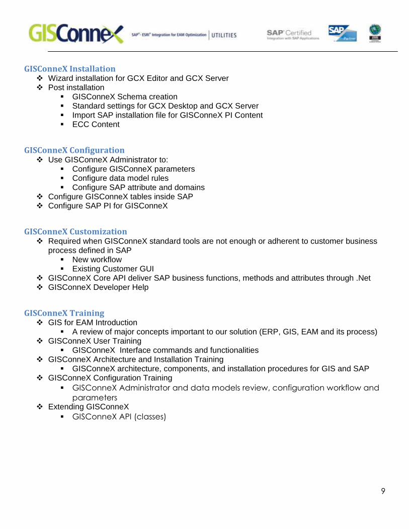
GISConneX Installation Wizard installation for GCX Editor and GCX Server Post installation
GISConneX Schema creation Standard settings for GCX Desktop and GCX Server Import SAP installation file for GISConneX PI Content ECC Content
GISConneX Configuration Use GISConneX Administrator to:
Configure GISConneX parameters Configure data model rules Configure SAP attribute and domains
Configure GISConneX tables inside SAP Configure SAP PI for GISConneX
GISConneX Customization Required when GISConneX standard tools are not enough or adherent to customer business
process defined in SAP New workflow Existing Customer GUI
GISConneX Core API deliver SAP business functions, methods and attributes through .Net GISConneX Developer Help
GISConneX Training GIS for EAM Introduction
A review of major concepts important to our solution (ERP, GIS, EAM and its process) GISConneX User Training
GISConneX Interface commands and functionalities GISConneX Architecture and Installation Training
GISConneX architecture, components, and installation procedures for GIS and SAP GISConneX Configuration Training
GISConneX Administrator and data models review, configuration workflow and
parameters Extending GISConneX
GISConneX API (classes)

10
High Level Schematic of Technical Architecture
Architectural Components description
GISConneX Software Architecture
ArcGIS Server
SAP ECCWeb Server
ArcMap
GISConneX Administrator
GISConneX Editor SQL
TCP/IP
SAP NetweaverPI
SOAP
GISConneXPI Content RFC
and
SOAP
Web Application
GISConneX Web API
GISConneX Server•GIS•Log Service•Interfaces•Post Service
GISConneX ECC Components•SAP GUI maps•ECC Interfaces•Standard BAPIs•Enterprise Services•GC ABAPs
Mob.Plat.Server
Windows Mobile
GISConneX Mobile
Mobile Plat. Client
GISConneX Mobile Broker
HTTPS RFC
SOAP
SQLTCP/IP
(Figure 2. GISConneX Architecture Diagram)
The GISConneX software components are highlighted in light green in the diagram above. GISConneX Editor is an ArcGIS Desktop Extension and is available with ArcMap. The GISConneX Editor handles all GISConneX ADM and PD use cases. GISConneX Administrator allows the user to configure basic parameter as the GISConneX database connections and set other user options and parameters. The GISConneX Server is the main software component for the system architect perspective. It is implemented on top of ArcGIS Server. It holds all GISConneX parameters, like data mapping and some GUI behavior. It also centralizes the GISConneX logging, executes batch posting, map services, check-out and check in services and hosts web application that implements the GISConneX Web API.

11
The GISConneX Web API component works on the GISConneX Server and it can be used to build web mapping applications that can deliver map data with SAP attributes through a web interface. It can be used to extend already existing web application in the organization or to create new ones. The GISConneX PI Content is pre-built, there is a SAP PI interfaces that implement the communication between SAP ECC and GISConneX Server and Editor. This content speeds up implementation as the others GISConneX components. The SAP PI interfaces are consumed through SOAP/XML, while the communication to SAP ECC can be both through RFC or SOAP/XML. GISConneX can also support other brokers beyond SAP Netweaver, or provide direct access to SAP ECC. At SAP ECC we also have ABAP add-on to allow GISConneX Components to deploy maps inside SAP GUI and to improve the interface capabilities and performance. Finally we have the GISConneX Mobile components. The GISCConneX Mobile Broker is responsible to control the data check in and check out to the mobile device. For the user the GISConneX Mobile will provide a map application with interfaces ready to communicate with the elected mobile platform client’s component. GISConneX supports ArcGIS Mobile and SAP MI or Syclo Agentry mobile platforms.
ESRI/SAP Required Software:
GISConneX
Component
Required ESRI License Required SAP License
GISConneX Administrator
and Editor
ArcGIS Editor SAP PI or other SOA Broker,
SAP Professional or SAP PUL
(platform User License)
GISConneX Server, ArcGIS Server Standard SAP ECC
(Version 4.7 and above)
Technical Object Map ArcGIS Server Standard SAP Professional (SAP Gui)
Work Browser ArcGIS Server Standard SAP PI or other SOA Broker,
SAP Professional or SAP Portal
WM Maint Planner
Workbench
ArcGIS Server Standard and
ArcGIS Desktop with ArcGIS
Spatial Analyst (optional)
SAP Professional (SAP GUI)
GISConneX EAM for Asset Data Management Enterprise License Agreement includes Software Maintenance and Support services for one year from the date of licenses activation (go-to-live date).

12
Information on Hardware required
The GISConneX solution has no special hardware requirements beyond that of SAP and ESRI software. ESRI desktop software has these requirements:
ArcInfo, ArcView, ArcEditor
CPU Speed 1.6 GHz recommended or higher
Processor Intel Core Duo, Pentium 4 or Xeon Processors
See Dual or dual-core support policy
Memory/RAM 1 GB minimum, 2 GB recommended or higher
If using the ArcSDE Personal Edition for Microsoft SQL Server Express software, 2 GB of RAM is
required.
Display Properties 24 bit color depth
Screen Resolution 1024 x 768 recommended or higher at Normal size (96dpi)
Swap Space Determined by the operating system, 500 MB minimum.
Disk Space 2.4 GB
In addition, up to 50 MB of disk space maybe needed in the Windows System directory (typically
C:\Windows\System32). You can view the disk space requirement for each of the 9.3 components in
the Setup program.
If using ArcGlobe (as part of 3D Analyst), additional disk space may be required. ArcGlobe will create
cache files when used.
Video/Graphics
Adapter
24-bit capable graphics accelerator
An OpenGL 1.3 or higher compliant video card is required, with at least 32 MB of video memory,
however 64 MB of video memory or higher is recommended.
Networking
Hardware
Simple TCP/IP, Network Card or Microsoft Loopback Adapter is required for the License Manager.