gpr ground penetrating radar. ground penetrating radar (gpr) is a tool archaeologists will use more...
Post on 20-Dec-2015
250 views
TRANSCRIPT
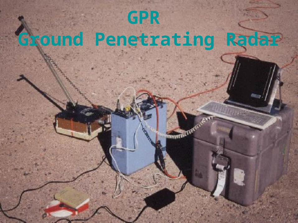
GPR Ground Penetrating Radar
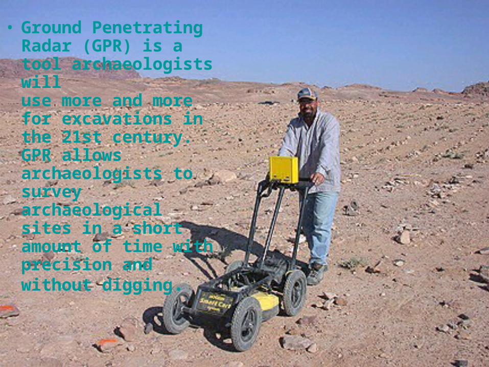
• Ground Penetrating Radar (GPR) is a tool archaeologists willuse more and more for excavations in the 21st century. GPR allows archaeologists to survey archaeological sites in a short amount of time with precision and without digging.
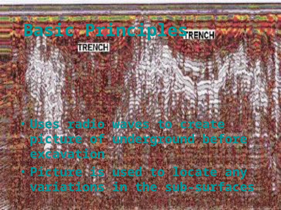
Basic Principles
• Uses radio waves to create picture of underground before excavation
• Picture is used to locate any variations in the sub-surfaces
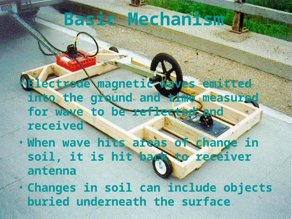
Basic Mechanism
• Electrode magnetic waves emitted into the ground and time measured for wave to be reflected and received
• When wave hits areas of change in soil, it is hit back to receiver antenna
• Changes in soil can include objects buried underneath the surface
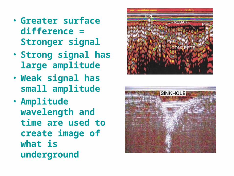
• Greater surface difference = Stronger signal
• Strong signal has large amplitude
• Weak signal has small amplitude
• Amplitude wavelength and time are used to create image of what is underground
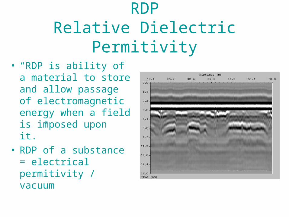
RDPRelative Dielectric Permitivity
• “RDP is ability of a material to store and allow passage of electromagnetic energy when a field is imposed upon it.”
• RDP of a substance = electrical permitivity / vacuum
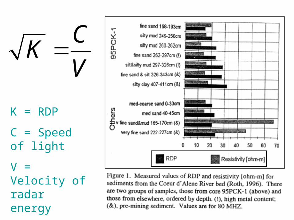
CK
V
K = RDP
C = Speed of light
V = Velocity of radar energy
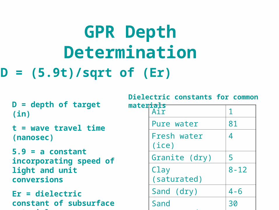
GPR Depth Determination
D = (5.9t)/sqrt of (Er)
D = depth of target (in)
t = wave travel time (nanosec)
5.9 = a constant incorporating speed of light and unit conversions
Er = dielectric constant of subsurface material
Air 1
Pure water 81
Fresh water (ice) 4
Granite (dry) 5
Clay (saturated) 8-12
Sand (dry) 4-6
Sand (saturated) 30
Dielectric constants for common materials
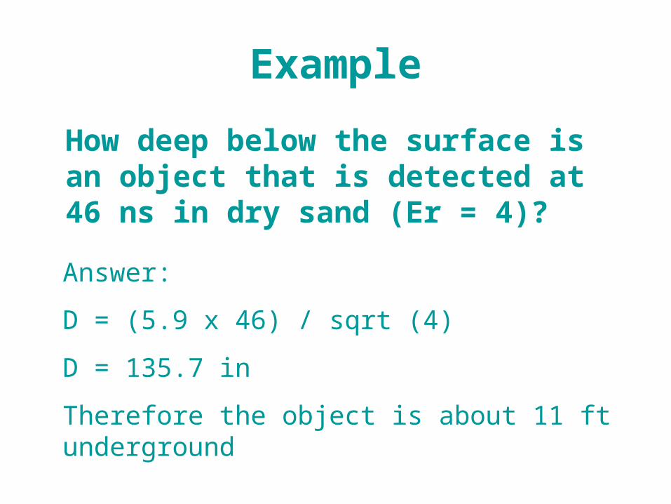
Example
How deep below the surface is an object that is detected at 46 ns in dry sand (Er = 4)?
Answer:
D = (5.9 x 46) / sqrt (4)
D = 135.7 in
Therefore the object is about 11 ft underground

Equipment
• Consists of:
1. control unit
2. display unit
3. transmitting and receiving unit
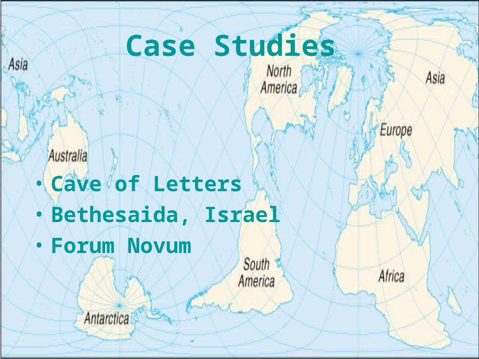
Case Studies
• Cave of Letters
• Bethesaida, Israel
• Forum Novum
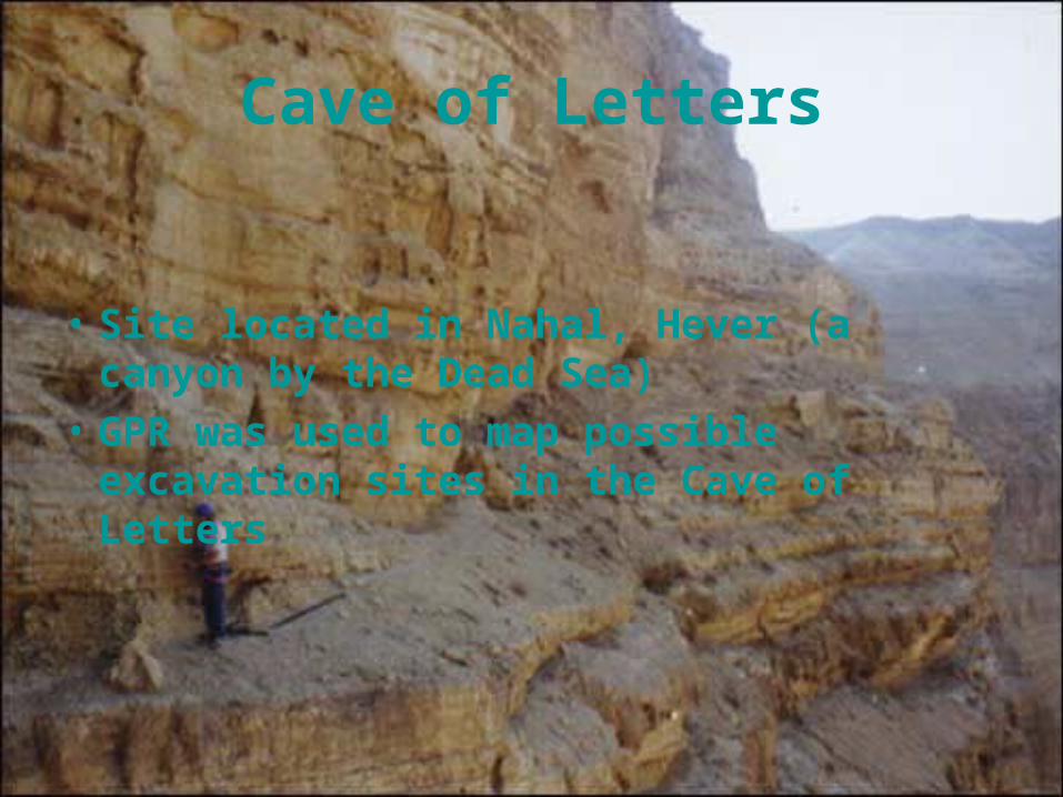
Cave of Letters
• Site located in Nahal, Hever (a canyon by the Dead Sea)
• GPR was used to map possible excavation sites in the Cave of Letters

Artifacts Found
• Coins
• Clothes
• Letters mentioning Jewish leader Bar-Kokhba who had fought against the Romans around the middle first century
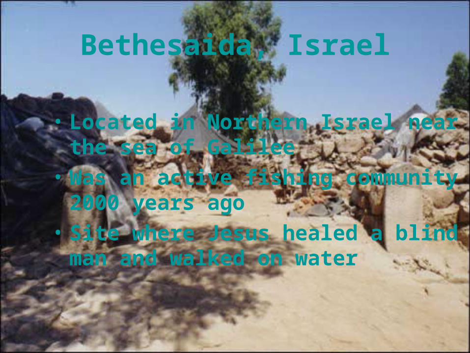
Bethesaida, Israel
• Located in Northern Israel near the sea of Galilee
• Was an active fishing community 2000 years ago
• Site where Jesus healed a blind man and walked on water

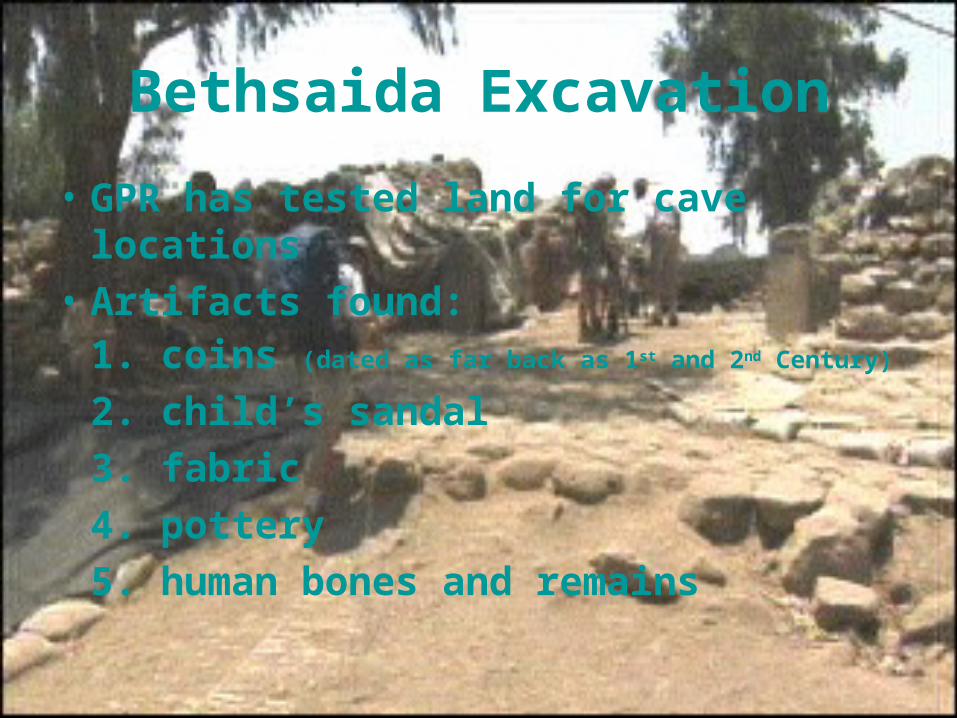
Bethsaida Excavation
• GPR has tested land for cave locations
• Artifacts found:1. coins (dated as far back as 1st and 2nd Century)
2. child’s sandal
3. fabric
4. pottery
5. human bones and remains
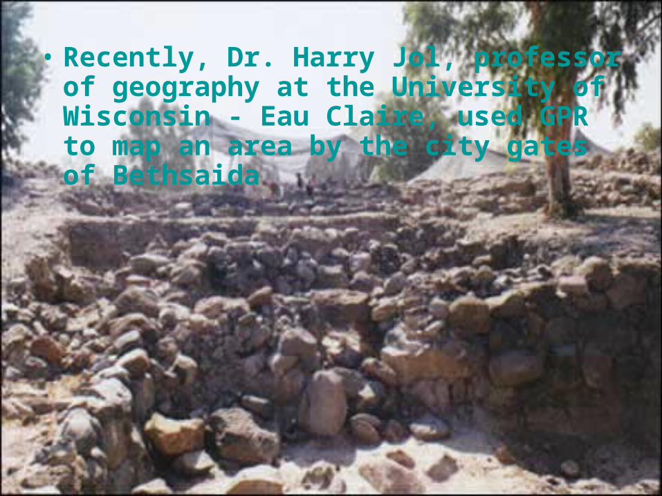
• Recently, Dr. Harry Jol, professor of geography at the University ofWisconsin - Eau Claire, used GPR to map an area by the city gates of Bethsaida
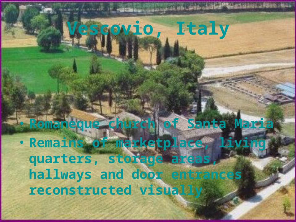
Vescovio, Italy
• Romaneque church of Santa Maria
• Remains of marketplace, living quarters, storage areas, hallways and door entrances reconstructed visually
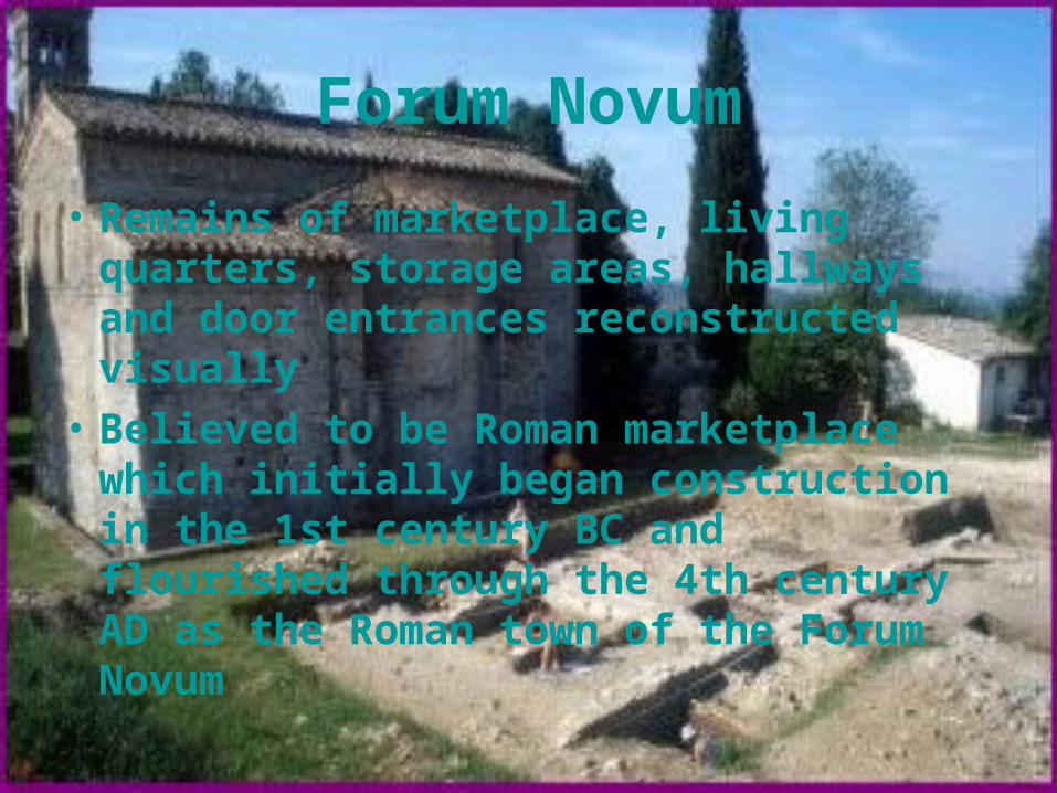
Forum Novum
• Remains of marketplace, living quarters, storage areas, hallways and door entrances reconstructed visually
• Believed to be Roman marketplace which initially began construction in the 1st century BC and flourished through the 4th century AD as the Roman town of the Forum Novum

Excavation
• British School of Archaeology in Rome have conducted excavation sites
• Sites include:
1. an amphitheatre
2. a bath complex
3. the villa
4. a tomb complex
5. crypts from the 8th to 9th centuries located behind the church

GPR reading from Forum Novum
Wrap up…
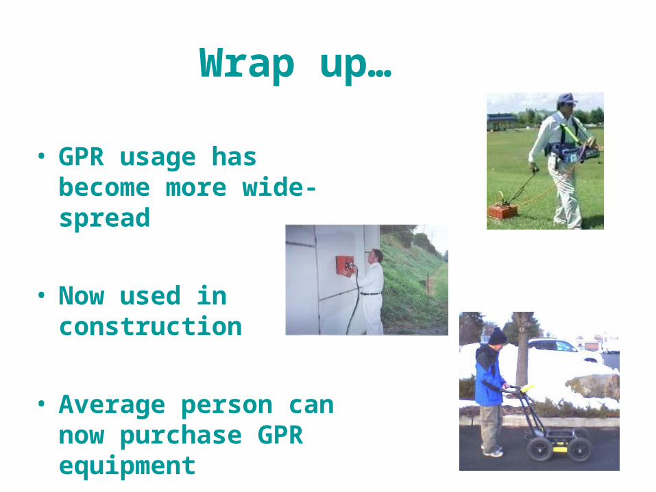
• GPR usage has become more wide-spread
• Now used in construction
• Average person can now purchase GPR equipment