grays harbor vessel traffic risk assessment (ghvtra)
TRANSCRIPT

Grays Harbor Vessel Traffic Risk Assessment (GHVTRA)
Hazard Identification Workshop 1 Handbook
January 2018

ii January 2018
Publication and Contact Information
For more information contact: Scott Ferguson
Spill Prevention, Preparedness and Response Program P.O. Box 47600 Olympia, WA 98504-7600 Phone: 360-407-7465
Washington State Department of Ecology - www.ecology.wa.gov
o Headquarters, Olympia 360-407-6000
o Northwest Regional Office, Bellevue 425-649-7000
o Southwest Regional Office, Olympia 360-407-6300
o Central Regional Office, Union Gap 509-575-2490
o Eastern Regional Office, Spokane 509-329-3400
STATE OF WASHINGTON
DEPARTMENT OF ECOLOGY
PO Box 47600 • Olympia, WA 98504-7600 • 360-407-6000
711 for Washington Relay Service• Persons with a speech disability can call 877-833-6341
December 29, 2017
Thank you for participating in the Grays Harbor Vessel Traffic Risk Assessment workshops! We areprivileged to have this opportunity to bring tribes and stakeholders together to identify ways we can improve oil spill prevention and response preparedness in this significant waterway and ecosystem. Yourparticipation is vital to ensure we consider all relevant information, and produce the best possible information and regionally specific recommendations from this work.
To ensure you are able to fully participate, please take time to review this handbook before the
workshop. You'll find the workshop agenda, background information, instructions on what we would like participants to do ahead of time, and templates to help you capture your thoughts. The templates willbe used during the workshop to structure our conversations and record everyone's contributions.
We are fortunate to live in an area with unparalleled social, cultural, economic, and environmental resources and opportunities. Our region is also unique in the robust and effective forums that exist to improve maritime safety and prevent oil from entering the water. Participants in these forums includetribes, government agencies, industry, nongovernmental organizations, and citizens, each with an important role to play and interests to safeguard. The state legislature recognizes the damage that an oilspill on our waters could cause to our resources, and they have consistently invested in a comprehensive Spills Prevention, Preparedness, and Response program to mitigate these risks. The Grays Harbor VesselTraffic Risk Assessment is an important step in our work to protect our states sensitive resources. As a result of all of these factors, Washington has one of the lowest spill rates in the nation.
However, we all realize that a major spill could be catastrophic. In keeping with the collaborative natureof our maritime forums, we look forward to forthright and detailed conversations about how we can continue to improve spill prevention and preparedness. Thank you again for dedicating your time andenergy to this important shared work.
I look forward to seeing you at the workshop.
Sincerely,
Dale Jensen
Program M:Jager Spill Prevention, Preparedness, and Response
�
iii January 2018
iv January 2018
Grays Harbor Vessel Traffic Risk Assessment (GHVTRA)
Hazard Identification Workshop 1 Handbook
SPPR Program
Washington State Department of Ecology
Olympia, Washington

v January 2018
This page is purposely left blank

vi January 2018
Contents Publication and Contact Information .................................................................................. ii
Workshop Agenda ...............................................................................................................1
Hazard Identification Scope ...........................................................................................1
Expected Outcomes .......................................................................................................1
Agenda ...........................................................................................................................1
About this Handbook ...........................................................................................................3
Grays Harbor Vessel Traffic Risk Assessment ....................................................................4
Background ....................................................................................................................4
Goals ..............................................................................................................................4
Process ...........................................................................................................................4
Initial Focus ...................................................................................................................5
Workshop Schedule .......................................................................................................6
Hazard Identification ...........................................................................................................6
Background ....................................................................................................................6
Approach ........................................................................................................................6
Hazard Identification Scope ..................................................................................6
Expected outcomes ................................................................................................8
Process ...................................................................................................................8
Workshop Materials ...........................................................................................................10
Waterway Areas ...........................................................................................................10
Hazard Identification Templates ..................................................................................12
Instructions ..........................................................................................................12
Template 1: Area 1, Underway, Collision ...........................................................13
Template 2: Area 1, Underway, Allision/Grounding ..........................................14
Template 3: Area 1, Underway, Structural Failure/Flooding ..............................15
Template 4: Area 2, Underway, Collision/Allision/Grounding ..........................16
Template 5: Area 2, Anchored, Allision/Grounding ...........................................17
Template 6: Area 3, Underway, Collision/Allision/Grounding ..........................18
Template 7: Area 4, Underway, Collision/Allision/Grounding ..........................19
Template 8: Area 4, Mooring/Unmooring, Collision/Allision/Grounding .........20
Template 9: Area 4, Moored, Oil Spill ................................................................21

vii January 2018
Template 10: Area 4, Moored, Fire/Explosion ....................................................22
Glossary and References ....................................................................................................23
Glossary .......................................................................................................................23
References ....................................................................................................................26

GHVTRA Hazard Identification Workshop 1 Participant Handbook
1 January 2018
Workshop Agenda
Hazard Identification Scope Conduct a series of workshops to:
• Identify local factors associated with hazards to commercial vessel operations in GraysHarbor that could result in an oil spill
• Develop regionally specific recommendations to improve oil spill prevention andpreparedness
Expected Outcomes The workshop will produce a list of local factors related to oil spill hazards for commercial cargo, passenger, towing and tank vessels greater than 300 gross tons.
Agenda 8:30 WELCOME AND INTRODUCTIONS – Dale Jensen, Program Manager, WA State
Dept. of Ecology Spill Prevention, Preparedness, and Response Program
8:40 SAFETY BRIEFING AND WORKSHOP OVERVIEW – Scott Ferguson and Brian Kirk; WA State Dept. of Ecology Spill Prevention, Preparedness, and Response Program; Workshop Facilitators
• Safety procedures• Grays Harbor Vessel Traffic Risk Assessment process• Hazard Identification Workshop 1 scope and objectives• Agenda Review• Meeting ground rules and decision making approach
9:00 HAZARD IDENTIFICATION PROCESS
• Waterway Areas• Template Review
9:15 HAZARD IDENTIFICATION
• Structured brainstorming using templates
10:30 BREAK

GHVTRA Hazard Identification Workshop 1 Participant Handbook
2 January 2018
10:45 HAZARD IDENTIFICATION, CONTINUED
• Structured brainstorming using templates
12:00 WORKING LUNCH
• Discuss Response Capability Workshop;• Discuss Commercial Fishing, Tribal Fishing, and Recreational Vessel Oil Spill
Prevention and Response Workshop; or• Continue hazard identification, if required based on progress
12:45 HAZARD IDENTIFICATION, CONTINUED
• Structured brainstorming using templates
3:45 BREAK/PREPARE WORKSHOP OUTPUT
4:00 REVIEW OUTPUT FROM WORKSHOP
• List of local factors• Other ideas/considerations identified by participants
4:15 OVERVIEW OF HAZARD IDENTIFICATION WORKSHOP 2
4:30 ADJOURN

GHVTRA Hazard Identification Workshop 1 Participant Handbook
3 January 2018
About this Handbook This handbook is intended to provide you with all the material you will need to successfully prepare for, and participate in, the Grays Harbor Vessel Traffic Risk Assessment Hazard Identification Workshop 1.
Before the workshop, please review this handbook, and complete the “Local Factors” section of the Hazard Identification templates. Detailed instructions are on page 12.
Additional handbooks will be provided for the other workshops in this assessment, including Hazard Identification Workshop 2, the Response Capability Workshop, and the Commercial Fishing, Tribal Fishing, and Recreational Vessel Oil Spill Prevention and Preparedness Workshop.
The following two sections of the handbook give background information on the Grays Harbor Vessel Traffic Risk Assessment, and describe our approach to Hazard Identification.
The Workshop Material section has a figure showing the waterway, and the hazard identification templates that we will complete during the workshop.
A glossary and references are provided at the end of the handbook to help you prepare for the workshop, and for your use during the workshop.

GHVTRA Hazard Identification Workshop 1 Participant Handbook
4 January 2018
Grays Harbor Vessel Traffic Risk Assessment
Background Ecology received funding in the 2017-2019 budget to continue our oil spill prevention risk assessment work. Our current funding supports a risk assessment for oil spills from commercial vessels in Grays Harbor, and a rail traffic risk assessment. This builds on previous work, including:
• 2014 Marine and Rail Oil Transportation Study (Ecology, 2015)• 2015 update to a vessel traffic risk assessment for Strait of Juan de Fuca, Puget Sound,
San Juan Islands and connecting waterways (Van Dorp, 2017)• 2016 Salish Sea Oil Spill Risk Reduction Workshop (Ecology, 2016)• 2017 Columbia River Vessel Traffic Evaluation and Safety Risk Assessment (Ecology,
2017)
Goals The goals of the Grays Harbor Vessel Traffic Risk Assessment are to:
• Assess baseline and changing oil spill risks from commercial vessels operating in GraysHarbor
• Identify measures that could help reduce the risks of oil spills• Assess oil spill response preparedness• Identify baseline response capability
Process Ecology is following the International Maritime Organization (IMO) Formal Safety Assessment (FSA) process to conduct the Grays Harbor Vessel Traffic Risk Assessment (IMO, 2002). Adopted by the IMO in 2002, Formal Safety Assessments use a structured and systematic methodology to assess the risks relating to maritime safety and the protection of the marine environment, and for evaluating the costs and benefits of options for reducing these risks (IMO, 2002). The FSA process includes the following steps:
• Preparatory Stepo Definition of Goals, Systems, Operations
• Step 1: Hazard Identification• Step 2: Risk Analysis• Step 3: Risk Control Options• Step 4: Cost Benefit Assessment• Step 5: Recommendations for Decision Making

GHVTRA Hazard Identification Workshop 1 Participant Handbook
5 January 2018
Initial Focus Ecology’s focus during fiscal year 2018 (July 1, 2017 – June 30, 2018), is completing the preparatory step and Step 1, Hazard Identification. We are facilitating two workshops to conduct the Hazard Identification. Two additional workshops will extend the Hazard Identification process. The first will discuss oil spill response preparedness and the second will focus on commercial fishing, tribal fishing, and recreational vessel oil spill prevention and preparedness. A schedule of all workshops is shown below.
During the first Hazard Identification workshop, participants will review potential incidents that could result in oil spills from commercial vessels, with a goal of identifying any local factors that could contribute to these incidents. Examples of local factors may include a submerged jetty that could contribute to vessel grounding risks, or a sharp turn in a channel that could contribute to collision and allision risks. The list of local factors will be the primary outcome of the first workshop.
In the second Hazard Identification workshop, participants will discuss each local factor listed in the first workshop, and identify any safeguards currently in place to prevent the incident, and any high-level recommendations that could improve oil spill prevention.
The Hazard Identification is centered on the discussion of local factors, rather than other risk components, such as the relative frequency of vessel incidents, or the consequence of oil spills, for two reasons.
First, commercial vessel incidents, like collisions or groundings resulting in an oil spill, are relatively rare events both globally and in the historical data available for Grays Harbor. Ecology data for 2007-2017 show only one oil spill from a large commercial vessel: a 1-gallon hydraulic oil spill from a cargo ship in 2011 (Ecology, 2017a). The last major oil spill in the vicinity of Grays Harbor was the oil barge Nestucca in December, 1988 (NOAA, 2017). Rather than ask participants to provide qualitative judgments about the likelihood of these relatively rare events, the workshop seeks to benefit from local knowledge and expertise about the commercially navigable waterway.
Additionally, the overall Grays Harbor Vessel Traffic Risk Assessment and the Hazard Identification workshops are intended to improve oil spill prevention and preparedness. It is beyond the scope of this assessment to model potential spill consequences in terms of the fate, transport, and effect of spilled oil.
The risk assessment process may end, or pause, after the Hazard Identification is complete. Ecology anticipates making a decision on whether to continue with Steps 2-5 of the FSA process in the spring of 2018 based on the results of the Hazard Identification, and possible changes in Agency and fiscal direction. In addition to this risk assessment, Ecology has a role in the State Environmental Policy Act (SEPA) process for any permitting decisions related to vessel traffic and oil movement.

GHVTRA Hazard Identification Workshop 1 Participant Handbook
6 January 2018
Workshop Schedule Date Event
January 25, 2018 Hazard Identification Workshop 1 Port of Grays Harbor
February 28, 2018 Hazard Identification Workshop 2 Port of Grays Harbor
March 28, 2018 Response Capability Workshop McCausland Hall, Westport Maritime Museum
TBD Commercial Fishing, Tribal Fishing, and Recreational Vessel Oil Spill Prevention and Preparedness Workshop
June, 2018 Hazard Identification and Response Capability Preliminary Report
Hazard Identification
Background Hazard Identification is first step in the Formal Safety Assessment process. The purpose of this step is to identify a list of hazards and associated scenarios, prioritized through the use of screening criteria, which are specific to the problem under review (IMO, 2002). Hazard Identification can be accomplished through a variety of techniques, such as structured group brainstorming or Fault Tree Analysis (ABS, 2000).
Approach Ecology will facilitate structured brainstorming discussions to accomplish the Hazard Identification process. The scope, expected outcomes, and process are described below.
Hazard Identification Scope Conduct a series of workshops to:
• Identify local factors associated with hazards to commercial vessel operations in GraysHarbor that could result in an oil spill
• Develop regionally specific recommendations to improve oil spill prevention andpreparedness.

GHVTRA Hazard Identification Workshop 1 Participant Handbook
7 January 2018
Details:
• Hazards include hazards to navigation and vessel incidents that could result in an oil spill(e.g., collision, allision, grounding, flooding; fire/explosion; structural failure)
o Includes consideration of meteorological/hydrographic condition, e.g., highwinds, heavy seas, fog, and tides and currents including cyclical changes and tidalextremes
o Does not include region wide hazards, e.g., Cascadia Subduction Zoneearthquake/tsunami
• The fate and effect of spilled oil will be considered during the Response CapabilityAssessment workshop. In-depth consideration of the environmental, cultural, oreconomic impacts of the spilled oil is beyond the scope of the Hazard Identification andResponse Capability Assessment.
• Geographic boundarieso Offshore from buoy “GH” (approximately 5nm offshore) to Weyerhaeuser
Company Bay City Log Export, Berths 1 and 2o Workshop may include discussion of offshore vessel traffic management practices
westward of buoy “GH”, as noted on templates 1 and 2
• Types of vessels:o Commercial cargo, passenger, towing, fishing, and tank vessels > 300 gross tons
Includes specific hazards for different vessel types (e.g., considerations forgrain ships, car carriers, etc.)
o Commercial and tribal fishing vessels and recreational vessels < 300 gross tons Will be considered during the Hazard Identification workshops as
operations that could impact a commercial cargo, passenger, towing,fishing, or tank vessel > 300 gross tons
Ecology is planning a workshop to discuss commercial and tribal fishingvessel and recreational vessel oil spill prevention and preparedness forvessels < 300 gross tons
• Oil spillso Oil as defined by the state of Washington RCW 90.56.010: "Oil" or "oils" means
oil of any kind that is liquid at twenty-five degrees Celsius and one atmosphere ofpressure and any fractionation thereof, including, but not limited to, crude oil,bitumen, synthetic crude oil, natural gas well condensate, petroleum, gasoline,fuel oil, diesel oil, biological oils and blends, oil sludge, oil refuse, and oil mixedwith wastes other than dredged spoil. Oil does not include any substance listed inTable 302.4 of 40 C.F.R. Part 302 adopted August 14, 1989, under section 102(a)of the federal comprehensive environmental response, compensation, and liabilityact of 1980, as amended by P.L. 99-499

GHVTRA Hazard Identification Workshop 1 Participant Handbook
8 January 2018
• Vessel activities and incidentso Definitions for vessel activities, incident types, immediate causes, and
contributing factors are provided in the Glossary, and are adapted from 46 CFR,RCW 88.46, WAC 317-31, and the Pacific States/British Columbia Oil Spill TaskForce Data Dictionary
• Timeframeo Focus on current hazardso Hazard Identification workshops will include qualitative discussions of potential
changes in hazards or offshore vessel traffic management practices as a result ofany projects that are proposed at the time of the workshops
Expected outcomes • Workshop 1:
o A list of local factors related to oil spill hazards for commercial cargo, passenger,and tank vessels
• Workshop 2:o For each local factor identified in Workshop 1 – A description of the causes of the
hazard, safeguards intended to prevent the hazard, and any high-levelrecommendations to reduce the likelihood or consequence of the hazard
o Description of any identified potential changes to hazards due to changes in vesseltraffic related to proposed projects
• Following Workshop 2:o A report documenting the Hazard Identification process, workshops, and resultso This report will be combined with the report of the Response Capability
Preparedness workshop, and the planned workshop discussing commercialfishing, tribal fishing, and recreational vessel oil spill prevention and preparedness
Process Ecology will facilitate structured brainstorming discussions to review vessel incidents that could result in an oil spill (e.g., collisions, allisions, groundings, fires/explosions, structural failure). As described above, the goal of these discussions is to identify any local factors that could contribute to vessel incidents. Examples of local factors may include a submerged jetty that could contribute to vessel grounding risks, or a sharp turn in a channel that could contribute to collision and allision risks.
Hazard identification templates, provided in the Workshop Material section, will be used to promote a systematic consideration of potential local factors. The templates are organized by areas of the waterway, vessel activity, and incident type. Ecology will review each template with workshop participants, and encourage participants to contribute to the discussion of local factors.

GHVTRA Hazard Identification Workshop 1 Participant Handbook
9 January 2018
This page is purposely left blank

GHVTRA Hazard Identification Workshop 1 Participant Handbook
10 January 2018
Workshop Materials
Waterway Areas
4 3
2 1
Study boundary Waterway Area division line
Discussion of offshore vessel traffic management may extend westward of buoy “GH”

GHVTRA Hazard Identification Workshop 1 Participant Handbook
11 January 2018
This page is purposely left blank

GHVTRA Hazard Identification Workshop 1 Participant Handbook
12 January 2018
Hazard Identification Templates
Instructions The templates in this handbook will be used to identify and record local factors associated with hazards to commercial vessel operations in Grays Harbor that could result in an oil spill.
To aid your participation in the workshop, please follow these steps:
Before the workshop
• Review each template• Refer to the Waterway Areas figure for a visual depiction of each area
o The text description of each area is intended to be generalo If there are differences between the text description and the figure, use the area as
shown in the figure• Consider how the incident described on the template could occur• Examples of possible causes and contributing factors are provided on each template; feel
free to add to these as needed• Think about specific features or characteristics of conducting vessel operations in Grays
Harbor that could contribute to the incidento General examples of these local factors could include
Water depth Navigational channel configuration Tide/current variations Seasonal changes in weather Local operating practices and procedures
o This is not a complete list – we are counting on your knowledge and expertise tohelp identify as many local factors as possible
o Write your list of local factors in the space provided on the templateo Please include specific details. This will improve the process, and will add to the
accuracy and usefulness of the outcomes from the workshop
During the workshop
• Use your list of local factors, and any causes and contributing factors you identified, tocontribute to the discussion of each template

GHVTRA Hazard Identification Workshop 1 Participant Handbook
13 January 2018
Template 1: Area 1, Underway, Collision Using this template
• See complete instructions in the Grays Harbor Vessel Traffic Risk Assessment(GHVTRA) Hazard Identification Workshop 1 Participant Handbook, page 12.
• Before the workshop, review each template and consider the described incidento Examples of how the incident could occur and possible causes are provided. Add
to these as neededo Think about local factors (specific features or characteristics of operating a
commercial vessel in Grays Harbor) that could contribute to the incidento Write your list of local factors on this template
• During the workshop, use your list of local factors, and any causes and contributingfactors you identified, to contribute to the discussion of each template
Area 1: Bar Channel and Entrance Channel to Point Chehalis Reach (inside buoy 11) Vessel Activity: Underway Incident Category: Collision
How could an incident occur? • Contact with a fishing net or crab pot• Difficulty crossing the bar• Failure to maintain position in channel• Failure to negotiate turn to entrance channel• Failure to take action to avoid another vessel• Incident related to vessels offshore, including areas westward of buoy “GH”
Possible immediate causes/contributing factors (examples) • Environmental• Equipment failure
o Resulting in full or partial loss of electrical powero Resulting in full or partial loss of propulsiono Resulting in loss of navigational equipmento Resulting in loss of steering
• Human error• Organization/maintenance failure• Other
Local factors • • •

GHVTRA Hazard Identification Workshop 1 Participant Handbook
14 January 2018
Template 2: Area 1, Underway, Allision/Grounding Using this template
• See complete instructions in the Grays Harbor Vessel Traffic Risk Assessment(GHVTRA) Hazard Identification Workshop 1 Participant Handbook, page 12
• Before the workshop, review each template and consider the described incidento Examples of how the incident could occur and possible causes are provided. Add
to these as neededo Think about local factors (specific features or characteristics of operating a
commercial vessel in Grays Harbor) that could contribute to the incidento Write your list of local factors on this template
• During the workshop, use your list of local factors, and any causes and contributingfactors you identified, to contribute to the discussion of each template
Area 1: Bar Channel and Entrance Channel to Point Chehalis Reach (inside buoy 11) Vessel Activity: Underway Incident Category: Allision/Grounding
How could an incident occur? • Contact with a buoy, fishing net or crab pot• Contact with jetty• Difficulty crossing the bar• Failure to maintain position in channel• Failure to negotiate turn to entrance channel• Ground outside harbor• Ground outside of entrance channel• Ground on submerged jetty• Incident related to vessels offshore, including areas westward of buoy “GH”
Possible immediate causes/contributing factors (examples) • Environmental• Equipment failure
o Resulting in full or partial loss of electrical powero Resulting in full or partial loss of propulsiono Resulting in loss of navigational equipmento Resulting in loss of steering
• Human error• Organization/maintenance failure• Other
Local factors ••

GHVTRA Hazard Identification Workshop 1 Participant Handbook
15 January 2018
Template 3: Area 1, Underway, Structural Failure/Flooding Using this template
• See complete instructions in the Grays Harbor Vessel Traffic Risk Assessment(GHVTRA) Hazard Identification Workshop 1 Participant Handbook, page 12
• Before the workshop, review each template and consider the described incidento Examples of how the incident could occur and possible causes are provided. Add
to these as neededo Think about local factors (specific features or characteristics of operating a
commercial vessel in Grays Harbor) that could contribute to the incidento Write your list of local factors on this template
• During the workshop, use your list of local factors, and any causes and contributingfactors you identified, to contribute to the discussion of each template
Area 1: Bar Channel and Entrance Channel to Point Chehalis Reach (inside buoy 11) Vessel Activity: Underway Incident Category: Structural Failure/Flooding
How could an incident occur? • Severe weather conditions while crossing bar
Possible immediate causes/contributing factors (examples) • Environmental• Equipment failure• Human error• Organization/maintenance failure• Other
Local factors • • •

GHVTRA Hazard Identification Workshop 1 Participant Handbook
16 January 2018
Template 4: Area 2, Underway, Collision/Allision/Grounding Using this template
• See complete instructions in the Grays Harbor Vessel Traffic Risk Assessment(GHVTRA) Hazard Identification Workshop 1 Participant Handbook, page 12
• Before the workshop, review each template and consider the described incidento Examples of how the incident could occur and possible causes are provided. Add
to these as neededo Think about local factors (specific features or characteristics of operating a
commercial vessel in Grays Harbor) that could contribute to the incidento Write your list of local factors on this template
• During the workshop, use your list of local factors, and any causes and contributingfactors you identified, to contribute to the discussion of each template
Area 2: Point Chehalis Reach and South Reach to buoys 17/18; North Channel; Westport Marina
Vessel Activity: Underway Incident Category: Collision/Allision/Grounding
How could an incident occur? • Contact with a buoy• Failure to maintain position in channel• Failure to negotiate turn to South Reach• Failure to take action to avoid another vessel• Ground outside of channel
Possible immediate causes/contributing factors (examples) • Environmental• Equipment failure
o Resulting in full or partial loss of electrical powero Resulting in full or partial loss of propulsiono Resulting in loss of navigational equipmento Resulting in loss of steering
• Human error• Organization/maintenance failure• Other
Local factors • • •

GHVTRA Hazard Identification Workshop 1 Participant Handbook
17 January 2018
Template 5: Area 2, Anchored, Allision/Grounding Using this template
• See complete instructions in the Grays Harbor Vessel Traffic Risk Assessment(GHVTRA) Hazard Identification Workshop 1 Participant Handbook, page 12
• Before the workshop, review each template and consider the described incidento Examples of how the incident could occur and possible causes are provided. Add
to these as neededo Think about local factors (specific features or characteristics of operating a
commercial vessel in Grays Harbor) that could contribute to the incidento Write your list of local factors on this template
• During the workshop, use your list of local factors, and any causes and contributingfactors you identified, to contribute to the discussion of each template
Area 2: Point Chehalis Reach and South Reach to buoys 17/18; North Channel; Westport Marina
Vessel Activity: Anchored Incident Category: Allision/Grounding
How could an incident occur? • Allision caused by a vessel underway• Drag anchor/Failure to maintain position in anchorage• Swing into another vessel while at anchor
Possible immediate causes/contributing factors (examples) • Environmental• Equipment failure
o Resulting in full or partial loss of electrical powero Resulting in full or partial loss of propulsiono Resulting in loss of navigational equipmento Resulting in loss of steering
• Human error• Organization/maintenance failure• Other
Local factors • • •

GHVTRA Hazard Identification Workshop 1 Participant Handbook
18 January 2018
Template 6: Area 3, Underway, Collision/Allision/Grounding Using this template
• See complete instructions in the Grays Harbor Vessel Traffic Risk Assessment(GHVTRA) Hazard Identification Workshop 1 Participant Handbook, page 12
• Before the workshop, review each template and consider the described incidento Examples of how the incident could occur and possible causes are provided. Add
to these as neededo Think about local factors (specific features or characteristics of operating a
commercial vessel in Grays Harbor) that could contribute to the incidento Write your list of local factors on this template
• During the workshop, use your list of local factors, and any causes and contributingfactors you identified, to contribute to the discussion of each template
Area 3: South Reach from buoys 17/18, Crossover Channel, and North Channel to buoy 35; South Channel
Vessel Activity: Underway Incident Category: Collision/Allision/Grounding
How could an incident occur? • Contact with a buoy or fishing net• Failure to maintain position in channel• Failure to negotiate turns in channel• Failure to take action to avoid another vessel• Ground outside of channel
Possible immediate causes/contributing factors • Environmental• Equipment failure
o Resulting in full or partial loss of electrical powero Resulting in full or partial loss of propulsiono Resulting in loss of navigational equipmento Resulting in loss of steering
• Human error• Organization/maintenance failure• Other
Local factors • • •
GHVTRA Hazard Identification Workshop 1 Participant Handbook
19 January 2018
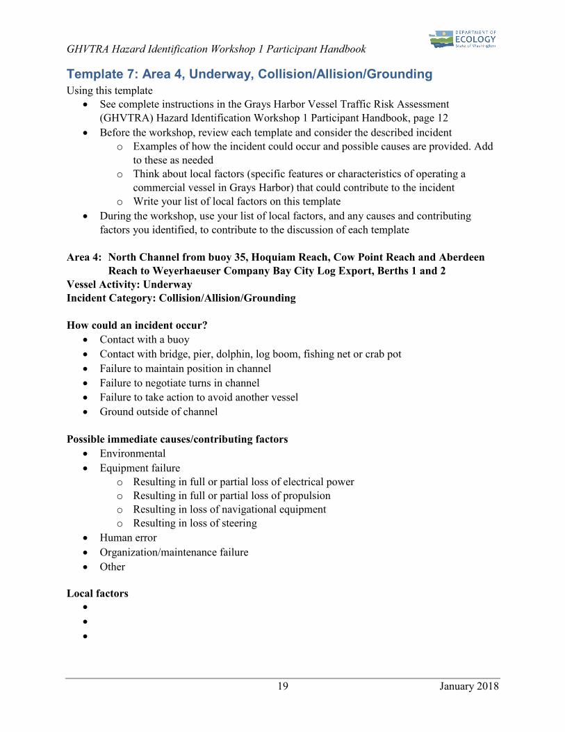
Template 7: Area 4, Underway, Collision/Allision/Grounding Using this template
• See complete instructions in the Grays Harbor Vessel Traffic Risk Assessment(GHVTRA) Hazard Identification Workshop 1 Participant Handbook, page 12
• Before the workshop, review each template and consider the described incidento Examples of how the incident could occur and possible causes are provided. Add
to these as neededo Think about local factors (specific features or characteristics of operating a
commercial vessel in Grays Harbor) that could contribute to the incidento Write your list of local factors on this template
• During the workshop, use your list of local factors, and any causes and contributingfactors you identified, to contribute to the discussion of each template
Area 4: North Channel from buoy 35, Hoquiam Reach, Cow Point Reach and Aberdeen Reach to Weyerhaeuser Company Bay City Log Export, Berths 1 and 2
Vessel Activity: Underway Incident Category: Collision/Allision/Grounding
How could an incident occur? • Contact with a buoy• Contact with bridge, pier, dolphin, log boom, fishing net or crab pot• Failure to maintain position in channel• Failure to negotiate turns in channel• Failure to take action to avoid another vessel• Ground outside of channel
Possible immediate causes/contributing factors • Environmental• Equipment failure
o Resulting in full or partial loss of electrical powero Resulting in full or partial loss of propulsiono Resulting in loss of navigational equipmento Resulting in loss of steering
• Human error• Organization/maintenance failure• Other
Local factors • • •

GHVTRA Hazard Identification Workshop 1 Participant Handbook
20 January 2018
Template 8: Area 4, Mooring/Unmooring, Collision/Allision/Grounding Using this template
• See complete instructions in the Grays Harbor Vessel Traffic Risk Assessment(GHVTRA) Hazard Identification Workshop 1 Participant Handbook, page 12
• Before the workshop, review each template and consider the described incidento Examples of how the incident could occur and possible causes are provided. Add
to these as neededo Think about local factors (specific features or characteristics of operating a
commercial vessel in Grays Harbor) that could contribute to the incidento Write your list of local factors on this template
• During the workshop, use your list of local factors, and any causes and contributingfactors you identified, to contribute to the discussion of each template
Area 4: North Channel from buoy 35, Hoquiam Reach, Cow Point Reach and Aberdeen Reach to Weyerhaeuser Company Bay City Log Export, Berths 1 and 2
Vessel Activity: Mooring/Unmooring Incident Category: Collision/Allision/Grounding
How could an incident occur? • Contact with a buoy• Contact with bridge, pier, dolphin, log boom, fishing net or crab pot• Failure to maintain position in channel• Failure to negotiate turns in channel• Failure to take action to avoid another vessel• Ground outside of channel• Hard hit by tug• Tug miscommunication
Possible immediate causes/contributing factors • Environmental• Equipment failure
o Resulting in full or partial loss of electrical powero Resulting in full or partial loss of propulsiono Resulting in loss of navigational equipmento Resulting in loss of steering
• Human error• Organization/maintenance failure• Other
Local factors • • •
GHVTRA Hazard Identification Workshop 1 Participant Handbook
21 January 2018
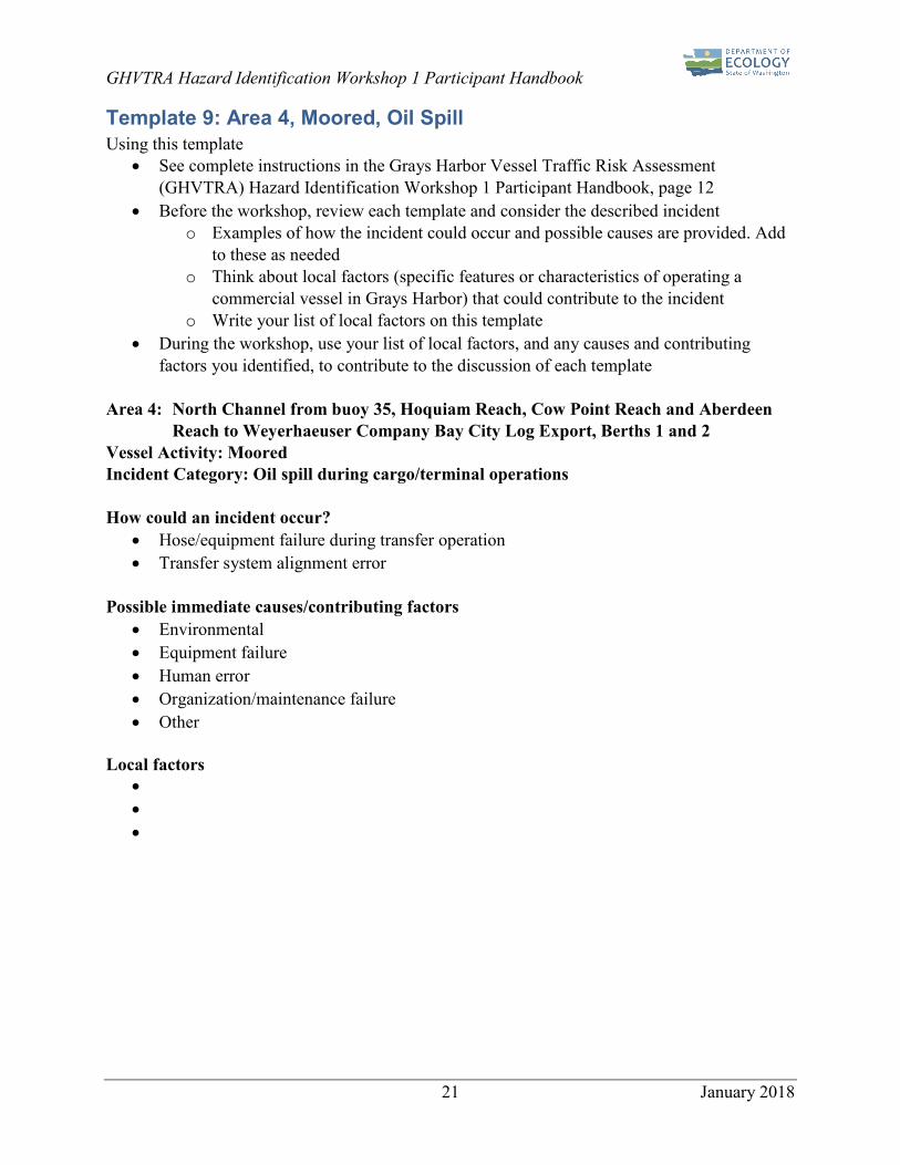
Template 9: Area 4, Moored, Oil Spill Using this template
• See complete instructions in the Grays Harbor Vessel Traffic Risk Assessment(GHVTRA) Hazard Identification Workshop 1 Participant Handbook, page 12
• Before the workshop, review each template and consider the described incidento Examples of how the incident could occur and possible causes are provided. Add
to these as neededo Think about local factors (specific features or characteristics of operating a
commercial vessel in Grays Harbor) that could contribute to the incidento Write your list of local factors on this template
• During the workshop, use your list of local factors, and any causes and contributingfactors you identified, to contribute to the discussion of each template
Area 4: North Channel from buoy 35, Hoquiam Reach, Cow Point Reach and Aberdeen Reach to Weyerhaeuser Company Bay City Log Export, Berths 1 and 2
Vessel Activity: Moored Incident Category: Oil spill during cargo/terminal operations
How could an incident occur? • Hose/equipment failure during transfer operation• Transfer system alignment error
Possible immediate causes/contributing factors • Environmental• Equipment failure• Human error• Organization/maintenance failure• Other
Local factors • • •

GHVTRA Hazard Identification Workshop 1 Participant Handbook
22 January 2018
Template 10: Area 4, Moored, Fire/Explosion Using this template
• See complete instructions in the Grays Harbor Vessel Traffic Risk Assessment(GHVTRA) Hazard Identification Workshop 1 Participant Handbook, page 12
• Before the workshop, review each template and consider the described incidento Examples of how the incident could occur and possible causes are provided. Add
to these as neededo Think about local factors (specific features or characteristics of operating a
commercial vessel in Grays Harbor) that could contribute to the incidento Write your list of local factors on this template
• During the workshop, use your list of local factors, and any causes and contributingfactors you identified, to contribute to the discussion of each template
Area 4: North Channel from buoy 35, Hoquiam Reach, Cow Point Reach and Aberdeen Reach to Weyerhaeuser Company Bay City Log Export, Berths 1 and 2
Vessel Activity: Moored Incident Category: Fire/Explosion
How could an incident occur? • Secondary to another accident• Electrical fire• Cargo fire/explosion
Possible immediate causes/contributing factors • Environmental• Equipment failure• Human error• Organization/maintenance failure• Other
Local factors • • •
GHVTRA Hazard Identification Workshop 1 Participant Handbook
23 January 2018
Glossary and References
Glossary Allision – vessel striking a fixed or semi-fixed object such as a pier, bridge, an anchored vessel, or buoy. (adapted from OSTF, 2014)
Anchor – to use the anchor to secure a ship to the sea floor. (National Geospatial-Intelligence Agency, 2017)
Anchorage – an area where vessels may anchor, either because of suitability or designation. (National Geospatial-Intelligence Agency, 2017)
Bulk – a material that is stored or transported in a loose, unpackaged liquid, powder, or granular form capable of being conveyed by a pipe, bucket, chute, or belt system.1
Cargo Vessel – a self-propelled ship in commerce, other than a tank vessel or a passenger vessel, three hundred gross tons or more, including but not limited to, fishing vessels and freighters.2
Collision – vessels striking each other. (adapted from OSTF, 2014)
Covered vessel – a tank vessel, cargo vessel, or passenger vessel.3
Disabled Vessel – a vessel that needs assistance, whether docked, moored, anchored, aground, adrift, or underway. This does not mean a barge or any other vessel not regularly operated under its own power.4
Discharge – any spilling, leaking, pumping, pouring, emitting, emptying, or dumping.5
Facility - any structure, group of structures, equipment, pipeline, or device, other than a vessel, located on or near the navigable waters of the state that transfers oil in bulk to or from a tank vessel or pipeline that is used for producing, storing, handling, transferring, processing, or transporting oil in bulk.6
Fire/Explosion – uncontrolled ignition of gas or liquid. (adapted from OSTF, 2014)
Fishing Vessel – a vessel engaged in the commercial catching, harvesting or processing of fish, or in tendering to or from vessels that catch, harvest or process fish.7
Grounding – vessel striking the waterway bottom with enough force to damage the vessel. (adapted from OSTF 2014)
Flooding – water intrusion into areas on a vessel not intended to hold water. (adapted from OSTF, 2014)
1 Chapter 88.46 RCW, Vessel Oil Spill Prevention and Response 2 Chapter 317-31 WAC, Cargo and Passenger Vessels--Substantial Risk 3 Chapter 88.46 RCW, Vessel Oil Spill Prevention and Response 4 46 CFR 10.107, Definitions in Subchapter B 5 Chapter 88.46 RCW, Vessel Oil Spill Prevention and Response 6 Chapter 88.46 RCW, Vessel Oil Spill Prevention and Response 7 Chapter 317-31 WAC, Cargo and Passenger Vessels--Substantial Risk

GHVTRA Hazard Identification Workshop 1 Participant Handbook
24 January 2018
Hazardous Substances – both dry and liquid substances, listed Table 302.4 of 40 C.F.R. Part 302 adopted August 14, 1989, under section 102(a) of the federal comprehensive environmental response, compensation, and liability act of 1980, as amended by P.L. 99-499, including: methanol, ethanol styrene, xylene.8
Loss of Electrical Power – failure of the main electrical system to provide power meeting the needs for vessel operation; stopping a vessel while underway to complete repairs of the electrical system is considered a loss of electrical power. (adapted from OSTF, 2014)
Loss of Navigational Equipment – a partial loss of propulsion, steering, electricity, or navigational equipment that results in a vessel being unable to maintain its intended track clear of navigational hazards or other vessels without assistance.9 Loss of Propulsion – failure of the propulsion system to propel the vessel as designed; the shutdown of a vessel’s propulsion system while underway to complete repairs is considered a loss of propulsion. (adapted from OSTF, 2014) Loss of Steering – failure of the steering system to control the vessel’s heading as designed; stopping a vessel while underway to complete repairs of the steering system is considered a loss of steering. (adapted from OSTF, 2014) Marine Facility – any facility used for tank vessel wharfage or anchorage, including any equipment used for the purpose of handling or transferring oil in bulk to or from a tank vessel.10
Mooring – the act of securing a craft to the ground, a wharf, pier, quay, etc. (adapted from National Geospatial-Intelligence Agency, 2017)
Navigable Waters of the State – those waters of the state, and their adjoining shorelines, that are subject to the ebb and flow of the tide and/or are presently used, have been used in the past, or may be susceptible for use to transport intrastate, interstate, or foreign commerce.11 Nonpersistent Oil – a petroleum based oil such as gasoline, diesel or jet fuel, which evaporates relatively quickly.12
Nonpetroleum Oil – oil of any kind that is not petroleum-based, including but not limited to: Biological oils such as fats and greases of animals and vegetable oils, including oils from seeds, nuts, fruits, and kernels.13
Oil – “Oil” as defined in RCW 88.40. (RCW 88.40.011, 1990) Passenger Vessel – a ship of three hundred or more gross tons with a fuel capacity of at least six thousand gallons carrying passengers for compensation.14
8 40 CFR 302 9 Vessel Incident Checklist. Washington SPPR Program Evaluation of Vessel Incidents and Emergencies 10 Chapter 88.46 RCW, Vessel Oil Spill Prevention and Response 11 Chapter 88.46 RCW, Vessel Oil Spill Prevention and Response 12 Adapted from Chapter 173-182 WAC, Oil Spill Contingency Plan 13 Adapted Chapter 173-182 WAC, Oil Spill Contingency Plan 14 Chapter 88.46 RCW, Vessel Oil Spill Prevention and Response

GHVTRA Hazard Identification Workshop 1 Participant Handbook
25 January 2018
Persistent Oil – a petroleum based oil that does not meet the requirements of a nonpersistent oil.15
Severe Weather Conditions – observed nautical conditions with sustained winds measured at forty knots and wave heights measured between twelve and eighteen feet.16
Ship – any boat, ship, vessel, barge, or other floating craft of any kind.17
Spill – an unauthorized discharge of oil into the waters of the state.18
Structural Failure – failure of a structure or structural component, including tank plating or shell. (OSTF, 2014)
Tank vessel – a ship that is constructed or adapted to carry, or that carries, oil in bulk as cargo or cargo residue, and that: operates on the waters of the state, or transfers oil in a port or place subject to the jurisdiction of this state.19
Underway – vessel underway conducting normal operations. (adapted from OSTF, 2014)
Vessel Emergency – a substantial threat of pollution originating from a covered vessel, including loss or serious degradation of propulsion, steering, means of navigation, primary electrical generating capability, and seakeeping capability.20
15 Adapted from Chapter 173-182 WAC, Oil Spill Contingency Plan 16 Chapter 88.46 RCW, Vessel Oil Spill Prevention and Response 17 Chapter 88.46 RCW, Vessel Oil Spill Prevention and Response 18 Chapter 88.46 RCW, Vessel Oil Spill Prevention and Response 19 Chapter 88.46 RCW, Vessel Oil Spill Prevention and Response 20 Chapter 88.46 RCW, Vessel Oil Spill Prevention and Response

GHVTRA Hazard Identification Workshop 1 Participant Handbook
26 January 2018
References American Bureau of Shipping (ABS). (2000). Guidance Notes on Risk Assessment Applications for the Marine and Offshore Oil and Gas Industries. June, 2000. https://ww2.eagle.org/content/dam/eagle/rules-and-guides/current/other/97_riskassessapplmarineandoffshoreoandg/pub97_riskassesment.pdf
Grays Harbor Safety Committee. (2014). Grays Harbor Safety Plan. Revised October 2016. http://www.portofgraysharbor.com/harbor-safety/downloads/archive/Harbor-Safety-Plan_Grays-Harbor.pdf
International Maritime Organization. 2002. Guideline for Formal Safety Assessment (FSA) for use in the IMO Rule-Making Process. MSC/Circ. 1023, MEPC/Circ. 392. April 2002. http://www.safedor.org/resources/1023-MEPC392.pdf
International Maritime Organization. 2005. Amendments to the Guidelines for Formal Safety Assessment (FSA) for use in the IMO Rule-Making Process (MSC/Circ. 1023, MEPC/Circ. 392. MSC/Circ. 1180, MEPC/Circ. 474. August 2005. http://www.imo.org/en/OurWork/Safety/SafetyTopics/Documents/1180-MEPC474.doc
National Geospatial-Intelligence Agency (NGA). (2017) The American Practical Navigator, Bowditch, Volume 2, 2017 Edition. 2017. Pub 9. https://msi.nga.mil/NGAPortal/MSI.portal?_nfpb=true&_pageLabel=msi_portal_page_62&pubCode=0002
National Oceanic and Atmospheric Administration (NOAA). (2017). Incident News: T/B Nestucca. Website. Accessed December 6, 2017. https://incidentnews.noaa.gov/incident/6641
National Oceanic and Atmospheric Administration (NOAA). (2017a). Coast Pilot 7 Pacific Coast: California, Oregon, Washington, Hawaii and Pacific Islands 2017 (49th) Edition. December 2017. https://www.nauticalcharts.noaa.gov/publications/coast-pilot/index.html
National Oceanic and Atmospheric Administration (NOAA). (2017b). Chart 18502: Grays Harbor. Westhaven Cove. February 2017. http://www.charts.noaa.gov/PDFs/18502.pdf
The Pacific States – British Columbia Oil Spill Task Force (OSTF).(2014). Pacific States/British Columbia Oil Spill Task Force Data Dictionary. Revised 2014. http://oilspilltaskforce.org/wp-content/uploads/2013/08/Data-Dictionary-Revised-2014_FINAL.pdf
United States Code (42 USC 9601). (1980). Summary of the Comprehensive Environmental Response, Compensation, and Liability Act (Superfund). 1980. https://www.epa.gov/laws-regulations/summary-comprehensive-environmental-response-compensation-and-liability-act
Van Dorp, Johan Rene and Merrick, Jason. (2017). VTRA 2015 FINAL REPORT UPDATING THE VTRA 2010. Prepared for Washington State Department of Ecology. January 2017. http://www2.seas.gwu.edu/~dorpjr/VTRA_2015/REPORTS/VTRA%202015%20ECOLOGY%20FINAL%20REPORT%20-%2001_09_17.pdf
Washington Department of Ecology (Ecology). (2015). Washington State 2014 Marine and Rail Oil Transportation Study. March 2015. Publication no. 15-08-010. https://fortress.wa.gov/ecy/publications/SummaryPages/1508010.html
GHVTRA Hazard Identification Workshop 1 Participant Handbook
27 January 2018
Washington Department of Ecology (Ecology). (2016). 2016 Salish Sea Oil Spill Risk Mitigation Workshop Summary Report. December 2016. Publication no. 17-08-005. https://fortress.wa.gov/ecy/publications/documents/1708005.pdf.
Washington Department of Ecology (Ecology). (2017). Report to the Legislature on Columbia River Vessel Traffic Evaluation and Safety Assessment (CRVTSA). Prepared for Washington Department of Ecology. Prepared by DNV GL. November, 2017. Publication no. 17-08-010. https://fortress.wa.gov/ecy/publications/documents/1708010.pdf