groundwater management plan - university lands
TRANSCRIPT
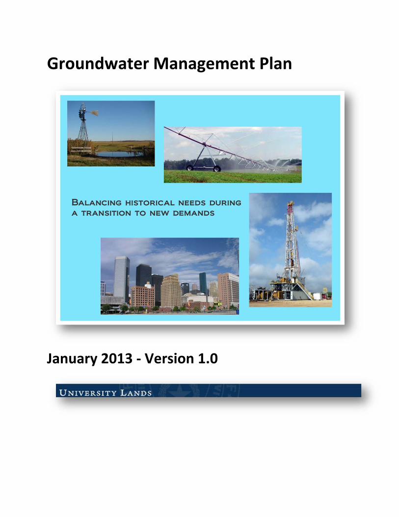
Groundwater Management Plan
January 2013 ‐ Version 1.0
Table of Contents
ii
Page
Purpose And Intent .......................................................................................................................... 4
Plan Adoption ................................................................................................................................. 4
Background ..................................................................................................................................... 5
Surface Interests Division of University Lands..................................................................................... 7
Policy ............................................................................................................................................. 8
Technical Research And Studies ........................................................................................................ 9
Water Conservation ......................................................................................................................... 9
Public Information ........................................................................................................................... 9
Management Authority .................................................................................................................... 9
Management Of Groundwater Supplies ........................................................................................... 10
Equity And Discretion .................................................................................................................... 11
State of Texas Water Regulatory & Water Planning Agencies............................................................. 11
Management Goals ....................................................................................................................... 20
iii
List of Tables & Figures
Tables Page
Table 1: Historical Timeline of University Lands ................................................................. 6
Table 2: Universtiy Lands Property Inside and Outside GCD Boundaries .......................... 13
Figures Page
Figure 1: Process for University Lands Groundwater Management Plan Development ...... 5
Figure 2: Map of University Lands ......................................................................................... 7
Figure 3: Map of University Lands and Groundwater Conservation Districts ..................... 12
Figure 4: Map of University Lands location within Groundwater Management Area's ..... 14
Figure 5: University Lands location relative to the Regional Water Planning Groups ........ 16
Figure 6: Water Planning Process and University Lands Participation ................................ 17
Figure 7: Major Aquifer Underlying University Lands ......................................................... 18
Figure 8: Minor Aquifer Underlying University Lands ......................................................... 19
List of Appendices
Appendix A
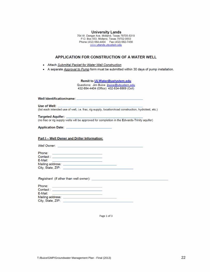
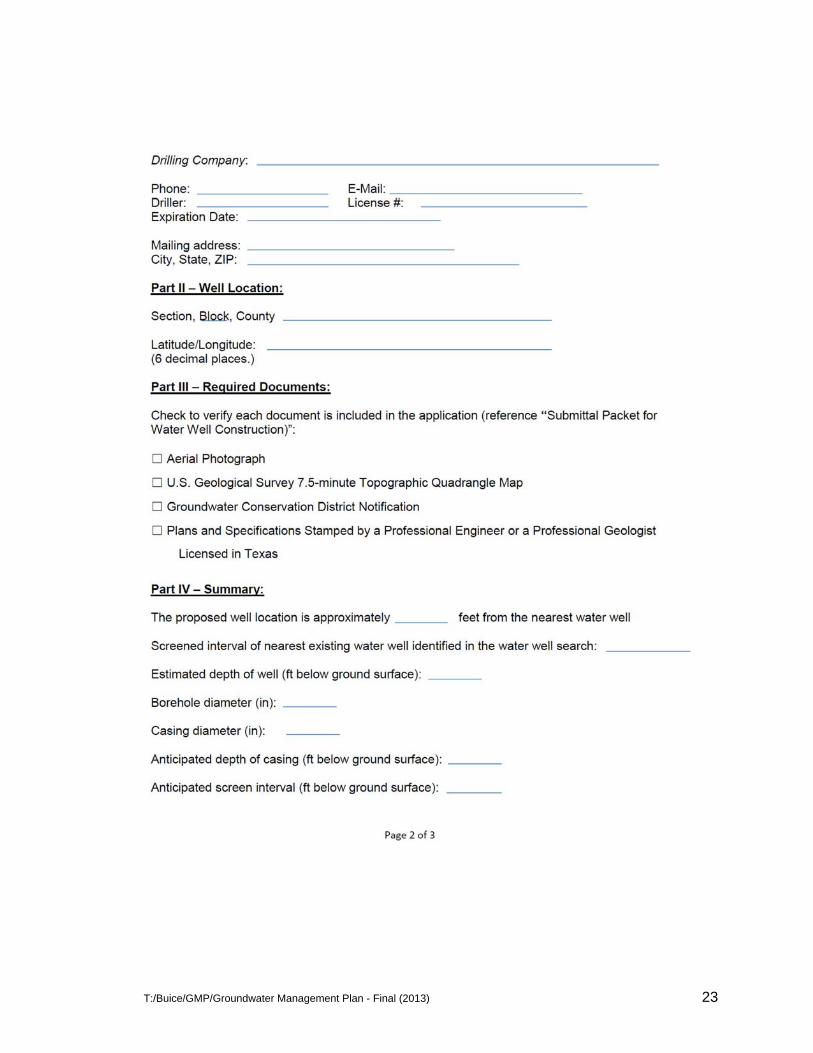
Application for Construction of a Water Well ......................................................................... 22
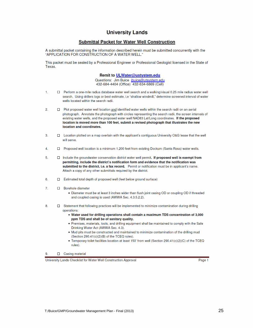
Submittal Packet for Water Well Construction ....................................................................... 25
Submittal Packet for Approval to Pump Water Well ............................................................... 27
T:/Buice/GMP/Groundwater Management Plan - Final (2013) 4
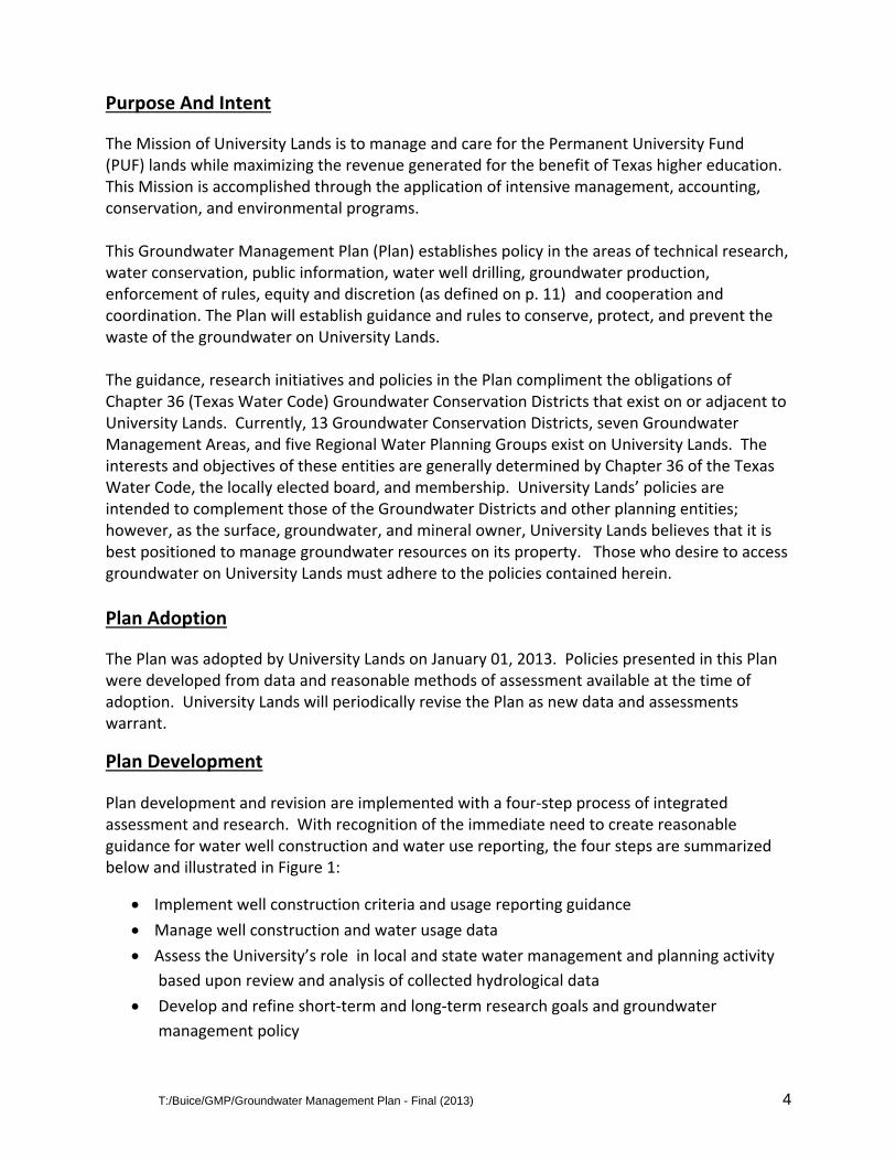
Purpose And Intent
The Mission of University Lands is to manage and care for the Permanent University Fund (PUF) lands while maximizing the revenue generated for the benefit of Texas higher education. This Mission is accomplished through the application of intensive management, accounting, conservation, and environmental programs. This Groundwater Management Plan (Plan) establishes policy in the areas of technical research, water conservation, public information, water well drilling, groundwater production, enforcement of rules, equity and discretion (as defined on p. 11) and cooperation and coordination. The Plan will establish guidance and rules to conserve, protect, and prevent the waste of the groundwater on University Lands. The guidance, research initiatives and policies in the Plan compliment the obligations of Chapter 36 (Texas Water Code) Groundwater Conservation Districts that exist on or adjacent to University Lands. Currently, 13 Groundwater Conservation Districts, seven Groundwater Management Areas, and five Regional Water Planning Groups exist on University Lands. The interests and objectives of these entities are generally determined by Chapter 36 of the Texas Water Code, the locally elected board, and membership. University Lands’ policies are intended to complement those of the Groundwater Districts and other planning entities; however, as the surface, groundwater, and mineral owner, University Lands believes that it is best positioned to manage groundwater resources on its property. Those who desire to access groundwater on University Lands must adhere to the policies contained herein.
Plan Adoption
The Plan was adopted by University Lands on January 01, 2013. Policies presented in this Plan were developed from data and reasonable methods of assessment available at the time of adoption. University Lands will periodically revise the Plan as new data and assessments warrant.
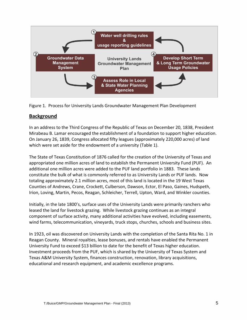
Plan Development
Plan development and revision are implemented with a four‐step process of integrated assessment and research. With recognition of the immediate need to create reasonable guidance for water well construction and water use reporting, the four steps are summarized below and illustrated in Figure 1:
Implement well construction criteria and usage reporting guidance
Manage well construction and water usage data
Assess the University’s role in local and state water management and planning activity
based upon review and analysis of collected hydrological data
Develop and refine short‐term and long‐term research goals and groundwater
management policy
T:/Buice/GMP/Groundwater Management Plan - Final (2013) 5
Figure 1. Process for University Lands Groundwater Management Plan Development
Background
In an address to the Third Congress of the Republic of Texas on December 20, 1838, President Mirabeau B. Lamar encouraged the establishment of a foundation to support higher education. On January 26, 1839, Congress allocated fifty leagues (approximately 220,000 acres) of land which were set aside for the endowment of a university (Table 1). The State of Texas Constitution of 1876 called for the creation of the University of Texas and appropriated one million acres of land to establish the Permanent University Fund (PUF). An additional one million acres were added to the PUF land portfolio in 1883. These lands constitute the bulk of what is commonly referred to as University Lands or PUF lands. Now totaling approximately 2.1 million acres, most of this land is located in the 19 West Texas Counties of Andrews, Crane, Crockett, Culberson, Dawson, Ector, El Paso, Gaines, Hudspeth, Irion, Loving, Martin, Pecos, Reagan, Schleicher, Terrell, Upton, Ward, and Winkler counties. Initially, in the late 1800’s, surface uses of the University Lands were primarily ranchers who leased the land for livestock grazing. While livestock grazing continues as an integral component of surface activity, many additional activities have evolved, including easements, wind farms, telecommunication, vineyards, truck stops, churches, schools and business sites. In 1923, oil was discovered on University Lands with the completion of the Santa Rita No. 1 in Reagan County. Mineral royalties, lease bonuses, and rentals have enabled the Permanent University Fund to exceed $13 billion to date for the benefit of Texas higher education. Investment proceeds from the PUF, which is shared by the University of Texas System and Texas A&M University System, finances construction, renovation, library acquisitions, educational and research equipment, and academic excellence programs.
T:/Buice/GMP/Groundwater Management Plan - Final (2013) 6
As of August 2012, more than 1.3 million acres of University Lands are leased for oil & gas production and exploration with more than 9,968 oil wells in 259 oil fields and over 853 gas wells in 119 gas fields. Today, the combination of horizontal drilling and hydraulic fracturing has created new opportunity for the development of unconventional oil & gas from shale formations on a significant portion of University Lands. Increased water use associated with the development of hydraulic fracturing established the need for uniform water well design and construction, a groundwater use policy, and research of the groundwater resource on University Lands.
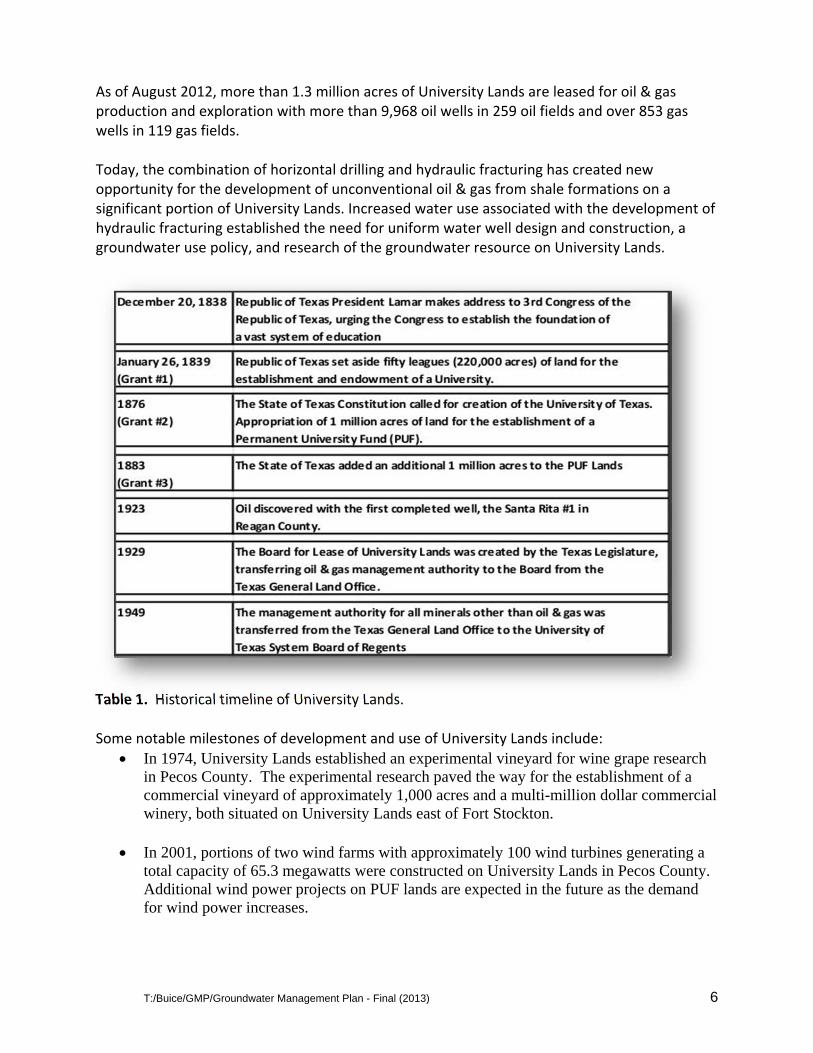
Table 1. Historical timeline of University Lands. Some notable milestones of development and use of University Lands include:
In 1974, University Lands established an experimental vineyard for wine grape research in Pecos County. The experimental research paved the way for the establishment of a commercial vineyard of approximately 1,000 acres and a multi-million dollar commercial winery, both situated on University Lands east of Fort Stockton.
In 2001, portions of two wind farms with approximately 100 wind turbines generating a total capacity of 65.3 megawatts were constructed on University Lands in Pecos County. Additional wind power projects on PUF lands are expected in the future as the demand for wind power increases.
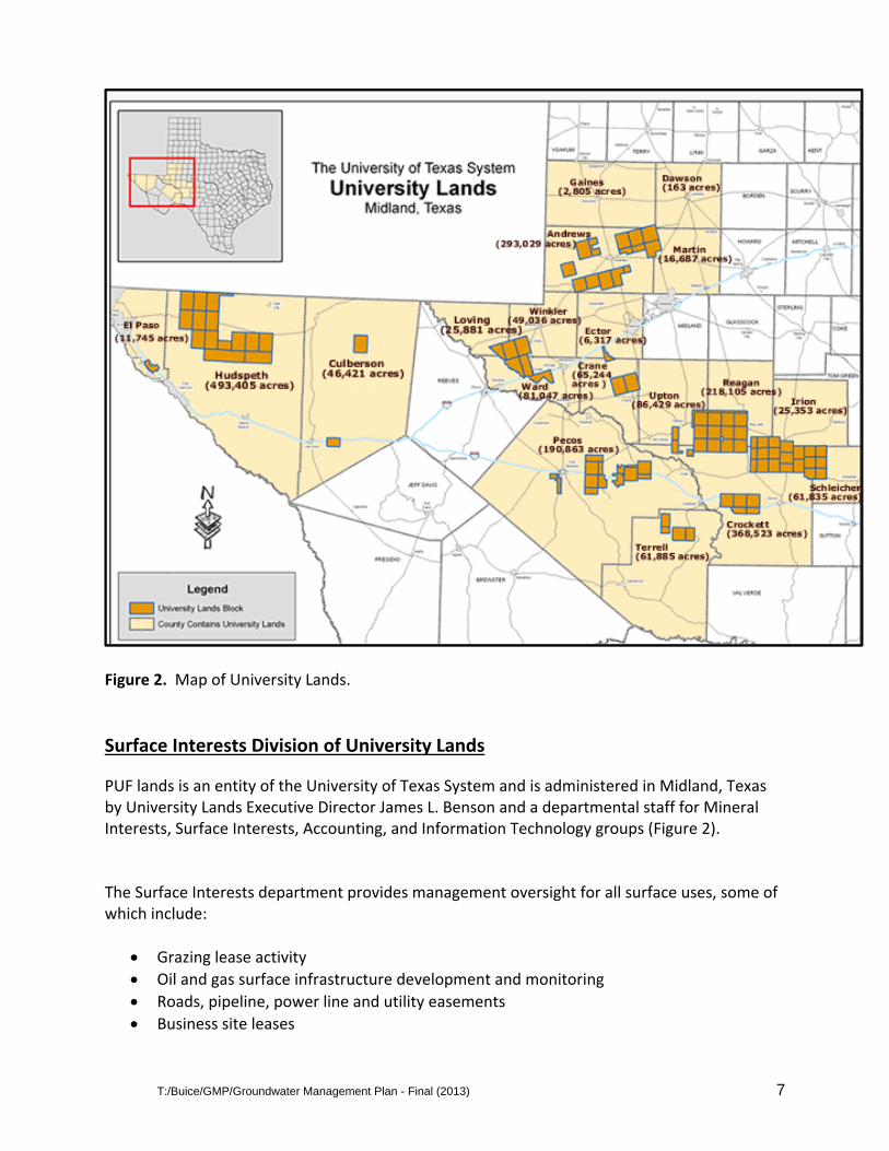
T:/Buice/GMP/Groundwater Management Plan - Final (2013) 7
Figure 2. Map of University Lands.
Surface Interests Division of University Lands
PUF lands is an entity of the University of Texas System and is administered in Midland, Texas by University Lands Executive Director James L. Benson and a departmental staff for Mineral Interests, Surface Interests, Accounting, and Information Technology groups (Figure 2). The Surface Interests department provides management oversight for all surface uses, some of which include:
Grazing lease activity
Oil and gas surface infrastructure development and monitoring
Roads, pipeline, power line and utility easements
Business site leases
T:/Buice/GMP/Groundwater Management Plan - Final (2013) 8
Vineyard / Winery lease
Leases for various oil field operations
Wind farm leases, etc…
To support these activities, the Surface Interests’ team is tasked with the following
responsibilities:
Monitoring daily activity on approximately: o 4000 active oil and gas leases o 7,500 miles of pipeline, distribution, transmission power line, and
communication line easements o 112 grazing leases o 450 commercial surface leases
Development of rate and surface damage schedules used in conjunction with surface leases for business sites, issuing pipeline easements, material used for construction of oil well locations and roads
Waste management oversight and remediation activity
Oversight of remediation activity
Preservation of archeological artifacts
Administration of potable water contracts for municipal and industrial (commercial) use
Administration of water used for oil & gas development (drilling and fracing)
University Lands allows ranching operations to access groundwater resources for livestock
watering via windmill wells and small diameter wells equipped with submersible pumps.
University Lands has implemented a groundwater policy to ensure that historical water use
remains available and unaffected by newer, non‐traditional groundwater use, and to enable
data collection of water utilization from PUF lands.
Policy
University Lands promotes water conservation, groundwater studies, dissemination of groundwater information to the public, and cooperation and coordination of all groundwater users on University Lands. These policies will minimize the mining of groundwater resources on University Lands and add collectively to the groundwater knowledge base of all entities that operate on University Lands.
Conformance to this Plan does not necessarily exempt or otherwise relieve a groundwater user from responsibility to notify and/or adhere to the policies of groundwater conservation districts. This Plan does not usurp or supplant any groundwater conservation district policy. Entities using groundwater on University Lands must demonstrate compliance with this Plan.
T:/Buice/GMP/Groundwater Management Plan - Final (2013) 9
Technical Research And Studies
Sound technical information is critical to effective management of groundwater resources. As
such, University Lands will perform groundwater research through its staff of geologists,
specialists, and engineers, as well as through outside consultants. This research may
incorporate the periodic recording of groundwater elevation, production, and quality in
selected wells. Potential research topics include, but are not limited to the following:
Water Conservation Practices Water Recycling Aquifer Geology and Hydrology Groundwater Data Monitoring & Collection Water Well Design GIS and Remote Sensing Best Practices Evaporation Studies
Water Conservation
Fresh (potable) groundwater is a vital resource that can be extended through appropriate preservation methods. In some instances, University Lands may require a conservation plan for certain groundwater uses to ensure beneficial use, and to promote the elimination or minimization of wasted water. University Lands will cooperate with, and expects the cooperation of, each water user to promote the most efficient use of water.
Public Information
University Lands will share information with the public and will cooperate with the media and other interested parties. Public dissemination of information creates awareness and support to minimize mining of the groundwater. Voluntary conservation measures can significantly extend the groundwater resource and reduce conflict among competing interests.
Management Authority
Recognizing that groundwater is fundamental to utilization of University Lands’ resources, this Plan seeks to manage groundwater withdrawal in a manner that assures continued future water availability while maximizing PUF revenue. The economic cost of uncontrolled groundwater use is not necessarily apparent and University Lands must insure that the rate of groundwater mining is not “excessive” in an effort to guarantee future availability of this resource and the subsequent economic benefits, which water supports. Fee simple title of PUF lands has never left the sovereign; and as such, University Lands manages, and controls access to the surface and the subsurface of the land. It can contract with the groundwater user to control the nature, quantity, duration of pumping, and payment, if required, for use of the groundwater on its lands or exportation of groundwater off of its
T:/Buice/GMP/Groundwater Management Plan - Final (2013) 10
lands. University Lands does not assume this position lightly, rather it considers this authority a great responsibility that requires stewardship of the groundwater resource and recognition that entities beyond its boundaries rely on the same aquifers underlying PUF lands. Groundwater withdrawal can be minimized by four key methods:
Mandatory conservation
Implementation of best practices
Limitation on groundwater production
Restrict access to specific aquifers In managing groundwater withdrawals, University Lands shall take into account several factors, including:
Economic impact of conservation measures
The degree and effect of groundwater mining
Hydrological characteristics of the aquifers within the lands
Management Of Groundwater Supplies
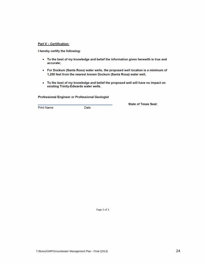
University Lands will manage groundwater to conserve the resource while seeking to enhance the economic viability of all entities using the water. With consideration of the economic and cultural activity that depends on a reliable source of groundwater, University Lands will identify and promote best management practices of all groundwater resources. Working with groundwater users, University Lands will establish and maintain an observation well network to monitor aquifer conditions. University Lands will perform regular internal assessments of water availability, and as appropriate, cooperate with others to assess the groundwater resources. University Lands’ policy and guidance for water well construction and management of groundwater withdrawal is administered with an application to drill and with a subsequent approval to produce groundwater. These applications and guidance are provided in Appendix A. University Lands may deny an application to install a water well, or deny or limit groundwater production if the applications are incomplete or nonconforming. Before installing a water well, an application shall be submitted to University Lands that describes the proposed well location, intended use of well, O&G lease information, as appropriate, and well construction criteria including the targeted aquifer and screen interval. The well must be drilled within 90 days of application approval. Within 30 days of well completion, the applicant must submit an approval packet to produce the groundwater. This packet will include pump test results, laboratory water quality analyses, Well Reports, and 3rd‐party confirmation that cement circulated to the ground surface.
T:/Buice/GMP/Groundwater Management Plan - Final (2013) 11
Equity And Discretion
All groundwater users must employ sound groundwater management and conservation practices. Although one entity’s groundwater withdrawal may cause no obvious consequence, cumulative water withdrawal can affect competing economic and cultural interests, therefore, every entity is subject to this Plan. To ensure the Plan’s objectives are achieved, University Lands retains discretion in allowing groundwater withdrawal. Temporary exceptions may be granted to alleviate potential economic hardship due to hydrological or geographic characteristics or potential adverse consequences to adjacent landowners, or other users of groundwater. This Plan does not prescribe a specific production ratio of groundwater withdrawal based upon the number of acres of land leased or otherwise utilized by an entity. Nothing in this Plan, should be interpreted to mean that an entity is entitled to use groundwater in any amount merely because the Plan does not prescribe a ratio for production.
State of Texas Water Regulatory & Water Planning Agencies
In the State of Texas, the management of groundwater use and planning is provided by the following three regulatory and planning entities:
Groundwater Conservation Districts (GCD)
Groundwater Management Areas (GMA)
Regional Water Planning Groups (RWPG) (Figure 6)
Groundwater Conservation Districts
In Title 2 (Water Administration), Subtitle E (Groundwater Management), Chapter 36 (Groundwater Conservation Districts) of the Texas Water Code, the State of Texas identifies Groundwater Conservation Districts as its preferred method of groundwater management through rules developed, adopted, and promulgated by a district in accordance with the provisions of Chapter 36. GCD’s consist of locally elected board members responsible for promulgating and administering rules for groundwater use in the District’s boundaries.
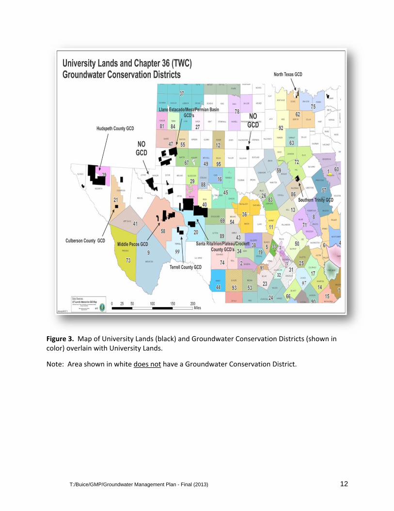
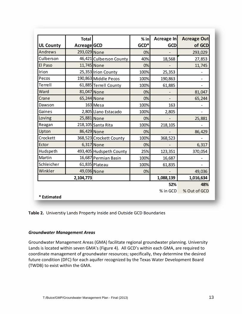
Approximately half (52%) of PUF lands are within the boundary of thirteen GCDs. The location of these GCDs is illustrated in Figure 3, and the percent by county of University Lands within a GCD is shown in Table 2. The eleven GCD’s administer unique rules and regulations. In areas where no GCD’s exist, no rules or regulations, aside from those promoted by University Lands, regulate water well spacing or groundwater withdrawal.
T:/Buice/GMP/Groundwater Management Plan - Final (2013) 12
Figure 3. Map of University Lands (black) and Groundwater Conservation Districts (shown in color) overlain with University Lands.
Note: Area shown in white does not have a Groundwater Conservation District.
T:/Buice/GMP/Groundwater Management Plan - Final (2013) 13
Table 2. Universtiy Lands Property Inside and Outside GCD Boundaries
Groundwater Management Areas
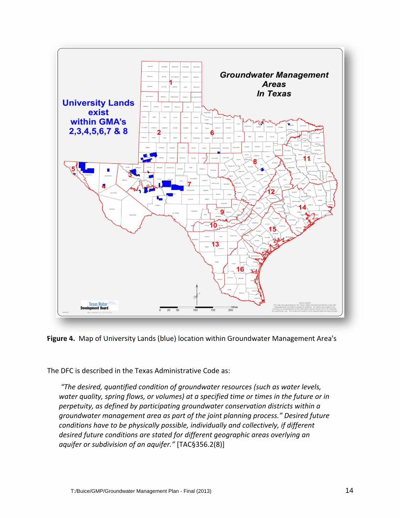
Groundwater Management Areas (GMA) facilitate regional groundwater planning. University Lands is located within seven GMA’s (Figure 4). All GCD’s within each GMA, are required to coordinate management of groundwater resources; specifically, they determine the desired future condition (DFC) for each aquifer recognized by the Texas Water Development Board (TWDB) to exist within the GMA.
T:/Buice/GMP/Groundwater Management Plan - Final (2013) 14
Figure 4. Map of University Lands (blue) location within Groundwater Management Area's
The DFC is described in the Texas Administrative Code as:
“The desired, quantified condition of groundwater resources (such as water levels, water quality, spring flows, or volumes) at a specified time or times in the future or in perpetuity, as defined by participating groundwater conservation districts within a groundwater management area as part of the joint planning process.” Desired future conditions have to be physically possible, individually and collectively, if different desired future conditions are stated for different geographic areas overlying an aquifer or subdivision of an aquifer.” [TAC§356.2(8)]
T:/Buice/GMP/Groundwater Management Plan - Final (2013) 15
To determine a DFC, the conservation districts within the GMA are required to consider present and future groundwater use and the availability of groundwater, i.e. the hydrological characteristics of an aquifer. The DFC’s can be established for each aquifer, subdivision of an aquifer or geologic strata, or each geographic area overlying an aquifer. The State of Texas mandated a September 2010 deadline for GMA’s to establish DFC’s. The TWDB will generate a Groundwater Availability Model (GAM) based on the DFCs to develop Managed Available Groundwater (MAG) quantities. The MAG is an estimate of the maximum volume of groundwater that can be extracted annually to maintain the DFC.
The DFCs for groundwater on University Lands have only recently been developed. The GCD’s use of the Managed Available Groundwater in their permitting and planning is not entirely clear, and is not necessarily consistent across the GMA’s. Statewide, some GCD’s use the MAG to determine the maximum allowable permitted pumping volumes within the GMA to achieve the DFC. The Groundwater Availability Models require establishment of a groundwater “budget” that summarizes the amount of water entering and leaving the aquifer. The groundwater budget considers factors such as precipitation recharge, surface water outflow to springs and rivers, lateral flow into and out of the aquifers and flow between aquifers (leakage). Additionally, historical and projected future groundwater pumping rates are critical factors in establishing Desired Future Conditions and Managed Available Groundwater.
Regional Water Planning Groups
In 1997, the Texas legislature established 16 Regional Water Planning Groups (RWPGs). Figure
5 provides a map that illustrates the geographical extent of the RWPG’s with University Lands
overlaid. University Lands are within five RWPG’s.
The RWPG’s contain approximately 20 members representing the interests of the groundwater
users within each group. The RWPG’s submit a Regional Water Plan to the TWDB on a five‐year
schedule. The TWDB condenses the 16 Regional Water Plans into one State Water Plan.

T:/Buice/GMP/Groundwater Management Plan - Final (2013) 16
Figure 5. University Lands location (yellow) shown relative to the geographical boundaries of Regional Water Planning Groups (shown in color)
In 2011, the State mandated that the RWPG’s use the MAG model, developed by the TWDB
from the DFC’s provided by the GMA’s. The State Water Plan is now directly linked to decisions
(DFC’s) made by local GCD board members.
T:/Buice/GMP/Groundwater Management Plan - Final (2013) 17
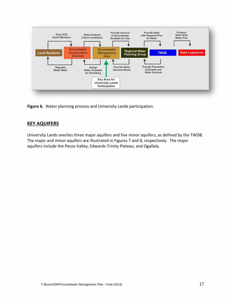
Figure 6. Water planning process and University Lands participation.
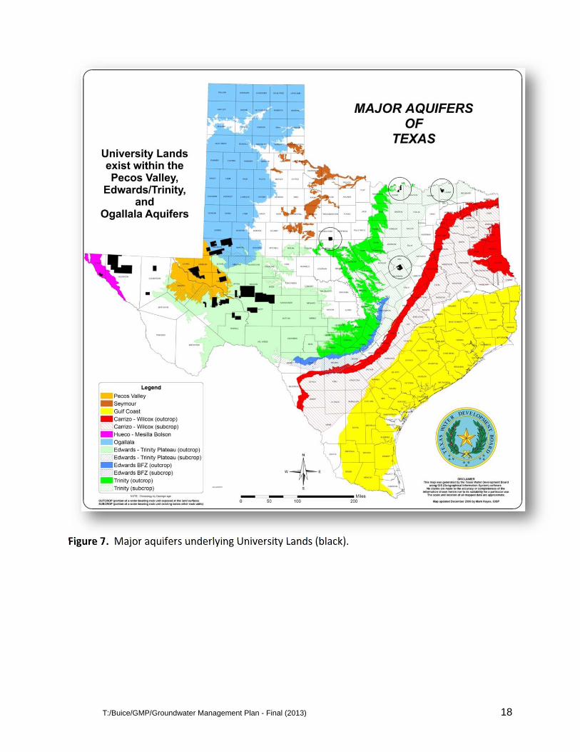
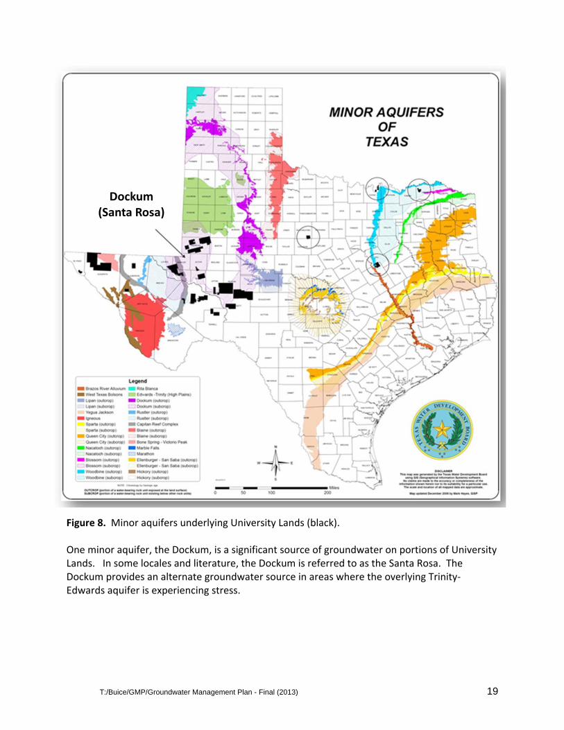
KEY AQUIFERS University Lands overlies three major aquifers and five minor aquifers, as defined by the TWDB. The major and minor aquifers are illustrated in Figures 7 and 8, respectively. The major aquifers include the Pecos Valley, Edwards‐Trinity Plateau, and Ogallala.
T:/Buice/GMP/Groundwater Management Plan - Final (2013) 18
Figure 7. Major aquifers underlying University Lands (black).
T:/Buice/GMP/Groundwater Management Plan - Final (2013) 19
Figure 8. Minor aquifers underlying University Lands (black). One minor aquifer, the Dockum, is a significant source of groundwater on portions of University Lands. In some locales and literature, the Dockum is referred to as the Santa Rosa. The Dockum provides an alternate groundwater source in areas where the overlying Trinity‐Edwards aquifer is experiencing stress.
Dockum
(Santa Rosa)
T:/Buice/GMP/Groundwater Management Plan - Final (2013) 20
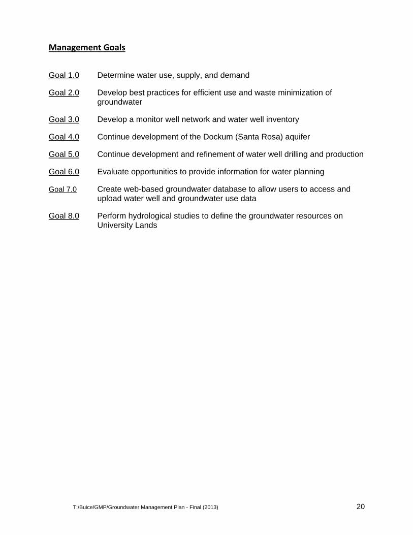
Management Goals
Goal 1.0 Determine water use, supply, and demand
Goal 2.0 Develop best practices for efficient use and waste minimization of groundwater
Goal 3.0 Develop a monitor well network and water well inventory
Goal 4.0 Continue development of the Dockum (Santa Rosa) aquifer
Goal 5.0 Continue development and refinement of water well drilling and production
Goal 6.0 Evaluate opportunities to provide information for water planning
Goal 7.0 Create web-based groundwater database to allow users to access and upload water well and groundwater use data
Goal 8.0 Perform hydrological studies to define the groundwater resources on University Lands
T:/Buice/GMP/Groundwater Management Plan - Final (2013) 21
Appendix A
T:/Buice/GMP/Groundwater Management Plan - Final (2013) 22
T:/Buice/GMP/Groundwater Management Plan - Final (2013) 23
T:/Buice/GMP/Groundwater Management Plan - Final (2013) 24
T:/Buice/GMP/Groundwater Management Plan - Final (2013) 25
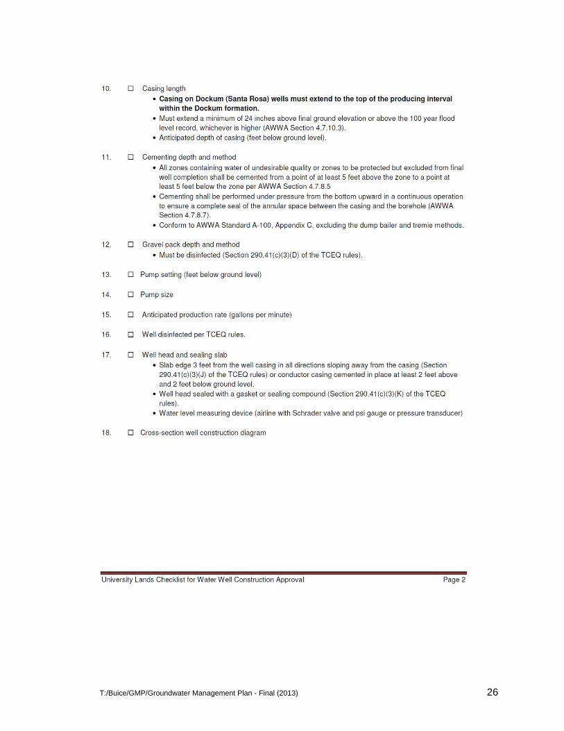
T:/Buice/GMP/Groundwater Management Plan - Final (2013) 26
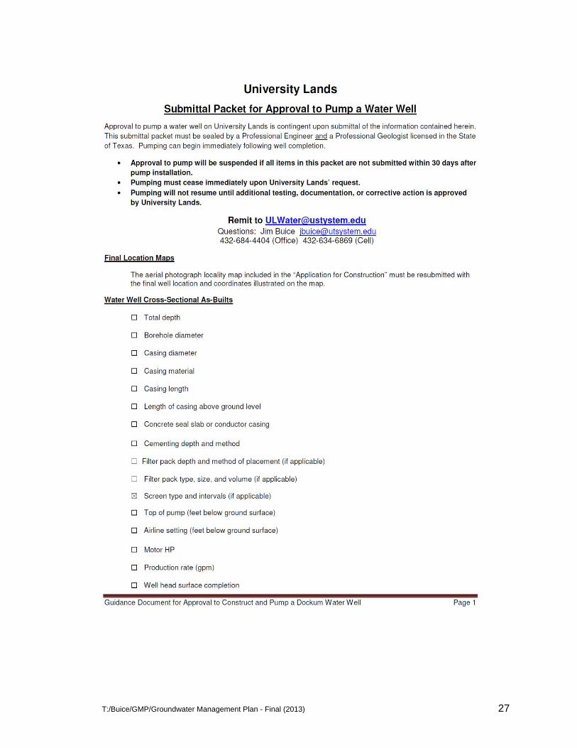
T:/Buice/GMP/Groundwater Management Plan - Final (2013) 27
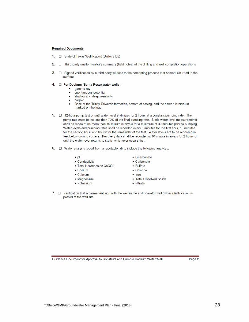
T:/Buice/GMP/Groundwater Management Plan - Final (2013) 28