guadalcanal plains, solomon islands …
TRANSCRIPT

GUADALCANAL PLAINS, SOLOMON ISLANDS GROUNDWATER AVAILABILITY GUIDE
Isaac Lekelalu'
July 1998 SOPAC Training Report 77
1 Hydrogeologist Water Resources Division
Ministry of Energy, Water & Mineral Resources P.O. Box G37
Honiara SOLOMON ISLANDS Prepared for the Solomon Islands Water Resources Division of the Ministry of Energy, Water & Mineral
Resources during Fellowship Attachment at the SOPAC Secretariat, 1998

GUADALCANAL PLAINS GROUNDWATER AVAILABILITY GUIDE
Compiled by
Isaac Lekelalu [Hydrogeologist]
May 1988
Intemal Report
Water Resources Division
Ministry of Energy, Water & Mineral Resources
P.O.Box G37 Honiara
Solomon Islands

CONTENTS
Page
Introduction 1
Background Information 1
Geology of Guadalcanal Plains 2
Fig. I: Guadalcanal Island showing the Guadalcanal Plains
Fig. la: The Guadalcanal Plains Area
Hydrogeology of Guadalcanal Plains 2
Water Balance on Guadalcanal Plains 3
Water Well Location & Borehole Information 4
Correlation of well Logs 5
Lungga-Ngalimbiu Zone 5
Fig. 2: Map of Lungga-Ngalirnbiu Zone Fig. 2a: Iso-salinity contours (Lungga-Ngalimbiu) Fig. 2b & 2c: Cross section of Lungga-Ngalimbiu Zone
Ngalimbiu-Mbalisuna Zone 7
Fig. 3: Map of Ngalimbiu-Mbalisuna Zone Fig. 3a: Cross section of Ngalimbiu-Mbalisuna Zone
Mbalisuna-Mberande Zone 8
Fig. 4: Map of Mbalisuna-Mberande Zone Fig. 4a: Cross section of Mbalisuna-Mberande Zone
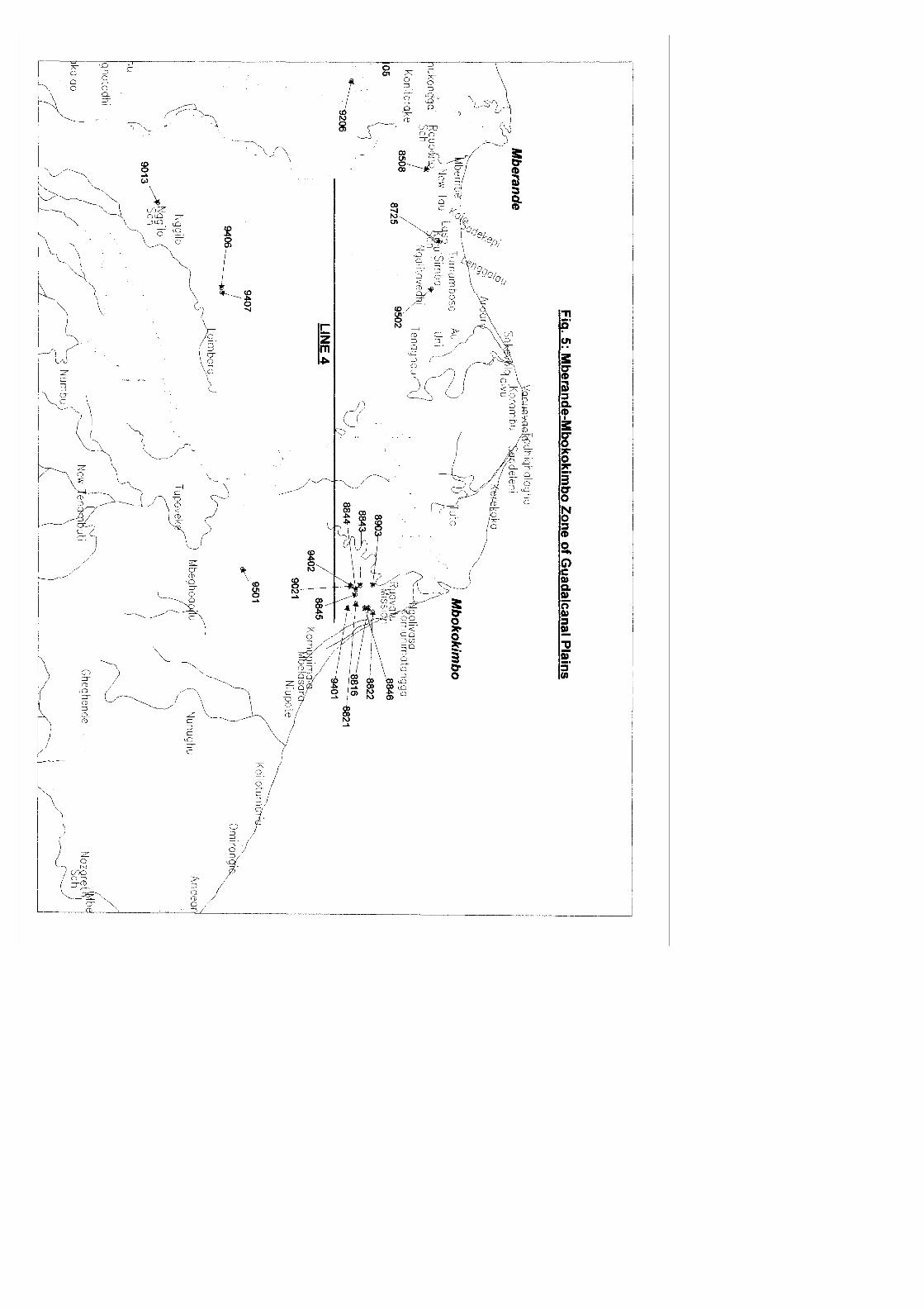
Mberande-Mbokokimbo Zone 9
Fig. 5: Map of Mberande-Mbokokimbo Zone Fig. 5a & 5b: Cross section of Mberande-Mbokokimbo Zone
Questions and Answers to borehole drilling 10-13
Fig. 6: Well construction method
Conclusion 13
References 15
Appendices 16

The Guadalcanal Plains Groundwater Availability Guide
Introduction
This report outlines information about the availability of groundwater on the Guadalcanal Plains on Guadalcanal Island. It is the result of past information captured from work carried by Water Resources Division. These include geophysical surveys, drilling, well monitoring and water quality analyses.
Work carried out by the Division dates back to the 1960s. The Guadalcanal Plains is the most exploited area on Guadalcanal as far as groundwater extraction is concerned. Since more people demand groundwater, the Division sees the need to produce a guide in order to answer the frequently asked questions by those who want to have groundwater as their source of water supply.
Some of the questions asked are:
1. How deep do I need to drill a well?
2. How much groundwater can I expect to get from the well?
3. How far will I put the well from possible sources of pollution?
4. Is it safe to use groundwater from the well for drinking and cooking?
5. How will I construct the water well?
6. How much will it cost to drill a well?
7. What type of pumps do I need for the well?
8. How long will the well provide water?
9. Where can I get help concerning water well drilling?
Background Information
The importance of the Guadalcanal Plains as an area where agriculture and other commercial activities is taking place makes it vital for its assessment and control as far groundwater is concerned. There is increasing number of farming, both domestic and commercial taking place in the area. More people will need groundwater for vegetable farms, animal farming, industry and also public water supplies for communities.
The Water Resources division has been drilling water bores in the area since the 1980s and there is increasing demand for groundwater. Out of the total number of wells drilled, about 80 percent are drilled at the
1
Guadalcanal Plains. Due to the increased use of major rivers for dumping of rubbish and sedimentation groundwater will play an important part in supplying water for the people in this area.
The Water Resources division, over the past years has been gathering information from bores drilled. These include borehole logs, water levels monitoring, pumping tests and geophysical investigations in areas prior to drilling. These data are stored in the division's database and are used by people who request them.
The Guadalcanal Plains is situated to the east of Honiara, capital of the Solomon Islands (Fig. 1). It covers an area of about 300 square kilometres and is drained by the five major rivers from the southern mountains.
These rivers are the Lungga, Ngalimbiu, Mbalisuna, and Mberande and Mbokokimbo rivers. The other smaller streams contributing to the river systems are the Tenaru, Tangaresso and Matepona streams.
These plains are the largest in the country, extending from Lungga to Aola. Their width varies from 2 to 13 kilometres. They are the result of coalescing of the deltas of the rivers draining the area.
Geology of Guadalcanal Plains
The majority of the Guadalcanal Plains deposits (Hallet 1990) consist of recent alluvium (Ngalimbiu alluvial formation). Layers roughly graded deposits of gravel; sand and clay are inter-bedded and inter-fingered.
Marine sand deposits are observed along the seashores. They consist of fine well-graded sand with small amounts of shell debris. Such deposits are seen to the east of Tenaru Bay. To the south of the plains close to the foothills are scattered outcrops of the Honiara limestone and the Honiara beds. These formations consist of a mixture of sandstone and debris of reefal corals.
Grain size analyses of boreholes in the area showed two features. The well-graded deposits consist of sediments having fine sand. These are found along (marine deposits) and also close to the seashore (fine delta deposits). Running sand is normally an encountered feature at these locations and the well yield is generally low.
The poorly graded deposits have a mixture of gravel, sand and clay. These deposits could be found allover the plains and the best aquifers are located in the gravel layers of the delta sediments.
Hydrogeology of the Guadalcanal Plains
The geology of the area is such that the formations consist of irregular delta deposit. Layers of gravel, sand and clay are superposed. In some places the lithology observed from drilled wells differs a lot within short distances (e.g. 50m at Holy Name of Mary-Tenaru).
2


The best aquifers normally tapped at the plains are located in the gravelly and sandy layers. They are generally confined and some wells drilled are artesian (Kulu School, Makira Belle-Foxwood).
Superposition of different aquifers occurs frequently. The range of the thickness of these aquifers is large (2-15 m). Since there are no experimental pumping tests carried out in these aquifers, the interaction between them is not known.
Water Balance on Guadalcanal Plains
An estimate of the water balance on the Guadalcanal Plains (Hallet 1990) is made using the monthly average rainfall and mean temperature collected during 24 years in Honiara.
The water balance formula is:
P = EP + Re + Q +/- Sm where P - Precipitation EP-Evapotranspiration (using
Thornwaite) Re - Aquifer recharge Q - Surface runoff Sm - Soil moisture deficit
Due to the lack of other relevant data on the Guadalcanal Plains, some of the water balance parameters are omitted. The interception is assumed zero because the area is covered with grass and the change in water storage is also assumed zero (minimal groundwater is withdrawn).
The water balance shows that the amount of rainwater available for the recharge and the surface water runoff is only 520mm.
According to the Thornwaite theory, the soil moisture deficit must be zero before having groundwater recharge and the water balance shows that no recharge occurs between June and December, during the dry season.
The low value of 520mm indicates that groundwater potential may be limited on the Guadalcanal Plains. In this case large withdrawal of groundwater could lead to overexploitation.
Overexploitation could be bad for aquifers along the seashore where saltwater intrusion could occur. However, it is possible that aquifer recharge occurs by groundwater from the foothills south of the Plains where rainfall increases with altitude (up to 6000 mm per year).
Water Well Location
After carrying out a few electrical soundings close to water wells, it becomes helpful to use the geophysical method to locate water wells.
Though the results do not show the exact geology of the site, interpretations they give on the ground resistivities can be helpful.
The following general indications can be used:
(i) a resistivity value < 20 Ohm-m indicates high clay content (bad aquifer)
(ii) a resistivity value > 60 Ohm-m indicates gravel layer(good aquifer)
(iii) a resistivity value < 10 Ohm-m indicates salt water (iv) contrasted resistivity values, even low (between 20 & 60 Ohm-m)
indicate the presence of gravel layers interbedded with clay (v) thickness of the layer with low resistivity is generally under-
estimated
Bore hole Information
There are more than two hundred boreholes drilled on the Guadalcanal Plains. They are used for domestic, irrigation, village supply, public supply, industry and geotechnical investigation for bridges and roads.
In this guide the Guadalcanal Plains is divided into four zones, with each zone bounded by the major rivers and the bore holes located in each zone are matched in terms of their lithology, water quality and yield.
They are divided in the following zones:
1. Lungga-Ngalimbiu
4
2. Ngalimbiu-Mbalisuna
3. Mbalisuna-Mberande
4.. Mberande-Mbokokimbo
The boreholes are drilled to depth from 5 metres to about 72 metres. The deepest well was drilled at Ngalimbiu area for water supply purposes.
Wells are normally screened at the gravel layers because these give high yields for water supply purposes. There are wells that have screened placed at the sandy layers. These are done at locations where gravel layers are not encountered.
Generally, the layers of gravel, coarse sand or a mixture of both form the permeable layer which is the water bearing layer in most wells on the Guadalcanal Plains.
Correlation of Well Logs
The purpose of dividing the Guadalcanal Plains into zones is to try and match the well logs and see the depths to which aquifers, aquicludes and aquitards exist at a selected area and direction.
Cross sections of wells in each zone are plotted and soil layer information is approximately matched at these areas.
Lungga-Ngalimbiu Zone
This zone bounded by the east coordinates 614000 and 626000, is an interesting one owing to the drilling programs that had been carried out by the Americans during the Second World War (1942).
A lot of information concerning groundwater in this area was compiled by RC Baker in his report on “An occurrence of saline ground water on Guadalcanal", 1950. Since most of the military installations were located on the western end of the coastal plains, numerous wells for water supply we~ drilled here (Fig 2a).
" In Baker's report it was pointed out that the coastal plains comprised of clay to medium-coarse gravel (mixed) but the fine materials are dominant. It was also hard to correlate the strata from one well to the next. However, there is a zone of permeable sand at depth from 30m to 40m in several wells. 5

(a) Top where only one figure is given
Yellow clay frequently occurs at 53.3m to 54.86m (about 50.0m below sea level) and reported hard drilling at this depth. Grass and roots were encountered in two wells at 178 feet with a maximum depth drilled to about 152.4 metres. No water wells reached the underlying basement rock.
Well yield in few wells drilled during the World War II by the Americans exceeded 100 gal/min (5 l/s) and water is artesian, rising to about ground surface, about 4.572 metres above sea level.
From the data provided by Baker, most of the wells drilled have brackish or salt water to depths of more than 30 metres. Only very few wells have good water quality. Wells drilled were at the vicinity of Henderson, along Tenaru river and Dodo Creek area. It was assumed that the saline water at this area was ocean water that was incorporated into the sediments as the coastal plain was built.
Similarly, water wells drilled at the same area by the Water Resources Division are generally shallow and screened at the gravelly sandy layers. Due to the high salinity levels in the area some of the wells are not fit for drinking (Tenaru School, Levers plantation, US Navy Tenaru, Vutu). Wells near the coast and 3 kilometres inland are shallow, have high salt content and low yield. Long term pumping in wells drilled may have a risk in saltwater contamination of the aquifer (Fig.2 & 2a).
6


Geophysical surveys carried out showed that the saltwater zone (very conductive) is approximately 15 metres below ground level. For water wells with an average depth of 12 metres, pumping tests and water quality showed transmissivity values from 200-600 m2/day and TDS values from 300-700 mg/l.
Shallow wells, less than 15 metres are recommended and this extends to about 3 kilometres inland. For wells very close to the seashore drilling should be limited to less than 10 metres.
Wells drilled at Kongga, New Koloula, Black Post and further east (Okea SIPL, Old Selwyn College and SIPL) area showed lower salinity levels with well depths exceeding 20 metres. These wells are close to the Ngalimbiu River and are about 4 kilometres from the coast. There is a higher rate of success of wells drilled at this area and well depths have reached 30 metres (Okea SIPL). This area is quite far from the seashore and the Ngalimbiu River acts as the groundwater recharge zone.
From the Lungga-Ngalimbiu cross section of plotted wells, the following general lithology is observed (Fig.2b & 2c):
- Clay/silt layer: ground level to about 5 metres - Gravel/sand layer: 5-30 metres - Clay/silt: 30-45m - Gravel/sand layer: below 45m
Ngalimbiu-Mbalisuna Zone
The Ngalimbiu-Mbalisuna Zone, bounded by the east coordinates 626000638000 is not so exploited as far as drilling and geophysical surveys is concerned. There are few people who request water bores from this area of the Plains. Most water wells are located around Tetere and west of Mbalisuna (Fig.3 & 3a).
As such only few wells which include geotechnical bores and some water bores are drilled in the area. The depth of water wells are drilled here vary according to the depth to which aquifers are encountered.
Generally, the tendency being to drill a well and tap aquifers according to the amount of water needed by the client. This is only based on the number of households and the average daily consumption rate.
The water yields from these bores are determined from pumping tests carried out and since the water bores are for small users (1-2 houses) the pumping tests are carried for two hours (1 hr pumping & 1 hr recover test) .
There are a number of shallow wells drilled close to the coast, which yield water of good quality. These are Suaghi, Basikali, Ghorabau communities. Pump tests carried out showed abundant groundwater (T=1,300 m2/day) for a 12 meters well located about 1.5 km from the coast but close to a stream. Further inland, transmissivity values for two wells
7


were 200 and 130 m2/day respectively. These values indicate groundwater reserves can be used for bigger water supplies if tapped.
Saltwater intrusion into wells around this area is not a very big concern, unlike the Lungga to Tenaru area. Wells are drilled to an average depth of 30 metres and aquifers of gravel and coarse sands are tapped for groundwater.
The salinity levels are low (180-360 mg/l) and due to the cost of drilling, which is expensive it is recommended that shallow wells with gravel layers can be drilled around this area with abundant groundwater obtained.
Geophysical surveys carried out at Suaghi, very close to the seashore showed brackish water below 30 metres hence wells are drilled to less than 15 metres.
From the results of wells drilled at this area, the success rates are high. It was also seen that fine/coarse sandy layers are dominant around the Matepona area while gravel layers are present close to the Mbalisuna river.
A generalized lithology make up of the area is as follows (Fig.3a):
- Clay/silt layer: ground level to about 10m
- Gravel/sand layer: 10-30m - Clay/silt layer: 30-40m - Gravel/sandstone: below 40m
Mbalisuna-Mberande Zone
This zone bounded by the east coordinates 638000-643000 has water wells drilled close to the coast and also along the main road linking Honiara and Aola, to the east (Fig.4).
There are a number of water wells drilled that yield abundant groundwater with good water quality results. Previous geophysical soundings were carried out at this area to determine the aquifers.
Information from drilled wells around this zone showed that the majority of wells are successful and groundwater is abundant. Pumping tests results showed groundwater yields of more than 2 litres/sec (>30 gpm) and transmissivity values indicate groundwater reserves fit for larger water supplies.
From the cross section plots of well logs in the area, the likely well logs for the areas is as follows (Fig.4a):
- Clay/silt layer: ground level to about 3.0m
- Gravel/sand layer: 3.0-30.0m - Clay/silt layer: 30.0-45.0m
8


- Gravel/sand layer: below 45m
It recommended that drilling done in this zone might yield groundwater at depths of 30 metres and also below 45 metres. Furthermore water wells proposed close to the seashore should be limited to less than 20 metres deep to prevent saltwater intrusion into the aquifer during pumping.
Mberande-Mbokokimbo Zone
This zone bounded by the east coordinates 643000 to 653000 is not fully exploited for groundwater. A likely reason may be that people have access to surface water sources. However, a survey has to be carried out to confirm this (Fig.5).
A couple of geophysical surveys were carried out in this area and the estimates of drilling depths were made.
The area east of Mberande River was exploited for groundwater. These belong to people who live along the main road that links Aola and Honiara. Water wells are for domestic and commercial farming such as poultry and vegetables.
Other water wells are located near the seashore that yielded groundwater because they are shallow. It is quite difficult to correlate well logs because the water wells are far from each other.
In this case water wells drilled at Ruavatu School may not be used to correlate with those close to the Mberande River.
A very approximate lithology match for this zone is as follows (Fig.5a & 5b):
- Clay/silt layer: ground level to 35m - Gravel/sand layer: 35-45m - Sandstone/clay layers: below 45m
Water wells east of the Mberande are screened at 30-4 Om below ground level. For low water consumers, shallow wells drilled to 20 metres may produce groundwater. More geophysical surveys and drilling is required
in this area in order to get a good idea about its water bearing and other impermeable layers.
After considering the whole area, the questions often always asked by people who want water wells drilled could be answered.
It is the purpose of this guide to provide people the information they need to know before proceeding on to request drilling a well for their
water supplies.
9


On the Guadalcanal Plains, groundwater travels in the south to north direction hence "'-later wells must be put on the southern side while toilets, poultry, piggery, cattle farms and rubbish dumps on the seaward direction.
3. Is it safe to use groundwater from the well for drinking and cooking?
The primary reason for putting water wells far from possible sources of
pollution is to have groundwater that is safe to use.
On the Guadalcanal Plains, most water wells drilled have water quality that is fit for drinking and cooking. The results of water analyses done showed that chemical constituents of groundwater are within the acceptable standards of the World Health Organization guidelines (WHO).
Most water wells on the Guadalcanal Plains, however, are not disinfected with chlorine. As such, there is a risk that some of the wells have harmful bacteria in them. There is a high possibility that shallow wells that do not have concrete slabs constructed to seal off surface runoff into the well may have this risk of pollution.
It is therefore highly recommended that water should be boiled for at least 15 minutes and cooled before drinking.
Water samples from wells drilled on the Guadalcanal Plains have the chemical contents analyzed in the Geochemical Laboratory, Ministry of Energy, Water and Mineral Resources.
Analyses to determine the number of harmful bacteria are done at Environmental Health Division, Ministry of Health and Medical Services.
Table 3. The World Health Organization (WHO) guideline for drinking Water.
Parameters Maximum Acceptable Maximum Allowable pH 7.0-8.5 6.5-9.2 Total Dissolve Salts 500 mg/l 1500 mg/l Calcium hardness (Ca) 190 mg/1_ 500 mg/l Magnesium (Mg) 175 mg/l 530 mg/l Total Hardness 365 mg/l 1030 mg/l Chloride (Cl) 200 mg/l 600 mg/l Arsenic (As) 00 mg/l 0.05 mg/l Bacteria 00 per 100ml sample 00 per 100 ml sample
4. How will I construct the water well?
It is the responsibility of the Water Resources Division to construct the well after drilling_is completed. Most water wells on the Guadalcanal Plains are screened with high-pressure PVC pipes. There are few places where galvanized steel pipes are used (Fig.6).
11