gude landfill remediation approach update … landfill remediation approach update community meeting...
TRANSCRIPT
®
Gude Landfill Remediation Approach Update
Community Meeting
Date: September 18, 2012

®
Outline
Outline● Introductions● Site Investigation Summary ● Landfill Background● Community Engagement● Remediation Approach Overview● Next Steps● Land Reuse Process● County Contacts and Additional Information● Questions and Discussions
2
®
Introductions● Gude Landfill Concerned Citizens (GLCC)
– Dave Peterson (DS1 HOA President)
– Laszlo Harsanyi (DS2 HOA President)
– Nick Radonic (DS3 HOA President)
● Montgomery County DEP– Bob Hoyt, DEP Director
– Peter Karasik, DSWS Section Chief
– Steve Lezinski, DSWS Engineer III
– Jamie Foster, DSWS Engineer I
Introductions
– Keith Ligon, Julia Tillery and
George Wolohojian
3
®
Introductions● DEP engaged EA Engineering, Science, and Technology,
Inc. (EA) as a technical resource
● EA – founded 1973
● Experienced in assessing groundwater contamination, performing risk evaluations and evaluating remediation alternatives at landfills – Mark Gutberlet, Project Manager
– Barb Roeper, Sr. Technical Reviewer
– Cynthia Cheatwood, Risk Evaluation Scientist
Introductions 4
®
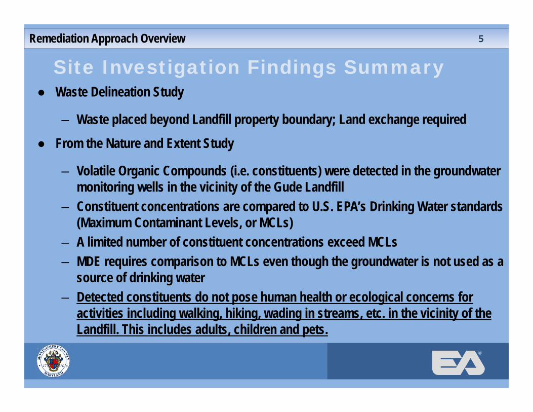
Site Investigation Findings Summary● Waste Delineation Study
– Waste placed beyond Landfill property boundary; Land exchange required
● From the Nature and Extent Study
– Volatile Organic Compounds (i.e. constituents) were detected in the groundwater monitoring wells in the vicinity of the Gude Landfill
– Constituent concentrations are compared to U.S. EPA’s Drinking Water standards (Maximum Contaminant Levels, or MCLs)
– A limited number of constituent concentrations exceed MCLs– MDE requires comparison to MCLs even though the groundwater is not used as a
source of drinking water– Detected constituents do not pose human health or ecological concerns for
activities including walking, hiking, wading in streams, etc. in the vicinity of the Landfill. This includes adults, children and pets.
Remediation Approach Overview 5
®
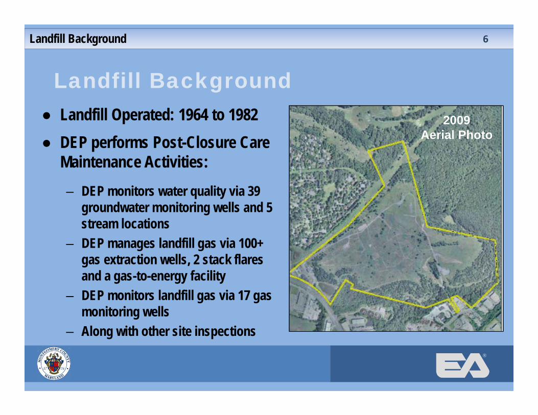
Landfill Background● Landfill Operated: 1964 to 1982● DEP performs Post-Closure Care
Maintenance Activities: – DEP monitors water quality via 39
groundwater monitoring wells and 5 stream locations
– DEP manages landfill gas via 100+ gas extraction wells, 2 stack flares and a gas-to-energy facility
– DEP monitors landfill gas via 17 gas monitoring wells
– Along with other site inspections
Landfill Background
2009 Aerial Photo
6
®
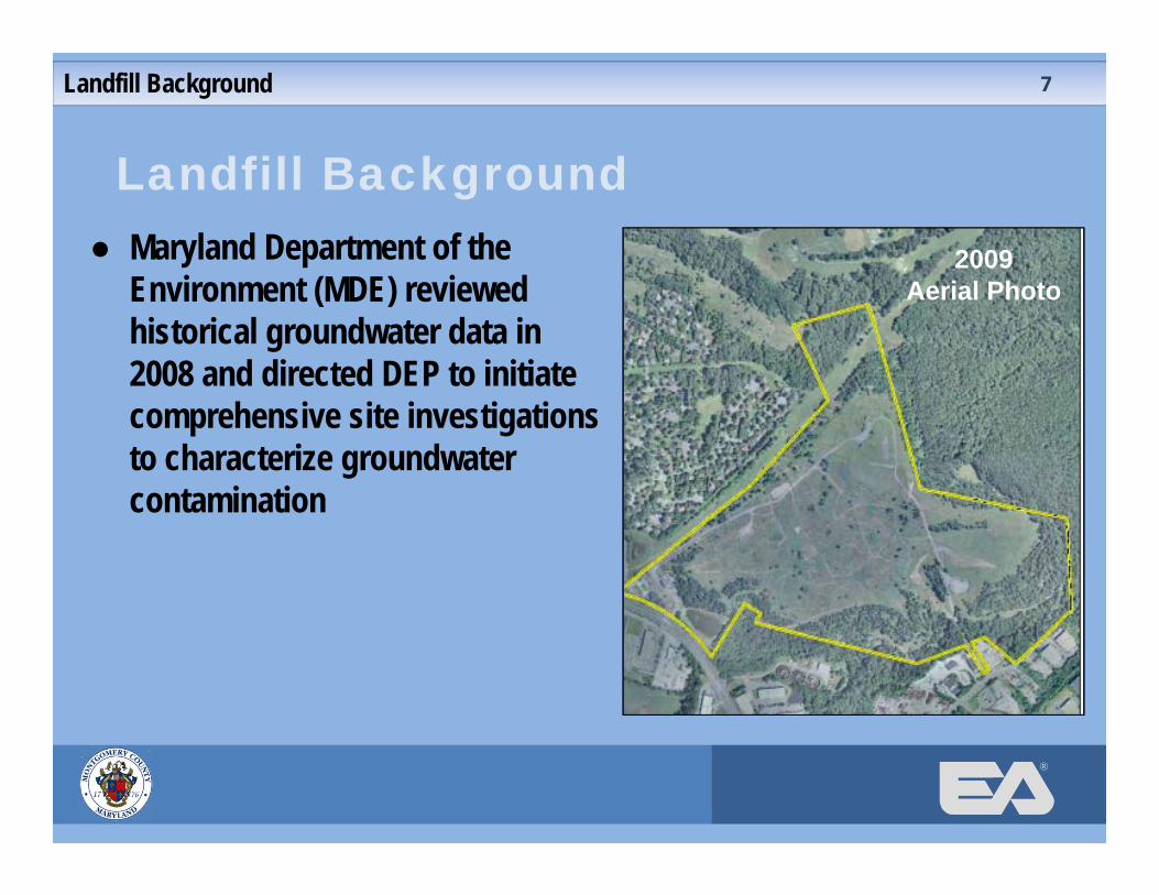
Landfill Background● Maryland Department of the
Environment (MDE) reviewed historical groundwater data in 2008 and directed DEP to initiate comprehensive site investigations to characterize groundwater contamination
Landfill Background
2009 Aerial Photo
7
®
Landfill Background● Groundwater and surface water quality analysis performed since
1984● The groundwater in the vicinity of the Landfill is not used as a
potable water supply● Potable water for Derwood Station is supplied by the Washington
Suburban Sanitary Commission (WSSC)
Landfill Background 8

®
Community Engagement● GLCC/DEP Monthly Meetings – 25 meetings (since June 2009)● DEP Remediation Webpage (June 2009)● Community Meeting (September 2009)● DEP Newsletters and Fact Sheets – 4 distributions (2010-2012)● Derwood Station HOA Newsletters (2009-2012)
Community Engagement 9
®
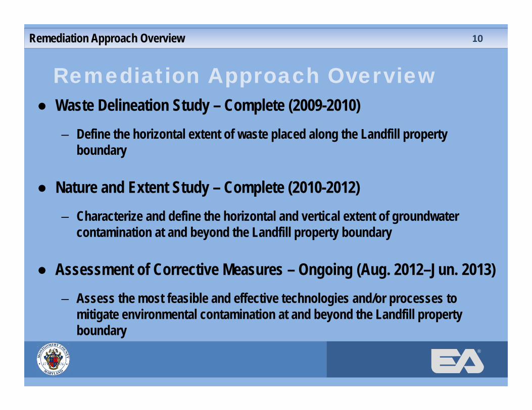
Remediation Approach Overview● Waste Delineation Study – Complete (2009-2010)
– Define the horizontal extent of waste placed along the Landfill property boundary
● Nature and Extent Study – Complete (2010-2012)– Characterize and define the horizontal and vertical extent of groundwater
contamination at and beyond the Landfill property boundary
● Assessment of Corrective Measures – Ongoing (Aug. 2012–Jun. 2013)– Assess the most feasible and effective technologies and/or processes to
mitigate environmental contamination at and beyond the Landfill property boundary
Remediation Approach Overview 10
®
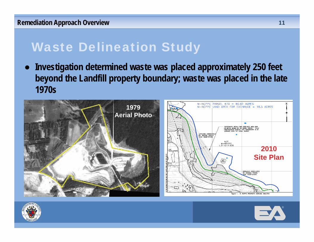
Waste Delineation Study
Remediation Approach Overview
● Investigation determined waste was placed approximately 250 feet beyond the Landfill property boundary; waste was placed in the late 1970s
1979 Aerial Photo
2010 Site Plan
11

®
Exchange of Land with M-NCPPC
Remediation Approach Overview
Montgomery County Land9.6 acres
Montgomery County Land 7.4 acres
M‐NCPPC Land16.5 acres
● Initiate land exchange with M-NCPPC for ~ 17 acre transfer
● Final Property Survey of 3 land parcels near complete
12
®
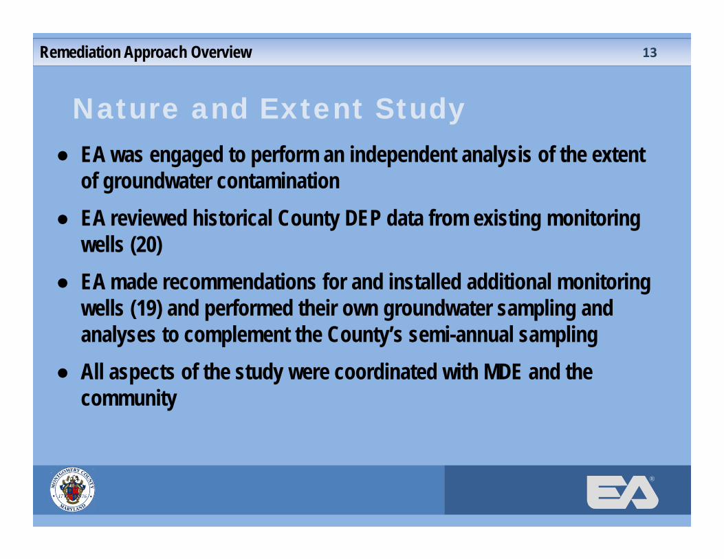
Nature and Extent Study● EA was engaged to perform an independent analysis of the extent
of groundwater contamination● EA reviewed historical County DEP data from existing monitoring
wells (20)● EA made recommendations for and installed additional monitoring
wells (19) and performed their own groundwater sampling and analyses to complement the County’s semi-annual sampling
● All aspects of the study were coordinated with MDE and the community
Remediation Approach Overview 13
®
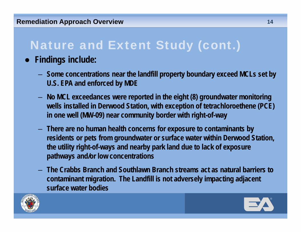
Nature and Extent Study (cont.)● Findings include:
– Some concentrations near the landfill property boundary exceed MCLs set by U.S. EPA and enforced by MDE
– No MCL exceedances were reported in the eight (8) groundwater monitoring wells installed in Derwood Station, with exception of tetrachloroethene (PCE) in one well (MW-09) near community border with right-of-way
– There are no human health concerns for exposure to contaminants by residents or pets from groundwater or surface water within Derwood Station, the utility right-of-ways and nearby park land due to lack of exposure pathways and/or low concentrations
– The Crabbs Branch and Southlawn Branch streams act as natural barriers to contaminant migration. The Landfill is not adversely impacting adjacent surface water bodies
Remediation Approach Overview 14
®
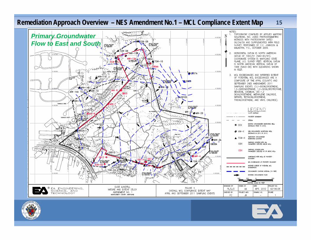
Remediation Approach Overview – NES Amendment No.1 – MCL Compliance Extent Map 15
Primary Groundwater Flow to East and South

®
Assessment of Corrective Measures Remedial Action Objectives:
● Groundwater: U.S. EPA’s drinking water maximum contaminant levels (MCLs) will not be exceeded in the groundwater at the Gude Landfill property boundary
● Landfill Gas (LFG): Methane will not exceed lower explosive limit (LEL) at the Gude Landfill property boundary
● Leachate: No non-storm water discharges (leachate) will occur to waters of the State
Assessment of Corrective Measures 16
®
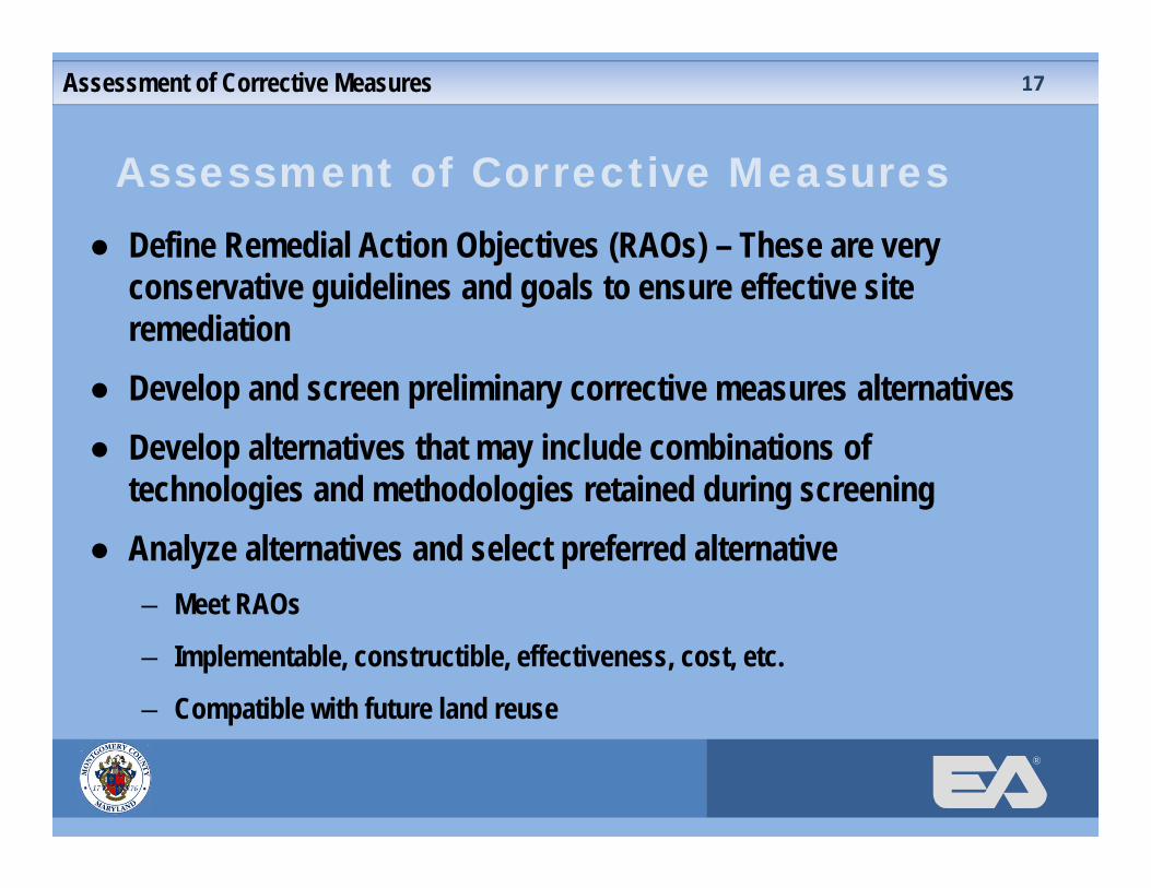
Assessment of Corrective Measures● Define Remedial Action Objectives (RAOs) – These are very
conservative guidelines and goals to ensure effective site remediation
● Develop and screen preliminary corrective measures alternatives ● Develop alternatives that may include combinations of
technologies and methodologies retained during screening● Analyze alternatives and select preferred alternative
– Meet RAOs
– Implementable, constructible, effectiveness, cost, etc.
– Compatible with future land reuse
Assessment of Corrective Measures 17

®
Potential Corrective Measures ● Waste Relocation
– Excavating, removing and relocating solid waste to remove the source of contaminants
– Processing solid waste to screen cover soil and recyclable material
– Selective or extensive in area
Potential Corrective Measures 18
®
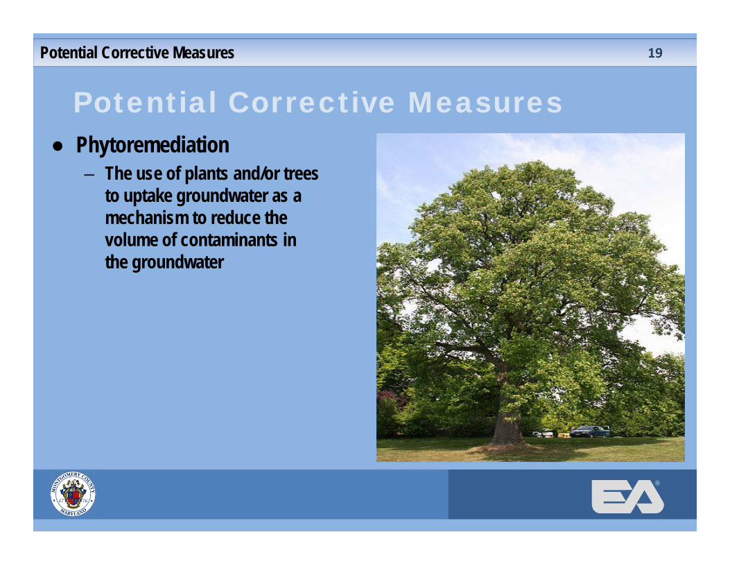
Potential Corrective Measures ● Phytoremediation
– The use of plants and/or trees to uptake groundwater as a mechanism to reduce the volume of contaminants in the groundwater
Potential Corrective Measures 19
®
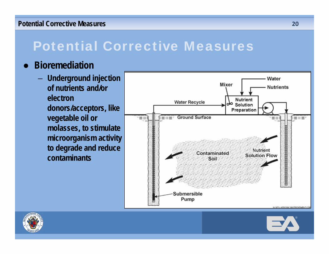
Potential Corrective Measures ● Bioremediation
– Underground injection of nutrients and/or electron donors/acceptors, like vegetable oil or molasses, to stimulate microorganism activity to degrade and reduce contaminants
Potential Corrective Measures 20
®
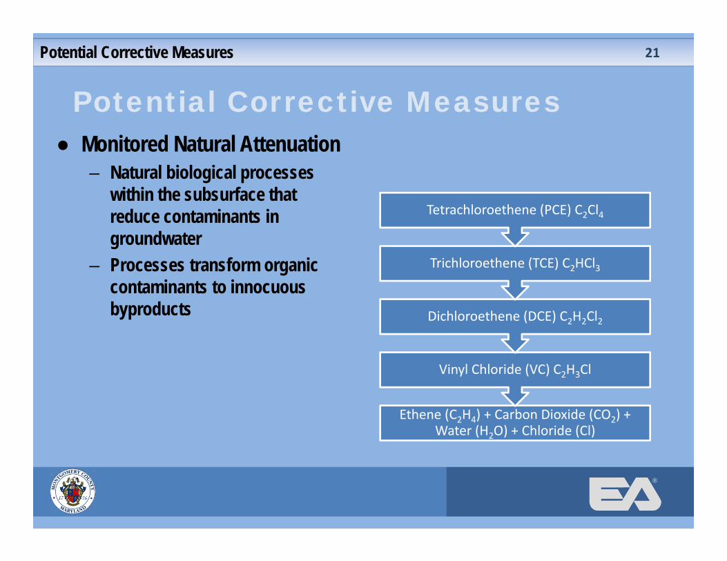
Potential Corrective Measures ● Monitored Natural Attenuation
– Natural biological processes within the subsurface that reduce contaminants in groundwater
– Processes transform organic contaminants to innocuous byproducts
Potential Corrective Measures 21
Ethene (C2H4) + Carbon Dioxide (CO2) + Water (H2O) + Chloride (Cl)
Vinyl Chloride (VC) C2H3Cl
Dichloroethene (DCE) C2H2Cl2
Trichloroethene (TCE) C2HCl3
Tetrachloroethene (PCE) C2Cl4
®
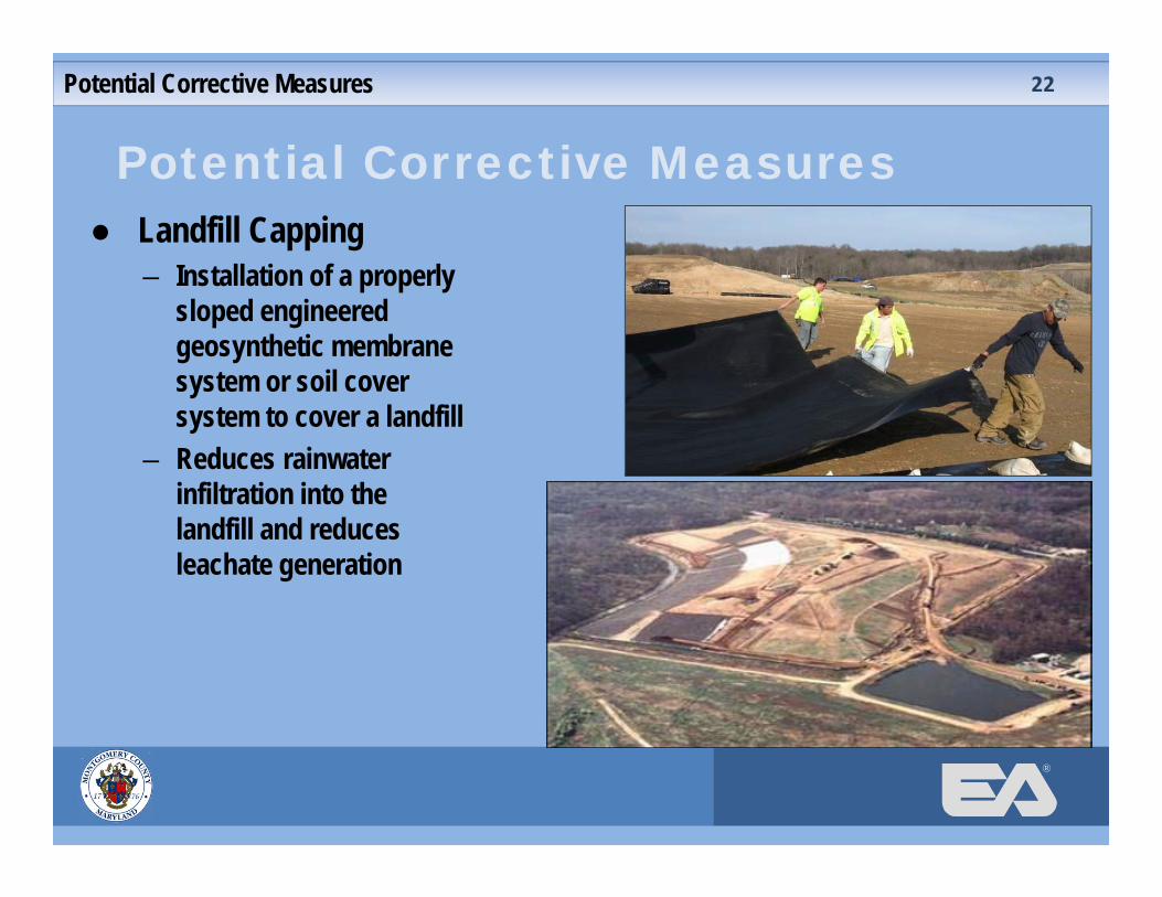
Potential Corrective Measures ● Landfill Capping
– Installation of a properly sloped engineered geosynthetic membrane system or soil cover system to cover a landfill
– Reduces rainwater infiltration into the landfill and reduces leachate generation
Potential Corrective Measures 22
®
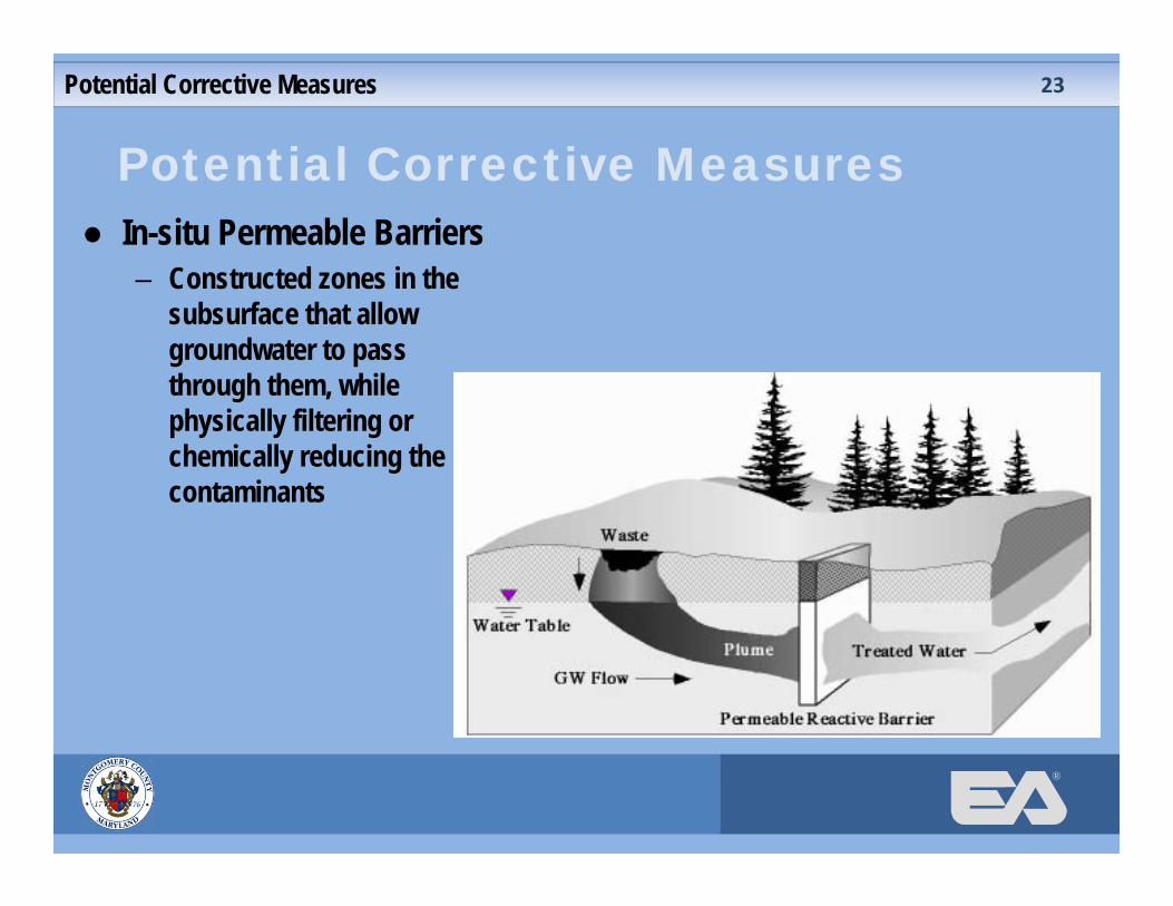
Potential Corrective Measures ● In-situ Permeable Barriers
– Constructed zones in the subsurface that allow groundwater to pass through them, while physically filtering or chemically reducing the contaminants
Potential Corrective Measures 23

®
Potential Corrective Measures ● Impermeable Barriers
– Constructed zones in the subsurface that restrict the flow of groundwater and subsurface gases
– Used to contain contamination as well as to divert water and gases from specific areas
Potential Corrective Measures 24
®
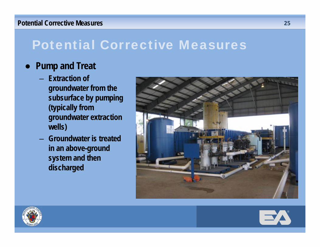
Potential Corrective Measures ● Pump and Treat
– Extraction of groundwater from the subsurface by pumping (typically from groundwater extraction wells)
– Groundwater is treated in an above-ground system and then discharged
Potential Corrective Measures 25
®
Assessment of Corrective Measures● EA will prepare the final technical report● MDE review and comment ● Revisions to ACM ● MDE ACM approval● Potential future land reuses will be identified by the community,
the County Executive and other interested parties● Design and implement selected corrective measure(s),
considering potential future land reuse options in design of corrective measure(s) to the extent feasible
● Monitor success of corrective measure(s)
Next Steps 26
®
Ongoing Community Engagement● Monthly GLCC/DEP Meetings● Community representatives are welcome to initiate and continue
discussions on future land reuse with the County Executive throughout the ACM process and final implementation of corrective measures
● DEP will continue to present documents to the community at principal milestones such as the completion of the ACM study
● DEP will continue to post documents to the remediation webpage
Next Steps 27

®
Anticipated Schedule
Next Steps
**
* Land Reuse Coordination
28

®
Land Reuse Process
Land Reuse Process 29
● Meetings with all parties interested in potential land reuses ● Community will have an opportunity to meet directly with the
County Executive● The County Executive will make a recommendation to MDE on the
proposed remediation approach ● The County Executive’s Office will put together a conceptual future
land reuse plan considering information provided by all interested parties, which is also consistent with the remediation approach
®
Land Reuse Process (cont.)
Land Reuse Process 30
● The land reuse plan will go to the County M-NCPPC Planning Board for review under the Mandatory Referral Process
● Recommendations for approval or revision are provided by the Planning Board
● The County Council controls funding and will vote on whether to formally approve the final project
● If approved, the project will go forward as a full CIP project and design and permitting work will begin
®
Land Reuse Community Preference
Land Reuse Community Preference 31
● Derwood Station HOAs performed a survey of residents that indicated a preference for passive land reuse activities for the Landfill site, which include: – Running and walking trails
– Bike paths
– Model plane flying areas
– Children’s play areas
– Dog park areas
– Garden plots
®
County Contacts & Additional Info.
County Contacts and Additional Information
● Peter Karasik– Section Chief, DSWS Central Operations.– 240-777-6569; [email protected]
● Stephen Lezinski– Engineer III, DSWS Central Operations.– 240-777-6590; [email protected]
● Gude Landfill Remediation Webpage– http://www6.montgomerycountymd.gov/swstmpl.asp?url=/content/dep/solidwaste/faci
lities/gude/index.asp
● GLCC/DEP Monthly Meetings– Open to public and held the second Thursday each month.– Contact Steve Lezinski for schedule.
32
®
Questions and Discussions
Questions and Discussions 33