hawaii flood management news
TRANSCRIPT

1
“Say Goodbye to Long LOMA Processing Times” continued on page 5
FEMA is developing an application called "eLOMA," which will provide licensed land surveyors and professional engineers with an Internet-based system to proc-ess straightforward requests for Letters of Map Amendment (LOMAs). A LOMA is a letter from FEMA stating that an existing structure or parcel of land that has not been elevated by the placement of fill is not expected to be inundated by the 1- percent-annual-chance flood (the base flood). The process to obtain a LOMA has historically taken 30 to 60 days, but with eLOMA, homeowners could receive their determinations in the time it takes to enter the re-quired information online. How Does eLOMA Work? To receive an eLOMA, licensed professionals will register on FEMA's Multi-hazard In-formation Platform (MIP) to establish an account. They can then enter property- specific information that they have certified as accurate as well as data gleaned from the FEMA Flood Insurance Rate Maps and Flood Insurance Study Reports. The eLOMA online service will then make a determination based on the submitted in-formation, and users will be able to print a copy of it. An eLOMA will perform the same functions as a standard LOMA. The only differ-ence between the two is that the online determination is made automatically with standard checks and some random audits rather than with the more lengthy man-ual review given to the LOMA by FEMA staff. In addition, the eLOMA does not re-place the LOMA procedure. The eLOMA is an op-tional process appli-cable to only the most straightforward LOMA requests. Cur-rently, there is no charge to receive a LOMA, and eLOMAs also will be available to the public at no cost.
January 2006 Hawaii Flood Management News is published quarterly. It is supported by the Federal Emer-gency Management Agency under the Com-munity Assistance Program. The contents are dedicated to the public. The authors and publisher are solely responsible for the accu-racy, and do not necessarily reflect the views of the federal government. We welcome newsworthy items from the gen-eral public. Articles may be sent to the De-partment of Land and Natural Resources, En-gineering Division, P.O. Box 373, Honolulu, Hawaii 96809. Call (808) 587-0267 for more information. If you’d like to receive this newsletter via email, please send your email address to [email protected] or if you wish to be re-moved from our mailing list please contact Elaine Keb at (808) 587-0227.
Say Goodbye to Long LOMA Processing Times Michael Godesky, FEMA
1 • Say Goodbye to Long LOMA
Processing times
Inside This Issue
2 • Historic Hurricane Season Shatters
Previous Agency Records
• Flood Insurance Rate Maps
• Upcoming Events
3 • First TsunamiReady State in United
States
4 • What is it? Flood or Wind Dam-
age?
• Ask the Expert,
Insurance Questions
6 • What is it? Flood or Wind Dam-
age? (cont.)
• Announcements
5 • Historic Hurricane Season (cont.)
• Say Goodbye to Long LOMA
Processing times (cont.)
Hawaii Flood Management NewsHawaii Flood Management News
Department of Land and Natural ResourcesDepartment of Land and Natural ResourcesDepartment of Land and Natural Resources Engineering DivisionEngineering DivisionEngineering Division
Linda Lingle, Governor
Some hilltop buildings may be eligible for LOMAs. (Photo by Lynd Morris, NFIP Bureau)

Historic Hurricane Season Shatters Previous Agency Records
2
Flood Insurance Rate Maps
“Historic Hurricane Season ...” continued on page 5
WASHINGTON, D.C. -- The 2005 hurricane season was the most active in U.S. history with a total of 26 named storms. The Department of Homeland Secu-rity's Federal Emergency Management Agency (FEMA) responded in record ways to the six storms that made landfall along our coastlines, including the nation's largest and costliest natural disaster ever, Hurricane Katrina. In addition to Katrina, FEMA also responded to Hurricane Dennis, Tropical Storm Cindy, Hurricane Rita, Hurricane Ophelia, and Hurricane Wilma. Com-bined, the six storms represent the most widespread and catastrophic series of disasters in the nation's history. Hurricane and tropical storm damage in 2005 spurred emergency and disaster declarations in a record 44 states and the District of Columbia to address the expense of sheltering millions of evacuees forced from their homes by Katrina and Rita. "This hurricane season has been historic in many ways, not only in the num-ber of storms but in FEMA's role in them," said David Paulison, acting director of FEMA. "FEMA has taken more applications, and delivered more assis-tance in a shorter period of time than during any other hurricane season in our history. I am proud of the good people who work at FEMA and for their tireless effort to help those whose lives were altered by these storms. A long road to recovery remains ahead of those who were impacted by the Gulf Coast hurricanes and we will continue to be there to help." The agency's data processing centers have collected a record three million applications for assistance throughout the 2005 hurricane season. In com-parison, this is almost triple the number of applications FEMA took during all of 2004 when four hurricanes hit the Florida coast. Until last year, FEMA had never taken more than a million applications for any single year. Already FEMA has provided more than $22 billion dollars in relief funds in re-sponse to the six storms, and that figure is expected to rise significantly over the coming months and years as relief operations continue. The $22 billion dollars is the most granted during a single year by FEMA, and represents the fastest delivery of relief funds in FEMA's history. For the first time ever, the National Disaster Medical System (NDMS) utilized
February 2-5, 2006 12th Annual Home Building & Remodeling Show, Neal Blaisdell Exhibition Hall (http://www.bia-hbrs.com/) June 11-16, 2006 30th Annual Conference of the Association of State Floodplain Managers (ASFPM), Albu-querque, New Mexico. For more informa-tion, visit ASFPM’s website at www.floods.org August 16 - 17, 2006 (Tentative) 2nd Annual Hawaii Floodplain Manager’s Conference and CFM Exam. More info, email: [email protected]
Upcoming Events
Have you updated your library lately? Does your office have FEMA’s current copy of the Flood Insurance Studies (FIS)? The following are the most current printing of each County’s Flood Insurance Study.
City and County of Honolulu June 2, 2005
Hawaii County April 2, 2004
Kauai County
September 16, 2005
Maui County May 15, 2002
Please remember that the Flood Insurance Study may not necessarily have the most cur-rent flood hazard information. FEMA approved Letter of Map Revisions (LOMR), can also up-date the study information. Please check with your local NFIP coordinator for current informa-tion, or you could also find it on-line at www.fema.gov. County NFIP Coordinators: Oahu: Mario Siu-Li 523-4247 Kauai: Mario Antonio 241-6620 Maui: Francis Cerizo 270-7771 Hawaii (East): Kelly Gomes 961-8327 Hawaii (West): Kiran Emler 327-3530
Photo: www.weather.com

Source: FCW
3
NOAA’S National Weather Service Declares Hawaii
First TsunamiReady State in the United States Dibya Sarkar, FCW
Release Date: December 12, 2005 - National Weather Service (NWS) officials announced last week that Hawaii is the first state in the country to be prepared for se-vere weather storms and tsunamis under voluntary federal guidelines. Under the NWS programs, all four of the state’s counties achieved the distinctions of StormReady and Tsu-
namiReady, which the agency designed to help communities meet cer-tain communications and safety guidelines and skills. “Hawaii has experienced more tsunami threats than any other state in the union, and we know how devastating they can be,” Sen. Daniel Inouye (D-Hawaii) said in a prepared statement. “In Hawaii we have taken steps to be better prepared for the next tsunami. We have an emergency operations center in every county, a statewide siren system, evacuation maps in the phone books, regular drills and public education programs.” Although the programs are separate, much of the criteria are similar. State and local officials must address a few exceptions and additions to be TsunamiReady. In both programs, communities must establish a 24-hour warning point, which can be a police or fire department dispatching point, to receive and disseminate NWS information and activate the local warning system. They must also have established emergency operations centers for juris-dictions that have more than 2,500 people. Those emergency operations centers and warning points must be able to receive and send weather information in multiple ways, including via National Oceanic and Atmospheric Administration Weather Radios, satel-lite downlink feeds from NWS, a statewide telecommunications network, amateur radio transceivers, wireless devices and local radios. To be ready for tsunamis, communities must also connect to NOAA’s Weather Wire via the Internet, receive e-mail and pager messages from the Pacific Tsunami Warning Center, and monitor Coast Guard broad-casts, among other methods. The programs also require communities to train government employees and prepare operations and evacuation plans, among other criteria. The StormReady program started in 1999, and more than 990 desig-nated communities now exist in 48 states. More than 20 TsunamiReady communities exist in six states. Those communities must renew their pro-gram designations every three years. Hawaii Gov. Linda Lingle said in a press release that her administration is proposing a comprehensive emergency preparedness package fo-cused on hazard mitigation, improved preparedness and accelerated response and recovery efforts.
Janes Island, SC
South Africa
Colorado
Oklahoma
United Kingdom
Western Australia
Australia
SIGNS
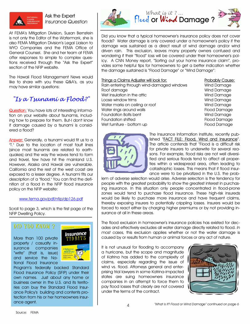
Did you know that a typical homeowner’s insurance policy does not cover floods? Water damage is only covered under a homeowner’s policy if the damage was sustained as a direct result of wind damage and/or wind driven rain. This exclusion, leaves many property owners confused and wondering if their “flood” loss will be covered under their homeowner’s pol-icy. A CNN Money report, “Sorting out your home insurance claim”, pro-vides some helpful tips for homeowners to get a better indication whether the damage sustained is “Flood Damage” or “Wind Damage”: Things a Claims Adjuster will look for: Probably Cause: Rain entering through wind-damaged windows Wind Damage Roof damage Wind Damage Wet insulation in the attic Wind Damage Loose window trims Wind Damage Water marks on ceiling or roof Wind Damage Water rings around walls Flood Damage Foundation Bolts bent Wind Damage Foundation shifted Flood Damage Wet furniture - bottom up Flood Damage
The Insurance Information Institute, recently pub-lished “FACT FILE: Flood, Wind and Insurance”. The article contends that “Flood is a difficult risk for private insurers to underwrite for several rea-sons. For example, flood risks are not well diversi-fied and serious floods tend to affect all proper-ties within a widespread area, often leading to catastrophic losses. This means that if flood insur-ance were to be privatized in the U.S. the prob-
lem of adverse selection would arise. Adverse selection is the tendency for people with the greatest probability to show the greatest interest in purchas-ing insurance. In this situation only people concentrated in flood-prone zones would tend to purchase flood insurance. These high-risk insureds would be likely to purchase more insurance and have frequent claims, thereby exposing insurers to potentially crippling losses. Insurers would be forced to react either by charging higher premiums or by not providing in-surance at all in these areas. The flood exclusion in homeowner’s insurance policies has existed for dec-ades and effectively excludes all water damage directly related to flood. In most cases, this exclusion applies whether or not the water damage is caused by or results from human or animal forces or any act of nature. It is not unusual for flooding to accompany a hurricane, but the scope and magnitude of Katrina has added to the complexity of claims, especially regarding the issue of wind vs. flood. Attorneys general and enter-prising trial lawyers in some Katrina-impacted states are suing homeowners insurance companies in an attempt to force them to pay flood losses that clearly are not covered under the terms of the contract.
DD ID YOU KNOW ?ID YOU KNOW ? More than 100 private property / casualty in-surance companies “write” (that is, issue) and service the Na-tional Flood Insurance Program’s federally backed Standard Flood Insurance Policy (SFIP) under their own names. Just about any home or business owner in the U.S. and its territo-ries can buy the Standard Flood Insur-ance Policy’s building and contents pro-tection from his or her homeowners insur-ance agent.
4
Flood or Wind Damage ?
Source: FEMA
Ask the Expert Insurance Question
At FEMA’s Mitigation Division, Susan Bernstein is not only the Editor of the Watermark, she is also FEMA Mitigation Division’s Legal Liaison to WYO Companies and the FEMA Office of General Counsel. She and her team at FEMA offer responses to simple to complex ques-tions received through the “Ask the Expert” section of the NFIP website. The Hawaii Flood Management News would like to share with you these Q&A’s, as you may have similar questions: "Is a Tsunami a Flood?"
Question: You have lots of interesting informa-tion on your website about tsunamis, includ-ing how to prepare for them. But-I don't know if damage caused by a tsunami is consid-ered a flood? Answer: Generally, a tsunami would fit us to a "T." Due to the location of most fault lines (since most tsunamis are related to earth-quakes) and the way the waves tend to form and travel, few have hit the mainland U.S. However, Alaska and Hawaii are vulnerable. California and the rest of the west coast are exposed to a lesser degree. A tsunami fits our description of a "flood." You can find the defi-nition of a flood in the NFIP flood insurance policy on the NFIP website:
www.fema.gov/pdf/nfip/dp126.pdf Scroll to page 3, which is the first page of the NFIP Dwelling Policy.
“What is it? Flood or Wind Damage” continued on page 6
T I D B I T S Call your insurance agent
today.
What is it ? ...

5
NOTE: We offer this publication information for refer-ence only. We do not endorse any product or com-pany. Please note website links may have changed since the publication of this newsletter.
Source: Watermark
all three of its components at the same time; medical response teams, patient evacuation, and definitive hospital care. NDMS deployed more than 5,000 health care professionals and treated more than 160,000 patients during the hurricane season, 16 times more patients than they had ever treated in any other single year. FEMA's Urban Search and Rescue teams also responded in record numbers dispatching 68 teams comprised of more than 3,000 personnel. More than 6,500 rescues were made during the hurricane season by these teams. A total of 38 teams alone were deployed to assist in the rescue efforts for Hurricane Katrina, marking the largest deployment of search and rescue teams for any single event in our nation's history. In all, FEMA set records for the number of commodities distributed, the number of personnel deployed, the number of patients treated, the number of people rescued and the number of families and governments assisted during the 2005 hurricane season. Committed to the long term recovery of the Gulf Coast region, FEMA expects additional records will be broken as work with state and local officials continues to rebuild this vibrant and integral area of the country. FEMA prepares the nation for all hazards and manages federal response and recovery efforts following any national incident. FEMA also initiates mitigation activities, trains first responders, works with state and local emergency manag-ers, and manages the National Flood Insurance Program. Source: FEMA Release Date: November 30, 2005 Release Number: 1603-188
Insurance Information Institute
Home Inventory Software
Spotlight, features informative publications which are available to the public free of charge. This quarter’s selection is:
Spotlight “Historic Hurricane Season ...” continued from page 2
The Insurance Information Institute (III) has developed a cool way to inventory your worldly possessions with their “Know Your Stuff - Home Inventory” program. This free software is fun and easy to use. Once you have completed your inven-tory, this program is designed to make it easy to keep this information up to date. You will also find lists of items in typical rooms to help guide you through the inventory process. III has also developed a video release of step by step instructions on to use the software. Visit:
http://www.knowyourstuff.org/
to download the software or view the video instructions.
The Future Looks Bright FEMA will be closely monitoring the progress of eLOMAs and, if they are suc-cessful, may consider expanding eLOMA capabilities to include:
♦ accepting and handling processing fees ♦ allowing on-line applications for LOMRs, LOMR-Fs,
etc. ♦ determining the Base Flood Elevation by latitude
and longitude, via a Digital Flood Insurance Rate Map (DFIRM) database (there must be enough vol-ume to warrant this change)
♦ permitting e-LOMAs for buildings constructed on fill
(community acknowledgement would be required to validate the fill).
Questions about the new eLOMAs can be directed to the FEMA Map Assis-tance Center (877-FEMA-MAP). Michael Godesky, the Project Engineer for FEMA's Risk Identification Branch, is also the coordina-tor of FEMA's Letter of Map Change Workgroup.
“Say Goodbye to Long LOMA Processing Times” continued from page 1
Watch the "Taking Inventory" video news release...

would be forced to incorporate flood coverage into stan-dard homeowners policies and incorporate an appropri-ate premium—one, unlike current flood insurance, not subsidized by taxpayers. This could add hundreds of dol-lars to the average homeowners premium in all 50 states. Some insurers could respond by refusing to write any cov-erage in coastal areas or flood plains. With contracts up-ended, a national crisis in the availability and affordability of homeowners insurance could ensue.”
Hawaii Flood Management News
Board of Land and Natural Resources Peter T. Young, Chairperson Timothy E. Johns Toby Martyn Gerald DeMello Ted K. Yamamura Taryn Schuman Ron Agor Engineering Division Eric T. Hirano, Chief Engineer Editor: Carol Tyau-Beam Editorial Support Staff: Elaine Keb
Department of Land and Natural Resources Engineering Division P.O. BOX 373 HONOLULU, HAWAII 96809
6
The typical homeowners policy covers damage due to wind, wind-driven rain and fire (including arson), theft (including looting), vandalism and damage caused by fallen trees. Rain entering through wind-damaged windows, doors or a hole in a wall or the roof, resulting in standing wa-ter or puddles, is considered windstorm rather than flood damage and is covered by the homeowners policy. The NFIP flood insurance policy covers exactly what home-owners policies do not—damage caused by the general condition of flooding typically caused by storm surge, wave wash, tidal waves, or the overflow of any body of water over normally dry land areas. Insurance policies are legal contracts with specific policy terms and conditions. The provisions of standard policies have been reviewed and approved by regulators in each state. The wording of water damage exclusions is virtually identical in all 50 states. If the coverage rulings were to go against insurers, this would create an enormous financial liability for an explicitly ex-cluded peril for which no premium was collected and for which insurers have no reserves to pay claims. Some insurers may fail as a result. Insurers would also not know if their con-tracts were valid anywhere. To protect themselves, they
“What is it? Flood or Wind Damage” continued from page 4
Source: Insurance Information Institute
The Department of Land and Natural Resources, Engineering Di-vision is pleased to announce that Edwin Matsuda has been named the new head of the Flood Control and Dam Safety Section. In addi-tion to his new duties, Mr. Matsuda is also the State Dam Safety Engi-neer. His predecessor, Mr. Sterling Yong retired last June. CONGRATULATIONS Edwin !!