hdf5 for npoess data products alan m. goldberg the mitre corporation [email protected]...
TRANSCRIPT
HDF5 for NPOESS Data Products
Alan M. Goldberg The MITRE Corporation [email protected]
Organization: W803Project: 1400NT01-SE
This work was performed under NOAA contract 50-SPNA-9-00010.Opinions expressed are those of the author, and do not represent the
United States Government.
© 2002 The MITRE Corporation. All rights reserved.

The NPOESS Program
Products Requirements HDF Implementation (Presentation by Chad Fox / Raytheon)

Data Flow OverviewField Terminals and Centrals
Application Processing,Display, & Dissemination
FT ProcessorElement
CentralCentral Element
NPOESS-UniqueProcessing
RFElectronics
Demodulator
C3S/DRR
SpaceSegment
NPOESS-UniqueCollection
Antenna
UserTerminal
IDPS External I/FOtherData
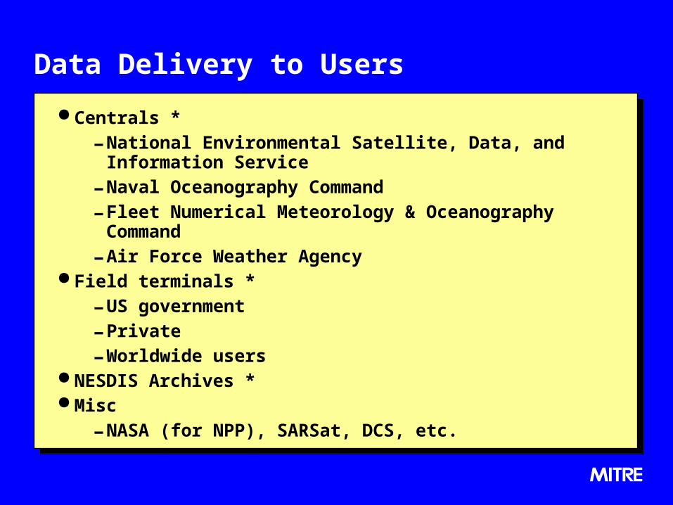
Data Delivery to Users
Centrals *
- National Environmental Satellite, Data, and Information Service
- Naval Oceanography Command
- Fleet Numerical Meteorology & Oceanography Command
- Air Force Weather Agency Field terminals *
- US government
- Private
- Worldwide users NESDIS Archives * Misc
- NASA (for NPP), SARSat, DCS, etc.

Major Product Relationships
Environmental Phenomena
Propagation Sensor
Sensor Scene
Environmental Data Record
EnvironmentModel
Sensor Model
Sensor Data Record
A0569F223B365CC369B707070FFF
Comm
Raw Data
Record
Packetized Data
A0569F223B365CC369B707070FFF
100110110011100
100110110011100
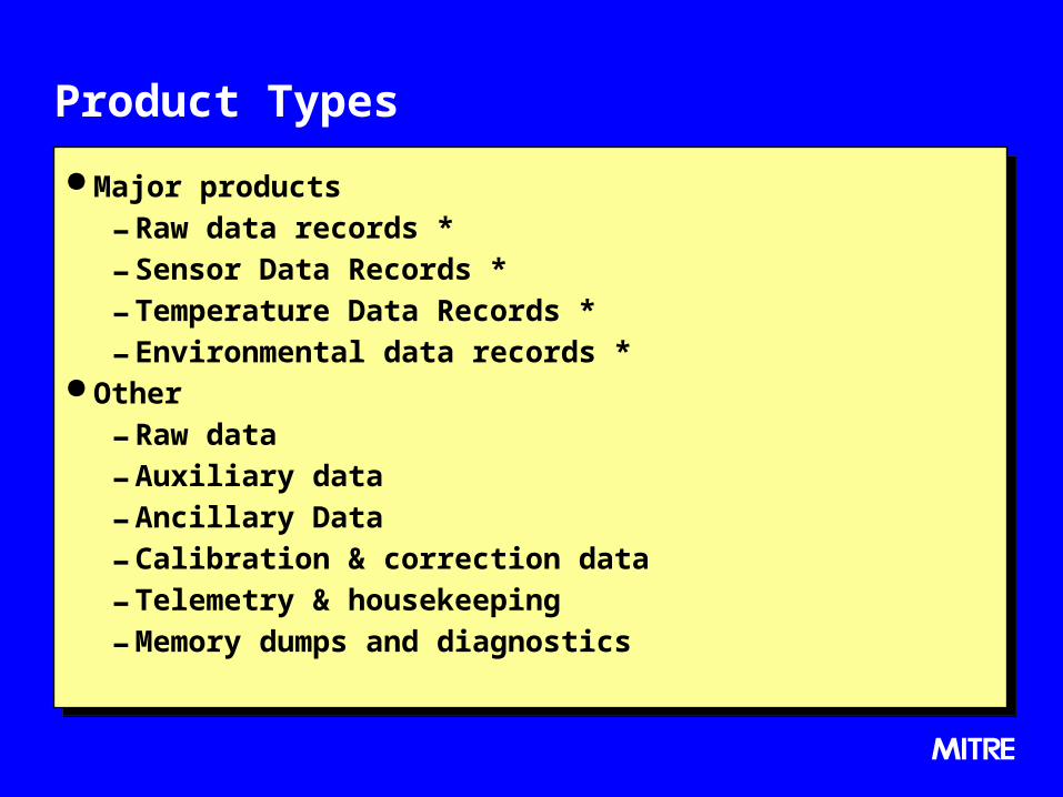
Product Types
Major products
- Raw data records *
- Sensor Data Records *
- Temperature Data Records *
- Environmental data records * Other
- Raw data
- Auxiliary data
- Ancillary Data
- Calibration & correction data
- Telemetry & housekeeping
- Memory dumps and diagnostics

Delivery Requirements
Operational *; platform independence; suitable for transmission, efficient conversion, and storage
Standards based: Interoperability*, consistent with Joint Technical Architecture and National Spatial Data Infrastructure
Rapid & available*: >95% delivered within 30 min. at Centrals; 15 min. goal
Self-documenting Flexible for over 100 initial products Flexible for evolutionary or new sensors and algorithms User selectable aggregation (from one granule up to full orbit) Delivery: Push or pull; Assured; Secure* Efficient: 3 TB per day at each Central Consistent interface for delivery to Centrals*, Field terminals*, & long
term archives*
* key requirement

Schedule
Interface with Centrals to be published (draft) in spring 2003. First deliverable version of IDPS to be ready in spring 2005
for NPP risk-reduction mission in spring 2006 Hardware specification for software support at field
terminals to be published by Oct. 2005 Operational system to be ready in mid 2008 for first NPOESS
launch in mid 2009.

Issues
How much EOSDIS heritage to retain, if any, e.g.
– whether to use EOS swath construct Develop an NPOESS profile to handle particular attributes of
NPOESS data, e.g.
– variable length compressed packets in RDRs
– conical scan geometry Assure long-term stability of the standard Provide user support Suitability for archival use
– HDF5 is primarily defined by its API, not the format

Backup

Data Processing Flow in IDPS
MetadataMetadata
Converted Mission
Data
Converted Mission
Data
MetadataMetadata
Mission Data Packets
Mission Data Packets
Corr. Data Packets
Corr. Data Packets
Auxiliary/ Telemtry/
Hskpng Data Packets
Auxiliary/ Telemtry/
Hskpng Data Packets
MetadataMetadata
Envi-ronment
Data
Envi-ronment
Data
Ancillary Data
Ancillary Data
RDR EDR
Ancillary Data Packets
Ancillary Data Packets
LRD Only
ConvertedTelemetry
TDR/ SDR
Format Format Format Format
EDR Process
Environment
Model
SDR Process
Sensor Model
Delivered Raw DataDelivered Raw Data
RDRProcess
Communi-cations Model
SDR-like
Process
Product Interface to Users
Local
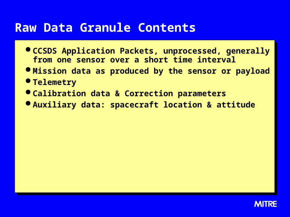
Raw Data Granule Contents
CCSDS Application Packets, unprocessed, generally from one sensor over a short time interval
Mission data as produced by the sensor or payload Telemetry Calibration data & Correction parameters Auxiliary data: spacecraft location & attitude

Sensor/Temperature Granule Contents
Radiometrically corrected data, which is an estimate of the flux at the sensor aperture.
Mission data by in-track position, cross-track position, channel, detector, etc.
Georeferenced in spacecraft coordinates, & intersection with the ellipsoid
Generally, not filtered, resampled, etc.
TDRs are microwave SDRs without antenna pattern removed

Environmental Data Granule Contents
SDRs processed with environmental models and ancillary data (by others) to produce estimates of environmental parameters
Reported as cross-track / in-track values identified in earth coordinates
- unless resampling is specifically required

Metadata - Scope Identifications: - Name / Level / Type-subtype / Sequential number
Description: - Start-end date-time; Start-end orbit
- Subsatellite coordinates; Corner coordinatesHistory: - Space segment components / DRR components / Source
files / Algorithm versions / Processing facility / Processing date-time
Contents: - Size / Granules
- Predecessor quality / Missing data / Out-of-bounds / Processing errors / Quality free text
Formats: - Data elements / Structures / Formats

Metadata - Structure
As goal, all metadata will be compliant with NSDI standards
- <tag> = “parameter”, where <tag> is defined by FGDC or the NPOESS extension profile.
Metadata will be hierarchical, as appropriate:
- file-metadata granule_metadata
– scan_metadata
» point_metadata Metadata should map to the file naming convention Metadata will be included with associated data files, and
accessible as a stand-alone file.

Data
Hierarchical Sensor specific format “Internal” metadata, such as detailed geolocation, quality,
annotation, illumination & view geometry
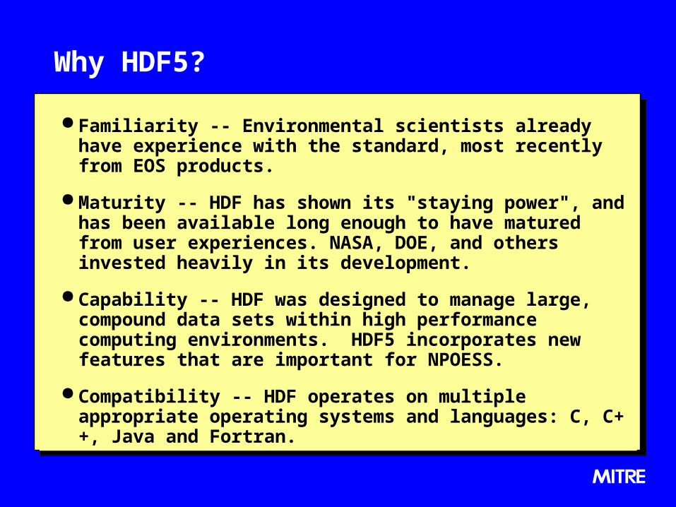
Why HDF5?
Familiarity -- Environmental scientists already have experience with the standard, most recently from EOS products.
Maturity -- HDF has shown its "staying power", and has been available long enough to have matured from user experiences. NASA, DOE, and others invested heavily in its development.
Capability -- HDF was designed to manage large, compound data sets within high performance computing environments. HDF5 incorporates new features that are important for NPOESS.
Compatibility -- HDF operates on multiple appropriate operating systems and languages: C, C++, Java and Fortran.
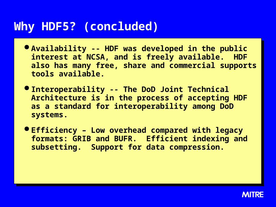
Why HDF5? (concluded)
Availability -- HDF was developed in the public interest at NCSA, and is freely available. HDF also has many free, share and commercial supports tools available.
Interoperability -- The DoD Joint Technical Architecture is in the process of accepting HDF as a standard for interoperability among DoD systems.
Efficiency – Low overhead compared with legacy formats: GRIB and BUFR. Efficient indexing and subsetting. Support for data compression.

Notional Structure -- external metadata
granule_ngranule_2
file_metadatasummary_ metadata
granule_ metadata
granule_1
UniqueFileName.txt

Notional Structure -- HDF portion
granule_ngranule_2
metadata data
granule_1
UniqueFileName.hdfroot
otherlocal_
metadatamission
_data