hernan g. arango, rutgers university ([email protected]) tal ezer, pricenton university...
TRANSCRIPT
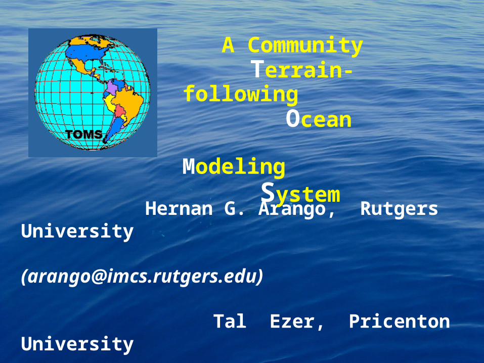
Hernan G. Arango, Rutgers University ([email protected])
Tal Ezer, Pricenton University ([email protected])
FTP File: TOMS.tar
A Community Terrain-following Ocean Modeling
System
Bennett et al. (FNMOC; OSU)
Chassignet / Iskandarani et al. (RSMAS)
Cornuelle / Miller (SIO)
Geyer (WHOI)
Hetland (TAMU)
Lermusiaux (Harvard)
Mellor (Pricenton)
Moore (U. Colorado)
Shchepetkin (UCLA)
Signell (SACLANT; USGS)
COLLABORATORS
Chao / Song (JPL)
Preller / Martin (NRL)
Naval Operational Community
POM Ocean Modeling Community
ROMS / SCRUM Ocean Modeling Community
OTHER COLLABORATORS

To design, develop and test an expert ocean modeling system for scientific and operational applications
To support advanced data assimilation strategies
To provide a platform for coupling with operational atmospheric models (like COAMPS)
To support massive parallel computations
To provide a common set of options for all coastal developers with a goal of defining an optimum coastal/relocatable model for the navy
OBJECTIVES

Use state-of-the-art advances in numerical techniques, subgrid-scale parameterizations, data assimilation, nesting, computational performance and parallelization
Modular design with ROMS as a prototype
Test and evaluate the computational kernel and various algorithms and parameterizations
Build a suite of test cases and application databases
Provide a web-based support to the user community and a linkage to primary developers
APPROACH

“The complexity of physics, numerics,data assimilation, and hardware technology should be transparent
to the expert and non-expertUSER”
CHALLENGE

Free-surface, hydrostatic, primitive equation model
Generalized, terrain-following vertical coordinates
Boundary-fitted, orthogonal curvilinear, horizontal coordinates on an Arakawa C-grid
Non-homogeneous time-stepping algorithm
Accurate discretization of the baroclinic pressure gradient term
High-order advection schemes
Continuous, monotonic reconstruction of vertical gradients to maintain high-order accuracy
TOMS KERNEL ATTRIBUTES

Dispersive Properties of Advection
/2/4 3/4
kx
1/2
1
3/2
2
5/2
K(k
) • x
2
4
610
8
ParabolicSplines
Vs
FiniteCentered
Differences

Horizontal mixing of tracers along level, geopotential, isopycnic surfaces
Transverse, isotropic stress tensor for momentum
Local, Mellor-Yamada, level 2.5, closure scheme
Non-local, K-profile, surface and bottom closure scheme
TOMS SUBGRID-SCALE PARAMETERIZATION

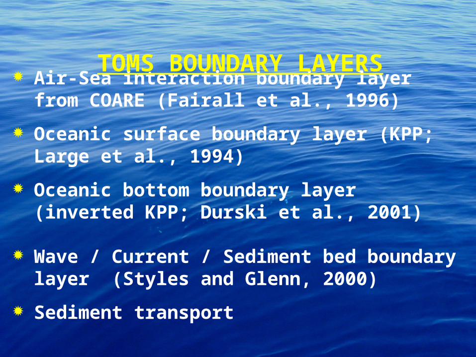
Air-Sea interaction boundary layer from COARE (Fairall et al., 1996)
Oceanic surface boundary layer (KPP; Large et al., 1994)
Oceanic bottom boundary layer (inverted KPP; Durski et al., 2001)
TOMS BOUNDARY LAYERS

Boundary Layer Schematic
Longwave
Shor
twav
e
Evap
OHH
OHH
1. ABL2. SBL3. BBL
4. WCBL
Air-Sea interaction boundary layer from COARE (Fairall et al., 1996)
Oceanic surface boundary layer (KPP; Large et al., 1994)
Oceanic bottom boundary layer (inverted KPP; Durski et al., 2001)
TOMS BOUNDARY LAYERS
Wave / Current / Sediment bed boundary layer (Styles and Glenn, 2000)
Sediment transport

Lagrangian Drifters (Klinck, Hadfield)
Tidal Forcing (Hetland, Signell)
TOMS MODULES

Gulf of Maine M2 Tides
Surface
Elevation(m)

Lagrangian Drifters (Klinck, Hadfield)
Tidal Forcing (Hetland, Signell)
TOMS MODULES
River Runoff (Hetland, Signell, Geyer)

5 10 15 20 25
Distance (km)
-10
-15
-25
-20
-5
Dep
th (
m)
30
25
20
15
10
5
Sal
init
y (P
SS
)
Hudson River Estuary

Lagrangian Drifters (Klinck, Hadfield)
Tidal Forcing (Hetland, Signell)
River Runoff (Hetland, Signell, Geyer)
TOMS MODULES
Biology Fasham-type Model (Moisan, Shchepetkin)
EcoSim Bio-Optical Model (Bissett)

Systematic evaluation of numerical algorithms via robust test problems
Data/Model comparisons
Study optimal combination of algorithmic options for various coastal applications
Documentation of testing procedures
TOMS TESTING

Modular, efficient, and portable Fortran code (F77+, F90)
C-preprocessing managing
Multiple levels of nesting
Lateral boundary conditions options for closed, periodic, and radiation
Arbitrary number of tracers (active and passive)
Input and output NetCDF data structure
Support for parallel execution on both shared- and distributed -memory architectures
TOMS CODE DESIGN

Coarse-grained parallelization
TOMS PARALLEL DESIGN

}
} Nx
Ny
PARALLEL TILE PARTITIONS
8 x 8

Coarse-grained parallelization
TOMS PARALLEL DESIGN
Shared-memory, compiler depend directives MAIN (OpenMP standard)
Distributed-memory (MPI; SMS)
Optimized for cache-bound computers
ZIG-ZAG cycling sequence of tile partitions
Few synchronization points (around 6)
Serial and Parallel I/O (via NetCDF)
Efficiency 4-64 threads

Nudging
Optimal Interpolation (OI)
Tangent linear and Adjoint algorithms
4D VARiational data assimilation (4DVAR) and Physical Statistical Analysis System (PSAS) algorithms
Inverse Ocean Modeling System (IOMS)
Ensemble prediction platform based on singular value decomposition
Error Subspace Statistical Estimation (ESSE)
TOMS DATA ASSIMILATION

Historical, Synoptic, Future in
Situ/Remote Field/Error Observations
d0R0
FieldInitialization
Central Forecast
Sample Probability
Density
Mean
SelectBest
Forecast
Shooting
ESSE Smoothing viaStatistical Approximation
MinimumError
Variance
Within ErrorSubspace
(Sequential processing ofObservations)
MeasurementModel
A PosterioriResidulesdr (+)
Performance/AnalysisModules
OA viaESSE
GriddedResidules
Synoptic Obs
Measurement Model
Measurement Error
Covariance
^
cf(-)^
0
Options/Assumptions
Most Probable Forecast
mp(-)^
EnsembleMean
q{j^
Adaptive Error
SubspaceLearning
ConvergenceCriterion
Continue/StopIteration Breeding
PeripheralsAnalysisModules
Normalization
SVDp
Continuous Time Model Errors Q(t)
ScalableParallel
EnsembleForecast
+PerturbationsError SubspaceInitialization
1
j
q
1
j
q
^
^
^
uj(o,Ip)with physicalconstraints
+
(+)^
E(+)(+)
E0
(+)^
Ea(+)a(+)
FieldOperationAssumption
Key
(-)^
E(-)(-)
-+
+
+
-
+-
---
-
+
+
+
dC(-)
Data Residuals
^
+
+
+
--
+/-+
j=1
j=q
+
ESSE FlowDiagram

Density Jacobian Class (Blumberg and Mellor, 1987; Song 1998; Song and Wright 1998)
More Accurate
Error vanishes with linear density profiles
Pressure Jacobian Class (Lin 1998; Shchepetkin and McWilliams, 2001)
JEBAR consistent
Conserve Energy
PRESSURE GRADIENT FORCE
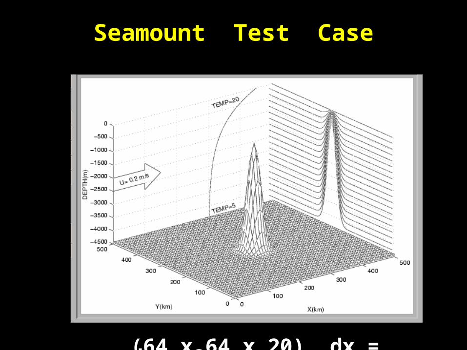
Seamount Test Case
(64 x 64 x 20) dx = dy = 8 km

Models with 2nd order advection schemePOM ROMS
Second Order Advection Scheme
SurfaceElevationAnomaly
StreamFunctionAnomaly

Advection Schemes in ROMS (Seamount Case)
V
Second OrderCentered
Third Order Upstream Bias
Fourth Order Centered

Pressure Gradient Errors
POM(6th order)
U (
cm/s
)V
(cm
/s)
ROMS
POM
X (km)

Relative CPU per time step
Per
cen
tage

Build TOMS from ROMS prototype Mellor-Yamada, level 2.5 Passive and active open boundary conditions Tidal forcing River runoff Lagrangian drifters Data assimilation
Inter-comparison between POM and ROMS Evaluation of time-stepping, advection, and
pressure gradient algorithms
Initial development of TOMS web site
RESULTS (YEAR 1)

Initial web page: www.aos.princeton.edu/WWWPUBLIC/ezer/TOMS

To Be Determined !!!
Potential Users:
NAVO
FNMOC
NOAA
USCG
TRANSITION PATHS

Chassignet et al., 2000: Damee modeling review
Ezer, 2000: Mixed-layer evaluation
Ezer and Mellor, 2000: POM Damee application
Haidvogel et al., 2000: ROMS Damee application
Malanotte-Rizzoli et al., 2000: ROMS Damee
Mellor, 2001: Improved turbulence scheme
Mellor et al., 2001: Generalized vertical coordinate
PUBLICATIONS