highway mileposts exits portland metro area - · pdf filewesterly or southerly point; this...
TRANSCRIPT

For updated information on highway work and current travel information throughout Oregon, visit www.tripcheck.com or call the Oregon road report at 511 or (800) 977-6368
Visit the ODOT News Media Center at www.odot.state.or.us
1Oregon Department of Transportation
Background Region 1
Highway Mileposts
&
Exits
Portland Metro Area
January 2012
Background: Highway Mileposts & Exits
Mileposts and Exits
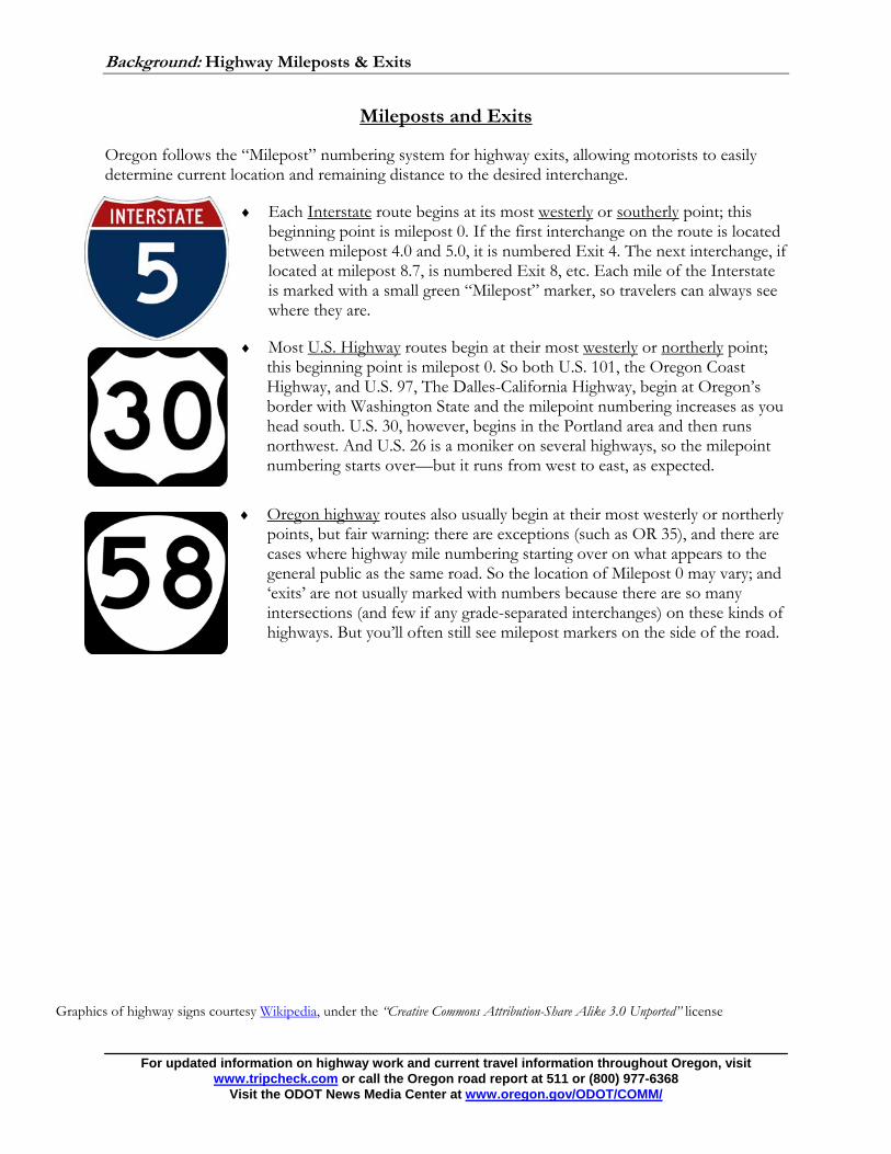
Oregon follows the “Milepost” numbering system for highway exits, allowing motorists to easily determine current location and remaining distance to the desired interchange.
Each Interstate route begins at its most westerly or southerly point; this beginning point is milepost 0. If the first interchange on the route is located between milepost 4.0 and 5.0, it is numbered Exit 4. The next interchange, if located at milepost 8.7, is numbered Exit 8, etc. Each mile of the Interstate is marked with a small green “Milepost” marker, so travelers can always see where they are.
Most U.S. Highway routes begin at their most westerly or northerly point; this beginning point is milepost 0. So both U.S. 101, the Oregon Coast Highway, and U.S. 97, The Dalles-California Highway, begin at Oregon’s border with Washington State and the milepoint numbering increases as you head south. U.S. 30, however, begins in the Portland area and then runs northwest. And U.S. 26 is a moniker on several highways, so the milepoint numbering starts over—but it runs from west to east, as expected.
Oregon highway routes also usually begin at their most westerly or northerly points, but fair warning: there are exceptions (such as OR 35), and there are cases where highway mile numbering starting over on what appears to the general public as the same road. So the location of Milepost 0 may vary; and ‘exits’ are not usually marked with numbers because there are so many intersections (and few if any grade-separated interchanges) on these kinds of highways. But you’ll often still see milepost markers on the side of the road.
Graphics of highway signs courtesy Wikipedia, under the “Creative Commons Attribution-Share Alike 3.0 Unported” license
For updated information on highway work and current travel information throughout Oregon, visit www.tripcheck.com or call the Oregon road report at 511 or (800) 977-6368
Visit the ODOT News Media Center at www.oregon.gov/ODOT/COMM/

Background: Highway Mileposts & Exits Page 1
Interstate 5 – Pacific Highway – Mileposts
308 – Interstate Bridge/Jantzen Beach 307 – North Delta Park/Slough Bridge 306 – Columbia Boulevard/Lombard Street 305 – Portland Boulevard to Killingsworth 304 – Alberta to Skidmore 303 – I-405/Fremont Bridge 302 – Broadway/Coliseum Exit 301 – Burnside Bridge to Morrison Bridge 300 – West End of Marquam Bridge 299 – Ross Island Bridge 298 – Corbett Avenue Overpass 297 – Terwilliger Overpass 296 – Multnomah Boulevard 295 – Capitol Highway 294 – Oregon 99W Junction 293 – Haines Road 292 – Oregon 217 Junction 291 – Lake Oswego/Durham Interchange 290 – Tualatin/Sherwood (Nyberg Road) Int. 289 – I-205 Junction 287 – Norwood Road Overpass 286 – Stafford Road Interchange 285 – Clackamas/Washington County
Line/Tektronics Bldg 284 – Wilsonville 282 – Aurora Junction 281 – Baldock Rest Area 280 – Arndt Road, Marion/Clackamas
County Line 278 – Fargo Road/76 Truck Stop 277 – Donald Road 276 – Fellers Road 275 – Broadacres Road 274 – Truck Scales
273 – Crosby Road 272 – Woodburn Junction 270 – Butteville Road (Gervais Road) 269 – St. Louis Road 267 – Keene Road 266 – Concomly Road to Waconda Road 263 – Brooks Junction/Bingo Truck Stop 262 – Quinaby Road 261 – Perkins Road 260 – Chemawa Road 258 – Hayesville Junction 257 – Silverton Road, NE 256 – Market Street 255 – Center Street 254 – State Street 253 – Santiam Junction (Oregon 22) 252 – Turner Road 251 – Marietta Street/Boone Road 250 – Battlecreek Road 249 – Commercial Street 248 – Turner/Sunnyside Junction 247 – Illahe Hill 244 – North Jefferson Junction 243 – Ankeny Hill Junction 242 – Talbot Road Junction 241 – North of Santiam River 240 – Hoefer Road Junction 239 – Dever/Conner Junction 238 – South Jefferson Junction 237 – Viewcrest Junction 235 – Millersburg Junction 234 – North Albany Junction 233 – Albany Junction/Oregon 20
For updated information on highway work and current travel information throughout Oregon, visit www.tripcheck.com or call the Oregon road report at 511 or (800) 977-6368
Visit the ODOT News Media Center at www.oregon.gov/ODOT/COMM/

Background: Highway Mileposts & Exits Page 2
Interstate 5 – Pacific Highway – Exits I-5 Southbound 308 – Jantzen Beach 307 – Oregon 99E-MLK, Jr.
Boulevard/Marine Drive 306B – Interstate Avenue/Portland
International Raceway 304 – Portland Boulevard 303 – Alberta Street/Swan Island 302B – Interstate 405/U.S. 30 W 302A – Rose Quarter/City Center 301 – Interstate 84/U.S. 30 E 300 – Oregon 99E/U.S. 26 E (Ross Island
Bridge) 299 – Oregon 43 297 – Terwilliger Boulevard 296B – Multnomah Boulevard 296A – Barbur Boulevard 295 – Capitol Highway 294 – Oregon 99W-Tigard/Newberg 293 – Haines Street 292 – Oregon 217 Junction 291 – Carman Drive/King City 290 – Lower Boones Ferry Road/Durham 289 – Tualatin/Sherwood 288 – Interstate 205-Oregon City/West
Linn 286 – Stafford/N. Wilsonville 284 – Wilsonville
I-5 Northbound 284 – Wilsonville 286 – Stafford/N. Wilsonville 288 – Interstate 205 Junction 289 – Tualatin/Sherwood 290 – Lake Oswego/Durham 291 – Carman Drive/King City 292A – Oregon 217 Junction 292B – Kruse Way/72nd Avenue 293 – Haines Street 294 – Barbur Boulevard 295 – Taylors Ferry Road 297 – Terwilliger Boulevard 298 – Corbett Avenue 299A – Oregon 43/U.S. 26 E (Ross Island
Bridge) 299B – Interstate 405/City Center 300 – Interstate 84/U.S. 30 E Junction 302A – Rose Quarter/Broadway-Weidler Street 302B – Interstate 405/U.S. 30 W-St. Helens 302C – Greeley Avenue/Swan Island 303 – Killingsworth Street/Swan Island 304 – Portland Boulevard 305A – U.S. 30 Bypass-Lombard Street East 305B – U.S. 30 Bypass-Lombard Street West 306A – Columbia Boulevard 306B – Expo Center 307 – Oregon 99E-Delta Park/Marine Drive 308 – Jantzen Beach
For updated information on highway work and current travel information throughout Oregon, visit www.tripcheck.com or call the Oregon road report at 511 or (800) 977-6368
Visit the ODOT News Media Center at www.oregon.gov/ODOT/COMM/

Background: Highway Mileposts & Exits Page 3
Interstate 84 – Columbia River Highway – Mileposts 1 – 12th Avenue 2 – 33rd Avenue 3 – 47th Avenue 4 – 68th Avenue 5 – 82nd Avenue 6 – I-205 Junction 7 – 102nd Avenue 10 – 122nd Avenue 11 – Parkrose Water Tower 12 – 162nd Avenue 13 – 181st Avenue 14 – 201st Avenue 15 – Sandy Boulevard Exit
(Westbound) 16 – Wood Village Exit 17 – Troutdale Junction 18 – Lewis and Clark Park 22 – Corbett 23 – Corbett Viewpoint 24 – Rooster Rock 25 – Rooster Rock State Park 28 – Bridal Veil 29 – West Dalton 31 – West of Multnomah Falls 34 – Horsetail Falls 35 – West of Dodson Overpass 37 – East of Dodson Overpass 39 – Moffett Creek 40 – Bonneville Dam 41 – Tunnel 42 – Multnomah/Hood River
County Line 43 – West of Cascade Locks Exit 44 – Moody Street Overpass 45 – East of Cascade Locks
Exit 46 – Herman Creek 47 – Herman Creek Log Pond 49 – Eastbound Scale House 51 – Wyeth 52 – Shellrock Mountain 53 – Lindsey Creek 54 – Westbound Scale House
55 – Starvation Creek Rest Area 56 – Viento State Park Exit 58 – Mitchell Creek 59 – Mitchell Point 61 – Ruthton Hill Point 62 – West of Hood River Exit 63 – Jaymar Underpass 64 – Multnomah/Hood River
County Line 65 – Oregon 35 Exit 66 – Koberg Rest Area 68 – Wasco/Hood River County
Line 69 – Chicken Charly Island 70 – Mosier 71 – Schogren RR Overpass 73 – Memaloose Rest Area 75 – Rowena Bluff 76 – Mayer Park Overpass 77 – Rowena 79 – Tooley Lake 80 – Tooley Terrace 81 – Pinewood Trailer Court 82 – Chenowith Creek Bridge 83 – Kopper Kitchen 84 – West/The Dalles City Ctr
Exit 85 – Grain Elevator 86 – Boat Basin Exit 87 – The Dalles Br/Bend Hwy
197 Exit 88 – Fifteen Mile Creek 89 – Dalles Dam Exit 90 – Five Mile RR Overpass 92 – Sand Dunes 94 – No Name Lake 96 – Celilo Bridge RR Overpass 97 – Celilo Interchange 99 – Tunnel Point RR 100 – Wasco/Sherman County
Line 101 – Miller RR Overpass 102 – Fulton Canyon
104 – Biggs Grain Elevator 105 – Biggs Junction 107 – Old Maryhill Ferry 109 – Rufus RR Overpass 110 – Rufus 112 – John Day Dam/
Viewpoint 114 – John Day River/
Sherman-Gillian 122 – Quinton RR Station 123 – Phillippe Interchange 129 – Blaylock Interchange 131 – Woelpern Rat Hole 136 – Arlington Viewpoint 137 – Eastbound Arlington
Exit 138 – Westbound Arlington
Exit 147 – Heppner Junction 149 – Gilliam/Morrow County
Line 151 – Three Mile 157 – RR Overpass 159 – Tower Road 161 – Boardman Rest Area 164 – Boardman 168 – Oregon 730 Junction 177 – Morrow/Umatilla
County Line 178 – Ordnance Interchange 180 – Westland Road 183 – Hermiston 186 – Stanfield Rest Area 189 – Stanfield Interchange 193 – Lexington/Echo Junction 198 – Rew Elevator 199 – Yoakum Interchange 203 – Barnhart Interchange 207 – West of Pendleton 209 – Pendleton City Center 211 – East of Pendleton
Interchange
For updated information on highway work and current travel information throughout Oregon, visit www.tripcheck.com or call the Oregon road report at 511 or (800) 977-6368
Visit the ODOT News Media Center at www.oregon.gov/ODOT/COMM/

Background: Highway Mileposts & Exits Page 4
Interstate 84 – Columbia River Highway, Banfield Expressway – Exits Westbound 18 – Lewis and Clark State Park/Oxbow
Regional Park 17 – Marine Drive/Troutdale 16 – 238th Drive/Wood Village 14 – 207th Avenue/Fairview 13 – 181st Avenue/Airport Way 9 – Interstate 205 Junction 2 – 43rd Avenue 1 – Lloyd Center 0 – Convention Center/Rose Quarter
Eastbound 1 – 33rd Avenue 2 – 39th Avenue 3 – 58th Avenue 4 – 68th Avenue 5 – Oregon 213-82nd Avenue 6 – Interstate 205 S 7 – Halsey Street/Gateway District 8 – Interstate 205 N 9 – 102nd Avenue/Parkrose 10 – 122nd Avenue 13 – 181st Avenue/ Gresham 14 – 207th Avenue/Fairview 16 – 238th Drive/Wood Village 17 – Marine Drive/Troutdale 18 – Lewis and Clark State Park/Oxbow
Regional Park
For updated information on highway work and current travel information throughout Oregon, visit www.tripcheck.com or call the Oregon road report at 511 or (800) 977-6368
Visit the ODOT News Media Center at www.oregon.gov/ODOT/COMM/

Background: Highway Mileposts & Exits Page 5
Interstate 205 –East Portland Freeway
Mileposts 0 – Interstate 5 1 – SW 65th Avenue, Washington/Clackamas
County Line 2 – SW Prosperity Park Road 3 – Stafford Road 4 – Tualatin River 5 – South Woodbine Road 6 – 10th Street 7 – Viewpoint 8 – Southbound Rest Area 9 – Oregon 43 Junction (West Linn) 10 – Park Place/Molalla Interchange 11 – Gladstone Interchange 12 – Strawberry Overpass 13 – Milwaukie/Oregon 224 Interchange 14 – Sunnyside Road 16 – Johnson Creed Boulevard 17 – Mt. Scott Boulevard Underpass 18 – Harold Street Underpass 19 – Powell Boulevard 20 – Market Street Overpass 21 – Glisan Street Overpass 23 – Prescott Street Overpass 24 – Columbia Slough 25 – Marine Drive 26.5 – Washington State/Oregon Border
Exits Northbound 3 – Stafford Road/Lake Oswego 6 – West Linn/10th Street 8 – Oregon 43-West Linn/Lake Oswego 9 – Oregon 99E-Oregon City/Gladstone 10 – Oregon 213-Park Place/Molalla 11 – Gladstone/DMV 12 – Oregon 224 E/Oregon 212 Junction 13 – Oregon 224 W/Oregon 213–82nd Avenue 14 – Sunnybrook Boulevard/Sunnyside Road 16 – Johnson Creek Boulevard 17 – Foster Road 19 – U.S. 26-Powell Boulevard/Division Street 20 – Washington Street/Stark Street 21A – Glisan Street 21B – Interstate 84/U.S. 30 W–Portland 22 – Interstate 84/U.S. 30 E–The Dalles 23A – U.S. 30 Bypass East-Sandy Boulevard 23B – U.S. 30 Bypass West-Columbia Boulevard 24A – Portland Airport 24B – Airport Way East Southbound 21B – Interstate 84/U.S. 30 W-Portland 21A – Glisan Street/Stark Street 19 – U.S. 26-Powell Boulevard/Division Street 17 – Foster Road 16 – Johnson Creek Boulevard 14 – Sunnyside Road/Sunnybrook Boulevard 13 – Oregon 224 W-Milwaukie 12B – Webster Road/Johnson City 12A – Oregon 212/Oregon 224 E 11 – Gladstone/DMV 10 – Park Place/Molalla 9 – Oregon 99E-Oregon City/Gladstone 8 – Oregon 43-West Linn/Lake Oswego 6 – West Linn/10th Street 3 – Stafford Road 0 – Interstate 5
For updated information on highway work and current travel information throughout Oregon, visit www.tripcheck.com or call the Oregon road report at 511 or (800) 977-6368
Visit the ODOT News Media Center at www.oregon.gov/ODOT/COMM/

Background: Highway Mileposts & Exits Page 6
Interstate 405 – Stadium Freeway – Exits Southbound 3 – NW Industrial Area/ U.S. 30 W 2B – Everett Street 2A – Couch Street, Burnside Street 1D – U.S. 26 W 1C – 6th Avenue/U.S. 26E 0 – Interstate 5 Junction
Northbound 1A – Naito Parkway 1B – 4th Avenue 1C – 6th Avenue 1D – Sunset Highway (U.S. 26) West
Junction/12th Avenue 2A – Salmon Street 2B – Everett Street 3 – U.S. 30 W, Interstate 5
For updated information on highway work and current travel information throughout Oregon, visit www.tripcheck.com or call the Oregon road report at 511 or (800) 977-6368
Visit the ODOT News Media Center at www.oregon.gov/ODOT/COMM/

Background: Highway Mileposts & Exits Page 7
U.S. 26 – Sunset Highway Mileposts 35 – Columbia/Washington County Line 37 – Timber/Vernonia Junction 41 – Sunset Tunnel 42 – Schofield Road 43 – Strassel Road 45 – Staley’s Junction 47 – Manning 49 – Sell Road 52 – Banks/Harrison Junction 53 – Oregon 6 Junction 55 – Dersham Road 58 – McKay Creek 59 – Jackson School Road 61 – Shute Road 62 – Cornelius Pass Road 64 – 185th Overpass 66 – Cornell Road 67 – Murray Boulevard 68 – Cedar Hills Boulevard 69 – Oregon 217 Junction 70 – Golf Creek Road 71 – Washington/Multnomah County Line
Exits Eastbound 53 – Oregon 6 Junction 57 – Glencoe Road/North Plains 59 – Jackson School Road 61 – Helvetia Road/Shute Road 62 – Cornelius Pass/West Union 64 – 185th Avenue 65 – Cornell Road/Bethany Boulevard 67 – Murray Boulevard 68 – Cedar Hills Boulevard/Beaverton 69A – Oregon 217 Junction 69B – Cedar Hills/Barnes Road 71 – Sylvan 72 – Oregon Zoo/Forestry Center 73 – Canyon Road/PGE Park Westbound 72 – Zoo/Forestry Center 71B – Sylvan 71A – Canyon Road/West Slope 69B – Cedar Hills/Barnes Road 69A – Oregon 217 Junction 68 – Cedar Hills Boulevard 67 – Murray Boulevard 65 – Cornell Road/Bethany Boulevard 64 – 185th Avenue 62 – Cornelius Pass/West Union 61 – Helvetia Road/Shute Road 59 – Jackson School Road 57 – Glencoe Road/North Plains 53 – Oregon 6 Junction
For updated information on highway work and current travel information throughout Oregon, visit www.tripcheck.com or call the Oregon road report at 511 or (800) 977-6368
Visit the ODOT News Media Center at www.oregon.gov/ODOT/COMM/

Background: Highway Mileposts & Exits Page 8
U.S. 26 – Mt. Hood Highway – Mileposts
17 – Stone Road 18 – Brown Road 19 – Oregon 212 Junction 20 – Kelso Road 21 – J. Jarl Road 23 – Sandy West City Limit 25 – Sandy East City Limit 26 – Fireside Cafe 27 – Shorty’s Corner 28 – Poodle Kennel 29 – Pioneer Cafe 30 – Wisteria Trout Farm 31 – Cherryville Junction 32 – Cherryville Hill 33 – Alder Creek 34 – Alder Creek East 35 – Sleepy Hollow West 36 – Sleepy Hollow Eastcook’s Motel 37 – Cook’s Motel 38 – Brightwood West 39 – Brightwood East 40 – Wildwood 42 – Welches 44 – Rhododendron 45 – Tollgate Park 46 – Zigzag River Bridge 47 – Forest Creek Camp 48 – Mile Bridge 35 Road 49 – Split Rock 3 Lane 50 – Sign Map 51 – Sharp Curve 3 Lane 53 – Hidden Lake Trail 54 – Government Camp East 56 – Snow Bunny Lodge 57 – Oregon 35 Junction
60 – 76 Station 62 – Clackamas/Wasco County Line, Frog
Lake Campground 63 – Blue Box Pass 66 – Skyline Road 68 – Bear Pay 70 – Oregon 216 Junction
For updated information on highway work and current travel information throughout Oregon, visit www.tripcheck.com or call the Oregon road report at 511 or (800) 977-6368
Visit the ODOT News Media Center at www.oregon.gov/ODOT/COMM/

Background: Highway Mileposts & Exits Page 9
U.S. 30 – Lower Columbia River Highway – Mileposts U.S. 30 is NW Yeon from mile 1.97 to approximately milepost 3.92 where it becomes NW St. Helens Road, which it remains until around milepost 9.65. The following mileposts only cover part of the section of U.S. 30 known as the Lower Columbia River Highway. U.S. 30 coincides with Interstate 84 east of Portland and travels through Portland as both a bypass and a business route; those sections are not covered here. 1 – Interstate 405 Junction 2 – NW Nicolai Street/NW Suffolk Street 3 – NW 35th Avenue 4 – NW Kittridge Avenue/St Helens Road 5 – NW 55th Avenue 6 – Doanne Creek 7 – Knappton-General Road/Beneath St.
John’s Bridge 8 – Linnton-West/NW Hoge Avenue 9 – Owens Corning – Trumbull/Linnton-
East 10 – NW Newberry Road 11 – Quarry Road/Morse Bros. Angell
Quarry 13 – Cornelius Pass/NW McNamee Road 14 – Logie Trail Junction/Chestnut Lane 16 – ODOT Preclearance site/Weigh Station 17 – NW Lower Rocky Point/Boat Launch 18 – NW St Helens Road,
Multnomah/Columbia County Line 19 – Johnsons Landing Road/Bonneville
Drive/Old Portland Road 20 – Peace Candle of the World/Fred Meyers 21 – NE Williams Street 22 – Gilmore Road/N Scappoose Creek
23 – Columbia Memorial Gardens Cemetery 24 – Tarbell Road 25 – Berg Road/Old Portland Road 26 – Legacy Lane/Bay Hill Lane 27 – Millard Road 28 – Sykes Road 29 – Wyeth Street 30 – Harrie Creek/Chime Crest Frontage
Road 31 – E Street 32 – Railroad Spur/Columbia City-West 33 – Weigh Station 34 – Deer Island-West/Front Road 36 – Butterfield Road 37 – Jones Road 39 – Nicolai Cutoff Road 40 – Jaquish Road/Goble-West 41 – Neer City Road 42 – Trojan Nuclear Power Plant 43 – Prescott Beach/Graham Road 44 – Jack Falls Road/Lindberg Road 45 – Laurelwood Road 47 – First Street 48 – Mill St
For updated information on highway work and current travel information throughout Oregon, visit www.tripcheck.com or call the Oregon road report at 511 or (800) 977-6368
Visit the ODOT News Media Center at www.oregon.gov/ODOT/COMM/

Background: Highway Mileposts & Exits Page 10
Oregon 6 – Wilson River Highway – Mileposts 2 – Weigh Station 4 – Old/New Oregon 6 Junction 6 – East of Mills Bridge 7 – West of Blue Hole 8 – Siskeyville Access 9 – Country Kitchen 10 – Butler Ranch 11 – Kansas Creek 12 – DeMolay Camp 13 – Fawn Holly Farm 14 – Fall Creek 16 – Fox Creek 18 – Jordan Creek Inn 20 – Swinging Bridge 21 – Gravel Stockpile 23 – Lee’s Camp 28 – South Fork Bridge 29 – East of Slide Area 30 – East Rutherford Road 31 – West Deadman’s Curve 32 – Devil Lake Fork Bridge 33 – Tillamook/Washington County Line 37 – South Fork Gales Creek 39 – Timber Road 42 – Gales Creek Road 43 – Parson Road 46 – Cedar Canyon Road 49 – Banks Junction 50 – Aerts Road 52 – Sunset Highway (U.S. 26) Junction
For updated information on highway work and current travel information throughout Oregon, visit www.tripcheck.com or call the Oregon road report at 511 or (800) 977-6368
Visit the ODOT News Media Center at www.oregon.gov/ODOT/COMM/

Background: Highway Mileposts & Exits Page 11
Oregon 8 – Canyon Road/Tualatin Valley Highway – Mileposts
0 – Washington/Multnomah County Line 1 – Canyon Drive 2 – SW 96th Avenue 3 – SW 114th Avenue 4 – Cedar Hills Boulevard 5 – SW 160th Avenue 6 – SW 185th Avenue 7 – SW 198th Avenue 8 – SW 219th Avenue 9 – SW 229th Avenue, Hillsboro East City Limit 11 – Minter Bridge Road 14 – Hillsboro West City Limit 15 – NW 341st Avenue, Cornelius East City Limit 17 – Cornelius West City Limit, Forest Grove East City Limit
For updated information on highway work and current travel information throughout Oregon, visit www.tripcheck.com or call the Oregon road report at 511 or (800) 977-6368
Visit the ODOT News Media Center at www.oregon.gov/ODOT/COMM/

Background: Highway Mileposts & Exits Page 12
Oregon 10 – Mileposts The following mileposts cover only portions of Oregon 10 under state jurisdiction and known as being part of either the Beaverton-Hillsdale Highway or the Farmington Highway. While both highways are part of Oregon 10, they are recognized as separate highways by ODOT and thus have their own mile numbering systems. Oregon 10 also coincides with Oregon 99W for several miles; please refer to Oregon 99W’s listing for more information. Oregon 10 – Beaverton-Hillsdale Highway Oregon 10 – Farmington Highway 1 – Oregon 217 Junction 1 – Robinson Road 2 – Jesuit High School/Valley Plaza Shopping
Center 2 – River Road 3 – SW Tile Flat Road/Slab Creek
3 – Scholls Ferry Road/Fred Meyer Marketplace 4 – Clark Hill Road 5 – Farmington Quarry/East Hazeldale 6 – Hazeldale School/SW Marlin Road 7 – 179th Avenue/Mountain View Middle
School 8 – SW 160th Avenue
For updated information on highway work and current travel information throughout Oregon, visit www.tripcheck.com or call the Oregon road report at 511 or (800) 977-6368
Visit the ODOT News Media Center at www.oregon.gov/ODOT/COMM/

Background: Highway Mileposts & Exits Page 13
Oregon 18 – Mileposts 10 – Polk/Yamhill County Line 31 – Harmony Road 32 – Red Prairie Road 33 – South Bridge Street 34 – Sheridan Junction 37 – Bellevue Junction 38 – Muddy Creek Bridge 39 – Christiansen Farm 41 – Pringle Corner 42 – Muddy Valley Junction 43 – Durham Road/McMinnville Bypass 45 – Boothbend Overpass 46 – McMinnville Interchange
For updated information on highway work and current travel information throughout Oregon, visit www.tripcheck.com or call the Oregon road report at 511 or (800) 977-6368
Visit the ODOT News Media Center at www.oregon.gov/ODOT/COMM/

Background: Highway Mileposts & Exits Page 14
Oregon 43 – Mileposts 1.2 – SW Boundary St.; the Water Tower 1.7 – Willamette Park 2 – SW Taylors Ferry Rd. 2.7 – Sellwood Bridge 3.5 – Portland south city limit 4 – SW Riverwood Rd 4.9 – SW Greenwood Rd./SW Breyman Ave. 5.1 – Multnomah/Clackamas Co. line 5.7 – SW Terwilliger Blvd. 6 – Lake Oswego north city limit 6.1 – A Ave. 7 – S. McVey Ave. 7.9 – Forman St./Marylhurst University 8 – West Linn City limit 9.3 – Mary S. Young State Park 10 – White Tail Dr. 11 – McKillican St./Central Village Shopping Center 11.2 – I-205 11.4 – On Willamette River Bridge; West Linn south city limit & Oregon City north city limit 11.7 – OR 99E/Main St.
For updated information on highway work and current travel information throughout Oregon, visit www.tripcheck.com or call the Oregon road report at 511 or (800) 977-6368
Visit the ODOT News Media Center at www.oregon.gov/ODOT/COMM/

Background: Highway Mileposts & Exits Page 15
Oregon 47 – Mileposts
South from Forest Grove (Tualatin Valley Highway) 21 – Dilley 22 – Spring Hill Road 24 – Scoggins Creek 25 – Patton Road 26 – Washington/Yamhill County Line
North from Forest Grove (Nehalem Highway) 89 – Forest Grove North City Limit 88 – Verboort Road 87 – Osterman Road 85 – Roy Road 84 – Oregon 6 Junction, Banks South City Limit 83 – Banks North City Limit 77—81 in common with U.S. 26, Sunset Highway 74 – Schofield Road 72 – Nowakowski Road 69 – Washington/Columbia County Line 63 – Vernonia South City Limit
For updated information on highway work and current travel information throughout Oregon, visit www.tripcheck.com or call the Oregon road report at 511 or (800) 977-6368
Visit the ODOT News Media Center at www.oregon.gov/ODOT/COMM/

Background: Highway Mileposts & Exits Page 16
Oregon 99E – Pacific Highway East – Mileposts
5 – Milport Road 6 – Milwaukie – South 7 – The Bomber 8 – Marguerite Street 9 – Naef Road 10 – Hull Avenue 11 – Arlington Road 12 – Gladstone South City Limit, Oregon City North City Limit 13 – Canemah 14 – Oregon City South City Limit 15 – Pulp Siding 16 – Pulp Siding – South 17 – Coalco 18 – New Era 19 – Territorial Road Flats-North 20 – Territorial Road Flats-South 21 – Canby East City Limit 22 – Canby West City Limit
For updated information on highway work and current travel information throughout Oregon, visit www.tripcheck.com or call the Oregon road report at 511 or (800) 977-6368
Visit the ODOT News Media Center at www.oregon.gov/ODOT/COMM/

Background: Highway Mileposts & Exits Page 17
Oregon 99W – Pacific Highway West – Mileposts 8 – Multnomah/Washington County Line 10 – SW Garrett Road 11 – Bull Mountain Road 12 – Tualatin River 13 – Cipole Road 14 – Onion Flat 15 – Six Corners 16 – Elwert Road 17 – Brookman Road 18 – Bell Road 20 – Washington/Yamhill County Line
For updated information on highway work and current travel information throughout Oregon, visit www.tripcheck.com or call the Oregon road report at 511 or (800) 977-6368
Visit the ODOT News Media Center at www.oregon.gov/ODOT/COMM/

Background: Highway Mileposts & Exits Page 18
Oregon 210 – Scholls Ferry Road – Mileposts
0 – Oregon 219 Junction 1 – Tualatin River 2 – Clark Hill Road 4 – Pleasant Valley Road 5 – Reuser Road 7 – SW 135th Avenue 8 – Sorrento Road 10 – Homestead Lane 11 – Denney Road 12 – Jamison Road 13 – Oregon 10 Junction
For updated information on highway work and current travel information throughout Oregon, visit www.tripcheck.com or call the Oregon road report at 511 or (800) 977-6368
Visit the ODOT News Media Center at www.oregon.gov/ODOT/COMM/

Background: Highway Mileposts & Exits Page 19
Oregon 211 – Woodburn-Estacada Highway – Mileposts 10 – Gribble Road 11 – Oregon 213 Junction 12 – Molalla West City Limit 13 – Molalla Paper 14 – Molalla East City Limit 15 – Wiles Road 16 – Dickie Prairie Road 17 – Russell Farm 18 – Cedardale Store 19 – Camp Adams 20 – 76 Station 21 – Colton South 22 – Colton North 23 – Gorbertt Road 24 – Curves 25 – Fir Valley Tavern 26 – Cox-Hight Road 27 – Hight Road 28 – Clear Creek Hill 29 – Springwater Road 30 – Smith Road 31 – Day Hill Road 32 – Day Hill Curves 33 – Estacada South 34 – Oregon 224 Junction
For updated information on highway work and current travel information throughout Oregon, visit www.tripcheck.com or call the Oregon road report at 511 or (800) 977-6368
Visit the ODOT News Media Center at www.oregon.gov/ODOT/COMM/

Background: Highway Mileposts & Exits Page 20
Oregon 212 – Clackamas-Boring Highway – Mileposts Oregon 212 coincides with Oregon 224 from Interstate 205 (exit 12A) to Rock Creek Junction. 0 – Rock Creek Junction 1 – Anderegg Parkway 2 – North Court 3 – Old Barn Lane 4 – 232nd Drive 5 – Holly View Terrace 7 – Boring 8 – Mt. Hood Highway (U.S. 26) Junction
For updated information on highway work and current travel information throughout Oregon, visit www.tripcheck.com or call the Oregon road report at 511 or (800) 977-6368
Visit the ODOT News Media Center at www.oregon.gov/ODOT/COMM/

Background: Highway Mileposts & Exits Page 21
Oregon 213 – Cascade Highway South – Mileposts 0 – Interstate 205 Junction 3 – Beavercreek Road 4 – Canyon Ridge Drive 5 – Green Tree Drive 6 – Monte Carlo Way 7 – Carus Road 8 – Spangler Road 9 – Union Hall Road 10 – Glenn Drive 11 – Mulino Road/Passmore Road 12 – Molalla Fire Station 13 – Macksburg Road 14 – Cascadia Court 15 – Vick Road 16 – Oregon 211 Junction 17 – Marquam Hill Road 18 – Dart Road
For updated information on highway work and current travel information throughout Oregon, visit www.tripcheck.com or call the Oregon road report at 511 or (800) 977-6368
Visit the ODOT News Media Center at www.oregon.gov/ODOT/COMM/

Background: Highway Mileposts & Exits Page 22
Oregon 217 – Beaverton-Tigard Highway – Exits & Mileposts Southbound Northbound 0 – Sunset Highway, U.S. 26 7.4 – Interstate 5, Washington/Clackamas
County Line 1 – Walker Road 2A – Oregon 8/Oregon 10 7 – SW 72nd Avenue 2B – Allen Boulevard 6 – Oregon 99W/Tigard Junction 3 – Denney Road 5 – Greenburg Road 4A – Progress Road 4 – Progress Road 4B – Scholls Ferry Road 3 – Denney Road 5 – Greenburg Road 2B – Allen Boulevard 6 – Oregon 99W/Tigard Junction 2A – Oregon 8/Oregon 10 7 – SW 72nd Avenue 1 – Walker Road 7.4 – Interstate 5, Washington/Clackamas
County Line 0 – Sunset Highway, U.S. 26
For updated information on highway work and current travel information throughout Oregon, visit www.tripcheck.com or call the Oregon road report at 511 or (800) 977-6368
Visit the ODOT News Media Center at www.oregon.gov/ODOT/COMM/

Background: Highway Mileposts & Exits Page 23
Oregon 219 – Hillsboro-Silverton Highway – Mileposts
1 – Tualatin River 3 – Grabel Road 4 – Burkhalter Road 5 – Firdale Road 8 – Laurel Road 10 – Mcfee Creek 11 – Mountain Home Road 15 – Washington/Yamhill County Line
For updated information on highway work and current travel information throughout Oregon, visit www.tripcheck.com or call the Oregon road report at 511 or (800) 977-6368
Visit the ODOT News Media Center at www.oregon.gov/ODOT/COMM/

Background: Highway Mileposts & Exits, Portland Metro Area Page 24
Oregon 224 – Clackamas Highway – Mileposts
0 – Oregon 99E Junction 1 – Oatfield Road 2 – Harmony Road 3 – Webster Road 4 – Oregon 213/Lake Road 5 – Oregon 212 Junction 6 – Oak Acres 7 – SE 130th 8 – Rock Creek Scales 9 – Carver 10 – Tong Road 11 – Keller Road 12 – Semple Road 13 – Deep Creek Curves 14 – Deep Creek 15 – Barton 16 – Barton Flats 18 – Eagle Creek 19 – Eagle Fern Park 20 – Brooks Café 21 – Heiple Road 22 – Rivermill Dam 23 – Estacada 34 – Oregon 211 Junction
For updated information on highway work and current travel information throughout Oregon, visit www.tripcheck.com or call the Oregon road report at 511 or (800) 977-6368
Visit the ODOT News Media Center at www.oregon.gov/ODOT/COMM/

Background: Highway Mileposts & Exits, Portland Metro Area Page 25
For updated information on highway work and current travel information throughout Oregon, visit www.tripcheck.com or call the Oregon road report at 511 or (800) 977-6368
Visit the ODOT News Media Center at www.oregon.gov/ODOT/COMM/
Hall Boulevard
1 – Sorrento Road 2 – Fanno Creek 4 – SW Locust 5 – SW Hunziker 7 – Durham Road 8 – Bridgeport Road 9 – Nyberg Road 10 – SW Avery 11 – Norwood Road 12 – Day Road