housatonic river management plan
TRANSCRIPT

Housatonic River Management Plan
Housatonic River Commission 2006


Housatonic River Management Plan
Prepared for:Housatonic River Commission
17 Sackett Hill RoadWarren, CT 06754
Town Commission Members Canaan Ellery Sinclair Karl L. Munson Cornwall Philip W. Hart Lynn Fowler Kent Jesse Klingebiel Brad Smith New Milford Sharon Ward David Schrang North Canaan Fredrick H. Ruggles, Jr. Tim Abbott Salisbury George Kiefer Gordon N. Whitbeck Sharon William R. Tingley James Krissel
Staff Northwestern Ct. Council of Governments: Dan McGuinness Lois Pinney
Prepared by:Dodson Associates, Ltd.
Landscape Architecture and PlanningP.O. Box 160
463 Main StreetAshfield, MA 01330
September, 2006
Funded in part by the CT DEP through a US EPA Clean Water Act Section 604(b) Grant


Table of Contents
Executive Summary…………………………………………………………………………….......1
Introduction……………………………………………………………………………………...…4
Section I: Housatonic River Commission……………………………………………………....…5 Objectives of Commission Duties of Commission
Corridor Delineation
Section II: Natural Resources and Land Use………………………………………………....….8 Natural Resource and Land Use Analysis Land Protection Natural Resource and Land Use Recommendations
Section III: Recreational Management………………………………………………………......23 Recreation Management Goals Overview of Resources and Uses by Segment Current Recreational Uses Recreation Management Recommendations
Section IV: Water Quality…………………………………………………………………….......30 Existing Water Quality Water Quality Problems/Threats Water Quality Recommendations
Section V: FERC Re-licensing………………………………………………………………........34
Conclusion........................................................................................................................................36
Appendix A: List of Maps................................................................................................................37Appendix B: Index of Acronyms.....................................................................................................38Appendix C: 1981 Housatonic River Management Plan Regulations.............................................39Appendix D: State of Connecticut Water Quality Classification System.........................................43Appendix E: EPA Human Health and Ecological Risk Assessment Findings.................................45Appendix F: 1985-2002 Land Cover Comparison Table.................................................................46Appendix G: Survey Form and Response Summary.......................................................................47
Bibliography....................................................................................................................................53


Housatonic River Management PlanDodson Associates, Ltd. September 2006
�
Housatonic River, Salisbury, CT
Executive Summary
The Housatonic River Commission (HRC) was created by the Towns of Canaan, Cornwall, Kent, New Milford, North Canaan, Salisbury and Sharon and held its first meeting in July 1979. In July, 1981, the Commission completed a River Management Plan that outlined objectives and duties of the Commission and defined the corridor boundaries. The Plan also included regulatory language that was incorporated into the zoning regulations of all towns except North Canaan. The River Management Plan has been effective in aiding the HRC in monitoring development and environmental impacts along the corridor and in advocating for the scenic, historic and natural resources of the River. This updated Plan discusses current conditions within the River Valley and addresses changes in land use trends and regulatory practices that affect the Region.
Since the completion of the 1981 Plan, several land use and environmental issues have had major impacts on the River corridor. The most significant among these are the discovery of the extent of the polychlorinated biphenyl (PCB) contamination from the General Electric plant in Pittsfield, the Federal Energy Regulatory Commission (FERC) re-licensing of the Falls Village and Bulls Bridge hydropower facilities and the pressures from increased development. The impact of these issues on the River’s health is discussed and incorporated into the recommendations for each relevant section.
To help gauge opinions on conditions in the River Valley, a survey was sent to town land use commissioners and board members in all seven towns. The questions covered a variety of issues including greatest threats to the River, the HRC corridor boundaries, and current zoning and regulatory practices. The survey results have been used in developing this Plan.
The updated River Management Plan includes sections on land use, recreation management and water quality. Within each section is a discussion of existing conditions, significant issues or threats and a series of recommendations to be addressed by both the HRC and the individual municipalities. The Plan includes a set of overall recommended actions for the HRC to continue its mission and expand its outreach within the Region.
The Plan’s land use section provides a series of inventories that document existing conditions in the Corridor regarding land coverage and natural, scenic, cultural and recreational resources. Through the use of Geographic Information Systems technology, these inventories have been mapped using data from the State of Connecticut, the Housatonic Valley Association and the National Park Service. This section also contains a land use analysis and a discussion of current land protection practices in the region.
Recommendations for the land use section include more detailed and site specific data for resource documentation and the need for more significant protection strategies for environmentally sensitive areas. Additional regulatory strategies are also recommended to address the need for protection

Housatonic River Management PlanDodson Associates, Ltd. September 2006
2
Covered Bridge, Kent, CT
of ridgelines, the reduction of impervious surfaces, and the additional protection of water quality through aquifer and watershed protection areas.
In November of 1989, the HRC commissioned a Recreation Management Plan. This document addressed the desire of the HRC to promote the effective local management of existing recreational facilities along the River while anticipating the growing demand for recreation. The Recreation Management Plan (RMP) provides recommended actions that individual communities and the HRC can take to address existing site-specific recreational uses and to help eliminate conflicts. Much of the information contained in the RMP has been updated and incorporated into this Management Plan.
A significant occurrence since the preparation of the 1989 RMP has been the re-licensing of the Falls Village and Bulls Bridge hydropower dams by the Federal Energy Regulatory Commission (FERC). The regulatory language for the re-licensing of the dams has brought important changes in the use and management of the River in those areas. The most significant change is the requirement that the operation of the two hydropower dams be changed from “pond and release” to “run of the river”. Northeast Generation Services (NGS), which owns both hydropower dams, will now be responsible for preparing Recreation Plans, Shoreline Management Plans and Critical Habitat Management Plans for each of the dams. The HRC will review and comment on these plans in order to ensure that environmental and recreational issues of concern to the Commission are addressed.
The Plan’s final section addresses water quality along the River and within the watershed. Existing conditions regarding ground and surface water have been discussed as well as threats to water quality in the region. The most significant issues currently facing the River Corridor are the polychlorinated biphenyl (PCB) contamination from the General Electric plant in Pittsfield, increased development pressure, non-point source pollution within the watershed and the threat of invasive species.
Water quality along the River can be affected by many sources, some of which are not easily identifiable or are not located anywhere near the River itself. The contamination of the River by PCBs is a case in point. The HRC will continue to advocate for the cleanup of the PCBs in the River. Additional recommendations for water quality protection include developing outreach programs that will educate the general public about the sources of water pollution including septic system failure, non-point source runoff and nutrient loading in soils. The HRC will continue to comment on projects and plans that impact the River’s environmental health.
The Plan’s overall recommendations provide the HRC with an updated strategy for the protection of the River. Three areas - the inner corridor, outer corridor, and the village centers - are designated in the 1981 Plan. This Plan includes the designation of a fourth tier to the Corridor boundary. This Sensitive Areas Zone (SAZ) would provide some protective review of projects in areas that are environmentally sensitive and in which certain development would have direct

Housatonic River Management PlanDodson Associates, Ltd. September 2006
�
impacts on the health of the River Corridor. Areas within the SAZ that are of particular concern are the major tributaries, wetlands and critical wildlife habitats.
Ultimately, the River Management Plan provides a snapshot of existing conditions within the River Corridor and recommends strategies for the HRC and individual municipalities to continue protecting the significant environmental resources and character of the River. The Plan also addresses actions that the HRC can take to increase the Commission’s visibility in order to better achieve the Commission’s goals and objectives.

Housatonic River Management PlanDodson Associates, Ltd. September 2006
�
Introduction
In response to the threat of increasing development and recreational activities in the Housatonic River Valley, the Housatonic River Commission (HRC) was formed by the member towns in 1978, to advise a seven-town region on the issues significantly impacting the environmental quality of the River. Active since 1979, the HRC advises the towns of Canaan, Cornwall, Kent, New Milford, North Canaan, Salisbury and Sharon regarding development along the River.
This updated River Management Plan provides a comprehensive view of the current status of the River Corridor and documents changes that have occurred in recent years. The Plan covers existing conditions within the Corridor including the most recent land cover data, water quality issues, the effects of invasive species and recreational use and management. A further analysis is made of recent actions taken within the Corridor boundary that significantly affect the River.
Ultimately, the Plan identifies the most important issues and opportunities facing the River and the Commission. It provides data and recommendations to protect the environmental health of the River and preserve the significant natural, cultural and recreational resources that make the Region unique.

Housatonic River Management PlanDodson Associates, Ltd. September 2006
�Housatonic River, Salisbury, CT
Section I. Housatonic River Commission
The HRC’s purpose is to coordinate, on a regional basis, the local management and protection of the Housatonic River Valley in northwestern Connecticut. The 1981 Plan spelled out the Commission’s objectives and duties. With minor modifications, this Plan reaffirms those original objectives and duties.
Objectives of the Housatonic River Commission
• Promote the retention of the free-flowing and scenic character of the Housatonic River;• Promote the protection and improvement of water quality, through:
1. the elimination of toxic waste discharges and waste discharges lacking tertiary treatment;
2. the adoption of measures to assure the proper performance of septic systems, including control of minimum lot sizes in relation to their soil characteristics;
3. the adoption of measures for aquifer protection, ridgeline protection, erosion and sediment control, and the regulation of gravel and topsoil mining;
4. the adoption of best management practices by farms within the watershed; and5. the adoption of measures to minimize non-point source pollution.
• Promote the preservation of significant ecological areas, including protection of fish and wildlife habitats and the continued stocking of indigenous game birds and fish;
• Promote the adoption of measures to control density of recreational activity in the River corridor; and
• Consult and cooperate with State agencies, the Towns, and local groups in Connecticut, Massachusetts, and New York, and Federal agencies, for the achievement of these objectives.
Duties of the Commission
• Recommend each member town adopt standards for protection of the River Corridors.
• Provide inter-town coordination of a regional Housatonic River Management Plan with each of the Towns involved.
• Explore and develop, when required, means to limit and/or regulate the recreational use of the River.
• Monitor development in the Corridors and review and comment on development applications.
• Consult with the State and Federal agencies, e.g. the Northwest Conservation District, the US Department of Agriculture Natural Resource Conservation Service, Federal Energy Regulatory Commission, and Connecticut Department of Environmental Protection, and comment on their plans affecting the River.
• Encourage gifts of land and conservation easements to the individual towns, local land trusts or to a regional land trust to protect critical ecological,

Housatonic River Management PlanDodson Associates, Ltd. September 2006
6
West Cornwall
archeological or wildlife habitat areas.• Encourage towns in the River Corridor to actively carry out the objectives of this Management
Plan.• Educate the general public on the importance of the River.
Corridor Delineation
The Housatonic River Corridor covered by the Commission, stretches 41 miles from the Massachusetts border to the Boardman Bridge in New Milford. The Corridor boundaries were identified in the original River Management Plan and have not been altered since that time. They consist of an inner boundary, an outer boundary and Village Centers. These boundaries have been digitized and mapped based on a boundary delineation originally prepared for the HRC by the USDA Soil Conservation Service. (See Map 1: Corridor Boundaries)
Inner Corridor The inner corridor boundary was initially defined by the combined streambelt limits based on soil type as determined by the US Department of Agriculture Soil Conservation Service (now the USDA Natural Resource Conservation Service) in their publication A Guide for Streambelts and the 100 year flood hazard limit based on topography as mapped by the Federal Flood Insurance Program, whichever is greater. This boundary has been revised based on 2004 soil data provided by the State of Connecticut DEP. The revised inner corridor boundary combines wetland and hydric soils and the 100 year floodplain boundary.
Outer Corridor The outer corridor is defined as that portion of the river watershed lying between the Inner Corridor boundary and the Valley’s ridgelines, or as determined by individual communities, and exclusive of Village Centers. In the Town of Kent, for example, the existing boundary extends to include a significant portion of Macedonia Brook.
Village CentersAll village centers located within the watershed boundary are considered significant. Village centers are important to the Region’s historical and scenic character and are included in the development of land use regulations affecting the Corridor. Village centers contain the most intensively developed areas along the River as well as the greatest potential for future development. Unless carefully managed, storm water runoff from the existing and future development could negatively impact the River’s water quality.
Sensitive Areas ZoneAccording to the survey of land commissions, selectmen and others (see Appendix G) conducted for this Plan, over 42% of the respondents found the River Commission Corridor boundary to be insufficient to achieve the HRC’s mission. Among those responses, major tributaries, wetlands

Housatonic River Management PlanDodson Associates, Ltd. September 2006
�
within the watershed and significant viewsheds along the River were all considered important in the boundary delineation.
The previous River Management Plan specified that the Outer Corridor boundary take into account areas of “potential pollution hazard” to the River. While potential pollution hazards extend throughout the watershed, there are key areas currently outside the Corridor boundaries that can, and should be, protected from incompatible uses. These include: portions of major tributaries flowing into the Housatonic River; significant wetland and wildlife areas adjacent to the river and its tributaries; agricultural land along the tributaries; and environmentally sensitive areas identified in the previous plan. In these areas, poorly managed construction activities, excessive nutrient loading on farmland and increased storm water runoff would have direct and long term negative impacts on the River’s water quality.
This Plan proposes including these key areas in a Sensitive Areas Zone. Delineation of this new Zone is based on the 2004 data for Prime and Important Farmland soils, highly erodable and hydric soils and natural hydrological systems. Development and land use within this Zone should be carefully monitored by the HRC.

Housatonic River Management PlanDodson Associates, Ltd. September 2006
�
Housatonic River, Sharon
Section II. Natural Resources and Land Use
Natural Resource and Land Use Analysis
All natural resource and land use data compiled for this Plan has been updated and mapped on a series of six maps which are described in Appendix A.
Natural ResourcesThe Connecticut Department of Environmental Protection (DEP) maintains a Natural Diversity Database and the 2004 data have been incorporated into the mapping for the Plan. The Database contains information on the location and population status of endangered species of flora and fauna in Connecticut. It is designed to improve the quality of all State decisions related to rare and endangered species and critical habitats. There are approximately 33 designated areas within the Inner Corridor and approximately 15 designated areas within the Outer Corridor.
The State DEP also monitors Endangered, Threatened and Special Concern Species on a county by county basis. Based on 2003 data, the following types and number of species have been identified in Litchfield County (a complete list of species can be found at the CT DEP web site):
• Amphibians: 5• Birds: 30• Fish: 2• Invertebrates: 50• Mammals: 3• Plants: 200• Reptiles: 7
Natural communities and habitat areas of particular note include marble ridges in Canaan and Kent, highly unusual riverside seeps along sections of the River’s Inner Corridor, patches of floodplain in North Canaan, Kent, and especially at the mouth of the Hollenbeck and caves in Salisbury.
According to 2002 data from the University of Connecticut Center for Land Use and Education Research (CLEAR), the HRC towns contain large tracts of forest (see Appendix F). The amount of forest cover, however, is declining. In 1985 the seven-town region, was 68.5% forested but, by 2002, had decreased to 67.4% forested land. This represents a loss of approximately 2,345 acres within the seven towns. This decline corresponds with the steady rise in developed areas within the State.

Housatonic River Management PlanDodson Associates, Ltd. September 2006
�
In contrast to the decline of forested land, forested wetlands increased by approximately 1,500 acres between 1985 and 2002 (see Appendix F). During this same period, the amount of non-forested wetlands remained constant.
Robbins Swamp, in Canaan and North Canaan, is the largest inland wetland in Connecticut and is considered one of the best examples of a calcareous (sweet) water wetland by The Nature Conservancy. Calcium-rich, this wetland is home to approximately 120 rare and endangered species. Wetlands provide critical habitats for insects, wildlife and plants. Land UseDevelopment has been a critical issue within the River Corridor for many years. There has been a rise in developed land use including residential, commercial and industrial development throughout the seven-town region with most growth occurring in established village centers and along major roads. As previously noted, the growth in development is reflected in the loss of forested land.
Based on the Land Cover data, agricultural land in the Region has not changed significantly and continues to be primarily within the River Valley bottom and along its major tributaries. There have been several recent State and Federal programs that encourage the continuance of farming and offer incentives for environmentally friendly farming operations. These were initiated through the enactment of the Federal 1996 Farm Bill and administered by the US Department of Agriculture and the State of Connecticut. In addition, the State of Connecticut has several programs aimed at preventing the loss of farmland. The best known State program is the Farmland Preservation Program under which the farmer sells the land’s development rights to the State.
Land Protection
Existing Protected Open Space (See Map 5: Recreational Resources)
Public Through a combination of easements and fee simple ownership, the Federal government has protected approximately 15,004 acres in the seven River Commission Towns. The most significant Federal presence is the land along the Appalachian Trail corridor owned by the National Park Service. Within the Housatonic River Valley, the State of Connecticut owns approximately 66,707 acres of in the form of State Parks, Forests and Wildlife Management Areas. Additionally, 1,207 acres of land are owned by the municipalities in the form of parks, conservation areas and school land.
Agricultural Land

Housatonic River Management PlanDodson Associates, Ltd. September 2006
�0Kent Furnace
PrivateApproximately 30,500 acres of open space within the seven towns are permanently protected and owned by a variety of local land trusts and national conservation organizations. Local town based land trusts are active in acquiring and managing open space. The Cornwall Conservation Trust, for example, owns ten parcels totaling 322 acres and has conservation easements on another eight parcels totaling over 500 acres.
The most visible national organization is The Nature Conservancy, through its Berkshire Taconic Program and Northwest Highlands Program. Together, these conservation programs work in every community served by the HRC except New Milford. The Nature Conservancy has extensively documented and researched the natural resources and environmental issues affecting this area and recognizes the Berkshire Taconic Landscape as one of the “Last Great Places” on earth.
Private corporations, principally Northeast Utilities and its subsidiaries, Connecticut Light and Power (CL&P) and Northeast Generation Services Company, own significant amounts of undeveloped land within the seven HRC towns. These holdings include large parcels directly on the River. CL&P, for example, owns 146 acres of undeveloped land with River frontage in New Milford’s Gaylordville area. Development of these large private parcels would have a significant impact on the River.
Changes The amount of publicly protected open space has increased in the past twenty years, especially through conservation organizations and the National Park Service. Local land trusts have also become increasingly active in identifying and acquiring parcels for conservation and protection. Through the State of Connecticut programs such as the Wildlife Management Areas, more emphasis has been placed on protecting regional resources and areas surrounding high priority resources.
At the Federal level, the HRC towns are part of a four State region covered by the Highlands Conservation Act, which authorizes $100 million in federal matching funds over ten years to help the States purchase land and easements. The HRC towns have also benefited from the US Department of Agriculture Forest Service’s Forest Legacy Program. The program, which is administered by the State DEP, focuses on acquiring the development rights to important forest areas through out the State.
Historic, Archeological and Environmentally Sensitive Areas (See Map 3: Cultural Resources)
Historic AreasThe Region’s significant iron industry heritage is represented in many sites and areas throughout the River Valley. An interpretive trail has been

Housatonic River Management PlanDodson Associates, Ltd. September 2006
��
developed that follows these sites and guides the public through the history of the iron industry. The Region also has a rich Native American history and the Schaghticokes still have a reservation along the River in Kent. Many of these sites and areas have been permanently protected or have been identified as significant and in need of conservation and/ or protective measures.
In 2002, the US National Parks Service completed a feasibility study and environmental assessment for the Upper Housatonic Valley National Heritage Area. This new National Heritage Area would encompass twenty-nine towns in Connecticut and Massachusetts and would include all of the towns in the Housatonic River Commission except for New Milford. To date, the Upper Housatonic Valley National Heritage Area has not received federal approvals.
Seven National Register Historic Districts currently exist within the Housatonic River Valley. National Register designation is honorary in nature and does not provide restrictions on property located within the district. However, five of the seven are also local historic districts. Local historic district designation allows for protective measures for these resources through local historic district regulations. The specific districts located within the HRC boundaries or within a one-mile radius are as follows: a. Falls Village Historic District, Canaan: National Register (NR) b. Flanders Historic District, Kent: NR and Local historic district c. Canaan Village Historic District, North Canaan: NR d. Lime Rock Historic District, Salisbury: NR and Local historic district Archeological AreasArcheologically sensitive areas were identified in the 1981 River Management Plan based on the field work and investigation of Russell Handsman in Hunters and Gatherers, Villages and Farms: A Preservation of the Cultural Resources of the Housatonic River Valley. There were also a number of “culturally sensitive” areas identified in the 1989 Housatonic River Recreation Management Plan. These have been indicated on the Cultural Resources Map. Ultimately, all of these sites should be explored and inventoried either by individual towns or by the State Archeologist. Environmentally Sensitive AreasEnvironmentally sensitive areas are those that should be a high priority for protection based on their ecological value as prominent natural features within the River Corridors. These include water-related resources such as major tributaries and wetlands, geologic resources such as caves and ravines and ecologically significant habitat areas. A list of these areas was compiled for the 1981 River Management Plan and should still be considered highly relevant to the environmental health of the Region.
Blackberry River, North Canaan
Housatonic River Management PlanDodson Associates, Ltd. September 2006
�2
There are also environmentally sensitive areas that currently fall outside of the outer boundary. While some of the areas are afforded protection in whole or part, from development, others are not. All of these environmentally sensitive areas should be considered for some form of long term preservation. These areas include, but are not limited to, the following:
Water Related • Major Tributaries: Hollenbeck River,
Blackberry River, Salmon Kill, Macedonia Brook, Ten Mile River
• Great Falls, Canaan (Falls Village)• Robbins Swamp, Canaan and North Canaan• Kent Falls, Kent• Chapel Pond, Kent• Fuller Pond, Kent
Geologic• Deans Ravine, Canaan• Barrack Mountain, Canaan (Falls Village)• Dark Entry Ravine, Cornwall• St. John’s Ledges, Kent• Lime Quarries, New Milford
Habitat Areas• Schaghticoke Reservation, Kent• Bulls Bridge, Kent• Pond Mountain Natural Area, Kent• Floodplain Forests, Sunset Hill Farms and Stillwater Farms
Scenic Quality (See Map 3: Cultural Resources)The Housatonic River Corridor contains some spectacular scenery. Views from the River, along designated scenic roads and throughout the surrounding areas are unique in quality and should be considered as an integral part of the land use decision-making process.
Scenic Roads• One of the primary scenic experiences through the Housatonic River Valley is the view
from the roadways. The State of Connecticut has designated Route 7 from the Kent-New Milford Town line north to the Canaan-North Canaan Town line as a scenic road. In Sharon, Route 4 from the River to Dunbar Road is also designated as scenic. State designation as a scenic road provides for a higher level of scrutiny of all State projects affecting the road.
Several towns within the HRC corridor including Canaan, Kent, New Milford and Sharon have a local scenic road ordinance that gives them another significant tool toward scenic resource protection. More can be accomplished to preserve the scenic integrity through linking these resources and identifying key viewpoints that will enhance the experience.
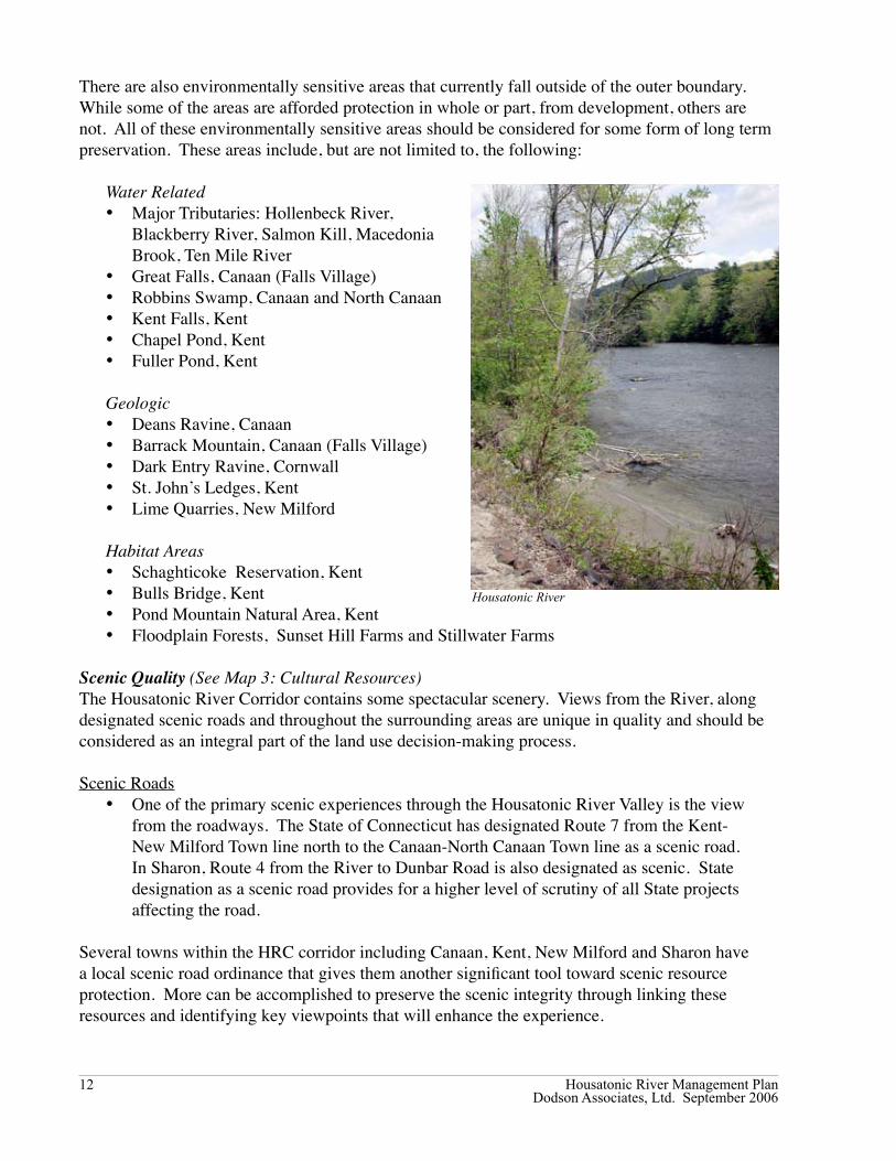
Housatonic River

Housatonic River Management PlanDodson Associates, Ltd. September 2006
��
Vistas and ViewshedsPreserving the Housatonic Valley’s unique scenic quality should be a priority for the Commission towns. The most significant threats to that scenic quality are residential development along the Valley’s ridgelines and the construction of communication towers. As energy costs increase, interest is also likely to increase in the development of wind generators on the Valley’s ridgelines. Unless carefully sited, wind generators could have a negative impact on the Valley’s scenic quality.
To date, none of the seven towns have adopted zoning regulations governing development along ridgelines. Communication towers are governed by the Connecticut State Siting Council with input from the towns. The Towns and the HRC need to be active participants in the Siting Council process in order to monitor this issue. Residential development on ridgelines can be addressed in the form of erosion control on steep slopes and the protection of property values. In addition to regulatory measures, scenic and viewshed protection can also be addressed through the use of scenic easements.
GreenwaysThe development of greenways has become a significant component to resource protection and open space planning. The State of Connecticut defines greenways as “linear open spaces that can help conserve native landscapes and ecosystems by protecting, maintaining and restoring natural connecting corridors”. While providing significant recreational opportunities, the benefits of establishing greenways for individual communities can also be demonstrated in other ways. They can provide buffers between incompatible land uses, promote economic development and tourism and contribute to the protection of valuable historic, cultural and natural resources.
Housatonic RiverBelt GreenwayIn 1992 the Housatonic Valley Association (HVA) began its Housatonic RiverBelt Greenway program to increase the shoreline land available for public recreational use and comprehensive land protection and management along the River. In 2001, the State of Connecticut Greenways Council designated the Riverbelt as an official State Greenway. HVA’s program has two important goals. These are: to provide public recreation while promoting river stewardship by establishing a “greenway” of continuous walking and biking paths linking open spaces, parks, community centers, and river access points; and to encourage development strategies within the river corridor consistent with both river conservation and community growth needs.
HVA provides technical support to individual communities creating and building greenway components. Recent accomplishments through this program within the HRC corridor are in Canaan and Kent. In 1995, CL&P and the Town of Canaan collaborated on the construction of the one-mile Falls Village Historic Trail, and in 1997, the Kent Land Trust purchased 12 acres of riverfront land in South Kent to add to their protected farmland along the river’s eastern shore. In 1999 they also opened a “riverwalk” and picnic area.
Scenic Vista, Cornwall

Housatonic River Management PlanDodson Associates, Ltd. September 2006
��
TrailsThere are many significant trails that contribute to the greenways within the Housatonic River Valley. Among these are the Appalachian National Scenic Trail operated by the National Park Service and the Mohawk Trail which is one of many State of Connecticut “Blue Trails” maintained by the Connecticut Forest and Park Association. These trails are discussed in greater detail in the Recreation Management section of this Plan.
Land Use RecommendationsThe recommendations described below incorporate a range of strategies that can be accomplished through a combination of local and regional initiatives. Recommendations that include resource inventories and documentation might be completed by professional consultants hired by the Housatonic River Commission or local non-profit organizations or through State agencies that specialize in these areas. Changes to local land use regulations and the development of resource protection strategies can be accomplished by each community’s planning and zoning commissions with the assistance of the Commissioners as well as the local regional planning agency. Coordination of these initiatives within each town will be important to the successful implementation of this Plan. Historic, Archeological and Environmental Resources1. Sites and areas that pertain to the iron history and heritage of the region should be inventoried
and protected.2. Archeological sites previously identified should be documented.3. Environmentally sensitive areas should be expanded to include the protection of much of the
River edge that remains in private ownership. This can be accomplished through the purchase of conservation easements or outright purchase of those parcels identified as highly sensitive.
Scenic Resources1. Conduct a Scenic Resource Inventory that includes the identification of all views and vistas
along the corridor and distinguishes prominent resources. This inventory should also identify roads that can be used as links between previously designated scenic roads to provide a network.
2. Based on the Scenic Inventory, preserve views both from the River to the ridgelines and from the roads to the River through the purchase of scenic easements, scenic road designation and ridgeline protection regulations.
Recommended Additions to Land Use Regulations
The 1981 Plan contained model zoning regulations for the Inner Corridor, the Outer Corridor, and the Village Centers. These model regulations created an “overlay zone” requiring development conform to the Housatonic River overlay regulations as well as the zoning regulations governing the underlying zoning district. All of the HRC towns except North Canaan added these regulations to their town zoning regulations. The regulations below are based on the 1981 regulations but have been modified to reflect current concerns and circumstances.
Housatonic River, Salisbury

Housatonic River Management PlanDodson Associates, Ltd. September 2006
��
Recommended Zoning RegulationsIn addition to the provisions of the existing Zoning Regulations, the following requirements and criteria shall apply to each of the four zoning districts in the Housatonic River Corridor. If there is a conflict between the regulations listed below and other sections of these zoning regulations, the most restrictive provisions shall apply.
Except as noted, all applications for special exceptions, site plan approval, zoning permits, variances and zone changes affecting the four zoning districts shall be referred to the Housatonic River Commission for review and comment. The Housatonic River Commission shall have thirty-five days to report its recommendations to the referring board or commission. The Housatonic River Commissions recommendations are strictly advisory.
1. Inner Corridor
1.1 Statement of Purpose – To protect with appropriate standards a carefully defined area of land along the Housatonic River which is flood prone, environmentally sensitive and possesses many other valuable natural resources.
1.2.a The following shall be permitted uses subject to the requirements of the underlying zoning district.
1.2.1 Open space uses which do not require the excavation, grading or clearing of an area greater than 5,000 square feet.
1.2.2 Game management, fishing, hunting, camping, picnicking and other passive recreational activities that do not require excavation, grading, clearing or construction.
1.2.3 Farming, plant nurseries, pastures, trails, forest management, horticultural and other agricultural uses that do not require excavation, clearing or grading of an area greater than 10,000 square feet.
1.2.4 Maintenance or reconstruction of existing public ways and bridges.
1.2.b Excavation of sand, gravel, minerals and topsoil shall be prohibited within the Inner Corridor.
1.3 Except for uses stated in Section 1.2, all other uses permitted in the underlying zoning district within the Inner Corridor shall be allowed only as Special Permits and shall be subject to the following requirements and criteria in addition to any requirement for a Special Permit as established in the existing Zoning Regulations.
1.3.1 General Requirements – No special permit shall be granted if the Commission finds that a proposed land use will: a. create air or water pollution, b. increase erosion or sedimentation, c. create danger of flood damage,

Housatonic River Management PlanDodson Associates, Ltd. September 2006
�6
d. obstruct flood flow, e. damage the fish or wildlife habitat of species listed by the State of Connecticut as threatened or endangered, f. adversely affects any unique feature or natural resource.
1.3.2 Criteria – In determining the above, the following criteria shall apply:
a. Water Pollution Control. No activity shall locate, store, discharge or permit the discharge of any treated, untreated or inadequately treated liquid, gaseous, or solid materials of such nature, quantity, obnoxiousness, toxicity, or temperature that run off, seep, percolate, or wash into surface stream or ground waters so as to contaminate, pollute, or harm such waters or cause nuisances, such as objectionable shore deposits, floating or submerged debris, oil or scum, color, odor, taste, or unsightliness or be harmful to human, animal, plant or aquatic life.
b. Erosion and Sedimentation Control. Filling, grading, lagooning, dredging, earth moving activities, road construction and other land use activities shall be conducted in such manner to prevent erosion and sedimentation damage to surface stream waters. To this end, all construction shall comply with the “2002 Connecticut Guidelines for Soil Erosion and Sediment Control” as amended.
c. Storm Water Management. All storm water management systems shall be designed, constructed and maintained in such a manner as to minimize the impact of storm water discharge on the River. All systems shall follow the best practices as recommended by the “2004 Connecticut Storm Water Quality Manual” as amended.
d. General Soils Evaluation. All land uses shall be located on soils in or upon which the proposed uses or structures can be established or maintained without causing adverse environmental impacts, including severe erosion, mass soil movement and water pollution, whether during or after construction.
e. Flood Control. The 100 year flood area shall be as shown on the applicable federal flood map. Within this area all new construction or substantial improvement of residential structures shall be elevated to or above the level of the 100 year flood; all new construction or substantial improvements to non-residential structures shall be elevated to or above the level of the 100 year flood or together with attendant utility and sanitary facilities shall be flood proofed up to the level of the 100 year flood.
f. Insecticides, Herbicides and Fertilizers. Use of these shall only be in accordance with such standards and procedures established by the Connecticut Department of Environmental Protection. Activities which
Housatonic River Management PlanDodson Associates, Ltd. September 2006
��
could result in increased nitrogen and phosphorus loading shall be minimized.
g. Timber Harvesting. The harvesting shall be performed by following the best management practices as described in the Connecticut Resource and Conservation Development Forestry Committee’s “A Practical Guide for Protecting Water Quality While Harvesting Forest Products” 1990, as amended.
h. Signs and Billboards. Signs relating to goods and services sold on the premises shall not exceed six (6) square feet in area, and shall not exceed two (2) signs per premises. Billboards and signs relating to goods and services not rendered on the premises are prohibited.
2. Outer Corridor
2.1 Statement of Purpose – To establish a review procedure which will guard against pollution, erosion, sedimentation and establish other basic safeguards on development activity which, although occurring at some distance from it, could adversely affect the Housatonic River.
2.2 For uses permitted in the underlying zoning district within the Outer Corridor, the following review procedures are required:
2.2.1 All activities involving construction shall be conducted in such manner to prevent erosion and sedimentation damage to surface stream waters. To this end, all construction shall comply with the “2002 Connecticut Guidelines for Soil Erosion and Sediment Control” as amended.
2.2.2 Storm Water Management. All storm water management systems shall be designed, constructed and maintained in such a manner as to minimize the impact of storm water discharge on the River. All systems shall follow the best practices as described in the “2004 Connecticut Storm Water Quality Manual” as amended.
2.2.3 Timber Harvesting. The harvesting shall be performed by following the best management practices as described in the Connecticut Resource and Conservation Development Forestry Committee’s “A Practical Guide for Protecting Water Quality While Harvesting Forest Products” 1990, as amended.
2.2.4 Applications involving commercial or industrial construction shall be reviewed to assure that building location, site layout, landscaping and screening will be compatible with the rural and natural character of the Corridor area. Commercial and industrial buildings, structures, parking areas, and signs shall be screened from the view of boaters on the River. The screening

Housatonic River Management PlanDodson Associates, Ltd. September 2006
��
shall be accomplished by means of existing vegetation, additional landscaping and/or berms.
2.2.5 All sand, gravel, mineral and topsoil excavations shall require a special exception. The applicant shall provide a plan, acceptable to the Commission, for the restoration of the disturbed area. The plan must be prepared by a licensed professional engineer or landscape architect. The applicant must post a performance bond to assure that the restoration is accomplished according to the accepted plan. In deciding on the application, the Commission shall consider the extent to which the excavation is visible from the River and public highways.
3. Village Centers
3.1 Statement of Purpose – To allow village centers as defined within the Corridor to develop according to Town plans while protecting the Corridor areas.
3.2 The portion of a village center lying within the Inner Corridor shall be subject to the provisions of Section 1 of this regulation.
3.3 The portion of a village center lying within the Outer Corridor shall be subject to the following requirements.
3.3.1 All activities involving construction shall be conducted in such manner to prevent erosion and sedimentation damage to surface stream waters. To this end, all construction shall comply with the “2002 Connecticut Guidelines for Soil Erosion and Sediment Control” as amended.
3.3.2 Storm Water Management. All storm water management systems shall be designed, constructed and maintained in such a manner as to minimize the impact of storm water discharge on the River. All systems shall follow the “2004 Connecticut Storm Water Quality Manual” as amended.
4. Sensitive Areas Zone 4.1 Statement of Purpose – To establish a review procedure for applications which will guard against pollution, erosion, sedimentation and establish other basic safeguards on development activity which, although occurring at some distance from it, could adversely affect the Housatonic River.
4.2 For uses other than single family residences permitted in the underlying zoning district within the Sensitive Areas Zone, the following review procedures are required:
4.2.1 All activities involving construction shall be conducted in such manner to prevent erosion and sedimentation damage to surface stream
Housatonic River Management PlanDodson Associates, Ltd. September 2006
��
waters. To this end, all construction shall comply with the “2002 Connecticut Guidelines for Soil Erosion and Sediment Control” as amended.
4.2.2 Storm Water Management. All storm water management systems shall be designed, constructed and maintained in such a manner as to minimize the impact of storm water discharge on the River. All systems shall follow the best practices as described in the “2004 Connecticut Storm Water Quality Manual” as amended.
4.2.3 All sand, gravel, mineral and topsoil excavations shall require a special exception. The applicant shall provide a plan, acceptable to the Commission, for the restoration of the disturbed area. The plan must be prepared by a licensed professional engineer or landscape architect. The applicant must post a performance bond to assure that the restoration is accomplished according to the accepted plan.
Additional Recommended Land Use Regulations
In addition to the zoning regulations mentioned above, the HRC recommends the Towns consider the following plans and regulations to protect the River.
1. Impervious Surface CoverageImpervious surfaces are primarily paved areas, buildings, and compacted earth or stone that creates a barrier to the percolation of rainfall into the soil. These surfaces disrupt the natural water cycle by increasing surface run-off and decreasing the infiltration of precipitation into the groundwater. Studies have shown that water quality is significantly related to the amount of impervious surface in a watershed.
Change zoning regulations to reduce impervious surface coverage within their communities through site design guidelines and Best Management Practices for storm water system design and maintenance. Information on planning and site design as well as Best Management Practices can be found in the “2004 Connecticut Storm Water Quality Manual”. A town zoning regulations can, for example, establish a limit on the ratio of impervious surface coverage to total lot area.
The 2002 Northwest Connecticut Parking Study completed by Fitzgerald & Halliday, Inc, discussed the need to improve water quality in the region by reducing impervious parking surfaces. The Study identified several primary strategies including amending parking standards, encouraging shared parking and construction of parking with pervious materials. Although parking is not the only issue in storm water management and ultimately improved water quality, reducing impervious surfaces should be a high priority.
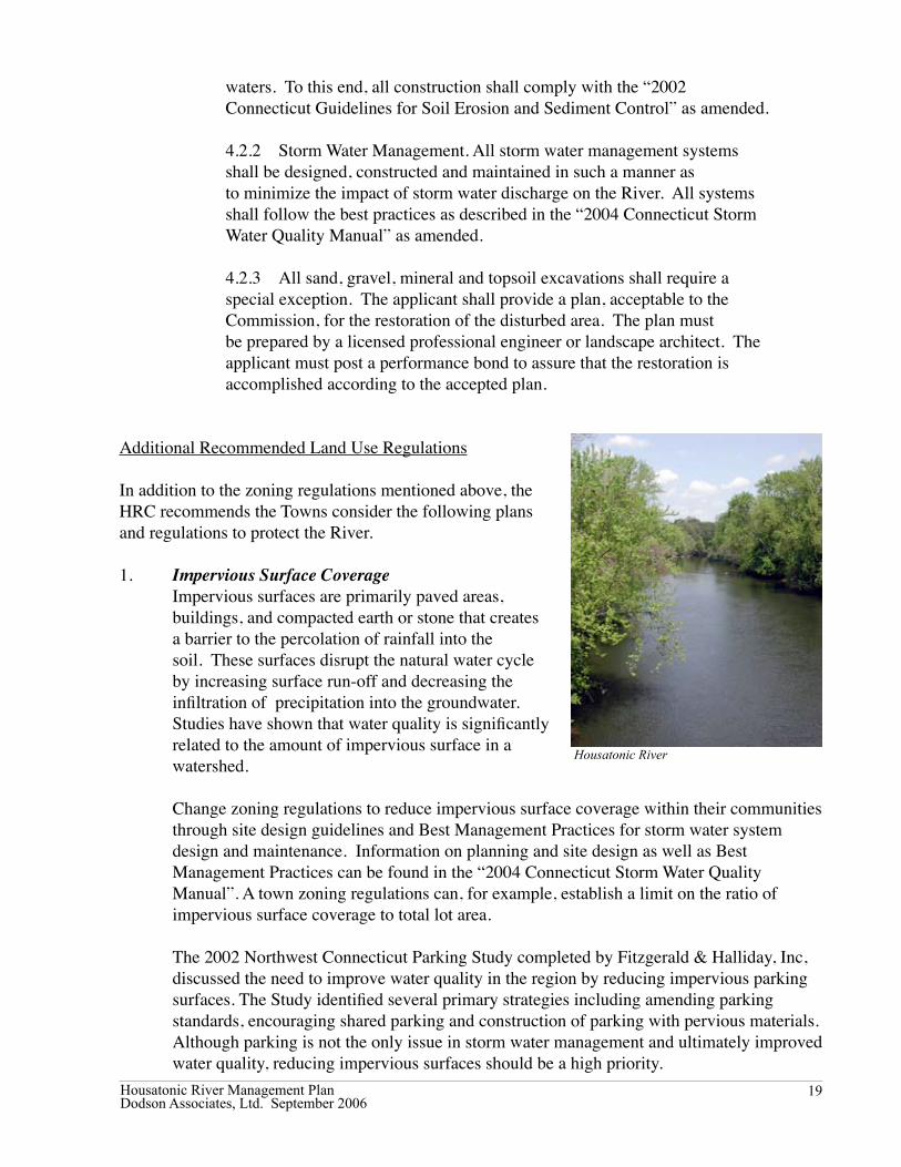
Housatonic River
Housatonic River Management PlanDodson Associates, Ltd. September 2006
20
2. Natural Resource InventoryConduct a Natural Resource Inventory that will identify important natural resources and set protection priorities that will provide a framework for evaluating the impacts of development. The Natural Resource Inventory could be done as part of the Plan for Conservation and Development.
3. Village DistrictsEstablish Village Districts to protect the historic and scenic character of those village centers that are within the Corridor boundaries. Village district regulations would allow the town to establish architectural standards for new buildings and for modifications to existing buildings.
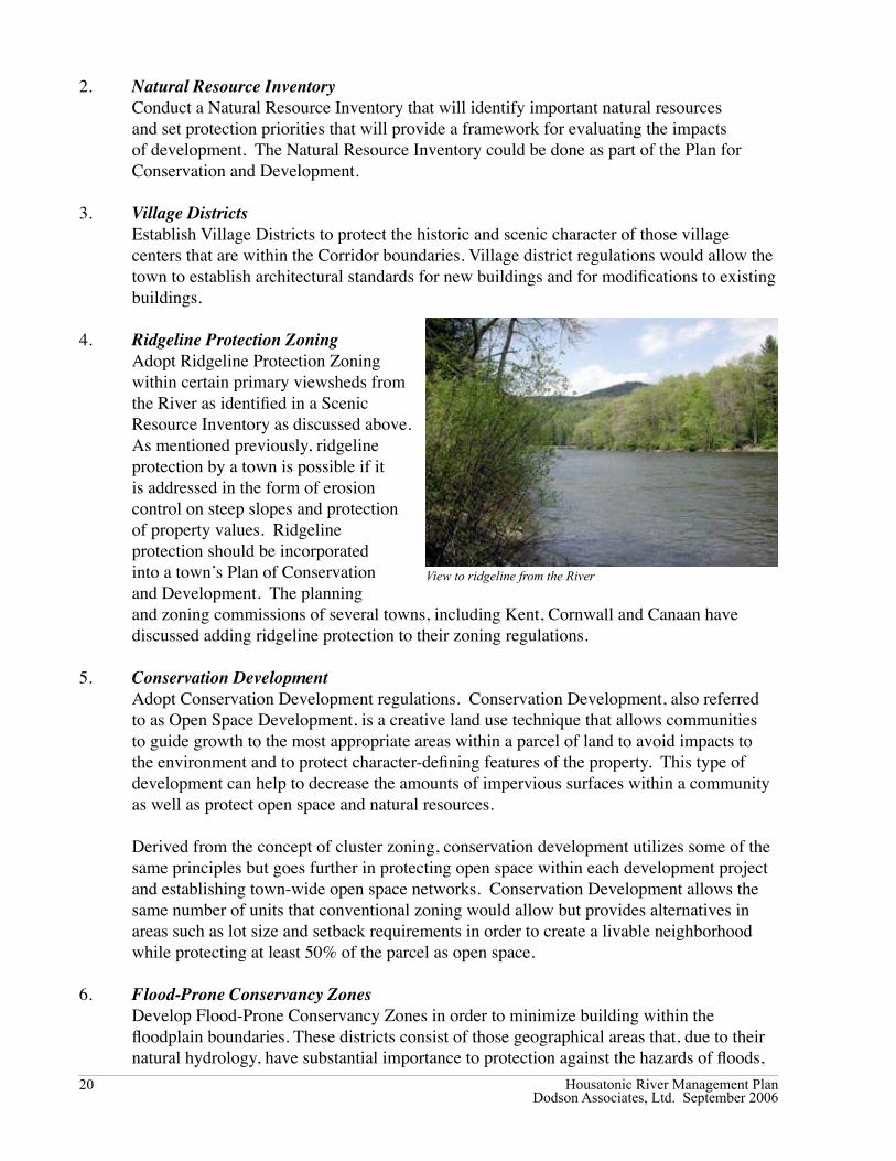
4. Ridgeline Protection ZoningAdopt Ridgeline Protection Zoning within certain primary viewsheds from the River as identified in a Scenic Resource Inventory as discussed above. As mentioned previously, ridgeline protection by a town is possible if it is addressed in the form of erosion control on steep slopes and protection of property values. Ridgeline protection should be incorporated into a town’s Plan of Conservation and Development. The planning and zoning commissions of several towns, including Kent, Cornwall and Canaan have discussed adding ridgeline protection to their zoning regulations.
5. Conservation DevelopmentAdopt Conservation Development regulations. Conservation Development, also referred to as Open Space Development, is a creative land use technique that allows communities to guide growth to the most appropriate areas within a parcel of land to avoid impacts to the environment and to protect character-defining features of the property. This type of development can help to decrease the amounts of impervious surfaces within a community as well as protect open space and natural resources.
Derived from the concept of cluster zoning, conservation development utilizes some of the same principles but goes further in protecting open space within each development project and establishing town-wide open space networks. Conservation Development allows the same number of units that conventional zoning would allow but provides alternatives in areas such as lot size and setback requirements in order to create a livable neighborhood while protecting at least 50% of the parcel as open space.
6. Flood-Prone Conservancy Zones
Develop Flood-Prone Conservancy Zones in order to minimize building within the floodplain boundaries. These districts consist of those geographical areas that, due to their natural hydrology, have substantial importance to protection against the hazards of floods,
View to ridgeline from the River

Housatonic River Management PlanDodson Associates, Ltd. September 2006
2�
erosion and pollution. These geographical areas would include flood prone areas, natural water storage areas adjacent to ponds, rivers and streams and wetlands. The number and types of uses allowed are restricted. A Flood-Prone Conservancy District provides a greater level of protection than existing State and Federal floodplain restrictions; especially for smaller flood prone areas.
Other Programs and Protective Measures In addition those mentioned above, the HRC has reviewed the following programs aimed at
protecting the River.
1. Nutrient Management PlansEncourage Nutrient Management Plans for active farms within the watershed and along major tributaries. In 2002, US EPA and Litchfield County Conservation District – now the Northwest Conservation District - conducted a pilot project in the Blackberry River watershed to demonstrate the feasibility of using agricultural nutrient management plans on individual farms to reduce nutrient loading to ground and surface water. Nutrient Management Plans address the proper storage of manure, proper land application of manure, appropriate site management and the record keeping that documents land practices.
Having Nutrient Management Plans in place on large agricultural operations within the watershed increases the protection of natural resources and water quality. The Natural Resources Conservation Service of the USDA provides technical assistance with the preparation of these plans as well as Connecticut DEP. Farmers should also be encouraged to take advantage of programs created under the 1996 Farm Bill that help mitigate resource damage and aid compliance with environmental laws. In addition, the CT Department of Environmental Protection is proposing a general permit for farms that meet the definition of either an “animal feeding operation” or a “concentrated animal feeding operation”.
2. Wild and Scenic DesignationIn the late 1970s, the Housatonic River Commission was formed as an alternative to federal designation of the Housatonic as a Wild and Scenic River. At that time, designation carried with it federal requirements that the Towns along the River considered onerous and intrusive. Since then, Federal requirements for Wild and Scenic designation have become more flexible and more compatible with the realities of regions where the Federal government is not a major landholder. For example, fourteen miles of the Upper Farmington River in Connecticut have been designated as Wild and Scenic and a cooperative arrangement between federal, state and local officials has been developed. HRC will continue to review the implications of Wild and Scenic Designation for the Housatonic River. Painting of ‘Fishing on the River’

Housatonic River Management PlanDodson Associates, Ltd. September 2006
22
3. State “Protected Rivers” and “Multiple Use River” ProgramsChapter 484 of the Connecticut General Statutes provides for the designation of “Protected Rivers”; Chapter 485 provides for designation of “Multiple Use Rivers”. Under both chapters, a plan would have to be prepared. Under the Protected Rivers program the plan would have to be approved by Connecticut General Assembly; under the Multiple Use River program, the plan would have to be approved by the State Department of Environmental Protection. Approval of the member towns is also required. Once a plan is approved, town land use plans and regulations would have to be amended to conform to the plan. Any further changes to those regulations would have to be approved by a “river commission” in the case of a multiple use river or a “river committee” for a protected river. Under both programs, the road to designation is long and fraught with uncertainty. The HRC does not intend to pursue designation for the Housatonic as either a protected river or a multiple use river.
4. Housatonic Riverkeeper ProgramThe Waterkeeper Alliance is a national alliance of local non-profit organizations that work on watershed protection. “Riverkeepers”, “Baykeepers” and “Lakekeeper” are all part of the Waterkeeper Alliance.
The Housatonic River Initiative based in Massachusetts has started a Housatonic Riverkeeper program which is intended to cover the entire River. To date, however, their efforts have been concentrated on the Massachusetts part of the River. The HRC encourages the Program’s efforts to protect the River and will cooperate with the Riverkeeper Program when appropriate.

Housatonic River Management PlanDodson Associates, Ltd. September 2006
2�
Section III. Recreational Management In 1989, the River Commission prepared a Recreation Management Plan to assess the impact of recreation on the River. The recreation management goals listed below are based on that Plan.
Recreational Management Goals • Promote effective local management of existing recreation facilities and resources for their best
use.• Preserve the Housatonic River environment and its unique and fragile natural features from
over use.• Minimize conflicts among various recreational users and promote a balanced blend of uses
appropriate to the River environment.• Promote education of the general public in the safe and responsible recreational use of the
Housatonic River.
Overview of Resources and Uses by SegmentThe four-segment overview provided below has been updated from the 1981 River Management Plan.
From the MA border to Falls Village Power Station (7.9 miles)The Housatonic River in this segment runs primarily through farmland. Access points for boaters are at Rannapo Road in Ashley Falls, Dutchers Bridge in Salisbury and above the Falls Village dam on the West side of the River. There is a short Class 5 kayaking run (“Rattlesnake Rapids”) south of the Great Falls. The Appalachian Trail crosses the River at the Amesville Bridge in Falls Village.
Robbins Swamp the State’s largest inland wetland, is east of the River in Canaan and North Canaan and is a popular duck hunting area. The Blackberry and Hollenbeck Rivers enter the Housatonic in this segment and the Hollenbeck Preserve, owned by The Nature Conservancy, encompasses 182 acres along the River and provides a habitat for significant rare plant and animal species including the State’s declining grassland bird species.
Falls Village Power Station to Kent Center (20.5 miles)This section of the River is heavily used for boating and fishing particularly from spring through early fall. Housatonic Meadows State Park along the west side of the River offers convenient camping, access to the River, and parking for fishermen. The CT DEP Trout Management Area, which DEP stocks annually, runs for 9 miles through Sharon and Cornwall and includes a 3.5-mile fly-fishing only area. Macedonia Brook State Park also offers seasonal camping. The Kent Falls State is a popular site for hiking, fishing and picnicking.
A section of the Appalachian Trail runs for five miles along the west side of the River between
Great Falls

Housatonic River Management PlanDodson Associates, Ltd. September 2006
2�
Kent and Cornwall Bridge. It is the longest stretch of river walk between Georgia and Maine. There are also access points for fishing and boating at Amesville, CL&P field in Sharon, Covered Bridge in West Cornwall, Housatonic Meadows State Park and Swifts Bridge in Sharon and Cornwall. Commercial boat rental operations conduct business in this segment.
Kent Center to Bulls Bridge (3.8 miles)This wide stretch of River is good for flat water canoeing and rowing. The Appalachian Trail runs along the ridge line in Kent, parallel to
and west of the River. The Schaghticoke Reservation is on the west side of the River. Route 7 runs along the east side of this River segment offering scenic views for tourists. A canoe/kayak take-out is just north of Spooner Dam on Bulls Bridge Island.
Bulls Bridge to Boardman’s Bridge (8.1 miles)Bulls Bridge is an area for experienced kayakers offering the only true Class 4-5 run in Connecticut according to the Housatonic Area Canoe and Kayak Squad (HACKS). The Bulls Bridge Gorge area is also environmentally and historically significant and contains rare species as well as historic resources such as the site of the 1826 Bulls Bridge Iron Furnace. Scenic overlooks are located on the Bulls Bridge utility property but access and parking is an issue due to congestion. The Appalachian Trail follows the River in the area of Bulls Bridge. Protecting this sensitive area from overuse is a major concern.
The Tenmile River, a major tributary, enters the Housatonic just below the Gorge. Rafting is common in this segment and there are access points at Bulls Bridge, the west bank of River south of Gaylordsville Bridge, the west bank south of the new Boardman Bridge, and Young’s field at New Milford Center (just south of current Housatonic River Commission boundary). The State DEP has designated a bass management area and a trout management area in this segment.
Current Recreational UseThe types of recreational uses in the Housatonic River and Valley have remained relatively unchanged and continue to include canoeing, kayaking, fishing, camping, hiking, birding, hunting, tourism and cross-country skiing. The level of recreational use on the River and in the region, however, has increased. The conversion of the hydropower dams at Falls Village and Bulls Bridge from “pond and release” to “run of the river” beginning in June 2004 will have a long term affect on boating and fishing. The management of uses and levels of use should be based on the carrying capacity of the resource.
Carrying CapacityCarrying capacity can be defined as the amount of use a recreational resource such as the Housatonic River can tolerate before permanent degradation occurs to the resource’s physical, ecological and aesthetic attributes. The physical and ecological capacity of a resource can have
Scenic Vista, Sharon

Housatonic River Management PlanDodson Associates, Ltd. September 2006
2�
a direct impact on the health of the resource, but aesthetic capacity can have a significant impact on the River’s character. While physical and ecological impacts can be measured objectively, the aesthetic impacts are more subjective and “in the eye of the beholder.”
Across the country, managers of public recreation facilities and areas are turning from abstract planning to more specific planning based on public perception and shared goals. Some researchers also suggest that the emphasis has been changing from “capacity planning” to “capacity decision-making.” While capacity planning was characterized by long-term processes, capacity decision-making has shorter time frames and made the management process more public. The National Park Service, and others, have developed methodologies for involving the public in this kind of decision making, which is designed to build a consensus among the many different (and often competing) groups that share a river corridor.
Fishing Fishing, which is predominately catch-and-release due to PCB contamination, is common throughout the length of the River and along its major tributaries. Formal access points are few but informal ones are common. Several outfitting companies offer fly-fishing lessons and guided fishing trips.
In 1999 the State DEP prepared a Trout Management Plan for Connecticut’s Rivers and Streams. Based on surveys conducted for the Plan, it was found that the Housatonic River experienced approximately 38,000 hours annually spent in fishing on the River. Fishing is highest in the spring and fall.
The Housatonic Trout Management Area (TMA) between Sharon and Cornwall is one of the most heavily fished sections of river in Connecticut and is gaining popularity with out-of-state fishermen. Access to the TMA, however, is limited. The most
heavily used section of the TMA is at Housatonic Meadows State Park which provides convenient access and parking. As a result of the State’s 1999 Plan, a second trout management area was created extending from the Bulls Bridge Dam in Kent to the Gaylordsville Bridge in New Milford.
The State DEP has also created two bass management areas (BMAs). The first runs approximately six miles from Dawn Hill Road in Sharon to Skiff Mountain Road in Kent. The second bass management area corresponds with the trout management area that runs from Bulls Bridge Dam to the Gaylordsville Bridge.
The recent FERC re-licensing of the Falls Village and Bulls Bridge hydropower dams will affect fishing in the River due to the fact that the change to run-of river operation will affect the natural habitats along the River and, therefore, the location and types of fish.
Trout Management Area

Housatonic River Management PlanDodson Associates, Ltd. September 2006
26
Canoeing and KayakingNon-motorized boating in the form of canoes, kayaks and rafts is a major recreational activity along the River. The numbers of boaters has been increasing with the highest rates of users during April through October. The upper Housatonic is also well known for whitewater canoeing and kayaking with Class 5 rapids in Falls Village and Class 4-5 rapids in Bulls Bridge. Access to the River can be found along most stretches. The largest concentration of put-in and takeout point is between Falls Village and Housatonic Meadows.
Canoe and kayak rental businesses distribute maps showing these access points. According to the Housatonic Area Canoe and Kayak Squad, a local boating organization, the typical user is a novice kayaker learning river skills as well as families, scouting groups and others who enjoy the scenery and pleasure of the beautiful river valley.
Whitewater rafting is done at the Bulls Bridge Gorge. However, according to the 1989 Recreation Management Plan, commercial whitewater rafting is not appropriate due to the environmental degradation of natural areas. The River Commission’s concern over commercial operations remains high.
The recent change to run-of-river operation at the Falls Village and Bulls Bridge hydropower dams will affect commercial boating operations because they will no longer be able to rely on the scheduled releases of water inherent in the previous pond and release mode of operation. Local boaters who have their own equipment and are able to take advantage of high water when it occurs are expected to experience minimal impacts. Boaters – and all other users of the River – will now be dependent on naturally occurring River conditions.
HikingAppalachian Trail The Appalachian Trail runs 51.4 miles in Connecticut, all of which is within the Housatonic River Valley. Approximately nine miles are within the inner corridor and approximately fourteen are within the outer corridor boundary. There is a 4.9-mile stretch through Kent and Sharon that runs along the river edge. The National Parks Service (NPS) owns approximately 7,000 acres of Appalachian Trail corridor in the State and protects hundreds of additional acres with conservation easements. Through an agreement with the NPS, the Connecticut Chapter of the Appalachian Mountain Club (AMC) maintains and manages the Trail and the corridor lands in Connecticut.
According to the most recent statistics from the Connecticut Chapter of the AMC, nearly 100,000 hikers per year use the Connecticut section of the Appalachian Trail.
Mohawk Trail in ConnecticutThe 24 mile Mohawk Trail extends from the Appalachian Trail on Breadloaf Mountain in Sharon, crosses the River and runs along the eastern side of the Housatonic River Valley back to the Appalachian Trail on Warren Turnpike in Canaan. The Mohawk Trail is part of the State’s Blue Trail system.
Kayak Rental Facility

Housatonic River Management PlanDodson Associates, Ltd. September 2006
2�
Local TrailsIn 1995, Connecticut Light and Power and the Town of Canaan, constructed a one-mile Historic Trail to the Ames Iron Works site in Falls Village. The Kent Land Trust opened a river walk and picnic area in the protected farmland areas along the eastern shore of the River in 1999.
Camping/ State ParksTwo State Parks within the Housatonic River Valley offer camping facilities; a third, Kent Falls, is only for day use. Housatonic Meadows offers 95 campsites and Macedonia Brook offers 51 campsites. There is also camping along the Appalachian Trail, at the Stanley Works property and at private, commercial campgrounds. Camping is primarily during the summer months but Housatonic Meadows State Park offers limited off-season camping. Housatonic Valley State Parks account for 3% of day use in the State and two with camping account for 7% of State use.
2003 Statistics for State Park/Forest Use: a. Housatonic Meadows Day Use = 45,468 Campers = 15,141 b. Macedonia Brook Day Use = 37,666 Campers = 5,335 c. Kent Falls Day Use = 110,308 d. Total Park Use (Statewide) Day Use = 5,960,456 Campers = 288,594 e. Forest Use (Statewide) Day Use = 1,761,631
Campers = 35,074 HuntingPublic hunting areas are located at Housatonic and Wyantenock State Forests, Robbins Swamp Wildlife Management Area (WMA), Stanley Works Cooperative WMA (permit required) and Wickwire, a privately owned area leased by the State. Hunting in the State Forests is allowed for deer, turkey, small game and waterfowl. Wickwire and Stanley Works only allow hunting for small game and waterfowl. BirdingThe Housatonic River Valley offers multiple opportunities for birders including recommended sites along the River in Kent and Falls Village. Birding lists for the area are available through organizations such as the Connecticut Ornithological Association and the Sharon Audubon Center.
TourismThe Housatonic River Valley is one of the most beautiful places in New England and is easily accessible from Hartford, Boston and New York City. Sightseeing and visiting historic and cultural attractions are significant activities in the Valley. The opportunities for boating, fishing, camping, hiking, and other active pursuits draw tourists to the Valley.
Kent Falls State Park

Housatonic River Management PlanDodson Associates, Ltd. September 2006
2�
In 2002 the National Park Service prepared a Feasibility Study and Environmental Assessment for the potential Upper Housatonic Valley National Heritage Area. While including all of the towns within the River Corridor except for New Milford, the proposed area includes eighteen towns in Berkshire County, Massachusetts as well as the Connecticut Towns of Norfolk, Colebrook and Warren. Designation of the area is currently pending in the US Congress. The Study produced the following data regarding tourism in the region:
• It was estimated, based on tourist data from the Litchfield Hills Visitors Bureau (LHVB), that the tourism industry generates around $67 million annually in the upper eight towns.
• Designation will bring added economic boon but will increase crowding and impacts on natural and recreational resources.
• The LHVB survey results indicate that the main reasons that visitors come to the region are “culture/heritage, romance, and to ‘take a break’”. A State of Connecticut Study in 2000 also confirmed that visitors come from northeast urban areas to enjoy the natural, cultural, and recreational value of the Housatonic River Valley.
The designation of the National Heritage Area will have effect the region’s tourist industry. The Feasibility Study also suggests that there may be increased crowding which can effect the natural and scenic resources of the corridor.
Recreational Management RecommendationsThese recommendations were initially identified in the 1989 Recreation Management Plan but have been modified and updated for the purposes of this Plan.
Housatonic River Commission1. Encourage a Carrying Capacity Study that will provide the appropriate information for
local management decision-making regarding recreational use and capacity in the region.
2. Develop a means of monitoring the recreational use of the River by segment; the monitoring system will be used to alert the towns when the River segments carrying capacity is being exceeded.
3. Advocate for appropriate safety-related signage.
4. Encourage the development and distribution of River guides and safety brochures.
5. Encourage the State, the Towns and private property owners to keep existing access points open and clean.
6. Encourage coordination of educational and recreational programs within the River Corridor.
7. Participate actively in all planning studies that FERC has required NGC to undertake as a condition of the hydropower re-licensing for the Falls Village and Bulls Bridge Dams. These include the Recreation Plan, Shoreline Management Plan, Critical Habitat Management Plan and Programmatic Agreements.

Housatonic River Management PlanDodson Associates, Ltd. September 2006
2�
8. Encourage inter-town agreements for a coordinated, in-river, accident response system.
9. Encourage inter-town agreements for policing of riverside activity, where appropriate.
10. Monitor conditions of lands along the River to detect and report areas where environmental problems are occurring.
11. Work with the Upper Housatonic Valley National Heritage Area to encourage appropriate tourism and recreational management decision-making that preserves the long-term health of the River.

Housatonic River Management PlanDodson Associates, Ltd. September 2006
�0
Housatonic River
Section IV. Water Quality
Water Quality Standards and Classifications For the purposes of this Plan, water quality conditions and goals within the Housatonic River corridor are presented as per CT DEP’s 2002 Water Quality Standards and associated Water Quality Classifications maps. The Water Quality Standards set overall policy for management of Connecticut’s waters, and the Water Quality Classification maps describe goals and presumed conditions for specific water resources. CT DEP assesses water quality in two distinct areas: ground water and surface water. The classifications that apply to the Housatonic River Valley area have been noted on the Map 6: Water Resources.
Ground Water ClassificationsThe CT DEP has four main ground water classifications (see Appendix D). These classifications indicate water quality criteria and designated uses for each class. Most of the Region’s ground water is classified as GA. The CT DEP presumes that the ground water in GA areas are, at a minimum, suitable for drinking or other public uses without treatment.
The State has created an Aquifer Protection Program aimed at protecting “major public water supply wells in sand and gravel aquifers to ensure a plentiful supply of public drinking water for present and future generations”. This program, which is in the process of being implemented, requires municipalities to adopt State approved land use regulations to protect areas around active well fields in sand and gravel aquifers serving more than 1,000 people. The boundaries of these “Aquifer Protection Areas” must be approved by the State. North Canaan and Salisbury are the only two HRC towns having areas that fall under this program.
Surface Water ClassificationsThe CT DEP has five main surface water classifications. Due to the presence of PCBs, the entire Housatonic River in Connecticut is classified as D/B. The D classification means that the River does not meet one or more of the State designated uses goals such as being suitable recreation or fish and wildlife habitat. The State’s ultimate goal for the Housatonic River is to achieve Class B water quality which would make the River suitable for recreational use, fish and wildlife habitat, and agricultural water supply.
Water Quality Problems/ThreatsIdeally, water resource issues should be examined within a watershed context, an approach which allows for a more holistic evaluation of the many land use policies and practices affecting water quality and quantity. All ground and surface water within a watershed should be included in his type of water resource assessment since ground and surface water systems are interconnected.
While a comprehensive assessment of the Housatonic River watershed was not undertaken as part of this planning process, the Commission has identified some of the major issues affecting water quality within the Housatonic River and its watershed. A municipal survey which was conducted

Housatonic River Management PlanDodson Associates, Ltd. September 2006
��
as part of this project rated PCBs as the highest single threat to the water quality of the River. Pollution from stormwater runoff was considered the next biggest threat. These and other water resource issues are discussed in more detail below.
General Electric PCB Remediation and RestorationIn 2000, a Consent Decree was approved in Federal Court requiring General Electric (GE) to remediate and restore specific portions of the River and to investigate and potentially implement cleanup measures for additional downstream areas. This document calls for the River remediation and restoration to be addressed in three phases: a. Remediation and restoration of the upper 1/2 mile nearest the GE plant. This was completed by GE in 2002. b. Remediation and restoration of the next 1 1/2 mile reach. This was completed by EPA in 2006. c. Investigation of the Rest of River, which encompasses the all of
the Housatonic River in Massachusetts and Connecticut downstream of the 2 mile stretch which has already been cleaned up. This phase required EPA to conduct Human Health and Ecological Risk Assessments and to develop a model of PCB fate, transport, and bioaccumulation in the River system. Based on these assessments and the model, decisions will be made with regard to cleanup of PCBs in the Rest of River.
In June 2005, the EPA finalized the Humans Health and Ecological Risk Assessments. Among the significant findings were:
a. the risks from eating fish and waterfowl in the Rest of River exceeded the EPA risk range;
b. benthic invertebrates, amphibians and fish-eating mammals are at high risk for survival, growth and/or reproductive success.
(See Appendix E for a summary list of findings.)
Because of the stable and toxic nature of the PCBs, continued monitoring of sediment and fish is necessary. All developments along or in the River that disrupt floodplain soils or River sediments should be tested for PCBs. Testing in the impoundment areas behind the dams is especially important prior to repair. Testing also needs to be done when bridges are repaired or replaced.
Natural Resources Damage FundAs part of the Consent Decree, GE paid over $15 million as compensation for the damages done to the River’s natural resources by their release of PCBs. This $15 million, which has been divided equally between Connecticut and Massachusetts, will be used to fund restoration projects in each State. The fund, commonly referred to as the Natural Resources Damage Fund, is to be used to restore, rehabilitate, replace, and/or acquire natural resources or natural resource services damaged by the PCBs.
Housatonic River

Housatonic River Management PlanDodson Associates, Ltd. September 2006
�2
Connecticut’s share of the fund is controlled by three trustees – one from the CT Department of Environmental Protection, one from the US Fish and Wildlife Service and one from the National Oceanic and Atmospheric Administration. The CT Trustee has established a citizens group to advise the CT Trustee during the restoration planning process. The Housatonic River Commission and the Northwestern CT Council of Governments are both represented on this advisory group.
Before any project can be undertaken, the Trustees must first develop a Natural Resources Restoration Plan. The Plan must evaluate restoration project alternatives and explain the rationale behind the projects chosen for implementation. The preparation of this Plan is still in its early stages. The HRC will have the opportunity to submit projects for inclusion in the Plan as well comment on the final Plan.
Non-point Source PollutionPerhaps the most prevalent type of non-point source pollution is polluted storm water runoff. Water flowing over the land picks up contaminants including oil and sand from parking lots, fertilizer from agricultural land and pesticides from suburban lawns. The contaminated runoff flows, directly and indirectly, into the watershed’s rivers and lakes The EPA estimates that this type of pollution is now the single largest cause of deterioration of water quality.
In 2003, the University of Connecticut’s Nonpoint Education for Municipal Officials project released an Impervious Surface Research Report that covered fifteen of Connecticut’s watersheds. The closest watershed to the Housatonic River was the Shepaug River, a major tributary of the Housatonic. The purpose of the study was to relate the percentage of impervious area to water quality.
The Study concluded that the quality of stream flow was found to be significantly related to: (1) the percentage of impervious surface, (2) the percentage of urban land cover, and (3) the percentage of urban plus the percentage of agricultural land cover. Previous research concluded that stream degradation occurs at 10%-20% imperviousness. More recent literature review indicates that a single threshold is adequate and that thresholds actually range from 4%-12% for fish populations, 8%-15% for macroinvertebrates and 4%-50% for abiotic measurements such as water quality and habitat. According to the 2002 land cover data from the State, the seven-town region is currently approximately 7.6% developed land and 16.2 % agricultural land.
Invasive Non-Native SpeciesZebra MusselsZebra mussels are an invasive species of freshwater mollusk that were first found in the Twin Lakes in Salisbury in 1998. These animals are filter feeders and when in abundance they can cause disruptions to aquatic ecosystems by greatly reducing plankton densities. They are also known for their effect on public water supply and hydroelectric facilities due to their ability to colonize pipes and constricting flow. They can also severely damage boat intakes.
Zebra Mussels have already been identified in the region; it is imperative that their spread be minimized. The Twin Lakes flow into tributaries of the Housatonic River. CT DEP has been working on the issue. In the meantime, precautions such as examining and washing boats can slow their spread.

Housatonic River Management PlanDodson Associates, Ltd. September 2006
��
Invasive VegetationBy out-competing and displacing native species, invasive plants have a detrimental effect on the native habitat and environment of the River. The Invasive Plant Atlas of New England project, which is supported by the US Department of Agriculture, provides comprehensive information on the location of invasive plants. For example, according to the Atlas, fifteen species of invasive plants have been located at twenty-three different sites in Canaan. The information in the Atlas on the location and spread of invasive species is intended to lead to better control and management measures.
In 2003, the State passed a law creating the Connecticut Invasive Plants Council. The Council is responsible for research on invasive plants as well as developing programs to educate the public about the problems that invasive plants cause. A second law passed in 2003 banned the import, sale, purchase, possession, cultivation and distribution of seven non-native aquatic plants. In 2004, additional invasive plants were added to the list.
Water Quality Recommendations
Housatonic River Commission 1. Continue to advocate for the clean-up of PCBs in Rest of River.
2. Cooperate with other organizations in educating the general public and municipalities about non-point source pollution and its impact on water quality.
3. Cooperate with the State DEP in warning people who fish in the River about PCBs in the fish.
4. Encourage towns to adopt zoning regulations that will decrease impervious surface coverage and provide better natural resource protection.
5. Encourage individual towns to develop measures to prevent the spread of invasive flora and fauna.

Housatonic River Management PlanDodson Associates, Ltd. September 2006
��
Section V. FERC Licensing of NGS Hydropower Facilities
BackgroundAn application was filed with the Federal Energy Regulatory Commission (FERC) in August, 1999 by Connecticut Light and Power Company, taken over later by Northeast Generation Services Company, for a single, new license for five hydropower dams on the Housatonic River. Among the five dams included in the application were the Falls Village Dam and the Bulls Bridge Dam located within the Housatonic River Commission boundary.
In August 2000, the Connecticut DEP issued the 401 Water Quality Certification (401 WQC) for the project. The 401 WQC required that the operation of the Falls Village and Bulls Bridge hydropower dams be changed from a “pond and release” operation to a “run of the river” operation. This change to “run of the river”, which the HRC supported, was the most contentious issue of the FERC re-licensing. The 401WQC also required that minimum flows be maintained in the bypassed sections of the River below both the Falls River Dam and the Bulls Bridge Dam. The HRC supported the minimum flows.
FERC issued a Draft Environmental Impact Statement in July, 2003. The Final EIS was issued in May, 2004 and the Order Issuing New License was issued in June, 2004. As required by Federal law, the State’s 401 WQC was incorporated into the new license.
Required EnhancementsThe New License Agreement required run of river operation and bypassed-reach minimum flows at both the Falls Village and Bulls Bridge Dams. The License also required the preparation of a Shoreline Management Plan, Critical Habitat Management Plan, Recreation Plan and Programmatic Agreement for all developments.
The Shoreline Management Plan is to provide for: (1) safe public access to shoreline and river front lands and waters for informal recreational and navigational uses; (2) the conservation of important resources and environmental qualities surrounding the project’s shoreline and riverfront lands; and (3) the development of shoreline and riverfront areas and facilities that are consistent with both project and non-project needs and demands.
The Shoreline Management Plan is required to include a number of other provisions such as a 200 foot vegetated buffer zone around River front lands owned by NGS, a public education program, and measures to control erosion from trails and parking lots.
The Critical Habitat Management Plans for Falls Village and Bulls Bridge are to provide for the protection and enhancement of sensitive resources at these developments. They will include the following minimum provisions: (1) annual monitoring of sensitive populations; (2) identifying
Bulls Bridge Dam

Housatonic River Management PlanDodson Associates, Ltd. September 2006
��
protection measures and potential restoration projects based on the results of the monitoring; (3) consulting with the appropriate federal and state agencies concerning the results of the monitoring; and (4) filing the comments with FERC.
The preparation of a Recreation Plan for all developments includes the following provisions:
(1) Recreational enhancements:Falls Village-
a. Completion of Amesville Historical Interpretive Trail
b. Grading the parking area, driveway and picnic area at lower falls recreation area as well as other improvements.c. An interpretive trail, picnic tables, portable toilet, trash receptacle and parking area at the lower falls hiking area.
Bulls Bridge-a. Scenic Area: add additional parking, raft slide and stairway at put-in location, upgrade signage along hiking and portage trails. The Housatonic River Commission and the Town of Kent opposed the raft slide and parking during the re-licensing. Because of the run-of-river operation, the raft slide and stairway are no longer under consideration.
b. Overlook Platform: improve parking and trail access, additional signage. c. Additional signage at Bypassed Reach access area. d. Take –out area: picnic tables, parking area and river accessway. (2) Final designs, estimated costs, and a construction schedule
(3) Provide an on-site management presence at Bulls Bridge Gorge during the summer and on weekends from April to October to monitor use and provide maintenance and information to the public.
(4) Soil erosion and sediment control measures for enhancements. (5) A map showing the new and upgraded facilities. (6) A discussion of how each facility will be operated and maintained.
(7) A discussion of existing crowding problems and potential recreational use conflicts and measures to reduce such conflicts during peak use and special events.(8) A program for monitoring recreational use and updating recreation plans on a 6-year cycle.(9) A discussion of the efforts of project recreation on Appalachian Trail use and management recommendations to address any negative effects identified.
(10) A provision for trash collection and removal.(11) Provisions for facilitating the Rattlesnake Slalom, Covered Bridge Slalom and Housatonic Downriver whitewater races.
The implementation of a Programmatic Agreement for managing historic properties provides for the protection and preservation of existing historic and cultural resources within the project boundaries. At Bulls Bridge, NGC is required to:
1. Document eligibility of the Covered Bridge for inclusion on the National
Falls Village Dam

Housatonic River Management PlanDodson Associates, Ltd. September 2006
�6
Register of Historic Places. 2. Protect the ruins of the Bulls Bridge iron furnace by restricting access to the site and implementing measures to stabilize the site.
NGC is required to consult with the River Commission in the preparation of both the Shoreline Management Plan and the Recreation Plan.
Conclusion
The Housatonic River Corridor contains significant natural and scenic resources that create a region rich in wildlife, recreational opportunities and cultural activities. These resources and the environmental health of the River itself are at risk from a variety of sources. The River Management Plan documents existing conditions regarding resources, use of the River, and water quality issues.
In conclusion, this Plan will serve to educate local officials and the public about the Housatonic River and the various measures that must be taken to protect the River. The Housatonic River Commission is committed to using this Plan as a guide for the Commission’s continuing role as an advocate for the River.

Housatonic River Management PlanDodson Associates, Ltd. September 2006
��
Appendix A: List of Maps
Map 1: Corridor BoundariesThis map delineates the proposed new Housatonic River Commission inner and outer corridor boundaries as well as identifying the proposed Sensitive Areas Zones.
Map 2: Land Cover This map contains 2002 data compiled from CT DEP and CLEAR. This data includes Barren Land (land with less that 1/3 vegetative or other cover), Coniferous Forest, Deciduous Forest, Developed Land, Forested Wetland, Non-forested Wetland, Turf and Grass, Utility Right of Ways and Water. (See Appendix B for a complete list of acronyms)
Map 3: Cultural Resources This data was compiled from the Housatonic Valley Association GIS, Connecticut Map and Geographic Information Center (MAGIC), the 1989 Housatonic River Recreation Management Plan and the National Park Service. The data includes Local and National Register Historic Districts, Historic Sites, Archeological Sites, Industrial Sites, Scenic Areas and Roads, Agricultural Land, Environmentally Sensitive Areas and Views.
Map 4: Natural Resources This data was compiled from the CT DEP, CLEAR and MAGIC and consists of Forest, Wetland and Water Land Cover, the Natural Diversity Database, Protected Open Space by ownership, and Soils.
Map 5: Recreational Resources This data was compiled from the Housatonic Valley Association GIS, MAGIC, and the USGS Topographic Maps. The data includes Protected Open Space, Topography, Natural Landmarks, Boating Access Points, River Access Points, Bird Watching Sites, Fishing Areas, Trails, Greenways and White Water Rafting Areas.
Map 6: Water Resources This data was compiled from CT DEP and MAGIC and includes Wetland and Floodplain Boundaries, Surface and Ground Water Classifications, Aquifer Protection Areas and Watershed Boundaries and Inland Wetland and Hydric Soils.

Housatonic River Management PlanDodson Associates, Ltd. September 2006
��
Appendix B: List of Acronyms
APA Aquifer Protection AreaCLEAR University of Connecticut Center for Land Use Education and ResearchCL&P Connecticut Light and PowerCSSC Connecticut State Siting CouncilCTDEP Connecticut Department of Environmental ProtectionEIS Environmental Impact StatementEPA United States Environmental Protection AgencyFERC Federal Energy Regulatory CommissionFWS United States Fish and Wildlife ServiceGIS Geographic Information SystemHACKS Housatonic Area Canoe and Kayak SquadHRC Housatonic River Commission HVA Housatonic Valley AssociationLHVB Litchfield Hills Visitors BureauMAGIC Connecticut Map and Geographic Information CenterNCD Northwest Conservation DistrictNDD Natural Diversity DatabaseNGS Northeast Generation Services CompanyNPS National Park ServiceNR National Register of Historic PlacesNRCS Natural Resource Conservation Service (USDA: formerly the SCS)PCB Polychlorinated biphenylRMP Housatonic River Recreation Management PlanSAZ Sensitive Areas ZoneTMA State of Connecticut Trout Management AreaUHVNHA Upper Housatonic Valley National Heritage AreaUSDASCC United States Department of Agriculture Soil Conservation ServiceUSGS United States Geographic Service410WQC Connecticut 410 Water Quality Certification

Housatonic River Management PlanDodson Associates, Ltd. September 2006
��
Appendix C: 1981 River Management Plan Recommendations
In addition to the provisions of the existing Zoning Regulations, the requirements and criteria as stated in paragraph 1, 2, and 3 shall apply for each of the three areas of the Housatonic River Corridor. If there is a conflict between the provisions listed below and existing regulation, the most restrictive provision shall apply.
1. Inner Corridor
1.1 Statement of Purpose - To protect with appropriate standards for zoning permits a carefully defined area of land along the Housatonic River which is flood prone, environmentally sensitive and possesses many valuable natural resources.
1.2 The following shall be permitted uses subject to any existing zoning Regulations.
1.2.1 open space uses which do not require moving, removing or otherwise altering the position of earth, stone, sand, gravel or water except for flood control or erosion control measures.
1.2.2 Game management, fishing, hunting where permitted, camping and picnicking in specified areas and other recreational activities compatible with the objectives of this management plan and which do not trespass on private property.
1.2.3 Farming, plant nurseries, pastures, golf courses trails, forest management, horticultural and other agricultural uses that do not significantly alter the natural character of the corridor.
1.2.4 Maintenance or reconstruction of existing public ways and bridges.
1.3 Except for uses stated in 1.2, all other uses permitted in the existing Zoning Regulations within the Inner Corridor shall be allowed only as Special Permits and shall be subject to the following requirements and criteria in addition to any requirement for a Special Permit as established in the existing Zoning Regulations.
1.3.1 General Requirements - No special permit should be granted if the Zoning Commission finds that a proposed land use will:
a. create water or air pollution, b. increase erosion or sedimentation, c. create danger of flood damage, d. obstruct flood flow, e. damage fish or wildlife habitat f. adversely affect any unique feature or natural resource
1.3.2 Criteria - In determining the above, the following criteria shall apply: a. Water Pollution Control. No activity shall locate, store, discharge, or permit
Housatonic River Management PlanDodson Associates, Ltd. September 2006
�0
the discharge of any treated, untreated or inadequately treated liquid, gaseous, or solid materials of such nature, quantity, obnoxiousness, toxicity, or temperature, that run off, seep, percolate, or wash into surface stream or ground waters so as to contaminate, pollute, or harm such waters or cause nuisances, such as objectionable shore deposits, floating or submerged debris, oil or scum, color, odor, taste, or unsightliness or be harmful to human, animal, plant, or aquatic life.
b. Erosion and Sedimentation Control. Filling, grading, lagooning, dredging, earth moving activities, road construction, and other land use activities shall be conducted in such manner to prevent to the maximum extent possible, erosion and sedimentation damage to surface stream waters. To this end, all construction shall be accomplished in conformance with the erosion prevention provisions of“Erosion and Sediment Control Handbook - Connecticut”,1976,USDA Soil Conservation Service.
c. Mineral Exploration and Excavation. Mineral exploration to determine the nature or extent of mineral resources shall be accomplished by hand sampling, test boring, or other methods which create minimum disturbance. Sand, gravel and topsoil excavation shall be permitted only where such operation, with an accepted conservation plan developed with the County Conservation District, will not leave an objectionable scar on the landscape nor adversely affect an aquifer area. Such operations must be completed within a specified time with a specified amount of material to be removed and will require posting of a bond adequate to assure leaving the land with acceptable contours and vegetative cover.
d. General Soils Evaluation. All land uses shall be located on soils in or upon which the proposed uses or structures can be established or maintained without causing adverse environmental impacts, including severe erosion, mass soil movement and water pollution, whether during or after construction.
e. Subsurface Sewage Disposal. New subsurface sewage disposal systems may be located only in soils having characteristics rated as having no more than “slight” limitations for the proposed use in the “Soil Survey, Litchfield County, Connecticut, “November 1970 edition or as revised, published by the U.S.
Department of Agriculture, Soil Conservation Service, available from the Litchfield County Soil and Water Conservation District. Within the 100-year flood area the system must be flood proofed or be elevated to or above the 100-year flood level.
f. Flood Control. The 100 year flood area shall be as shown on the applicable federal flood map. Within this area all new construction or substantial improvement of residential structures shall be elevated to or above the level of the 100 year flood; all new construction or substantial improvements to non-residential structures shall be elevated to or above the level of the 100 year flood or together with attendant utility and sanitary facilities, shall be flood proofed up to the level of the 100 year flood.
Housatonic River Management PlanDodson Associates, Ltd. September 2006
��
g. Insecticides, Herbicides and Fertilizers. Use of these shall be only in accordance with such standards and procedures established by the Connecticut Department of Environmental Protection.
h. Timber Harvesting Extensive logging or clear cutting of timber only when in compliance with a plan approved by a State forester.
i. Signs and Billboards. Signs and billboards relating to goods and services sold on the premises shall be permitted, provided such signs shall not exceed six (6) square feet in area, and shall not exceed two (2) signs per premises. Billboards and signs relating to goods and services not rendered on the premises shall be prohibited.
2. Outer Corridor
2.1 Statement of Purpose - To establish a review procedure for zoning permits which will guard against pollution, erosion, sedimentation and establish other basic safeguards on development activity which, although occurring at some distance from it, could adversely affect the Housatonic River.
2.2 For uses permitted in the existing Zoning Regulations within the Outer Corridor, the following-review procedures are required:
2.2.1 Activities involving construction or earth moving, shall be reviewed with regard to soil types in exposed areas to determine whether provisions must be made for erosion and sediment control in accordance with guidelines available from the U.S. Department of Agriculture Soil Conservation Service.
2.2.2 All permits involving installation of subsurface sewage disposal systems shall be reviewed using the Soil Conservation Service interpretation of the soil and slopes involved in order to identify those specific areas where existing minimum lot sizes are most likely to be inadequate to support a permanent subsoil sewage system or where special design engineering of the system may be required by the State Health Code.
2.2.3 Clearing of land (other than immediate areas required for building construction or clearing for agricultural use) shall be reviewed by a State Forester.
2.2.4 Permits involving commercial or industrial construction shall be reviewed to assure that building location, site layout, landscaping and screening will be compatible with the rural and natural character of the Corridor area.
2.2.5 Mineral exploration and excavation permits shall be reviewed according to criteria in 1.3.2 (c).
3. Village Centers

Housatonic River Management PlanDodson Associates, Ltd. September 2006
�2
3.1 Statement of Purpose - To allow village centers as defined within the Corridor to develop according to Town plans while protecting the vulnerable Inner Corridor area.
3.2 The portion of a village center lying within the Inner Corridor shall be subject to the provisions of Section 1 of this regulation, but the remainder of the village center area shall be completely exempt from this regulation.

Housatonic River Management PlanDodson Associates, Ltd. September 2006
��
Appendix D: State of Connecticut Water Quality Classifications
Inland Surface Water Classifications:
Class AADesignated uses: existing or proposed drinking water supply, fish and wildlife habitat, recreational use (may be restricted,) agricultural and industrial supply.
Discharge restricted to: discharges from public or private drinking water treatment systems, dredging and dewatering, emergency and clean water discharges.
Class A Designated uses: potential drinking water supply; fish and wildlife habitat; recreational use; agricultural and industrial supply and other legitimate uses including navigation.
Discharge restricted to: same as allowed in AA.
Class BDesignated uses: recreational use: fish and wildlife habitat; agricultural and industrial supply and other legitimate uses including navigation.
Discharge restricted to: same as allowed in A and cooling waters, discharges from industrial and municipal wastewater treatment facilities (providing Best Available Treatment and Best Management Practices are applied), and other discharges subject to the provisions of section 22a-��0 CGS.
Class CIndicates unacceptable quality, the goal is Class B or Class A. Designated uses: same as for B. One or more of the class B uses is not fully supported due to problems that can and will be corrected by normal DEP programs. A good example is the intermittent water quality problems caused by combined sewer overflows.
Discharges restricted to: same as for Classes B or A .
Class DIndicates unacceptable quality, the goal is Class B or Class A. Designated uses: same as for B. One or more of the designated uses for class B is not fully supported due to an intractable or very difficult pollution problem. An example is the PCB contaminated bottom sediments in the Housatonic River.
Discharges restricted to: same as for Classes B or A.

Housatonic River Management PlanDodson Associates, Ltd. September 2006
��
Groundwater Classifications:
Class GAA Designated uses: existing or potential public supply of water suitable for drinking without treatment; baseflow for hydraulically connected surface water bodies.
Discharges limited to: treated domestic sewage, certain agricultural wastes, certain water treatment wastewaters.
Class GADesignated uses: existing private and potential public or private supplies of water suitable for drinking without treatment; baseflow for hydraulically connected surface water bodies.
Discharge restricted to: as for GAA and discharge from septage treatment facilities subject to stringent treatment and discharge requirements, and other wastes of natural origin that easily biodegrade and present no threat to groundwater.
Class GBDesignated uses: industrial process water and cooling waters; baseflow for hydraulically connected surface water bodies; presumed not suitable for human consumption without treatment.
Discharge restricted to: same as for A (Note; same treatment standards apply), certain other biodegradable wastewaters subject to soil attenuation.
Class GCDesignated uses: assimilation of discharge authorized by the Commissioner pursuant to Section 22a-430 of the General Statutes. As an example a lined landfill for disposal of ash residue from a resource recovery facility. The GC hydrogeology and setting provides the safest back up in case of technological failure.
Discharge restricted to: potential discharges from certain waste facilities subject to extraordinary permitting requirements.

Housatonic River Management PlanDodson Associates, Ltd. September 2006
��
Appendix E: EPA Human Health and Ecological Risk Assessment Findings
The Human Health Risk Assessment findings were: a. Risks from eating fish and waterfowl in the Rest of River exceed the
EPA risk range. b. Backyard gardens with PCB soil concentrations of greater average than 2 ppm present risks. c. Risks from backyard beef, dairy and poultry that occur within 100% of the floodplain, with an average PCB soil concentration of greater than 2 ppm present risks. d. Risks to commercial farmers who eat their dairy products and vegetable crops where feed and crops are grown in PCB average soil concentrations of greater than 2 ppm may exceed the EPA risk range. e. On a parcel-specific basis, there may be some risks exceeding EPA benchmarks from direct contact exposure.
The Ecological Risk Assessment findings were:
a. High Risk: Benthic invertebrates, amphibians and fish-eating mammals are at risk for survival, growth and/or reproductive success. b. Intermediate to High Risk: Some fish-eating birds, omnivorous and carnivorous mammals and threatened and endangered species are at risk for survival, growth and/or reproductive success while others are not. c. Low to Intermediate Risk: Some individual fish are at risk but the fish community as a whole appears to be unaffected.
d. Low Risk: Insectivorous Birds do not appear to be at risk.

Housatonic River Management PlanDodson Associates, Ltd. September 2006
�6
Appendix F: 1985-2002 Land Cover Comparison Table

Housatonic River Management PlanDodson Associates, Ltd. September 2006
��
Appendix G: Survey Form and Response Summary
Town Survey
Town: ___________________________
Board/affiliation (circle one): 1. Land Use Commission (Planning and Zoning, Inland Wetlands, ZBA, Conservation) 2. Board of Selectmen 3. Non-profit conservation organization (i.e. land trust) 4. Other _____________________________________
1. Please rank what you see as the biggest current threats to the Housatonic River Corridor: (1 - most severe threat, 2 - less severe threat , 3 - minor threat, 4 - no threat)__ Water pollution from storm water runoff__ Water pollution from sources other than storm water runoff__ Recreational overuse__ Unsuitable residential development__ Unsuitable commercial development__ Hydropower generation__ PCBs__ Other _____________________________________________
2. Six of the seven Towns represented on the River Commission have included in their zoning regulations an overlay zone for the Housatonic River. Has the adoption of the Housatonic River Overlay Zone been sufficient for land conservation and resource protection within the River Corridor? (circle one)a. Yesb. Noc. No Opinion / Don’t Know
If you answered No, please rank what types of zoning regulations or overlay zone you feel would be useful additions: (1 - most useful, 2 - less useful, 3 - marginally useful, 4 - not useful or detrimental) ___ Cluster or conservation development (Planned Conservation Zones)___ Backlot / interior lot / flag lot development___ Village center overlay districts
___ Increased minimum lot size for residences___ Restrictions on impervious surface coverage (buildings, parking lots, etc.)___ Restrictions on development on ridgelines and steep slopes (greater than 20%)___ Other __________________________________________________
3. The Housatonic River Corridor Outer Boundary is defined as the area between the ridge lines to the east and the west of the River. Do you feel the current Housatonic River Commission Corridor outer boundary is sufficient to achieve their mission? (circle one)a. Yesb. Noc. No Opinion / Don’t Know
If you answered No, should the boundary be: (circle one)Extended to include all major tributariesExtended to include all wetlands within the watershedExtended to include significant viewsheds along the riverAll of the aboveOther ______________________________________________
4. Do you feel that recreational use of the River has been limited and/or regulated sufficiently since the adoption of the 1981 River Management Plan? (circle one)

Housatonic River Management PlanDodson Associates, Ltd. September 2006
��
a. Yesb. Noc. No Opinion / Don’t Know
If you answered No, please rank the following ways of improving management of recreational use: (1 - most effective, 2 - less effective, 3 - minor effect, 4 - not effective or detrimental) ___ Limited boat access areas___ Restricted fishing areas and/ or times___ Natural flow or run of the river___ Education and outreach efforts___ Increased enforcement of environmental regulations___ Expansion of existing facilities___ Other __________________________________________________________
5. Are current zoning and regulatory practices in your Town sufficient for the preservation and protection of significant natural, cultural and scenic resources along the River? (circle one)
a. Yesb. Noc. No Opinion / Don’t Know
6. Has enough been done to improve the River’s water quality? (circle one)a. Yesb. Noc. No Opinion / Don’t Know
If you answered No, please rank which of the following should be considered for further action: (1 - most important, 2 - less important, 3 - minor importance, 4 - unimportant)__ Improved non-point source pollution monitoring and enforcement__ Better aquifer and watershed protection__ Additional PCB clean-up__ Education and outreach __ Other______________________________________________
7.Do you feel there been a significant change in the type and style of land use within the River corridor since 1990? (circle one)
a. Yesb. Noc. Don’t know / no opinion
If you answered Yes, how would you describe the change: (circle all that apply) a. improved design of commercial and residential development b. increase in second home development c. increased size of residences; d. increased amounts of lands preserved as open space
e. commercial and/or residential development out of scale with surroundings f. increased visibility of development from the River g. other _______________________________________
8. The River Commission’s goals include: the protection and improvement of water quality; the preservation of significant ecological areas; the adoption of measures to control recreational activity and cooperation between Towns, State and Federal agencies and local groups working in the Valley. Do you feel that the adoption of the River Management Plan has been a successful tool to achieve the objectives of the River Commission? (circle one)a. Yesb. Noc. Don’t know / no opinion

Housatonic River Management PlanDodson Associates, Ltd. September 2006
��
9. Please use the space below for other comments about the River, the River Commission or the River Management Plan:
__________________________________________________________________________________________________________________________________________________________________________________________________________________________________________
Housatonic River Management Plan Survey Response SummaryAugust 2004
Number of Responses by each town:Canaan/Falls Village 9Cornwall 11Kent 8Lee, MA 1Litchfield/W. Cornwall 1New Milford 9North Canaan 3Salisbury 5Sharon 10Unknown 1
** Total Responses: 58 out of 210
Board/affiliations participated:Land Use Commission (Planning/Zoning, Inland Wetlands, ZBA, Conservation) 47Board of Selectmen 3Non-profit Conservation Organization 3Other* 6
*Litchfield Land Trust, President & River Sports Alliance*Town Council*Board of Finance*Historic District Commission*Housatonic River Commission, Representative from Falls Village
Q1. Biggest current threats to the Housatonic River
Threat: Ranked at: 1 2 3 4PCBs 24 14 2 2Water Pollution from storm water runoff 17 12 8 4Unsuitable residential development 14 19 11 1Water pollution from other sources 15 16 9 1Unsuitable commercial development 13 15 11 1Hydropower generation 3 6 16 13Recreational overuse 3 2 20 11Other :

Housatonic River Management PlanDodson Associates, Ltd. September 2006
�0
Schagticoke recognition/sovereign independence
1
Poor Planning 1Silt flow 1Special community development w/ visual restrictions
1
Golf CoursesLittering
Q2. Is the Housatonic River Overlay Zone sufficient for land conservation and resource protection within the River Corridor?
Yes 14Don’t Know/No Opinion 15No 29 (see below)
Additional zoning regs suggested: Ranked at: 1 2 3 4 % of #1 Ranking from “No” Responses
Restrict development on ridgelines/steep slopes 20 1 0 0 69%Restrictions on impervious surface coverage 15 5 0 0 52%Cluster or conservation development 10 7 1 2 34%Increased minimum lot size for residences 10 4 3 2 34%Village center overlay districts 4 6 5 1 14%Backlot/interior lot/flag lot development 1 4 7 1 3%Other:Commercial/Industrial development restrictions 1Cluster housing for facultyMandatory vegetative buffersMore strict E&S controlsMore strict mandatory/enforcement of development activityMore aesthetic controls
Q3. Is the Housatonic River Commission Corridor outer boundary sufficient to achieve their mission?
Yes 26Don’t Know/No Opinion 8No 24 (see below)
Suggested boundary extension: % of #1 Ranking from “No” ResponsesInclude all major tributaries 8 33%Include all wetlands within watershed 5 21%

Housatonic River Management PlanDodson Associates, Ltd. September 2006
��
Include significant viewsheds along the river 4 17%All of the above 10 42%Other:Entire watershed needs to be considered in every decision and recommendation
1
Q4. Is recreation use of the River limited/regulated sufficiently since adoption of the 1981 River Management Plan?
Yes 28Don’t Know/No Opinion 14No 16 (see below)
Additional recreational regs suggested: Ranked at: 1 2 3 4 % of #1 Ranking from “No” Responses
Education and outreach efforts 10 1 0 1 63%Increased enforcement of environ. regulations 9 2 1 0 56%Natural flow or run of the river 5 2 0 4 31%Limited boat access areas 4 4 3 1 25%Restricted fishing areas/times 4 2 4 1 25%Expansion of existing facilities 0 0 0 8Other:Improve access areas to prevent erosion 2Provide additional methods of garbage/trash management
2
Q5. Are current zoning and regulatory practices in your Town sufficient for the preservation and protection of significant natural, cultura and scenic resources along the River?
Yes 23Don’t Know/No Opinion 6No 26
Q6. Has enough been done to improve the River’s water quality?
Yes 3Don’t Know/No Opinion 8No 47(see below)
Consider for further action: Ranked at: 1 2 3 4 % of #1 Ranking from “No” Responses
Improved non-point source pollution monitoring and enforcement
23 14 3 1 49%

Housatonic River Management PlanDodson Associates, Ltd. September 2006
�2
Additional PCB cleanup 21 16 3 2 45%Better aquifer and watershed protection 21 16 3 0 45%Education and outreach 13 13 7 2 28%Other:Silt 1
Q7. Has there been a significant change in the type and style of land use within the River corridor since 1990
Yes 32 (see below)Don’t Know/No Opinion 12No 14
Land use changes: % of “Yes”
ResponsesIncreased size of residences 25 78%Increase in second home development 24 75%Increased amounts of lands preserved as open space 23 72%Increased visibility of development from river 13 41%Commercial/residential development out of scale with surroundings 10 31%Improved design of commercial/residential development 9 28%Other:Loss of agricultural use of land 1Visible towers 1
Q8. Has the adoption of the River Management Plan been a successful tool to achieve the objectives of the River Commission?
Yes 27Don’t Know/No Opinion 20No 7

Housatonic River Management PlanDodson Associates, Ltd. September 2006
��
Bibliography
Basden, Tom, Why a Nutrient Management Plan?, West Virginia University Extension Service, August, 2000.
Bruun, Eric, Housatonic River Restoration Plan, Housatonic River Restoration, Inc. 1998.
Chilman, Kenneth et al, Evolving Concepts of Recreational Carrying Capacity Management. Southern Illinois University, Carbondale, Illinois. 2001.
Church, David and John Myers, Shawangunk Ridge Conservation and Design Guidebook. The Catskill Center for Conservation and Development, Inc. 1993.
Clausen, John C. et al, Impervious Surface Research: Final Report. University of Connecticut Department of Natural Resources and Management and Engineering. May, 2003.
Connecticut Department of Environmental Protection, “DEP Divers Monitor State’s Zebra Mussel Invaders”. 0ctober, 2000. Updated 2002.
Connecticut Department of Environmental Protection: Bureau of Natural Resources, 2004 Angler’s Guide.
Dodson Associates, The Rhode Island Conservation Development Manual, Rhode Island Department of Environmental Management. 2003.
Emblidge, David, Exploring the Appalachian Trail: Hikes in Southern New England. Stackpole Books. 1998.
Federal Energy Regulatory Commission, Order Issuing New License: Falls Village and Bulls Bridge Dams. Issued June 23, 2004.
Fitgerald & Halliday, Inc., Northwest Connecticut Parking Study. August 2002.
Flink, Charles A. and Robert M. Searns, Greenways: A Guide to Planning and Development, The Conservation Fund, Island Press, Washington DC. 1993.
Gould, Carol, Housatonic River Recreation Management Plan. Housatonic River Commission. 1989.
Hagstrom, Neal T. et al, “A Survey of Connecticut Streams and Rivers- Upper Housastonic River and Naugatuck River Drainages”. Fisheries Division, CT DEP, Hartford. 1993.
Housatonic River Commission, Housatonic River Management Plan. 1981.
Hyatt, William A. et al, A Trout Management Plan for Connecticut’s Rivers and Streams, CT DEP. 1999.

Housatonic River Management PlanDodson Associates, Ltd. September 2006
��
Litchfield County Soil and Water Conservation District, The Housatonic River Watershed: A Success Story in Nutrient Management Planning. 1989.
Molleur, Robert T. and Jeffrey R. Loser, “Tools for Watershed and Landscape Management”, USDA, NRCS: Environmental Quality Incentives Program. 1998.
National Park Service, Upper Housatonic Valley National Heritage Area: Feasibility Study and Environmental Assessment. 2002.
Orciari, Robert D. and Gerald H. Leonard, “Catch-and-Release Management of a Trout Stream Contaminated with PCB’s”, North American Journal of Fisheries Management. 1990.
Salisbury Land Trust, A Guide to Birding in the Northwest Corner. Date Unknown.
US Department of the Interior, Heritage Conservation and Recreation Service, The Housatonic in Connecticut: A Wild and Scenic River Study. August 1979.
Additional References
American Rivers www.amrivers.org
Audubon Center in Sharon www.audubon.org/local/sanctuary/sharon
Berkshire-Litchfield Environmental Council P.O. Box 552, Lakeville, CT 06039
Center for Land Use Education and Research www.clear.uconn.edu Connecticut Land Cover Map Series
Connecticut Department of Environmental Protection www.dep.state.ct.us Non-Native Invasive Plant Species Policy, 1999 Endangered Species Mapping for Municipalities Project, 1996 Water Quality Classifications , 2004 Natural Diversity Database, 2004 Connecticut Greenways
Connecticut General Statutes www.cga.ct.gov
Connecticut Historical Commission www.chc.state.ct.us
Connecticut Invasive Plant Council www.invasives.eeb.uconn.edu Connecticut Invasive Plant List, January 2004 Non-native Invasive and Potentially Invasive Vascular Plants in CT, January 2003
Connecticut Siting Council www.ct.gov/csc/
Housatonic Area Canoe and Kayak Squad http://users.bestweb.net/keech/hacks.htm

Housatonic River Management PlanDodson Associates, Ltd. September 2006
��
Housatonic Environmental Action League P.O. Box 21, Cornwall Bridge, CT 06754
Housatonic Fly Fishermen’s Association, Inc. www.hffa.net
Housatonic River Initiative www.housatonic-river.com
Housatonic River Keeper [email protected]
Housatonic River Restoration www.restorehousatonic.com
Housatonic Valley Association www.hvathewatershedgroup.org Housatonic River Watershed Housatonic Riverbelt Greenway PCB Fact Sheet, 2004 Community Watershed Initiative
Lower Housatonic River Guide, Connecticut www.borntoexplore.org
National Register of Historic Places www.nationalregisterofhistoricplaces.com
The Nature Conservancy www.nature.org Berkshire Taconic Landscape www.lastgreatplaces.org/berkshire
Nonpoint Education for Municipal Officials (NEMO) www.nemo.uconn.edu
Northwest Connecticut Trout Unlimited www.nwcttu.com
United States Department of Agriculture National Agroforestry Center (NAC) www.unl.edu/nac Working Trees for Communities, 2002 Soil Conservation Service Natural Resources Conservation Service www.nrcs.esda.gov Identification of Inland Wetland Soils- Litchfield County, CT Nutrient Management Soil Potential Ratings for Septic Tank Absorption Fields
United State Environmental Protection Agency (EPA) www.epa.gov GE/Housatonic River Site in New England www.epa.gov/region1/ge Upper Housatonic Valley Heritage Area www.upperhousatonicheritage.org
Zoning
Local Zoning Ordinances for Cornwall, North Canaan, Canaan, Salisbury, Sharon, Kent and New Milford.

Housatonic River Management PlanDodson Associates, Ltd. September 2006
�6
Steep Slope Ordinance, Harrison Township, Gloucester County, New Jersey.
Skyline/Ridgeline Protection Overlay Zoning District, Castle Rock, Colorado. 1999.
Information Repositories for GE/PCB’s Housatonic River Documents
Berkshire Athenaeum Public Library Reference Department 1 Wendell Ave., Pittsfield, MA 01201413.499.9480
Connecticut Department of Environmental Protection 79 Elm St., Hartford CT
Cornwall Public Library 30 Pine St., Cornwall CT 06796860.672.6874
EPA Records CenterOne Congress St., Suite 1100Boston, MA 02114617.918.1440
Kent Memorial Library (Kent Library Association) 32 North Main St., Kent, CT 06757860.927.3761
Massachusetts Department of Environmental Protection 436 Dwight St., Suite 500, Springfield MA
Simons Rock College of Bard Library84 Alford Rd., Great Barrington, MA 01230413.528.7274