hydrogeologic reconnaissance of poro point and … · hydrogeologic reconnaissance of poro point...
TRANSCRIPT

Hydrogeologic Reconnaissance of Poro Point and Vicinity Luzon Island, Philippines
| GEOLOGICAL SURVEY WATER-SUPPLY PAPER 1608-E
r>
Prepared on behalf of the U.S. Department of the Navy

Hydrogeologic Reconnaissance of Poro Point and Vicinity Luzon Island, PhilippinesBy G. F. WORTS, JR.
CONTRIBUTIONS TO THE HYDROLOGY OF ASIA AND OCEANIA
GEOLOGICAL SURVEY WATER-SUPPLY PAPER 1608-E
Prepared on behalf of the U.S. Department of the Navy
UNITED STATES GOVERNMENT PRINTING OFFICE, WASHINGTON : 1964

UNITED STATES DEPARTMENT OF THE INTERIOR
STEWART L. UDALL, Secretary
GEOLOGICAL SURVEY
Thomas B. Nolan, Director
For sale by the Superintendent of Documents, U.S. Government Printing Office Washington, D.G. 20402

CONTENTS
PageAbstract __ _ ____-__-_----_--__--_--------------------_---------- ElIntroduction- ____________________________-__-_---.-.-----_--.------- 1
Purpose and scope of the study and report -______________----_ 1Area investigated...... _____________-_______-______-_----_-_ 2Definitions __ __________________--____-_--_--_..-_-_---------- 2Acknowledgments. ________________ ____________ ______________ 3
Geologic units related to the occurrence of ground water ____-__------- 4Rosario Formation __ _______________-_-__-_-_--_..__-___------ 4Damortis Formation. __________________________________________ 4Coralline limestone. _______________-__________-____--___--_---- 6River alluvium........ ________________________________________ 6Coastal-plain deposits. _________________________________________ 6Beach deposits _____________________________---____---_-_------ 7
Aquifer system at Poro Point. ______________________________________ 7Boundaries and extent. ________________________________________ 7Recharge____________________.________-__ _____________________ 9Coefficients of transmissibility and storage. _____-_-___-______-_--- 10Ground water in storage______________- ---------- __________---_- 10Effect of pumping on salinity. ______________________---____----_ 12Quality of water __ __________________-____---_-_--______------ 13
References cited. _______________-_-____________-_---_-_-_-_---_--_- 14
ILLUSTRATIONS
Pag« PLATE 1. Map of Poro Point and vicinity, Luzon Island, Philippines,
showing general geology____________________________ In pocketFIGUBE 1. Map of Poro Point, Luzon Island, Philippines, showing wells
and test holes_________________________________________ E5
TABLES
TABLE 1. Descriptions of water wells, Poro Point-2. Logs of wells______________________3. Chemical analyses.__________________
Page E8 11 13


CONTRIBUTIONS TO THE HYDROLOGY OF ASIA AND OCEANIA
HYDROGEOLOGIG RECONNAISSANCE OF PORO POINT AND VICINITY, LUZON ISLAND, PHILIPPINES
By G. F. WORTS, JR.
ABSTRACT
In 1961 a reconnaissance of the geology and ground-water hydrology of Poro Point, on the west coast of Luzon Island, Philippines, was made on behalf of the U.S. Department of the Navy. Poro Point, which marks the northern end of Lingayen Gulf, is about half a mile wide and projects northwestward about 2 miles into the China Sea. The point is underlain by coralline limestone of probable Pleistocene age.
The aquifer system consists of a fresh-water lens floating on salt water within the coralline limestone. Several tube wells obtain fresh water from the lens, but in May, at the end of the 6-month dry season during which rainfall totals only 4J4 inches, the water becomes brackish. "Skimming wells" are considered the best method of obtaining fresh water from the lens, whose annual range in average thickness is probably 25 to 40 feet.
Recharge is about 2,000-3,000 acre-feet per year and is derived wholly from precipitation during the 6-month wet season in which rainfall totals about 92 inches. The approximate amount of ground water stored in the fresh-water lens ranges from about 3,000 acre-feet at the end of the dry season to about 5,000 acre- feet at the end of the wet season. Most of the ground water is discharged through seeps and submarine springs around Poro Point; pumpage in 1961 was only about 100 acre-feet.
INTRODUCTION
PURPOSE AND SCOPE OF THE STUDY AND REPORT
In October 1961 the author was detailed to the Philippines to assist the U.S. Department of the Navy in the development of a water supply at Wallace Air Force Station, Poro Point, Luzon Island. The results of this work were released to the Navy in two reports, from which the basic geologic and hydrologic information has been extracted and is presented here. Because only 2 weeks were available for the field study and collection of data, this hydrogeologic study is con sidered to be a reconnaissance.
El

E2 CONTRIBUTIONS TO THE HYDROLOGY OF ASIA AND OCEANIA
AREA INVESTIGATED
Poro Point is on the west coast of Luzon Island about 2 miles west of San Fernando, La Union Province, and about 150 miles north- northwest of Manila, Philippines (pi. 1). The point projects about 2 miks northwestward into the China Sea and marks the northern end of Lingayen Gulf. It is at lat 16°37'N. and long 120°17'E.
The best map of the area is AMS (Army Map Service) Sheet 30691, San Fernando, Luzon (scale 1:50,000), from which plate 1 of this report has been compiled. The area covered by this reconnaissance is about 15 square miles; the area of Poro Point is about 450 acres.
Poro Point is reached from Manila by train (Manila Railroad) and by paved highway. Wallace Air Force Station, the Voice of America (Philippines Relay Station), Philippine Navy personnel, Lepanto Consolidated Mining Co., Shell Oil Co., and Standard-Vacuum Oil Co. are on the point. All obtain their water supply from wells drilled in the coralline limestone or in beach deposits.
Plate 1 shows the area covered by the reconnaissance of the geology. Although hydrologic studies of the area were concentrated almost wholly on Poro Point and the sand isthmus that connects it with the mainland, the general hydrologic features of the area between San Fernando and the Bauang River were examined.
DEFINITIONS
Definitions of terms as used in this report are given in the following paragraphs.
Aquifer. An aquifer may be defined as a deposit, formation(s), or part of a formation that is water bearing and will yield water to wells. Although the chemical and bacterial quality of the water is not a controlling factor in the basic definition, an aquifer can be sub divided areally or vertically to delimit the parts containing potable and unpotable water.
Coefficient of transmissibility. The coefficient of transmissibility may be defined as the number of gallons of water, at the prevailing water temperature, that will move in 1 day through a vertical strip of the aquifer 1 foot wide, having a height equal to the full saturated thickness of the aquifer, under a hydraulic gradient of 100 percent (1 ft per ft); it generally is expressed as gallons per day per foot (gpd per ft).
Field coefficient oj permeability. The field coefficient of permea bility may be defined as the number of gallons of water, at the prevail ing water temperature, that will move in 1 day through a cross- sectional area of the aquifer 1 foot square under a hydraulic gradient of 100 percent; it generally is expressed as gallons per day per square

HYDROGEOLOGY, PORO POINT, LUZON, PHILIPPINES E3
foot (gpd per sq ft). It is also equal to the transmissibility divided by the saturated thickness, in feet, of the aquifer.
The field coefficient can be converted to the standard laboratory coefficient at 60 °F. by applying a correction factor. The tempera ture of ground water at Wallace Air Force Station is 86 °F. To obtain the standard laboratory coefficient, the field coefficient of permeability must be multiplied by a conversion factor of 0.73 (extra polated from Wenzel, 1942, p. 62).
Coefficient of storage. The coefficient of storage may be defined as the volume of water released from or taken into storage per unit surface area of the aquifer per unit change in the component of head normal to that surface; it commonly is expressed as a decimal fraction.
Porosity. Porosity of a rock or deposit may be expressed quanti tatively as the ratio of the aggregate volume of interstices in the material to the total volume of the material. This ratio is usually stated as a percentage (Meinzer, 1923). A value of 30 percent is assumed for the coralline limestone in the computations of ground water in storage in the fresh-water lens at Poro Point.
Specific yield. The specific yield of a rock or deposit, with respect to water, is the ratio of (1) the volume of water which the rock or deposit, after being saturated, will yield by gravity to (2) the volume of the rock or deposit. This ratio is stated as a percentage (Meinzer, 1923). Under water-table conditions, specific yield is nearly equal to the coefficient of storage.
ACKNOWLEDGMENTS
The writer is grateful for the help he received during the course of this study. Francis Mau and D. Q. Pang, Director's Office, Pacific Division, Bureau of Yards and Docks, Pearl Harbor, Hawaii, supplied data and information concerning Wallace Air Force Station. In Manila, Philippines, Comdr. F. W. Arnold, officer in charge of con struction, southwest Pacific representative, arranged the necessary contracts.
Adrian-Wilson Associates, Manila, architect and engineers for station design, supplied maps and data on wells. Perfecto Navarro and A. D. Tupas, Wells and Springs Department, National Water Works and Sewage Authority, Manila, furnished wells logs, chemical analyses, and information on well locations in the vicinity of San Fernando and at Poro Point. M. S. Cox and V. Maligalit, Inter national Cooperation Administration, Department of State, kindly supplied topographic maps (AMS) of the area. J. T. Sperazza, geologist, Standard-Vacuum Oil Co., supplied information on the general geology of the area.

E4 CONTRIBUTIONS TO THE HYDROLOGY OF ASIA AND OCEANIA
At Wallace Air Force Station, Ensign T. P. Quinn, resident officer in charge of construction, provided transportation and personally assisted the author in making contracts and doing the fieldwork. Major D. S. Parmelee, commanding officer, Wallace Air Force Station, facilitated the work in many ways. H. T. Cupps, manager, and L. W. Schuchmann, acting power-plant supervisor, Philippine Relay Station, Voice of America, supplied well data and other pertinent in formation. J. W. Makin, superintendent, Poro Installation, Lepanto Consolidated Mining Co., furnished well data and information on the general geology near San Fernando. F. L. Allied, Jr., superintendent, Poro Terminal, Standard-Vacuum Oil Co., supplied well data. Comdr. H. P. Kwasny, officer in charge of construction, Bureau of Yards and Docks Contracts, Southwest Pacific, Subic Bay Naval Base, assisted in many ways.
GEOLOGIC UNITS RELATED TO THE OCCURRENCE OF GROUND WATER
BOSABIO FORMATION
The Rosario Formation has been described by Corby (1951) and Irving (1952) as 5,000-10,000 feet of sand, silt, shale, and local pebble- conglomerate beds of probable Miocene and Pliocene age. The forma tion is exposed discontinuously along the east side of the study area (pi. 1), and there the beds are nearly vertical and strike N. 5°-10° W. Soft pebble-conglomerate, sandstone, and shale beds were observed in the exposures in and south of San Fernando and near Bauang. The conglomerate and sandstone beds probably would yield moderate amounts of water to wells, but because of their steep dip, they could contain unflushed brackish or salt water at shallow depth.
A test hole was drilled during the period of field study near the north end of Poro Point to a depth of 705 feet in search of a deep supply of potable water (fig. 1). The well penetrated coralline limestone to a depth of 130 feet and then penetrated 575 feet of clay and shale which may represent the Rosario Formation or the younger Damortis Formation. Data from the test hole and from other nearby wells indicate that no potable ground-water supplies occur beneath the coralline limestone at Poro Point, at least to a depth of 705 feet.
DAMORTIS FORMATION
The Damortis Formation has been described by Corby (1951) and Irving (1952) as about 600 feet of sandstone of probable late Pliocene age resting unconformably on the Rosario Formation. Exposures of the Damortis Formation are not known in this area, but in out-

HYDROGEOLOGY, PORO POINT, LUZON, PHILIPPINES E5
New station (under construction)
Philippine Air Force test well
\/'N> WASjv Philippine Air Force Station
(under construction)
2.\VOA 3
SAN FERNANDO HARBORProposed shaft site, VGA
LINGUYAN GULF
Philippine Navy shaft 0 °VOA 1EXPLANATION
Test or destroyed wellShell, Standard
Vacuum well
Base from 13th AF plan: AF 53-1
FIGUBE 1. Map of Poro Point, Luzon Island, Philippines, showing wells and test holes.
crops farther south along the coast of Lingayen Gulf the beds dip about 35° W. (Corby, 1951, p. 105).
The deep test hole at Poro Point was drilled in hope of penetrating either the sandstone of the Damortis Formation or the conglomerate and sandstone of the Rosario Formation. As already mentioned, only clay and shale were penetrated, and these provided no informa tion as to which formation underlies the coraUine limestone.
724-33E

E6 CONTRIBUTIONS TO THE HYDROLOGY OF ASIA AND OCEANIA
CORALLINE LIMESTONE
Coralline, or reef, limestone of probable Pleistocene age underlies most of Poro Point and is exposed in several adjacent areas on the mainland (pi. 1). At the point it covers an area of about 450 acres and extends as much as 100 feet above sea level. The deep test well passed through 130 feet of the deposit. The base of the limestone is everywhere below sea level; locally it may be as much as 100 feet below. The limestone has an apparent slight dip to the northeast. The maximum computed thickness is about 150 feet.
The limestone is composed principally of coral and other calcareous reef fossils. It is interbedded with coralline sand, which may con stitute as much as 25 percent of the section. Most of the sand seems to occur in the lower part of the unit. The limestone probably rests unconformably on either the Rosario Formation or the Damortis Formation, neither of which is exposed on Poro Point.
The coralline limestone is highly permeable and is the principal source of water supply at Poro Point.
RIVER ALLUVIUM
The river alluvium comprises the deposits of Recent age laid down by the Bauang, Ribusan, and Naguilian Rivers, which are 6-9 miles southeast of Poro Point (pi. 1). At the coast line the alluvium may be as much as 200 feet thick, but it presumably becomes thinner up stream and probably is still at least 100 feet thick near the town of Naguilian.
Where exposed, the uppermost part of the alluvium comprises boulders, cobbles, gravel, and sand. These highly permeable de posits receive recharge from the river during the wet season and during the early part of the dry season before the streams become dry or nearly dry. Even in the dry season the amount of ground water in storage is substantial and would be enough to supply ample fresh water to any large supply wells that might be drilled in the alluvium, except near the coast where sea-water intrusion may occur.
COASTAL-PLAIN DEPOSITS
The coastal-plain deposits comprise the lagunal clay, silt, and sand, and similar fine-grained deposits of Recent age laid down by minor coastal streams. The deposits were mapped between San Fernando and Bauang (pi. 1). Where observed in stream channels near the foothills east of the coast highway, the deposits are only 20-30 feet thick but presumably increase in thickness toward the coast.
The coastal-plain deposits supply only minor amounts of water to the numerous domestic dug wells along the coast. Because the deposits yield only small amounts of water to wells, it is feasible to consider them only as a source of supply for local domestic use.
HYDROGEOLOGY, PORO POINT, LUZON, PHILIPPINES E7
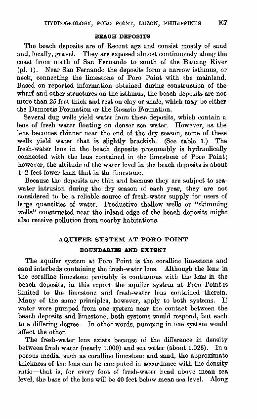
BEACH DEPOSITS
The beach deposits are of Recent age and consist mostly of sand and, locally, gravel. They are exposed almost continuously along the coast from north of San Fernando to south of the Bauang River (pi. 1). Near San Fernando the deposits form a narrow isthmus, or neck, connecting the limestone of Poro Point with the mainland. Based on reported information obtained during construction of the wharf and other structures on the isthmus, the beach deposits are not more than 25 feet thick and rest on clay or shale, which may be either the Damortis Formation or the Rosario Formation.
Several dug wells yield water from these deposits, which contain a lens of fresh water floating on denser sea water. However, as the lens becomes thinner near the end of the dry season, some of these wells yield water that is slightly brackish. (See table 1.) The fresh-water lens in the beach deposits presumably is hydraulically connected with the lens contained in the limestone of Poro Point; however, the altitude of the water level in the beach deposits is about 1-2 feet lower than that in the limestone.
Because the deposits are thin and because they are subject to sea- water intrusion during the dry season of each year, they are not considered to be a reliable source of fresh-water supply for users of large quantities of water. Productive shallow wells or "skimming wells" constructed near the inland edge of the beach deposits might also receive pollution from nearby habitations.
AQUIFER SYSTEM AT PORO POINT
BOUNDARIES AND EXTENT
The aquifer system at Poro Point is the coralline limestone and sand interbeds containing the fresh-water lens. Although the lens in the coralline limestone probably is continuous with the lens in the beach deposits, in this report the aquifer system at Poro Point is limited to the limestone and fresh-water lens contained therein. Many of the same principles, however, apply to both systems. If water were pumped from one system near the contact between the beach deposits and limestone, both systems would respond, but each to a differing degree. In other words, pumping in one system would affect the other.
The fresh-water lens exists because of the difference in density between fresh water (nearly 1.000) and sea water (about 1.025). In a porous media, such as coralline limestone and sand, the approximate thickness of the lens can be computed in accordance with the density ratio that is, for every foot of fresh-water head above mean sea level, the base of the lens will be 40 feet below mean sea level. Along

TABL
E 1
. D
escr
iptio
ns o
f w
ater
wel
ls,
Por
o P
oint
Dep
th o
f wel
l: D
epth
s gi
ven
in w
hole
fee
t ar
e re
port
ed o
r fr
om d
rille
rs' l
ogs;
tho
se i
nfe
et a
nd t
enth
s w
ere
mea
sure
d by
the
U.S
. G
eol.
Surv
ey.
Type
of w
ell:
C,
cabl
e to
ol;
R,
rota
ry;
D,
dug.
Ty
pe o
f pum
p: T
, tu
rbin
e; C
, cen
trif
ugal
.
Use
of w
ell:
S, s
uppl
y w
ell;
U,
unus
ed;
T,
test
; I,
ind
ustr
ial.
Wat
er-y
ield
ing
depo
sit:
Ql,
cora
lline
lim
esto
ne;
Qs,
bea
ch s
and.
(S
ee p
i. 1.
) O
ther
dat
a: L
og,
log
of w
ell
avai
labl
e; c
hem
., ch
emic
al a
naly
sis
avai
labl
e.
Ow
ner
and
wel
l No.
(l
ocat
ion
on f
ig.
l)i
Wal
lace
Air
For
ce S
tatio
n .. _
wel
l 1
wel
l 2
test
P
hili
ppin
e A
ir F
irce..
--
.....
wel
l 2
wel
lS
wel
l 4
wel
l 5
wel
l 6
wel
l 7
wel
ls
Lep
anto
C
onso
lidat
ed
Min
ing
Co.
, Po
ro I
nsta
llat
ion.
Sh
ell a
nd S
tand
ard-
Vac
uum
Oil
Co.
Yea
r dr
illed
1957
19
57
1961
19
61
1957
19
57?
Dep
th
(ft) 60?
73
705
170 33
.515
.0
45
80 15.0
15
.2
14
Typ
e of
wel
l
C
C
R
C C
C
C
D
D D
Wel
l di
am
eter
(i
n.) 6 6 6 6
36±
22 6 6 6
»10 «6 «6
Use
of
wel
l
U
S T
D U S u s u I D U s S.I
8,1
Yie
ld
of w
ell
(gpm
)
"56"
"""2
6"
1,00
0 50
30""
15
6"
Dra
w
dow
n (f
t)
........
....
.... 10 3± o'.¥
Typ
e of
pu
mp
Non
e. .
- T
N
one.
. .
T?..
Non
e?
-T
?.
T.
...
Non
e. .
_N
on
e..-
C
.. ..
C.
C?-.
.
Pum
p ho
rse
po
wer
. ...
. ... 3
..... .
..
Alti
tu
de o
f m
eas
ur
ing
poin
t
32.0
58
.6
45±
46
±
26.0
8?
13.0
1
26.9
7
17.3
7 14
.0
13.0
10.7
Wat
er le
vel b
elow
m
easu
ring
poi
nt
Dat
e
10/1
7/61
_ d
o..
..
71
/61
10/1
7/61
10/1
7/61
10/1
8/61
10
/17/
61
_ d
o..
5/ 2
/61
Fee
t
330.
70
2 56.
50
245
220.
04
211.
93
27.3
6 '2
4.40
*11.
55
«11.
34
M2.
40
'9.2
Wat
er-
yiel
d
ing
de-
posi
ts
Ql
Ql Ql
Ql Qs
Qs
Oth
er d
ata
Log
. L
og, c
hem
. L
og.
Log
, C
l rep
orte
d 1,
300-
3,00
0 pp
m.
Che
m.
Salt-
wat
er w
ell.
Che
m.
Log
.
Che
m.
Che
m.
Che
m.
1 Wel
l sym
bols
use
d in
fig
. 1:
Wal
lace
Air
Sta
tion,
WA
S; V
oice
of A
mer
ica,
VO
A.
2 Mea
suri
ng p
oint
, to
p of
cas
ing.
s Mea
suri
ng p
oint
, to
p of
hol
e in
pum
p ba
se.
< Mea
suri
ng p
oint
, to
p of
2-in
. nip
ple.
5 Dim
ensi
ons
in f
eet;
wel
ls a
re s
quar
e.6 M
easu
ring
poi
nt, t
op o
f sill
on
acce
ss d
oor.
* Mea
suri
ng p
oint
, top
of c
oncr
ete
curb
on
wel
l cov
er.

HYDROGEOLOGY, PORO POINT, LUZON, PHILIPPINES E9
the axis of Poro Point, water levels during the week of October 17 were about 2 feet above sea level, suggesting that the fresh-water lens was about 80 feet thick; in wells nearer the seaward margins of the point, levels were about a foot above sea level, suggesting a lens thickness of about 40 feet. LocaDy, where the limestone is thin, the fresh-water lens probably extends to the base of the limestone.
The limestone aquifer at Poro Point contains both salt water and fresh water. The lateral limits of the fresh-water system roughly coincide with the shore line; the lower limit is formed locally by the shale and clay but mostly by the fresh-water-salt-water interface, which fluctuates. During the dry season, when natural discharge and pumpage exceed recharge, the interf ace rises as the stored water in the lens is depleted. During the wet season, the converse is true. This oscillation explains why the water pumped from drilled wells on the point becomes slightly brackish toward the end of the dry season of each year and then becomes fresh again during the wet season.
RECHARGE
Recharge to the fresh-water lens is wholly from deep infiltration of rainfall and probably occurs only during the G^nonth wet season, May-October, during which the average rainfall is nearly 92 inches, as shown in the following table.
Average Rainfall at San Fernando
[38-year average through 1955; data from Weather Bureau, Manila]
Month
January. ___ _______________ _____.._______. ___ _February. _________ __ ________ __ ______ ___ ___March______ ____ ___________________ __ _________April-. --_-__- ___________________________ _.__ .May___ ________________ __ _________ __ __. _-June__-----______ ___ ____ _ _______ _ _ _ __.July __ _ _ _August--_-___--______-__-_ _ _____ ___ _. __ --.September ______ __-__-___----___ _ _ _____ __ __ _
December. ____-_--.___ __________________ ___
Wet season (May October) __ _ ___ ___ ____ - ___ -Diy season (November-April) _ __ _ ______ ___ ____
Rainfall (inches)
0.32.27.37.88
7. 113.023.826. 415.95.61. 9.76
96. 391.84.5
Number of rainy days
1113
1118222319953
116102
14
On the average, little or no recharge occurs during the 6-month dry season, November-April, during which the rainfall totals only about 4% inches. The limestone is highly permeable, as described below, and runoff reportedly occurs only during torrential downpours. Thus,
E10 CONTRIBUTIONS TO THE HYDROLOGY OF ASIA AND OCEANIA
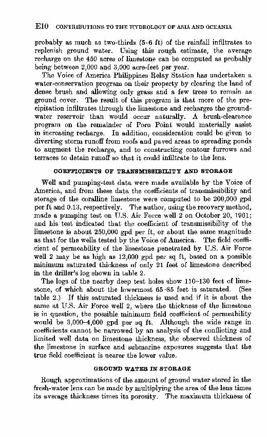
probably as much as two-thirds (5-6 ft) of the rainfall infiltrates to replenish ground water. Using this rough estimate, the average recharge on the 450 acres of limestone can be computed as probably being between 2,000 and 3,000 acre-feet per year.
The Voice of America Philippines Relay Station has undertaken a water-conservation program on their property by clearing the land of dense brush and allowing only grass and a few trees to remain as ground cover. The result of this program is that more of the pre cipitation infiltrates through the limestone and recharges the ground- water reservoir than would occur naturally. A brush-clearance program on the remainder of Poro Point would materially assist in increasing recharge. In addition, consideration could be given to diverting storm runoff from roofs and paved areas to spreading ponds to augment the recharge, and to constructing contour furrows and terraces to detain runoff so that it could infiltrate to the lens.
COEFFICIENTS OF TRANSMISSIBILITY AND STORAGE
Well and pumping-test data were made available by the Voice of America, and from these data the coefficients of transmissibility and storage of the coralline limestone were computed to be 200,000 gpd per ft and 0.13, respectively. The author, using the recovery method, made a pumping test on U.S. Air Force well 2 on October 20, 1961; and his test indicated that the coefficient of transmissibility of the limestone is about 250,000 gpd per ft, or about the same magnitude as that for the wells tested by the Voice of America. The field coeffi cient of permeability of the limestone penetrated by U.S. Air Force well 2 may be as high as 12,000 gpd per sq ft, based on a possible minimum saturated thickness of only 21 feet of limestone described in the driller's log shown in table 2.
The logs of the nearby deep test holes show 110-130 feet of lime stone, of which about the lowermost 65-85 feet is saturated. (See table 2.) If this saturated thickness is used and if it is about the same at U.S. Air Force well 2, where the thickness of the limestone is in question, the possible minimum field coefficient of permeability would be 3,000-4,000 gpd per sq ft. Although the wide range in coefficients cannot be narrowed by an analysis of the conflicting and limited well data on limestone thickness, the observed thickness of the limestone in surface and submarine exposures suggests that the true field coefficient is nearer the lower value.
GROUND WATER IN STORAGE
Rough approximations of the amount of ground water stored in the fresh-water lens can be made by multiplying the area of the lens times its average thickness times its porosity. The maximum thickness of

HYDROGEOLOGY, PORO POINT, LUZON, PHILIPPINES Ell
TABLE 2. Logs of wells
Material Thickness (ft)
Depth (ft)
U.S. Air Force well 1{Drilled July 1957; 6-in. casing; yield, 30 gpm. Water level: when drilled, 30-31 ft; on Oct. 17,1961, 30.70
ft below top of easing, which is 0.45 ft above concrete floor. Altitude of concrete floor, 31.48 ft. Unused. Reported salty]
Coralline limestone: Brown clay. ______ _ _________ __ ______ __________Limestone ______ ______ ____ ___ ______ __ _______Limestone(?) _ _ _________________ _________ ______
53817(?)
54360(?)
U.S. Air Force well 2forilled July 1957; 6-in. casing; perforations not known; yield, 50 gpm. Water level on Oct. 17, 1961,
56.00 ft below concrete floor, which is 58.08 ft above mean sea level]
Coralline limestone: Limestone. ____ ___________________________________
Limestone. ____ _ ______ ___ ____ _ _____ ___ __Rosario Formation (?) : J
223521
19
225778
97
U.S. Air Force deep test hole[Drilled by Shamrock Drilling Co., Oct. 18-22,1961; rotary; 6-in. open hole. Altitude about 45 ft.
Destroyed]
Coralline limestone: Soil_________________-_________._____. _____________Limestone interbedded with sand strata 1-5 ft thick. ___
Rosario or Damortis Formation: Clay, gray; gradingfdownward into shale at about 550 ft_
1129
575
1130
705
Philippine Air Force test well[Drilled July 1961; cable tool; chloride reported 1,300-3,000 ppm; casing pulled and well abandoned. Yield,
20 gpm; drawdown, 2 ft. Attitude about 45 ft]
Coralline limestone: Yellow clay. ___ ________ _____ _____ _ _ _______ _
Rosario or Damortis Formation: Blue sticky clay. _-_____---___ ____ _ ____-_-----_
5105
60
5110
170
i May be coralline limestone.
the lens is along the axis of Poro Point and is estimated from well data to range from about 80 feet at the end of the wet season to about 50 feet at the end of the dry season. The lens thins to a thickness of only a few feet around the shoreline of the point. These estimates suggest that the average thickness of the lens at these two times of the year is roughly 40 and 25 feet, respectively. Thus, the estimated amount of water stored in the lens at the end of the wet season is 450 acres X 40 feet X 0.3, or about 5,000 acre-feet; and at the end of the dry season, 450 acres X 25 feet X 0.3, or about 3,000 acre-feet.
E12 CONTRIBUTIONS TO THE HYDROLOGY OF ASIA AND OCEANIA
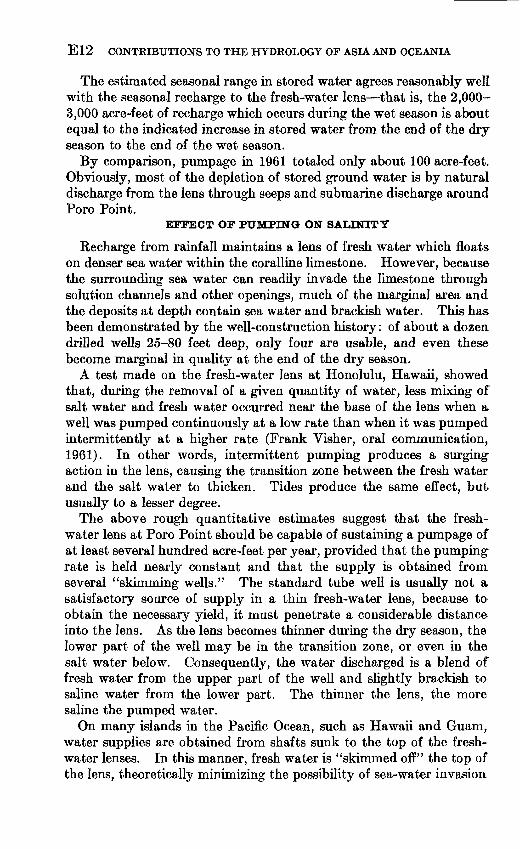
The estimated seasonal range in stored water agrees reasonably well with the seasonal recharge to the fresh-water lens that is, the 2,000- 3,000 acre-feet of recharge which occurs during the wet season is about equal to the indicated increase in stored water from the end of the dry season to the end of the wet season.
By comparison, pumpage in 1961 totaled only about 100 acre-feet. Obviously, most of the depletion of stored ground water is by natural discharge from the lens through seeps and submarine discharge around Poro Point.
EFFECT OF PUMPING ON SALINITY
Recharge from rainfall maintains a lens of fresh water which floats on denser sea water within the coralline limestone. However, because the surrounding sea water can readily invade the limestone through solution channels and other openings, much of the marginal area and the deposits at depth contain sea water and brackish water. This has been demonstrated by the well-construction history: of about a dozen drilled wells 25-80 feet deep, only four are usable, and even these become marginal in quality at the end of the dry season.
A test made on the fresh-water lens at Honolulu, Hawaii, showed that, during the removal of a given quantity of water, less mixing of salt water and fresh water occurred near the base of the lens when a well was pumped continuously at a low rate than when it was pumped intermittently at a higher rate (Frank Visher, oral communication, 1961). In other words, intermittent pumping produces a surging action in the lens, causing the transition zone between the fresh water and the salt water to thicken. Tides produce the same effect, but usually to a lesser degree.
The above rough quantitative estimates suggest that the fresh water lens at Poro Point should be capable of sustaining a pumpage of at least several hundred acre-feet per year, provided that the pumping rate is held nearly constant and that the supply is obtained from several "skimming wells." The standard tube well is usually not a satisfactory source of supply in a thin fresh-water lens, because to obtain the necessary yield, it must penetrate a considerable distance into the lens. As the lens becomes thinner during the dry season, the lower part of the well may be in the transition zone, or even in the salt water below. Consequently, the water discharged is a blend of fresh water from the upper part of the well and slightly brackish to saline water from the lower part. The thinner the lens, the more saline the pumped water.
On many islands in the Pacific Ocean, such as Hawaii and Guam, water supplies are obtained from shafts sunk to the top of the fresh water lenses. In this manner, fresh water is "skimmed off" the top of the lens, theoretically minimizing the possibility of sea-water invasion
HYDROGEOLOGY, PORO POINT, LUZON, PHILIPPINES E13
into the well. If sufficient water is not produced from the bottom of the shaft, the common practice is to drive one or more tunnels, or drifts, along the top of the ground-water lens until a sufficient supply is obtained.
At Poro Point the fresh-water lens has been developed successfully from a shallow shaft sunk by the Philippine Navy in the manner described above. Even during the critical dry season, the shaft reportedly has produced as much as 30,000 gpd, and the chloride content has remained low (80 parts per million in May 1961). The shaft is 15 feet deep, about 8 feet square, and contains 2-5 feet of water in the bottom the amount fluctuating in response to the wet and dry seasons. It reportedly has been test pumped at 500 gpm (gallons per minute) with a drawdown of about 2 feet. The pump on the well now produces 100 gpm, and the drawdown is less than half a foot.
More elaborate designs are available for the construction of shafts and tunnels to minimize the possibility of sea-water intrusion. For example, to assure that the pumping level is not drawn down below sea level, some shafts are completely cemented and made nearly water tight; all water enters the shaft from one or more tunnels over rectan gular weirs whose lips are set at mean sea level or at low water, depending on the control desired.
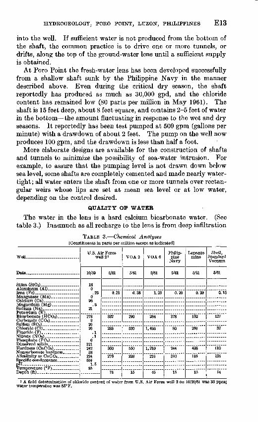
QUALITY OP WATER
The water in the lens is a hard calcium bicarbonate water. (See table 3.) Inasmuch as all recharge to the lens is from deep infiltration
TABLE 3. (Chemical Analyses [Constituents in parts per million except as indicated]
WeU.. ............. ............
Date... . .... . __ ....
Silica (SiOj)..-.................
Iron (Fe). _ ..... __ ......
Potassium (K) .................
Sulfate (BOO- ____ . _ .. Chloride (CD... ...............Fluoride (F)___... __ .........Nitrate (NO8)~- ... ... ... ...Phosphate (PO4)... ____ ....
Hardness (CaCO3) .............
pH... ......... .....Temperature (°F)__ ............Depth (ft)... ____ . __ .....
U.S. Air Force well 2 »
10/59
18 0 .23
0 96
.621
273 0
26 26
.1
.10
321 242 38
224 534
1.585
5/61
0.25
337
233
360
276
73
VGA 2
5/61
0.38
290
530
550
238
15
VGA 6
5/61
1.25
264
1,466
1,210
216
45
Philip pine
Navy
5'61
0.20
378
80
244
310
15
Lepanto mine
5/61
0.20
132
250
438
136
15
Shell, Standard Vacuum
5/61
0.15
127
37
110
124
14
1 A field determination of chloride content of water from U.S. water temperatue was 85°F.
Air Force well 2 on 10/20/61 was 35 ppm;

E14 CONTRIBUTIONS TO THE HYDROLOGY OF ASIA AND OCEANIA
of rain, the calcium bicarbonate content is acquired as the water percolates downward through the coralline limestone. Use of this water has resulted in an excessive amount of maintenance on pipe lines. For example, the 5-year-old line (about 2 in. in diameter) from U.S. Air Force well 2 to the existing station was recently replaced because it reportedly became so encrusted with scale that the flow was sub stantially reduced. In addition, the untreated water is not satis factory for cooling of equipment or for laundries. However, it is satisfactory for domestic use.
The Voice of America Philippines Relay Station uses distilled water for cooling electronic equipment and six diesel-powered genera tors. Heat exchangers use ground water pumped from Voice of America well 6 (fig. 1). A cooling tower is used to reduce the draft on the fresh-water lens.
REFERENCES CITED
Corby, G. W., and others, 1951, Geology and oil possibilities of the Philippines: Republic of the Philippines Dept. Agriculture and Nat. Resources Tech. Bull 21, 363 p.
Irving, E. M., 1952, Geological history and petroleum possibilities of the Phil ippines: Am. Assoc. Petroleum Geologists Bull., v. 36, no. 3, p. 437-476.
Meinzer, O. E., 1923, Outline of ground-water hydrology, with definitions: U.S. Geol. Survey Water-Supply Paper 494, 71 p.
Wenzel, L. K., 1942, Methods for determining permeability of water-bearing materials, with special reference to discharging-well methods: U.S. Geol. Survey Water-Supply Paper 887, 192 p.
O

