hydrology for floodplain analysis - rampp · hydrology for floodplain analysis presented by z. john...
TRANSCRIPT
Hydrology for Floodplain Analysis
Presented by
Z. John Licsko, PE, CFM
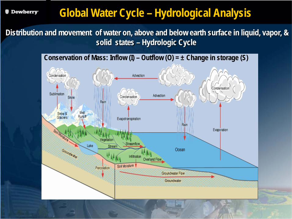
Conservation of Mass: Inflow (I) – Outflow (O) = ± Change in storage (S)
Distribution and movement of water on, above and below earth surface in liquid, vapor, & solid states – Hydrologic Cycle
Global Water Cycle – Hydrological Analysis

Watershed Scale Hydrologic Processes
Initial Abstractions (up to 4 inches under healthy forest stands)
Infiltration - Function of soil texture, thickness and structure – highest rates usually found under forested areas
Depression Storage – ability to store water on the soil surface – again forested soils
Interception/Evapo-Transpiration Baseflow – perennial flow Interflow – shallow subsurface flows Surface Runoff - water that is not infiltrated or
or otherwise stored.
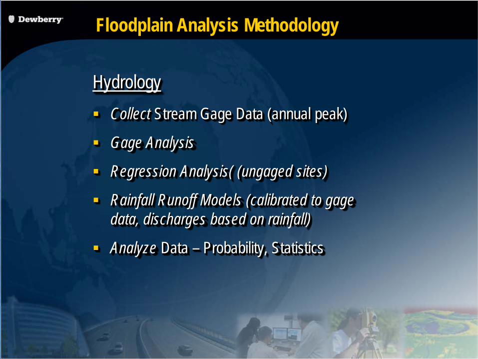
Floodplain Analysis Methodology
Hydrology Collect Stream Gage Data (annual peak)
Gage Analysis
Regression Analysis( (ungaged sites)
Rainfall Runoff Models (calibrated to gage data, discharges based on rainfall)
Analyze Data – Probability, Statistics
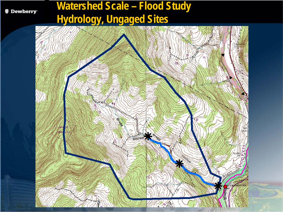
Watershed Scale – Flood Study Hydrology, Ungaged Sites
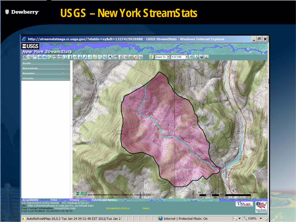
USGS – New York StreamStats
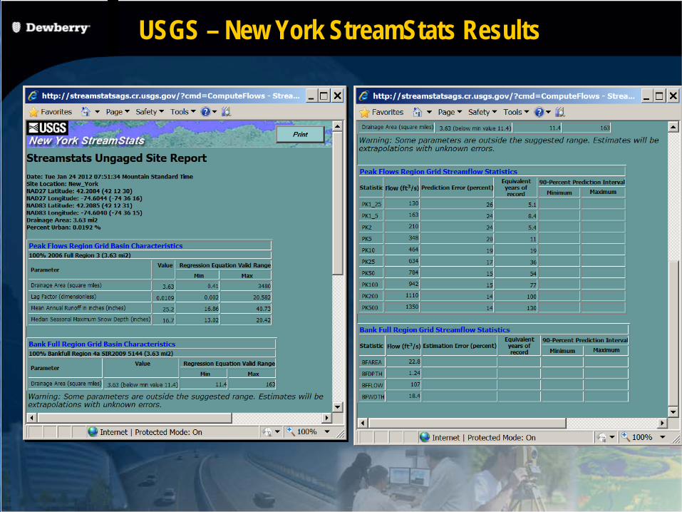
USGS – New York StreamStats Results
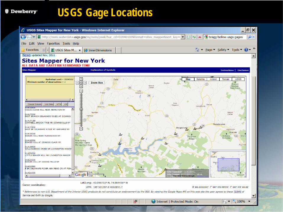
USGS Gage Locations

Discharge Measurements

Flooding in Natural Streams
Unsteady Flow
Mixed flow regime (sub-critical, critical and super critical)
Non homogeneous fluid (air and sediment mixes with water)
Floating debris
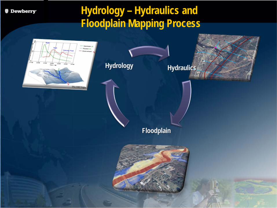
Hydraulics
Floodplain
Hydrology
Hydrology – Hydraulics and Floodplain Mapping Process
Hydrology used in Hydraulic Analysis
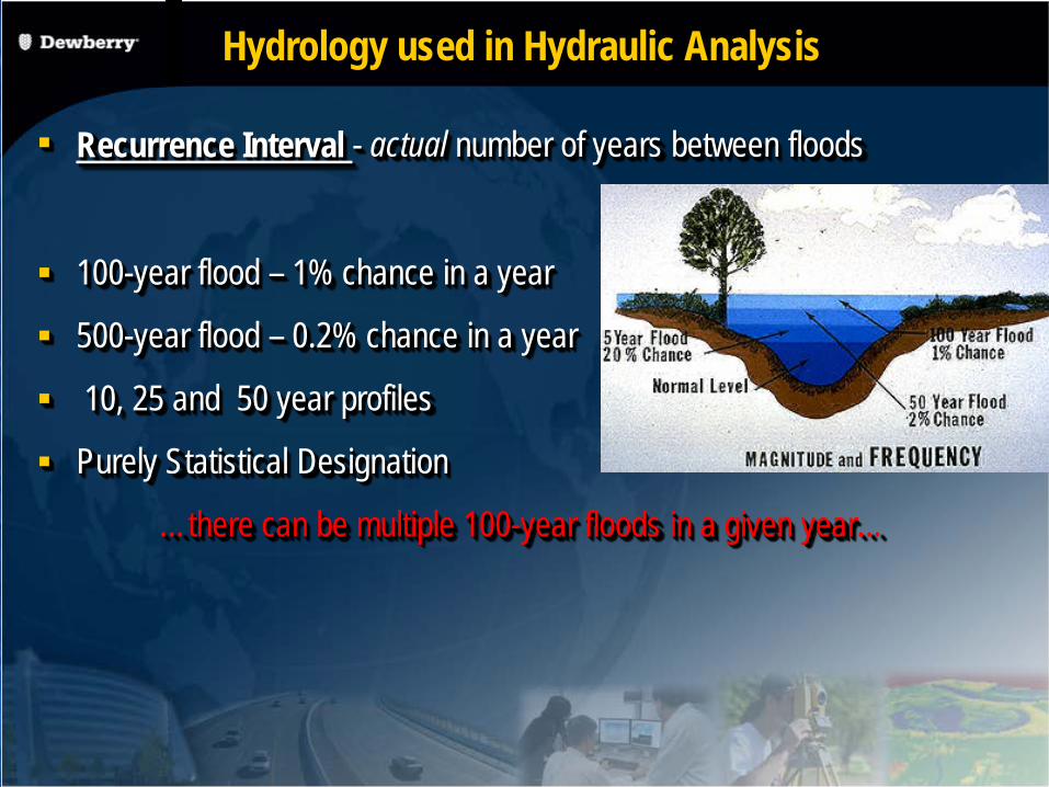
Recurrence Interval - actual number of years between floods
100-year flood – 1% chance in a year
500-year flood – 0.2% chance in a year
10, 25 and 50 year profiles
Purely Statistical Designation
…there can be multiple 100-year floods in a given year…
Limitations on the use of Regression Equations
Regulated Watersheds
Overbank Storage – Swamps/Wetlands
Drainage Area Outside Recommended Limits
Recently Developed Watersheds
Need for in-depth Hydrologic Analysis (i.e. urban areas)
Ignores difference in watershed shapes
Applicable FEMA Publications
FEMA Guidelines and Standards for Flood Hazard Mapping Partners
Volume 1: Flood Studies and Mapping
Appendix I: Discovery
Appendix C: Guidance for Riverine Flooding Analyses and Mapping
FEMA Procedure Memorandum 59, Guidance for Implementation of Watershed-Based Studies,

Selection of suitable hydrologic methods
Guidelines for Riverine Flooding Analysis & Mapping - Appendix C, FEMA, Nov, 2009
Methodology Suitability
Gage Analysis At gage locations/ sufficient length of record
Regression Equations Ungauged locations, unregulated
watersheds
Watershed Models
Regulated/ Urbanized watersheds. Calibration is needed

Approved Methodologies
Gage Analysis (Preferred) Uses observed annual peak discharge from USGS and other gage locations
Data is analyzed using statistical procedures outlined in “Bulletin 17B” also referred to as a LPIII analysis (PeakFQ program is used)
Need a minimum of 10 years of homogeneous data
Can be transferred upstream and downstream of the gage location
Regression Ungaged locations
Multiple regression analysis
Usually published by USGS (For NY this SIR 2006-5122, includes data to 1999)

Approved Methodologies Continued
Rainfall Runoff Modeling Usually HEC-HMS or HEC-1
FEMA’s accepted models list includes a number of others
Esopus Watershed has two examples of Effective Rainfall Models Stony Clove in Greene County -TR20
Esopus – HEC-1
Both have use old TP-40 rainfall totals

Esopus Rainfall Runoff Model (HEC-HMS)
Reasons to Revise Existing Hydrologic Analysis
Reflect Longer periods of record or data revisionsEffective hydrology on part of the Esopus (calibrated HEC-1- 1 gage, new model
use 6 gages ) and Stony Clove in Green County (TR-20 1982, probably un-calibrated since little or no gage data (approximate in Ulster County also gaged. ( HEC-HMS rainfall change (Cornell data updates to TP-40), more gages,
Reflect changed physical conditions For example, construction of a dam
To take advantage of improved hydrologic analysis HEC-HMS
To correct an error in the effective hydrologic analysis
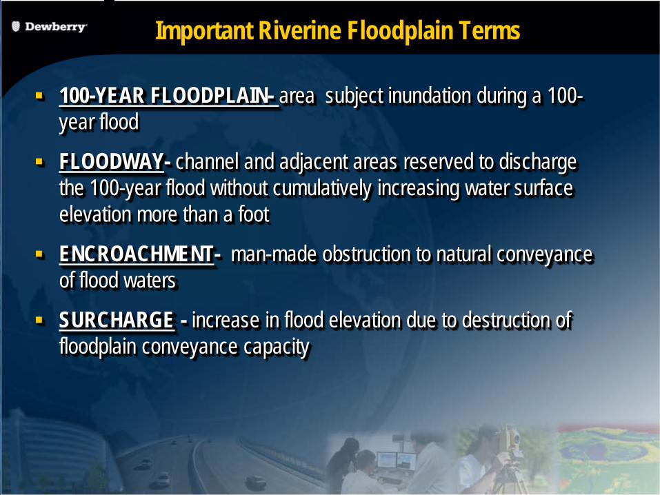
100-YEAR FLOODPLAIN- area subject inundation during a 100-year flood
FLOODWAY- channel and adjacent areas reserved to discharge the 100-year flood without cumulatively increasing water surface elevation more than a foot
ENCROACHMENT- man-made obstruction to natural conveyance of flood waters
SURCHARGE - increase in flood elevation due to destruction of floodplain conveyance capacity
Important Riverine Floodplain Terms
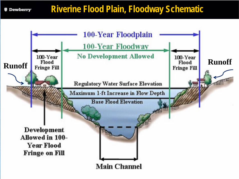
Riverine Flood Plain, Floodway Schematic
Runoff Runoff

Questions?