i - cathematthatters.com/worldhistory/textbook/cj6_366-371.pdf · geography and agriculture in...
TRANSCRIPT

Lesson
1MAIN IDEAS
Geography Meso-America has a variety of landforms.
Geography Climates in Meso-America vary from tropical to dry.
Geography Geographic diversity caused Meso-America to have a variety of natural resources and crops.
TAKING NOTES
Reading Skill: Finding Main IdeasIdentifying main ideas in a passage will help you understand what you read. As you read each section of Lesson 1, look for essential information on the main ideas. Record this information in a chart like the one shown below.
▲ Meso-American Farming Tools Meso-American farmers used hand tools with heads made of stone and metal to clear and prepare the land for planting.
Skillbuilder Handbook, page R2
Geography of Meso-America
landforms climate natural resources
366 • Chapter 11
7.7.1 Study the locations, landforms, and climates of Mexico, Central America, and South America and their effects on Mayan, Aztec, and Incan economies, trade, and development of urban societies.
CST 3 Students use a variety of maps and documents to identify physical and cultural features of neighborhoods, cities, states, and countries and to explain the historical migration of people, expansion and disintegration of empires, and the growth of economic systems.
REP 3 Students distinguish relevant from irrelevant information, essential from incidental information, and verifiable from unverifiable information in historical narratives and stories.
Geography and Agriculture in Meso-AmericaBuild on What You Know What is the landscape like in the area where you live? Are there high mountains? Or do you live in a lowland area? Are there any volcanoes nearby? As you’ll read in this lesson, Meso-America has all these different landforms.
Landforms of Meso-America ESSENTIAL QUESTION What landforms are found in Meso-America?
Rugged highlands, coastal lowlands, and smoking volcanoes are just some of the physical features that have shaped life in Meso-America.
Location and Landforms Meso-America, or Middle America, lies between the present-day United States and South America. It includes the southern part of Mexico and much of Central America. (See the map on page 363.)
Meso-America is a land of varying elevations. A central spine of mountains runs through much of the region. In the north, the mountain range divides into two. A section called the Mexican Plateau separates these two highland areas. On each side of the mountains, narrow coastal plains run along the Pacific Ocean and the Caribbean Sea and Gulf of Mexico. In some places, the plains widen into broad lowlands such as the Yucatán Peninsula. The Yucatán stretches into, and divides, the Caribbean Sea and the Gulf of Mexico.
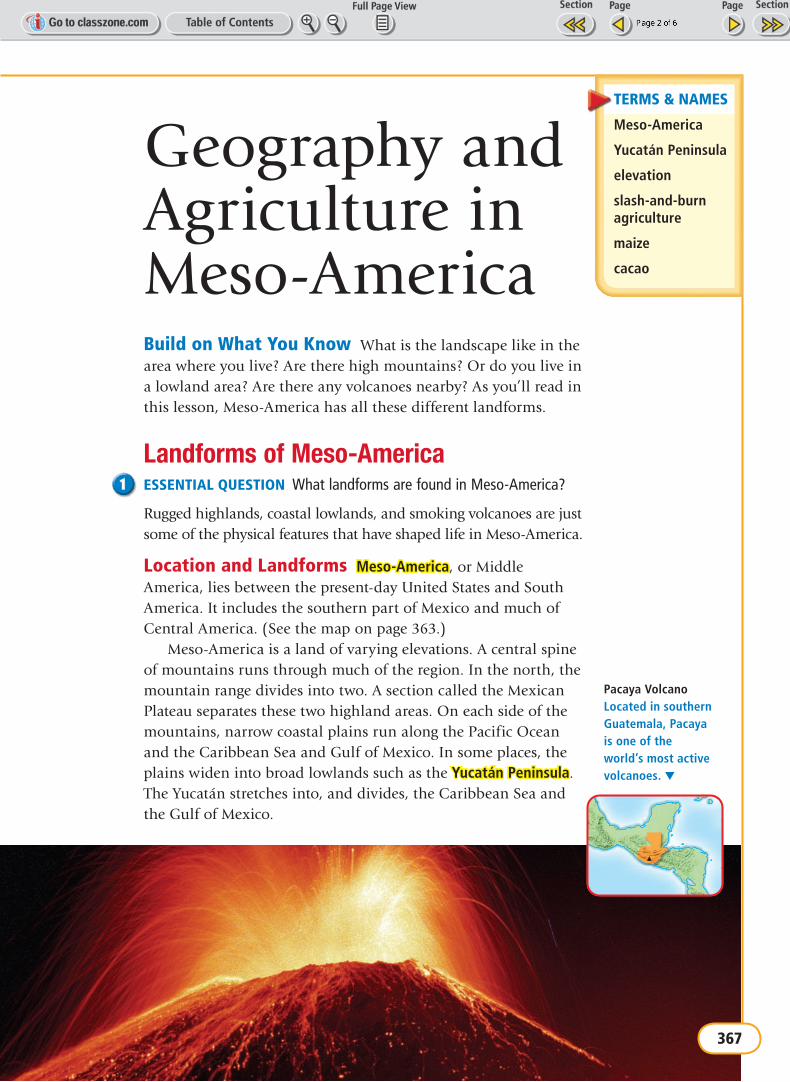
Pacaya Volcano Located in southern Guatemala, Pacaya is one of the world’s most active volcanoes. ▼
TERMS & NAMES
Meso-America
Yucatán Peninsula
elevation
slash-and-burn agriculture
maize
cacao
MapQuest.Com, Inc.
McDougal-Littell, 7th grade World History Programwh07pe-061101-009-m-a.ai
Locator: Pacaya VolcanoFinal proof date: 7/23/04
367
Volcanoes Volcanoes have had a huge effect on the landscape of Meso-America. When a volcano erupts, it spits out streams of lava, or melted rock, and clouds of ash. In time, the lava and ash build up to form huge conelike mountains. In Meso-America, some of these volcanic mountains are well over 10,000 feet high. More than a dozen of them are still active. (See the photograph on page 367.) That means they can erupt at any time. But most have been dormant, or inactive, for hundreds of years. The craters of a few of these dormant volcanoes have filled with water, forming vast highland lakes.
What is the landscape like in Meso-America?
Climate and Vegetation ESSENTIAL QUESTION How do climates vary in Meso-America?
The climate of Meso-America ranges from hot and humid in much of the south to desertlike conditions in the far north. Such a difference means diverse growing conditions for plants.
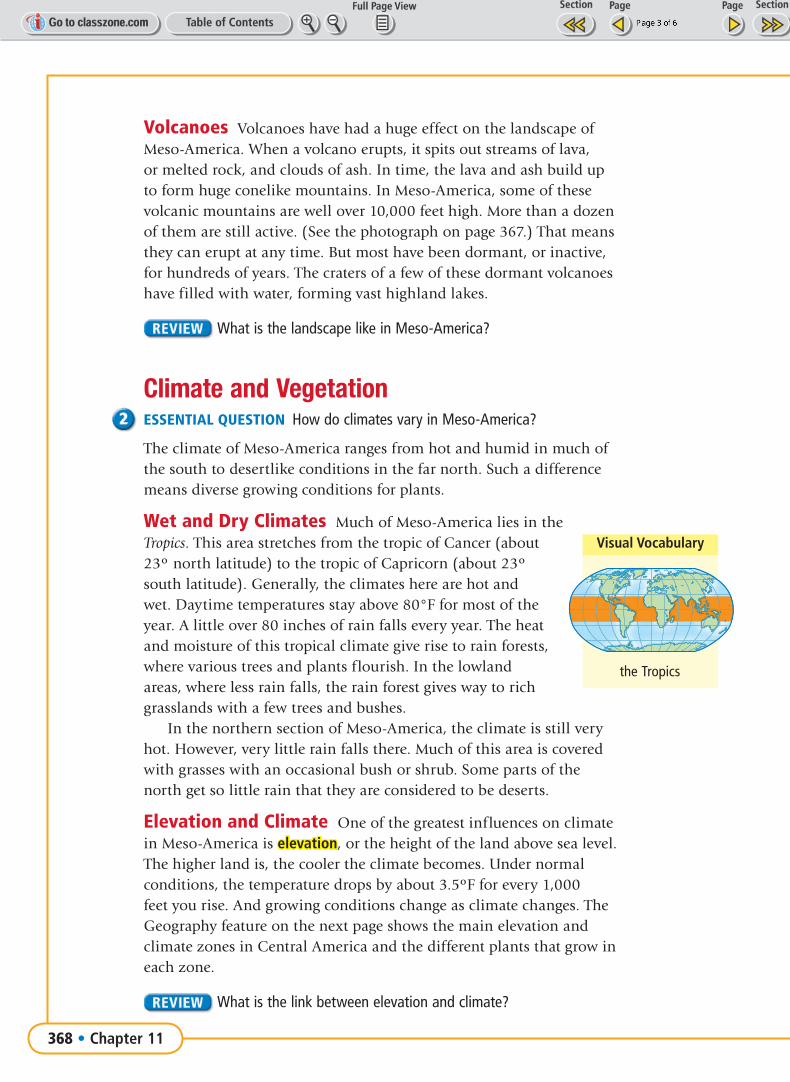
Wet and Dry Climates Much of Meso-America lies in the Tropics. This area stretches from the tropic of Cancer (about 23º north latitude) to the tropic of Capricorn (about 23º south latitude). Generally, the climates here are hot and wet. Daytime temperatures stay above 80°F for most of the year. A little over 80 inches of rain falls every year. The heat and moisture of this tropical climate give rise to rain forests, where various trees and plants flourish. In the lowland areas, where less rain falls, the rain forest gives way to rich grasslands with a few trees and bushes.
In the northern section of Meso-America, the climate is still very hot. However, very little rain falls there. Much of this area is covered with grasses with an occasional bush or shrub. Some parts of the north get so little rain that they are considered to be deserts.
Elevation and Climate One of the greatest influences on climate in Meso-America is elevation, or the height of the land above sea level. The higher land is, the cooler the climate becomes. Under normal conditions, the temperature drops by about 3.5ºF for every 1,000 feet you rise. And growing conditions change as climate changes. The Geography feature on the next page shows the main elevation and climate zones in Central America and the different plants that grow in each zone.
What is the link between elevation and climate?
Visual Vocabulary
MapQuest.Com, Inc.
McDougal-Littell, 7th grade World History Programwh07pe-010102-005
Geography 1-Robinson Projection2nd proof date: 5/19/04
Included blue map outline
the Tropics
368 • Chapter 11

Geography Shapes Meso-American Life ESSENTIAL QUESTION How has geographic diversity affected the natural resources and crops found in Meso-America?
The landforms and climate of Meso-America provided the region with a variety of natural resources. These natural resources helped to shape the way that early peoples of the region lived.
Natural Resources The highlands of what is now Guatemala supplied Meso-Americans with jade and obsidian, a black volcanic glass. People carved small figures from jade and made razor-sharp weapons from obsidian. They also found seashells and shark’s teeth in the coastal regions. Meso-Americans used these for jewelry.
Meso-Americans also made use of the animals found in the region. They especially prized the colorful feathers of a bird called the quetzal (keht•SAHL). The quetzal was sacred to many Meso-Americans. They often used the feathers from these birds to decorate their clothing and headdresses.
3
2
1
4
Elevation and Climate in Central AmericaClimate and vegetation vary according to elevation. This diagram shows the main climate zones, as defined by elevation, in Central America. The different natural vegetation and crops found in each zone are also shown.
1 Tierra Helada (Very Cold Land)
2 Tierra Fria (Cold Land)
3 Tierra Templada (Temperate Land)
4 Tierra Caliente (Hot Land)
GEOGRAPHY SKILLBUILDERINTERPRETING VISUALSHuman-Environment Interaction Which zones are the most productive for growing crops?
Tierra Fria (Cold Land)Natural Vegetation Modern Land Use
cloud forest(forest near mountain peaks with almost constant cloud cover)
wheat,potatoes
3,000 feet elevation
4,000 feet elevation
Tierra Helada (Very Cold Land)Natural Vegetation Modern Land Use
mountain grasses,mosses
animal grazing
Tierra Templada (Temperate Land)Natural Vegetation Modern Land Use
wet forest corn, beans,squash, cotton,coffee
2,000 feet elevation
Tierra Caliente (Hot Land)Natural Vegetation Modern Land Use
dry forest cacao,bananas,sugar cane
1,000 feet elevation
Early Meso-American Civilizations • 369

Agriculture Meso-Americans farmed all kinds of land. Some of it was good for farming, such as the floodplains of rivers or the slopes of volcanic mountains. In both places the soil was fertile—favorable for growing crops. Other areas, such as the rain forests, were not so good for farming. To work these lands, Meso-Americans used a method called slash-and-burn agriculture. Farmers cleared the land by cutting down trees. Then they burned the fallen trees and used the ashes to fertilize the soil. Finally, they planted crops on the cleared land. After a few years, they abandoned this land and moved on to another part of the rain forest.
Meso-Americans grew a variety of crops, including maize—a type of corn—beans, peppers, and squash. They used maize to make many types of foods such as the tortilla, a kind of flat bread. In addition, Meso-Americans grew cacao. Cacao is a type of tree that grows well in moist, hot tropical climates. Meso-Americans used the beans from this tree to make a chocolate drink. The beans also were a prized trading item.
Geography and Trade Meso-Americans looked outside of their local areas for many luxury goods. Jade and obsidian were mostly found only in mountain areas. Seashells came from the coastal areas. Trade developed as Meso-Americans began to exchange their local goods for goods found in other regions.
PATTERNS in HISTORY Agriculture and Cities
The development of agriculture made the production of surpluses possible and led to the development of urban societies.
1 Agriculture leads to settled villages.
2 As agriculture improves, surpluses of food crops such as corn are produced. This encourages population growth and larger villages.
3 Surpluses also mean that not everyone has to raise food. Some people begin specializing in other kinds of work, such as weaving.
4 Food surpluses and specialized skills lead to the growth of cities.
370 • Chapter 11

Activity
LessonReview Homework Helper
Meso-Americans traded goods over great distances by water. Using dugout canoes, they traveled the few navigable rivers in the region. They also ventured into open waters, traveling along the Pacific, Caribbean, and Gulf coasts. The Meso-Americans also carried on an overland trade, lugging the goods on their backs. Such heavy human labor was necessary because they had not developed the wheel and no horses or oxen were available to use as pack animals.
Trade goods were not the only items that moved along these routes. Knowledge also spread, carried by traders all over the region. This sharing and blending of ideas helped to create a common culture throughout Meso-America.
How did the geography of Meso-America encourage trade?
Lesson Summary• Meso-America has a variety of landforms.
• Meso-America has a variety of climates.
• Geographic diversity caused Meso-America to have a variety of natural resources and crops.
Why It Matters Now . . .Chocolate, made from the cacao bean, has become one of the world’s most popular foods.
1 Terms & Names1. Explain the importance of
Meso-America slash-and-burn agriculture Yucatán Peninsula maize elevation cacao
Using Your NotesFinding Main Ideas Use your completed chart to answer the following question:2. What are the major geographic features of
Meso-America? (7.7.1)
Main Ideas3. What landforms are found in Meso-America? (7.7.1)4. What types of climate does Meso-America
have? (7.7.1)5. How did Meso-Americans prepare the rain forest
for farming? (7.7.1)
Critical Thinking6. Making Inferences Meso-Americans did not
use pack animals to transport goods. How do you think overland trade would have been affected if Meso-Americans did have pack animals? (7.7.1)
7. Drawing Conclusions Why do you think Meso-Americans used slash-and-burn agriculture? (7.7.1)
Internet Activity Use the Internet to research what role chocolate played in the lives of Meso-Americans. Write and illustrate a report on chocolate in early Meso-America.INTERNET KEYWORDS: chocolate, Meso-America
ClassZone.com
Geography of Meso-America
landforms climate natural resources
Early Meso-American Civilizations • 371
(REP 3)